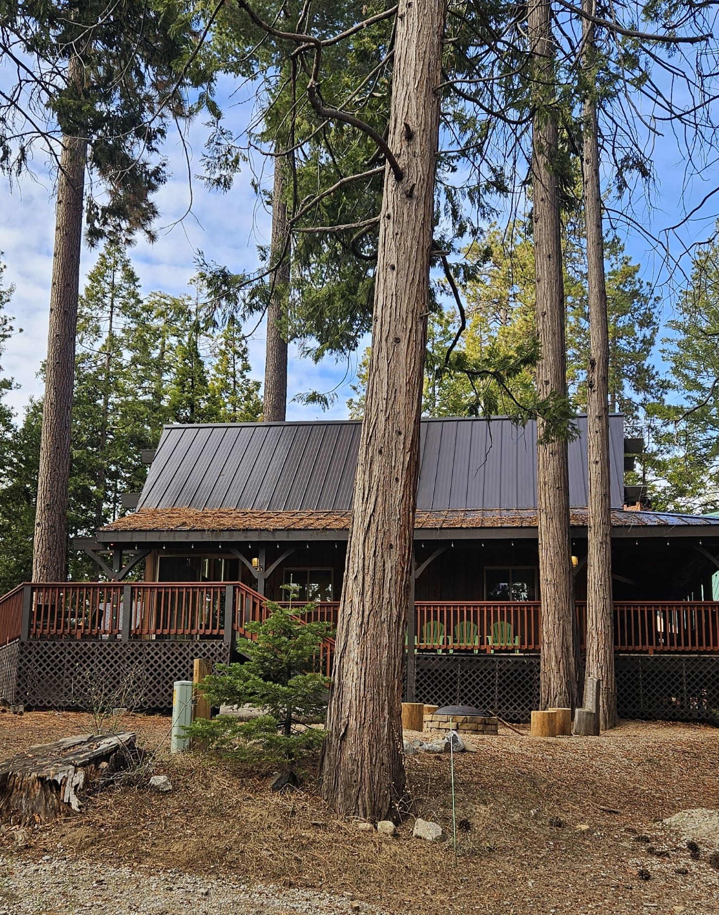
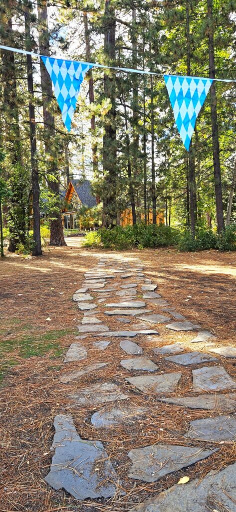
During the week of Christmas, our daughters Andrea and Candi invited us to join them and their families at a cabin rental in Shaver Lake.
Our cabin at Shaver Lake
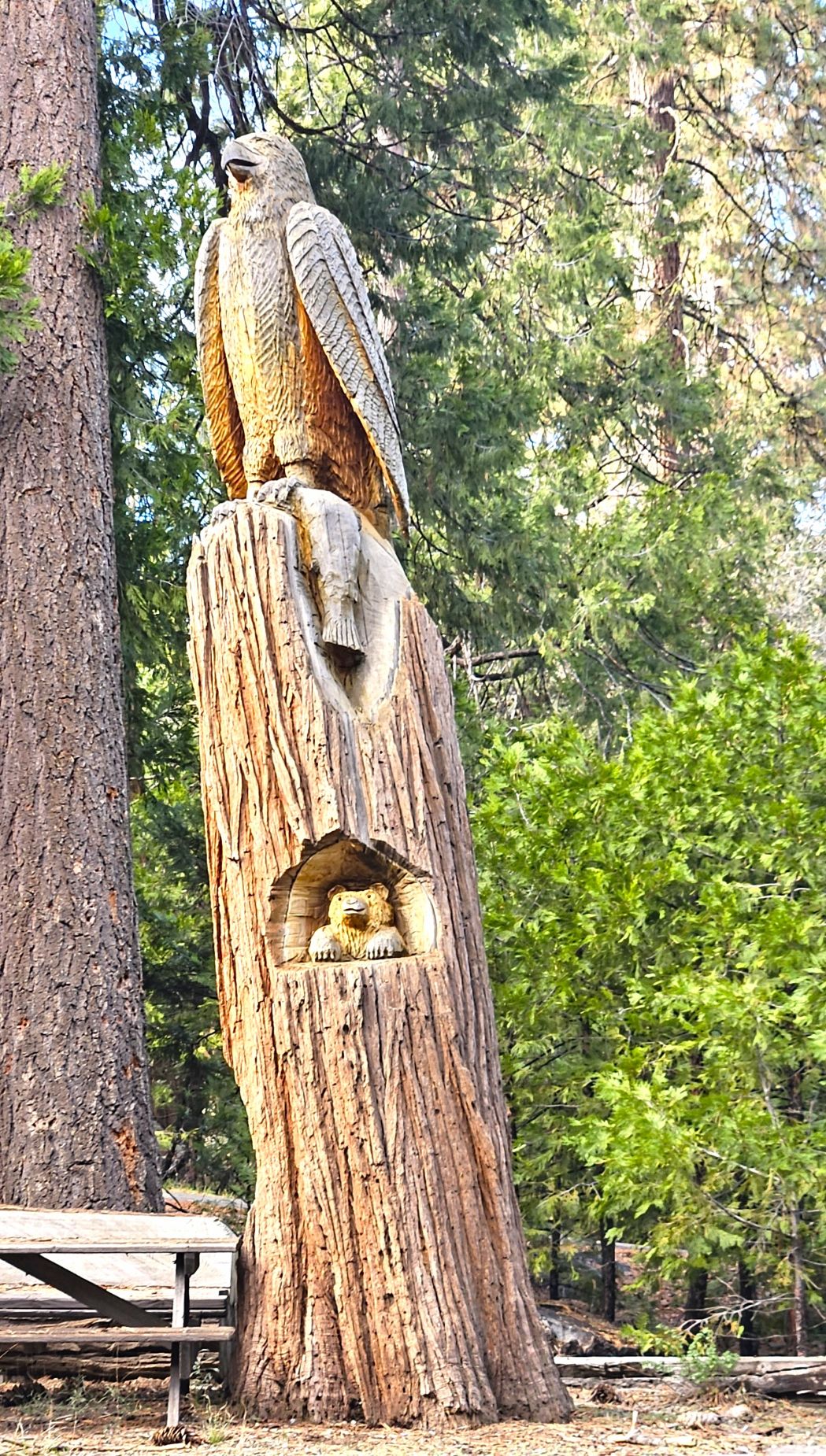
That afternoon after we arrived, we took a walk around the neighborhood and saw this tree carving at one of the nearby cabins.
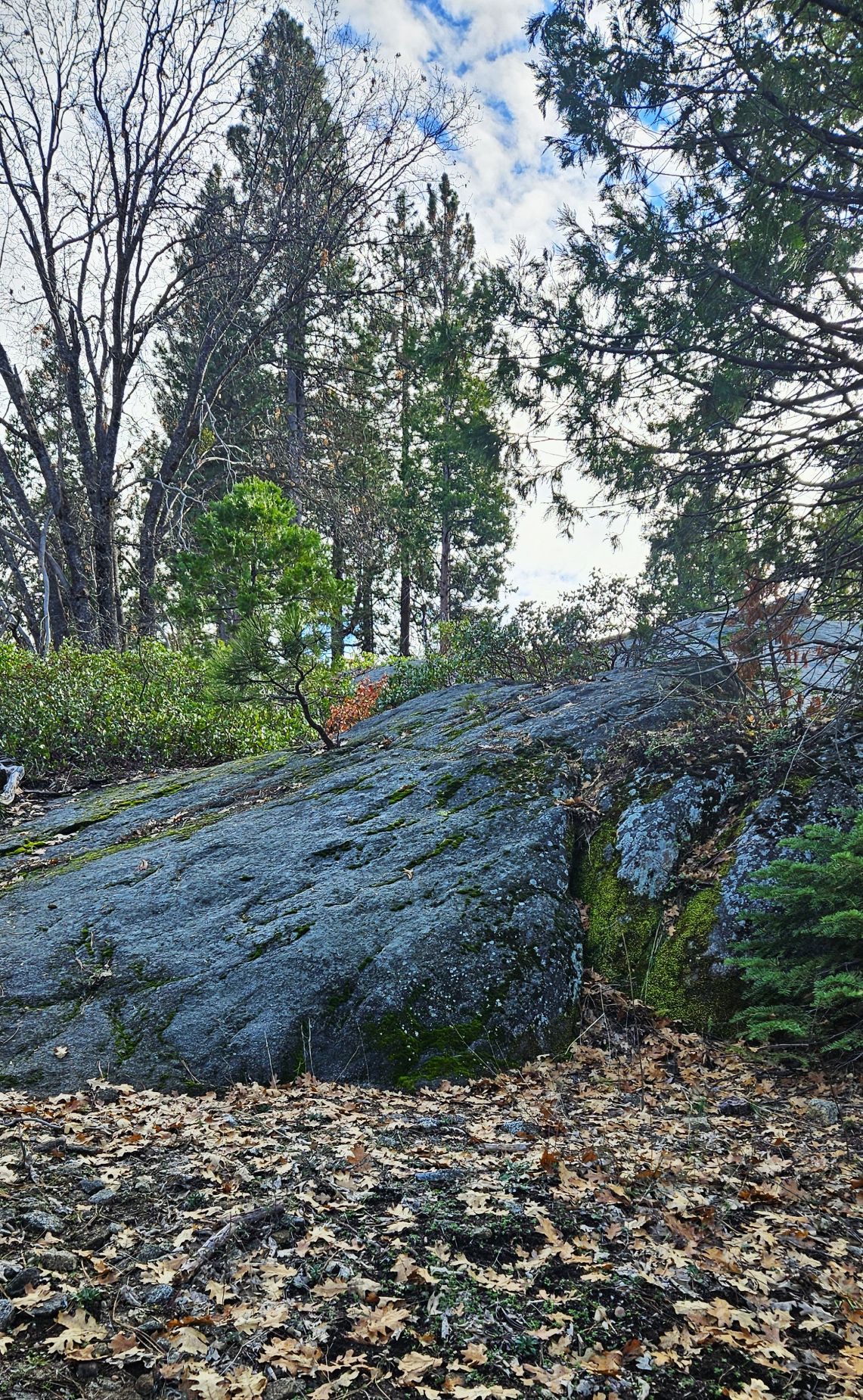
It was a cold and cloudy day, but we needed some exercise. We walked to a nearby campground that was closed for the season hoping to find some snow where the grandkids and dogs could play.
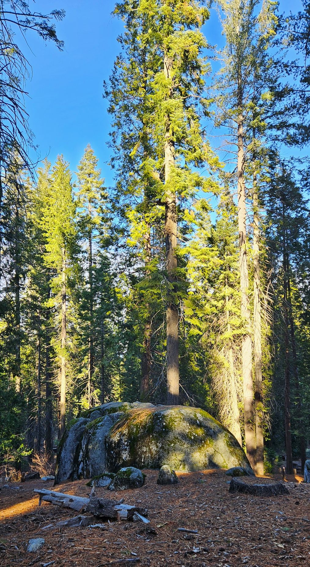
Large rock we saw on our walk.
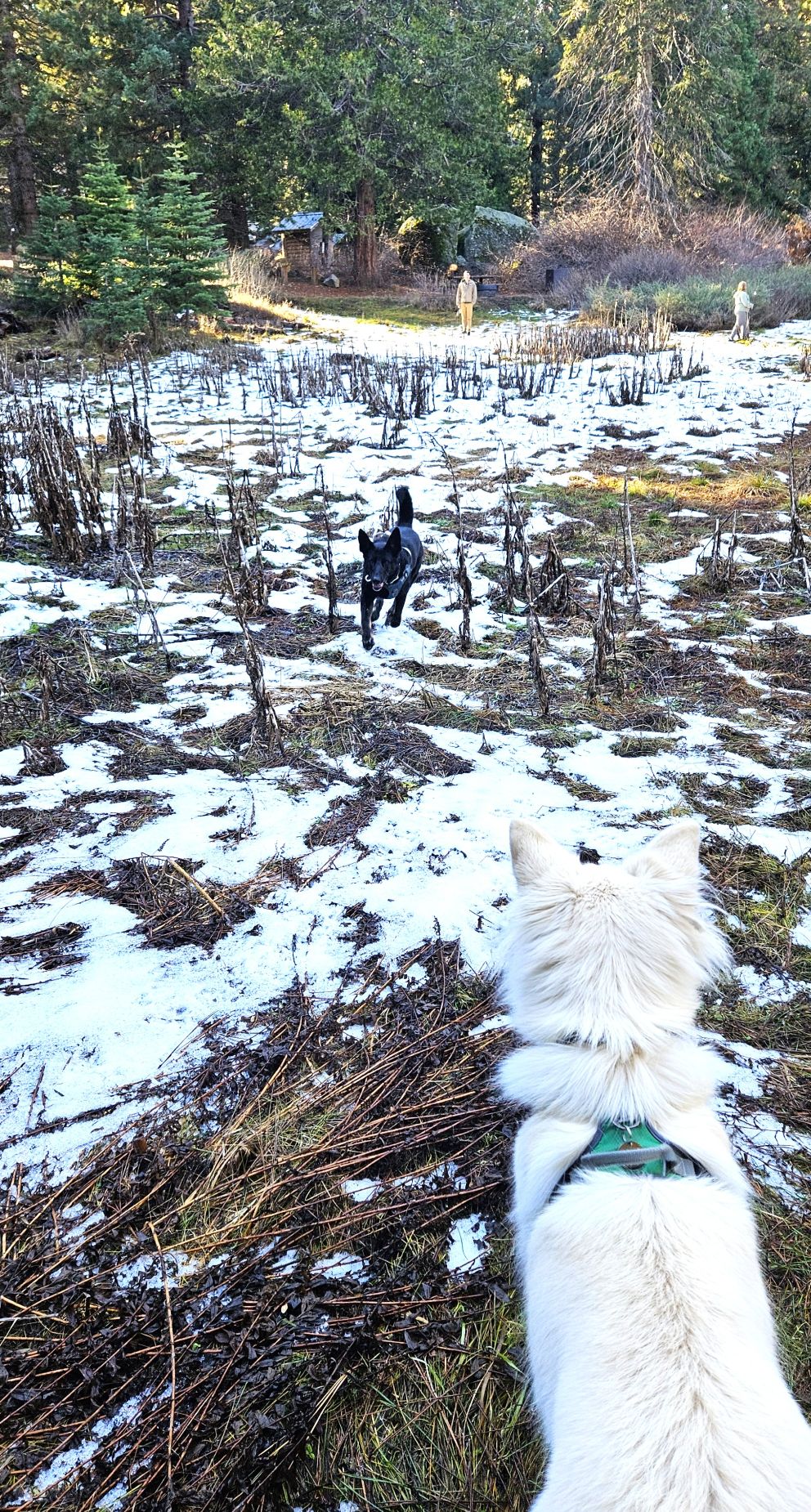
We finally found a patch of snow in a shaded meadow. Though there wasn’t much snow left, everyone had a great time.
The grand-dogs enjoyed the snow.
The late afternoon shadows told us it was time to head back to the cozy cabin and have some supper.
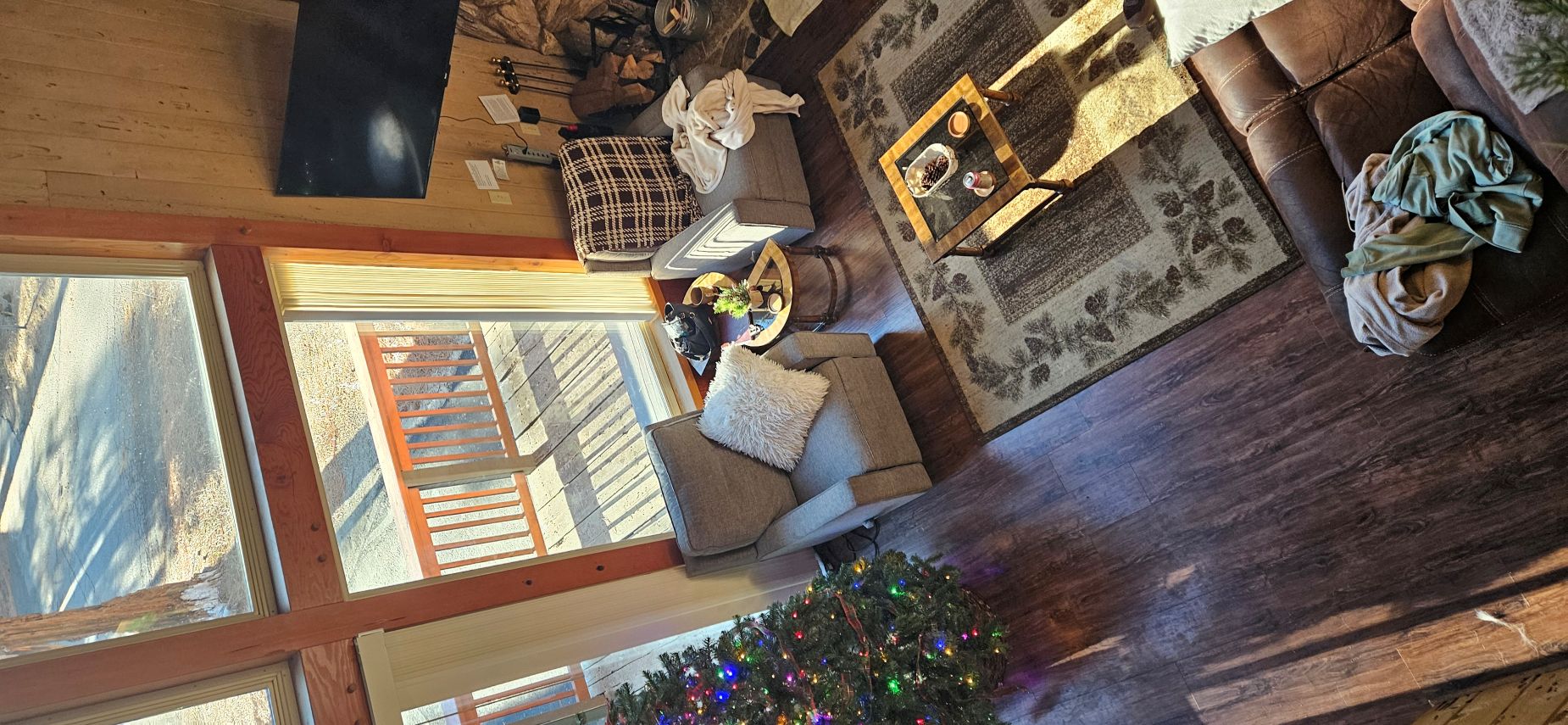
Our cozy cabin
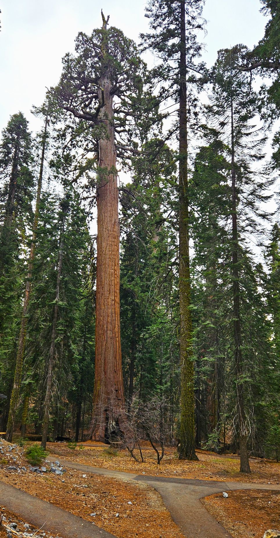
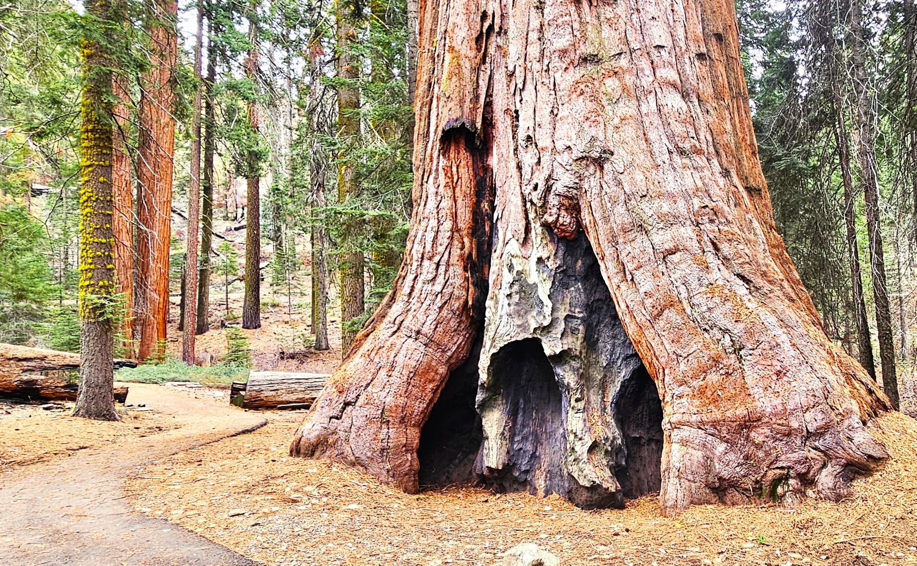
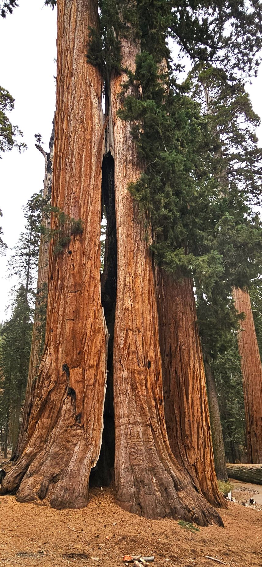
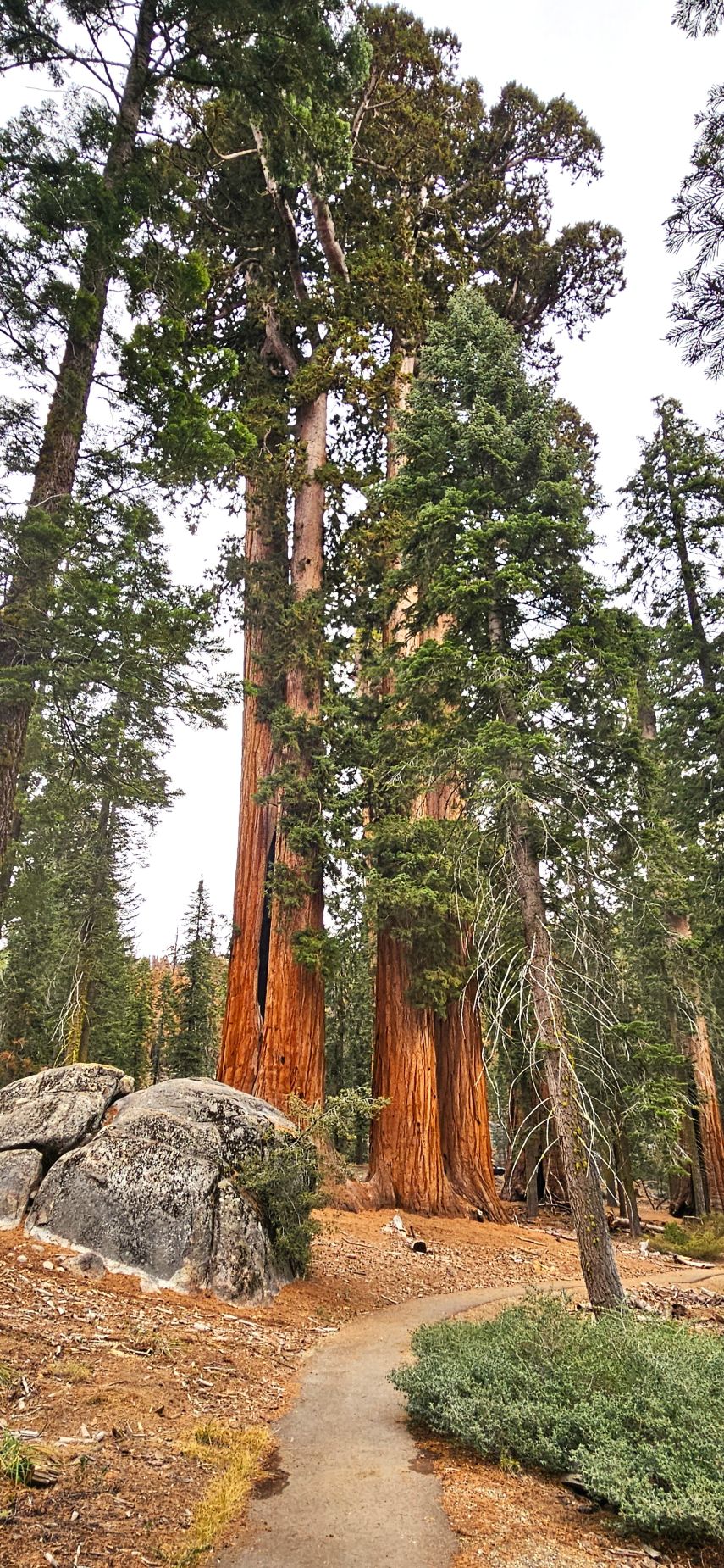
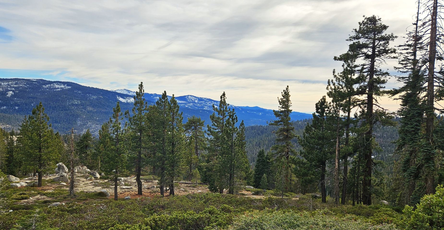
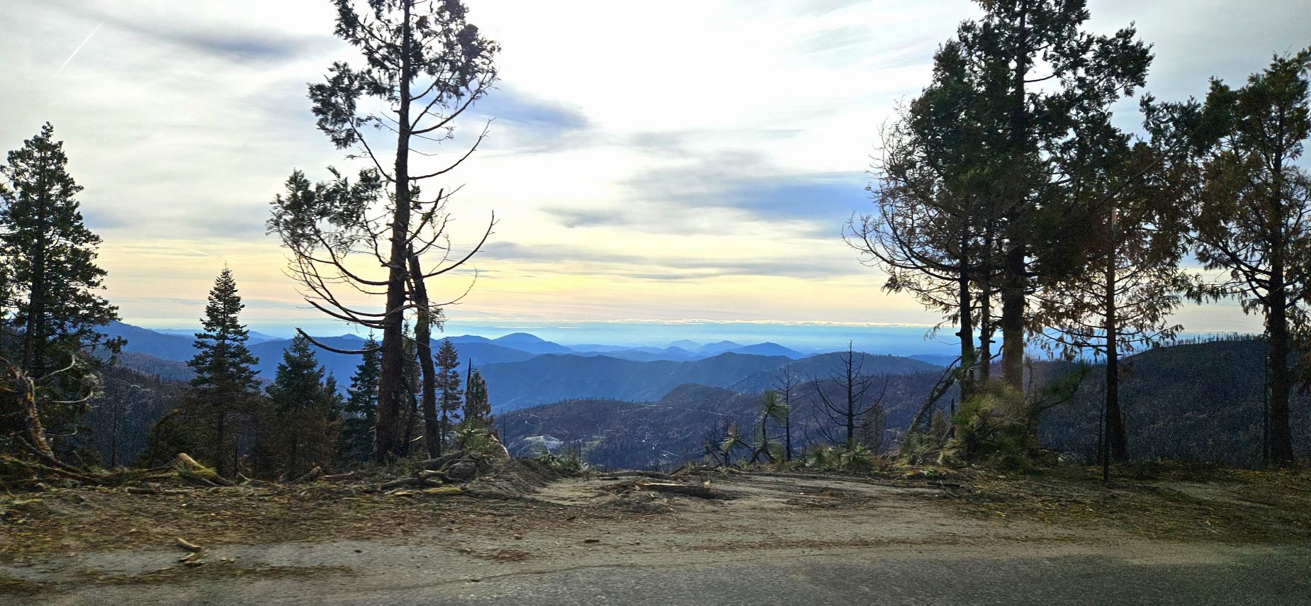
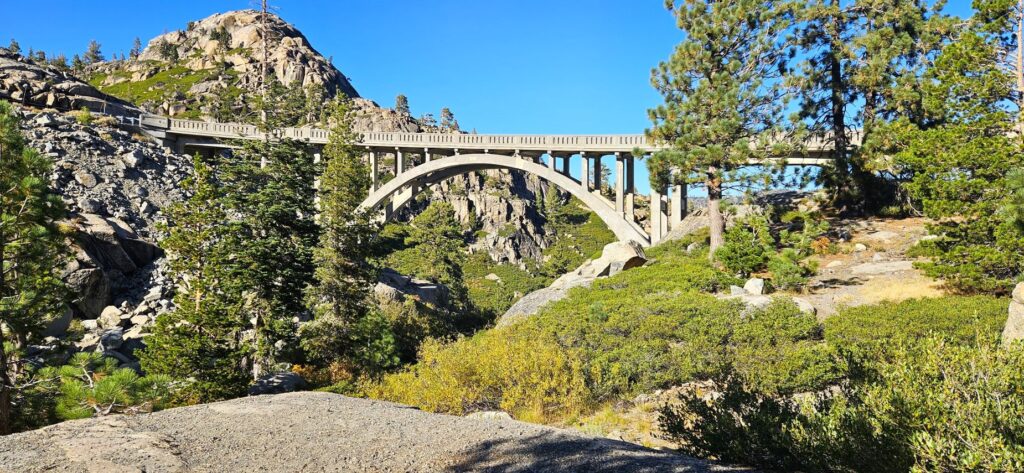
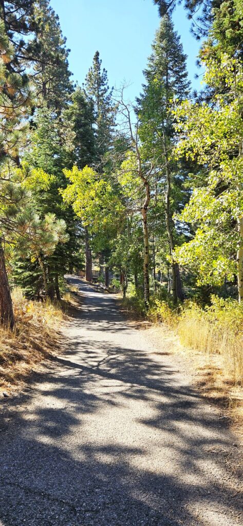
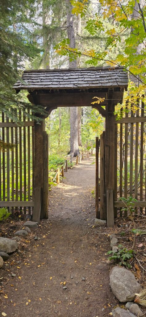
Over 30 years ago, we lived near Shaver Lake close to Wishon Reservoir. We decided to take a drive the next day to Courtright Reservoir and visit the area to see what was new. Along the way, we stopped at the McKinley Grove of Sequoias. There’s a nice new walking path with interpretive signs along the way.
A new pathway through the McKinley Grove
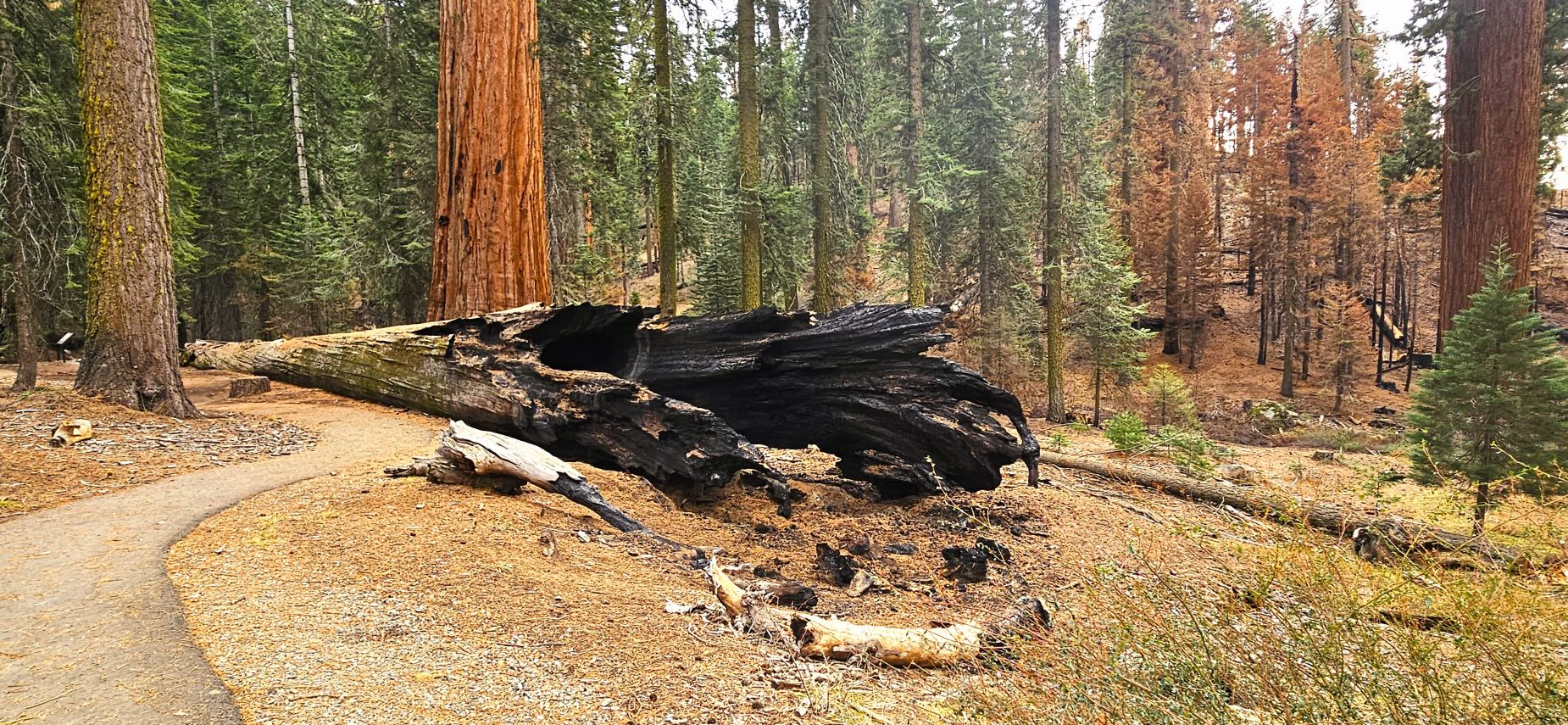
The Garnet Fire of August, 2025, came very close to the grove, as you can see from the burned trees in the background of the photo. Thankfully, the grove was spared and didn’t suffer any damage.
Burned trees from the fire of 2025 can be seen in the background of McKinley Grove
It’s estimated that some of these trees are around 2300 years old. Fires are actually beneficial to Sequoias in that fire is needed for their cones to release their seeds.
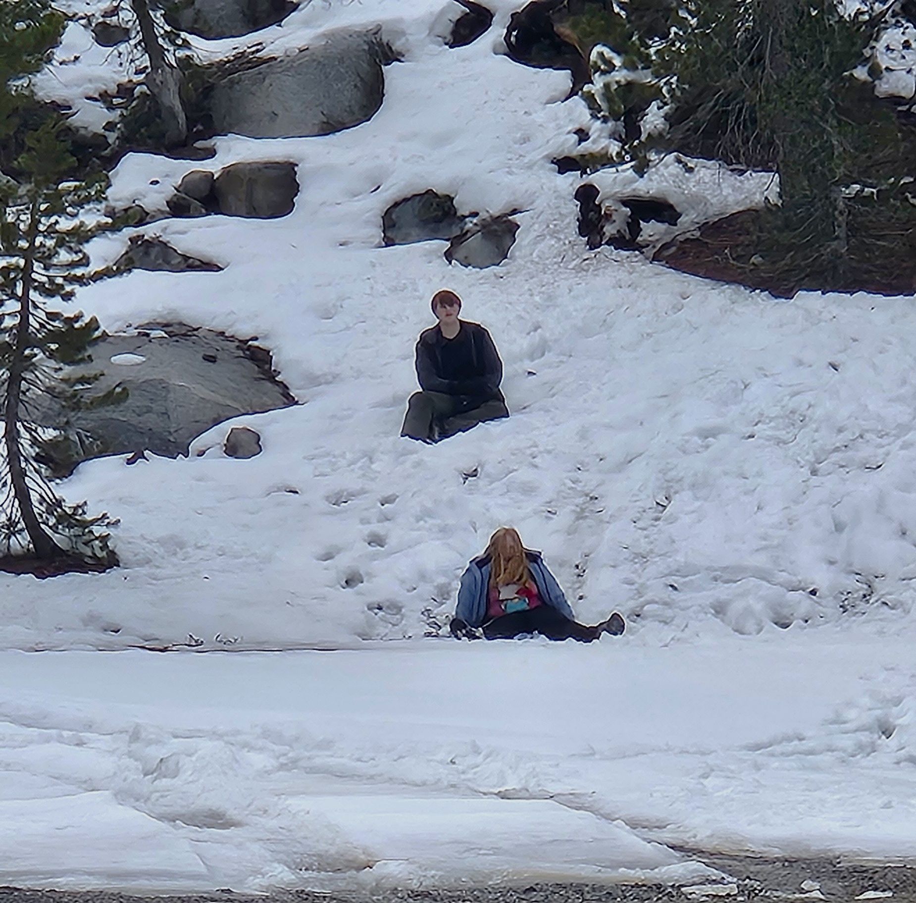
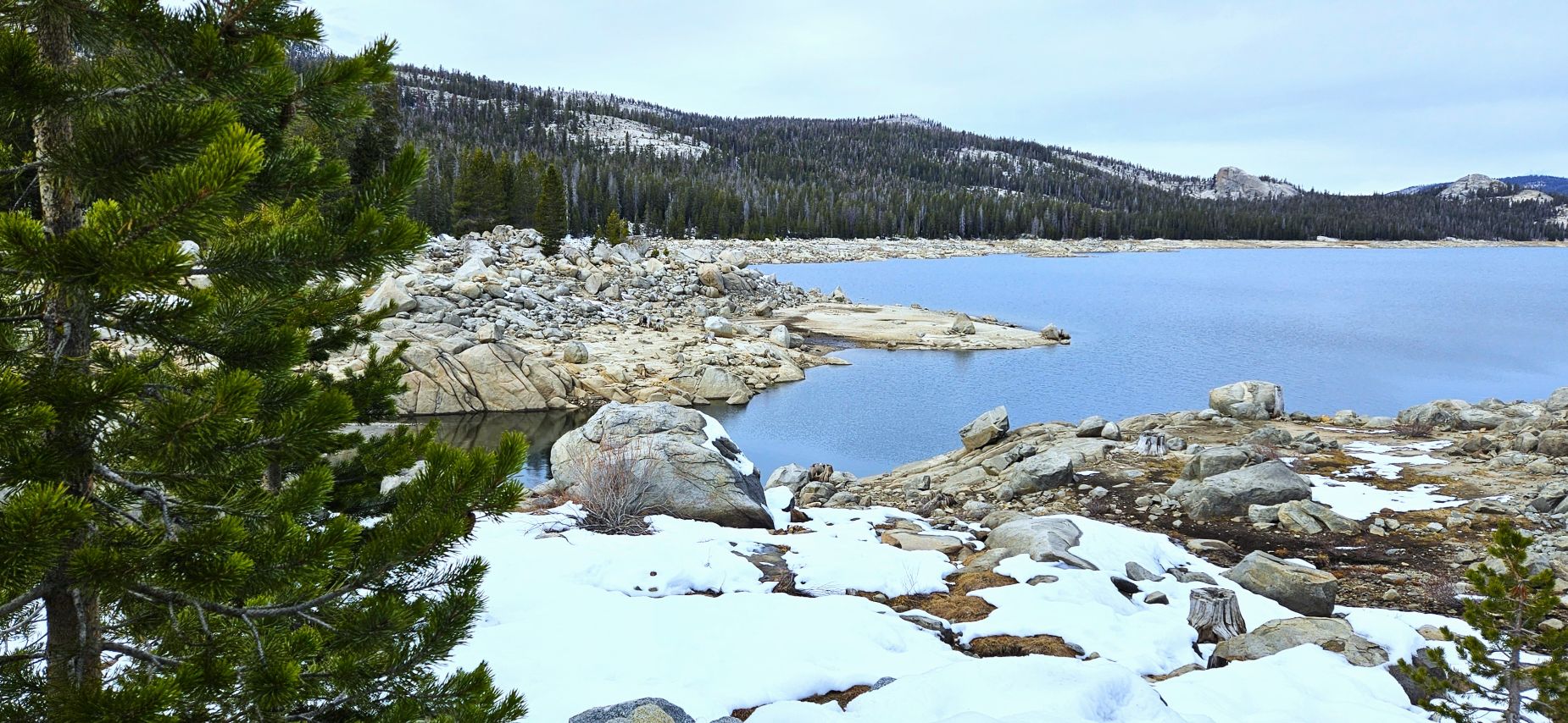
After a short break at McKinley Grove, we drove several more miles to Courtright Reservoir, the lake above Wishon Reservoir. Courtright is at a higher elevation (8200′), so we encountered more snow, to the delight of the grandkids.
Sledding in the snowCourtright Lake
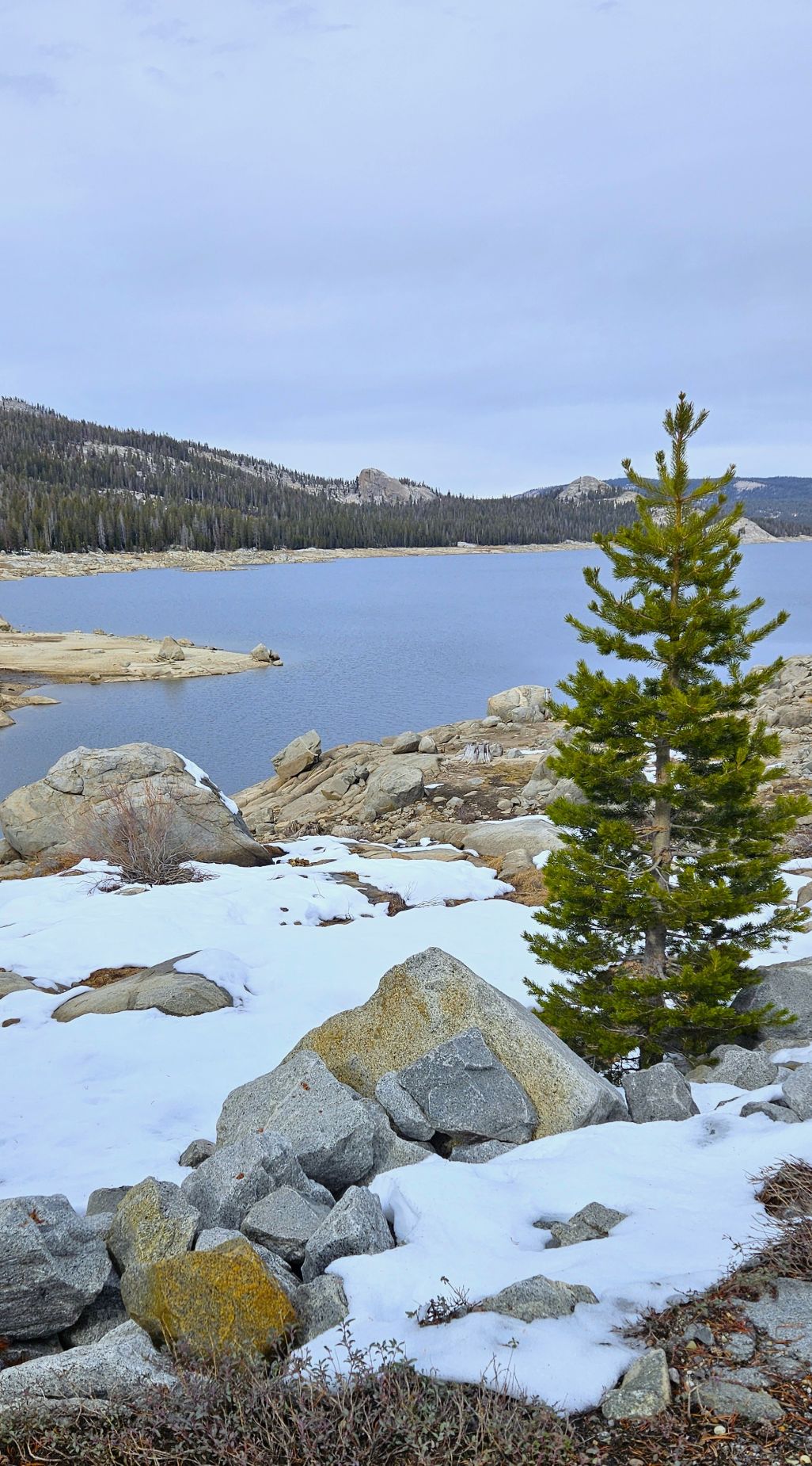
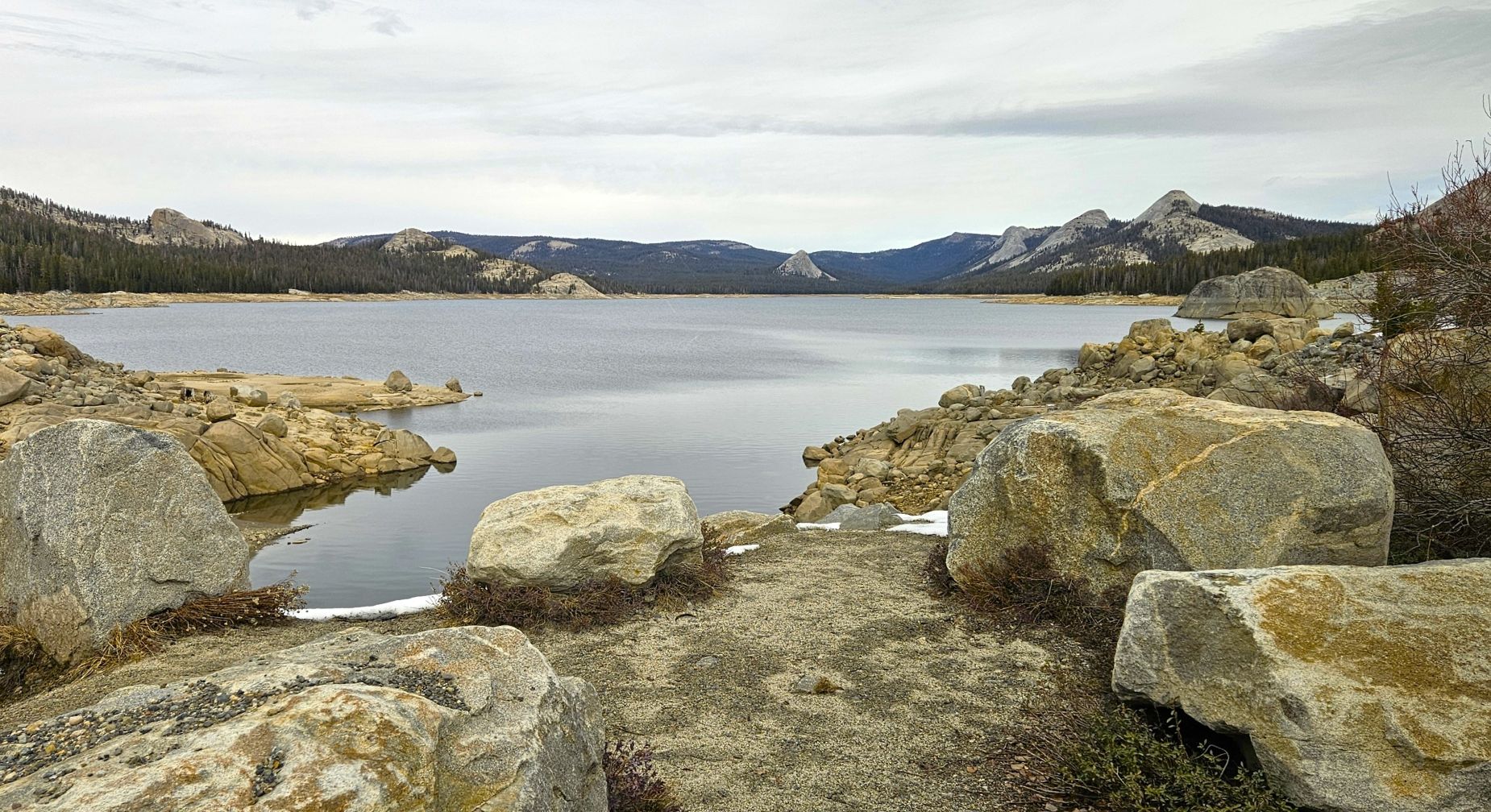
After spending some time there, we headed back to the cabin, enjoying the beautiful scenery along the way.
View along Courtright Road.View toward Wishon Reservoir on Courtright Road.
The landscape where the fire burned through was much changed. Loggers had already removed many of the damaged trees and vegetation which opened up the views in many places.
Burn area on McKinley Grove Road where trees and vegetation have been removed.
We enjoyed our time at Courtright Reservoir, Sierra National Forest and Shaver Lake area visiting familiar haunts of the past with family.
Then the trees of the forest will sing for joy in the presence of the Lord; For He is coming to judge the earth. Give thanks to the Lord, for He is good; For His faithfulness is everlasting. — I Chronicles 16:33-34
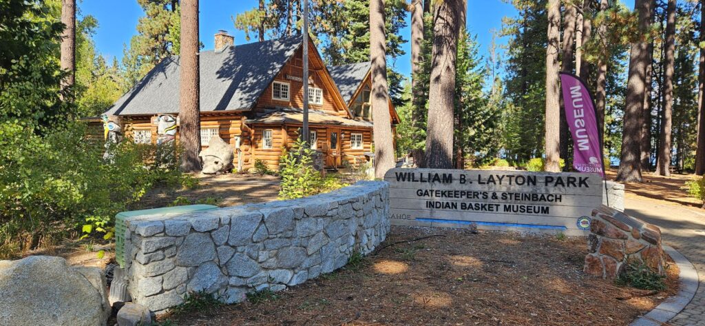
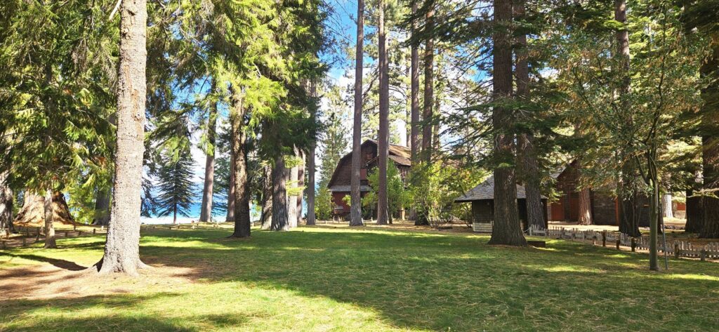
In Tahoe City, a little town in north Lake Tahoe, we visited the Gatekeeper’s Museum and Indian Basket Museum. We stopped here on our audio tour on a previous day, but it was closed. It was worth coming back to visit.
Entrance to Gatekeepers Museum, Tahoe City, NV
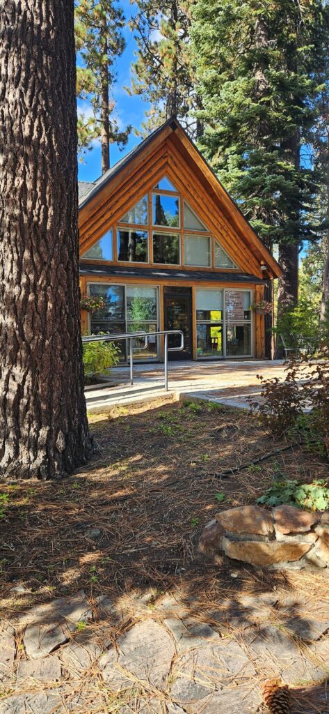
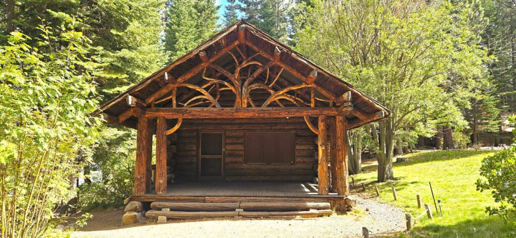
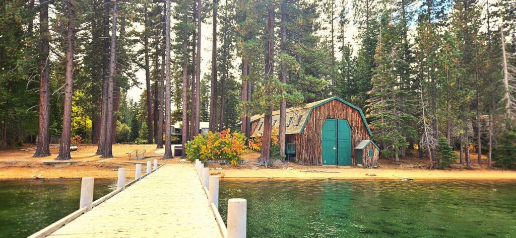
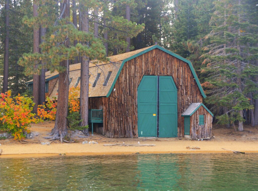
The Gatekeeper’s Museum was once the cabin where the Gatekeeper for the Lake Tahoe Dam resided, whose job it was to regulate the water flow out of the dam. It burned down in 1978 just before it was deeded over to the North Lake Tahoe Historical Society. They reconstructed it completely by hand on the original foundation.
Gatekeeper’s Museum
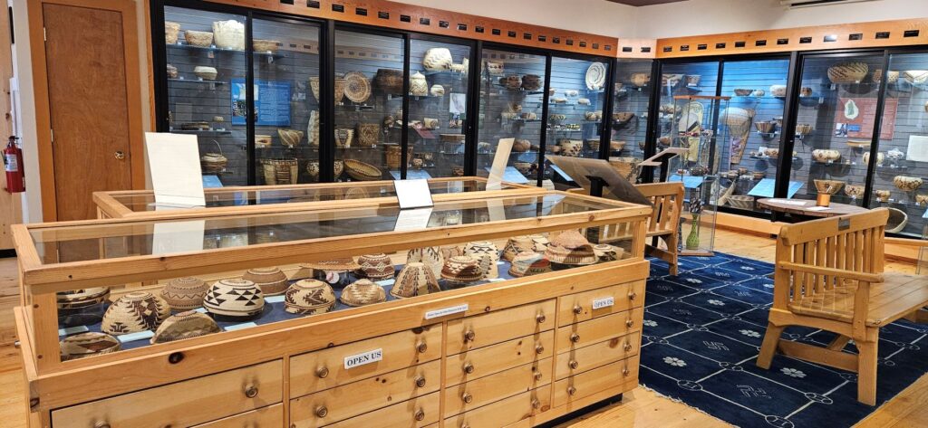
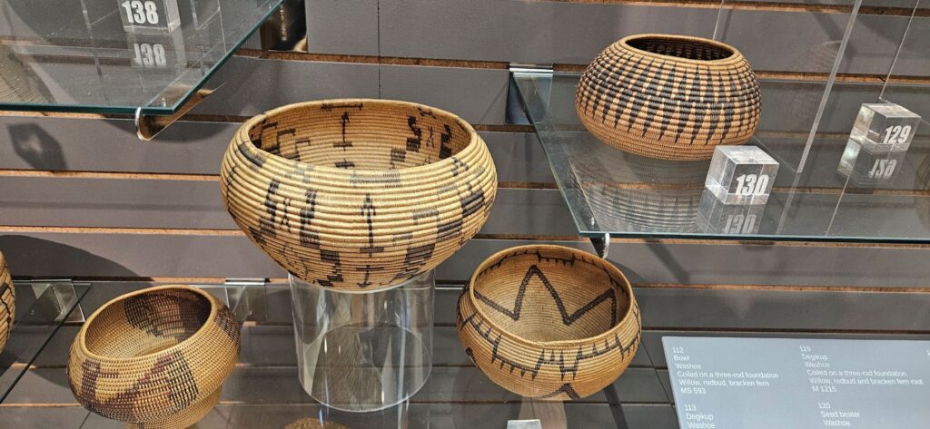
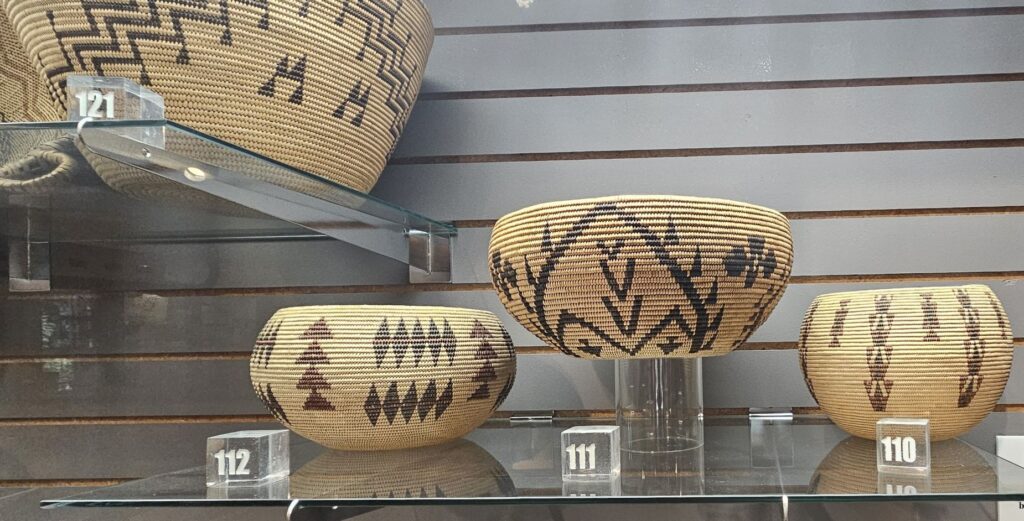
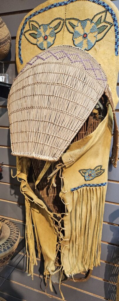
The museum also houses the Marion Steinbach Native American Basket Collection. The basket gallery showcases more than 700 baskets from native peoples of Western North America. The baskets are in very good condition and are works of art.
Indian Basket Collection is part of the Gatekeeper’s Museum.Cradle board for papoose
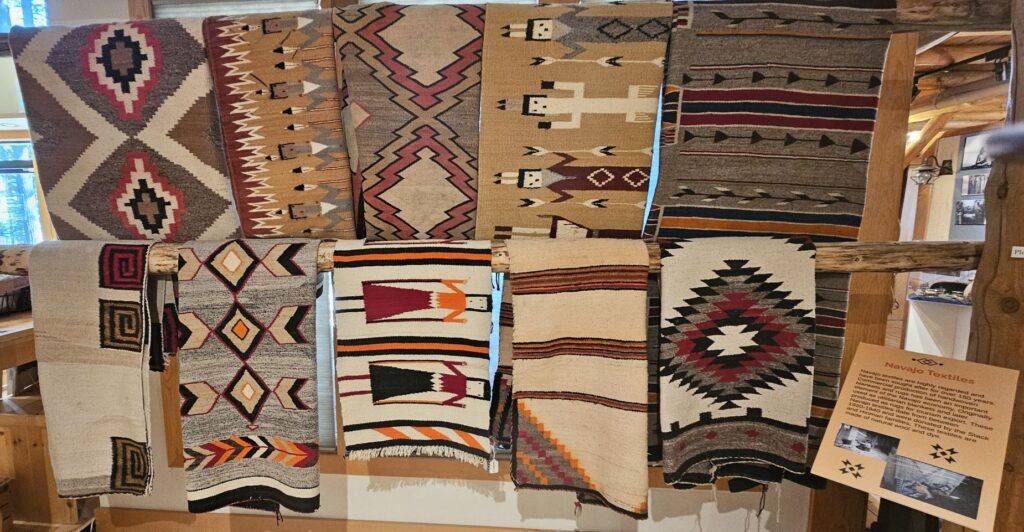
Another display showcases Navajo Indian rugs.
The rest of the museum preserves and tells the history of the Lake Tahoe area. There are stories of various boats that were used on the lake, artifacts from dog sled operators, and dresses from ladies of the past and more. Upstairs there’s more history and wild tales of the legend of the plug at the bottom of the lake.
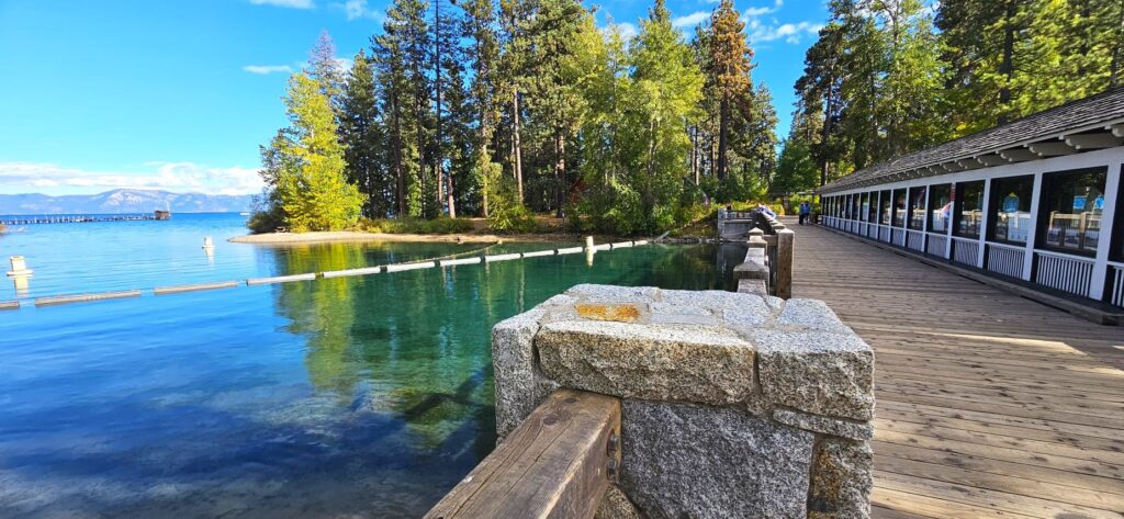
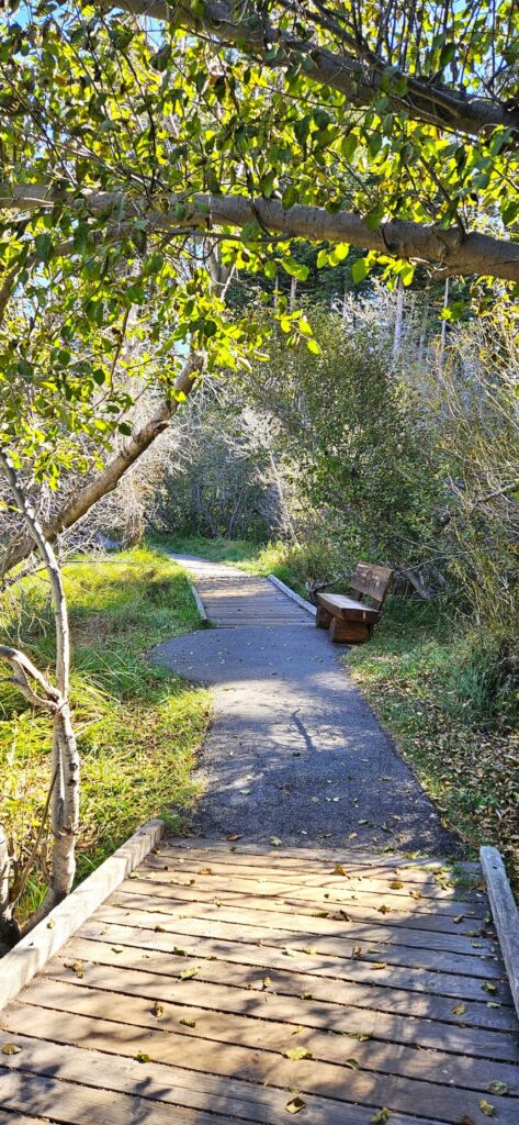
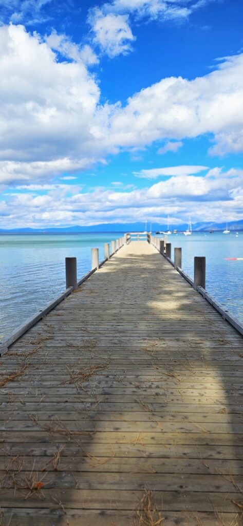
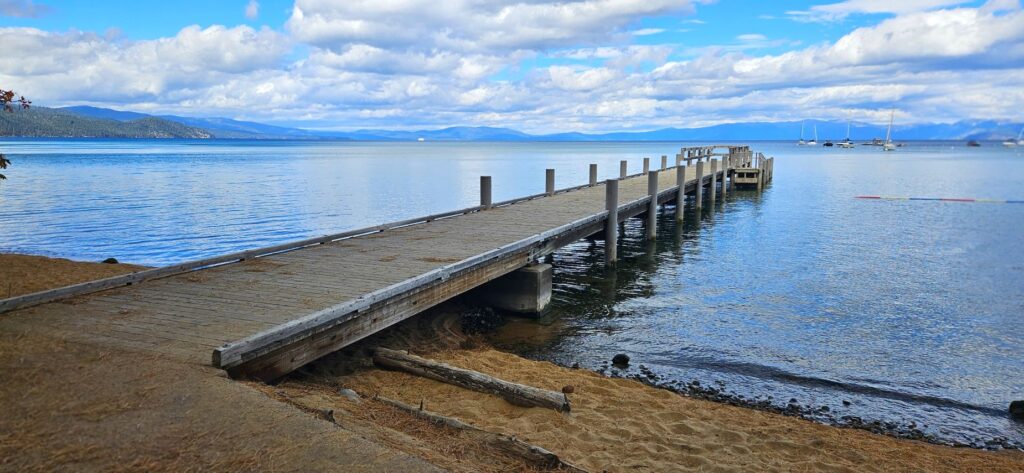
The outside of the museum has beautiful grounds that are right on the edge of the lake. Let’s take a walk down to the lake.
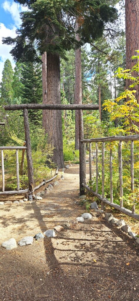
Pathway from Gatekeeper’s Museum to Lake Tahoe
Someone (not us) collected all these pine cones and arranged them on the picnic table.
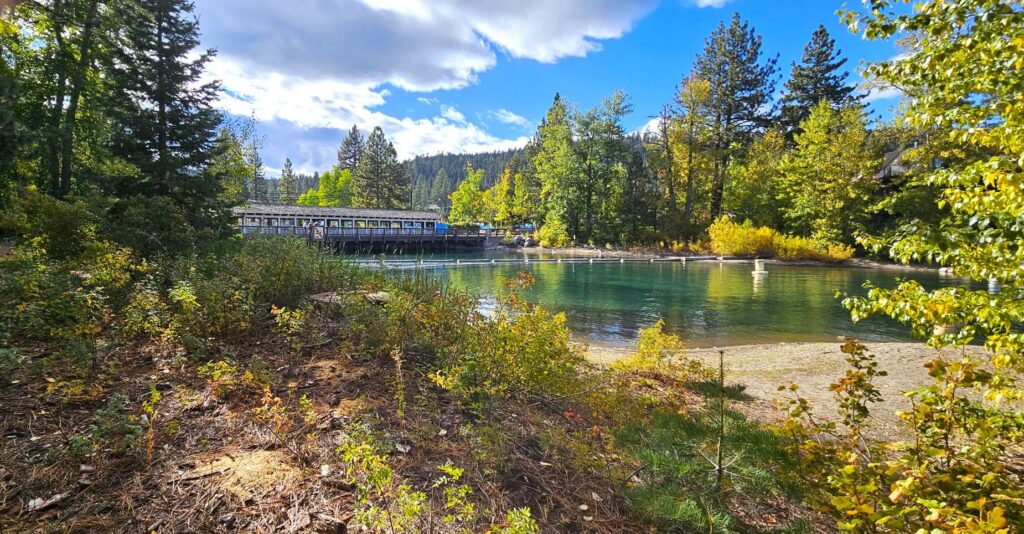
Within sight of the Gatekeeper’s grounds, is the famous Fanny Bridge which is located over the only outlet of Lake Tahoe into the Truckee River.
The bridge has an interesting story on how it got its name. It was so named from all the fannies that can be seen from the road as gawkers stare over the edge of the bridge at the water below. Do you see any fannies?
Here’s a view of what you can see from Fanny Bridge.
If you walk across the bridge, the North Lake Tahoe Visitor Center has a very interesting interactive display. The “Shaping Watersheds” interactive sandbox is a large-scale educational model where visitors can move the sand to build mountains, valleys and other land-forms. An overhead projector casts topographical contour lines and a color-coded elevation map onto the surface. The motion-sensing camera detects changes and the projected lines and colors change to reflect the new topography. It’s even fun for adults. Ask me how I know.
Grounds of Gatekeeper’s MuseumLake Tahoe from Gatekeeper’s Grounds
There was another historical cabin in Tahoe City that we did not get to see. It’s nice to have reasons to come back. This is one area I could visit over and over again.
“Whoever drinks of the water that I will give him shall never be thirsty; but the water that I will give him will become in him a fountain of water springing up to eternal life.” –Jesus
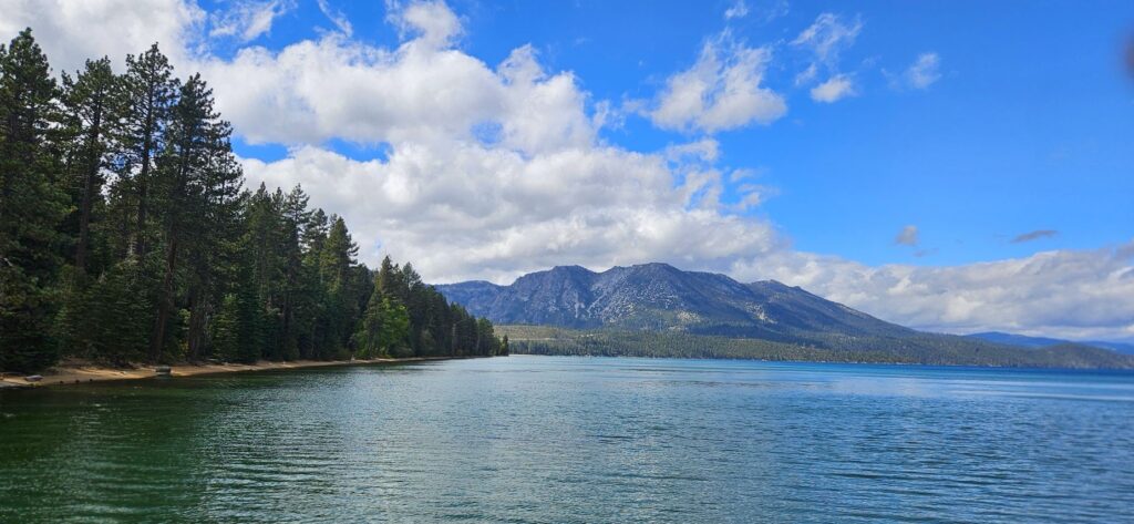
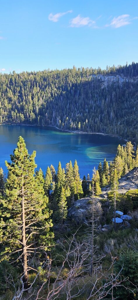
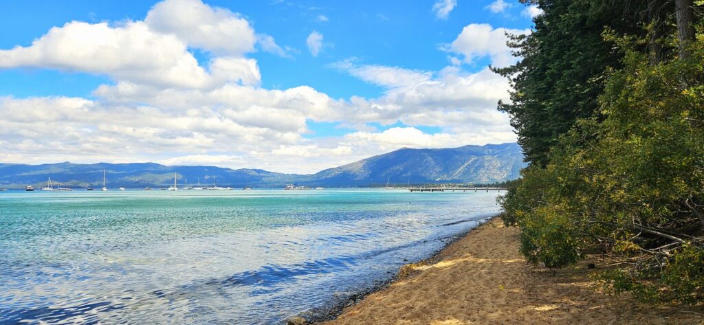
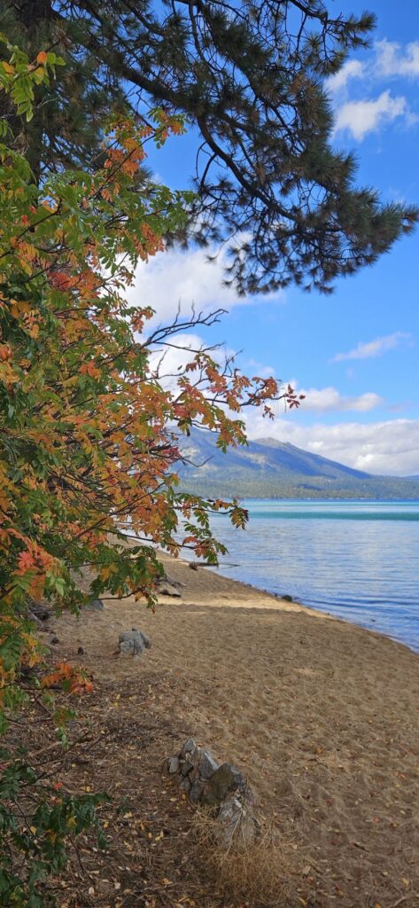
Lake Tahoe is the largest alpine lake in North America. It is the second deepest lake, after Crater Lake which is in Oregon.
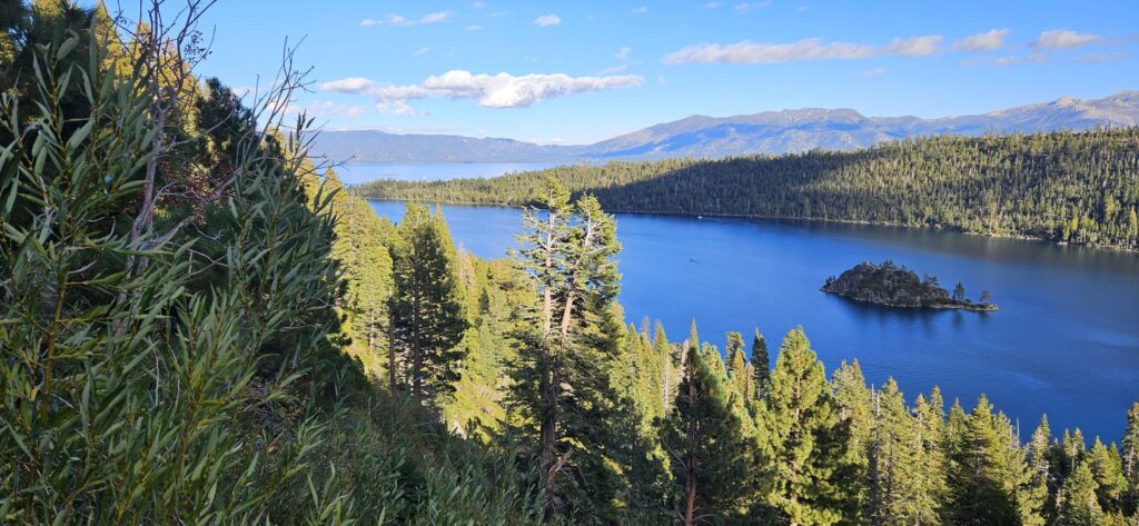
Fanette Island in Emerald Bay is the only island in Lake Tahoe
Lake Tahoe is completely surrounded by mountains of the Sierra Nevada and the Carson Mountain Range.
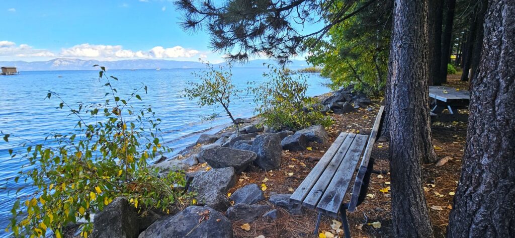
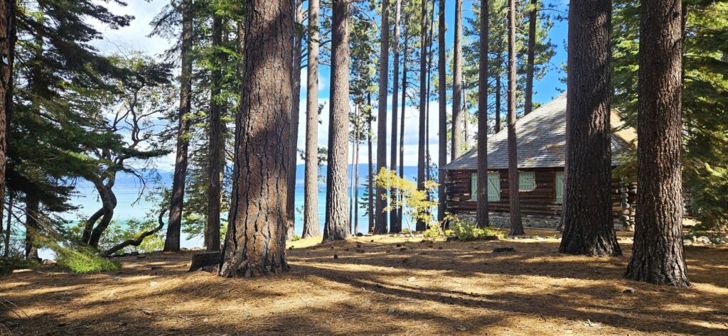
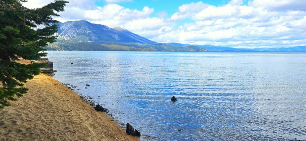
We enjoyed our three-week stay in South Lake Tahoe. The lake straddles two state lines, California and Nevada. We were on the California side, but did our shopping and fueling up in Nevada where prices were much better.
Emerald Bay at Lake Tahoe is a popular scenic spot.
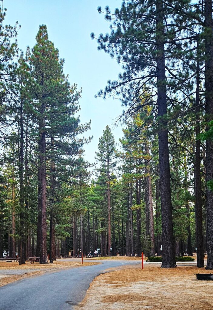
Our campsite was among tall beautiful pines. Whenever we stepped outside, we could smell the wonderful scent of the pines. Tahoe Valley Campground where we stayed is one of the Encore parks of Thousand Trails Campgrounds.
Our campground, Tahoe Valley Campground, at South Lake Tahoe
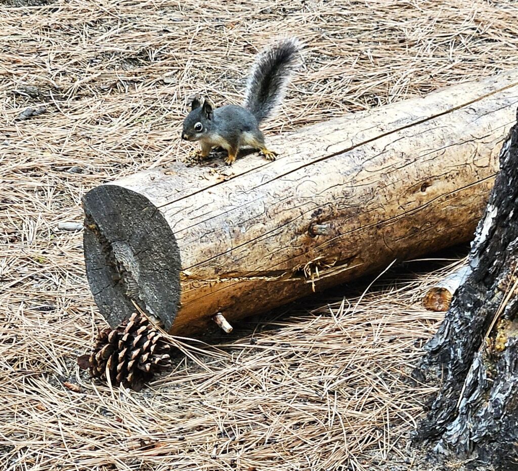
On our evening walks, we saw a variety of wildlife. There were plenty of tree squirrels like this little fellow.
Young squirrel eating pine nuts.
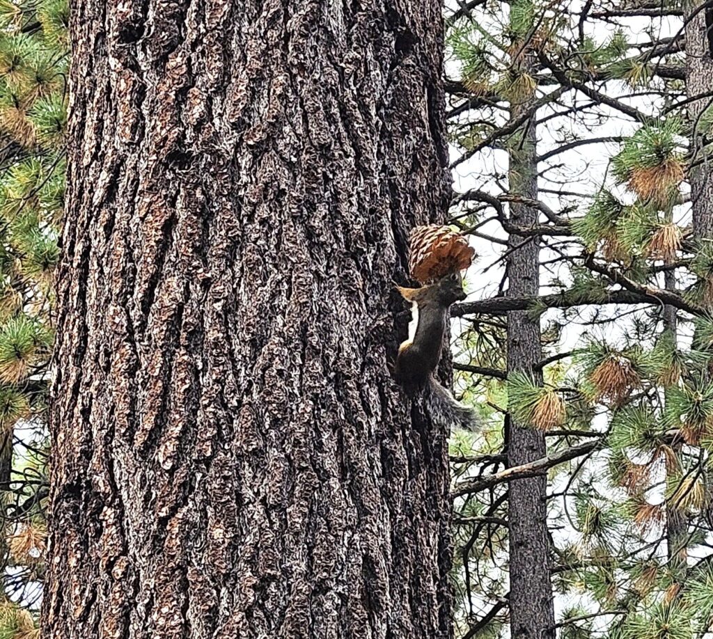
This squirrel amazed me at his determination to carry this pine cone (that was almost as big as he was) up this tree trunk.
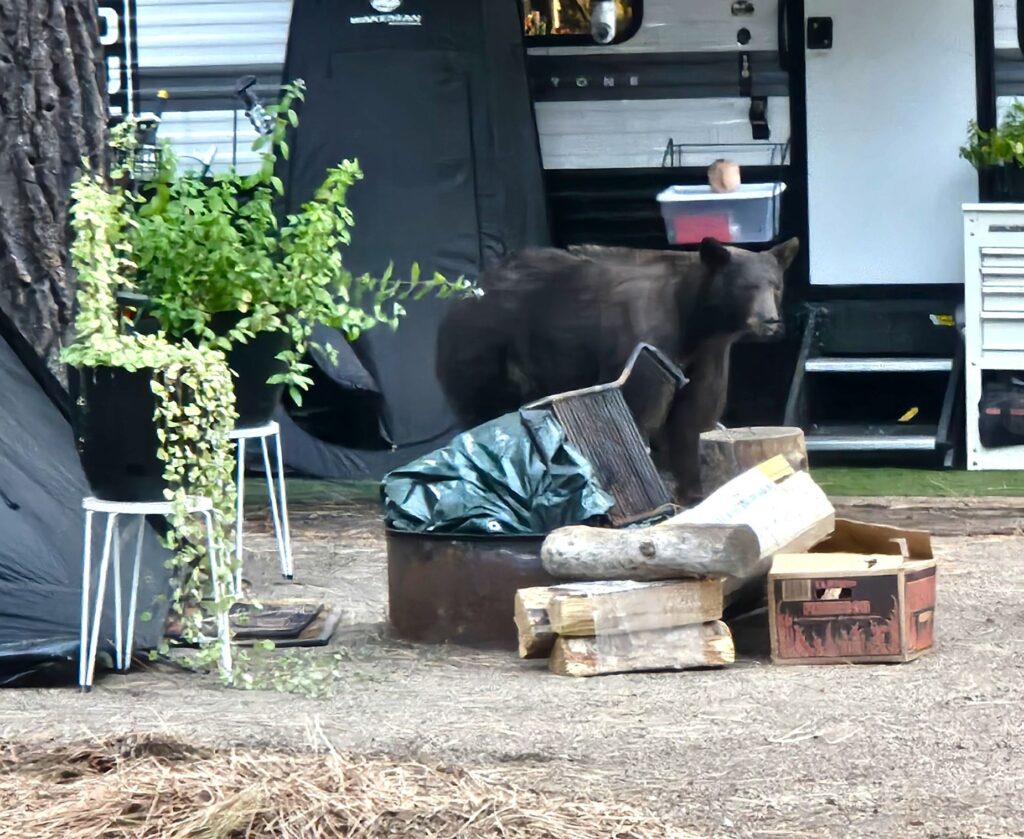
We even saw a bear one evening by a neighbor’s doorway. We had our own bear incident. I came out one morning to find both doors on the passenger side of our truck wide open. I thought maybe Ray had forgotten to close them, until I saw a bunch of trash around on the ground. Although we always lock the truck at night, we forgot that night. A bear opened the truck doors and found Ray’s bag of Fritos and our stash of peanut butter crackers. He ate everyone of them! (and left the trash for me to clean up.)
Bear at neighbor’s door
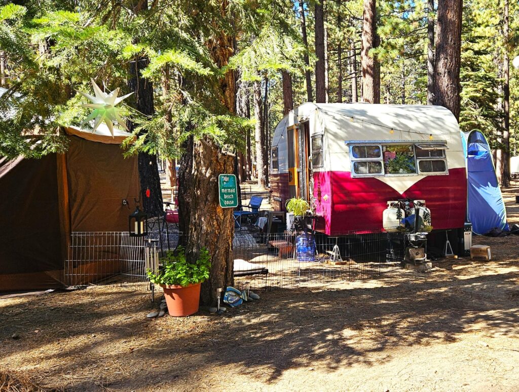
On our walks, we like to look at the variety of homes on wheels. I thought this little vintage trailer was cute.
Vintage Trailer
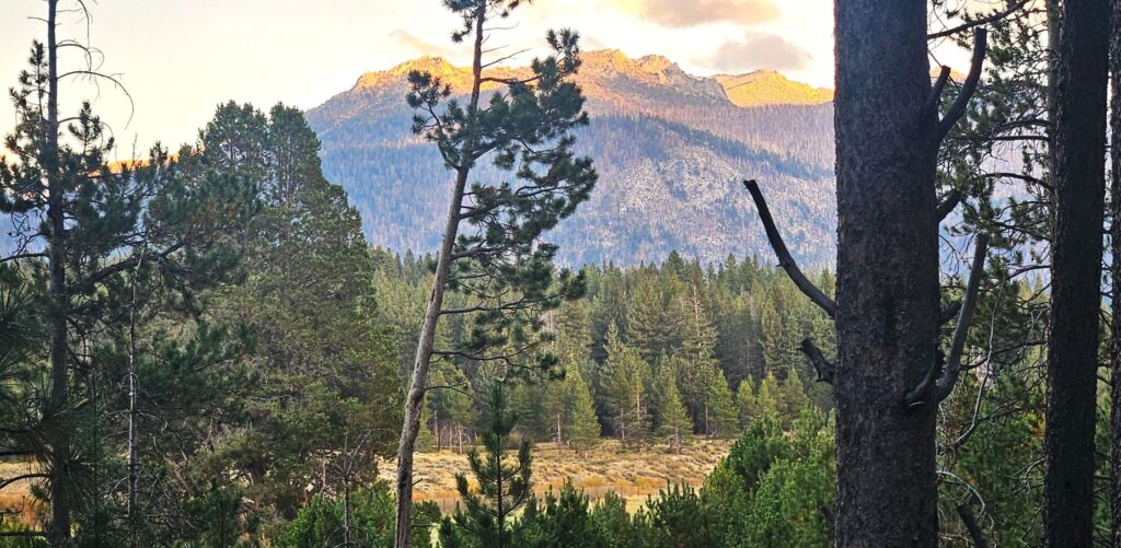
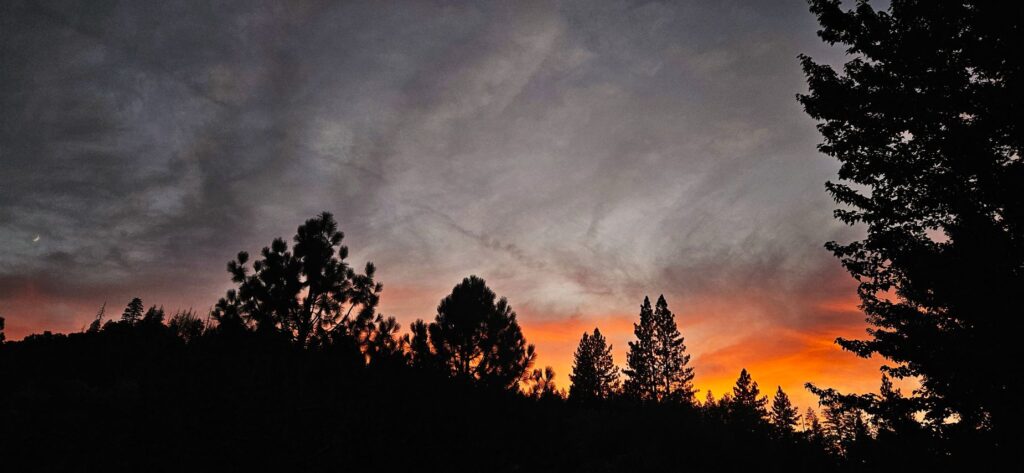
If we timed our walks right, we could peer through the trees and see the mountains in the distance as the last bits of sunlight lit up the mountain tops at sunset.
Sunset on mountain peaks
Donner Pass
One of our first excursions in the area was to Truckee, California, to see Donner State Park and Museum. The museum tells the history of the Donner party and the history of the Lincoln Highway (Highway 50). We listened to an audio tour and learned about the history of the area as we drove along. We lost the route in Truckee and had to finish it on our own. We listened to the rest of the tour on our way home.
Bridge on the Lincoln Highway
Taylor Creek Visitor Center
Another excursion closer to home was the Taylor Creek Visitor Center. We hiked the half-mile Rainbow Trail that makes a loop back around to the Visitor Center. It was a perfect day for a walk.
Rainbow Trail at Taylor Creek Visitor Center
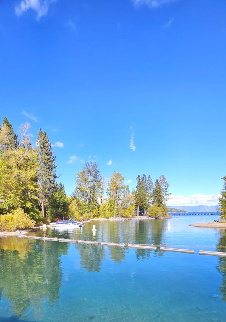
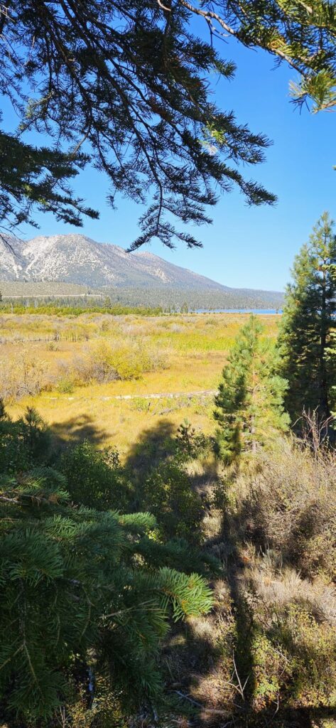
Most of the area is marshy. One of the reasons Lake Tahoe is so clear is that it is mostly filled from rain and snow. The marshes also contribute to the clarity by filtering water flowing into the lake.
Boardwalk on the Rainbow Trail
The marshes help slow the water flowing into the lake, thereby trapping sediment.The plants in the marshes absorb excess nutrients which removes pollutants from runoff and snow-melt before it reaches the lake.
Marshes like this purify the water flowing into Lake Tahoe
Lake Tahoe gets 300 to 500 inches of snow each year. This “Snowtel” is one of the ways the snowfall is monitored.
Snowtel for measuring snowfall
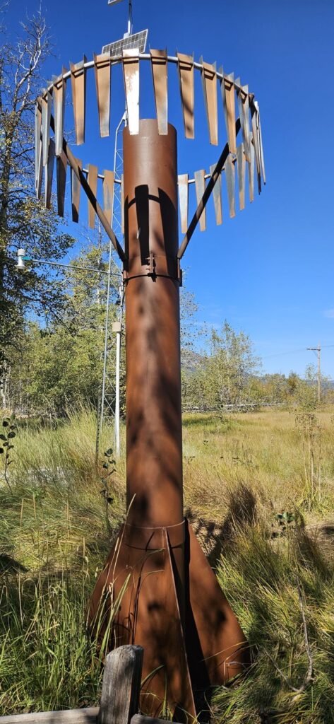
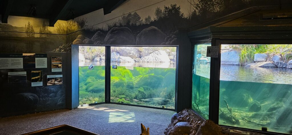
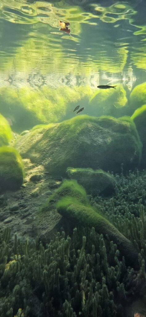
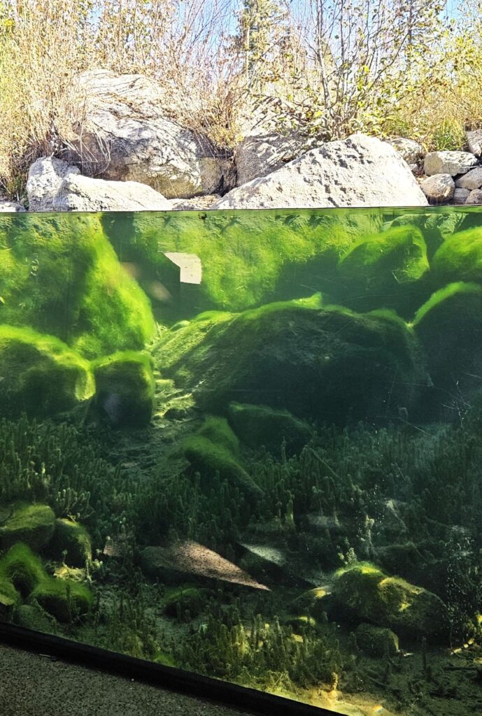
The Stream Profile Chamber is the highlight of the Rainbow Trail. Visitors can view the stream from under water. This is one of the most unique nature displays I’ve seen.
Stream Profile Chamber at Taylor Creek Visitor Center on the Rainbow Trail
We were there too early to see the salmon spawn. The Kokanee salmon spawn here in mid-October to November. We saw a few small fish.
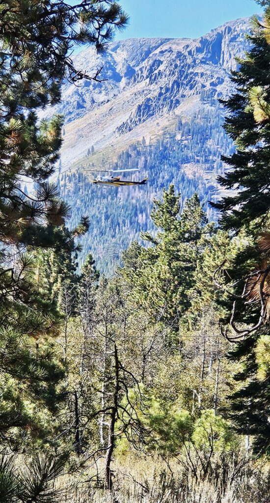
On our way back to the parking area, we saw this helicopter practicing search and rescue.
Helicopter practicing rescue efforts
Tallac Historic Site
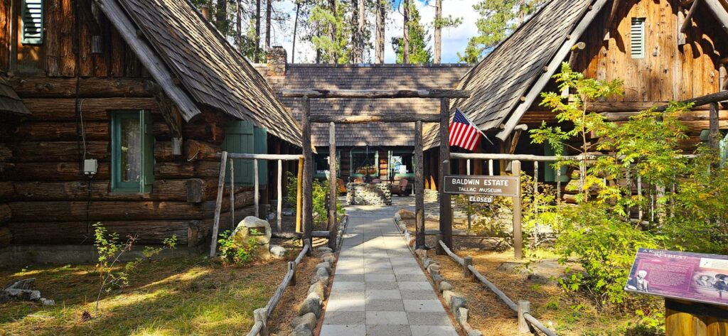
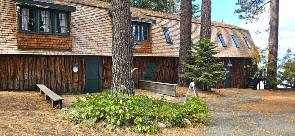
Near the Taylor Creek Visitor Center is the Tallac Historic Site. You can hike a short trail from Taylor Creek to get there, or drive a short distance and park in the parking lot. This historic site is a beautifully preserved glimpse into the lives of three prominent families from San Francisco during the Gilded Age.
The Baldwin Museum and Gift shop is in a central location on the properties.The Baldwin Estate Courtyard
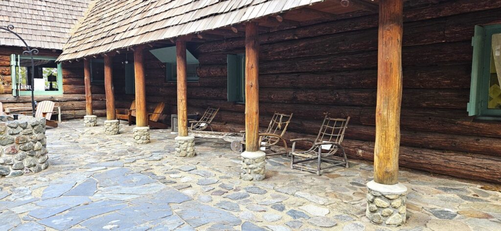
The walk through the grounds is beautiful.
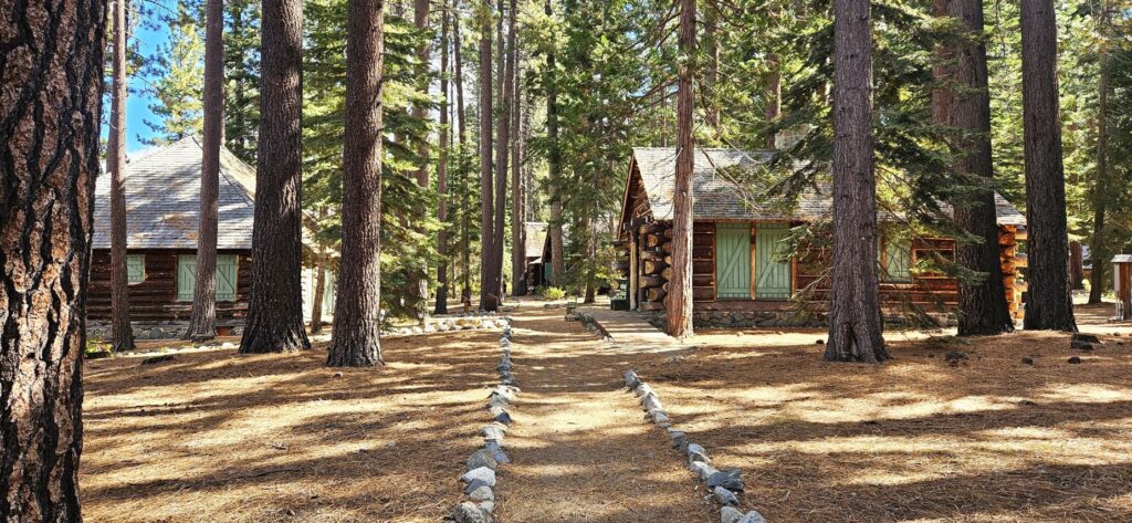
Besides the larger homes, there were many smaller cabins.
The grounds are right on the shore of Lake Tahoe with beautiful views of the lake and forest.
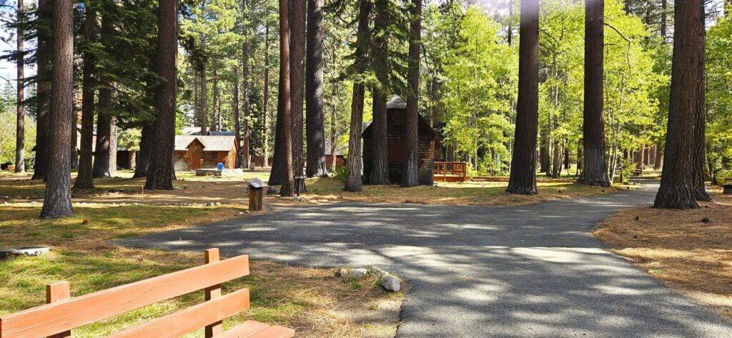
There are three estates here, so you can get some good exercise by going to all three.
Many of the buildings are still being restored. Volunteers restored this garden.
The Pope Estate invited painters, sculptors, photographers and other artists beginning in the 1920s. The Great Basin Institute re-launched the artist-in-residence program in 2023. The artists use the historic cabin as their personal studio, showcase their talent and provide workshops. The beautiful setting is an inspiration to any artist.
Further down the shoreline is a pier and marina.
To get supplies or to get to the other side of the lake, boats were launched from the boathouses on rails into the water.
If they didn’t want to get their feet wet, they used the pier.
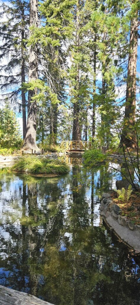
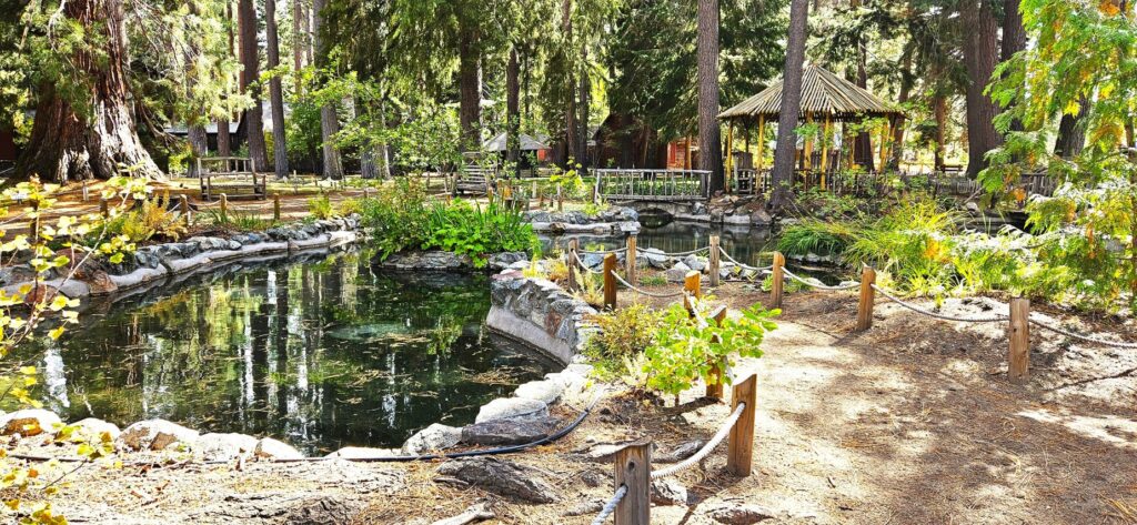
My favorite estate was the Pope Estate with it’s fish pond and gazebo.
Entrance to Pope EstateThe Pope Estate’s fish pond.
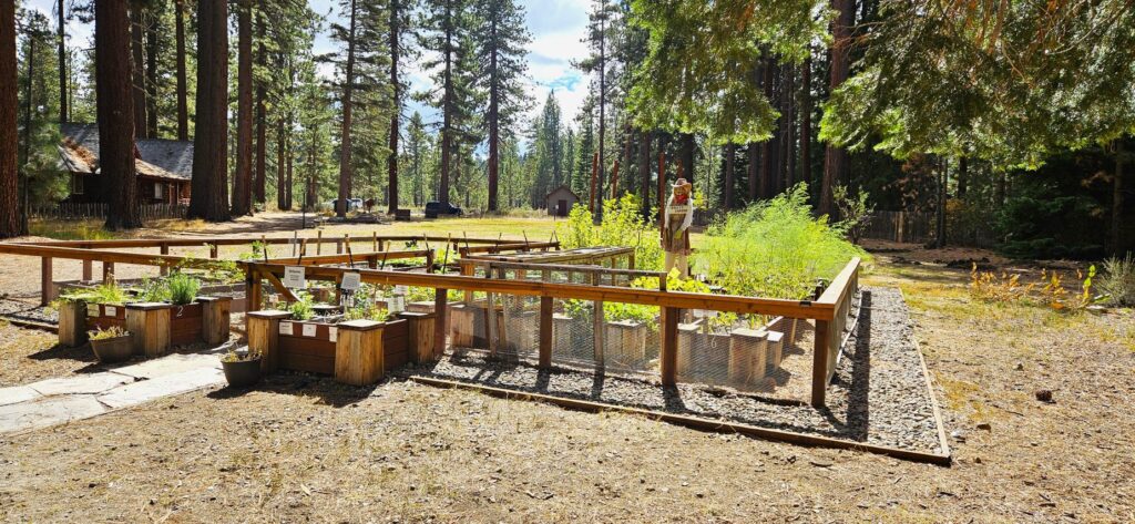
In this community garden, volunteers grow herbs and fruits and vegetables like strawberries, tomatoes and asparagus.
Community Garden at Tallac Historic Site
The Valhalla/Heller Estate boathouse was converted into a community theater which is currently used for events and performances.
The Valhalla/Heller Estate boathouse that was converted into a community theater.View of the boathouse/theater from the dock
Lake Tahoe is such a beautiful place, it is on my list to re-visit again and again. Some places are just especially beautiful. This is one of them.
“For since the creation of the world His invisible attributes, that is, His eternal power and divine nature, have been clearly perceived, being understood by what has been made, so that they are without excuse.” Romans 1:20
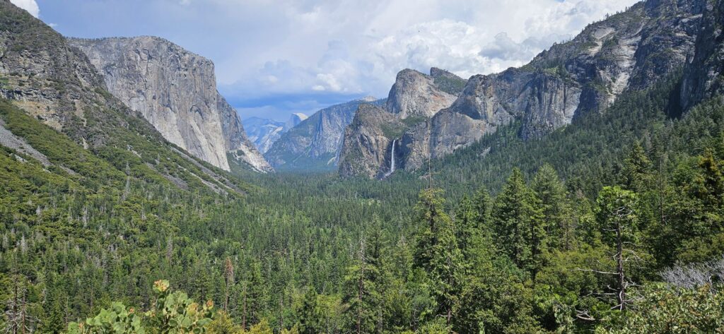
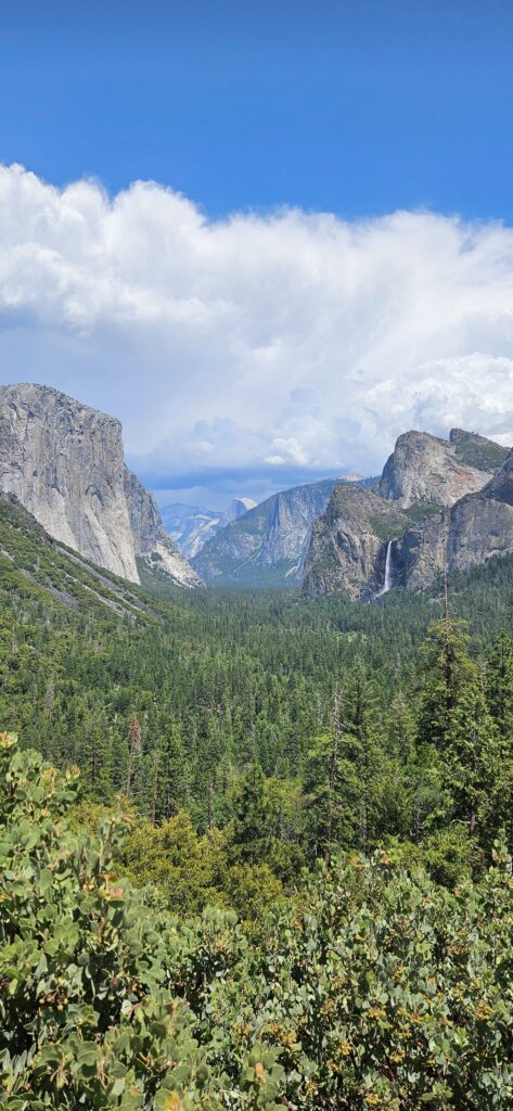
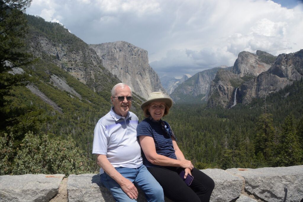
Now that Yosemite National Park has a reservation system during the summer months, we couldn’t just decide to go to Yosemite for the day without some planning. Even with our reservation, we waited 30 minutes to enter the park.
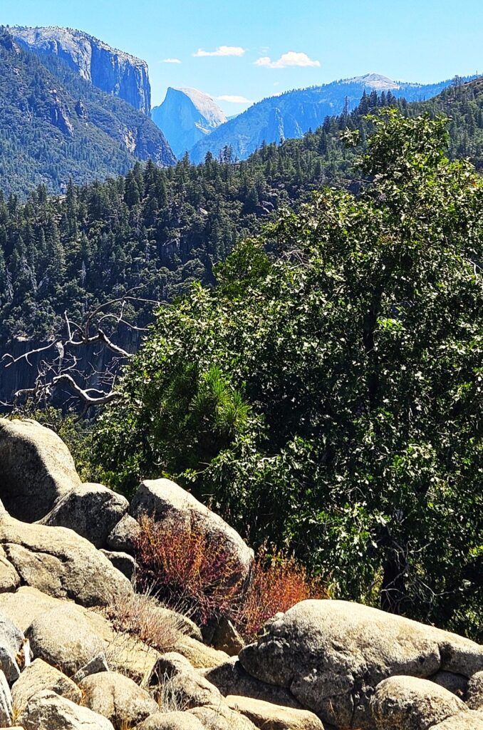
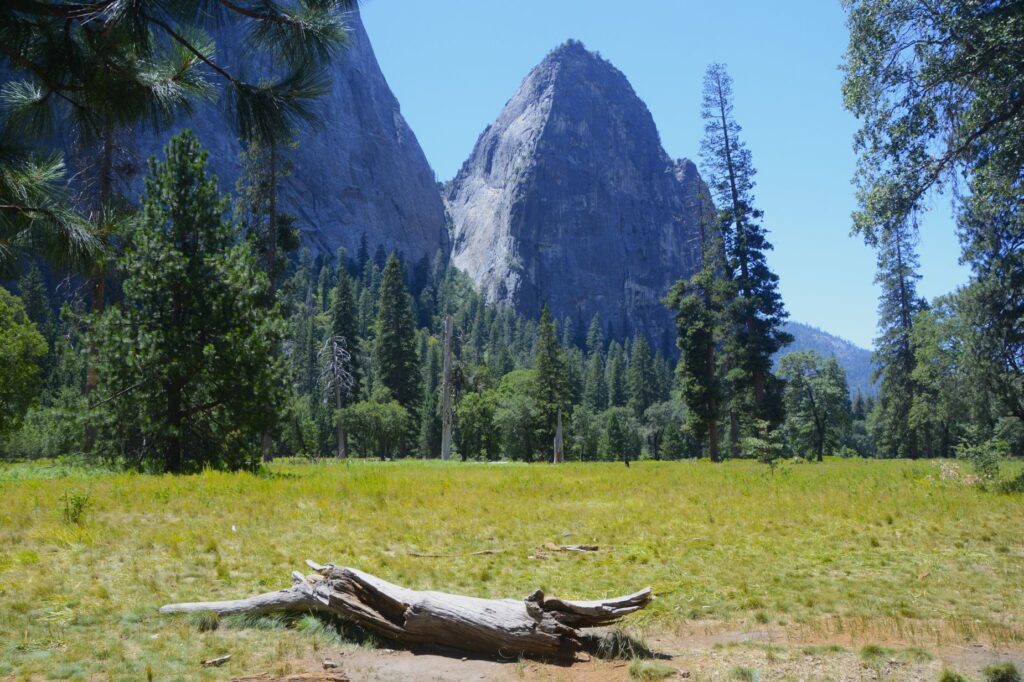
Half Dome from Big Oak Flat Road
The Valley was very crowded that day even though it was a week day. The parking at this pullout along the road was empty when I got there, but by the time I left, it was double parked with vehicles. Everyone had to see what we were looking at!
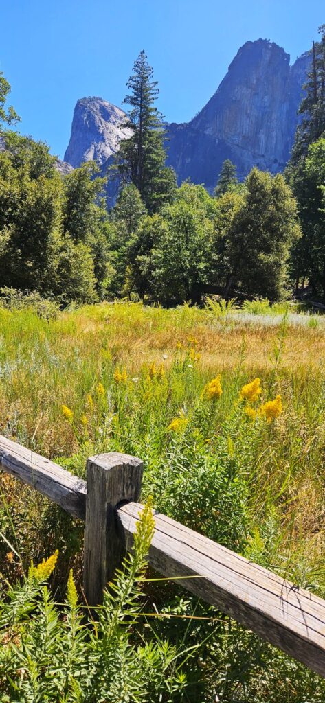
Tall Goldenrod
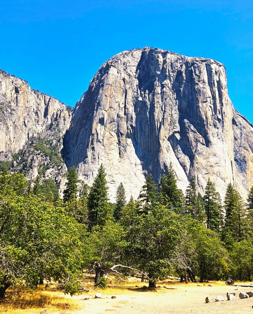
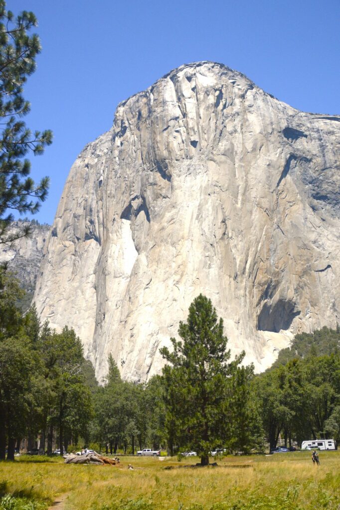
Across the road from us was a magnificent view of El Capitan.
El Capitan
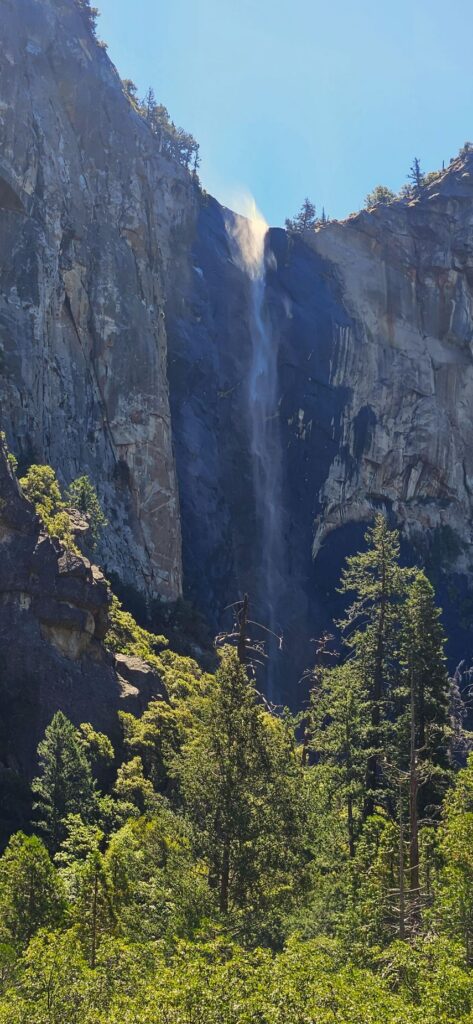
It was a bit windy that day. You can see the water at the top of Bridal Veil Falls being whipped up by the breeze. Though Bridal Veil still had water, Yosemite Falls was just a trickle.
Bridal Veil Falls
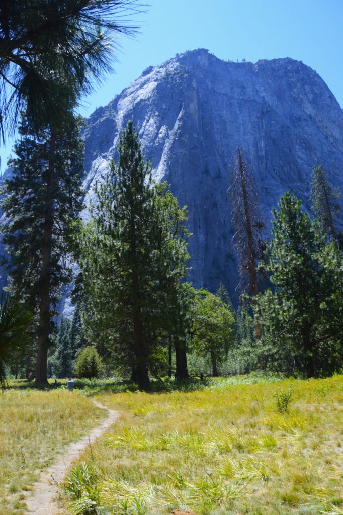
The parking lots in the valley were totally full. We drove around to see if anyone might be leaving, but soon gave up. We had to settle for parking along the road like this meadow pullout.
Meadow in Yosemite Valley
I took a little walk along the pathway and found this old fallen log.
Meadow in Yosemite Valley
Looking back, I could see El Capitan from a different angle.
El Capitan
We got tired of the crowds and decided to drive up into the high country. We found a nice pull out with a view. We were the only ones there.
View Point from Big Oak Flat Road
Our campground was only five miles from the Oak Flat entrance. We enjoyed our time there, but we didn’t attempt any more trips into the park. It was just too crowded for our taste. However, we enjoyed our evening walks around the campground and the many beautiful sunsets like this one.
Sunset at Yosemite Lakes Campground
“We can make our plans, but the Lord determines our steps.” Proverbs 16:9
Of all the national parks we’ve visited, (33 so far), Yosemite is our all-time favorite. While we were staying in Coarsegold, California, we couldn’t resist a visit to our former “backyard.”
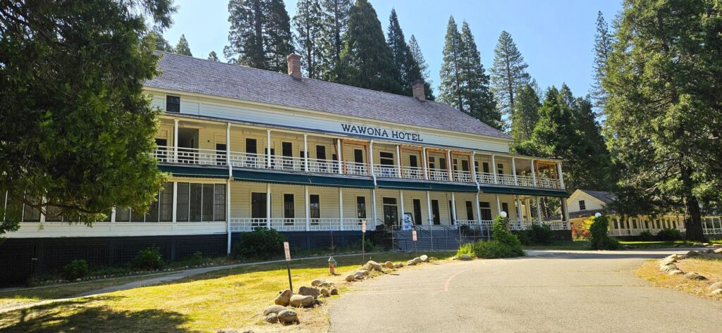
The Historical Wawona Hotel was being renovated in 2025.
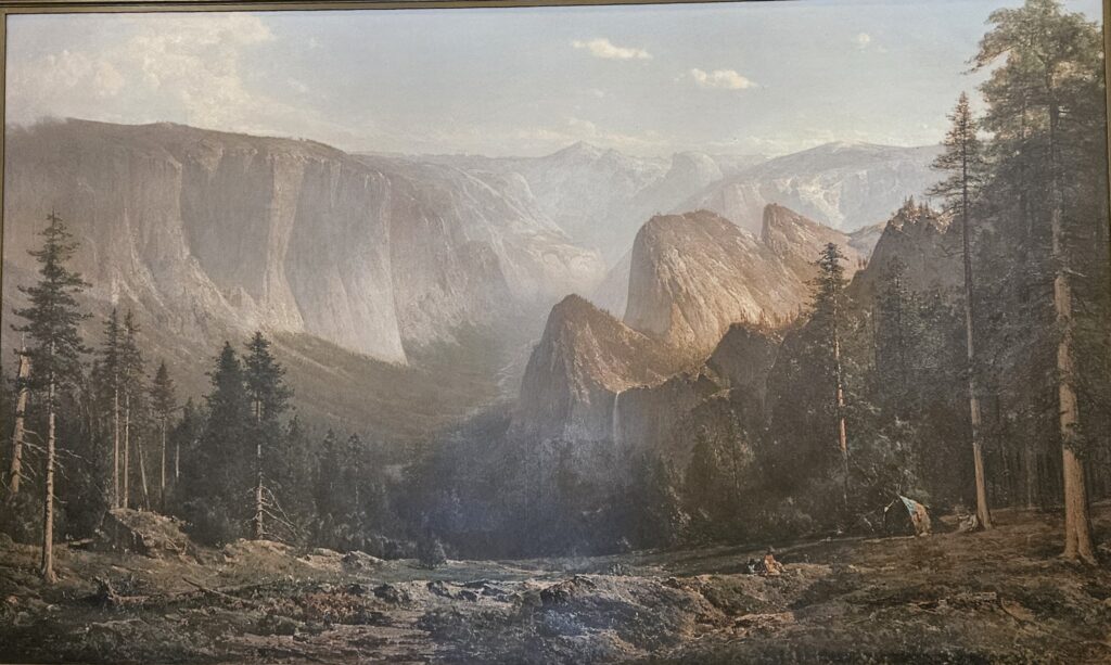
We entered Yosemite park through the Oakhurst entrance and stopped at the Wawona visitors’ center. In all our visits to Yosemite, I’d never been to this visitors’ center. It houses a fabulous collection of paintings of the famous landscape artist, Thomas Hill.
A large floor to ceiling painting of Thomas Hill in the Wawona Visitors’ center.
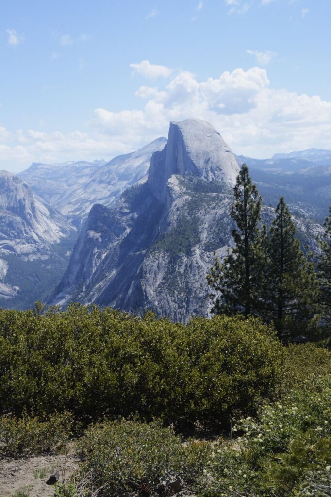
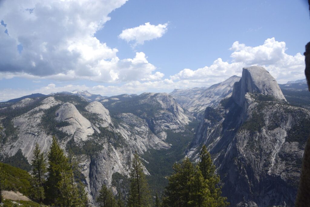
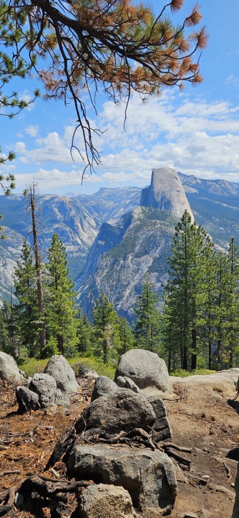
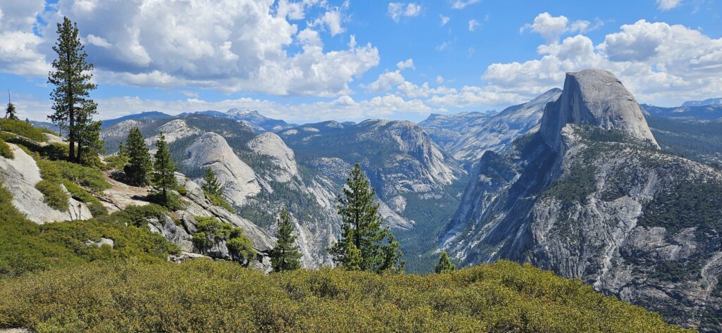
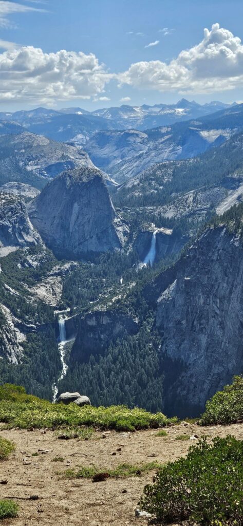
After getting my National Parks Passport book stamped and buying a couple of stickers for my journal, we drove on to Glacier Point. The road was fully opened recently after having been closed for a couple of years for repairs.
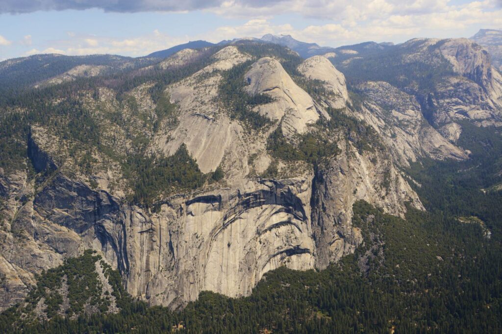
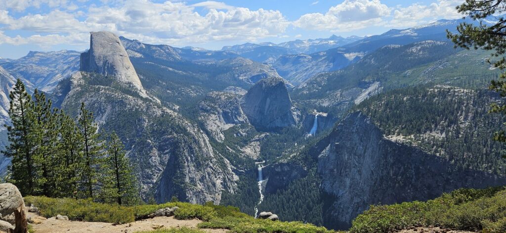
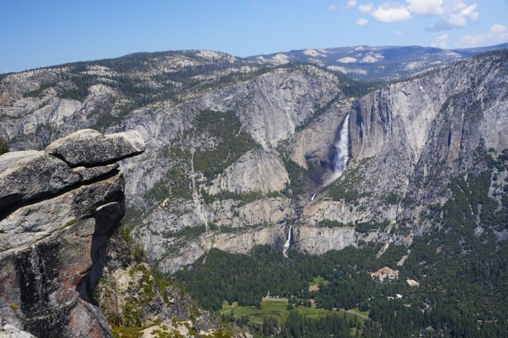
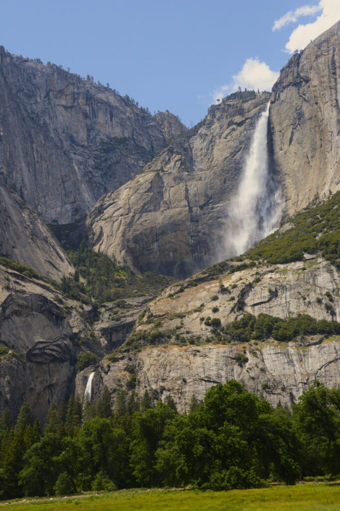
At over 7,200 feet in elevation, Glacier Point has the best views of Half Dome and Vernal and Nevada Falls. It also has wonderful views of Yosemite Valley and Yosemite Falls.
Huge rock walls of Yosemite Valley
The weather was a perfect temperature that day. The clouds added character to the beautiful landscape.
Half Dome and Yosemite ValleyView of Half Dome from Glacier PointVernal and Nevada Falls from Glacier PointHalf Dome, Vernal and Nevada Falls from Glacier PointRock ledge overlooking Yosemite Valley and Yosemite Upper and Lower Falls from Glacier Point
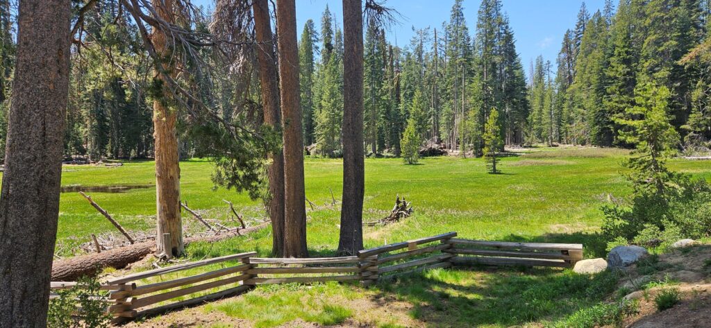
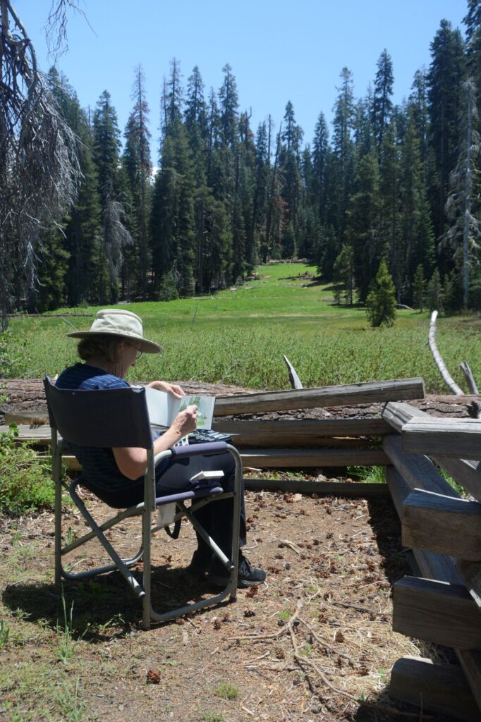
We were driving back from Glacier Point when we found this nice meadow where we stopped to eat our picnic lunch. I took some time to do a quick “plein air” watercolor painting. It wasn’t a Thomas Hill, but it was fun and relaxing.
Meadow on Glacier RoadPlein Air painting
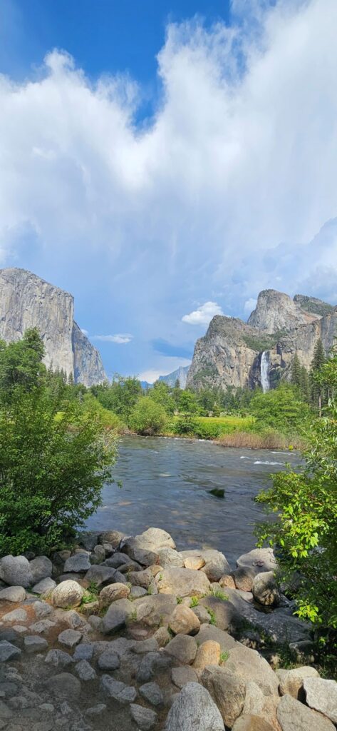
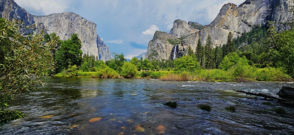
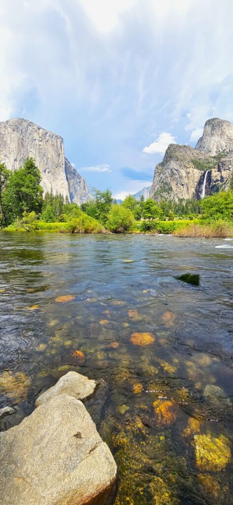
As we were coming through the tunnel, the view suddenly opened up and we saw this magnificent view of the valley and Bridal Veil Falls. I never get tired of looking at this view.
This view is known as the Tunnel view because the road goes through a tunnel and then opens up to this.
The clouds were really something that day. They started forming in the distance over the mountains and kept growing and growing until they filled the whole sky above.
While enjoying the view, a young lady from Utah offered to take our photo. She and her family own a campground in St. George, Utah. Since it was my birthday, I figured I should have a photo to commemorate it.
Birthday photo in Yosemite
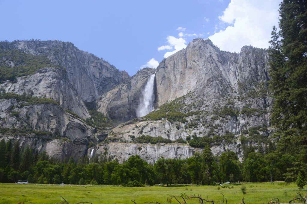
As we drove through Yosemite Valley, we caught glimpses of Yosemite Falls. They were full and beautiful from record snowfall and rainfall in the winter and spring of that year.
Yosemite Falls (Upper and Lower) from Sentinel Bridge area.Yosemite Falls
We continued on driving through the valley until we stopped at this viewpoint of Bridal Veil Falls and the Merced River.
Merced River and Bridal Veil Falls from Valley View TurnoutMerced River and Bridal Veil Falls from Valley View Turnout
By now the clouds had almost completely filled the sky above us. We turned toward home as we closed out our day with a last look at this magical place.
“I lift up my eyes to the mountains—where does my help come from? My help comes from the Lord, the Maker of heaven and earth.” Psalm 121:1
While traveling from Arizona to California, we stayed in Cathedral City, California. It’s not far from Indio. For some reason, we thought we had seen Joshua Tree National Park before. The fact was, we hadn’t.
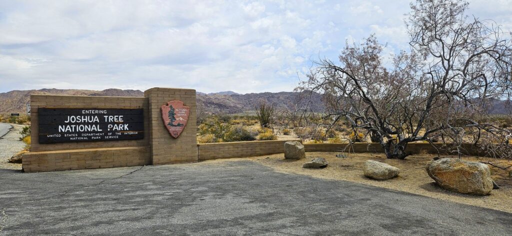
South entrance from Interstate Highway 10.
Of course, my first goal was to get my National Parks Passport book stamped at the visitors’ center. We entered the park from the south entrance from Hwy 10 and stopped at the Cottonwood Visitor Center.
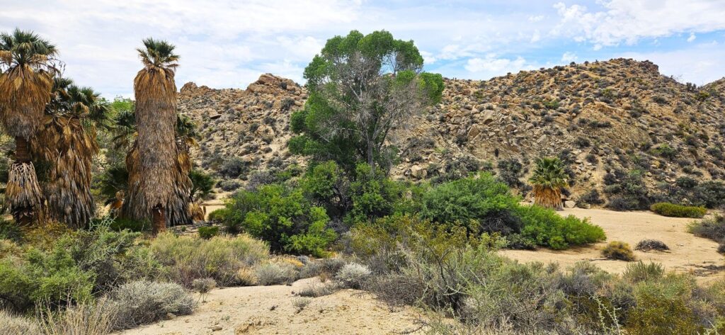
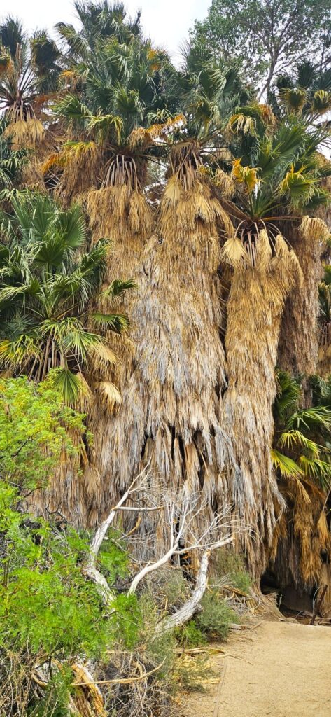
Lost Palms Oasis
Not far from the visitors’ center was a picnic area where we stopped and had our lunch. Near there was Lost Palms Oasis, the largest grove of California fan palms in the park. These huge bearded trees thrive due to a constant water supply from Cottonwood Spring.
California fan palms in Lost Palms Oasis
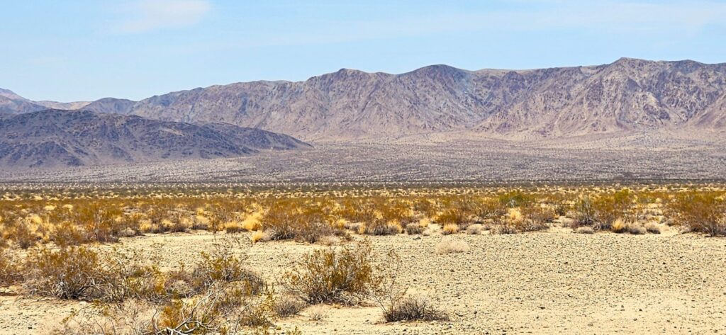
From there, we worked our way northwards through the park. We saw very few Joshua trees at first. The temperatures in the desert in early May were quite pleasant since we were climbing in elevation the whole time.
The road is about a 30 mile drive, but we made several stops along the way to learn about the desert plants and geology. This alluvial fan coming is a common sight where the mountains meet the desert floor. Material from the mountains is washed down by streams during rains and flash floods. As the water slows, sediment gets deposited from the streams.
Alluvial fan
The alluvial fan gets more moisture from runoff to support more plants like the ocotillo and chollas. Believe it or not, ocotillos are more closely related to blueberries and tea plants than cactus plants!
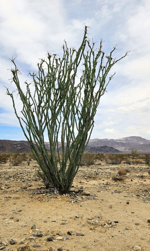
Ocotillo plant
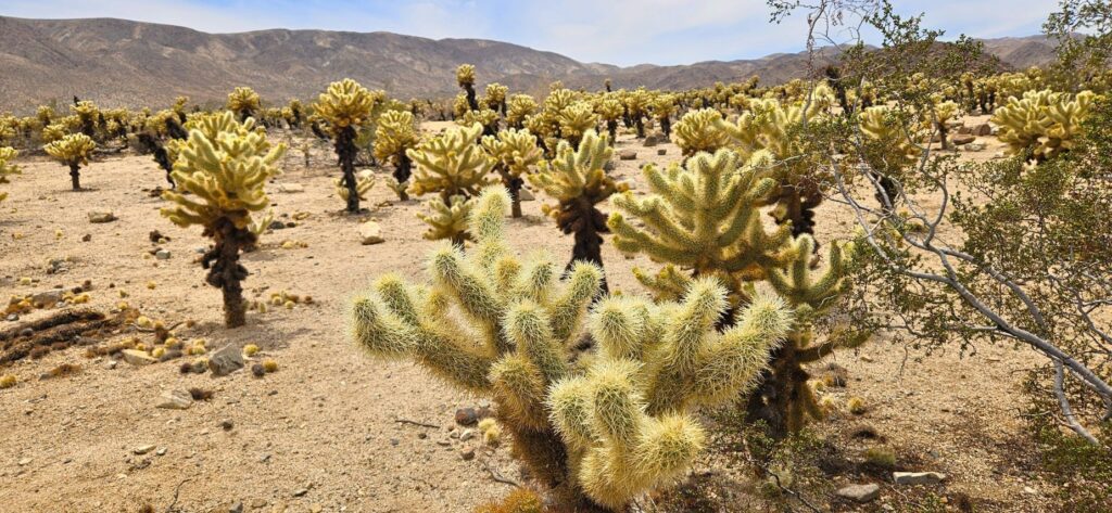
Our next stop was the cholla garden. I’ve never seen so many chollas in one place! There were warning signs telling tourists not to get too close. Chollas are also known as “jumping cactus” because if you happen to brush up against one, it will stick to you.
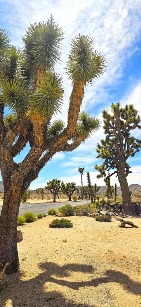
Joshua trees are a type of yucca plant. Sometimes it’s hard to tell the difference. I thought at first these yucca plants were baby Joshua trees. But they are yuccas.
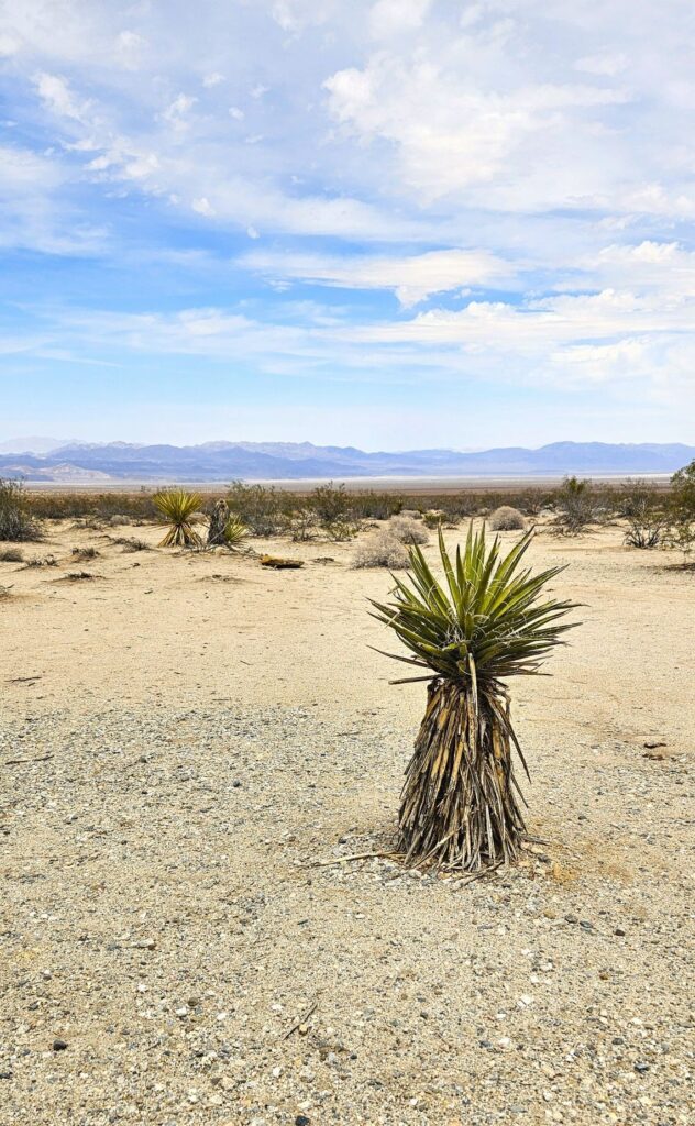
Spanish Dagger yucca plant
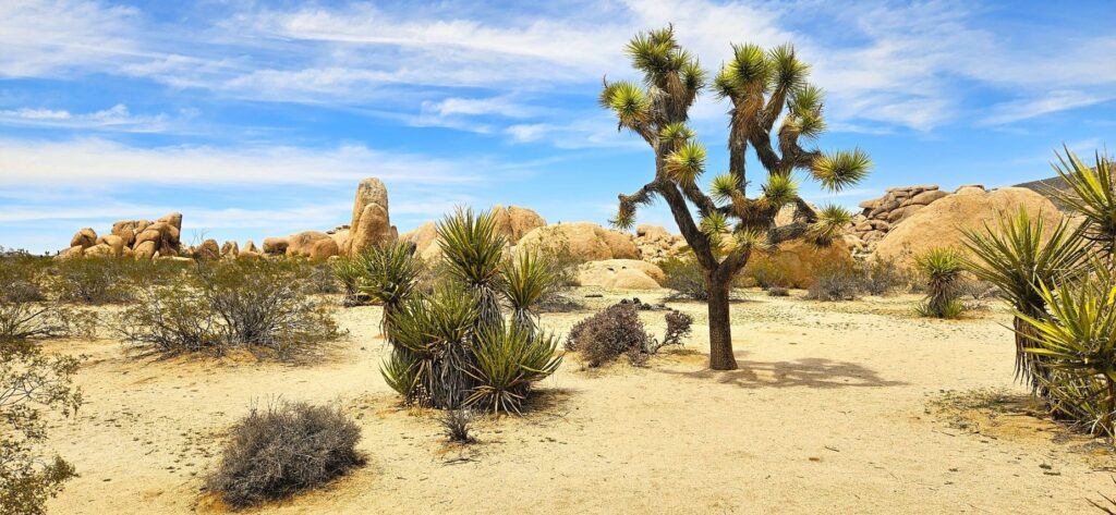
The next photo shows the difference between a yucca and a Joshua tree. It’s pretty easy to tell when they’re this big and side by side.
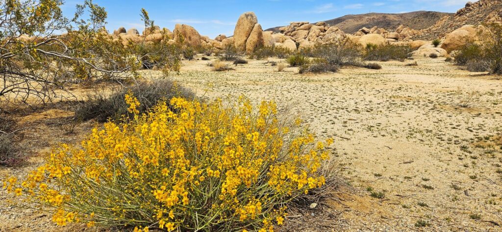
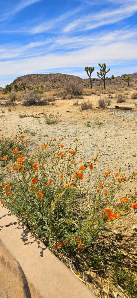
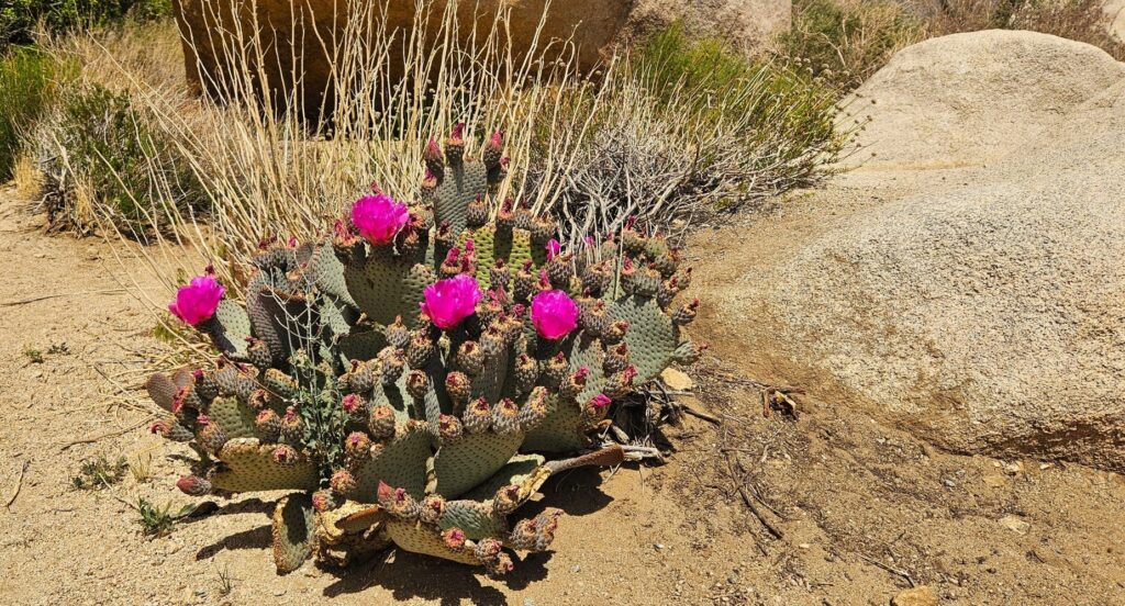
It was late spring when we visited, but there were plenty of desert flowering plants.
Flowering Blue Palo VerdeFlowering Desert Globe MallowFlowering Prickly Pear Cactus
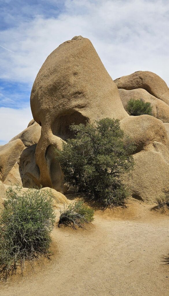
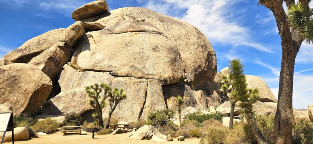
Along our route was this interesting rock formation called “Skull Rock.” Joshua Tree National Park has a variety of rock formations. This is a popular one for tourists.
Skull Rock
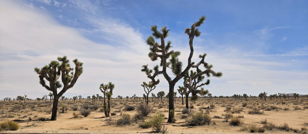
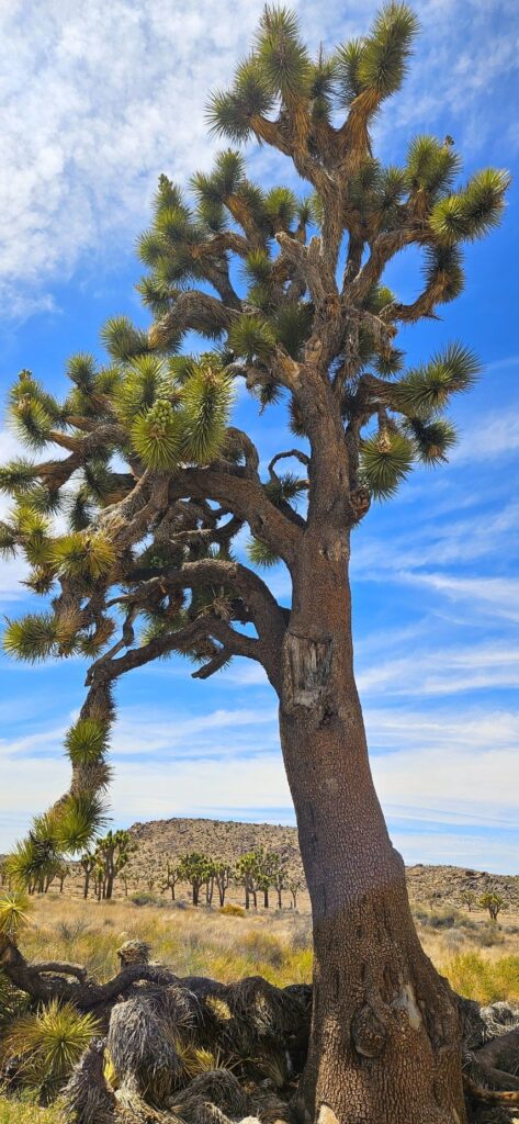
As we got further and further into the park, we began to see huge Joshua trees. I’ve seen many Joshua trees in my lifetime, but these were the biggest I’ve ever seen.
The trunks of these trees were like the size of an oak tree, and had many “arms.”
Large Joshua Trees
Another stop along our route was this “balancing rock” formation. It looked like it could topple down at any time.
Balancing Rock
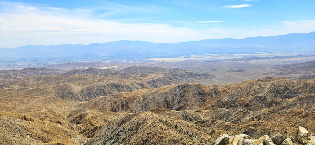
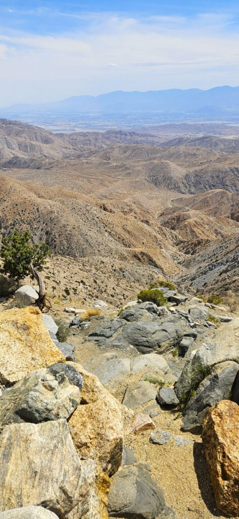
Our last stop in the park was Keys View where we could look out over the whole Coachella Valley. I didn’t know this, but the San Andreas Fault line runs right down the middle of this valley.
Keys View of Coachella Valley
At over 5,000 feet in elevation, we enjoyed the cool breezes as the day continued to warm up.
Overlooking Coachella Valley
Joshua Tree National Park is worth seeing. The variety of desert plants and animals that can withstand the extreme temperatures of desert weather is a testament to God’s marvelous creation.
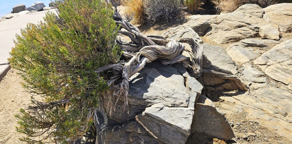
Twisted tree at Keys View
“The wilderness and the desert will rejoice, And the desert will shout for joy and blossom.” Isaiah 35:1a
Death Valley National Park was not a high priority on my bucket list of places to see because I imagined vast salt flats, sand dunes and barren desert that seemed somewhat boring. Instead, what I saw surprised me. I realized my preconceived ideas of it were very wrong. It is actually a beautiful and fascinating place to visit.
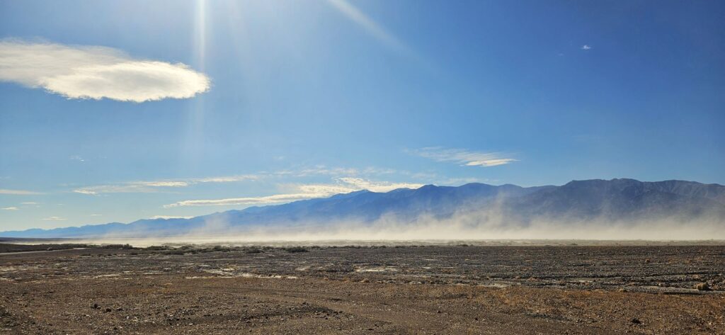
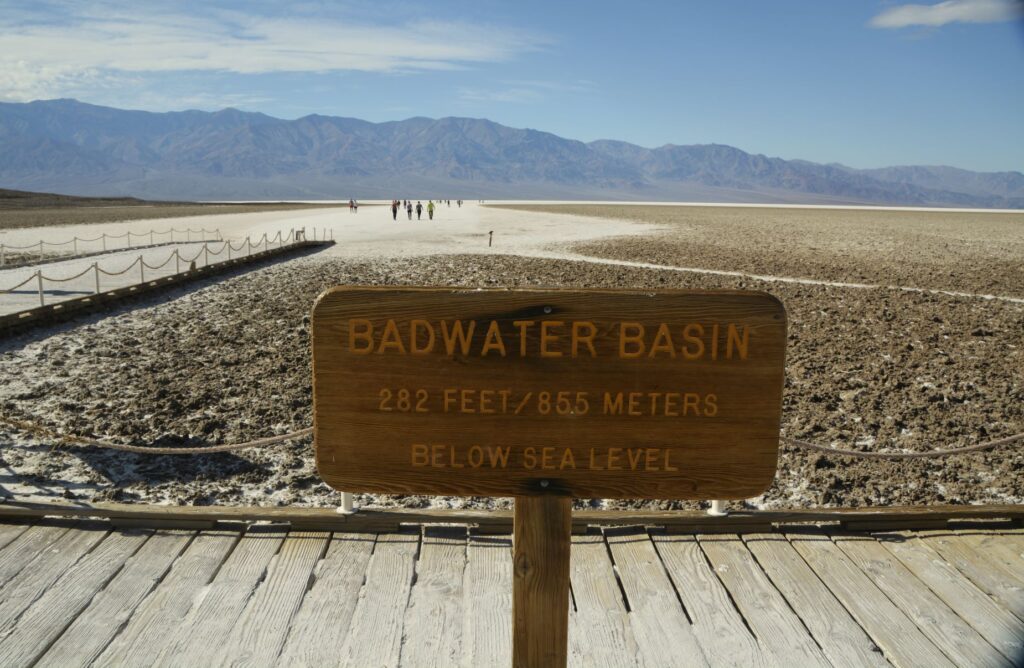
After our drive into the park and viewing the visitors’ center, our first stop was to see the salt flats at Badwater Basin. It was very windy that day and the dust blew across our pathway as we drove 17 miles south from the visitors’ center. It was so windy that sometimes a gust of wind would knock me off balance.
Badwater Basin is the lowest point in North America at 282 feet below sea level. There is no outlet for the rainfall and runoff from the mountains. Part of the basin had water in it when we were there due to recent record rainfalls in California.
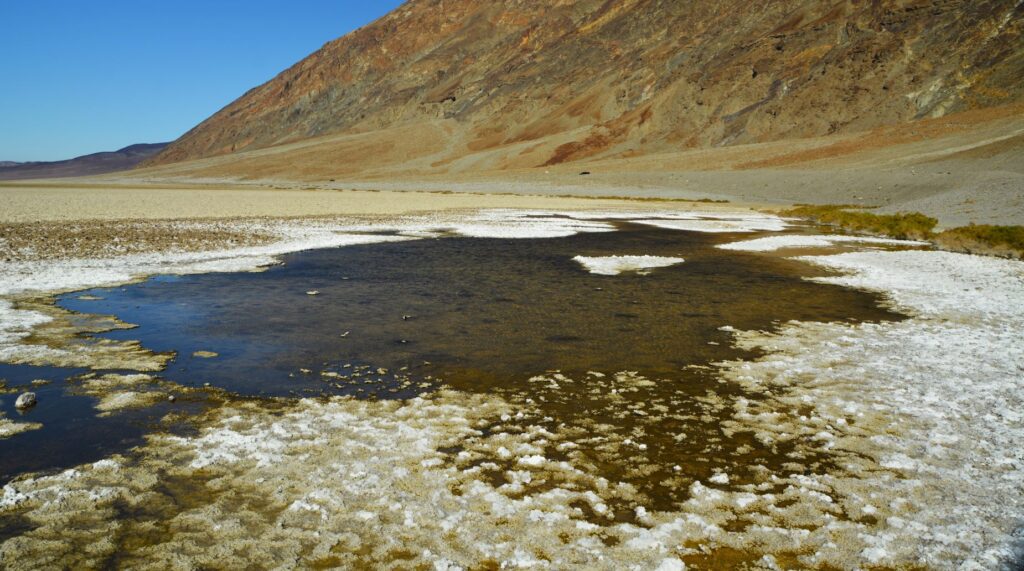
Near the parking lot were some pools which are spring fed. The water is very salty, from which it gets its name, “Badwater Basin.” Surprisingly, the pools support some unique animal and plant life.
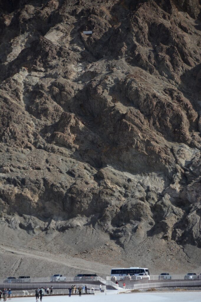
As I walked out toward the salt flats, I looked back at the mountain where I could barely make out the sign that says “Sea Level.”
Sea level sign on mountain above parking lot
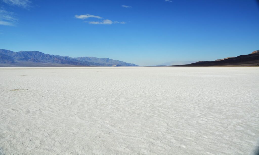
This is what it looks like about a quarter of a mile out on the salt flat. The sun shining on the white salt blinded me. The salt crystals were trampled down from the tourists. This is what I expected Death Valley to look like. But there was much more to see that was surprisingly beautiful.
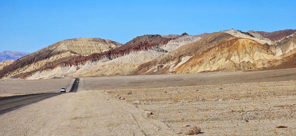
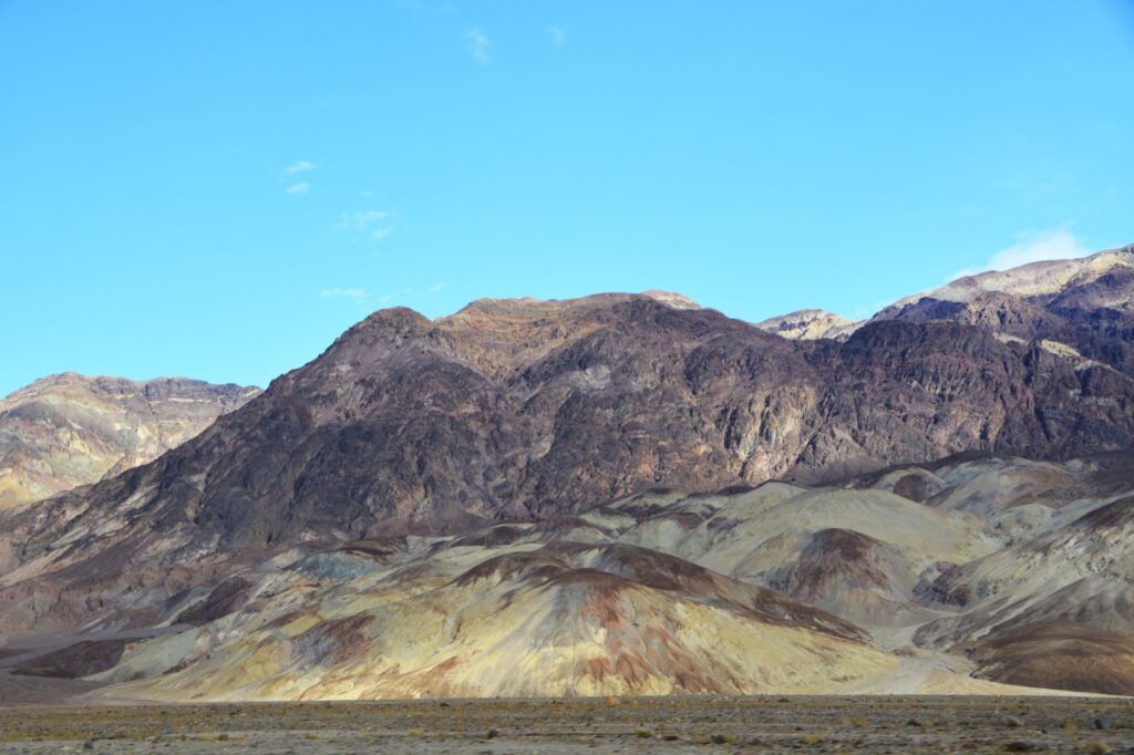
Heading back toward the visitors’ center, we began to see colorful rocks and mountains which were the result of volcanic deposits, chemical weathering, and oxidation of the exposed minerals. The deep reds, pinks and yellows were created by iron compounds.
We drove a nine mile drive called “Artists Drive” to see “Artists Palette.” These colorful hills are made from volcanic ash, gravel and playa deposits which contain iron oxides and chlorite.
Colorful deposits on Artists’ Drive
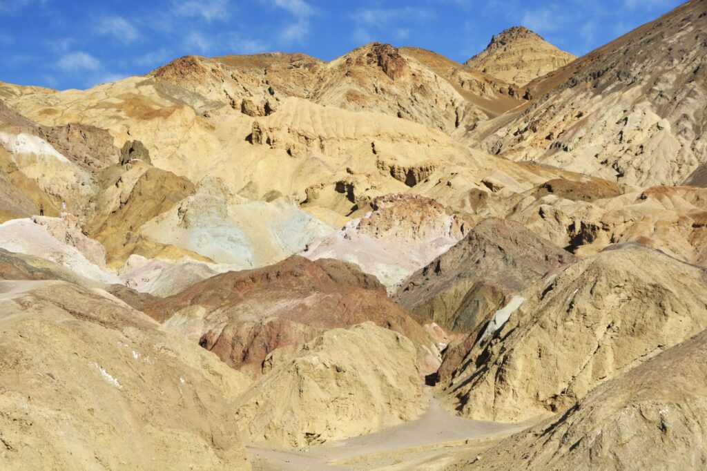
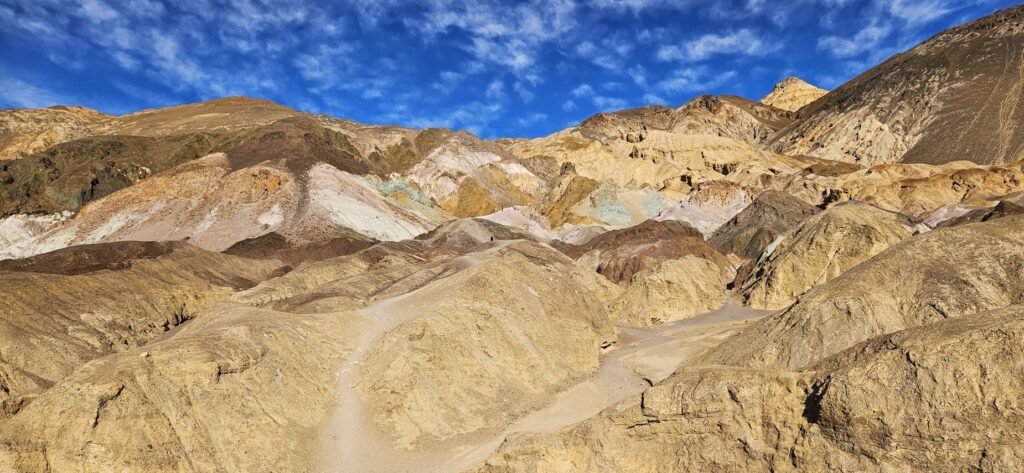
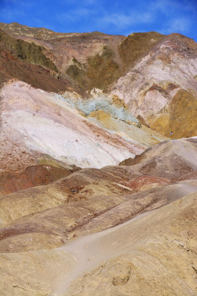
Rainfall, heat and flash flooding eroded the deposits of iron, manganese and mica which, when exposed, were oxidized by the air. This causes the colors of red, pink, yellow, green and purple.
The green rocks are from decomposed mica, not copper, as I originally thought. The purple is created by manganese.
Artist’s Palette
The colorful rocks and mountains were some of the first surprisingly beautiful discoveries in Death Valley. There was much more to come.
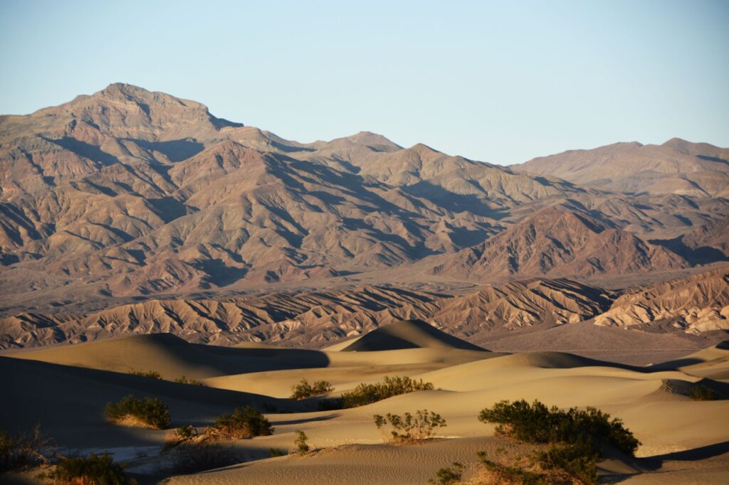
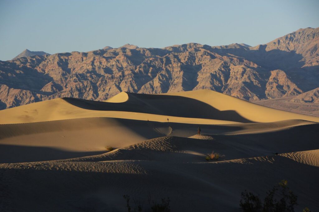
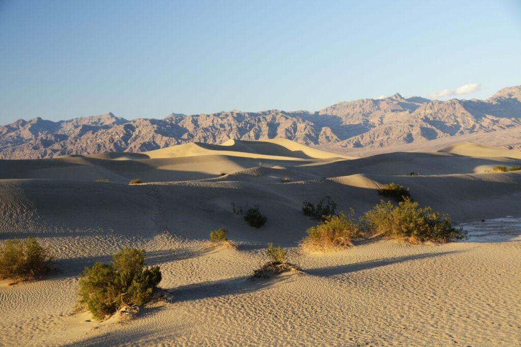
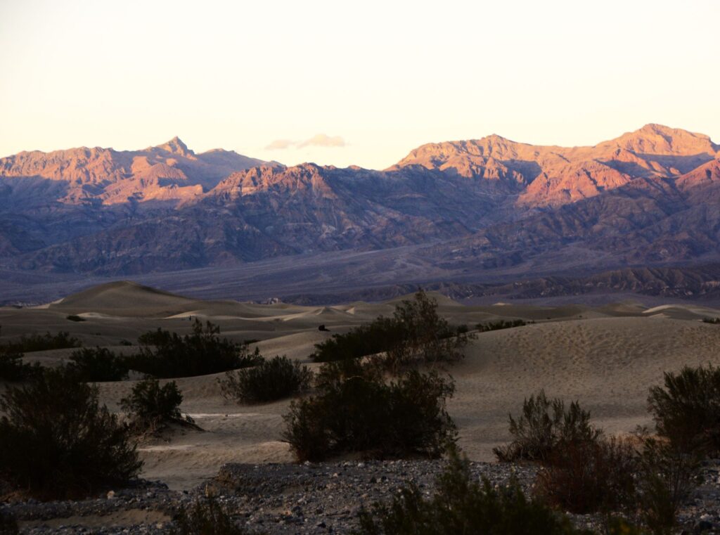
We drove on another 38 miles. We were racing against the clock to be at Mesquite Flat Sand Dunes before sunset. We arrived just in time. The shadows on the dunes were already beginning to deepen.
The dunes were massive. I felt like an ant climbing over them. Each one seemed bigger than the last.
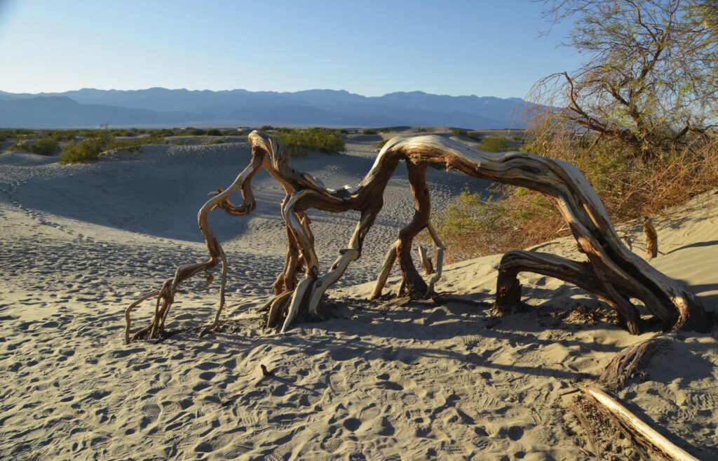
A twisted dead tree trunk was a reminder of the harshness of this environment. The highest recorded temperature in Death Valley was 134 degrees. I thought of the pioneers and native people who lived here before air conditioning and wondered how they survived. They likely fled to the surrounding mountains where temperatures were cooler.
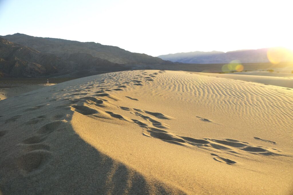
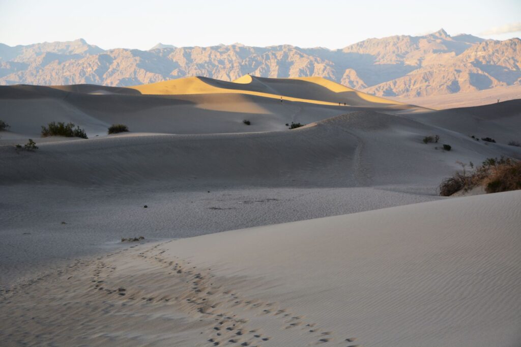
I followed the footprints of other tourists who had gone before me. I was sometimes confused about which way to go when down between the dunes.
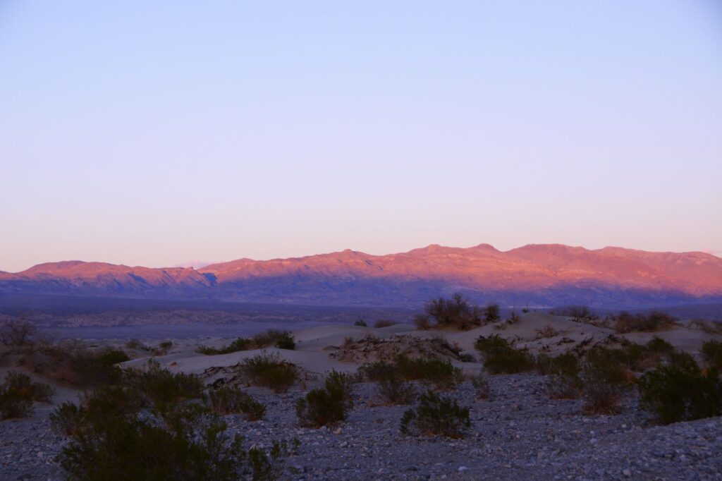
I climbed to the top of another dune and sat down as I watched as the last light of day illuminate the top of the mountain range. In the distance, I could see other people that were like tiny dots. I paused to catch my breath while enjoying the beauty of the stark contrast of the dark shadows against the sunlit sides of the dunes.
I thought of how these dunes would shift and change with time. The next time I visited they might be completely different in shape.
The shadows were quickly lengthening and the breeze grew cooler.
It was perfectly quiet. All I could hear was the sound of the wind as the last light of day faded on the distant mountains turning them a purplish pink. I followed my footprints back to the truck.
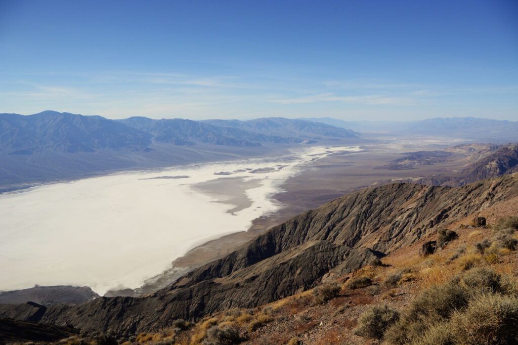
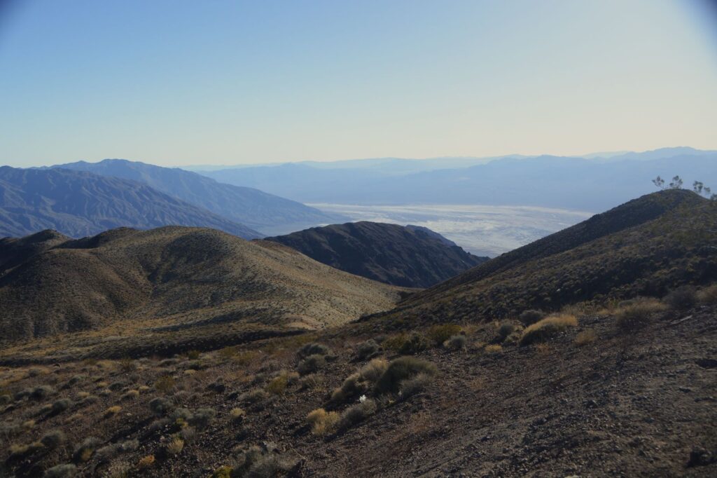
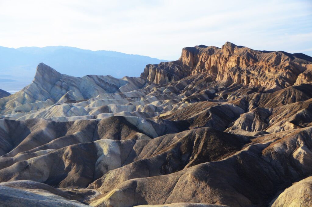
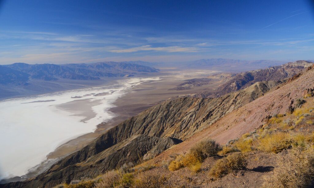
On our second trip into Death Valley National Park, we made our first stop at Dante’s View. This expansive view of the entire valley probably should have been our first stop of the trip. Looking down from over a mile above, one gets a great overview of the valley below, and a feeling for the great distances in this park.
Looking the other direction, it just keeps going on and on. This viewpoint was definitely worth the windy steep six mile drive. This view was unexpected. Previously, I thought Death Valley was flat all over.
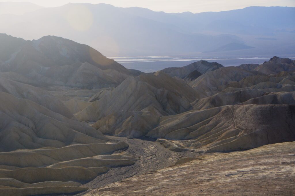
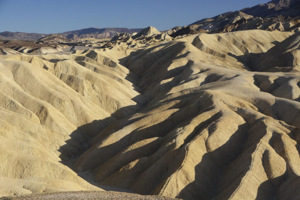
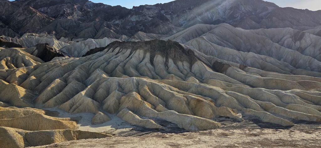
Zabriskie Point is another overlook on the way into the valley. We stopped here to hike up the quarter mile paved pathway to the overlook.
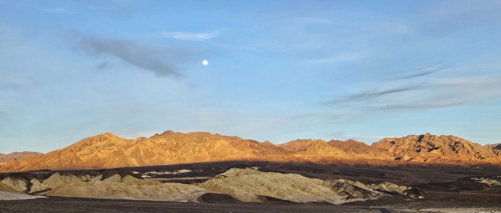
Since it was later in the day, the afternoon sun made interesting shadows on the golden colored badlands.
The beauty of Death Valley continued to surprise me. These different colored bands in the badlands at Zabriskie Point were so interesting.
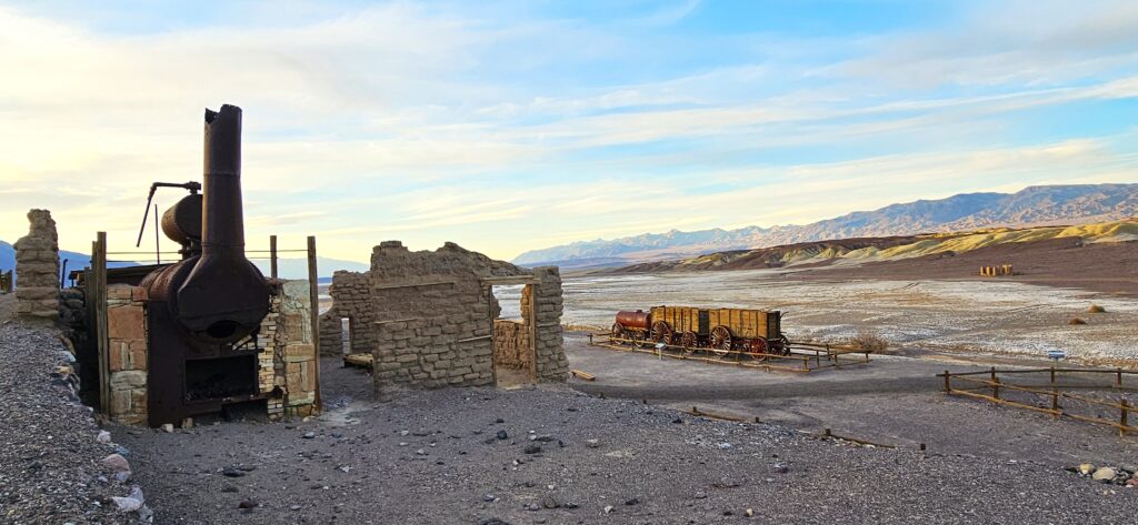
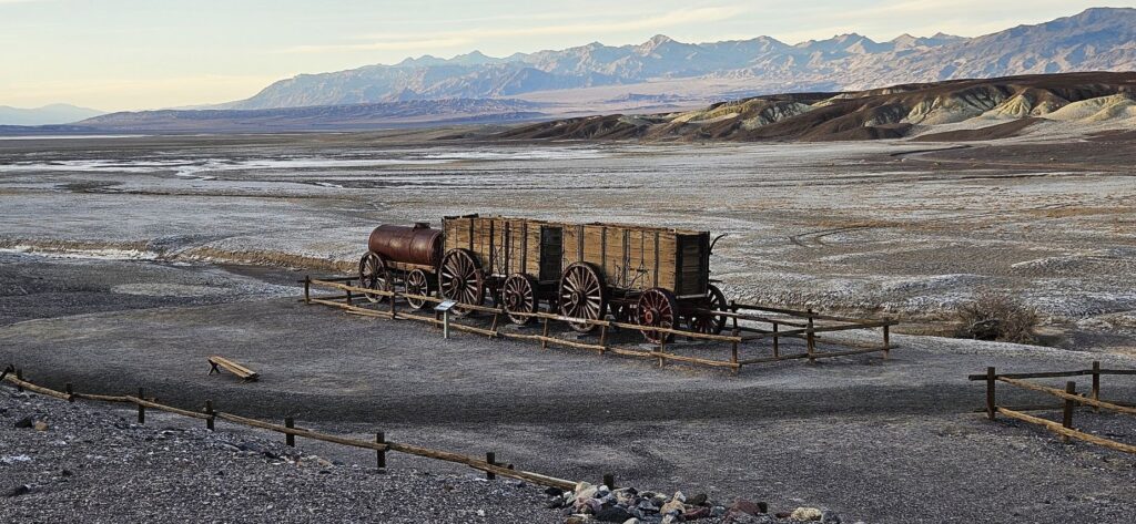
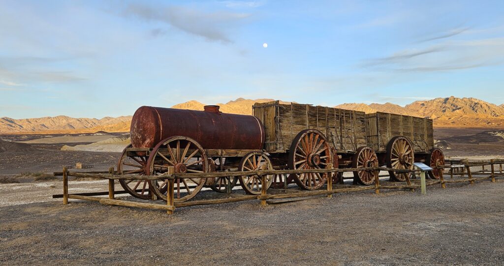
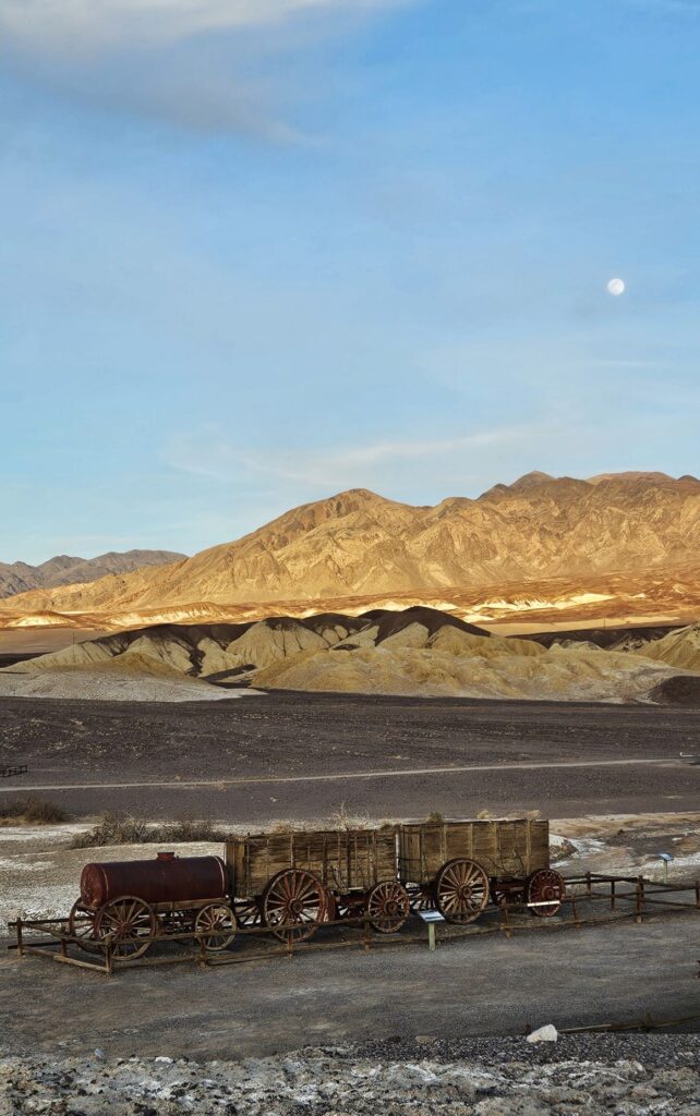
We had one more place to visit that day–The Harmony Borax Works. Here we saw the remains of a building for processing borax, one of the most profitable ores mined in the area. There was also an historic 20-mule team wagon.
Chinese laborers from San Francisco, scraped borax off the salt flats and transported it by wagon to the refinery.
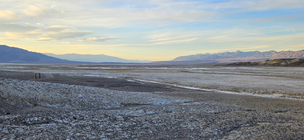
Borax fields
The borax could not be processed during the summer months due to the heat.
The nearest railroad was 165 miles away, so the ore was processed on site to make it easier to transport the borax by wagon.
Twenty Mule Team Wagon
As we ended our day, the moon rose over the mountains as the sun was setting. Once again, I was awestruck by the beauty.
Death Valley is a study of contrasts. It is the lowest place in elevation in North America at 282 feet below sea level, while the highest peak, Mt. Whitney (14,505 feet) is just a few miles away. Death Valley has had the highest temperature recorded (134 degrees), but also recorded a temperature of 15 degrees in the winter of 1913. Death Valley has an average rainfall of 2.2 inches per year. But lately, 2.2 inches of rain fell in a single day in August 2023, resulting in flooding.
We visited in February of 2025 and, other than the first day, we experienced beautiful weather. I would love to revisit Death Valley in the future. There are still many places we did not get to see. It truly was a surprise to me that such a desolate place could hold so much beauty.
“Even when walking through the dark valley of death I will not be afraid, for you are close beside me, guarding, guiding all the way.” Psalm 23:4
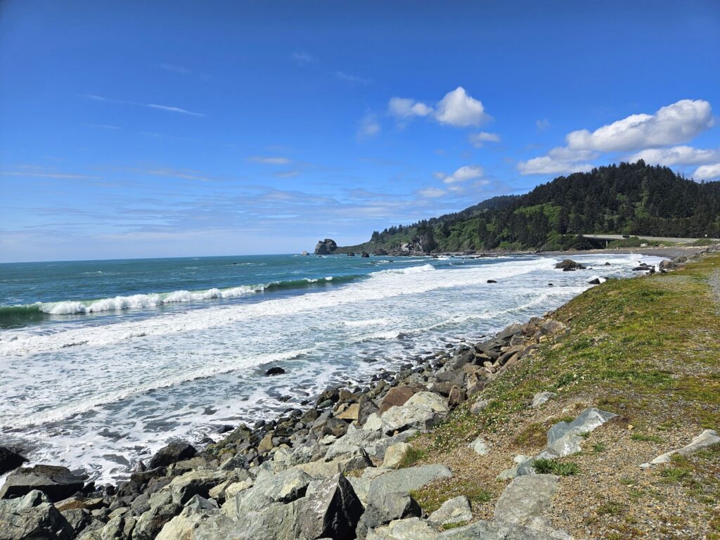
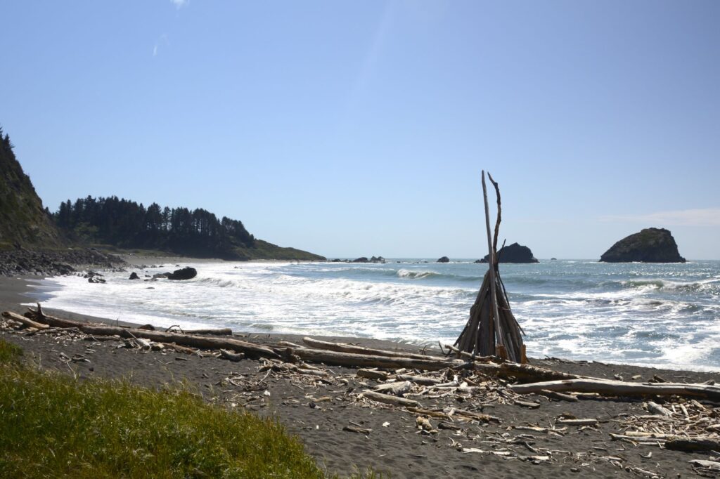
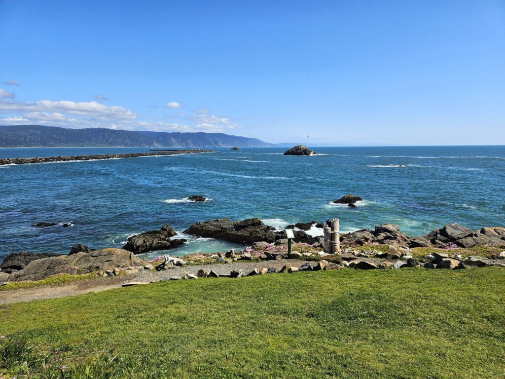
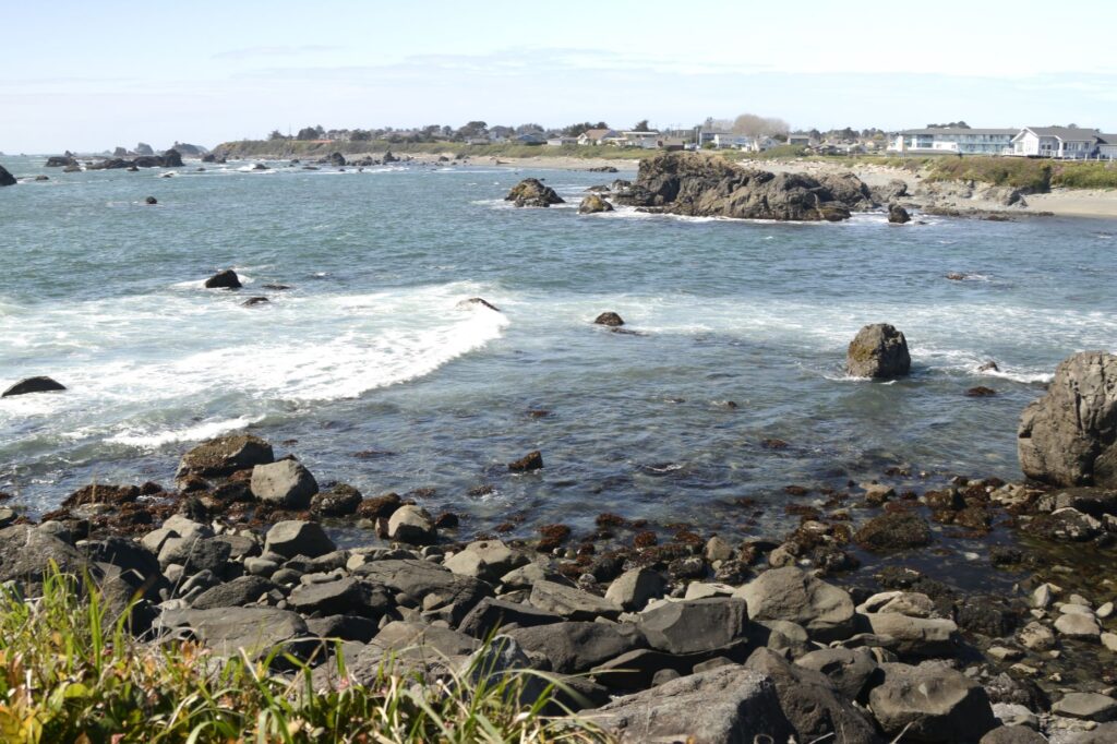
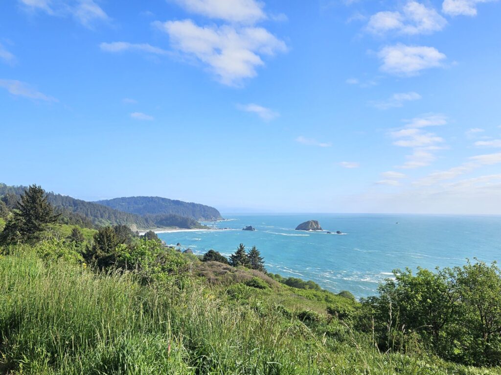
Crescent City lies on the northern coastline of California just 20 miles south of the Oregon border. We drove north on Highway 101 from our campground in Klamath to Crescent City one afternoon to see the quaint little town and lighthouse.
Northern California coast
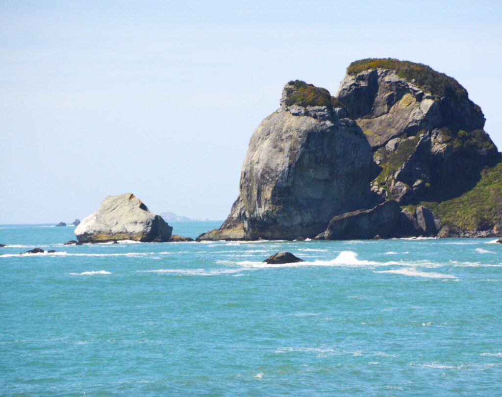
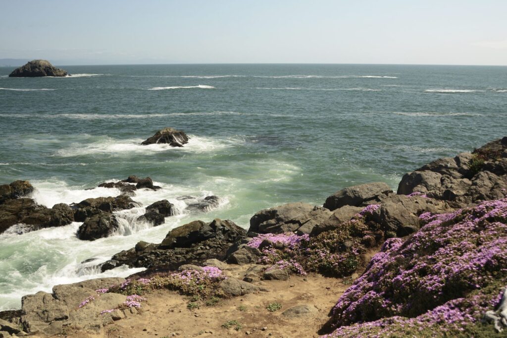
Along the way we saw large rock formations jutting up from the ocean near rocky beaches. The water was such a beautiful blue that day.
Rocky Northern California coastline
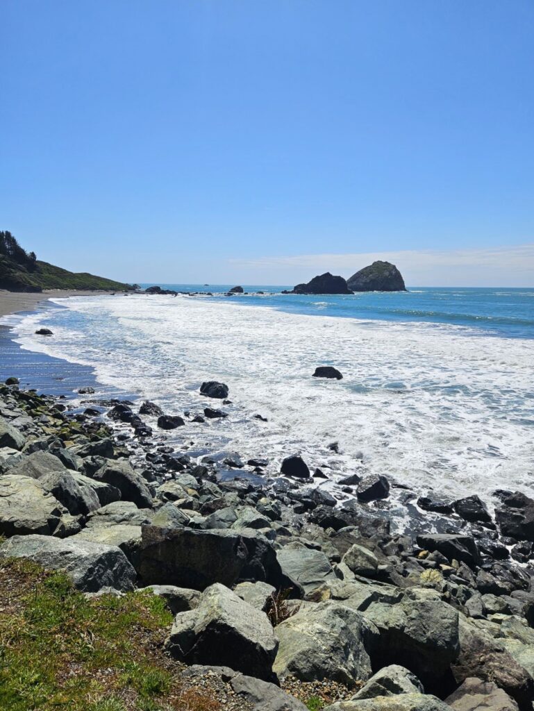
There is always plenty of driftwood on these beaches because the tree line comes to the edge of the ocean.
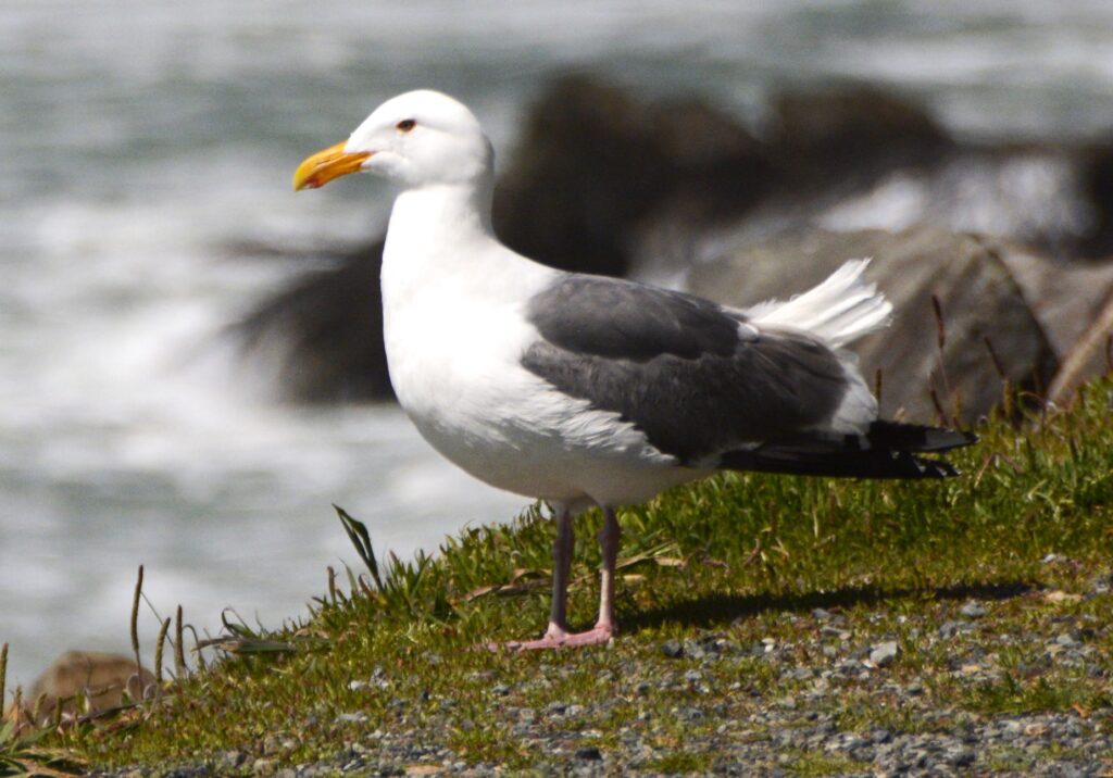
Driftwood artFriendly Seagull
Birds of all kinds love the safety of the rocky ledges and rock formations out in the ocean where they make their homes. There’s always plenty to eat along the water’s edge. Sea lions also like the rocks for sunning themselves.
Crescent City, so named because of its crescent shaped shoreline, was partially destroyed in 1964 from tsunami waves from the Alaskan Earthquake. The city installed a breakwater in 1957 to protect against future tsunamis. However, in 2011, several boats and docks were damaged from tsunami waves from an earthquake in Sendai, Japan.
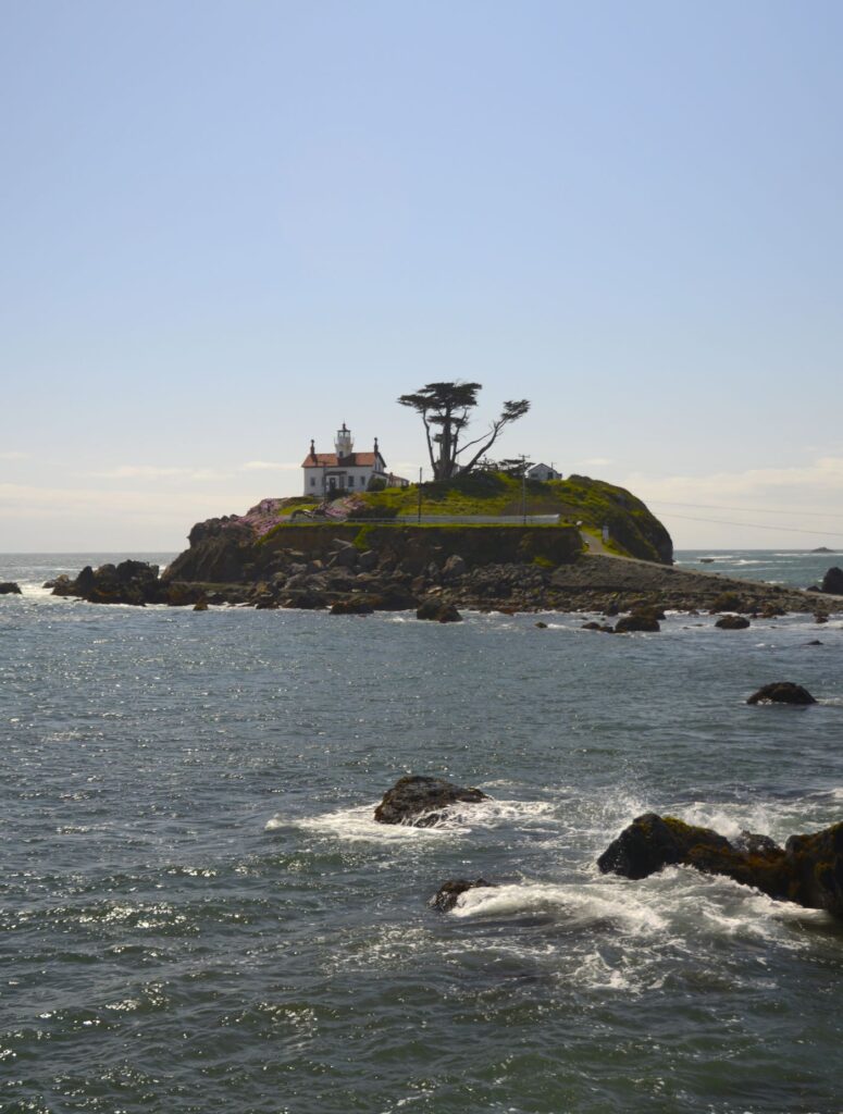
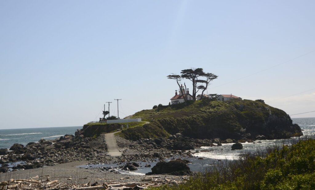
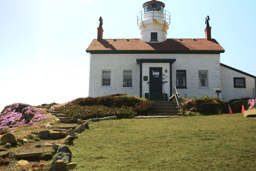
Battery Point Lighthouse
During the 1964 tsunami, the resident lighthouse keepers were stranded inside the Battery Point Lighthouse. Built in 1856, this lighthouse still stands strong. It is still active and serves as a private navigational aid.
Jetty near Battery Point Lighthouse
We walked out on the jetty to get a long-range view of the lighthouse. Signs warned us of sleeper waves that may crash over the jetty unexpectedly. We didn’t get wet, but a few waves splashed up on the jetty.
Low tide at Battery Point Lighthouse
We arrived at low tide, which is the only time the lighthouse is accessible by land. However, we were unable to go inside the lighthouse because it was was closed.
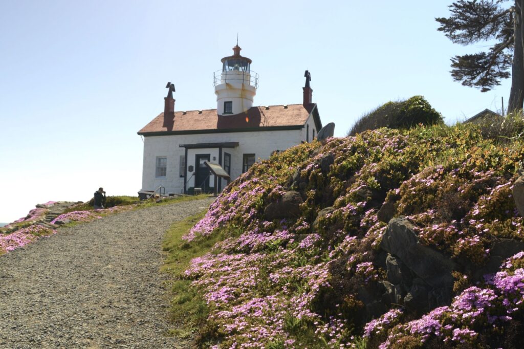
Spring flowers at Battery Point Lighthouse
The Battery Point Lighthouse was automated in 1953, but decommissioned from the Coast Guard in 1965. It was re-activated as a private aid to navigation in 1982.
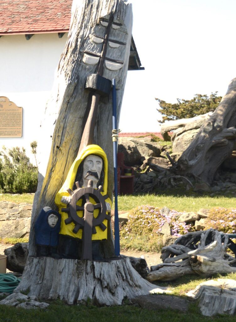
Fishing, crabbing, tourism and timber are the major industries in Crescent City. A carving outside the lighthouse pays tribute to their seafaring people.
Tree carving near Battery Lighthouse
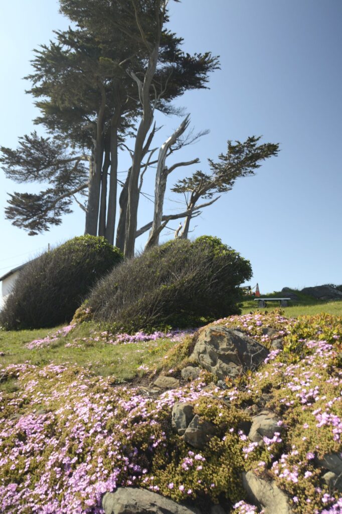
It was springtime at the lighthouse and the spreading phlox was brilliant with bloom. The Monterey Cypress trees are native to the California coast. They do well in the cool climate.
Gnarly Monterey Cypress Trees at Lighthouse
The color of the sea changes with the weather. On clear days, the water is a turquoise blue, and changes as the mist forms in the afternoon.
Crescent City from Battery Point Lighthouse
As we drove back to our campground in Klamath that afternoon, the sun came out. We stopped at this overlook to get one last shot at the beautiful California coastline.
“The sea is His, for it was He who made it, And His hands formed the dry land.” Psalm 95:5
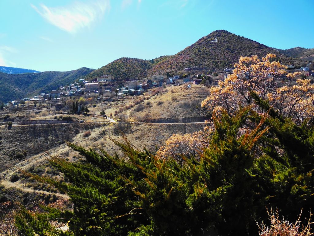
While we were in the Cottonwood area, we visited a few other places nearby. Jerome, 9 miles away, is a ghost town that has come back to life. It is now a tourist trap. Jerome State Historic Park is worth visiting.
The “ghost town” of Jerome is coming alive once more.
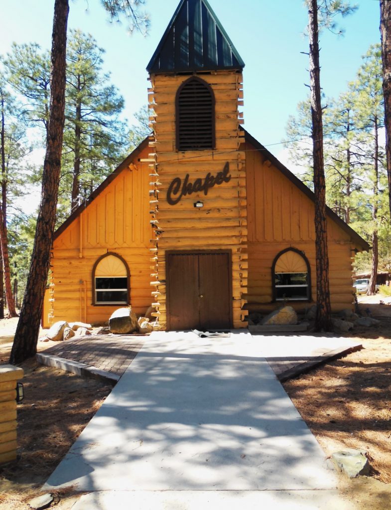
We drove the windy road through Jerome to Prescott, Arizona, where I spent one summer of my life as a kitchen helper at Prescott Pines Campground. The campground is a few miles outside of town. In many ways it looked the same, just updated.
The chapel at Prescott Pines Campground where I worked as kitchen staff in 1972.
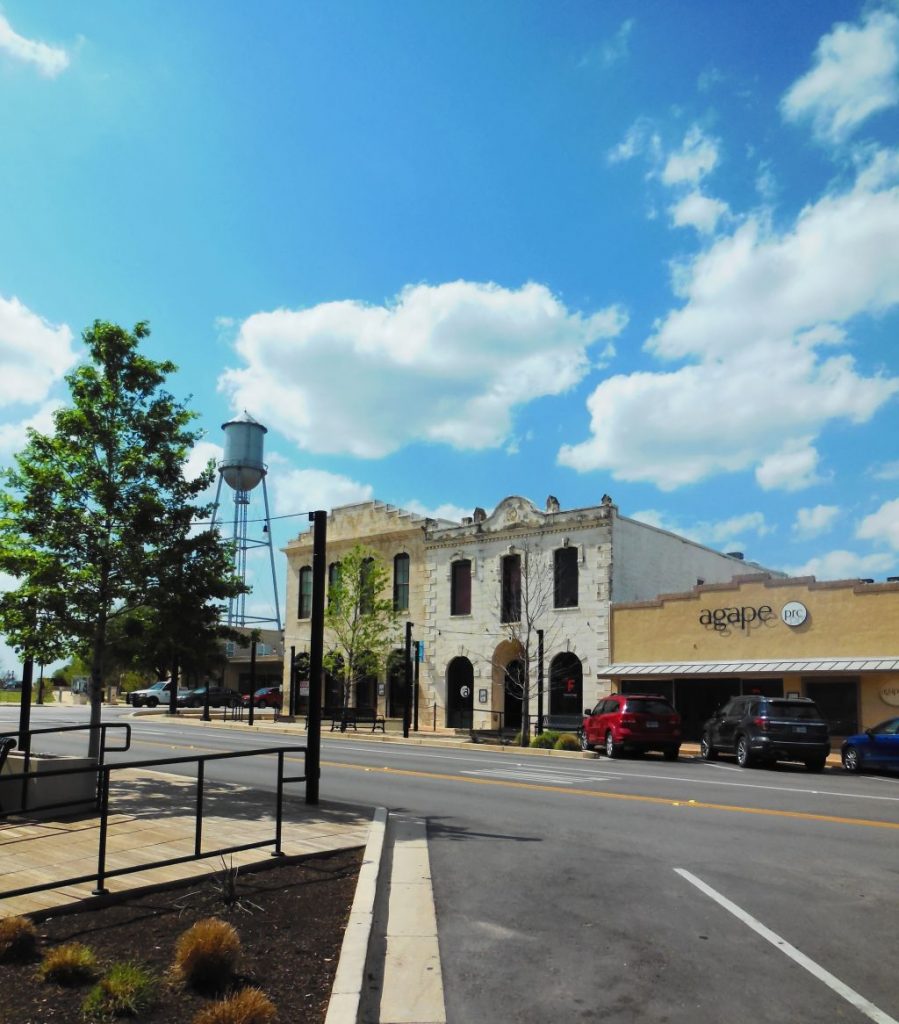
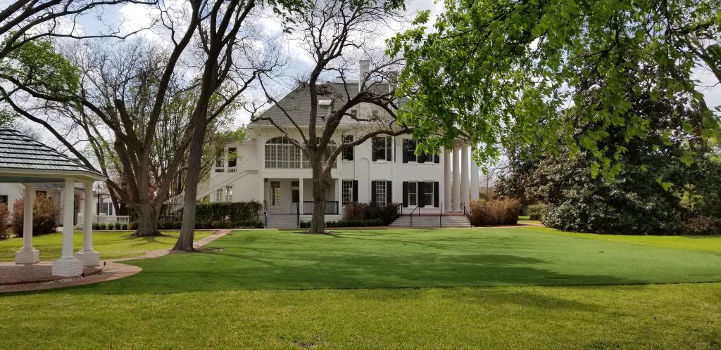
While we were in Cottonwood, we flew to Texas for a week-long stay with my dad while my sister was on vacation. We visited Round Rock, Texas, a pretty little town and the home of the beautiful historic Woodbine Mansion which is now a wedding venue.
Round Rock, Texas, main street.Woodbine Mansion in Round Rock, Texas
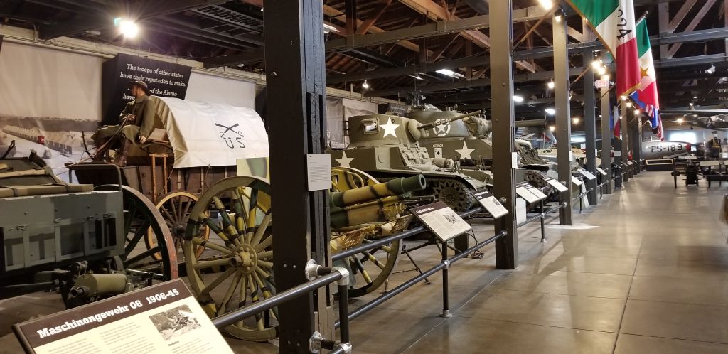
Another day, we visited the Texas Military Museum in Austin. It was large, so we saw just a small portion of it. We plan to visit it again someday.
Texas Military Museum
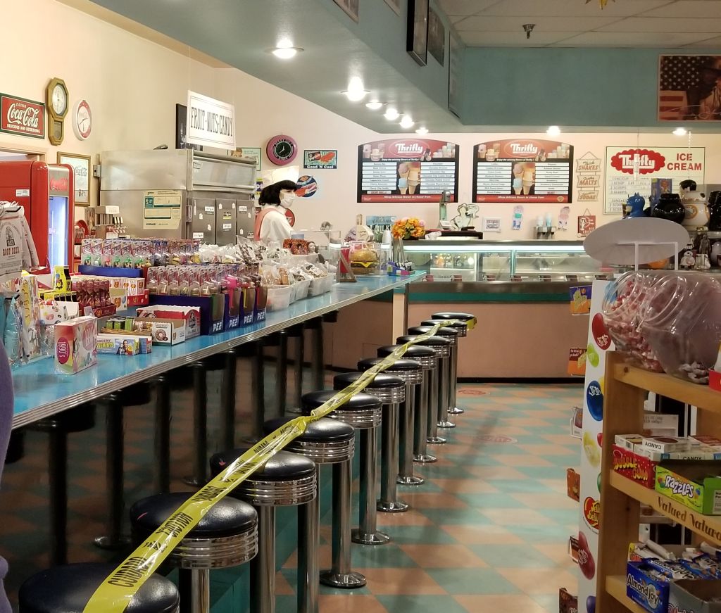
When we got back to Cottonwood, it was time to head back to California for the birth of our 10th grandchild. We used our Harvest Host membership for the first time and stayed overnight in the parking lot of Peggy Sue’s 50’s Diner about 10 miles from Barstow, California.
Inside gift shop at Peggy Sue’s 50s Diner
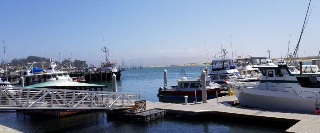
We stayed at our Thousand Trails Encore park in Oceano until our grandchild was born, helping the family with meals and laundry and other such things. Getting to be around the grandkids is always fun, but we made sure we took time for a side trip to Morro Bay for a lunch near the water.
Morro Bay, CA, marina
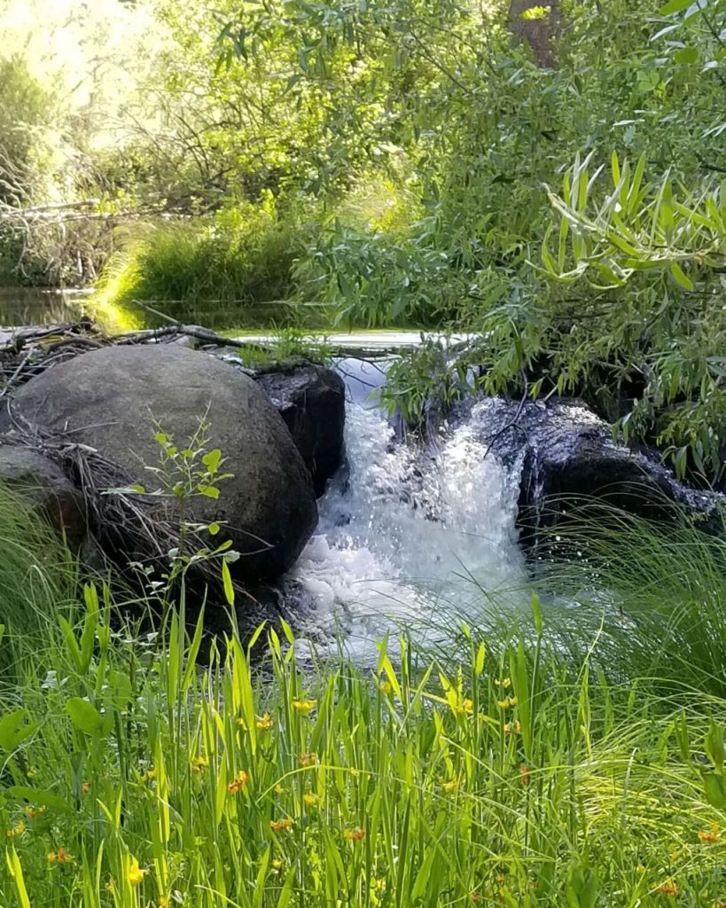
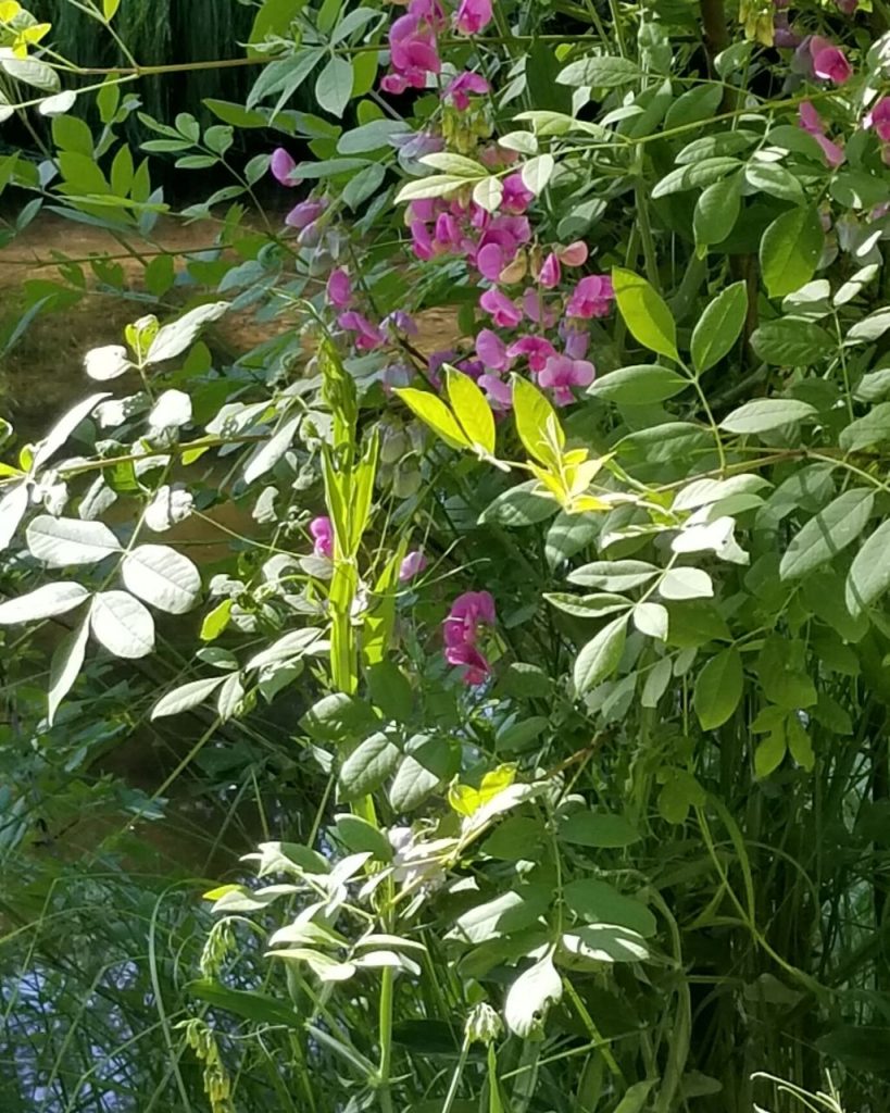
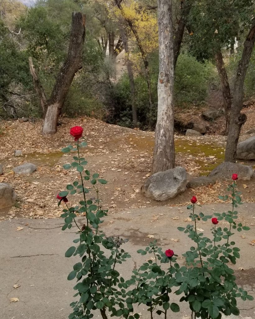
With the new baby welcomed, we made one last visit to our storage unit before heading north for our summer travels. The campground where we like to stay is in Oakhurst, CA. There is a beautiful little waterfall and wildflowers just behind the campsites and plenty of shade.
Our waterfall at Oakhurst, CA.Wildflowers at Oakhurst, CA.Our campsite at Oakhurst, CA.
During November and December, we enjoyed spending the holidays with our kids and grandkids. In January as we were headed out of California again to spend the rest of the winter months in Arizona, disaster struck.
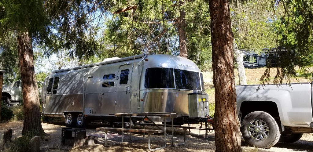
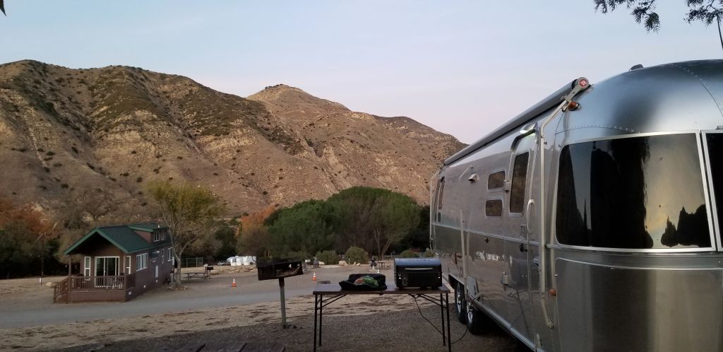
California has bio-diesel at a much cheaper price than Diesel #2. We thought we were saving money. Now we know better. Apparently, our truck has a unique fuel pump that can’t handle bio-diesel. It failed and all the metal parts were distributed throughout its fuel system. Three weeks and thousands of dollars later, we were wiser but poorer. Thankfully, we were able to spend those three weeks in a nice campground near Santa Barbara while the truck was being repaired.
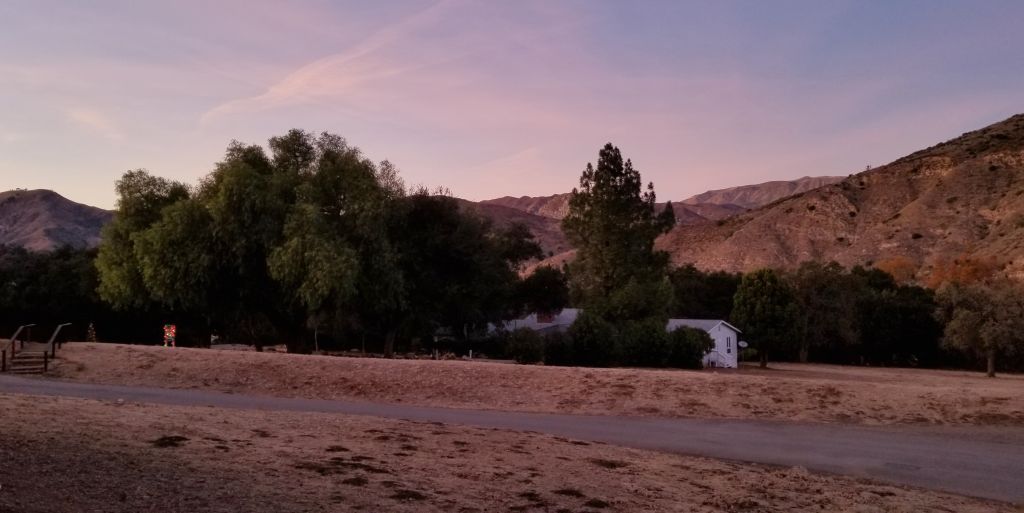
The hills outside Santa Barbara, California.
We were surrounded by mountains, and the hills were beautiful in the evening light.
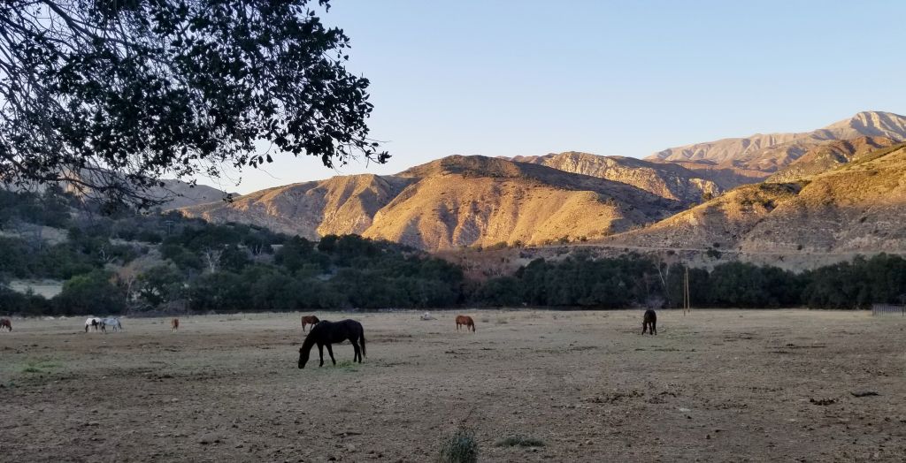
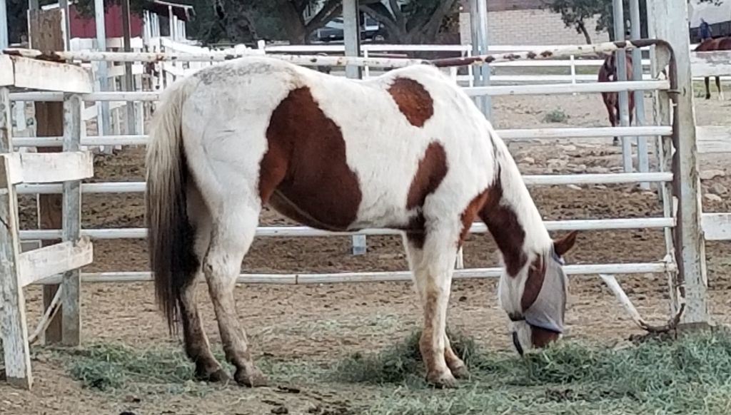
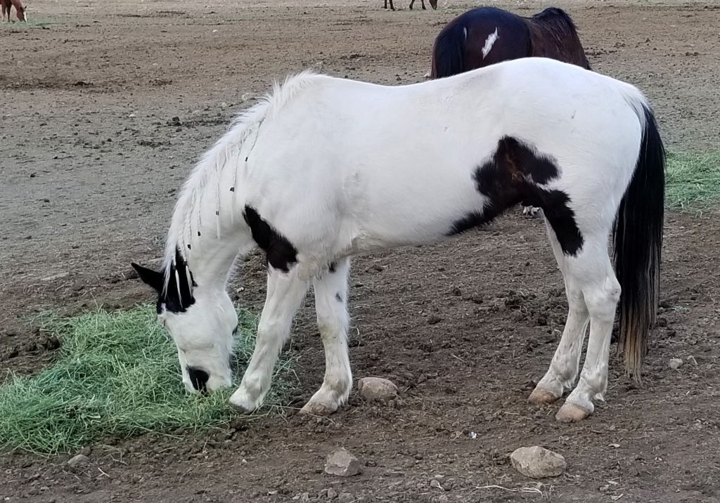
The campground was a working ranch with horses a plenty. I took the opportunity to get acquainted with some of the equine one afternoon.
Rancho Osa outside Santa Barbara, California, is a working ranch.
Our main concern was not being able to shop for groceries. Although there was a country store on the campground, the selection was very limited, especially when it came to fresh food and meat. After a couple of weeks, our supplies were very low. Our daughter, Ann, rescued us by driving there and taking us grocery shopping one afternoon in Santa Barbara. We were very grateful.
Because of the pandemic, auto parts were delayed in coming. We had a great mechanic, and the park rangers were very helpful in extending our stay. The hardest part of being stuck there for three weeks, was the lack of communication. The campground was in a canyon. We had to walk to another part of the campground to get enough phone signal to make a phone call.
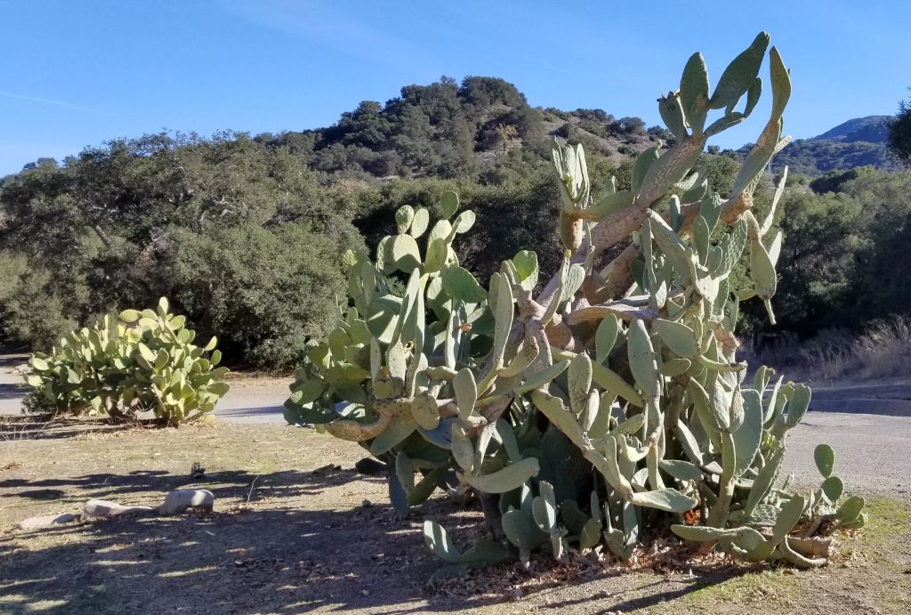
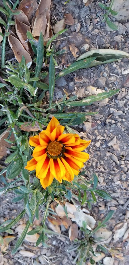
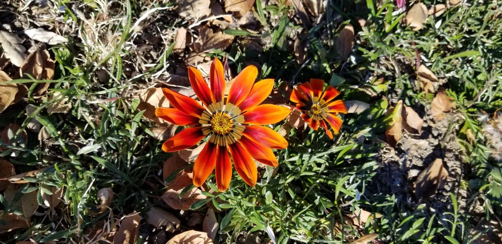
One way to spend time while we were waiting for our truck to be repaired was to take walks in the afternoon or evening discovering the beauty around us.
Prickly pear cactusBloom where you’re planted!
We were so grateful to have our truck back, and in the future, we would love to explore this area more.