Now that Yosemite National Park has a reservation system during the summer months, we couldn’t just decide to go to Yosemite for the day without some planning. Even with our reservation, we waited 30 minutes to enter the park.
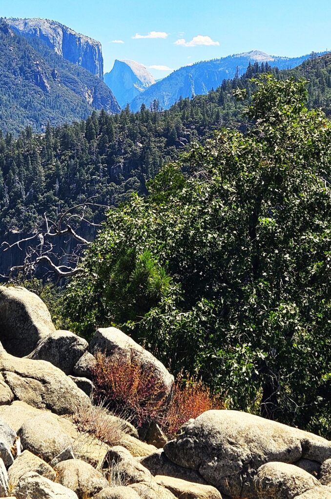
Half Dome from Big Oak Flat Road
The Valley was very crowded that day even though it was a week day. The parking at this pullout along the road was empty when I got there, but by the time I left, it was double parked with vehicles. Everyone had to see what we were looking at!
Tall Goldenrod
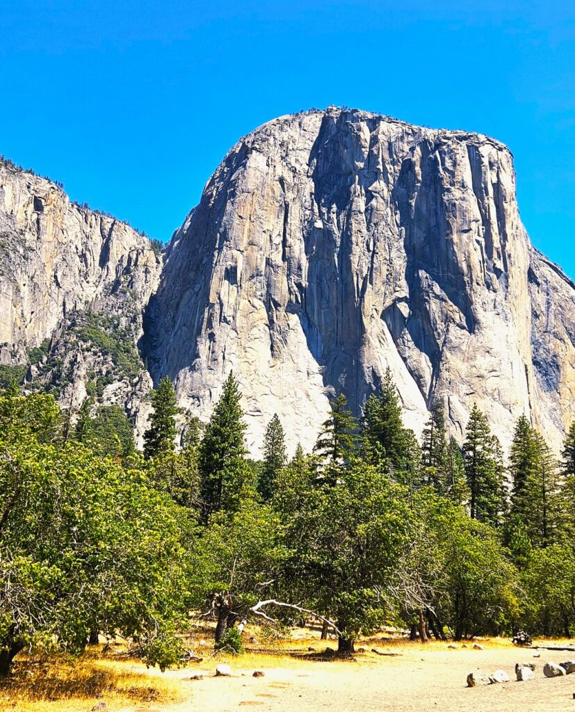
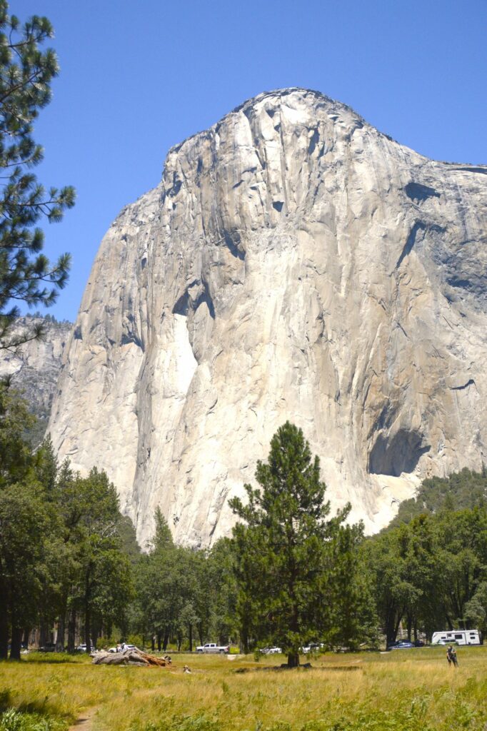
Across the road from us was a magnificent view of El Capitan.
El Capitan
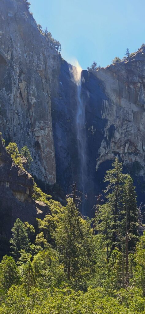
It was a bit windy that day. You can see the water at the top of Bridal Veil Falls being whipped up by the breeze. Though Bridal Veil still had water, Yosemite Falls was just a trickle.
Bridal Veil Falls
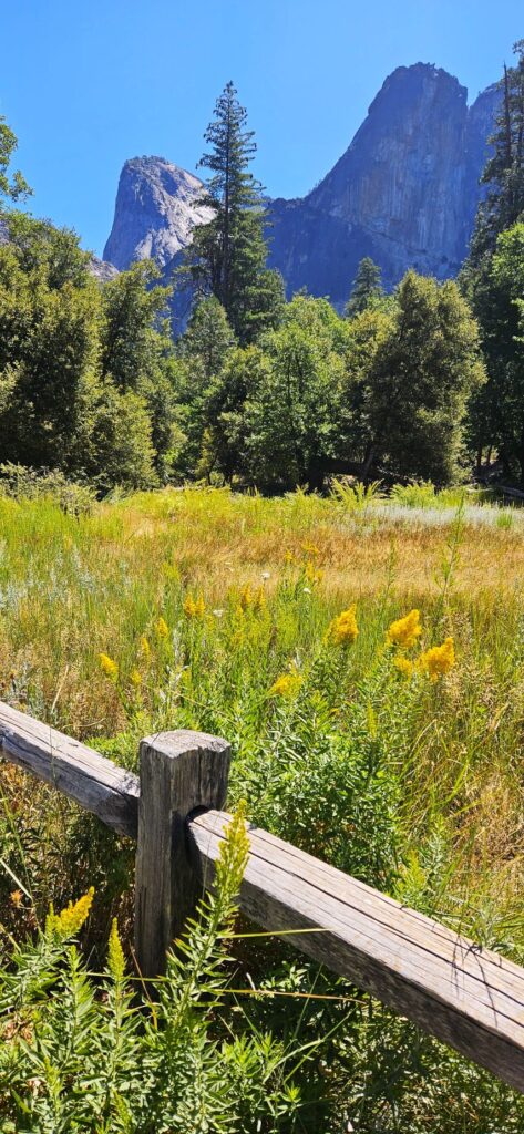
The parking lots in the valley were totally full. We drove around to see if anyone might be leaving, but soon gave up. We had to settle for parking along the road like this meadow pullout.
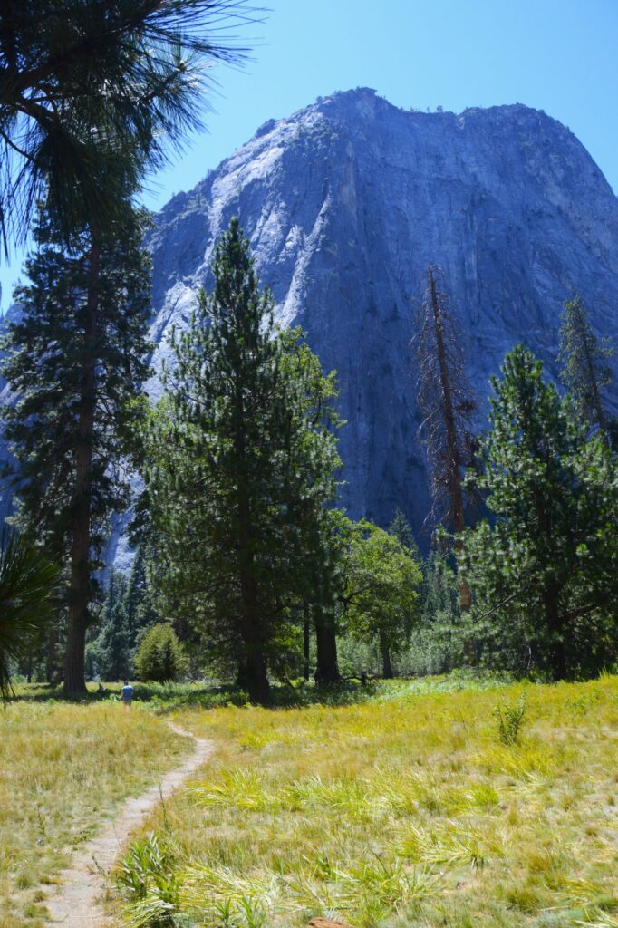
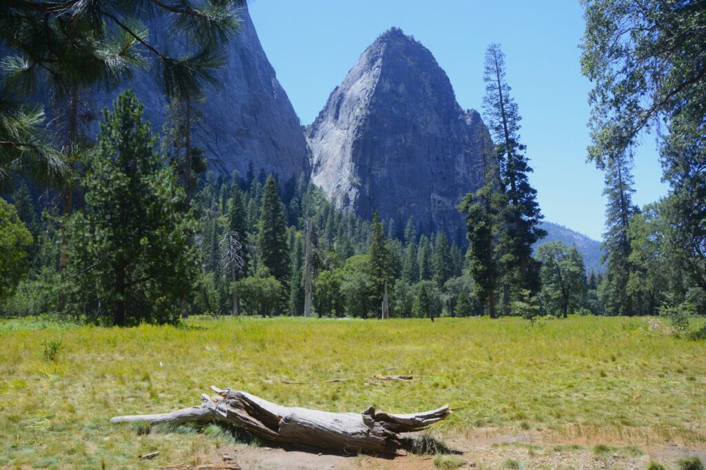
Meadow in Yosemite Valley
I took a little walk along the pathway and found this old fallen log.
Meadow in Yosemite Valley
Looking back, I could see El Capitan from a different angle.
El Capitan
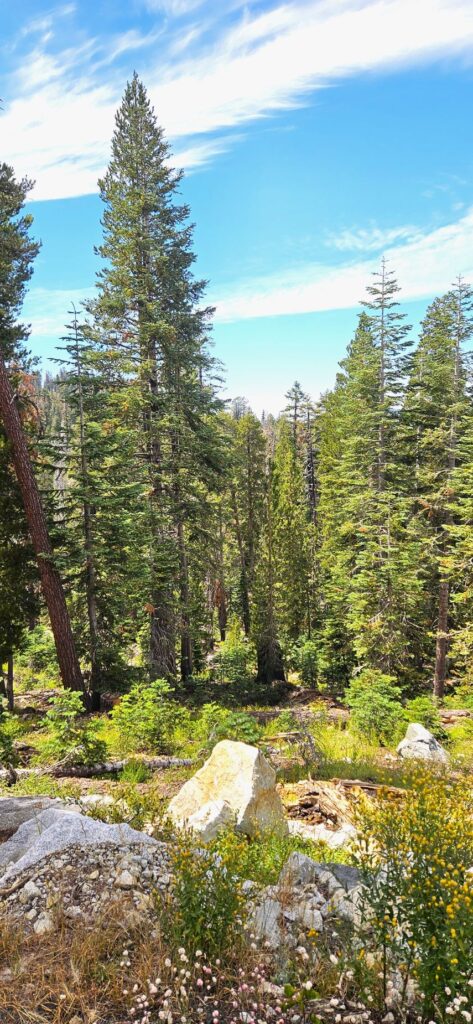
We got tired of the crowds and decided to drive up into the high country. We found a nice pull out with a view. We were the only ones there.
View Point from Big Oak Flat Road
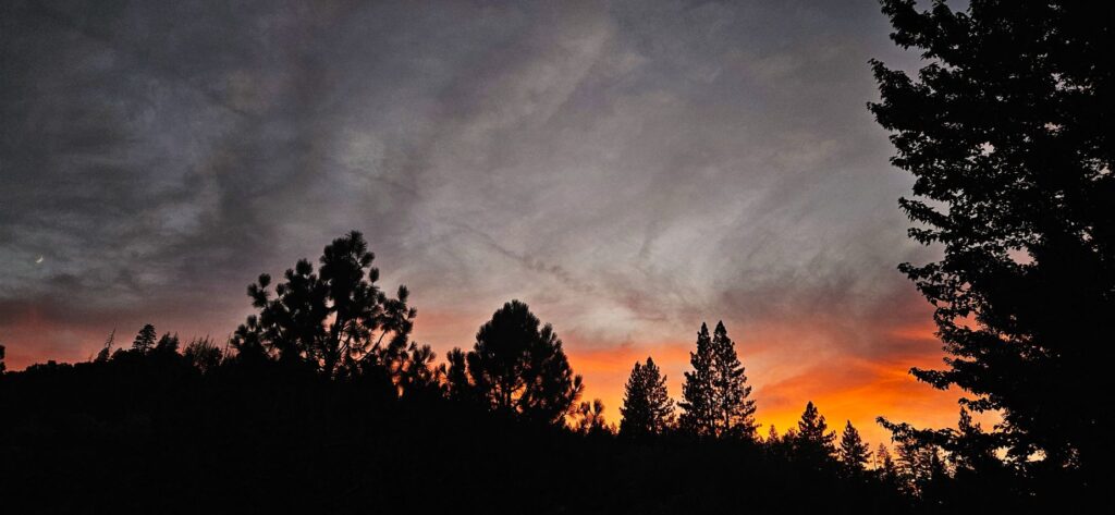
Our campground was only five miles from the Oak Flat entrance. We enjoyed our time there, but we didn’t attempt any more trips into the park. It was just too crowded for our taste. However, we enjoyed our evening walks around the campground and the many beautiful sunsets like this one.
Sunset at Yosemite Lakes Campground
“We can make our plans, but the Lord determines our steps.” Proverbs 16:9
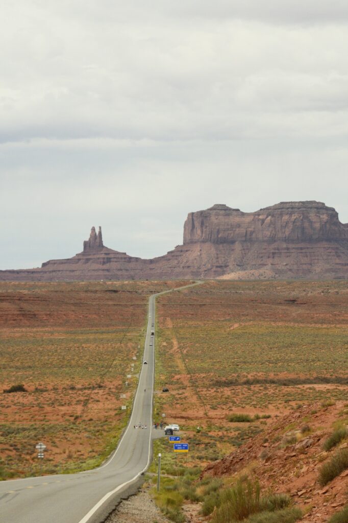
It was a cloudy morning when we left Monticello, Utah, to drive to Monument Valley across the Arizona border. It would take us nearly two hours to get there. I was wishing that the sun would pop out sometime during the day.
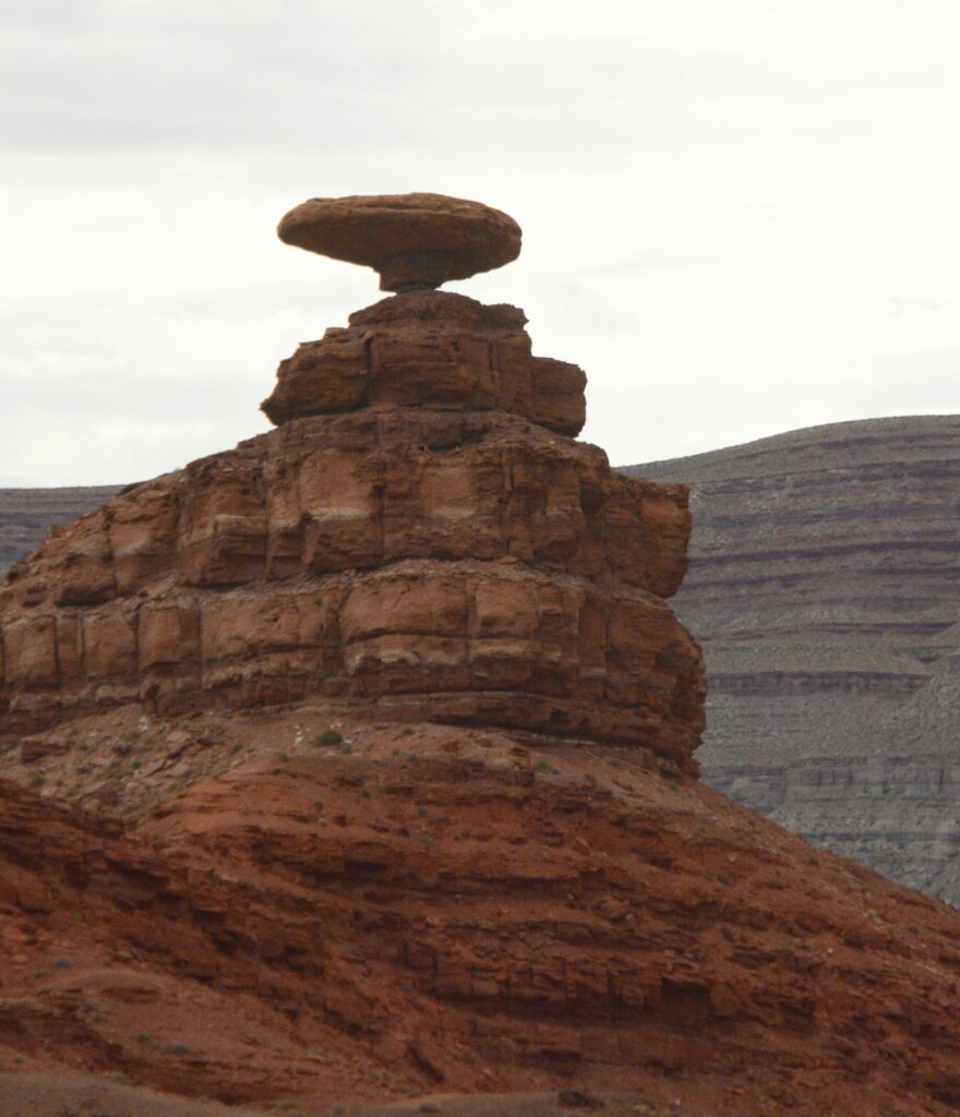
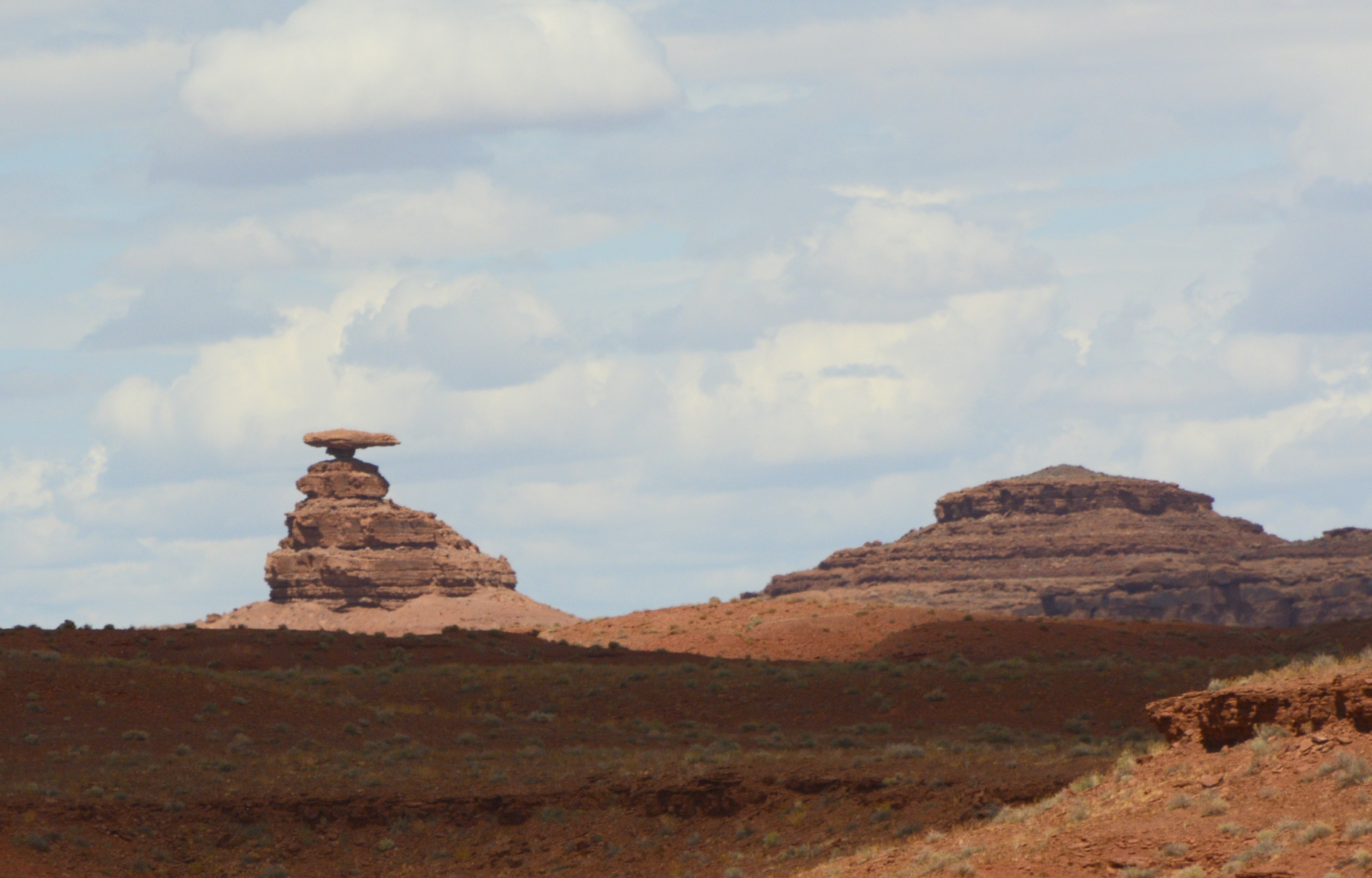
Along the way, we passed the little town of Mexican Hat, Utah, and the rock formation which gave it its name. Doesn’t it looks like a man sitting on a rock wearing a large Mexican hat?
Mexican Hat on Highway 163Mexican Hat Rock
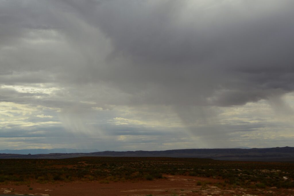
As we traveled further, we could see rain in the distance. I was hoping for some sunshine, and it wasn’t long before I got my wish.
Rain over the desert
A famous tourist spot outside Monument Valley is the location of a scene from the movie “Forrest Gump.” We didn’t get there early enough to beat the crowds. People were standing in the road, sitting in the road, lying in the road, blocking the road—all just to get a photo. It was a mess.
I just wanted a photo of the road leading up toward the mountains–without all the people. It turns out that was impossible. So I settled for a less than perfect photo.
Location of Forrest Gump movie scene
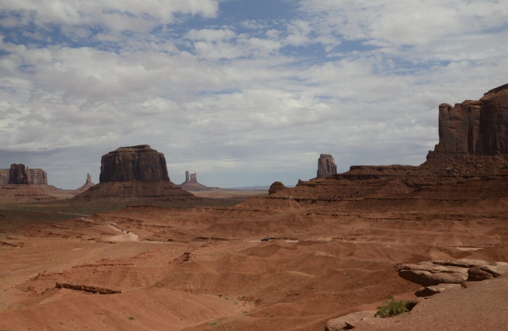
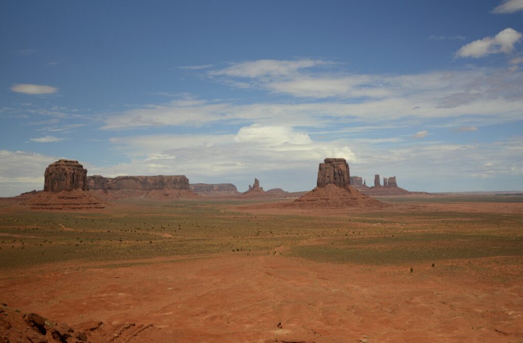
As we got closer to our destination, we could see some of the classic Monument Valley rock formations sticking up from the desert floor. At the same time, the sun began to peek out from the clouds.
Monument Valley is located on Navajo Indian Reservation. It is owned and operated by the Navajo Indian Tribe.
We first went to the Visitors’ Center. The Visitors’ Center is situated overlooking Monument Valley. We could see the road we would travel, winding its way across the desert floor.
Viewpoint from Monument Valley Visitors’ CenterLayers of rock as seen from balcony of visitors’ center
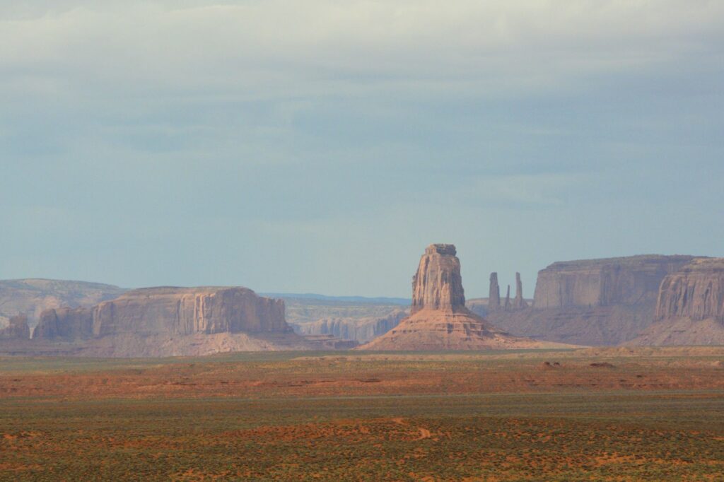
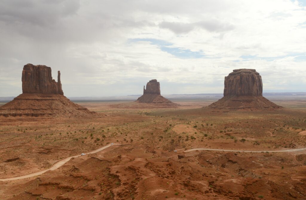
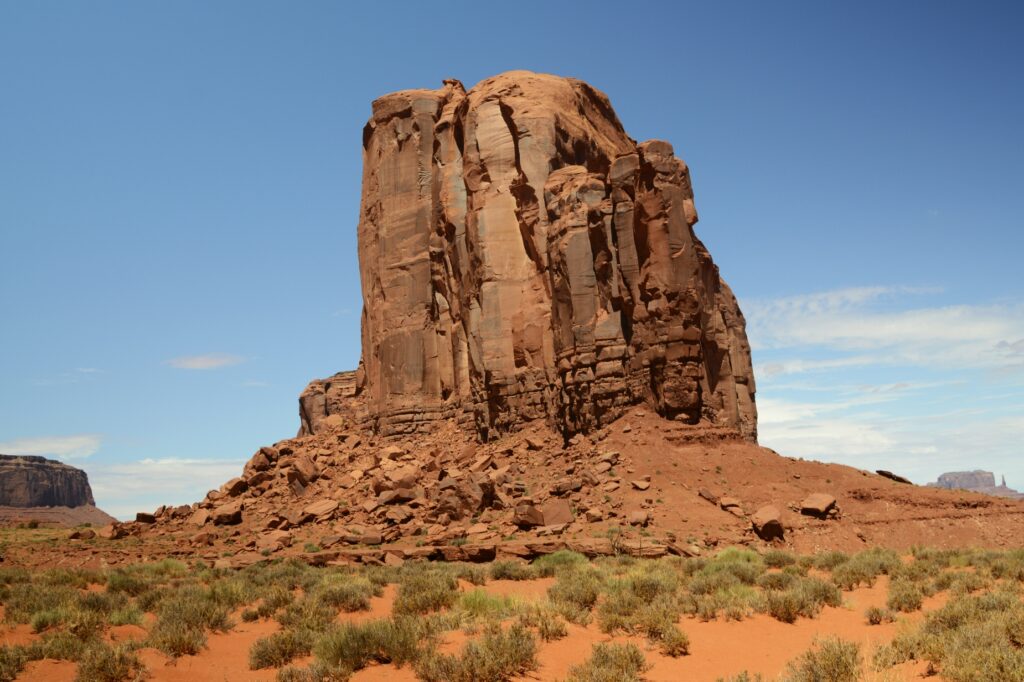
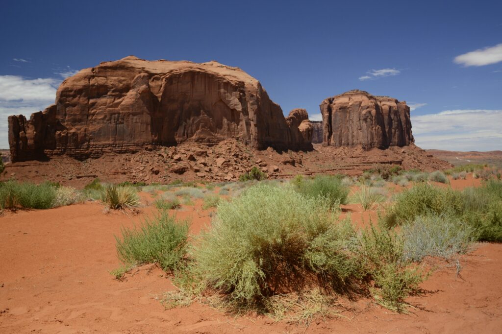
The balcony at the visitors’ center is one of the best places to get photos of the valley. Seen below are the classic “Mittens” with their “thumbs” sticking out of the sides, and Merrick Butte (on the right).
The two mittens and Merrick Butte
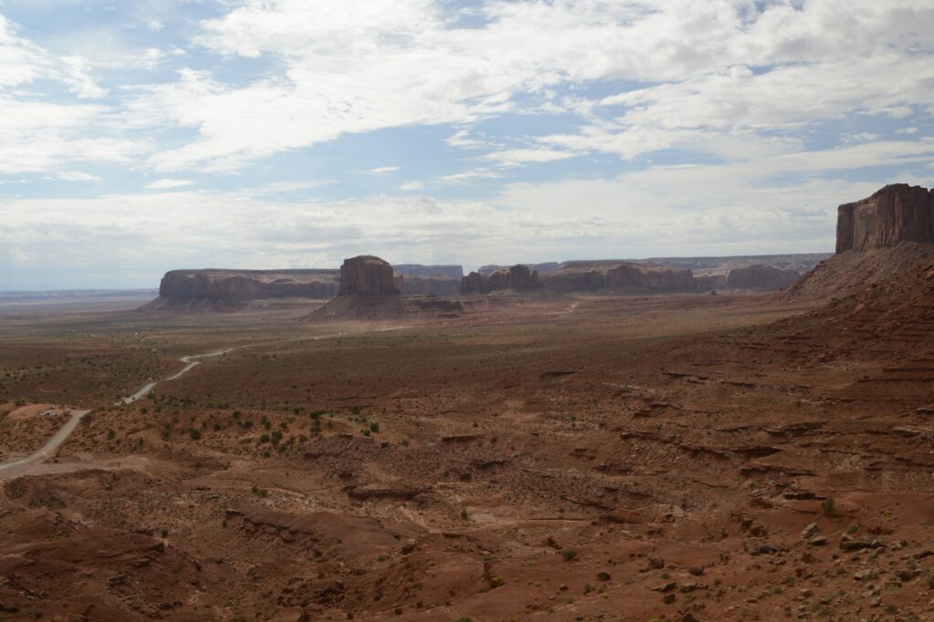
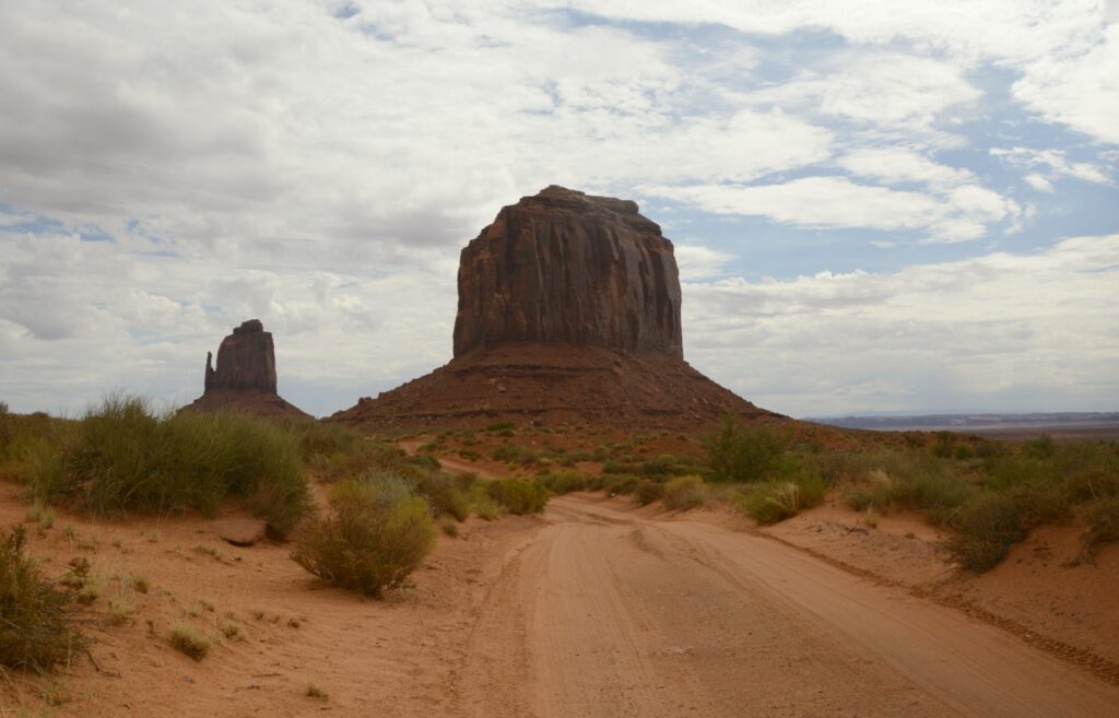
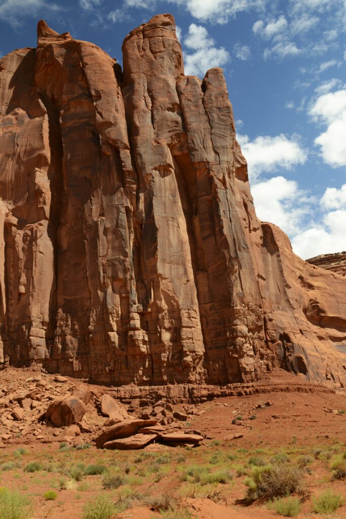
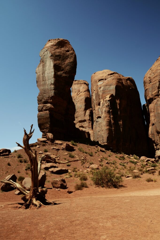
A four-wheel drive vehicle is recommended to drive the 17 mile loop. The first part of the road is a series of very steep and rutted switchbacks. Even in a 4WD truck, it was a rough ride. The speed limit was 15 mph, but I never got above 7 or 8 mph on that terrible road. It was dusty and bumpy. Our truck was coated with a fine layer of red dirt by the time we were done.
Merrick Butte. The dirt road is very primitive and rough.
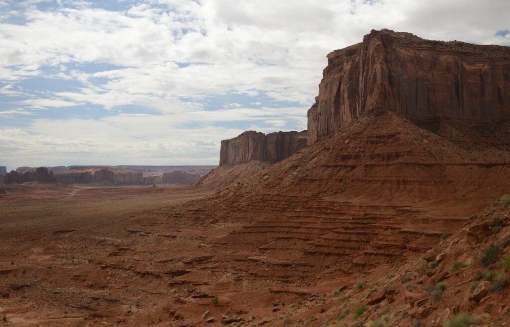
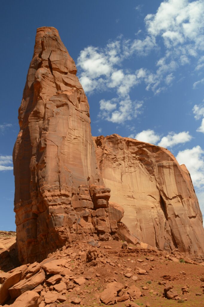
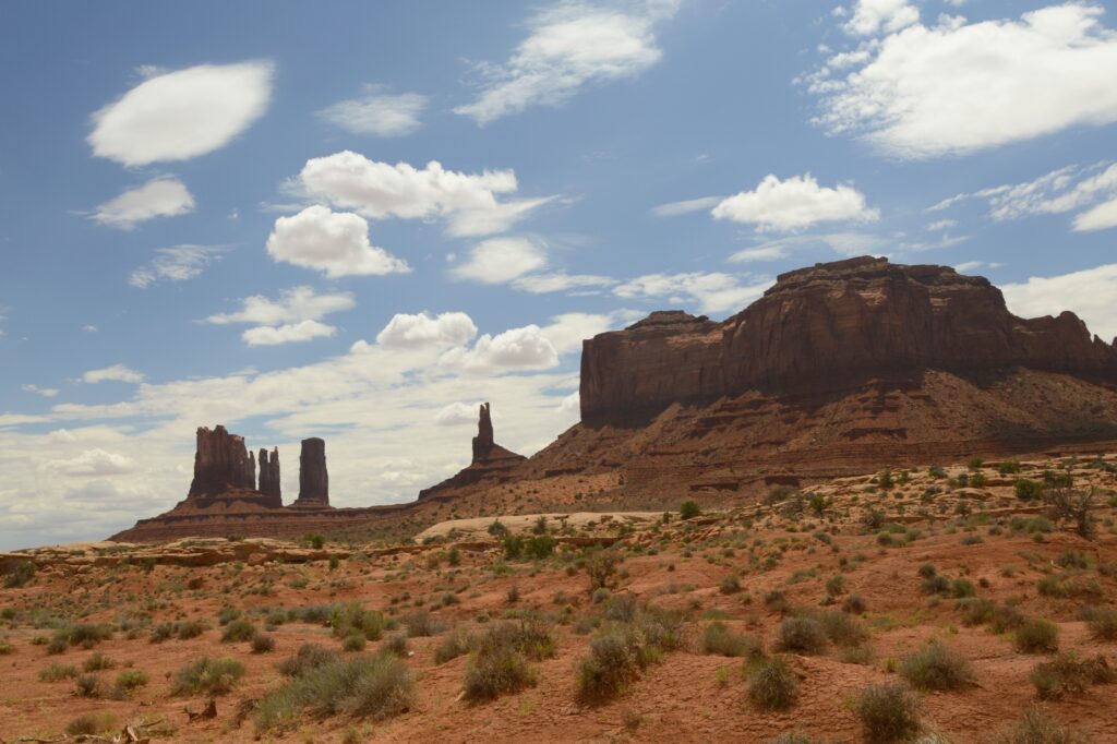
There are eleven marked viewpoints along the drive. The names describe the rocks, if you have an imagination.
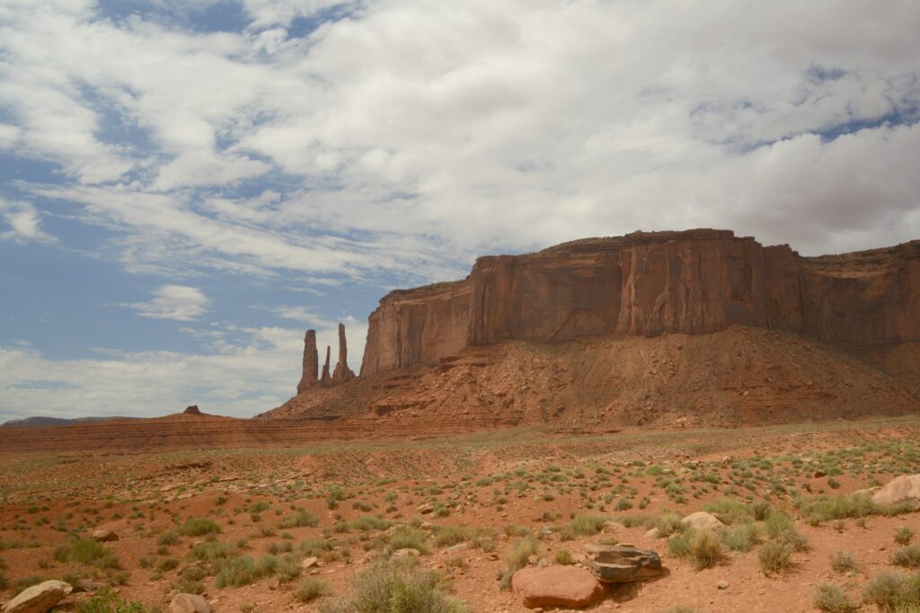
Sentinel Mesa and Three Sisters
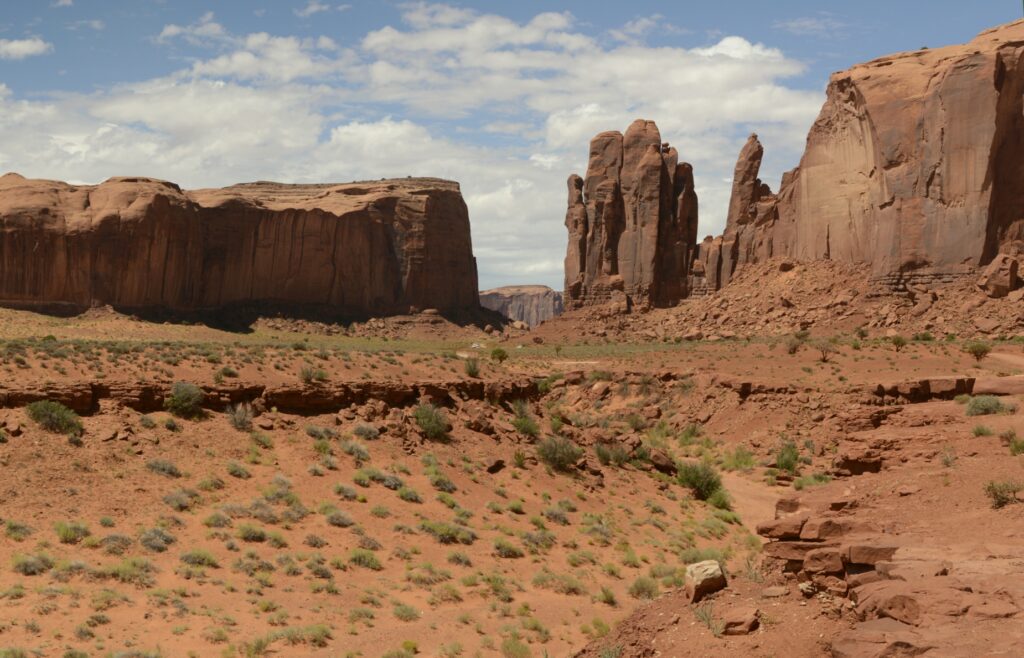
Three kinds of formations dominate the valley: mesas, buttes and pillars.
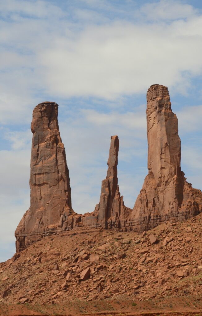
Three Sisters are three rock pillars.
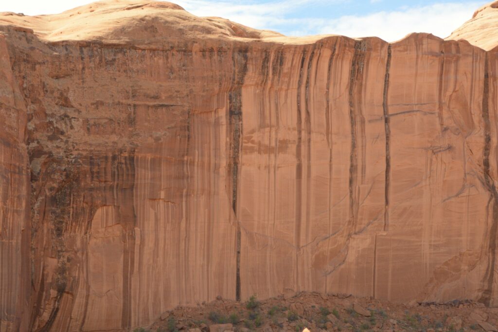
The hard top layers of the buttes and mesas called caprock resist weathering and erosion, but the softer sandstone layers below are eroded away by rain, snow, wind and ice. The debris that falls down the sides is known as scree or talus.
Scree at the bottom of sandstone cliffs
The rock walls have many interesting colors probably from minerals in the rocks and water.
Some of buttes and spires are over 1,000 feet high.
As the day progressed, the sun broke through the clouds. We had blue skies with puffy white clouds.
Big Indian Butte
Many western movies were filmed in Monument Valley. One of the iconic scenes is John Ford’s point as seen below. You may have seen this viewpoint in movies like “The Searchers” with John Wayne.
At this viewpoint, there was a Navajo Indian available to take photos of tourists sitting on a horse, for a price, of course.
John Ford’s PointCly Butte
On our way to the Artists Point, was Thumb butte. I thought it was a pretty good description of this rock formation. I give it a thumbs up!
The Thumb
The “window” between these rocks looks out on a large plain called Artists’ Point. The road leads to where you can get a view of the valley on the other side.
North Window viewpoint
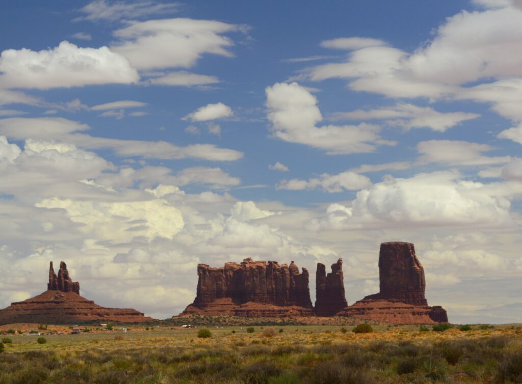
Views like this have made Monument Valley one of the most photographed places on earth.
View from artists’ point
The complimentary colors of the red rocks and green shrubs along with the blue sky inspire all kinds of artists, including me.
Desert Beauty
If you don’t have time to drive the seventeen mile road, there are still many great views from outside the park. These photos were taken from the highway. The blue sky and clouds made a beautiful backdrop against the red rocks.
View from outside Monument Valley
In the photo below, these formations from left to right are called King on His Throne, Stagecoach, Bear and Rabbit, and Castle Butte. Which one is your favorite?
King on his throne, Stagecoach, Bear & Rabbit and Castle Buttes
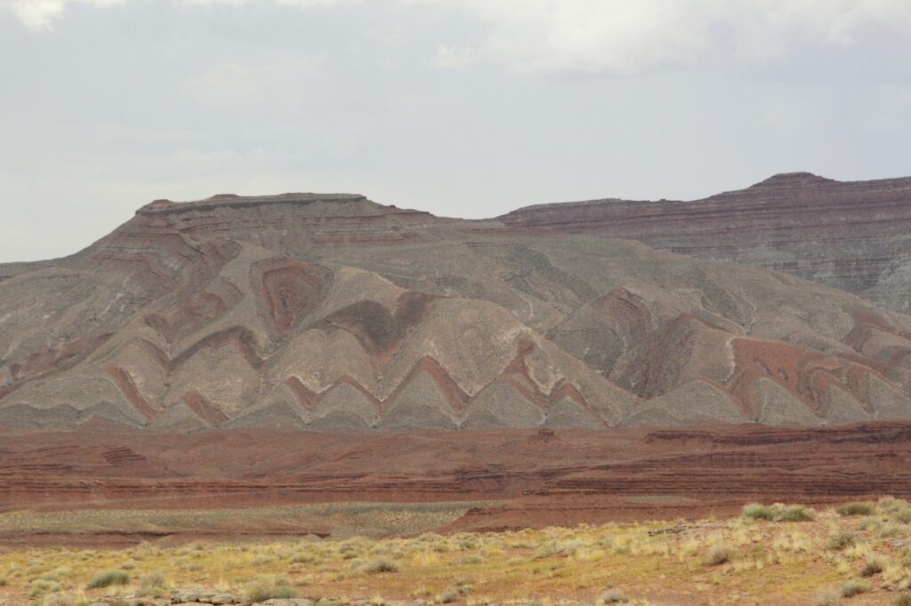
On our way back home, I noticed this mountain near Mexican Hat, Utah. Notice the folds in the rock. The rock had to be soft when it was folded because the rock would break if it was solid like it is today. Is it likely that these layers were laid down during Noah’s flood, and folded as the mountains were raised? Wouldn’t the layers have been worn away by erosion if it had taken millions of years for the layers to form as scientists tell us? Food for thought.
Folded mountain layers near Mexican Hat, Utah
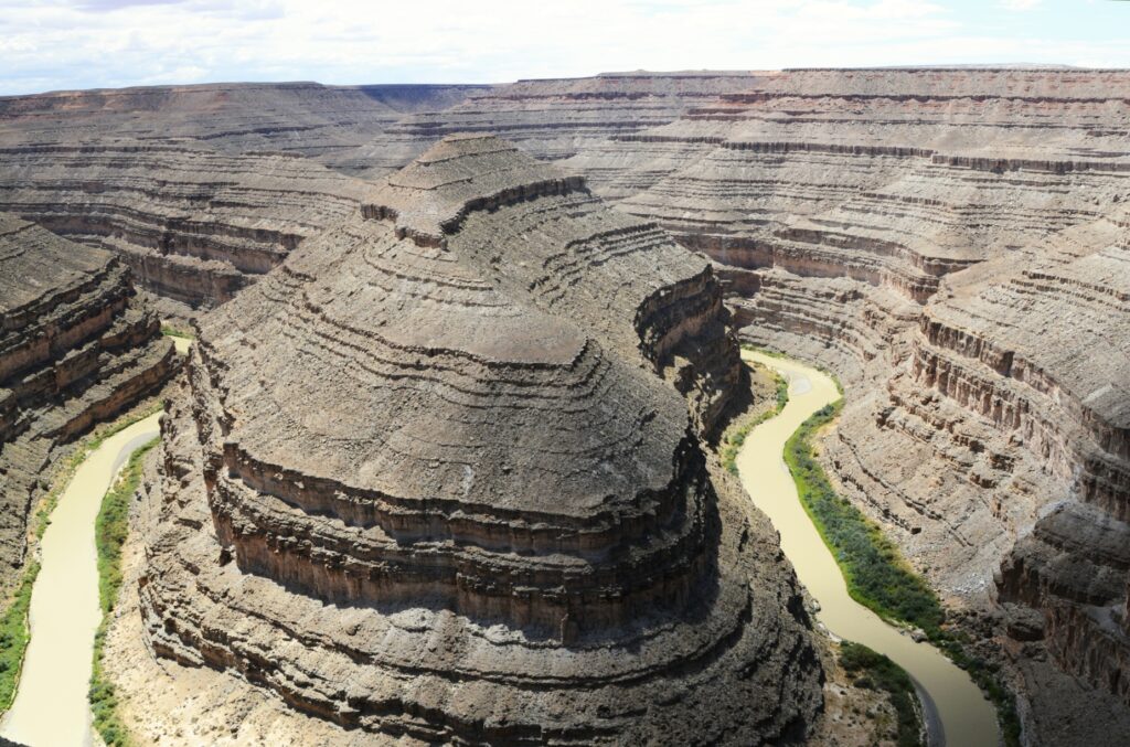
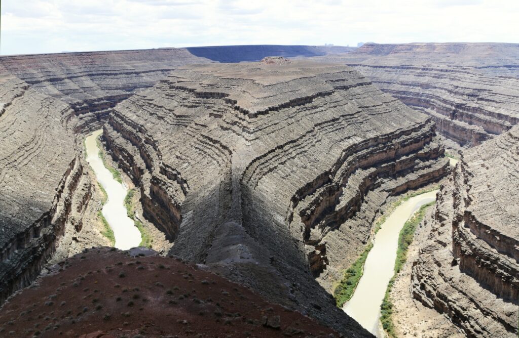
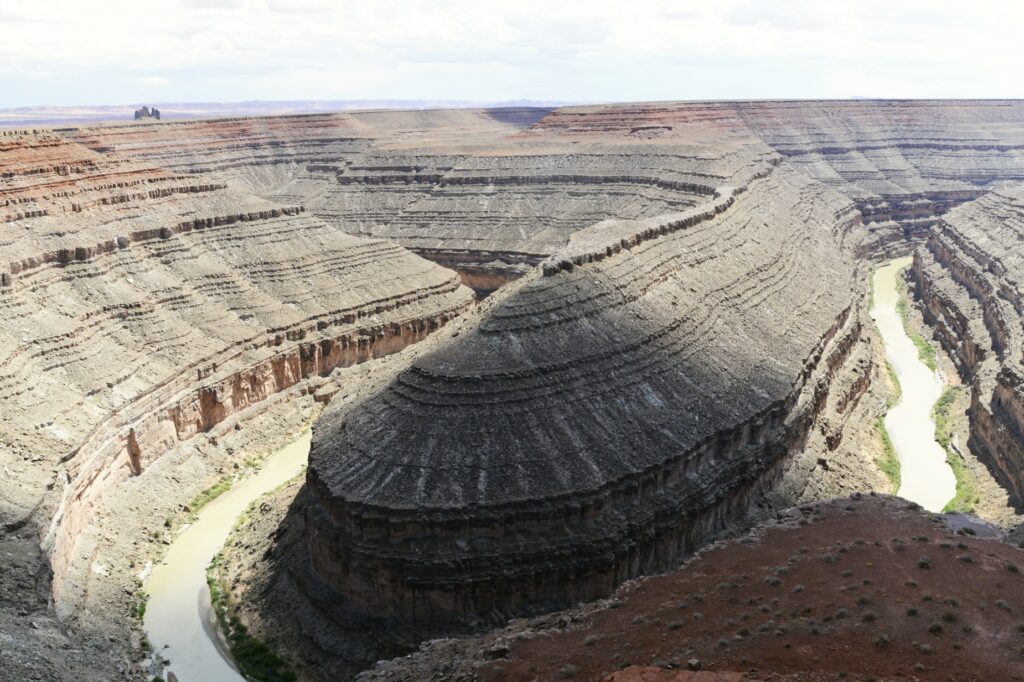
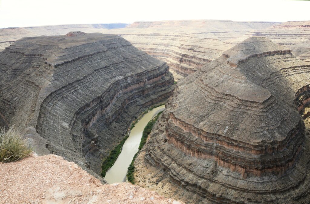
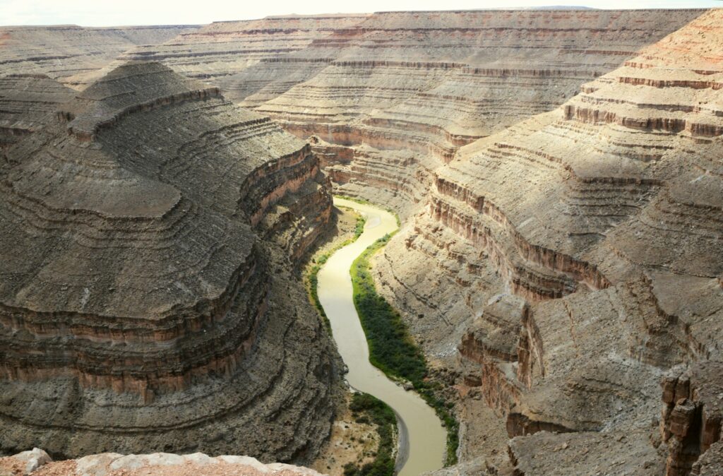
Goosenecks State Park
On our way back to Monticello, Utah, we made a detour to visit Goosenecks (Utah) State Park.
Goosenecks State Park, Utah
This small 10 acre Utah state park overlooks the San Juan River meandering and cutting a gorge of 1,000 feet deep.
It wasn’t quite as beautiful as Horseshoe Bend in northern Arizona, but it was still very impressive since you can stand on the edge and look straight down. Also, it is not just one bend in the river, but several all together.
The San Juan River at Goosenecks State Parke
I guess I should have been a geologist because places like this fascinate me. It was a great ending to our day.
“But let justice roll down like waters And righteousness like an ever-flowing stream. Amos 5:4
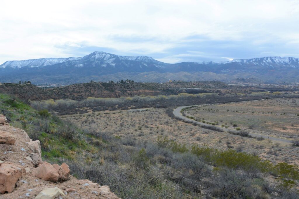
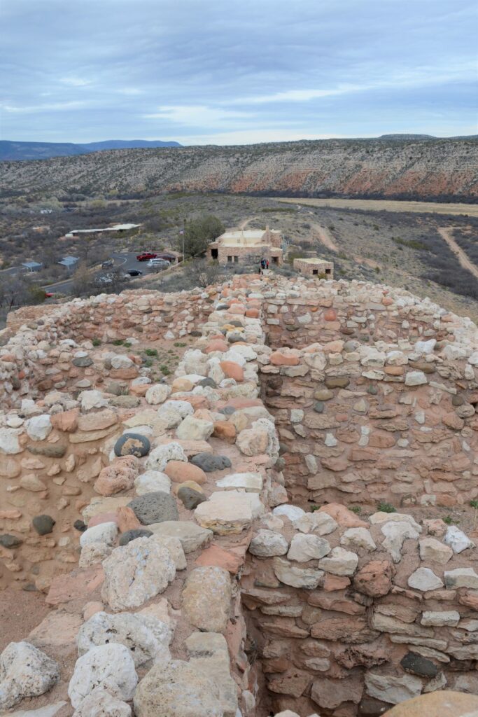
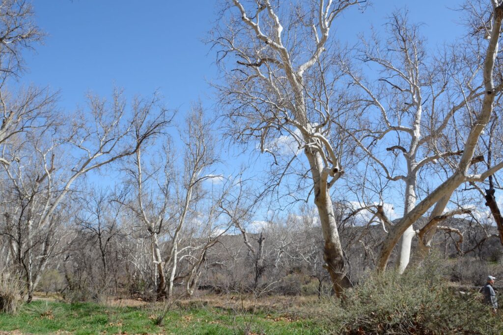
When I lived in Arizona, one of my favorite places to see while traveling north along Highway 17 was Verde Valley. The highway crests a hill and suddenly the view of a lush green valley opens up. As the highway descends into the valley, the green fields and bright green of the cottonwood trees are a stark contrast to the dry surrounding desert. Vermillian cliffs surround the valley while snow-capped mountains peak over the rim. It is a stunning view.
View from the top of Tuzigoot NM. Cottonwood trees line the Verde River. The ghost town of Jerome sits on the side of the distant mountains.
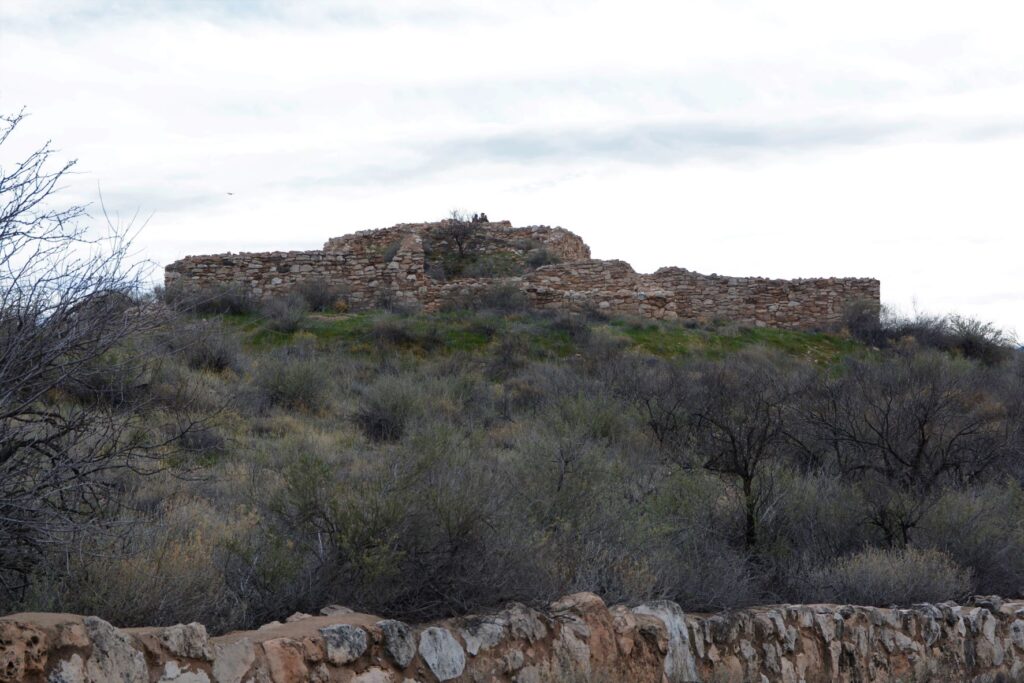
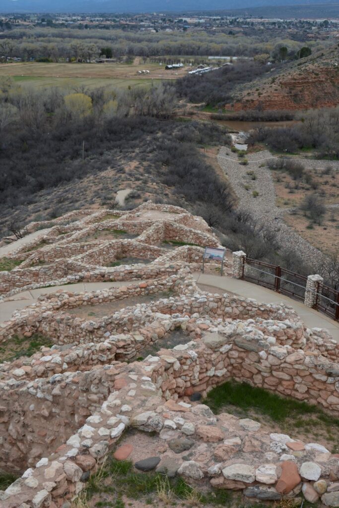
The Indians who came here 1400 years ago traveled along the Verde River valley. Like people of today, they liked to settle near water or on hilltops. One such group, the Sinagua, settled on a hill overlooking the Verde River. They were close enough to the river for water, but high enough to avoid the floodwaters when the river overflowed its banks.
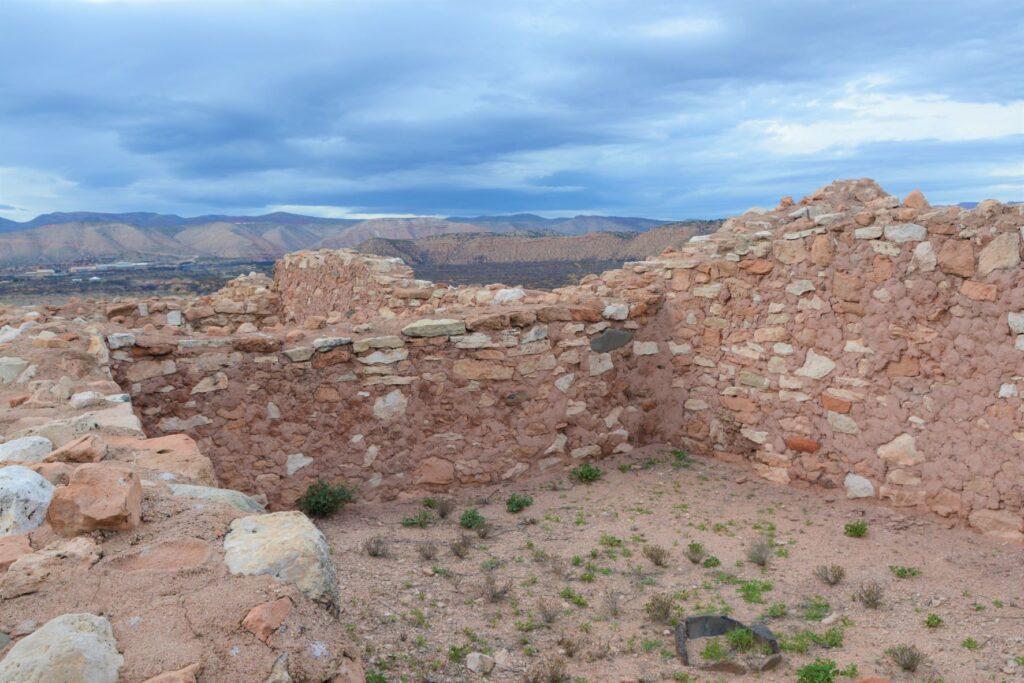
Tuzigoot ruins sit on a hilltop
We don’t know much about these people. Their multi-room settlement was similar in construction to many other pueblos found in New Mexico, Colorado and southern Arizona which means they traveled frequently to each others’ settlements. The relics found, as well as the construction of their dwellings, show evidence of this.
View from the ruins looking down toward the Verde River
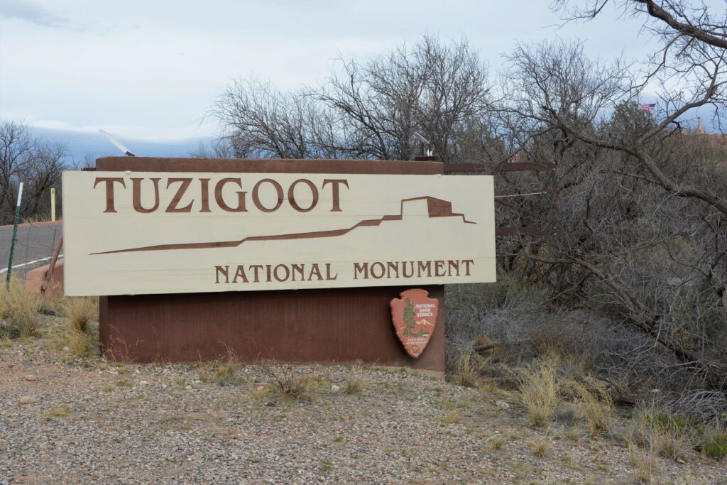
The Sinagua people eventually moved north and the walls crumbled and became buried and forgotten until the 1880s when two men from Smithsonian Institute began excavating the site. They gave the name “Tuzigoot” to this site. Tuzigoot is a corrupted form of the Tonto Apache name Tú Digiz, the name for this stretch of the Verde River. It is translated “Crooked Water.”
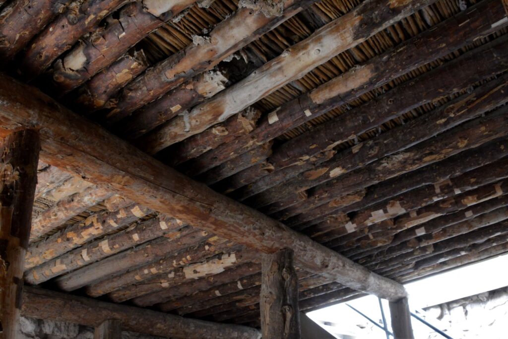
Typical wall construction was of adobe and stone.Roof construction was of logs from trees growing by the nearby Verde River.To preserved the structure, mortar is regularly replaced with a mixture similar to the original.
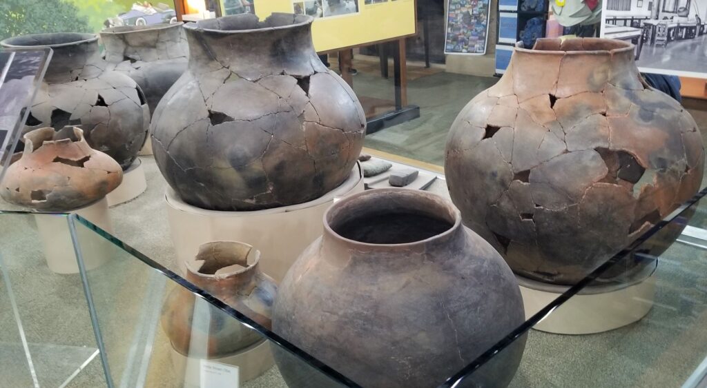
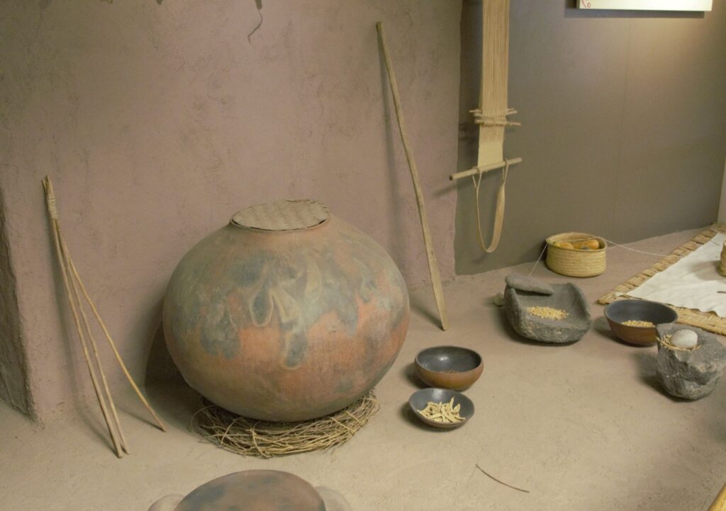
Since taking a pottery class many years ago, I have always been interested in pottery from historical sites. These pots were probably made by coil rope construction, smoothed, glazed and fired in a pit in the ground. What amazed me about these pots was their size!
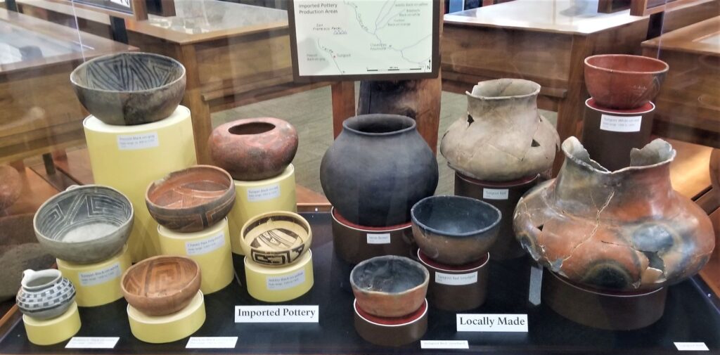
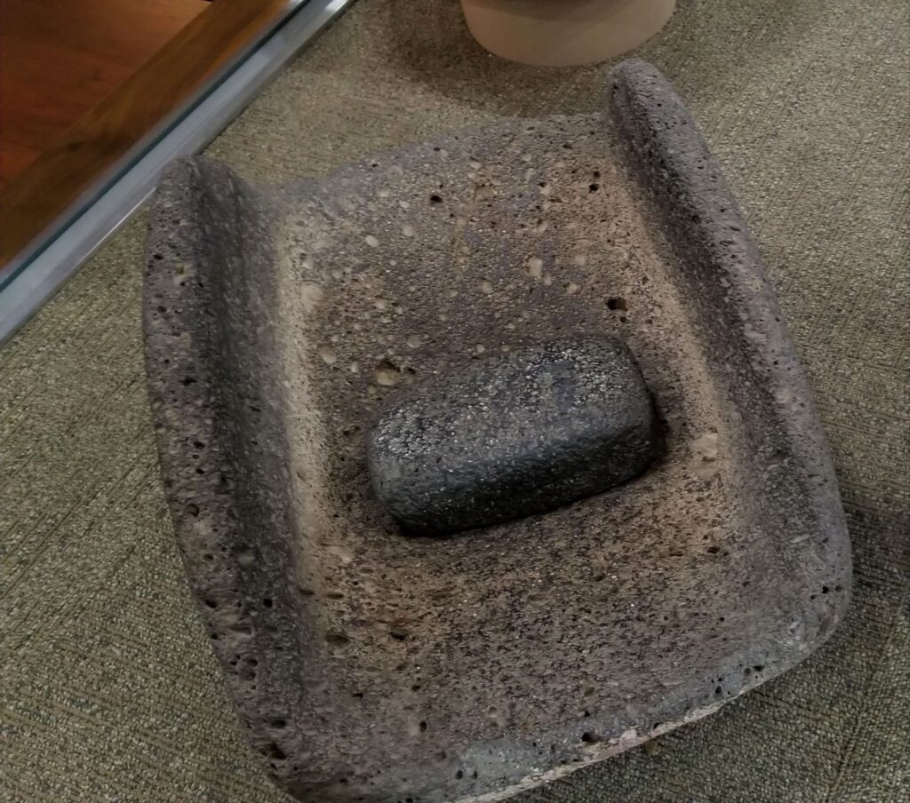
Large pots probably for water storage.Pottery imported from neighboring areas show that the desert people traveled and traded with one another.Grinding stone for grinding corn into flour.Wildlife is plentiful along the Verde River.
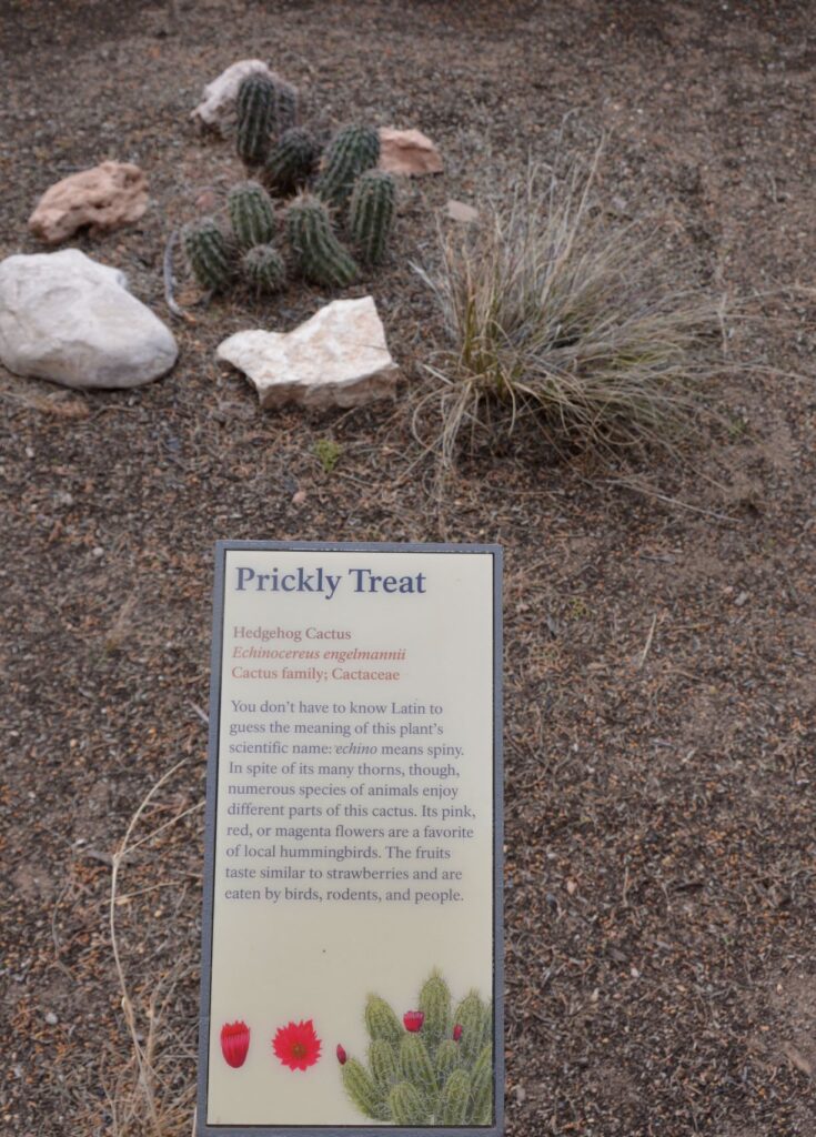
Along the walkway several indigenous plants were labeled. Isn’t this Hedgehog Cactus cute?
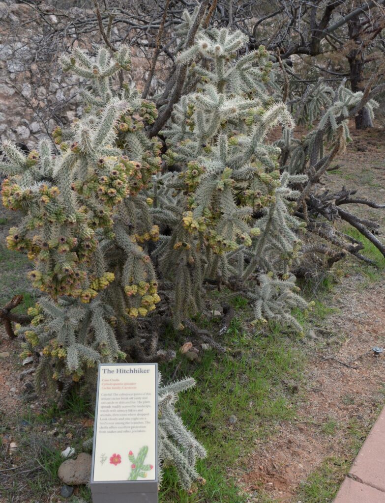
Cane Cholla Cactus is easily caught on clothing and shoes while walking by.
Today visitors can enjoy walking through the rooms of this ancient Indian village, see the displays of artifacts that were discovered here, and enjoy the beautiful views from atop the historical mound.
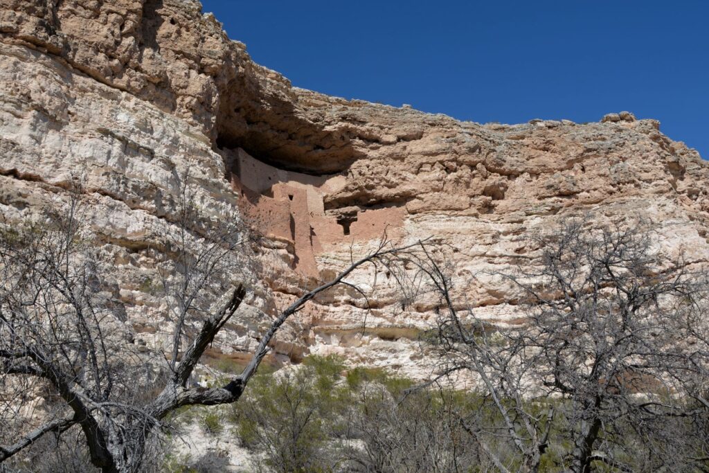
Montezuma’s Castle National Monument
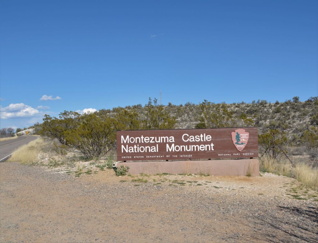
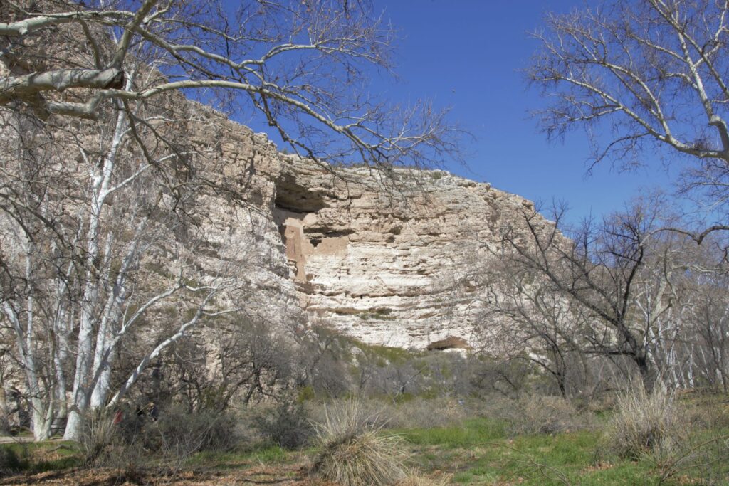
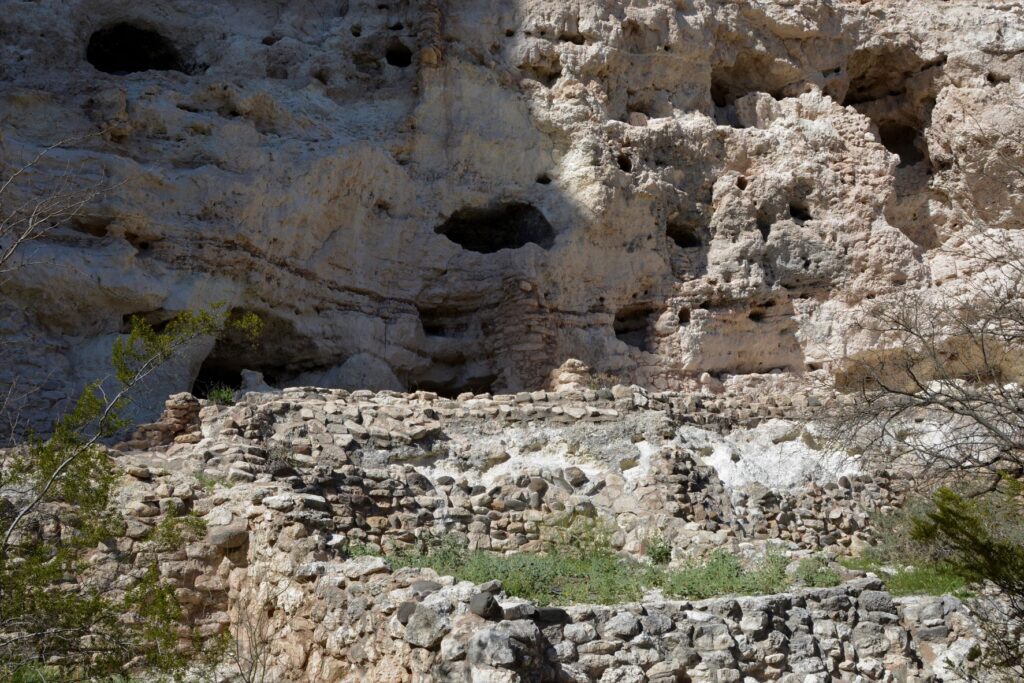
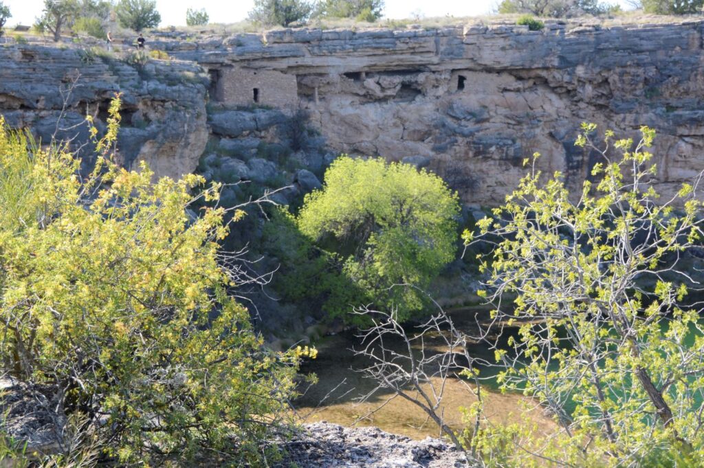
Less than 25 miles away is another ancient ruin known as Montezuma’s Castle National Monument which was also occupied by Sinagua people. It was misnamed by early discoverers of the site who thought that it was built by the Aztec Indians of Mexico.
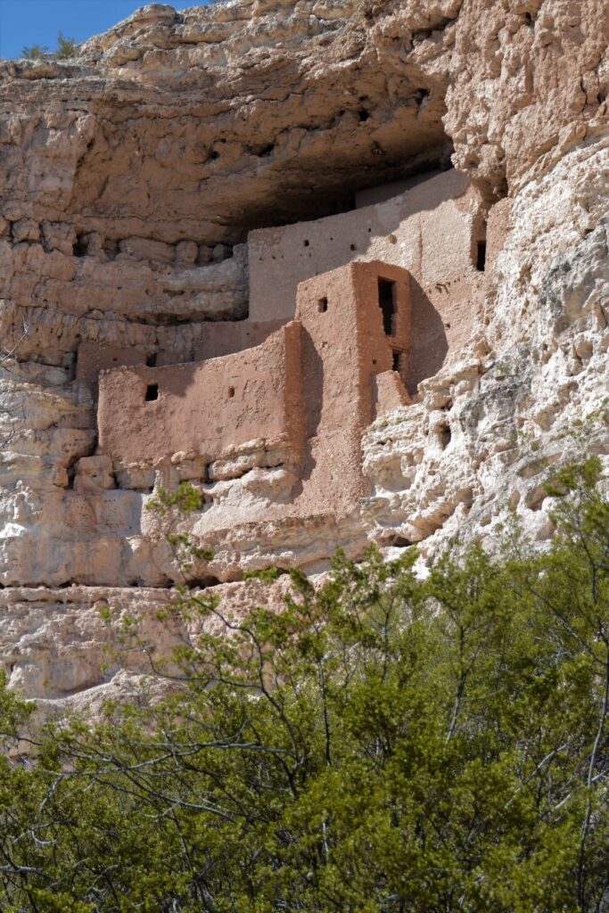
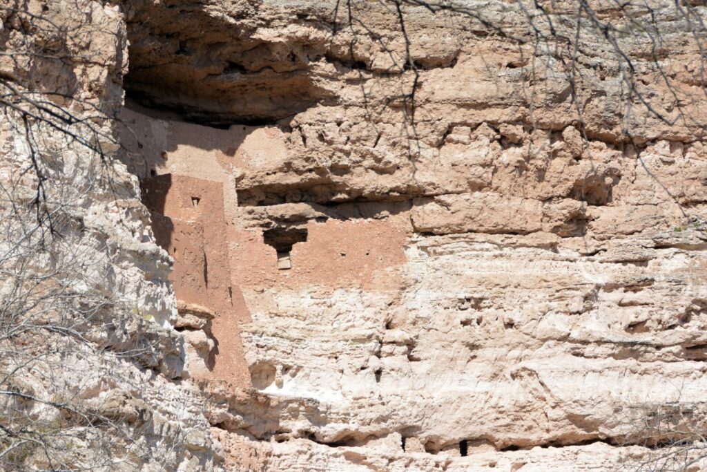
Montezuma’s Castle cliff dwellings
This pueblo cliff dwelling is an impressive five-story 20 room dwelling accessed by ladders during the time it was in use. It was south-facing, so it got the warmth of the winter sun. In summer, it was cool because of the shade from the cliffs.
Nearby, Beaver Creek kept the cliff dwellers supplied with water for living and gardening. The Indians grew crops of corn, beans and squash which were known as the Three Sisters because of how the plants worked together to sustain each other.
The beans climbed the corn stalks to reach sunlight, while supporting the corn from the winds, while the squash was a ground cover that kept the soil moist and discouraged the weeds. The beans, a legume, also enriched the soil. Do you grow these plants in your garden?
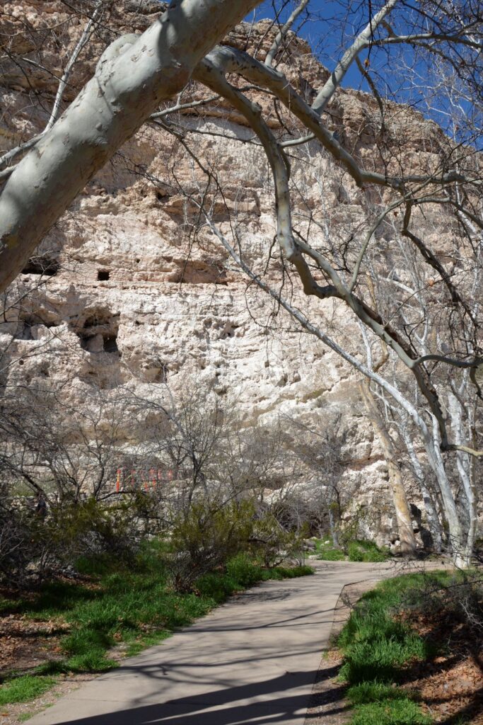
The pathway to the ruins is a short pleasant walk from the Visitors’ Center.One can see the similarities between these rock walls and the ones at Tuzigoot.
The day we visited, Beaver Creek was a rushing torrent from recent rains. The pathway to the creek was cordoned off to visitors. The Ranger told us that in a previous year, the creek had overflowed and the water came up to the bottom of the cliff. Maybe this is why the Indians built their pueblos way above the water.
Looking toward Beaver Creek, this area was where they grew their crops.
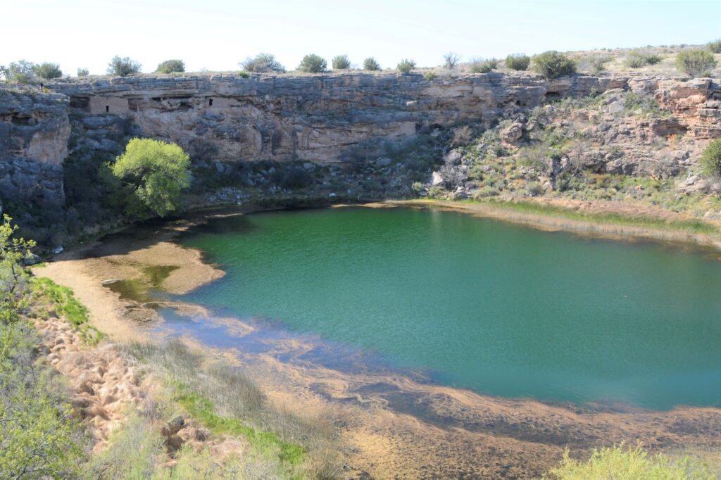
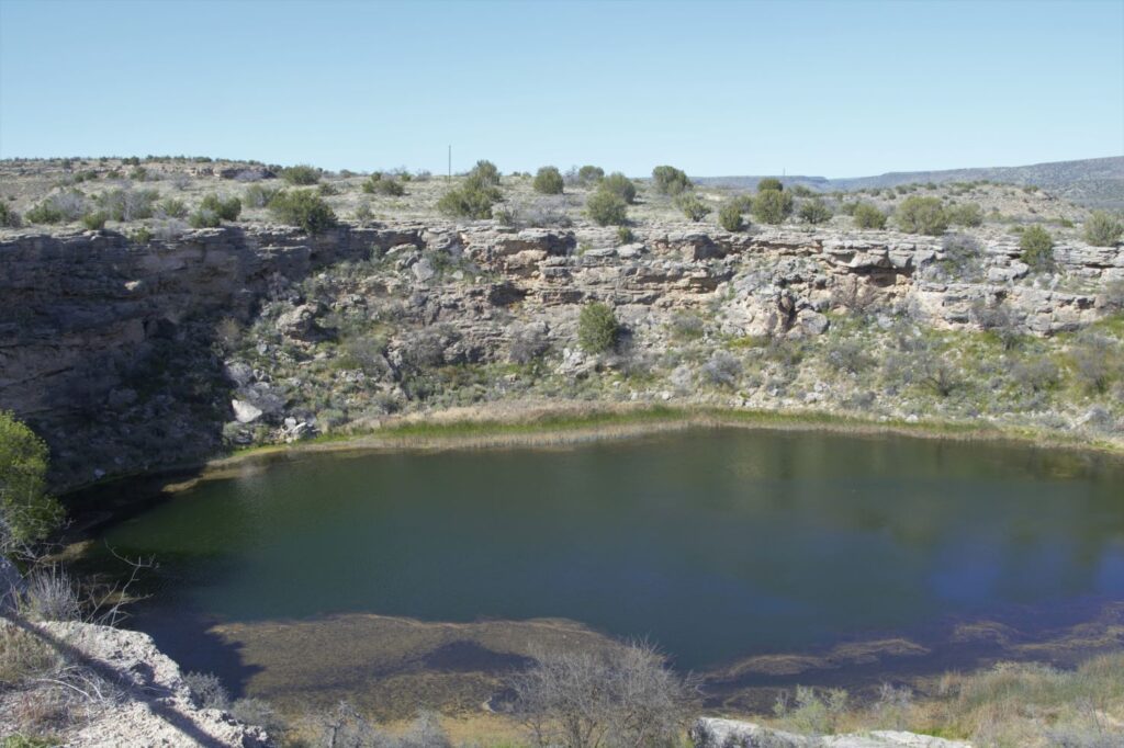
Montezuma’s Well
About 10 miles north of Montezuma’s Castle is Montezuma’s Well. Instead of taking us on paved roads, our GPS took us the long way. I couldn’t believe such a popular national monument would be accessed by a three mile dirt road. It dawned on us that there was a better way when we reached the entrance to the Monument. There was the paved road we were looking for. On our return route we followed the paved road back to Rimrock from which we were able to access Interstate 17.
Montezuma’s Well and cliff dwellings
There is a short climb up to the rim overlooking Montezuma’s Well. The well is an ancient sinkhole that is fed by an underground spring of over 1.5 million gallons of water each day. The spring waters are from rain and snow that fall on the nearby Mogollon Rim which then seeps through the rock until it reaches the spring. Pressure pushes the water up to the surface. It is said that the water takes as long as 10,000 years to travel from the Rim to the Well.
The well is deep. Millions of gallons of water flow into and out of the well.
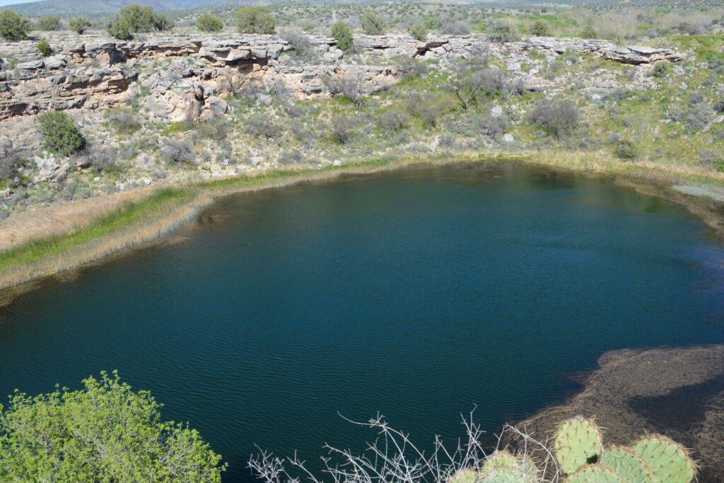
The water exits the well through underground streams and a cave system which drains into an ancient irrigation canal. The water level remains constant, as well as the temperature of the water which averages 70 degrees F. However, because the water has a high alkalinity and an excessive amount of dissolved carbon dioxide–more than 100 times higher than normal–fish cannot survive.
Fish can’t live in the water, but thousands of leeches live here.
The depth of the well is unknown because of the pressure of the water. Divers have discovered a “false bottom” at around 60 feet of pressurized groundwater that holds a column of fluidized sand in suspension. The fluidized sand rises from two deep vents in the floor of the well. One is 124 feet deep and the other is 74 feet deep. But previous measurements measured 137′ and 95′. So, we can just say, it’s deep.
Pueblo dwellings in the rocks above Montezuma’s Well
The people who built homes near Montezuma’s Well were the Hohokam and later the Sinagua.
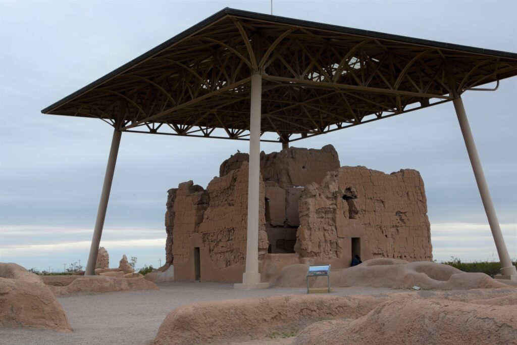
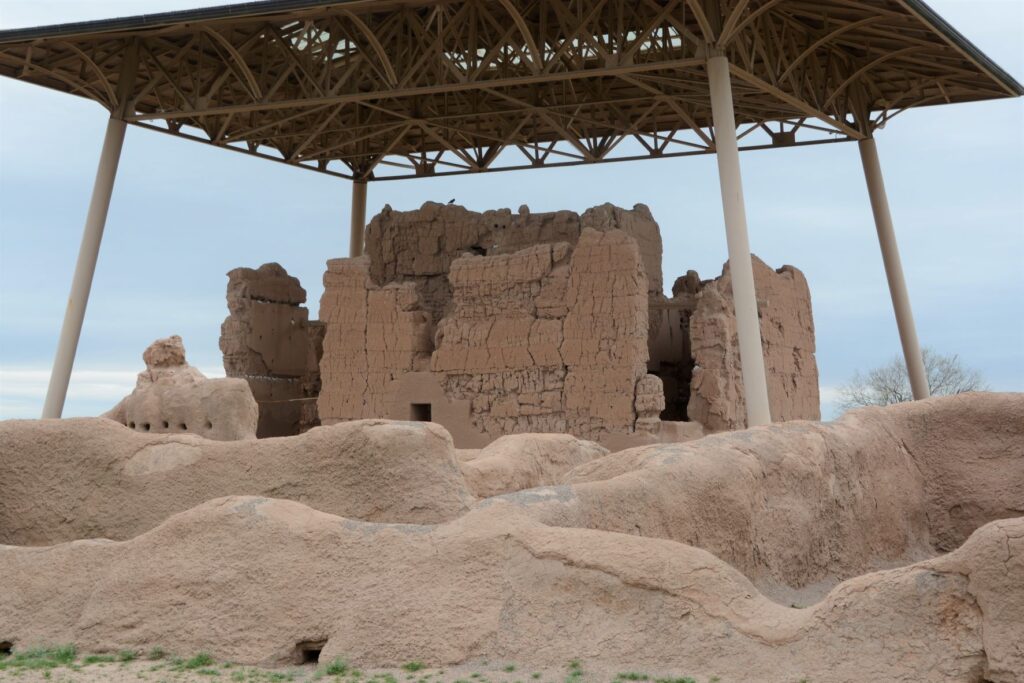
Casa Grande Ruins National Monument
Leaving the Verde Valley area, we traveled south to Mesa, Arizona. One afternoon we drove south, halfway to Tucson to Casa Grande Ruins National Monument. This “Grand House” was probably built in the 1300’s, which is the time period of the founding of the Byzantine Empire, the 100 years war, and the black death or bubonic plague in Europe. These desert people had already been using irrigation methods for hundreds of years to grow their crops.
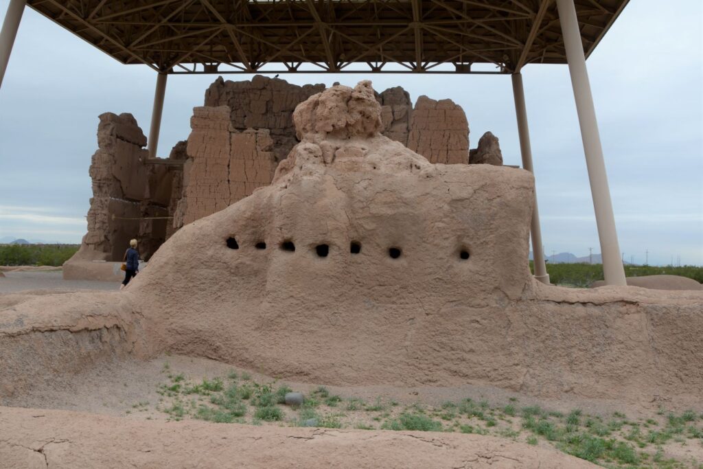
A metal structure over the ruins keeps it from deteriorating.
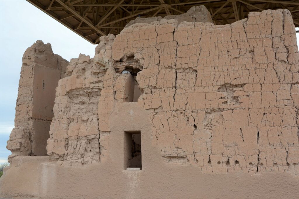
Archeologists are not sure of the purpose of this grand structure. However, because of the construction they believe it was well planned and organized. The builders used caliche, a natural concrete-like material found under the soil around this region. They used it to build houses with solid walls and flat roofs covered with this caliche substance.
Walls were made from caliche, a concrete-like material found in the ground.
These desert people were given the name “Hohokam.” It is not really the name of a tribe or people. The name may have come from “huhugam,” an O’Odham word that means ancestors. Today these people are referred to as Sonoran Desert people. By the way, Hohokam is the name of the grade school I attended. Our elementary schools were named after Indian tribes.
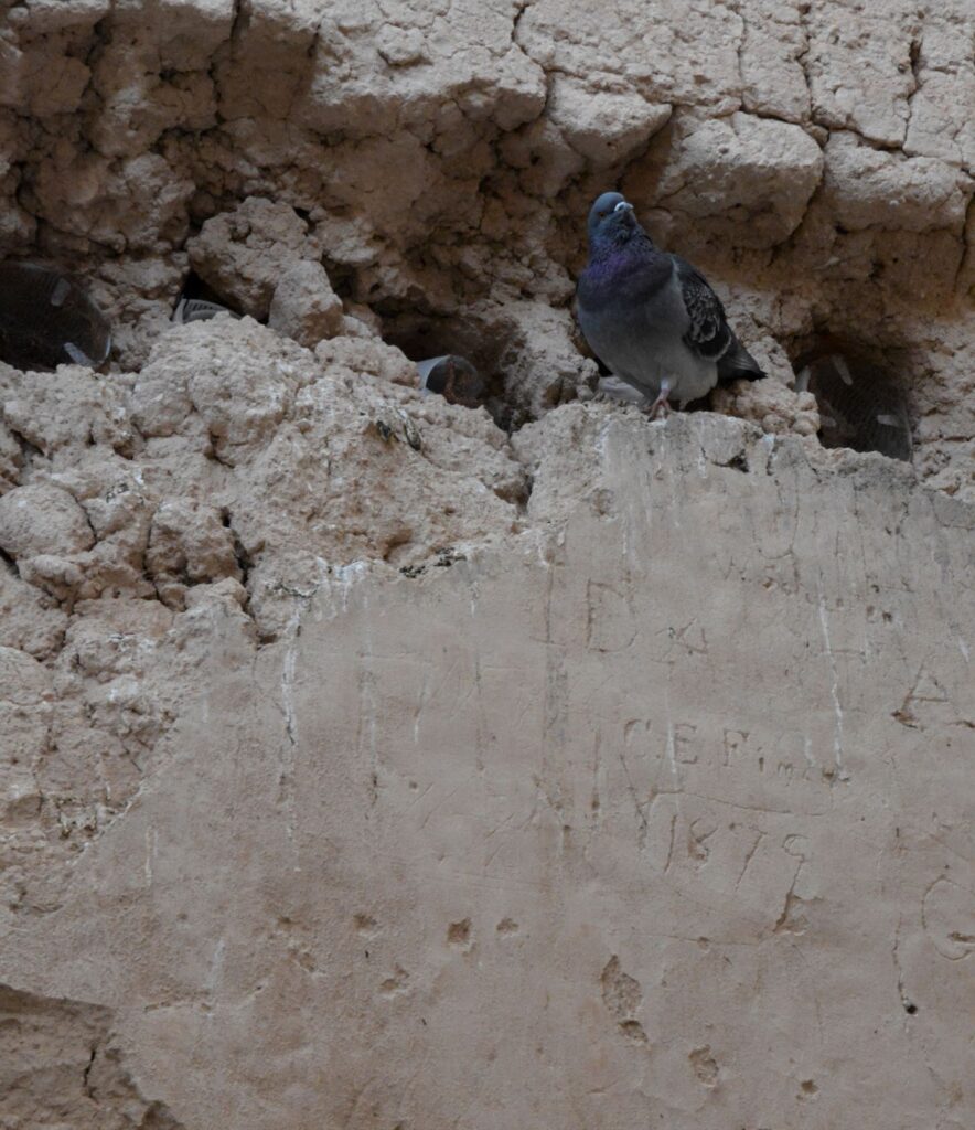
A pigeon makes its home among the walls of the ruins. Note the etched name and date below it.
When I took the photo above, I didn’t notice the name and date etched on the wall. It is a good thing that people like Mary Hemenway and President Benjamin Harrison took steps to preserve the ruins for future generations from vandalism and looting. Mary Hemenway was a wealthy woman who sponsored archaeological expeditions. One expedition to Casa Grande Ruins alerted her to the vandalism. She made efforts to preserve the site and as a result, it became the first federal prehistoric and cultural reservation by President Harrison in 1892.
One of the purposes of this structure might have been a calendar. Some of the holes line up directly with the sun on the summer and winter solstices.
In later years, the village homes were grouped into caliche-walled compounds which were arranged around public plazas and public structures. The Grand House or Casa Grande was at the center of this settlement.
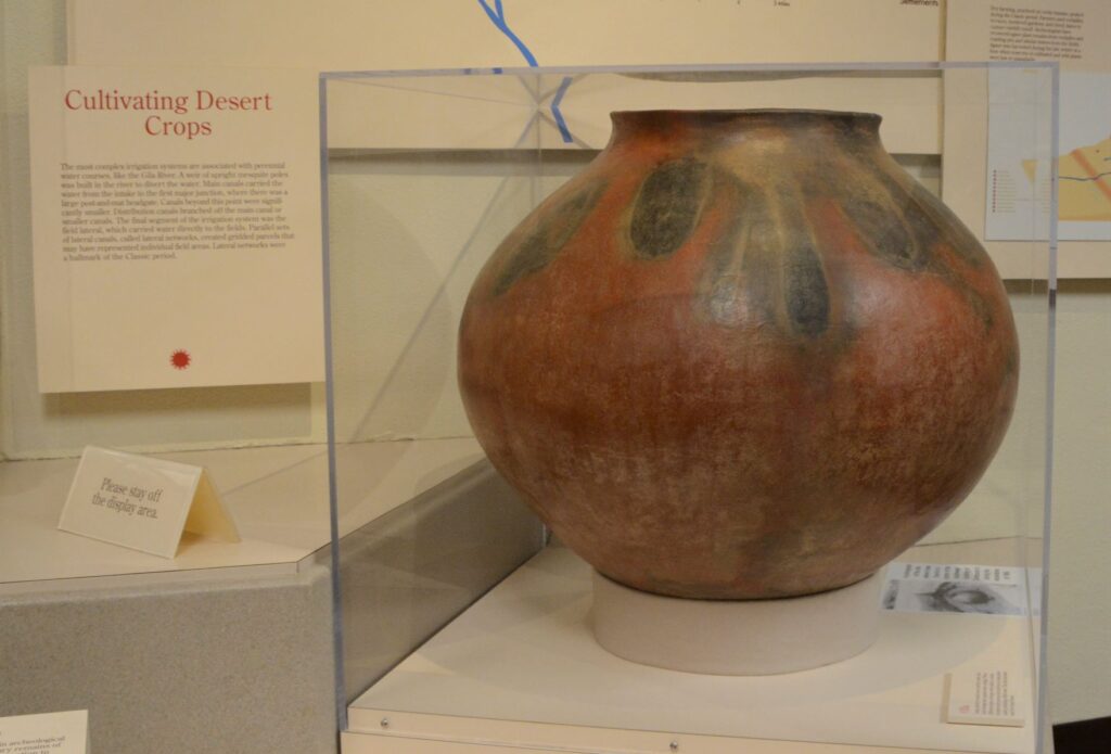
These desert people were identified by their type of pottery called “red-on-buff.” This beautiful piece of pottery below is an example of the techniques used in creating their pottery. In my opinion, the dark portions on this pot look to me like leaves of some plant that they tied around the neck of the pot while being fired which left these unusual designs.
This pot below looks similar in design to the one above with the plant-like designs.
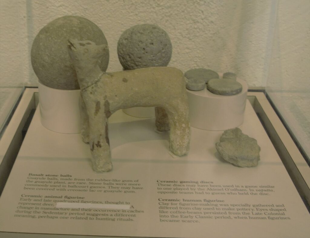
These desert people also enjoyed games. There are over 200 oval-shaped, structures with earthen sides located in large Hohokam villages in southern and central Arizona. Archaeologists have speculated that some kind of game was played within these courts with two teams using a hard rubber or stone ball. Round discs were found that might also have been used in other games.
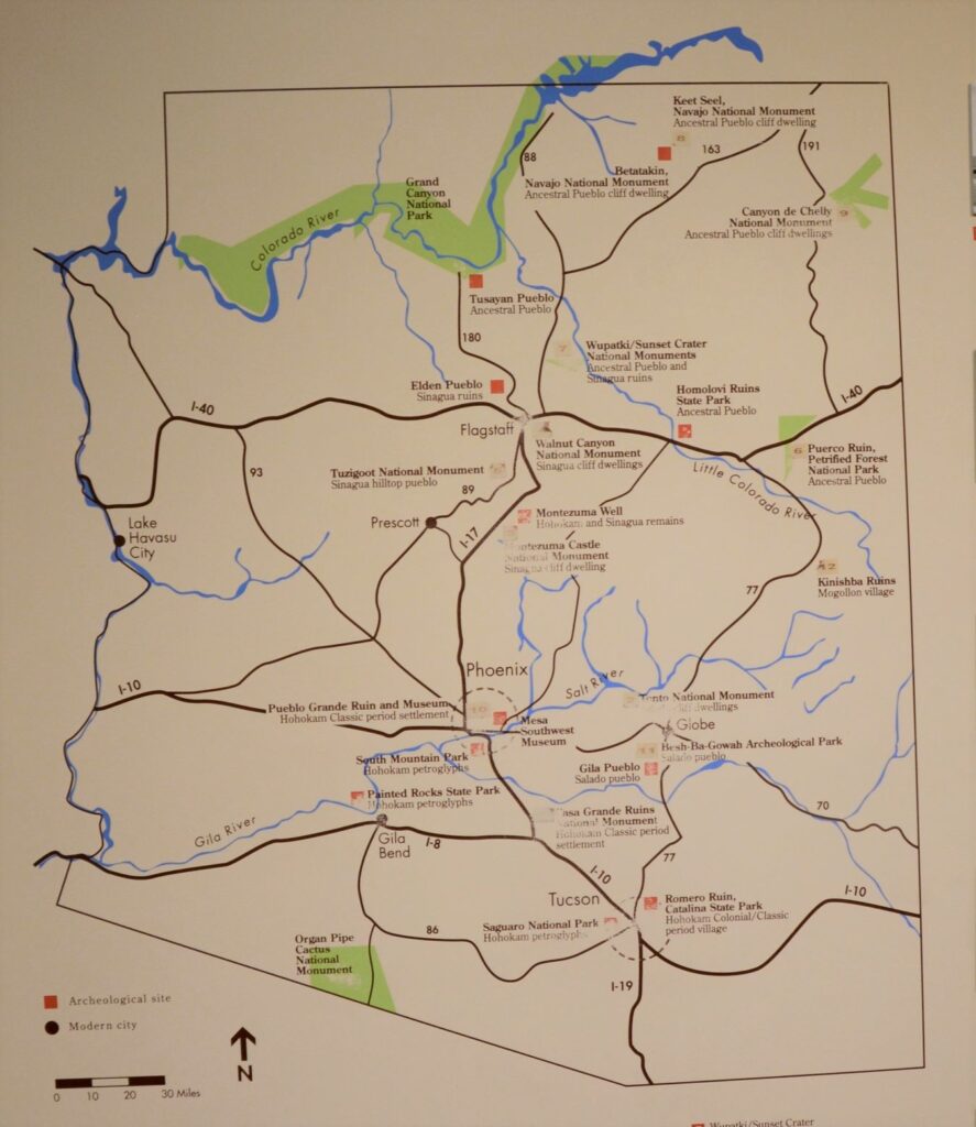
The map below shows many places around Arizona where the Sonoran desert people lived and moved. Eventually, they all left for unknown reasons. It may have been drought, floods, disease, invasion, earthquakes, internal strife or salinization of farmland. We don’t know. Yet we can still appreciate the structures, relics and places they left behind and marvel at their ingenuity.
I am glad we took time to see these places, having never visited any except Montezuma’s Castle when I was growing up. I don’t think I appreciated the contributions these people made to Arizona history. It’s a shame that Hohokam school didn’t teach us anything about the people that our school was named after. I think it would have made a big impression on me to have learned about them and to have visited Casa Grande National Monument.
But the moral of the story is, explore your own backyard. You never know what you might be missing!