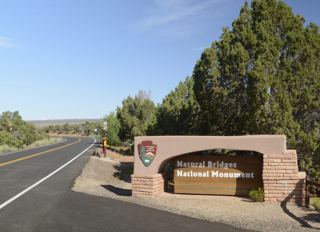
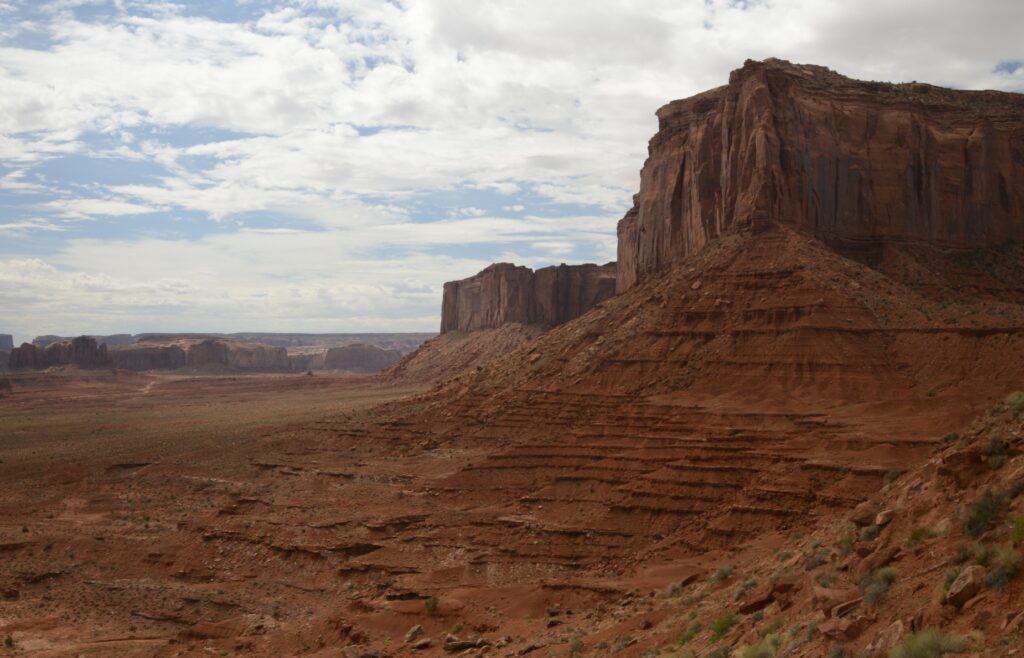
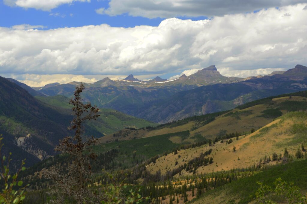
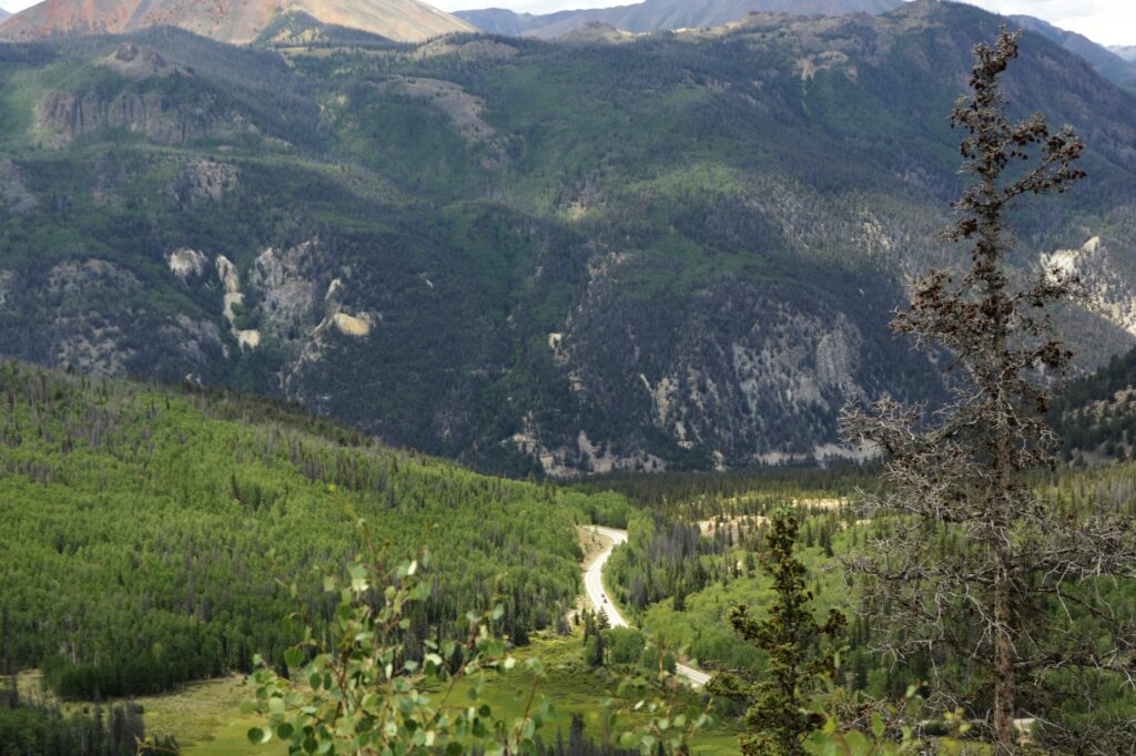
Utah’s first national monument, Natural Bridges, is off the beaten path. It was over an hour drive from Monticello, Utah, where we were staying. After turning on state highway 94 at Blanding, Utah, which is about the halfway point, there are no towns or services from then on. But the scenery is worth the drive.
There are three natural bridges within the park boundaries: Sipapu, Kachina, and Owachomo which are Hopi Indian words meaning “place of emergence,” rock art that resembles kachina dolls, and “rock mound.” They were discovered by a prospector in 1883, and later it was designated a national monument.
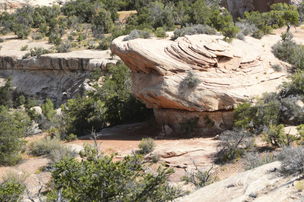
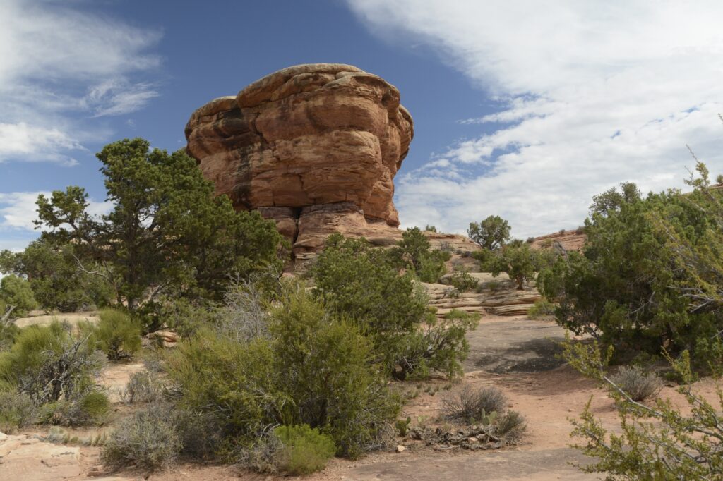
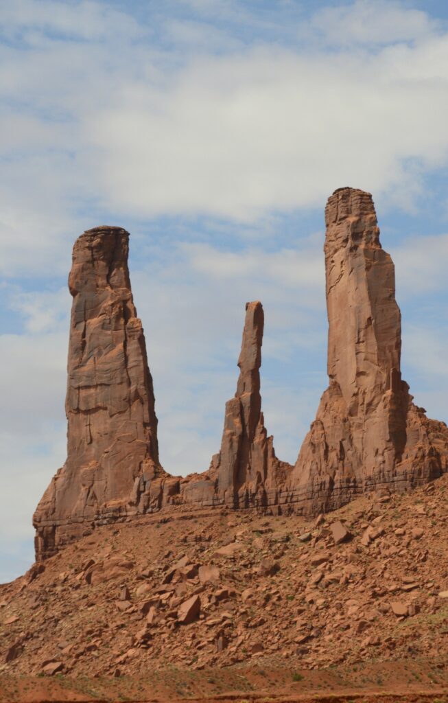
Sipapu Natural Bridge
We started our visit at the visitors’ center where we learned the difference between a natural bridge, an arch and a window. A natural bridge is formed by flowing water. As streams wind back and forth in a canyon, the thin walls are worn through by the water pounding against them.
Sipapu Natural Bridge
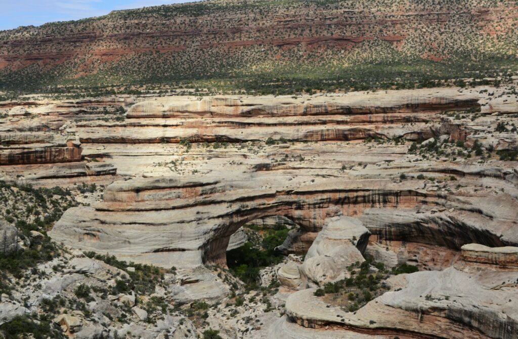
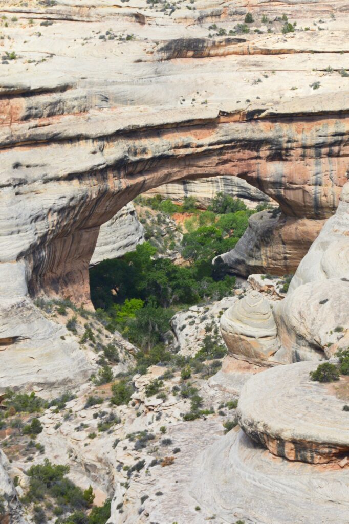
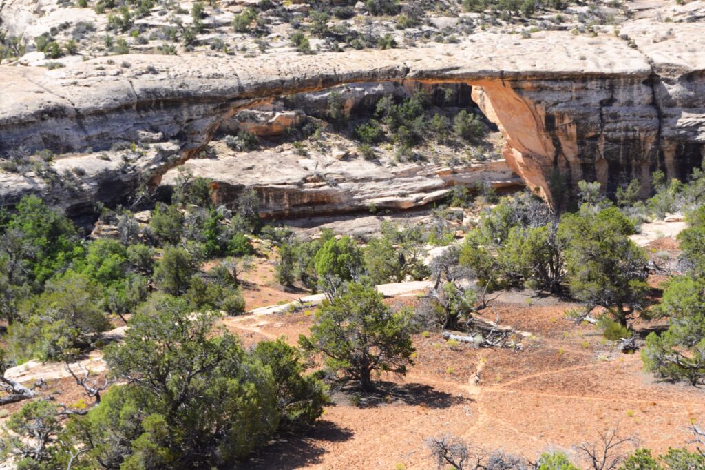
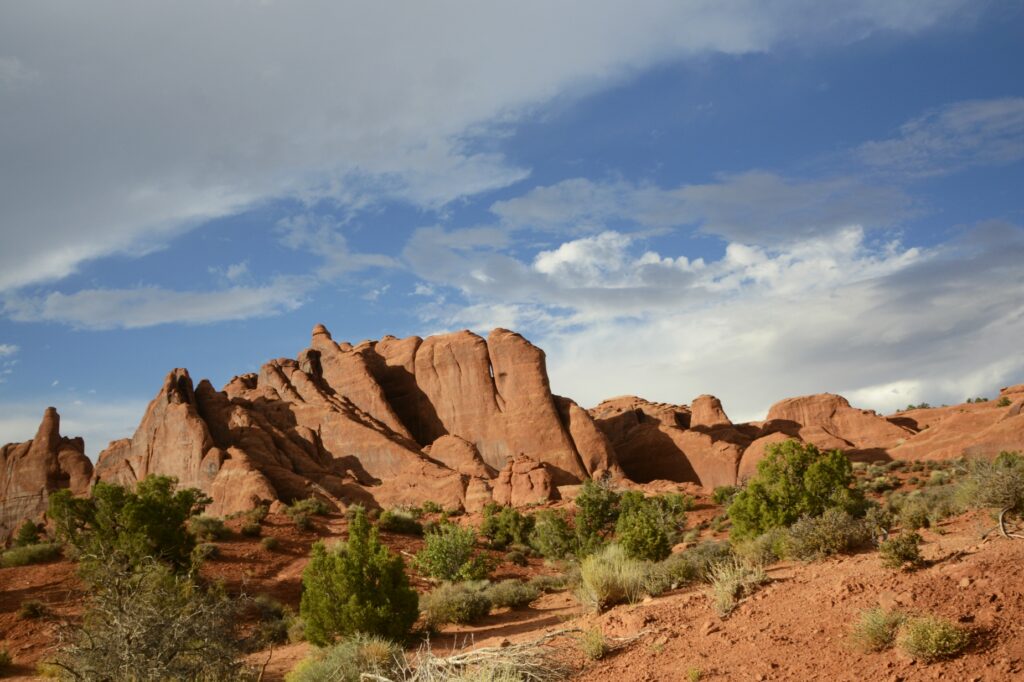
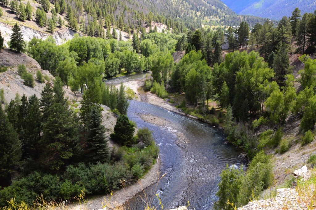
Sipapu (see-pa-pu) bridge was the first stop on the nine-mile Bridge View Drive through the park. It’s the largest of the three bridges. Its meaning has to do with an entryway by which the Hopi believe their ancestors came into this world. To give you an idea of its size, the dome of the United States Capitol would nearly fit underneath it. It is the second largest natural bridge in the U.S.
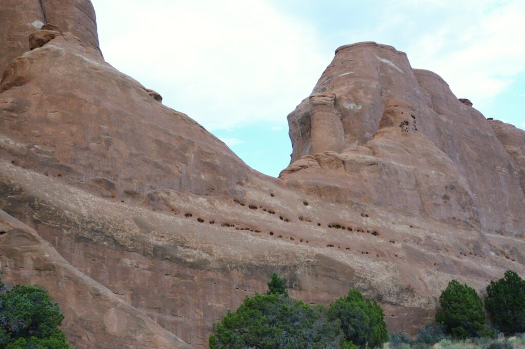
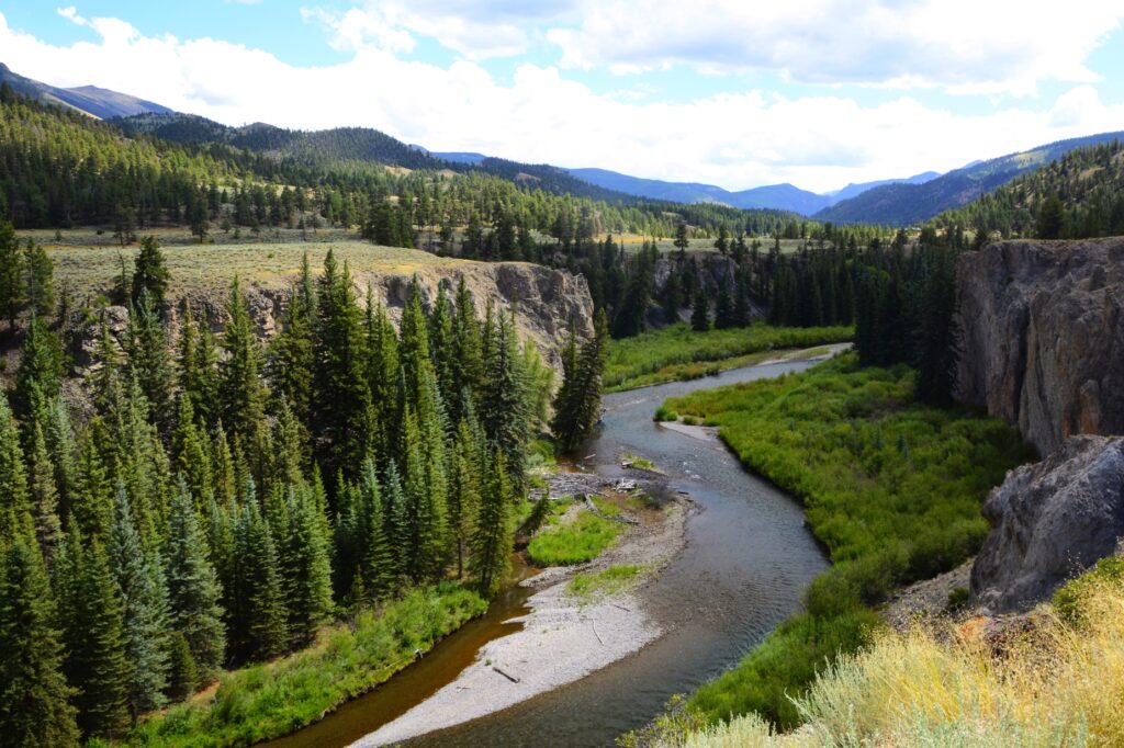
View of canyon
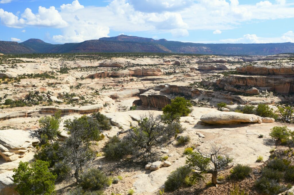
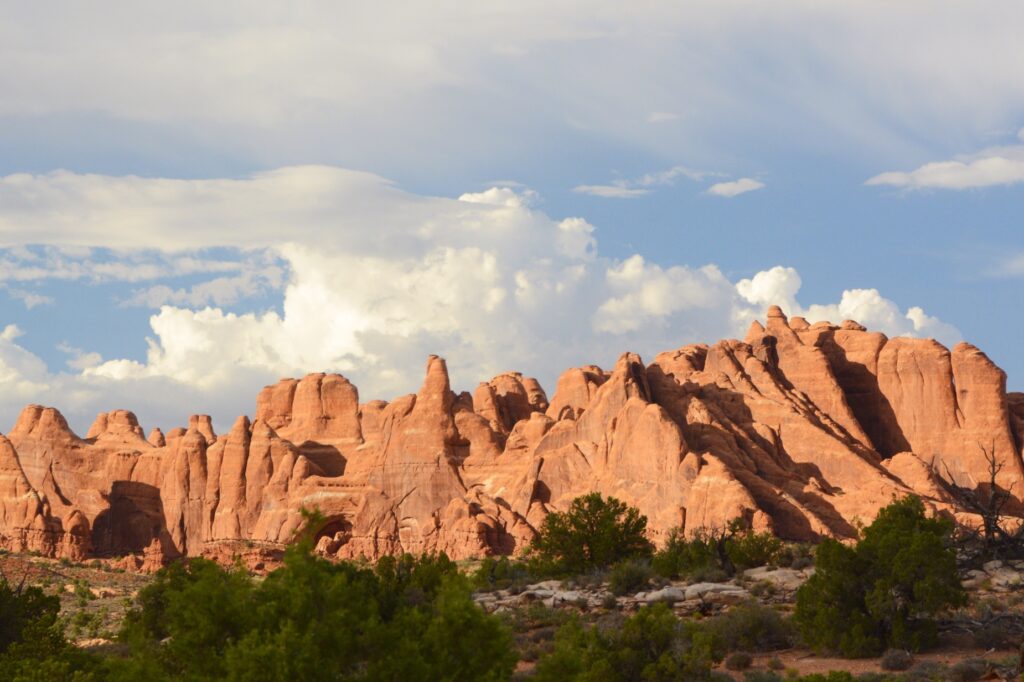
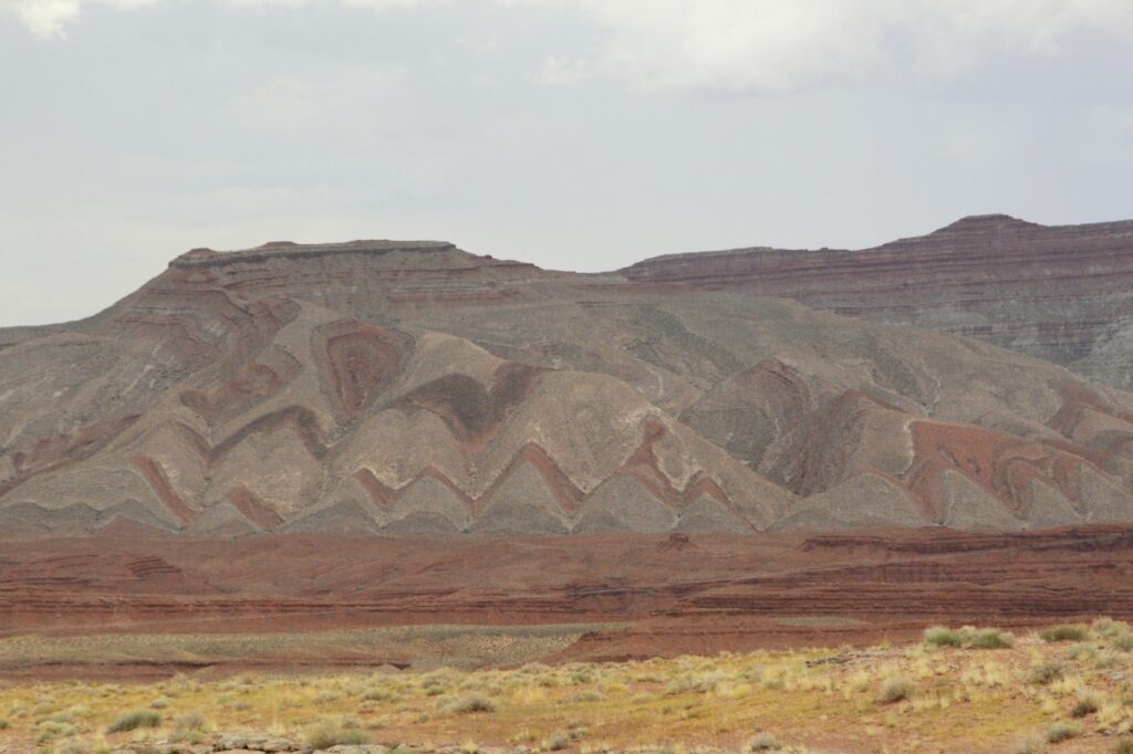
The drive along the canyon was beautiful. There were swirls in the rocks that showed water was a factor in forming the rocks we see today.
Swirls in rocks
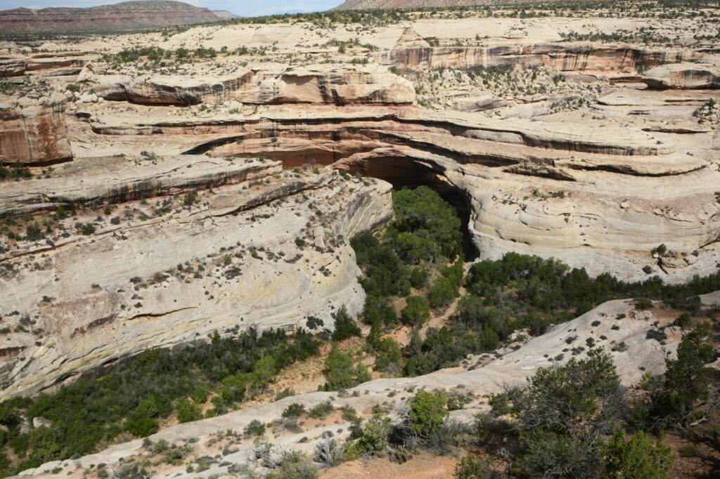
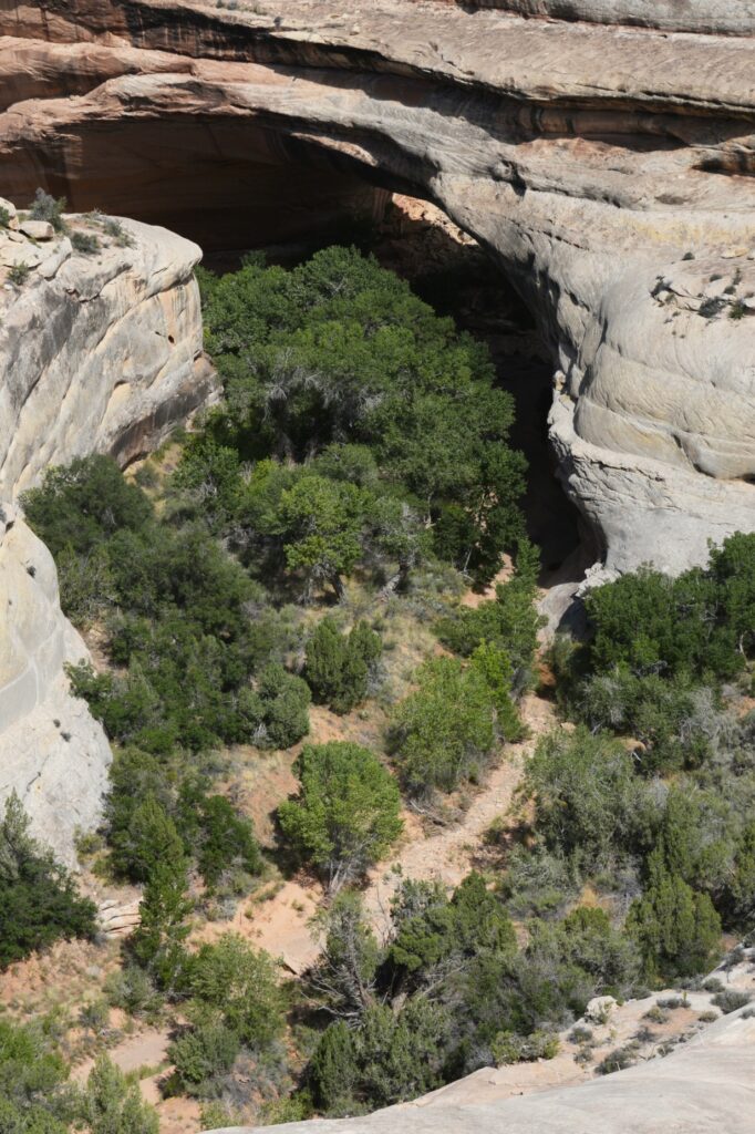
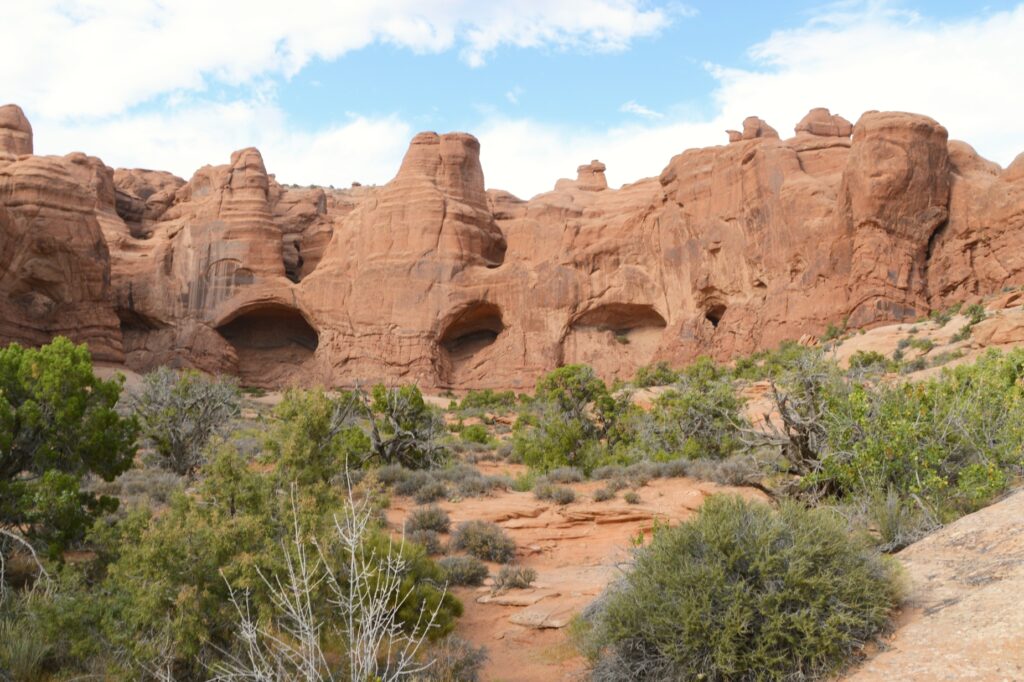
Kachina Bridge was harder to see because trees obscure the opening. It is smaller than Sipapu Bridge, but has a massive amount of rock above it.
Kachina BridgeKachina Bridge
The Owachomo Bridge is the smallest and thinnest of them all. A rock mound on the east end of the bridge is why it is named Owachomo. The word means “rock mound” in the Hopi Indian language.
Owachomo Bridge with rock mound on left
You can see that the rock on the top of this bridge is much thinner. Some believe it may be the oldest of the three because of the amount of erosion, but no one can tell for sure.
Owachomo Bridge
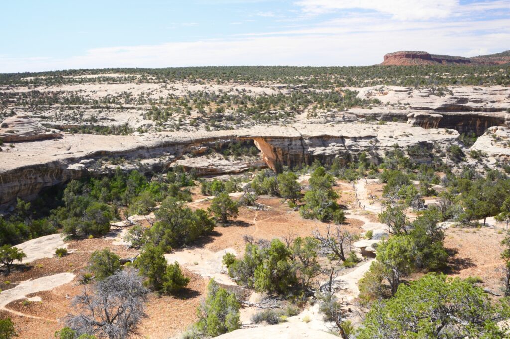
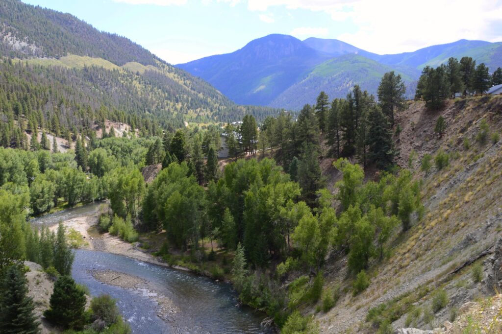
It was very hot that day, so we didn’t take any hikes down to see the bridges from below. The viewpoints from above don’t really showcase the enormity and size of the bridges. Perhaps someday we will return during a cooler time and take some of the hikes.
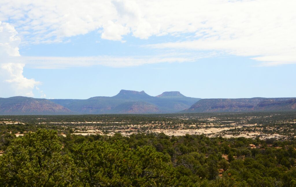
Bears Ears of Bears Ears National Monument
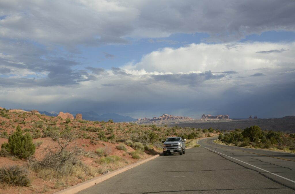
It was time for us to return to our campground. We ate our sack lunch and headed home. On our way out the park, I saw a sign about Bears’ Ears National Monument. I had been seeing signs for it, but didn’t know what to look for. In the distance were the Bears Ears for which the national monument is named. Someday, maybe we will explore it also.
“Great are the works of the Lord; They are studied by all who delight in them.” Psalm 111:2
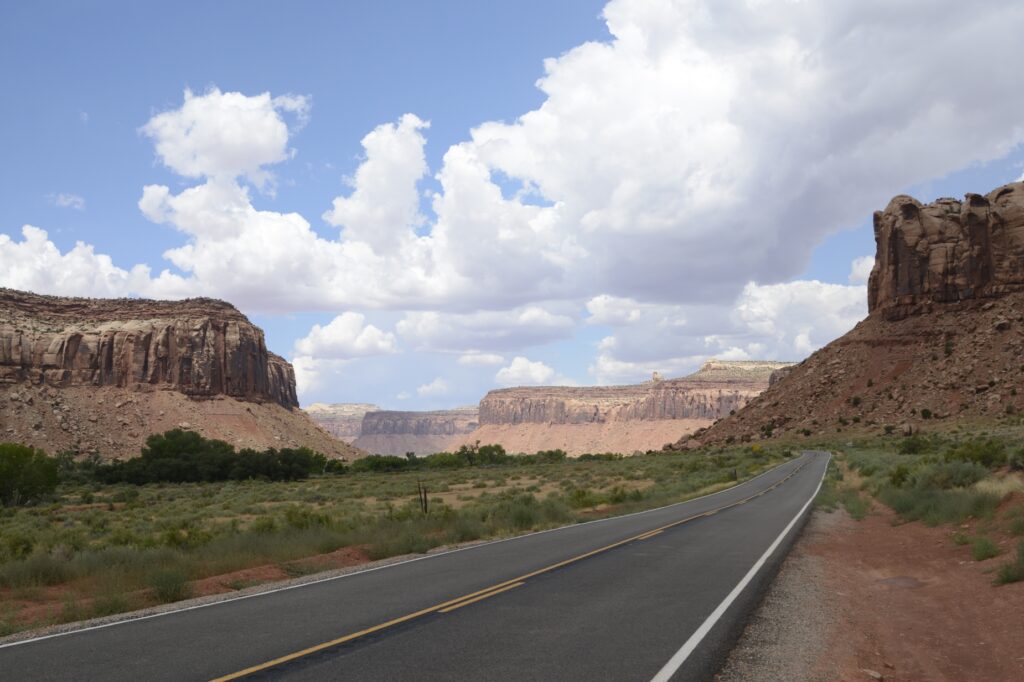
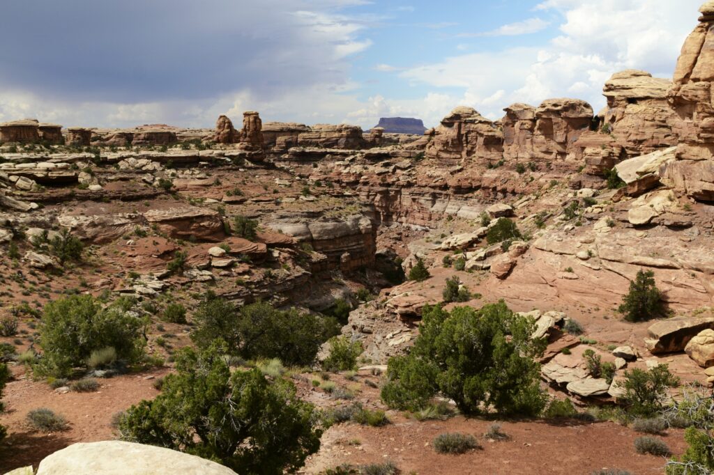
Several years ago, we visited Canyonlands National Park on the west entrance. The road follows the rim of the canyon where there are epic views of the canyons where one can see for miles. This time we visited the east entrance where we drove around the canyon floor.
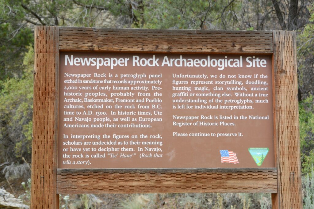
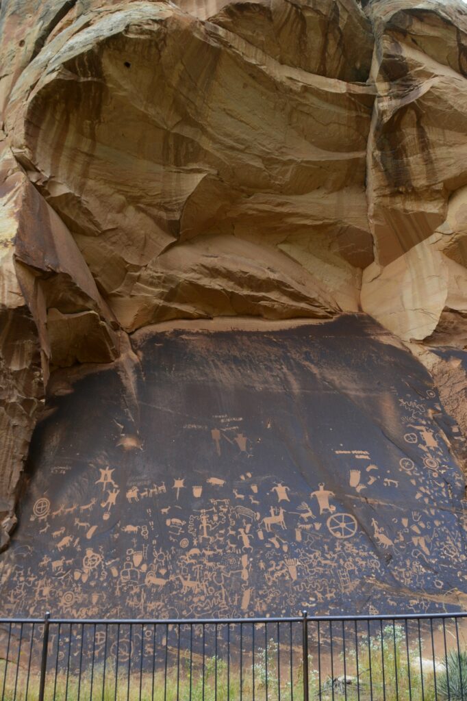
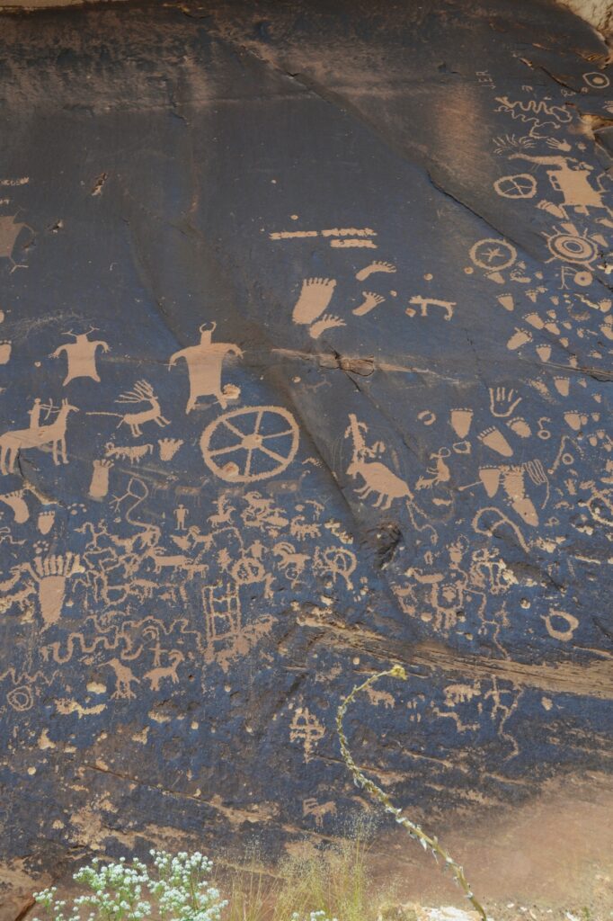
On our way there, we stopped to see Newspaper Rock Archaeological Site. This site is well protected by the overhanging cliff.
It was interesting to me to see that some of the feet drawn on the rock had six toes. It seems having an extra toe or finger was maybe highly valued. Excavations have found six-toed skeletons in Chaco Canyon in New Mexico.
Six-toed footprints, flying saucers, men with horns–what are these petroglyphs about?
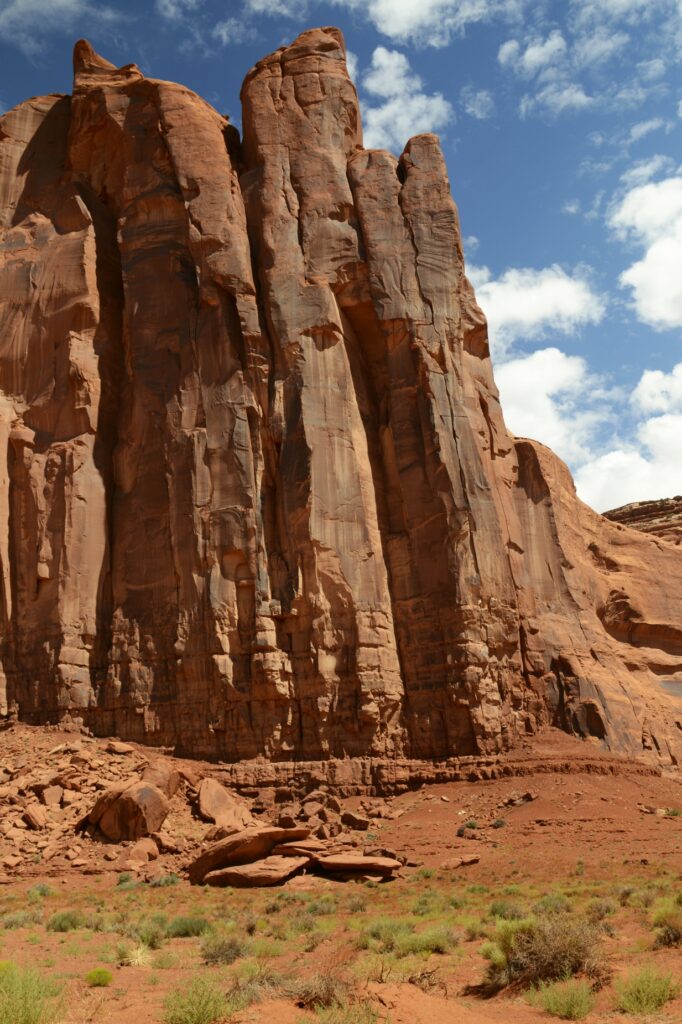
As we drove along the canyon floor on the way to the entrance of Canyonlands, the rock walls towered above us.
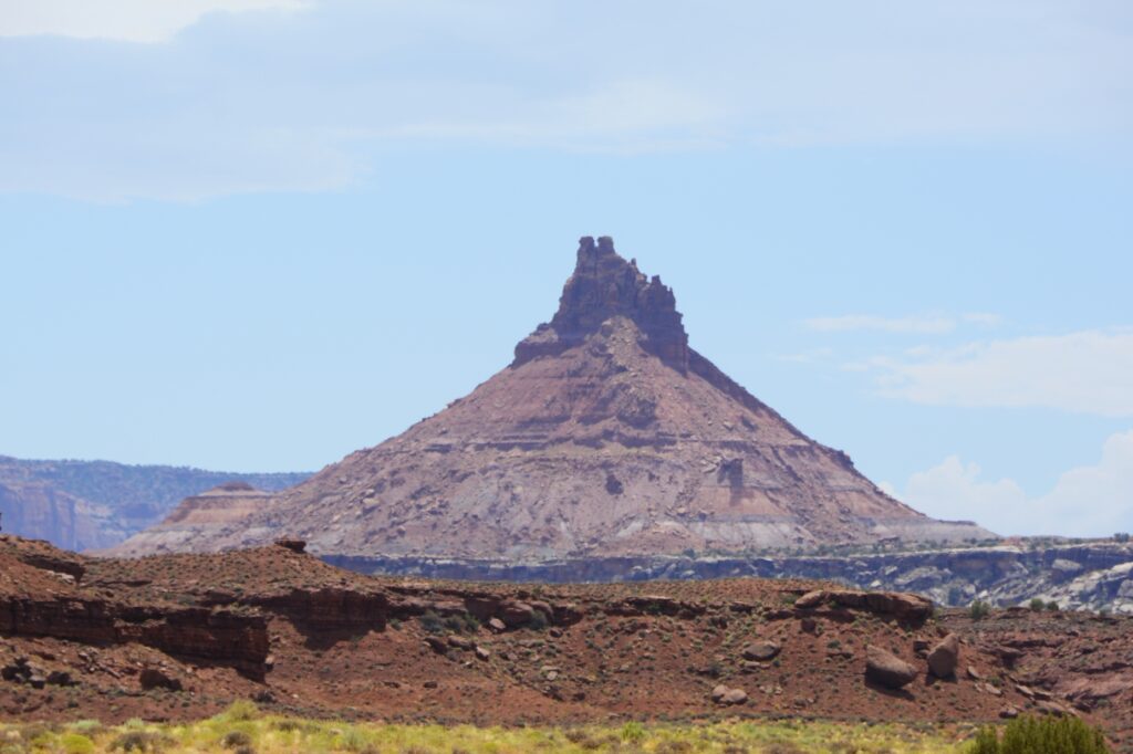
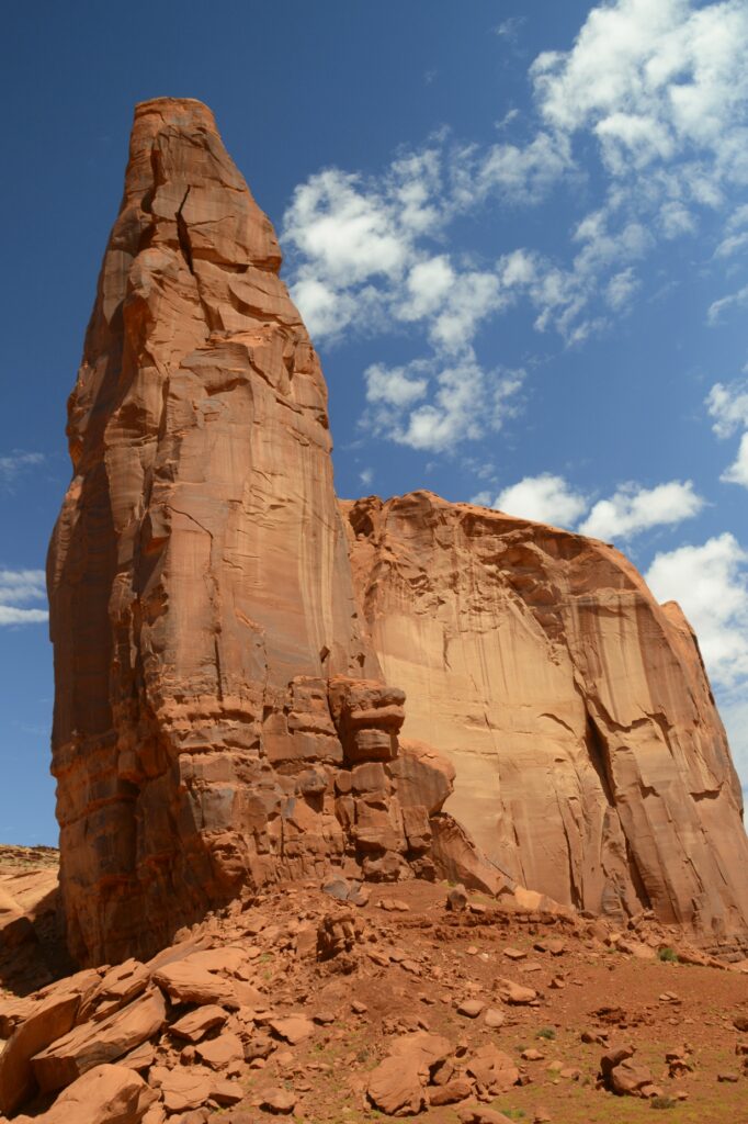
We saw this interesting rock formation along the way.
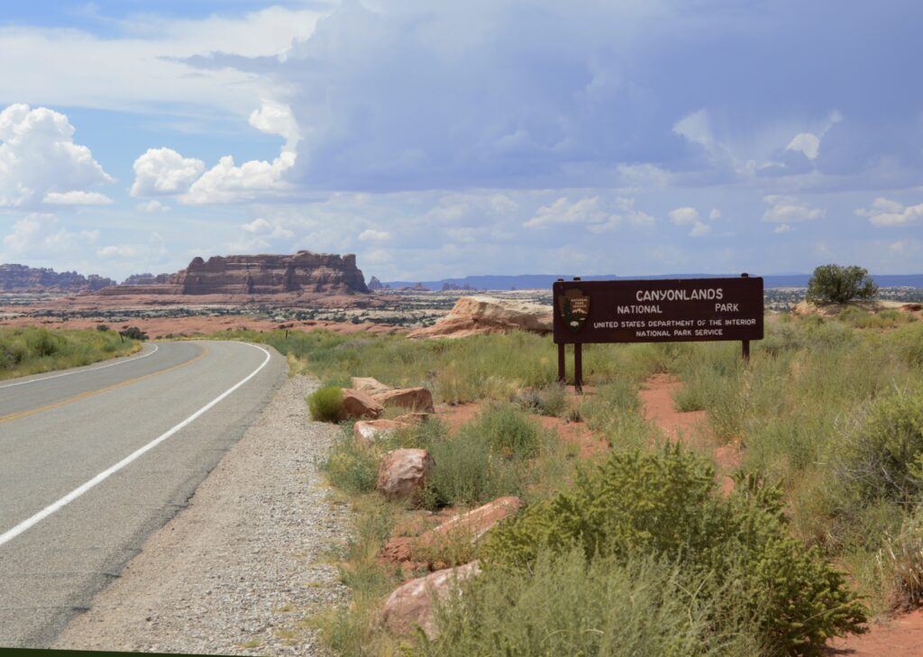
After driving several miles, we finally came to the entrance. We stopped at the visitors’ center where I found some post cards and a t-shirt.
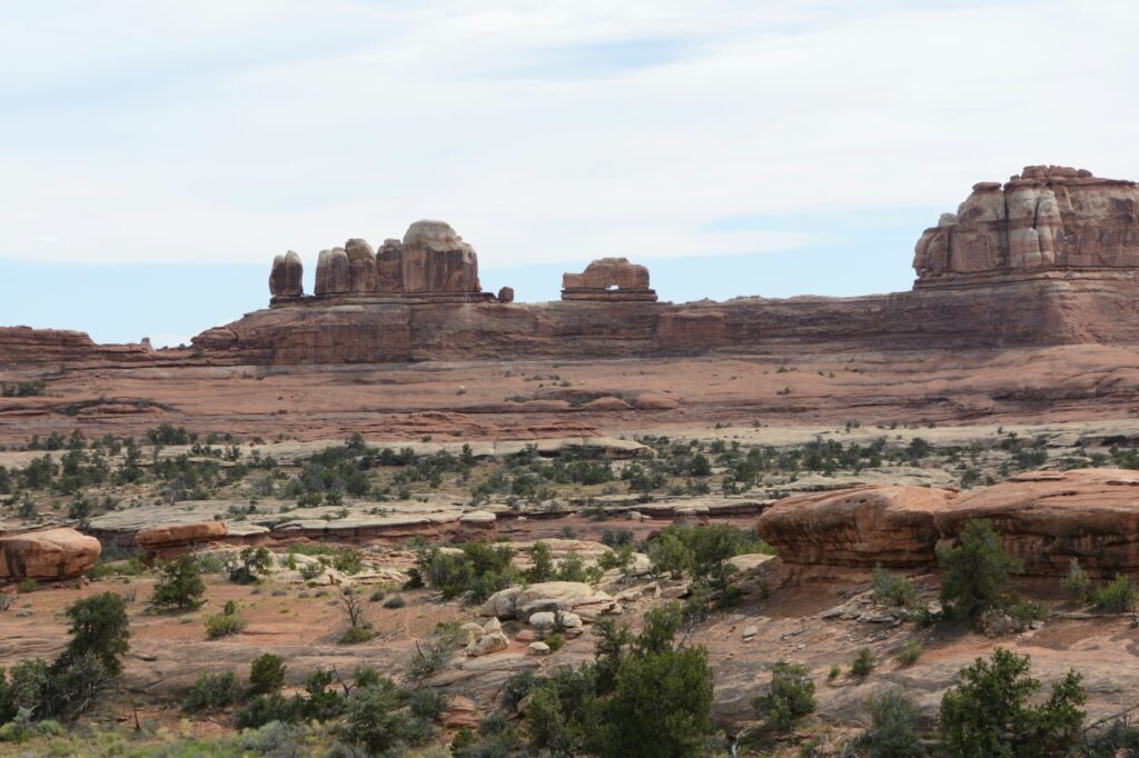
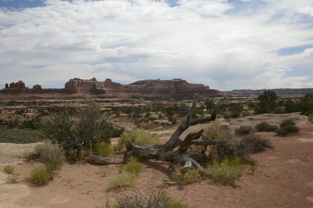
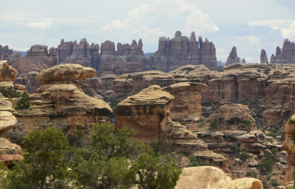
This section of the park is called The Needles because of the colorful spires of Cedar Mesa Sandstone that are prevalent in the area. There is only one road leading in and out of the area. We drove the scenic drive all the way to the end. Our first scenic viewpoint was the Wooden Shoe Arch Overlook. I think it was appropriately named.
Wooden Shoe Arch Overlook with Wooden Shoe Arch in the distance.
Our time in southeastern Utah was during the monsoon season of August. Every day a rain storm would bring clouds and often times rain.
We drove through the campground at the park just to get an idea of what the sites looked like. There were no hook ups and the sites were very small. Water was available only seasonally at the restroom facilities.
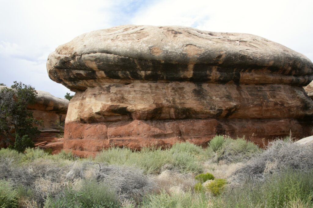
The rock formations around the campground looked like giant toadstools.
Toadstool like rock formations among the campground area.
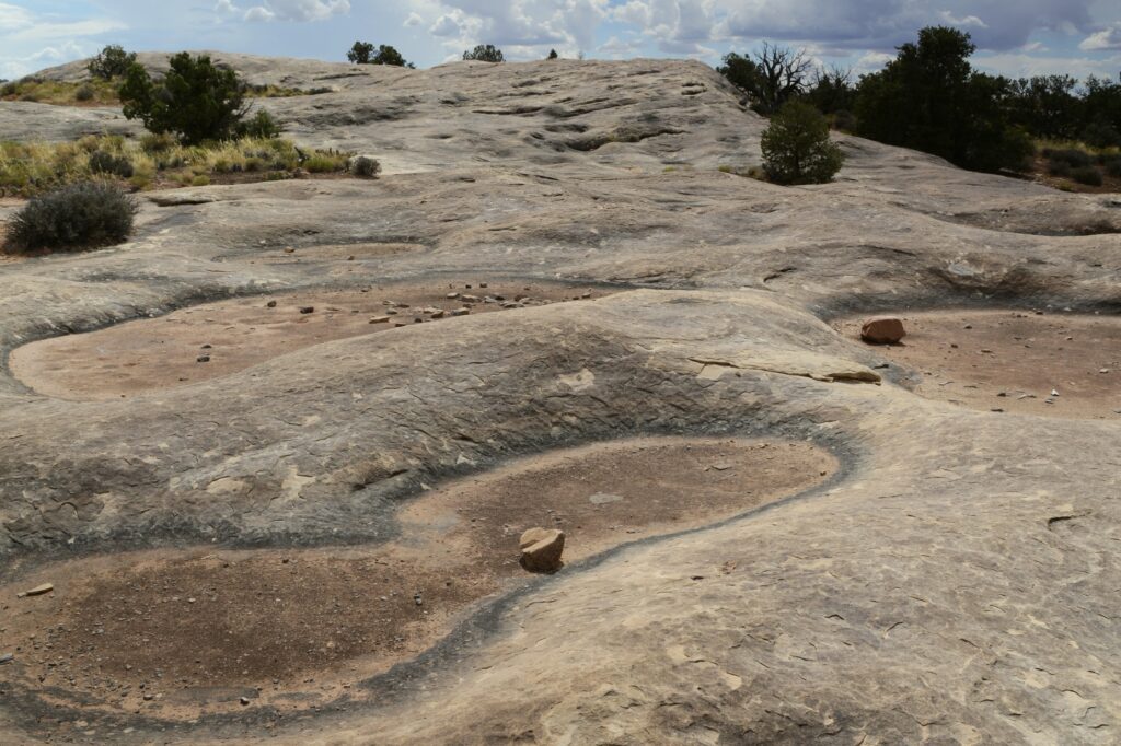
We drove to Pothole Point where we saw the potholes that collect water when it rains. Even though they were dried up, there is a whole ecosystem with aquatic life that comes alive when the rains come. It’s important not to step in the holes because of that. They are a source of water for the wildlife in the rainy season.
Pothole Point had many potholes to collect water during the rains.
At the end of the road is Big Spring Canyon Overlook. It was here that we got a good look at the pinnacles from which the name “The Needles” comes from.
The Pinnacles in the background give this section of the park its name: The Needles.Big Spring Canyon Overlook
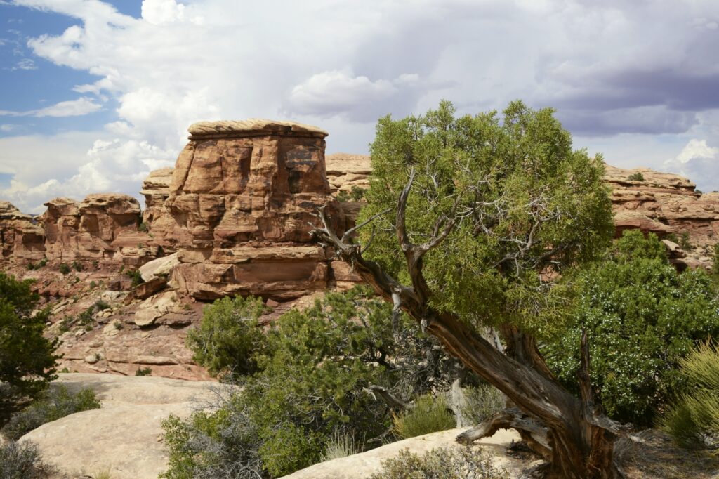
The Utah Juniper tree is a hearty tree that can survive the harshest of conditions due to its extensive and deep root system. The roots can grow 25 feet deep and spread out for 100 feet from the tree.
Utah Juniper clings to the rocks at Big Spring Canyon Overlook.
Although The Needles section of Canyonlands National Park was interesting and beautiful, it didn’t compare with the views from the western entrance. I was mildly disappointed. But I’m glad we got to see this area of the park.
We drove back to our campground in Monticello, Utah. That spot turned out to be a perfect base camp for visiting all the attractions of southeastern Utah. We still had at least one more area to explore, but I will save that for the next blog.
“No one is as holy as the Lord! There is no other God, nor any Rock like our God.” I Samuel 2:2
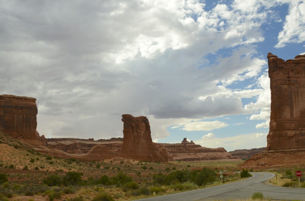
There are five national parks in the state of Utah. Even though we’ve visited all five in the past, we wanted to revisit Arches and Canyonlands again. There’s never enough time to see everything all at once.
Arches NP is now so popular that it requires a timed entry ticket to visit during peak hours. We found the afternoons had plenty of time slots available. I was also hoping to get some sunset photos.
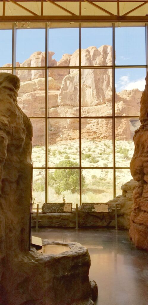
Visitors’ Center
We started our visit this time at the visitors’ center. It was built in 2005, so it was our first time to see it. I especially liked the views from the large windows.
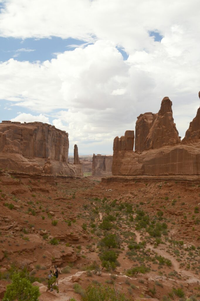
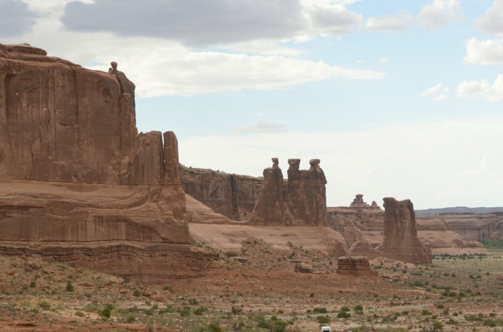
Park Avenue Viewpoint and Trailhead
Our first stop along the 40-mile scenic drive was the Park Avenue Viewpoint. From the viewpoint it was like looking through a window at the mountains beyond. The trail climbed down into a valley between massive rock formations.
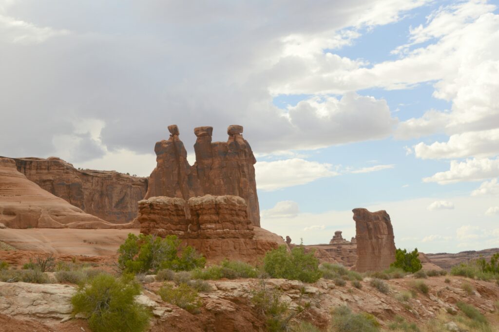
Three Gossips
The three gossips looked familiar to us from previous visits. I call them “Three Wise Men” because they look like they’re wearing turbans.
Erosion is constantly wearing down the sandstone rock. Some arches eventually collapse. Such is the one shown below. The three rock columns were once connected on top by a layer of rock.
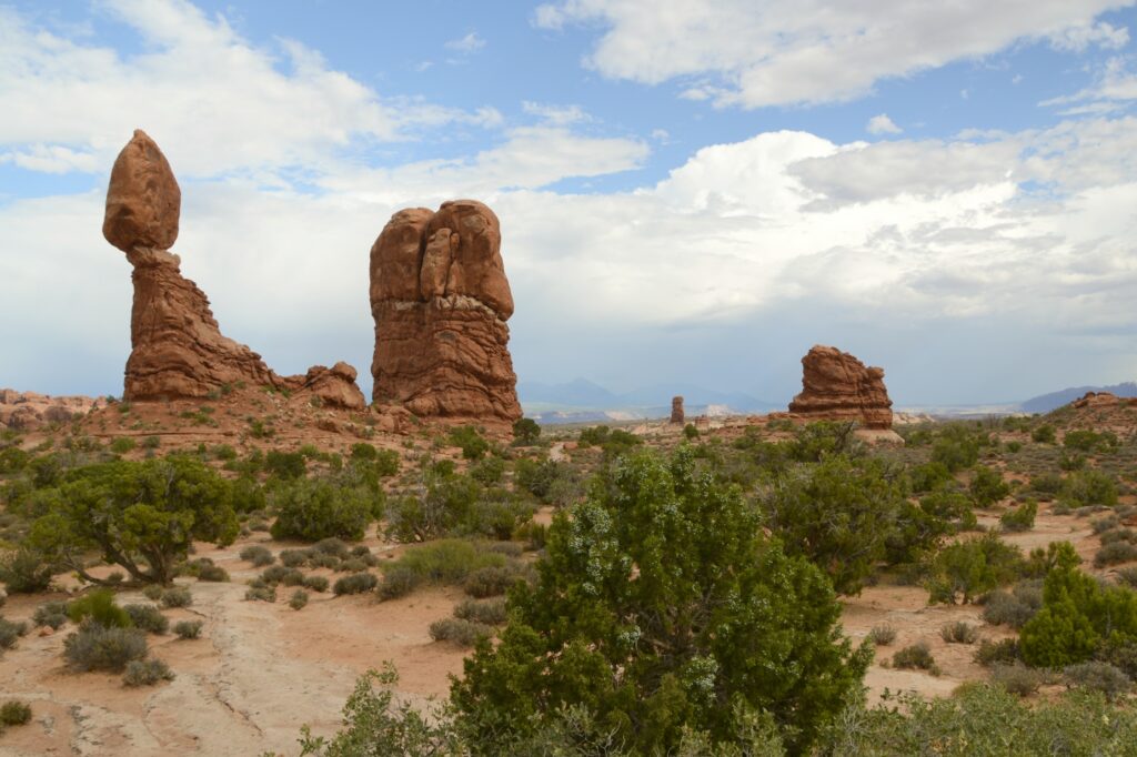
Other types of formations in the park are balancing rocks, such as this one.
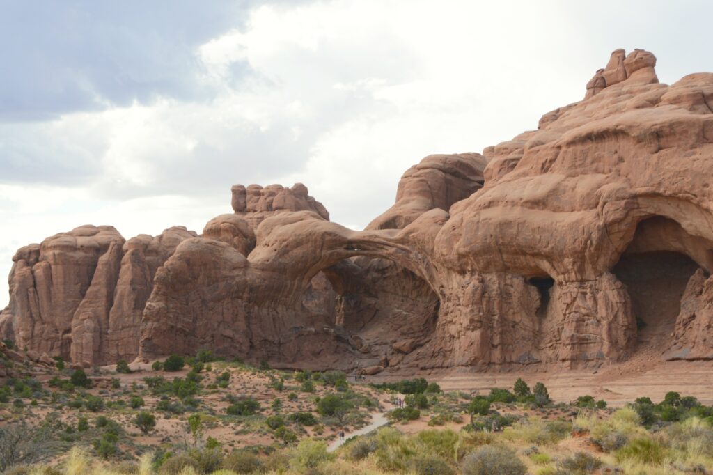
This double arch was formed from water erosion from the top, rather than more typical erosion from the side. Next to them are the beginnings of other arch caves.
Double ArchesDouble Arches and arch caves
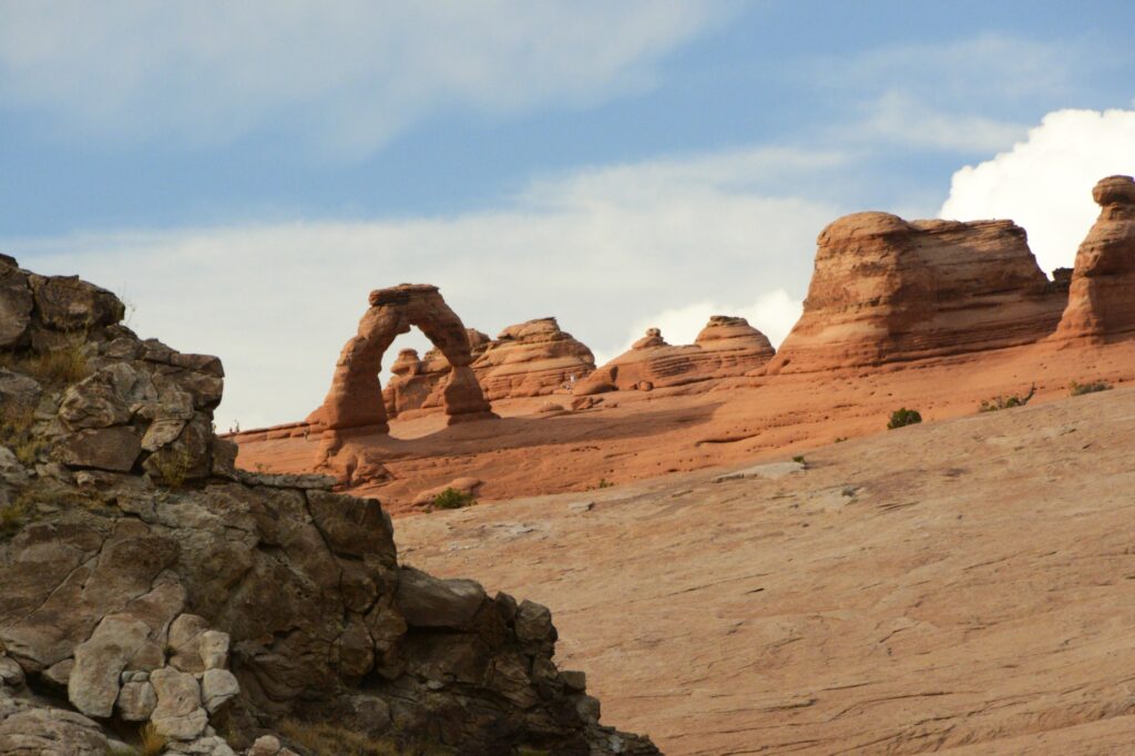
Delicate Arch has had many names in the past, including “Old Maids Bloomers”, “Pants Crotch” and “School Marm’s Pants.” Although the rumor is not true that the names of Delicate Arch and Landscape Arch were inadvertently exchanged due to a signage switch, in my opinion, the switched names fit better than the current ones.
We hiked up to this arch years ago. But this time, I just took a photo from a distance with a zoom lens.
Delicate Arch
There are over 2,000 natural arches in Arches National Park. There are also hundreds of towering pinnacles, huge rock fins, and giant balanced rocks.
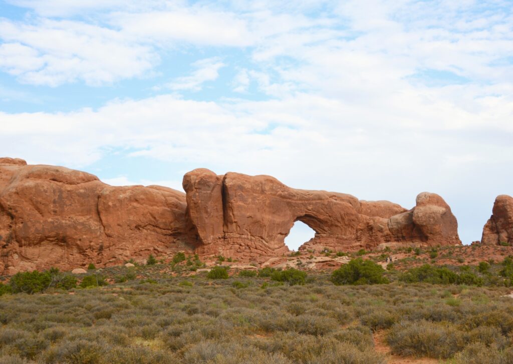
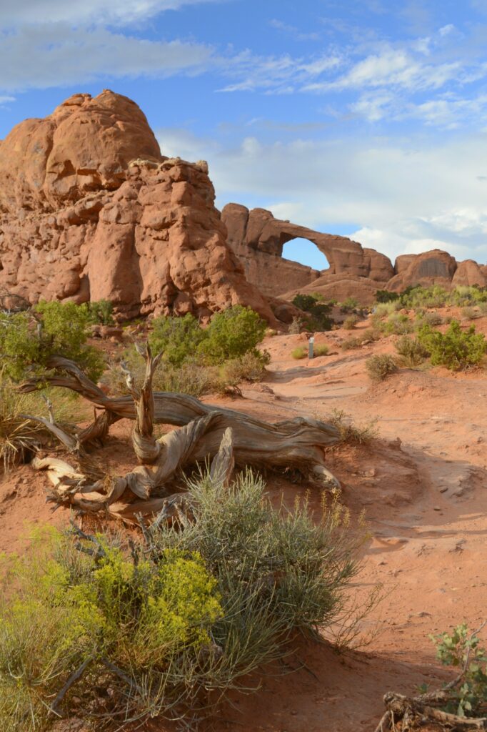
North Window
Windows are formed by blowing sand that erodes the rock instead of water erosion. North and South Windows are sometimes called the “spectacles” because they look like eyeglasses.
North and South Windows
Formations called “fins” are formed when water flows along parallel joints or fractures and erodes the rock away in “slices”.
Fin rock formations
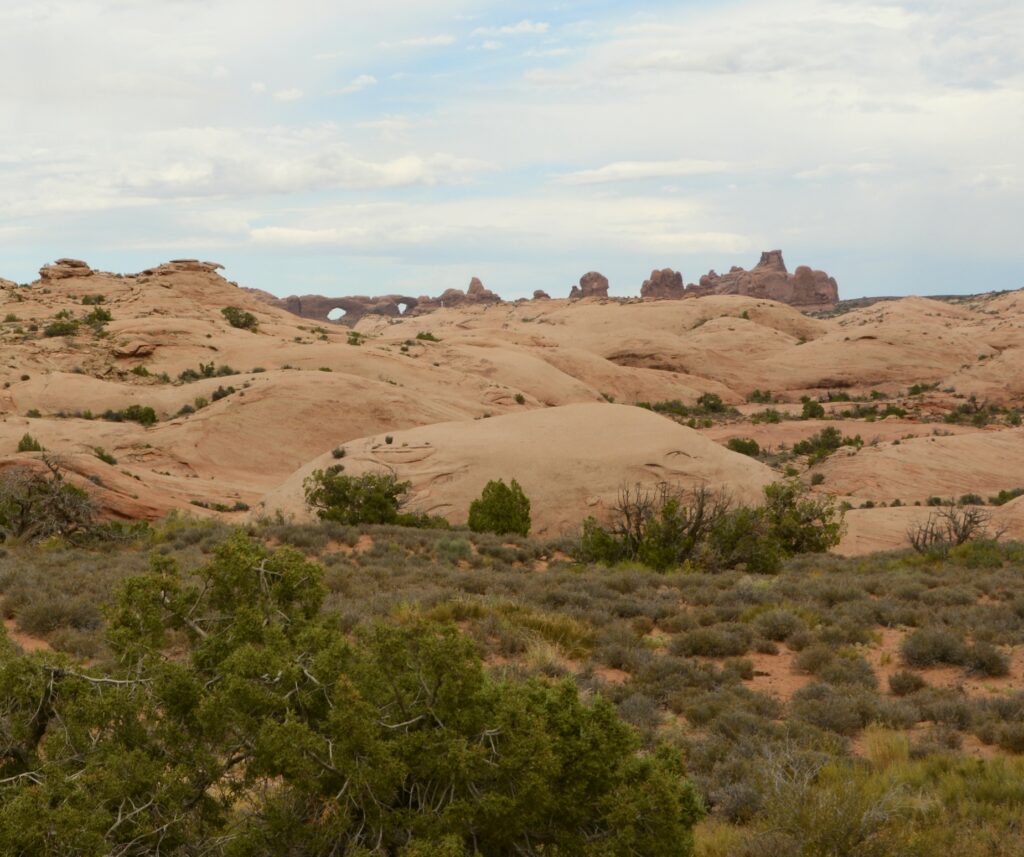
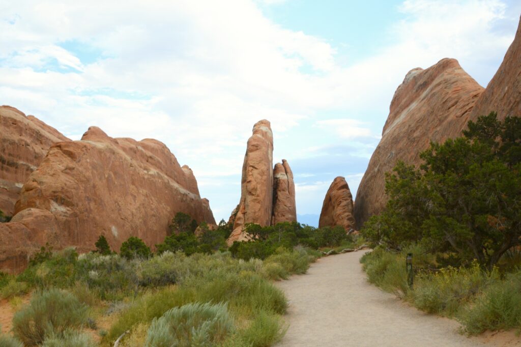
As the afternoon wore on, the clouds parted and the sun lit up the rocks. We weren’t at the end of the scenic drive yet. There were still more sites to see.
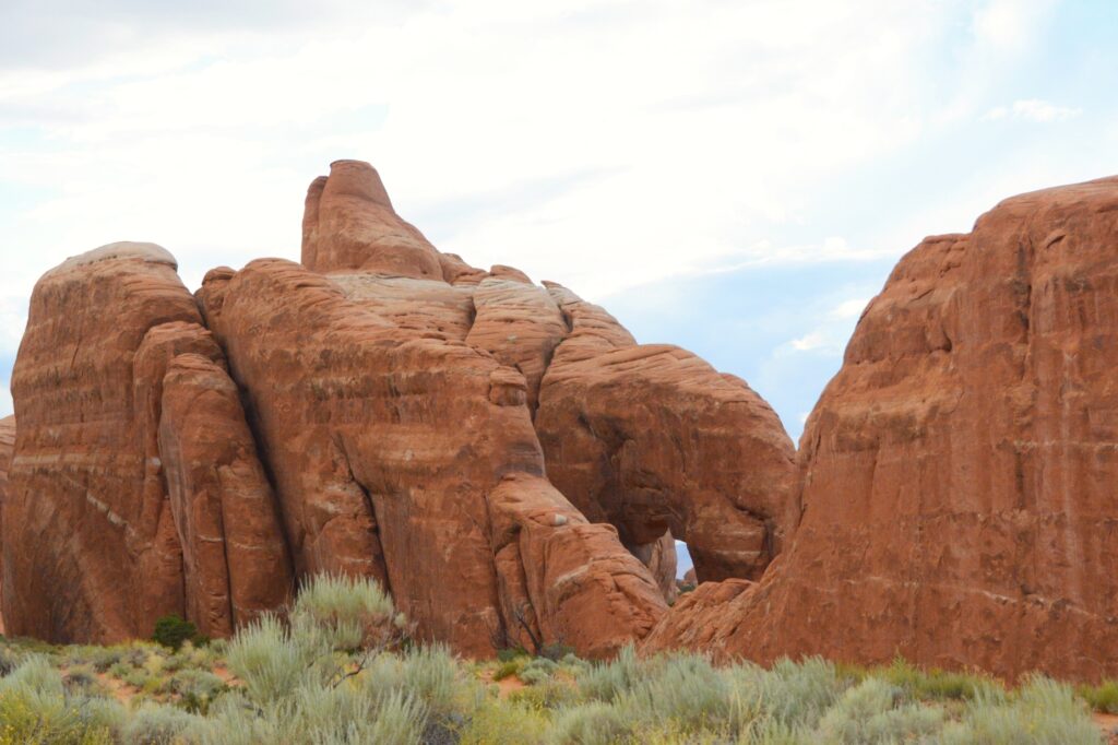
Driving along the road, we could see the beginnings of many arches forming in the rocks.
Cave arches
Skyline Arch was one of my favorites simply because you could see it from the road and it had this interesting twisted old tree in front of it.
Skyline Arch
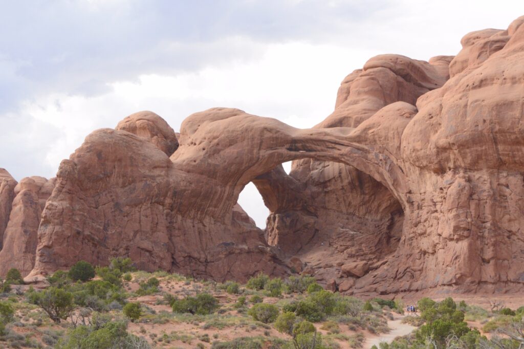
At the end of the scenic drive is Devils Garden Trailhead. This trail leads to Landscape Arch, which is the longest rock arch in North America. It is very long and thin, which makes me think it should have been named “Delicate Arch.”
The wind had kicked up, and it was late in the day, so I only hiked a short way on the two-mile hike to the arch.
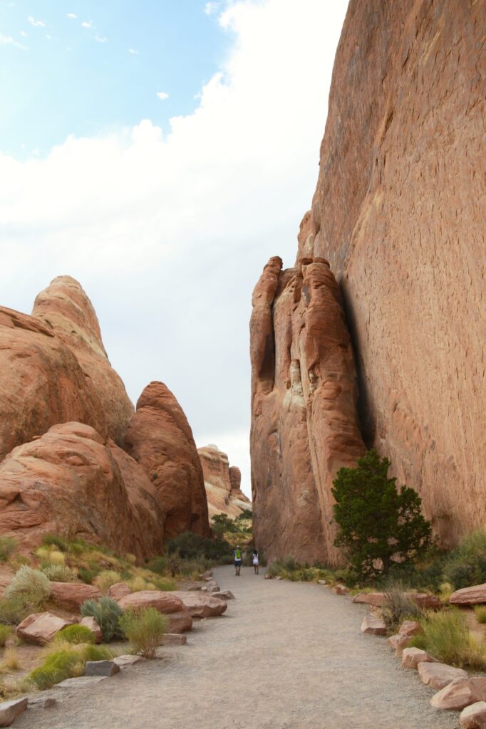
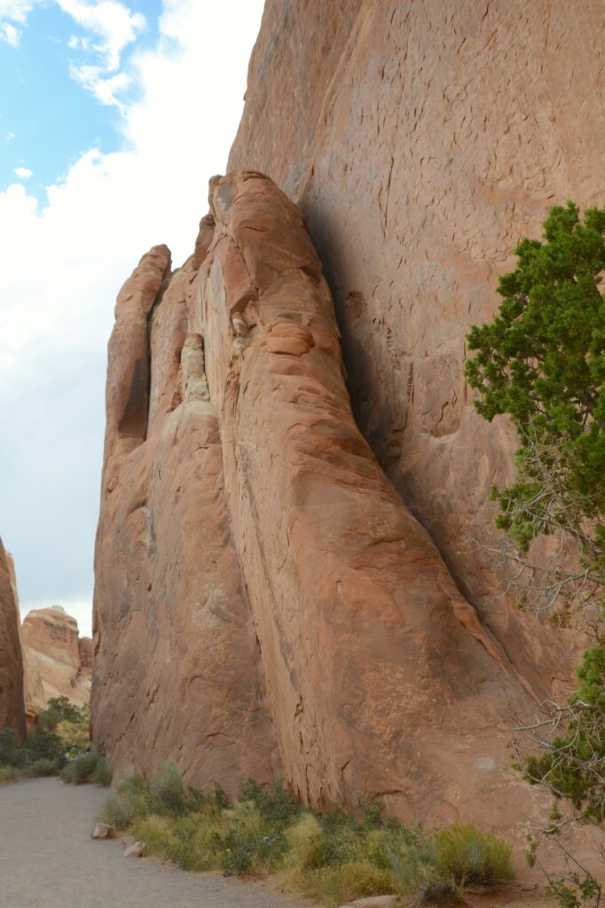
The Gates of Argonath
The entrance to the trail is something like walking through the Gates of Argonath in the Lord of the Rings. The rocks tower on either side of the pathway like guards.
Entrance to Devils Garden TrailheadDevils Garden Trail
I hiked far enough to see one of the other arches along the trail called Pine Tree Arch, then turned around and headed back.
Pine Tree Arch
We noticed these holes in the rock above the parking lot. It shows how water enters the rocks and begins the erosion process that eventually forms arches.
The rain was all around us while we were there, but it finally caught up with us as we were leaving.
The rain caught up with us.
Our second visit to Arches made for a beautiful day enjoying the beautiful scenery created by God.
He is the Rock; His deeds are perfect. Everything He does is just and fair. He is a faithful God who does no wrong; how just and upright He is! Deuteronomy 32:4 TLB
It was a cloudy morning when we left Monticello, Utah, to drive to Monument Valley across the Arizona border. It would take us nearly two hours to get there. I was wishing that the sun would pop out sometime during the day.
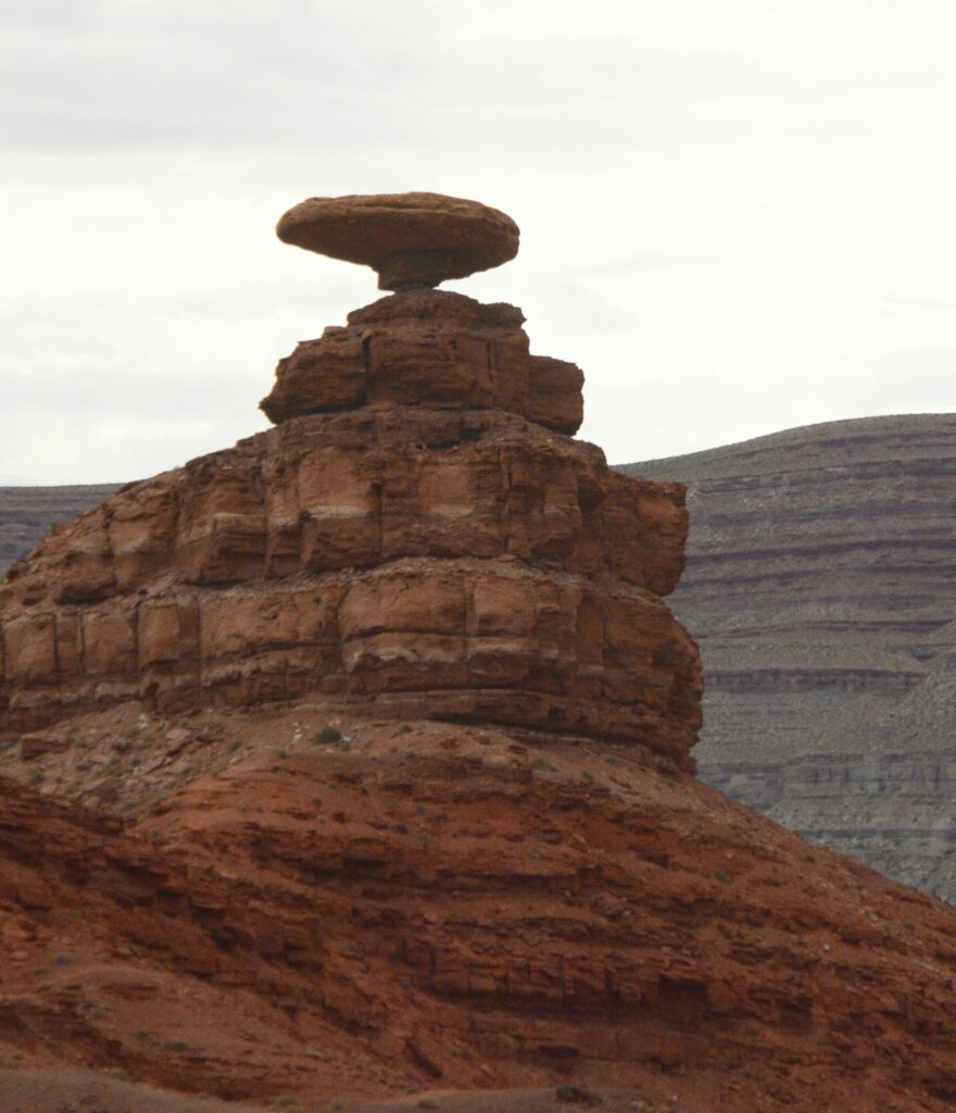
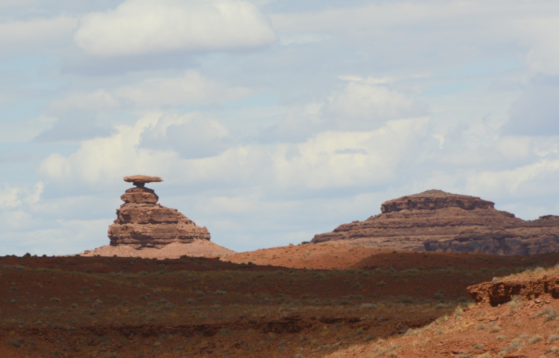
Along the way, we passed the little town of Mexican Hat, Utah, and the rock formation which gave it its name. Doesn’t it looks like a man sitting on a rock wearing a large Mexican hat?
Mexican Hat on Highway 163Mexican Hat Rock
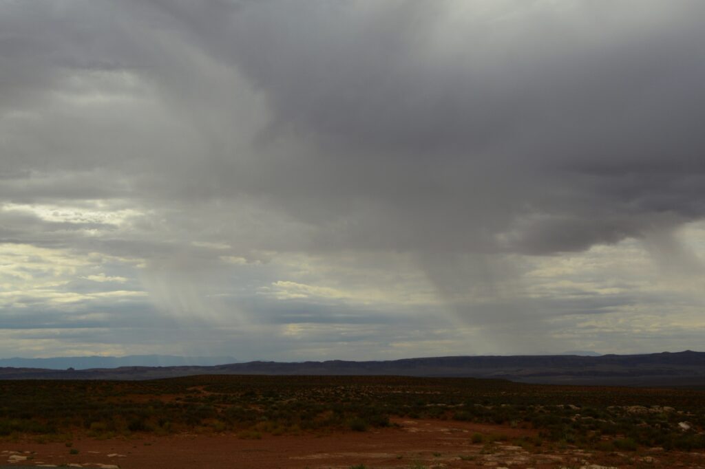
As we traveled further, we could see rain in the distance. I was hoping for some sunshine, and it wasn’t long before I got my wish.
Rain over the desert
A famous tourist spot outside Monument Valley is the location of a scene from the movie “Forrest Gump.” We didn’t get there early enough to beat the crowds. People were standing in the road, sitting in the road, lying in the road, blocking the road—all just to get a photo. It was a mess.
I just wanted a photo of the road leading up toward the mountains–without all the people. It turns out that was impossible. So I settled for a less than perfect photo.
Location of Forrest Gump movie scene
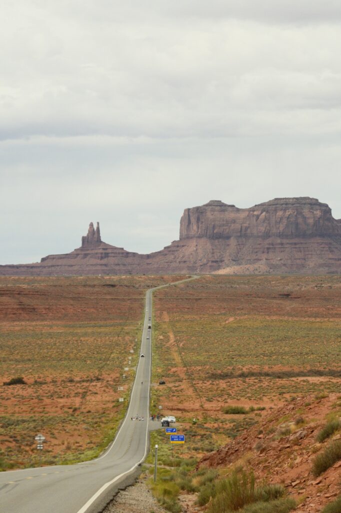
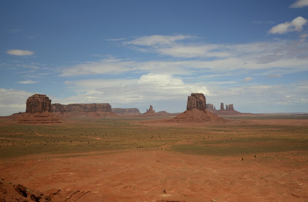
As we got closer to our destination, we could see some of the classic Monument Valley rock formations sticking up from the desert floor. At the same time, the sun began to peek out from the clouds.
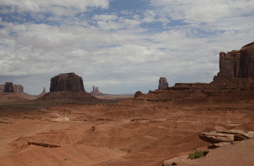
Monument Valley is located on Navajo Indian Reservation. It is owned and operated by the Navajo Indian Tribe.
We first went to the Visitors’ Center. The Visitors’ Center is situated overlooking Monument Valley. We could see the road we would travel, winding its way across the desert floor.
Viewpoint from Monument Valley Visitors’ CenterLayers of rock as seen from balcony of visitors’ center
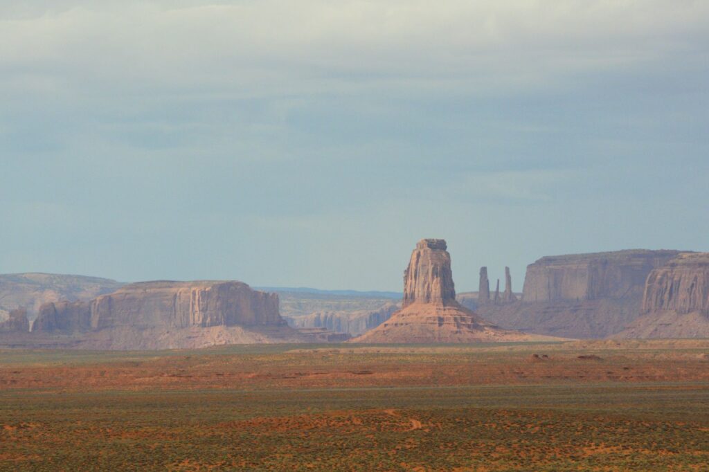
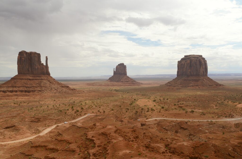
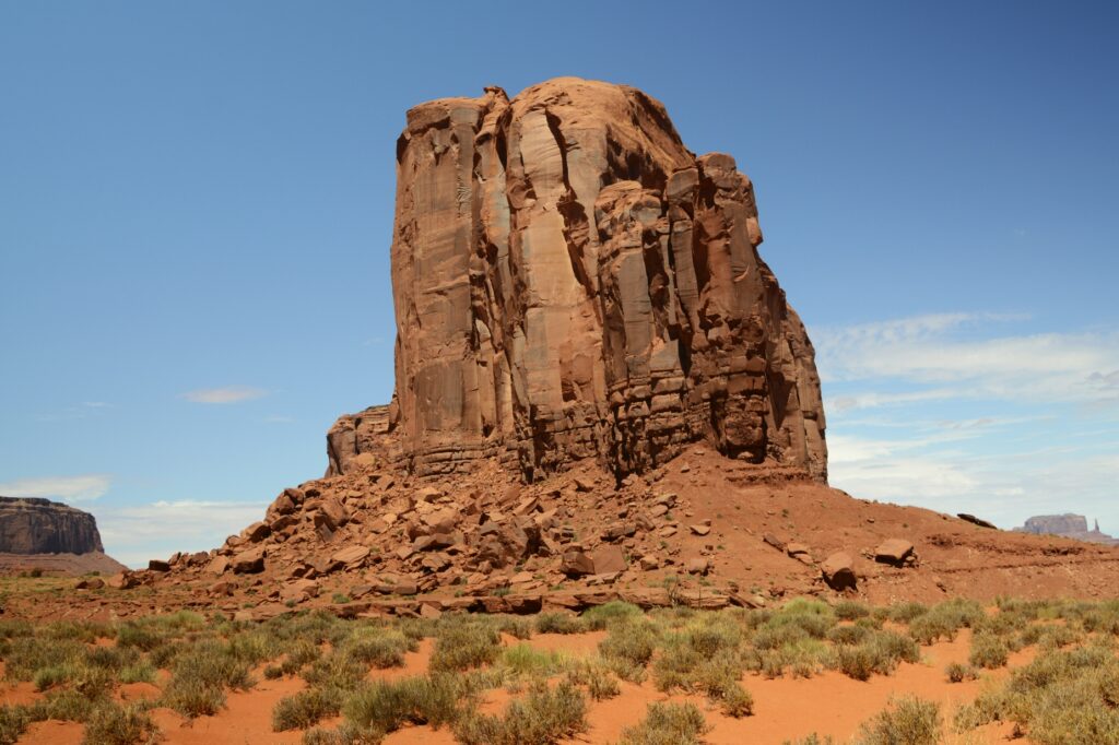
The balcony at the visitors’ center is one of the best places to get photos of the valley. Seen below are the classic “Mittens” with their “thumbs” sticking out of the sides, and Merrick Butte (on the right).
The two mittens and Merrick Butte
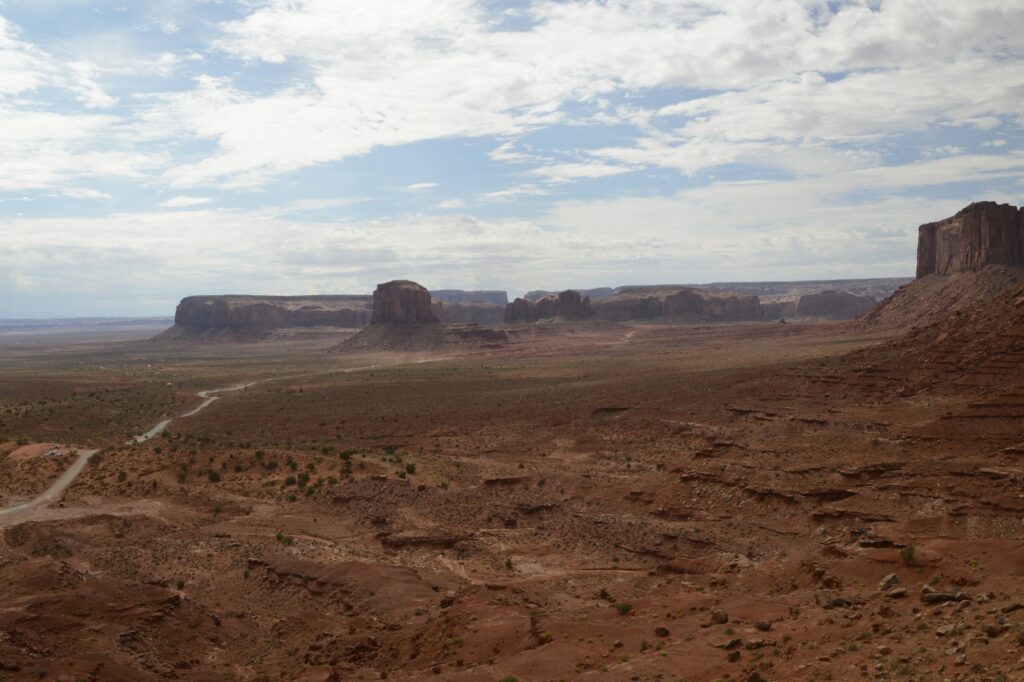
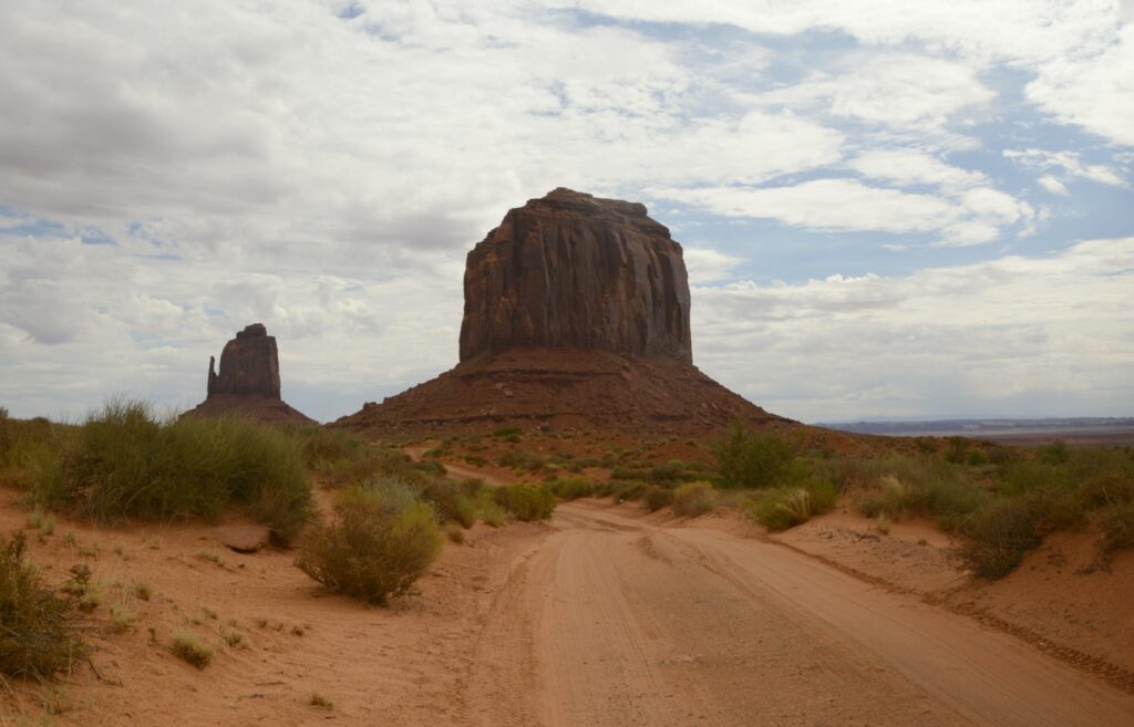
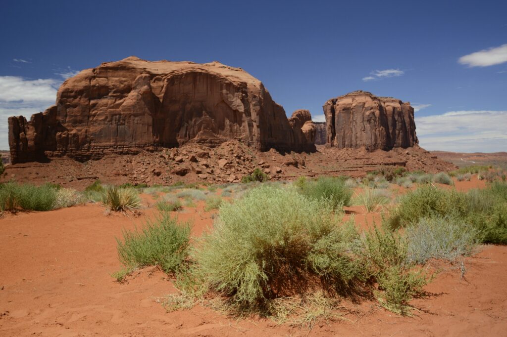
A four-wheel drive vehicle is recommended to drive the 17 mile loop. The first part of the road is a series of very steep and rutted switchbacks. Even in a 4WD truck, it was a rough ride. The speed limit was 15 mph, but I never got above 7 or 8 mph on that terrible road. It was dusty and bumpy. Our truck was coated with a fine layer of red dirt by the time we were done.
Merrick Butte. The dirt road is very primitive and rough.
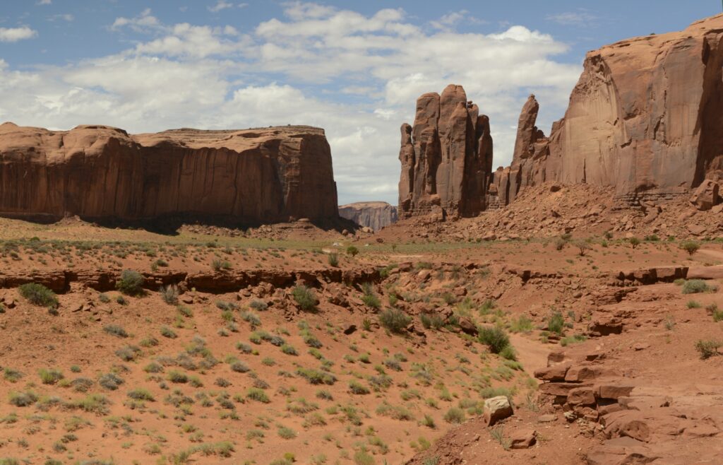
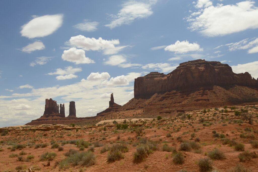
There are eleven marked viewpoints along the drive. The names describe the rocks, if you have an imagination.
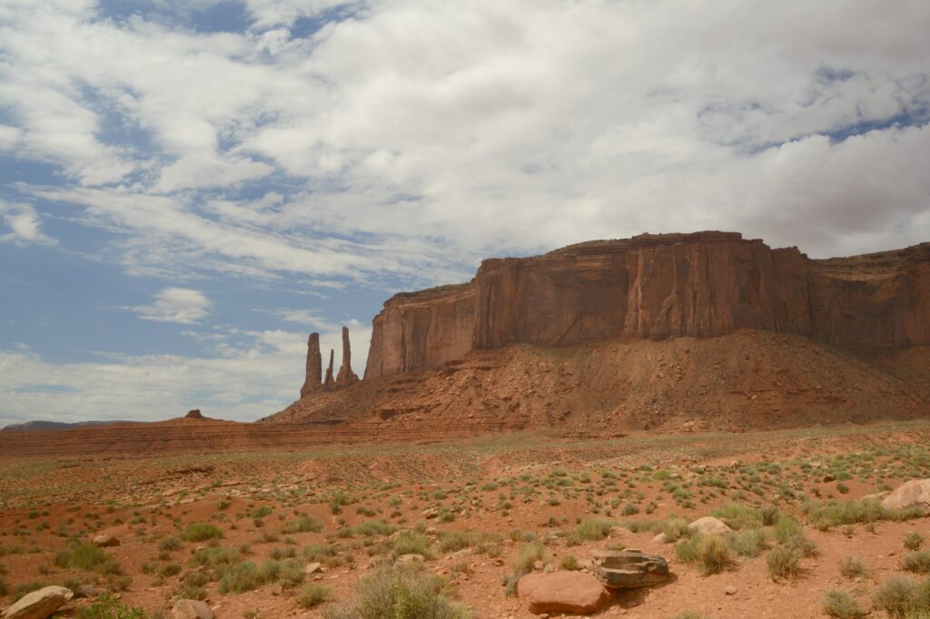
Sentinel Mesa and Three Sisters
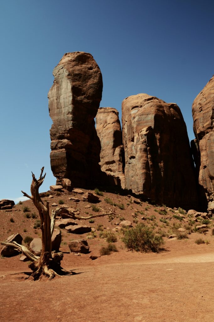
Three kinds of formations dominate the valley: mesas, buttes and pillars.
Three Sisters are three rock pillars.
The hard top layers of the buttes and mesas called caprock resist weathering and erosion, but the softer sandstone layers below are eroded away by rain, snow, wind and ice. The debris that falls down the sides is known as scree or talus.
Scree at the bottom of sandstone cliffs
The rock walls have many interesting colors probably from minerals in the rocks and water.
Some of buttes and spires are over 1,000 feet high.
As the day progressed, the sun broke through the clouds. We had blue skies with puffy white clouds.
Big Indian Butte
Many western movies were filmed in Monument Valley. One of the iconic scenes is John Ford’s point as seen below. You may have seen this viewpoint in movies like “The Searchers” with John Wayne.
At this viewpoint, there was a Navajo Indian available to take photos of tourists sitting on a horse, for a price, of course.
John Ford’s PointCly Butte
On our way to the Artists Point, was Thumb butte. I thought it was a pretty good description of this rock formation. I give it a thumbs up!
The Thumb
The “window” between these rocks looks out on a large plain called Artists’ Point. The road leads to where you can get a view of the valley on the other side.
North Window viewpoint
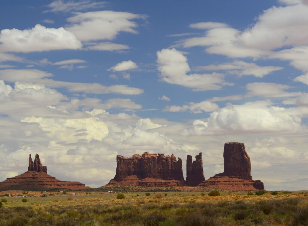
Views like this have made Monument Valley one of the most photographed places on earth.
View from artists’ point
The complimentary colors of the red rocks and green shrubs along with the blue sky inspire all kinds of artists, including me.
Desert Beauty
If you don’t have time to drive the seventeen mile road, there are still many great views from outside the park. These photos were taken from the highway. The blue sky and clouds made a beautiful backdrop against the red rocks.
View from outside Monument Valley
In the photo below, these formations from left to right are called King on His Throne, Stagecoach, Bear and Rabbit, and Castle Butte. Which one is your favorite?
King on his throne, Stagecoach, Bear & Rabbit and Castle Buttes
On our way back home, I noticed this mountain near Mexican Hat, Utah. Notice the folds in the rock. The rock had to be soft when it was folded because the rock would break if it was solid like it is today. Is it likely that these layers were laid down during Noah’s flood, and folded as the mountains were raised? Wouldn’t the layers have been worn away by erosion if it had taken millions of years for the layers to form as scientists tell us? Food for thought.
Folded mountain layers near Mexican Hat, Utah
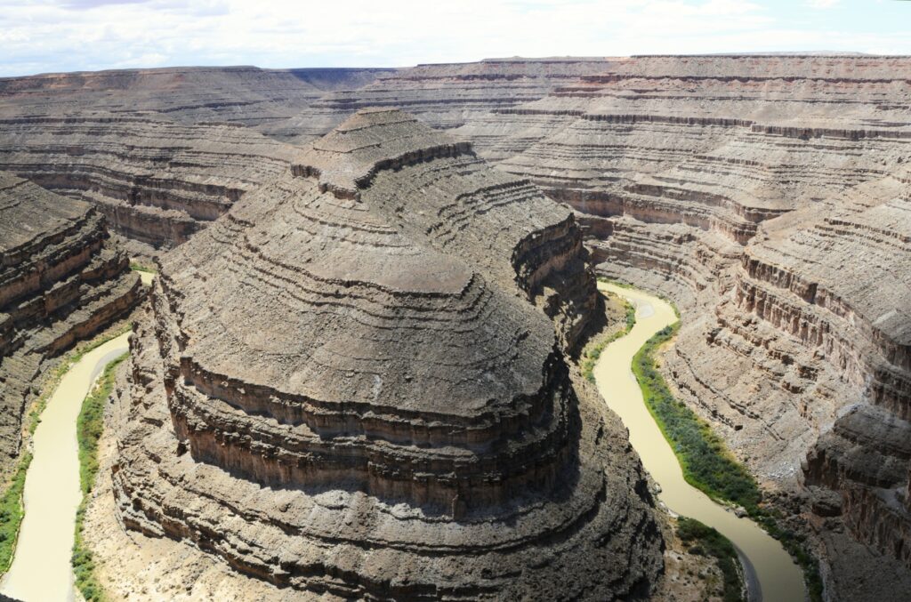
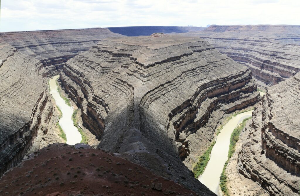
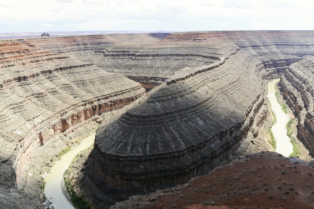
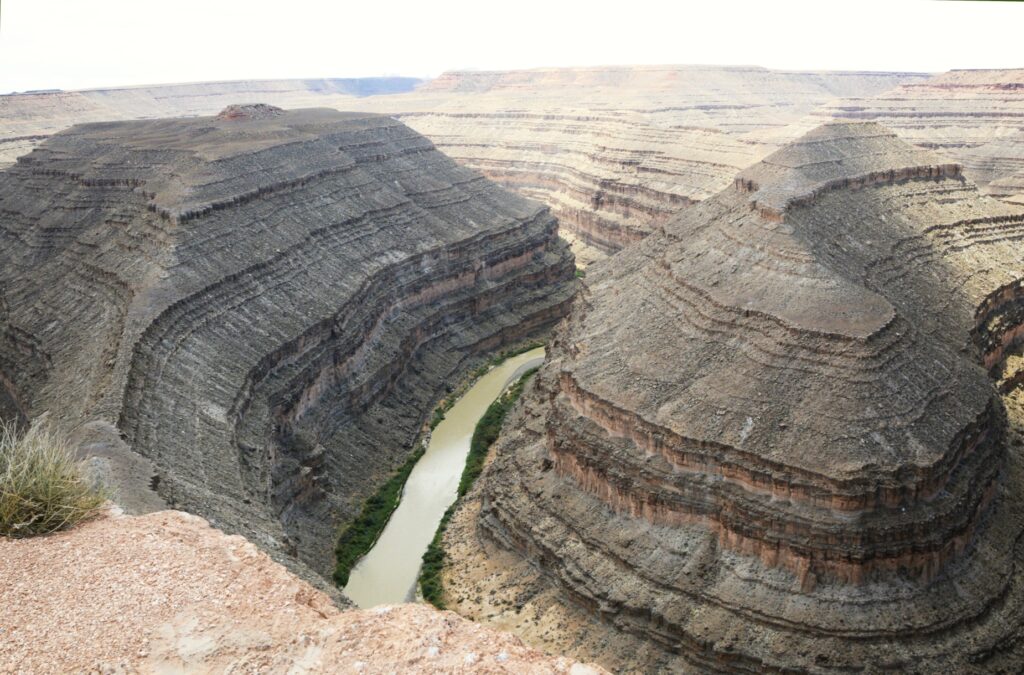
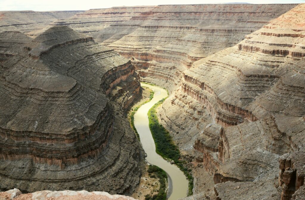
Goosenecks State Park
On our way back to Monticello, Utah, we made a detour to visit Goosenecks (Utah) State Park.
Goosenecks State Park, Utah
This small 10 acre Utah state park overlooks the San Juan River meandering and cutting a gorge of 1,000 feet deep.
It wasn’t quite as beautiful as Horseshoe Bend in northern Arizona, but it was still very impressive since you can stand on the edge and look straight down. Also, it is not just one bend in the river, but several all together.
The San Juan River at Goosenecks State Parke
I guess I should have been a geologist because places like this fascinate me. It was a great ending to our day.
“But let justice roll down like waters And righteousness like an ever-flowing stream. Amos 5:4
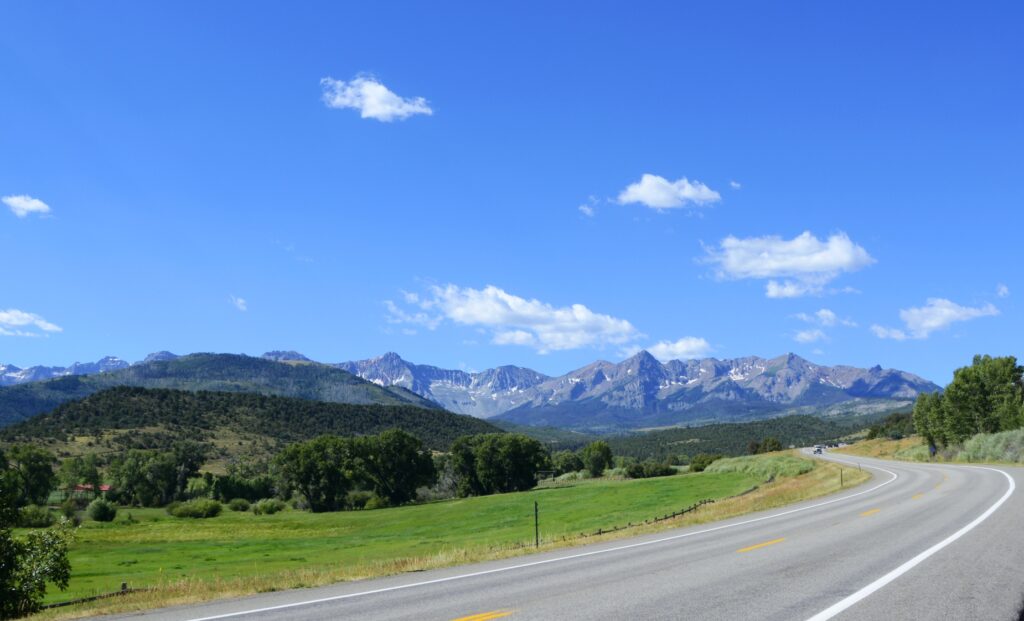
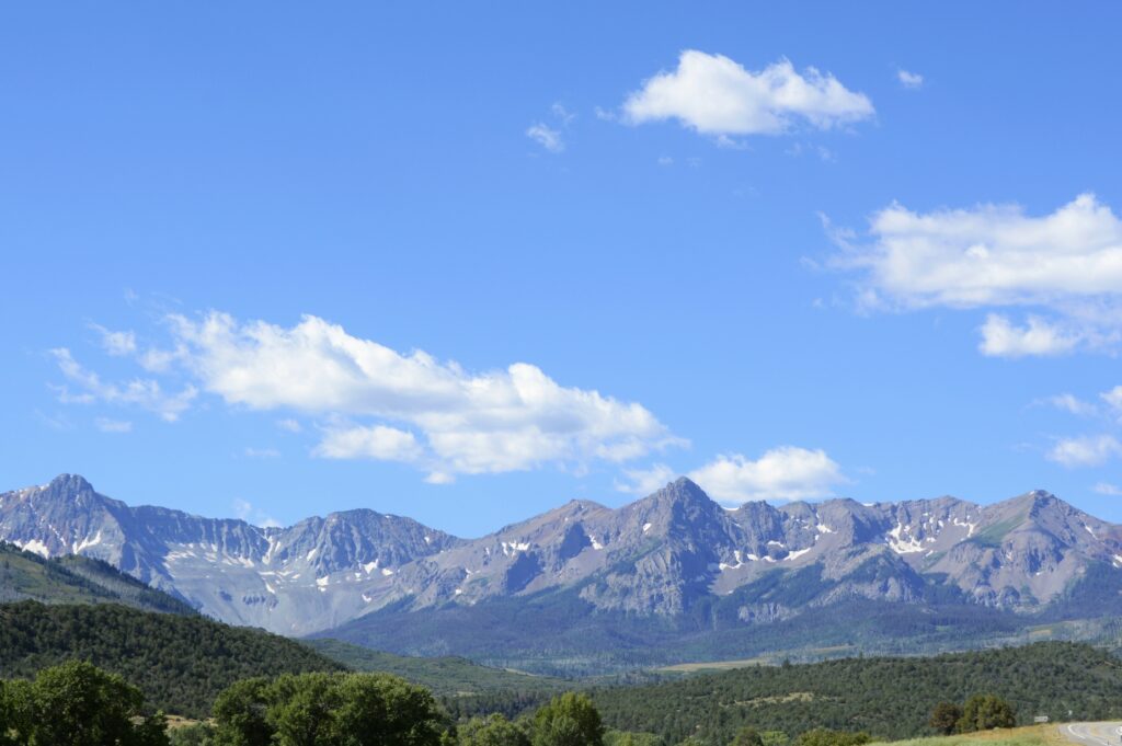
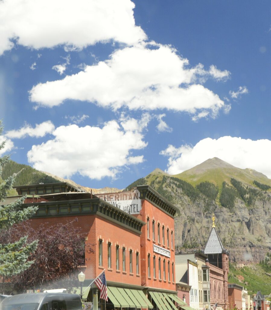
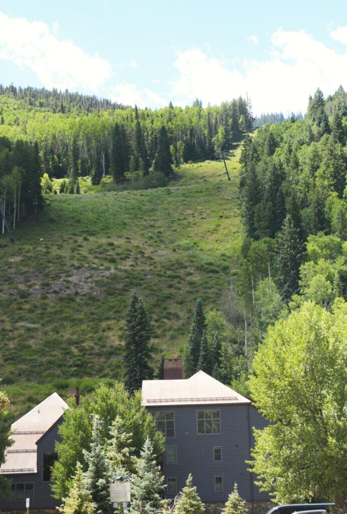
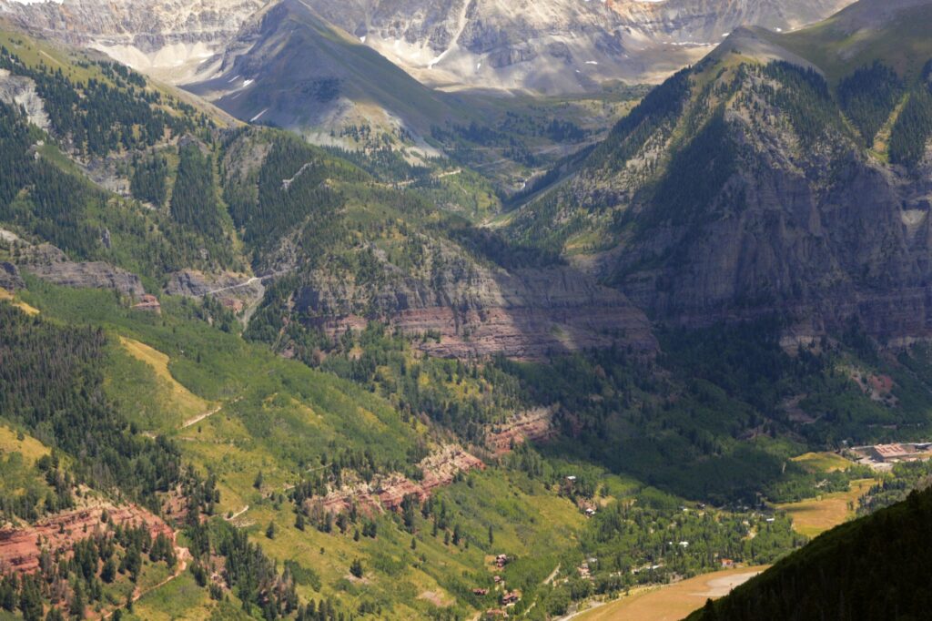
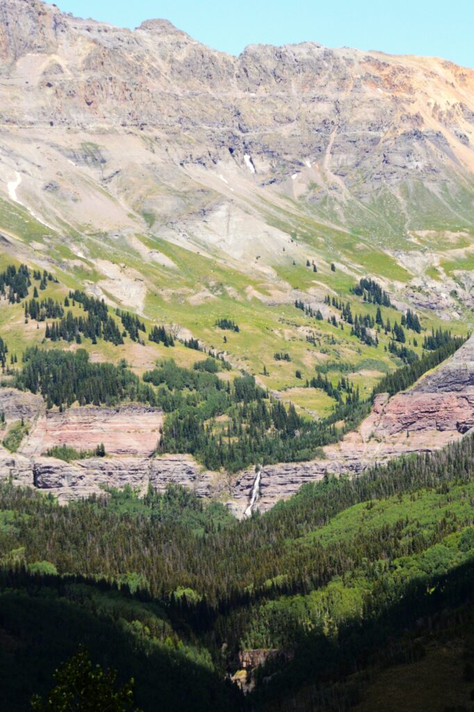
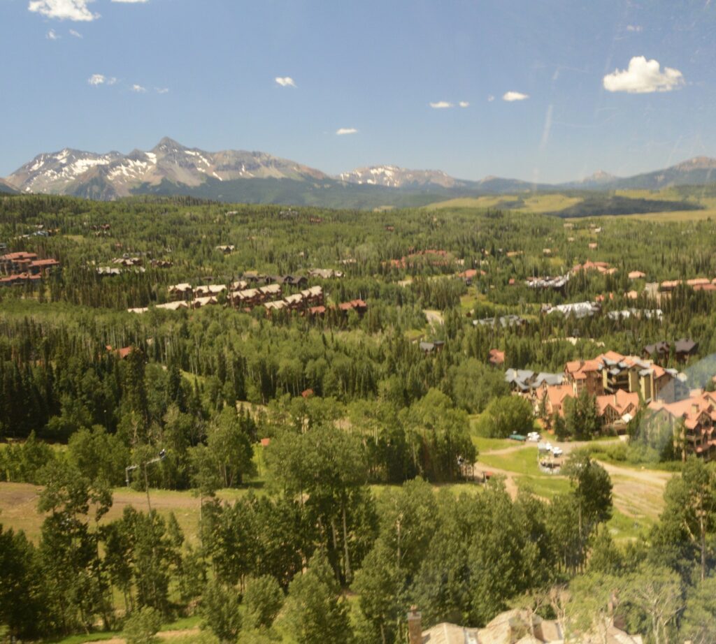
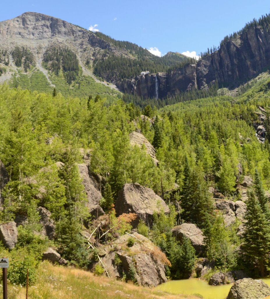
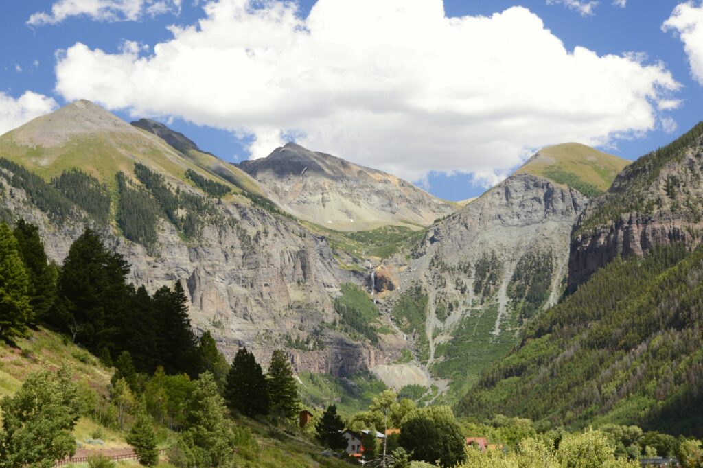
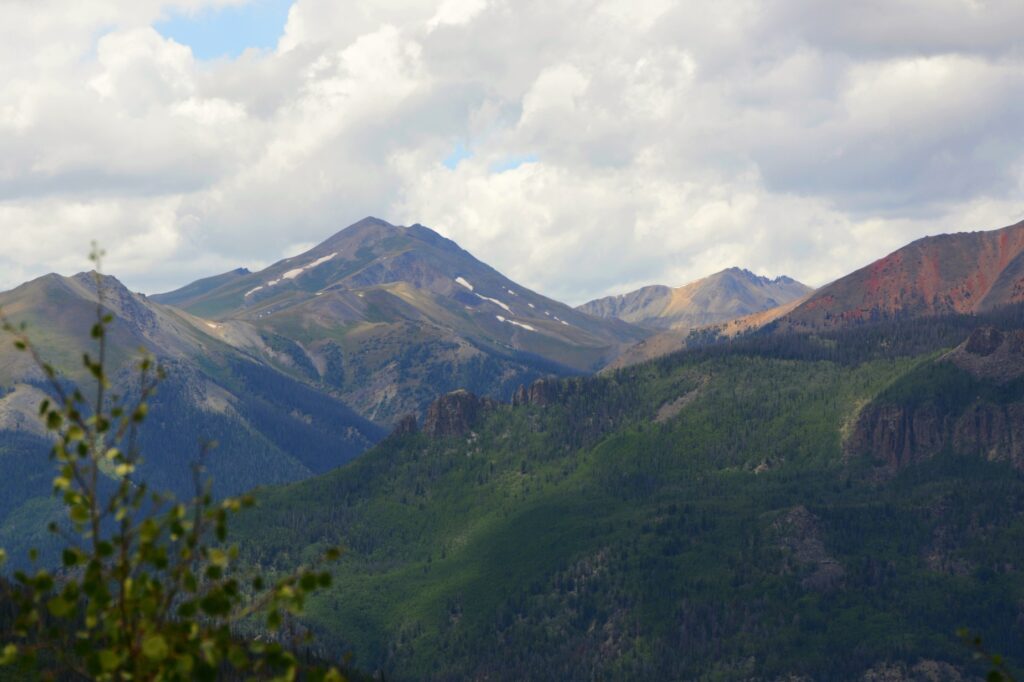
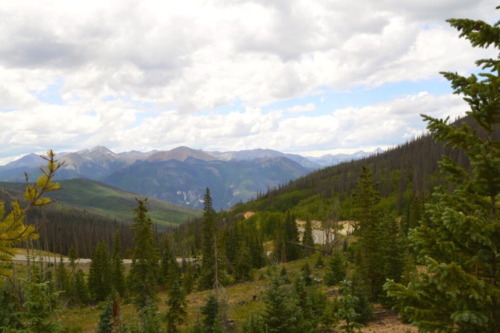
The historic town of Telluride in the San Juan Mountains of southwest Colorado could easily have become a ghost town after the mining companies closed down in 1978. Instead, it transformed into a winter ski and summer recreational resort town.
At an elevation of 8,750 feet, it is a popular place to escape the heat of summer. It was a three hour drive for us to this little town. Along the way, we saw some beautiful scenery.
The drive to Telluride is very scenic.Closer view of mountains on the way to Telluride.
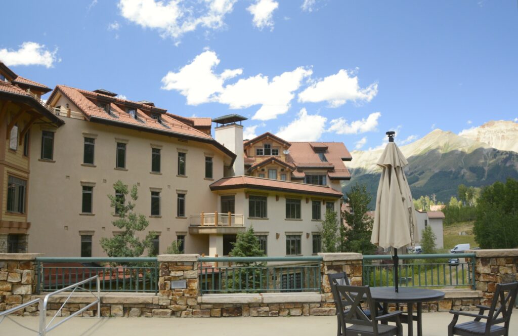
Having visited on the weekend, we had trouble finding parking. We found a spot on a side street and walked a short distance to the Visitors’ Center. There we found information about a free parking lot at the edge of town, and a shuttle bus that would take us where we wanted to go.
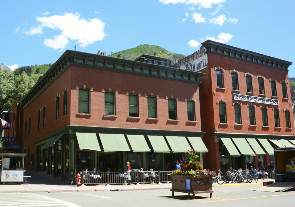
Historic New Sheridan Hotel in downtown Telluride
Telluride is both on the U.S. National Register of Historic Places and a U.S. Historic Landmark District, so I was able to get my Passport book stamped at the Visitors’ Center. There’s a self-guided walking tour of historic buildings, but Ray’s knee was hurting, so we chose not to do that. The New Sheridan Hotel is one of the historic buildings on the list.
The mountains are very close to the town of Telluride
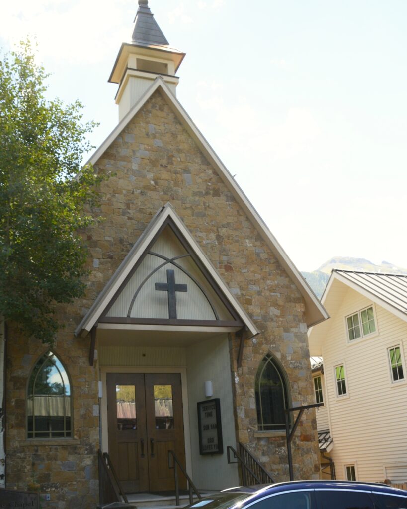
Before we moved from our parking spot, we spotted a cement wall in front of a little chapel nearby that made a perfect place to eat our picnic lunch.
Alpine Chapel where we ate our picnic lunch.
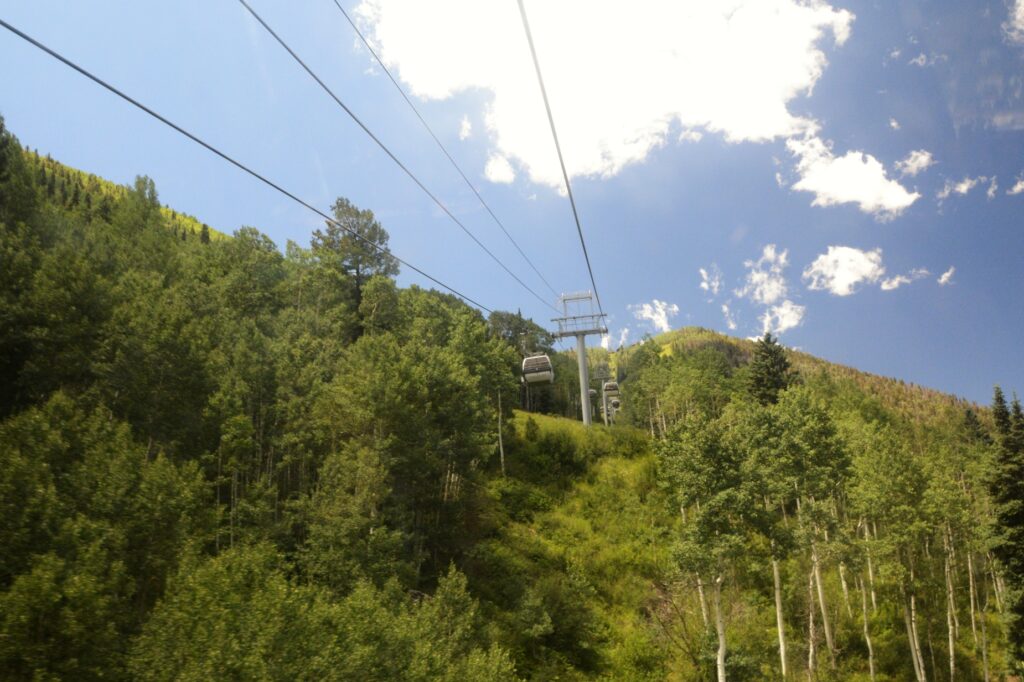
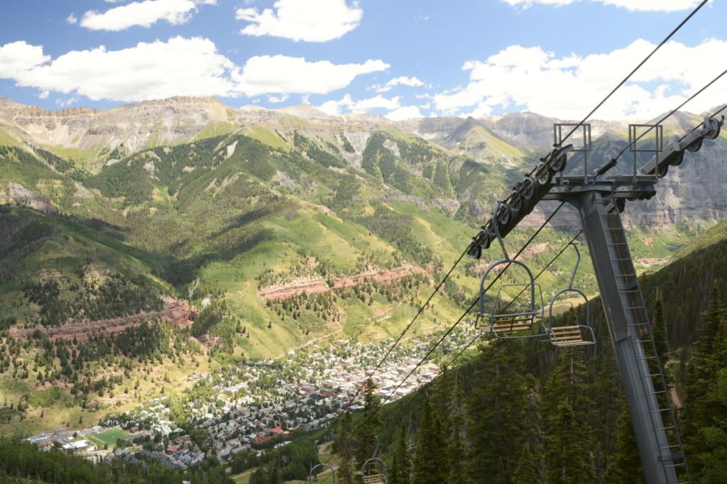
We found the free parking lot and hopped on the shuttle bus to the Gondola Station. At the Gondola Station we boarded a gondola car and were soon headed up toward the summit of the mountain.
Looking up the mountain at the gondola rideAnother ski lift from downtown Telluride
The free gondola ride lasts 13 minutes from the center of Telluride to the resort town of Mountain Village. It covers three miles of terrain. The gondola ride is the first and only free public transportation of its kind in the United States. It officially opened December 20, 1996, and it operates 6:30 a.m. to midnight year round.
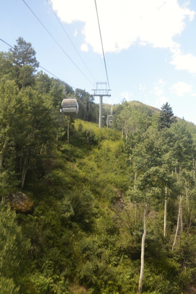
Gondola rideView from inside gondola looking up the mountain
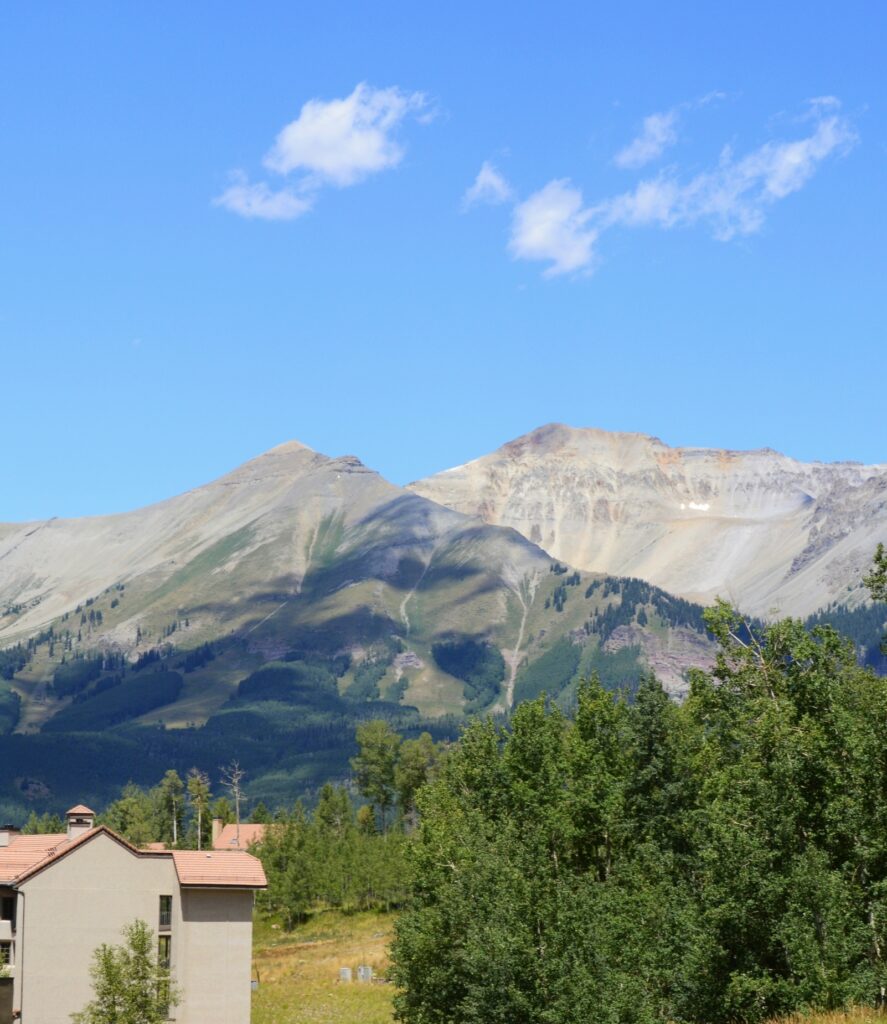
We got off at the San Sophia Station, (elevation 10, 540 feet) at the top of the mountain to view the scenery. The gondola continues down the other side to Mountain Village, but we wanted to look around the top of the mountain first.
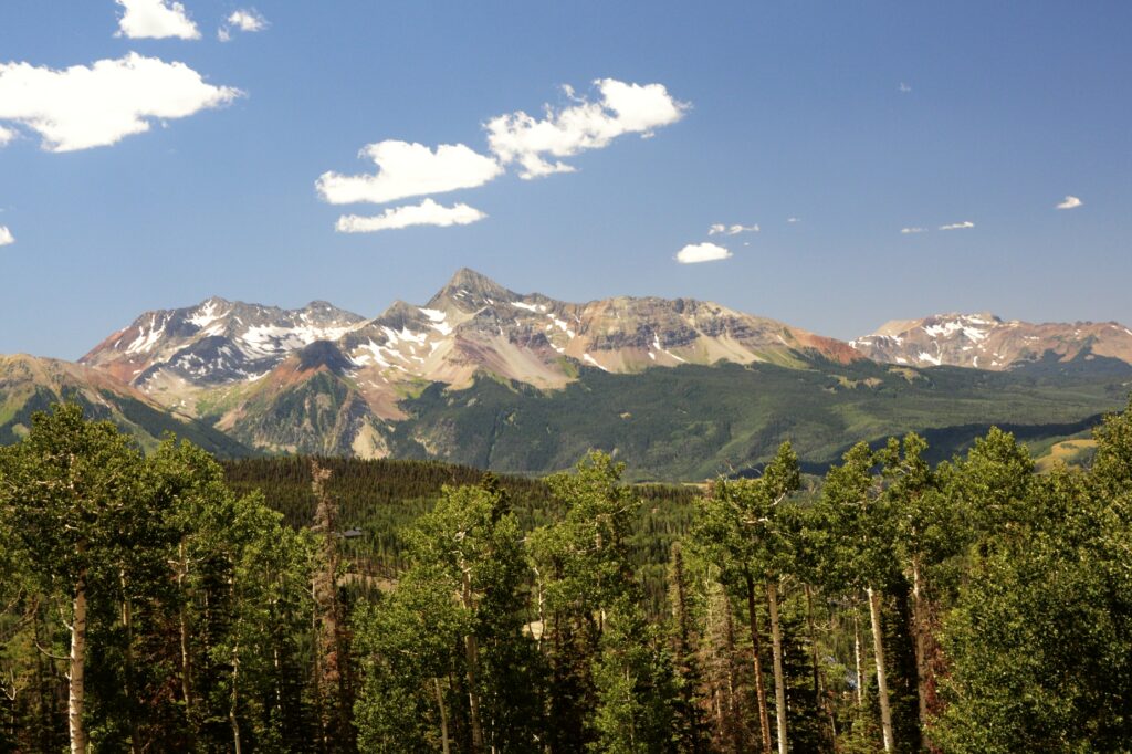
View from top of the mountain
The surrounding mountains were so colorful and beautiful. Looking down, we could see the town snuggled against the mountainsides.
Chair lift and view of Telluride from top of San Sophia StationTelluride from top of mountain from San Sophia Station
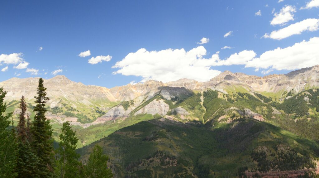
Telluride lies in a valley between steep mountains. In summer, clouds and thunderstorms during the day are common.
View of mountains from San Sophia stationView of mountains from San Sophia Station
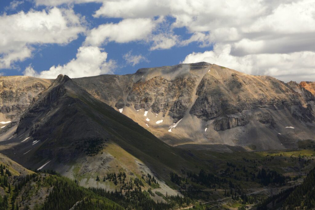
The views from the gondola and at the top of the mountain were amazing. Across the valley, I spied a waterfall called Cornet waterfall. In spite of the summer heat, there were still a few patches of snow remaining on the mountains.
Cornet Falls
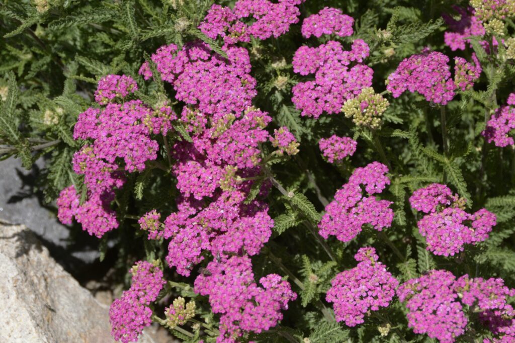
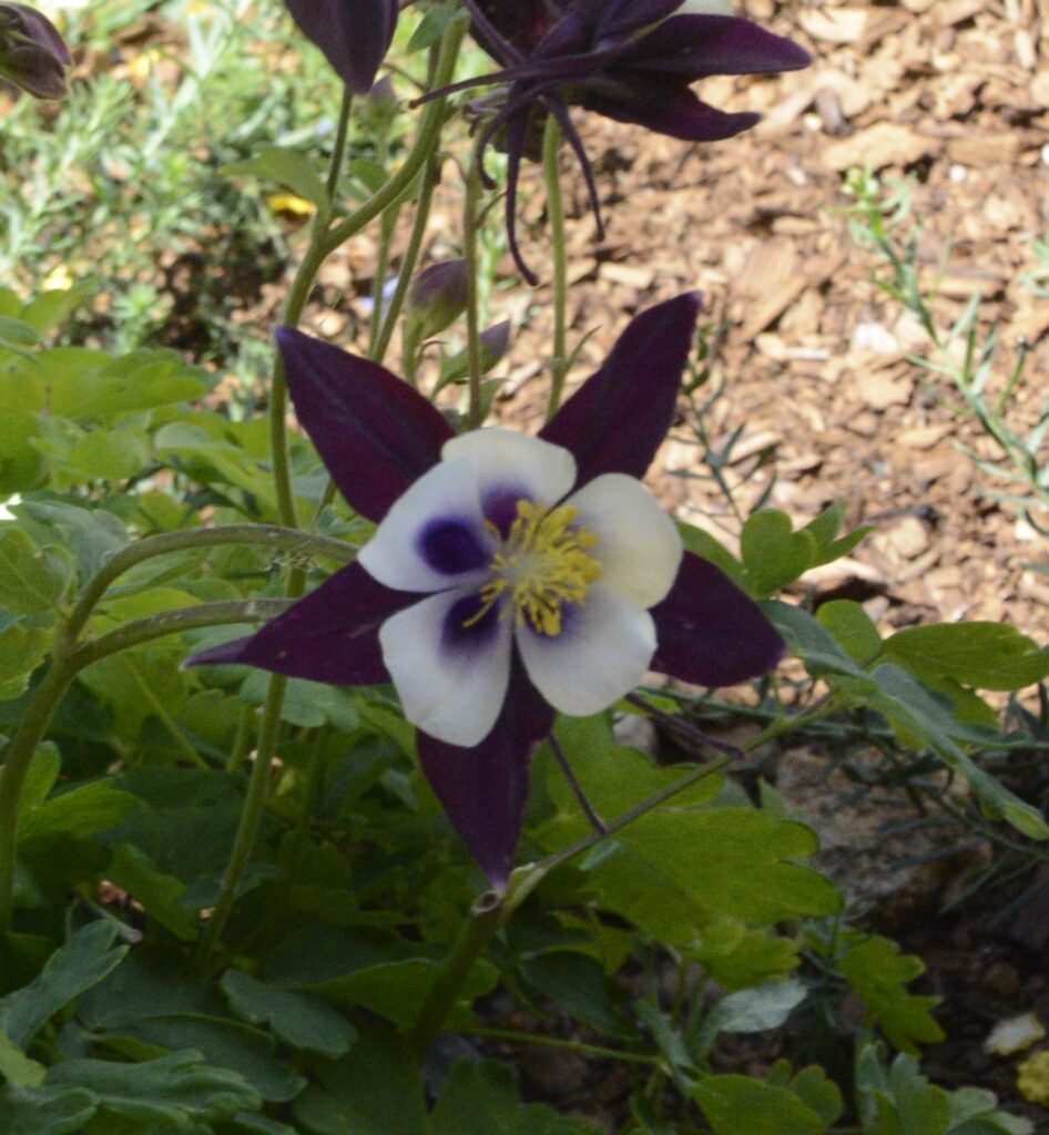
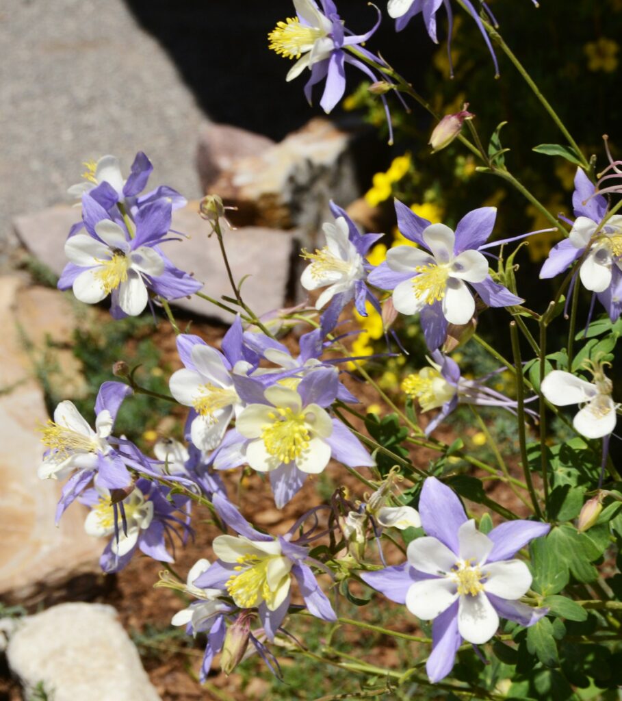
The nature center at San Sophia Station was closed, but outside there were native Colorado flowers planted around the building, including pink yarrow and two different colors of columbine.
Pink YarrowColumbine flower
The Rocky Mountain Columbine is the state flower of Colorado.
Rocky Mountain Columbine
We hopped back on the gondola and rode it down to Mountain Village. It is mostly condos and a ski resort area.
Mountain Village view from Gondola
There is another gondola that goes to Mountain Plaza shopping area, but we weren’t there to shop, so we took a break outside on the patio area and ate a snack we brought with us while enjoying the scenery.
We ate a snack here on the patioMountains around Mountain Village
After riding the gondola back up the mountain and down to Telluride again, we hopped on the shuttle. It makes a loop around the town, so we got to see some more of the town while riding to our parking spot. We had one more place to visit before leaving.
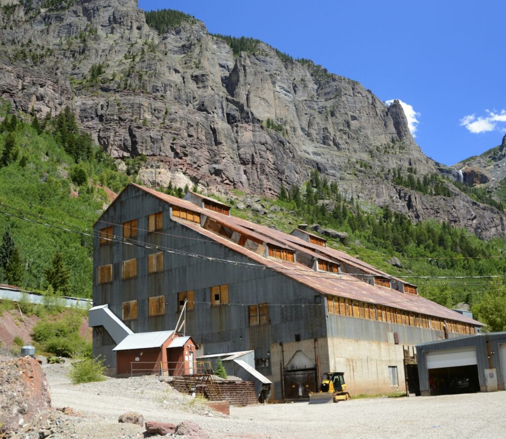
Pandora Mill
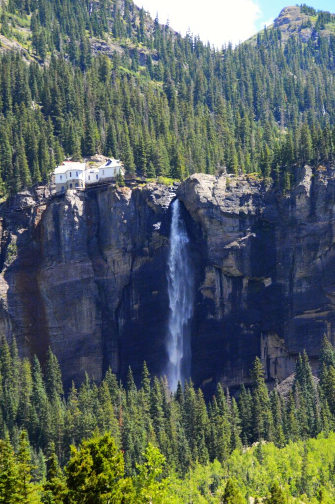
If you drive all the way through Telluride to the end of town, there is a parking lot by an old mining building, Pandora Mill. From there, you can see Bridal Veil Falls. At 365 feet tall, It is the tallest free-falling falls in Colorado.
Bridal Veil Falls
A privately owned, historic power plant sits at the brink of the falls.
Bridal Veil Falls and Power House
All the parking spots were taken, so I double parked and quickly jumped out and took a few photos of the waterfalls. I moved the truck to a parking spot near the old mill when I spotted another waterfall. Researching the name of this, I concluded that it is called Marshall Creek Falls.
Marshall Creek
As I zoomed out on my camera, I was able to get both falls in one photo.
Marshall Creek Falls and Bridal Veil Falls
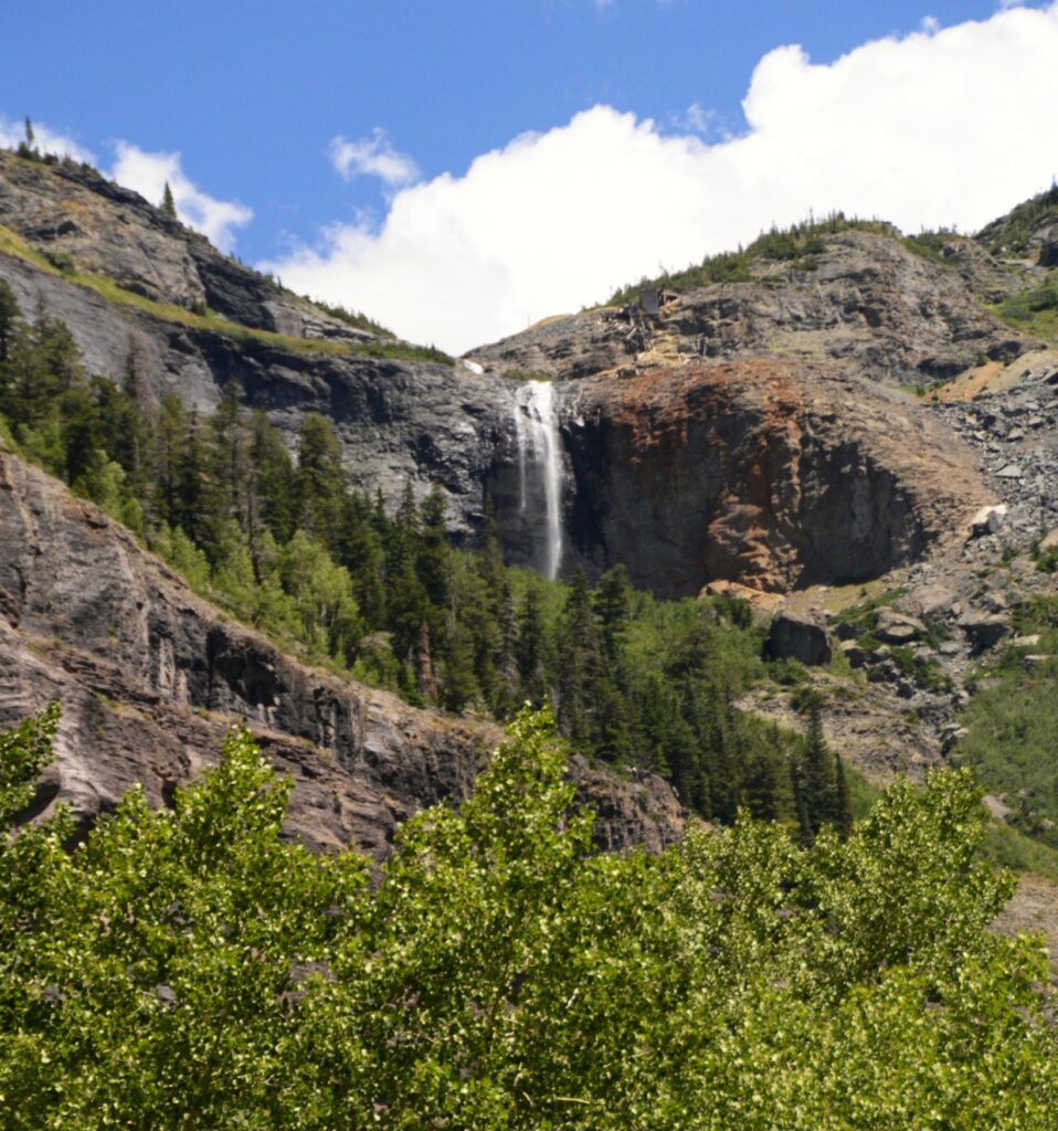
It was late afternoon so we decided to head home. As we drove a few miles out of town, I stopped for one last look. In the distance was Bridal Veil Falls at the end of the box canyon that holds the historic town of Telluride. What a view!
Looking back at Telluride and Bridal Veil Falls
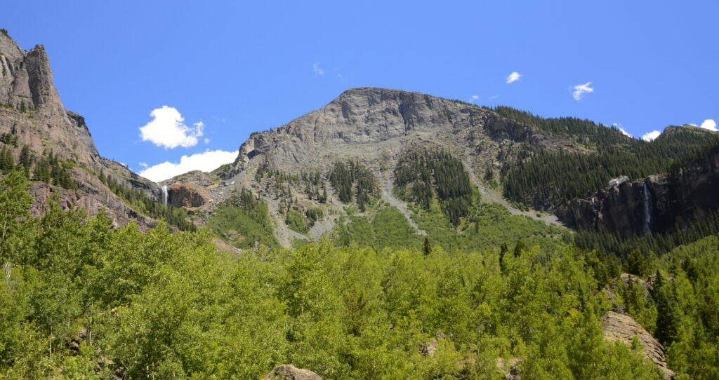
On our way home, I stopped at this roadside pull out and couldn’t resist more photos of these scenic mountains. Now the evening light made them look even more beautiful.
We had a nice day trip to Telluride. I would have liked to have spent more time there, but we had a long drive home. Maybe someday we will return.
“For all God’s words are right, and everything He does is worthy of our trust. He loves whatever is just and good; the earth is filled with His tender love. He merely spoke, and the heavens were formed and all the galaxies of stars. He made the oceans, pouring them into His vast reservoirs. Let everyone in all the world–men, women, and children–fear the Lord and stand in awe of Him. For when He but spoke, the world began!” —-Psalm 33:4-9
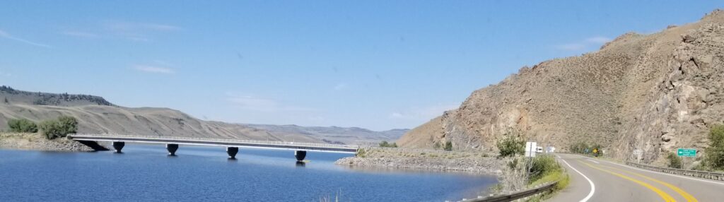
In the previous blog, I mentioned this bridge. It crosses the Gunnison Reservoir on the way to Lake City. One day we took a drive to explore this little mountain town.
Looking back across the lake, we could see our RV park snuggled on the hillside (on the left).
Our RV Park across the lake on the left side.
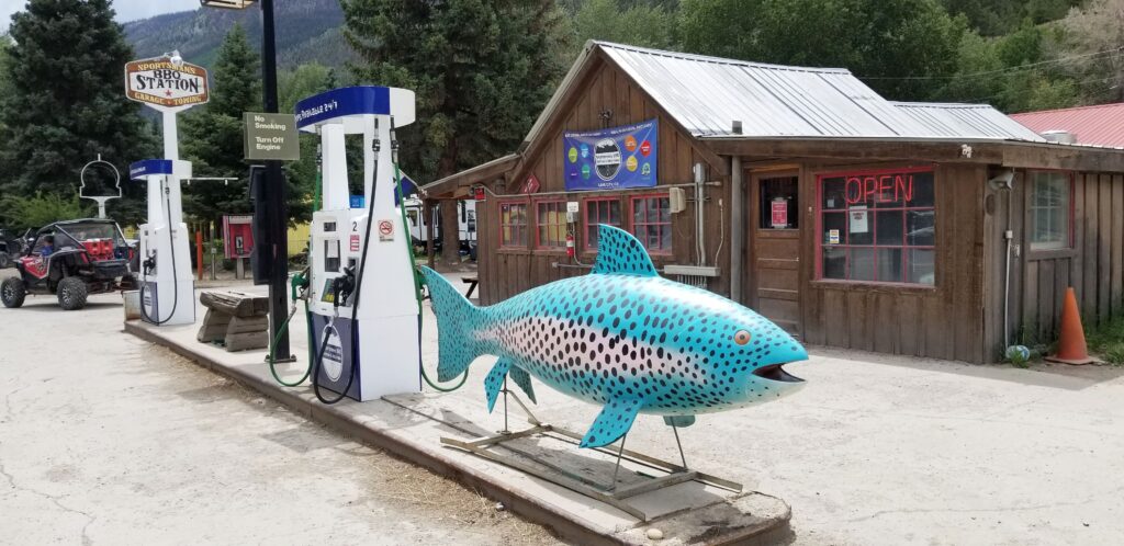
It was about lunch time when we arrived. Since we didn’t bring a picnic lunch that day, we stopped at Sportsman’s BBQ Station for lunch and got some pulled pork sandwiches. As you can probably tell by the blue fish, fishing is a popular pastime in Lake City, Colorado.
Sportsman’s BBQ Station
Lake City, population 432, gets its name from Lake San Cristobal, which is about a mile outside of the town. The lake had an interesting beginning, which I will tell more about shortly.
Lake San Cristobal
Lake City is situated in a valley surrounded by mountains of the San Juan mountain range. At 8,661 feet in elevation, it is a nice place to escape the summer heat. August is their wettest month. Although we didn’t get rained on, we did see some ominous looking thunderheads while we were there.
Lake City is named after Lake San Cristobal
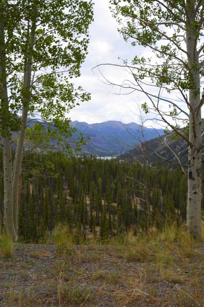
After lunch, we drove south over the mountain pass on Highway 149. As we drove out of town and gained elevation, we could see over the valley of Lake City.
Looking over the valley of Lake City, Colorado
The signs upon entering Colorado say, “Welcome to Colorful Colorado.” It is certainly true of the mountains. They are very colorful.
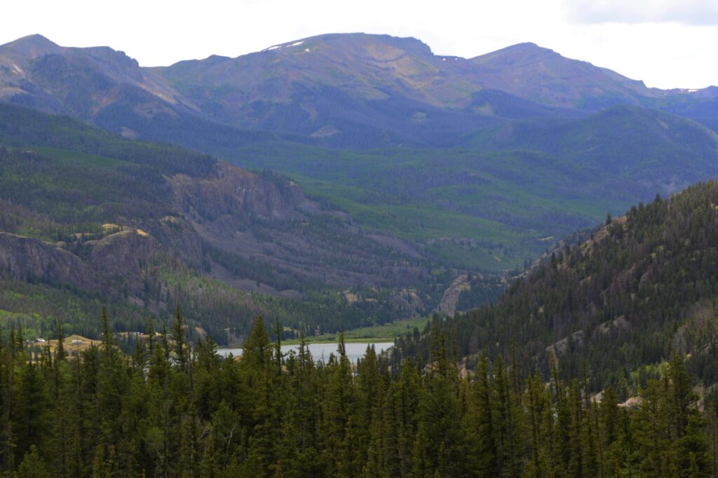
From left to right: Broken Hill, Wetterhorn Peak, Matterhorn Peak, (skip one) and Uncompahgre Peak
We stopped at a viewpoint overlooking the valley. The tallest peak that looks like the Matterhorn is Uncompahgre Peak which is over 14,000 feet. Two peaks to the left of it, is Matterhorn Peak at 13,500 feet. The next one to the left is another 14’er. It is Wetterhorn Peak. And the last one is Broken Hill at a little over 13,000 feet. They are all a part of the San Juan Mountains.
Looking back at the road we drove on.
The mountain pictured below is responsible for forming Lake San Cristobal. About 850 years ago, thousands of tons of water-saturated earth broke away and slid nearly four miles into the valley below. This was called the “Slumgullion Earthflow.” It blocked the Lake Fork of the Gunnison River and formed Lake San Cristobal. It is the second largest natural lake in Colorado.
About 350 years ago, another part of the mountain slowly slid down over part of the previous slide and continues today at a rate of 20 feet per year.
Slumgullion Earthflow
Other mountains in the surrounding area have names that fit their description, like Red Mountain and Grassy Mountain.
Red MountainGrassy Mountain
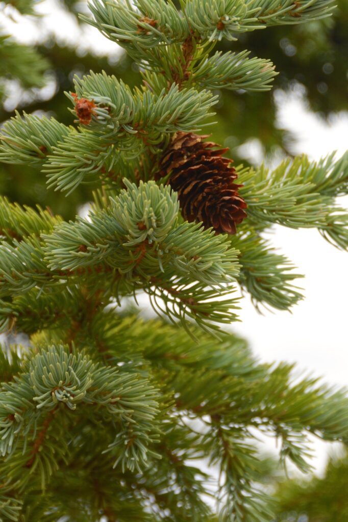
The trees were mostly spruce trees with aspen trees scattered in groups here and there.
Mountain Spuce tree
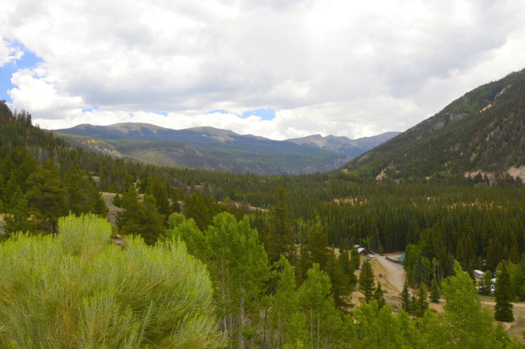
We weren’t quite at the summit of the Slumguillion Pass, so we kept going. We wanted to see what was on the other side of the mountain!
Looking back at the San Juan mountains.
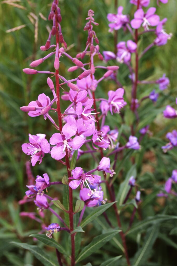
At the higher elevations, we spotted some wildflowers. Fireweed and yarrow were prevalent.
Fireweed in bloom
When we made it to the top of the pass, this is what we saw–mountains in every direction. The wild flowers were blooming in the cool mountain air. The peaks showed a few remaining patches of snow.
The other side of the mountain. Fireweed and yarrow were blooming at this elevation.
One other mountain looked like it also had a portion of it collapse and slide down the side of it. At 11,361 feet, we were above the treeline. The other side of the mountain looked very similar to the side we’d just climbed over.
Another earth slide on a mountain
The afternoon rain clouds were moving in, so we decided to head back to Lake City. If we had kept going, we would end up in South Fork at the junction of US Highway 160 that leads to Durango.
The other side of the mountain at Slumguillion Pass.
On our way back, the sun came out and spotlighted a portion of the mountains. We drove back down the mountain and into Lake City. For such a small town, it seemed quite busy.
Sunlight on mountains
On our way out of the town of Lake City, I found this beautiful spot on the Lake Fork of the Gunnison River. The road follows the river for many miles. There are beautiful gorges and rocks that make the drive very scenic.
Lake Fork of the Gunnison RiverSteep cliffs line both sides of Lake Fork of the Gunnison River
On our way we saw this scenic log barn situated by a small lake. There was no place to walk along the road, so I could only get photos of them separately.
Log BarnLake by log barn
We enjoyed our day trip to Lake City. The cool weather and beautiful scenery made it a lovely day.
“Before the mountains were born Or You gave birth to the earth and the world, Even from everlasting to everlasting, You are God”. — Psalm 90:2
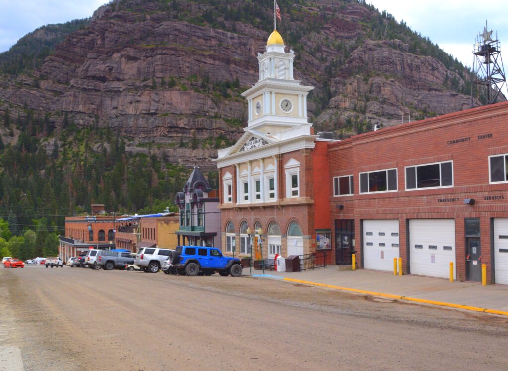
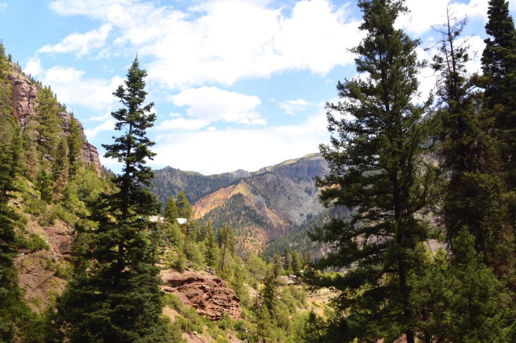
At 7,800 feet elevation, Ouray, Colorado, (pronounced “YOU-ray”), in a canyon surrounded by steep mountains on all sides, seemed like a perfect place to spend a hot summer day. It was named after Chief Ouray of the Ute Indian tribe.The town was originally a gold mining town. The Camp Bird Mine produced over one million ounces of gold by 1917.
For us, it was a two-hour drive to get there, and actually took longer because of a half-hour delay both ways for road construction. But it was definitely worth the drive.
Ouray town library and fire station.
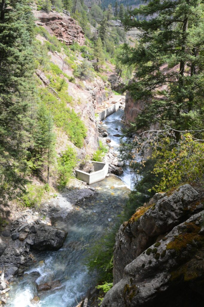
Our first priority was to see Box Canyon Falls. It is a city park not far outside of town. Long ago, it was up for sale for $5,000, but it never sold. It was deeded to the city for $75 to preserve it for everyone’s enjoyment.
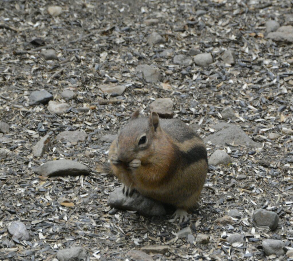
The parking lot was small, but we managed to squeeze into the last spot available. It was a short, easy walk to the falls. Along the way we saw some wildlife.
Chipmunk enjoys the bird seed dropped from the bird feeder.
We could hear the falls long before we could see it.
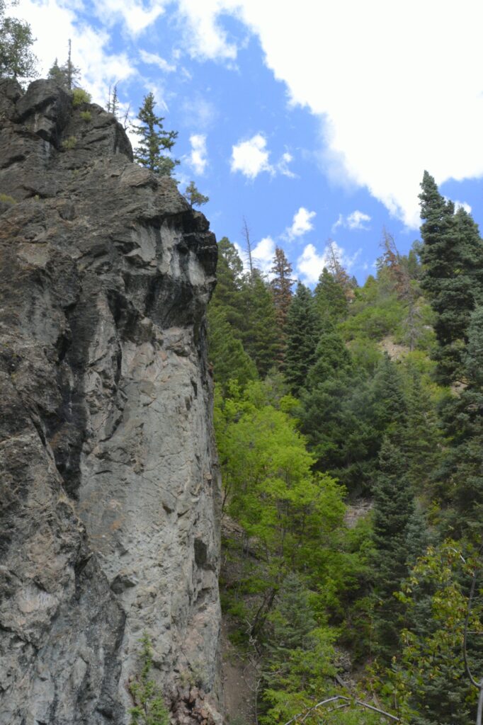
Steep rock walls of box canyon
In the stream flowing below us, there was a cement box which surrounds the source of a hot spring. Long ago, it flowed into the stream. But today, there’s a pipe that diverts the hot springs water to a popular hot springs swimming area on the outskirts of town.
A hot spring which used to flow into the stream is now piped into Ouray.
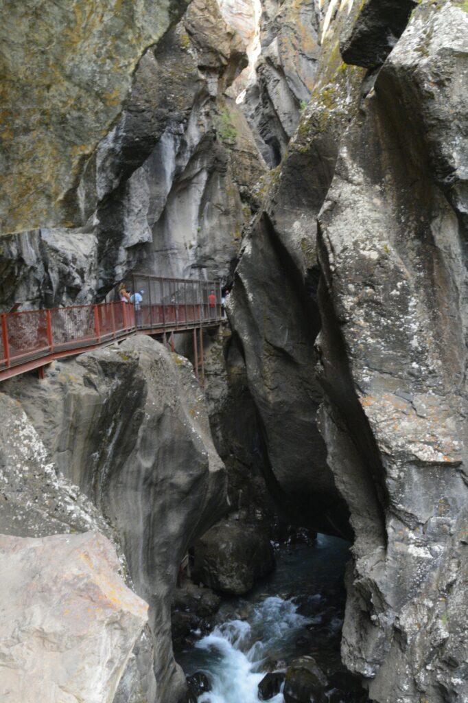
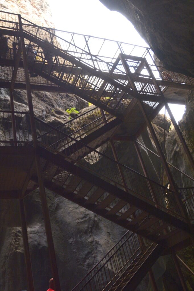
As we approached the waterfall, there was a catwalk along the rock walls.
Catwalk above Canyon Creek
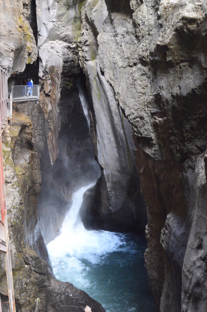
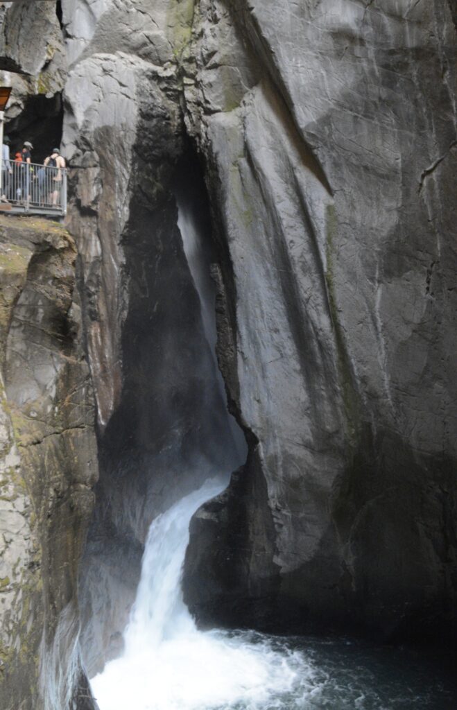
Our first glimpse of the waterfall was the lower section.
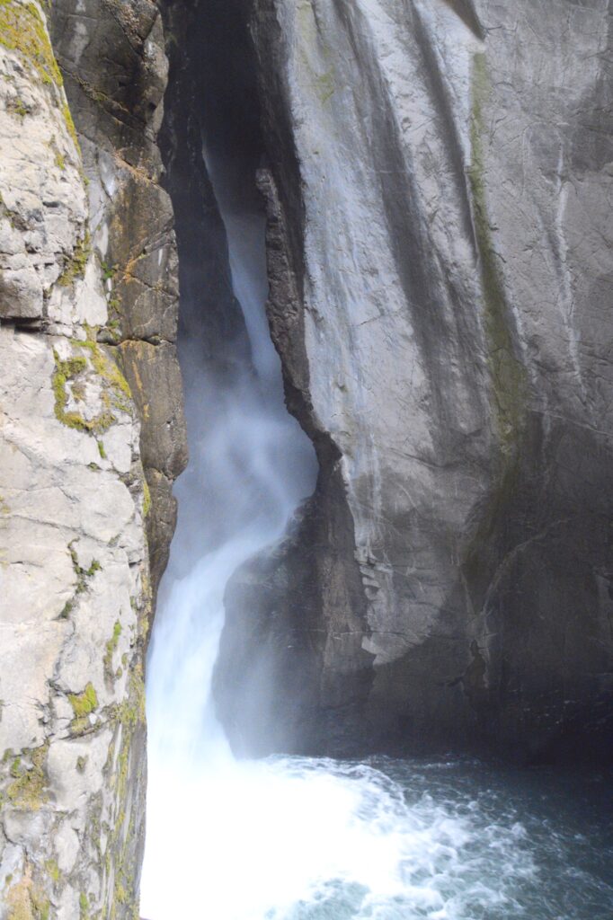
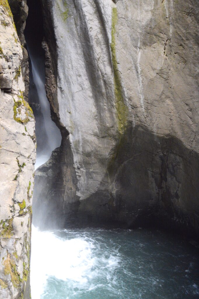
Next, we could see the water coming down the chute. It was very loud by this time, and mist filled the air.
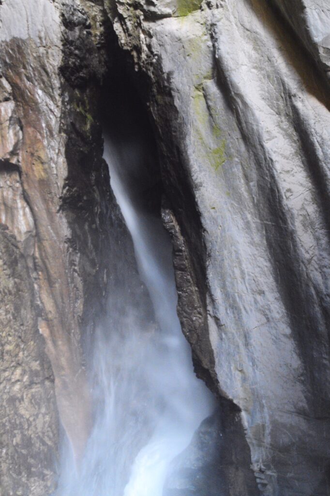
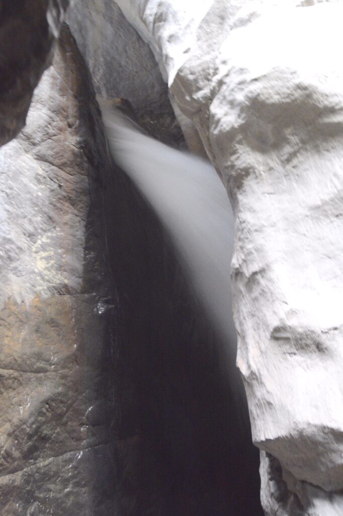
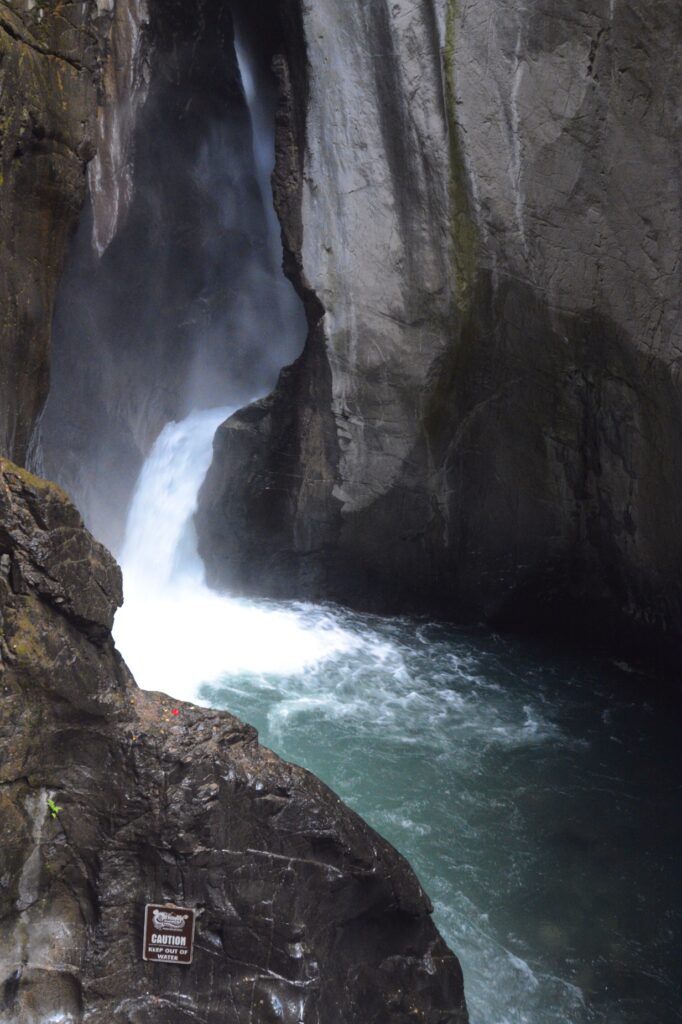
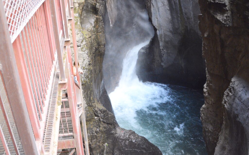
At the closet point, we could see the torrent of water coming down the box canyon chute. It has so much force, it could power the entire town of Ouray. The thunderous noise made it impossible to talk to one another.
From there we could see how the water came nearly straight down, falling 285 feet into a narrow quartzite canyon.
The catwalk had stairs that led down to the stream, so we walked down to see it better.
Catwalk Stairway to stream
The box canyon is also unique in that it is home to a colony of Black Swifts. These birds arrive in early June to make nests of mud and grass in the indentations of the rock walls. They lay one egg and care for the chick until autumn when they migrate to Brazil 4,300 miles away.
Photo by visitouray.com
What’s even more interesting is that the chick never flies until time to migrate. They hang onto the edge of the nest and flap their wings like a hummingbird to gain enough strength for the long arduous journey. However, to my disappointment, we didn’t see any of these amazing birds while we were there.
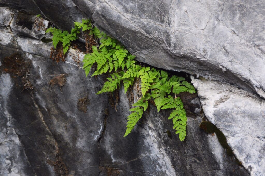
Moss and lichen on rock wallsFerns growing out of the rock wall
We hiked back out of the canyon. The view from the trail was so pretty.
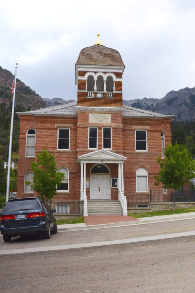
Back in the town of Ouray, we looked for a place to have our picnic lunch. We found a cement wall by the courthouse that made a perfect place.
The courthouse, built in 1888, was used in the movie True Grit, starring John Wayne.
Ouray Courthouse. Yes, the street really does slope that much!
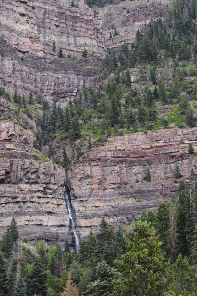
While we ate our lunch outside, I noticed a waterfall coming down one of the mountainsides of the town. The name of the waterfalls is Cacade Falls. I found out later that there is a quarter of a mile trail to the bottom of the falls. We will have to save that for another visit.
Cascade Falls in Ouray, Colorado
We went back home on Highway 550 the way we came, but if we had continued on south, we would have traveled on the famous “Million Dollar Highway” to Silverton, Colorado.
We have plenty of reasons to come back to Colorado and explore some more of the beautiful creation of God.
“Deep calls to deep at the sound of Your waterfalls; All Your breakers and Your waves have passed over me. The Lord will send His goodness in the daytime; And His song will be with me in the night, A prayer to the God of my life.” Psalm 42:7-8
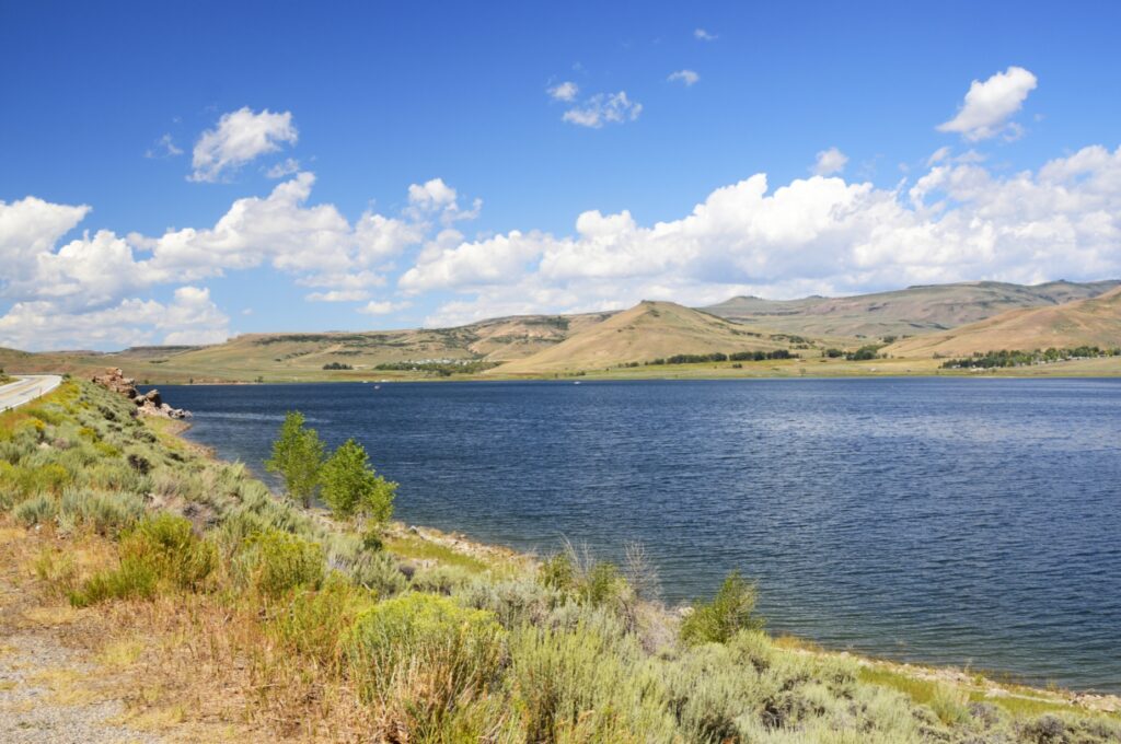
On our way from Canon to Gunnison, Colorado, we had to cross Monarch Pass. It is 11,312 feet in elevation. The road is in good condition, and the views are unforgettable.
Monarch Pass – 11, 312 feet in elevation
US Highway 50 is very scenic from Gunnison to our Thousand Trails campground. For several miles the road follows along beside the Gunnison River and Reservoir. We would cross this bridge later in the week on our way to Lake City. But that’s another story.
Blue Mesa Reservoir on US Hwy 50 West
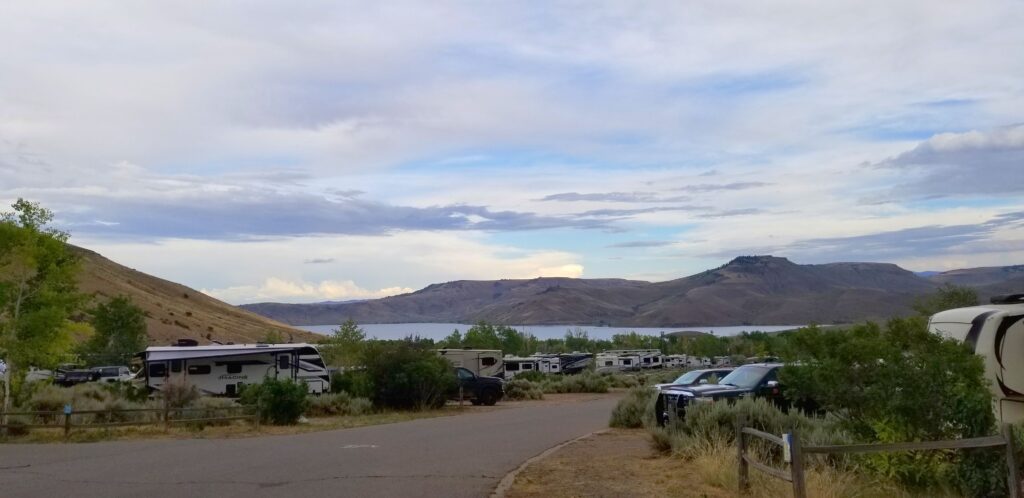
We could see the lake from our campsite. It was just across the highway from the campground. The weather changed every day. Sometimes it was very calm, and other times it was very windy.
Blue Mesa Thousand Trails RV Park
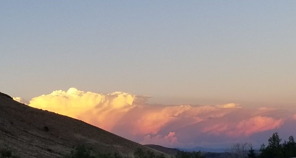
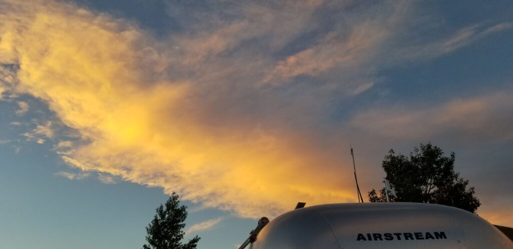
In the afternoons, we would often get thunderstorms with magnificent looking clouds, especially at sunset.
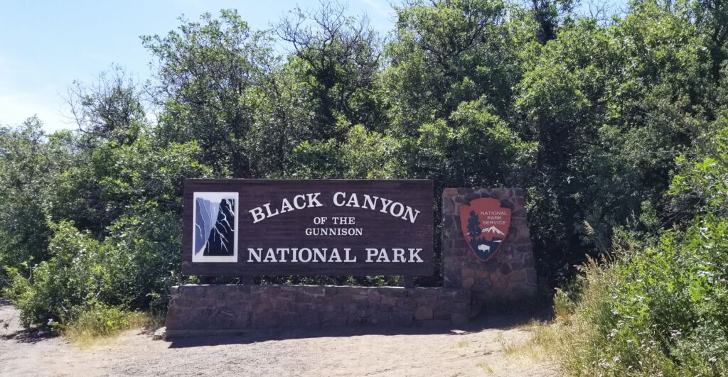
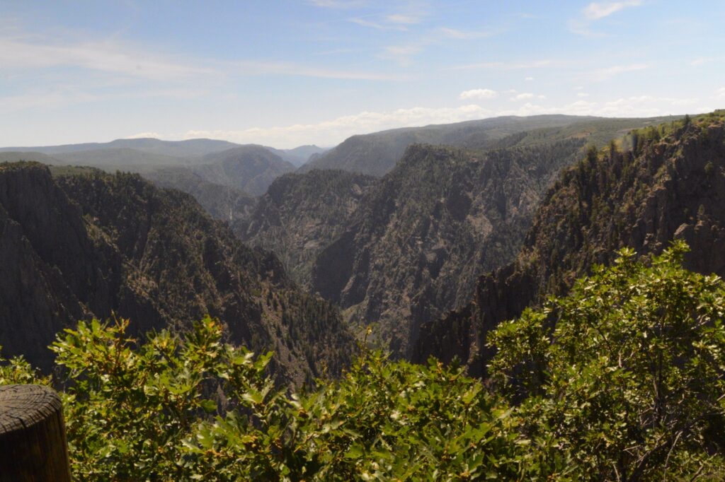
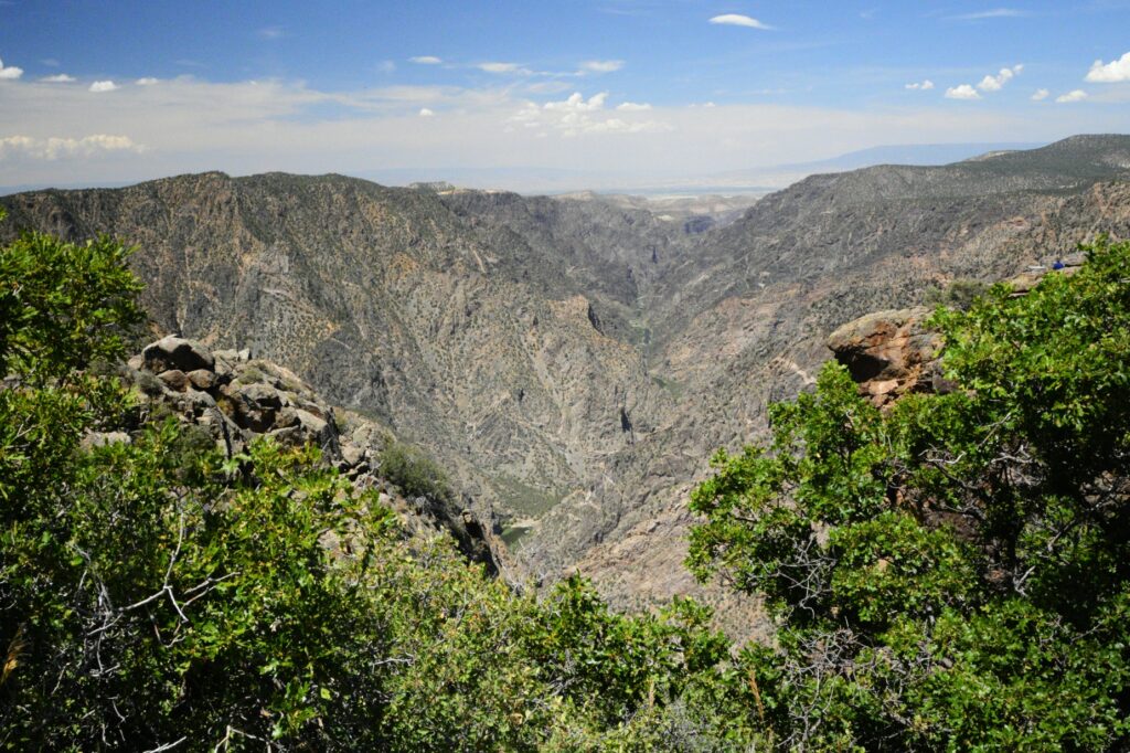
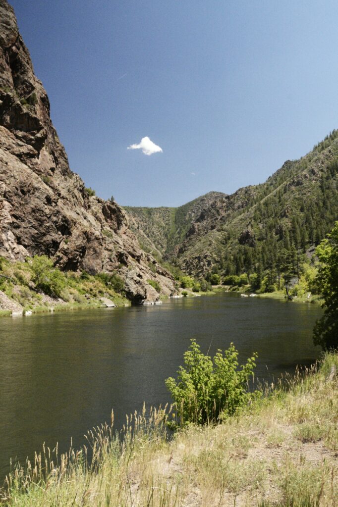
During our three-week stay there, we took several day trips. One of our trips was to a new national park (for us), Black Canyon of the Gunnison. I’d never heard of it before until I was looking on the map to see what was near us. It was still about an hour drive from us, but totally worth it.
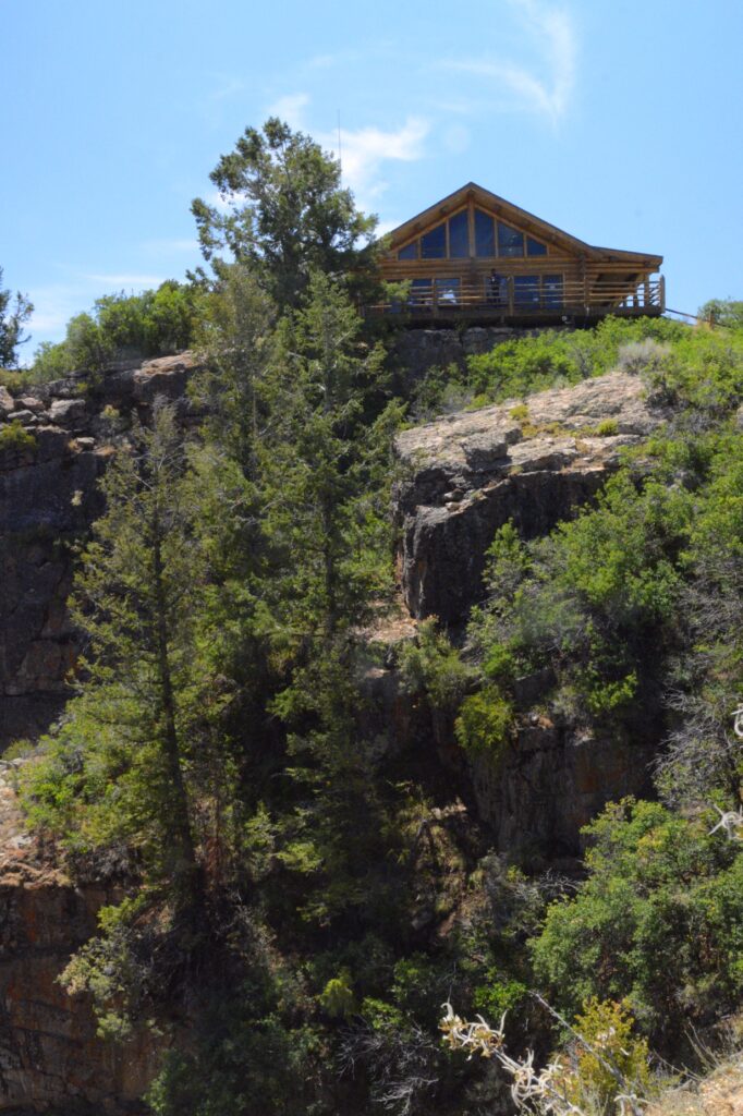
Right near the park entrance is the Visitors’ Center. It is perched on a hill overlooking the canyon. There’s a trail that leads to a lookout point. We walked down, but had to stop a couple of times coming back up. It is at an elevation of 5,600 feet and we weren’t used to it yet.
Visitors’ Center
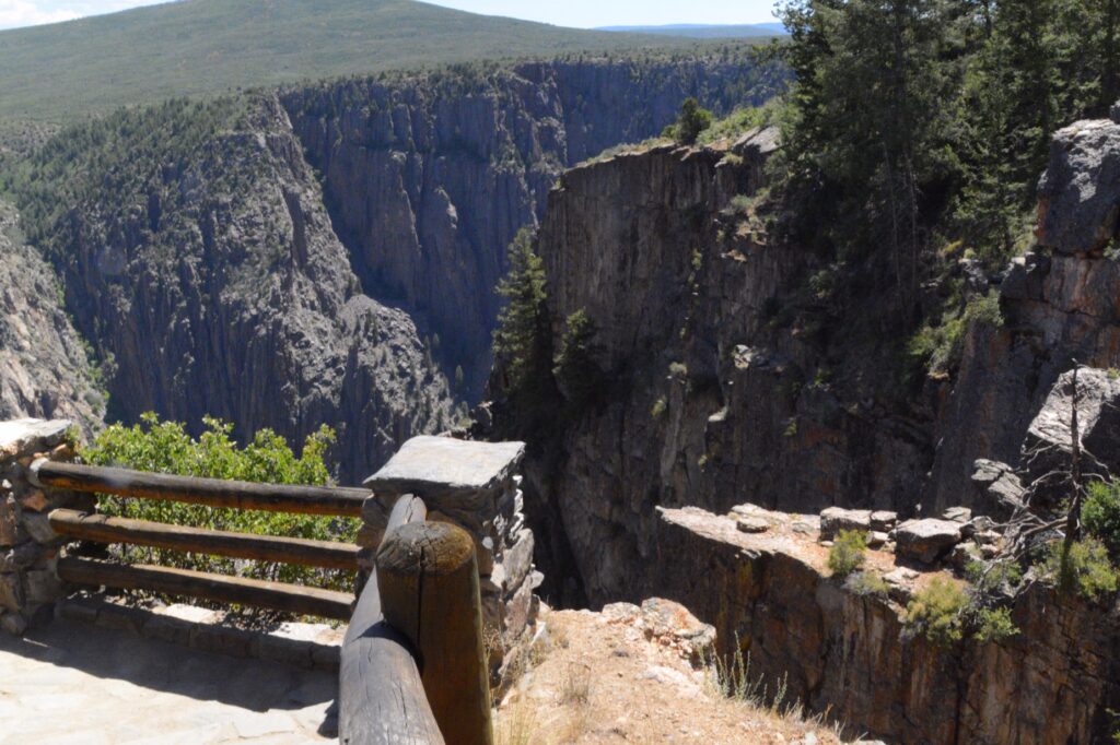
At our first lookout below the Visitors’ Center, we got our first real sense of the depth of this canyon. From 1,820 feet to 2,722 feet it makes it a real challenge for anyone afraid of heights as we were soon to find out.
Gunnison Point OverlookGunnison Point Overlook
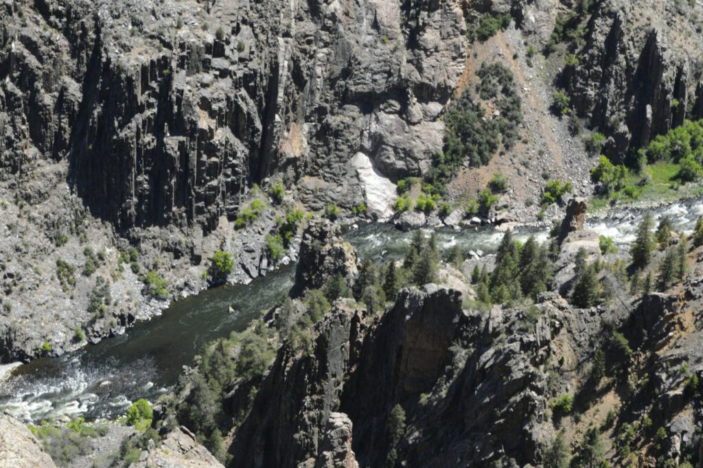
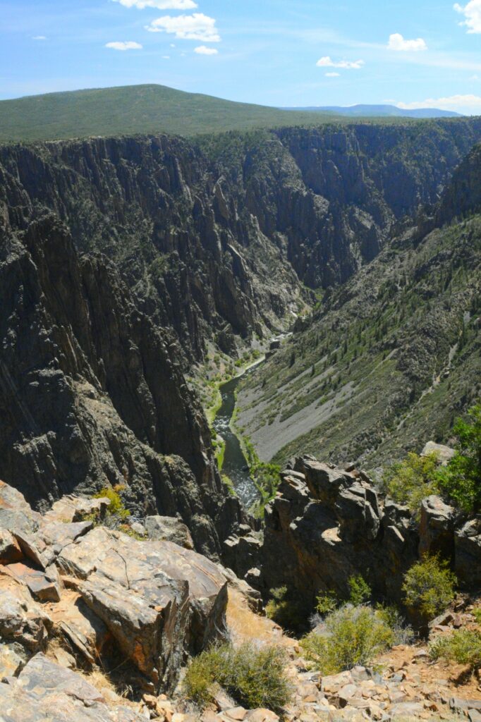
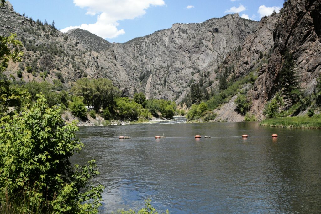
At the bottom of the canyon was the Gunnison River hundreds of feet below.
Gunnison RiverGunnison Point Overlook opposite direction
The road follows the edge of the canyon. We reached one point where the road nears the edge. There in the middle of the road was an RV stopped, straddling both lanes. A man was walking around in the road looking agitated.
I was driving, so I rolled down my window and asked him what was wrong. He (Brian) came over to tell me he had a panic attack and was unable to drive so close to the edge around the curve. When I offered to have someone (Ray) drive for him, he was visibly relieved. Ray took over for him and drove the rest of the way. We had our ham radios to communicate between the vehicles, so when I wanted to stop to take photos, Ray could pull over.
It surprised me that Brian got out and looked at the canyon at the overlooks. Apparently, he was okay with heights as long as he wasn’t driving.
Pulpit Viewpoint
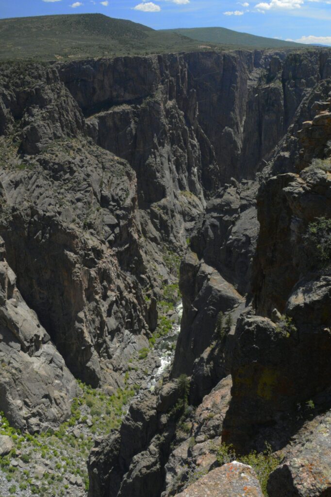
At Chasm Viewpoint, one can look straight down for hundreds of feet from the viewing point. The canyon is only 1,100 feet wide at the rim, and as little as 40 feet wide at the narrows.
Chasm Viewpoint
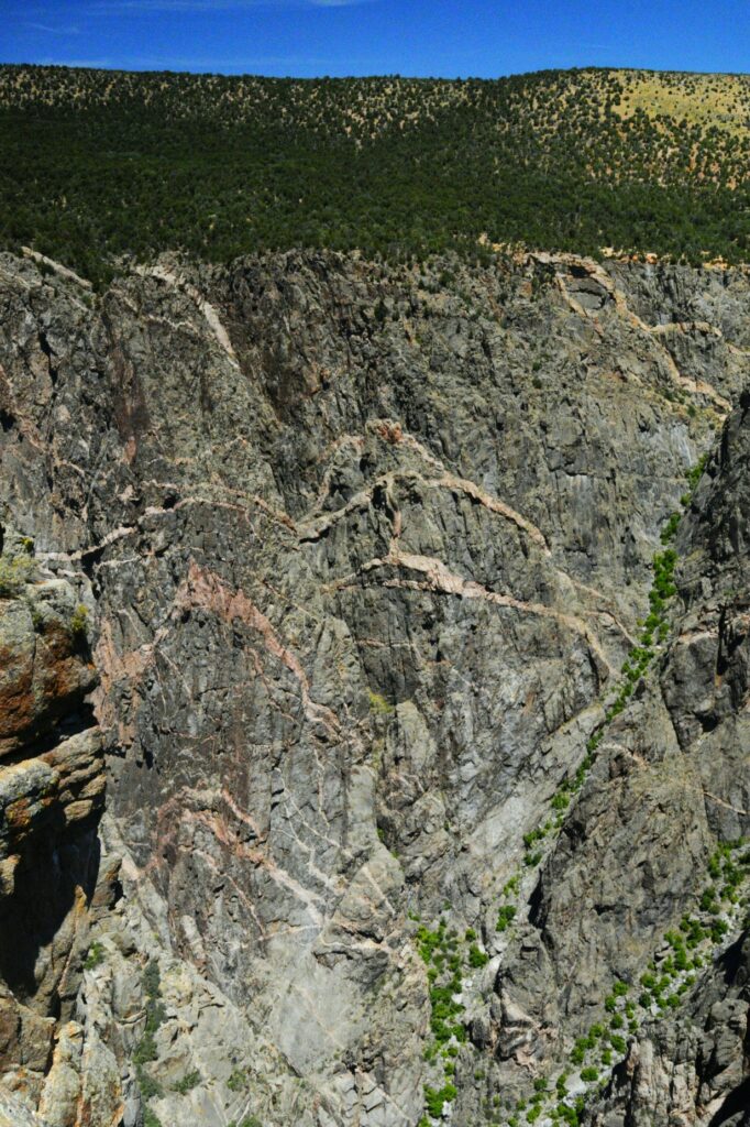
“Painted Rocks” looks like someone splashed paint across the canyon walls. The colors are from minerals from volcanic activity and erosion that exposed them.
Painted Rocks
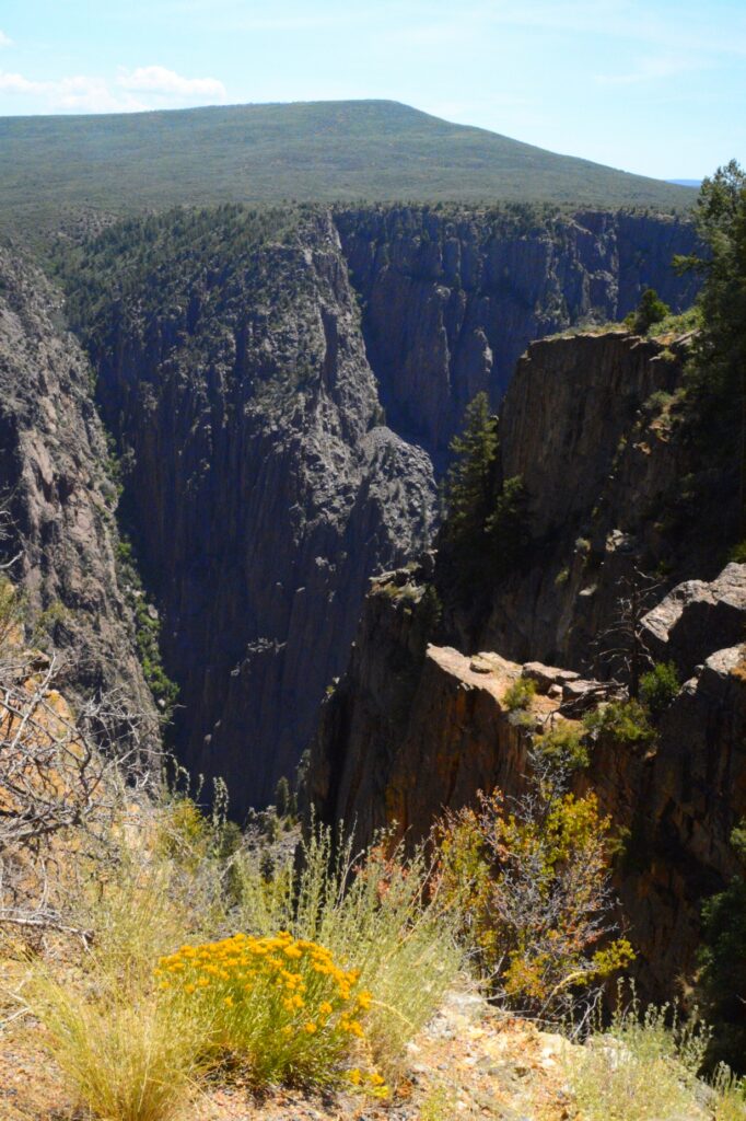
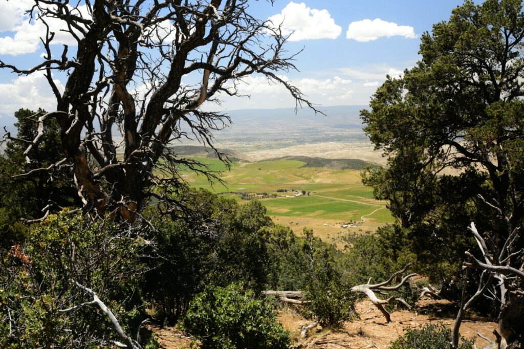
At Warner Overlook the distant valley is visible. The Canyon is 48 miles long, but only 14 miles is contained in the Black Canyon National Park boundaries.
Warner Point Overlook
The contrast between the rocky cliffs and the lush farmland below shows the beautiful variety in God’s creation.
Looking over the valley below
Ray drove the RV back to the entrance of the park where he handed it over to Brian again. Brain thanked us profusely and tried to pay Ray for his time, but Ray refused. He came over to shake my hand and thanked me also. His palm was still sweaty, so I knew his panic had been real. Later, we discovered a wad of money that he’d stuck in Ray’s back pocket. We were just glad to help a fellow traveler out of a pinch.
The road to the bottom of the canyon
After dropping Brian off, we drove the road down to the bottom of the canyon. The descent is quite steep in parts, but a beautiful drive. We brought a picnic lunch. By then it was nearly 2:00 p.m. and we were pretty hungry. We found a covered picnic area right by the river and enjoyed the view while we ate.
We’d had an interesting day. It wasn’t what we had planned, but sometimes God puts people in our way that need His love demonstrated to them.
We were glad to finally get back home to our little home on wheels.
For we are his workmanship, created in Christ Jesus for good works, which God prepared beforehand, that we should walk in them. Ephesians 2:10
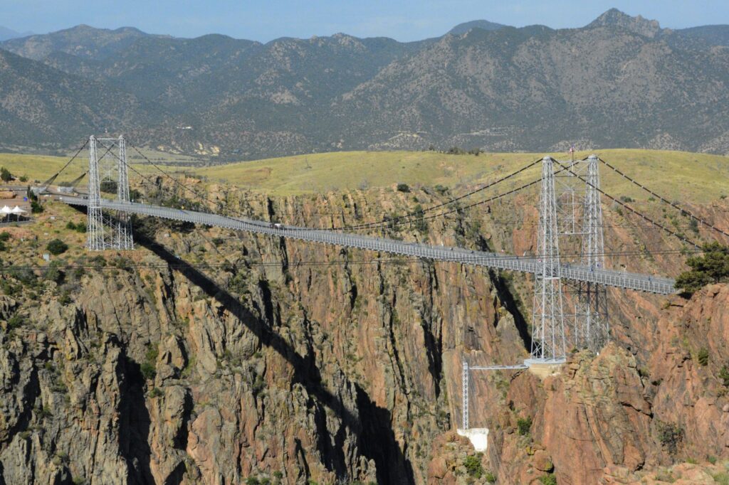
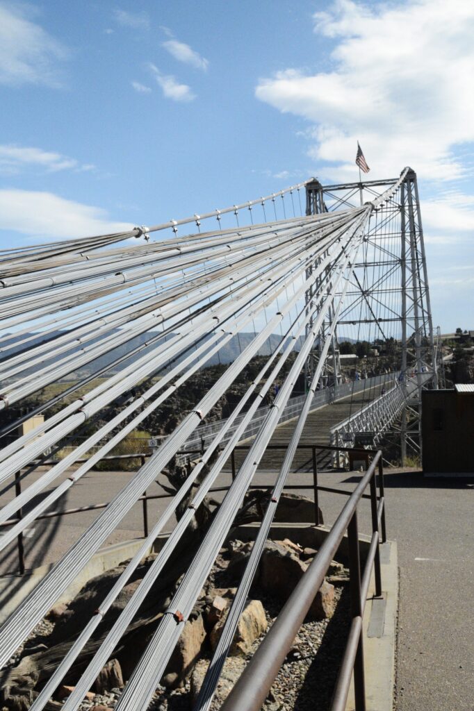
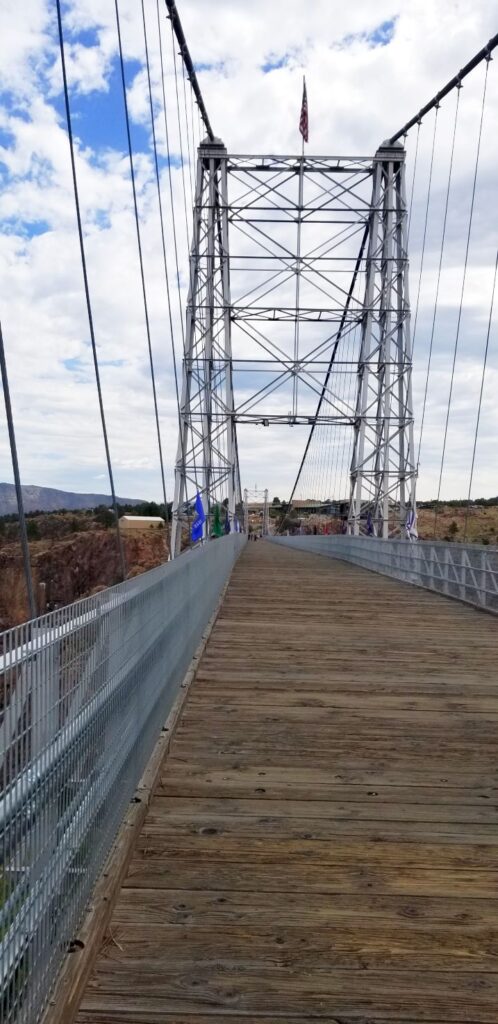
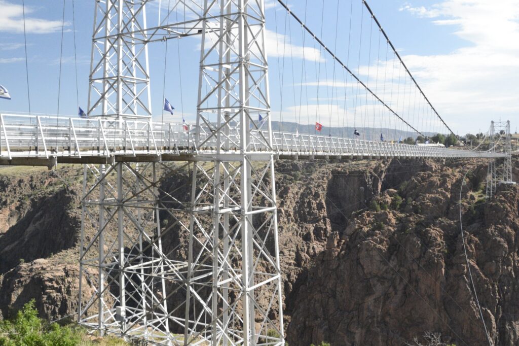
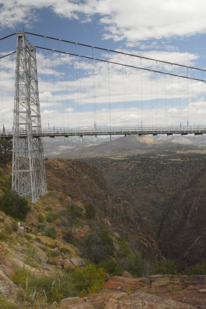
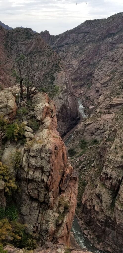
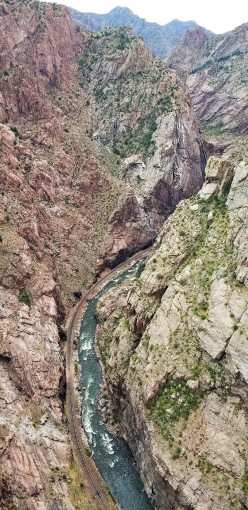
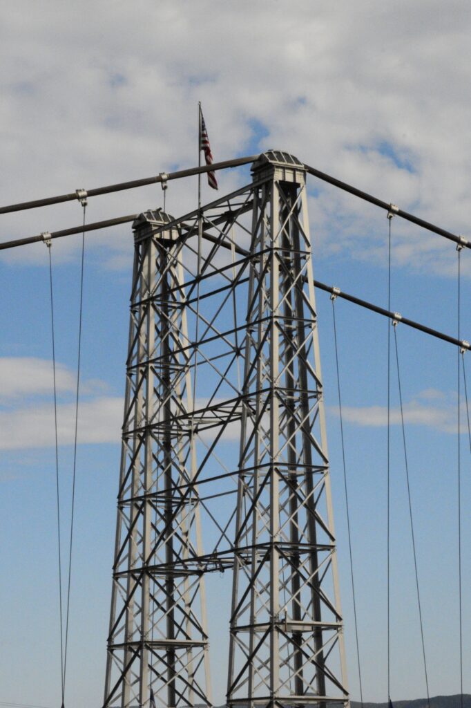
Royal Gorge and Bridge Park is America’s highest suspension bridge. At 956 feet above the Arkansas River, it is quite a feat of engineering having been built in 1929. Eighty men completed the bridge in just seven months.
Royal Gorge Suspension Bridge
A Texan, by the name of Lon Piper, was a businessman and bridge builder who had the dream to build the highest suspension bridge in the world. Along with engineer George E. Cole, they came up with a plan.
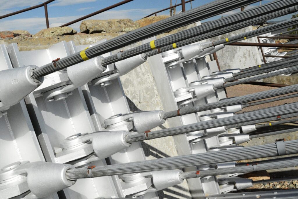
Steel towers 150 feet high were built first on opposite sides of the gorge. Then two steel cables were lowered into the gorge, joined and pulled back up.
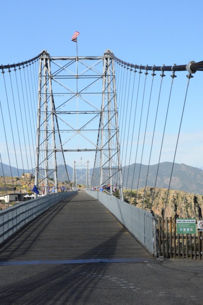
Two primary suspension cables consist of 2,100 strands of No. 9 galvanized wire in each cable. They are attached securely on each side as shown below.
The Royal Gorge Bridge spans 1,260 feet from rim to rim. The bridge floor is made of wooden planks. About 1/5th of them are replaced every year.
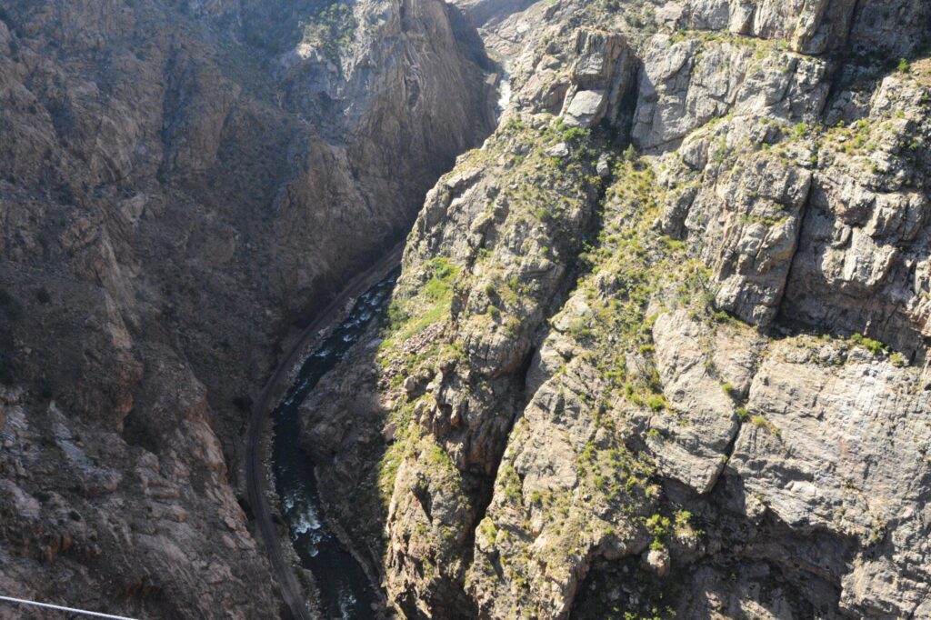
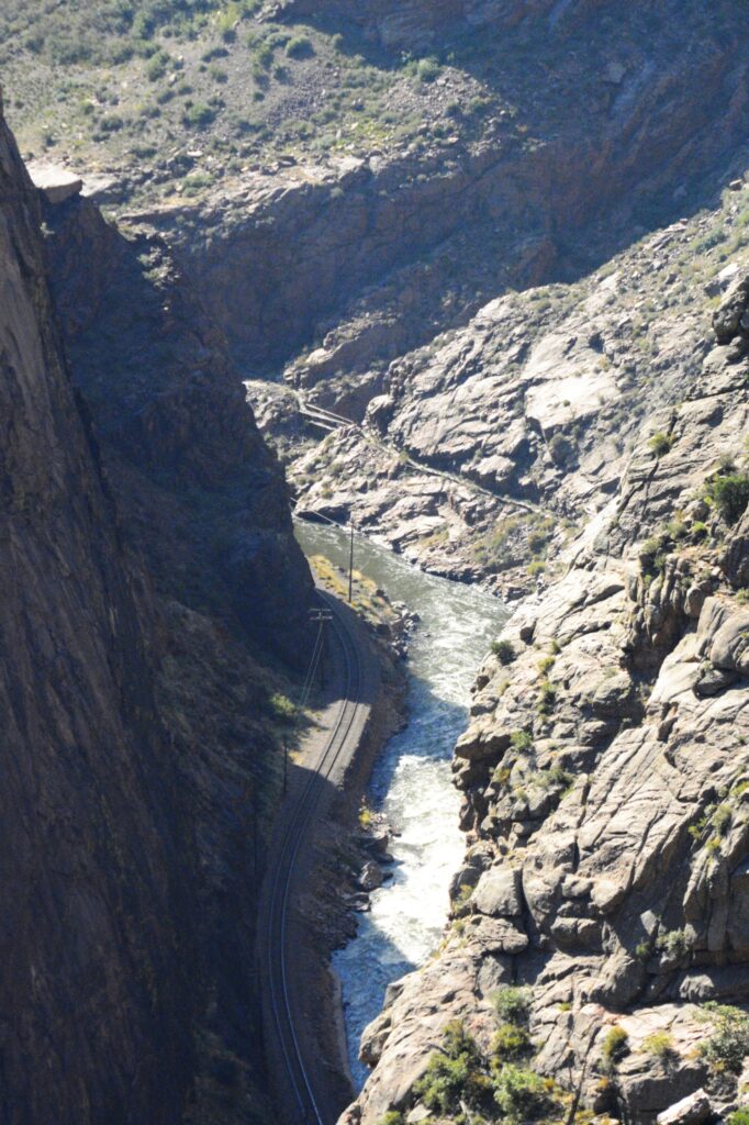
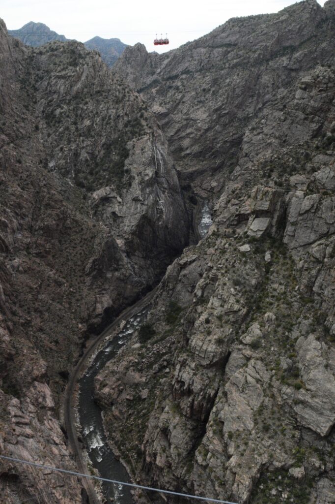
Since the bridge and park are privately owned, there is an entrance fee. We started our tour by walking across the bridge. It is about a quarter of a mile in length. We looked over the sides and saw the rapids of the Arkansas River below.
There is also a railroad track and a train that takes visitors through the gorge for a price. We crossed the bridge and while we were looking around, we heard the train whistle echoing in the canyon below.
On the other side of the gorge is a plaza with places to eat, and a theater. The theater is also a museum. We caught the first showing of a movie that tells the history of the bridge and its construction.
I took some photos of the bridge looking back at the Visitors’ Center before walking back across.
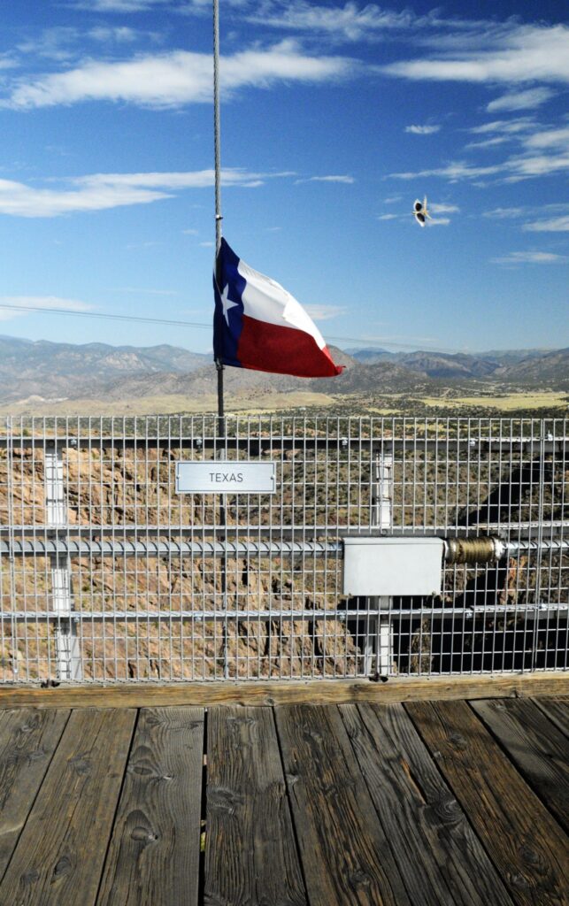
The flags of all 50 states are displayed along the sides of the bridge. We found our home state flag of Texas. I was very surprised to see that I caught a bird or something in the background of the photo. My best guess is it was a scissor-tailed flycatcher.
Texas flag with possibly a scissor tailed flycatcher in background.
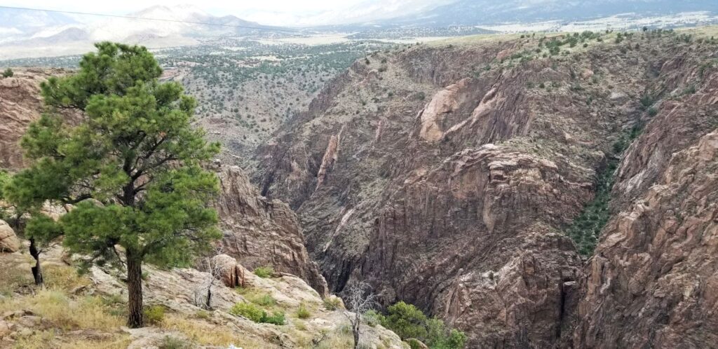
The canyon is stunningly beautiful, with red rocks, and distant mountains.
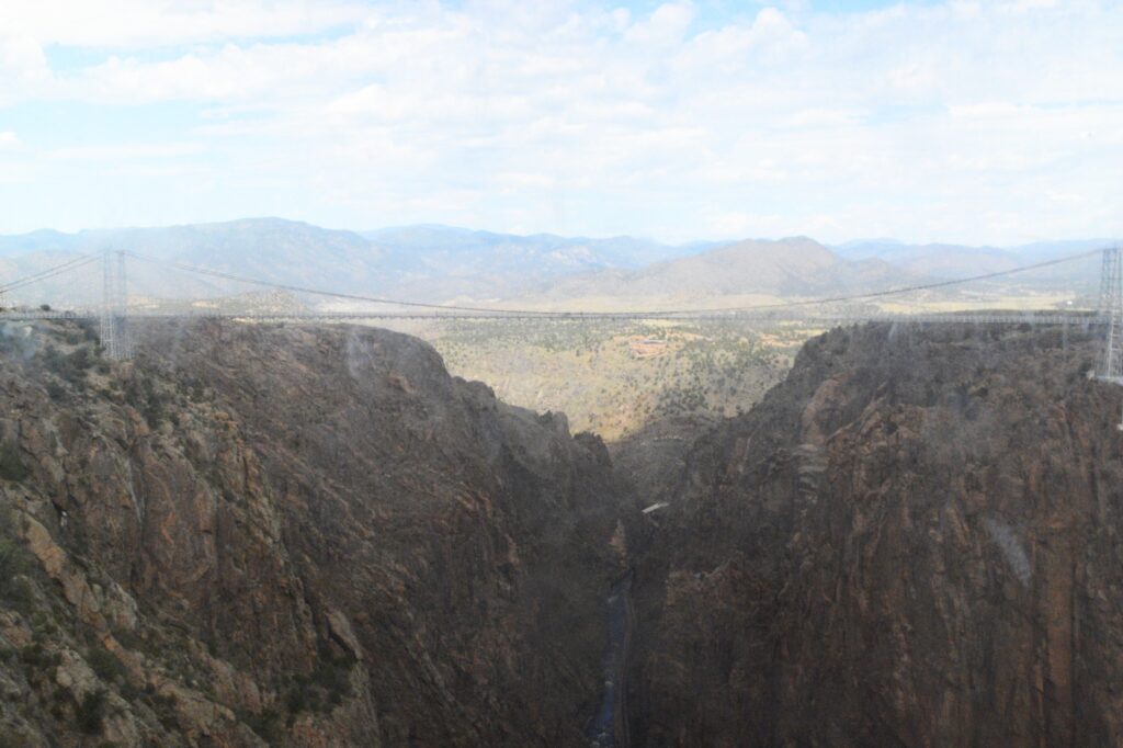
Our ticket included a gondola ride across the abyss. We didn’t know that we could ride it back after we walked across. So we got in line on the Visitors’ Center side. We were crammed in with six other people. It was hot and stuffy and the windows were dirty, so the photos weren’t very clear.
The gondola is suspended above the canyon. It’s a long way down.
The entire bridge can be seen from the gondola ride. After we rode across, we didn’t want to walk back across the bridge again, so we rode the gondola back. That time we were the only ones in our car.
View of bridge through dirty gondola windows.
The views of the gorge from the bridge are really beautiful. It’s a testament to the wonderful variety and splendor of the creation of God.
Royal Gorge Suspension Bridge held the title of highest suspension bridge in the world until 2012. Today, it is highest suspension bridge in the United States.
Zipliners ride the zip line across the canyon
As recently as 2012, a wildfire burned all the park’s buildings and some wooden planks of the bridge. The bridge was unharmed otherwise, and the buildings were rebuilt in seven months.
I visited here when I was a child, but I didn’t remember much about it. I was glad to see it again from an adult perspective. I appreciate the men back in 1929 who dreamed big enough to build a bridge that is a place for people to enjoy today.
The Royal Gorge reminds me of the huge chasm between man and God, and how Jesus bridged the gap that we could never cross.
“For there is one God, and there is one mediator between God and men, the man Christ Jesus.” I Timothy 2:5
Isn’t it wonderful to know that God is the Great Engineer who built a bridge across to us so that we could have a relationship with a holy God through Jesus, His Son.
******
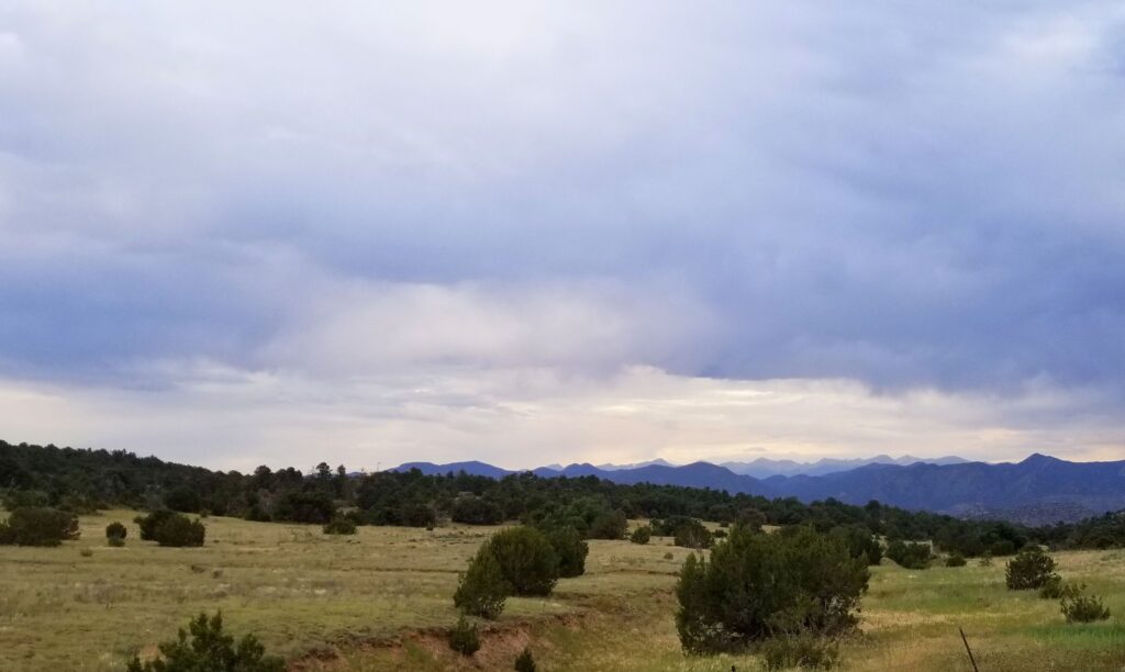
We drove back to our campground in Canon, Colorado. There was a storm that blew through in the evening making the distant mountains take on a purple hue.
We’d had enough excitement for the day. It was good to be back home.
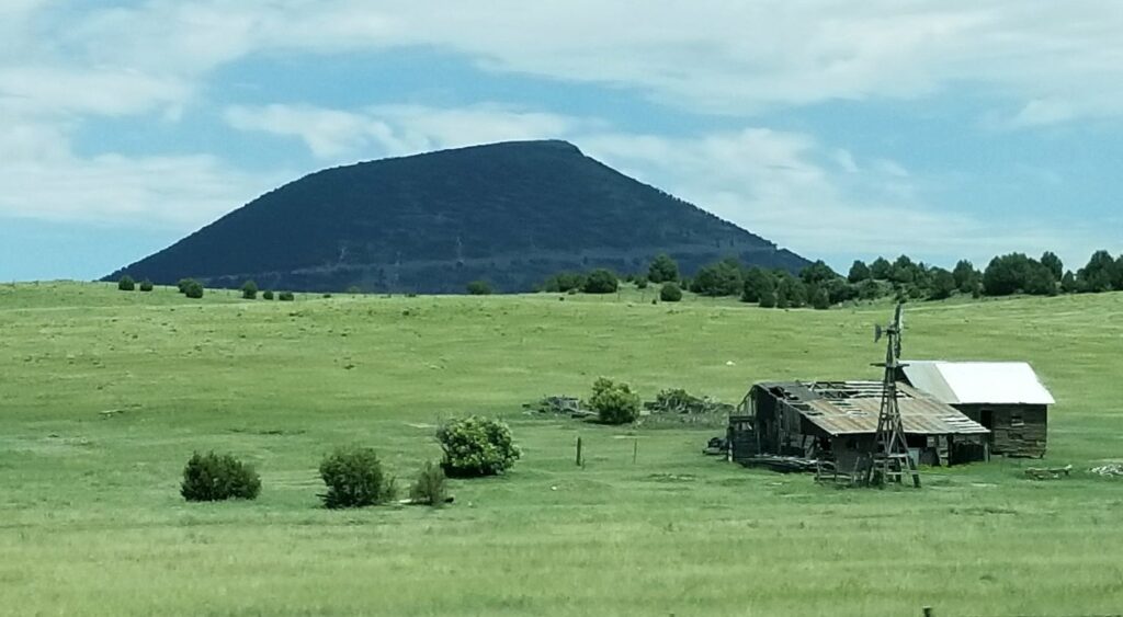
Our path to Colorado took us across the northeastern corner of New Mexico. Everything was green and beautiful. As we passed Capulin Volcano National Monument, I took a photo out the window. I thought maybe someday we would be able to visit there. Little did I know that day would come sooner than expected.
Not many miles past the volcano, our truck sounded a warning. A service engine light came on with a message that the truck fuel exhaust system needed cleaning. “Keep driving,” it said. Then it reduced the power and went into limp mode. It was especially slow going uphill. There was nothing we could do. It gave us seven warning messages. It seemed like our truck had major problems. That’s a scary thing when you’re pulling a trailer and there’s a mountain pass between you and your destination.
We stopped in the nearest town, Raton, New Mexico, where Ray got a bottle of fuel cleaner to add to the fuel tank. To make a long story short, we got a campsite in the KOA park there and made an appointment with a diesel mechanic the soonest we could get, which was five days from then.
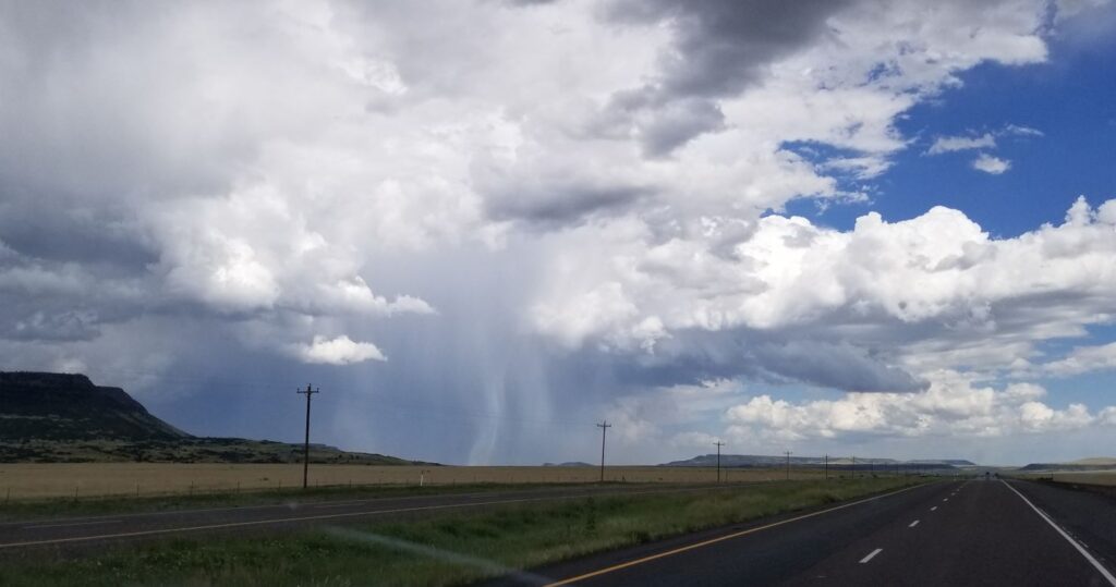
In the meantime, we needed to drive the truck to get the fuel cleaner throughout the system. We decided to drive back to see the Capulin Volcano National Monument that very same day. On the way, we saw a rainstorm about to cross our pathway.
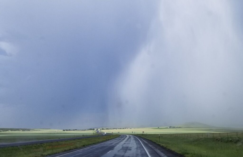
Most of it blew across the road before we got there, but we got a real truck wash for a few minutes.
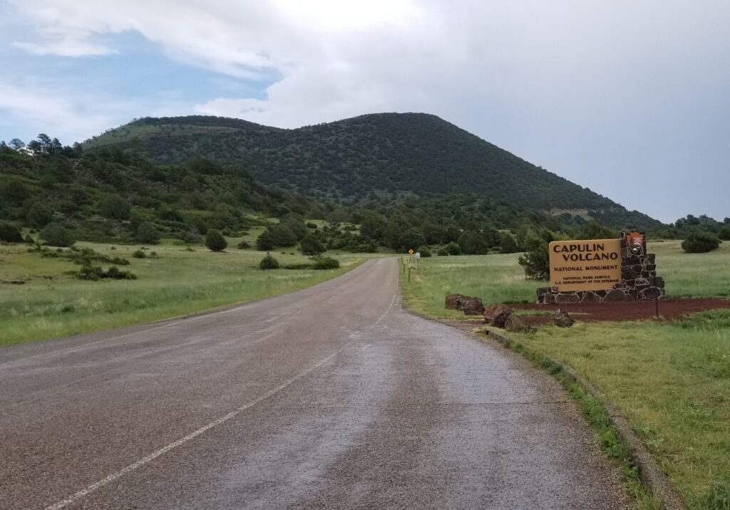
The national monument was only a few miles off the main road. The drive through the countryside was beautiful, especially after the rain.
We stopped at the Visitors’ Center before we drove up the road to the top of the volcano. The road curves around the volcano as it climbs to the top. The views were really something.
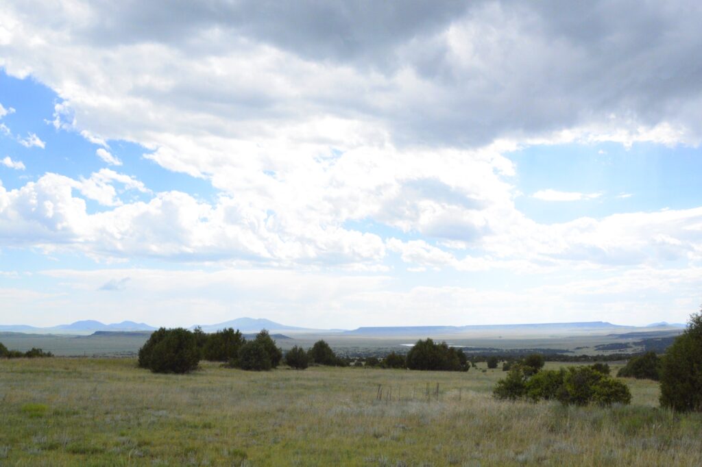
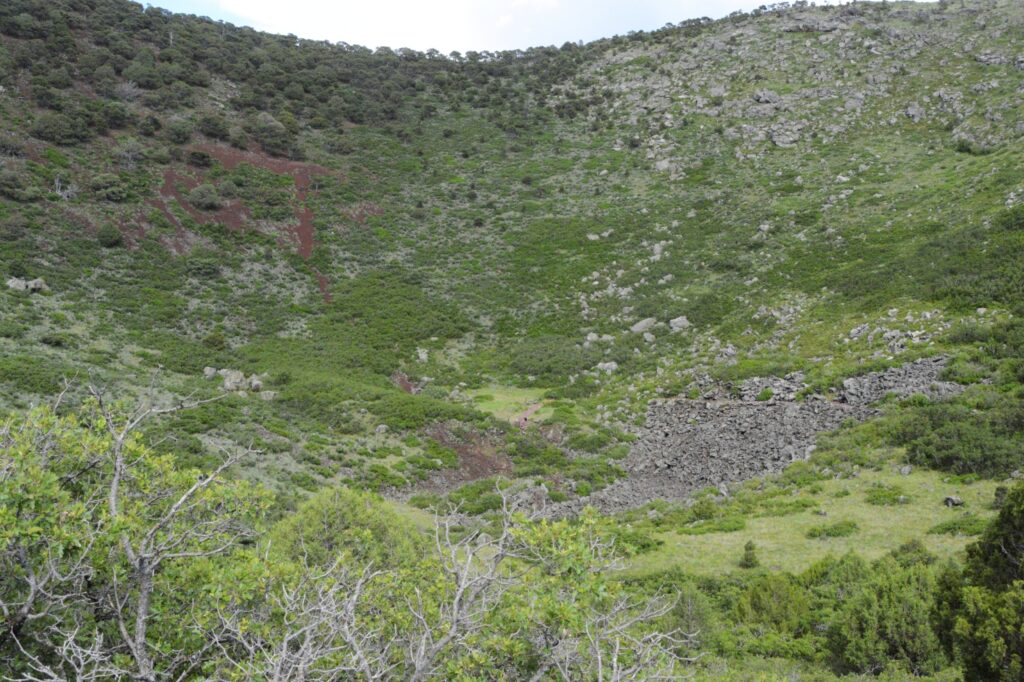
A shield volcano can be seen from the road up Capulin volcano.
At the top of the volcano was a parking lot. From the parking lot, there was a trail that went around the top of the crater and down to the bottom. We did not attempt that. It was a long ways down. If you look carefully, you might be able to see people at the bottom of the crater.
The crater was covered in vegetation, which surprised me. I was expecting bare rocks. I think that means this volcano has been extinct for a very long time.
Crater of Capulin Volcano
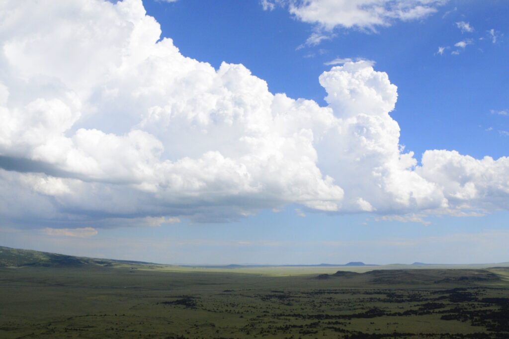
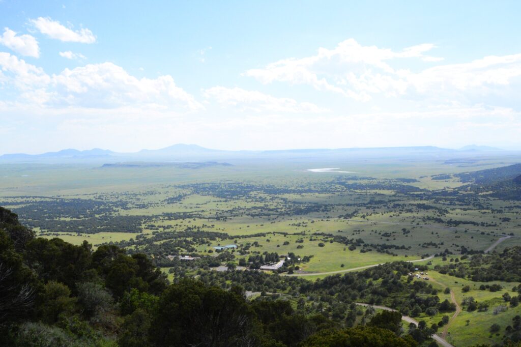
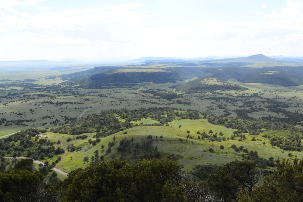
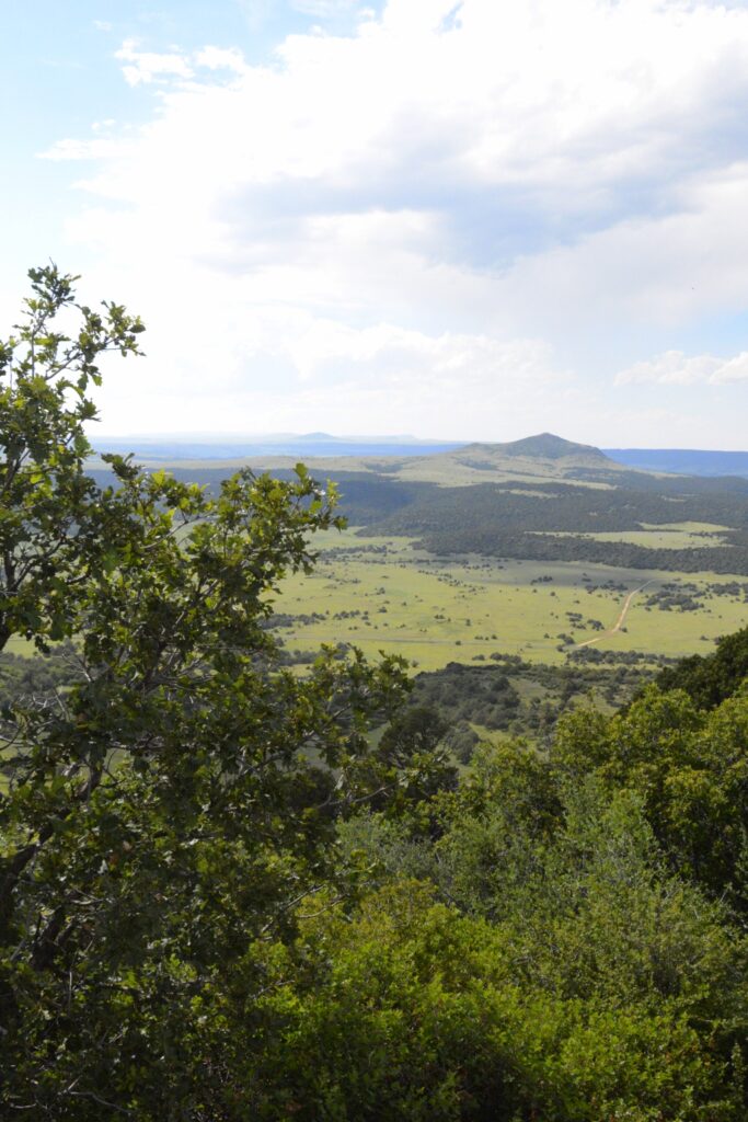
Here are a few more views from the top of the volcano. The elevation at the top was 7,877′.
View from top of volcano
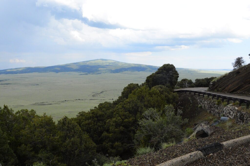
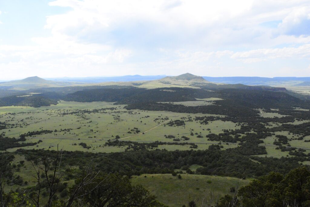
The flat top mountains are ancient lava flows. The peaks are other cinder cones, shield volcanoes and volcanic domes.
View from top of volcano
Capulin Volcano is said to have erupted when mammoths and giant bison roamed these plains.
There’s an interesting story about a former slave from Texas who found some ancient bison bones after a devastating flood in an area seven miles north of Capulin Volcano. What made the discovery important was the finding of “Folsom points”, stone projectile points used by early bison hunters. The fact that they were intermingled with the giant bison ribs, even embedded in one, meant that they could place mankind in North America almost 7,000 years earlier than previously thought. Of course, if they had believed the Bible, they could have saved themselves some trouble with their dating process.
President Woodrow Wilson declared Capulin Mountain a National Monument in 1916. It was considered the most perfect specimen of extinct volcanoes in North America. A road was built in 1925. In 1933 a Civil Works Project was approved and gave local men a dollar a day plus food to build a sound road. It was 1987, however, before the road was actually paved.
*****
Over a period of four days, we drove the truck several miles. One day we took a drive to nearby Sugarite State Park. The park has a couple of lakes formed by dams.
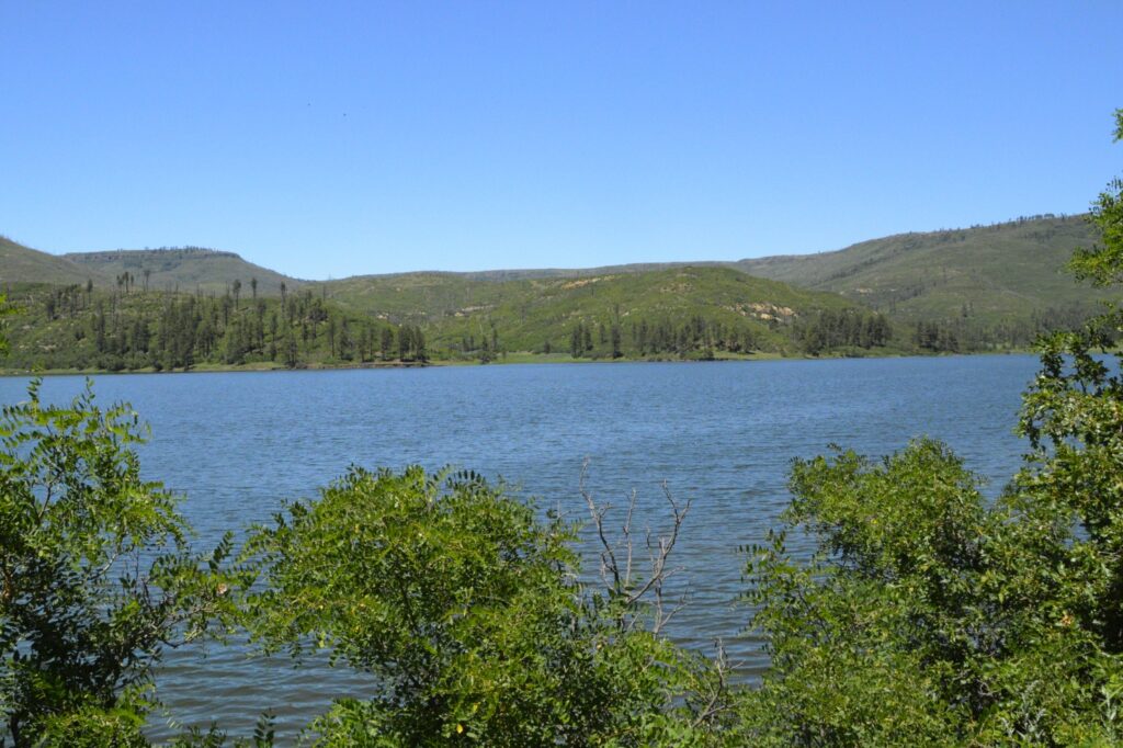
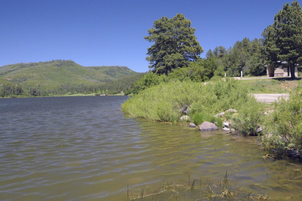
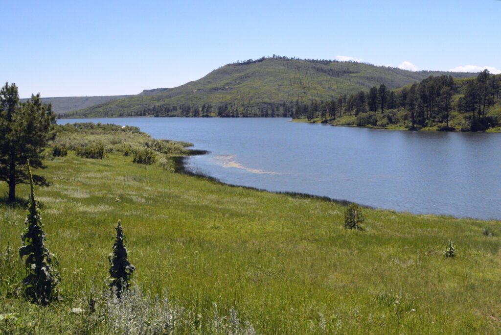
The upper lake, Lake Maloya, is the larger lake. The park is so close to the state line that Lake Maloya extends a short distance over the Colorado border.
Lake Maloya at Sugarite State ParkThe hills beyond the lake are in Colorado
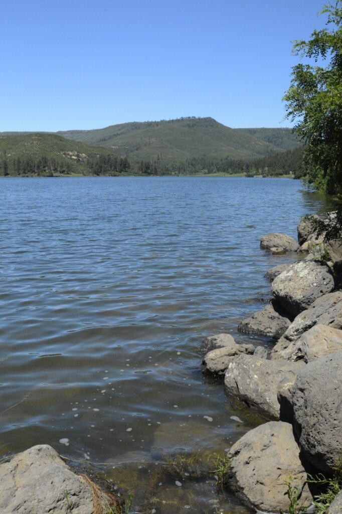
The lake is a popular fishing spot. A fisherman told me that there were pike and trout in the lake.
Lake Maloya is a popular place for fishing.Lake Maloya
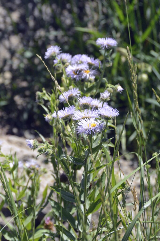
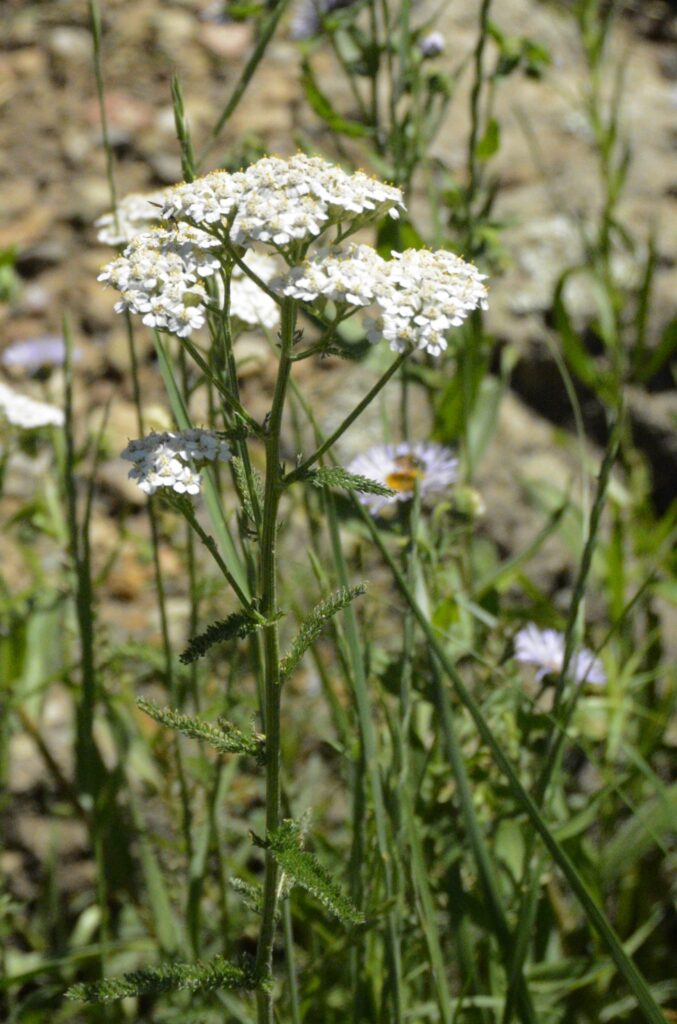
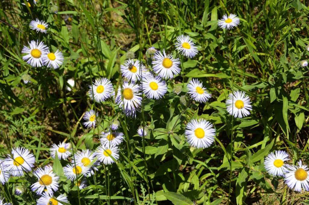
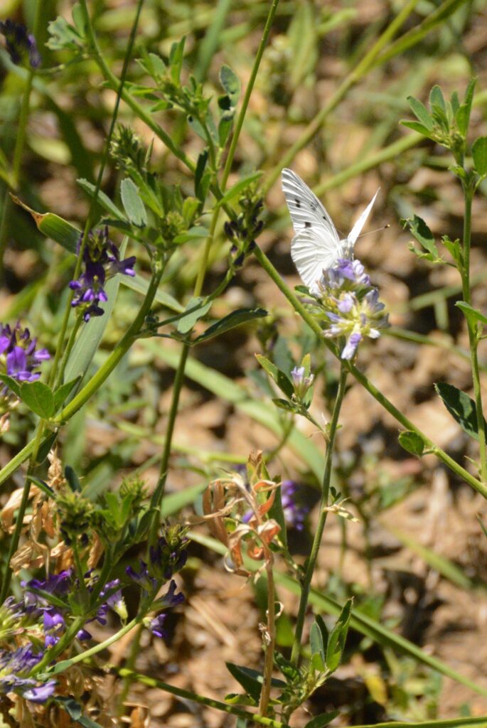
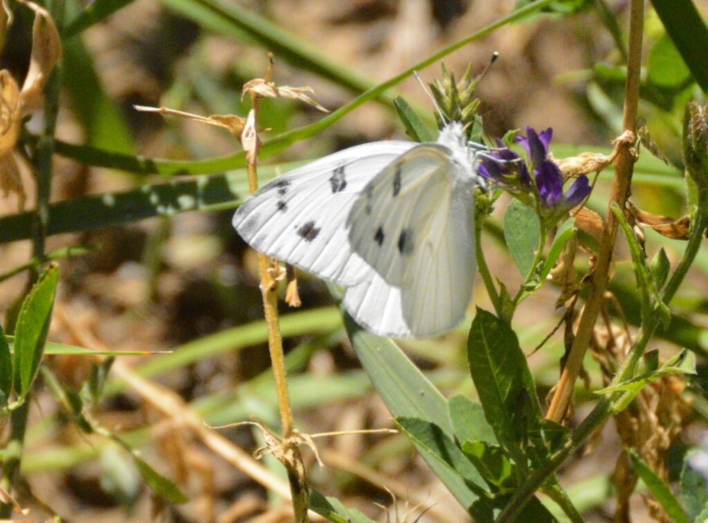
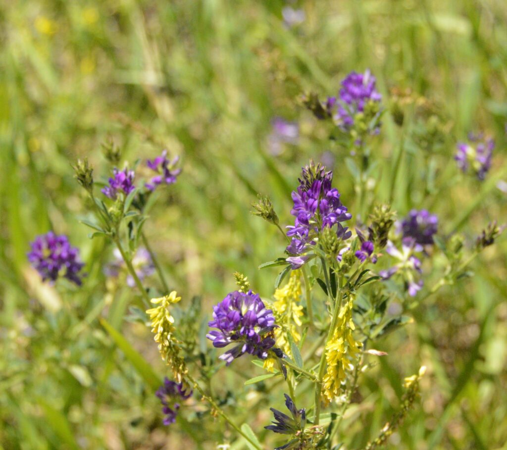
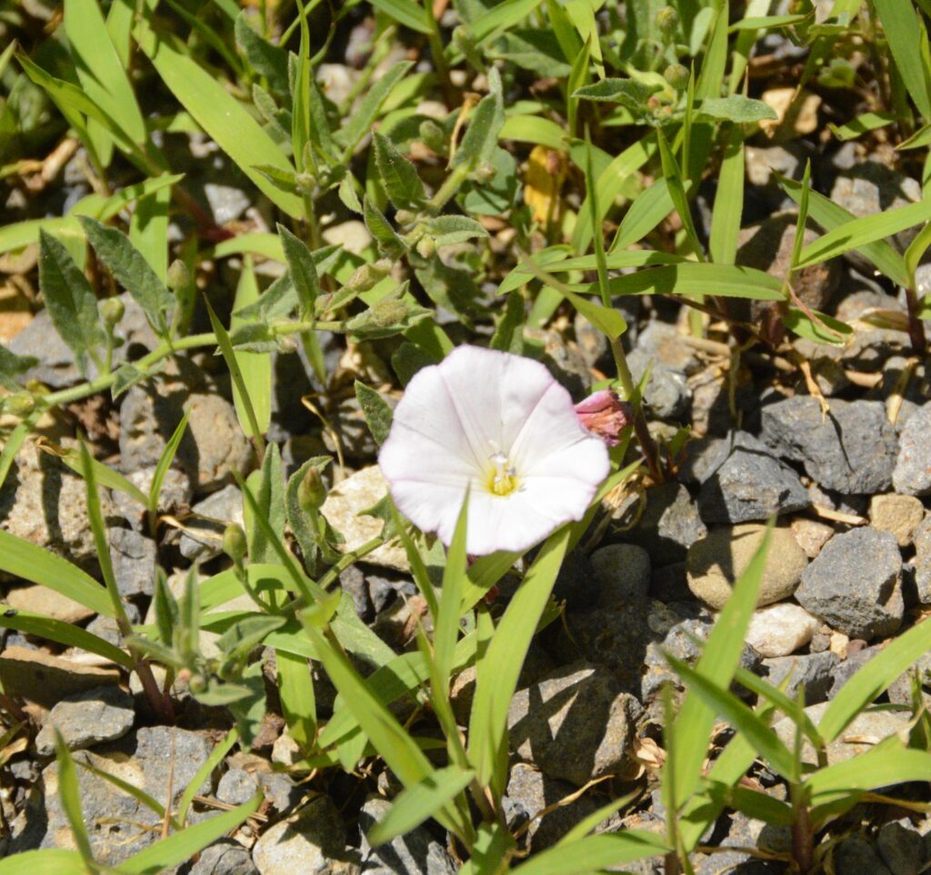
There were many wildflowers in bloom around the lake. Butterflies were also abundant. I discovered a phone app called “Picture This” that helps me identify flowers just by taking a photo of them. Here are some I identified with it.
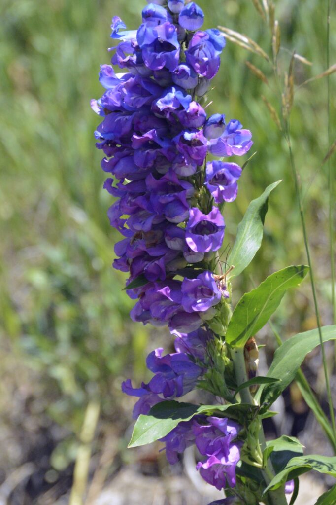
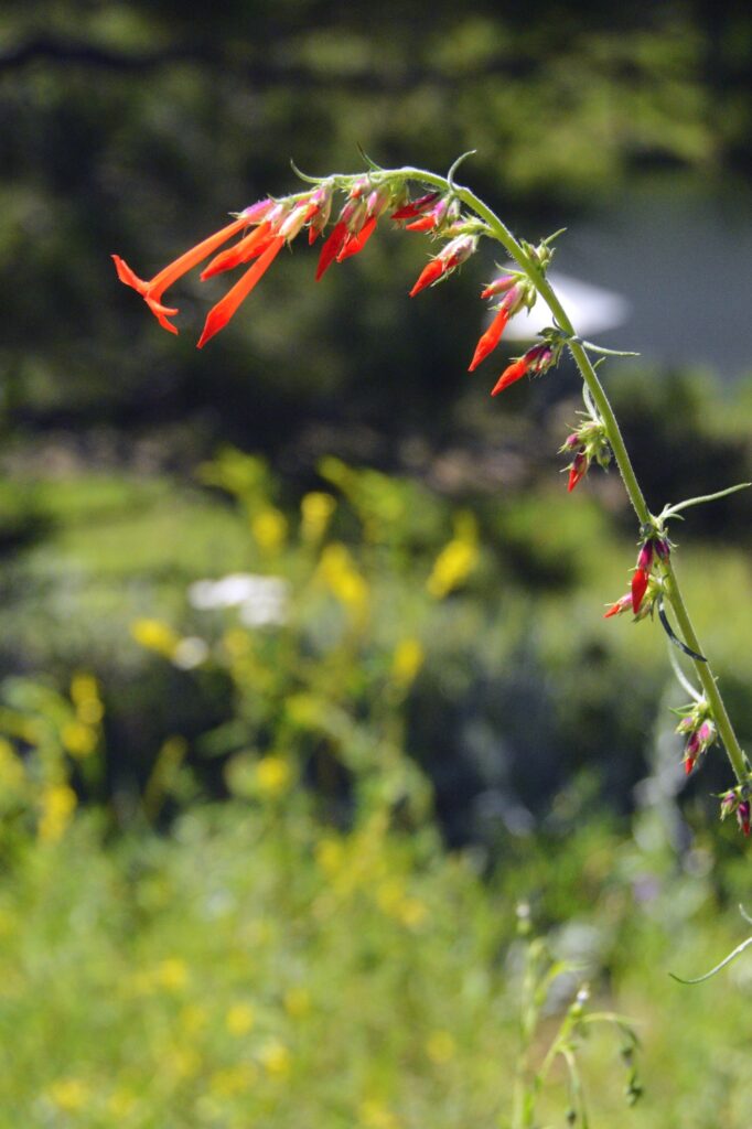
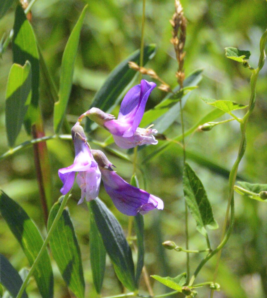
Rocky Mountain PenstamonAspen FleabaneYarrowAspen FleabaneCheckered White ButterflyAlfalfa flowersField BindweedScarlet GiliaMarsh Pea
We continued driving the truck each day. On day four, Ray was able to clear all the warning messages and canceled the appointment with the mechanic. The truck was running fine. We left the next day and drove across the pass to our next destination, thanking God for His wonderful care for us.
“Lord hears his people when they call to him for help. He rescues them from all their troubles.” Psalm 34:17