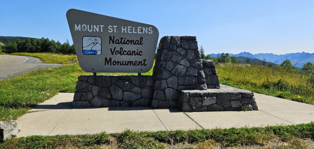
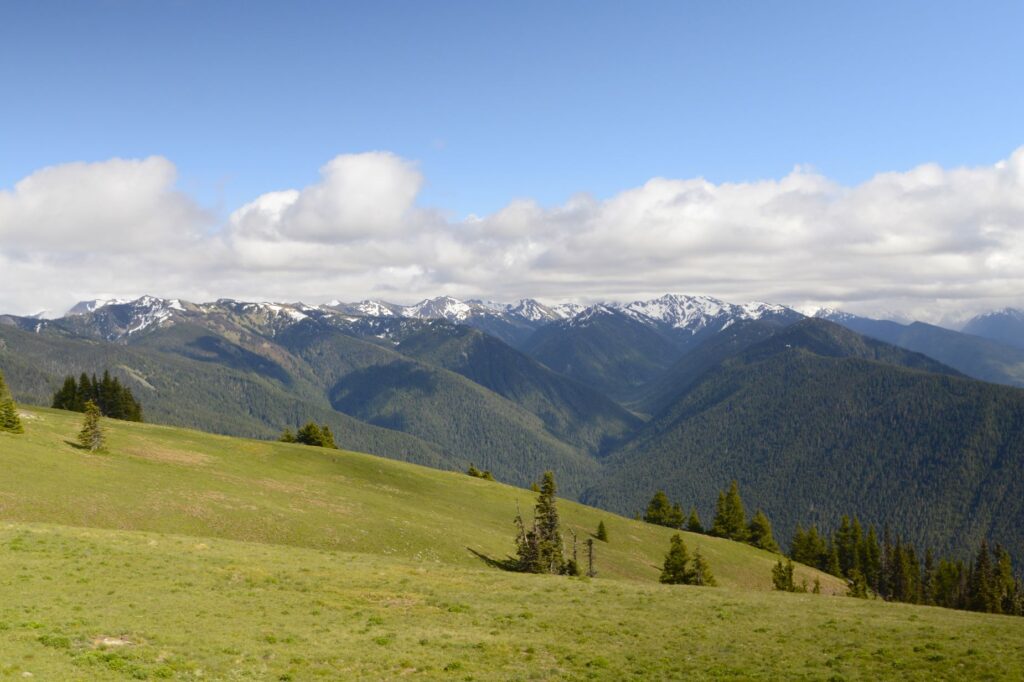
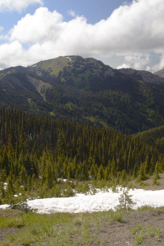
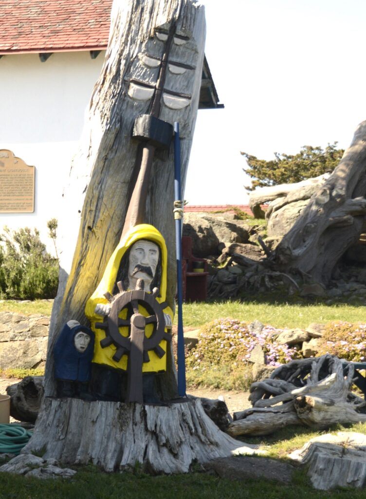
In 1980, Mt. St. Helens erupted. It is still considered an active volcano and is monitored carefully. It demonstrates to us how the earth can be transformed quickly by a catastrophic event.
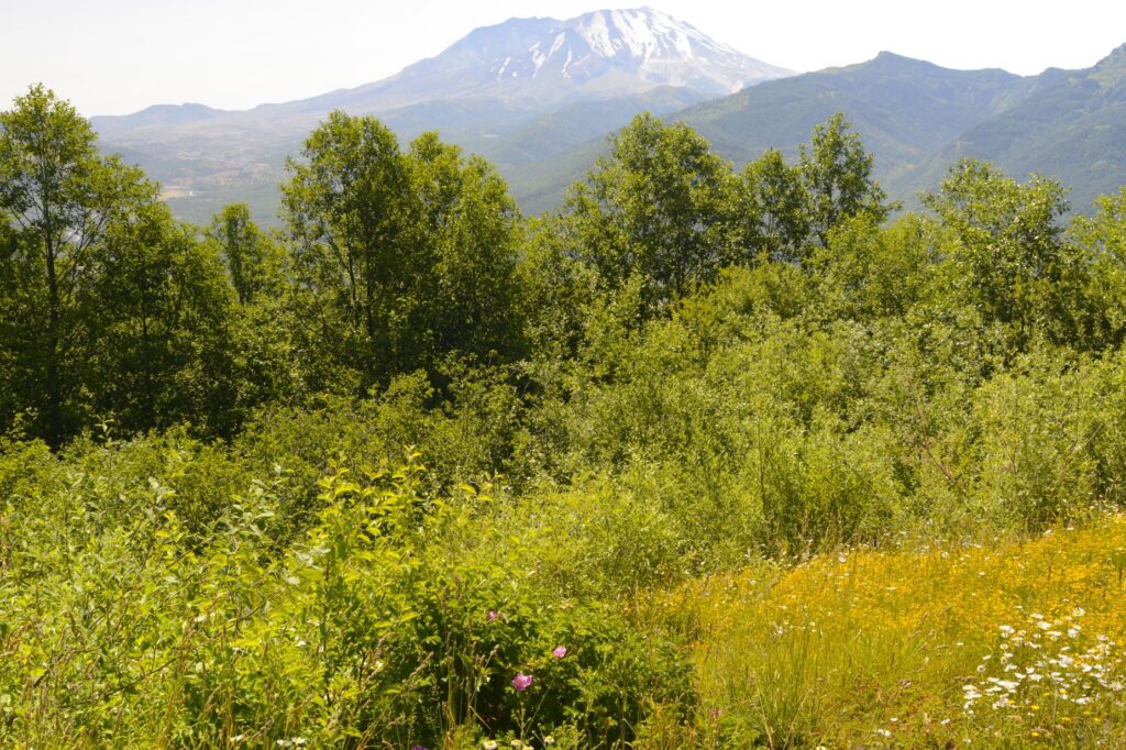
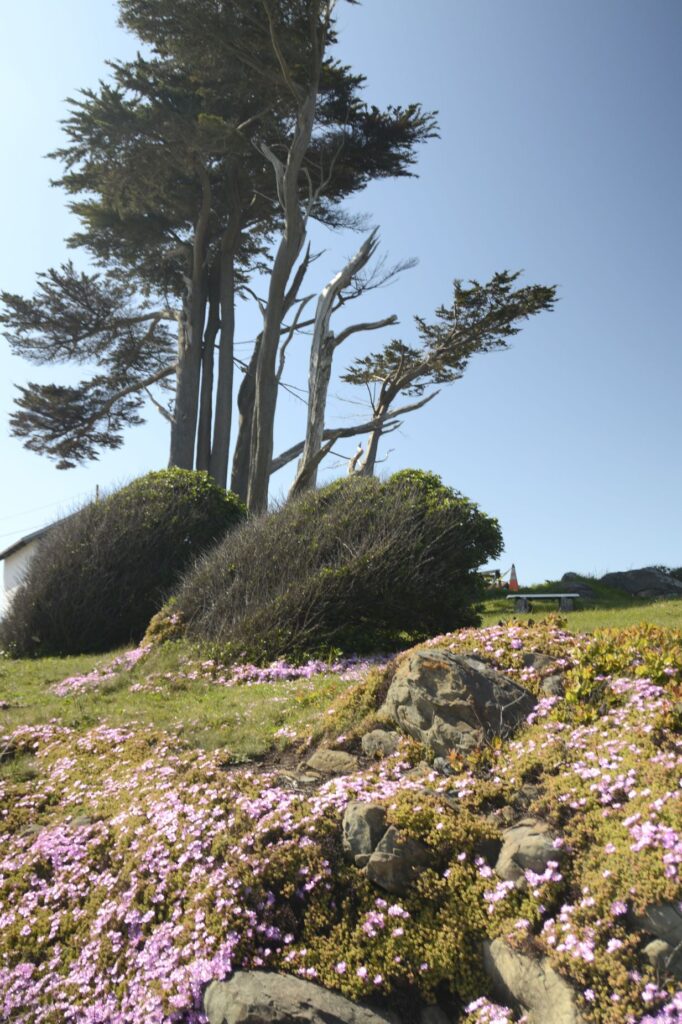
We drove to the west entrance of the national monument on Highway 505. The wildflowers were blooming. This created a peaceful view of the mountain as we stopped along the way at a couple of viewpoints.
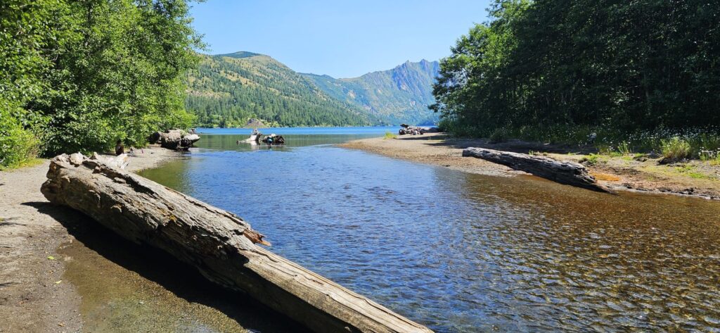
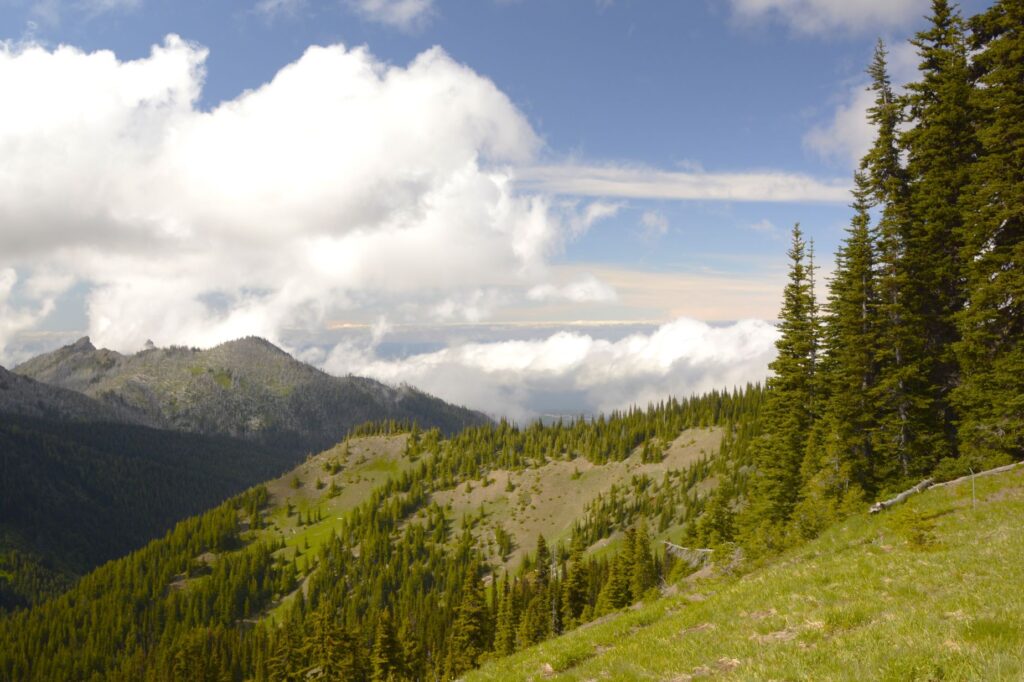
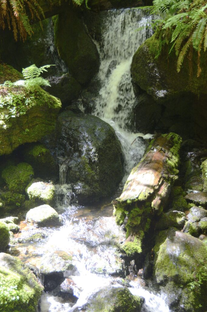
We tried to go to the end of the road to Johnston Ridge Observatory, but the road was closed for repairs. We could only go as far as Coldwater Lake. Apparently, the repairs are serious, in that, it isn’t expected to open until 2025. We stopped instead at Coldwater Lake where we found a picnic table to eat our lunch.
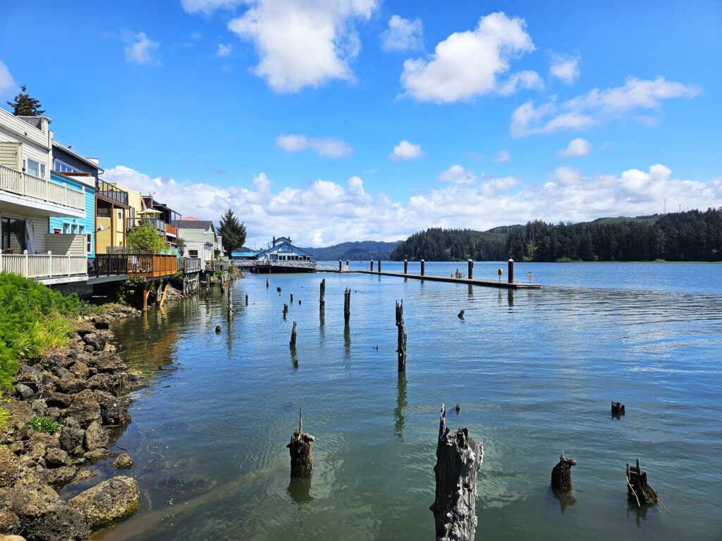
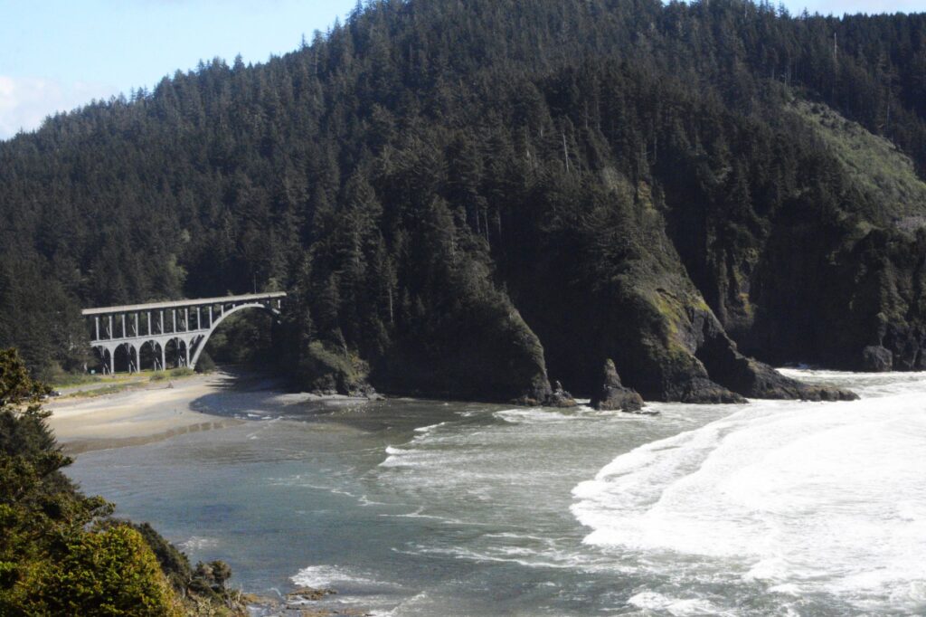
Coldwater Creek and Coldwater Lake. Notice the clear water.
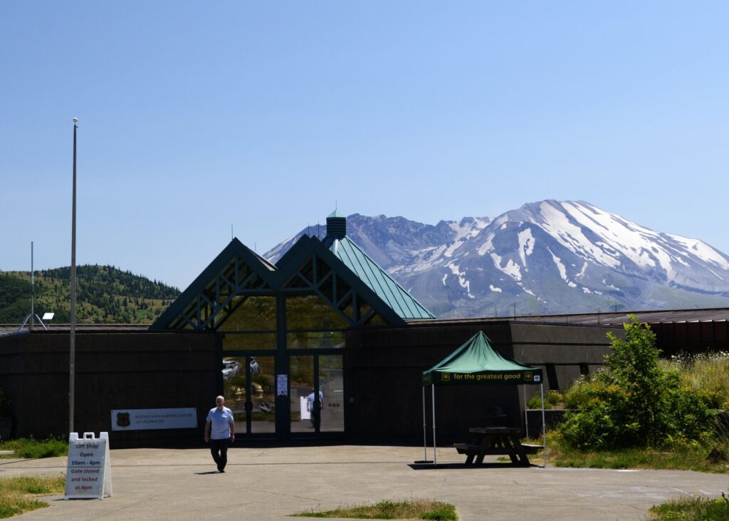
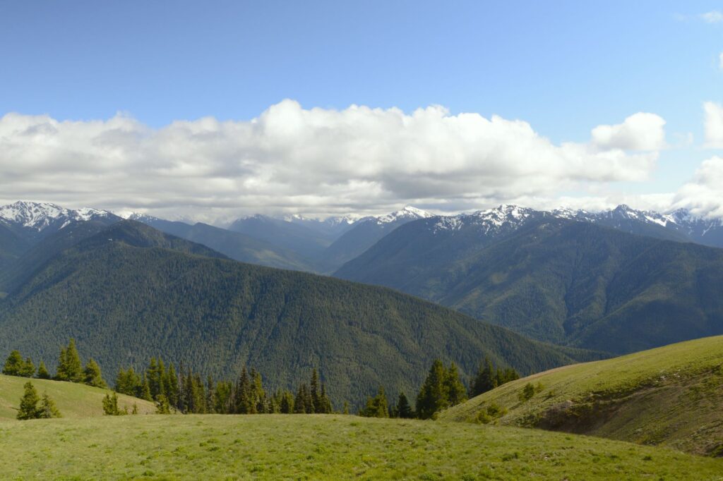
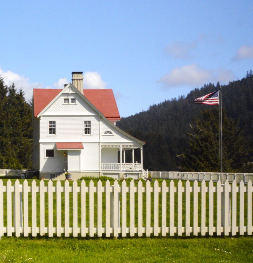
After lunch, we went to the Coldwater Visitors’ Center where we listened to a Ranger talk. From the deck we had a clear view of the mountain and Coldwater Lake where we had just been.
Coldwater Visitors’ Center
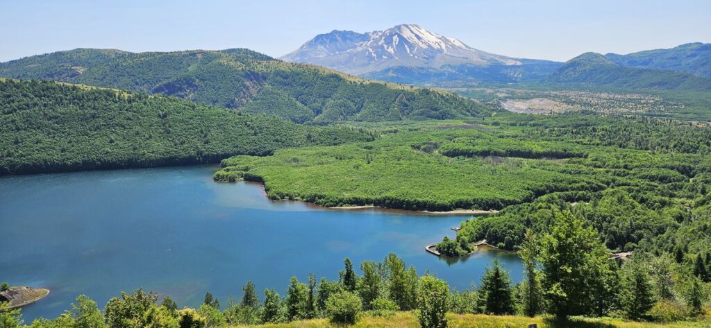
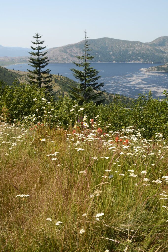
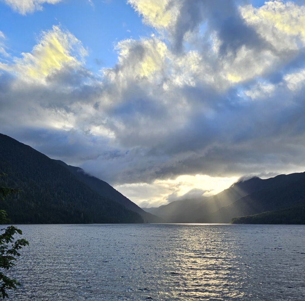
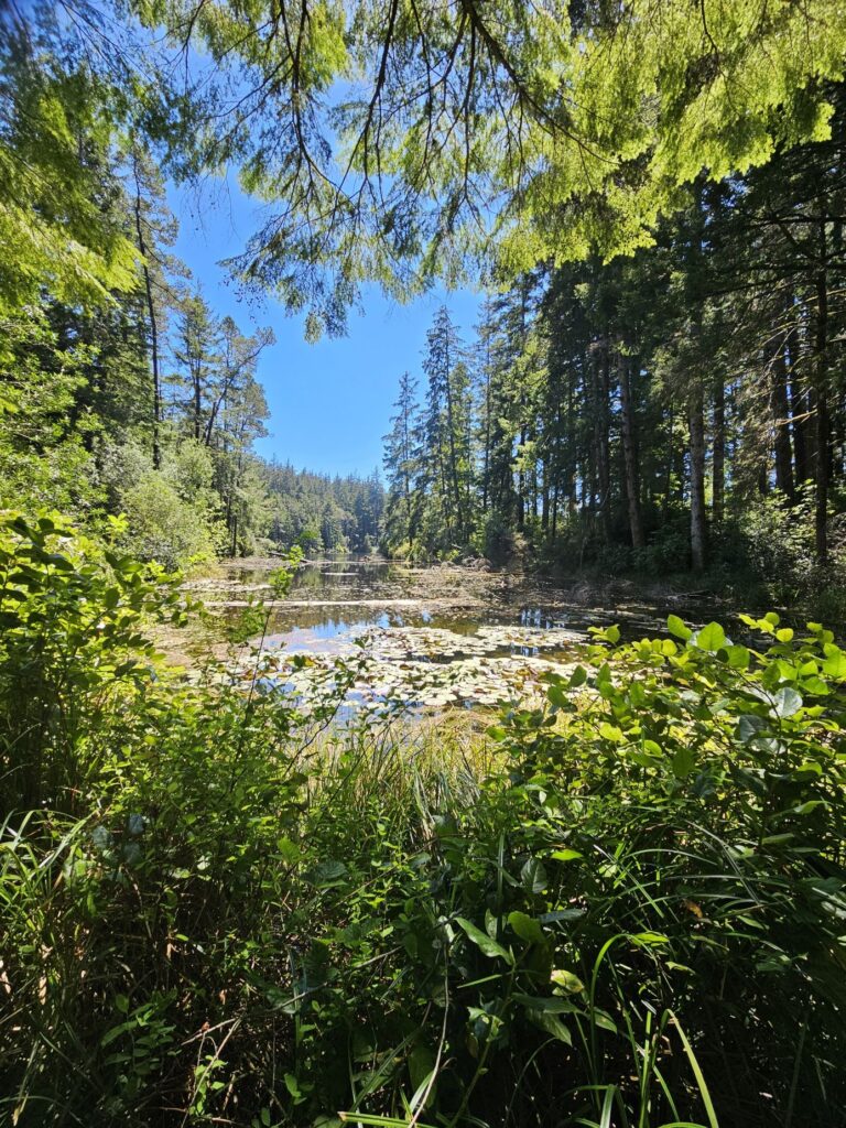
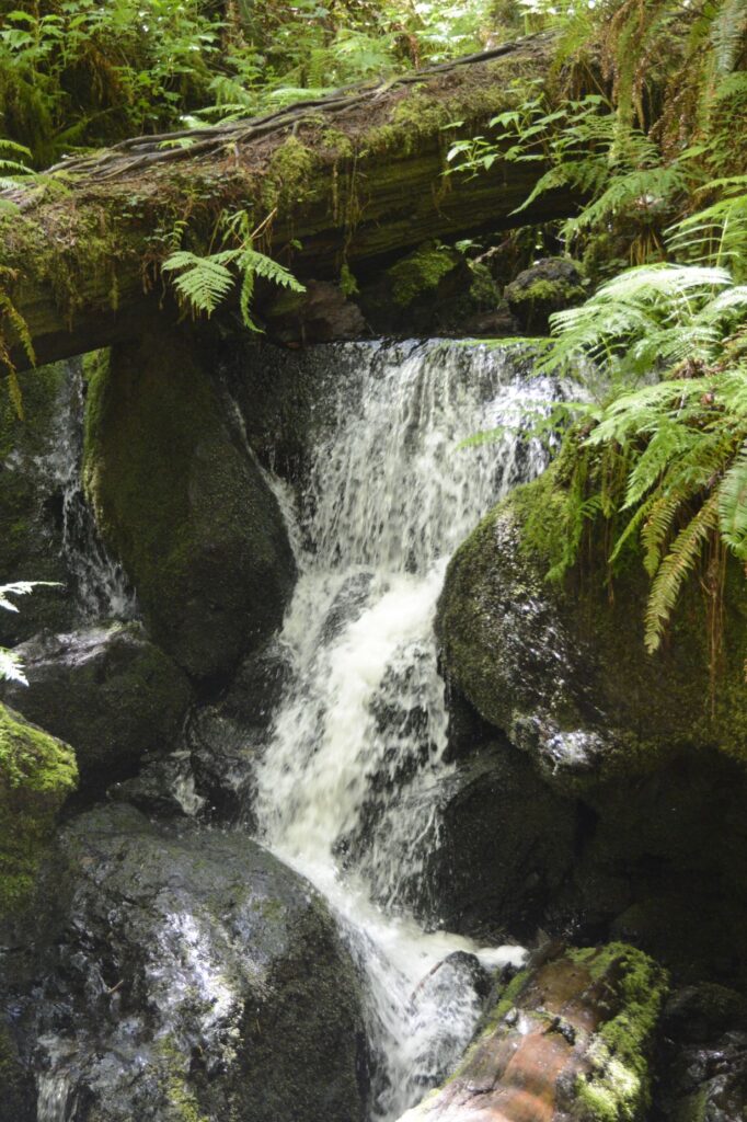
Coldwater Lake was formed after the eruption when Coldwater Creek was blocked by debris. Looking at the vegetation growing around the mountain, one wouldn’t suspect that anything catastrophic had happened recently. Coldwater Lake is clear and blue. But after the blast, it was filled with volcanic debris and vegetative matter. Though it took several months, bacteria in the water cleared up the debris in a very short time.
Mt. St. Helens and Coldwater Lake From Coldwater Visitors’ Center
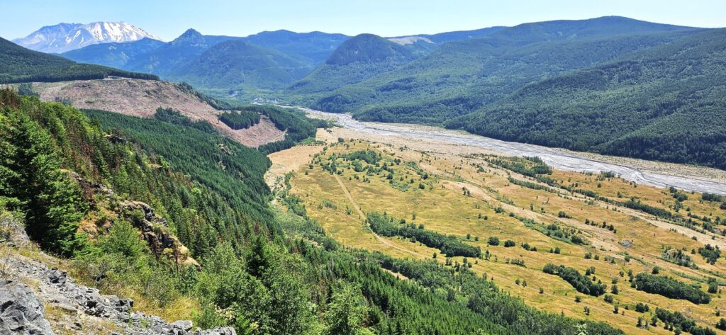
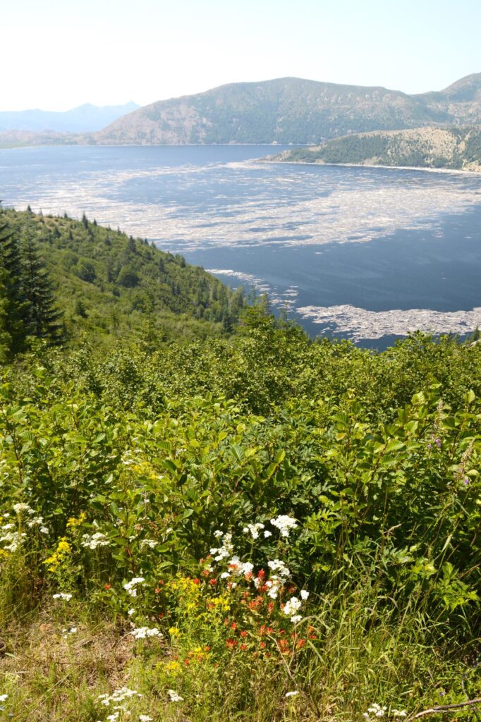
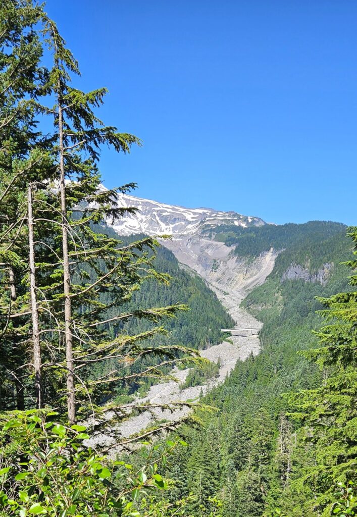
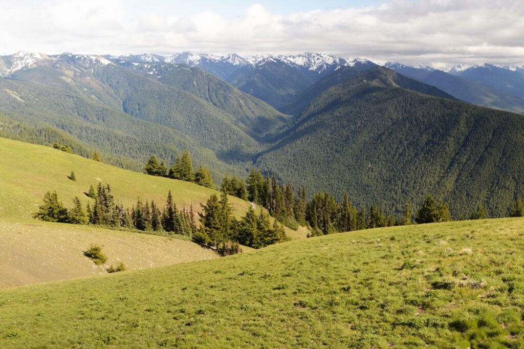
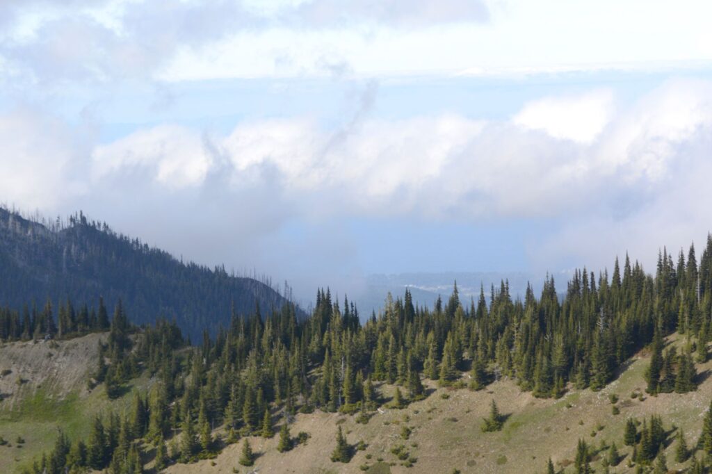
On our way out, we stopped at the Mt. St. Helens Forest Learning Center. From that viewpoint, we could see the debris channel where mud, water and ash flowed for several miles on the day of the eruption. Many trees have been planted in some of the blast areas. Today they are fully grown. Other areas were left alone to study the results of natural re-vegetation.
Debris flow and Mt. St. Helens in the background. Looking down river at the debris flow.
On another day, we drove to the backside of Mt. St. Helens to see Spirit Lake. The road there is an old forestry road. It is not bad, however, since it is paved the entire way. On that day, smoke from wildfires clouded the air.
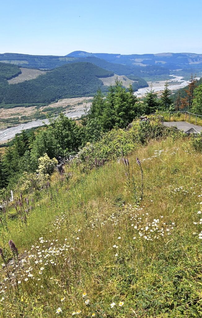
Flowers bloom where the former blast occurred.
All of the trees near the mountain were laid flat when the blast occurred. Only the areas in the shadow of the surrounding hills were left standing. The trees which were blown into the lake formed a mat that covered 40% of the surface. Today, there is still a small area covered by floating logs.
Spirit Lake
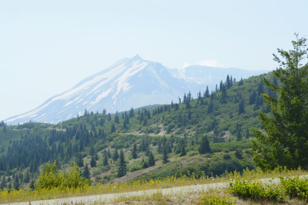
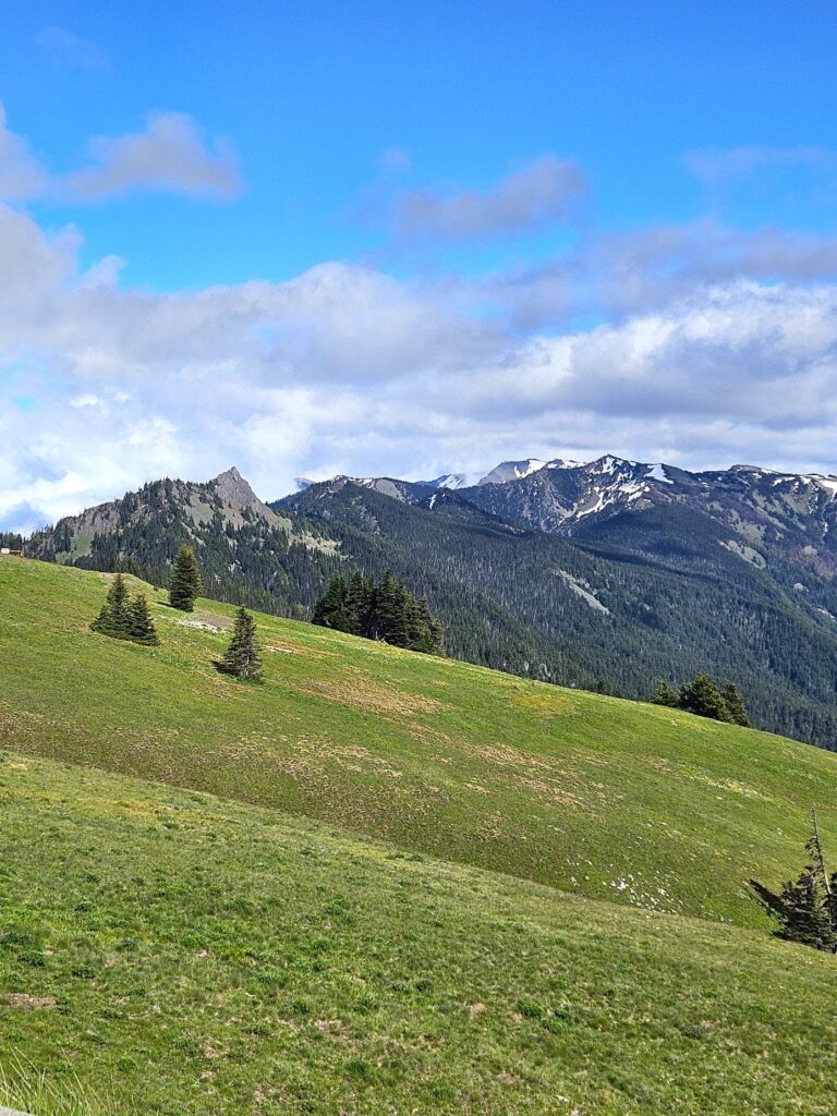
Mt. St. Helens had a very cone-like shape before the eruption. This is the side of Mt. St. Helens that was blasted away during the eruption. It is very easy to distinguish Mt. St. Helens from the other mountains around because of its altered shape.
Mt. St. Helen from Spirit Lake viewpoint.
The natural outlet to Spirit Lake was blocked and the lake rose 200 feet. A tunnel had to be constructed to maintain the lake’s depth at a constant level.
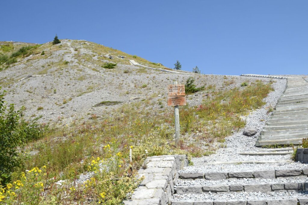
Although there is a trail up a ridge to see a better view of Spirit Lake, we opted out.
Trail to the top of the hill.
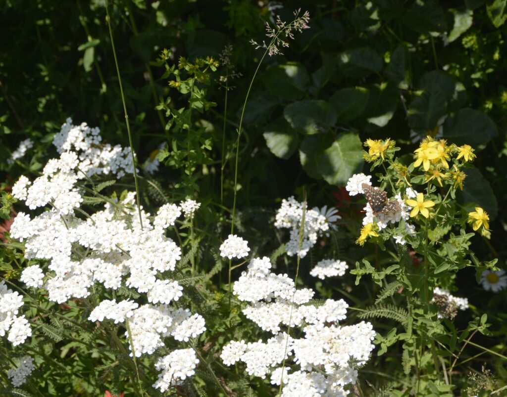
Wildflowers were abundant when we were there. Can you see the butterfly?
Looking the other direction at Spirit Lake, one can still see the area of destruction from the blast decades later. However, there is also plenty of plant life that has grown back, and wildlife that have come back to live there.
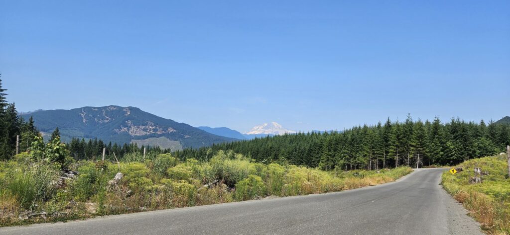
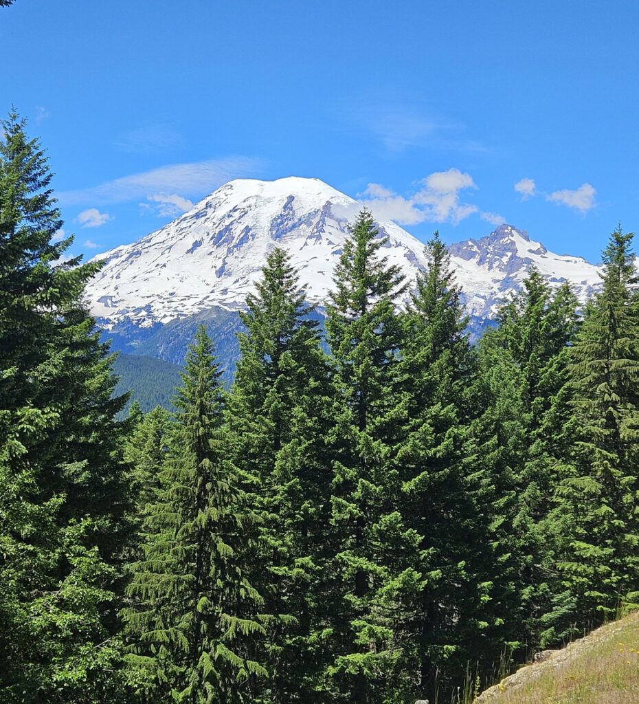
On our way back home, we spotted a very familiar mountain peak in the distance–Mt. Rainier.
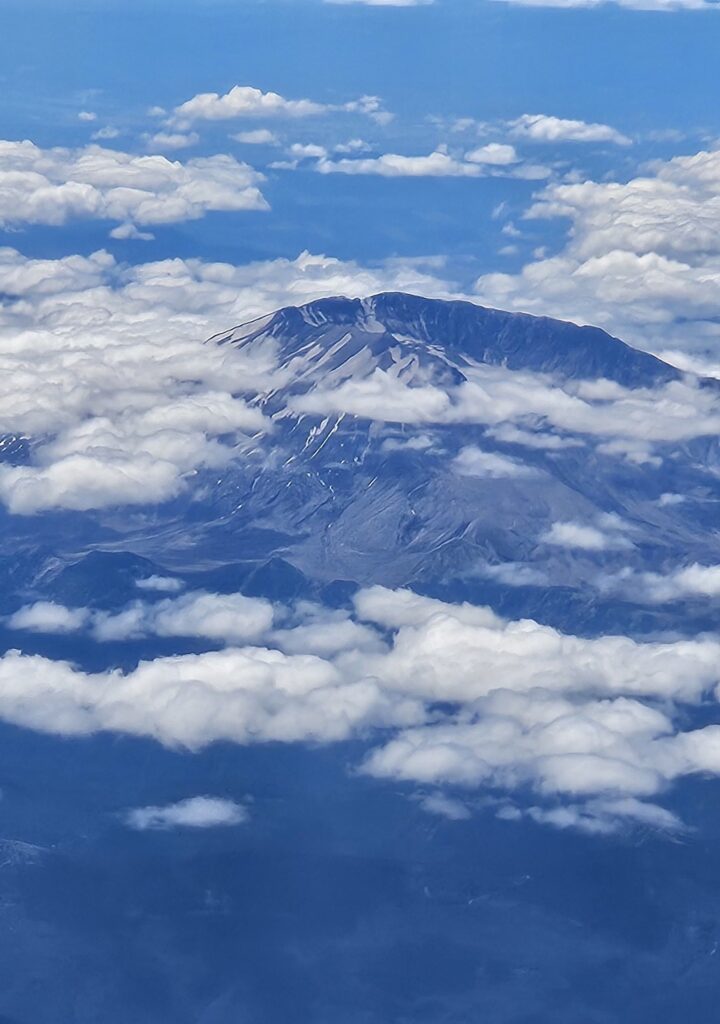
On our flight to Austin from Seattle, we once again got a view of this magnificent mountain.
Although this eruption happened decades ago, I’m still amazed at how the land has recovered. It’s hard to wrap my head around how much force was exerted that day to blow away half of the mountain.
“The mountains melted like wax at the presence of the Lord, At the presence of the Lord of the whole earth.” Psalm 97:5
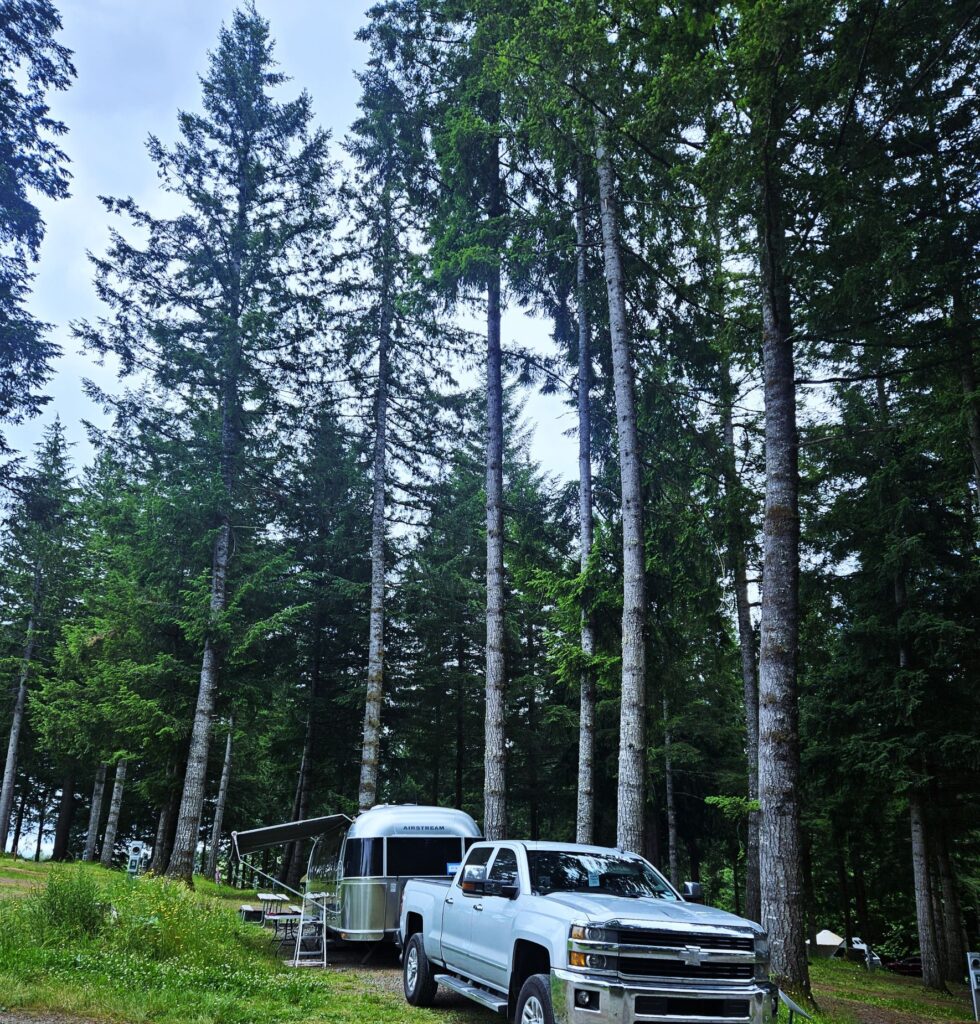
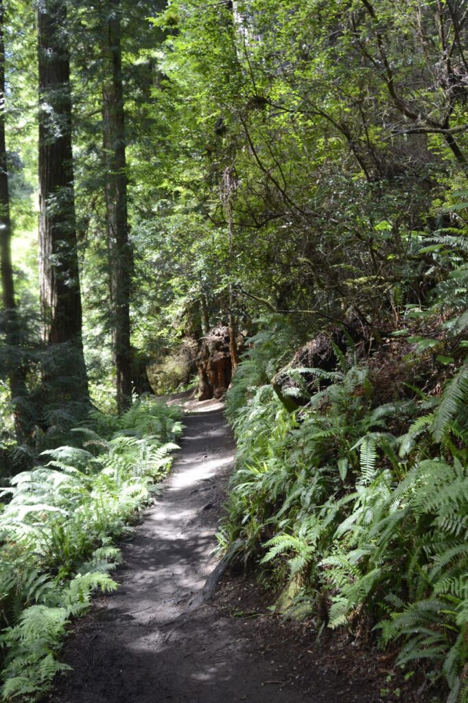
One of the prettiest campgrounds we’ve been in was in Silver Creek, Washington. Our campsite was among an old growth forest.
Paradise Campground
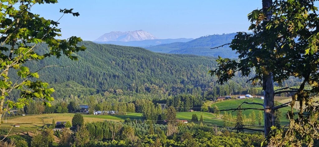
The entrance to the campground overlooks a beautiful valley and Mayfield Lake. In the distance on clear days, we could see Mt. St. Helen and Mt. Rainier.
View from Paradise Campground of Mt. St. Helen in the distance
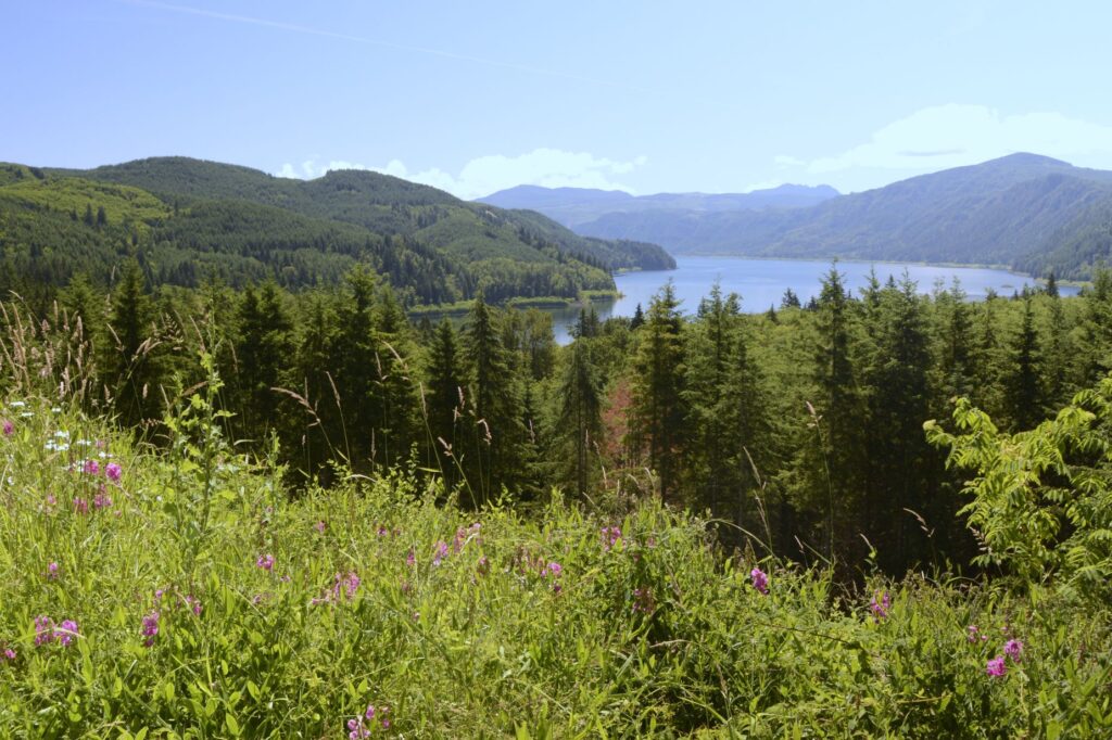
We were about an hour and a half from Mt. Rainier National Park. On one of our visits to the park, we stopped along the way to view Riffe Lake, a reservoir on the Cowlitz River.
Riffe Lake Scenic Viewpoint
Mt. Rainier National Park – Day 1
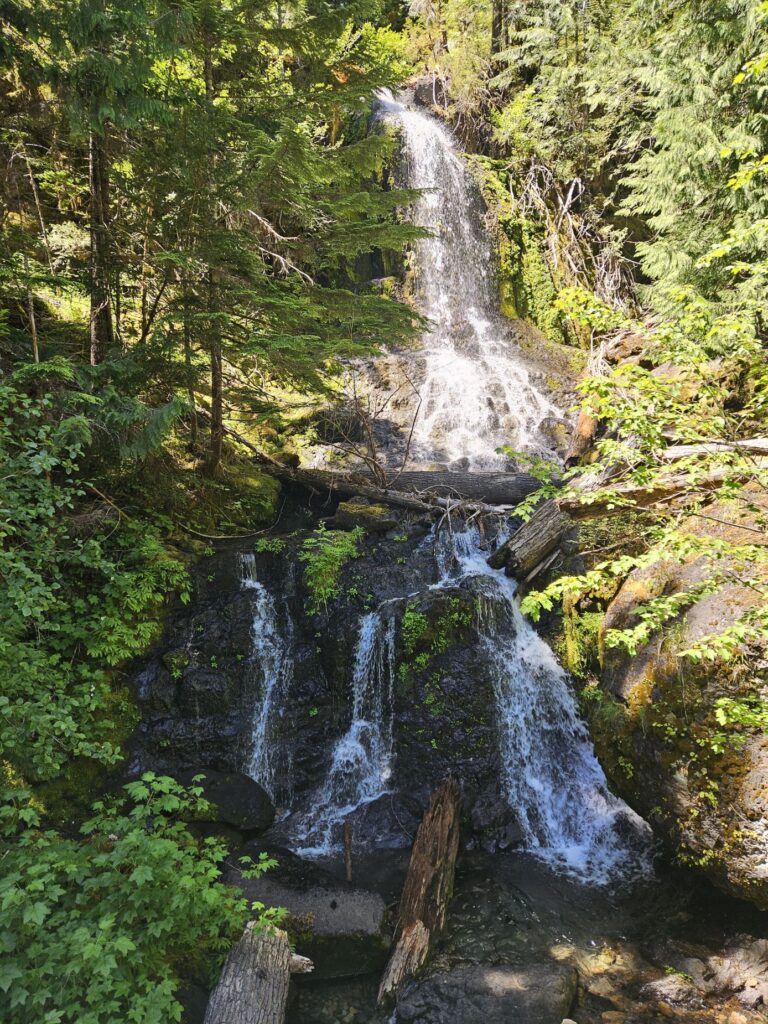
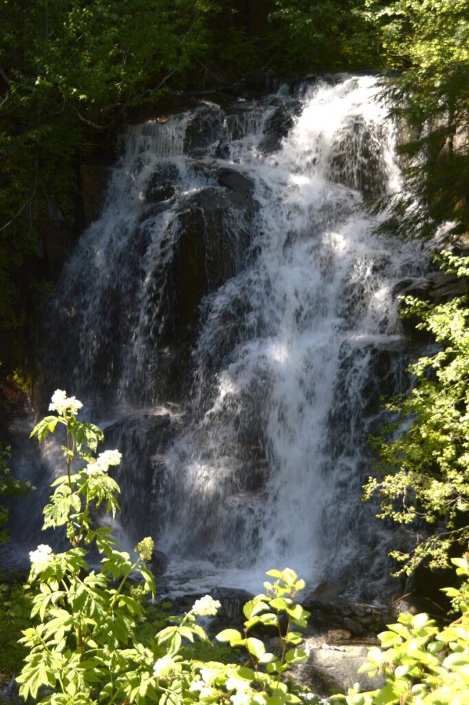
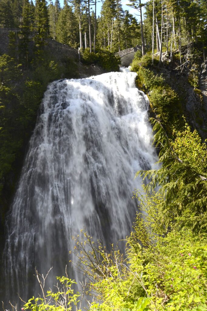
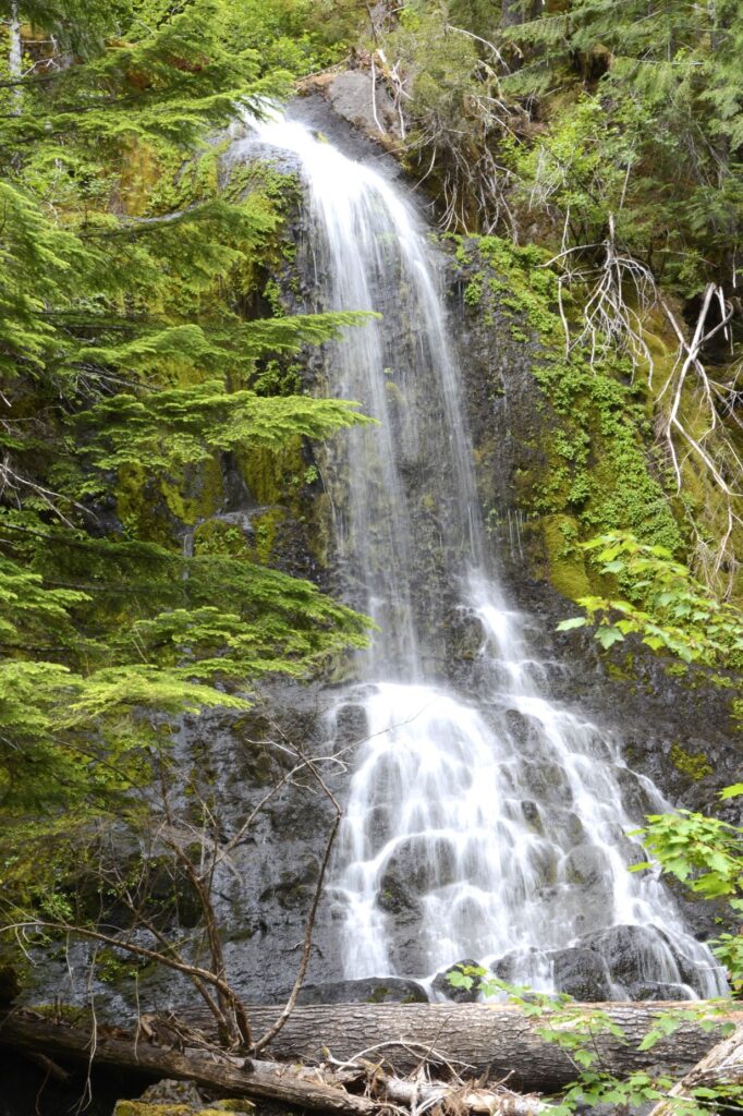
On our first visit, we entered the park through the Stevens Canyon Entrance. Not far from the entrance was Fall Creek. We stopped and took several photos of this pretty waterfall.
Fall Creek Waterfalls
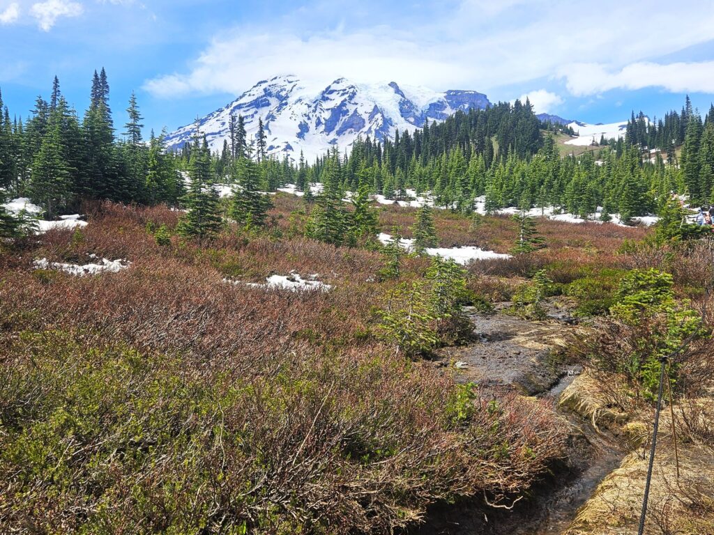
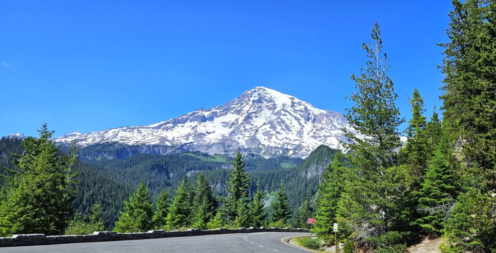
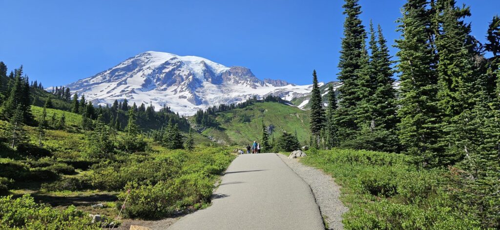
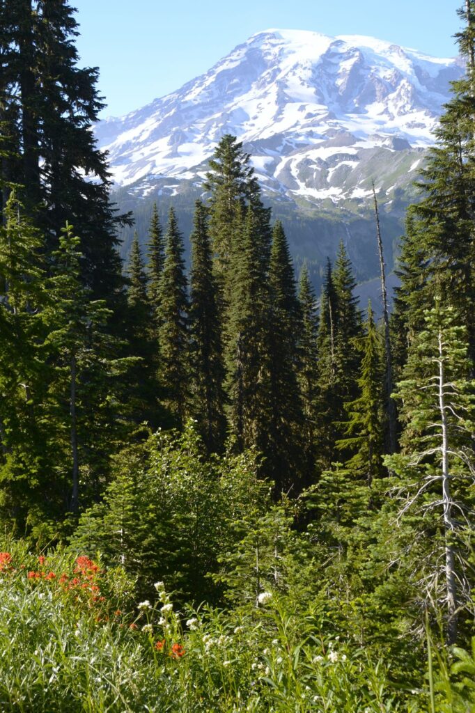
This was our first good look at Mt. Rainier. At over 14,000 feet, this glaciated volcano and its surrounding land was the fifth national park to be created. We happened to see Mt. Rainier on a sunny day when it wasn’t covered in clouds.
Mt. Rainier
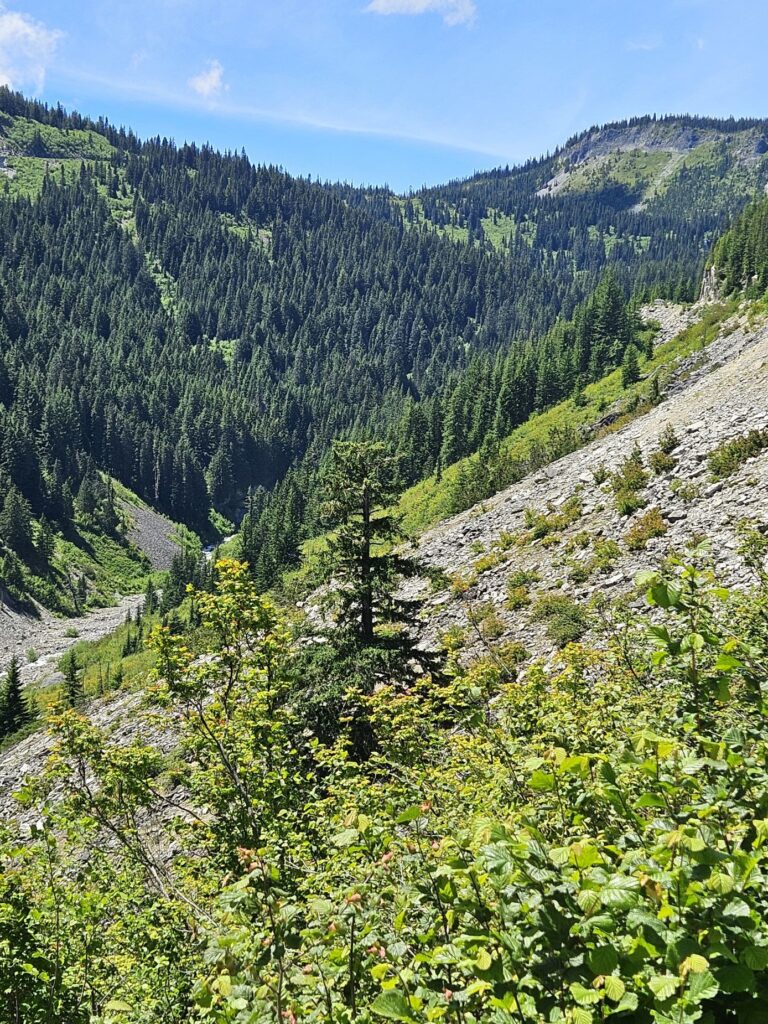
This park has plenty of scenic roads where valleys and tree-covered mountainsides are visible. It is a 21 mile drive from Stevens Canyon Entrance to the visitors’ center in the Paradise area.
Steep canyon valley in Mt. Rainier National Park
There is plenty of water run-off from the mountainsides and glaciers to create many beautiful waterfalls. This one is Stevens Creek Falls which we could see right from the road.
Stevens Creek Falls
With all that water, it is still amazing but not surprising to find out that there are over 400 mapped lakes in the park. This area shown below is called Reflection Lakes.
Reflection Lakes
We arrived at the Paradise area visitors’ center and found the parking lot was full and overflowing. People were parked along the road for quite a distance. We took a chance and drove around a bit until we found someone leaving the parking lot. It was a good spot, right in front of the visitors’ center.
Mt. Rainier from Paradise Visitors Center
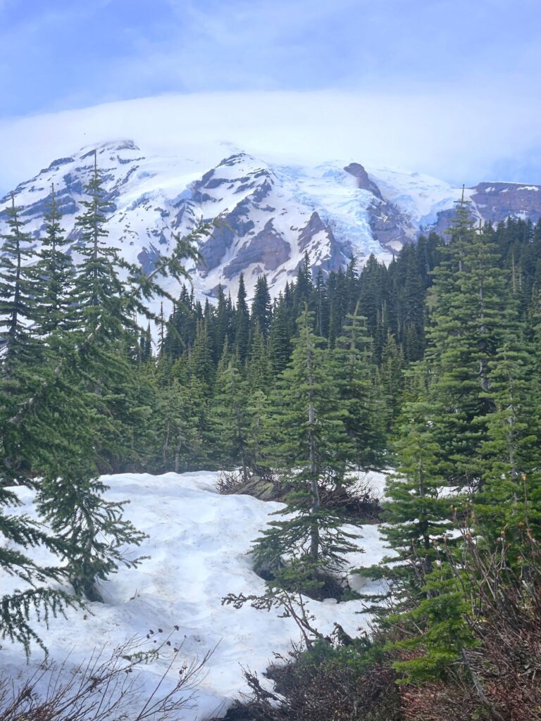
After getting my National Park Passport book stamped, and buying a few postcards for sending to the grandkids, we set out to see if we could hike the trail to Myrtle Falls. What we encountered was ice and snow all over the trail. It was too hazardous for us to hike it that day.
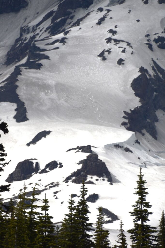
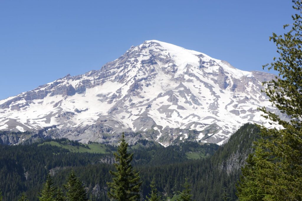
Mt. Rainier glaciers
There are over 26 glaciers on Mt. Rainier. You can see some in the photo above. I noticed something on the mountain when I zoomed in. See if you can see it in the photo below.
Ski trail on Mt. Rainier
Our exit from the park that day was through the Nisqually Exit, which meant that we saw different views. We stopped at Naranda Falls and I hiked the trail to the bottom.
Narada Falls from top
The trail was pretty steep and muddy, but the view was worth it. This is what it looked like from below.
Narada Falls from bottom
Mt. Rainier National Park – Day 2
On our second day going into the park, we stopped again at Fall Creek to experiment with different settings on the camera. The goal was to get the falls to show more motion which gives the water a blurred look. I think we achieved it!
Fall Creek
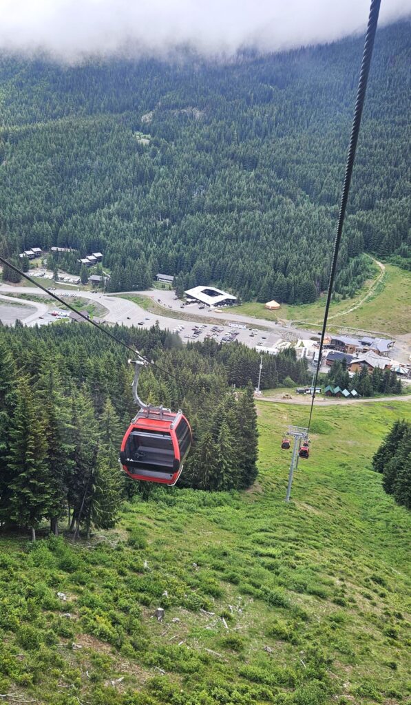
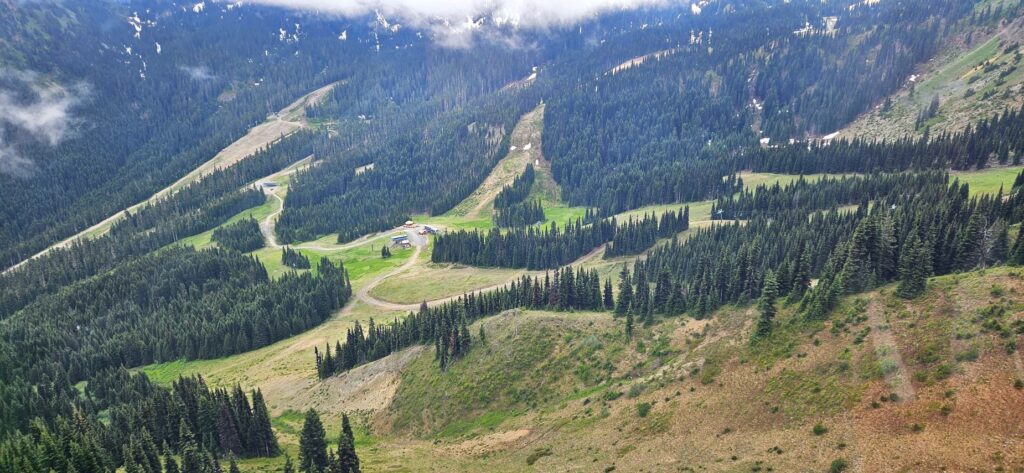
Our excursion that day was to ride the gondola at Crystal Mountain. It is located on the east side of Mt. Rainier outside the park limits. Since it was cloudy when we arrived, we killed some time inside the park shooting photos and eating lunch, hoping that the clouds would go away. They didn’t.
The twelve minute ride to the top of the mountain took us over 2,400 vertical feet. Despite the clouds, the scenery was fantastic.
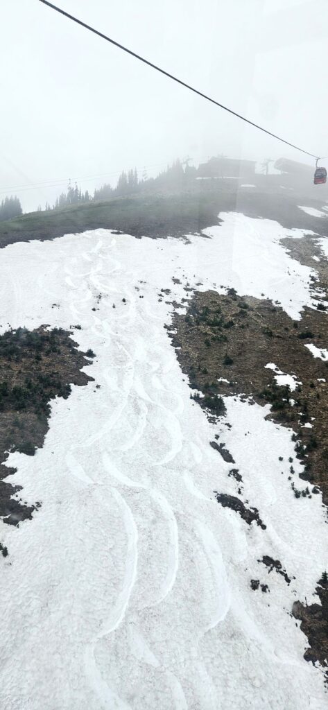
I was glad I wore my puffy jacket that day. The temperatures at the top were quite chilly.
Snow at the top of Crystal Mountain Gondola ride
We went to the Tower 16 Gift Shop to warm up and get some hot tea and a snack. While we were there, we watched the gondolas as they glided overhead.
Tower 16 gift shop
When we drove home that day, we saw this beautiful creek–Nickel Creek.
Nickel Creek
Mt. Rainier Park – Day 3
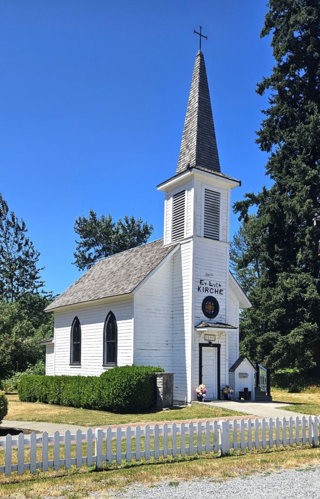
On our third visit to the park, we stopped on our way to visit this cute little church in the town of Elbe. This German church started in settlers’ homes until the church building was completed in 1906. Today services are still held monthly. In the tradition of the early pastors, the bishop arrives riding on a bicycle.
Mt. Rainier National Park has a timed entry policy between 7 am and 3 pm. Despite the timed entrance, it still took an hour and 7 minutes to get through the Nisqually entrance. This photo was taken later on after the traffic was gone.
Nisqually Entrance to Mt. Rainier NP
Our first stop on our third visit was at the historic Longmire area. Longmire is the original location of the park headquarters. It now houses a museum. Outside the museum is a tree log with historic dates from 1293. This tree was alive when Lewis and Clark visited the Pacific northwest. Amazing!
Log outside Longmire Museum Mt. Rainier National Park
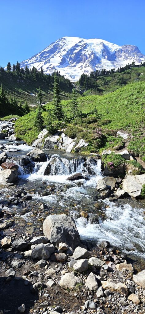
A scenic loop off the main road took us to a viewpoint of Nisqually glacier. This glacier has advanced and retreated over the years. In years of advance, it can be seen from the bridge shown in the photo. It can advance or retreat as much as three feet in a day.
Nisqually Glacier as seen from Ricksecker Point
The views of Mt. Rainier from the scenic loop are some of the best.
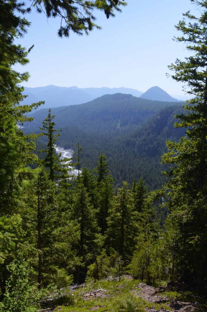
Looking down canyon from Nisqually glacier, we can see the stream below. Pacific silver firs dominate the landscape at this elevation of 4,000 feet.
Looking down the canyon from Nisqually glacier.
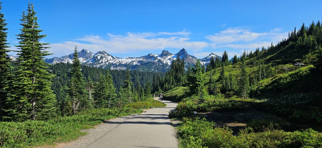
We drove again to the visitors’ center in the Paradise area where we again found a prime parking spot. This visit was different from our first visit. By now, the snow and ice had melted and the trail to Myrtle Falls was clear.
Trail to Myrtle Falls
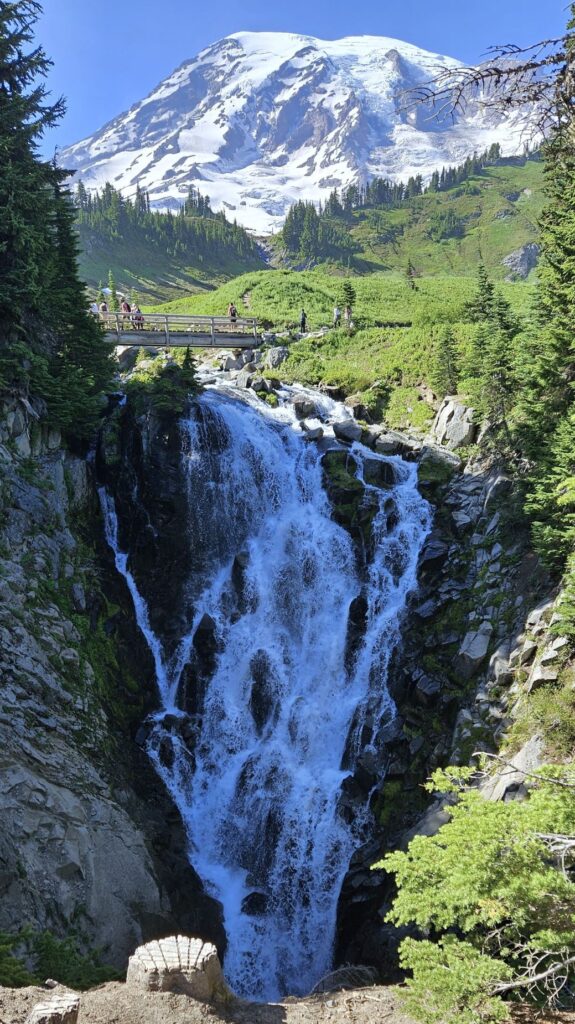
The trail is .9 miles round trip and moderately challenging because of the steepness. It is a 100 foot elevation gain, but it starts at over 5,000 feet. There is a bridge across the creek with a beautiful view of the mountain.
View from bridge at Edith Creek at Myrtle Falls
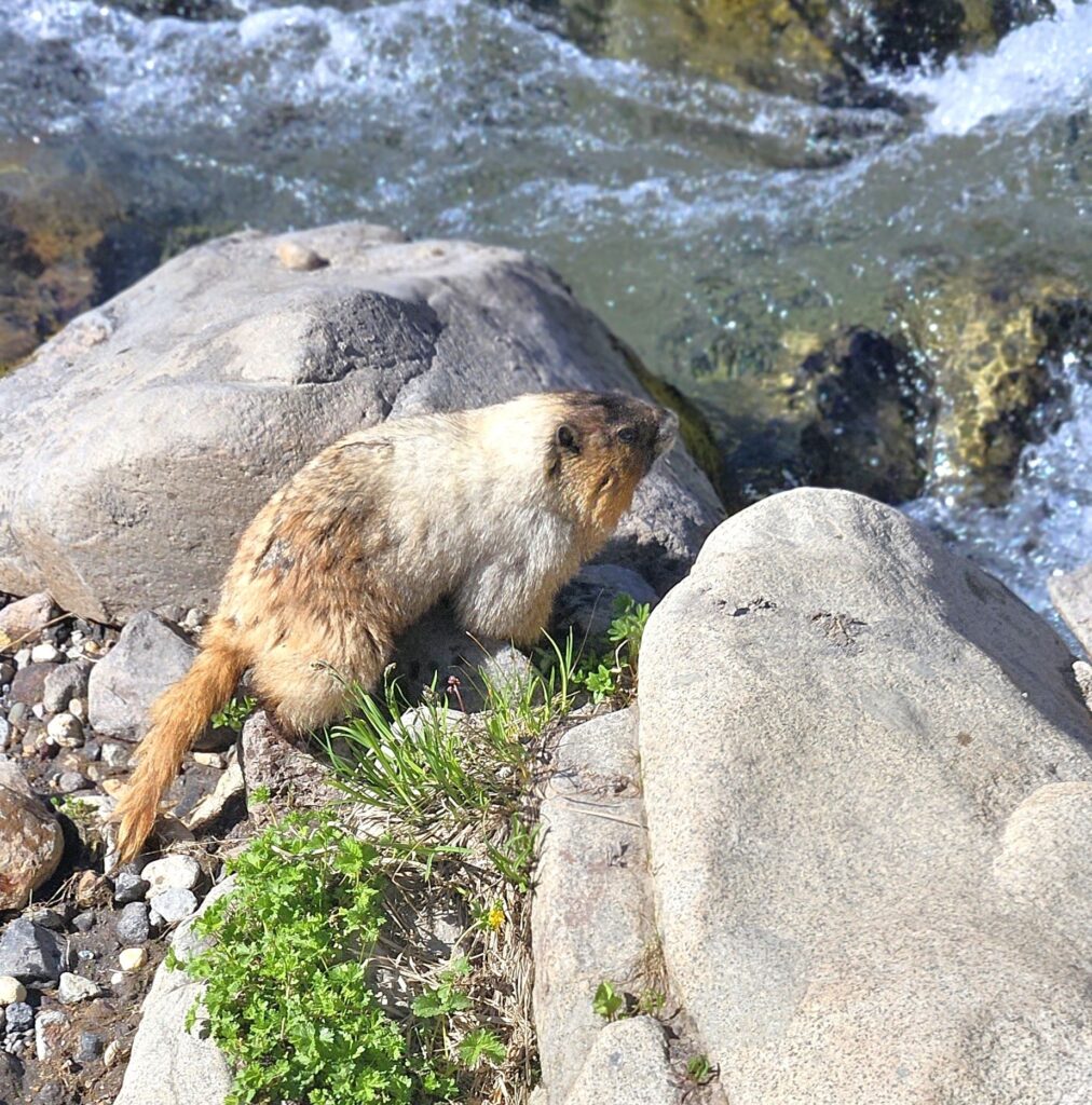
There was a fat coney, sometimes what is called a rock badger, near the creek. He didn’t seem to be very shy.
A steep pathway leads down to a viewpoint below the falls. It’s the best place to view Myrtle Falls. This was special to me because I recently painted this in a paint-along from an online artist. I wanted to see it for myself.
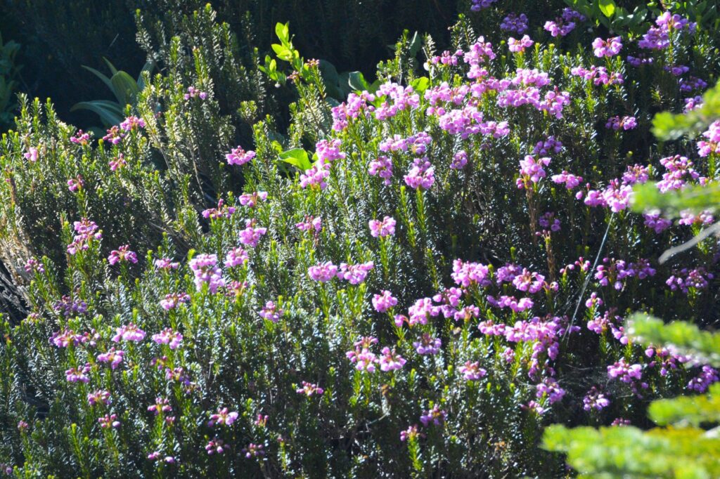
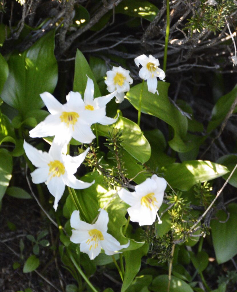
As we walked back to the parking lot, we stopped to see many of the wildflowers like mountain heather and giant white fawn lilies.
Pink mountain heatherGiant white fawn liliesWildflowers along trail to Myrtle Falls
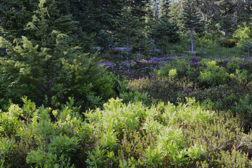
The views from the pathway back to the parking lot were stunning and the weather that day was perfect.
Pathway back from Myrtle Falls
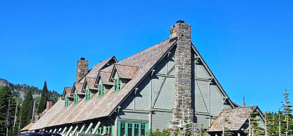
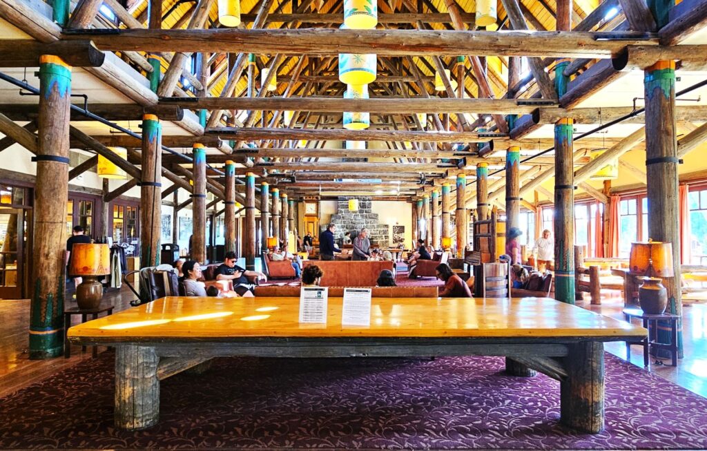
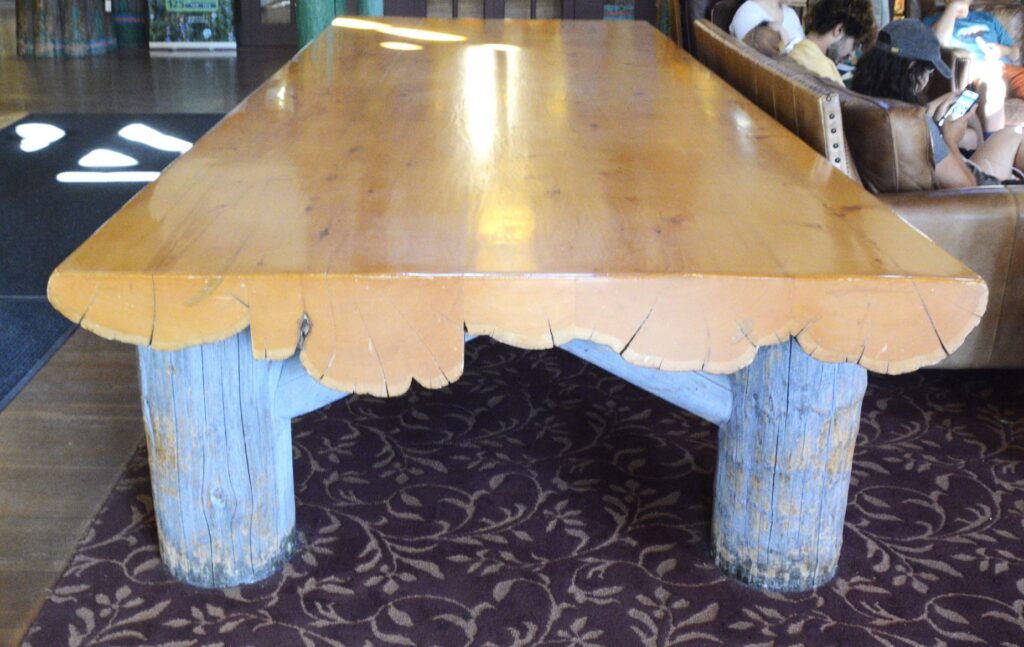
We also stopped in to see the historic Paradise Inn constructed in 1916. This reminded me somewhat of the hotel in Yellowstone, in that it has a large open timber frame. The large solid wood table in the main lounge is made of cedar logs.
Paradise Inn built in 1916Lounge in Paradise Inn has open timber frame and a massive cedar table 20 feet long.Cedar table made of five cedar logs 20 feet long
As we drove out of the park for the last time, we got one last look at the mountain framed by the beautiful trees and wildflowers.
Indian Paint Brush and Yarrow flowers of Mt. Rainier
Mt. Rainier National Park is my number two favorite national park. (Yosemite still remains my all-time favorite.) Mt. Rainier has so much variety–the mountain, the waterfalls, the forests, the scenic drives, the historical buildings–and much more. I feel like we could spend many more days there learning about and exploring this beautiful national park.
“Your righteousness is like the mighty mountains, your justice like the ocean depths. You care for people and animals alike, O Lord.” — Psalm 36:6
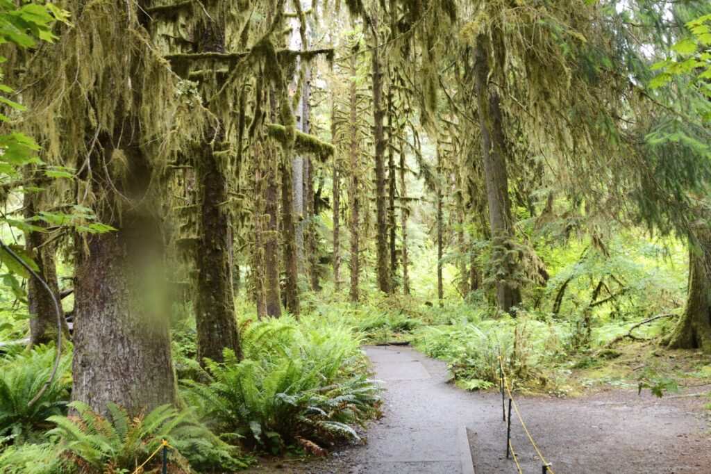
Olympic National Park is a huge park covering almost a million acres. Highway 101 makes a loop around three sides of it. We drove the western half of the loop. There are very few towns along the way. After a two hour drive, our first stop was the Hoh Rainforest entrance. Even though we left early in the morning, by the time we got there, the parking lot was almost full.
Hoh Rainforest
After getting my National Park Passport book stamped, we toured the visitors’ center, listened to a ranger talk, and then ate our lunch. The rangers suggested we hike the “Hall of Mosses Trail” first. It’s an easy .8 mile loop that starts near the visitors’ center.
A drop of rain on my lens on Hall of Mosses Trail.
It rained while we were there, as you would expect in a rainforest, but the rain was sporadic. I thought a drop or two of rain on my camera lens in the photos was only appropriate.
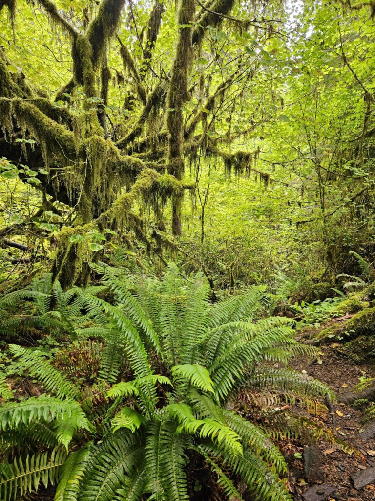
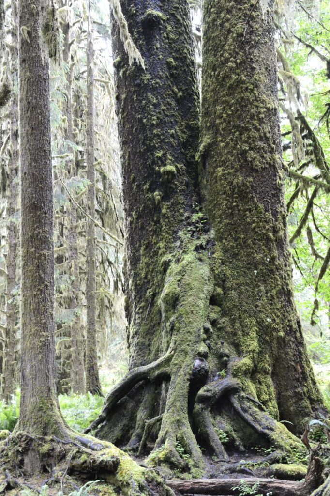
Trees with hanging moss and large ferns on the Hoh Rainforest Hall of Mosses Trail.
This lush forest with huge ferns and moss covering the tree trunks gave the feeling of being in another world. This rainforest gets over 200 inches of rain a year. The Park Ranger, who is 6′ 4″, held a rake above his head to give us an idea of how much 200 inches really is.
The Ranger joked that perhaps the legend of Big Foot came about from someone seeing a tree in the shape of a man walking, with moss hanging down (as his fur). The mossy trees could certainly give off that kind of vibe.
Big Foot or a tree?
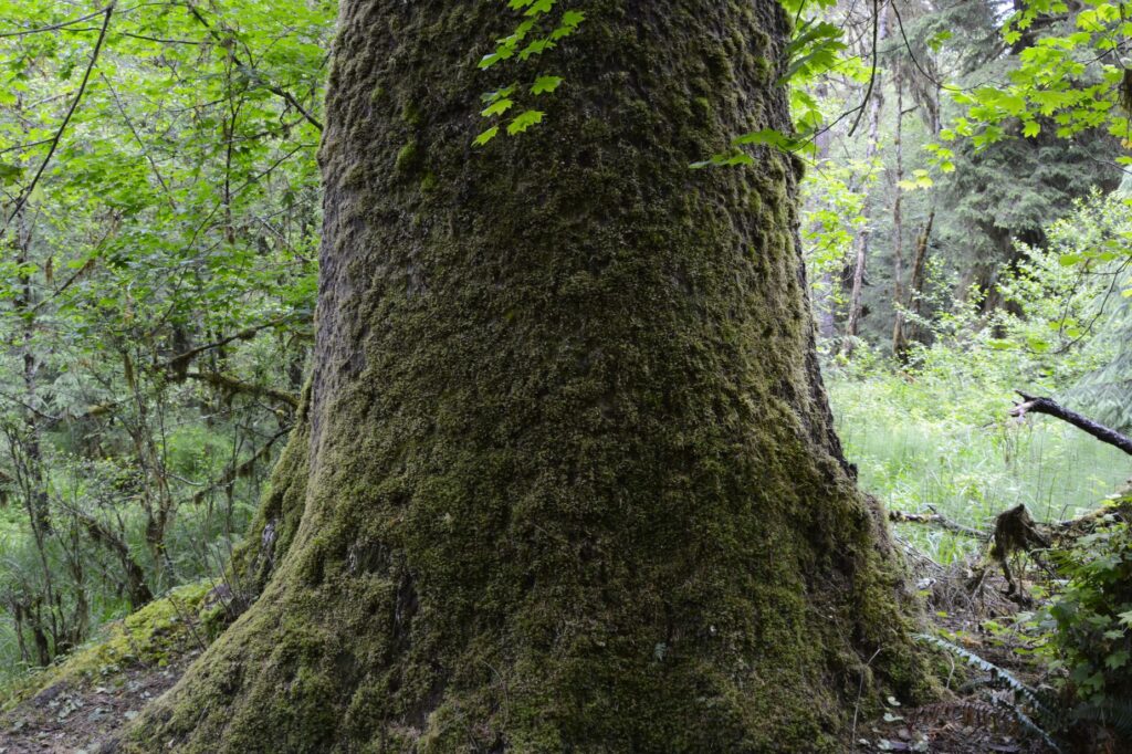
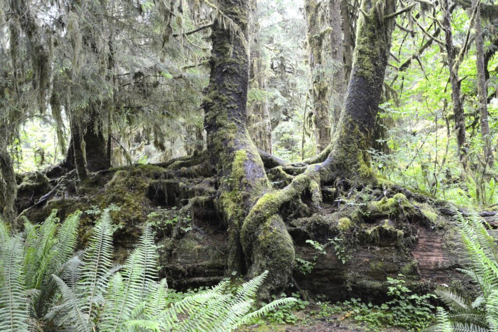
The Ranger told us of a scientist who got permission to take all the moss off of a large tree. The scientist dried the moss and weighed it. It weighed about 2,000 pounds or about a ton. What was sad to learn, is that the tree died. It turns out that the moss protects the tree, and the tree provides an environment for the moss to grow and thrive.
Two trees, or one?
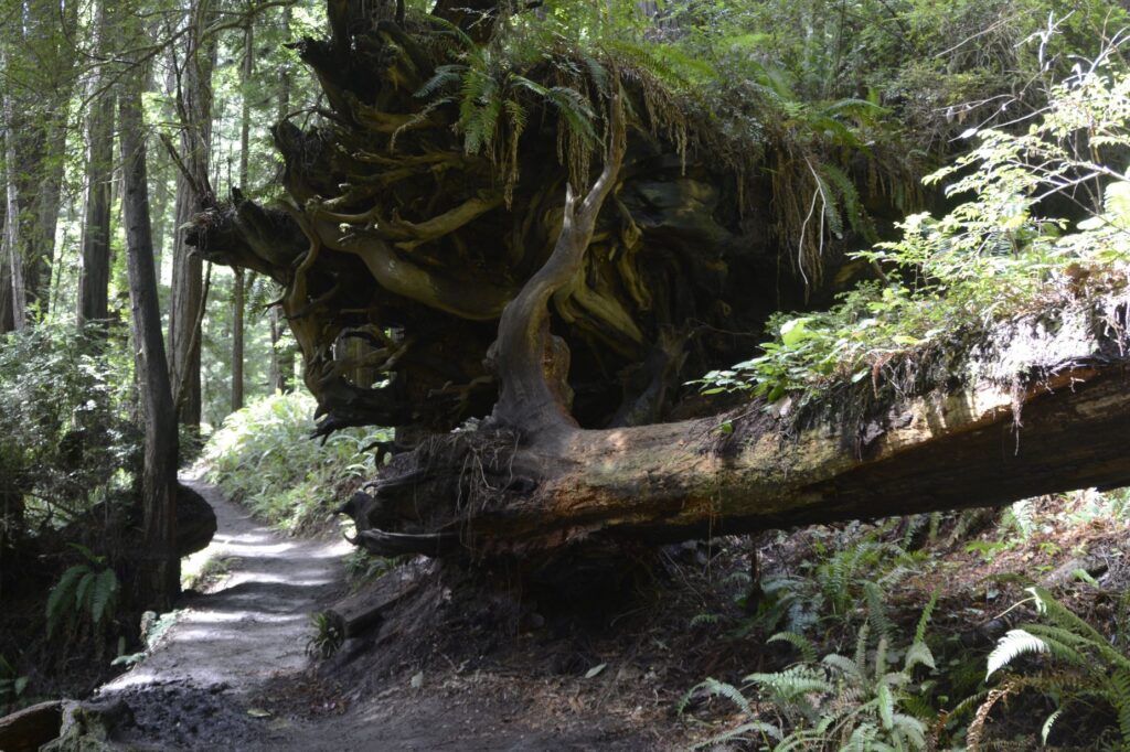
Fallen logs thick with moss provide soil for seedlings to grow forming a “tree nursery.” The photo below shows trees growing out of a fallen log.
Trees grow out of fallen log in a “tree nursery”
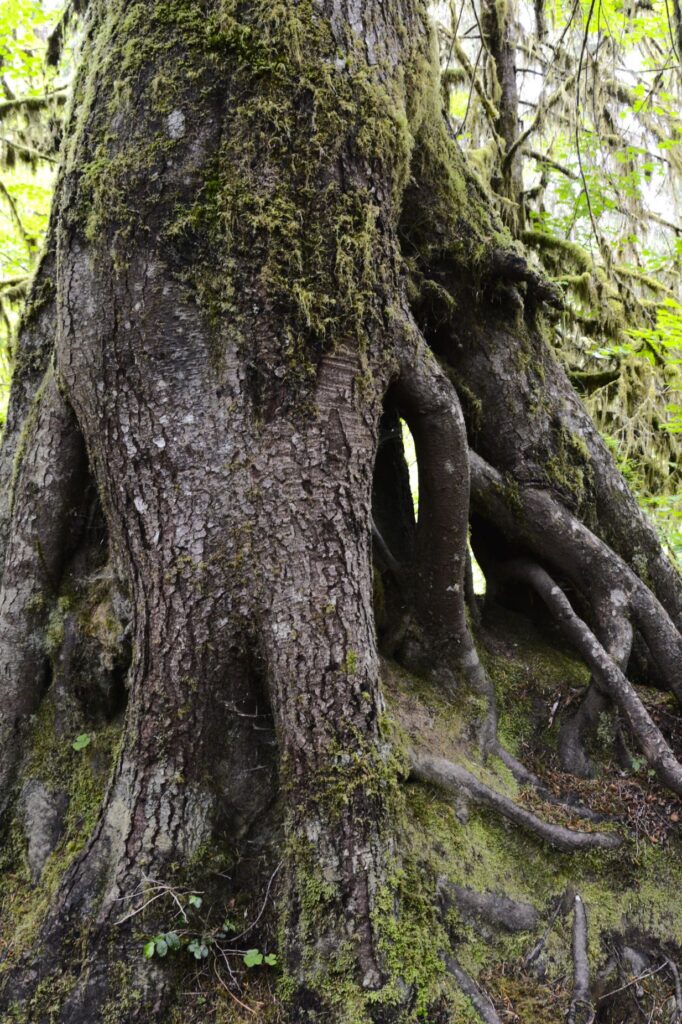
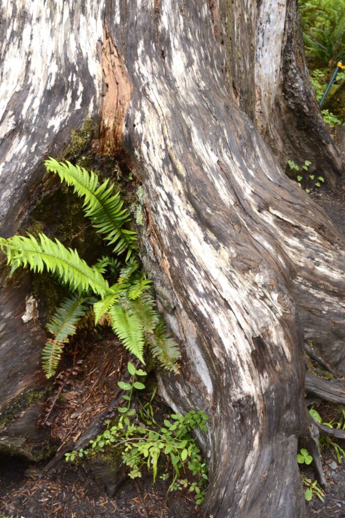
As the fallen log decays and rots away, the tree continues to grow forming a “cave” from the roots, like the one below.
Tree root “cave”
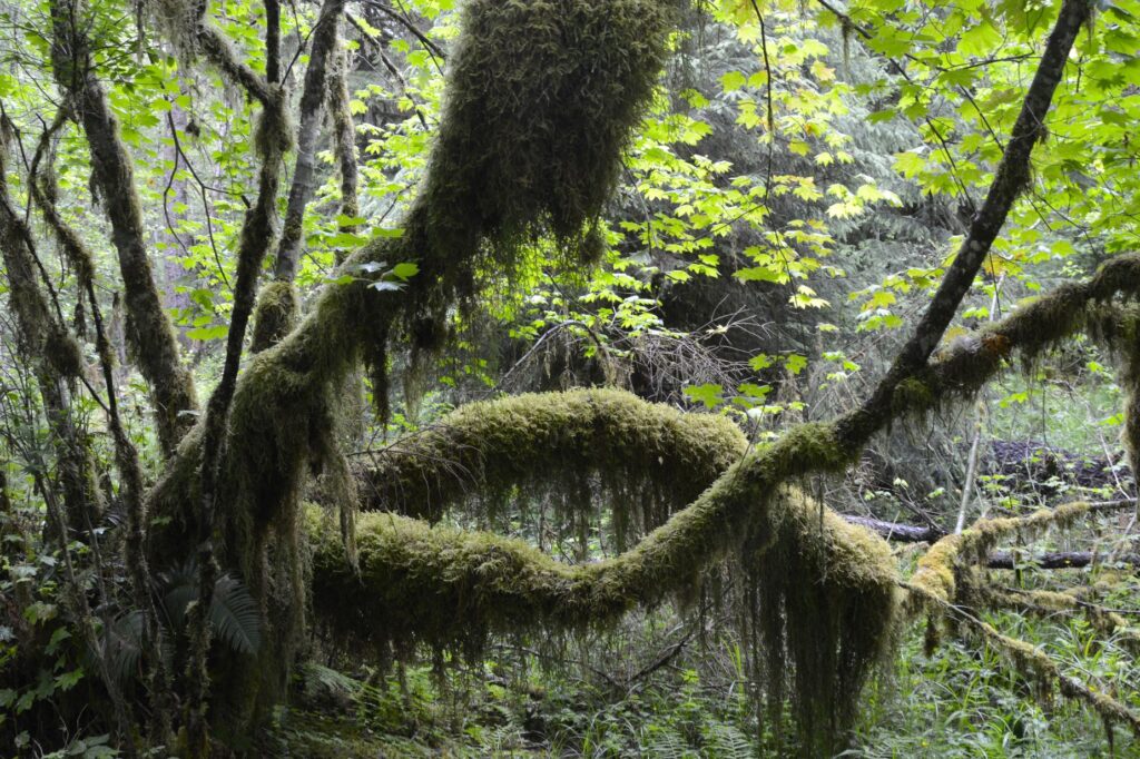
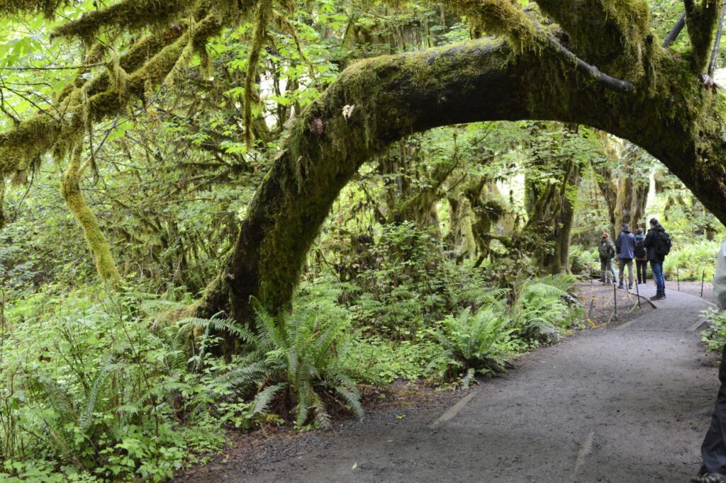
This tree arch was of special interest to the tourists that day.
Tree arch on Hall of Mosses Trail.
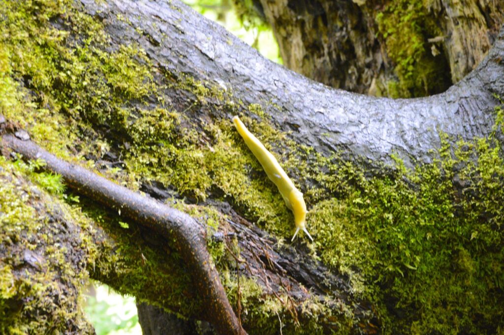
The thing that got everyone’s interest was this banana slug. Although I dislike slugs of any kind, this one was begging for attention.
Banana slug
The rainforest was fascinating, but it was early in the day and we were only 80 miles from Port Angeles where the road to Hurricane Ridge began. Instead of taking two long drives to see Olympic National Park, we decided to make it a really long day and see as much as we could all at once.
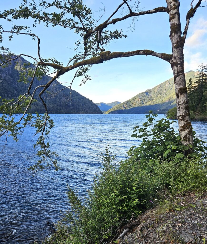
Crescent Lake
On our way to Port Angeles, the road winds around Crescent Lake. Surrounded by trees and mountains, this lake is really stunning. This lake is within the boundaries of the park.
Crescent Lake
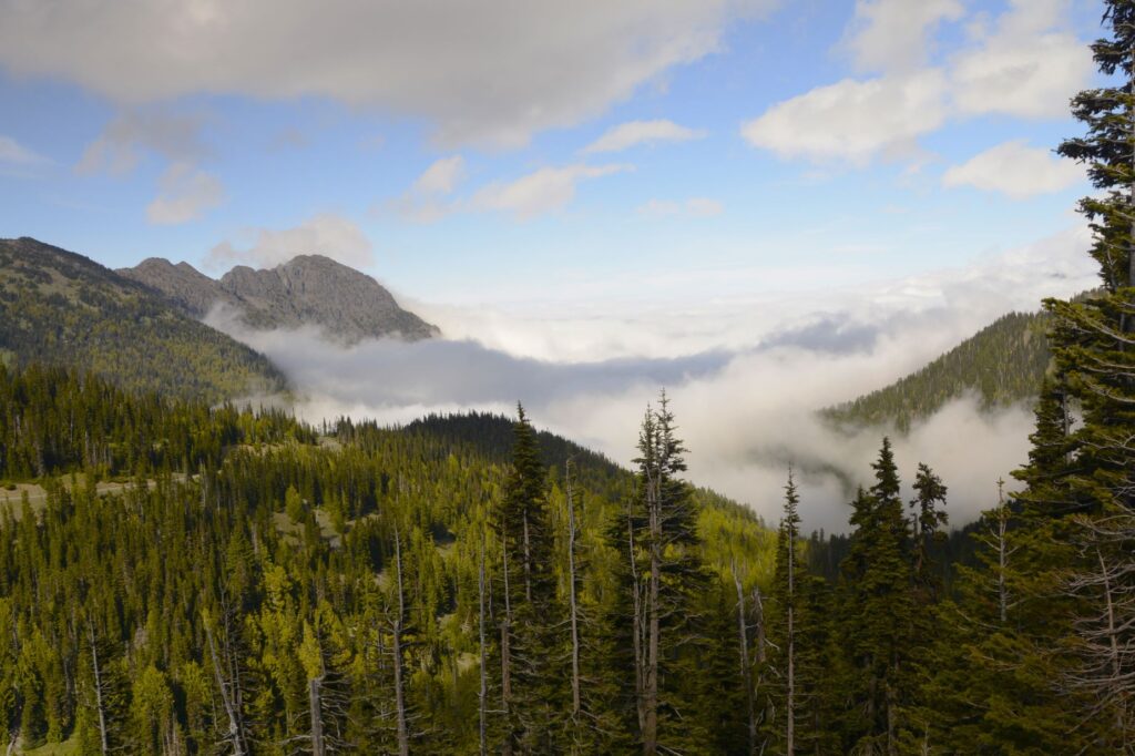
Hurricane Ridge
After stopping in Port Angeles for a few groceries, we drove up the road to Hurricane Ridge. I was worried that it would be socked in with clouds at the top. We did, in fact, drive through some pretty thick fog on the way up before we came out into the sunshine at the top.
We drove through thick fog to get to the top.
What we saw at the top of the mountain was like something out of The Sound of Music. It’s like being in the Swiss Alps of Washington. The mountain range in the distance is the Olympic Mountains, and one of the peaks is Mount Olympus.
Hurricane Ridge
In 2023, the Visitors’ Center at Hurricane Ridge burned down. The cause was never determined. Currently there are temporary facilities on tractor trailers.
The Olympic Mountain Range
Unlike other mountains in Washington, these were not formed from volcanoes. Rather, it is believed they are made out of sand and mud from the ocean floor that was piled up against the coastline of Washington from the submergence of the tectonic plate.
Mount Olympus is almost 8,000 feet high with 184 alpine glaciers.
We hiked a short ways from the parking lot to the top of the hill to see the other side. There were still patches of snow on the ground.
View of the other side of Hurricane RidgeView of other side of Hurricane RidgeView of other side of Hurricane Ridge
Crescent Lake
After driving back down into Port Angeles from Hurricane Ridge, we ate a delicious dinner at Kokopeli Grill. We drove back the way we came, which took us around Crescent Lake again.
Evening on road around Crescent Lake
Being so far north, the sky was light until 10:30 at night. We got home around 11:00 pm after a very long day. It was very worthwhile.
Sunset over Crescent Lake
“O Lord my God, how great You are!” Psalm 104:1 “Mountains rose and valleys sank to the levels You decreed.” Psalm 104:8 “The trees of the Lord are well cared for.” Psalm 104:16 “Those who live at the ends of the earth stand in awe of your wonders. From where the sun rises to where it sets, You inspire shouts of joy. ” Psalm 65:8
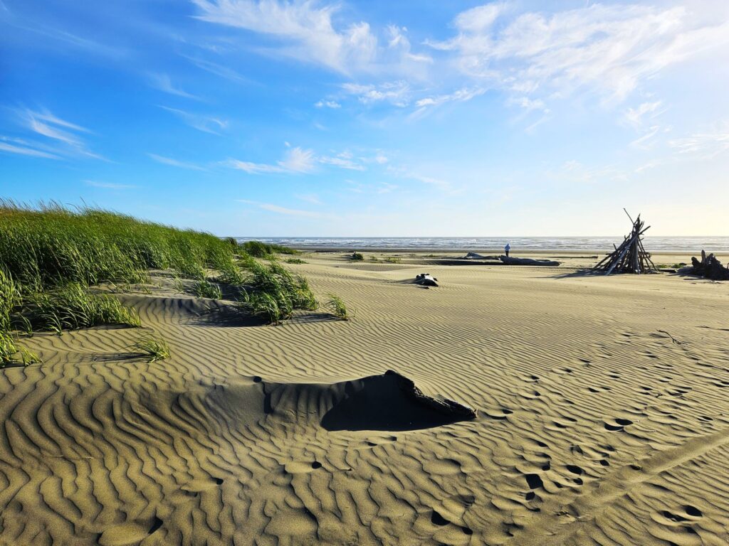
If you divide Washington state in half crosswise, Ocean City lies about halfway, right on the Pacific Ocean. It’s a very small town. Our RV park had its own pathway to the beach.
Ocean City RV park pathway to the ocean.
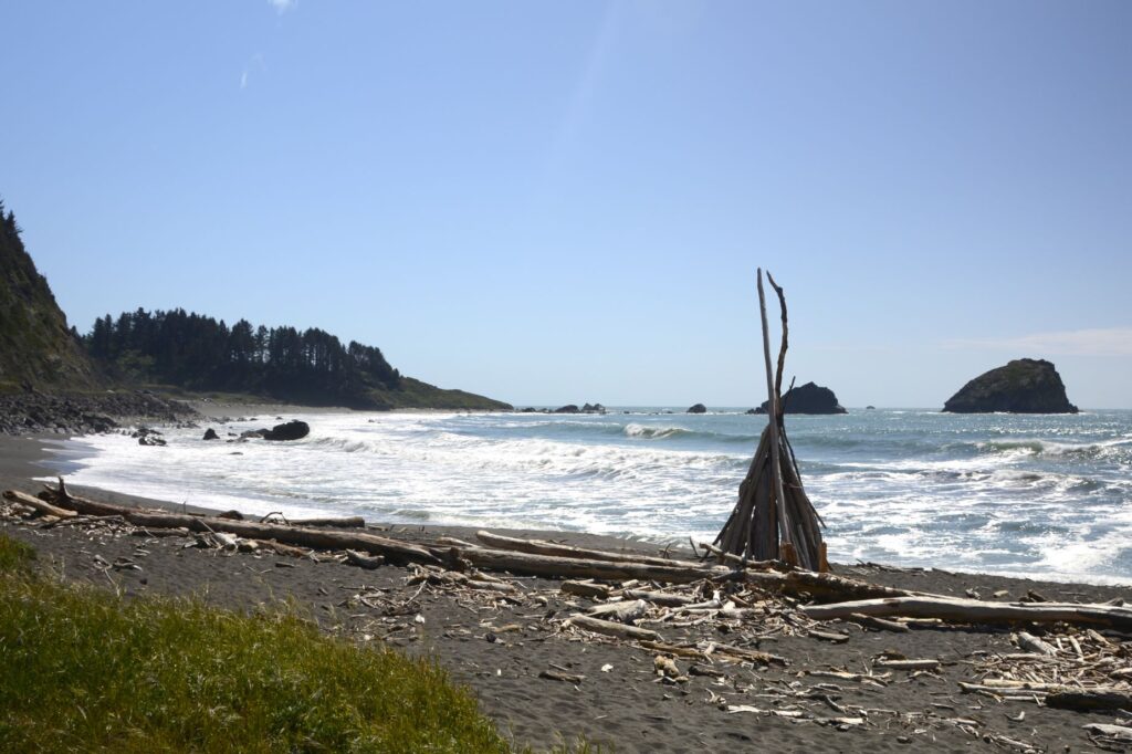
I checked out the beach right away, even though it was cold and windy. Driftwood structures are common on these beaches because of the abundance of driftwood.
Driftwood art
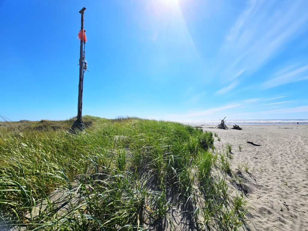
The beach is very long and it would have been hard to find the pathway back if not for this pole by the entrance.
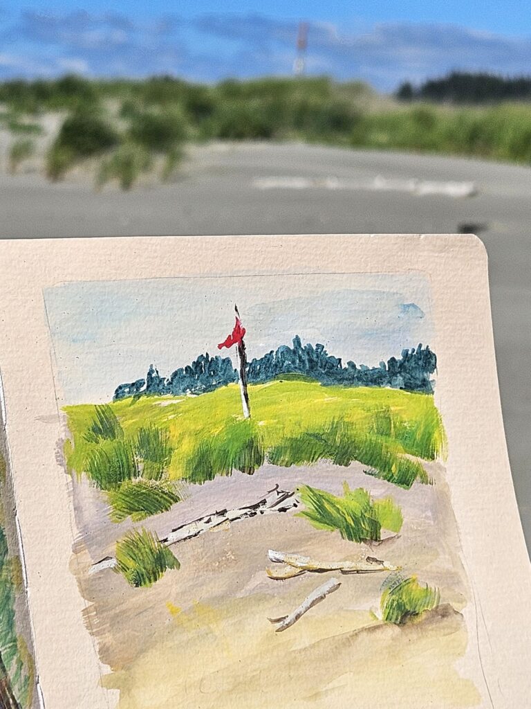
One afternoon I tried doing some ” en plein air” painting. I got sand in everything, including my painting. It was too cold to stay out for long. It was a cold, windy day.
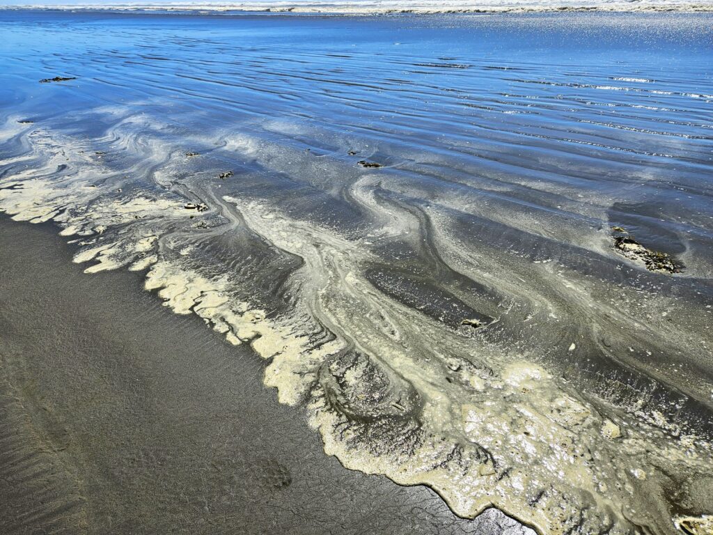
On another day, I explored closer to the water and saw these interesting designs of sea foam on the beach.
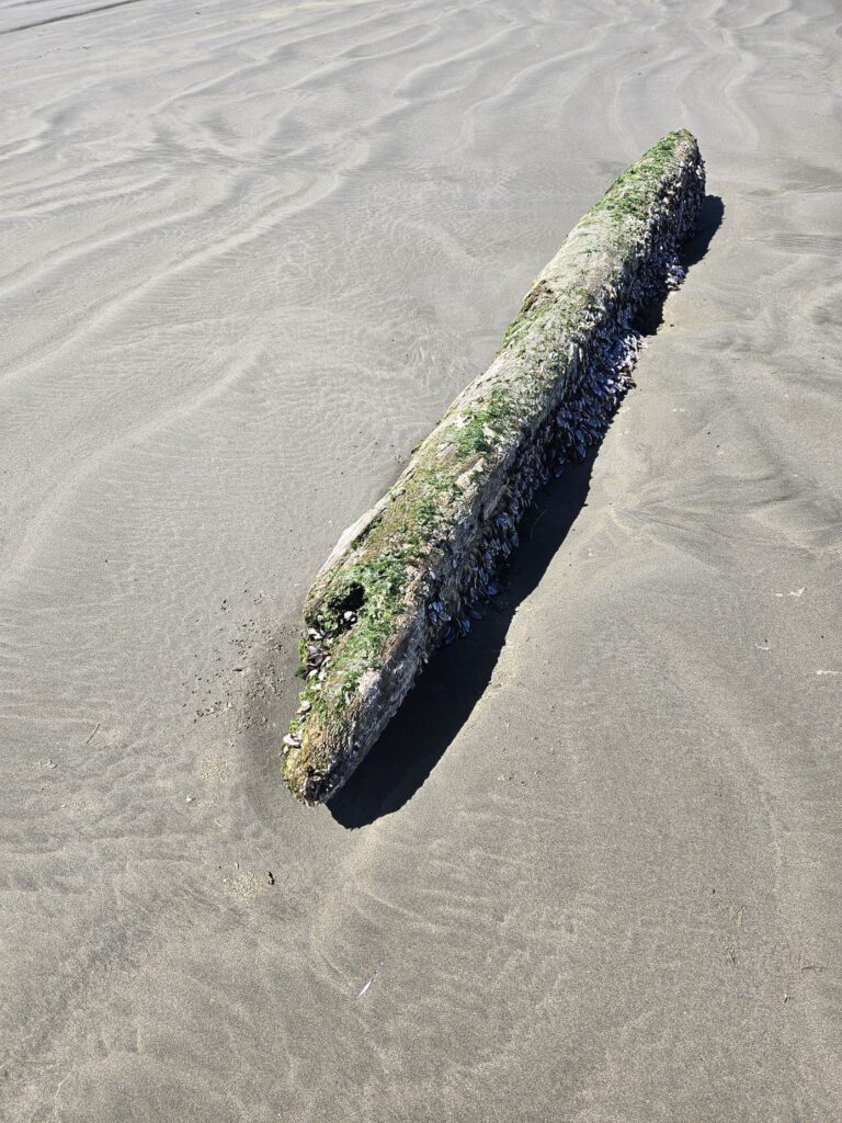
I also found this driftwood log. Upon closer examination, I noticed something strange on the backside of the log.
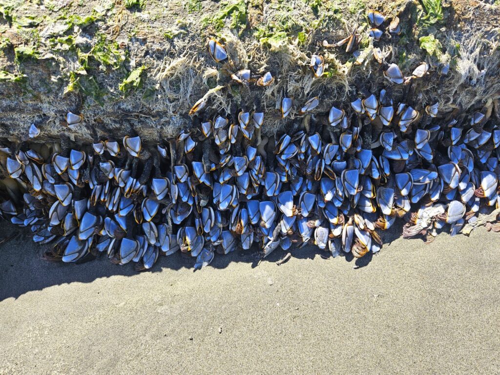
On the back of the driftwood log in the shade were hundreds of muscles clinging to the log. (At least, I think that’s what they were.) I think this log may have rolled up during high tide and left these poor muscles stranded.
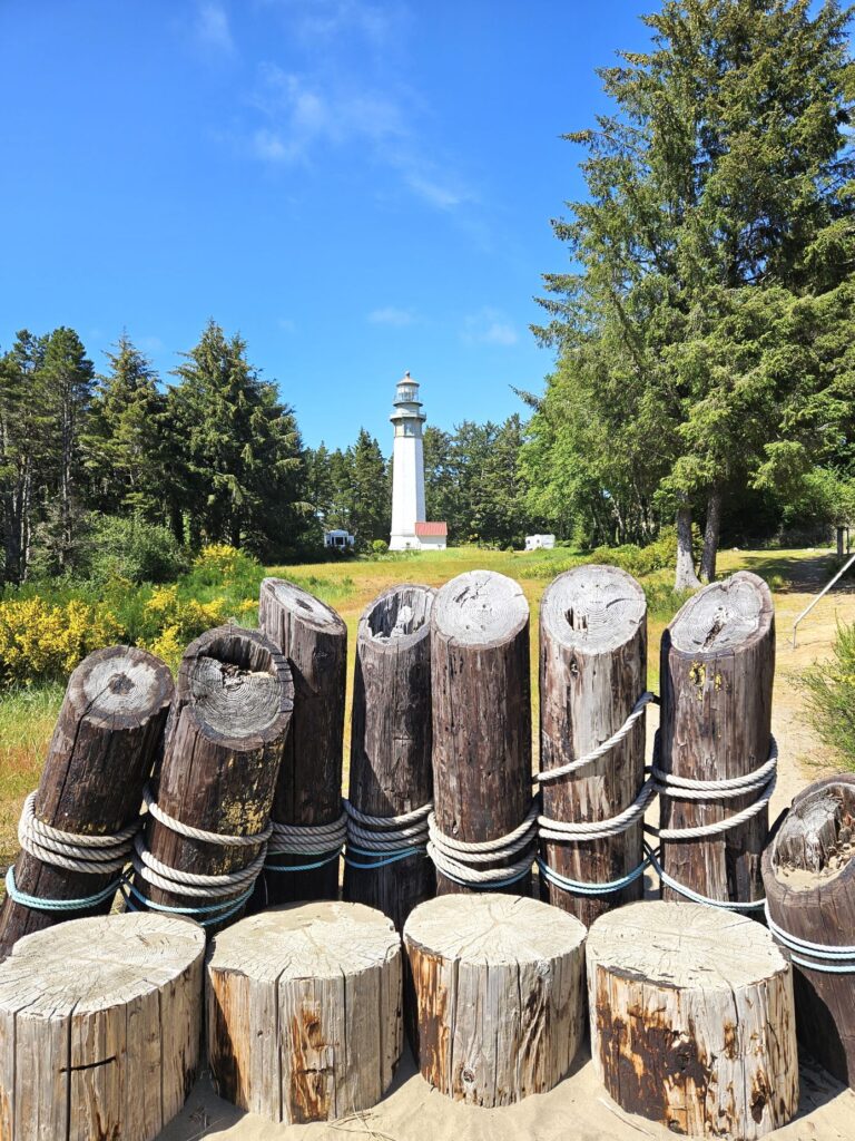
Grays HarborLighthouse
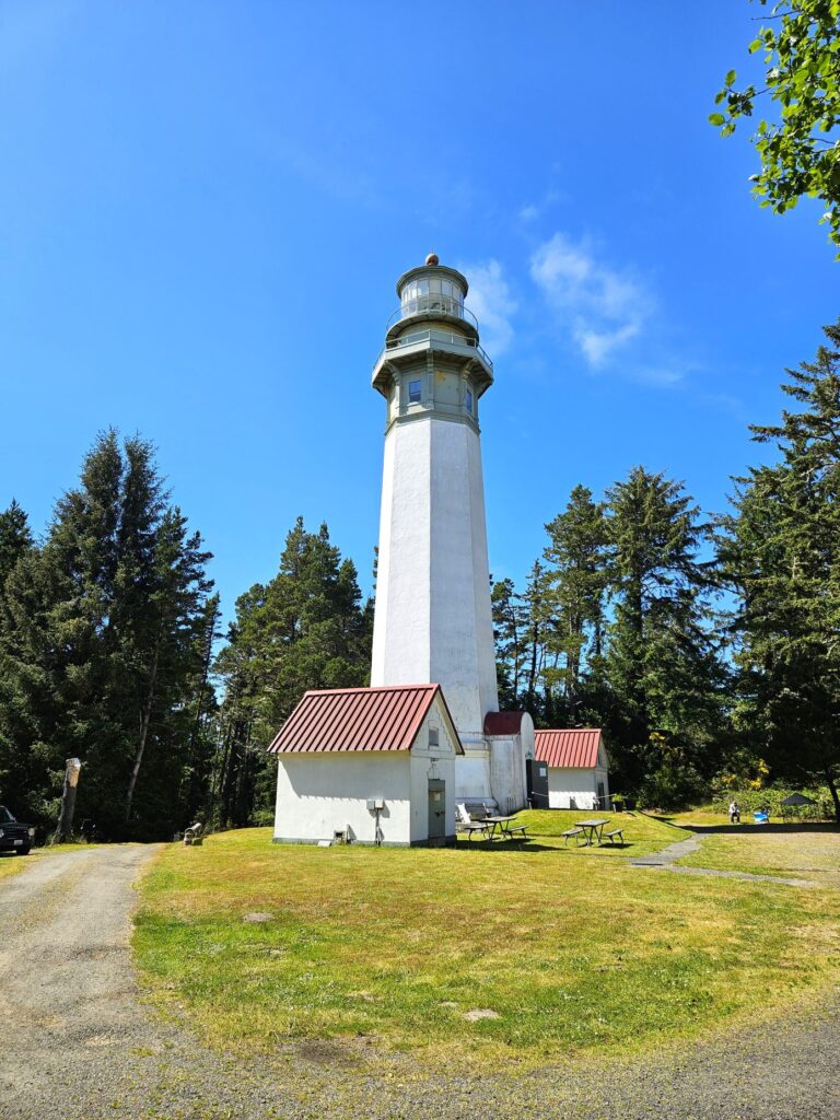
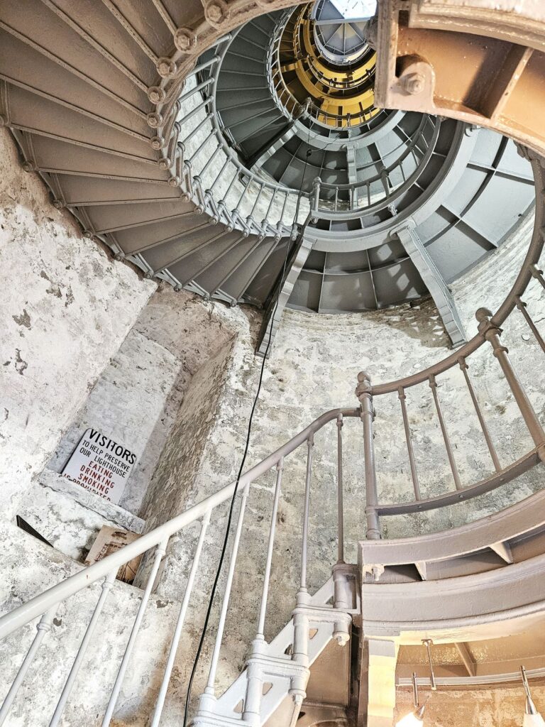
One afternoon, we drove across Grays Harbor to the south peninsula to see Grays Harbor Lighthouse. It is the tallest lighthouse in Washington with 135 steps to the lantern room. We opted out of climbing the stairs to the top.
Grays Harbor Lighthouse
The lighthouse is quite a distance from the ocean. This is due mostly to the jetty system at the entrance of the harbor. The land has built up between the lighthouse and the ocean until the lighthouse is now 3,000 feet from the ocean at high tide.
There are 27 lighthouses in Washington state. After seeing this one, we only have 24 more to visit!
Stairs inside Grays Harbor Lighthouse
While we were in Ocean City, we visited Olympic National Park. That will have to be in a separate blog soon to come.
Your word is a lamp to my feet And a light to my path. Psalm 119:105
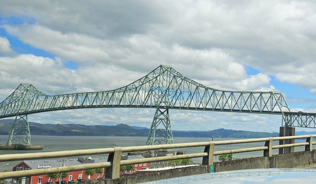
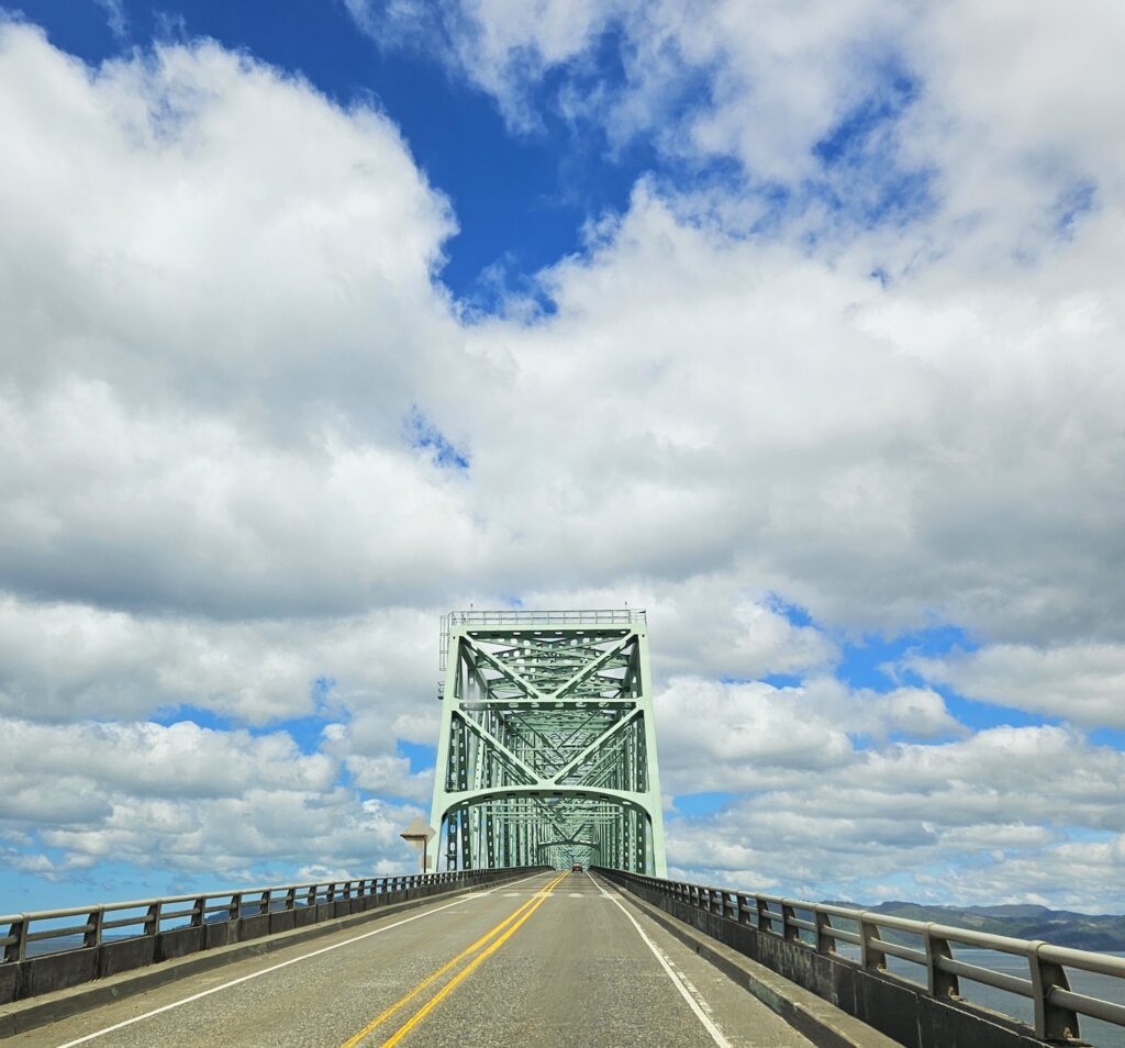
We crossed the Astoria-Megler Bridge over the Columbia River into Washington state. This four-mile long steel bridge is the longest continuous truss bridge in the nation. At the highest point, it is nearly 200 feet high over the river. I love bridges, but this one is definitely a little scary.
Astoria Bridge over the Columbia RiverThe Astoria Bridge
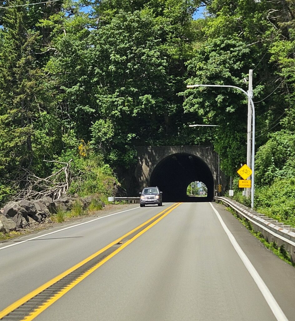
Soon after the bridge, we went through a tunnel. Highway 101 tunnels under Fort Columbia, a defensive fortress built in 1898 to defend the entrance of the Columbia River. It is now a state park. This road was turning out to be quite interesting!
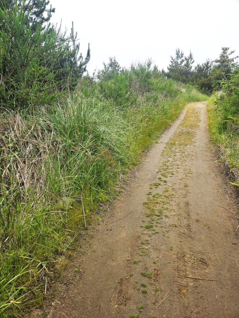
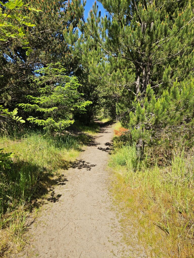
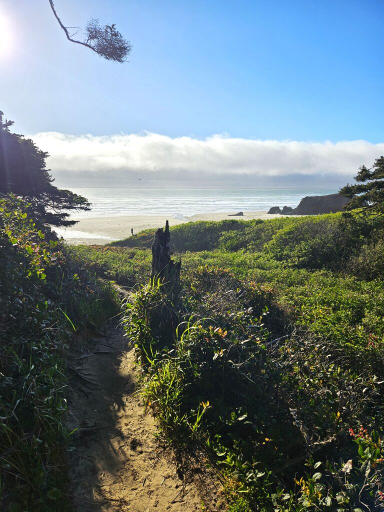
Our Thousand Trails campground was just a few miles up the coastline near the town of Seaview, Washington. We had our own trail to the beach, which was about a half-mile walk.
Trail to the beach
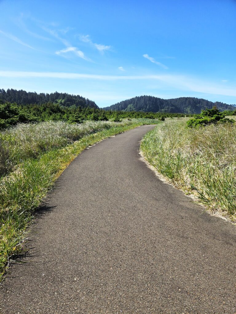
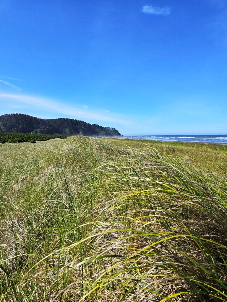
Our path to the beach connected to the Discovery Trail, a paved trail that starts in Ilwaco to the south and ends in Long Beach which borders Seaview on the north. To get to the beach, I had to walk through the tall grasses and climb over a sand dune.
Discovery Trail goes from Ilwaco which is south of Seaview to Long Beach which is north of Seaview.
I found a pathway, but rather than go all the way to the beach, I admired the view from atop the sand dune on that cold, windy day.
View from grassy sand dune.
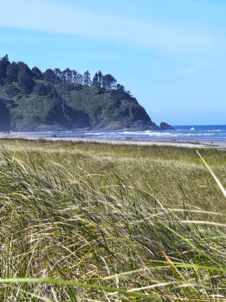
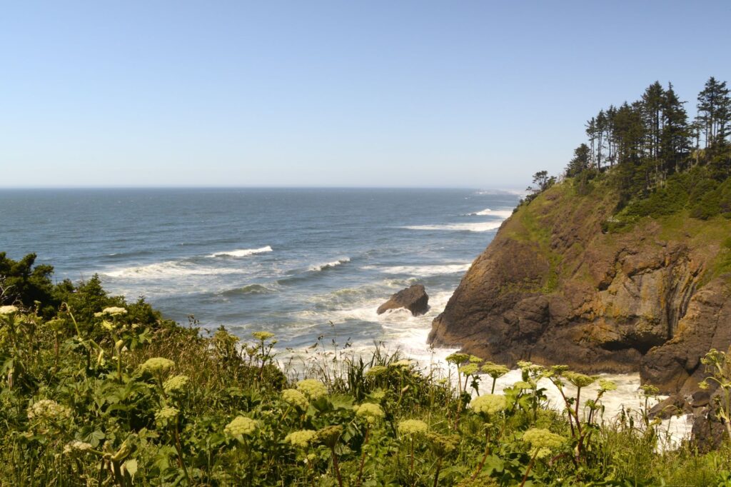
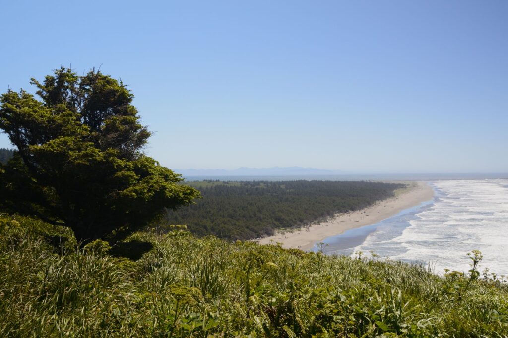
The coast of Washington is much like Oregon with rocky crags covered in trees jutting out into the ocean. This area is rich in Lewis and Clark history since it is where the famous expedition arrived on the west coast. It is also home to Long Beach, the world’s longest beach on a peninsula. It’s 28 miles long.
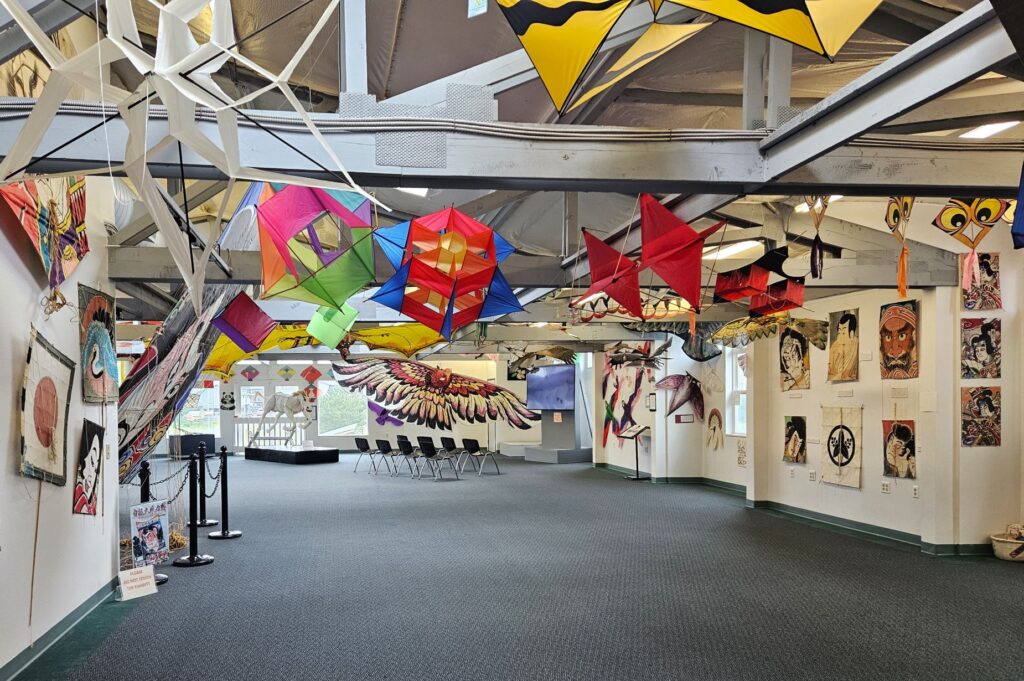
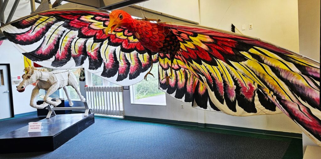
Cold, cloudy days are great for visiting museums. One such day, we visited the International Kite Museum in Long Beach, Washington. It displays kites from all over the world, as well as historical kites, like ones that were used in World War II.
There were kites of every shape and size, even a horse kite. Here we learned the true story of a young boy who flew a kite across Niagra Falls. His kite was used to get the first rope across Niagra Falls for the start of a bridge that was to be built.
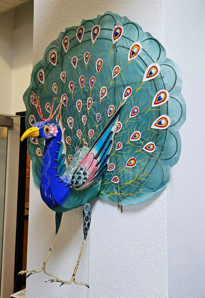
This peacock kite was one of my favorites. I’m not sure how it would fly, but it looked very interesting. Every year, Long Beach, Washington, has a kite festival that draws people from all over to fly kites and compete in competitions.
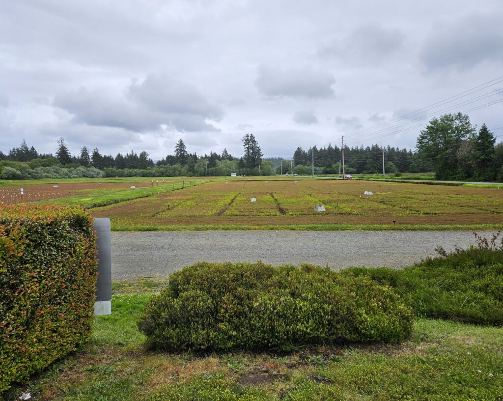
After the kite museum, we drove to the Cranberry Museum. At the Cranberry Museum we learned the history of cranberry farming in the surrounding area. Their displays include old machines and tools used for harvesting. In the gift shop there were hundreds of items made from cranberries: scones, cookies, jams, chocolates, soaps and essential oils, just to name a few. We bought some cranberry tea bags, and a cranberry fruit and nut bar. Delicious!
View of cranberry bogs near the Cranberry Museum
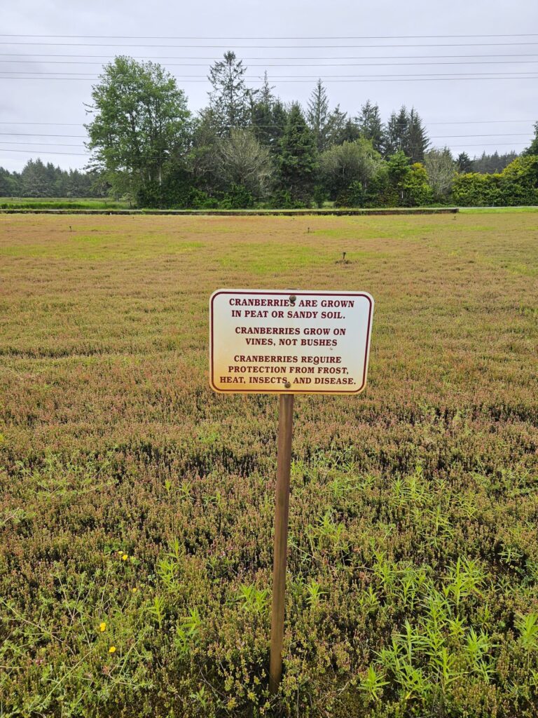
One of the things we learned is that cranberry bogs are only flooded during harvesting time. There are so many things that cranberry farmers have to deal with for a good cranberry harvest, like insects, weeds, frost, heat and disease.
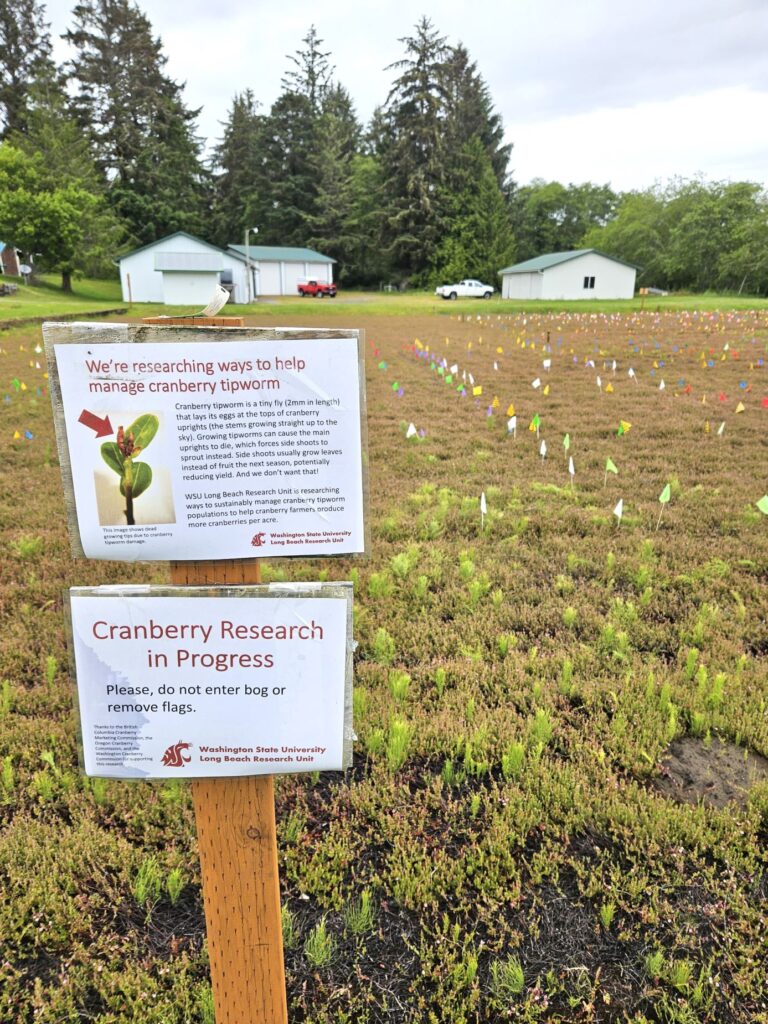
At this farm, they have fields where they are doing research. The flags keep track of treatments for the cranberry tipworm, an invasive insect.
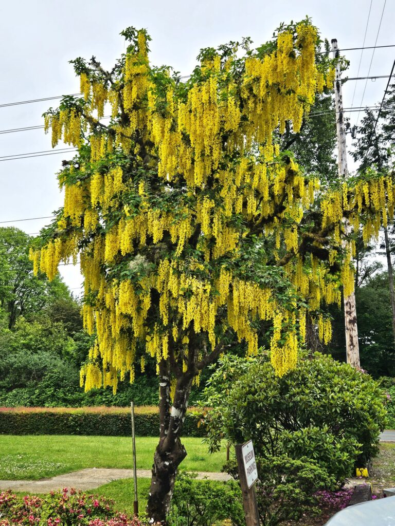
Out front of the museum was this beautiful tree called the golden chain tree. I thought it was very unique and beautiful.
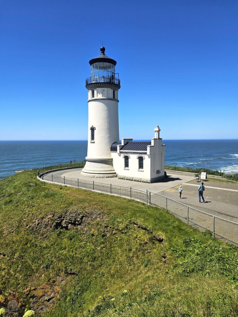
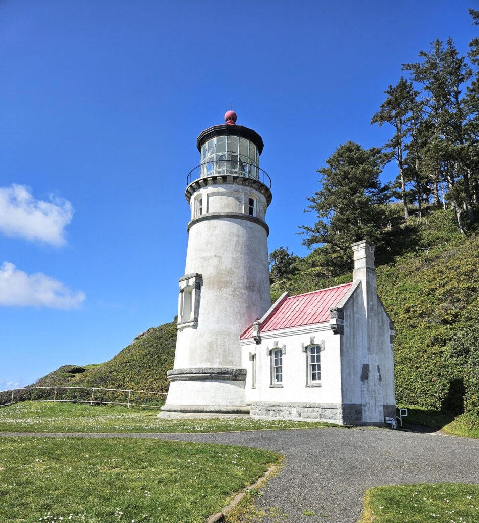
I love to photograph lighthouses. I photographed North Head Lighthouse at Cape Disappointment a couple of years before when it was covered in fog. This year I got another chance on a clear day to to try again.
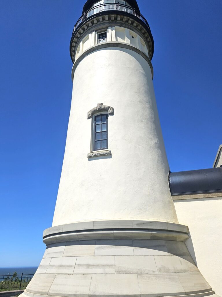
This is the first lighthouse we ever climbed to the top. It has 69 steps leading up to the lantern room where we learned about its history from a volunteer docent.
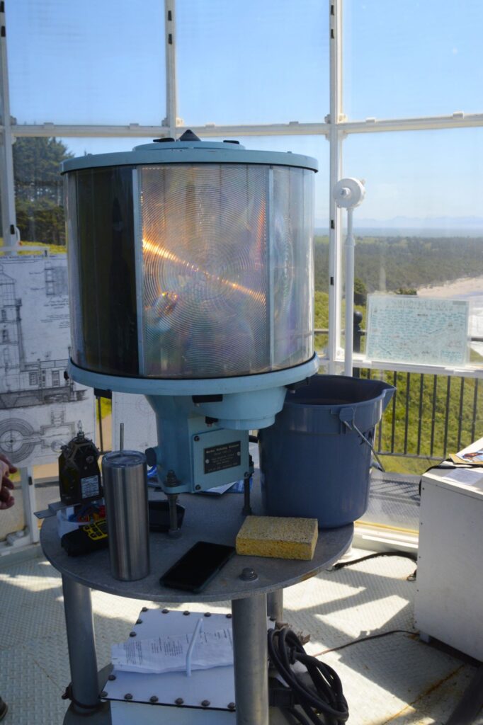
Standing near the light source, I was surprised it didn’t blind us. That’s because of the aerobeacon lens which focuses the light in one direction. It can be seen up to 21 miles out at sea. The light source itself, is a very small light.
Aerobeacon lens is now used in North Head Lighthouse
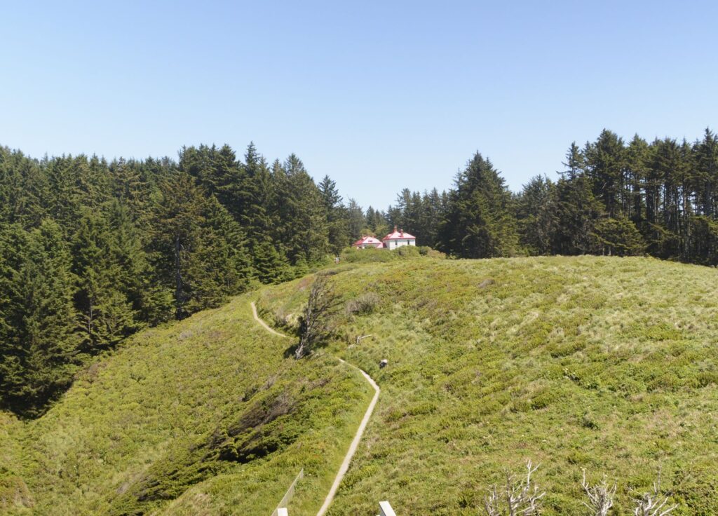
At the top of the lighthouse, we could see the rocky shore to the north and a long beach to the south, as well as the lighthouse keepers quarters up on the hill.
The rocky shore to the north of the lighthouse.View to the south of North Head Lighthouse.Path to Lighthouse keepers’ quarters
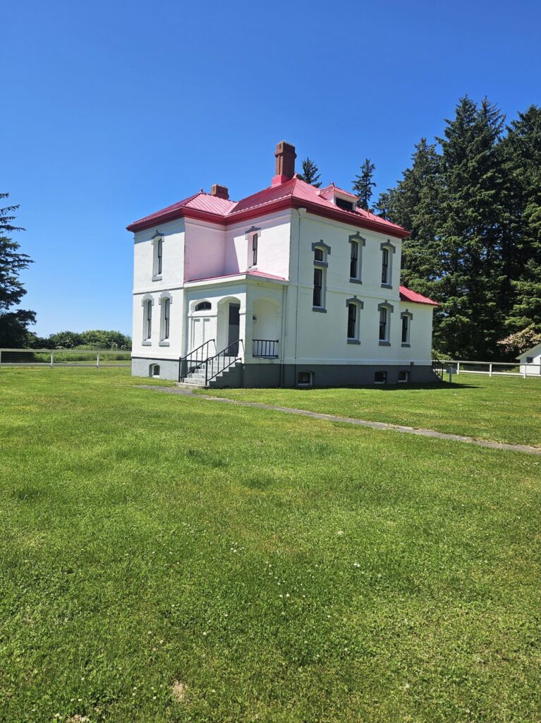
Today, the Lighthouse Keepers’ Quarters are available for overnight stays with kitchen, dining room and all the modern conveniences of today. Wouldn’t that be fun!
Lighthouse keepers’ quarters.
That same day we visited Cape Disappointment State Park to see the Cape Disappointment Lighthouse. It’s difficult to get a good photo up close because of the long steep trail. The trail is currently closed due to hazardous conditions. We drove to Waikiki Beach within the state park where we could see it at a distance.
Cape Disappointment Lighthouse
These two lighthouses are only two miles apart. North Head Lighthouse was built because ships approaching from the north could not see the Cape Disappointment Lighthouse in time to safely enter the Columbia River channel. Today, they are still used as navigational aids.
Jesus said, “I am the Light of the world; the one who follows Me will not walk in darkness, but will have the Light of life.” John 8:12
About three quarters of the way up the coast of Oregon lies Cloverdale, in Tillamook county where the Tillamook cheese factory is located. Cloverdale is dairy country, as you might have guessed. However, our campground happened to be close to the ocean. In fact, I could see the ocean when I climbed the hills on my walks around the campground.
View of ocean from campground
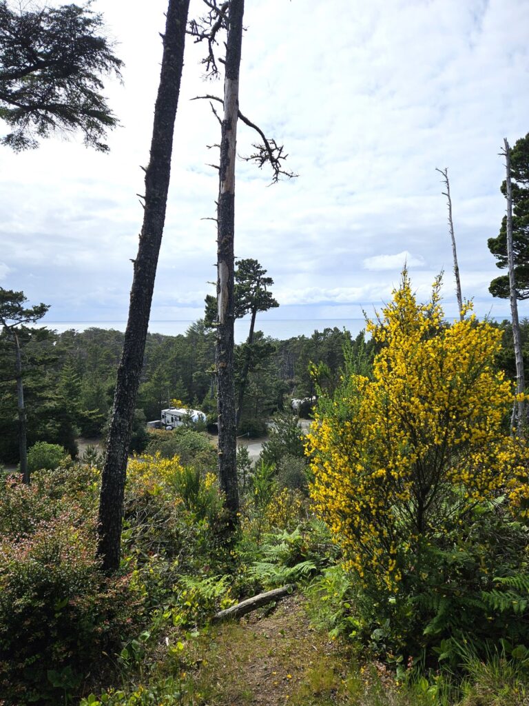
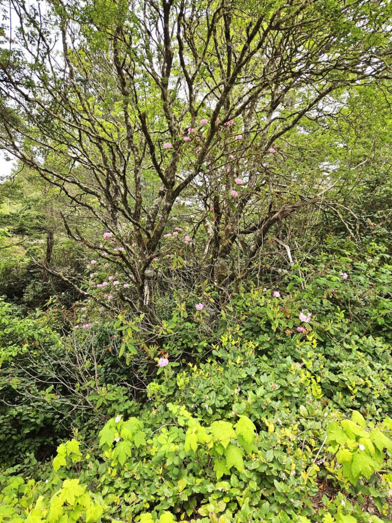
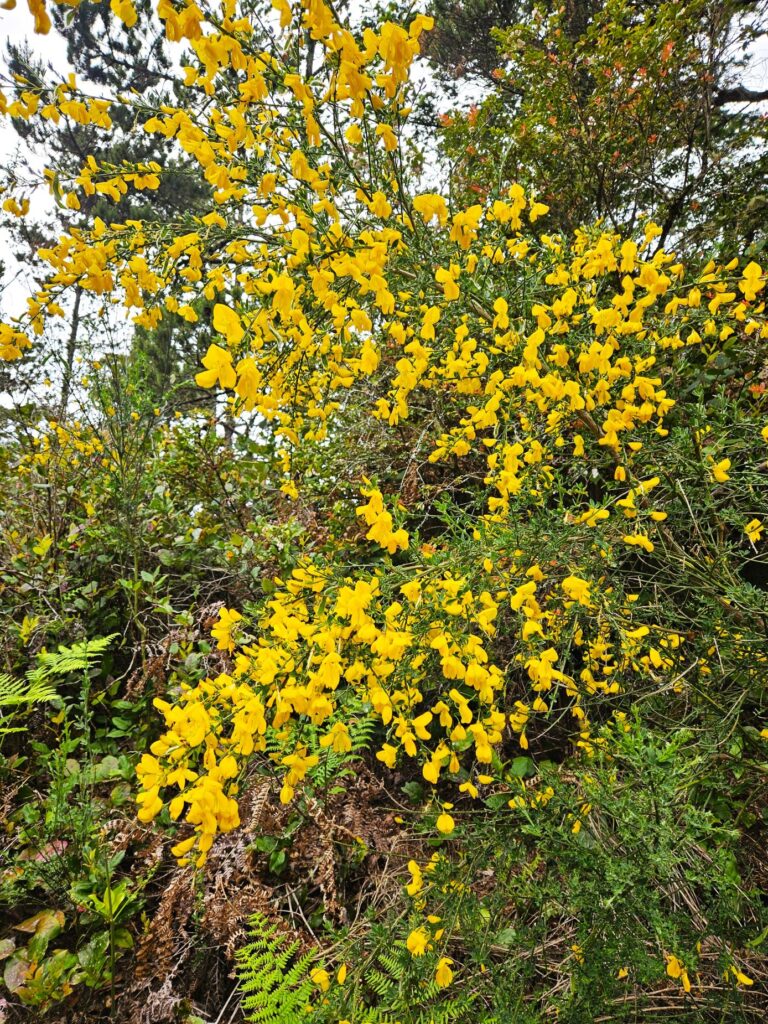
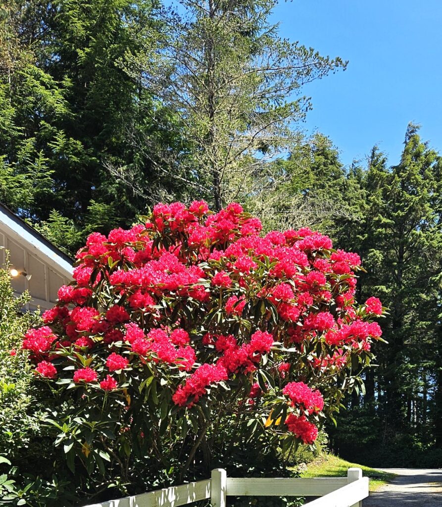
Wild rhododendrons grew throughout the campground, and yellow broom bushes were splashes of bright color that contrasted with the greenery.
Rhododendrons growing up in the tree.Yellow Broom
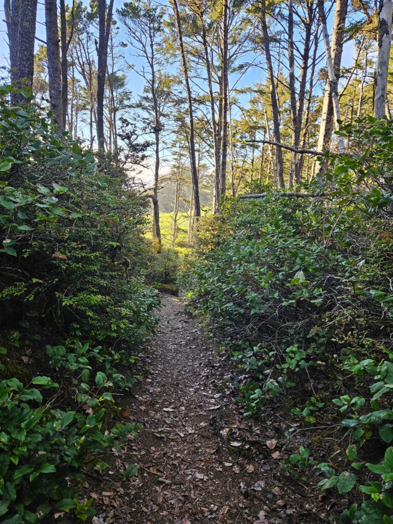
The campground had a trail that led to the ocean. It wound through the trees, across the road and down to the beach below. I followed it far enough to see the ocean and then turned back. I didn’t trust myself to go on alone. It was pretty steep, after all.
Pathway to ocean from campgroundPathway to ocean across from campground
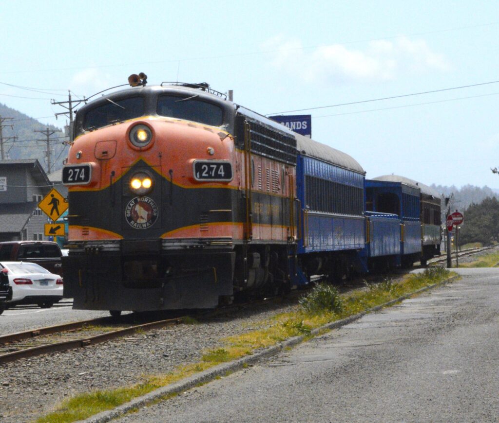
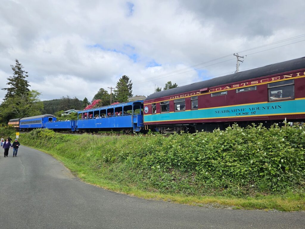
That week was Ray’s birthday. It was the perfect excuse to book rides for us on the historic Oregon Coast Scenic Railroad. This vintage train dated back to the early 1900’s. It was used to connect the coastal lands with larger inland cities like Portland.
Oregon Coast Scenic Railroad
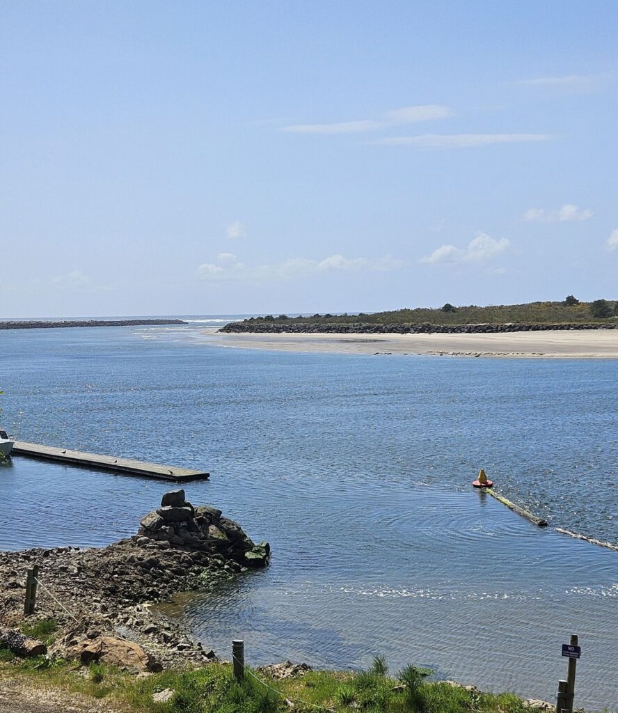
Our ride took us from the town of Rockaway Beach to the town of Wheeler. They are less than 10 miles apart by car. But by train, it took about an hour one way.
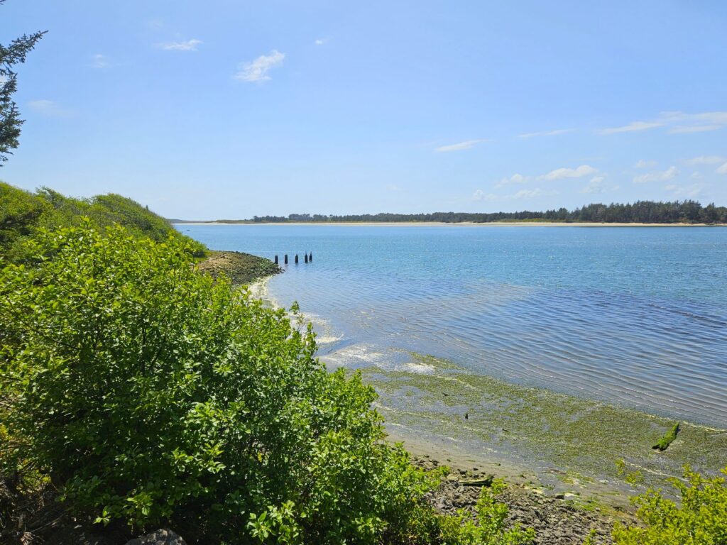
Tillamook Bay
The route follows the shoreline of Tillamook Bay which is famous for its Dungeness crabs and bay clams. The clouds were hovering over the coastal mountain range threatening rain.
On the harbor beach was a large group of seals sunning themselves. You can just barely see them at the edge of the water across the channel.
Seals sunning on the beach across the channel.
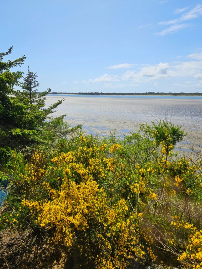
Being spring time, we saw plenty of wild flowers along the way. Much of the bay is a marshy bog which changes with the tides.
Yellow broom blooms along the edge of the bay.
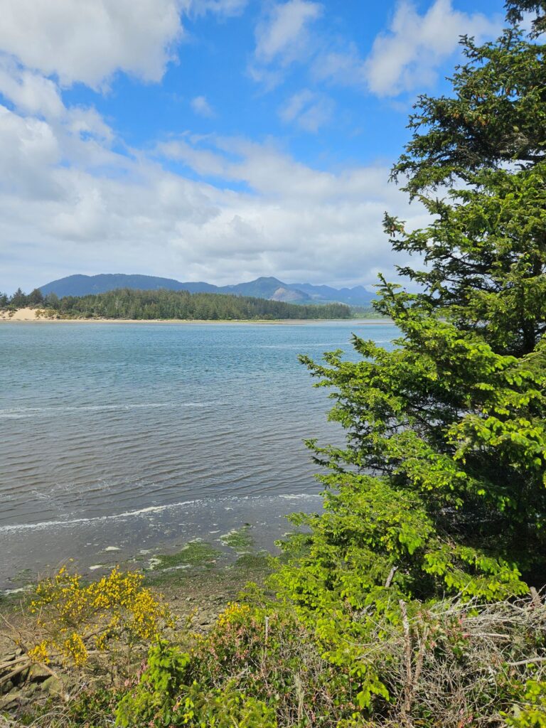
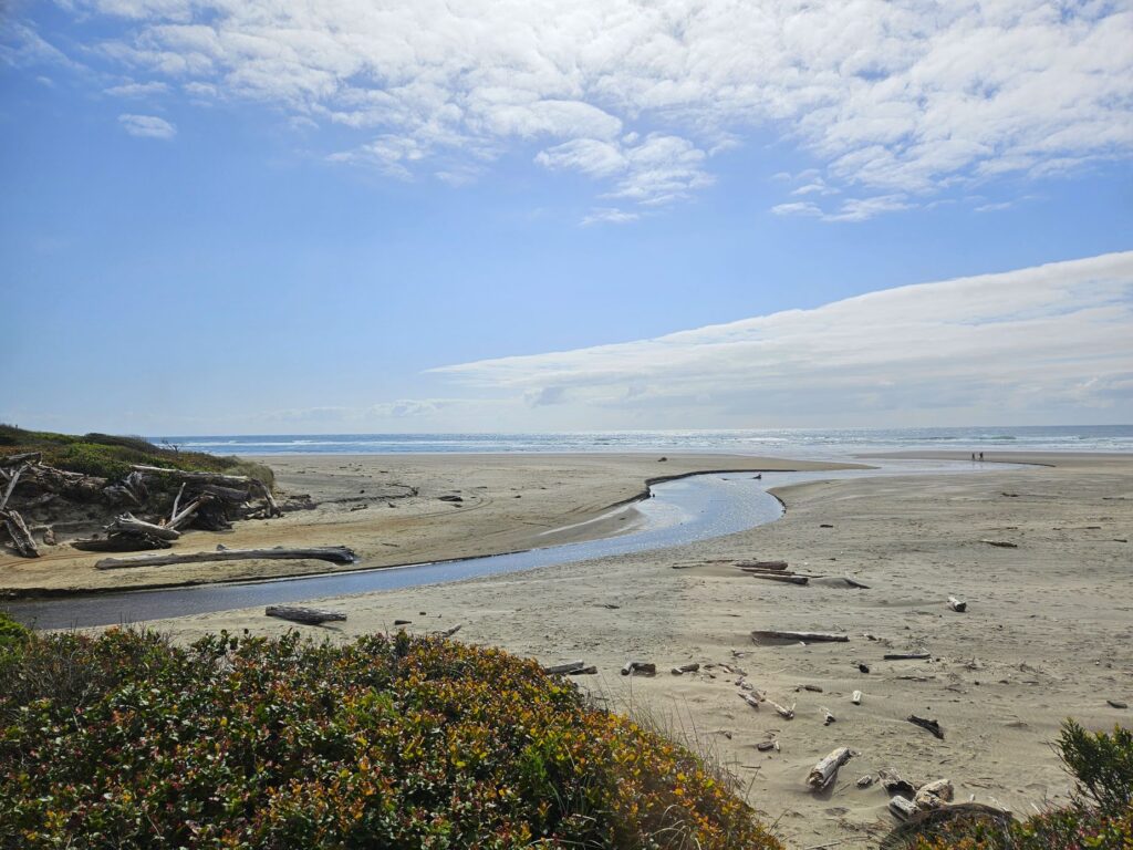
The bay has many fresh water tributaries like this one. Driftwood from the nearby forest litters the beaches.
We had a 45 minute layover in Wheeler before our ride back to Rockaway Beach. I was looking forward to stopping at a little cafe. But oddly, the cafe closed right when the train arrived, and another food truck closed for the hour during our layover, only to open after the train left. You would think they would want our business. Maybe they were shorthanded. Who knows.
The only thing open that day was the antique store where we wandered around in a confusing maze of aisles. I didn’t buy anything. It’s easy to say “no” when there’s no room to store it.
Layover in Wheeler on the Oregon Coast Scenic Railroad
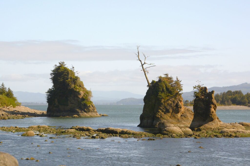
We had a nice relaxing afternoon on the train. On the way home, we saw these interesting rocks with trees growing on them. I wondered if this could be how “Rockaway Beach” got its name.
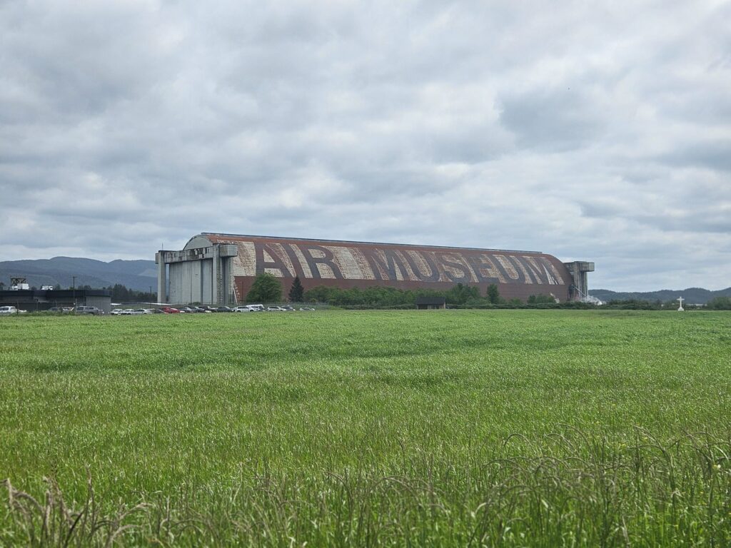
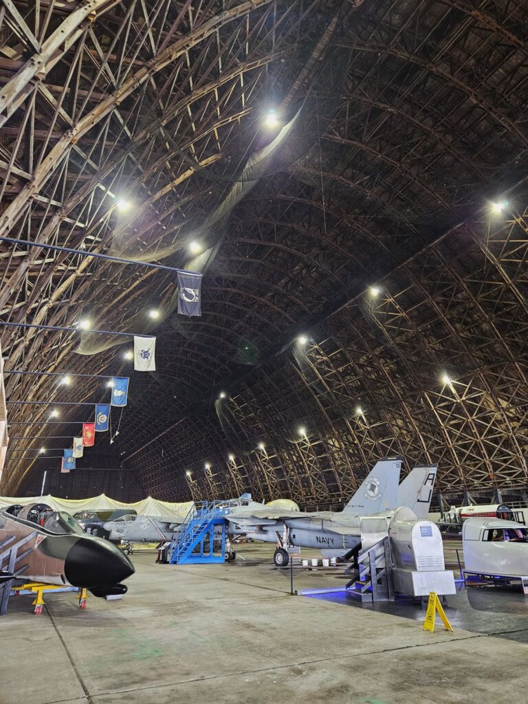
Later in the week, we visited the Tillamook Air Museum located near the town of Tillamook. I have to say, we didn’t have any trouble finding it.
This huge hangar was used during World War II to house up to eight blimps. The blimps were used for various war purposes. Today, the museum houses several planes and displays.
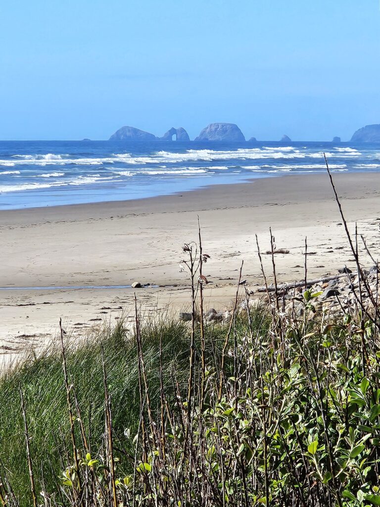
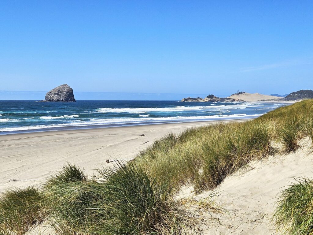
While we were in Tillamook, we looked for Cape Meares Lighthouse, which we have visited previously. We must have taken a wrong turn somewhere. We never found it. Instead, we found this nice state park called Cape Lookout.
Cape Lookout State Park
Looking down the beach the other direction, I saw Three Arch Rocks which is a National Wildlife Refuge. It looked interesting, but we didn’t pursue visiting it that day. We don’t mind leaving some places for future explorations.
Three Arch Rocks Natural Wildlife Refuge in the distance
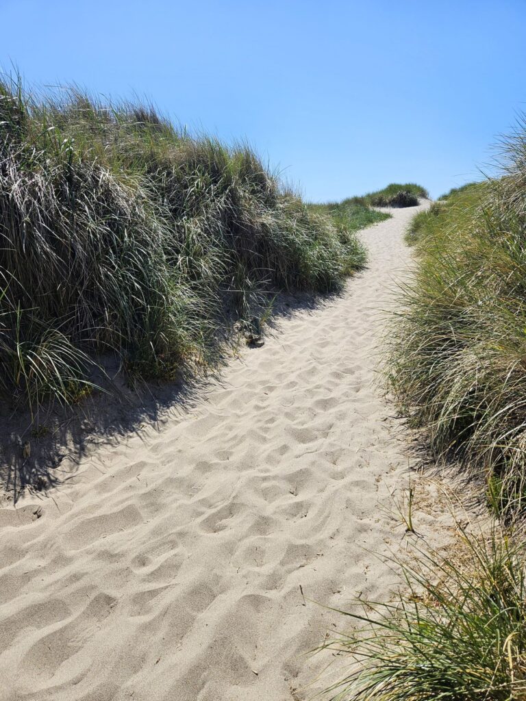
On another afternoon, we went to Bob Straub State Park and walked up this path to the beach. Walking up a steep hill in the sand wasn’t easy, but the views on the other side were worth it.
Bob Straub State ParkThe beach at Bob Straub State ParkBeach at Bob Straub State Park
We enjoyed our time on the Oregon Coast. We never made it to the Tillamook Cheese Factory. Sometimes there are just too many things to see and not enough time to see it all.
“You [God] are mightier than all the breakers pounding on the seashores of the world! Psalm 93:4”
About halfway up the coast of Oregon is the little town of Florence. The approach from the south crosses the Siuslaw (Sigh-YOO-slaw) River on an historic draw bridge which is still in use today. Amazingly, Oregon has over 200 historic bridges. Many of the ones along the coast were designed by Conde McCullough. His bridges are not just functional, but architecturally elegant. I love how each bridge is so unique in design.
Siuslaw Draw Bridge
Near the bridge is Old Town Florence, situated along the riverbank.The old pilings have now become landing places for birds of all types.
We walked along Bay Street, along the river. It has many interesting small shops and restaurants. We got some chocolate-covered toffee in a little candy store and strolled under the Japanese Cherry trees that were in bloom.
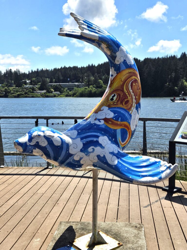
At the end of Bay Street is a small city park with a view of the Siuslaw Bridge. In the park are storyboards of native plants, birds and the history of the Siuslaw Bridge, as well as this painted seal. Other painted seals can be found throughout the city.
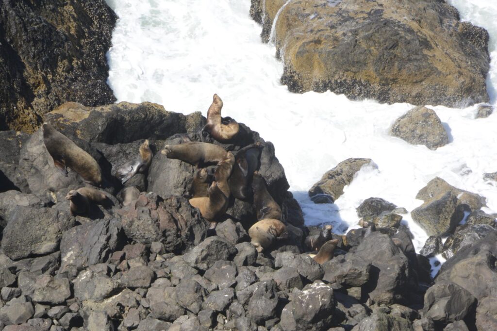
Later, we drove north along Highway 101. The Sea Lion Caves are a popular attraction for visitors. They are the largest sea caves in the USA. However, it’s a tourist trap and a little pricey, so we drove further north and saw some sea lions at one of the roadside viewpoints for free.
Sea Lions bask on rocks below Heceta Head Lighthouse viewpoint
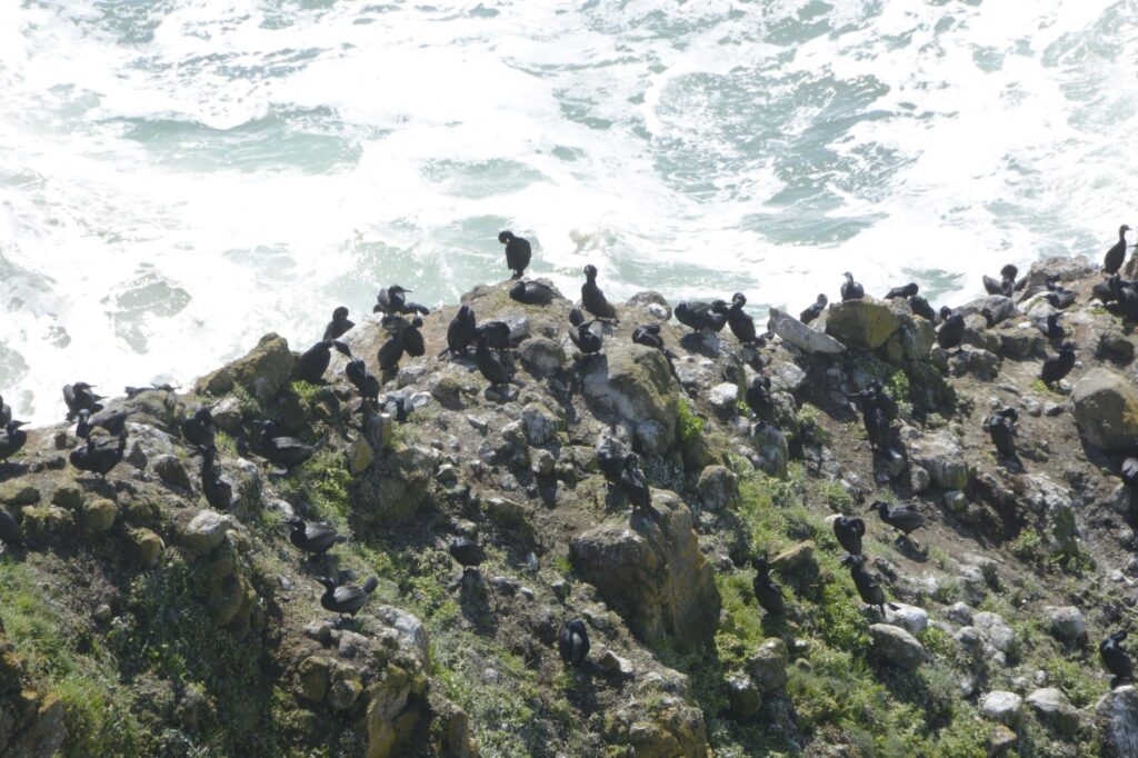
At the same place, we saw hundreds of birds on the rocks.
Bird colony on rocks near Heceta Head
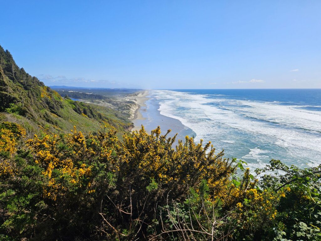
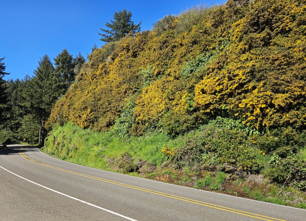
The gorse bushes were in full bloom. Whole hillsides were yellow with their blooms.
Gorse bushes in bloom on hillside
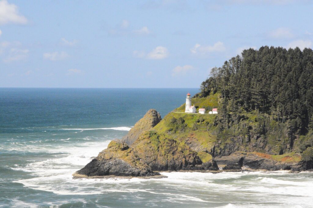
From this roadside view point, we could see Heceta Head Lighthouse. This is one of my favorite Oregon lighthouses because of this view.
Heceta Head Lighthouse from Highway 101 turnout
To get to the lighthouse on Highway 101, you go through a tunnel (Arch Cape Tunnel) and over another historic bridge (Cape Creek Bridge). There is a side road leading down and under the bridge to the beach area and parking lot.
Cape Creek Historic BridgeBeach at Cape Creek near parking lot for Heceta Head Lighthouse
This large rock held my attention for several minutes as I enjoyed watching the waves crash against the sides. Walking up the pathway to the lighthouse, I got a better view from above.
Heceta Head Lighthouse is one of several lighthouses along the rocky Oregon coastline. Built in 1893, its light is visible for twenty-one miles. It was built to fill in a ninety mile gap between two other lighthouses.
Heceta Head Lighthouse
After the lighthouse was automated and the lighthouse keepers moved away, the lighthouse keepers’ duplex was leased by Lane County Community College for classrooms for a satellite campus starting in 1970. They removed a wall separating the two dining rooms to make a classroom area. The students slept on bunk beds in the second story rooms. Imagine being a student and enjoying the Oregon Coast while taking classes!
Lighthouse keepers’ duplex
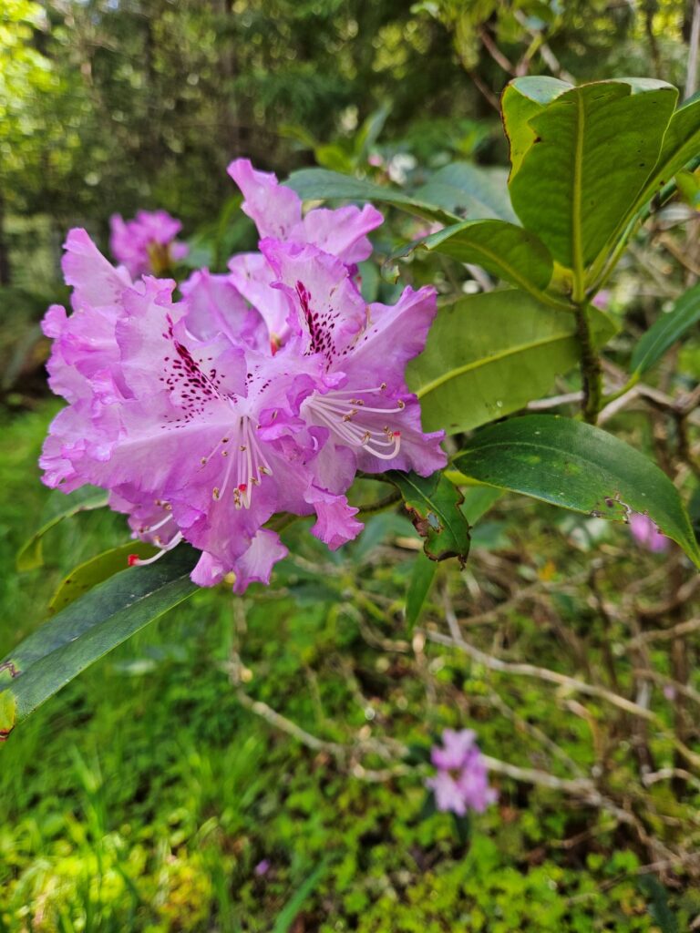
One of the pleasures of traveling in Oregon during the spring is seeing all the beautiful flowers in bloom. Pacific Rhododendrons grow wild and come into bloom in April and May. Florence, Oregon, has an annual rhododendron festival. There were one or more in just about every campsite in our campground in Cloverdale, Oregon. They like disturbed habitats such as roadside embankments and recently deforested wildlands.
Pacific Rhododendron
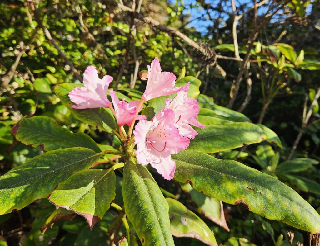
Azaleas are also plentiful and have beautifully colored blooms. Azaleas are rhododendrons, but not all rhododendrons are azaleas. I admit, I can’t tell the difference.
Azaleas in bloom in Cloverdale, OregonAzaleas were abundant in our campground in Cloverdale, Oregon
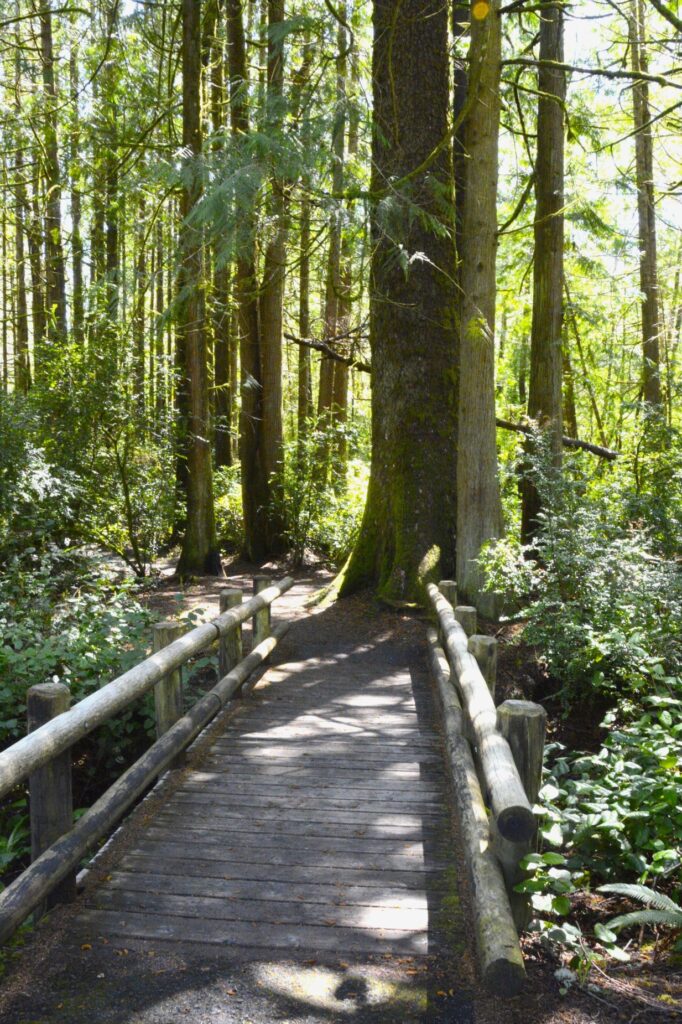
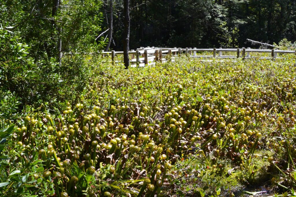
Another day while in Florence, Oregon, we drove a few miles out of town to Darlingtonia State Natural Site. It is an 18-acre botanical park with a boardwalk trail to a fen that is home to the plants called Darlingtonia Californica. They are more commonly known as a cobra lily.
Boardwalk to cobra lilies
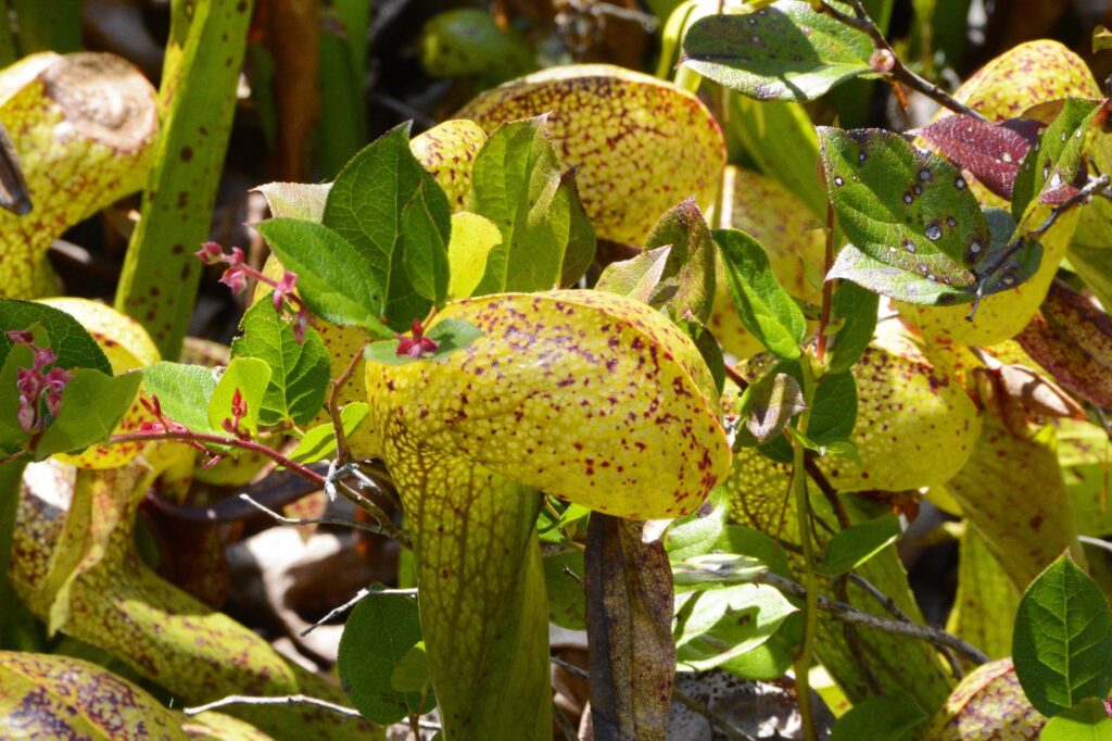
These strange plants are members of the pitcher plant family, i.e. insect-eating plants. They attract insects with nectar through an opening. Before the insect figures out what is happening, they are trapped. Then they are digested by the plant.
They are fascinating plants and are protected by the state of Oregon.
Cobra lilies get their name from their cobra shaped leaves.
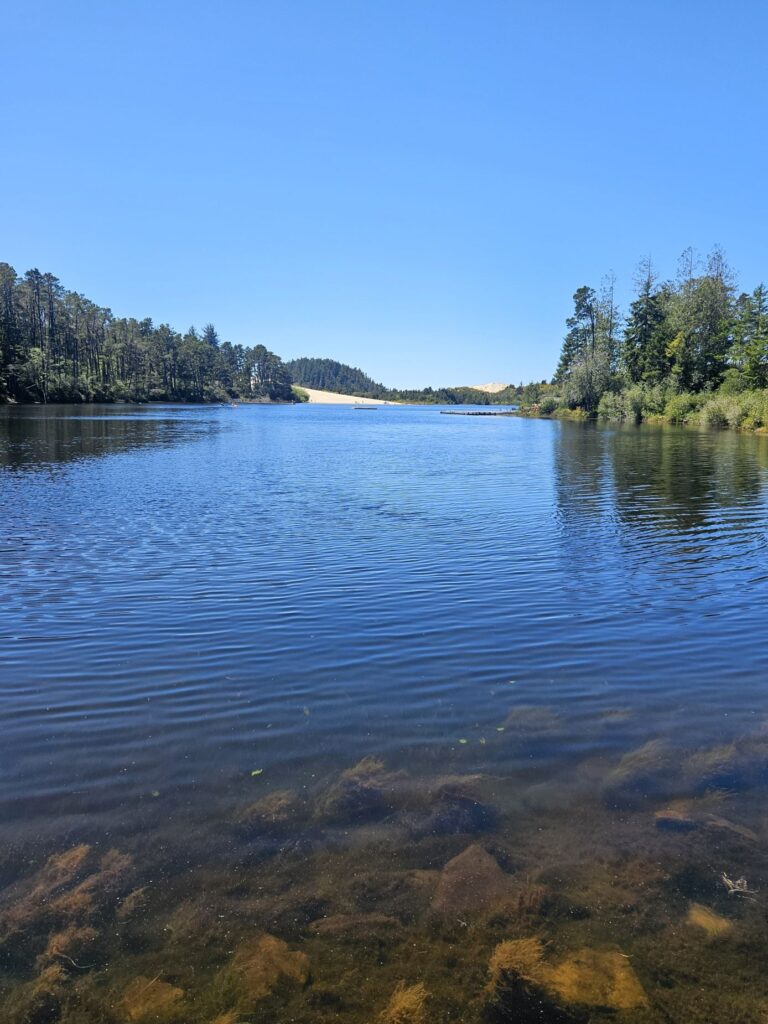
It rained so often that when the rain stopped, it was nice to get out in the sunshine. One such day, we took a short hike around part of Lily Lake in Jessie M. Honeyman Memorial State Park, a mile or so from our campground. You can see the sand dunes in the background.
Lily Lake
The water was clear and cold. As we walked on the pathway around the edge of the lake, we came to a boggy area where water lilies grew. Some of them were in bloom. I wanted to take photos of them, but there was a huge spider web blocking my way. Ray got a stick and removed it so I could get my photo. I felt sorry for destroying the spider’s home, but there was no way I was going to lean over it to get a photo.
Lily pads on Lily LakeBlooming lilies on Lily Lake
The sun was hot and the bugs were abundant, so we turned around and went back home. Even though it rained a lot, we enjoyed our visit to Florence, and the central coast of Oregon.
“O Lord, what a variety you have made! And in wisdom you have made them all! The earth is full of your riches. There before me lies the mighty ocean, teeming with life of every kind, both great and small.” Psalms 104:24-25
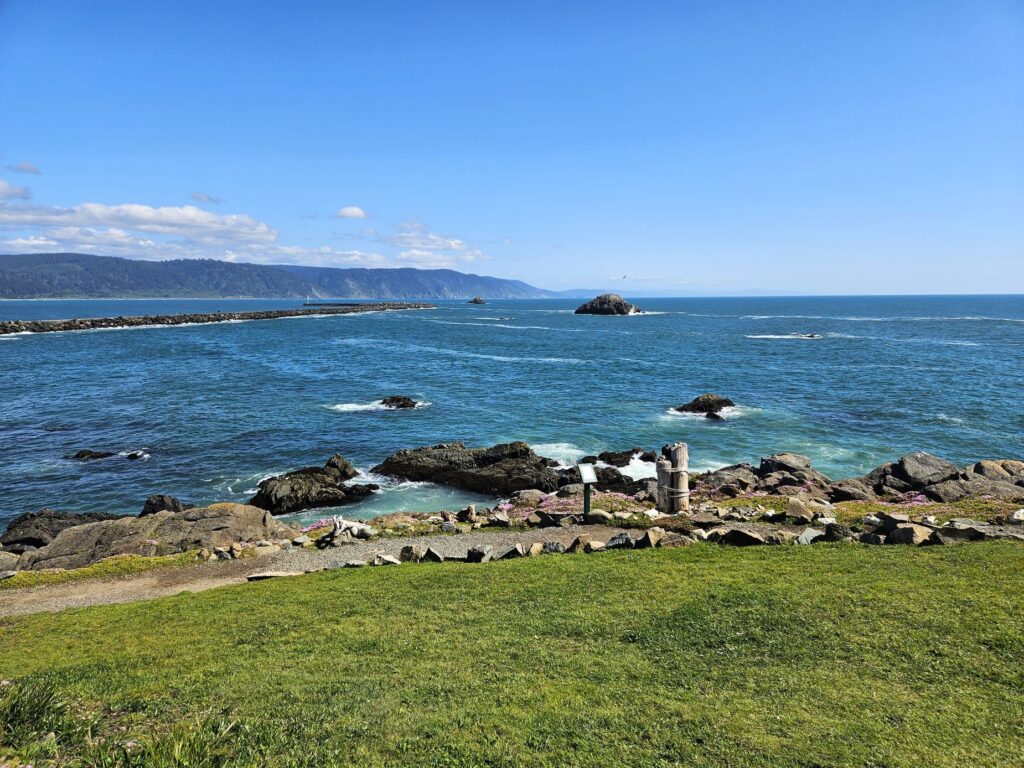
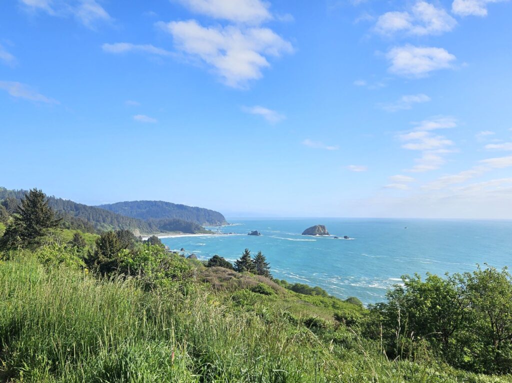
Crescent City lies on the northern coastline of California just 20 miles south of the Oregon border. We drove north on Highway 101 from our campground in Klamath to Crescent City one afternoon to see the quaint little town and lighthouse.
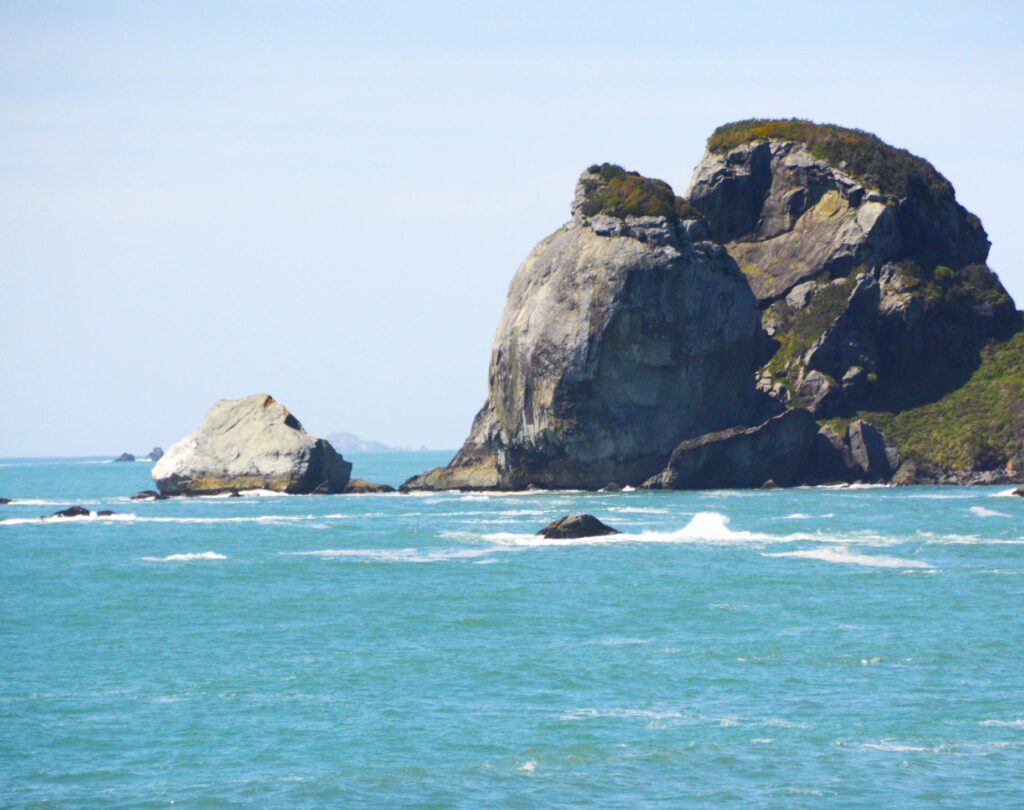
Northern California coast
Along the way we saw large rock formations jutting up from the ocean near rocky beaches. The water was such a beautiful blue that day.
Rocky Northern California coastline
There is always plenty of driftwood on these beaches because the tree line comes to the edge of the ocean.
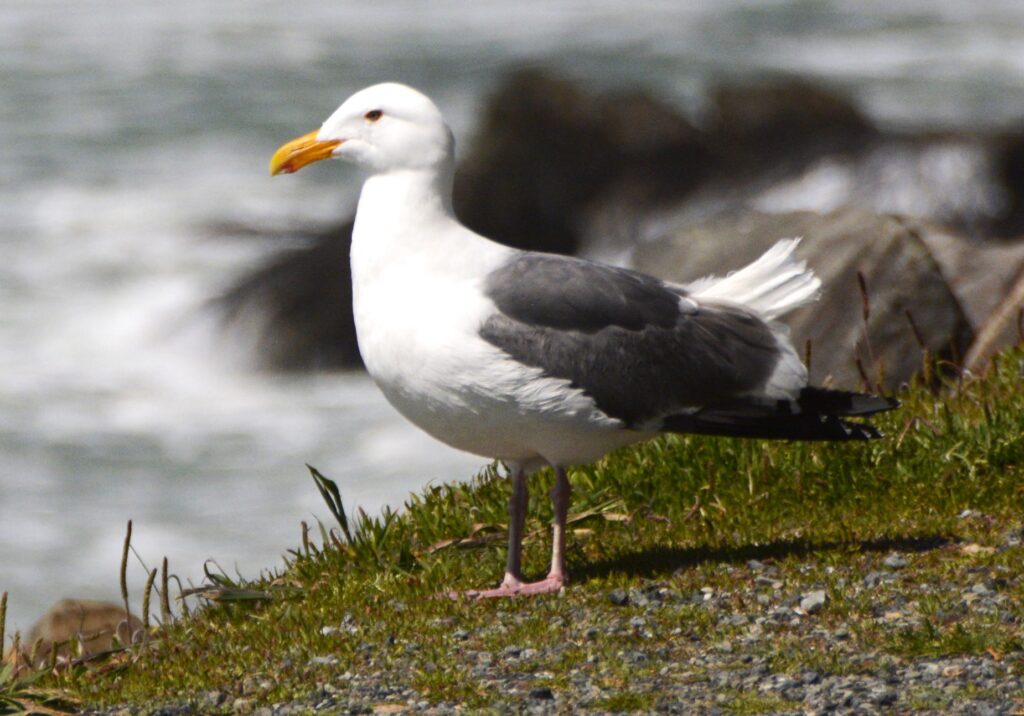
Driftwood artFriendly Seagull
Birds of all kinds love the safety of the rocky ledges and rock formations out in the ocean where they make their homes. There’s always plenty to eat along the water’s edge. Sea lions also like the rocks for sunning themselves.
Crescent City, so named because of its crescent shaped shoreline, was partially destroyed in 1964 from tsunami waves from the Alaskan Earthquake. The city installed a breakwater in 1957 to protect against future tsunamis. However, in 2011, several boats and docks were damaged from tsunami waves from an earthquake in Sendai, Japan.
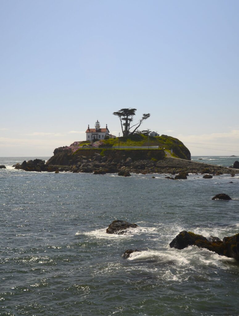
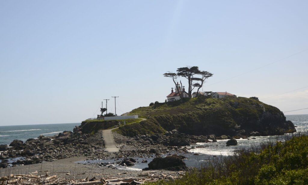
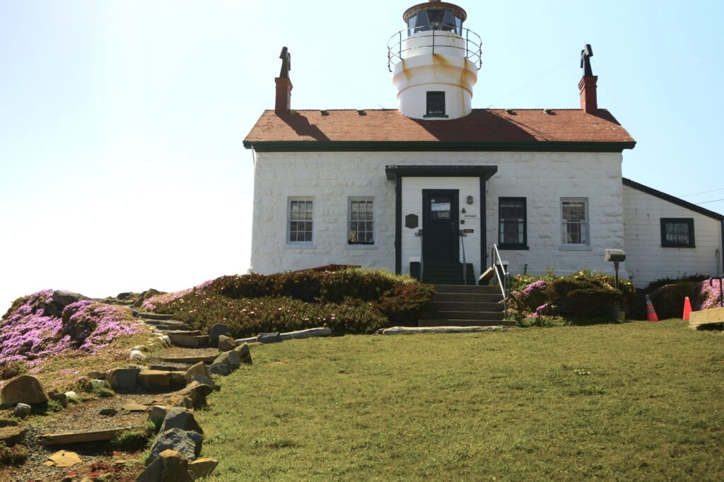
Battery Point Lighthouse
During the 1964 tsunami, the resident lighthouse keepers were stranded inside the Battery Point Lighthouse. Built in 1856, this lighthouse still stands strong. It is still active and serves as a private navigational aid.
Jetty near Battery Point Lighthouse
We walked out on the jetty to get a long-range view of the lighthouse. Signs warned us of sleeper waves that may crash over the jetty unexpectedly. We didn’t get wet, but a few waves splashed up on the jetty.
Low tide at Battery Point Lighthouse
We arrived at low tide, which is the only time the lighthouse is accessible by land. However, we were unable to go inside the lighthouse because it was was closed.
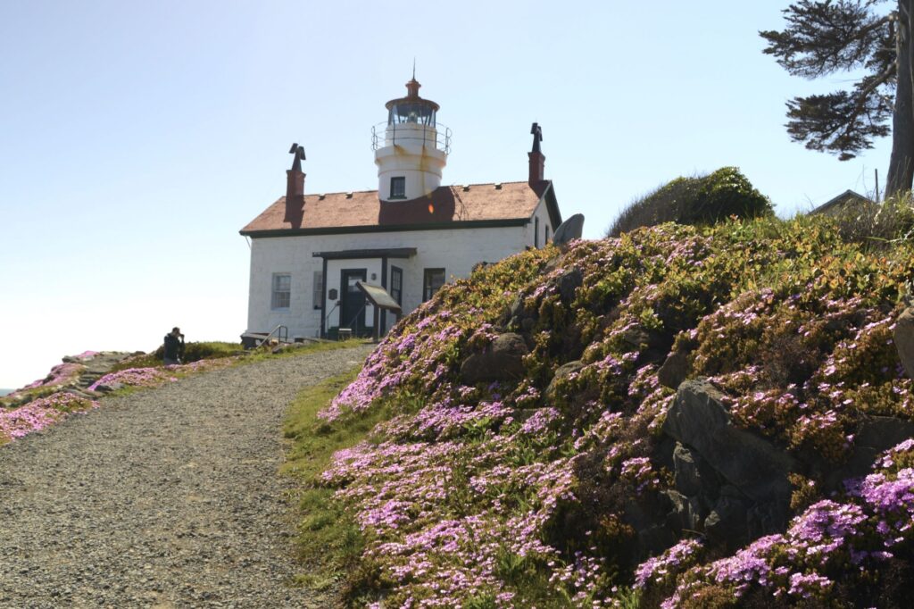
Spring flowers at Battery Point Lighthouse
The Battery Point Lighthouse was automated in 1953, but decommissioned from the Coast Guard in 1965. It was re-activated as a private aid to navigation in 1982.
Fishing, crabbing, tourism and timber are the major industries in Crescent City. A carving outside the lighthouse pays tribute to their seafaring people.
Tree carving near Battery Lighthouse
It was springtime at the lighthouse and the spreading phlox was brilliant with bloom. The Monterey Cypress trees are native to the California coast. They do well in the cool climate.
Gnarly Monterey Cypress Trees at Lighthouse
The color of the sea changes with the weather. On clear days, the water is a turquoise blue, and changes as the mist forms in the afternoon.
Crescent City from Battery Point Lighthouse
As we drove back to our campground in Klamath that afternoon, the sun came out. We stopped at this overlook to get one last shot at the beautiful California coastline.
“The sea is His, for it was He who made it, And His hands formed the dry land.” Psalm 95:5
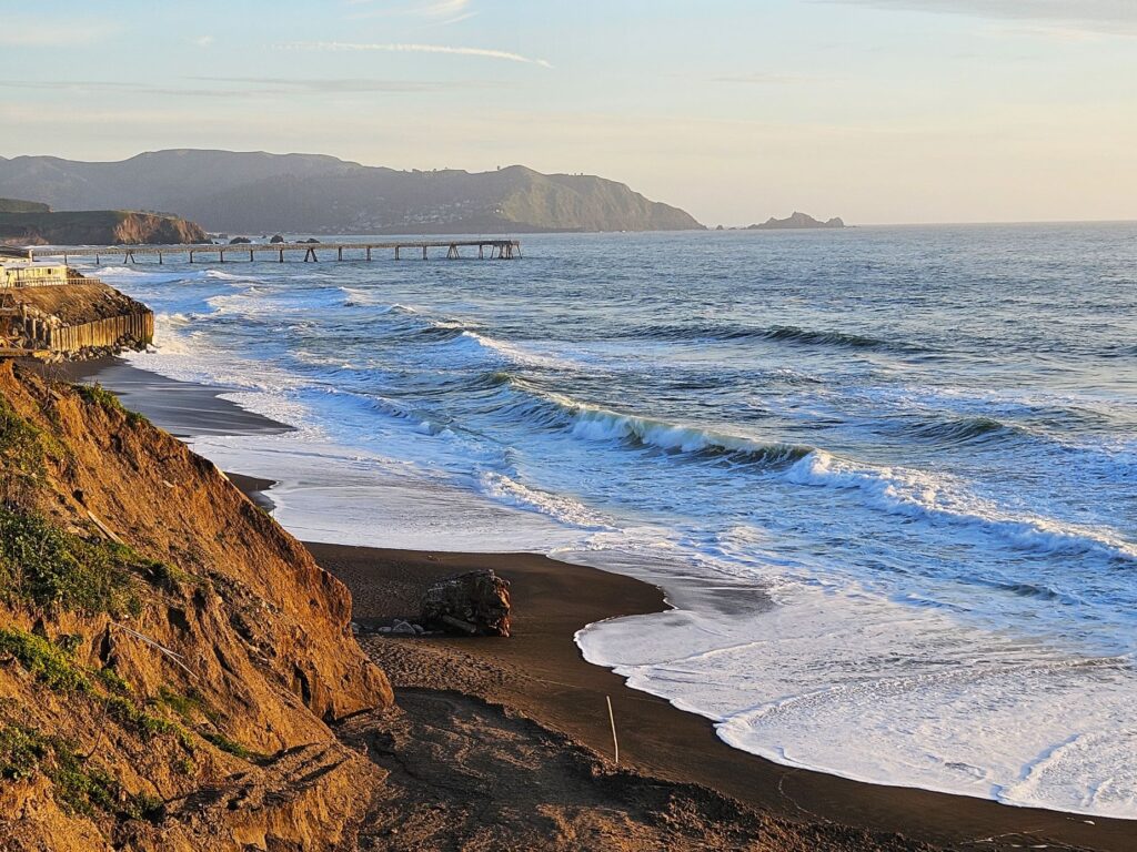
We began our 2024 summer travels by going up Highway 101 in California to Pacifica near San Francisco. Our first campsite was off Highway 1, right on the Pacific Ocean. We were up on a cliff, and it was pretty windy and chilly. My favorite thing about this site was that I could open the back curtains in our RV each morning and look out and see the ocean.
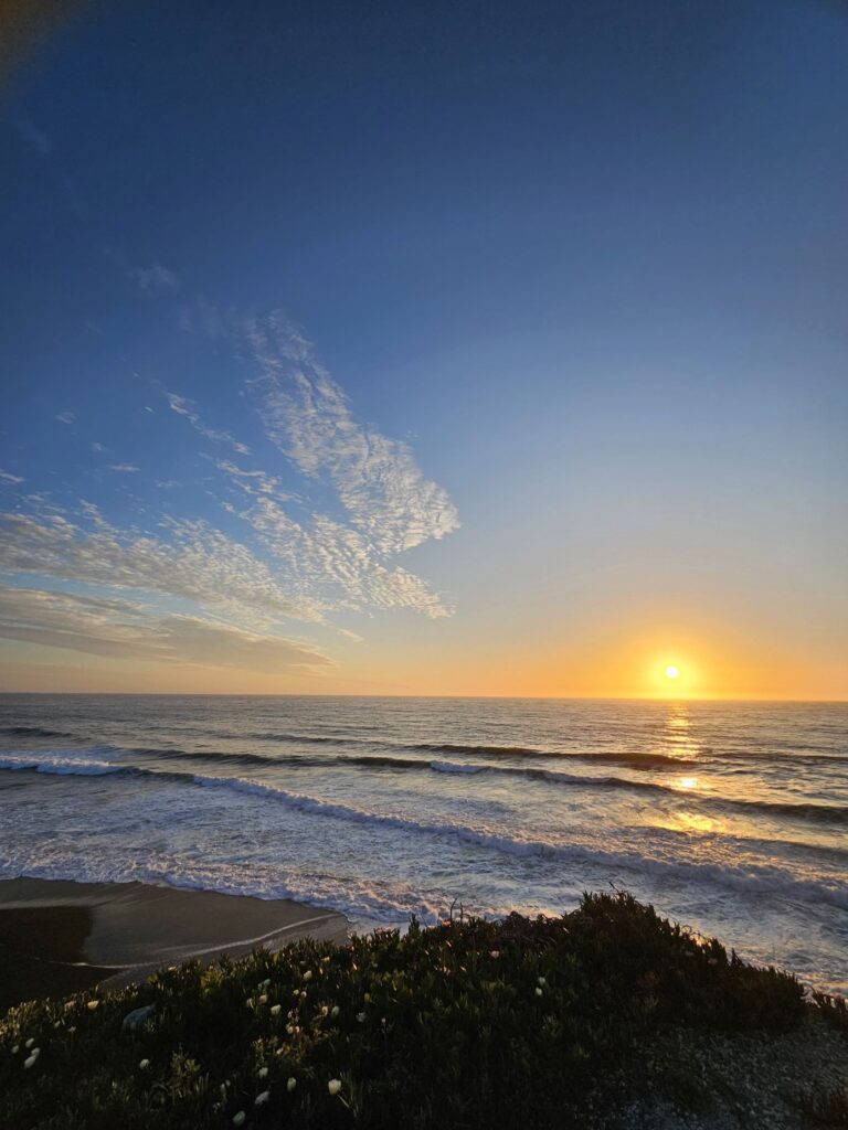
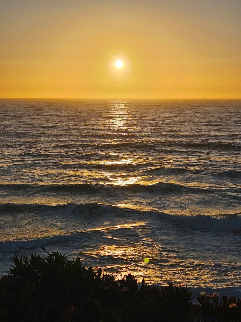
My other favorite thing to do was to capture photos of the sunset every evening. Every sunset was different and unique.
Sunset on Pacific coast
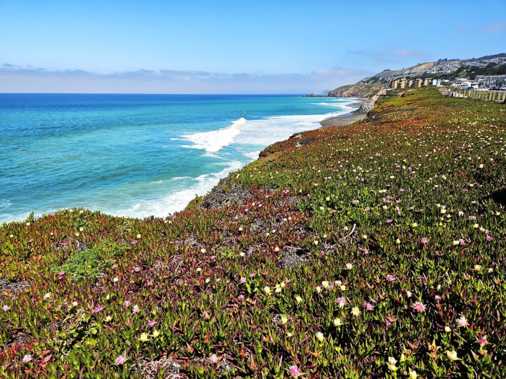
The ice plants were in full bloom. On clear afternoons, we could see people para-sailing over this coastline. The RV park is part of the Esplande Beach Overlook Trail. The trail goes right through the RV park and continues beyond it along this street. There are benches where you can sit and enjoy views like this. Some days the water was a beautiful turquoise blue.
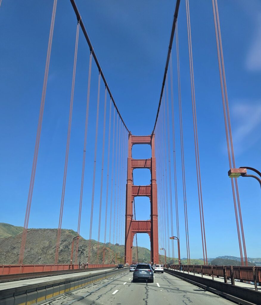
After spending four days there, we got back on Highway 101 and crossed the bay on the Golden Gate Bridge. Although Highway 1 follows the coastline, we followed Highway 101 because it is easier for pulling a travel trailer. Highway 101 eventually makes its way back to the ocean near Eureka, CA.
Golden Gate Bridge
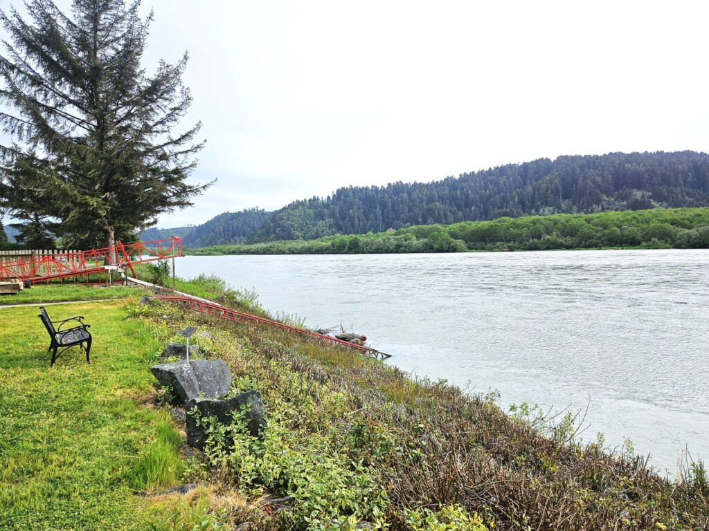
North of Eureka is Klamath, California, where the Klamath River meets the Pacific Ocean. Our campground was right on the Klamath River. From there, it was only a short drive to Redwoods National Park.
Our Campground was right on the Klamath River
Redwoods National Park is actually a combination of three California state parks (Prairie Creek Redwoods State Park, Del Norte Coast Redwoods State Park, Jedediah Smith Redwoods State Park) and a national park (Redwoods National Park) and stretches many miles along the northern coast of California.
Newton B Drury Scenic Parkway in Prairie Creek Redwoods State Park (Redwoods National Park)
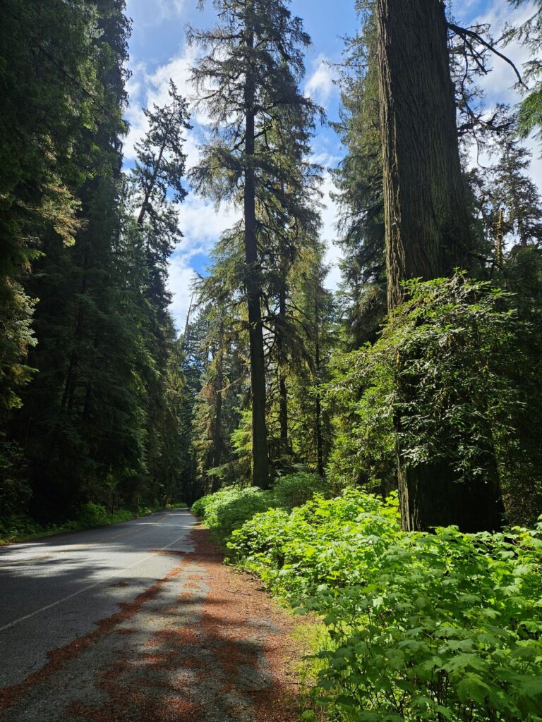
There’s a scenic drive south of Klamath called the Newton B. Drury Scenic Parkway. It is a ten-mile drive through the redwood trees.
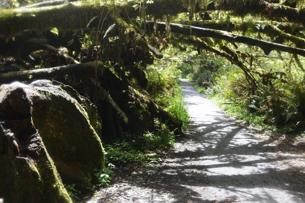
Redwoods along the Newton B. Drury Scenic ParkwayPathway to The Big Tree
Along the scenic drive was a side road to see The Big Tree. The pathway there was lined with all kinds of ferns.
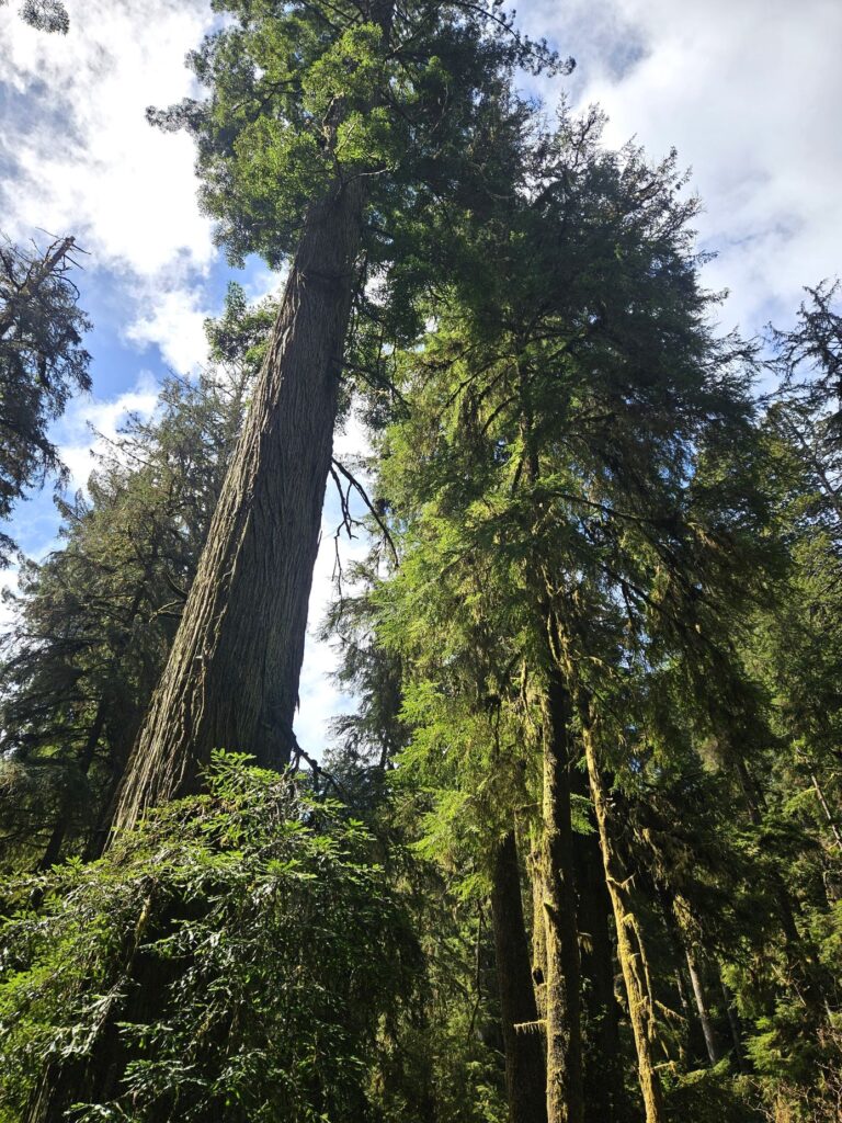
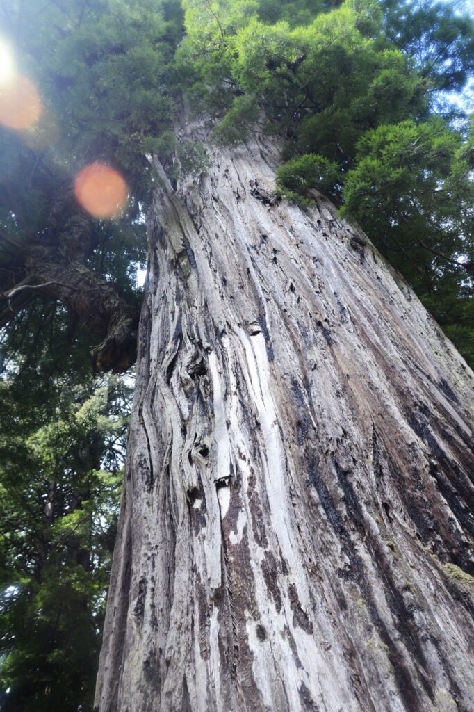
No camera can quite capture the immensity of these huge redwood trees.
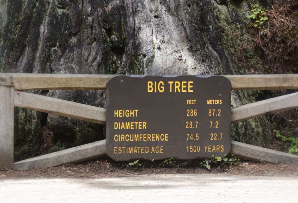
The Big Tree
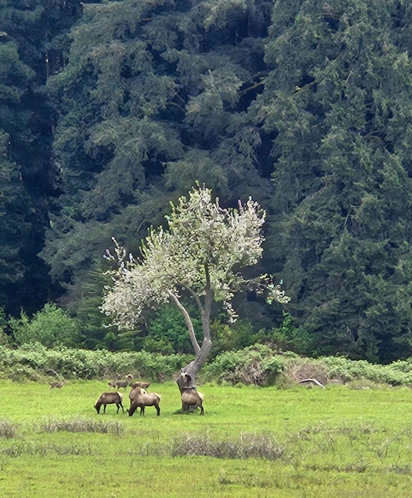
We continued south to the Prairie Creek Redwoods State Park Visitors’ Center. On the way, we saw a bear along the road. In the meadow we saw several elk grazing.
Elk grazing in Prairie Creek Redwoods State Park (Redwoods National Park)
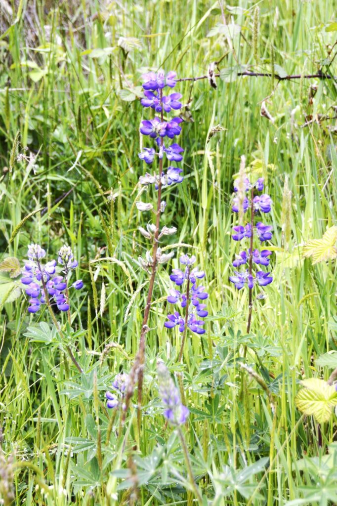
After getting my National Parks Passport book stamped, we drove further south to Elk Meadow area where I hiked to Trillium Falls. Wildflowers greeted me at the start of the trail.
Lupine blooming along trail.
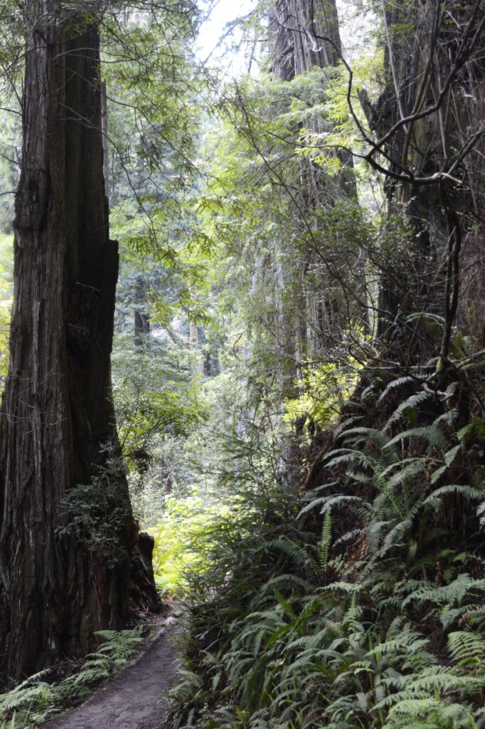
The forest soon closed in around me as the trail wound up switchbacks for a 200′ elevation gain. The sign at the trailhead said there were bears in the area. I was a little nervous being all alone, but I knew there were people ahead of me and behind me also.
Pathway to Trillium Falls
I quit worrying and just enjoyed the quiet and beauty of the forest. Ferns grew everywhere, even out of old tree stumps.
Pathway to Trillium Falls lined with ferns.
I had to hold onto the roots of a large fallen redwood trying to avoid a muddy spot on the trail. There were several spots that were muddy and slippery. I took my time and didn’t slip.
Roots of fallen Redwood tree
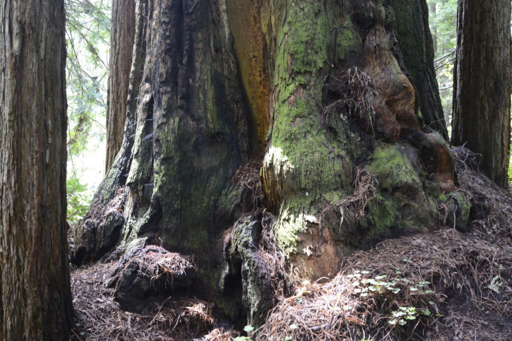
These giant redwoods don’t have deep roots, but the roots spread out for quite a distance around them. These huge moss-covered trunks intrigued me.
Moss covers Redwood tree trunks.A footbridge over water on the trail to Trillium Falls.
After a half-mile of hiking, I came to Trillium Falls. The falls weren’t that impressive, but the setting was magical. The forest and ferns around it made it such a pretty place.
There were several people gathered around the falls getting photos and climbing on the rocks. I had to wait to get some photos.
Trillium FallsTrillium Falls
It was such a beautiful spot in the late afternoon. The light was filtering down through the trees on this very twisted mossy tree that hung over the falls.
Tree at Trillium Falls with fern.
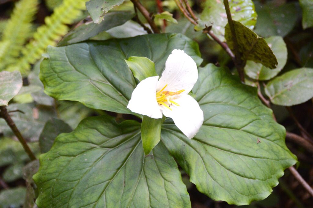
After lingering at the falls for awhile, I headed back to the truck. The trail continued on, but I didn’t carry any water with me, and I was getting pretty thirsty by then. I felt like this hike had been well worth the effort. There was just one thing more that I wished for. This may seem silly, but I prayed to see a trillium flower for which the falls was named.
My prayer was answered. Though I had looked all along the pathway for flowers, I didn’t see this one until I was on the way back.
Trillium Flower is known for it’s three petals and three leaves.
“The Lord directs the steps of the godly. He delights in every detail of their lives.” Psalm 37:23
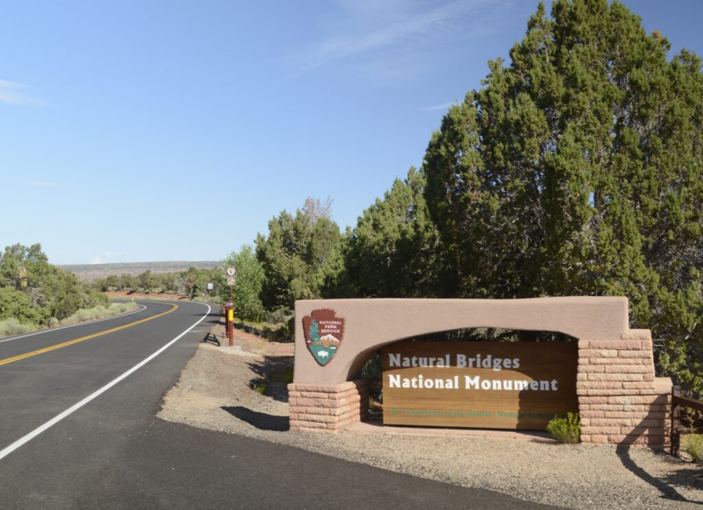
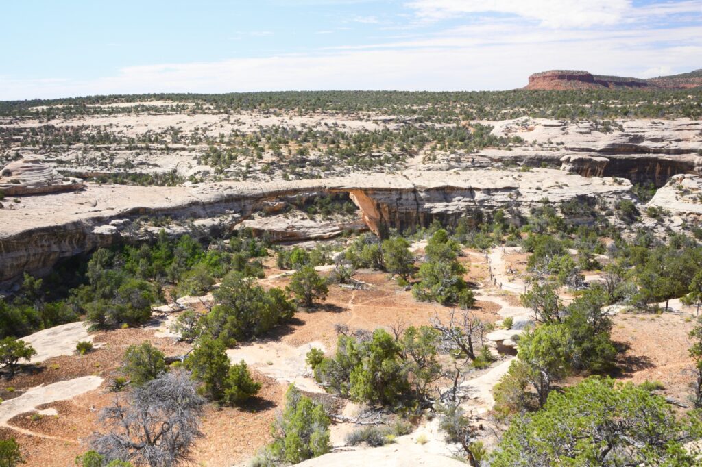
Utah’s first national monument, Natural Bridges, is off the beaten path. It was over an hour drive from Monticello, Utah, where we were staying. After turning on state highway 94 at Blanding, Utah, which is about the halfway point, there are no towns or services from then on. But the scenery is worth the drive.
There are three natural bridges within the park boundaries: Sipapu, Kachina, and Owachomo which are Hopi Indian words meaning “place of emergence,” rock art that resembles kachina dolls, and “rock mound.” They were discovered by a prospector in 1883, and later it was designated a national monument.
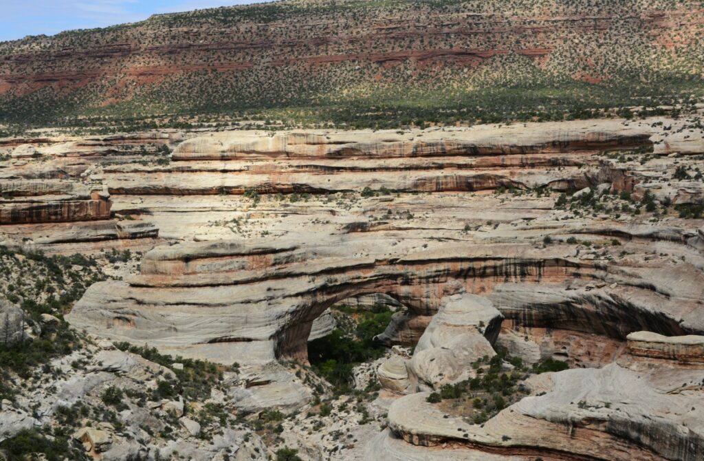
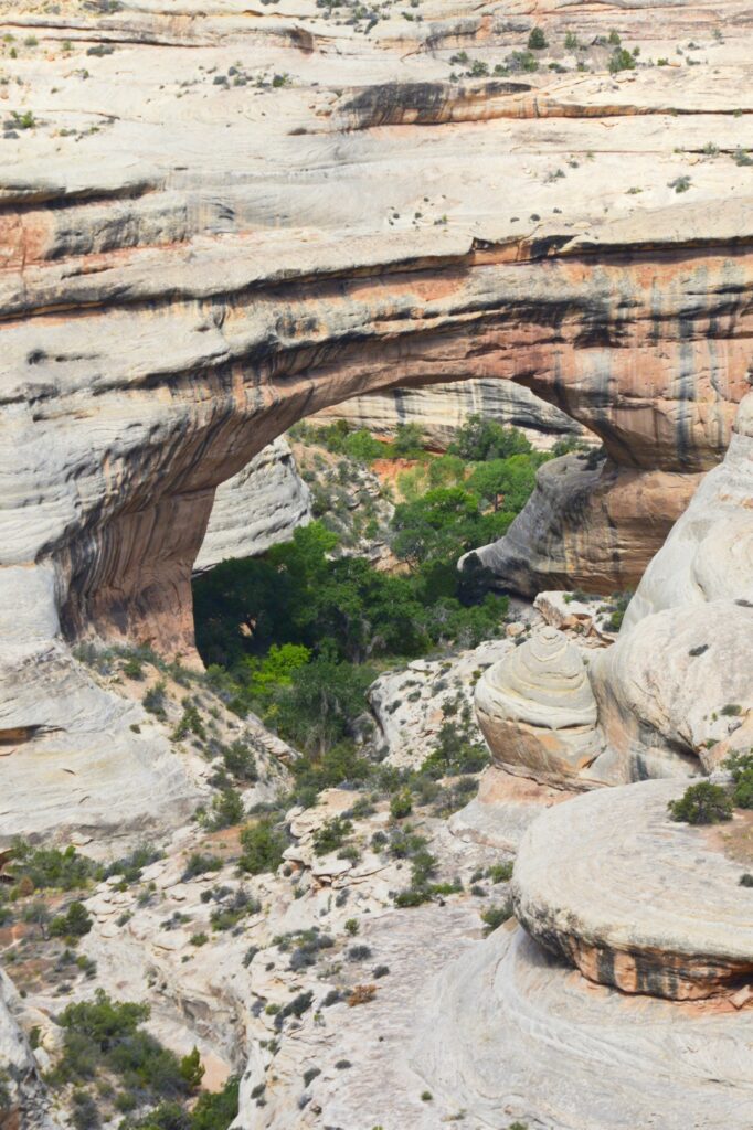
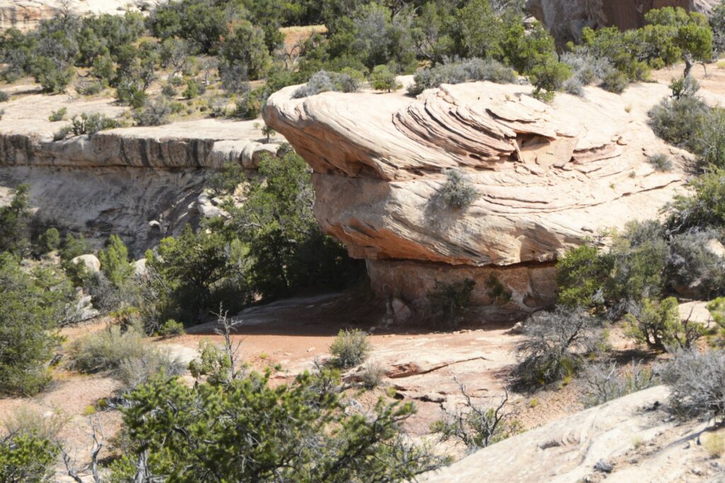
Sipapu Natural Bridge
We started our visit at the visitors’ center where we learned the difference between a natural bridge, an arch and a window. A natural bridge is formed by flowing water. As streams wind back and forth in a canyon, the thin walls are worn through by the water pounding against them.
Sipapu Natural Bridge
Sipapu (see-pa-pu) bridge was the first stop on the nine-mile Bridge View Drive through the park. It’s the largest of the three bridges. Its meaning has to do with an entryway by which the Hopi believe their ancestors came into this world. To give you an idea of its size, the dome of the United States Capitol would nearly fit underneath it. It is the second largest natural bridge in the U.S.
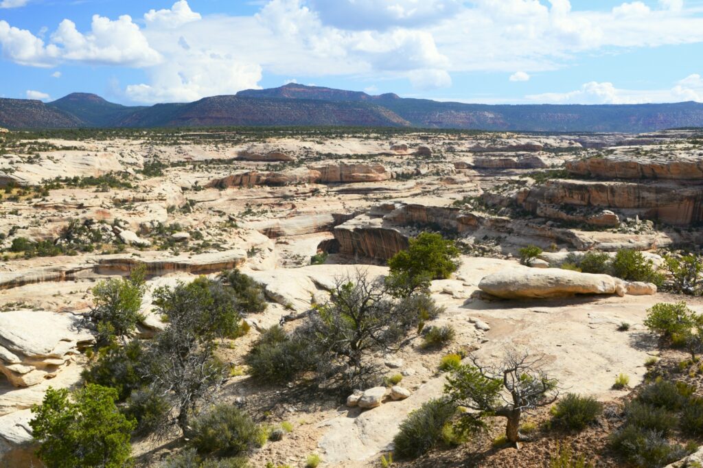
View of canyon
The drive along the canyon was beautiful. There were swirls in the rocks that showed water was a factor in forming the rocks we see today.
Swirls in rocks
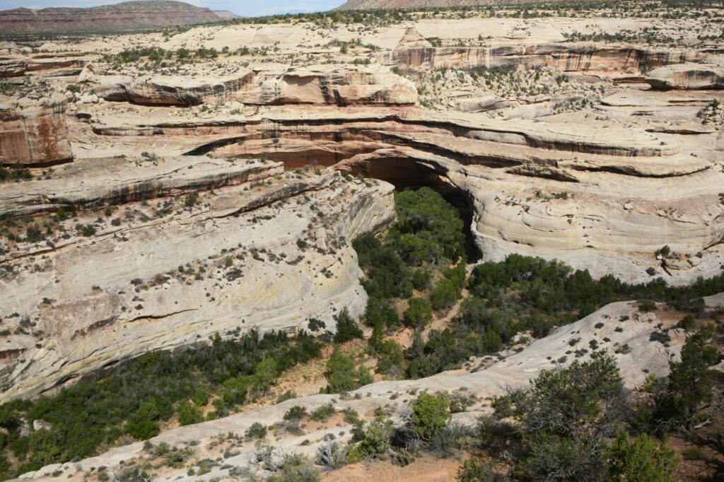
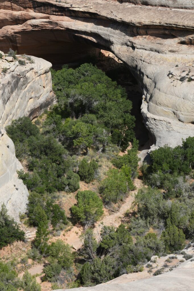
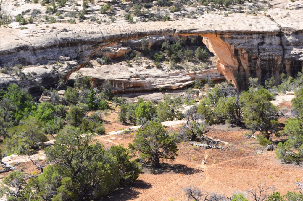
Kachina Bridge was harder to see because trees obscure the opening. It is smaller than Sipapu Bridge, but has a massive amount of rock above it.
Kachina BridgeKachina Bridge
The Owachomo Bridge is the smallest and thinnest of them all. A rock mound on the east end of the bridge is why it is named Owachomo. The word means “rock mound” in the Hopi Indian language.
Owachomo Bridge with rock mound on left
You can see that the rock on the top of this bridge is much thinner. Some believe it may be the oldest of the three because of the amount of erosion, but no one can tell for sure.
Owachomo Bridge
It was very hot that day, so we didn’t take any hikes down to see the bridges from below. The viewpoints from above don’t really showcase the enormity and size of the bridges. Perhaps someday we will return during a cooler time and take some of the hikes.
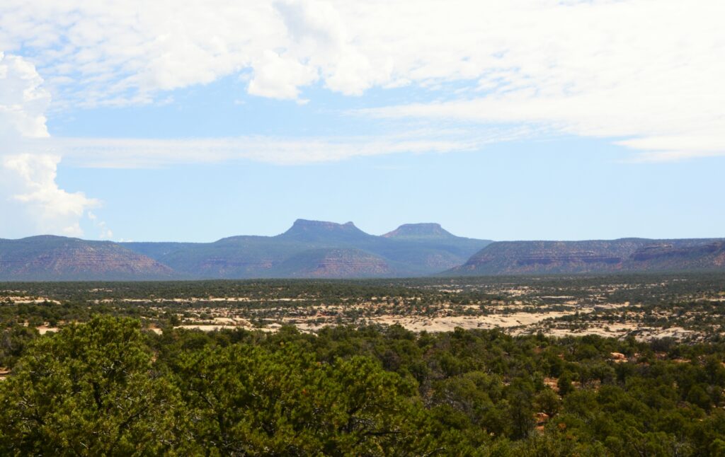
Bears Ears of Bears Ears National Monument
It was time for us to return to our campground. We ate our sack lunch and headed home. On our way out the park, I saw a sign about Bears’ Ears National Monument. I had been seeing signs for it, but didn’t know what to look for. In the distance were the Bears Ears for which the national monument is named. Someday, maybe we will explore it also.
“Great are the works of the Lord; They are studied by all who delight in them.” Psalm 111:2