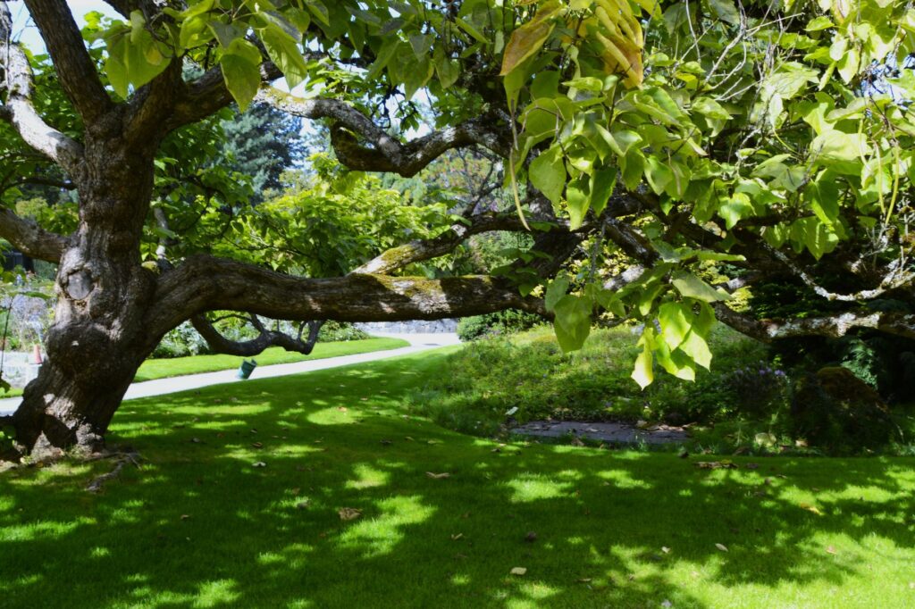
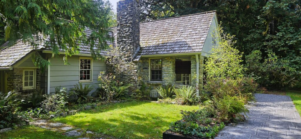
Of all the national parks we’ve visited, (33 so far), Yosemite is our all-time favorite. While we were staying in Coarsegold, California, we couldn’t resist a visit to our former “backyard.”
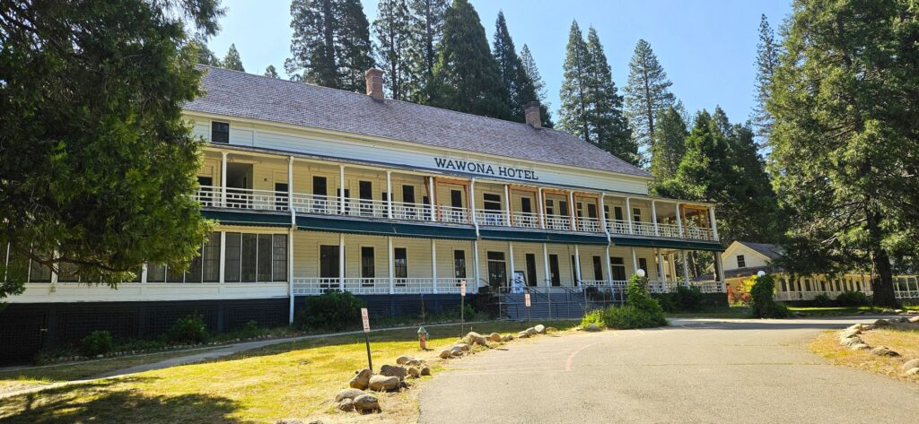
The Historical Wawona Hotel was being renovated in 2025.
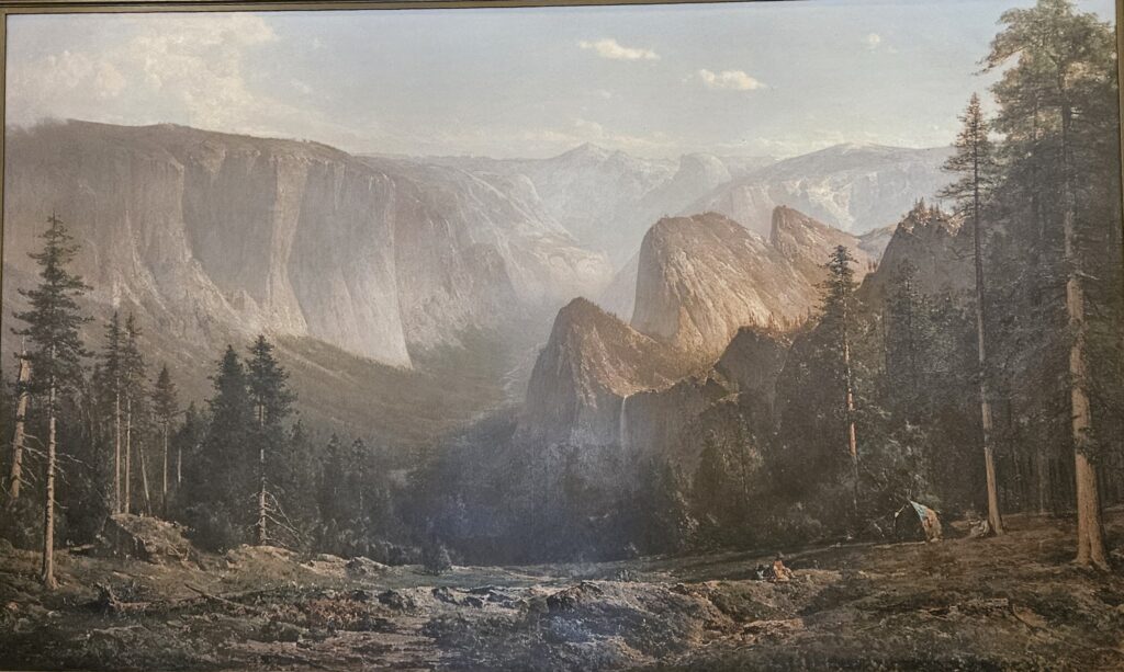
We entered Yosemite park through the Oakhurst entrance and stopped at the Wawona visitors’ center. In all our visits to Yosemite, I’d never been to this visitors’ center. It houses a fabulous collection of paintings of the famous landscape artist, Thomas Hill.
A large floor to ceiling painting of Thomas Hill in the Wawona Visitors’ center.
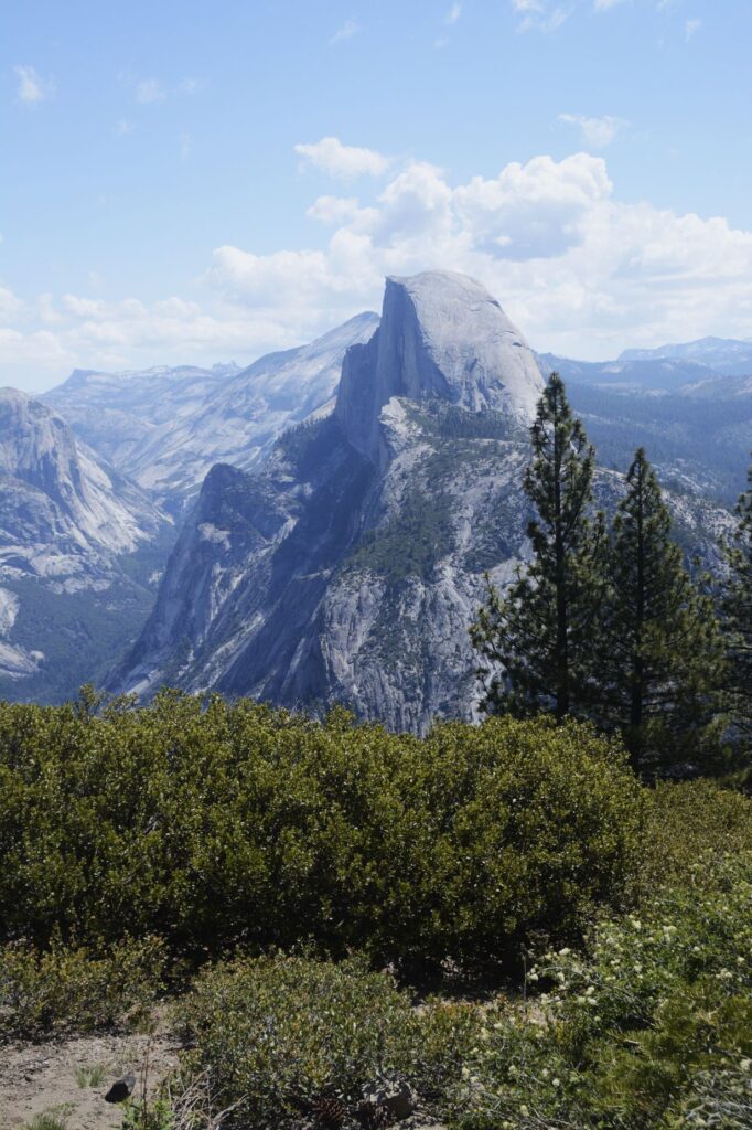
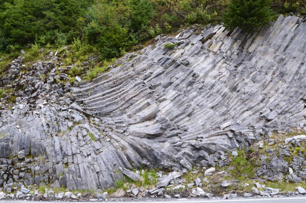
After getting my National Parks Passport book stamped and buying a couple of stickers for my journal, we drove on to Glacier Point. The road was fully opened recently after having been closed for a couple of years for repairs.
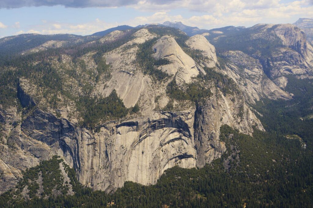
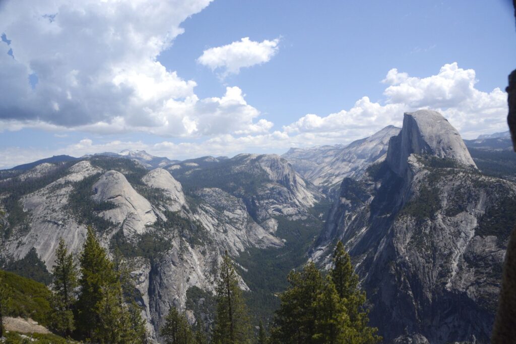
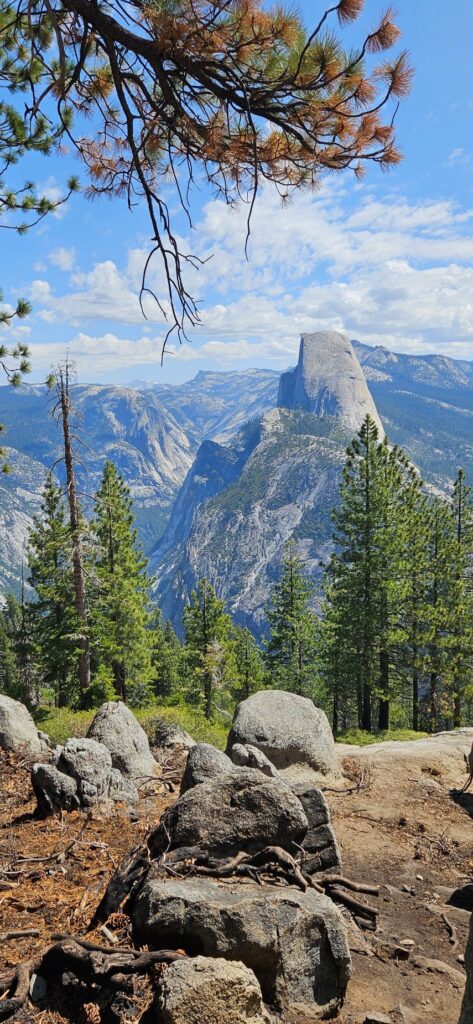
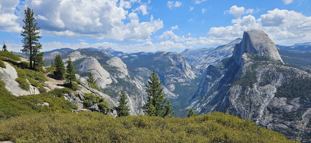
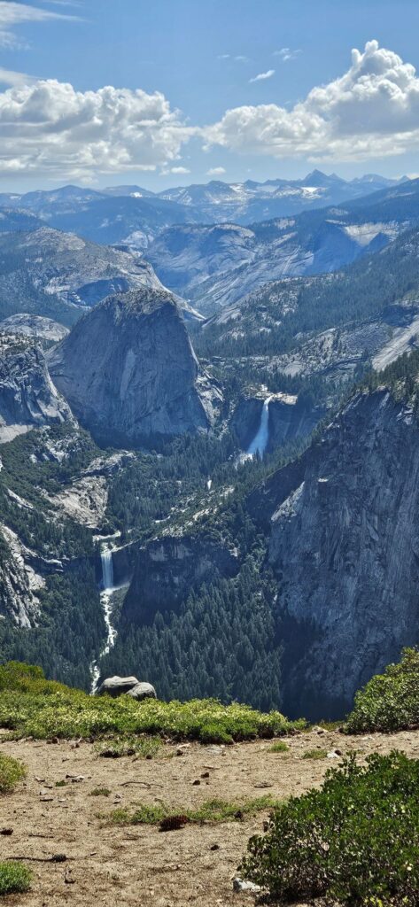
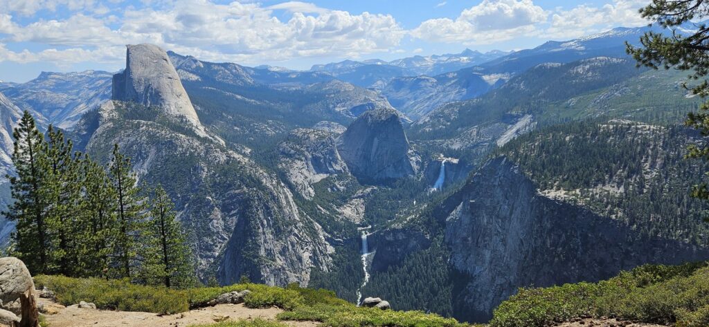
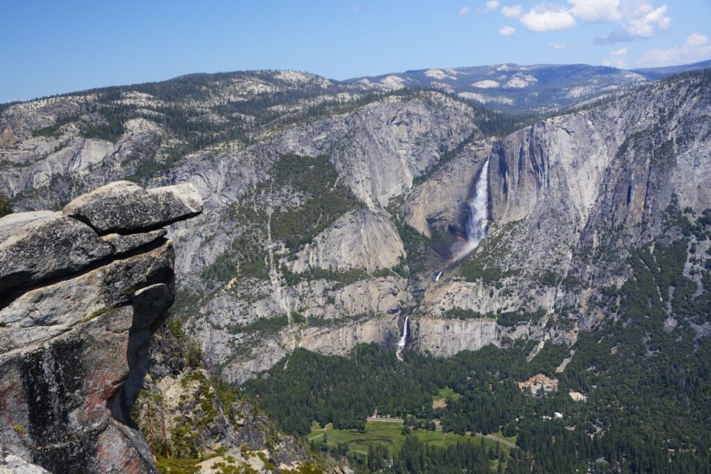
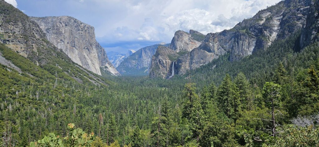
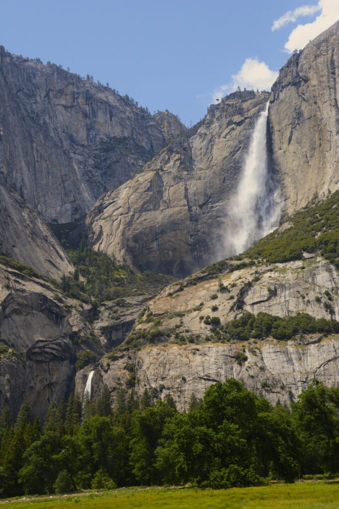
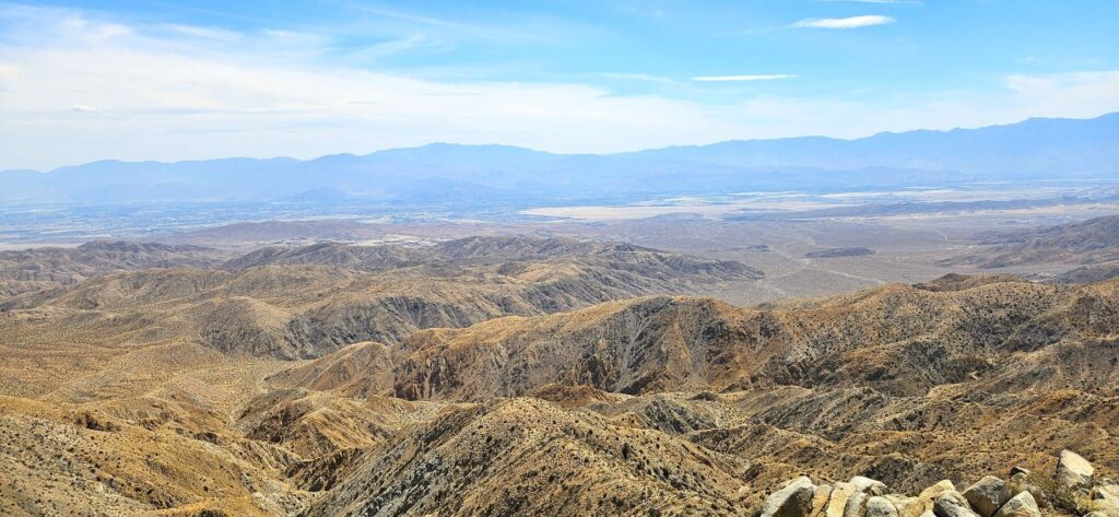
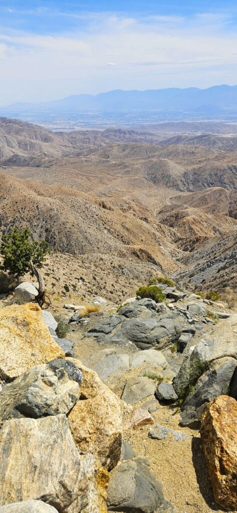
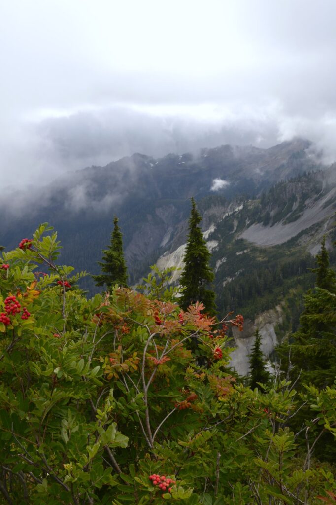
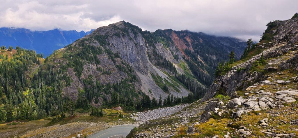
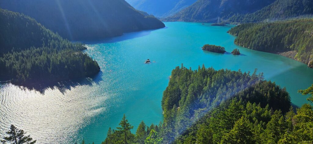
At over 7,200 feet in elevation, Glacier Point has the best views of Half Dome and Vernal and Nevada Falls. It also has wonderful views of Yosemite Valley and Yosemite Falls.
Huge rock walls of Yosemite Valley
The weather was a perfect temperature that day. The clouds added character to the beautiful landscape.
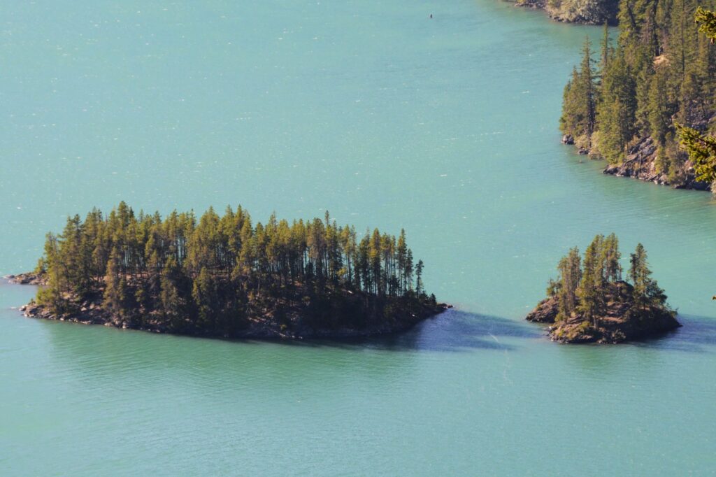
Half Dome and Yosemite ValleyView of Half Dome from Glacier PointVernal and Nevada Falls from Glacier PointHalf Dome, Vernal and Nevada Falls from Glacier PointRock ledge overlooking Yosemite Valley and Yosemite Upper and Lower Falls from Glacier Point
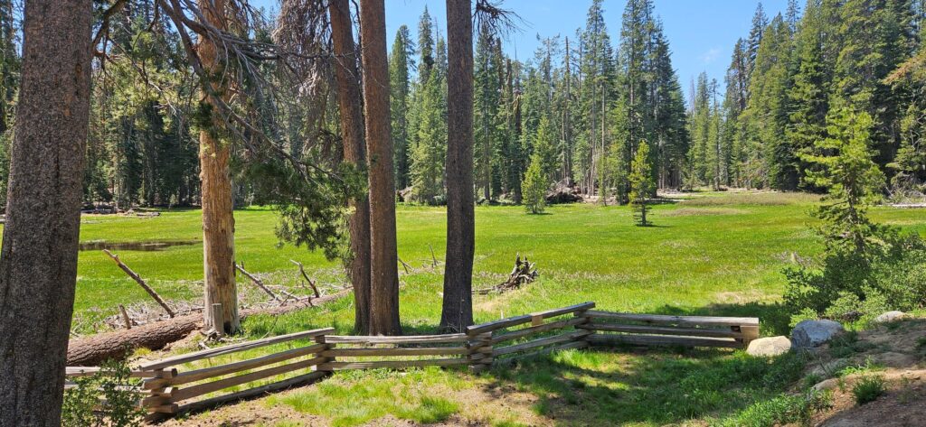
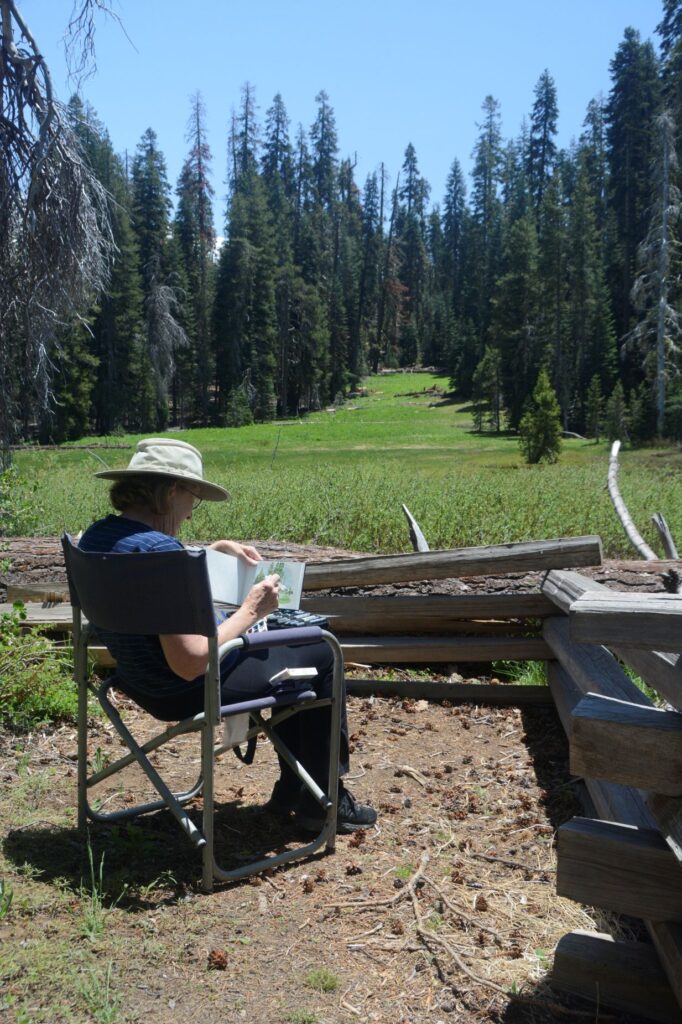
We were driving back from Glacier Point when we found this nice meadow where we stopped to eat our picnic lunch. I took some time to do a quick “plein air” watercolor painting. It wasn’t a Thomas Hill, but it was fun and relaxing.
Meadow on Glacier RoadPlein Air painting
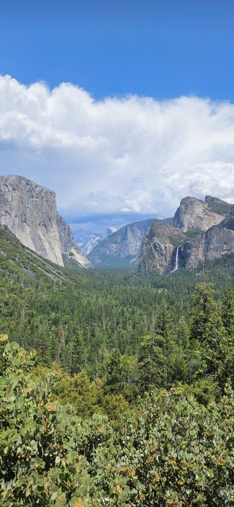
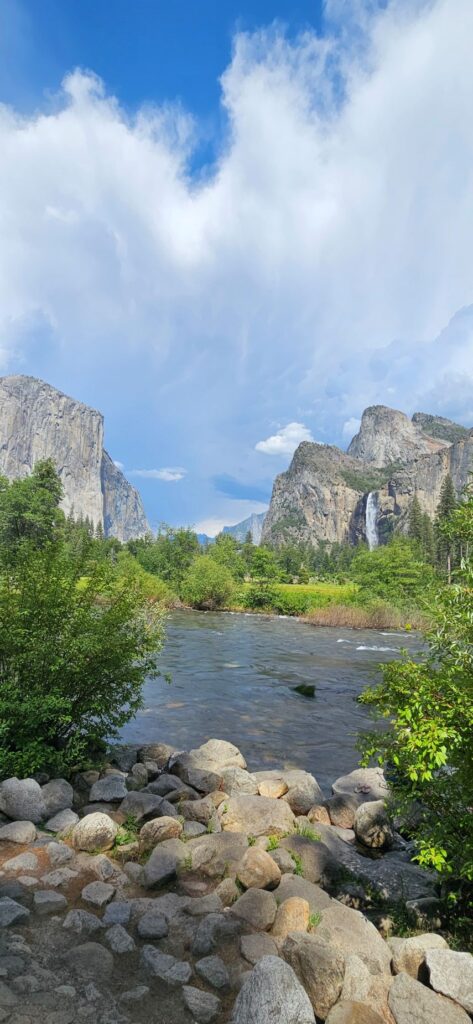
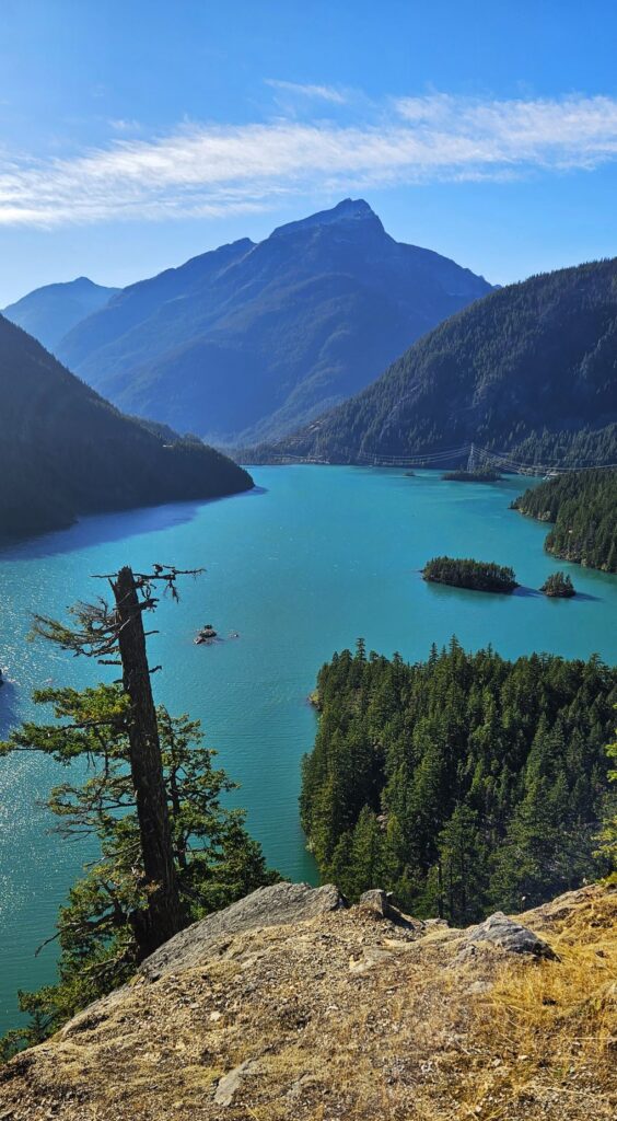
As we were coming through the tunnel, the view suddenly opened up and we saw this magnificent view of the valley and Bridal Veil Falls. I never get tired of looking at this view.
This view is known as the Tunnel view because the road goes through a tunnel and then opens up to this.
The clouds were really something that day. They started forming in the distance over the mountains and kept growing and growing until they filled the whole sky above.
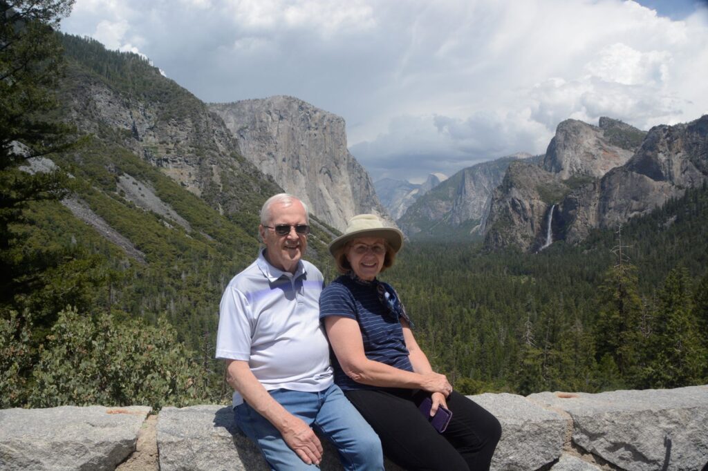
While enjoying the view, a young lady from Utah offered to take our photo. She and her family own a campground in St. George, Utah. Since it was my birthday, I figured I should have a photo to commemorate it.
Birthday photo in Yosemite
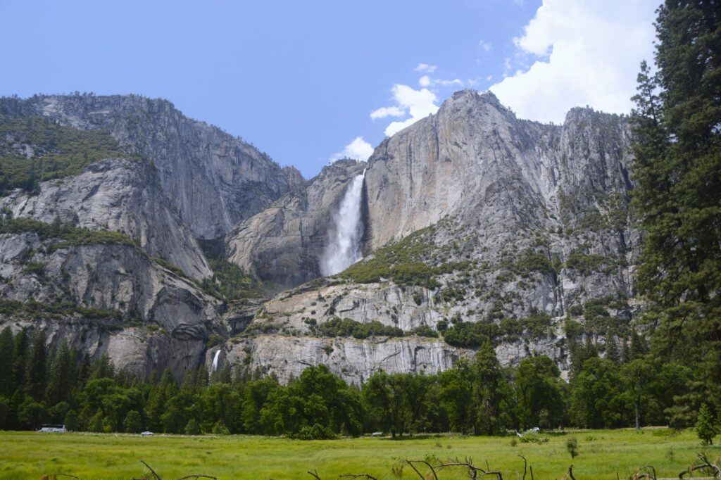
As we drove through Yosemite Valley, we caught glimpses of Yosemite Falls. They were full and beautiful from record snowfall and rainfall in the winter and spring of that year.
Yosemite Falls (Upper and Lower) from Sentinel Bridge area.Yosemite Falls
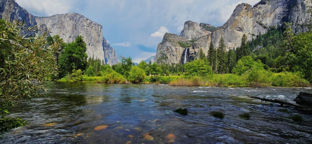
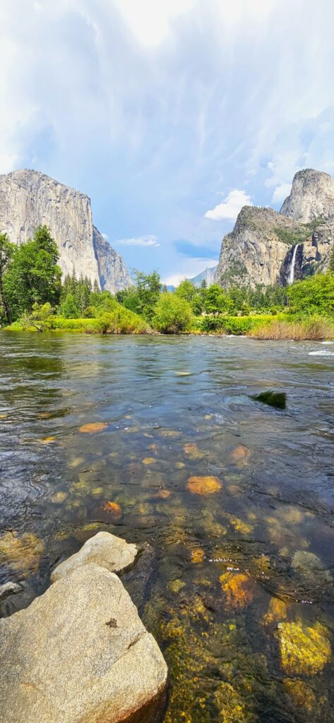
We continued on driving through the valley until we stopped at this viewpoint of Bridal Veil Falls and the Merced River.
Merced River and Bridal Veil Falls from Valley View TurnoutMerced River and Bridal Veil Falls from Valley View Turnout
By now the clouds had almost completely filled the sky above us. We turned toward home as we closed out our day with a last look at this magical place.
“I lift up my eyes to the mountains—where does my help come from? My help comes from the Lord, the Maker of heaven and earth.” Psalm 121:1
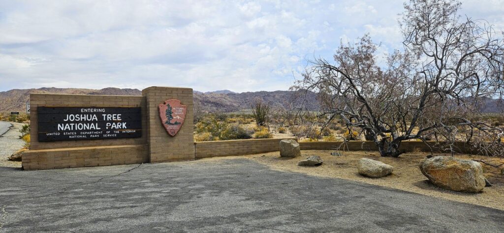
While traveling from Arizona to California, we stayed in Cathedral City, California. It’s not far from Indio. For some reason, we thought we had seen Joshua Tree National Park before. The fact was, we hadn’t.
South entrance from Interstate Highway 10.
Of course, my first goal was to get my National Parks Passport book stamped at the visitors’ center. We entered the park from the south entrance from Hwy 10 and stopped at the Cottonwood Visitor Center.
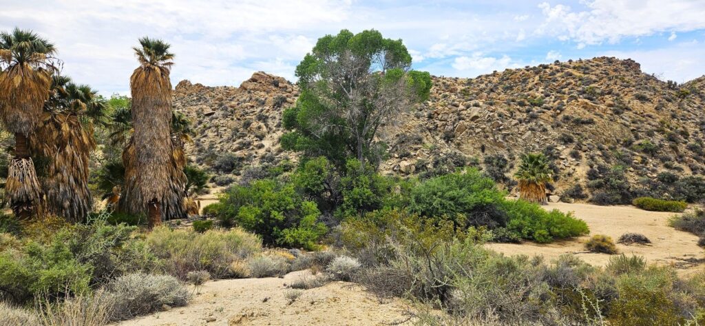
Lost Palms Oasis
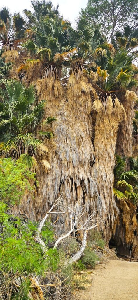
Not far from the visitors’ center was a picnic area where we stopped and had our lunch. Near there was Lost Palms Oasis, the largest grove of California fan palms in the park. These huge bearded trees thrive due to a constant water supply from Cottonwood Spring.
California fan palms in Lost Palms Oasis
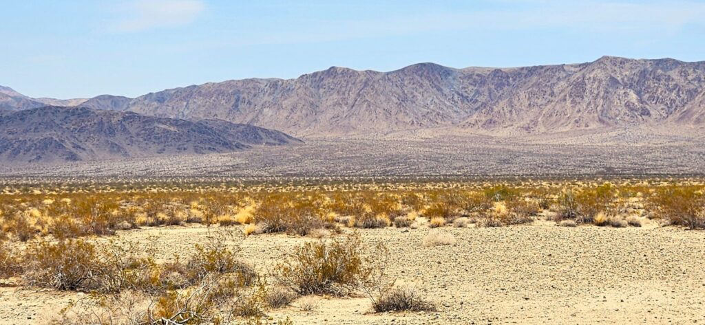
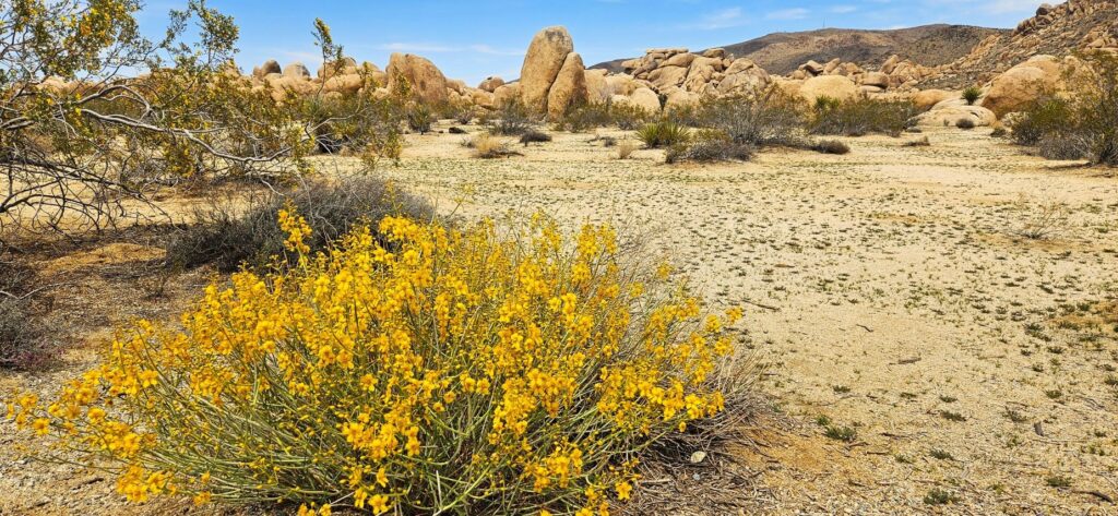
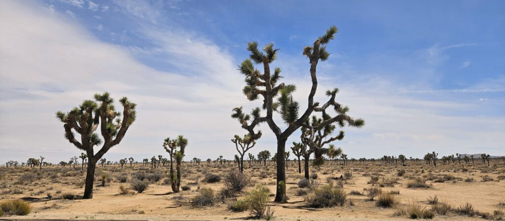
From there, we worked our way northwards through the park. We saw very few Joshua trees at first. The temperatures in the desert in early May were quite pleasant since we were climbing in elevation the whole time.
The road is about a 30 mile drive, but we made several stops along the way to learn about the desert plants and geology. This alluvial fan coming is a common sight where the mountains meet the desert floor. Material from the mountains is washed down by streams during rains and flash floods. As the water slows, sediment gets deposited from the streams.
Alluvial fan
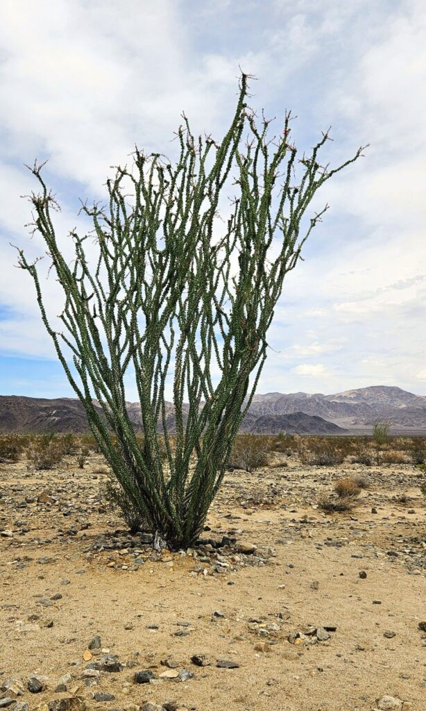
The alluvial fan gets more moisture from runoff to support more plants like the ocotillo and chollas. Believe it or not, ocotillos are more closely related to blueberries and tea plants than cactus plants!
Ocotillo plant
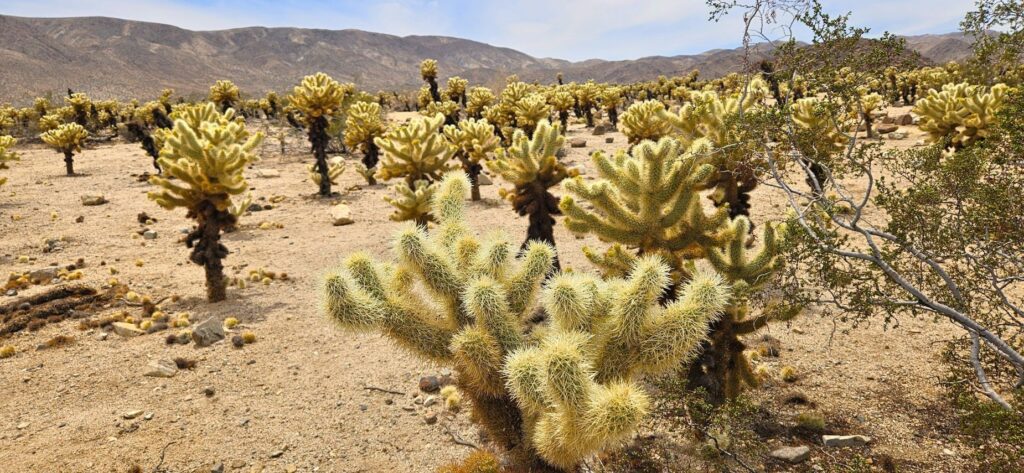
Our next stop was the cholla garden. I’ve never seen so many chollas in one place! There were warning signs telling tourists not to get too close. Chollas are also known as “jumping cactus” because if you happen to brush up against one, it will stick to you.
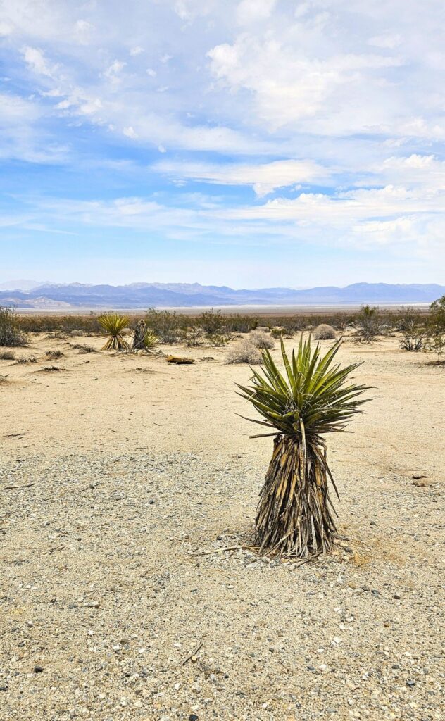
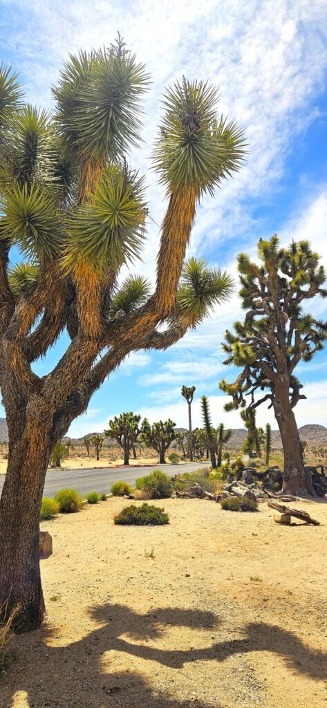
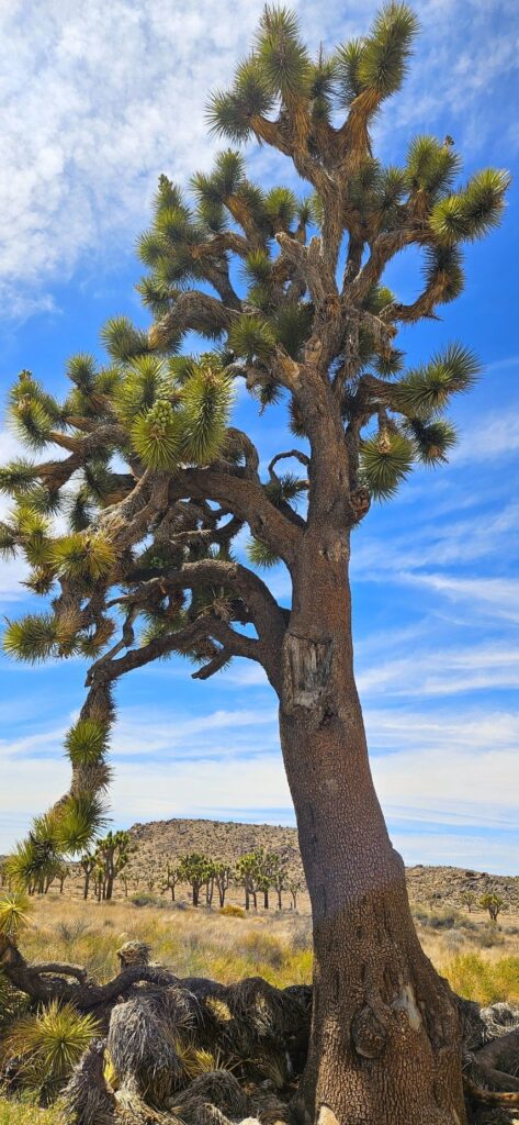
Joshua trees are a type of yucca plant. Sometimes it’s hard to tell the difference. I thought at first these yucca plants were baby Joshua trees. But they are yuccas.
Spanish Dagger yucca plant
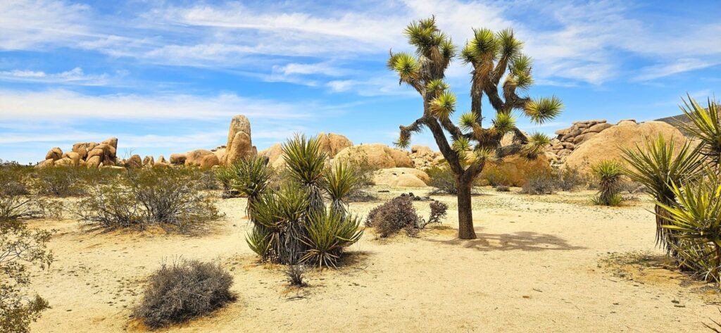
The next photo shows the difference between a yucca and a Joshua tree. It’s pretty easy to tell when they’re this big and side by side.
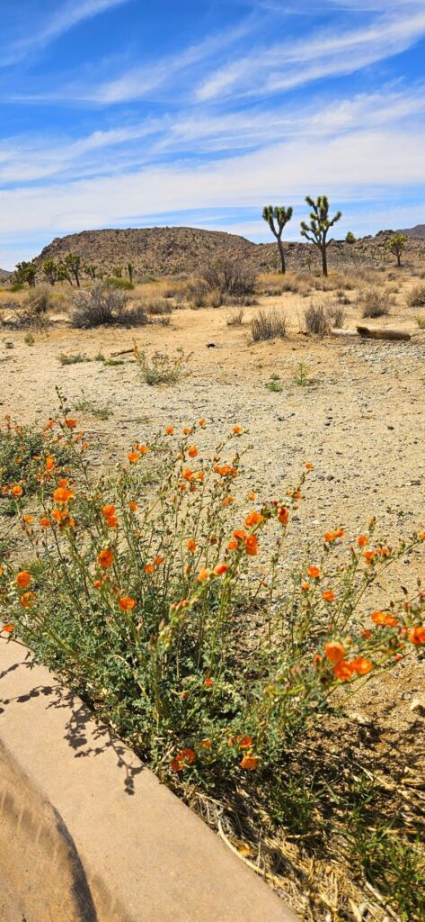
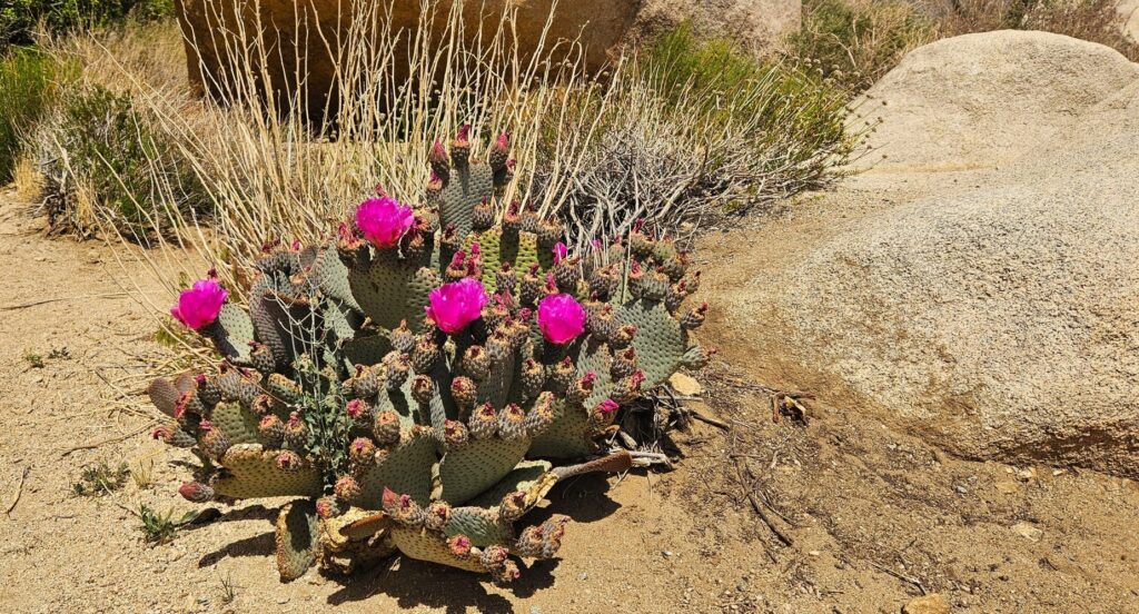
It was late spring when we visited, but there were plenty of desert flowering plants.
Flowering Blue Palo VerdeFlowering Desert Globe MallowFlowering Prickly Pear Cactus
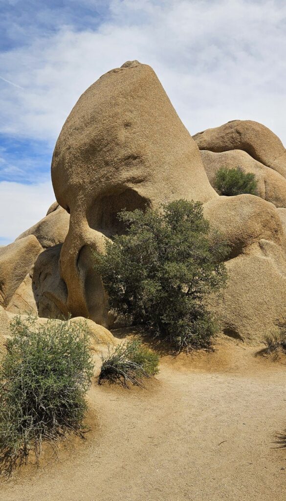
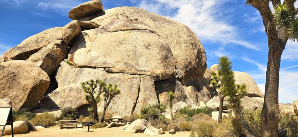
Along our route was this interesting rock formation called “Skull Rock.” Joshua Tree National Park has a variety of rock formations. This is a popular one for tourists.
Skull Rock
As we got further and further into the park, we began to see huge Joshua trees. I’ve seen many Joshua trees in my lifetime, but these were the biggest I’ve ever seen.
The trunks of these trees were like the size of an oak tree, and had many “arms.”
Large Joshua Trees
Another stop along our route was this “balancing rock” formation. It looked like it could topple down at any time.
Balancing Rock
Our last stop in the park was Keys View where we could look out over the whole Coachella Valley. I didn’t know this, but the San Andreas Fault line runs right down the middle of this valley.
Keys View of Coachella Valley
At over 5,000 feet in elevation, we enjoyed the cool breezes as the day continued to warm up.
Overlooking Coachella Valley
Joshua Tree National Park is worth seeing. The variety of desert plants and animals that can withstand the extreme temperatures of desert weather is a testament to God’s marvelous creation.
Twisted tree at Keys View
“The wilderness and the desert will rejoice, And the desert will shout for joy and blossom.” Isaiah 35:1a
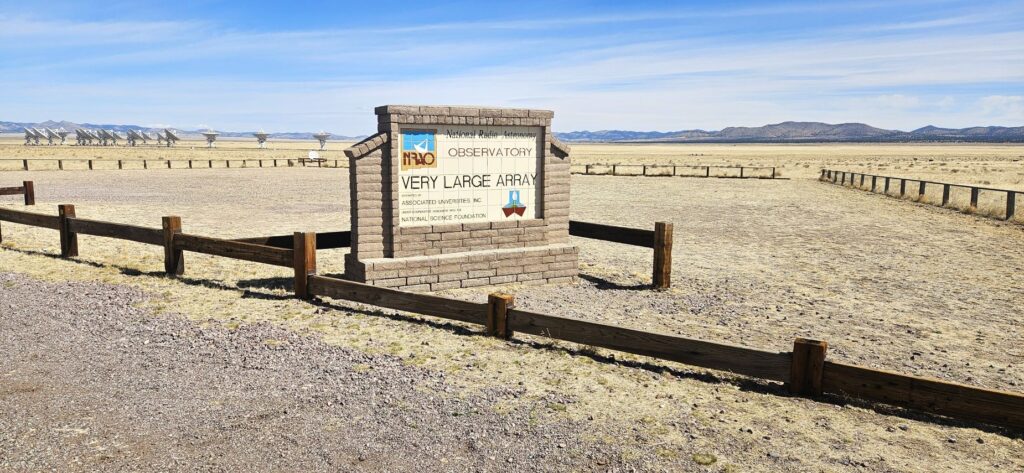
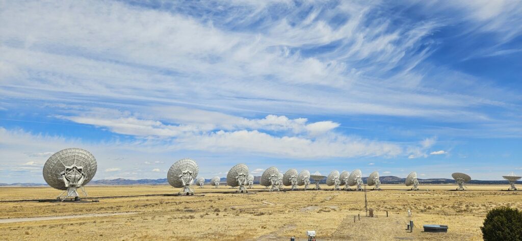
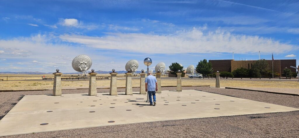
At nearly 7,000 feet altitude, on the very flat plains of San Augustin surrounded by mountains, in the middle of nowhere in New Mexico, is a fascinating place called “The National Radio Astronomy Observatory Very Large Array.” Or, VLA, for short.
Entrance to VLA
The VLA has 28 large radio telescopes. They are spread out in a Y-shaped array across the valley. Each of these huge telescopes is mounted on railroad tracks so they can be clustered together or spread out over 20 miles.
Row of radio telescopes. Telescopes are moved along rails to different locations.
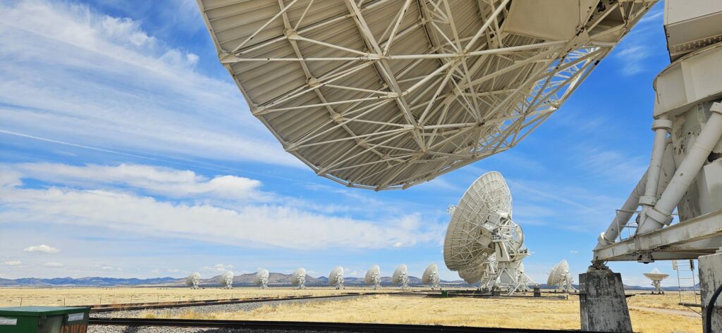
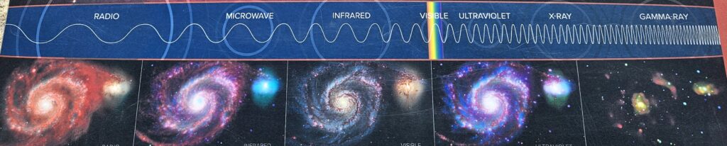
The telescopes are interconnected so that they can function as one very large radio telescope. The radio waves they collect from outer space are not visible to the human eye. Instead, a huge very sophisticated computer “translates” the radio signals into images we can see. Some of the observations have been of black holes, photoplanetary disks around young stars, tracing complex gas motions at the Milky Way’s center and more.
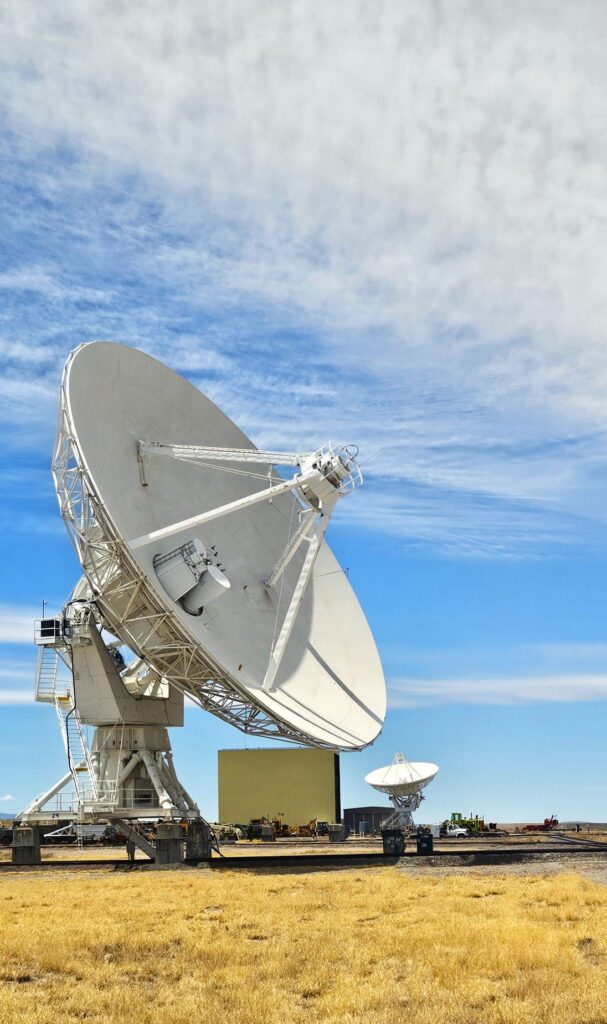
When we visited, the telescopes were clustered close together. Each telescope is 25 meters (or 82 feet) across.
Building for servicing large telescopes can be seen in the background
The different arrays are used to get various results. One is used for fine detail and another is used for a broader range of images. The super computer then merges the images together to form one visual image. The telescopes are moved about every three to four months to a different configuration.
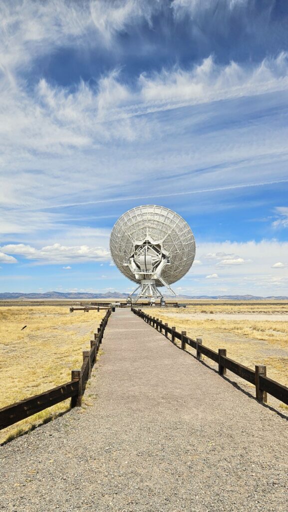
Walking tour path to radio telescope up close.
Each telescope dish itself can also move into different positions. These telescopes are operational 24 hours, seven days a week. Night or day doesn’t matter. What does matter is that it is far away from any radio waves like cell phones, microwave and radio signals that would interfere with these sensitive telescopes. That is why this location in the middle of nowhere was chosen for these sensitive instruments that are collecting very faint cosmic radio waves. The mountains block interfering radio waves from other surrounding sources.
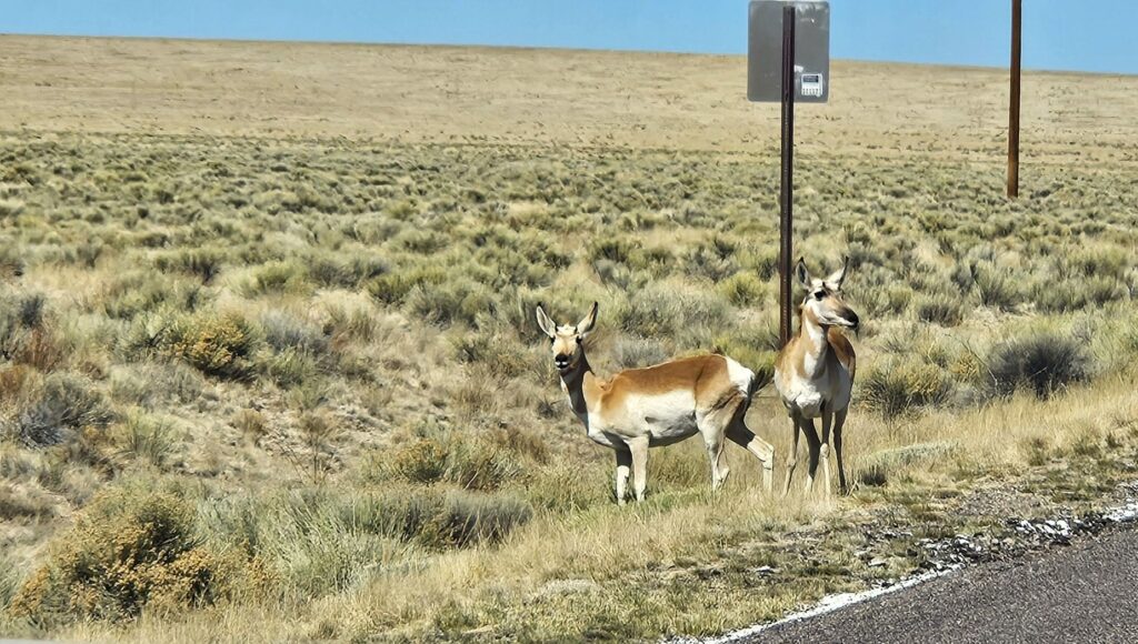
Pronghorn deer near VLA site
We toured the visitors’ center and museum, watched an informative video, and then went on a self-guided walking tour around the facilities. This sundial (in the center) showed historic moments on the ground where the sundial would have been pointing at the time they happened.
This VLA is located about 50 miles west of Socorro, New Mexico. We stopped here on our way from Socorro to Show Low, Arizona. We took our lunch break here after first touring the facilities. It was a nice break in a long day of travel, and besides that, we learned a lot.If you’re ever traveling on Hwy 60 through western New Mexico, stop and take some time to see this interesting place. It will be worth your time.
Sign board showing whirlpool galaxy, different wave lengths and images produced
I was impressed with how vast and huge is our universe. It reminded me of these verses in the Bible.
“When I consider Your heavens, the work of Your fingers, The moon and the stars, which You have set in place; What is man that You think of him, And a son of man that You are concerned about him?” Psalm 8:3-4
“The heavens tell of the glory of God; And their expanse declares the work of His hands”. Psalm 19:1
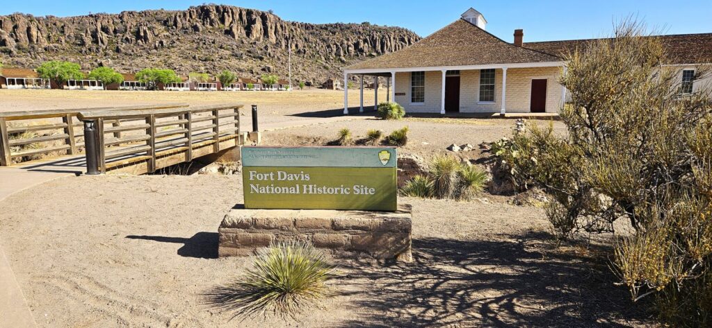
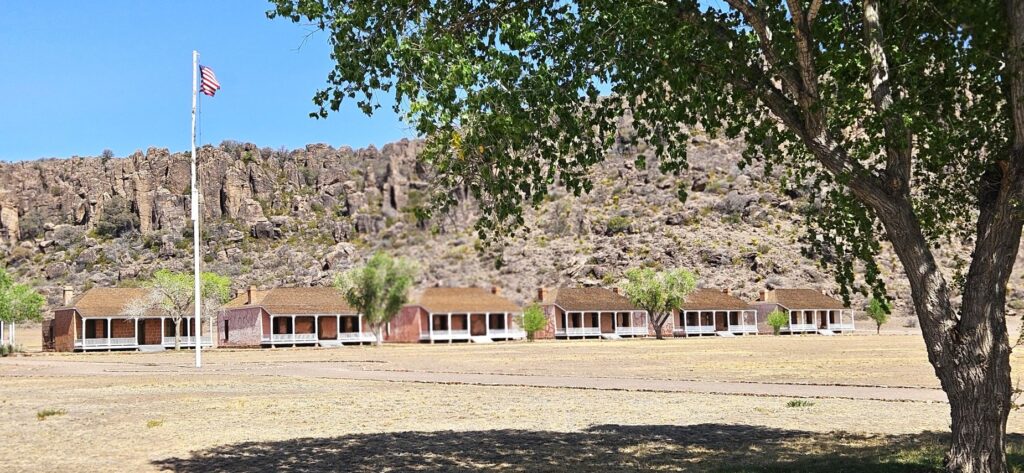
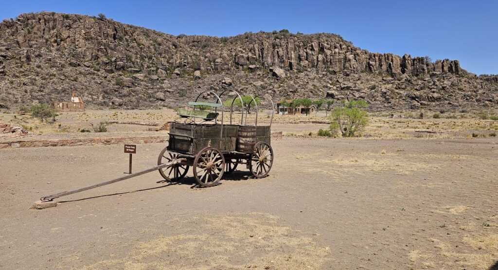
Imagine traveling 200 miles from San Antonio to El Paso, Texas, in the mid-1800’s by wagon, perhaps on your way to the gold fields in California. Travelers on this mountainous desert route were often raided and killed by Indians who were looking for food and livestock to supplement their hunter-gatherer way of life. This conflict caused the United States government to build and maintain a series of forts along this road. Fort Davis was one of these forts.
On our way going west out of Texas, we visited this historic Indian Wars’ frontier military post. Many of the buildings have been preserved, and some have been restored and furnished in period furnishings. We weren’t allowed to walk on the parade grounds because of the existence of artifacts still to be unearthed.
Parade Ground in front of row of officers’ quarters
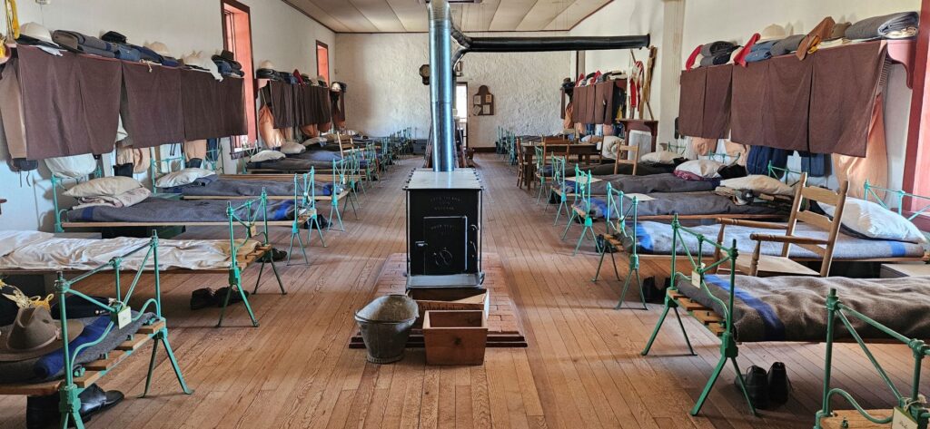
As we walked through the barracks, we learned that 26 soldiers lived together in one large room. There were quarters for up to 400 soldiers at one time. During their free time, they played cards or checkers, sang and danced, read newspapers and books from the post library or strolled around.
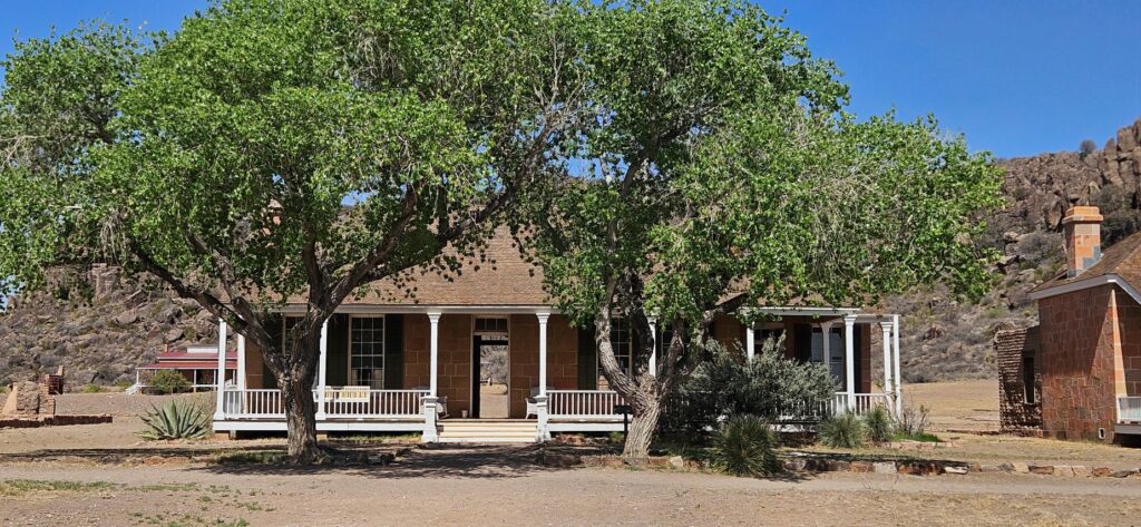
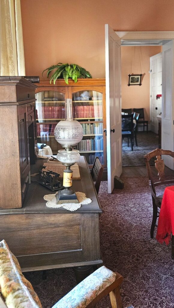
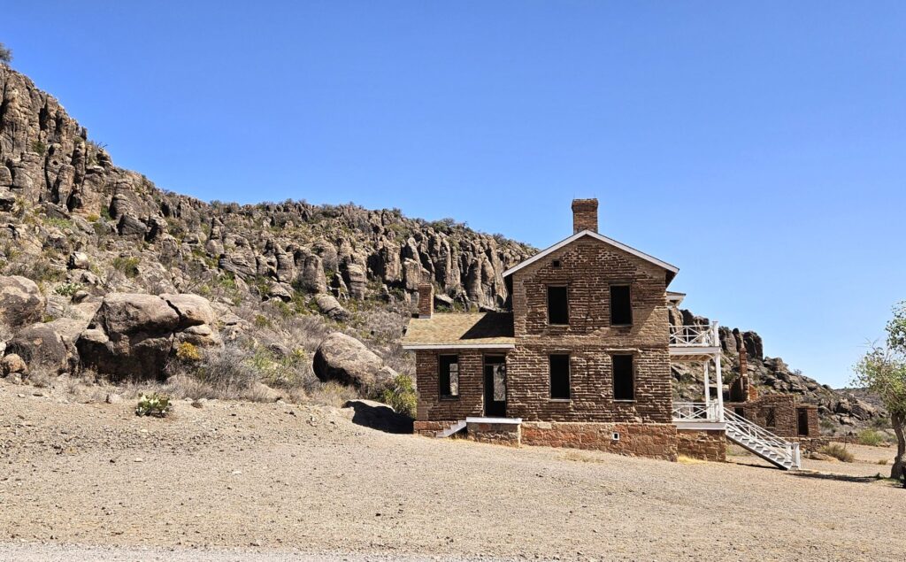
The commanding officers’ quarters were much better. Many of the officers brought their wives and children with them. Wives sometimes worked as laundresses, hospital workers, or servants to other officers’ families.
Officer’s Quarters
Even though they were far from civilization, the officers brought nice furniture with them to furnish their homes.
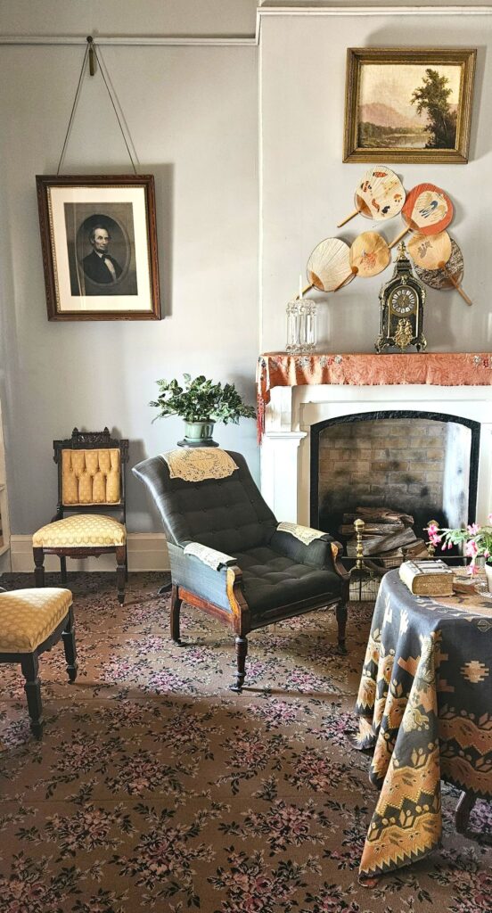
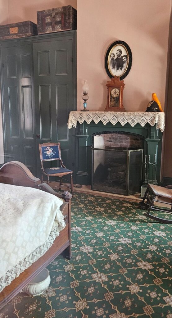
Below, a photo of the wife of the officer and his two children hangs above the mantle in the bedroom. The officer’s helmet is on the fireplace mantle.
Bedroom in Officer’s QuartersOfficer’s House
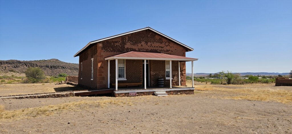
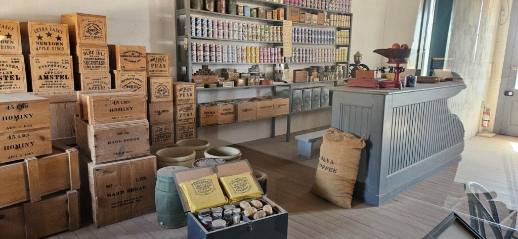
The Commissary stored food for the outpost. However, food had to be transported long distances. Food was sometimes already spoiled by the time it reached the fort. Some food was grown or bought locally, however.
Fort Davis CommissaryCommissary StoreroomSupplies had to be brought in by wagon
There were many structures on this 460 acre park. Of the 24 buildings that have been restored, only five are refurbished. There are also over 100 ruins and foundations. During the summer months, there are living history demonstrations. We were too early for that, however.
Two-Story House (not restored)
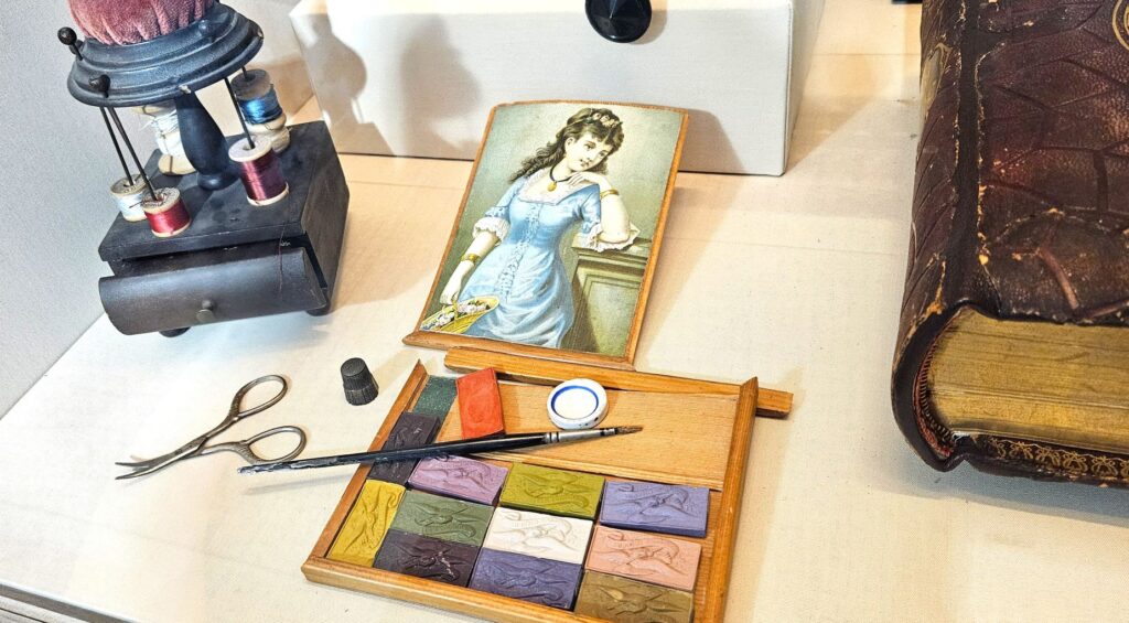
There’s a museum at the entrance to the park. This paint set and sewing kit were among the artifacts.
Sewing kit and paint set in museum
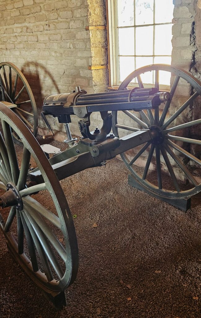
After the Civil War, Congress passed legislation to increase the size of the army and to require a certain amount of black soldier units. Some were stationed at Fort Davis.
These Buffalo soldiers not only engaged in over 100 Indian skirmishes, but they also built many structures on the post, strung over 300 miles of telegraph wire, and built a water delivery system that supplied running water to the garrison.
Gatling Gun
The main purpose of Fort Davis was to protect west Texas from the Comanches and Apache Indians. The Indians were eventually forced into Mexico where they were killed by Mexican soldiers. This ended the Indian Wars. The soldiers at Fort Davis also provided protection for wagon trains and mail coaches and survey parties. By 1891, the fort was abandoned, having outlived its usefulness.
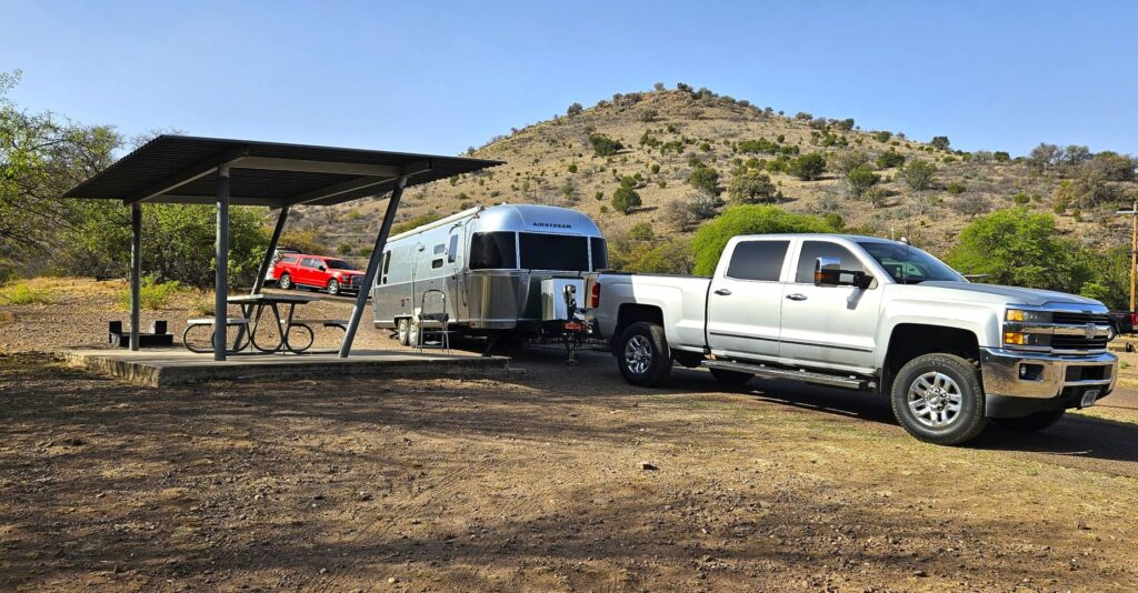
Our campsite at Davis Mountains State Park
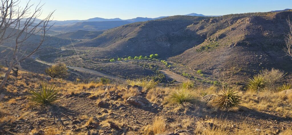
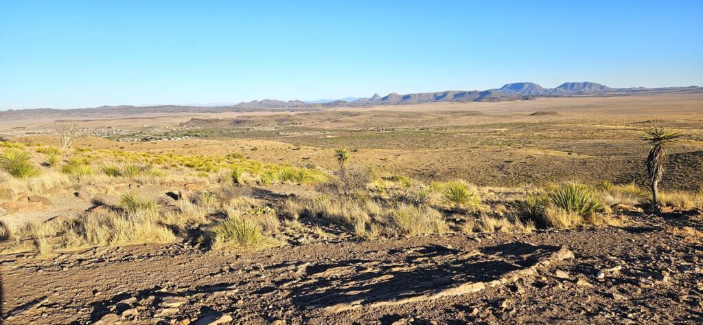
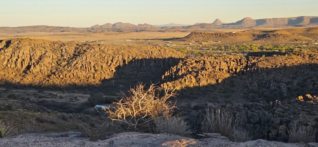
We stayed in Davis Mountains State Park Campground while we were there exploring the area. This state park is unusual, in that, it had full hookups at the campsites. There was a road that went up the mountain to a lookout. This photo is from the viewpoint looking toward the campground.
This next photos are looking toward the town of Fort Davis. We could see a long way.
Lookout at Davis Mountains State Park near Fort Davis.Lookout at Davis Mountains State Park
Fort Davis played an important role in the West. Learning about their lives and hardships makes me feel grateful for their contributions in settling the west. Fort Davis is a national historic park, so I was able to get my National Parks Passport book stamped once again and add another sticker to my journal.
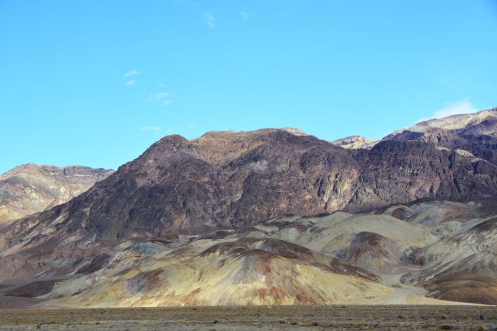
Death Valley National Park was not a high priority on my bucket list of places to see because I imagined vast salt flats, sand dunes and barren desert that seemed somewhat boring. Instead, what I saw surprised me. I realized my preconceived ideas of it were very wrong. It is actually a beautiful and fascinating place to visit.
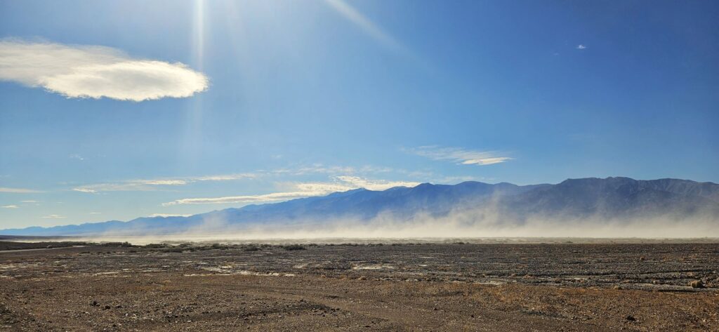
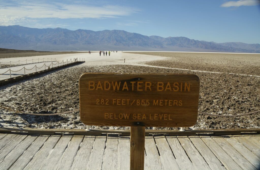
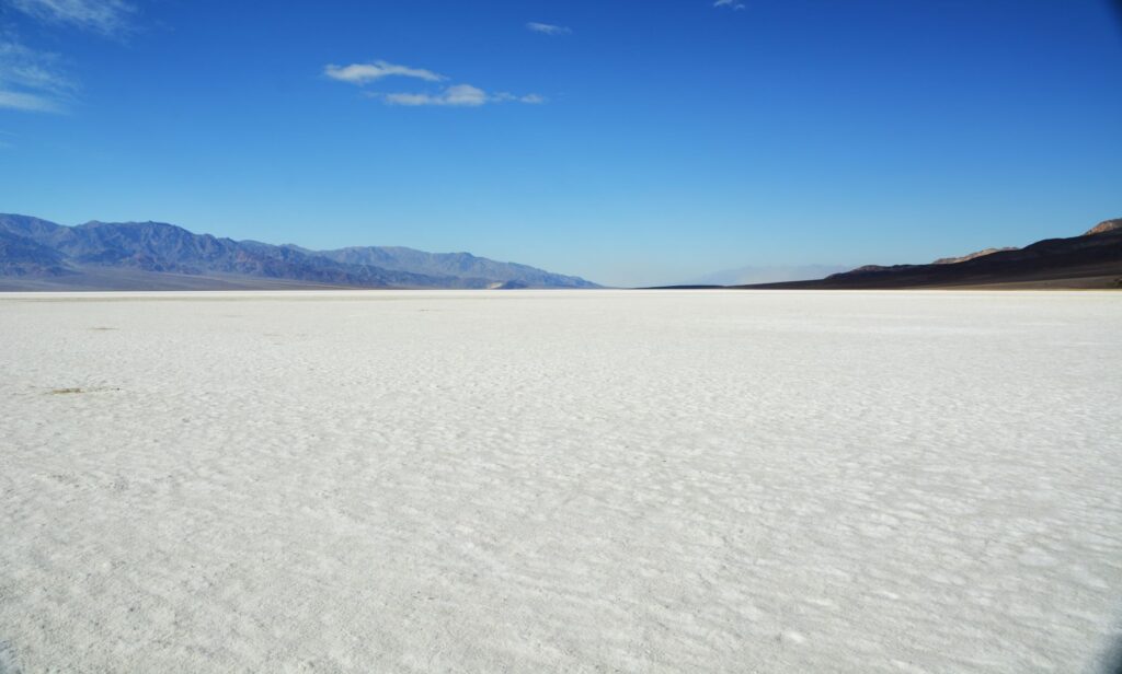
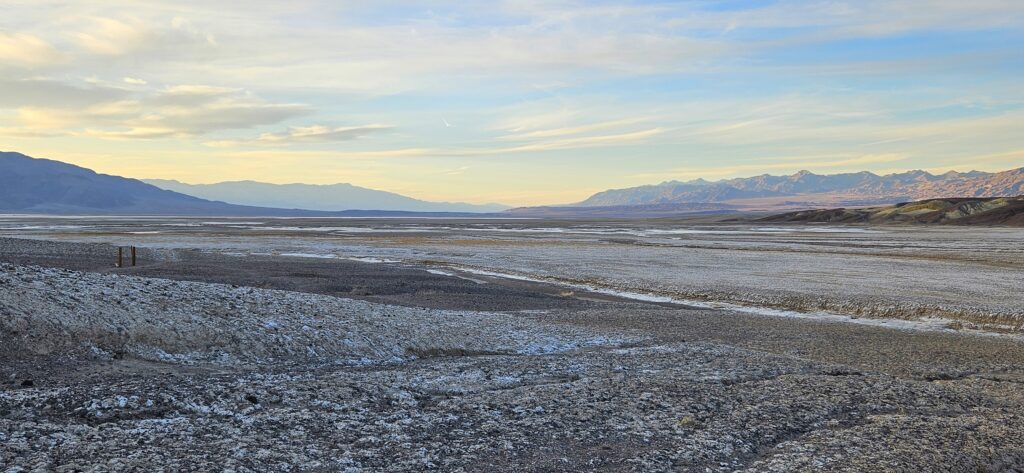
After our drive into the park and viewing the visitors’ center, our first stop was to see the salt flats at Badwater Basin. It was very windy that day and the dust blew across our pathway as we drove 17 miles south from the visitors’ center. It was so windy that sometimes a gust of wind would knock me off balance.
Badwater Basin is the lowest point in North America at 282 feet below sea level. There is no outlet for the rainfall and runoff from the mountains. Part of the basin had water in it when we were there due to recent record rainfalls in California.
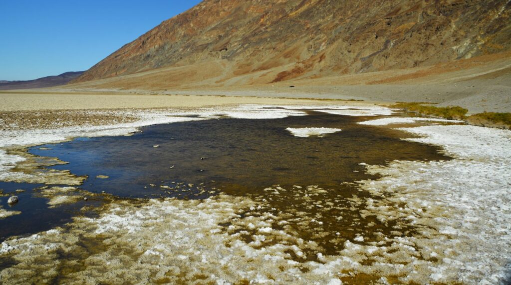
Near the parking lot were some pools which are spring fed. The water is very salty, from which it gets its name, “Badwater Basin.” Surprisingly, the pools support some unique animal and plant life.
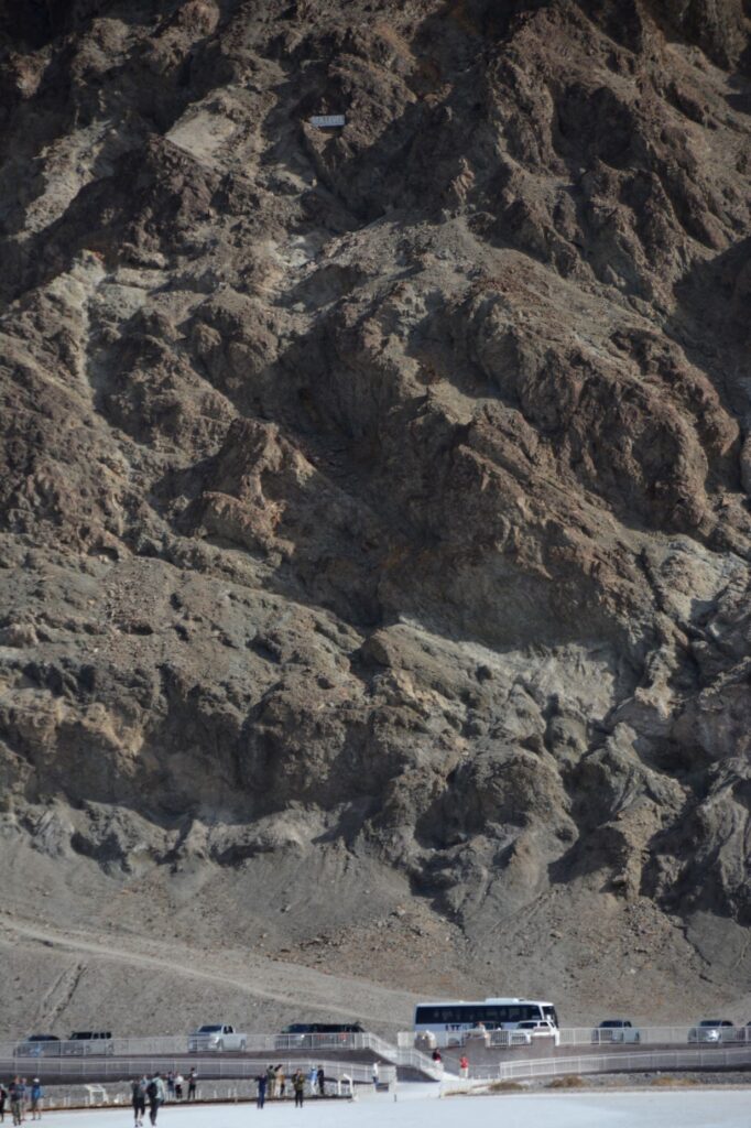
As I walked out toward the salt flats, I looked back at the mountain where I could barely make out the sign that says “Sea Level.”
Sea level sign on mountain above parking lot
This is what it looks like about a quarter of a mile out on the salt flat. The sun shining on the white salt blinded me. The salt crystals were trampled down from the tourists. This is what I expected Death Valley to look like. But there was much more to see that was surprisingly beautiful.
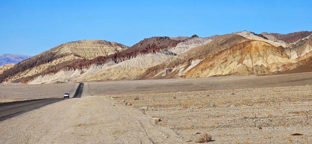
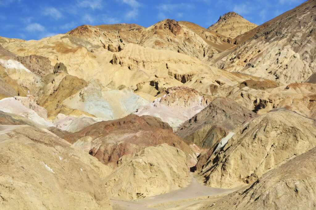
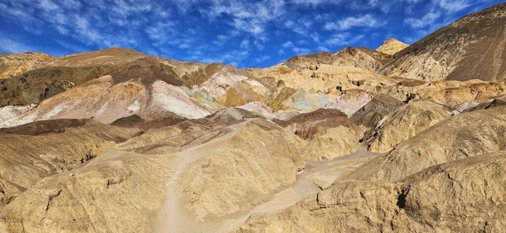
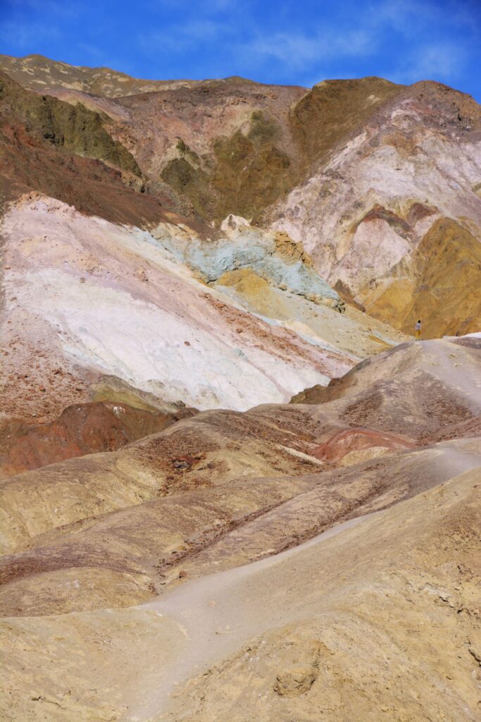
Heading back toward the visitors’ center, we began to see colorful rocks and mountains which were the result of volcanic deposits, chemical weathering, and oxidation of the exposed minerals. The deep reds, pinks and yellows were created by iron compounds.
We drove a nine mile drive called “Artists Drive” to see “Artists Palette.” These colorful hills are made from volcanic ash, gravel and playa deposits which contain iron oxides and chlorite.
Colorful deposits on Artists’ Drive
Rainfall, heat and flash flooding eroded the deposits of iron, manganese and mica which, when exposed, were oxidized by the air. This causes the colors of red, pink, yellow, green and purple.
The green rocks are from decomposed mica, not copper, as I originally thought. The purple is created by manganese.
Artist’s Palette
The colorful rocks and mountains were some of the first surprisingly beautiful discoveries in Death Valley. There was much more to come.
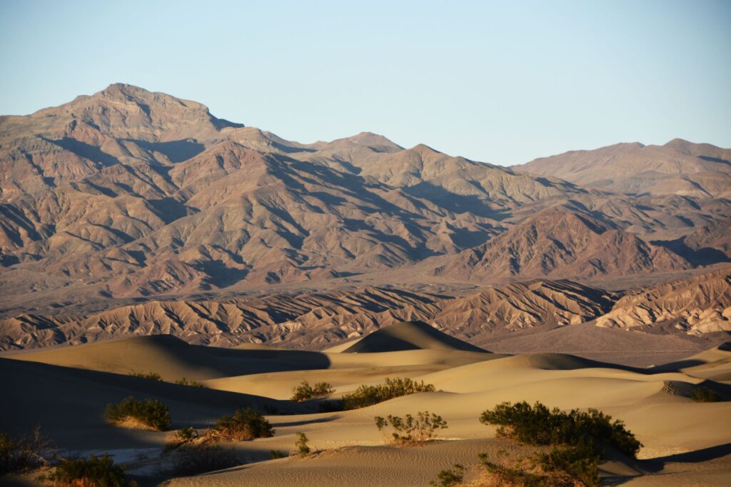
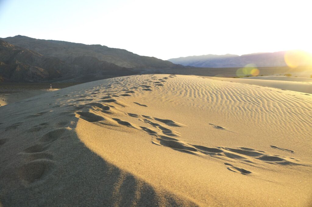
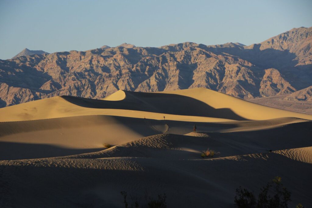
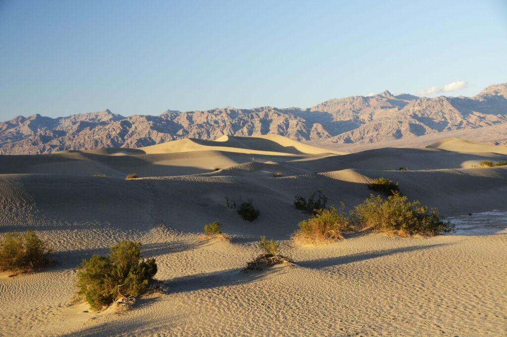
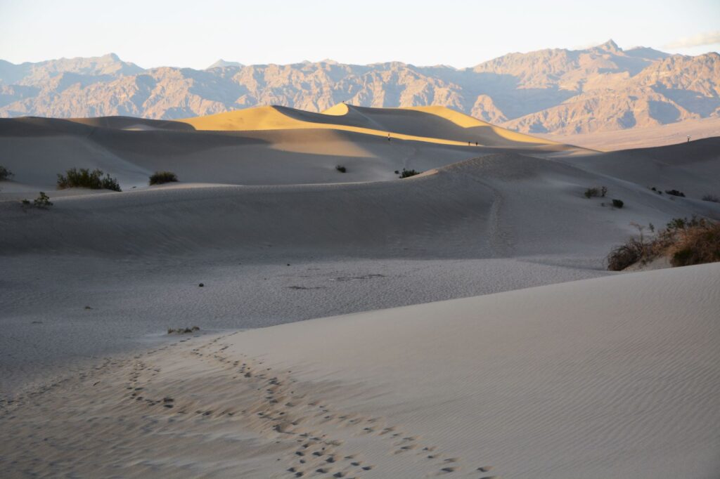
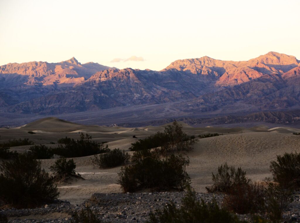
We drove on another 38 miles. We were racing against the clock to be at Mesquite Flat Sand Dunes before sunset. We arrived just in time. The shadows on the dunes were already beginning to deepen.
The dunes were massive. I felt like an ant climbing over them. Each one seemed bigger than the last.
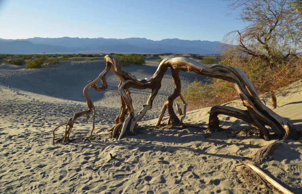
A twisted dead tree trunk was a reminder of the harshness of this environment. The highest recorded temperature in Death Valley was 134 degrees. I thought of the pioneers and native people who lived here before air conditioning and wondered how they survived. They likely fled to the surrounding mountains where temperatures were cooler.
I followed the footprints of other tourists who had gone before me. I was sometimes confused about which way to go when down between the dunes.
I climbed to the top of another dune and sat down as I watched as the last light of day illuminate the top of the mountain range. In the distance, I could see other people that were like tiny dots. I paused to catch my breath while enjoying the beauty of the stark contrast of the dark shadows against the sunlit sides of the dunes.
I thought of how these dunes would shift and change with time. The next time I visited they might be completely different in shape.
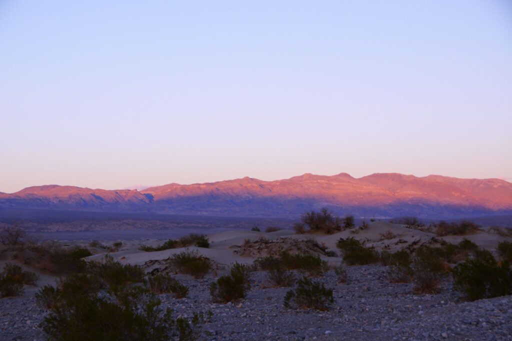
The shadows were quickly lengthening and the breeze grew cooler.
It was perfectly quiet. All I could hear was the sound of the wind as the last light of day faded on the distant mountains turning them a purplish pink. I followed my footprints back to the truck.
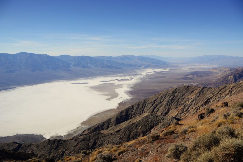
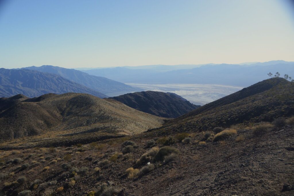
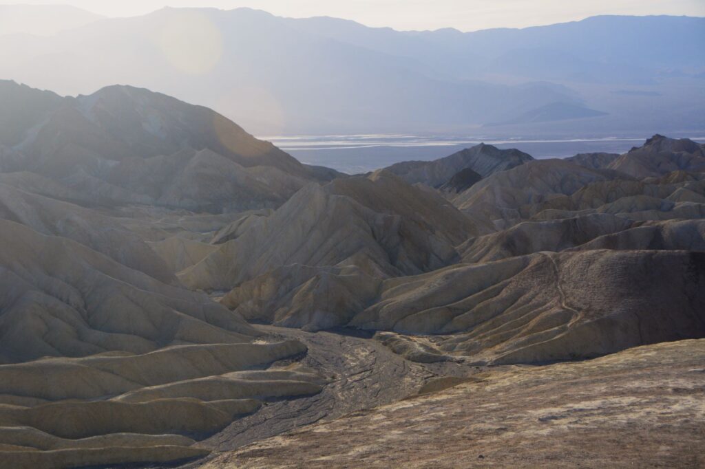
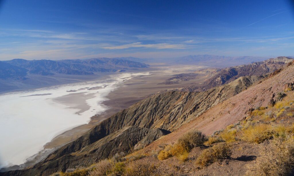
On our second trip into Death Valley National Park, we made our first stop at Dante’s View. This expansive view of the entire valley probably should have been our first stop of the trip. Looking down from over a mile above, one gets a great overview of the valley below, and a feeling for the great distances in this park.
Looking the other direction, it just keeps going on and on. This viewpoint was definitely worth the windy steep six mile drive. This view was unexpected. Previously, I thought Death Valley was flat all over.
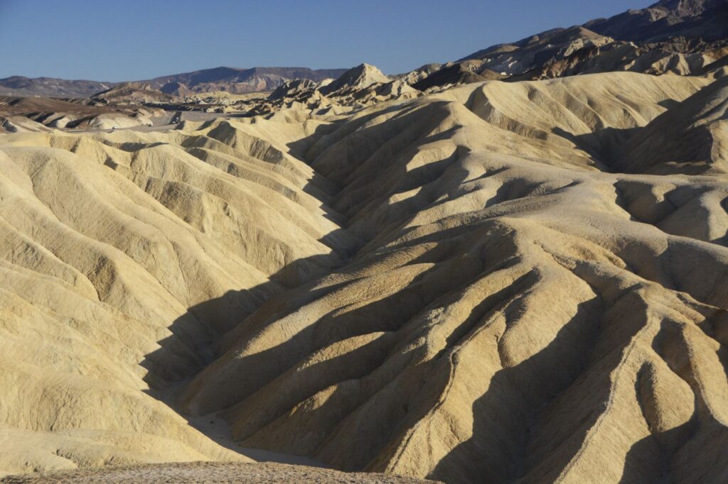
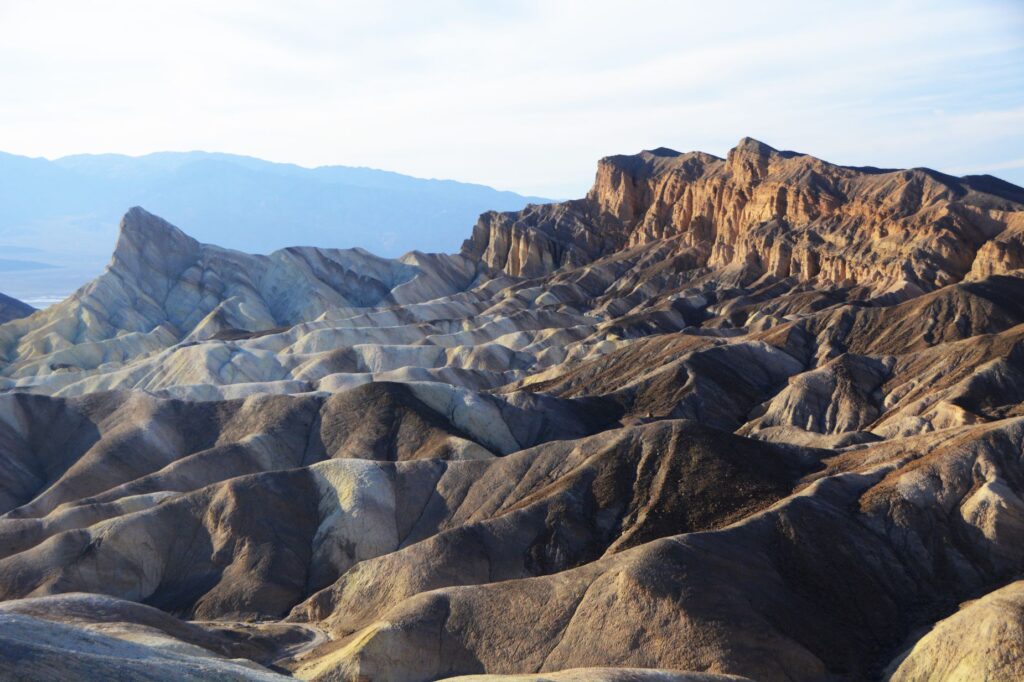
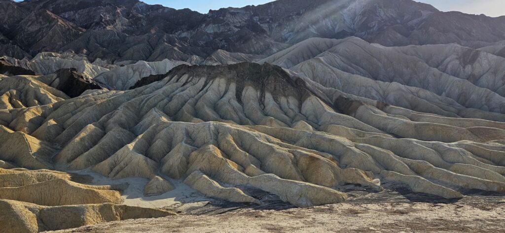
Zabriskie Point is another overlook on the way into the valley. We stopped here to hike up the quarter mile paved pathway to the overlook.
Since it was later in the day, the afternoon sun made interesting shadows on the golden colored badlands.
The beauty of Death Valley continued to surprise me. These different colored bands in the badlands at Zabriskie Point were so interesting.
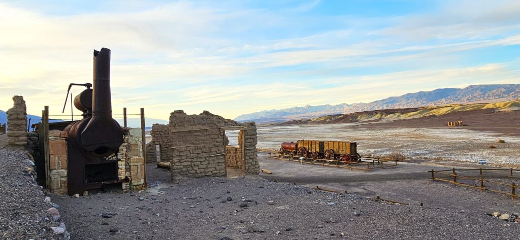
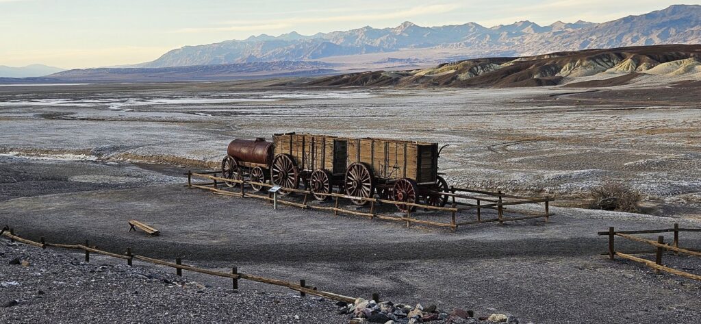
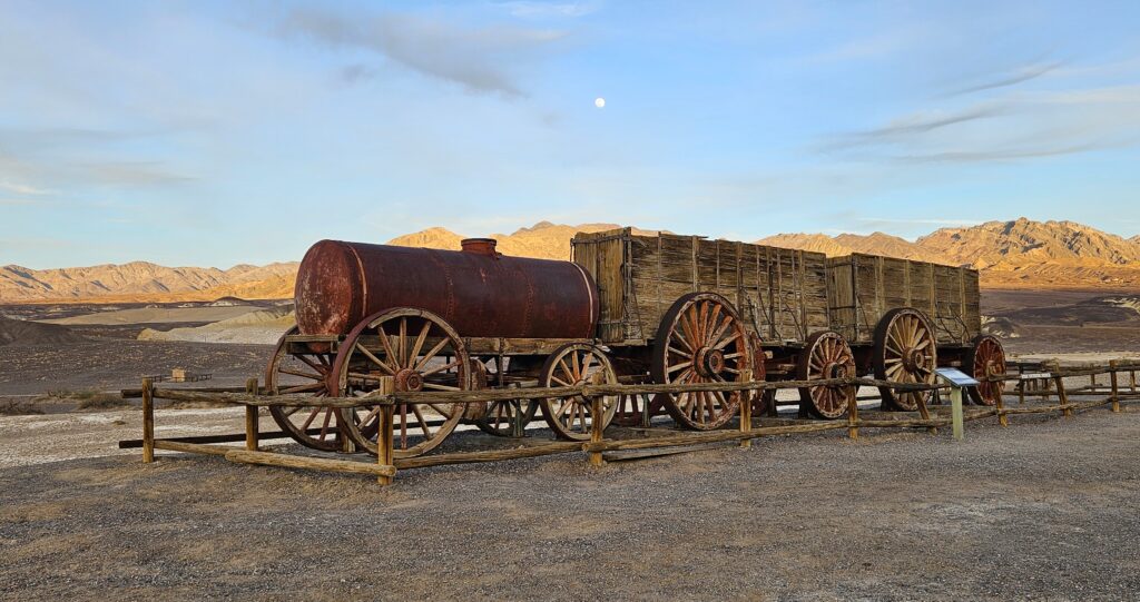
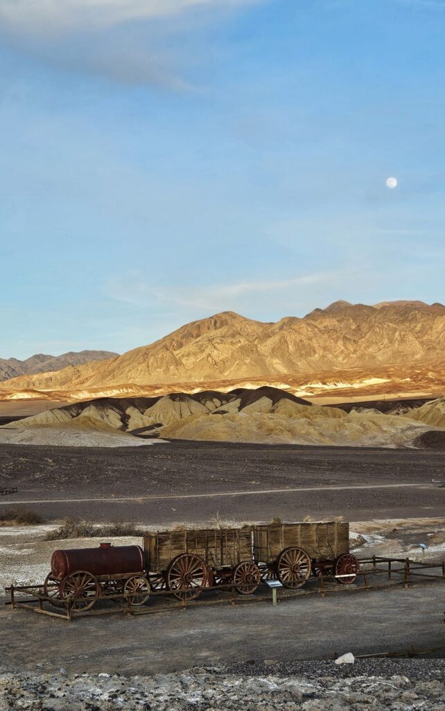
We had one more place to visit that day–The Harmony Borax Works. Here we saw the remains of a building for processing borax, one of the most profitable ores mined in the area. There was also an historic 20-mule team wagon.
Chinese laborers from San Francisco, scraped borax off the salt flats and transported it by wagon to the refinery.
Borax fields
The borax could not be processed during the summer months due to the heat.
The nearest railroad was 165 miles away, so the ore was processed on site to make it easier to transport the borax by wagon.
Twenty Mule Team Wagon
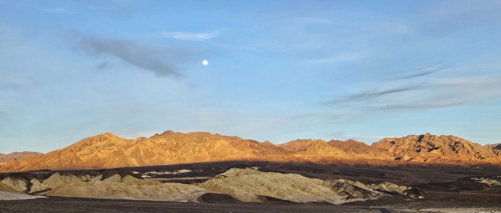
As we ended our day, the moon rose over the mountains as the sun was setting. Once again, I was awestruck by the beauty.
Death Valley is a study of contrasts. It is the lowest place in elevation in North America at 282 feet below sea level, while the highest peak, Mt. Whitney (14,505 feet) is just a few miles away. Death Valley has had the highest temperature recorded (134 degrees), but also recorded a temperature of 15 degrees in the winter of 1913. Death Valley has an average rainfall of 2.2 inches per year. But lately, 2.2 inches of rain fell in a single day in August 2023, resulting in flooding.
We visited in February of 2025 and, other than the first day, we experienced beautiful weather. I would love to revisit Death Valley in the future. There are still many places we did not get to see. It truly was a surprise to me that such a desolate place could hold so much beauty.
“Even when walking through the dark valley of death I will not be afraid, for you are close beside me, guarding, guiding all the way.” Psalm 23:4
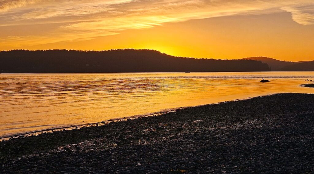
We had another beautiful campground in La Conner, Washington. It was right on Kilket Bay which connects to Puget Sound. A nice beach area was within walking distance of our campsite.
The weather was nice, for the most part, with foggy mornings that cleared up by noon. The evenings were nice for taking walks and watching the sunset.
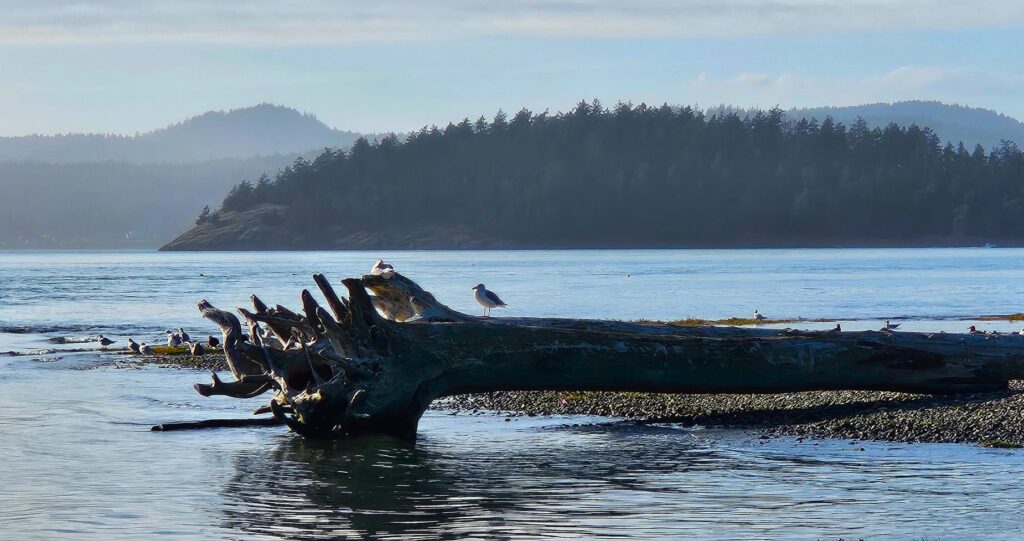
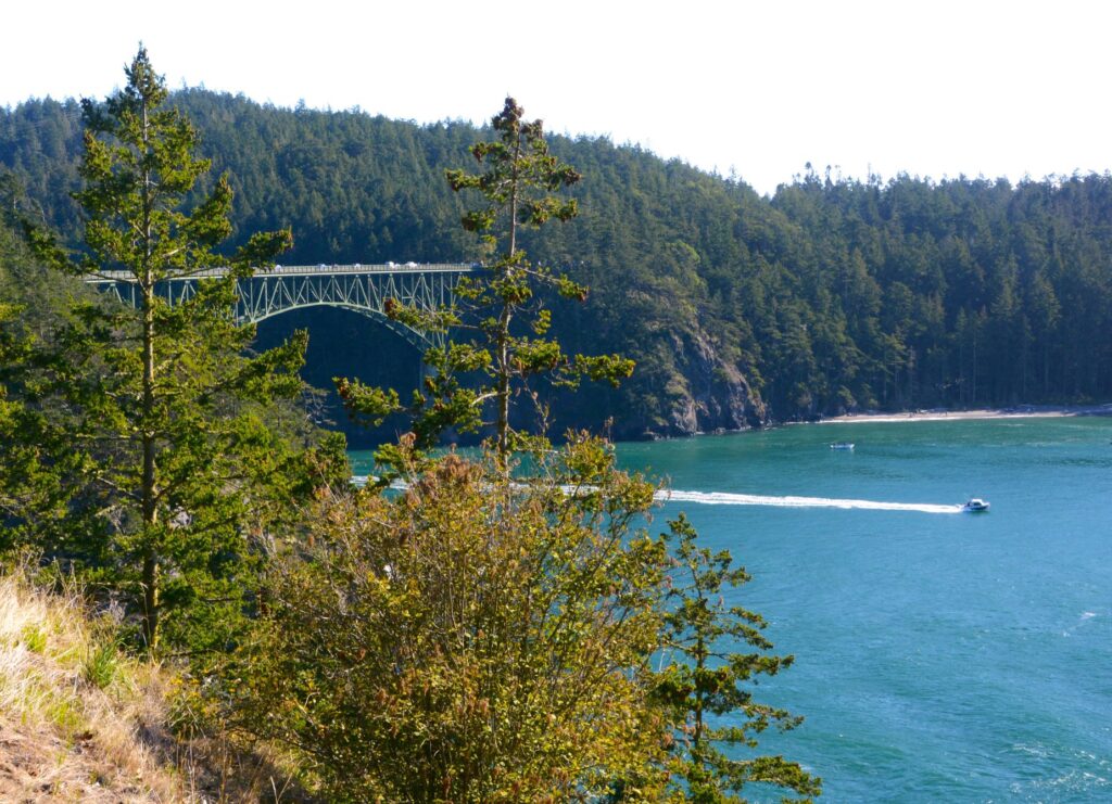
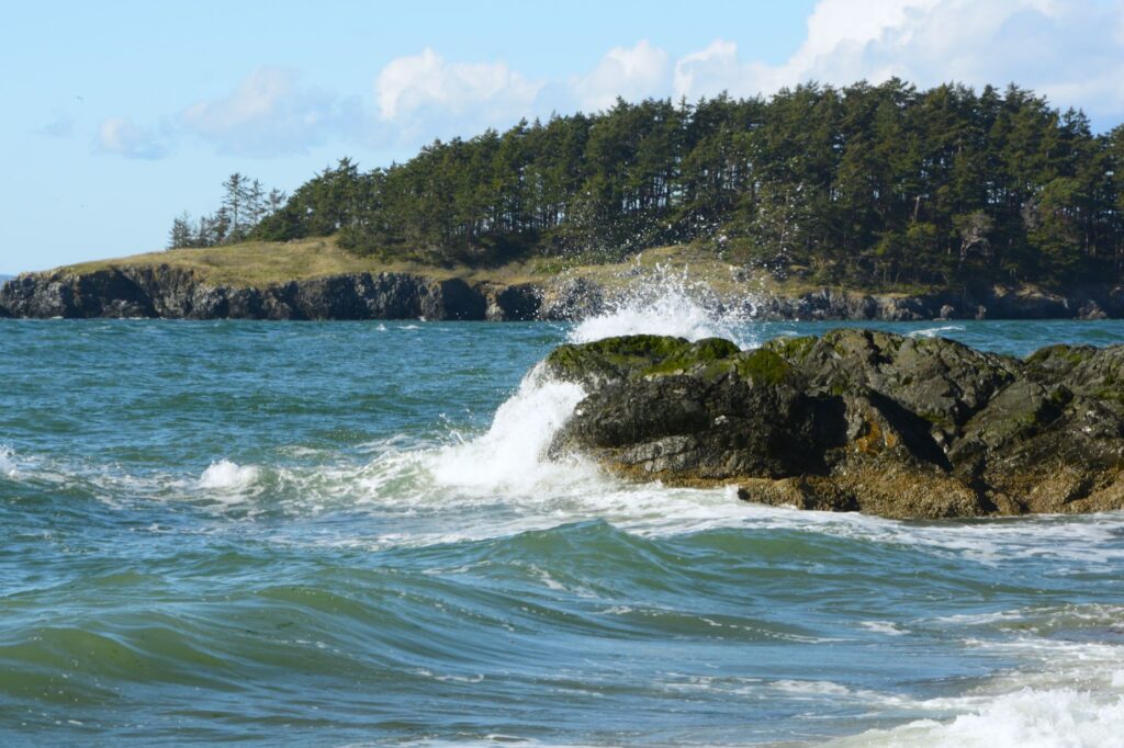
Deception Pass, Washington
Just across the bay from us and around the point was Deception Pass which opens into Puget Sound. This bridge is the only way to cross over to Whidbey Island by vehicle.
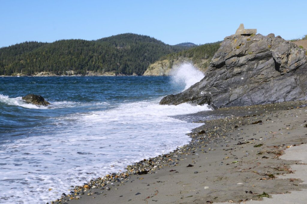
Deception Pass is a state park with scenic trails through old growth forest. Its rocky beaches are popular, especially on a sunny day.
Tree covered islands dot the bay, while waves crash over rocks.
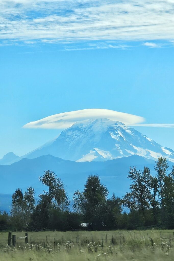
Leaving Washington
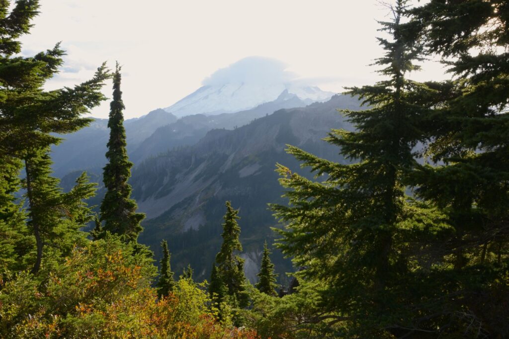
On one of our last days in northern Washington, I captured one last photo of the illusive Mount Baker from a distance. It was covered with a cap cloud once again.
Mount Baker, Washington
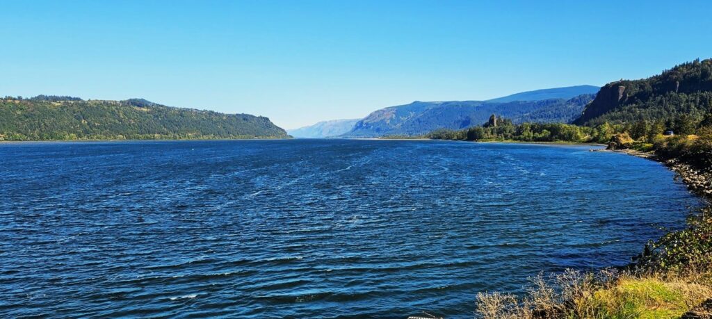
Columbia River
Washington gave us a rainy day farewell, the same as its welcome. We crossed over the Columbia River into Oregon, stopping in the Portland, Oregon area. The Columbia River is very wide at this point and forms the border between Washington and Oregon.
Scenic Columbia River Gorge
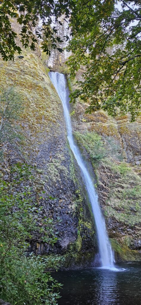
Another item on my bucket list was to see Multnomah Falls. The rain cleared and the day was beautiful. To get there, we had to drive along the Columbia River. We took a wrong turn and discovered another waterfall–Horsetail Falls.
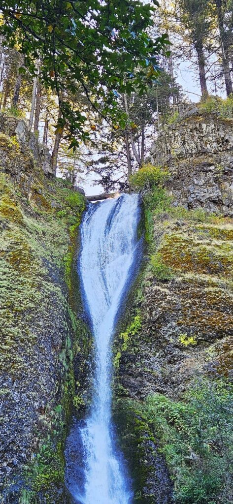
Horsetail Falls, Oregon
This 224 foot waterfall gets its name from Horsetail Creek and is right off the access road to US Hwy 84. Horsetail Falls is one of many waterfalls along the Columbia River Gorge.
Upper Horsetail Falls
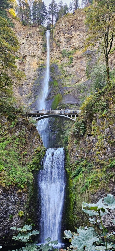
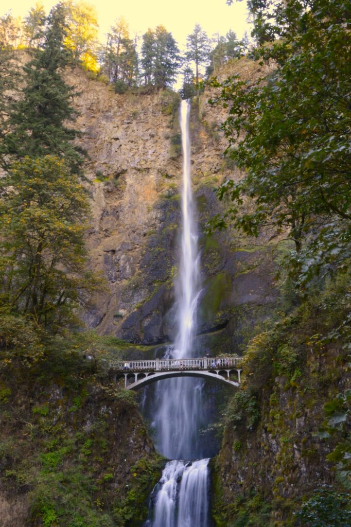
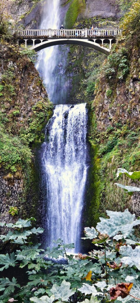
Multnomah Falls, Oregon
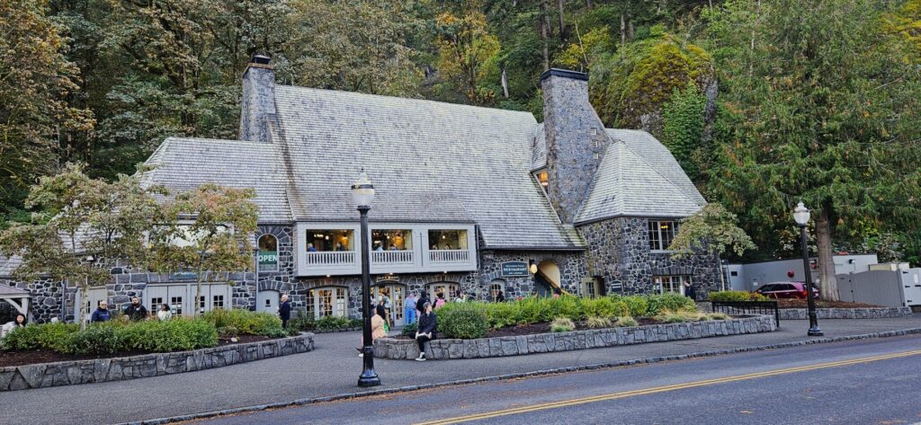
I have wanted to see Multnomah Falls for a long time. The first time we tried, we couldn’t find parking. This time, we waited a short time and were able to find a parking spot. At the bottom of the falls is this historic stone lodge built in 1925.
Multnomah Falls Lodge
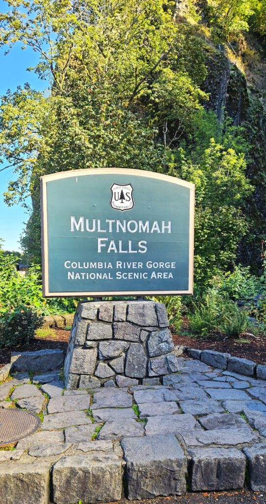
Multnomah Falls is part of the Columbia River Gorge National Scenic Area under the protection of the U.S. Forest Service.
Multnomah Falls is 620 feet high. It’s the tallest waterfall in Oregon.
This is a year-round waterfall fed by underground springs.
The Multnomah Creek Bridge was built in 1914.
Multnomah Creek Bridge over Multnomah Falls
Here’s a short little video of the waterfalls.
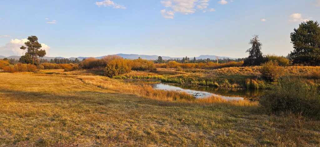
Bend, Oregon
From Portland, Oregon, we headed further south to Bend, Oregon. We began to see autumn colors, and the nights got cooler. Not many people were left in the campground. It was emptying out for the winter.
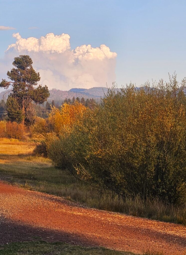
This area had a wildfire within sight of our campground, so the air was thick with smoke. We didn’t go outside much because of the smoke. Here it is drier and more prone to fires.
Smoke from wildfires rise into the air creating a cloud.
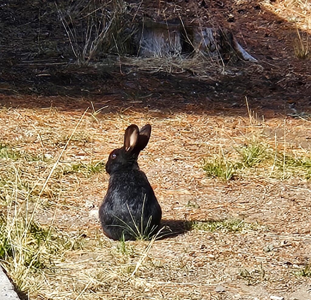
Several rabbits hopped around our campsite. This black one was my favorite.
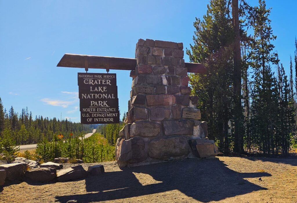
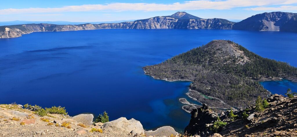
Crater Lake National Park, Oregon
From Bend, Oregon, we took a day trip to Crater Lake National Park. It was about a two-hour drive. This was another item on my bucket list. We had tried to see it years ago, but it was early spring and the roads were closed due to snow.
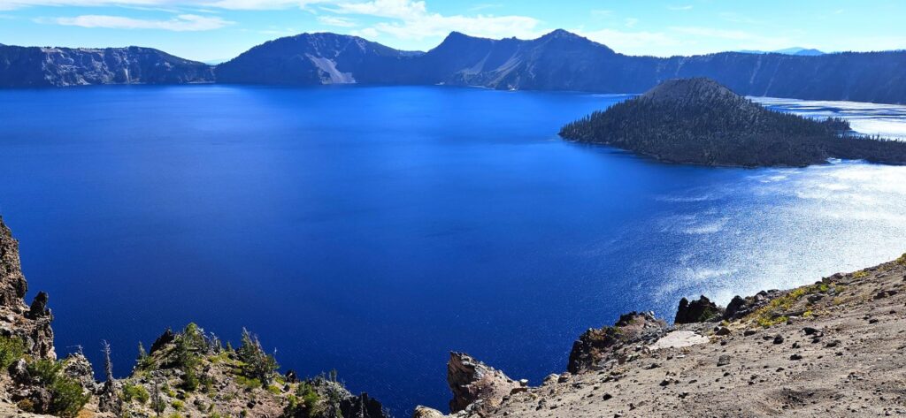
This was my first view of Crater Lake. The deep blue surprised me, even though I knew what to expect. This is the deepest lake in the United States. It is nearly 2,000 feet deep. There are no rivers that flow into or out of the lake and the water is very clear.
Wizard Island, the island you see here, is a volcano within a volcano. It is believed that Crater Lake was formed from a large volcano that collapsed, forming Crater Lake.
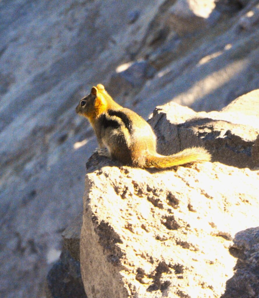
This chipmunk scrambled around the rocks. It is one of 70 species of mammals that live in the park.
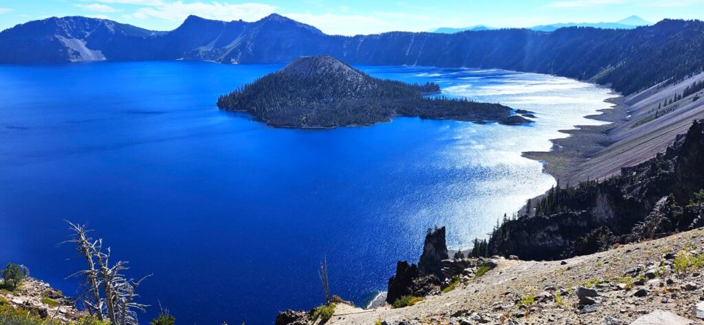
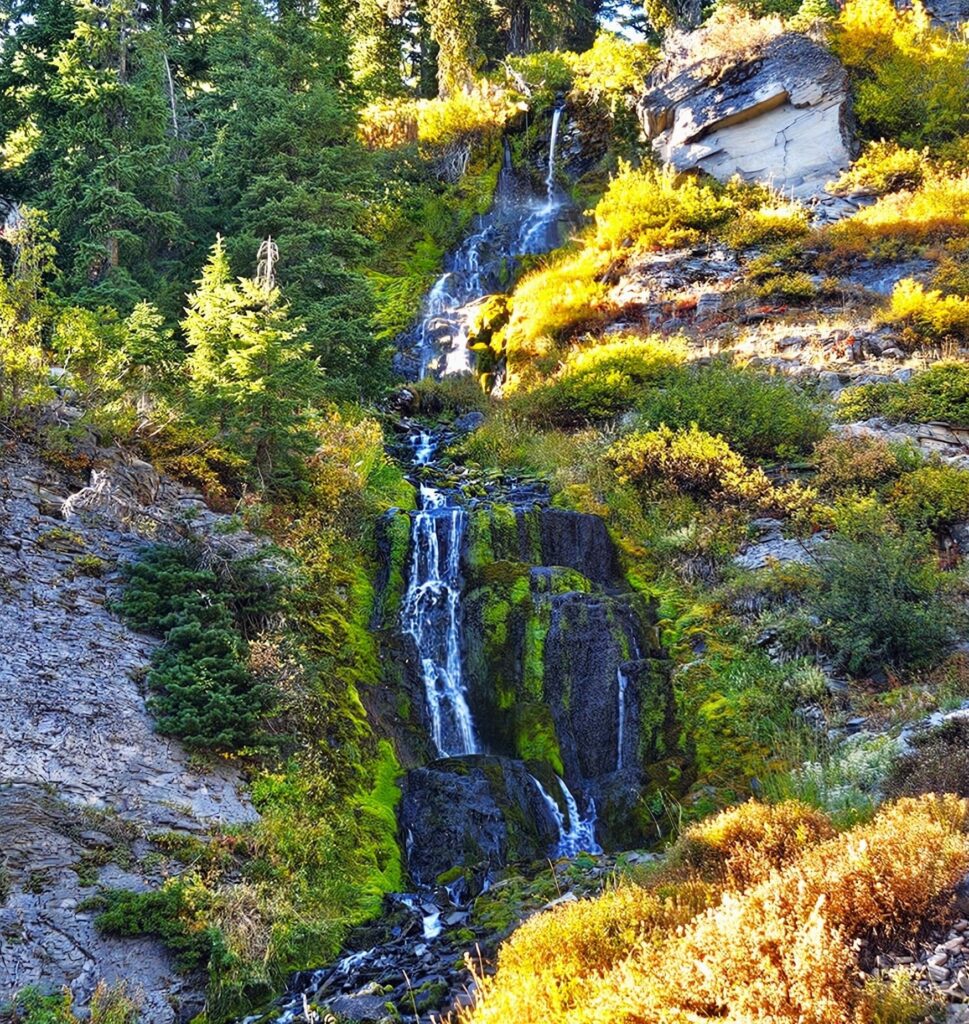
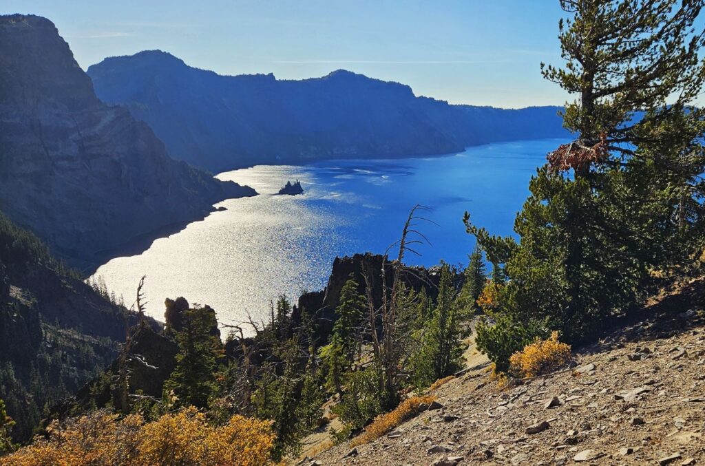
We drove the Rim Drive around the entire lake. It is 33 miles long. We stopped at many different viewpoints on our way.
Vidae Falls was one of our stops. It is about 100 feet high and tumbles over rocks in several cascades. It was just a few steps from the roadway, so it was an easy hike.
The tiny island on this side of the lake is called Phantom Ship. Its tall craggy rocks and shape give it the appearance of a ship when silhouetted.
Central Oregon
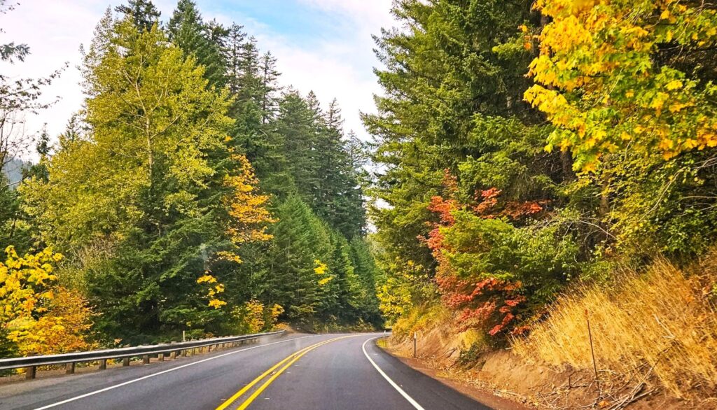
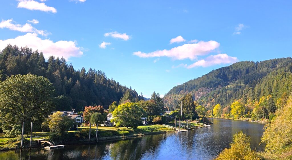
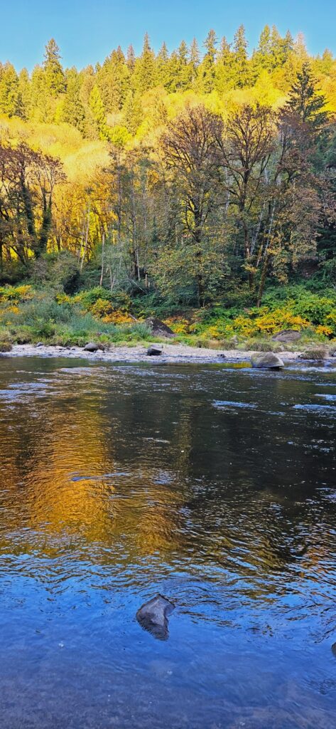
We swung over to the coast after leaving Bend, Oregon, and stayed in Florence, Oregon. We drove a few miles inland to see some fall color in the trees on Hwy 126 going toward Eugene.
We took a side road at the town of Mapleton, a cute town situated along the Siuslaw (See-you-slaw) River.
Mapleton, Oregon
Along the river, the yellow alders, cottonwoods and maple trees created a beautiful scene reflecting on the water.
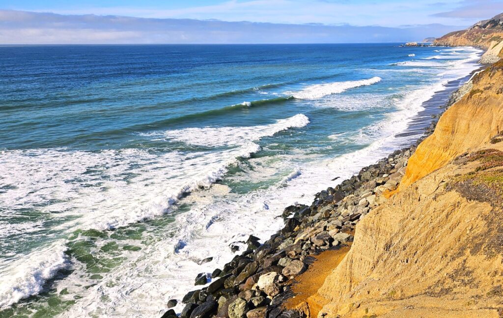
Pacifica, California
After a few more stops while on our way south, we reached Pacifica, California, near San Francisco. Our campground was right on the ocean. The waves are something I never tire of seeing.
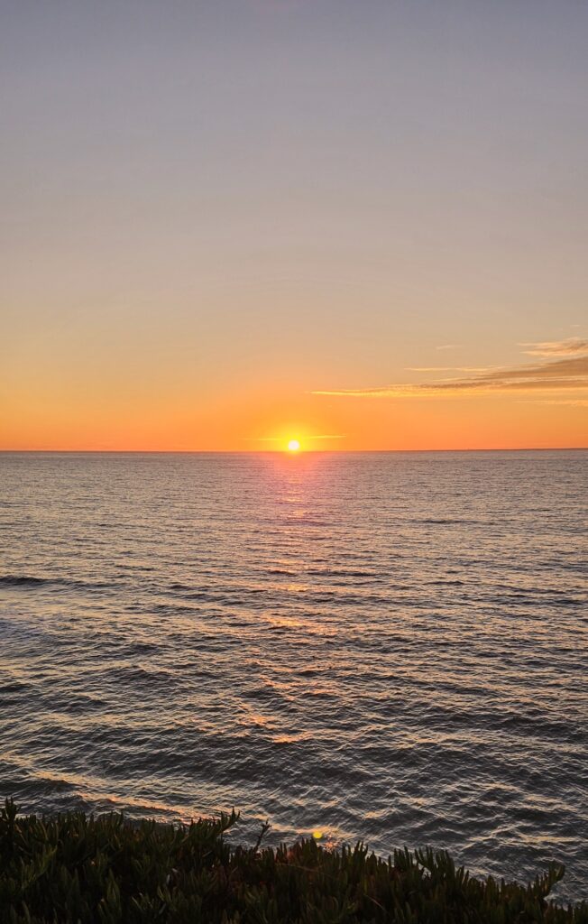
I also loved watching the sunset. A lot of the campers would come out in the evening to watch the sun setting over the ocean. It’s a nice ending to the day.
Pelicans in flight
The Pacific Northwest has so much beauty. During our six months of travel during the late spring, summer and early fall, we visited five national parks, one national monument, eight waterfalls, three lighthouses, several museums and one new country. It has been one of my favorite places to visit.
“Bless the Lord, O my soul! O Lord my God, you are very great! You are clothed with splendor and majesty, covering yourself with light as with a garment, stretching out the heavens like a tent.” Psalm 104:1-2 ESV
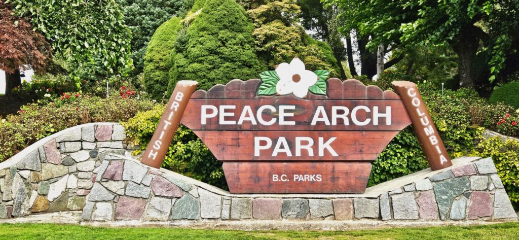
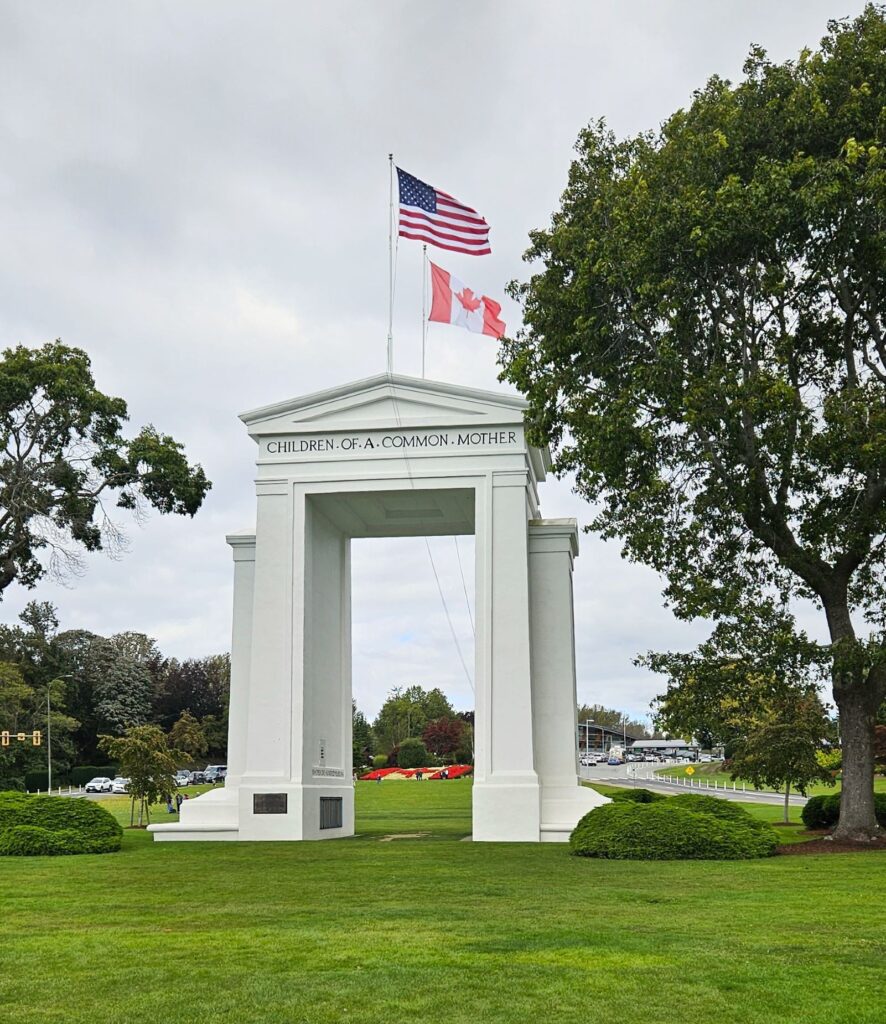
Blaine, Washington, where our northernmost campground was located, is nearly to the Canadian border. While we were there, we took one day to visit Vancouver, British Columbia. Our first stop was the Peace Arch which is a park that straddles the United States and Canadian border.
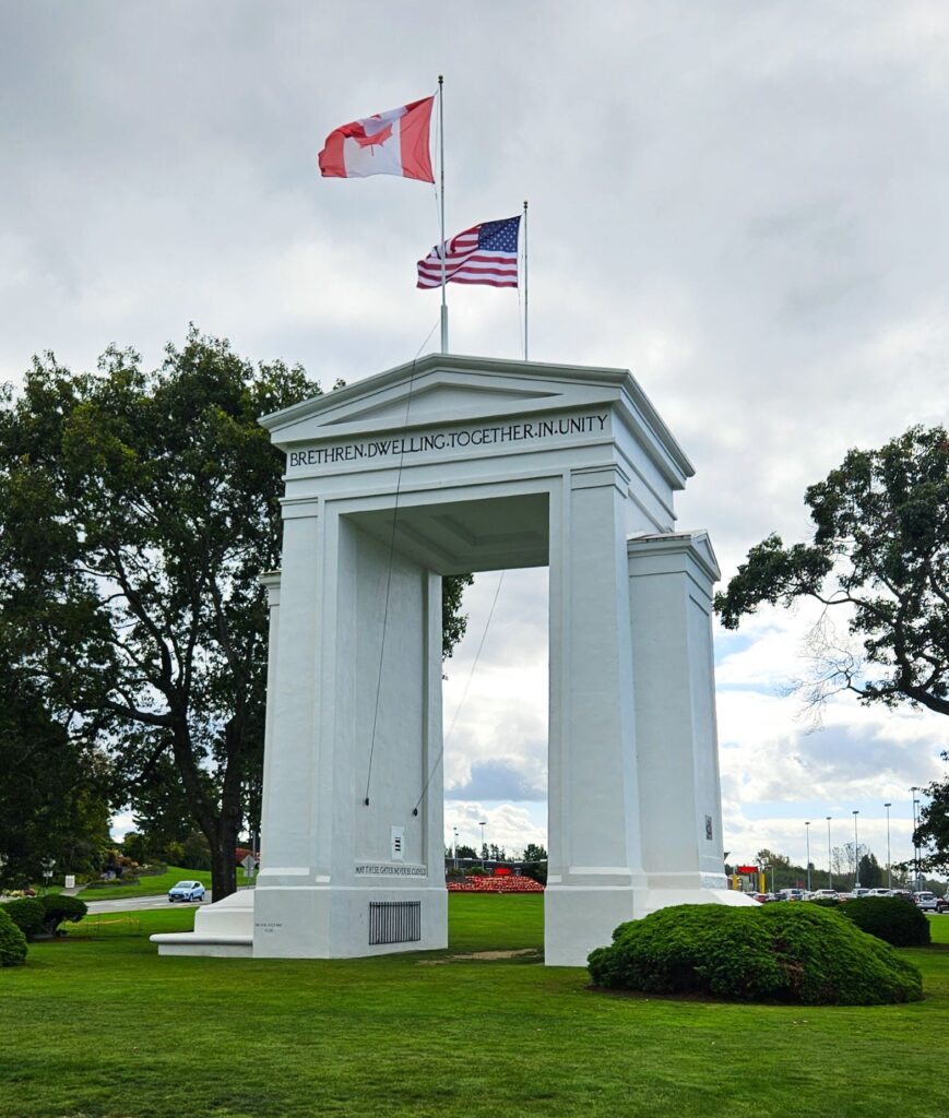
A sixty-seven foot white arch represents the peace between the two countries. The arch represents the longest undefended boundary in the world. It was constructed to commemorate the end of the war of 1812.
The Peace Arch, United States side
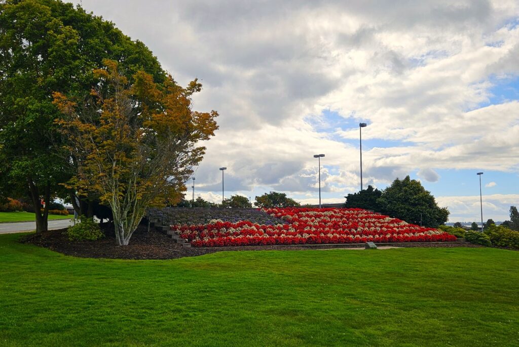
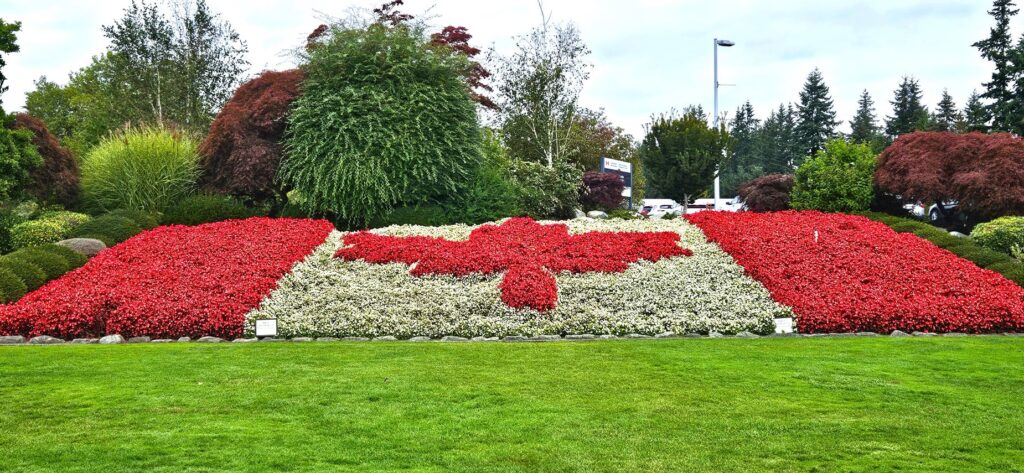
Each side has a flower bed representing its flag. Over 55,000 flowers are planted yearly in this seven-acre park. The USA side is inscribed with the words, “Children of a common mother.”
American flag in flowers
On the Canadian side, “Brethren dwelling together in unity” is inscribed over the arch.
Canadian side of the archCanadian flag in flowers
On the Canadian side is a totem pole. This particular one represents the history of the Haida people.
Totem pole
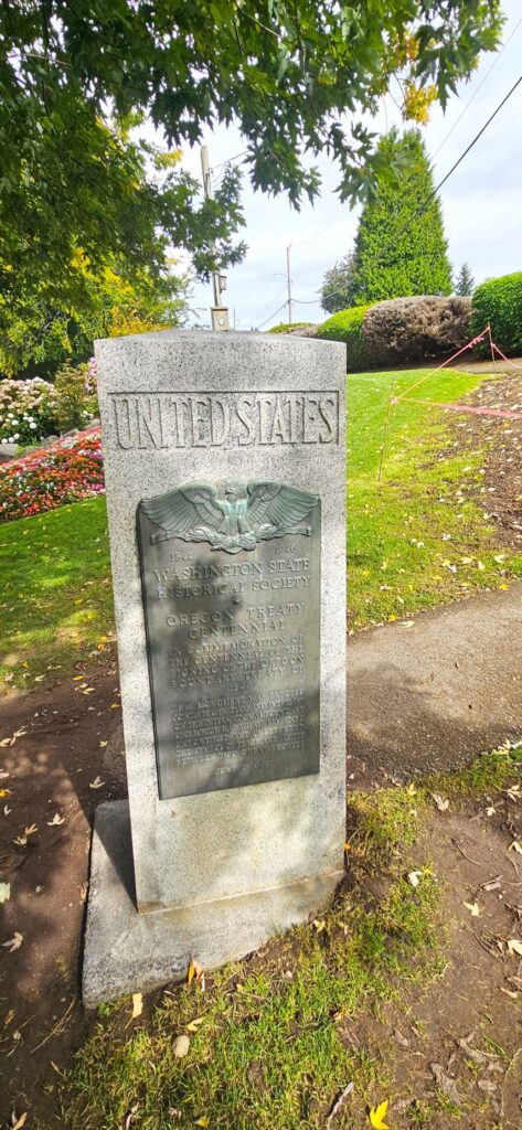
In the Peace Arch Park there is a monument where the borders meet. We stood with one foot in one country and one foot in the other.
Border monument
Over half a million people visit this park every year. Its beautiful grounds are perfect for family gatherings, picnics and weddings.
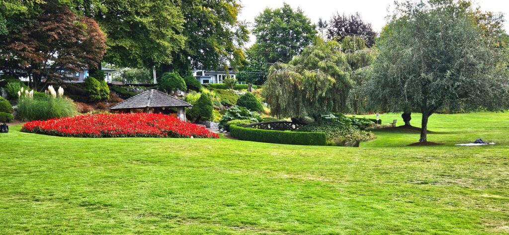
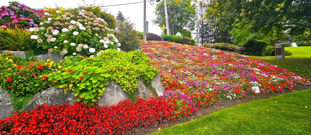
Gardens in the Peace Arch Park
Even though it was September when we visited, flowers still bloomed.
We enjoyed seeing the Japanese garden section of the park. It was a beautiful place to relax.
After leaving the Peace Arch Park, we had to go through Border Control. There was nothing friendly and peaceful about that encounter. The young border agent saw our Texas license and must have assumed all Texans carry an arsenal with them. She started questioning us about guns.
Do you own any? What kind? How many? Where do you store them? As a parting shot, she said, “You know, we think a lot differently about guns here. Only law enforcement and we (Border Control) are allowed to have guns. If we searched your vehicle and found guns, you would go to jail.”
Of course, we assured her we already knew about Canada’s strict gun laws. The lecture seemed a bit unfriendly for a Canadian “welcome.”
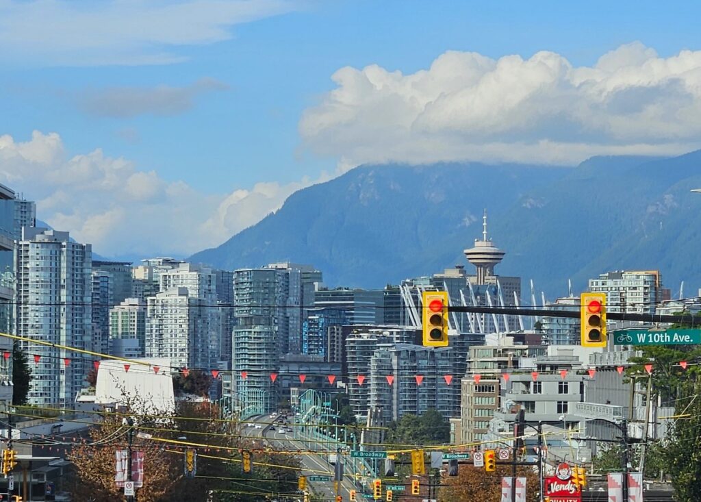
Vancouver BC
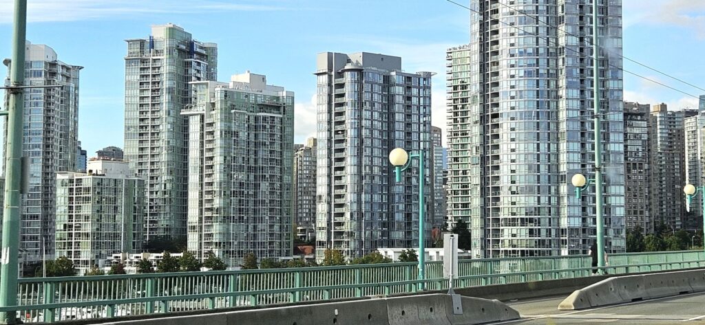
Look alike apartment buildings in Vancouver, BC
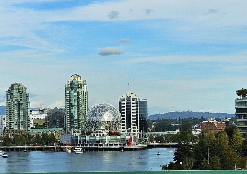
After more than an hour, we reached Vancouver. While crossing the bridge over the Fraser River, we spied the geodesic dome which houses the Science World at TELUS World of Science.
Vancouver has a space needle too. The Space Tower is Vancouver’s version of the Seattle Space Needle.
Space Tower in Vancouver, BC
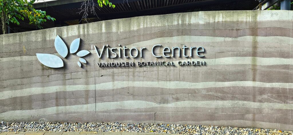
Vancouver’s streets are quite narrow. I was glad Ray was driving. We found the Vandusen Botanical Garden, but the parking lot was full. We slowly crept through until we found someone leaving. I jumped out to save the spot while Ray backed into it.
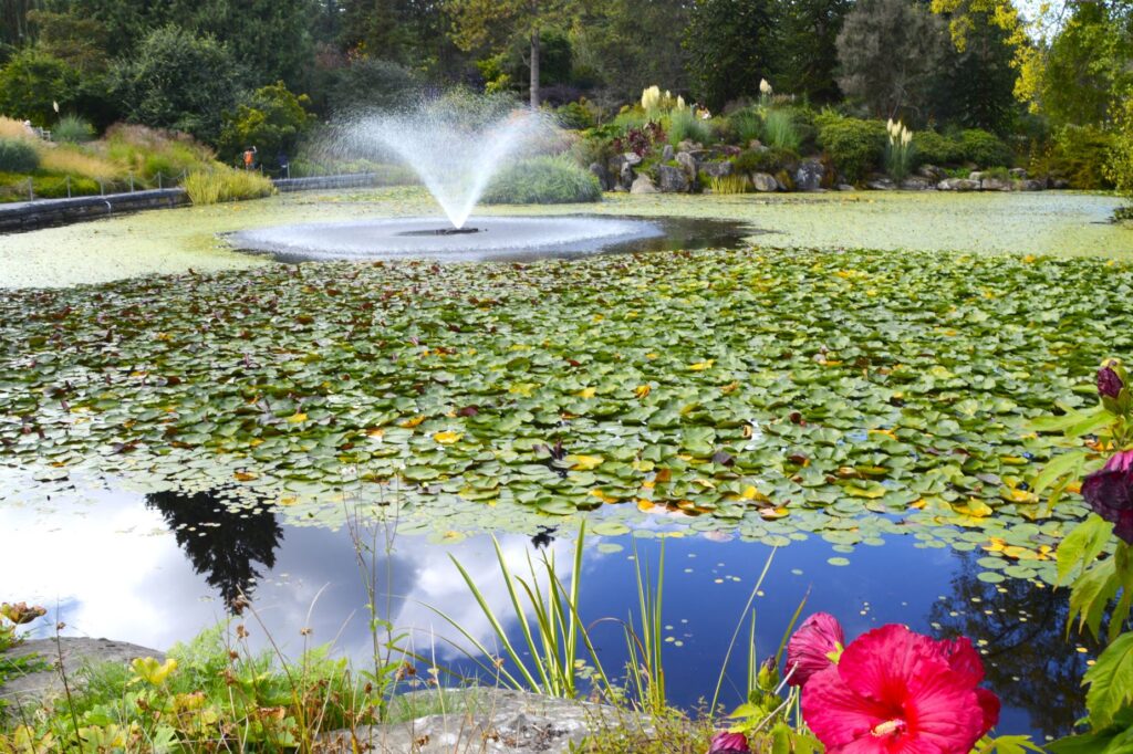
We stopped at the Visitors’ Center, (or is it Centre?) got a map, and headed out into the fifty-five acre garden. It was the weekend which meant that there was live music and live art painting demonstrations. The first thing we saw was this huge lily pond.
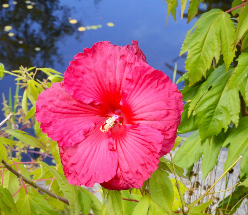
These Hibiscus flowers blooming by the edge of the pond were so bright and colorful.
Hibiscus
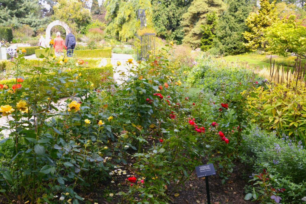
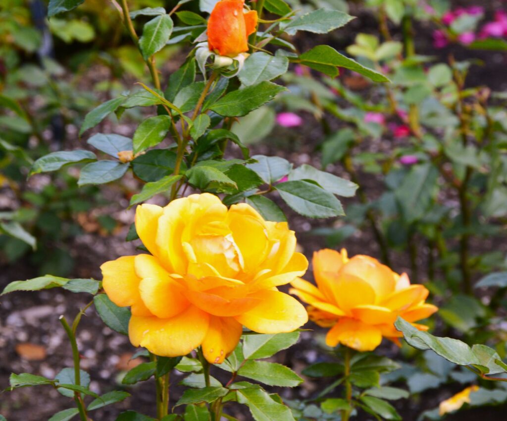
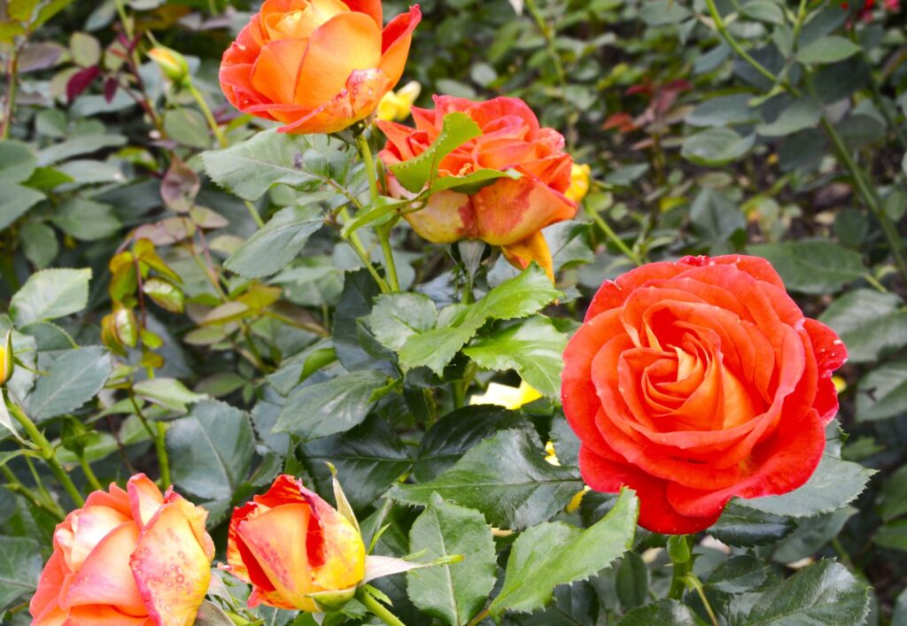
The rose garden was a beautiful spot. Being late summer, I thought the flowers might all be bloomed out, but there were still many roses in bloom. I didn’t see one aphid on any of them, nor did I see any leaf mold.
Rose GardenTea RoseHybrid Tea Rose
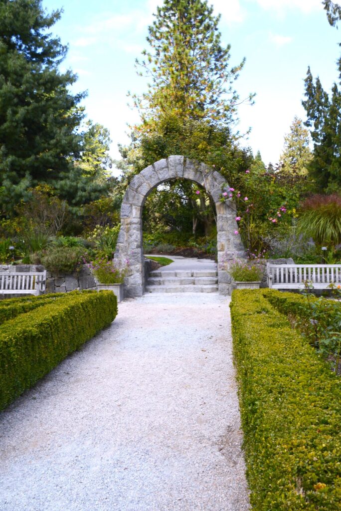
The rose garden had a rock archway which led into other parts of the garden.
Archway in Rose Garden
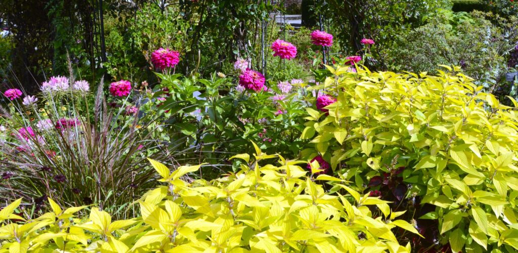
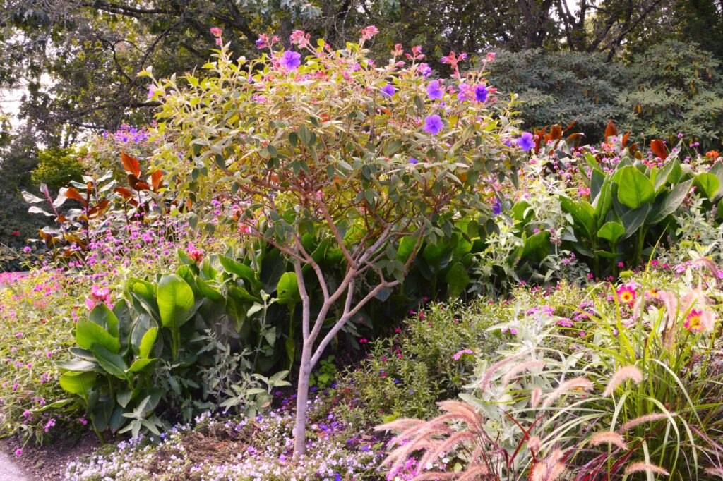
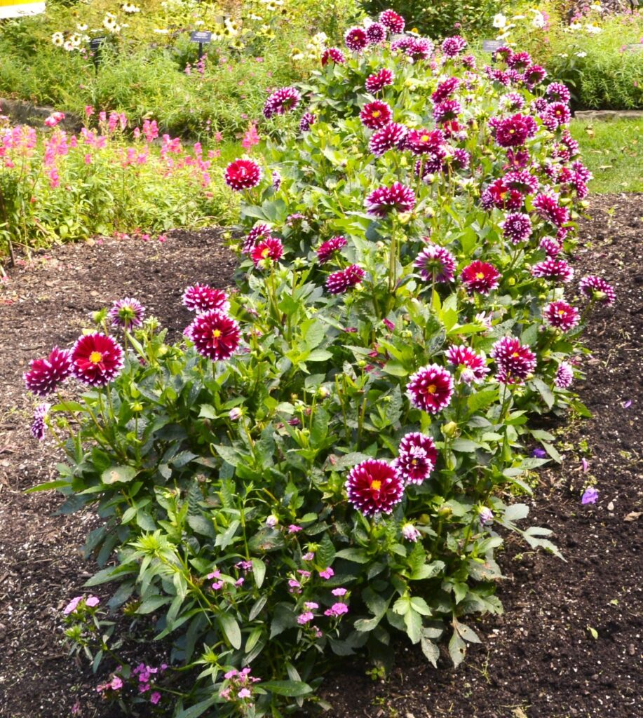
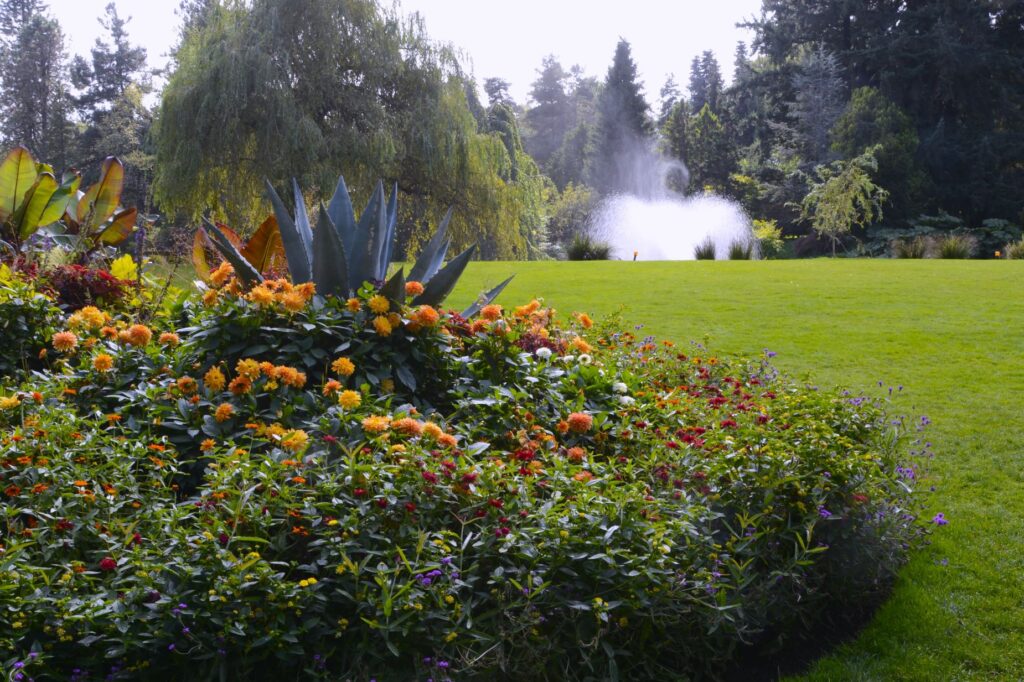
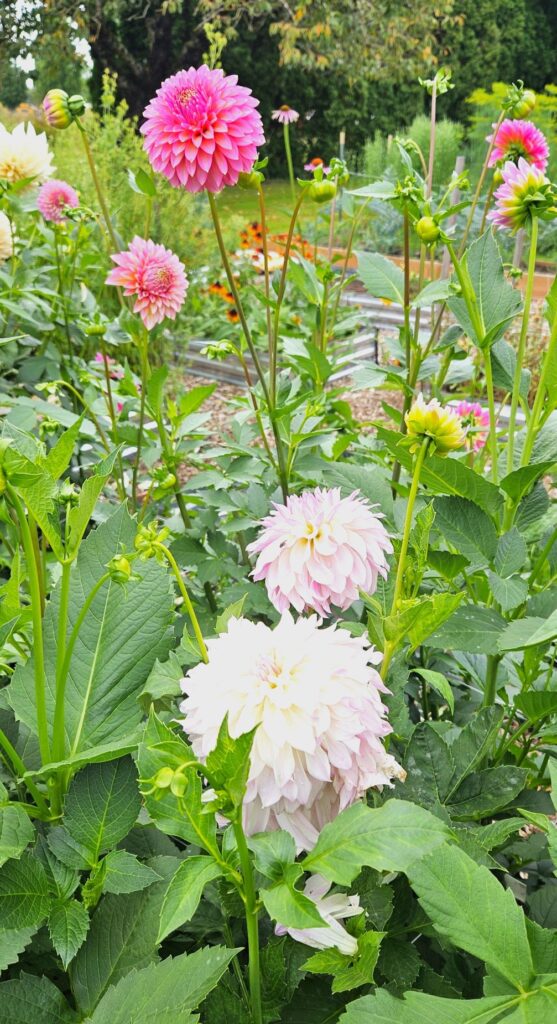
We walked along miles of pathways, it seemed, and saw many varieties of flowers, shrubs and trees. Dahlias were everywhere.
Dahlias
This garden displays plants from all over the world. It has an extensive collection of plants native to British Columbia.
Glory Bush
These two tone dahlias were some of my favorites.
Dahlias
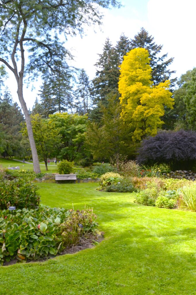
The extensive lawns made a beautiful setting against the flowering borders.
Yellow Blooming Scotch broom tree
Vancouver has a temperate oceanic climate. It is one of the warmest cities in Canada. The summer months are typically dry and modestly warm. It was a beautiful day when we were there.
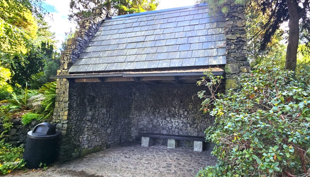
This Scottish Shelter is in the Heather section of the park. It was a nice shady place to sit out of the sun.
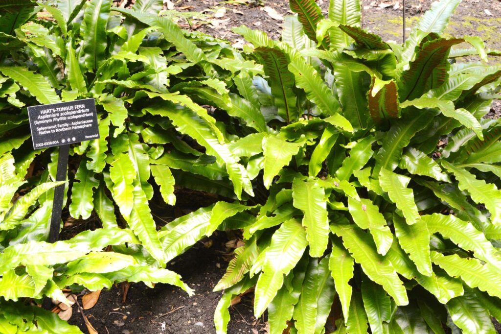
We have always enjoyed ferns ever since we had a fern garden terrarium when we were first married.
Hart’s Tongue Fern
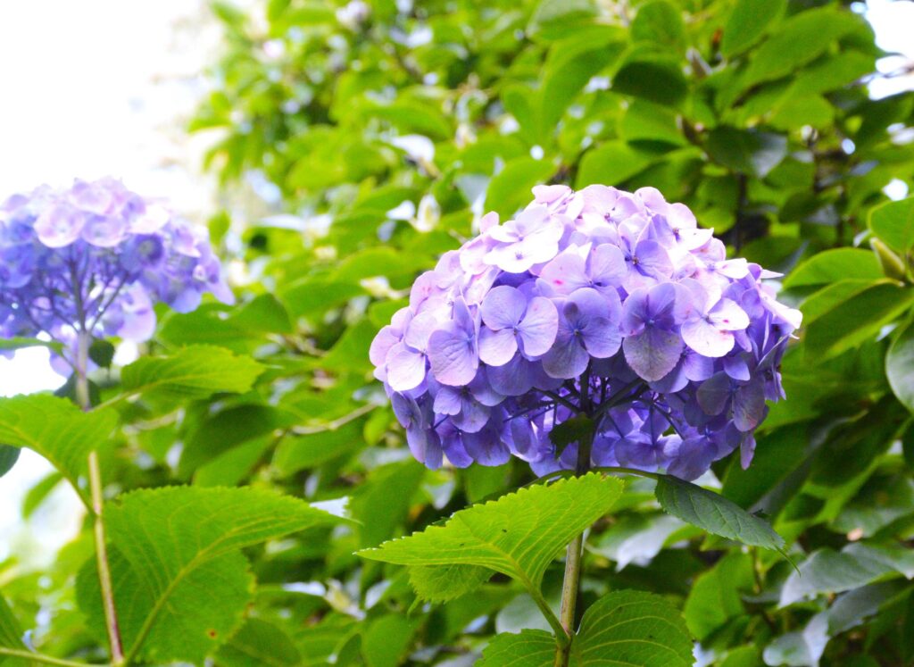
Hydrangeas are another favorite of mine. They look like one big flower, but they are really comprised of many smaller flowers grouped together into one.
Hydrangea
This Grotto was a little spooky. However, during the Festival of Lights, it is lit up with twinkling lights.
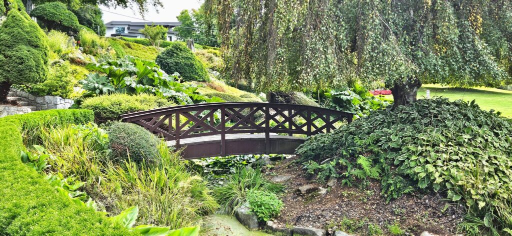
The Grotto leads to other parts of the garden
The VanDusen Botanical Gardens was developed as a public garden using an old golf course.
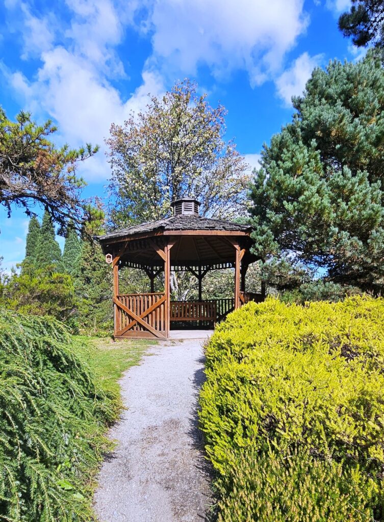
Gazebo
I used my phone app to identify all kinds of unfamiliar plants.
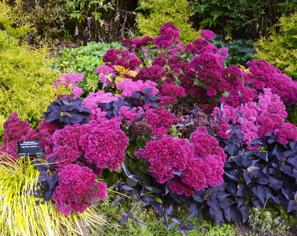
Showy Stonecrop
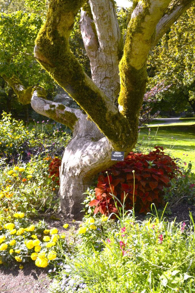
Not only did we see many different flowers, but we also saw many kinds of trees. This twisted oak tree with the moss-covered trunk was interesting.
This catalpa tree gave us a shady place to get out of the sun.
Northern Catalpa Tree
The camera doesn’t show it too well, but this tree trunk had many different colors.
Even with a map, we got confused about where we were in the park. I think we saw about three-quarters of it. But by then, our feet and legs were tired.
We had quite a ways to walk to our truck, so we headed back by way of this pathway. We had much more we wanted to see in Vancouver.
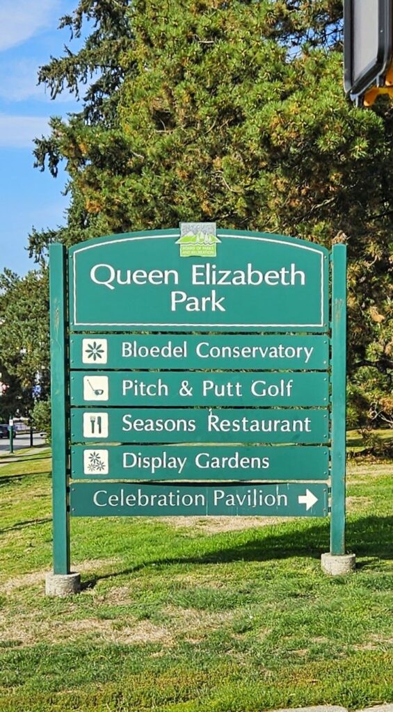
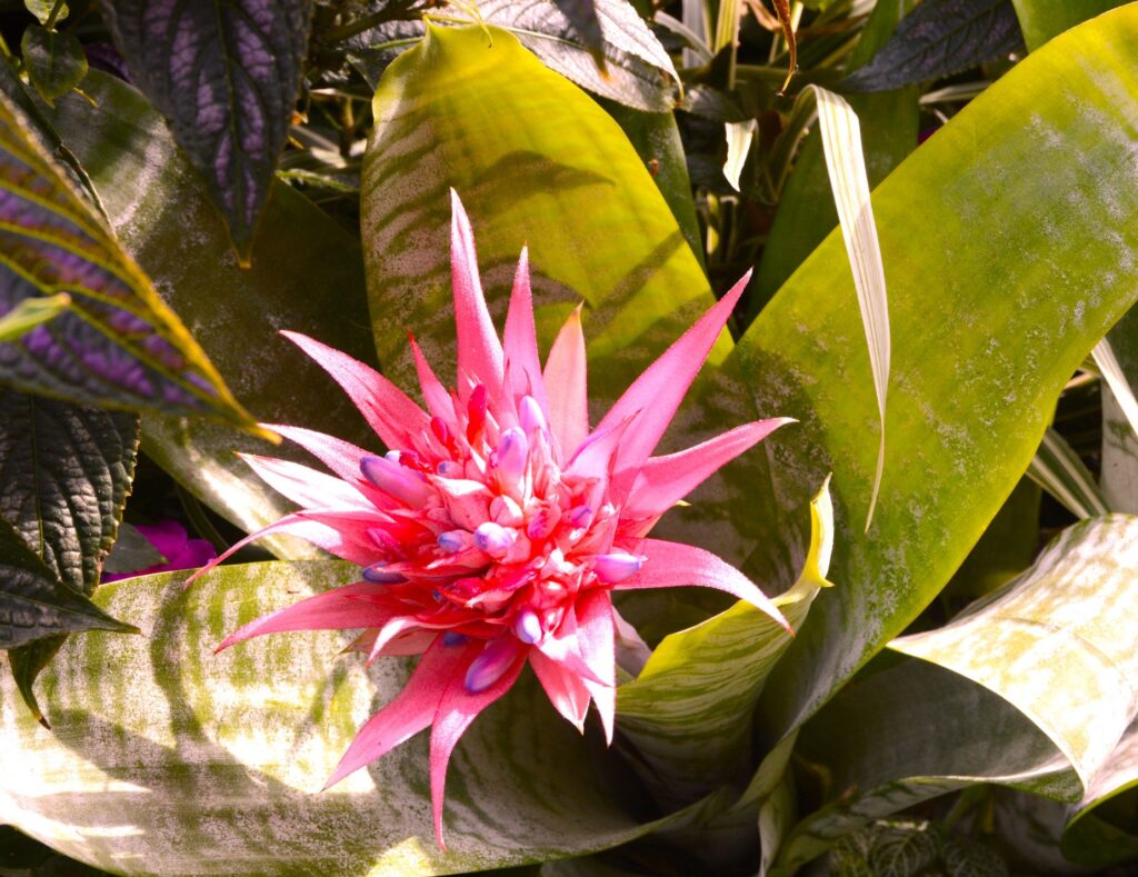
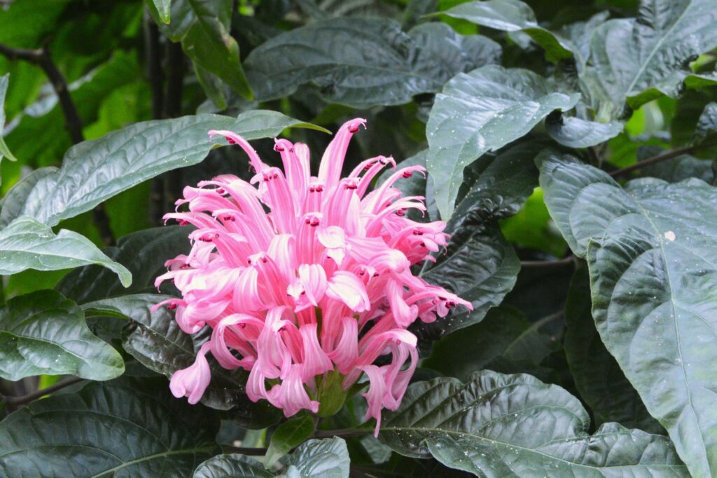
Bloedel Conservatory
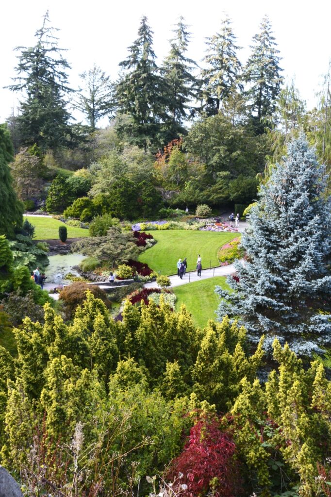
Our next stop in Vancouver was the Bloedel Conservatory in Queen Elizabeth Park. It sits on Vancouver’s highest point in the city.
The grounds of the park are beautifully landscaped. It makes a perfect setting for wedding photos. In fact, we saw a beautiful east Indian wedding party getting their wedding photos taken while we were there.
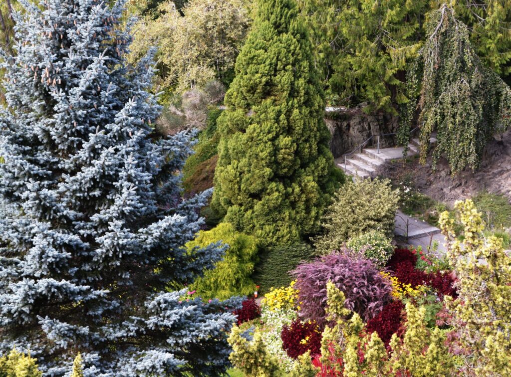
Sunken gardens of Queen Elizabeth Park
The park has a sunken garden below the Conservatory.
Steps leading down to Sunken Gardens
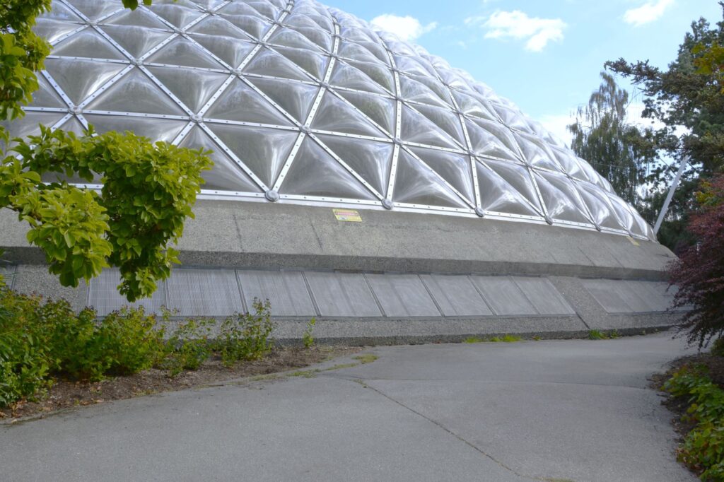
The Conservatory dome is 70 feet high and covers about a quarter of an acre. It was the first large triodetic dome structure in Canada.
Dome of Bloedel Conservatory
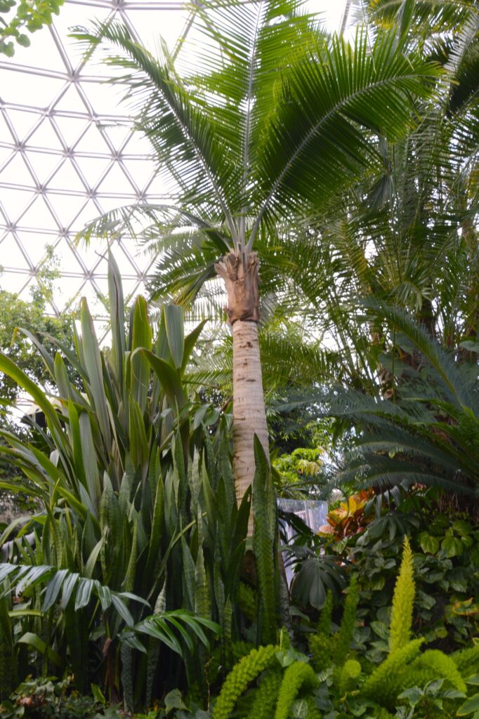
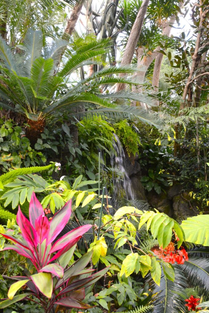
The dome houses more than 500 species of plants from around the world. The Conservatory uniquely houses three separate climate zones under one roof.
Snake Plant, Date Palm and Asparagus Fern inside the dome.
The temperature remains at a constant 64 to 70 degrees Fahrenheit year round. It was humid inside, but not unpleasant.
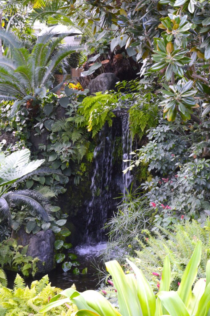
Waterfall
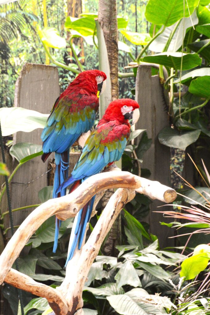
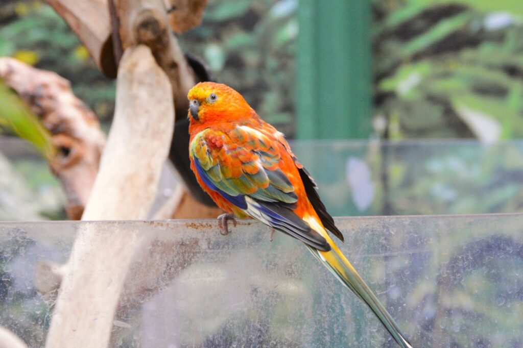
The Conservatory is also home to more than 100 colorful birds. The birds are used to humans and don’t mind posing for a photo.
Scarlet Macaws
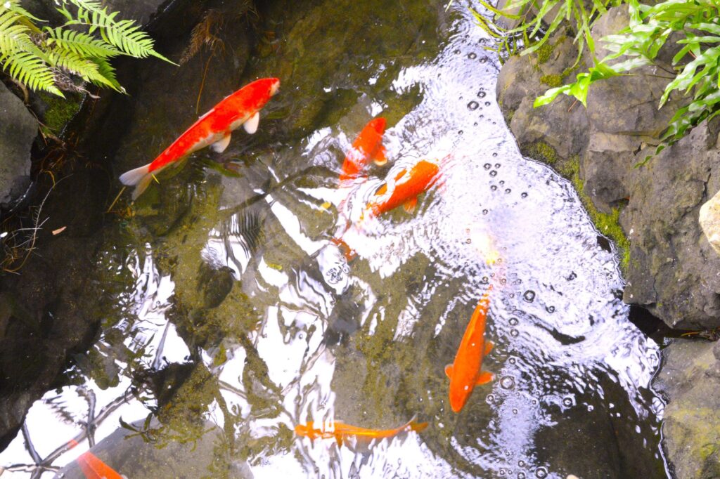
Besides waterfalls, there are water features throughout such as this koi pond.
Koi pond
The birds are not kept in cages. They fly wherever they wish. Sometimes they seem to beg for you to take their picture, like this colorful parakeet. He flew in front of the Macaws when I was trying to get their picture.
This bird seemed to be saying, “Look at me!”
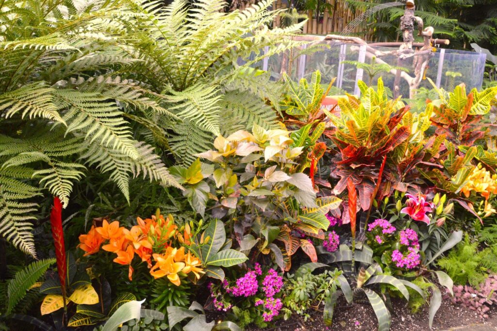
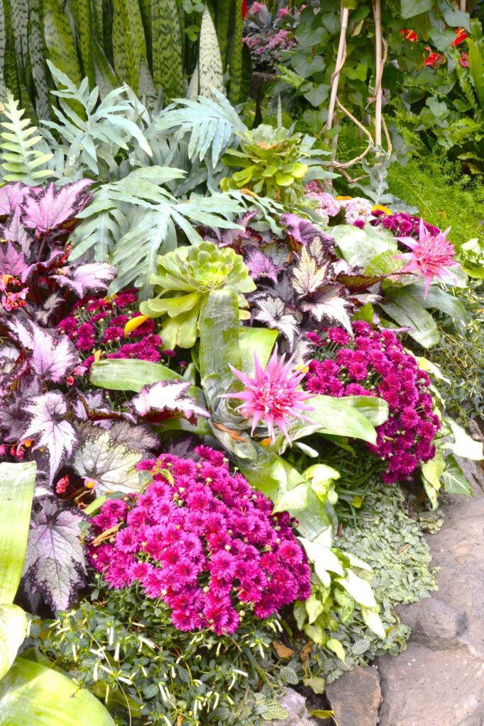
The birds are not the only colorful things in the conservatory. There were flowers, plants with colorful leaves, ferns and palms everywhere.
It was almost a sensory overload of where to look next. We crept along slowly so we could stop and see everything. So many beautiful plants were crowded into a very small space.
Pink Mums and various other plants
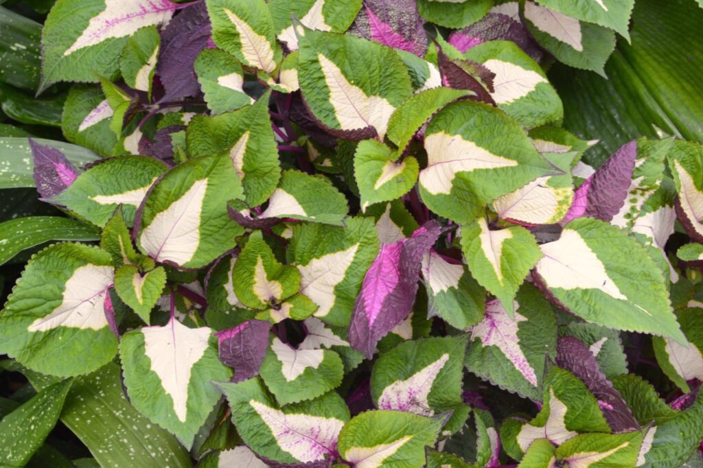
There were many colorful leaves like this coleus plant.
Coleus
These elephant ear plant leaves were huge. I can see where they get their name.
The patterns in the leaves and flowers were so unique.
Silver-nerve Plant
Some of my favorite flowers were the lilies. The colors on these are just beautiful.
Lilies
There’s a mouse population in the Conservatory. They got inside the Conservatory many years ago looking for a warm place to live. Since then, the Conservatory has embraced them and decided they are an important part of the ecosystem. As they have no predators, they are quite bold. This one made an appearance when we were there.
Mouse in the Conservatory
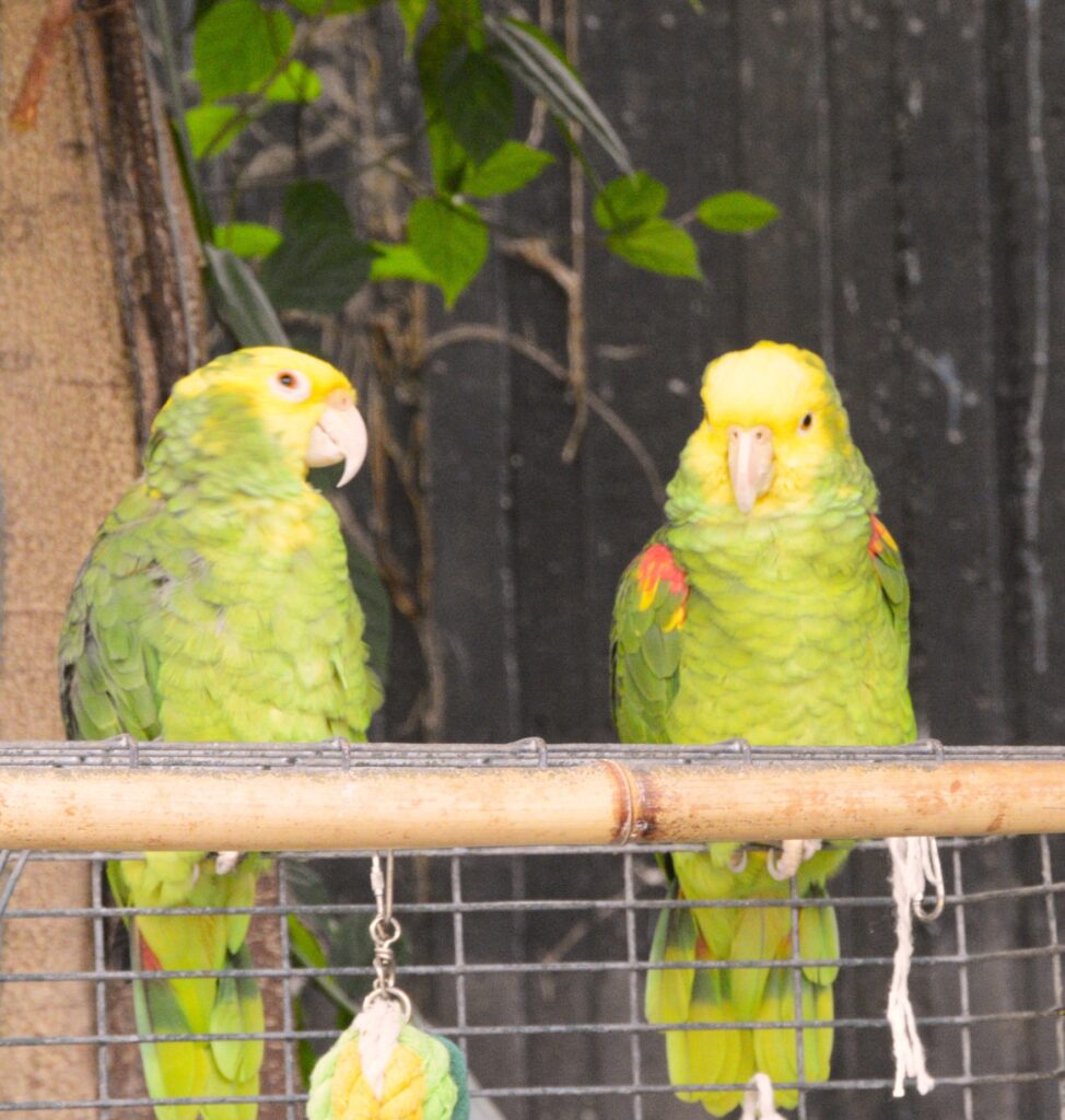
Chico and Pedra are double yellow-headed Amazon parrots. Each pair of birds seem to have their own “place” where they hang out.
We saw many uniquely shaped flowers like this silver-vase plant.
Silver vase plant
And like this Brazilian plume flower.
Brazilian-plume
Where ever we turned, there was some unusual plant, tree or flower.
Ti-plant
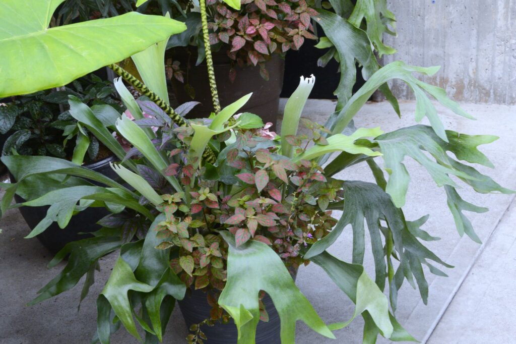
These staghorn ferns were familiar because Ray had one long ago that hung on a wall in our home.
Staghorn fern
As we were about to leave, we saw this beautiful white macaw. The gentleman who was holding him told us that these birds live a long time–like 40 to 60 years.
Cockatoo
This bird flitted around and finally settled so I could get his picture. I think it is some kind of oriole.
Black headed oriole (I think)
The variety of colorful plants, flowers and birds that God has created is just amazing.
As you can see, this place was a fun place to visit. Although they may not compare to Butchart Gardens, we thought these two botanical gardens were a nice substitute. Butchart Gardens would have cost us hundreds of dollars to visit, whereas, these cost only a few dollars to visit.
Flowering plants line the walkways in the Conservatory
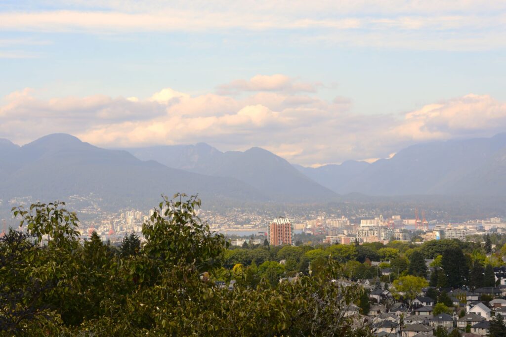
Since the Conservatory is on the highest spot in the city, we were able to get a photo of the surrounding city from there. Vancouver’s population is more than 2.6 million people.
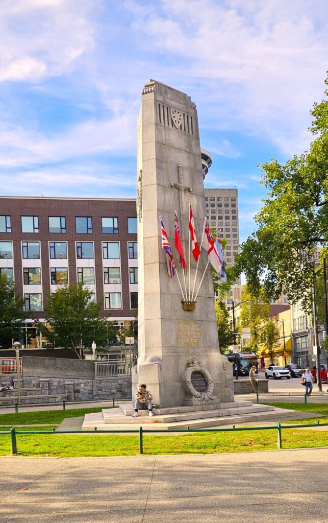
We had one more place to visit in Vancouver that day. To get there, we had to drive into the heart of the city, find a parking garage, and walk several blocks. Although the ceiling in the parking garage was very low, we managed to find a parking spot. Finding our way out by way of my phone proved to be more difficult. GPS took us the long way up scores of stairs to the ground level. We passed this monument on our way, which proved to be crucial in finding our way back.
Downtown Vancouver, BC
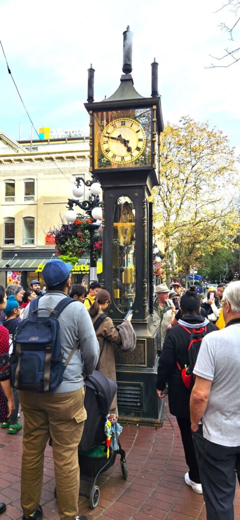
Gastown
This steam clock was our next destination. It is located in Gastown, the original site of Vancouver in the 1870s. A series of steam pipes run underground to provide heat to the city. Every hour this steam clock plays the Westminster chimes and sounds the hours with steam whistles. It was one of two in the world when it was constructed.
Waiting for the steam clock to sound off
Turn up your sound and listen to the video. It doesn’t quite sound right because one of the whistles wasn’t working. You can hear Ray trying to fill in the missing notes.
Steam Clock plays Westminster Chimes with steam whistles.
We lucked out that day. The clock went off once, but because the clock was running fast, the clock caretaker set the time back 12 minutes and we heard it go off a second time.
Finding our way back to the parking garage was a trick because I left the address of the parking garage in the truck. A friendly young Canadian man tried to help by pointing us in the direction of a couple of parking garages. Just at the right moment, I spied the monument we passed on the way out, and recognized the street that led to our parking garage.
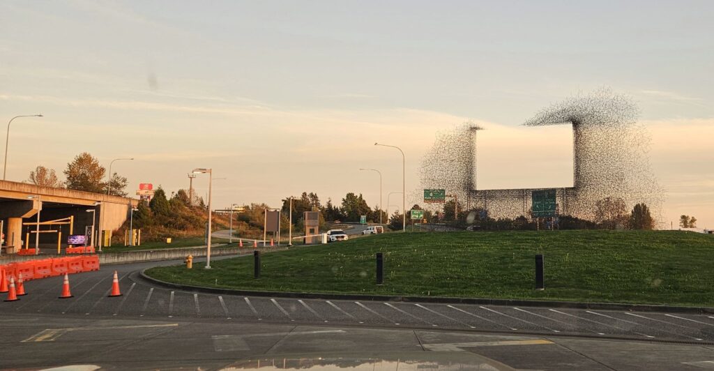
No that isn’t a flock of birds around an non-existent billboard. It is a weird art sculpture at the border.
We had a completely different experience crossing the border back into the USA. The two border agents were from Texas and greeted us warmly as fellow Texans. They were friendly and welcoming. It was nice to be back in the US.
“For all creation is waiting eagerly for that future day when God will reveal who His children really are.” Romans 8:19 NLT
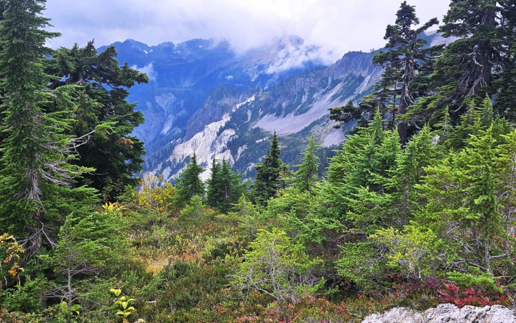
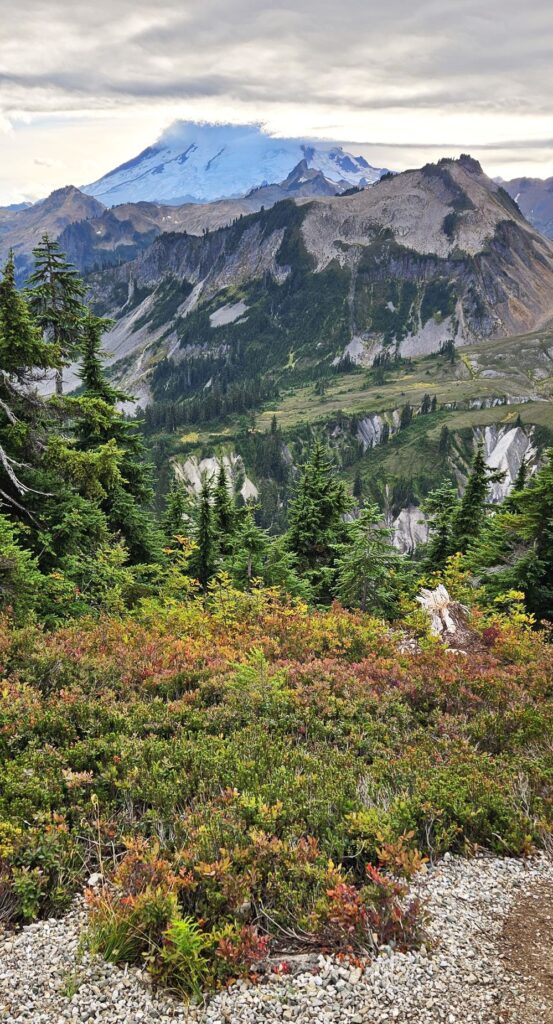
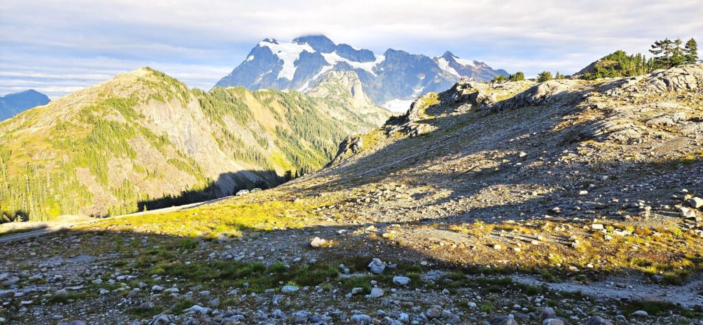
While staying in Birch Bay, Washington, we took a drive one day to see Mount Baker. On our way, we stopped at the Mount Baker Visitors’ Center, built by the CCC in the 1940s. Situated in the town of Glacier, it is 24 miles from the mountain.
The road to Mount Baker took us past a ski resort and ended at Artists’ Point. From there, we could see Mount Baker on one side and Mount Shuksan on the other. The road is winding and steep.
Road to Artists Point, Mt. Baker
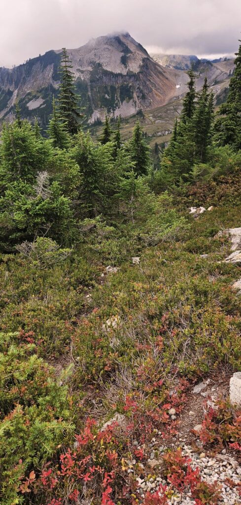
Artists’ Point is a perfect place to get a view of Mount Baker, except on the day we were there. It was covered in clouds.
Trail at Artists Point, Mt. Baker
I hiked the trail for a while, hoping the clouds would clear and reveal the mountain. But that was not to be. Both mountains were shrouded by clouds
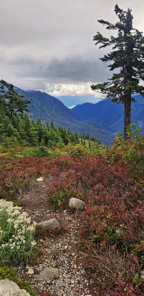
Flowers at Artists Point, Mt. Baker
The berries on the Sitka mountain-ash bushes contrasted brightly against the gray mountain. Disappointed, I hoped I might have another chance to see Mount Baker.
Mt. Baker covered in clouds
There are eleven glaciers on Mount Baker. Table Mountain Glacier is visible from this viewpoint.
Mt. Baker viewpoint
Mount Baker, at 10,781 feet, is the highest peak in the North Cascades. It is the second most active glacier-covered volcano. It is also one of the snowiest places in the world.
Mt. Baker
From the trail, I could see Baker Lake in the distance. It is believed to be formed much like Spirit Lake was formed. Mud, rock and water flowed from Mount Baker during an eruption that blocked the Baker River and created a lake.
Artists Point looking toward Baker Lake in distance
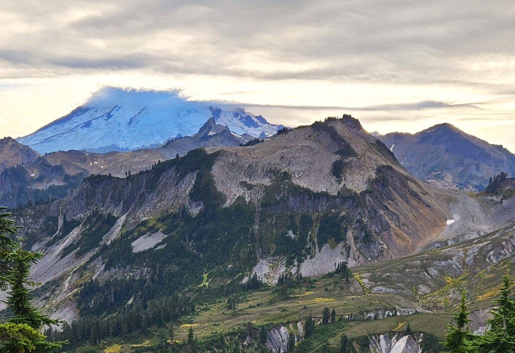
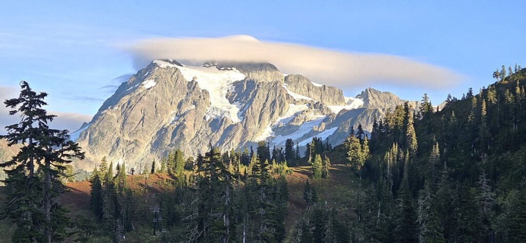
I got another chance to try to see Mount Baker. On our second trip, the clouds again formed over the mountains in the afternoon. But this time, we could clearly see Mount Shuksan.
Mt. Shuksan
On our way to Artists’ Point, we saw this interesting twisted rock formation.
Rock formation on road to Artists Point, Mt. Baker
The clouds lifted a little on Mount Baker as the afternoon wore on. The summit was almost visible.
An interesting fact about Mount Baker is that in 1975 there were signs of “renewed volcanic activity, ” according to the USGS. Monitoring was increased, but then it was dismantled. (?) The USGS says that it is a high priority to enhance the monitoring systems in the future. (It’s still an active volcano with regular steam eruptions!)
Mt Baker close up view
Later, a cap cloud formed over Mount Baker. The sun started peeking out beneath the clouds.
Cap cloud over Mount Baker
As the sun crept across the landscape, Mount Shuksan lit up.
Mount Shuksan from Artists’ PointMount Shuksan with a cap cloud above it
As we turned to drive home from Artists’ Point, we drove by this lake. We were there at the perfect moment to capture the photo of the day.
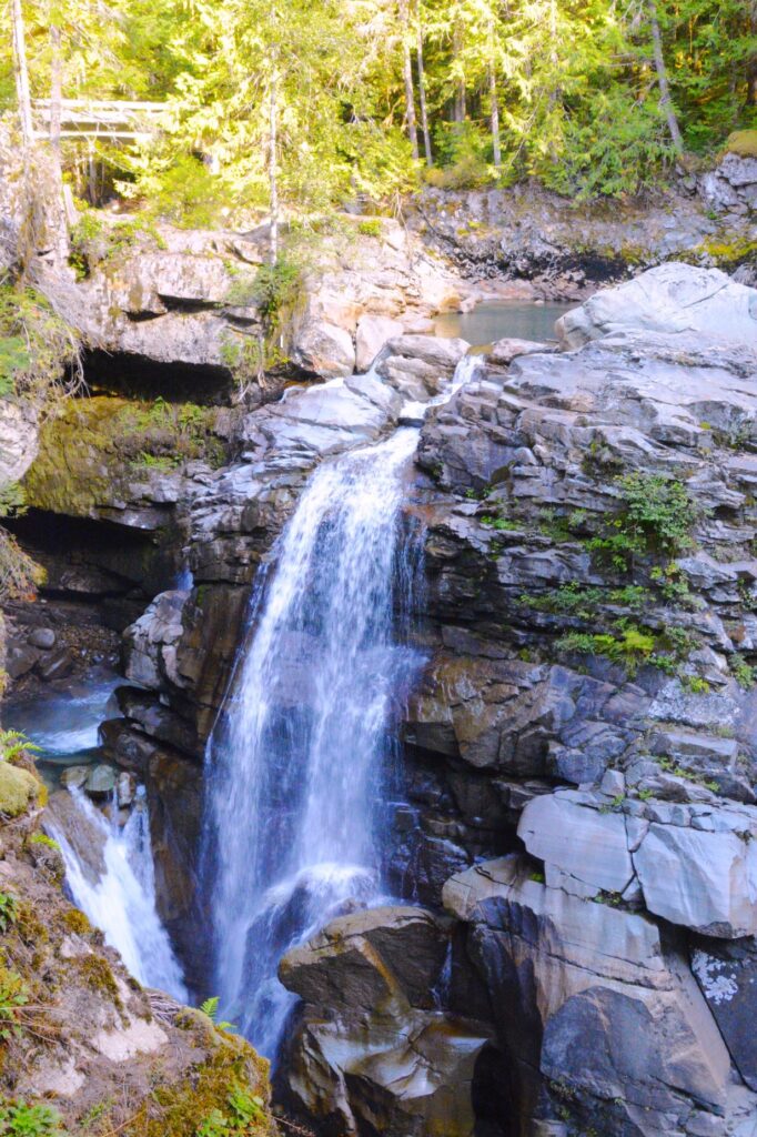
Nooksack Falls
On our way back home, we stopped at Nooksack Falls. It is a beautiful spot just off the highway.
Nooksack FallsUpstream from Nooksack FallsNooksack Falls downstream
Flower Picking in Mount Vernon, Washington
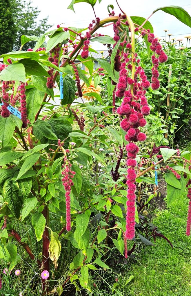
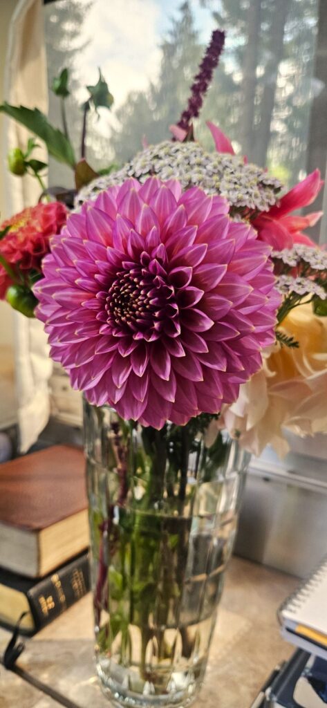
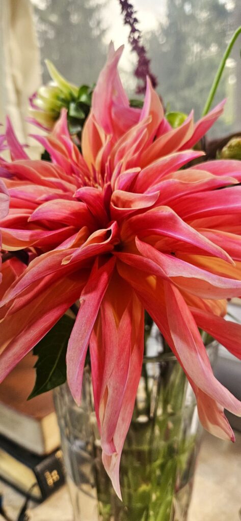
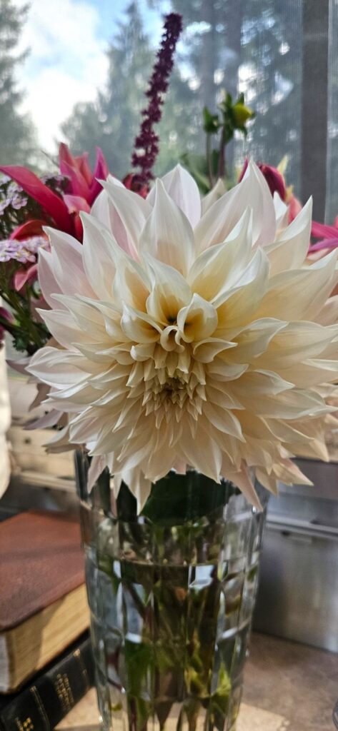
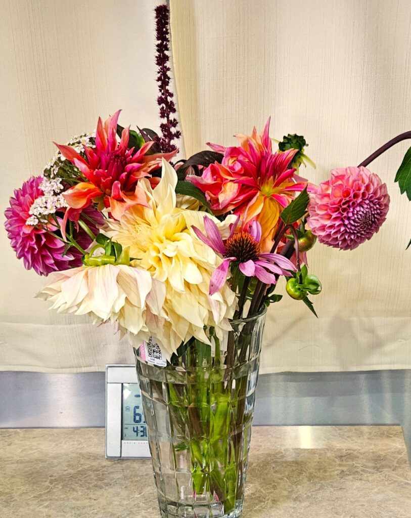
While we were staying in Concrete, Washington, Ray wanted to meet Mark Ward, a Christian YouTuber. Ray found out that Mark’s wife has a flower business. Ray signed me up for an afternoon session where I got to choose and cut 10 flowers for $10. All the while, Ray was hoping that he would be able to meet Mark. It turned out to be a fun time for me. And, yes, Ray got to meet Mark.
We had some shopping to do before we headed home. We had to leave the flowers in the truck, so they wilted a bit before we got them home. But the next day, they perked right up again. I had to buy a vase at a thrift shop to show them off.
DahliaDahliaDahlia
Here’s the bouquet while the flowers were still a bit wilted. I’m not much of a flower arranger, but with these beautiful flowers, it was hard to go wrong. The flowers lasted for more than a week.
May the glory of the Lord endure forever; May the Lord rejoice in His works; He looks at the earth, and it trembles; He touches the mountains, and they smoke. Psalm 104:31-32
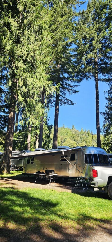
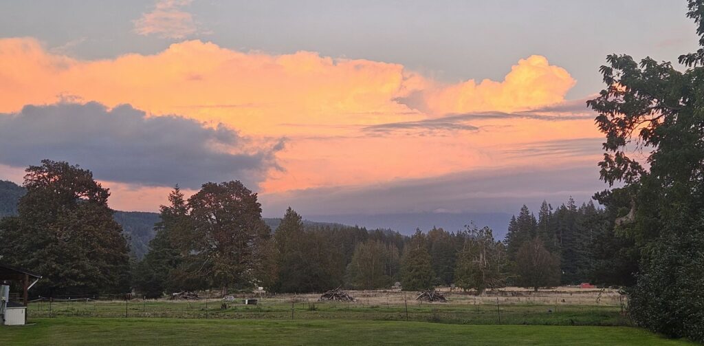
When we stayed near Concrete, Washington, in one of our Thousand Trails campgrounds, I considered it to be another one of the most beautiful campgrounds. We were among the tall trees in the Skagit River Valley of Washington state.
Grandy Creek Thousand Trails Campground, near Concrete, WA.Sunset at Grandy Creek Campground.
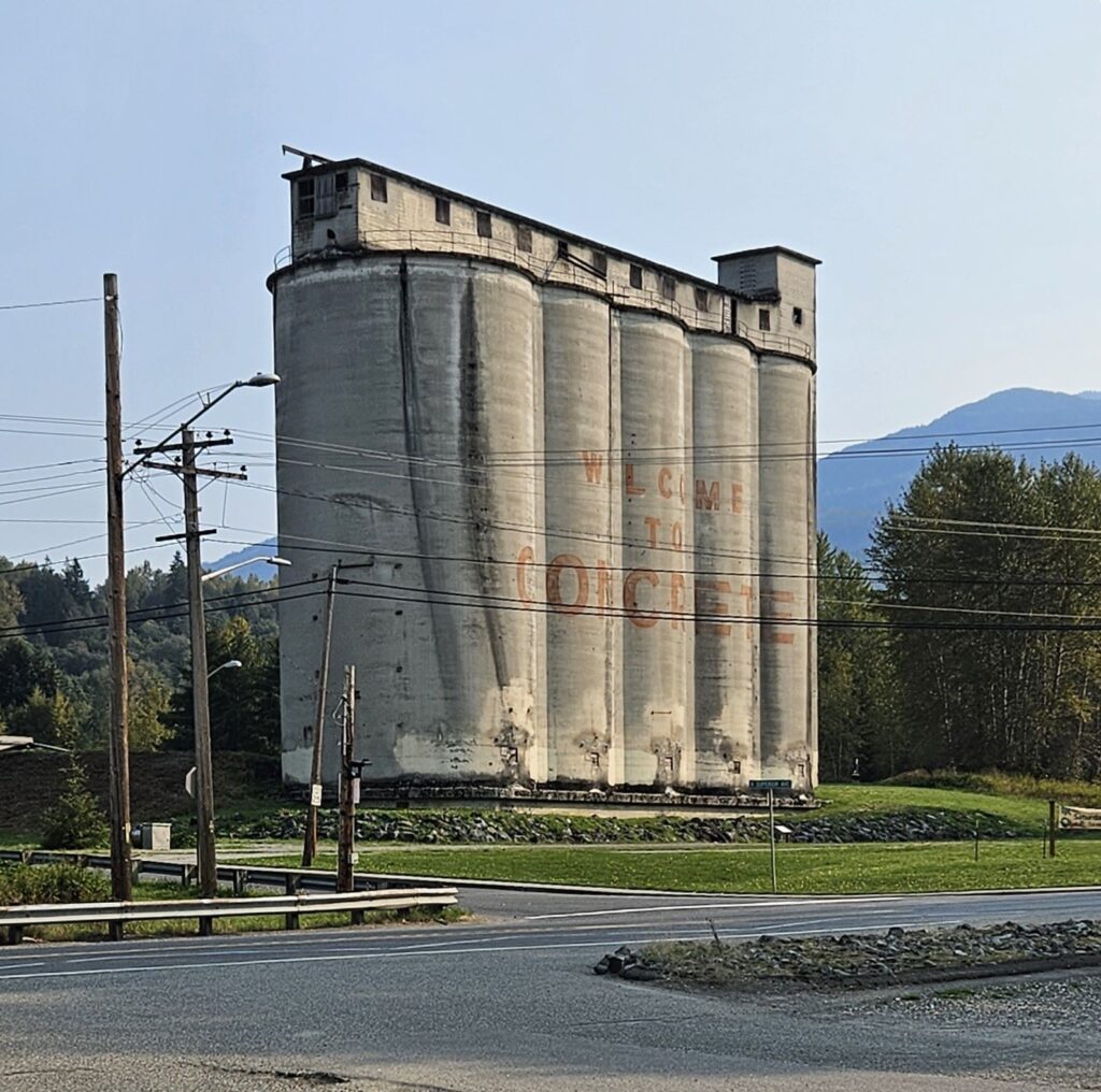
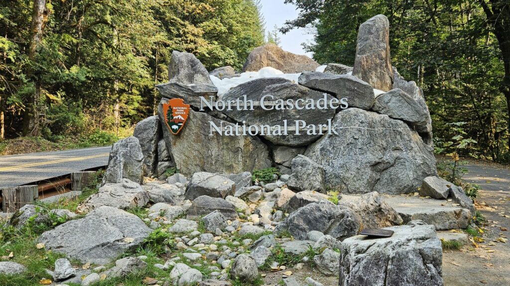
We were a few miles from the town of Concrete. Known as the gateway to North Cascades National Park, this town has a lot of historical character, such as these concrete silos at its entrance.
Town of Concrete, Washington
The first concrete plant in this town was built in 1905. Nearby was a limestone quarry. Today, it is a city park with a splash pad, playground, skate park and picnic area.
Skagit River next to Washington Highway 20
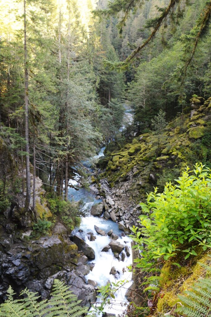
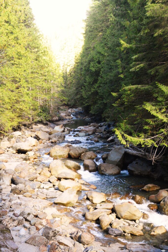
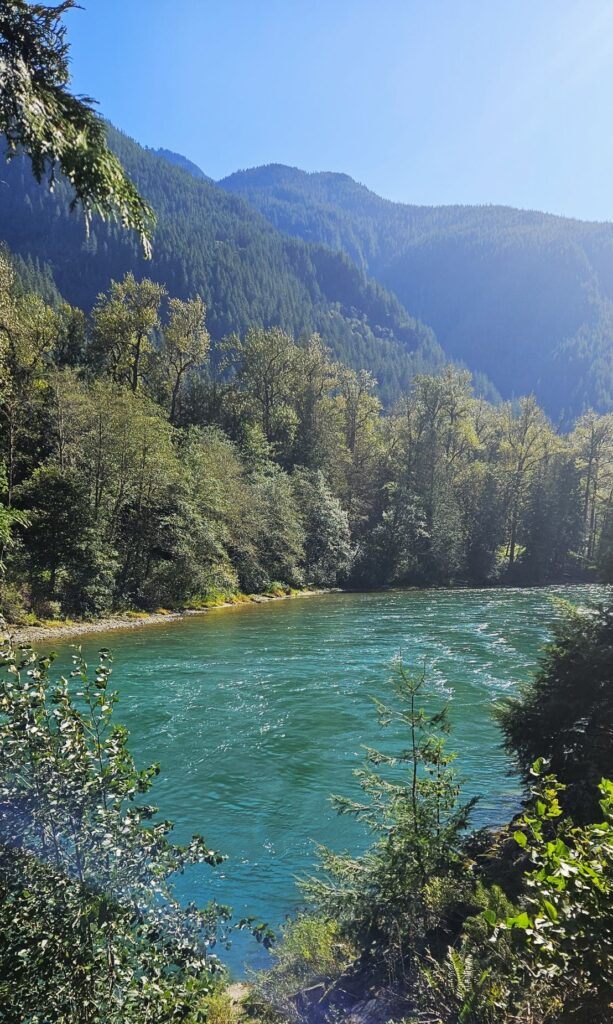
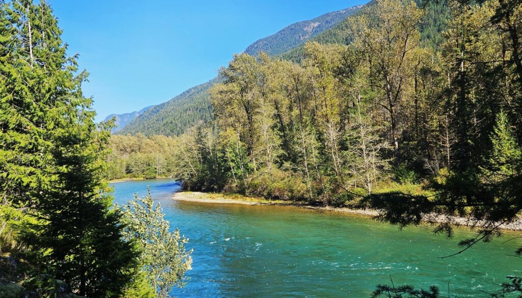
Highway 20 to North Cascades National Park goes right through Concrete and follows the Skagit River, a beautiful turquoise-blue waterway.
Skagit River
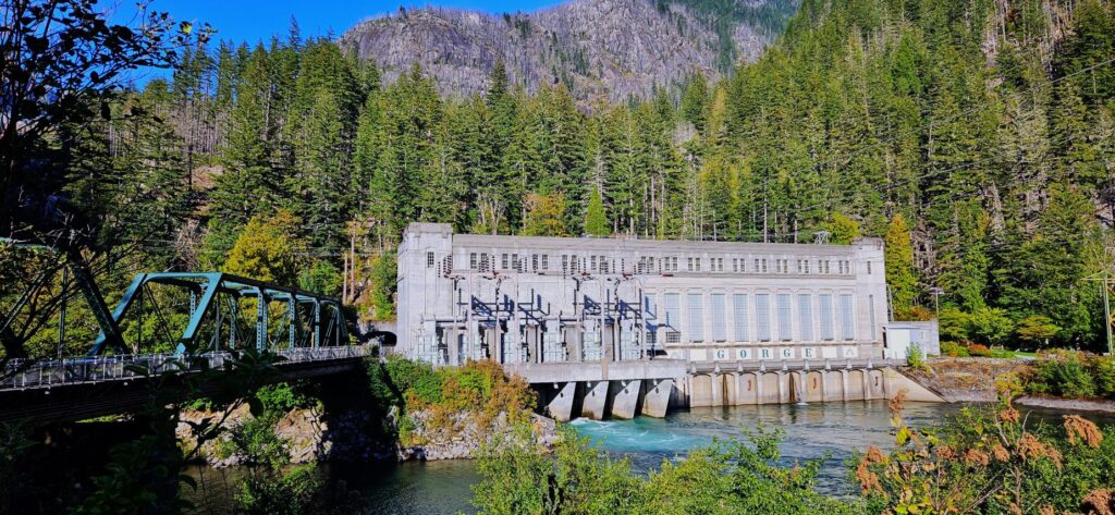
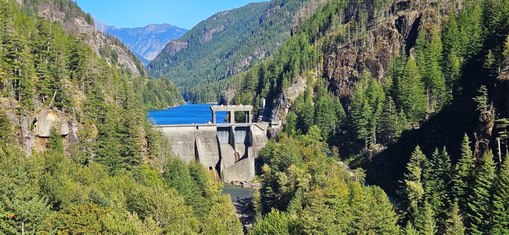
The Skagit River is also an important source of hydroelectric power for Washington. This is one of a series of powerhouses we passed on our way into North Cascades National Park. Hydro-electric power is of interest, especially to Ray, who worked at a hydro plant for several years.
Gorge Dam Powerhouse
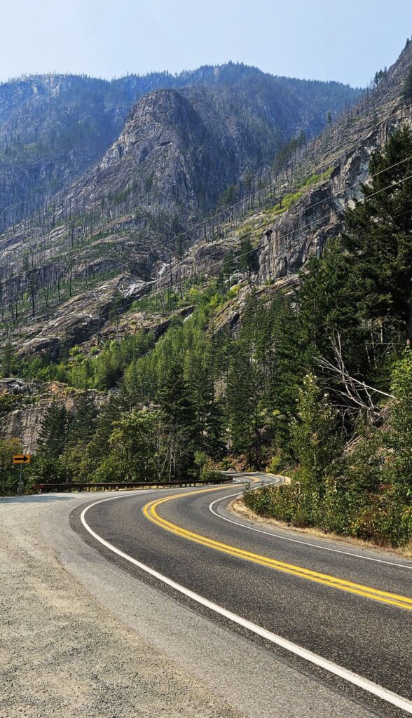
There’s only one main road through this national park, which is scenic Highway 20. It continues through the park and through the rest of Washington, all the way to the Idaho border.
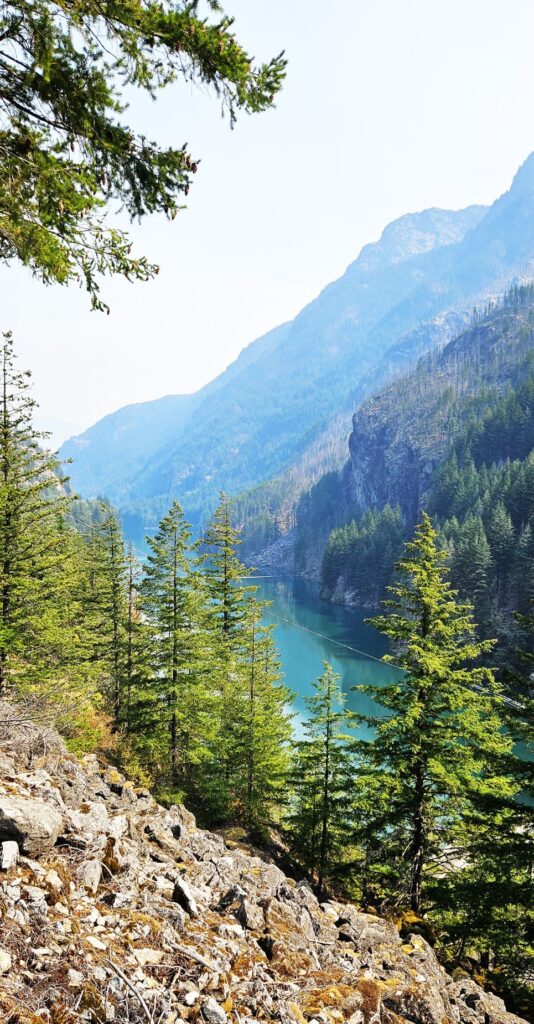
A description of the North Cascades is “mountains jutting sharply upward.” The mountains rise from 400 feet at the Skagit River to over 9,000 feet at Mt. Goode. With over 300 glaciers and multiple snowfields, North Cascades is the most glaciated area in the USA other than Alaska. However, not many were visible when we were there in late summer.
Mountains jut up steeply in North Cascades National Park
There were many wildfires in the park and surrounding areas on our first visit, so the skies were smoky.
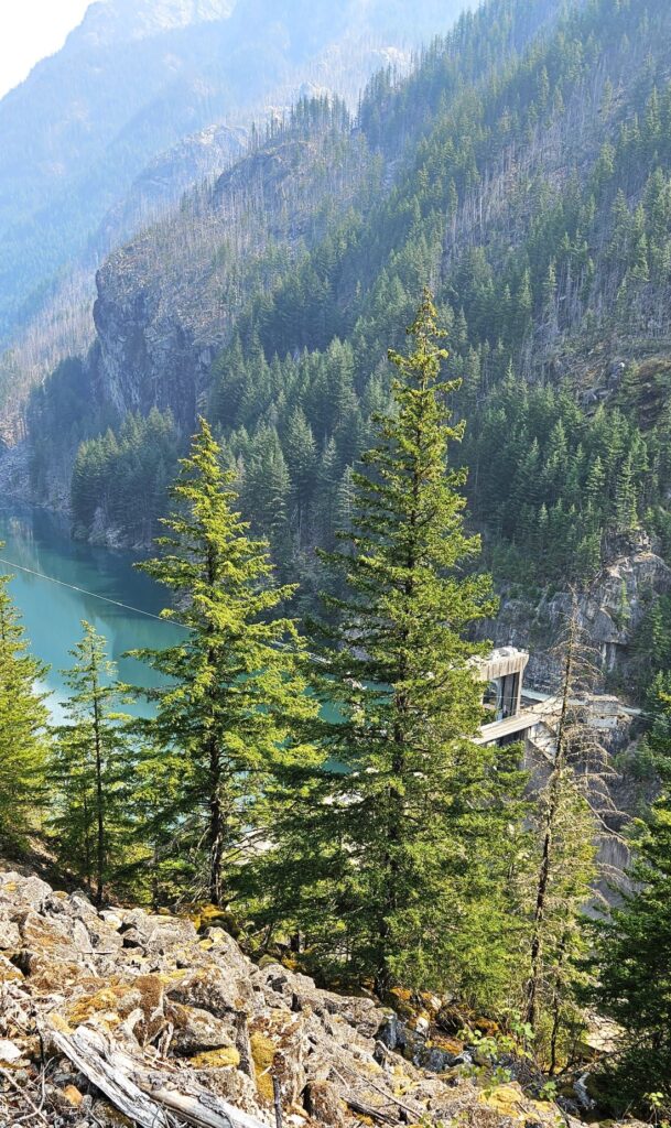
The Skagit River and its tributaries, the largest watershed that drains into Puget Sound, is one of many watersheds in the North Cascades. Dams like the one shown, not only provide hydro-electric power, but also flood control to areas downstream.
Gorge High Dam
Gorge High Dam was built in 1961. Upstream from it are the larger dams of Diablo and Ross. Gorge Dam, shown previously, fine tunes the flows from the upper dams.
Gorge High Dam on the Skagit River
Fine silt from glaciers grinding against rocks washes into the lakes and rivers. This “rock flour” is suspended in the water and refracts the light to give the lake its blue-green color.
Lake behind Gorge High Dam
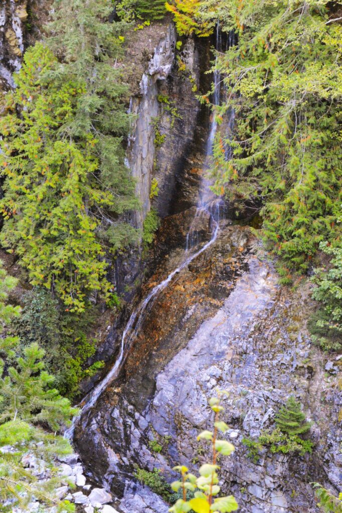
The steep mountainsides are perfect for the making of many waterfalls.The Cascade mountain range gets its name from the numerous waterfalls, and extends from northern California to British Columbia.
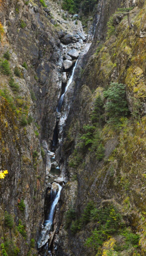
Gorge Creek Falls?
We visited in late summer when the waterfalls were at a minimum. There was a waterfall on each side of the road, so I’m not sure which one is Gorge Creek Falls.
Or, Gorge Creek Falls No. 2?
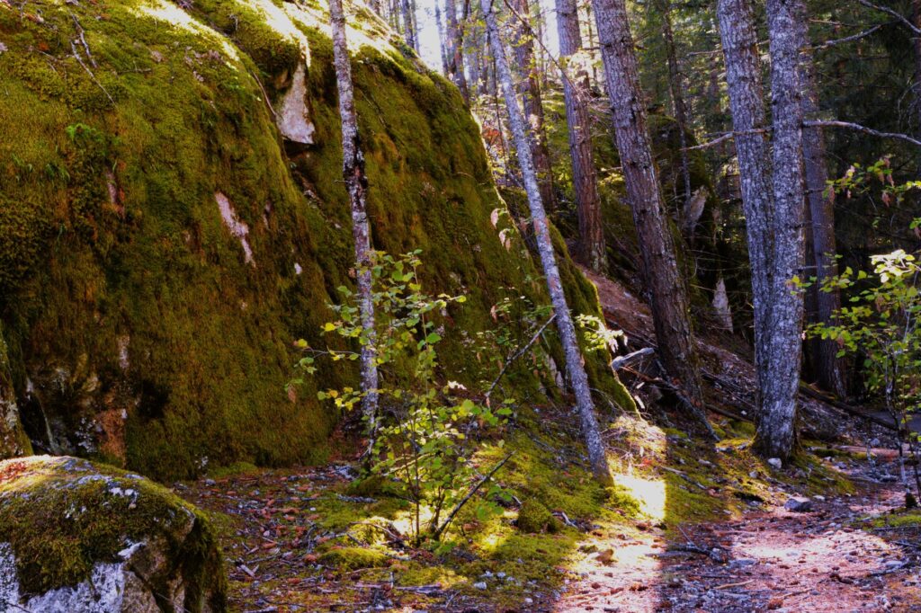
These rocks covered with thick green moss were really amazing and soft to the touch.
The next two photos were taken at Diablo Lake Overlook in nearly the same place. One was on our first visit when it was smoky, and the other on a clear day.
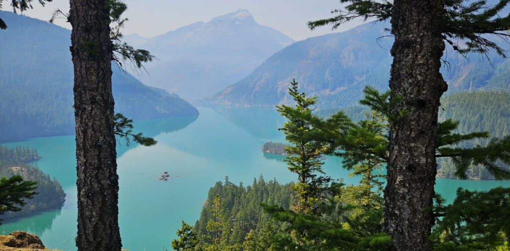
Diablo Lake Overlook
Diablo Lake was formed from Diablo Dam which was constructed in 1930. At that time, it was the tallest dam in the world rising 389 feet. Notice the islands in the lake.
Diablo Lake Overlook
A close up of the islands in the middle of the lake made me realize the size of Diablo Lake, and how high the overlook. Though the islands look small from the viewpoint, they are home to full size conifer trees.
Islands in Diablo Lake
Diablo Lake is just one of 500 lakes and ponds scattered throughout the mountain landscape of the North Cascades.
We drove further into the mountains until we were nearly to Washington Pass before we turned around and headed back home. It was a beautiful drive, in spite of the smoke.
For the mountains may move and the hills disappear, but even then my faithful love for you will remain. My covenant of blessing will never be broken,” says the Lord, who has mercy on you. Isaiah 54:10
Highway 5 cuts through the western part of Washington state, leading to Seattle. Any main roads near Highway 5 and surrounding cities can have heavy traffic almost anytime of day. To get to Fall City, a small town east of Seattle, and to avoid heavy traffic, we had to trick our GPS into taking us further east. The route we took was on back country roads through many small towns. The drive was really beautiful and much more relaxing.
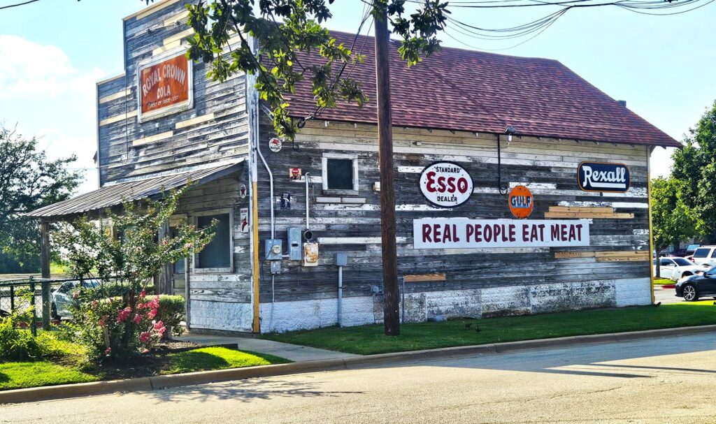
Country store in small town of Washington
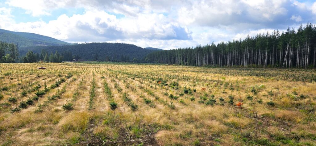
One of Washington’s main industries is lumber. We saw many acres of forested land. Where the trees had already been harvested, we saw many acres replanted with new trees.
New trees planted to replace the harvested ones.
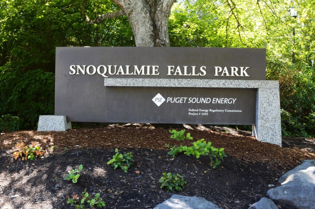
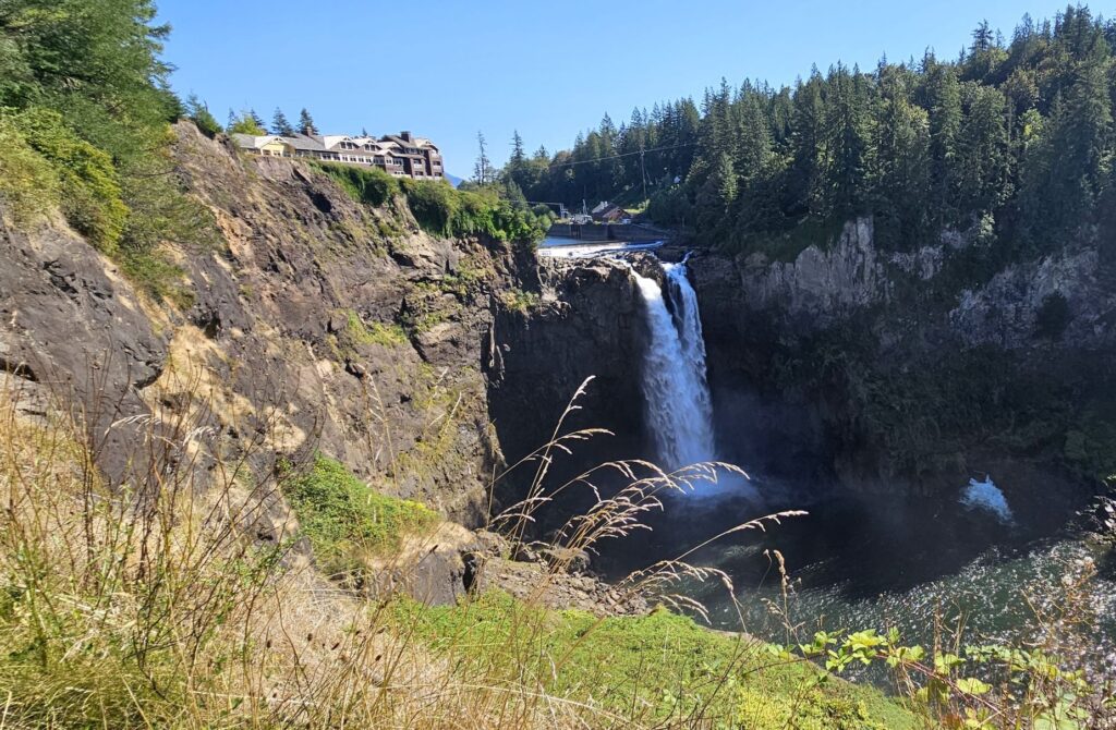
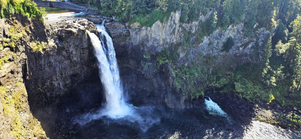
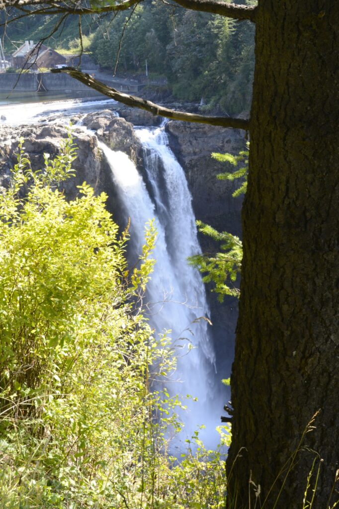
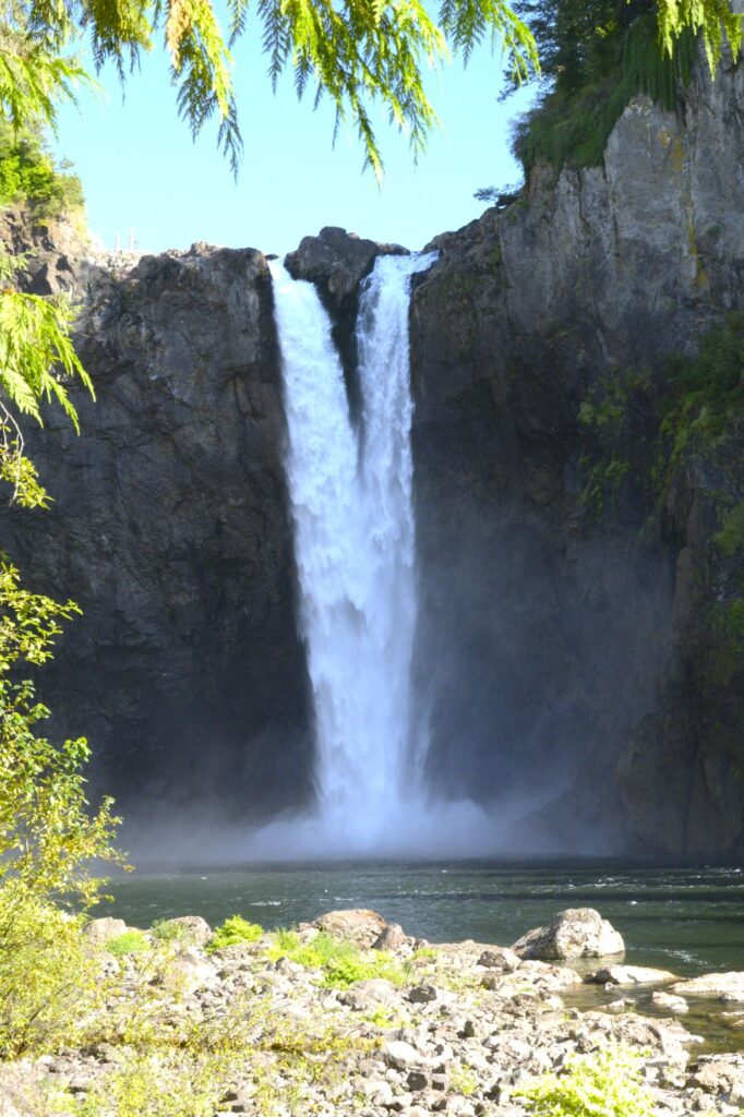
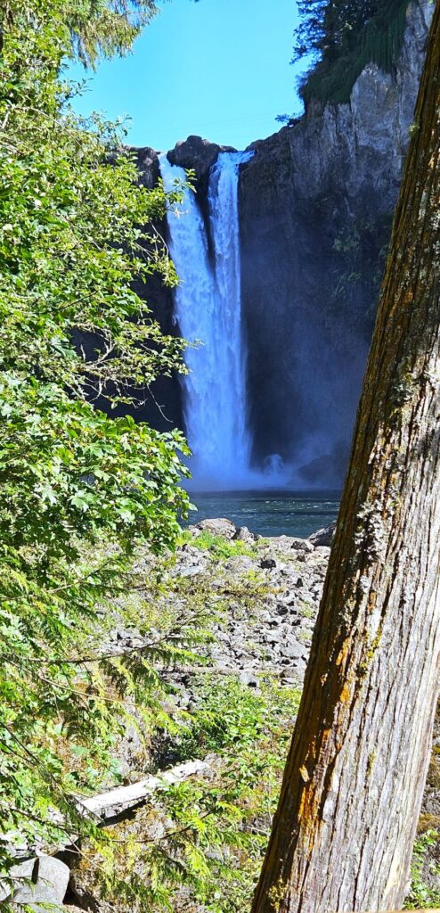
Snoqualmie Falls
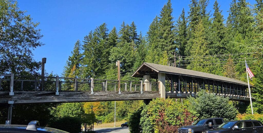
It was just a short drive from our campground in Fall City to Snoqualmie Falls, one of Washington’s most popular scenic attractions. This two acre park includes an observation deck overlooking the 270 foot waterfalls. There is free parking and a pedestrian bridge crossing the highway to the park.
Pedestrian bridge from parking lot to park.
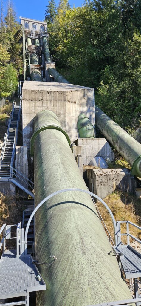
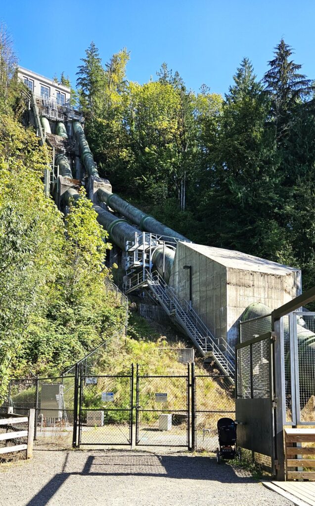
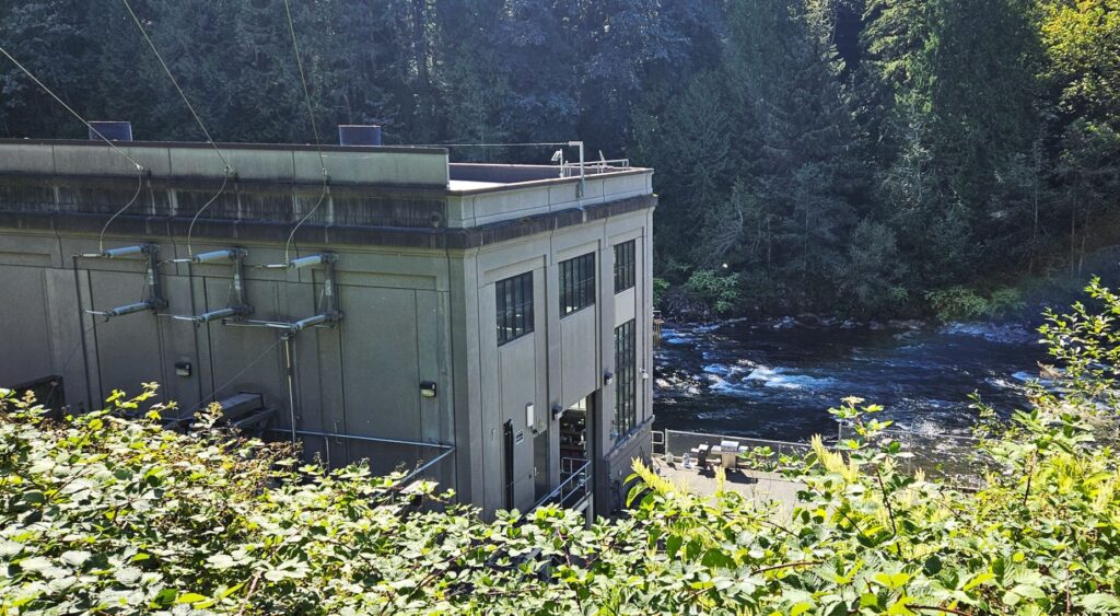
The park has information about the history of the waterfalls and the underground power plant. An underground power plant was built in 1890. The original generators are still functioning today.
It would be fun to stay in the Lodge at the edge of the cliff. At night time, colored lights light up the falls. The Lodge also houses a nice gift shop and restaurant.
From the top observation deck, we could see the waterfalls and the outlet for the underground power plant.
It was late summer when we visited and the water flow was low. In spring time, the water falls can cover from one side to the other in a huge torrent.
There’s a mile and a half trail to the bottom of the falls, or one can drive a couple of miles to a parking lot at the bottom. From the bottom on our way to the falls, we passed the penstock carrying water diverted from the river to the power house below.
Penstock for lower power house.
We walked by the power house to a catwalk along the river leading to another observation point.
Lower power houseSnoqualmie Falls from the lower observation point.
No one is allowed down along the riverbank because of the danger of quickly rising river levels. These two power plants supply power to the surrounding areas.
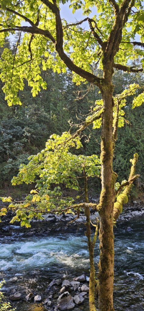
Afternoon light on tree by Snoqualmie River
Monroe, Washington
We moved to Monroe, Washington, just a short distance from Fall City. This campground was along a river. Washington has no shortage of rivers. In the evening, we took a walk down to the river. In one direction, the sun was fading on the peaceful river.
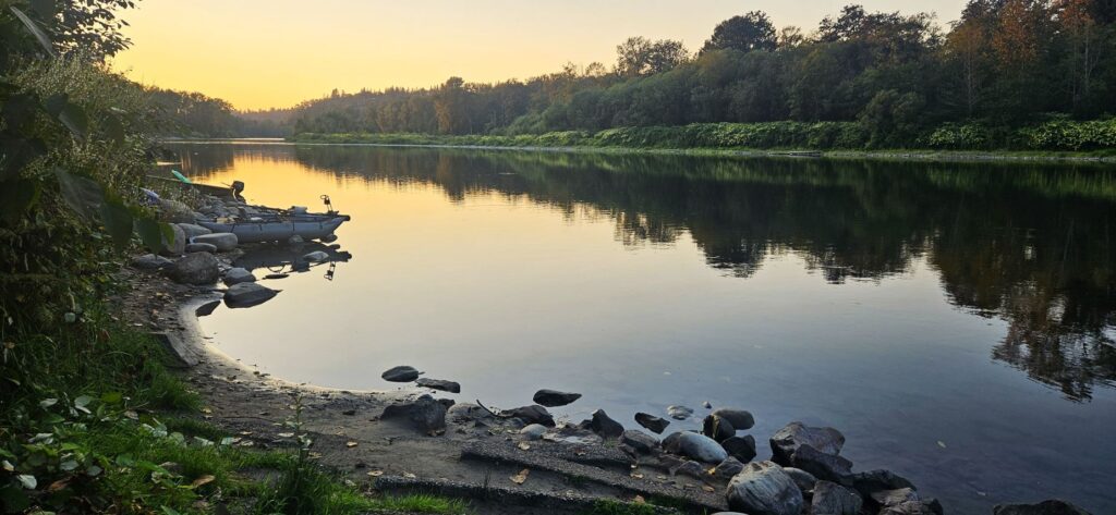
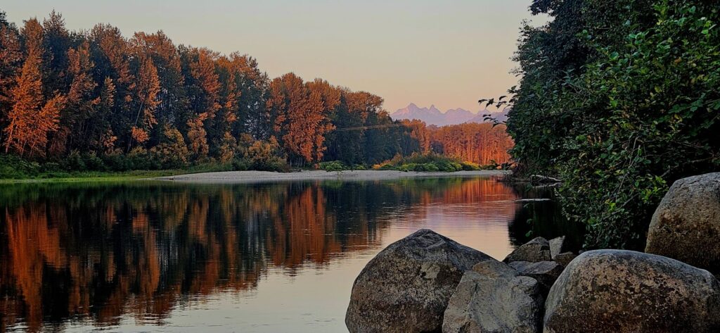
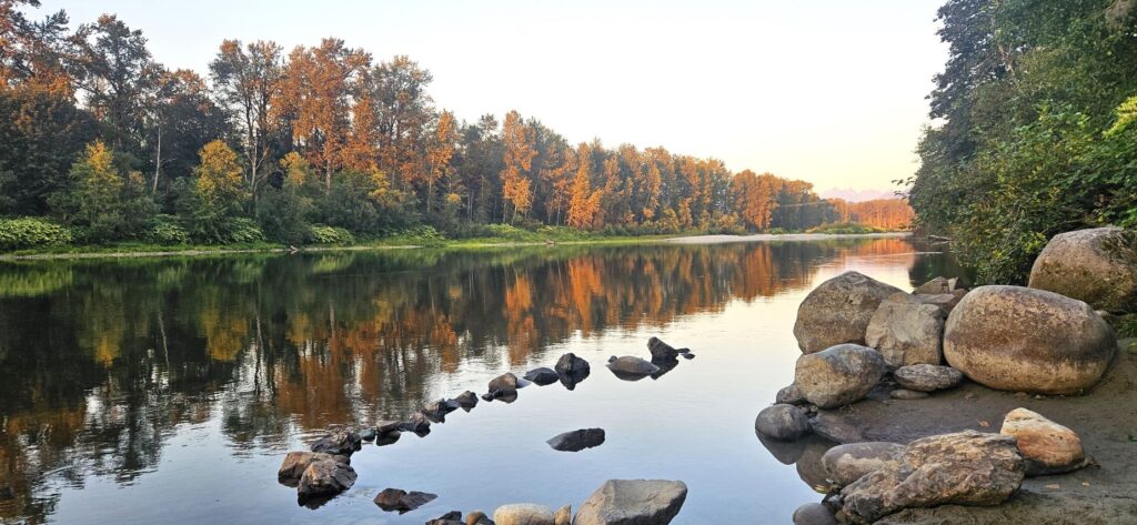
Skykomish River, Monroe, Washington
In the other direction and later on, the sun lit up the trees in autumn colors while the jagged peaks of the Cascades could be seen jutting up in the distance.
Skykomish River, Monroe, Washington
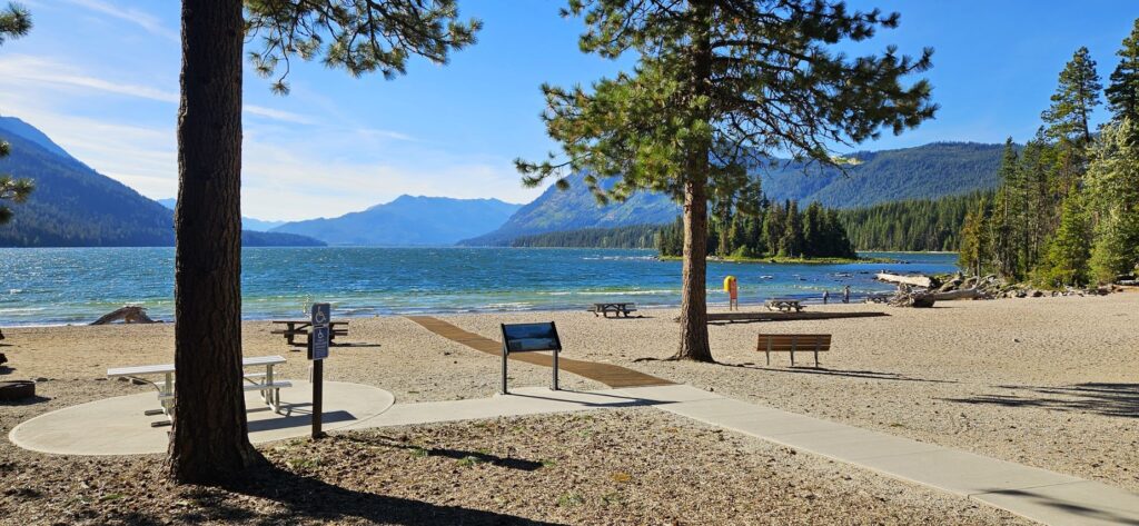
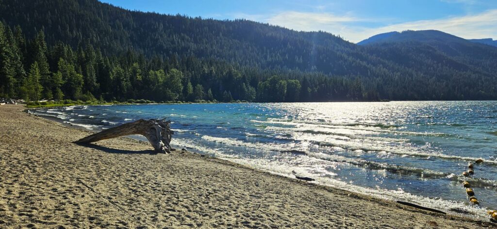
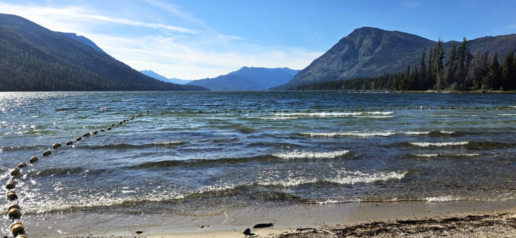
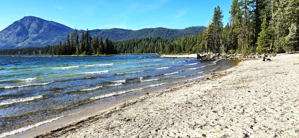
While we were in Monroe, we drove up Highway 2 beyond Stevens Pass to Lake Wenatchee. It’s only a few miles from Leavenworth. Homes line most of the lake edge, but we were able to find a beach access from Lake Wenatchee State Park with a nice walkway clear to the water’s edge.
It was a windy day, so not many people were out enjoying the water.
There was a roped off swimming area. A couple of islands with tall trees made me want to sail out and walk around on them.
Waves from the wind lap the shoreline.
Lake Wenatchee is such a pretty area. If it hadn’t been so cold and windy, we might have spent more time enjoying the scenery.
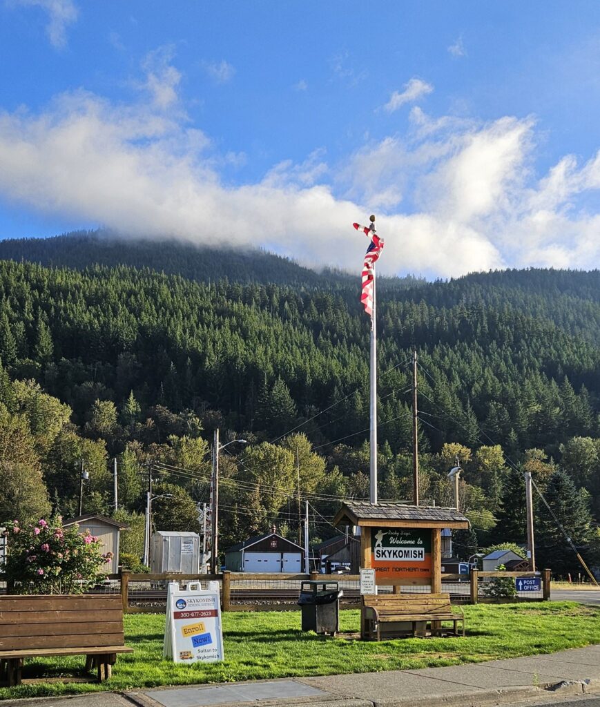
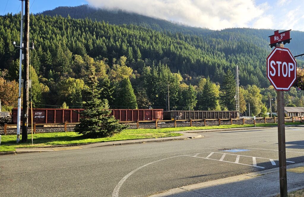
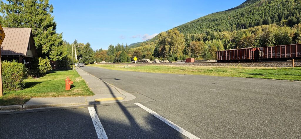
Skykomish, Washington
On our way home, we drove through the town of Skykomish, a Great Northern Railroad town. It’s a quaint little town.
Skykomish, a Great Northern Town
I liked the caboose-shaped road signs, and of course, the train in the background. The railroad was originally built to go from Montana to the Pacific Ocean.
Main Street is short, but today about 20 trains pass through this little town with shipments of products from all over the US, and even from foreign countries. Amtrak passes through twice a day, once from each direction, between Seattle and Chicago.
We enjoyed exploring the back roads near Fall City and Monroe, Washington. Soon we were off to another destination further north.
Make me know Your ways, Lord; Teach me Your paths. Psalm 25:4