Fort Davis National Historic Site

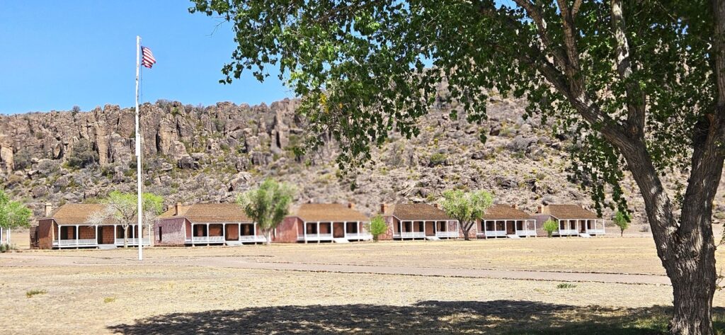
Imagine traveling 200 miles from San Antonio to El Paso, Texas, in the mid-1800’s by wagon, perhaps on your way to the gold fields in California. Travelers on this mountainous desert route were often raided and killed by Indians who were looking for food and livestock to supplement their hunter-gatherer way of life. This conflict caused the United States government to build and maintain a series of forts along this road. Fort Davis was one of these forts.

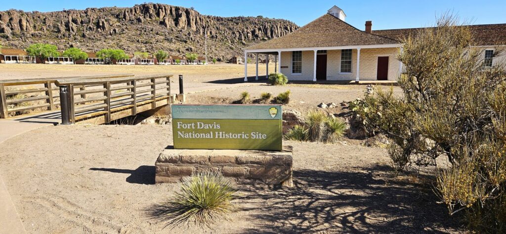
On our way going west out of Texas, we visited this historic Indian Wars’ frontier military post. Many of the buildings have been preserved, and some have been restored and furnished in period furnishings. We weren’t allowed to walk on the parade grounds because of the existence of artifacts still to be unearthed.

Parade Ground in front of row of officers’ quarters

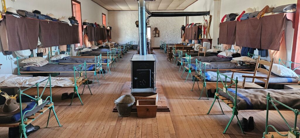
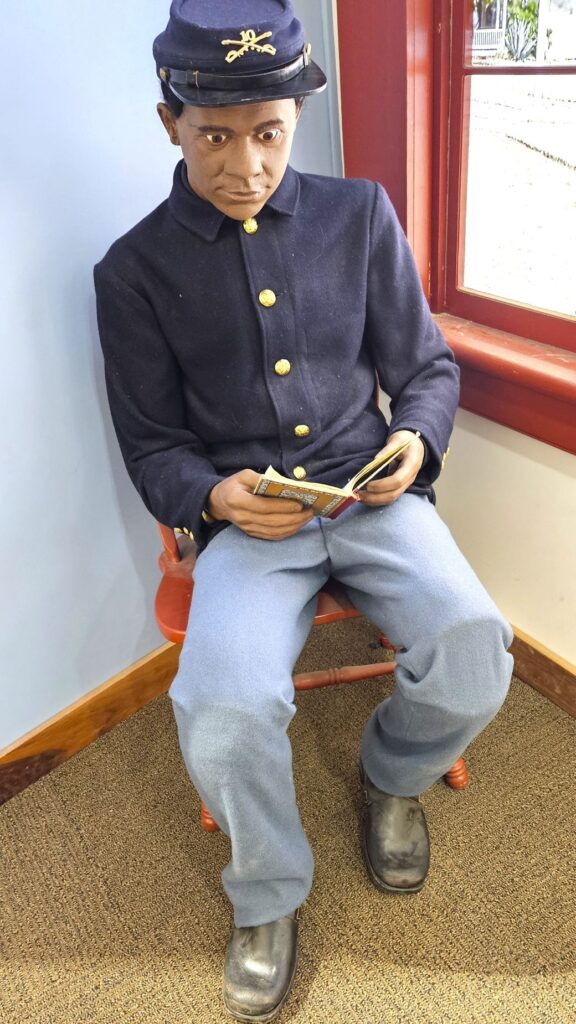
As we walked through the barracks, we learned that 26 soldiers lived together in one large room. There were quarters for up to 400 soldiers at one time. During their free time, they played cards or checkers, sang and danced, read newspapers and books from the post library or strolled around.

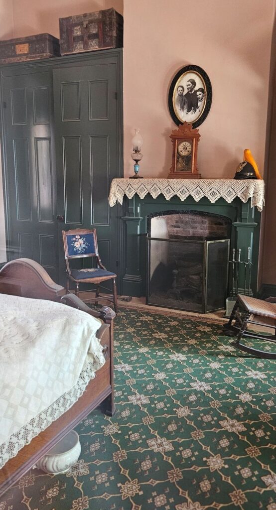
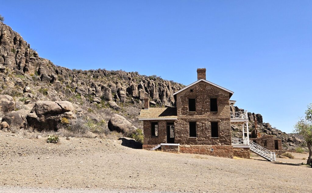
The commanding officers’ quarters were much better. Many of the officers brought their wives and children with them. Wives sometimes worked as laundresses, hospital workers, or servants to other officers’ families.

Officer’s Quarters

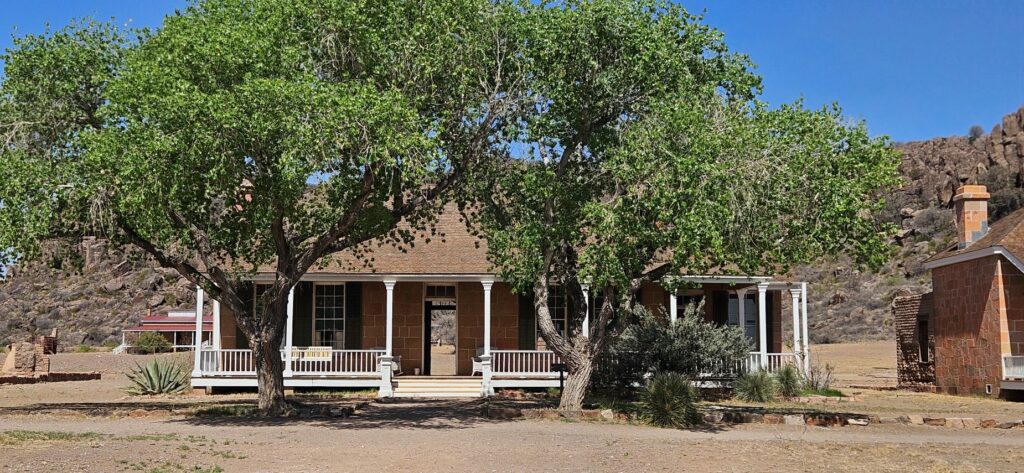
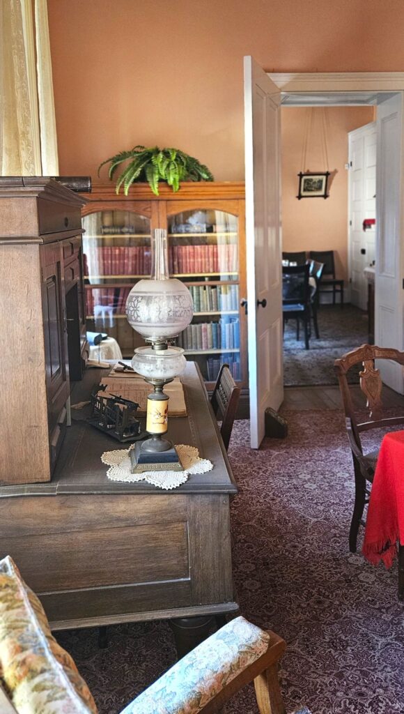
Even though they were far from civilization, the officers brought nice furniture with them to furnish their homes.

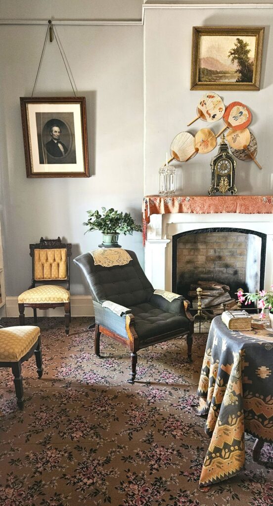
Below, a photo of the wife of the officer and his two children hangs above the mantle in the bedroom. The officer’s helmet is on the fireplace mantle.

Bedroom in Officer’s Quarters
Officer’s House

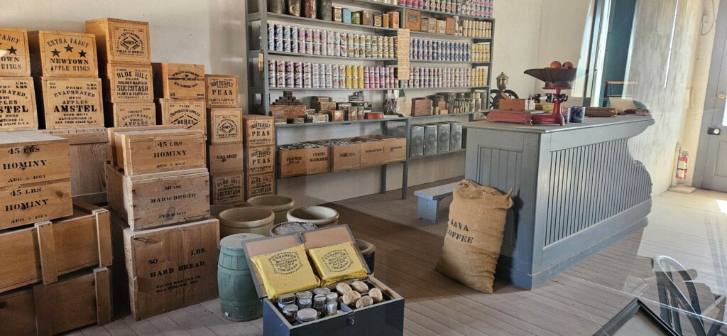
The Commissary stored food for the outpost. However, food had to be transported long distances. Food was sometimes already spoiled by the time it reached the fort. Some food was grown or bought locally, however.

Fort Davis Commissary
Commissary Storeroom
Supplies had to be brought in by wagon

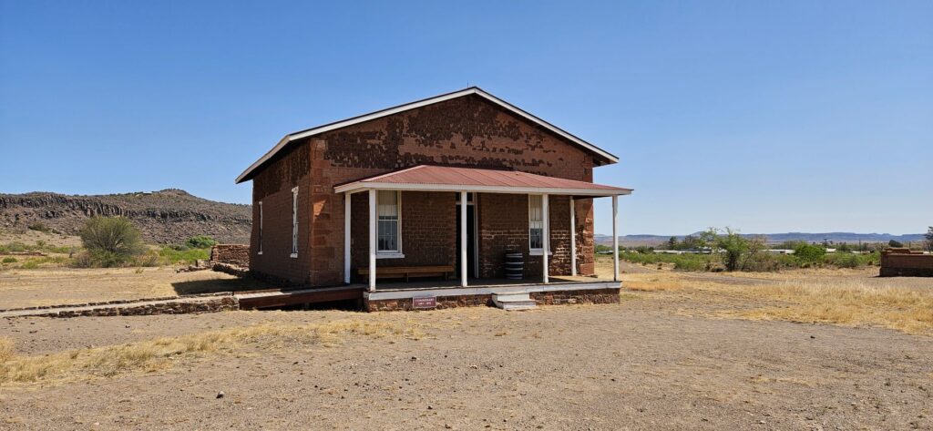
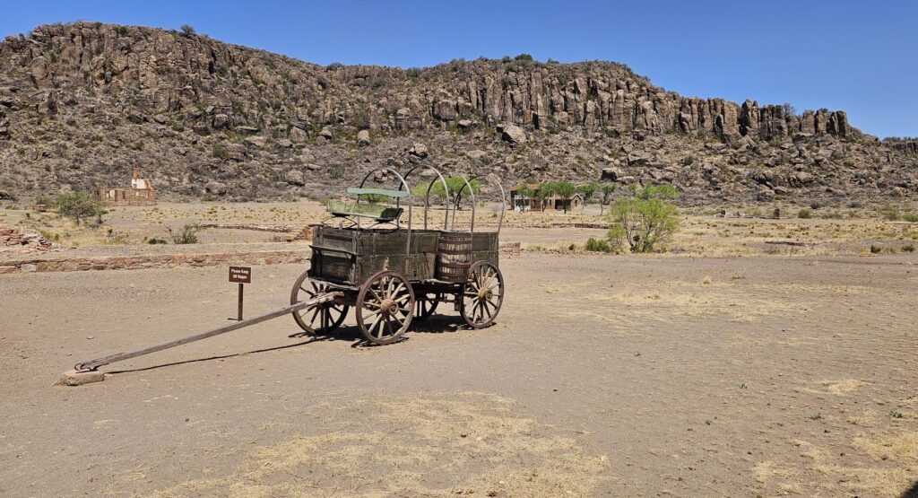
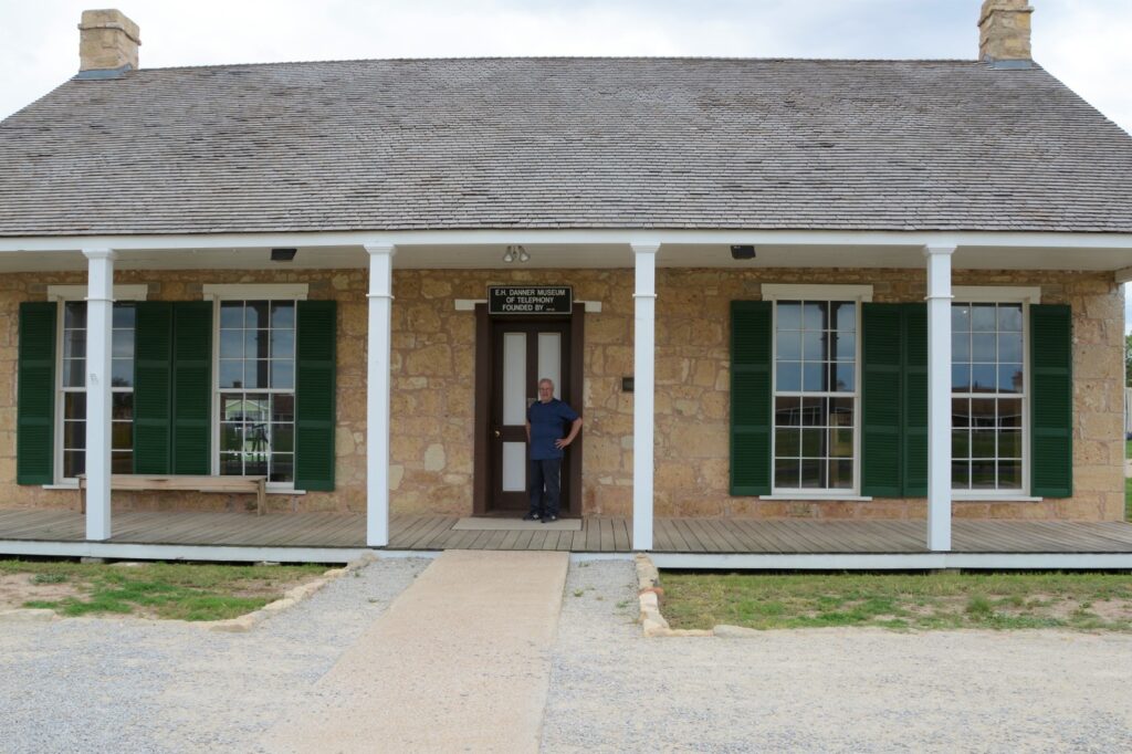
There were many structures on this 460 acre park. Of the 24 buildings that have been restored, only five are refurbished. There are also over 100 ruins and foundations. During the summer months, there are living history demonstrations. We were too early for that, however.

Two-Story House (not restored)

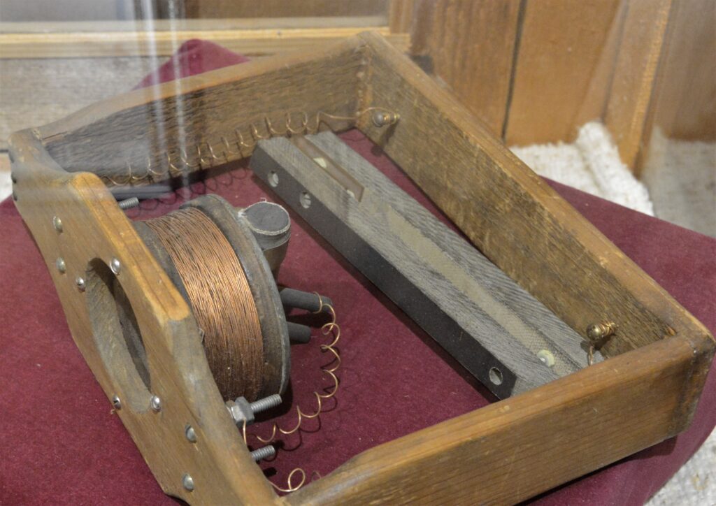
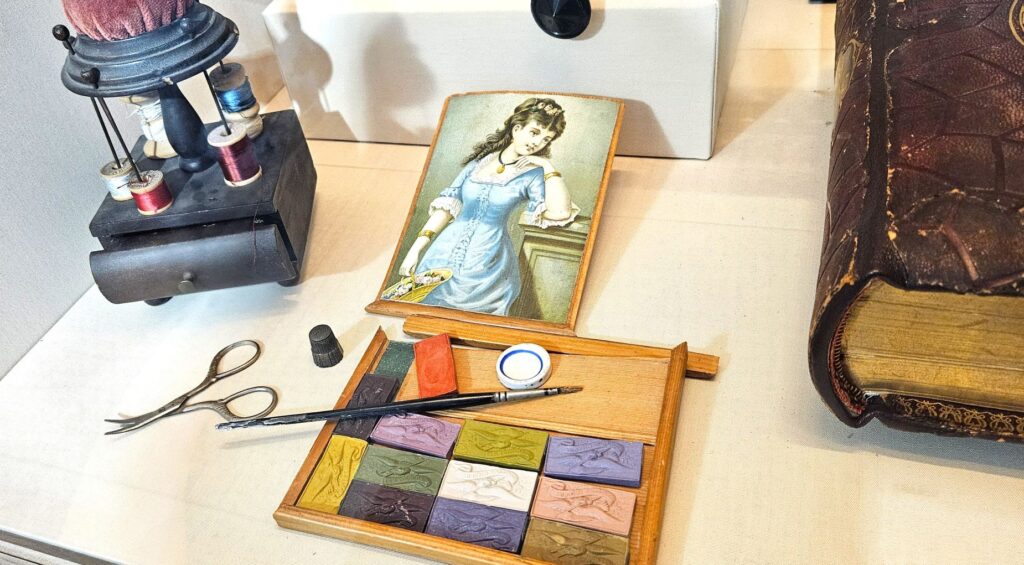
There’s a museum at the entrance to the park. This paint set and sewing kit were among the artifacts.

Sewing kit and paint set in museum

After the Civil War, Congress passed legislation to increase the size of the army and to require a certain amount of black soldier units. Some were stationed at Fort Davis.

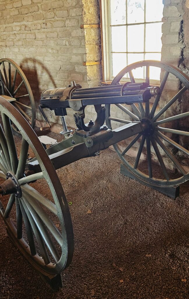
These Buffalo soldiers not only engaged in over 100 Indian skirmishes, but they also built many structures on the post, strung over 300 miles of telegraph wire, and built a water delivery system that supplied running water to the garrison.

Gatling Gun

The main purpose of Fort Davis was to protect west Texas from the Comanches and Apache Indians. The Indians were eventually forced into Mexico where they were killed by Mexican soldiers. This ended the Indian Wars. The soldiers at Fort Davis also provided protection for wagon trains and mail coaches and survey parties. By 1891, the fort was abandoned, having outlived its usefulness.

Our campsite at Davis Mountains State Park

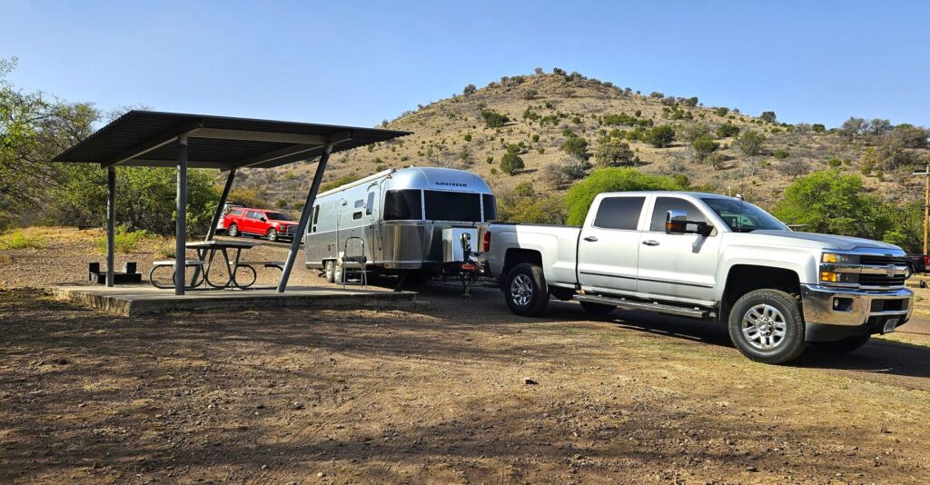
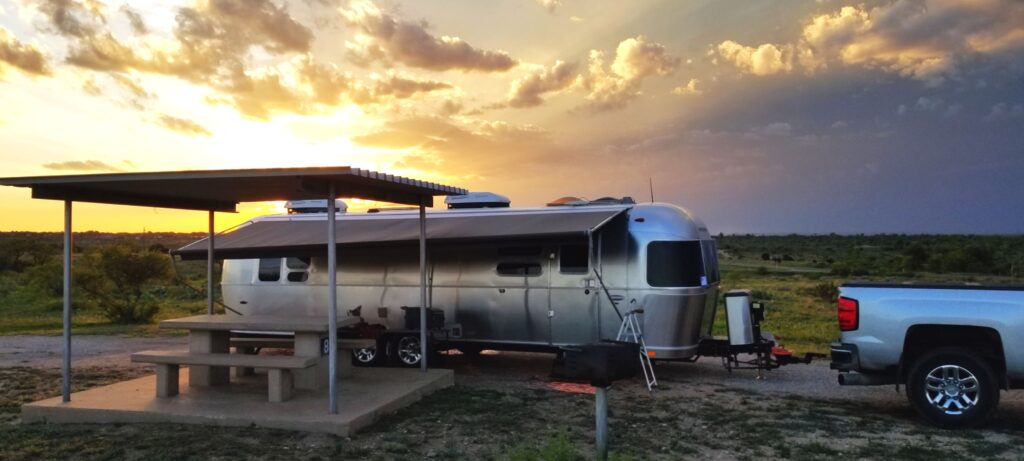
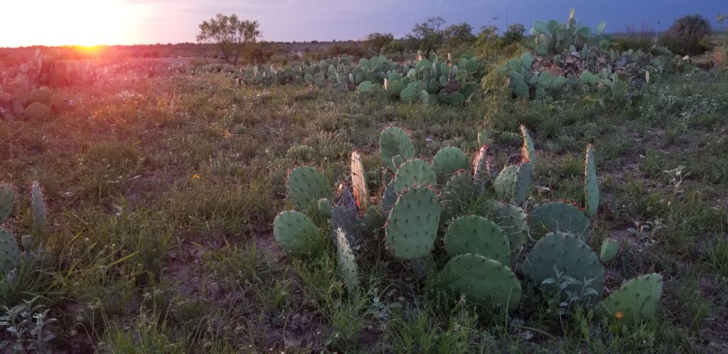
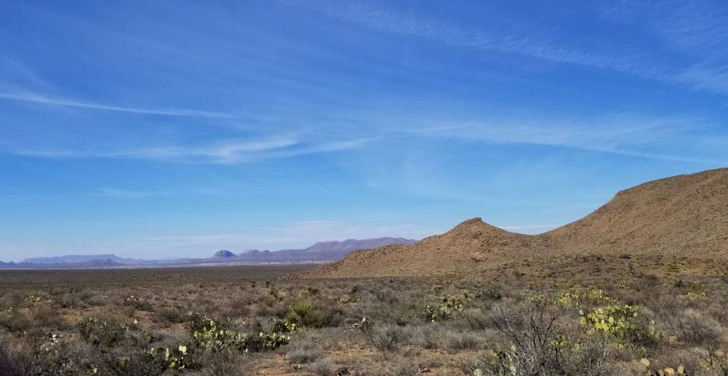
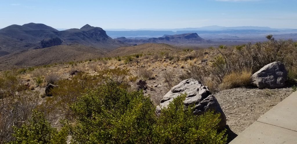
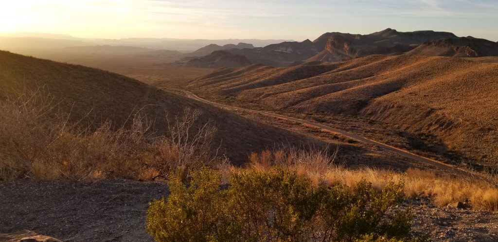
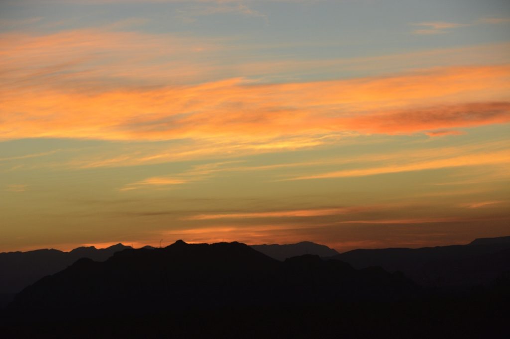
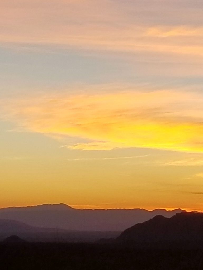
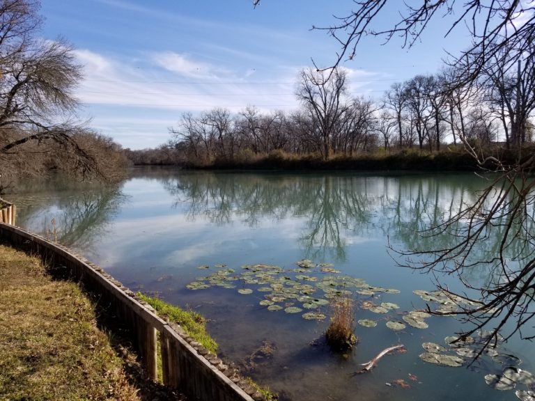
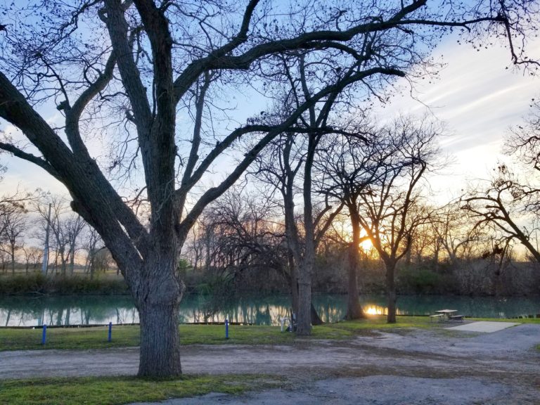
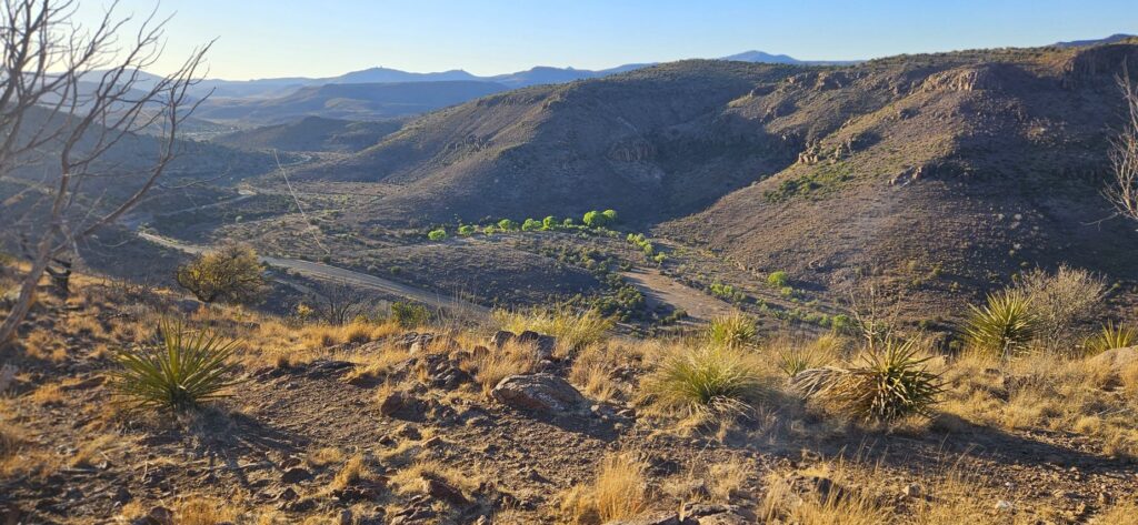
We stayed in Davis Mountains State Park Campground while we were there exploring the area. This state park is unusual, in that, it had full hookups at the campsites. There was a road that went up the mountain to a lookout. This photo is from the viewpoint looking toward the campground.

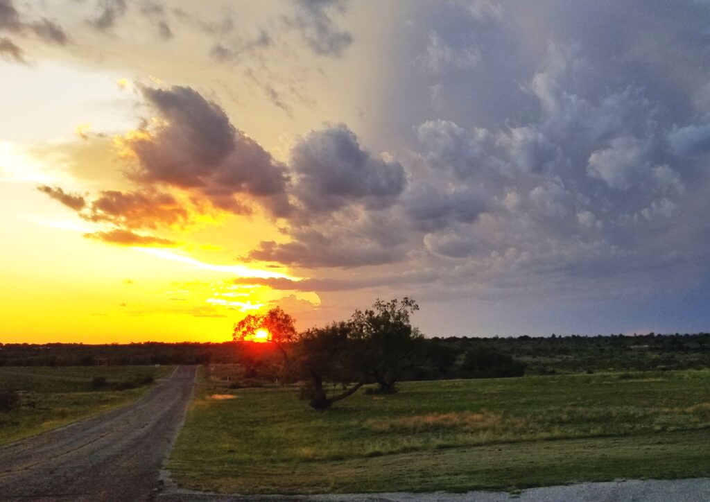
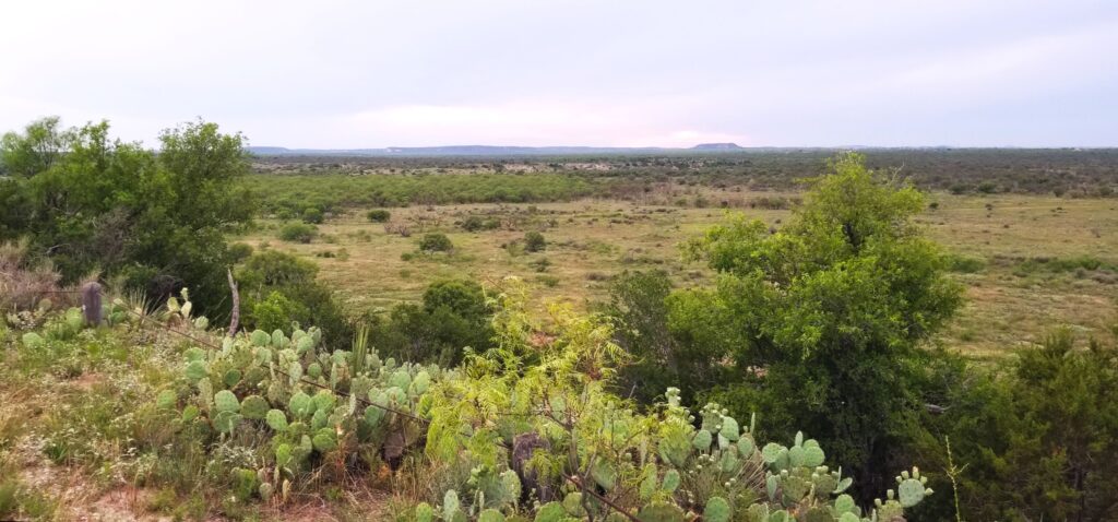
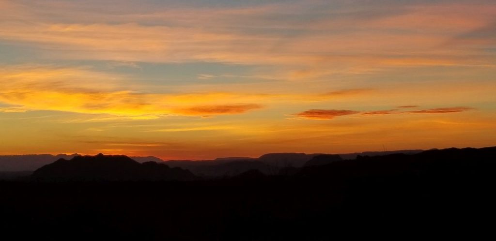
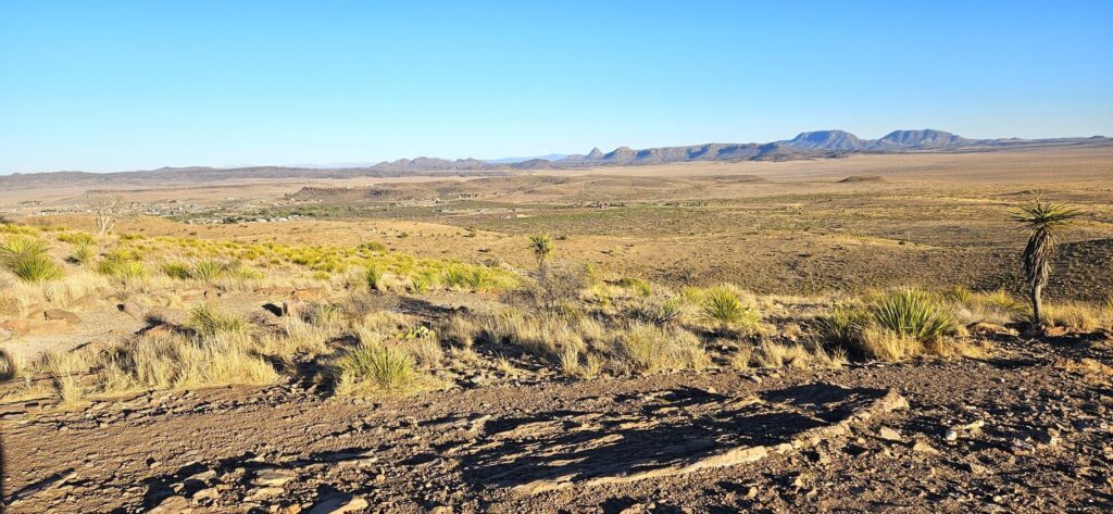
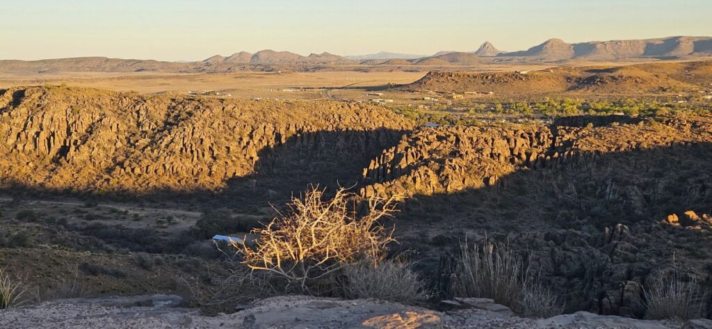
This next photos are looking toward the town of Fort Davis. We could see a long way.

Lookout at Davis Mountains State Park near Fort Davis.
Lookout at Davis Mountains State Park

Fort Davis played an important role in the West. Learning about their lives and hardships makes me feel grateful for their contributions in settling the west. Fort Davis is a national historic park, so I was able to get my National Parks Passport book stamped once again and add another sticker to my journal.

Murals of San Angelo, Texas

One of our favorite Texas towns to visit was San Angelo. We stayed in San Angelo State Park Campground where we had some great views of the evening sunsets.

Our campsite at San Angelo State Park

The weather was fickle with cloudy skies in the morning and rain and thunderstorms in the afternoons with clearing in between.

We sometimes went for walks in the evenings.

This part of Texas is dry and cactus, especially prickly pear, thrive.

One evening we drove to a lookout in the park where we could see for miles.

Lookout at San Angelo State Park

We drove into San Angelo to see some sites. Ray wanted to see the telephone museum located at Fort Concho, an historical fort established in 1867 to protect the frontier settlements. Fort Concho is now a National Historic Landmark, so I was able to get a stamp for my National Parks Passport book.

Fort Concho Museum of Telephony

The museum has on display a unit designed and made by Alexander Graham Bell. There were only five made and only two in existence today.

Unit designed and made by Alexander Graham Bell in 1876.
Old phones from Museum of Telephony in San Angelo, Texas

San Angelo is known for their historic murals depicting the history of the area. We went on a search to find as many as we could. The first one we saw was near the Train Museum and depot. It was about all the forms of transportation used throughout their history.

Four murals capture the history of transportation.

Up closer, they look like this.

Horse and buggy days.
Stagecoach was a form of transportation in the early days.
The Iron Horse was a vast improvement for transporting goods and people to the west.
The airplane made the vast Texas distances seem much smaller.

One of the things we were told to look for were sheep. They are decorated and found all around town. This one was at the Train Museum and Depot. We wanted to see the train museum, but we were on a mission to find the murals. We decided to save it for another time.

Train Museum and Depot

Most of the murals are found near the old downtown area of San Angelo. Since they are painted on the sides of buildings in parking lots, sometimes it was hard to get a clear photo of them. This one is of a local author who writes westerns about the Texas Rangers. His name is Elmer Kelton. I have not read any of his novels, but they sound interesting.

I stumbled across the Blacksmith mural while looking for another mural. This is right across the street from the famous Eggemeyer’s General Store. While taking a photo of Eggemeyer’s from across the street, I came upon another sheep!

Sheep #2
Eggemeyer’s General Store

This store has so much in it, it could take hours to see it all. I liked the Indian with the lollipops in his headdress.

Indian Lollipop holder

There were all kinds of candies, chocolates, sweets, jewelry, household goods, teapots, teacups, knickknacks, vintage signs, vintage toys, aprons, hand towels, kitchen items, bandanas, cards, stationery, and even an old car in the men’s section.

The men’s section had an old car.

The best thing about living in a travel trailer is that you’re not tempted to buy anything because you don’t have room. The worst thing about living in a travel trailer is that you can’t buy anything because you don’t have room.

I enjoyed just looking at all the kitchen items.

I collect photos of street clocks. Here on this same corner was a street clock.

Street clock in San Angelo, Texas

We wanted to find some more murals, and to my surprise, I found three more on the opposite street corner. These three were together and depicted the military history of the area. Ray was stationed in San Angelo for training at Goodfellow Air Force Base. He had a five and a half month long advanced electronic repair training.

Goodfellow Air Force Base mural

San Angelo Army Air Field was only used from 1942-1945 for training bombardiers for combat missions. It was closed after WWII and today is a civil airfield called Mathis Field.

San Angelo Army Air Field Mural

Fort Concho, as mentioned earlier, was a fort established to protect frontier settlers. William “Pecos Bill” Shafter commanded here along with other notables. Also, the 9th and 10th Cavalry Regiments and 24th and 25th Infantry Regiments were all black soldier units known as the Buffalo Soldiers.

Fort Concho Mural

Here’s a closer look at some of the details.

Fort Concho Mural

By now, we were hot and tired. We managed to find one more mural. This one was not mentioned on the website list of murals. I call it the Dry Goods Mural. There were two or three more that we missed or couldn’t find.

Dry Goods Mural

There were many more things we would have liked to see, but there just wasn’t time and energy for them.

We did, however, drive into town to see Lone Wolf Bridge in the evening. It was supposedly lit up at night, but though we stayed for awhile after sunset, we never saw any lights. It looks like a hangout for taggers. The bridge is covered with graffiti, It’s a sketchy area at night. So we left.

Lone Wolf Bridge

You can read about this historic bridge below.

If you ever get to San Angelo, there are lots of things to see. The top of my list is the water lily gardens and the murals. And don’t forget to take a picture of a sheep! They are all over town.

For a photo tour of sheep and their “ewe”-nique names, click on this link:

https://www.downtownsanangelo.com/sheep-gallery

Big Bend National Park

Big Bend National Park Entrance at Maverick Junction

From the tip of southern Texas, we traveled northwest along the Texas/Mexico border to the “bulge” of southern Texas. It is appropriately called “Big Bend” because that is where the Rio Grande River makes a huge bend toward the southeast and then bends back to the northeast. In the crook of this huge bend is Big Bend National Park.

Spring was a perfect time of year to visit before the heat set in. It was still chilly at night, and not many cacti or wildflowers were blooming yet except for a few bluebonnets (the Texas state flower) that were starting to bloom by the roadside.

Bluebonnets

We stayed in an RV park in the town of Terlingua (Ter-ling-gwa), a little town that got its start in the 1880’s when “quicksilver” (mercury) was found in the area.

The first thing I noticed was how vast this area is that Big Bend encompasses. You can see the purple mountains in the far distance, and somewhere beyond those mountains is the Rio Grande, and beyond them is Mexico. Though it is only #15 on the list of the largest national parks, Big Bend National Park is over 800,000 acres, and is larger than Yosemite National Park.

There are plenty of things to do in Big Bend NP including scenic drives, day hikes, river trips, bird watching, fishing, horseback riding and stargazing. Speaking of stargazing, Big Bend has the darkest night skies of any national park in the lower 48 states and is designated an International Dark Sky Park.

The Big Bend NP website has suggestions for scenic drives. We drove on all the paved roads in the park. The Ross Maxwell Scenic drive took us to Sotol Vista where we had a view over the entire valley. The notch in the distant ridge is where the road would end. That is where the Rio Grande cuts through steep cliffs at Santa Elena Canyon.

Sotol Vista
Santa Elena Canyon at the end of the road.

This is the “notch” in the faraway ridge you were looking at in the last photo. But first, some sites along the way.

We stopped at the Mule Ears Overlook. You don’t have to have much of an imagination to see the “mule ears”.

Mule Ears Overlook

Tuff Canyon and Castalon Peak were other stops.

Tuff Canyon
Castalon Peak

Near the end of the road, there is a massive mountain of rock wall that makes a natural barrier at the border of USA and Mexico.This is where the Rio Grande cuts through the rock and becomes Santa Elena Canyon.

Rock walls on the border make a natural barrier.

The Rio Grande is a favorite place for those who like to kayak and canoe down the river. It’s also a favorite spot to watch the sunset, as it sets between the two walls.

Rio Grande at Santa Elena River Access
Rio Grande at Santa Elena Canyon

We brought a picnic supper with us so we could wait for the sunset. But instead of staying at Santa Elena Canyon, we started making our way back along the same road, stopping to photograph the “golden hour” effect on various mountains and hills.

The sunset did not disappoint.

The next day we packed a lunch and drove to the high country of Big Bend on the Chisos Basin road. In less than 6 miles, this road climbs over 2,000 feet above the desert floor to an elevation of around 4,500 feet. As the road gained elevation, the desert flora soon gave way to drooping junipers, gray oaks and the tall Douglas firs and Arizona pines. The air was notably cooler.

The road ended at the Chisos Mountains Lodge and the Chisos Basin Visitor Center. The parking lot was full, so we turned around and went back home.

Our third day of exploration took us to Panther Junction where we turned onto the road to Rio Grande Village. This 20 mile drive descends nearly 2,000 feet in elevation on its way to the Rio Grande. Along the way we drove through a tunnel, and stopped for a view of the Rio Grande from above.

Tunnel before Rio Grande Overlook

Looking out across to the Rio Grande, we could see the mountains on the Mexican side of the Rio Grande. Nearby, we saw a spineless prickly pear cactus and other native plants.

Rio Grande Overlook
Spineless Prickly Pear Cactus

Down by the river is a campground, but the sites had no hookups. Even in early March the weather was quite warm. A generator would be a must.

We drove to the Rio Grande river overlook at Boquillas Canyon. Curiously enough, a sketchy-looking man was there selling trinkets and souvenirs to tourists for a high price. I’m not sure if he was from Mexico or the USA. There were three vehicles parked on the other side of the river and a canoe pulled up on the opposite bank. It’s hard to tell why the vehicles were there, and if they had anything to do with the peddler.

Rio Grande River at Boquillas Canyon Overlook

Another day we visited the nearby “ghost town” of Terlingua. The town is now a tourist trap more than a ghost town. A few old buildings and ruins could be seen. We visited a general store next door to the Holiday Hotel and the Starlight Theatre. We strolled through the old cemetery and then bought supper-to-go at the Rustic Iron BBQ.

General Store in Terlingua Ghost Town
Terlingua Ghost Town Cemetery

On the way home, I took a peek in the Quilt store in the town of Terlingua. Two little ladies were sewing away. The owner said she has 14 quilters working for her. When I asked how she ended up in the middle of nowhere, she said, “The warm weather!” “Yep,” I said, “That’s why we’re here.”

Quilt Store in Terlingua, Texas

Big Bend National Park was better than I anticipated. I found myself wanting to visit again someday because there’s so much more to see.

Sunset in Big Bend National Park

Ingram, Texas – Stonehenge II

Ingram, Texas – Stonehenge II

January 26, 2020

Stonehenge II, Ingram, Texas

We took our Airstream for some minor repairs near Kerrville, Texas. We heard about Stonehenge II and decided to drive a few miles out to Ingram, Texas, to see it. Situated in the middle of the 13.5 acre Hill Country Arts Foundation’s Campus, this is a totally man-made (even the stones) smaller-scale reproduction of the one in Salisbury, England.

It all started in 1989 when Doug Hill finished work on his back patio in Hunt, Texas. He had one big extra limestone slab left over. As a joke, he offered it to his neighbor, Al Sheppard. Al stood the slab upright in the middle of his pasture. Doug and Al then built an arch around it. It reminded them of Stonehenge in England. A vision formed and Sheppard contracted Hill to build his very own Stonehenge II. Later, Sheppard added two Moai head statues after visiting Easter Island. After Sheppard passed away, Stonehenge II was donated to the Hill Country Arts Foundation and moved to its current home in 2012.

Ray was suffering from allergies that day, so I took a walk around the site and visited the Gift Shop in the Visitor Center. The Art Gallery was closed, so our visit was short. By then, we got a call that our Airstream was ready to go, so we headed back to pick it up. Instead of heading back to our campsite near Medina Lake, we decided to head away from the cedar trees and the pollen that was making Ray so miserable.  Our campsite that night was in Seguin, TX, near the Guadalupe River. 

The Guadalupe River was a beautiful calm river complete with lily pads.

As the sun started setting, we were treated to some amazing beauty.

 Categories: Airstream Travel, RV Travel, Texas Travel Tags: Airstream, Airstream Travel, Guadalupe River Texas, Ingram, Kerrville, Stonehenge II, Stonehenge II Texas, Stonehenge in Texas, Texas