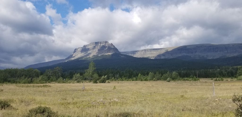
From St. Mary on the east side of Glacier National Park, we only had a hundred miles to our next stop. We drove several miles through Blackfeet Indian Reservation with beautiful scenery of mountains, grasslands and rolling hills.
Scenery after leaving St. Mary, Montana.
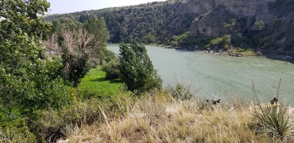
Leaving the reservation we drove parallel to the beautiful Rocky Mountains before arriving at Choteau, Montana, a little farming town.
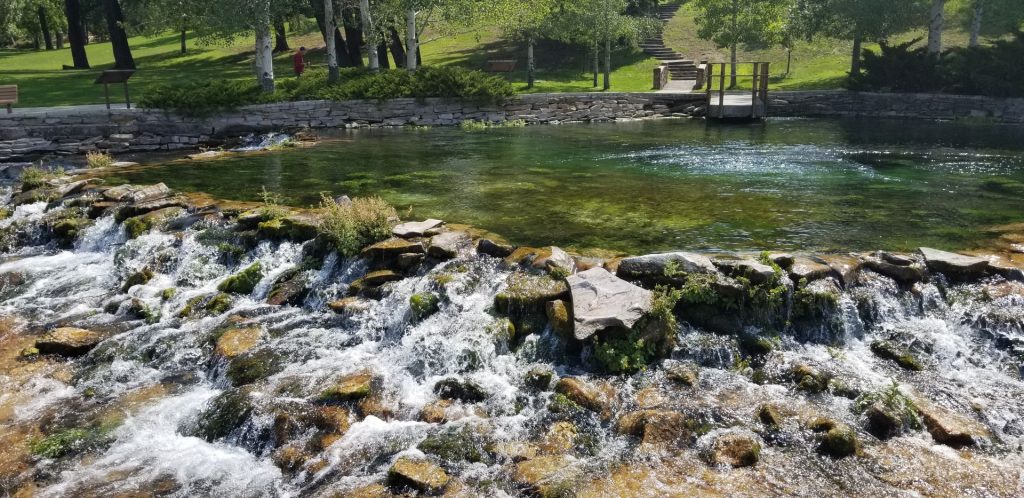
We took a day trip to Great Falls, MT. We ate at a Mongolian BBQ restaurant that we’d eaten at a year ago. Last year Ray’s knee was giving him so much trouble that he couldn’t get out and walk much. He missed seeing Giant Springs State Park, so we drove there to re-visit it.
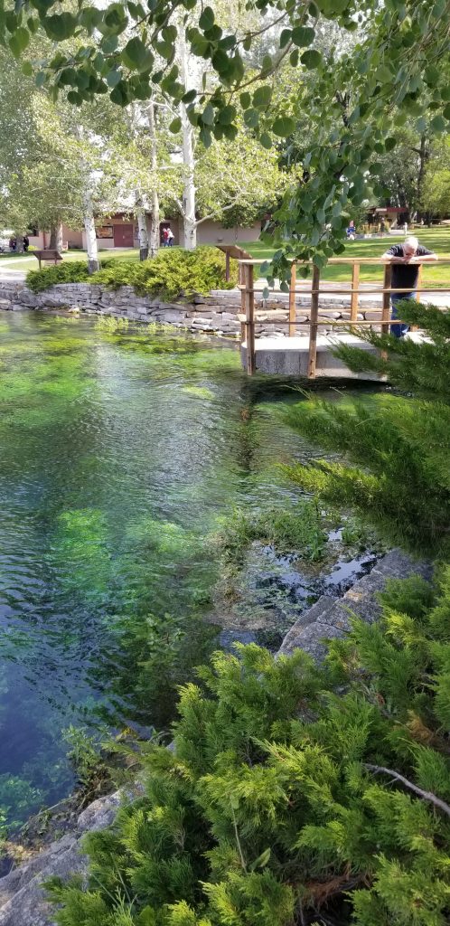
Giant Springs State Park where the water bubbles up in the pond area above.
The water from the spring originates in mountains over 100 miles away and flows underground till it bubbles up here. The water is so clear, that you can see the rocks and plants on the bottom.
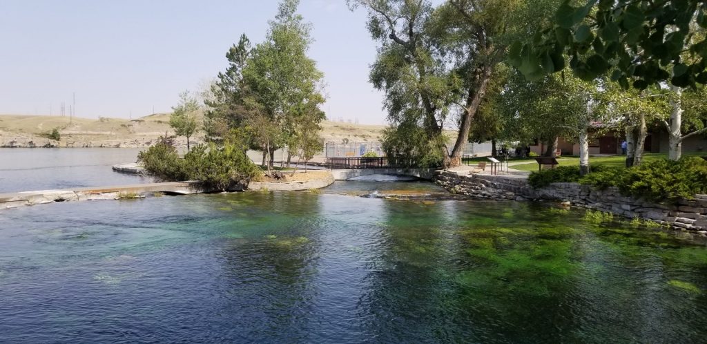
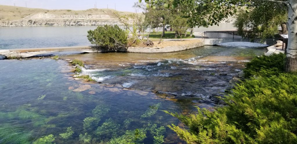
Giant Springs State Park where the water from the spring forms the Roe River, the shortest river in the world.Giant Springs State ParkGiant Springs State Park, MontanaGiant Springs State Park
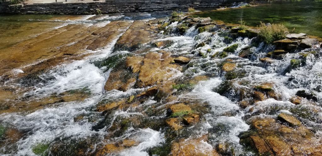
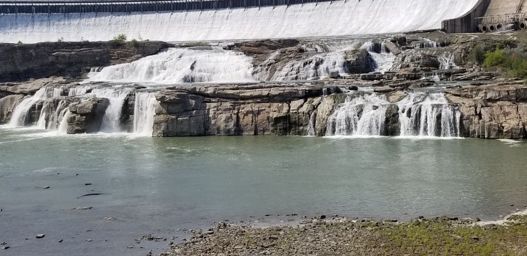
Five waterfalls are within a 10 mile segment of the Missouri River. Having seen three of the five waterfalls in Great Falls last year, Great Falls (which the city was named after) was on our list of sights to see . It is outside the city several miles away. We drove through miles of wheat fields on terrible roads to get there, but it was worth it.
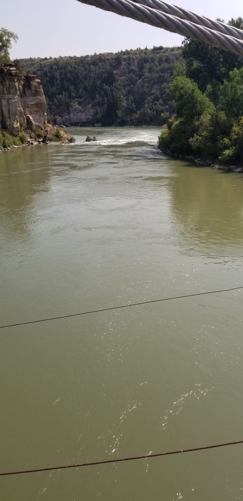
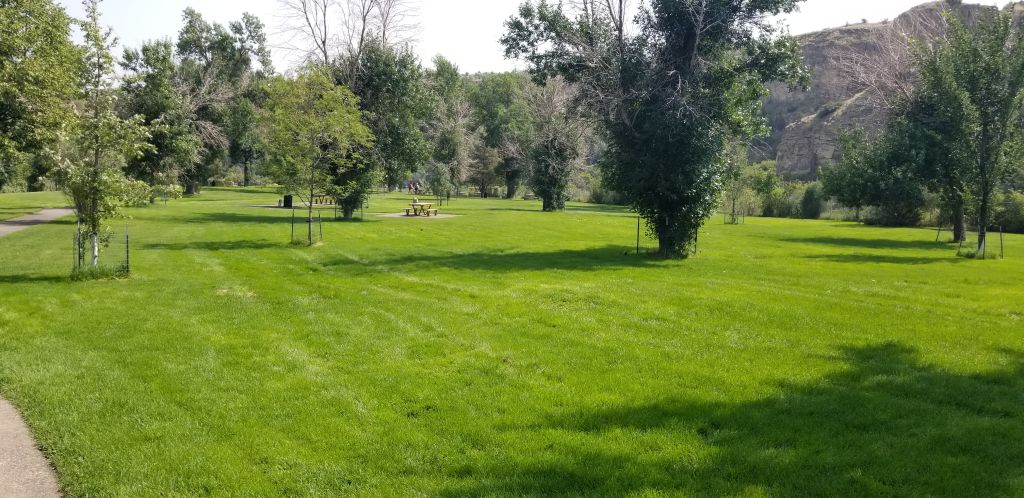
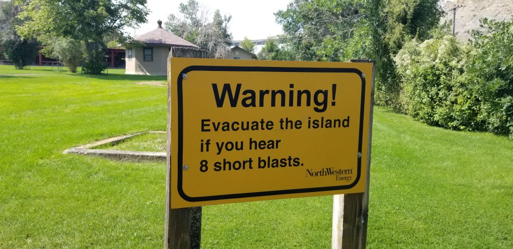
Once there, we walked across a suspension bridge to an island below the dam where there was a grassy park. The river flows around the island.
View up river from suspension bridgeView down river from suspension bridgePark on islandWarning sign on island below Great Falls Dam
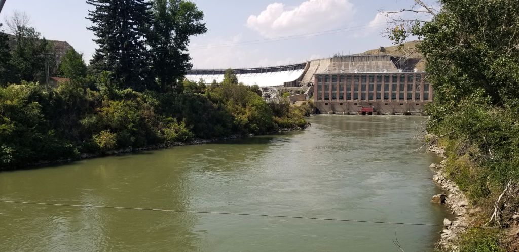
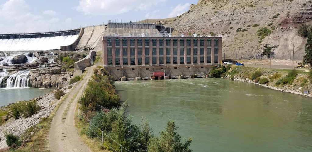
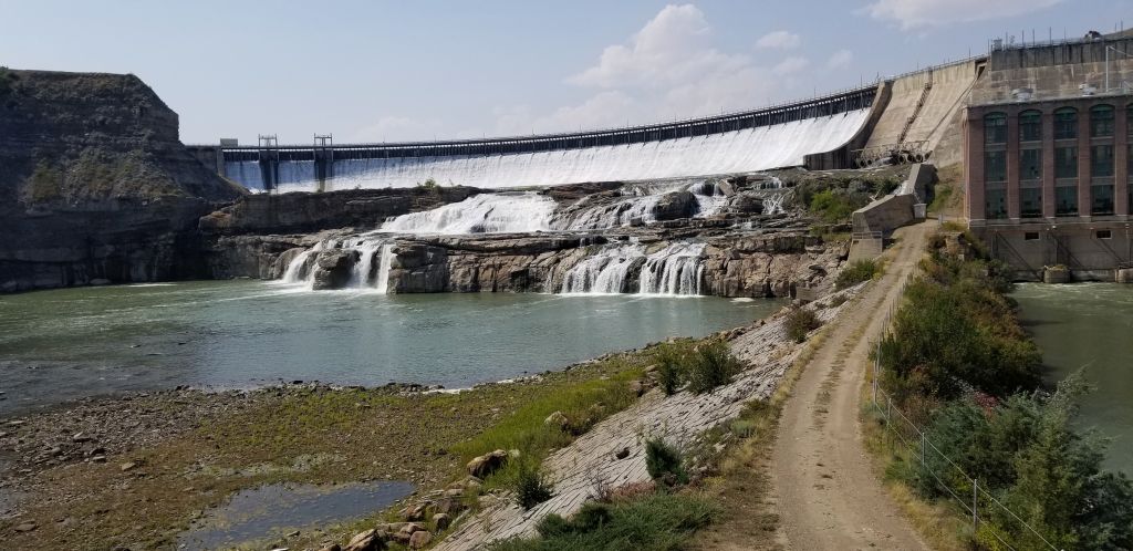
A trail led up a hill that gave us a perfect view of the dam and the powerhouse.
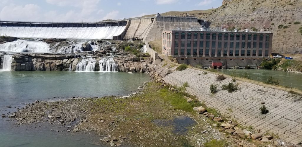
Powerhouse at Great Falls Dam.Dam and Powerhouse at Great Falls DamThe falls of Great Falls Dam.
Notice that the dam is spilling water through all the gates. Montana has a lot of water!
Great Falls Dam spilling water.
From the lookout at the end of the trail, we could see down river from the dam and powerhouse.
Down river view from end of trail.
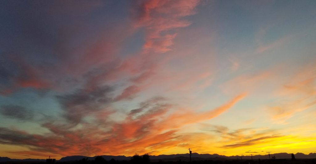
The evenings in Choteau, Montana, displayed some beautiful sunsets.
Our next destination awaited, so after a few days, we were off to a new location.
Glacier NP is one of those “can’t miss” places to see. It was one of our main destinations this year. Little did we know that when we started planning our itinerary back in February of 2021, that campgrounds near the park would already be filled up til mid-August. That meant that we needed to kill some time before we could get to Glacier National Park.
We decided to spend June and July and the first part of August seeing parts of Oregon and Washington, and I’m so glad we did. We had fun, cool weather (for the most part) and we got to see some beautiful sights.
Now, you can’t just drive into Glacier NP anymore. You have to have a Park pass (we had a Senior National Parks Pass) PLUS you need a ticket for Going to the Sun Road. That ticket is good for 7 days, but you have to go online ahead of time to reserve your time. This limits the number of people who can enter the park on any given day. Since there is only one road going through the park, it gets a lot of traffic.
The day we finally got to visit Glacier NP was a rainy day. Though the rain kept some people away, it was still hard to find a parking spot at the scenic turn-outs. So we just drove.
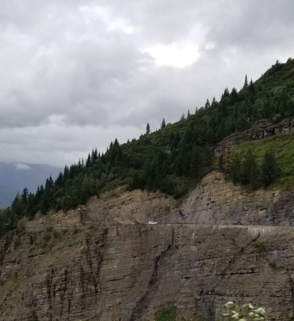
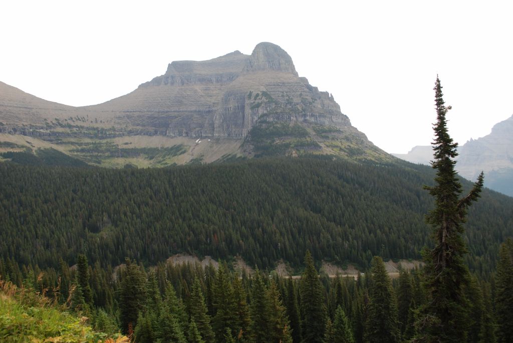
Up, up the mountain we drove, on curvy, windy, roads with only a short rock wall separating us from the edge of the cliff and valley below. Ray was driving, and I took photos out the window. It made me nervous to look straight down. Ray was in the driver’s seat so he wasn’t scared. Later, when I was driving up the same road and Ray was in the passenger seat, he said he felt a little scared too.
The Road to the Sun in Glacier NP is not for anyone afraid of heights!
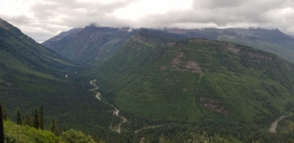
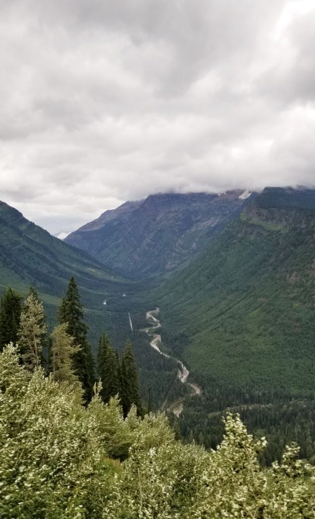
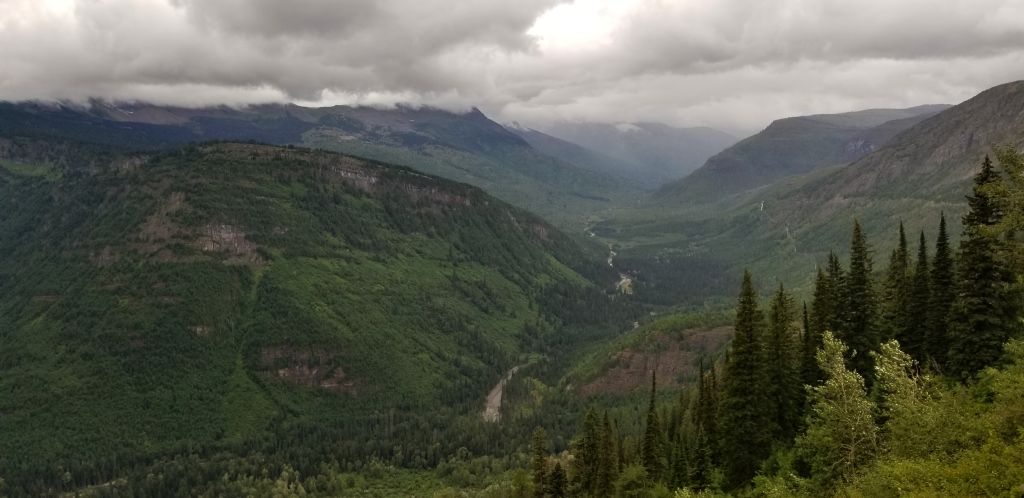
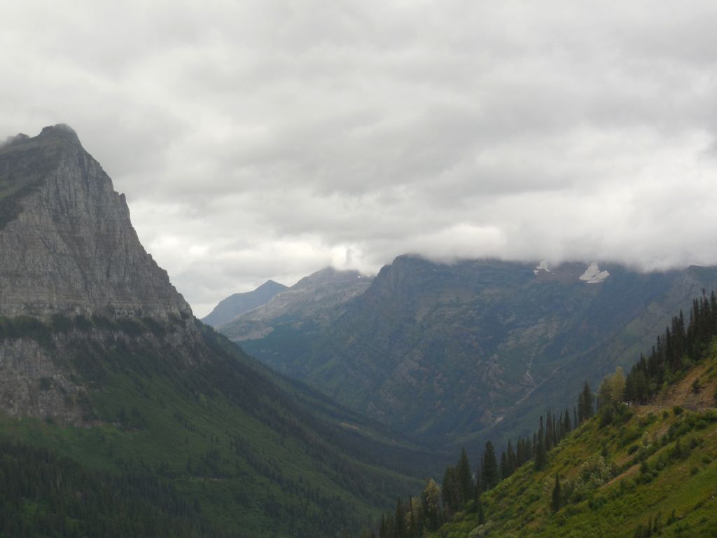
The road is very narrow, and at times it seemed like we would scrape the other cars as they passed by. We finally found a turnout where I could get some photos of the valley.
Valley carved by glaciers in Glacier NPGoing to the Sun Road winds through the valley of Glacier NP along McDonald Creek.
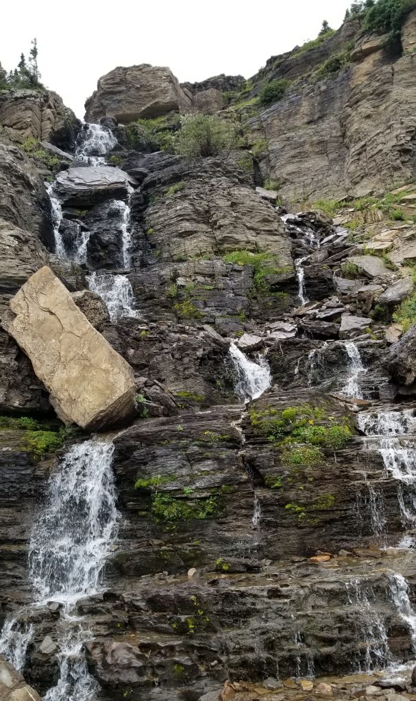
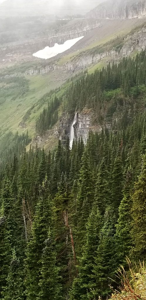
Along the way, we saw some waterfalls with a boulder that looked like it could roll right down.
Waterfall on the Going to the Sun Road, Glacier NP.
I was really disappointed that there were no glaciers to see. We saw what looked like patches of snow. I wouldn’t really classify them as glaciers. The valleys were carved by glaciers years ago so the name is still appropriate.
Some small patches of snow from glaciers are seen here.
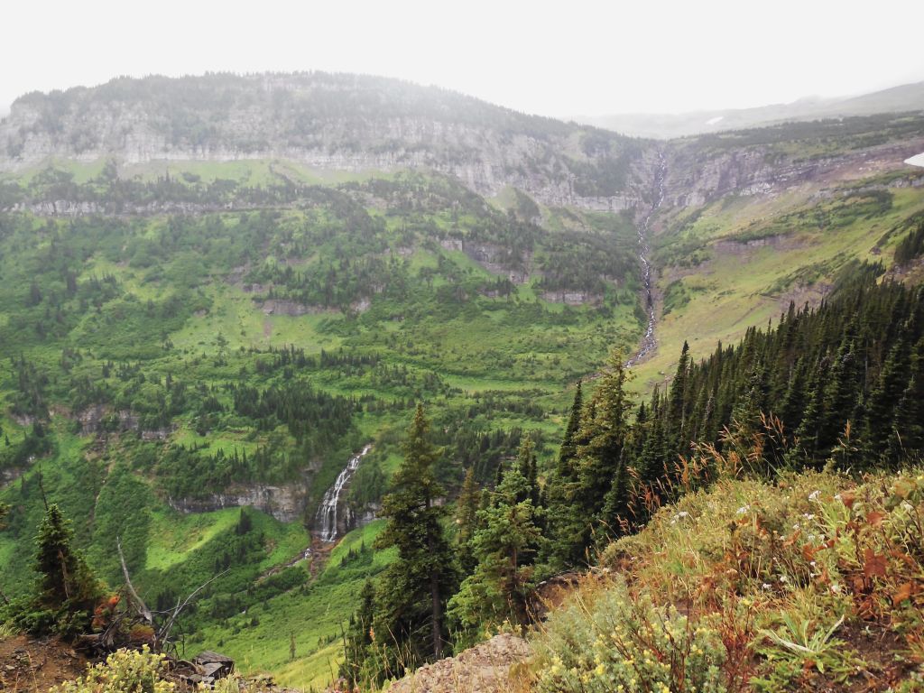
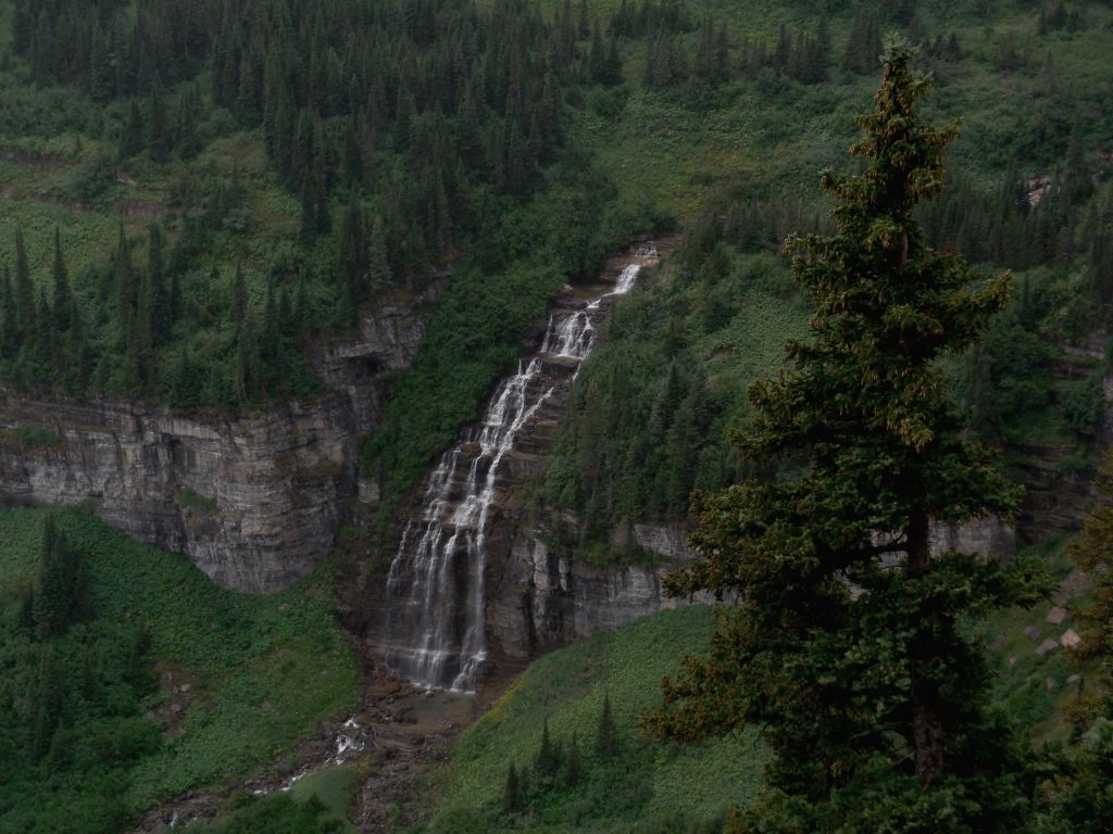
As we climbed higher and higher in elevation, the clouds settled down over the top of the mountains and it got foggy and misty. The highest point was Logan Pass where Logan Visitor Center is located. The parking lot was full, so we drove a short ways and stopped at a turnout at Lunch Creek where we ate our picnic lunch.
Lunch Creek waterfallClose up of Lunch Creek waterfall.
From there we could see another waterfall and the remains of a glacier.
Waterfall and glacier
We got there just in time before the mist enveloped us. We decided to turn around and go back the way we came instead of driving through the entire park that day. It was a good choice. By the time we drove back through the valley, we were able to find parking at some of the viewpoints that had previously been too packed to stop.
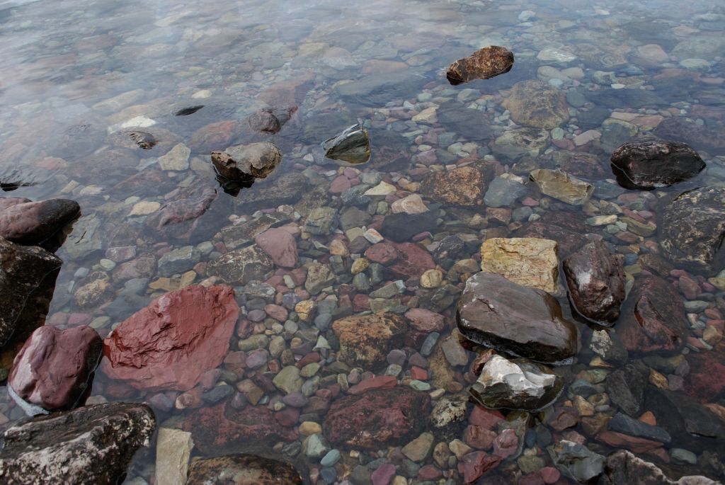
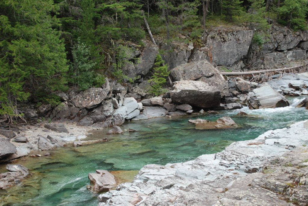
Colorful rocks cover the bottom and line the sides of McDonald Creek.
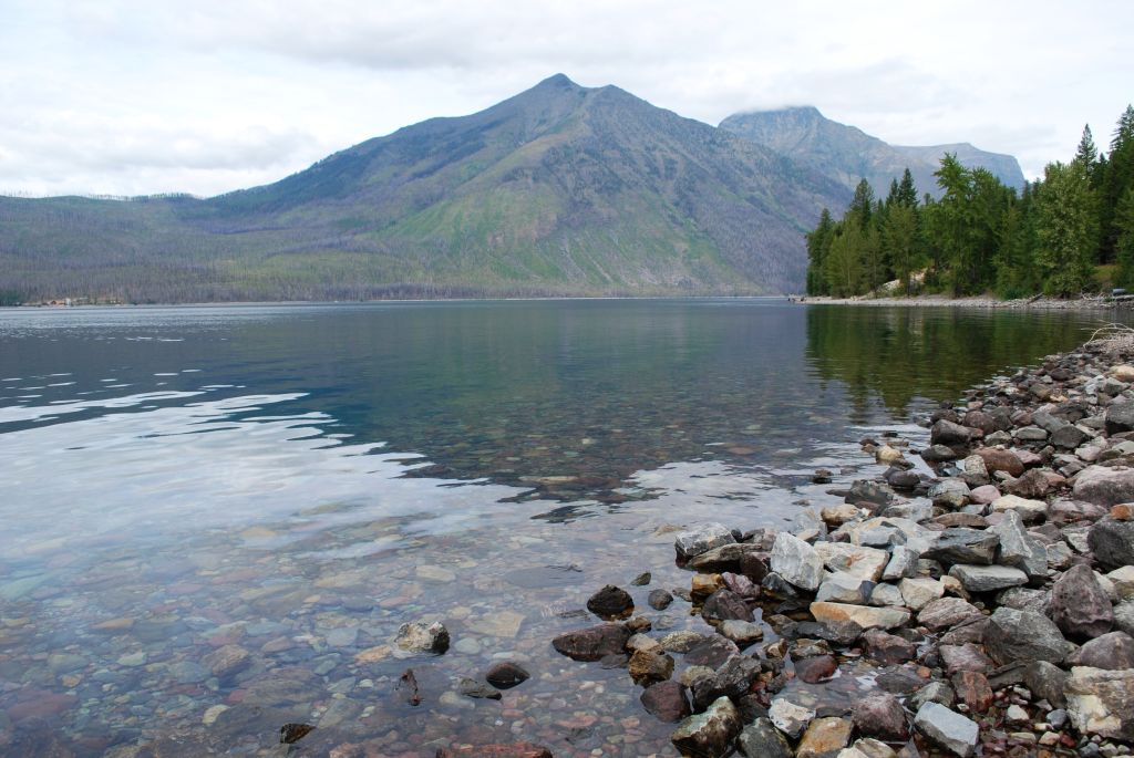
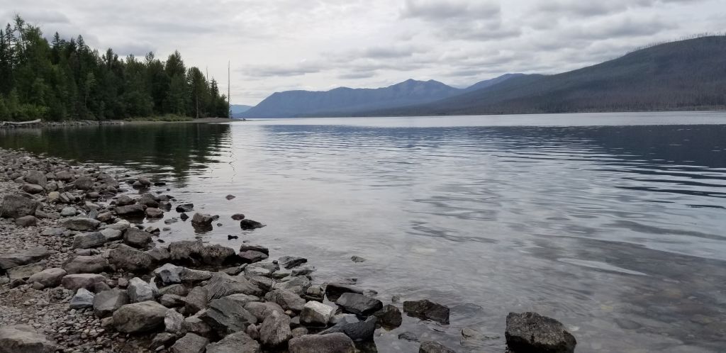
My grandfather’s name was Lake Macdonald, so of course I wanted to see Lake McDonald. (spelled differently). The rocks on the bottom of the lake and on the shore are a beautiful array of colors.
Lake McDonaldColorful rocks on the shore of Lake McDonaldLake McDonald
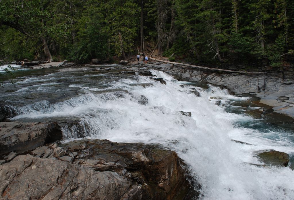
We visited the park a total of three different days. The weather never did get sunny. One of those days I hiked to McDonald Falls.
McDonald FallsUp river from McDonald Falls
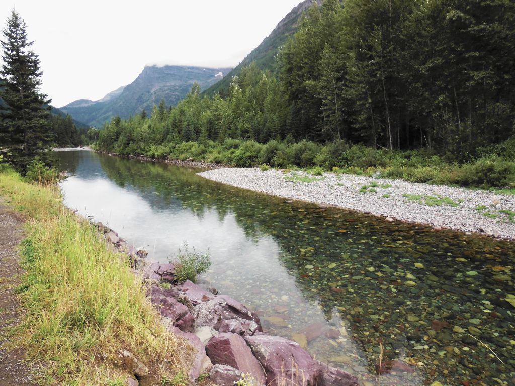
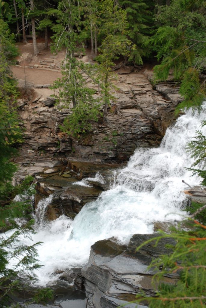
As we drove upstream alongside McDonald Creek, we found another waterfall and interesting views.
Cascade Falls along McDonald CreekBlue-green waters of the melted glaciers at McDonald Creek
On our third day in Glacier NP, we drove completely through the park, barely stopping except to eat our lunch. At Logan Pass, the road winds down to the small town of St. Mary.
We drove from one end of the park to the other, and then drove around the outside of the park on the south side back to where we started. It was also a beautiful drive, but long.
Coming down the other side of Logan Pass
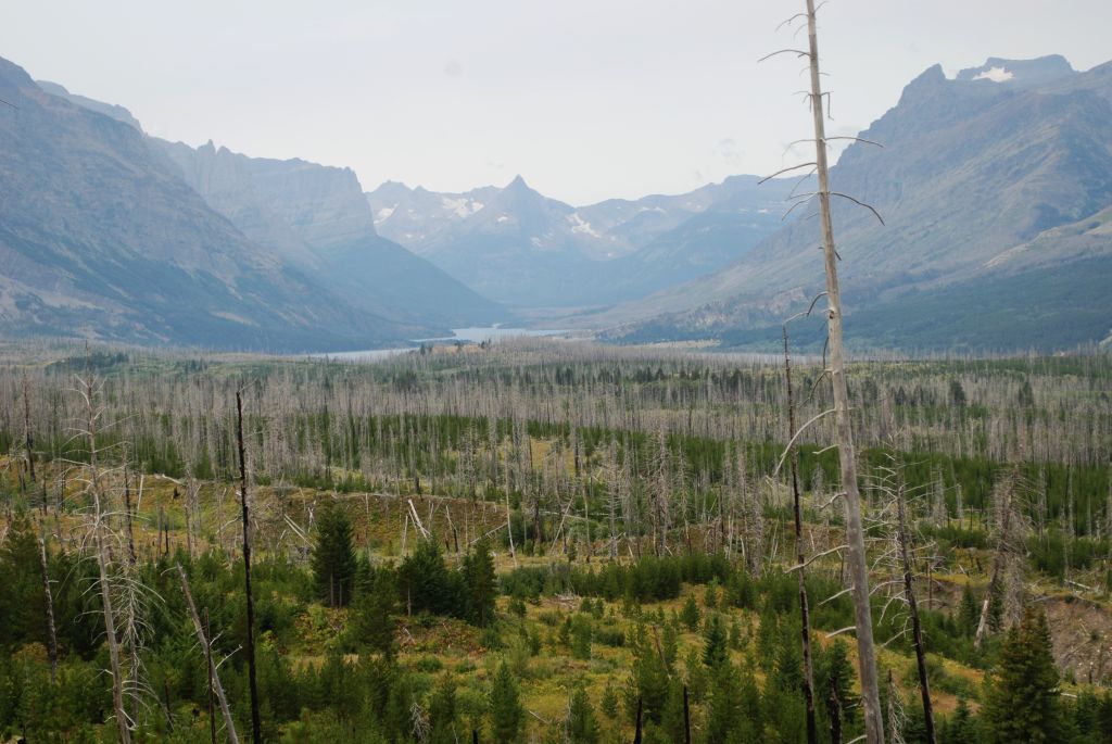
The other side of Logan Pass is much different in that it suffered damage from recent forest fires that changed the look of the landscape. There is a lake on that side too–St. Mary Lake which is about 1500′ higher in elevation than Lake McDonald.
Fire damage and St. Mary Lake in background.
Even with the recent rains, the smoke from fires in the western states came back quickly to make a haze over the mountains. We had planned to stay a few days in St. Mary, but due to the smoke, we decided to leave early. Our pass for Going to the Sun Road had expired, and we were ready to move on.
As we were making our way across Washington, we stopped for a couple of nights in Silver Creek, and then went on to on to Crescent Bar which is outside Quincy, Washington. From Silver Creek to Quincy was 213 miles–a longer drive than usual for us, as we try to keep it to 3 hours or less.
View from Paradise RV Campground in Silver Creek, WA.
From Silver Creek, we drove Highway 12 through the most beautiful country. High mountains lined either side as we drove through thickly wooded forest with an occasional small town. The primary industry is lumber. We passed some sawmills with stacks of 2×4’s and other sizes of lumber. We were very near Mt. Rainer, but we couldn’t see it because of the mountains that blocked our view.
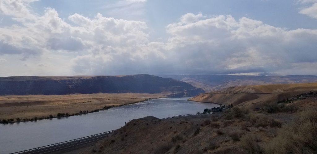
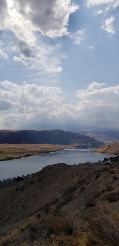
As we went further east, the terrain became dryer and the land changed to hay farms, dairies, apple orchards and Christmas tree farms all watered by irrigation. Our campground was on a cliff overlooking the Columbia River. The Columbia river makes a huge bend in the shape of a crescent. It is probably a mile or more across. There were mountains on the other side that made a beautiful background for sunsets. It was, however, very smokey when we got there. But later, a windy day and some rain cleared the sky.
Crescent Bar on the Columbia River
Crescent Bar on the Columbia River, WashingtonColumbia River, WashingtonColumbia River, Washington
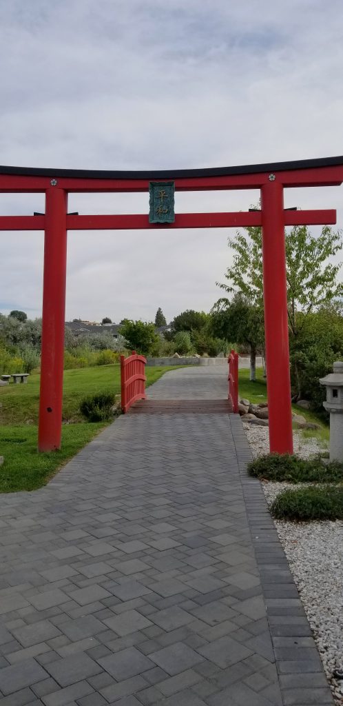
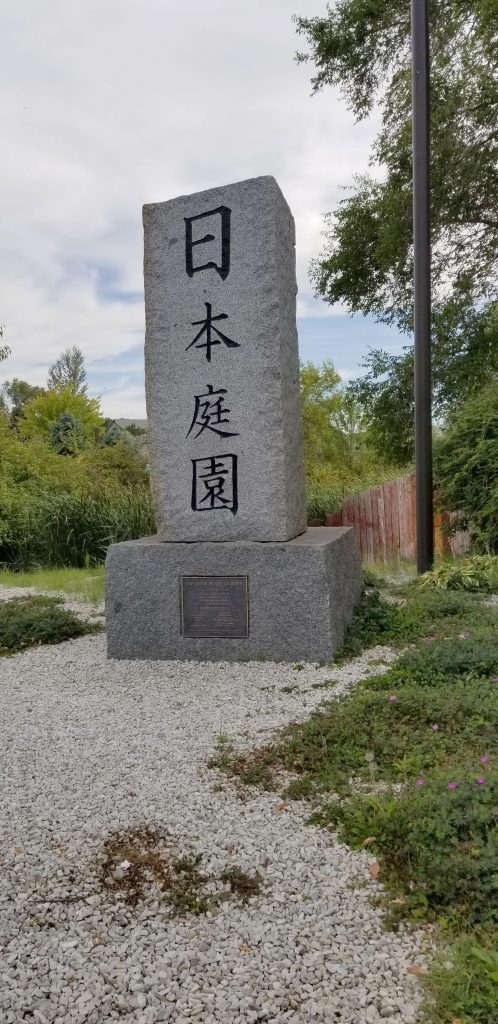
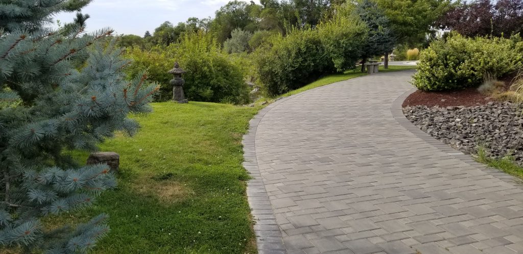
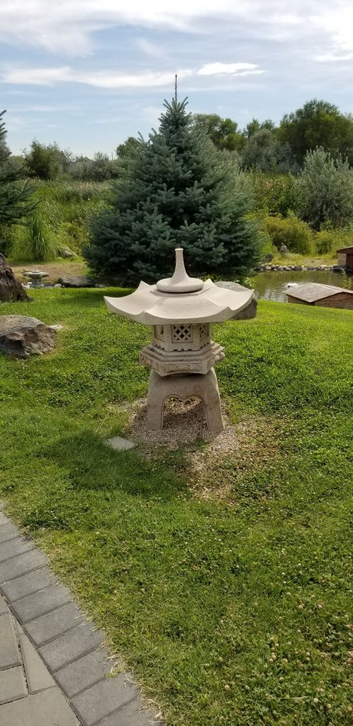
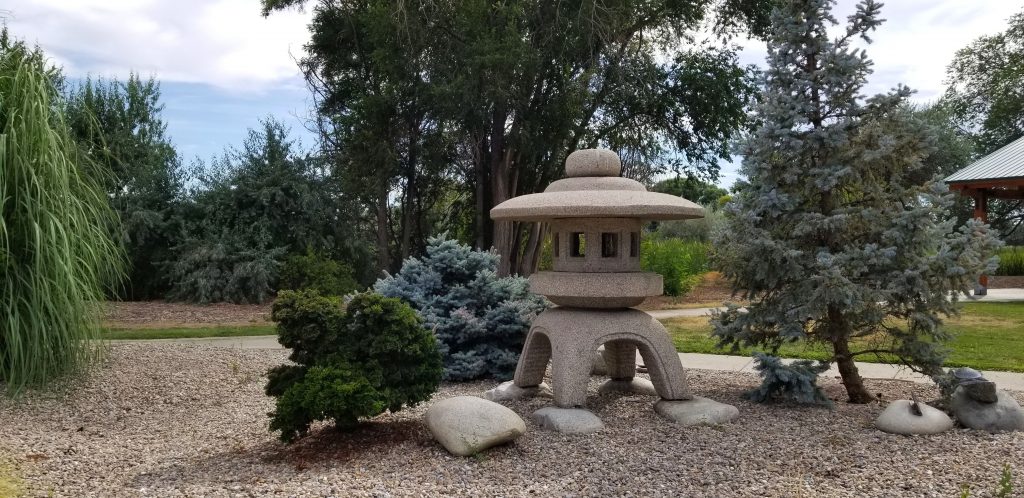
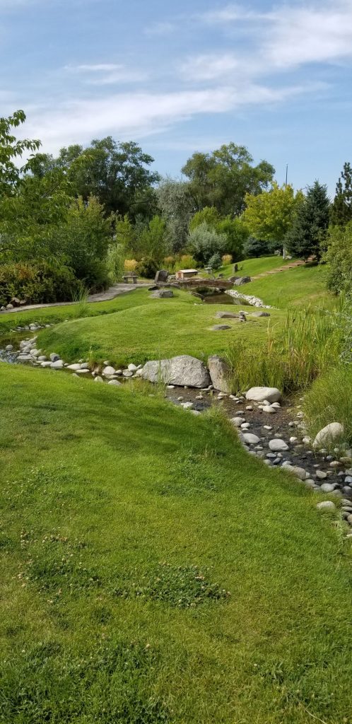
Japanese Peace Garden, Moses Lake, WA
We took a drive to Moses Lake, a town about 40 miles away, to see the Japanese Peace Garden. I couldn’t find any information about its history, who created it or why. It would have been a nice quiet place to enjoy if it hadn’t been so hot. We walked through quickly and got back into the car to cool off.
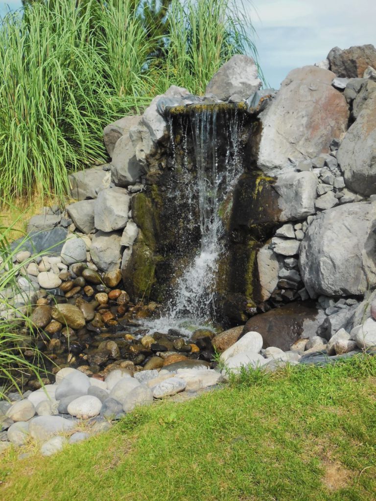
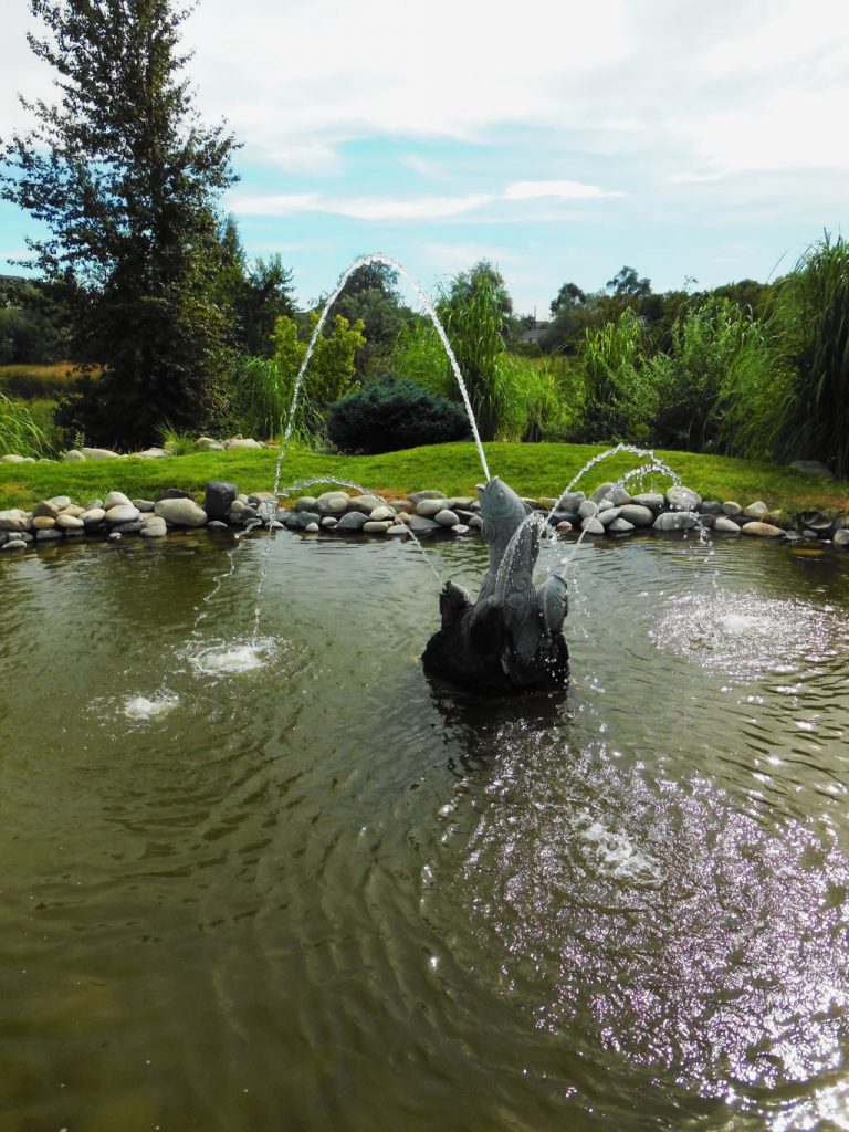
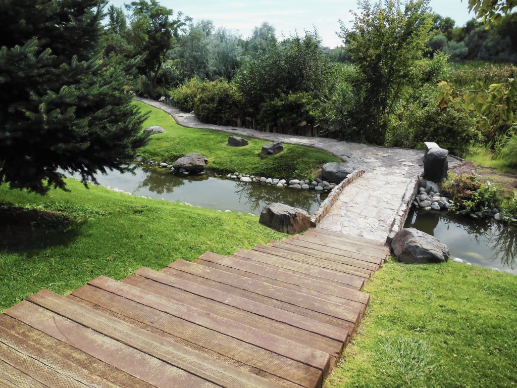
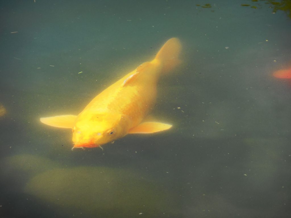
Entry into Japanese Peace Garden, Moses Lake, WAJapanese Peace Garden, Moses Lake, WAWaterfallThe brook winds through the Peace GardenFountain at Japanese Peace GardenKoi and goldfish swim below bridgeKoi Pond
Another side trip we took while in Quincy, Washington, was a trip to Grand Coulee Dam about 75 miles away. The drive there was along a canyon with the Grand Coulee lake beside the road.
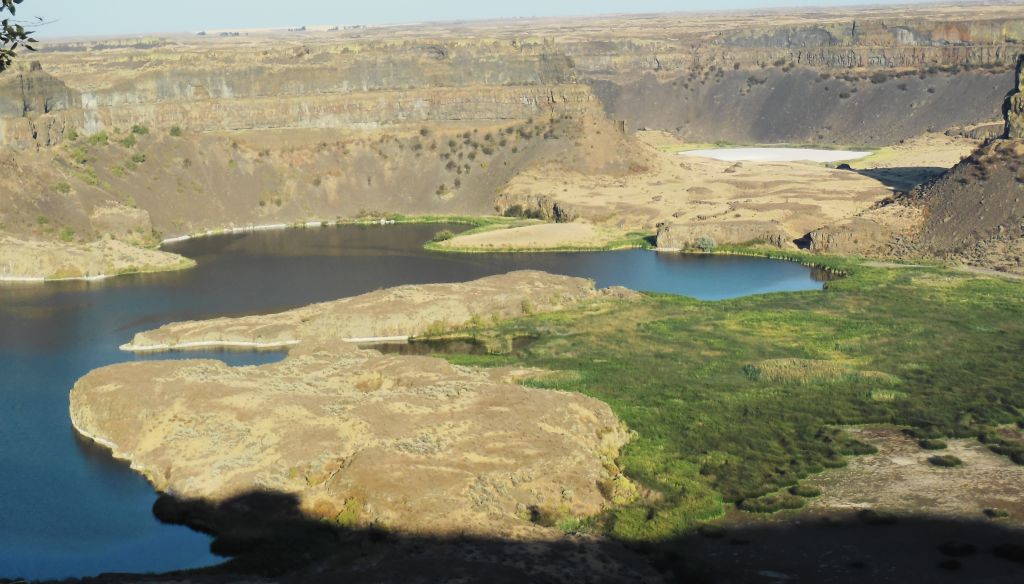
One of the scenic spots along the way was Dry Falls Visitor Center. The Visitor Center was closed, but the view of the dry falls was worth taking a photo. This area was once a huge waterfall when water broke through a glacial ice dam. The lake behind the dam was approximately the volume of Lake Ontario. The waterfall would have been 5 times the width of Niagara Falls and twice the height. Today, the falls are dry, hence the name.
Dry Falls, Montana
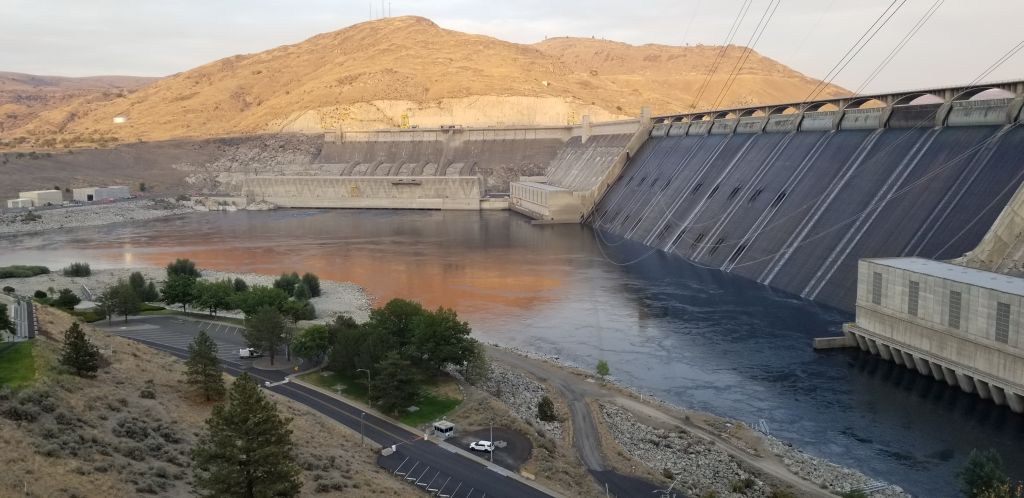
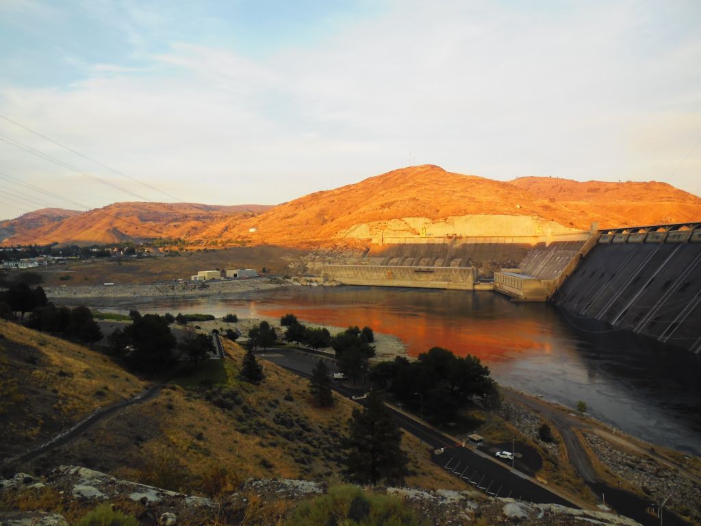
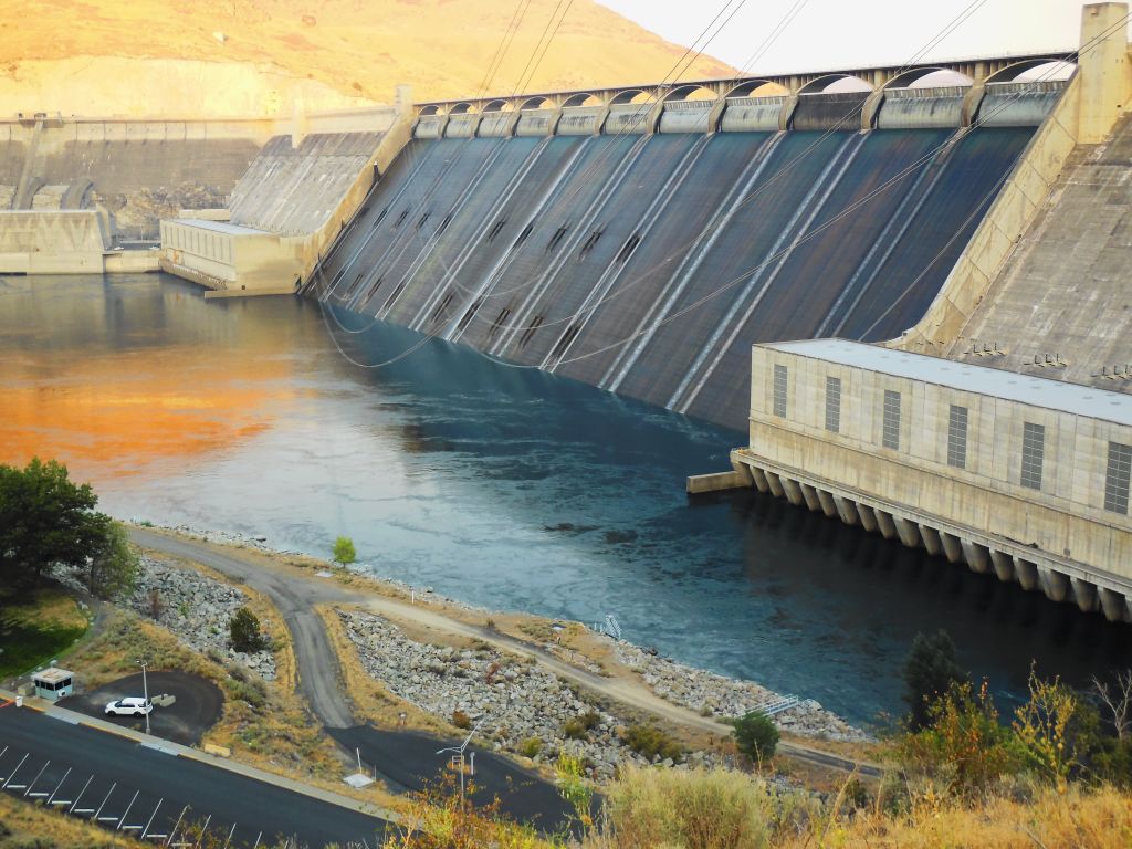
Grand Coulee Dam, Washington
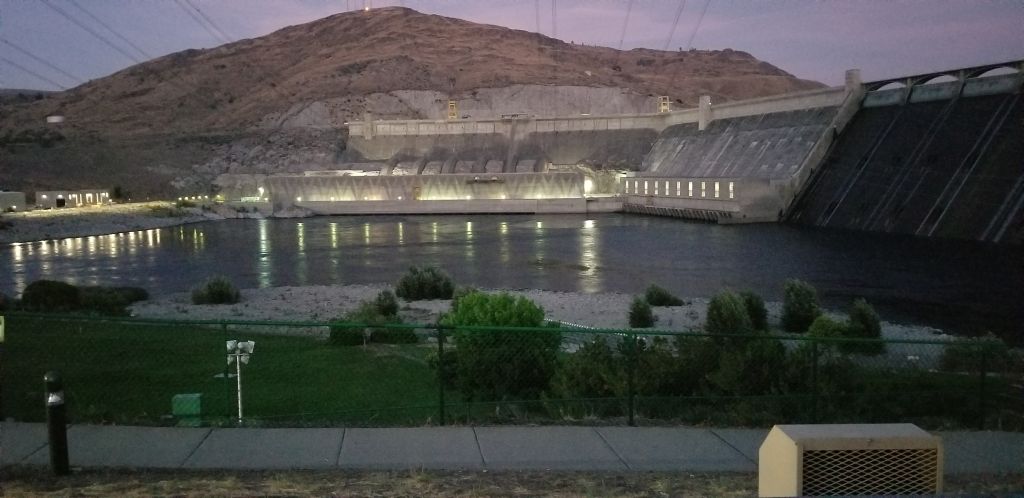
We got to Grand Coulee Dam just before sunset. After dark, there is a laser light show that tells the story of the dam and the surrounding area.
Grand Coulee DamSunset on Grand Coulee Dam
After dark, the spillway gates open and start spilling water until all the gates are completely spilling, creating a backdrop for the light show. Here they are before they start to spill.
Spillway for Grand Coulee Dam. The lights come on at Grand Coulee Dam.
I was unable to capture photos of the light show. I got some short videos, but they really don’t do it justice. Even though we arrived home late that night after the light show, it was an interesting side trip worth the time.
We drove across the famous Astoria- Megler Bridge in Astoria, Oregon. The bridge is a feat of engineering and quite impressive. The bridge is over 4 miles long and crosses the mouth of the Columbia River connecting Oregon and Washington on Highway 101. The ramp to the bridge steadily gains in elevation in a 360 curve. At the Oregon side, it is 200′ from the river below, allowing large ships access to travel up the Columbia River.
Astoria-Megar Bridge, Astoria, Oregon on Highway 101.
We drove to Cape Disappointment State Park in Washington state where we ate a picnic lunch. The beach was lined with a barrier of fallen trees. It is my guess that they were put there to protect the park from the tremendous breakers during bad weather. In the distance is Cape Disappointment Lighthouse.
Cape Disappointment Lighthouse, Washington.Cape Disappointment Lighthouse, Washington
Cape Disappointment was named so because Captain John Meares was unable to find the mouth of the Columbia River while sailing south in search of trade. He mistook it to be a large bay and was prevented from entering because of a large shallow shoal.
Looking back at Cape Disappointment State Park and beach in Washington.
We drove a short ways to The Lewis and Clark Interpretive Center. Although we did not pay to see the museum, there were exhibits in the lobby that were free to view.
Lewis and Clark Interpretive Center, Washington.
One exhibit was a first-order Fresnel Lens that was meant for the lighthouse. However, the lens was too big, so another one had to be ordered.
Fresnel Lens at Lewis and Clark Interpretive Center
Another display showed several lighthouses on the Oregon and Washington coast and their identifying light flashes.
Display at Lewis and Clark Interpretive Center, Cape Disappointment, Washington.
From the Lewis and Clark Interpretive Center, we had a better view of the lighthouse.
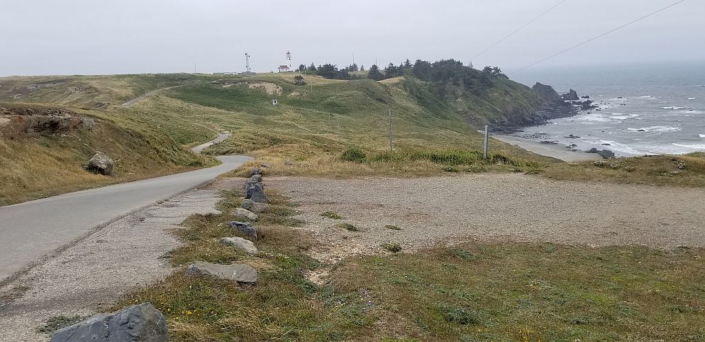
From there, we drove a short ways to see the North Head Lighthouse. North Head Lighthouse was built because ships approaching from the north could not see the lighthouse at Cape Disappointment.
Pathway to North Head Lighthouse.
I nearly missed getting a photo because of the fog that was blowing in. Cape Disappointment is one of the foggiest places in the U.S.
North Head Lighthouse, WashingtonNorth Head Lighthouse, WashingtonNorth Head Lighthouse keeper’s quarters.
I felt satisfied that we had seen as many lighthouses on the Oregon and Washington coast as we could during the time we were in Seaside, Oregon. We saw some beautiful scenery, we enjoyed the cool weather, and we feel sure we will be back.
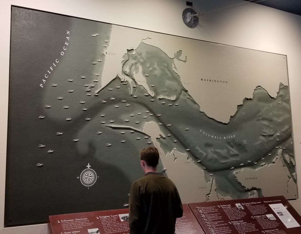
While we were staying in Seaside, Oregon, we went to The Columbia River Maritime Museum in Astoria, Oregon. As we entered the museum, we saw a large map of the shipwrecks at the mouth of the Columbia River.
Map of shipwrecks in the “Graveyard of the Pacific”, Columbia River Maritime Museum.
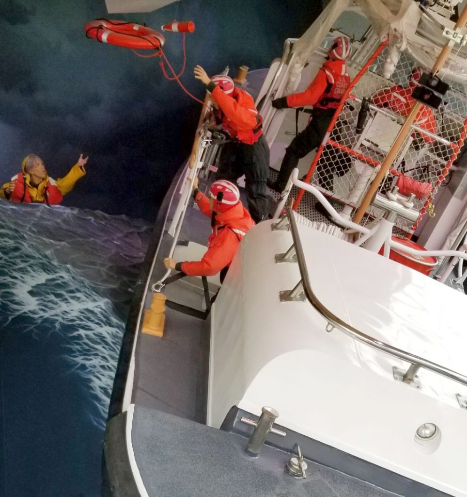
We watched a 3D surround sound documentary of “Aircraft Carrier–City at Sea” in the Theater. Then we wandered around the exhibits and learned about the extreme conditions of the Columbia River Bar, the U.S. Coast Guard and the Columbia River Bar Pilots.
U.S. Coast Guard Rescue display at Columbia River Maritime Museum.Display in Columbia River Maritime Museum.
The museum tells the history of the Columbia River from the times of the Indians and their dugout canoes to the present day. The museum is very expansive and takes 2 or 3 hours to see everything. We took a break for lunch and walked across the street to a food truck to get lunch and then came back to see more.
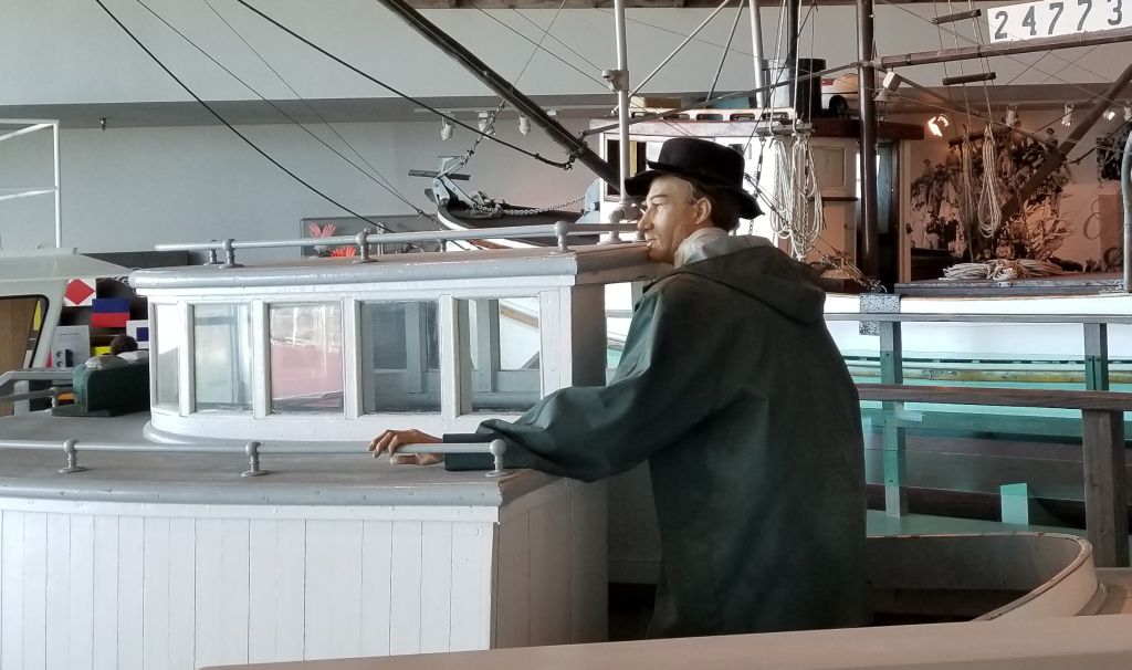
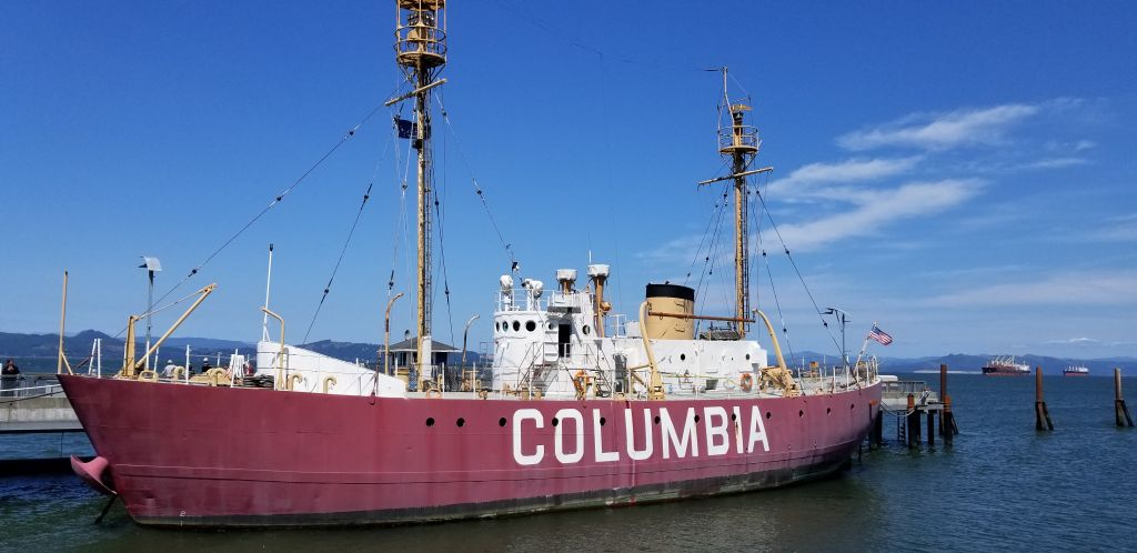
Outside the museum is docked the Lightship Columbia, a National Historic Landmark. It is an actual lightship that used to guide ships to safety at the mouth of the Columbia River. I was able to go aboard and see the sailors living quarters. The lightship is a floating lighthouse manned by a crew of 17 men working two to four week rotations, with 10 men on duty at a time. It was in use from 1951 to 1979.
The Columbia Lightship–part of The Columbia River Maritime Museum.
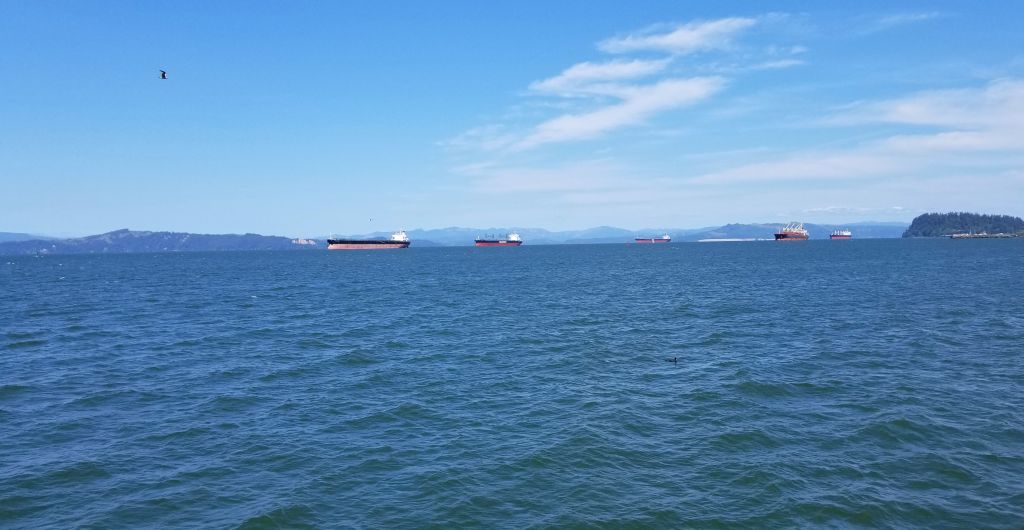
We learned at the museum that ships today must have a specially trained pilot to guide them through the mouth of the Columbia River where it meets the Pacific Ocean. This pilot will come aboard their ship and guide the ships through the treacherous waters and sand bars at the mouth of the river. We saw several large cargo ships waiting their turn.
Cargo ships on Columbia River await their turn to go through the dangerous waters at the mouth of the Columbia River.
Lewis and Clark Natl. Historical Pk.
Lewis and Clark have always been two of my favorite explorers ever since I read “Streams to the River, River to the Sea” by Scott O’Dell. The story of their amazing adventure is told in part at the Lewis and Clark National Historical Parknear Astoria, Oregon, off Highway 101. Besides having another national park to check off of our list, it gave us a day of learning about the history of our country and some exercise as we hiked the trails near the visitor center.
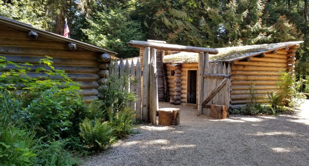
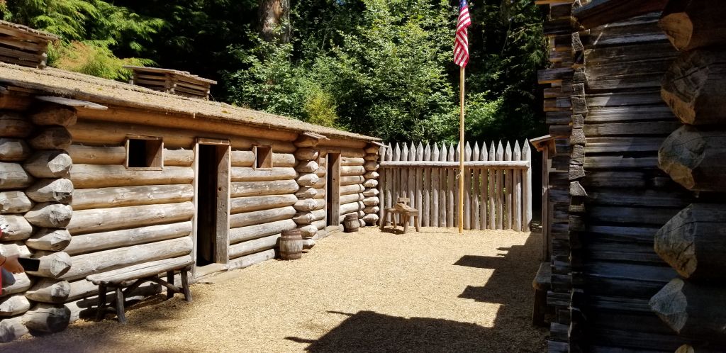
We stopped at the Visitor Center where we saw a short film about the story of the winter fort of the Lewis and Clark Expedition in1805 – 1806. They named it Fort Clatsop after the nation of Indians who resided nearby.
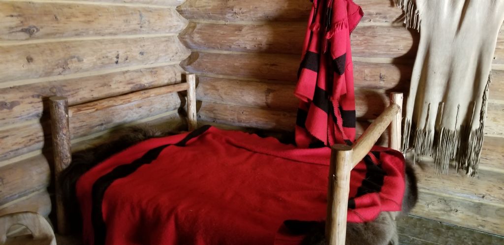
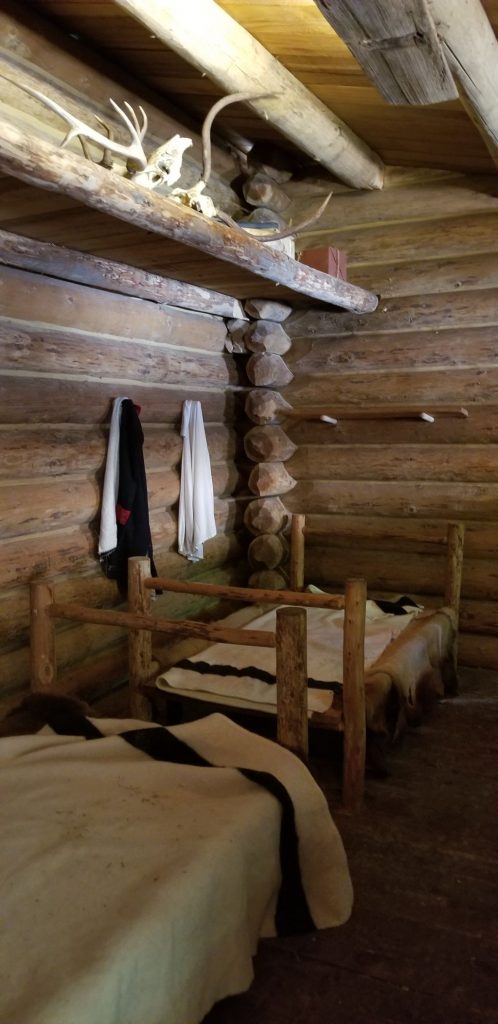
Replica of Fort Clatsop, the winter fort of the Lewis and Clark Expedition.Inside Fort ClatsopSleeping quarters inside Fort Clatsop.Room inside Fort Clatsop
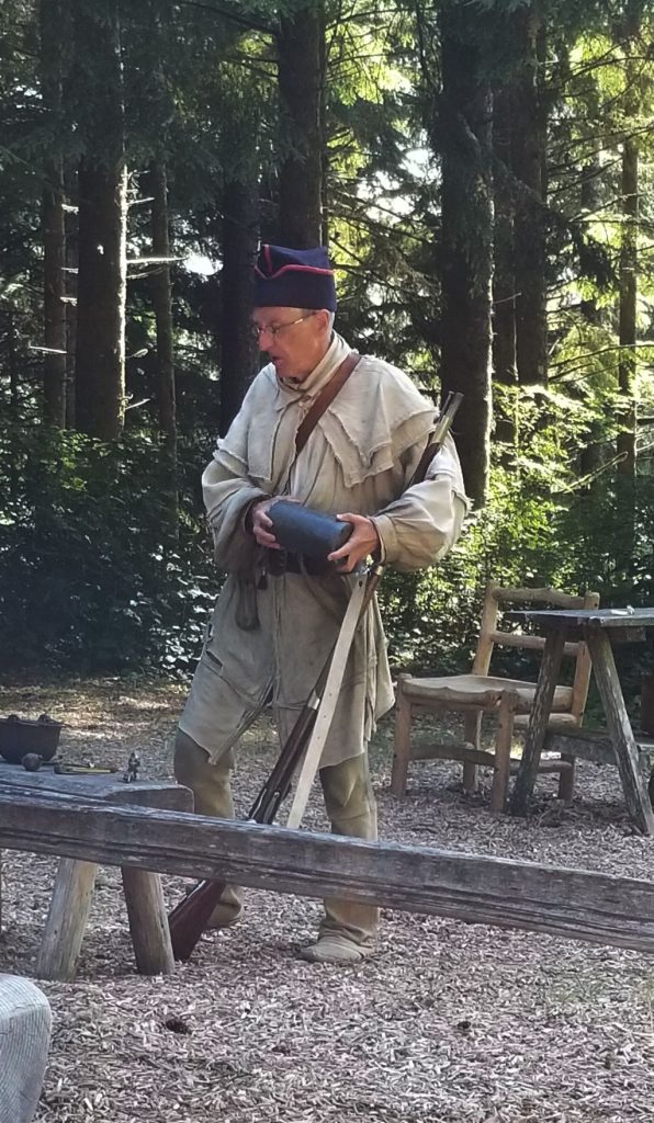
At the fort we watched a demonstration of the loading and shooting of a black powder rifle.
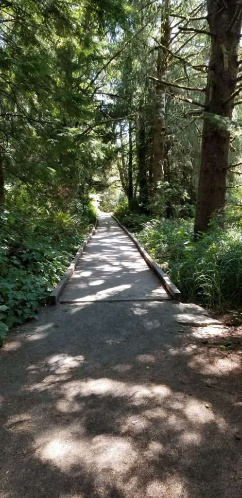
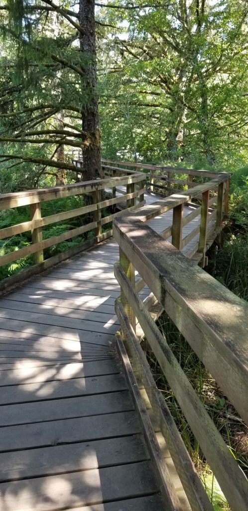
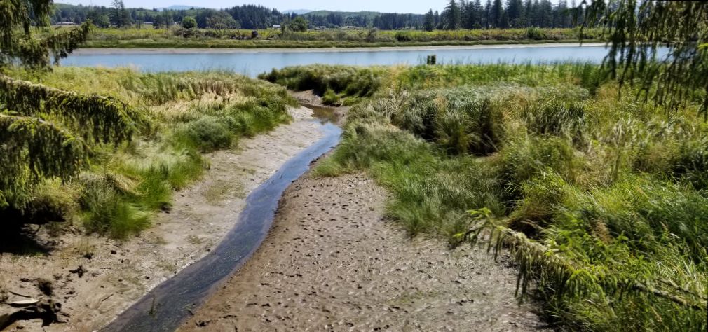
We walked down a pathway to the place on the river where Lewis and Clark could possibly have docked their dugout canoes.
Pathway to river access.Boardwalk to river.River access.
Lewis and Clark National Historical Park actually has several different site locations. Many of the other sites are only minutes away. We decided save some of those different locations for another visit at another time. In all, we had an enjoyable day visiting this park.
It was just a short drive north on Highway 101 from South Beach to Seaside, Oregon, where we stayed in another Thousand Trails RV Resort called Seaside RV Resort. We had to backtrack south to see the Tillamook Lighthouse which is not really near Tillamook. It was really only a few miles south of Seaside, Oregon.
The Tillamook Lighthouse is on an island. It was quite windy and hazy making it hard to get a good photo.
Tillamook Lighthouse, Tillamook, Oregon
The view from the Tillamook lookout was beautiful. If you look carefully, you can see Haystack Rock.
Scene from Tillamook Lighthouse viewpoint.
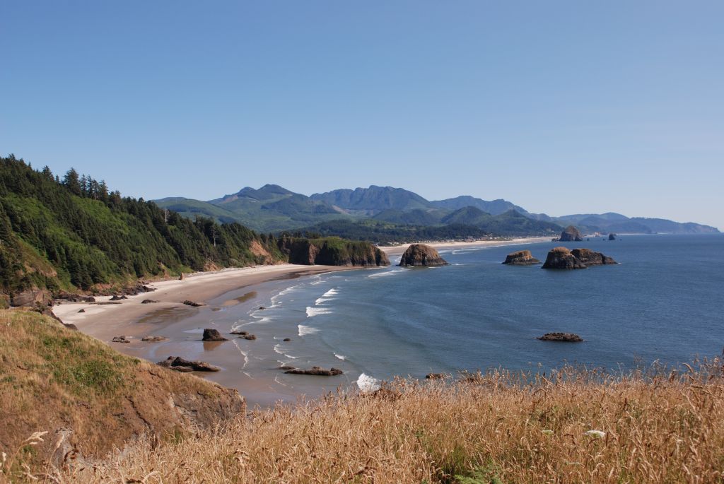
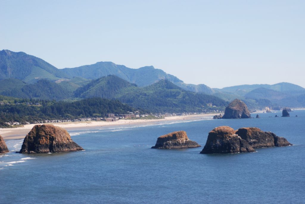
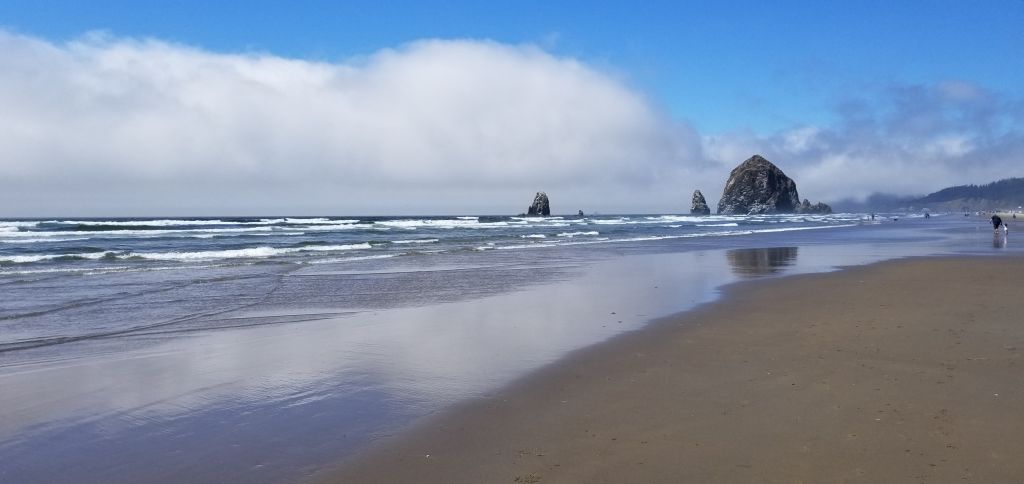
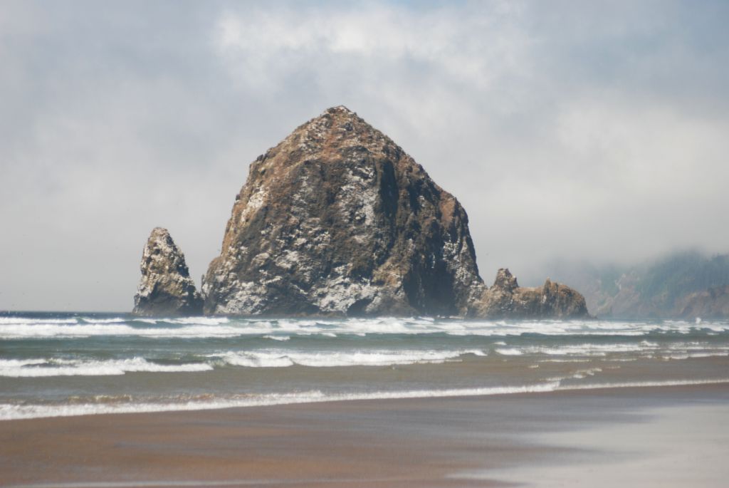
In this closer view Haystack Rock is in the distance. Later, we drove to Canon Beach where I got a closer look. Haystack Rock is home to many birds who make their nest in the nooks and crannies of the rock, even burrowing into the dirt to make their nests.
Haystack Rock in the distance at Canon Beach, Oregon.Haystack Rock
When the tide is out, many people like to explore the tide pools around the rock.
Haystack Rock
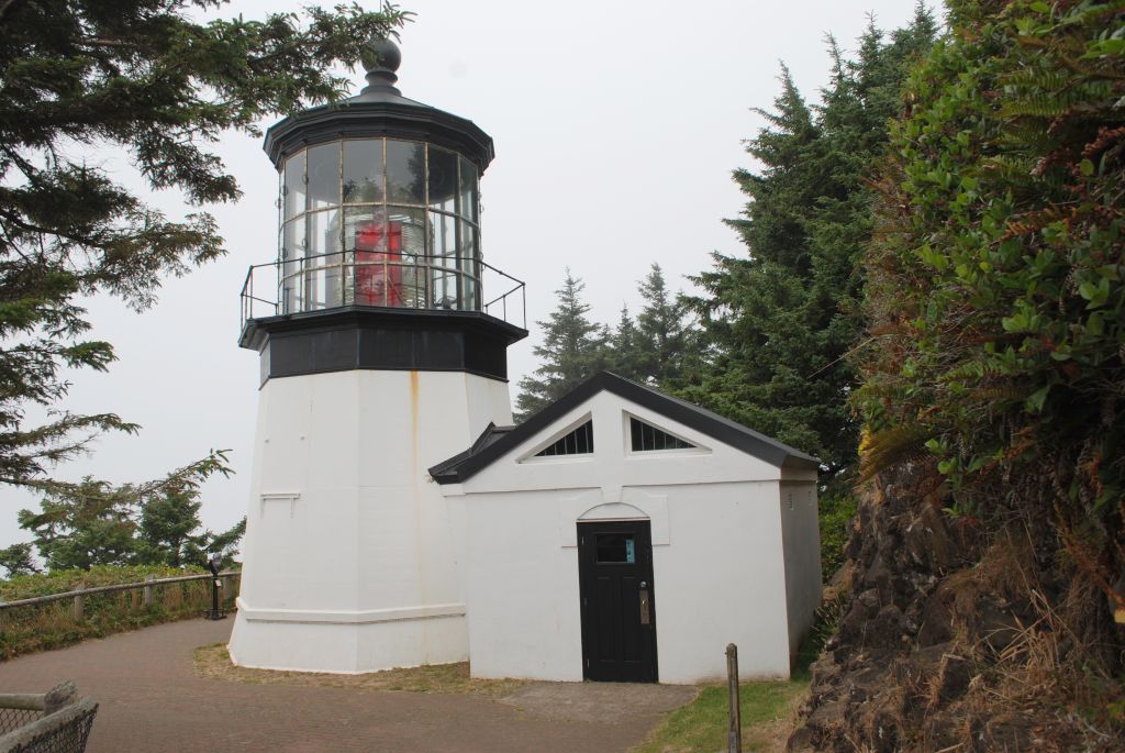
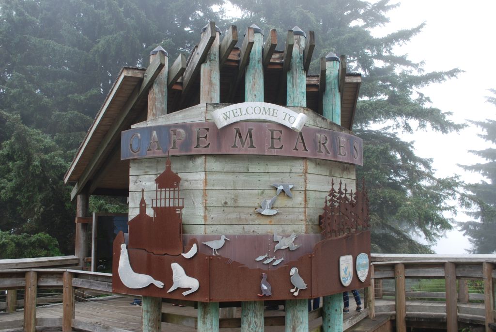
A long drive south to Tillamook took us closer to Cape Meares Lighthouse. The road there is very narrow and windy, but we finally found the end.
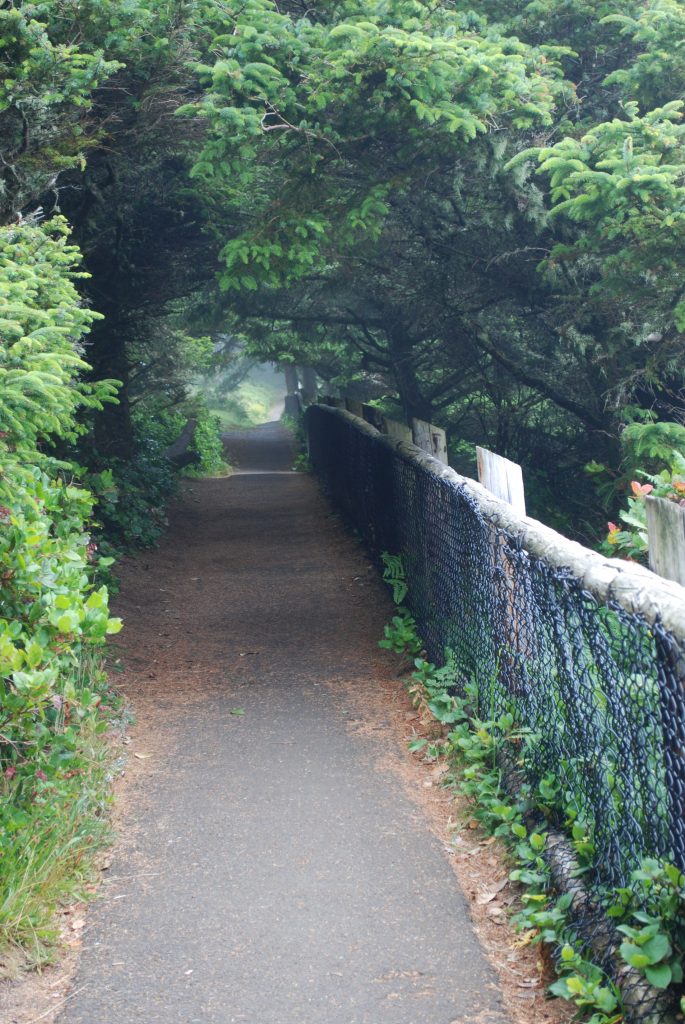
There are two pathways to the lighthouse. It was windy and very misty. We opted for the pathway through the trees. The air was so moist, the trees “rained” on us as the moisture collected on the leaves and foliage.
Pathway to Cape Meares Lighthouse.Cape Meares Lighthouse
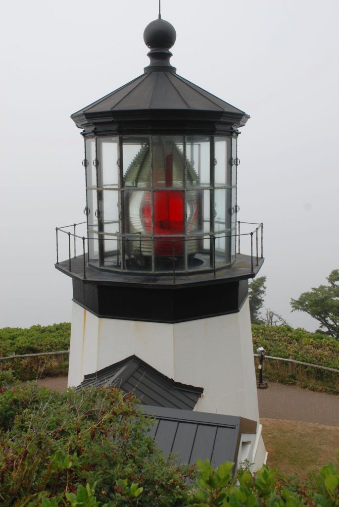
Although Cape Meares Lighthouse is the shortest lighthouse on the Oregon Coast, it put out a powerful beam that could be seen twelve miles out at sea. Each lighthouse had its own signature beam of light. Cape Meares was 30 seconds of fixed white light from the primary lens followed by a red flash of five seconds from the bull’s-eye lens once every minute.
Cape Meares LighthouseCape Meares Lighthouse information booth.
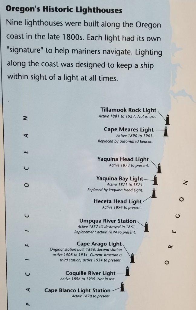
The photo below shows the nine historic lighthouses on the Oregon Coast and whether they are still active.
With the cold windy weather, we were glad to get back to our truck to get warm.
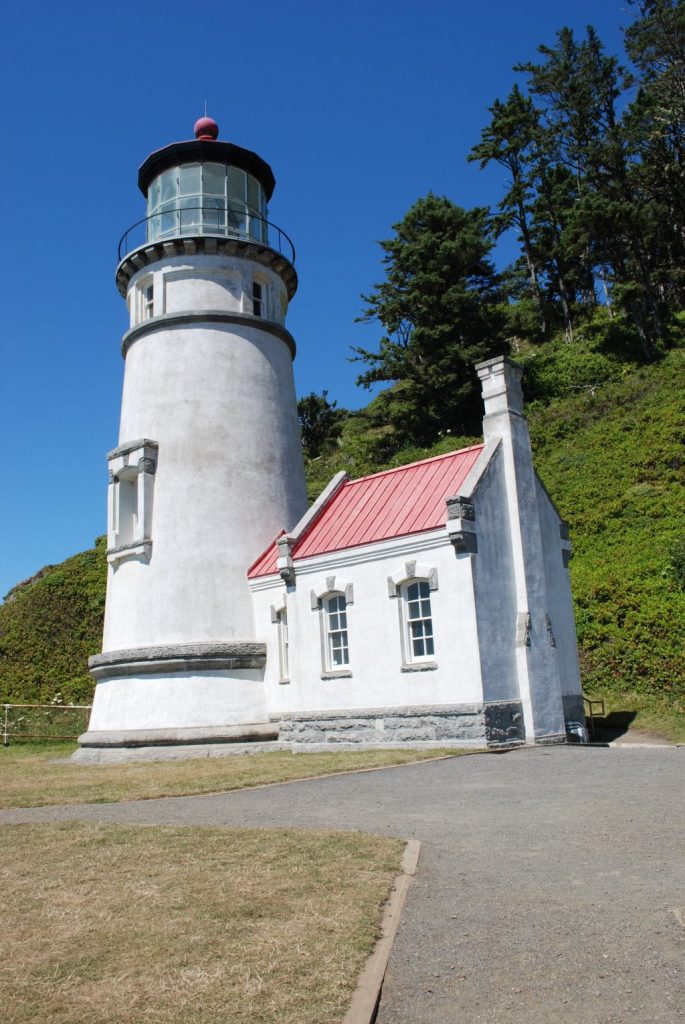
We stayed in South Beach, Oregon (near Newport, OR) for twelve days in Thousand Trails Whaler’s Rest RV Resort. My goal was to see and photograph as many lighthouses along the Oregon coast as I could.
Our campground was just a short distance away from the beach, but because of the thick trees and bushes and Highway 101 in between, it wasn’t an easy access. The weather was cloudy and overcast in the mornings. By noon, however, the sun was shining. So that’s when we decided to go looking for lighthouses.
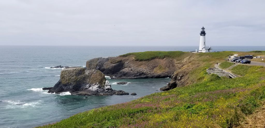
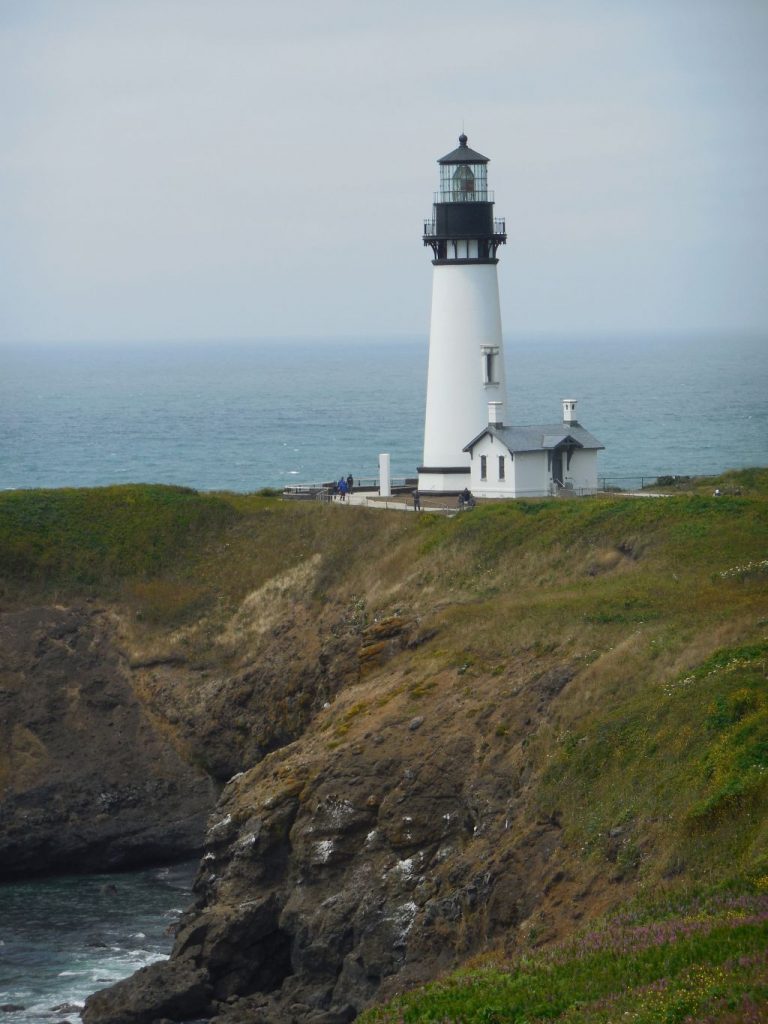
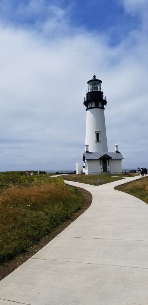
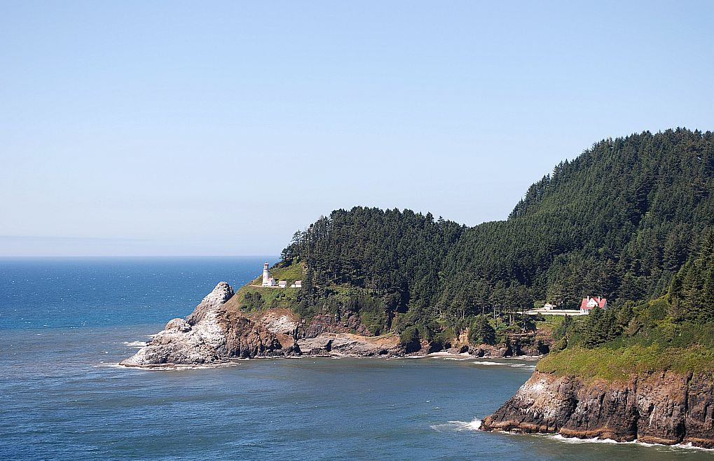
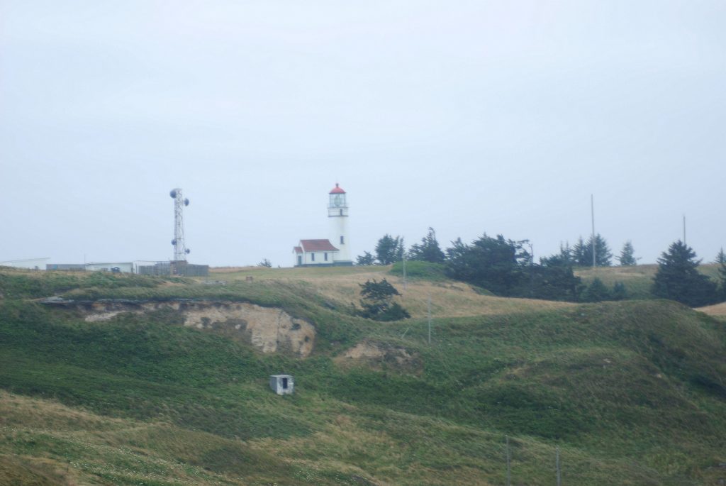
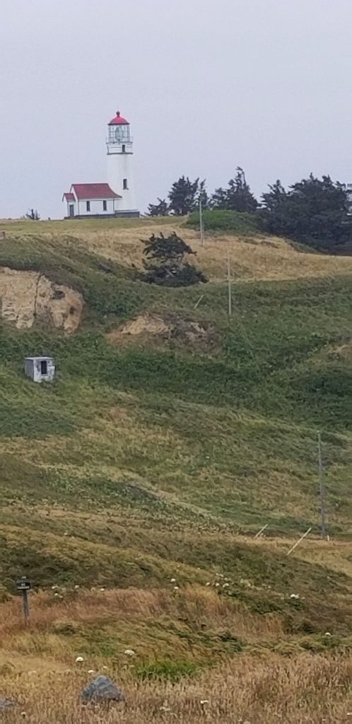
Our first lighthouse and my favorite, (Yaquina Head) was close to Newport just a few miles from the campground. It was easily accessible and very easy to photograph. We saw some sea lions sunning themselves on the rocks below.
Yaquina Head Lighthouse near Newport, Oregon.Yaquina Head Lighthouse, Newport, Oregon.Yaquina Head Lighthouse, Newport, Oregon.
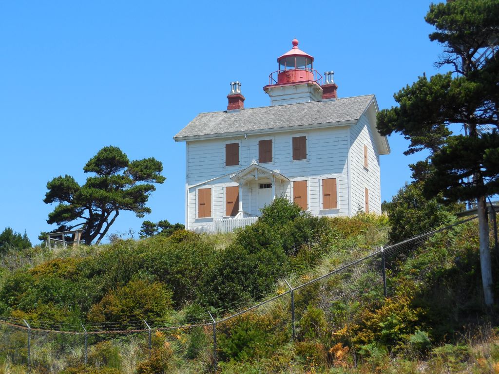
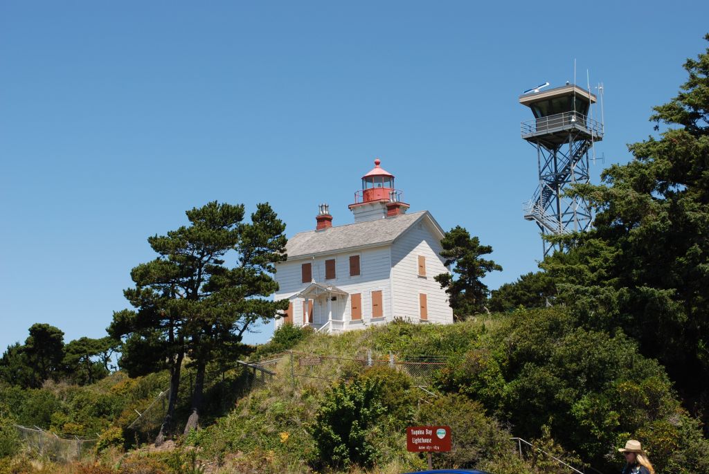
Near Yaquina Head Lighthouse is Yakina Bay Lighthouse. We visited it after all the other lighthouses on another day, but I include it here because it is in order going south on Highway 101. This one was a bit of a disappointment because the shutters were all closed over the windows making it look boarded up. There was a fence around it and an ugly tower next to it.
Yakina Bay LighthouseYakina Bay Lighthouse
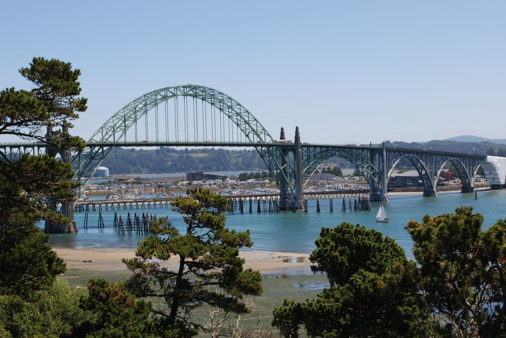
While we were there at Yakina Bay Lighthouse, we got a good view of Yakina Bay Bridge.
Yakina Bay Bridge
Our next next search for lighthouses took us south on Highway 101 as far as Cape Blanco, near Port Orford, Oregon.
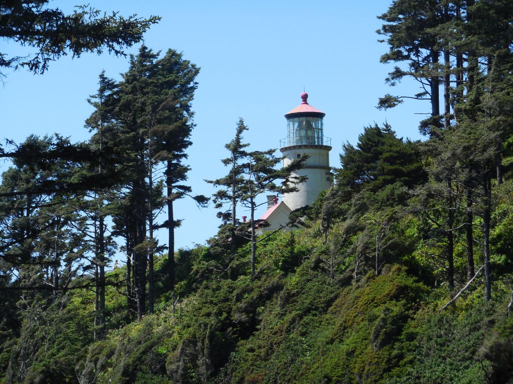
The first lighthouse we saw was Heceta Head Lighthouse near Florence, Oregon. (All of these lighthouses are just off Highway 101 in Oregon.) We had a bit of a hike uphill to see this lighthouse. Here it is from below.
Heceta Lighthouse near Florence, Oregon off Highway 101.Hectea Lighthouse
We were also able to see the lighthouse keeper’s house.
Lighthouse keeper’s house Heceta Head
The lighthouse is visible from Highway 101 further on.
We also saw many historic bridges designed by Conde McCullough from the 1930’s. Cape Creek Bridge near Heceta Head Lighthouse was built in 1932. It is a double-tiered structure with Roman arches and spans Cape Creek next to the Cape Creek Tunnel.
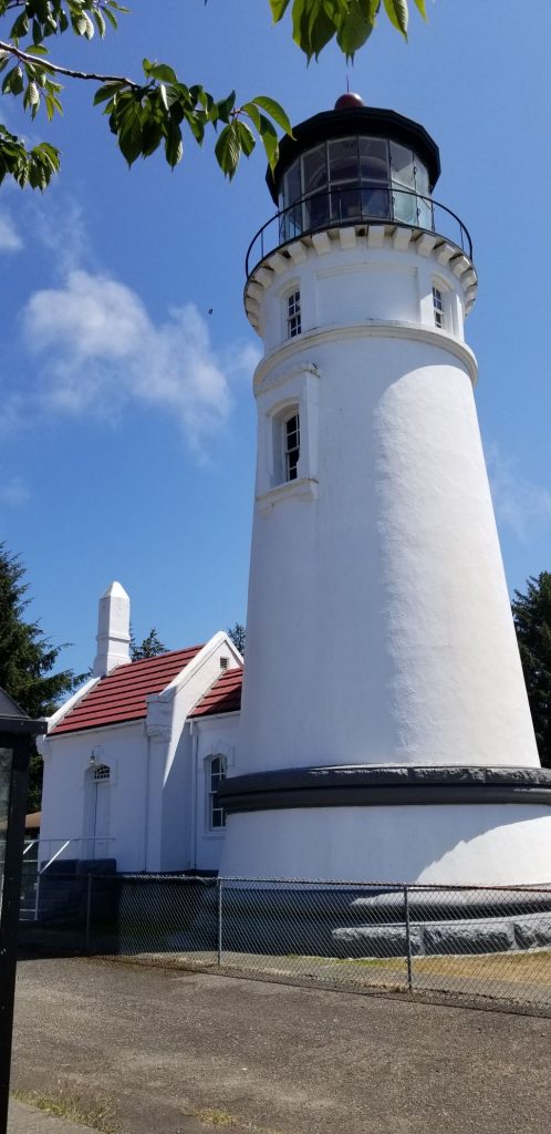
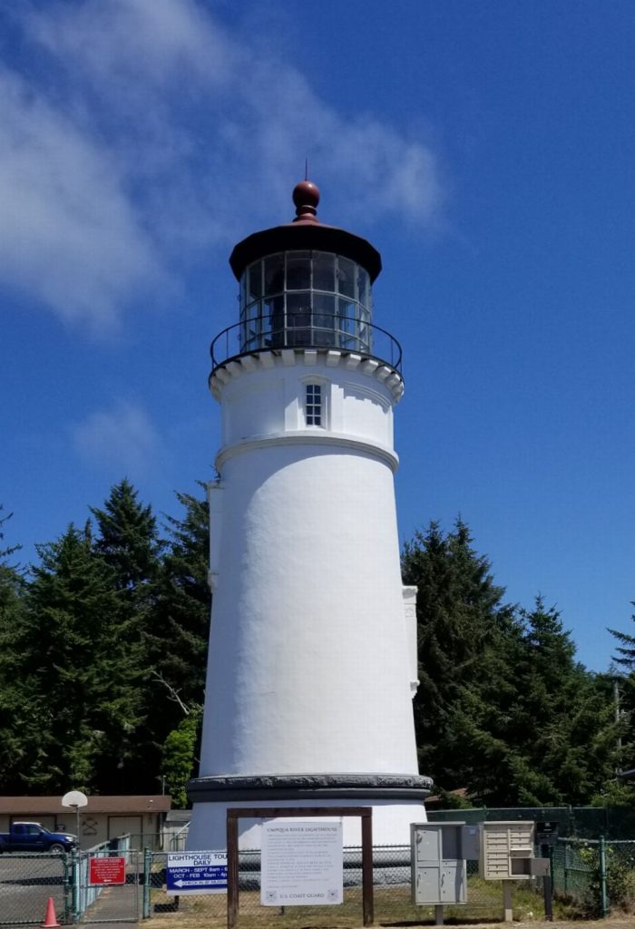
Our next lighthouse, Umpqua River Lighthouse, is located near the city of Reedsport. It isn’t quite as scenic because it was surrounded by a chain-link fence with a roadway running in front of it and mailboxes blocking the view.
Umpqua River Lighthouse, near Reedsport, Oregon.Umpqua River Lighthouse
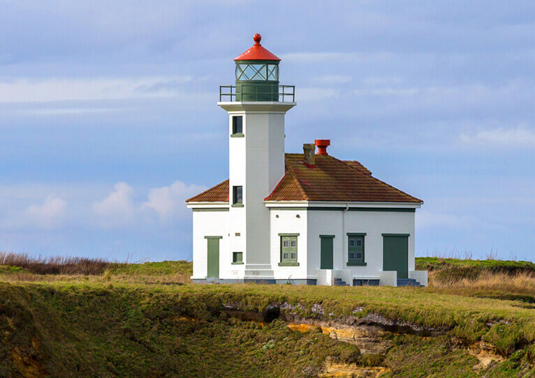
The next lighthouse going south is Cape Arago near Coos Bay. We were unable to find it, but we saw it from a distance from Sunset Bay State Park. However, I felt it was too hazy and distant to get a good photo. It is not accessible by land because it is on an island in the bay, and the closest place to get a good photo is Lighthouse Way which is a private drive. The photo is not mine, but one from the web.
Photo from visittheoregoncoast.com
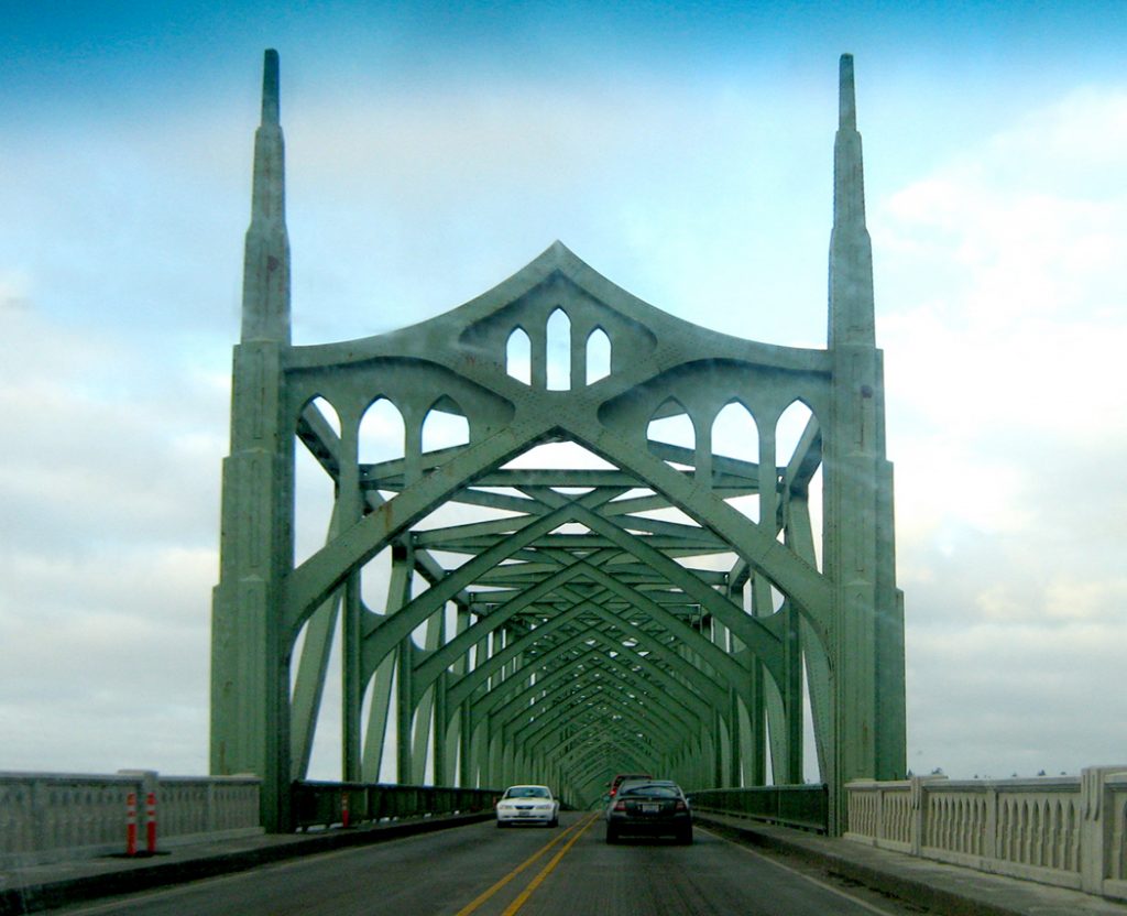
We drove across several bridges on Highway 101 on our quest for lighthouses. One of my favorites is the bridge across Coos Bay. The Coos Bay Bridge is an historic bridge that has a series of arches that come to a point at the top, giving you the feeling of driving though a cathedral. I didn’t get a photo of it, but I borrowed one from the web.
Photo by Richard Nilsen
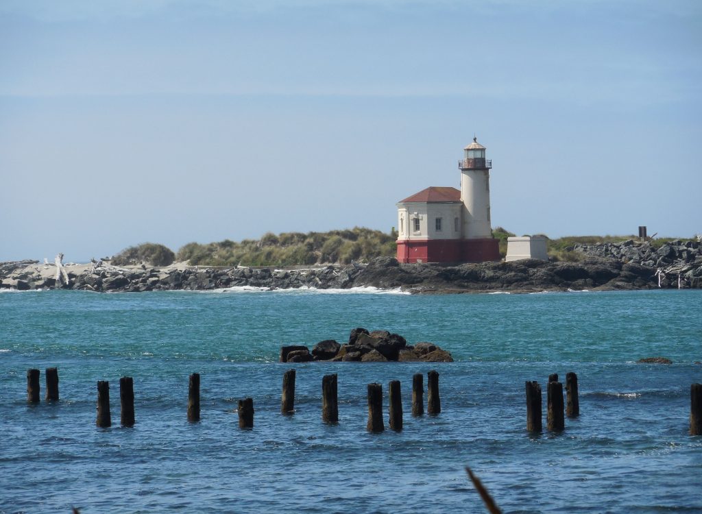
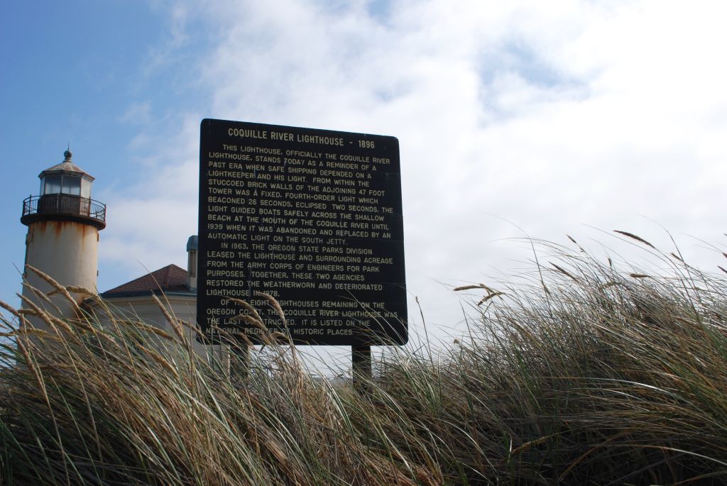
The next lighthouse south on Highway 101 in Oregon is the Coquille River Lighthouse near Bandon, Oregon.
Coquille River Lighthouse near Bandon, Oregon.
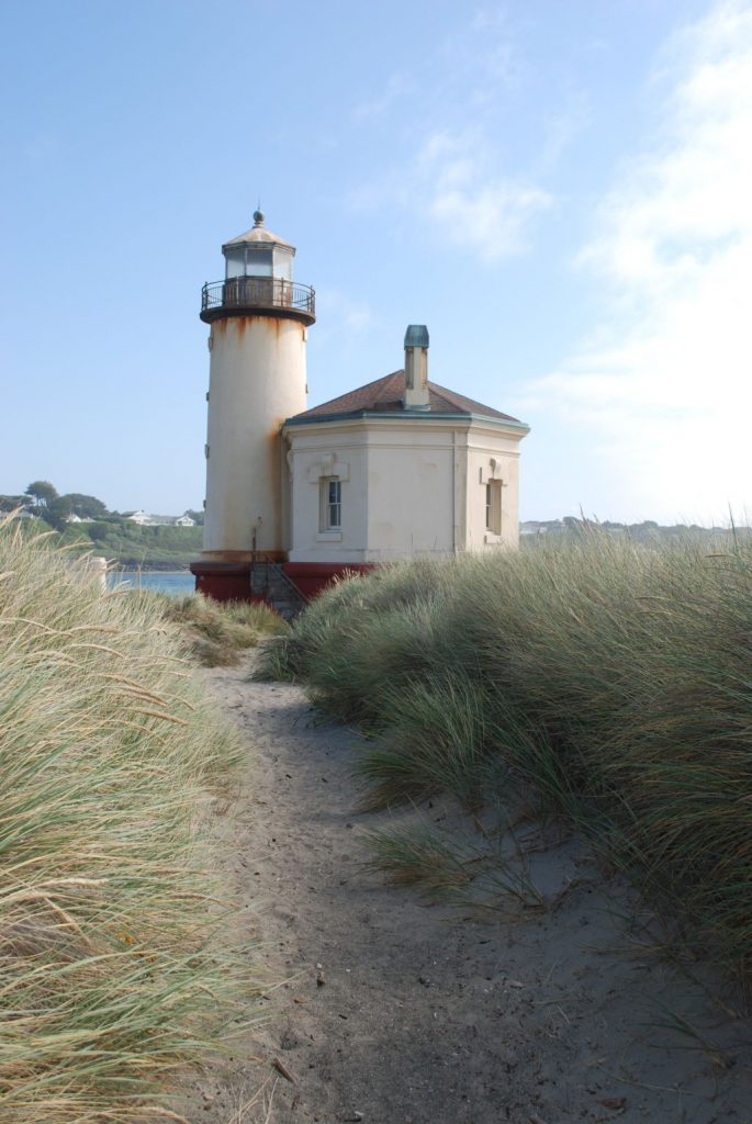
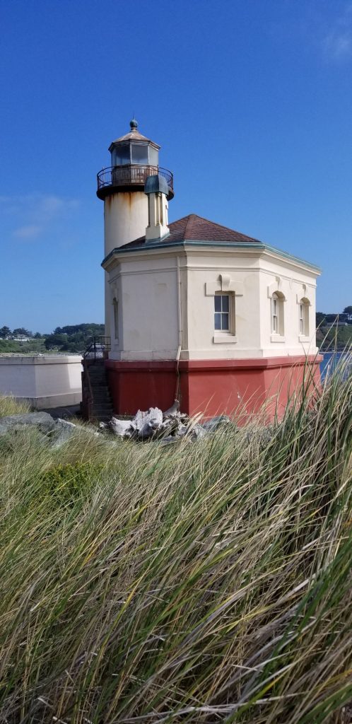
We had a round about way of finding this lighthouse. We first saw it across the river. Then we found a way to drive up closer and walk up.
Coquille River LighthouseCoquille River LighthouseCoquille River Lighthouse
The furthest lighthouse was over 250 miles from our campground. Cape Blanco Lighthouse is near Port Orford, Oregon. It was getting dark and the fog and clouds were rolling in from the ocean. The road to the lighthouse was closed by a gate. It turns out, the only day of the week that it is closed was the day we happened to visit it.
Cape Blanco Lighthouse near Port Orford, Oregon.Cape Blanco LighthouseCape Blanco Lighthouse
We drove back and got to our trailer around midnight, but we felt we were pretty successful in our mission.
We saw more lighthouses but that will be in the next blog.
On our way to the coast of Oregon, we stayed in Baker City, Oregon; Kennewick, Washington; and Welches, Oregon (Mount Hood area).
From Kennewick, Washington, we drove along the Columbia River on Highway 14. There is a highway on the Oregon side also, but we preferred the less traveled two lane road along the Washington side of the river.
The Columbia River looking toward the Oregon side from Highway 14.
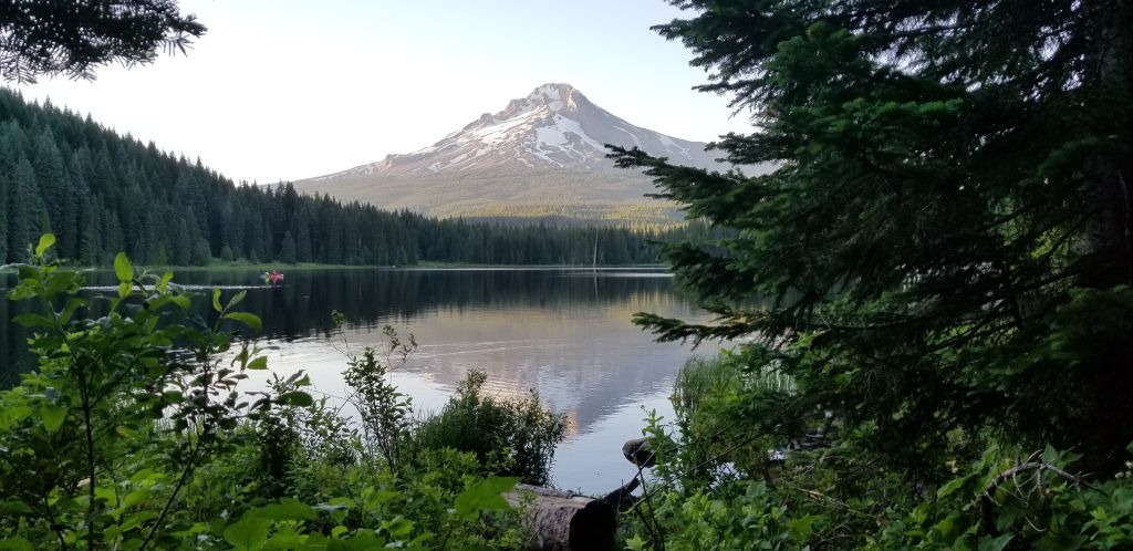
The bare hills and steep canyon walls were impressive. The dry barrenness gave way to trees and greenery as we approached the coastal rain belt. At one point we rounded a bend and in the distance loomed Mount Hood, snow capped and majestic. I’ve seen plenty of mountains, but there is no way to describe this huge mountain that juts up out of nowhere capped with snow in the middle of July. It’s just epic!
Mt Hood from Oregon Highway 35.
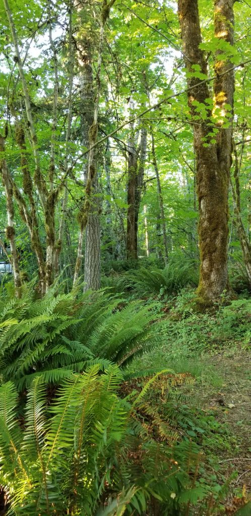
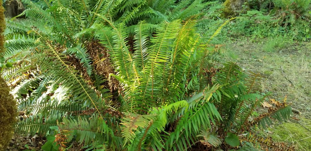
We stayed in one of our Thousand Trails Campgrounds in Welches, Oregon, a little town on the southwest side of Mount Hood. Our campsite was among the trees and lush vegetation. Beautiful ferns were everywhere in between campsites. We were grateful for the tree cover since the temperatures were unusually high–up into the 100’s for a few days.
Our campsite in Welches, Oregon.Ferns grew everywhere in abundance.
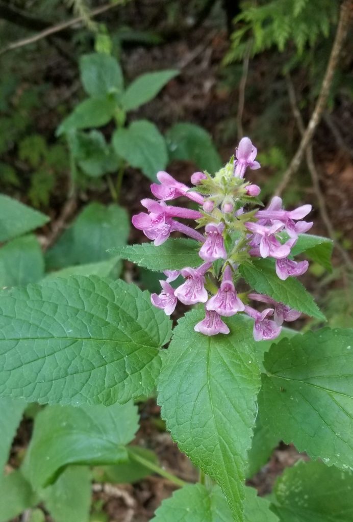
Wildflowers and berry bushes were everywhere.
Foxgloves grow among the trees.
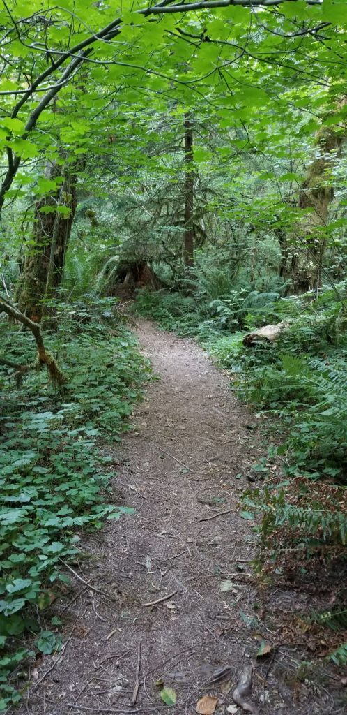
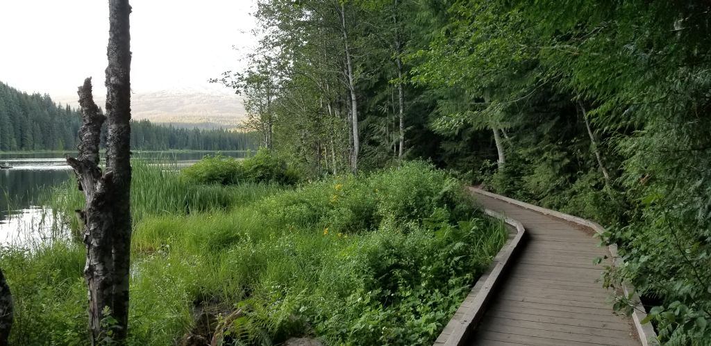
In the evenings, we liked to take walks. One evening we followed a path among the trees.
This path invited us to explore it.
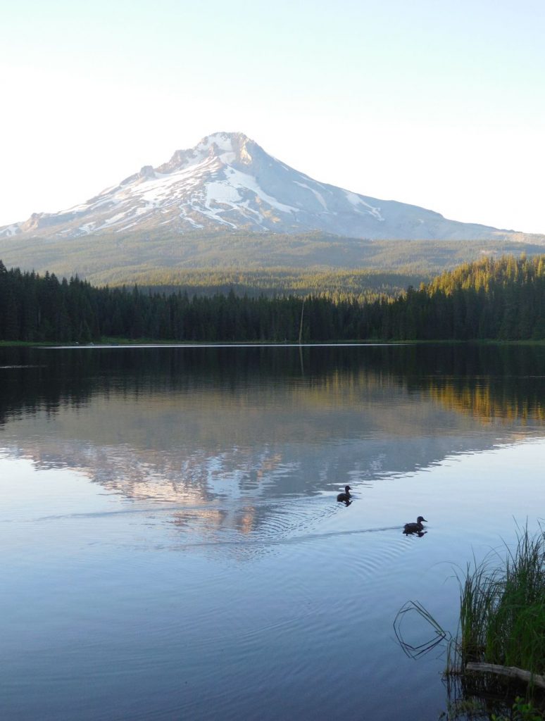
About 15 miles from our campground was Lake Trillium. The first time we went to see the lake, it was crowded with people swimming, fishing, and kayaking. I got a few photos, but the sky was hazy, and the water was choppy, so we decided to go back another time. The second time, we went on a weekday evening right before sunset and had better results.
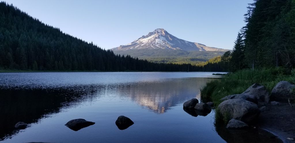
Mount Hood in evening light.
We found a pathway around the lake.
Walkway around lake.
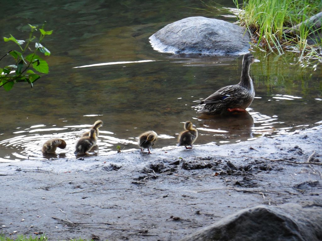
We even saw a mother duck and ducklings.
Mother duck and her ducklings at Trillium LakeThe lake is calmer and the reflection of the mountain is nice. This is my favorite photo from that evening.
We enjoyed our stay in the Mount Hood area, but it was time to head to the coast for some cooler weather.
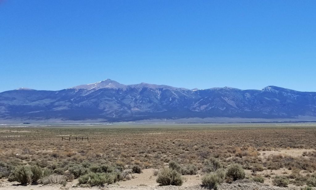
After leaving Arizona, we made our way north by way of eastern Nevada, going through Caliente, Ely and Wells, NV.
Wheeler Peak Great Basin National Park
On the way there, we drove along the backside of Great Basin National Park. I could see Wheeler Peak in the distance. We drove to the top of it when we visited the park last year. The 13,000’ peak still had snow on it.
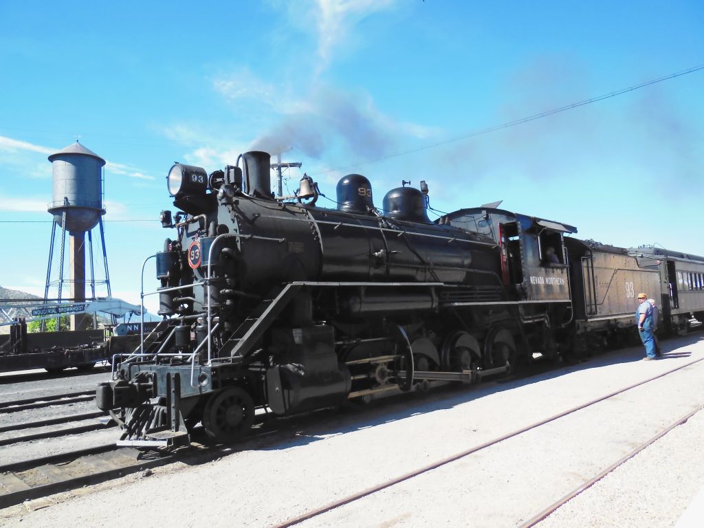
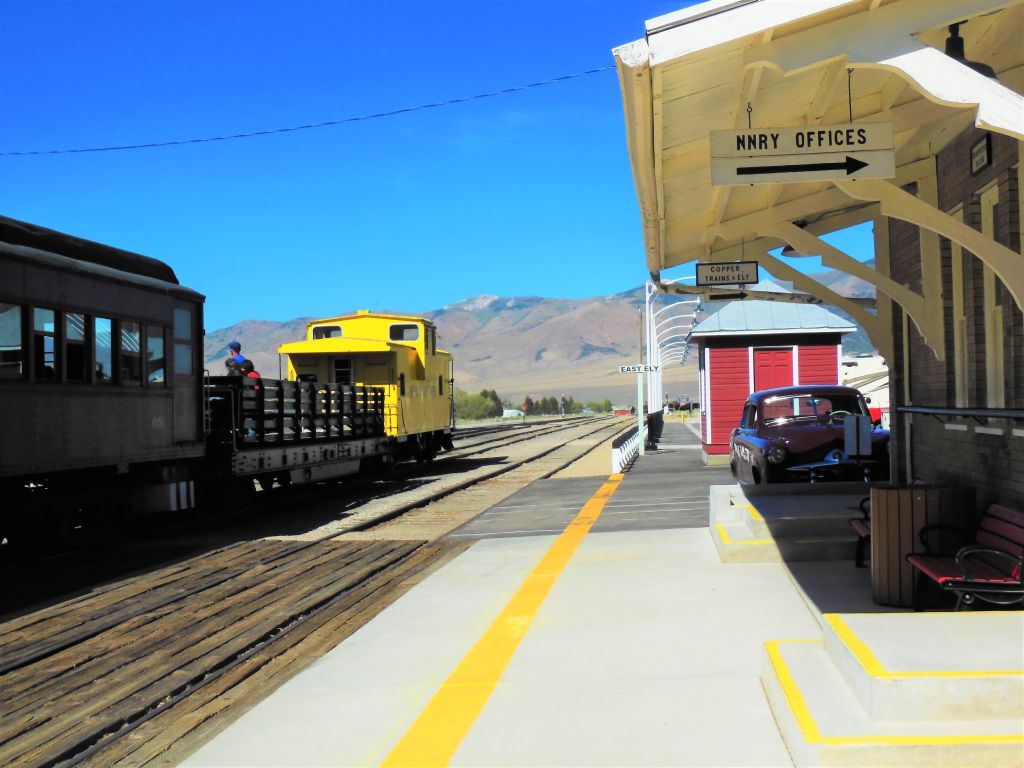
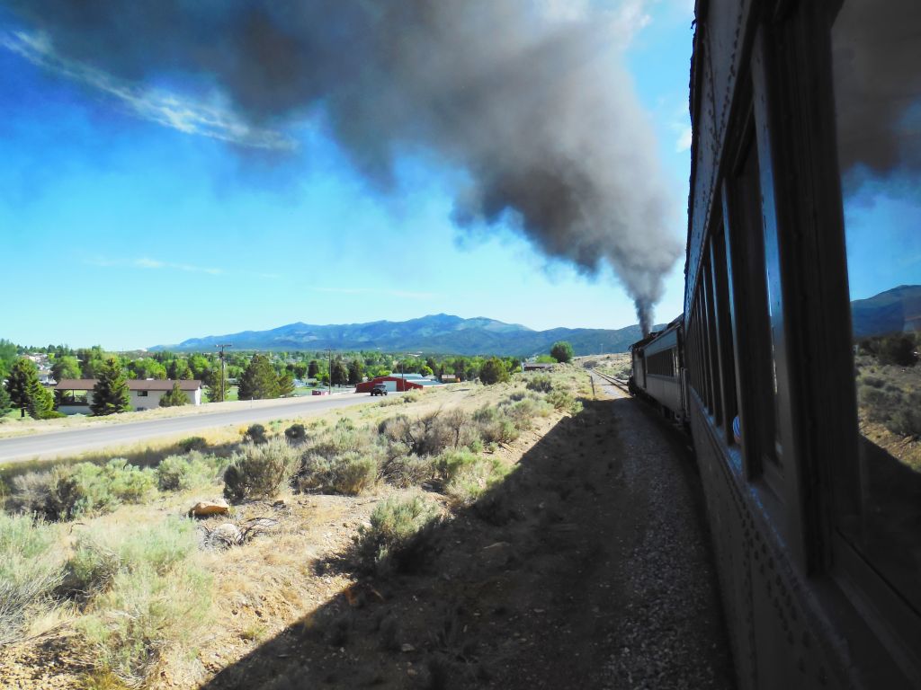
In Ely, we stopped for four nights so we could ride the Nevada Northern Railway and visit the Museum. The Railway is a National Historic Landmark and the museum complex includes a rail yard on 56 acres with 63 structures to explore.
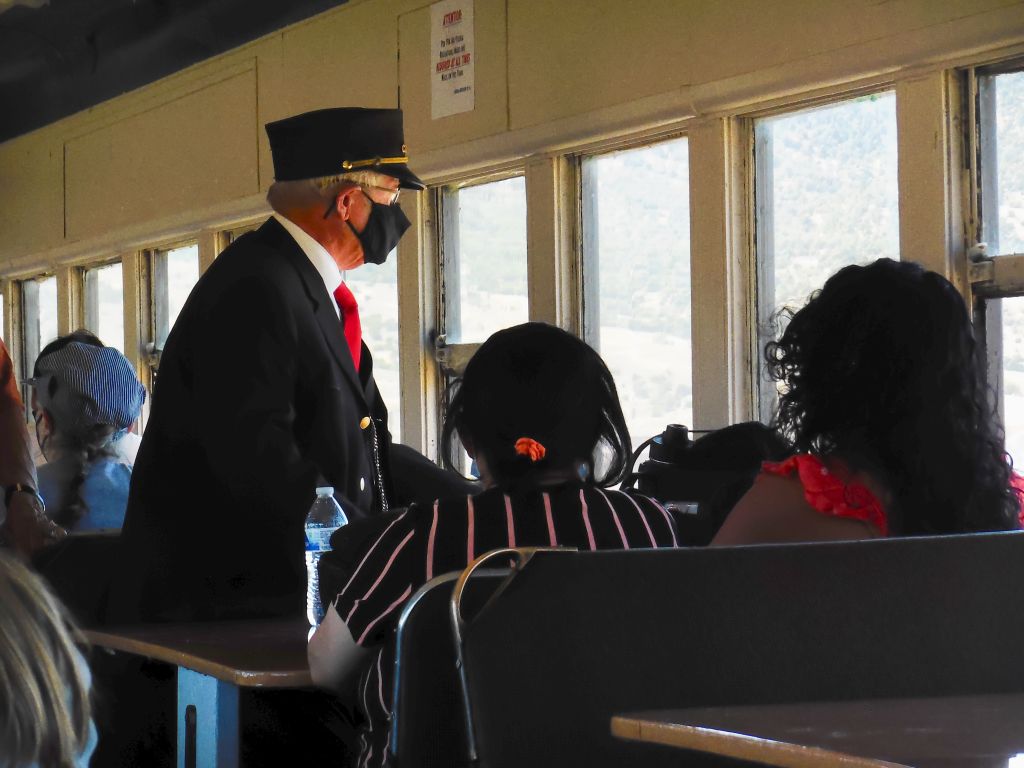
We enjoyed a 90 minute ride in an old passenger car pulled by a steam locomotive.
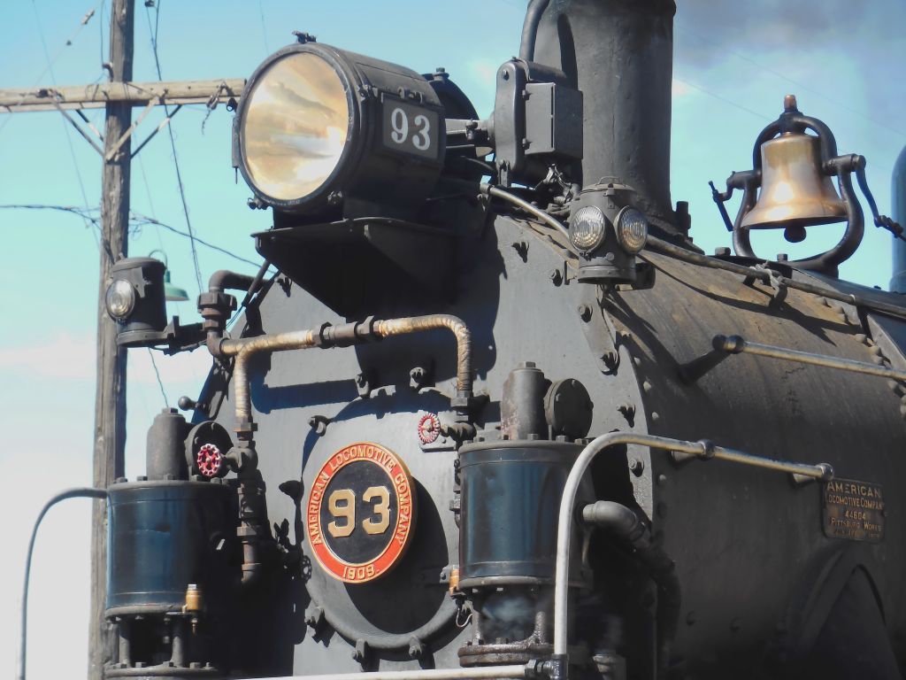
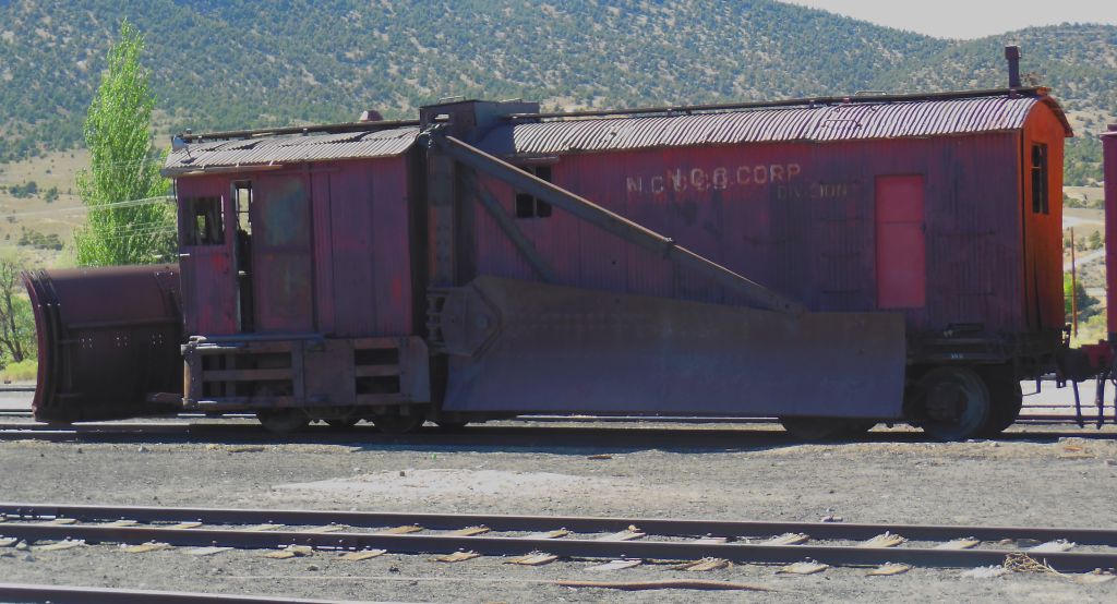
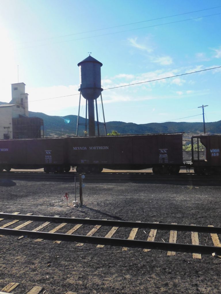
The train depot for the Northern Nevada Railway.The elevation of Ely is 6,437 feet. In winter, this snowplow was used to clear the snow off the tracks.Water tower for Northern Nevada Railway.The conductor punches our tickets.
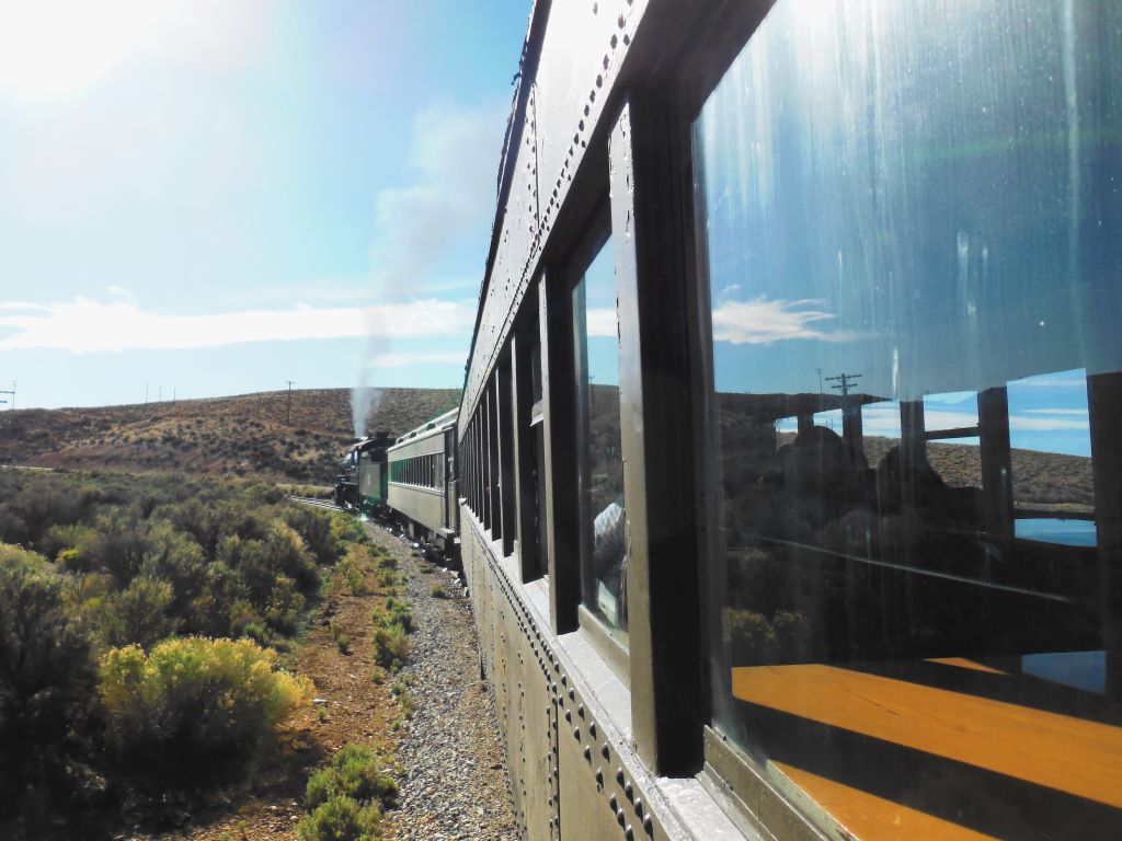
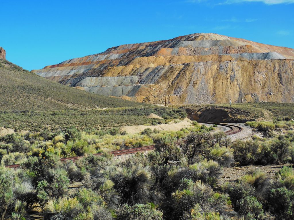
The ride took us through the hills around Ely to a large copper mine and back. Along the way we learned about local history.
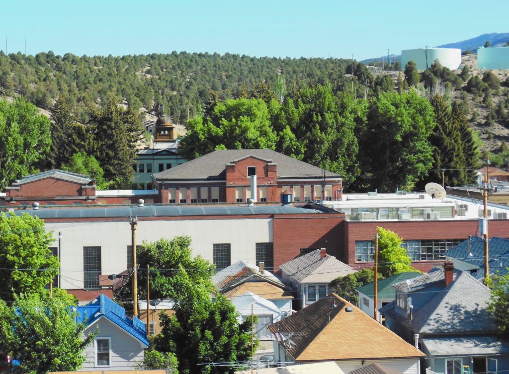
We view the historic town of Ely, Nevada, on our train ride out to the mine.
As we head out of town and uphill, the smoke gets blacker.
Northern Nevada RailwayTailings from the Robinson copper mine.
Copper was used for wiring homes for electricity in the late 1890s. This was once a thriving mine and is still being mined today.
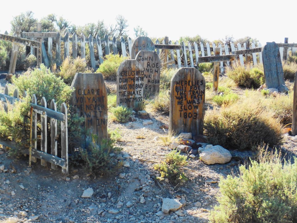
Humorous grave yard on the way to the Robinson copper mine.
On the way back, we were told that sometimes the train gets held up by bandits, but we didn’t see any that day. We did, however, see the graveyard and fake western town nearby.
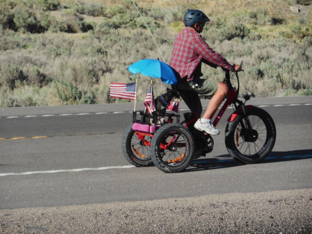
On our way there and back, this fellow with his little dog on the back rode along the highway parallel to the railroad track.
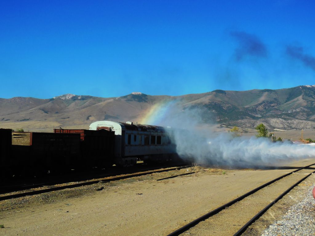
As we arrived back at the depot, we see the rainbow at our journey’s end as the locomotive lets off steam.
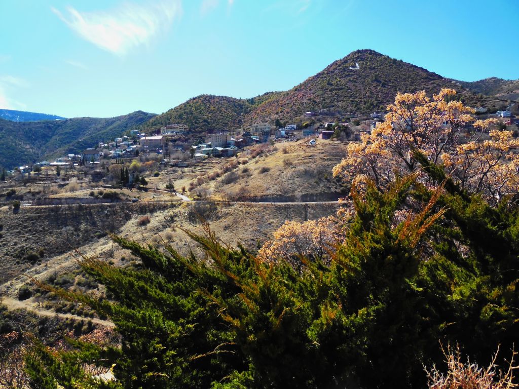
While we were in the Cottonwood area, we visited a few other places nearby. Jerome, 9 miles away, is a ghost town that has come back to life. It is now a tourist trap. Jerome State Historic Park is worth visiting.
The “ghost town” of Jerome is coming alive once more.
We drove the windy road through Jerome to Prescott, Arizona, where I spent one summer of my life as a kitchen helper at Prescott Pines Campground. The campground is a few miles outside of town. In many ways it looked the same, just updated.
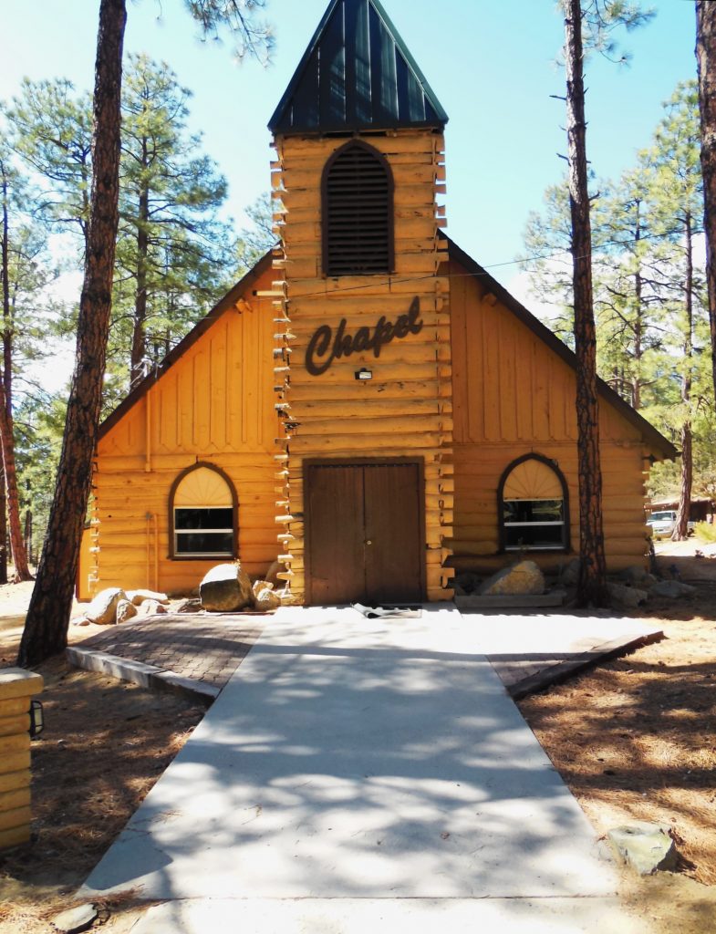
The chapel at Prescott Pines Campground where I worked as kitchen staff in 1972.
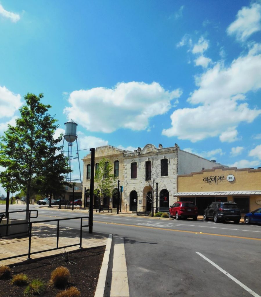
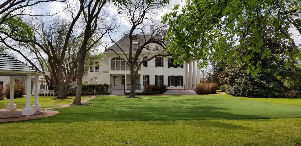
While we were in Cottonwood, we flew to Texas for a week-long stay with my dad while my sister was on vacation. We visited Round Rock, Texas, a pretty little town and the home of the beautiful historic Woodbine Mansion which is now a wedding venue.
Round Rock, Texas, main street.Woodbine Mansion in Round Rock, Texas
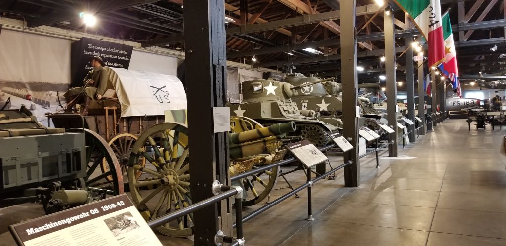
Another day, we visited the Texas Military Museum in Austin. It was large, so we saw just a small portion of it. We plan to visit it again someday.
Texas Military Museum
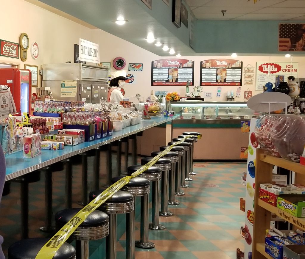
When we got back to Cottonwood, it was time to head back to California for the birth of our 10th grandchild. We used our Harvest Host membership for the first time and stayed overnight in the parking lot of Peggy Sue’s 50’s Diner about 10 miles from Barstow, California.
Inside gift shop at Peggy Sue’s 50s Diner
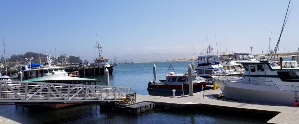
We stayed at our Thousand Trails Encore park in Oceano until our grandchild was born, helping the family with meals and laundry and other such things. Getting to be around the grandkids is always fun, but we made sure we took time for a side trip to Morro Bay for a lunch near the water.
Morro Bay, CA, marina
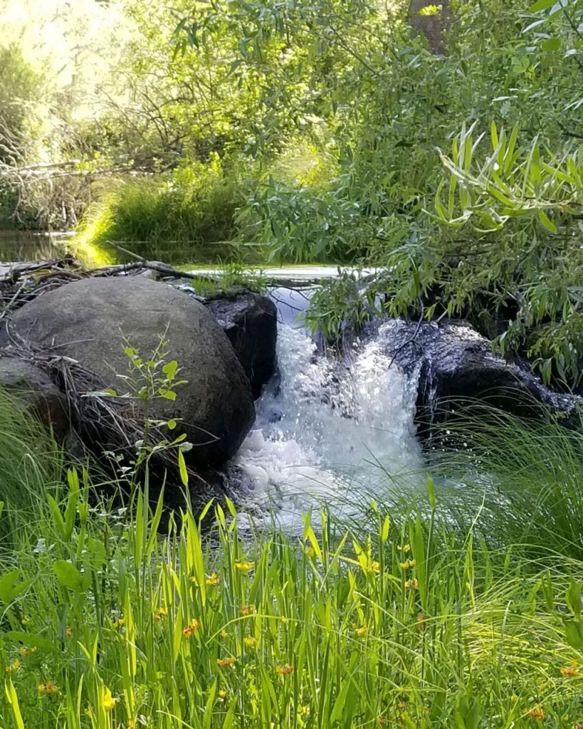
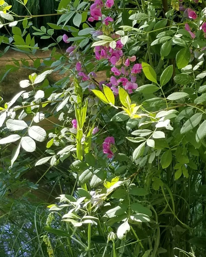
With the new baby welcomed, we made one last visit to our storage unit before heading north for our summer travels. The campground where we like to stay is in Oakhurst, CA. There is a beautiful little waterfall and wildflowers just behind the campsites and plenty of shade.
Our waterfall at Oakhurst, CA.Wildflowers at Oakhurst, CA.Our campsite at Oakhurst, CA.