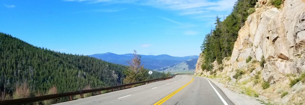
On our way from Canon to Gunnison, Colorado, we had to cross Monarch Pass. It is 11,312 feet in elevation. The road is in good condition, and the views are unforgettable.
Monarch Pass – 11, 312 feet in elevation
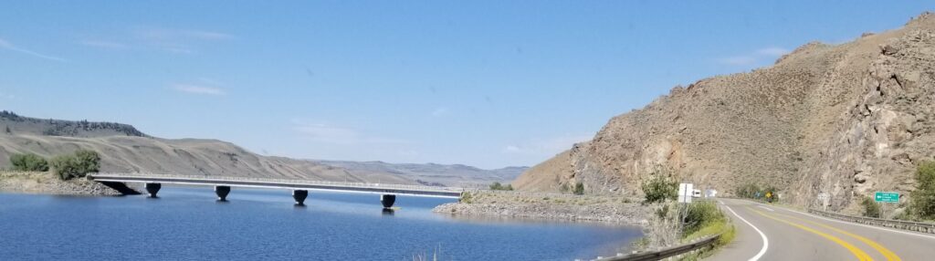
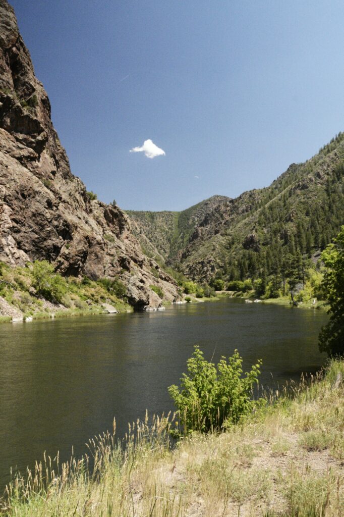
US Highway 50 is very scenic from Gunnison to our Thousand Trails campground. For several miles the road follows along beside the Gunnison River and Reservoir. We would cross this bridge later in the week on our way to Lake City. But that’s another story.
Blue Mesa Reservoir on US Hwy 50 West
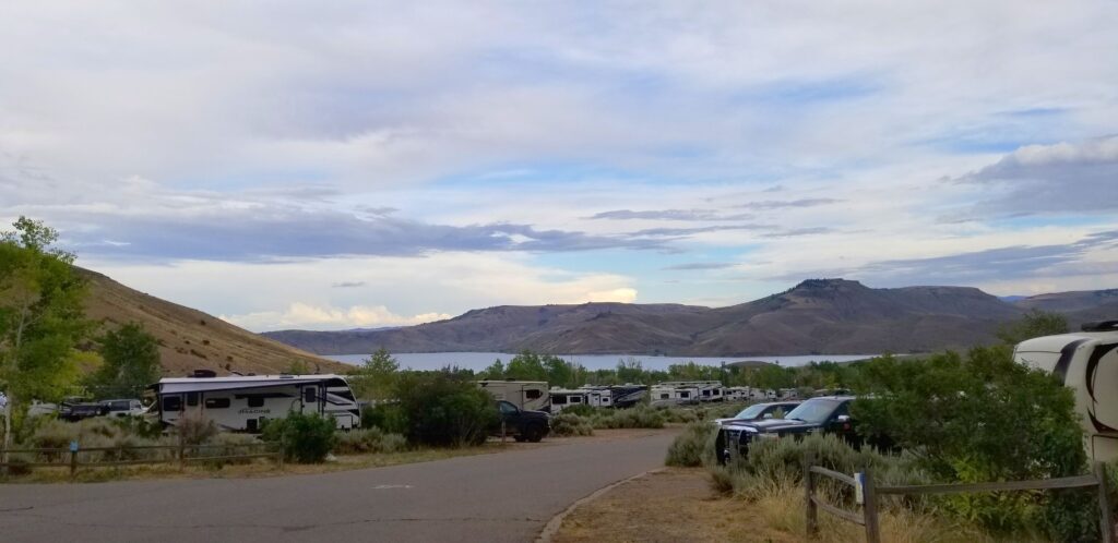
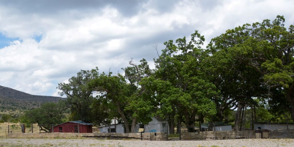
We could see the lake from our campsite. It was just across the highway from the campground. The weather changed every day. Sometimes it was very calm, and other times it was very windy.
Blue Mesa Thousand Trails RV Park
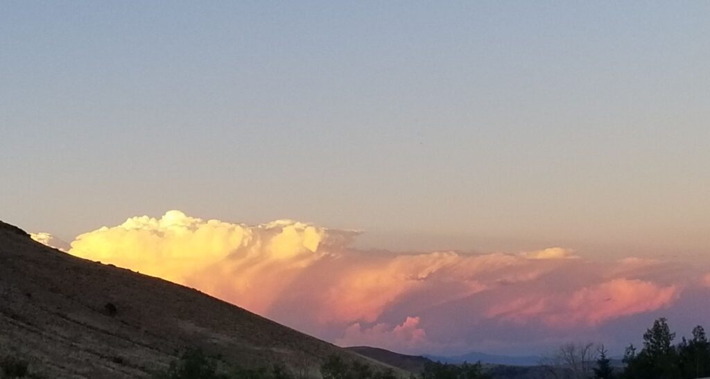
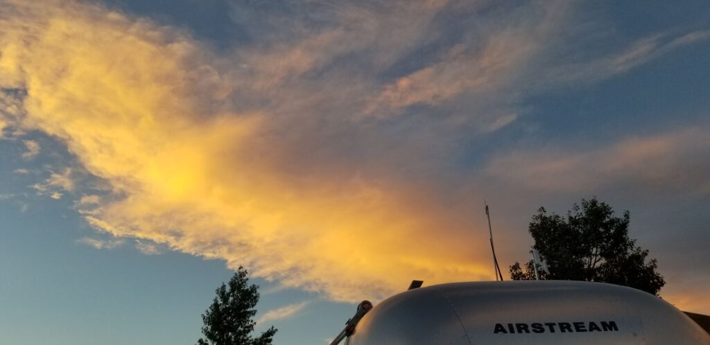
In the afternoons, we would often get thunderstorms with magnificent looking clouds, especially at sunset.
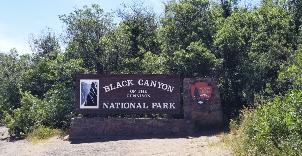
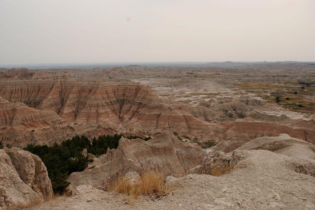
During our three-week stay there, we took several day trips. One of our trips was to a new national park (for us), Black Canyon of the Gunnison. I’d never heard of it before until I was looking on the map to see what was near us. It was still about an hour drive from us, but totally worth it.
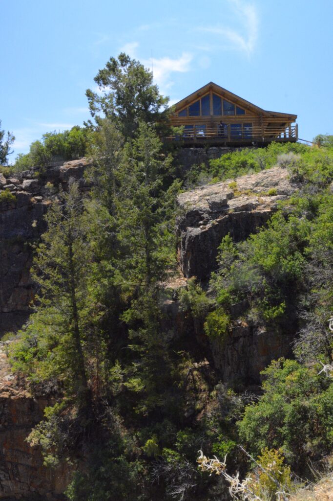
Right near the park entrance is the Visitors’ Center. It is perched on a hill overlooking the canyon. There’s a trail that leads to a lookout point. We walked down, but had to stop a couple of times coming back up. It is at an elevation of 5,600 feet and we weren’t used to it yet.
Visitors’ Center
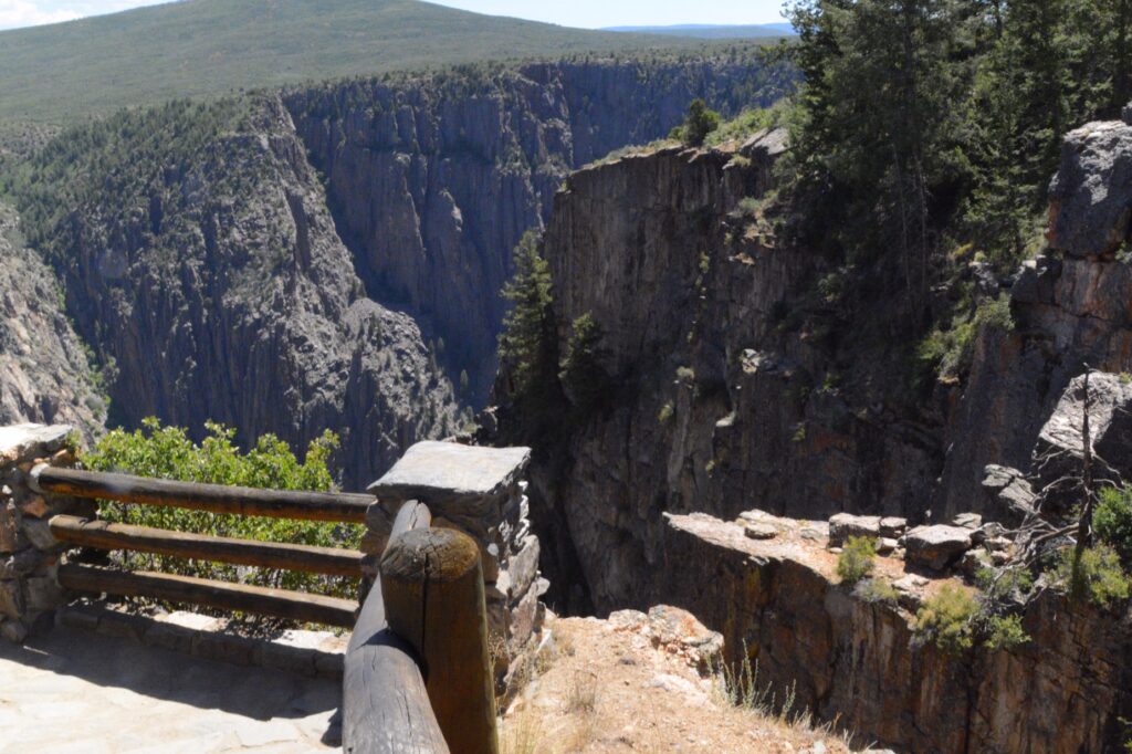
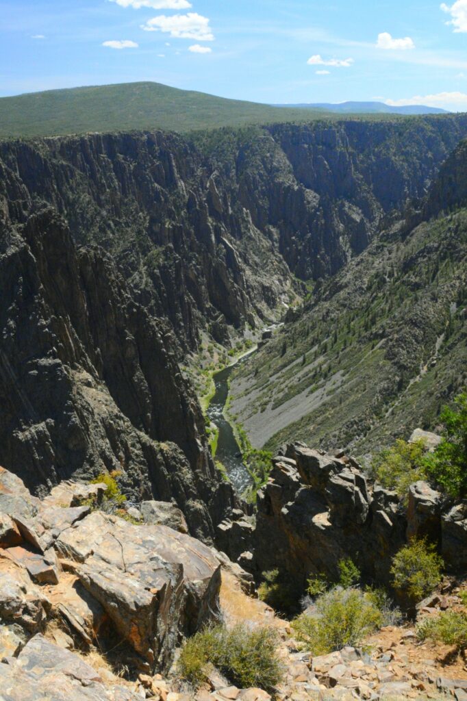
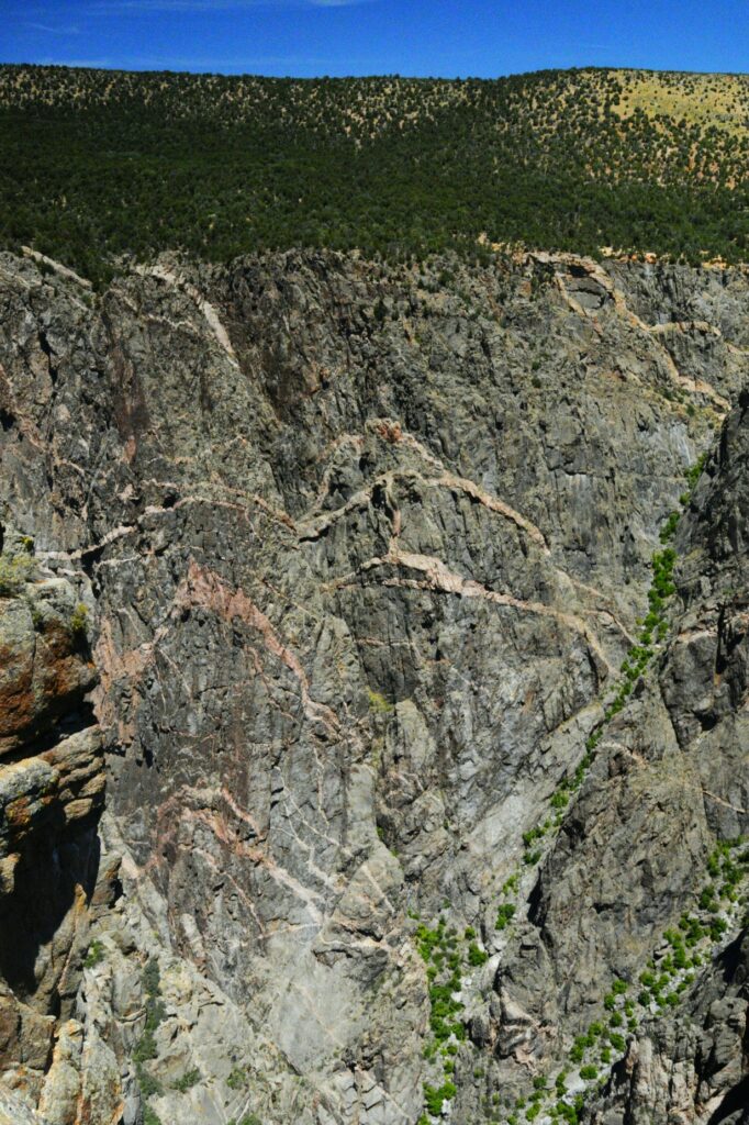
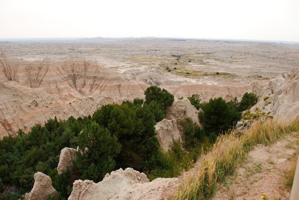
At our first lookout below the Visitors’ Center, we got our first real sense of the depth of this canyon. From 1,820 feet to 2,722 feet it makes it a real challenge for anyone afraid of heights as we were soon to find out.
Gunnison Point OverlookGunnison Point Overlook
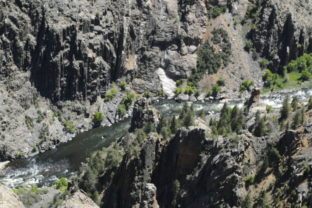
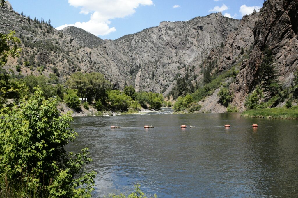
At the bottom of the canyon was the Gunnison River hundreds of feet below.
Gunnison RiverGunnison Point Overlook opposite direction
The road follows the edge of the canyon. We reached one point where the road nears the edge. There in the middle of the road was an RV stopped, straddling both lanes. A man was walking around in the road looking agitated.
I was driving, so I rolled down my window and asked him what was wrong. He (Brian) came over to tell me he had a panic attack and was unable to drive so close to the edge around the curve. When I offered to have someone (Ray) drive for him, he was visibly relieved. Ray took over for him and drove the rest of the way. We had our ham radios to communicate between the vehicles, so when I wanted to stop to take photos, Ray could pull over.
It surprised me that Brian got out and looked at the canyon at the overlooks. Apparently, he was okay with heights as long as he wasn’t driving.
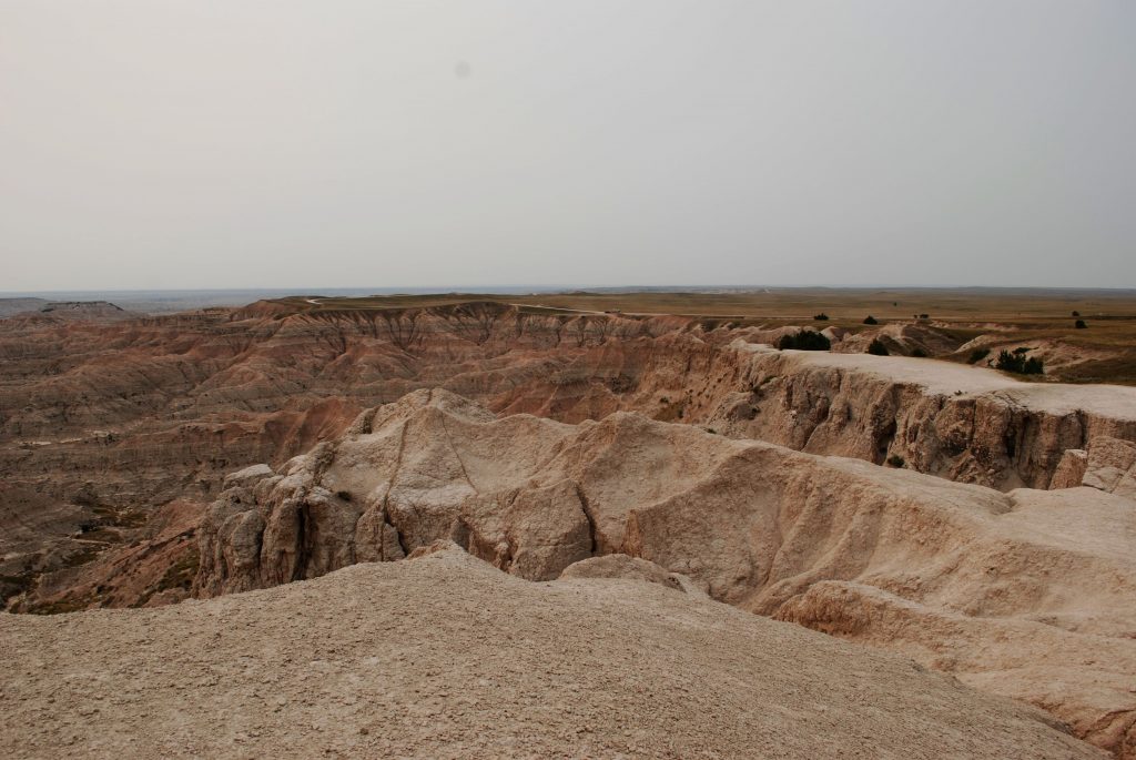
Pulpit Viewpoint
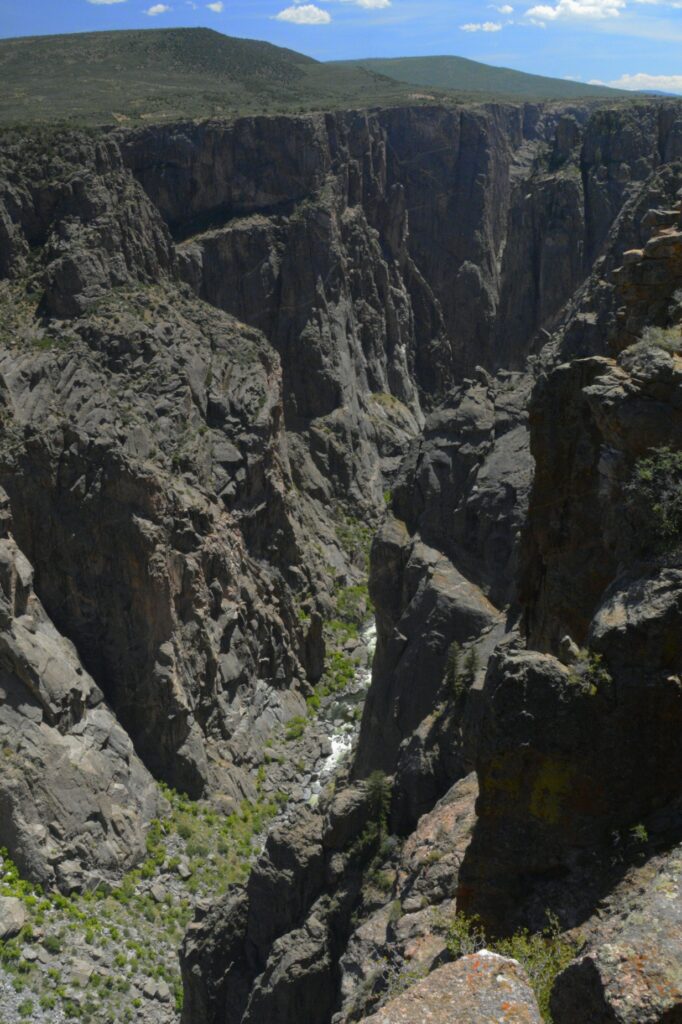
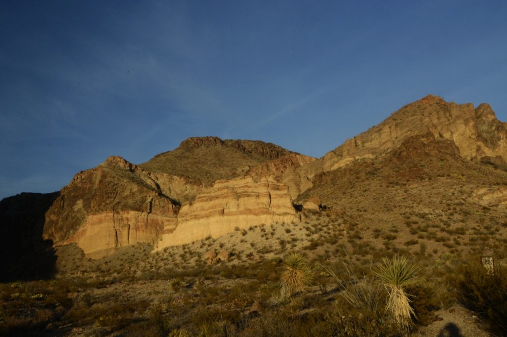
At Chasm Viewpoint, one can look straight down for hundreds of feet from the viewing point. The canyon is only 1,100 feet wide at the rim, and as little as 40 feet wide at the narrows.
Chasm Viewpoint
“Painted Rocks” looks like someone splashed paint across the canyon walls. The colors are from minerals from volcanic activity and erosion that exposed them.
Painted Rocks
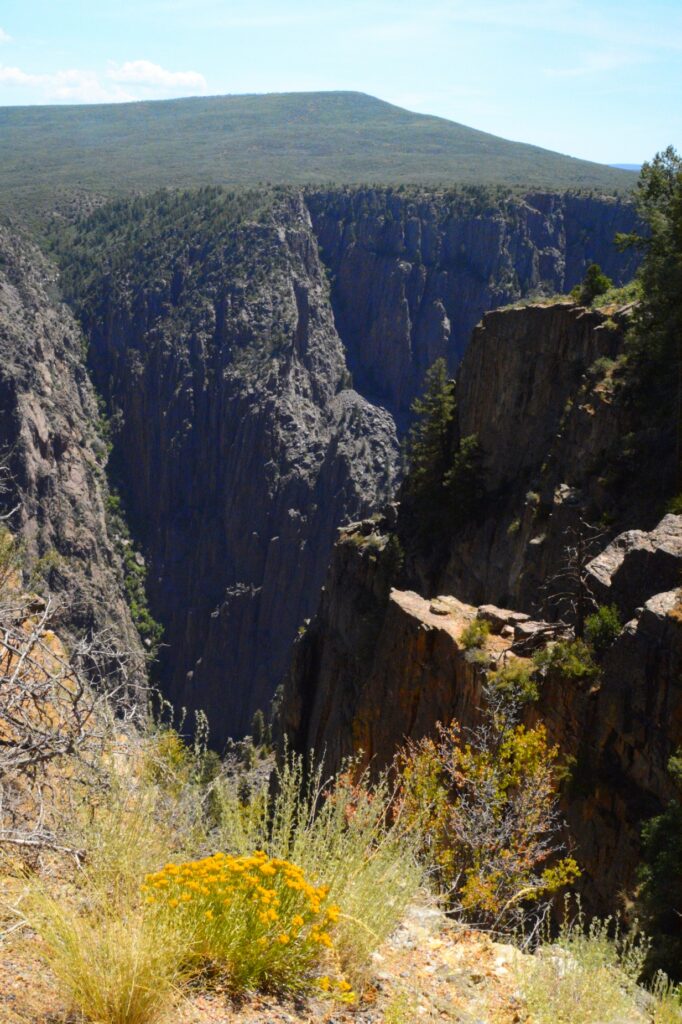
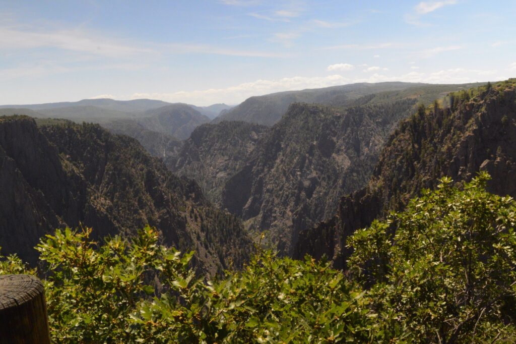
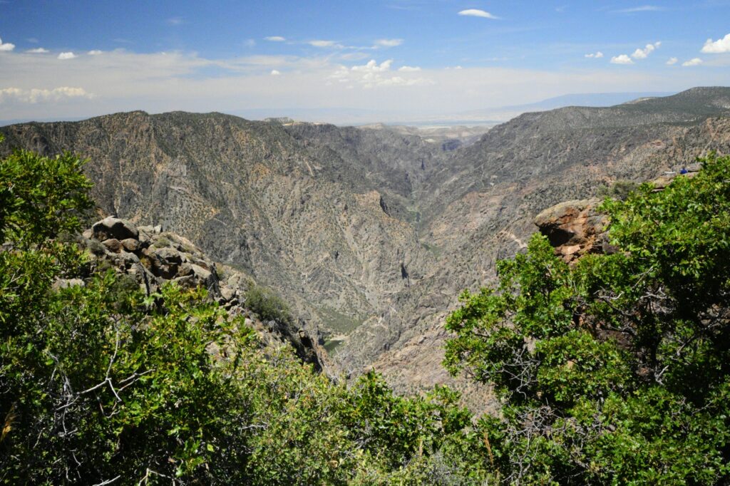
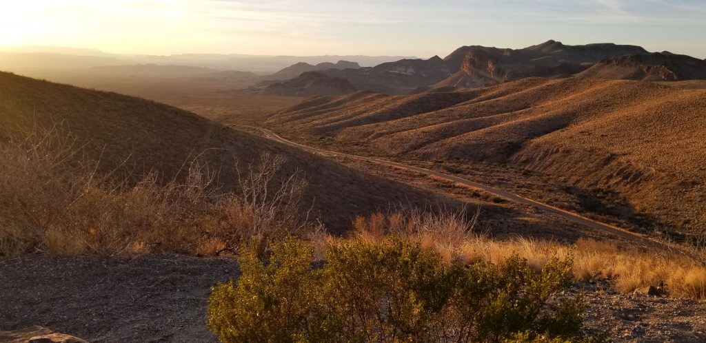
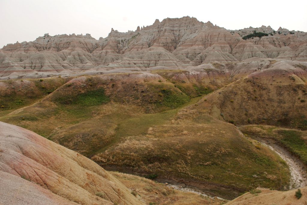
At Warner Overlook the distant valley is visible. The Canyon is 48 miles long, but only 14 miles is contained in the Black Canyon National Park boundaries.
Warner Point Overlook
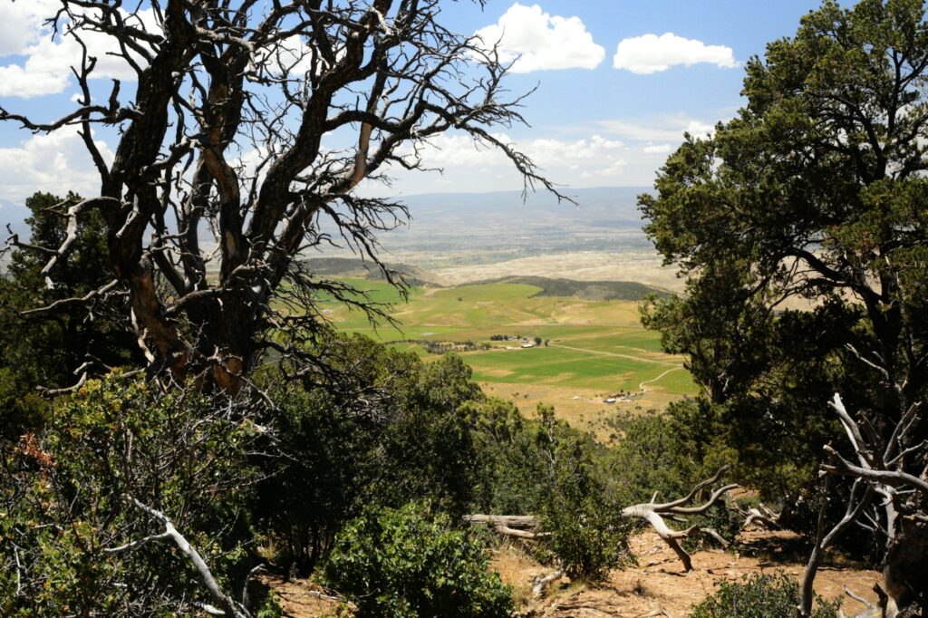
The contrast between the rocky cliffs and the lush farmland below shows the beautiful variety in God’s creation.
Looking over the valley below
Ray drove the RV back to the entrance of the park where he handed it over to Brian again. Brain thanked us profusely and tried to pay Ray for his time, but Ray refused. He came over to shake my hand and thanked me also. His palm was still sweaty, so I knew his panic had been real. Later, we discovered a wad of money that he’d stuck in Ray’s back pocket. We were just glad to help a fellow traveler out of a pinch.
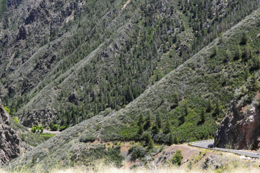
The road to the bottom of the canyon
After dropping Brian off, we drove the road down to the bottom of the canyon. The descent is quite steep in parts, but a beautiful drive. We brought a picnic lunch. By then it was nearly 2:00 p.m. and we were pretty hungry. We found a covered picnic area right by the river and enjoyed the view while we ate.
We’d had an interesting day. It wasn’t what we had planned, but sometimes God puts people in our way that need His love demonstrated to them.
We were glad to finally get back home to our little home on wheels.
For we are his workmanship, created in Christ Jesus for good works, which God prepared beforehand, that we should walk in them. Ephesians 2:10
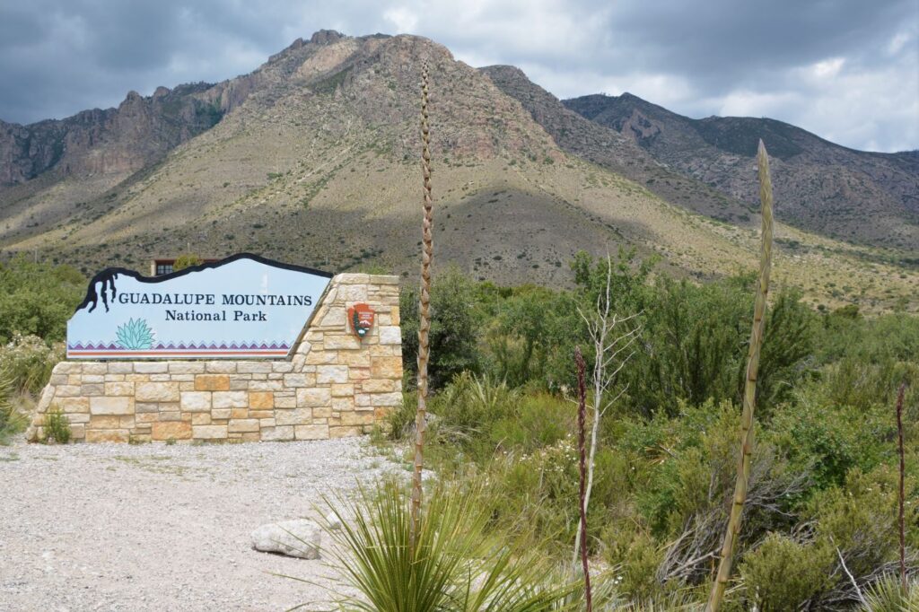
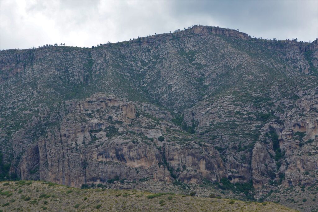
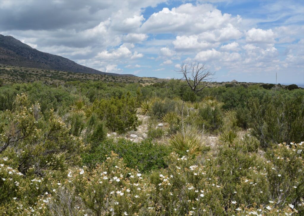
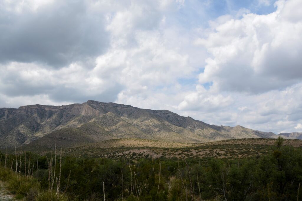
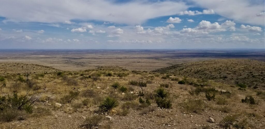
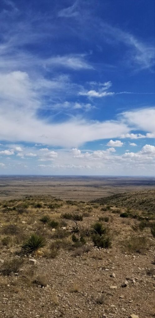
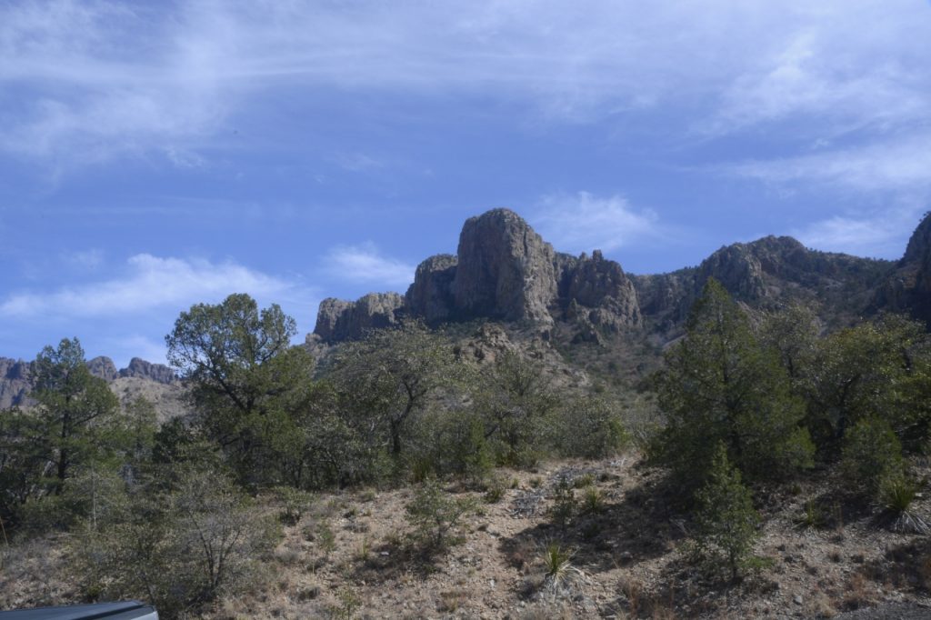
Created in 1966, Guadalupe Mountains National Park contains the highest point in the state of Texas, Guadalupe Peak (8,751′). The park is located near Carlsbad, New Mexico, and just a few miles across the Texas border. In the western “arm” of Texas, this less known national park is well-known for its clean air.
The views of mountains in Guadalupe Mountains National Park with a zoom lens
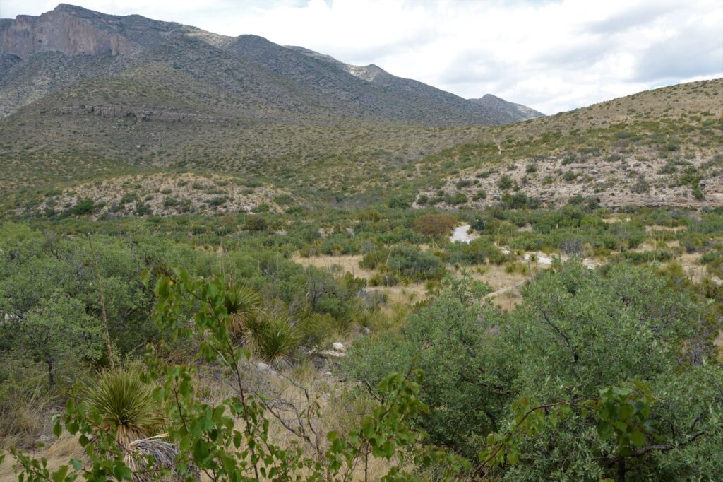
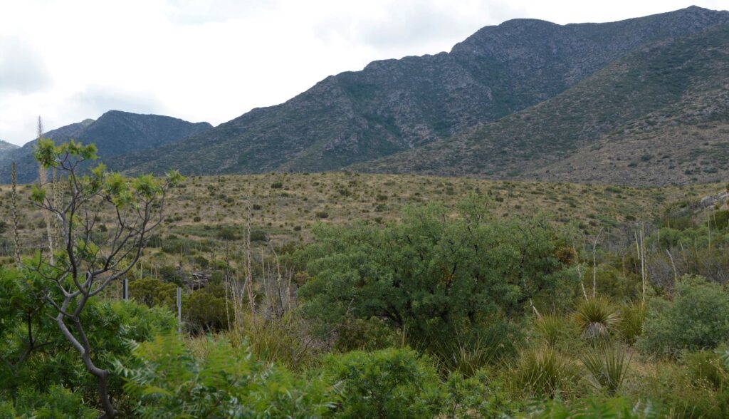
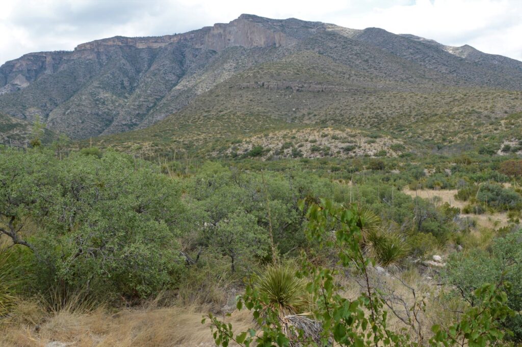
The Park is intentionally inaccessible. It was created during a time when the environmental movement was in full swing. Ninety-five percent of the park is wilderness. From the eastern border of the park where we were, there are only three short roads into the park. If you like to hike, however, there are numerous trails throughout. For us old people, we had to be content with viewing the mountains from a distance.
There are roads around the outside of the park with various viewpoints. If we had driven several hours more, we might have been able to see more, but we just didn’t have the time.
Like Yosemite National Park, this park also has an “El Capitan.” It is a 1,000′ high limestone cliff. It is visible from the highway as you drive further south. However, we did not go that far.
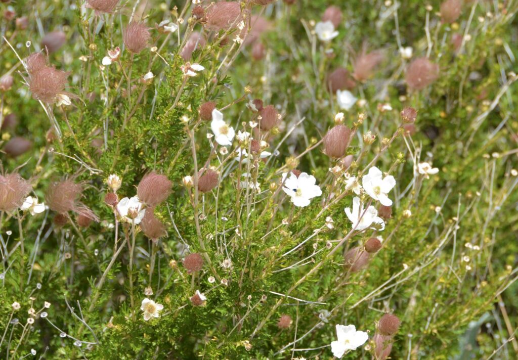
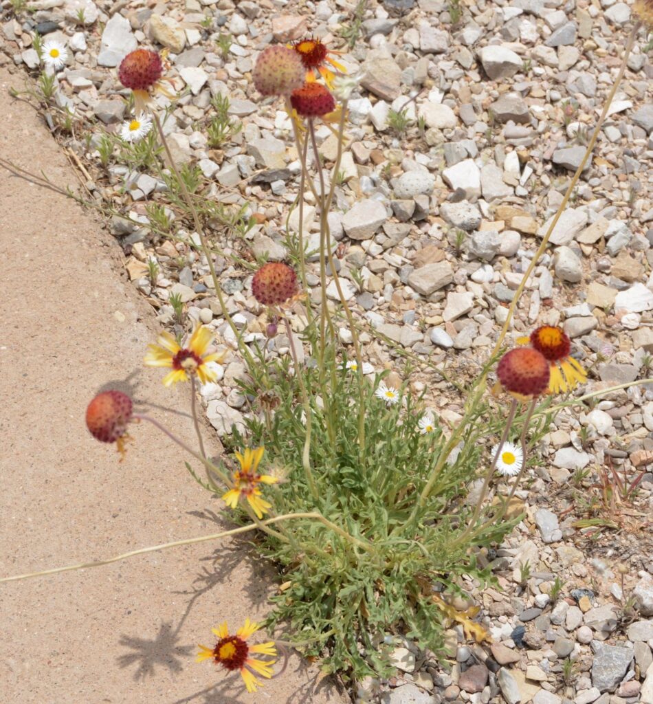
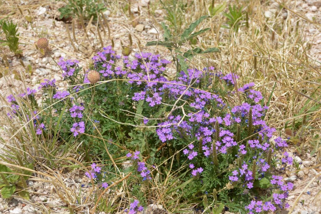
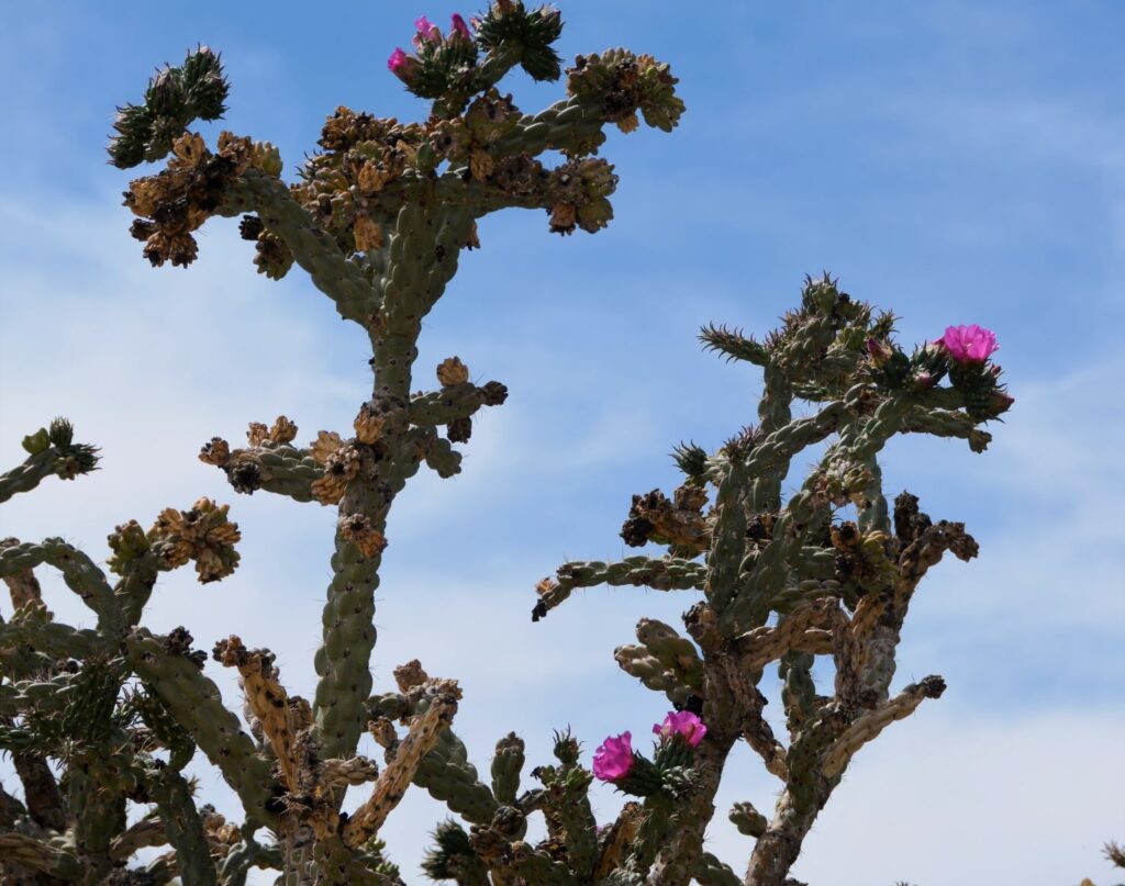
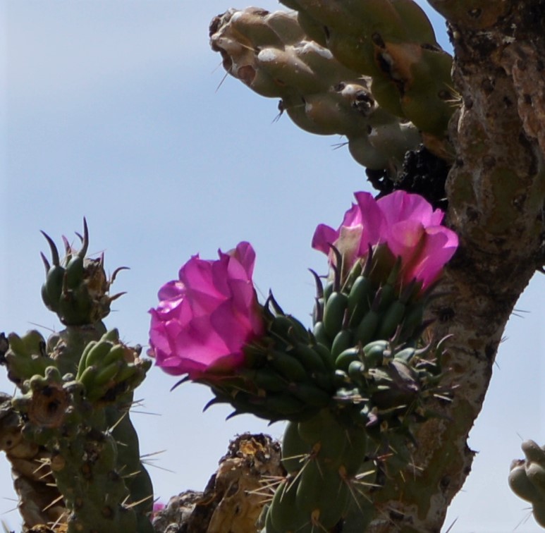
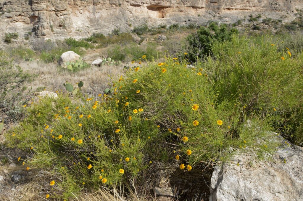
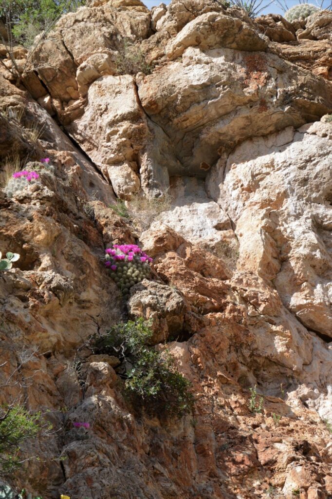
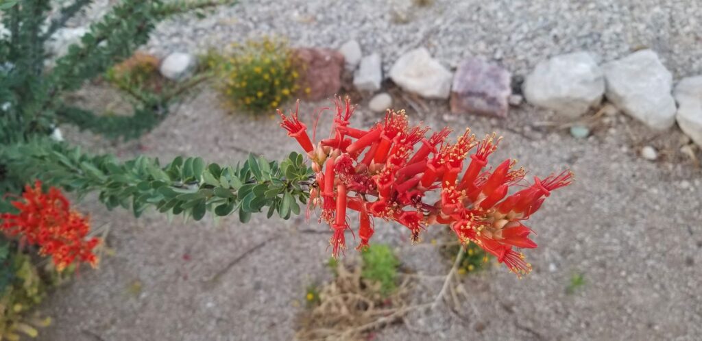
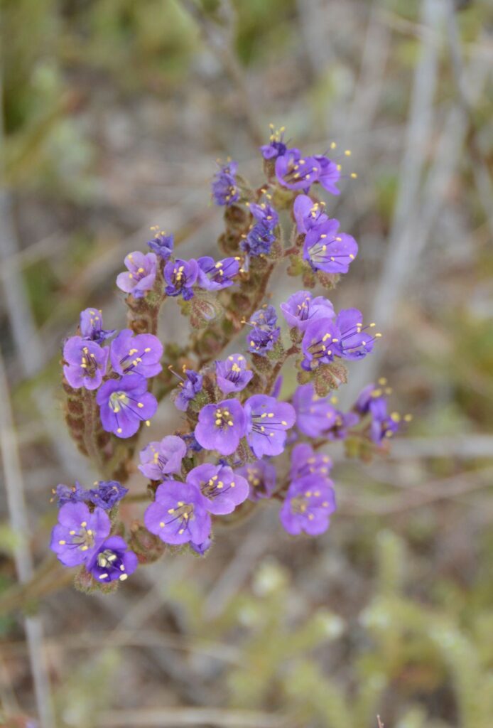
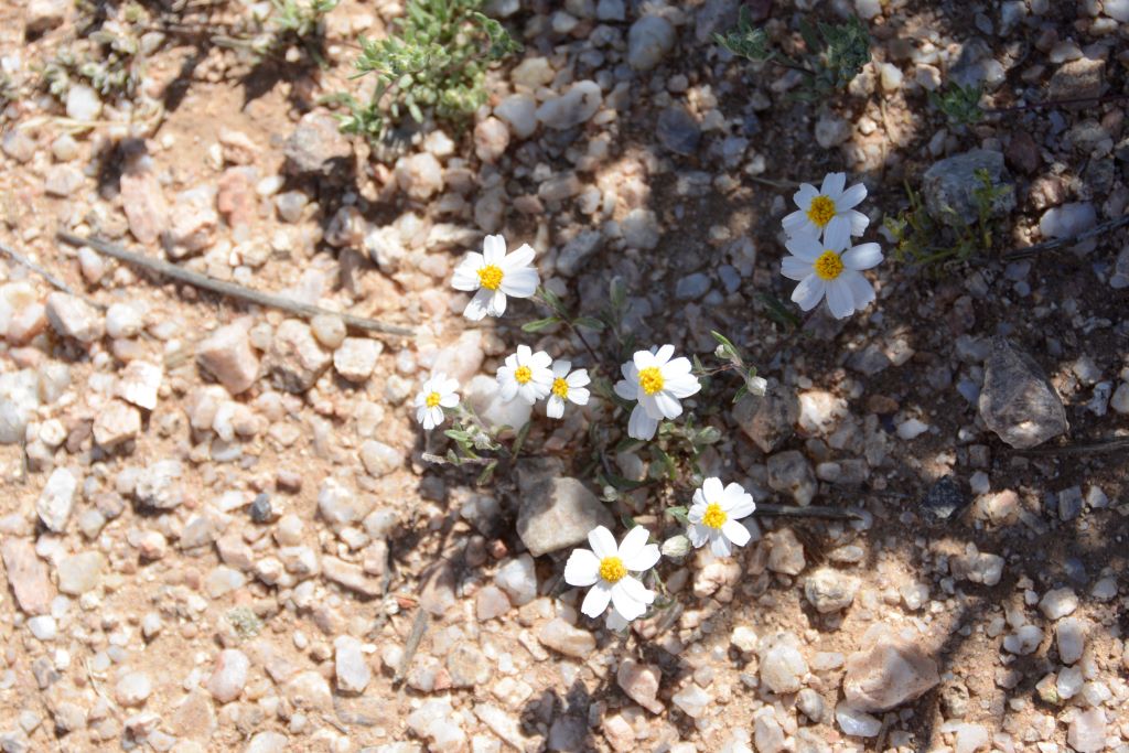
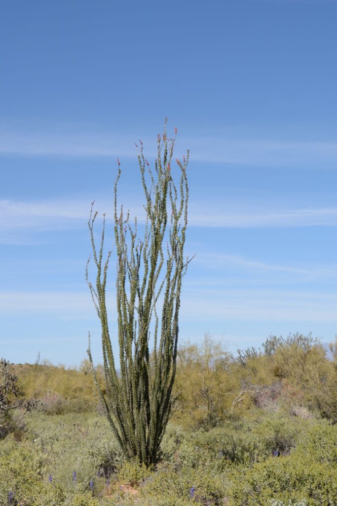
The wildflowers and cactus were in bloom and we enjoyed seeing the beauty of the desert in bloom.
We visited the historic Frijole Ranch, but the museum was closed. It is only open seasonally when staff or volunteers are available. There was a spring outside the ranch house that flows continually at 5 gallons per minute. A spring house covers the opening and the water flows in a channel through the courtyard.
Frijole Ranch
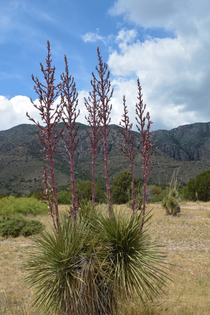
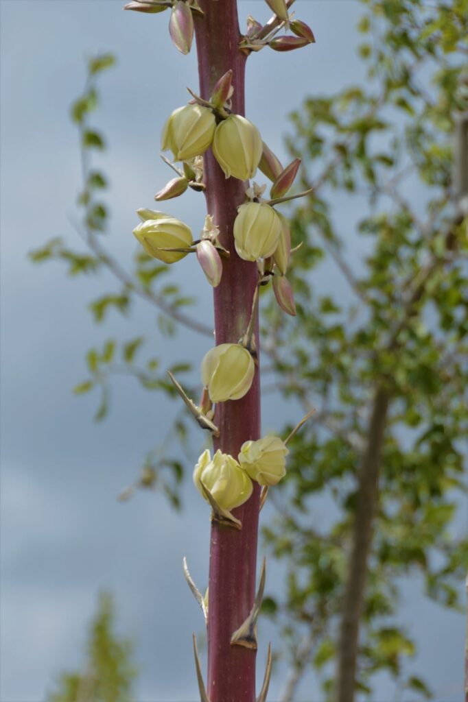
Outside the Visitors’ Center, we were fascinated with the yucca plants in various states of bloom. The yucca is related to the agave plant.
Yucca plants in early bloomClose up of yucca blooms
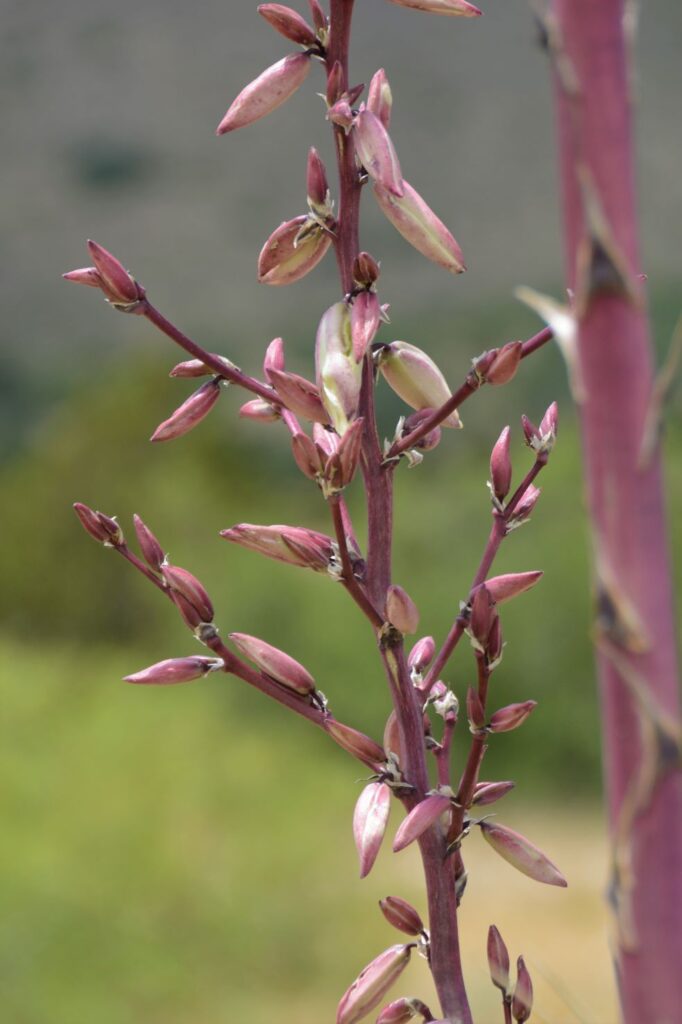
Indians called yucca “soap weed.” The roots were used for washing. Other parts of the plant were used for medicine and food. The fibers were used for many things and the seeds were used for tea or dried for making beads.
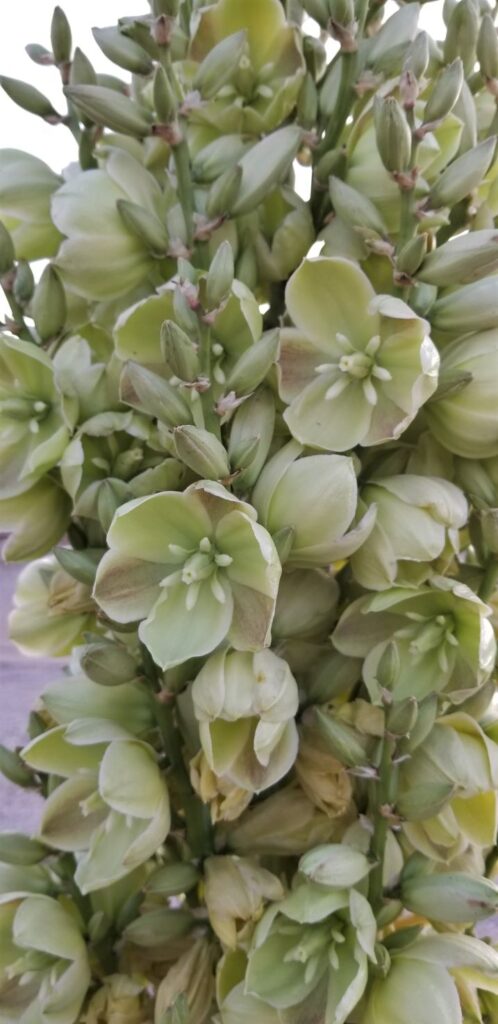
Yucca plants with mature flowersMature flowers of the yucca plant
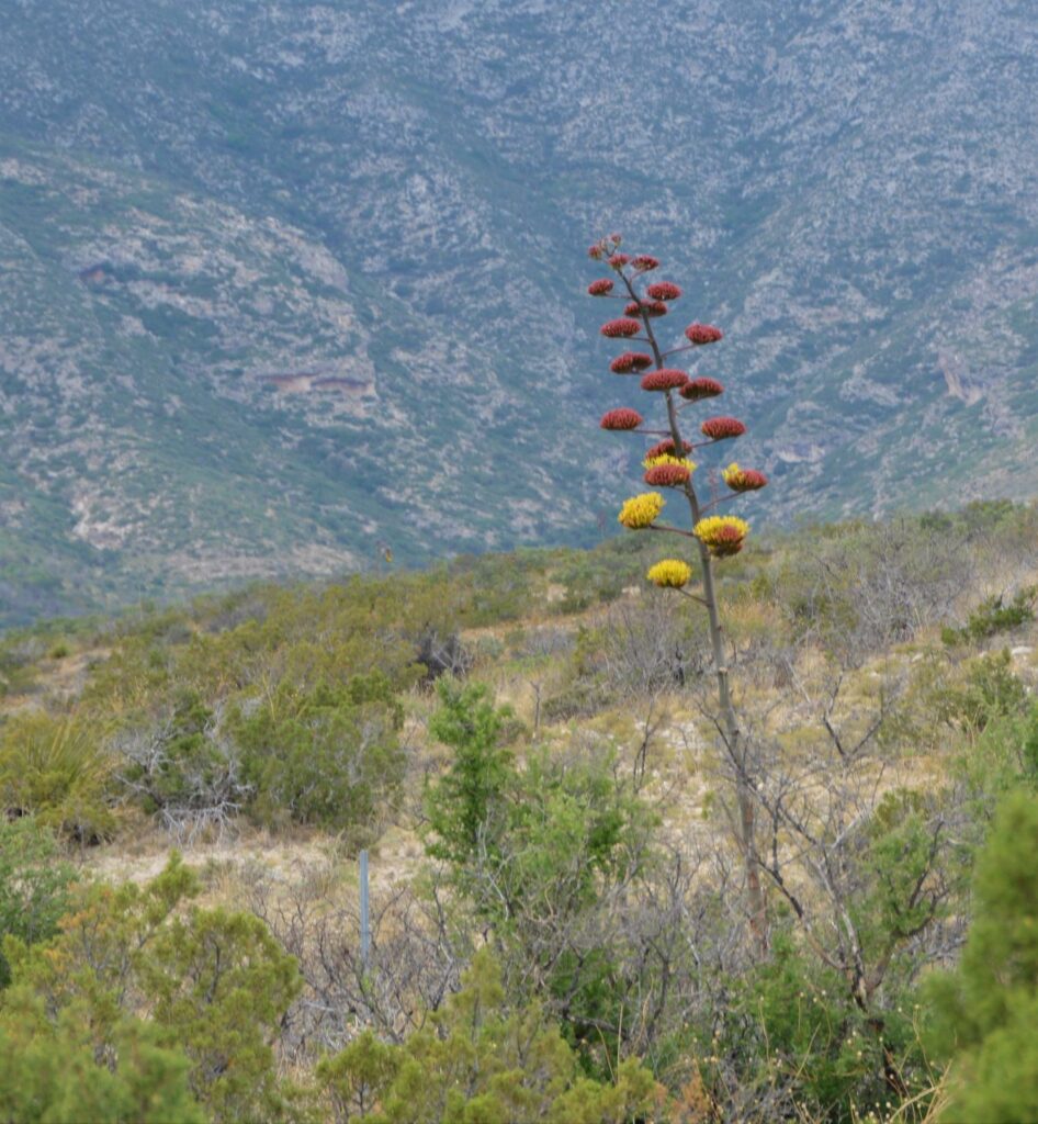
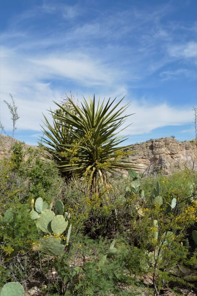
And we also saw century plants in bloom. Century plants and yucca plants look similar, but the century plants have “branches” with blooms on the ends.
Century Plant in bloom
Later in the afternoon, the sun finally came out and lit up the mountains.
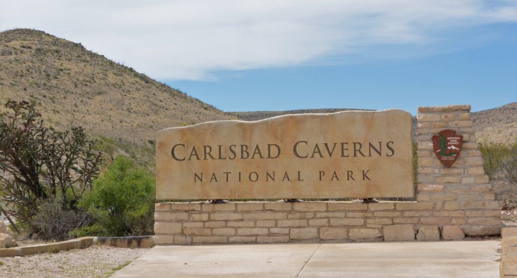
In the early afternoon, we headed back to our campground. On the way, we were going to pass Carlsbad Caverns National Park, so we decided to stop. We were too late to go on a cave tour, but we looked at the exhibits in the Visitors’ Center. I got my National Parks Passport Book stamped since we had already visited years ago.
The five mile drive into the park was reason enough to visit. The cacti were in bloom everywhere. On our way out of the park, I got a few photos of the blooms. Right at the entrance a huge cholla cactus was in bloom.
This is the view from the Visitors’ Center at Carlsbad Cavers NP. I didn’t remember this from our visit years ago, but it is a beautiful view.
View from Carlsbad Caverns National Park Visitor Center in New Mexico.
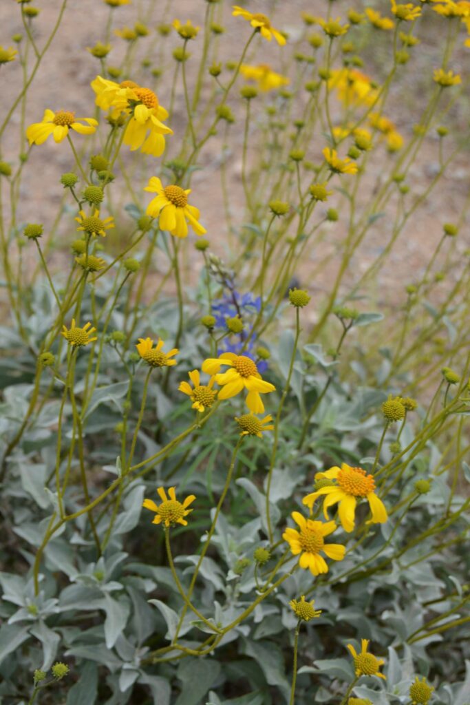
More wildflowers decorated the roadside.
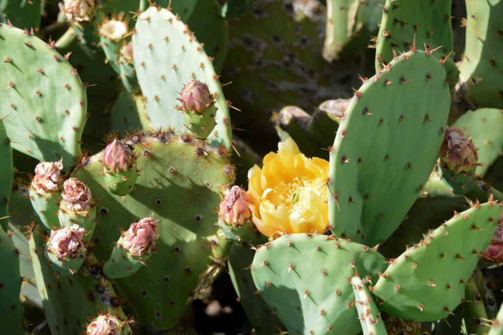
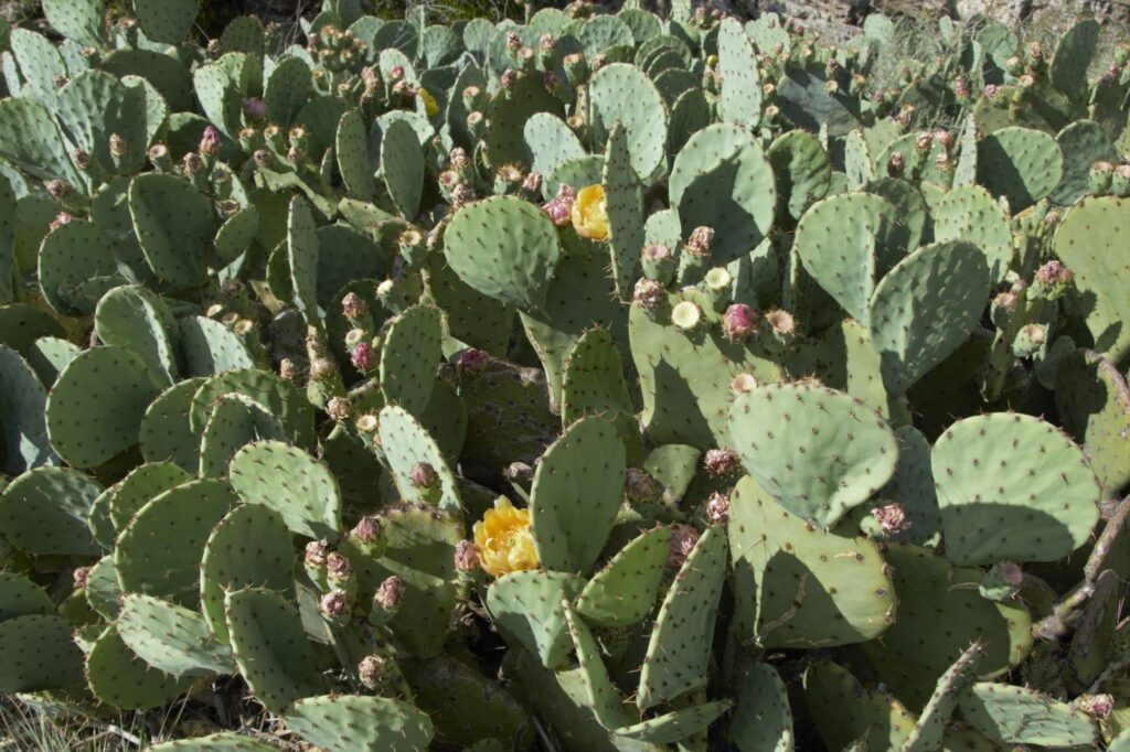
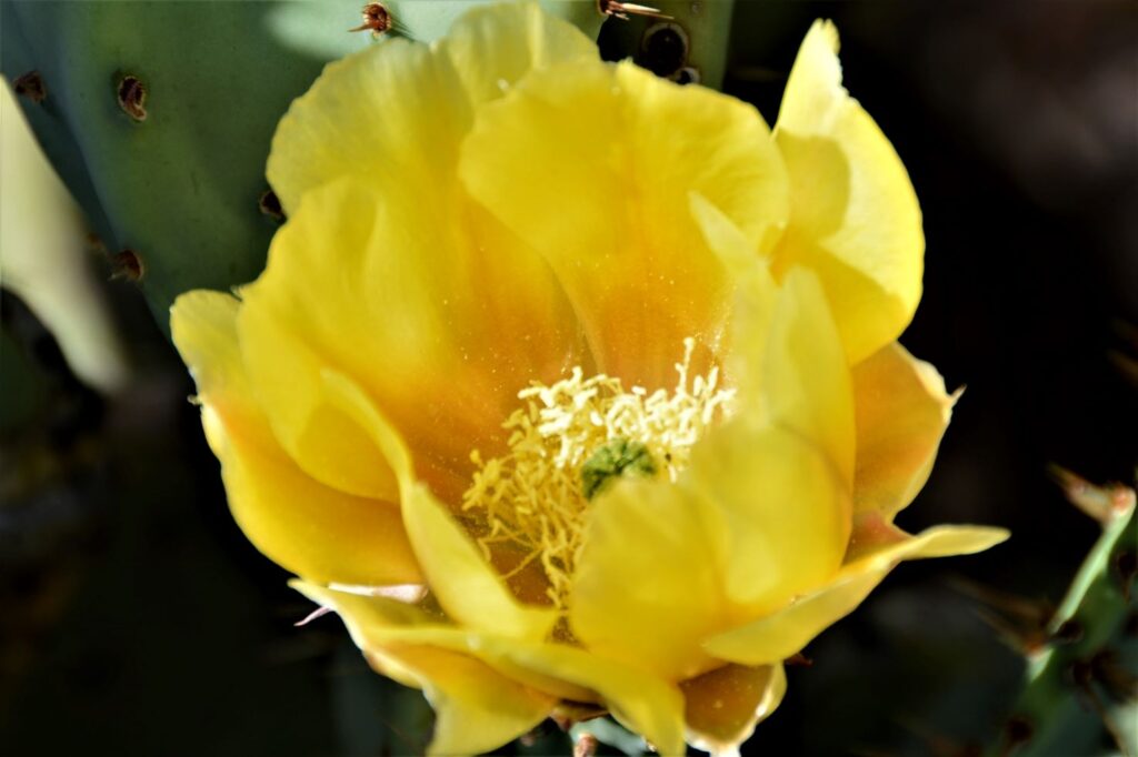
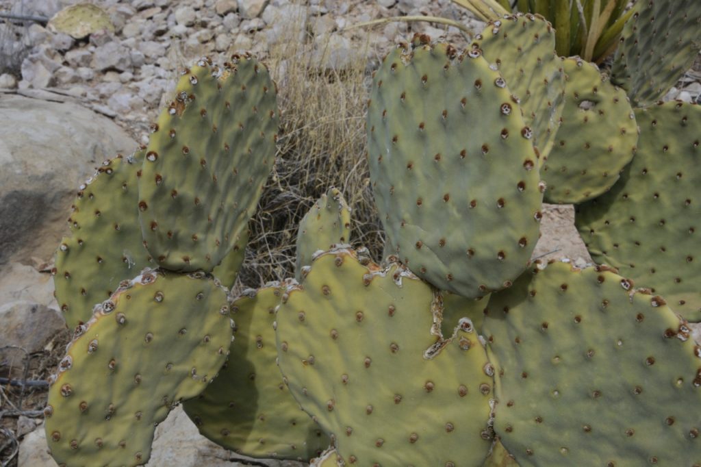
I’ve never seen such an abundance of prickly pear cacti, many with bright yellow blooms.
Prickly pear cactusBloom of prickly pear cactus
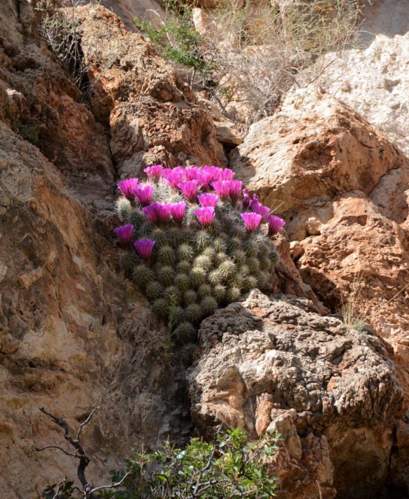
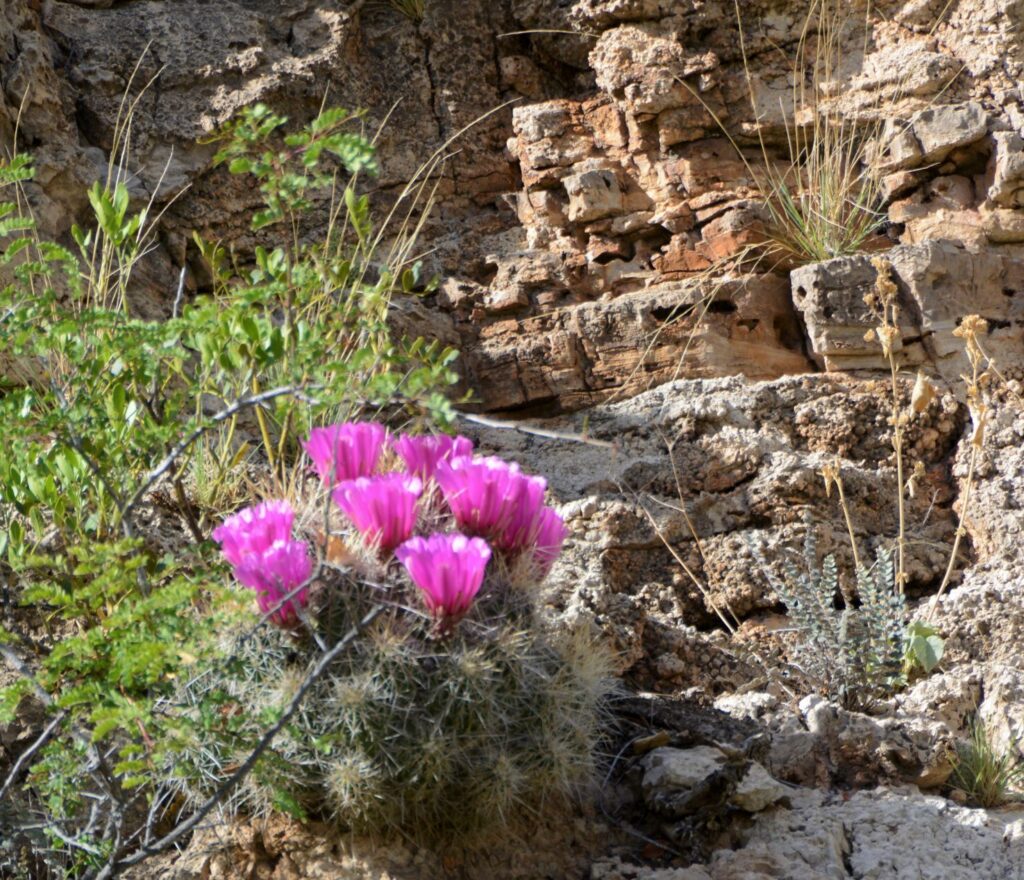
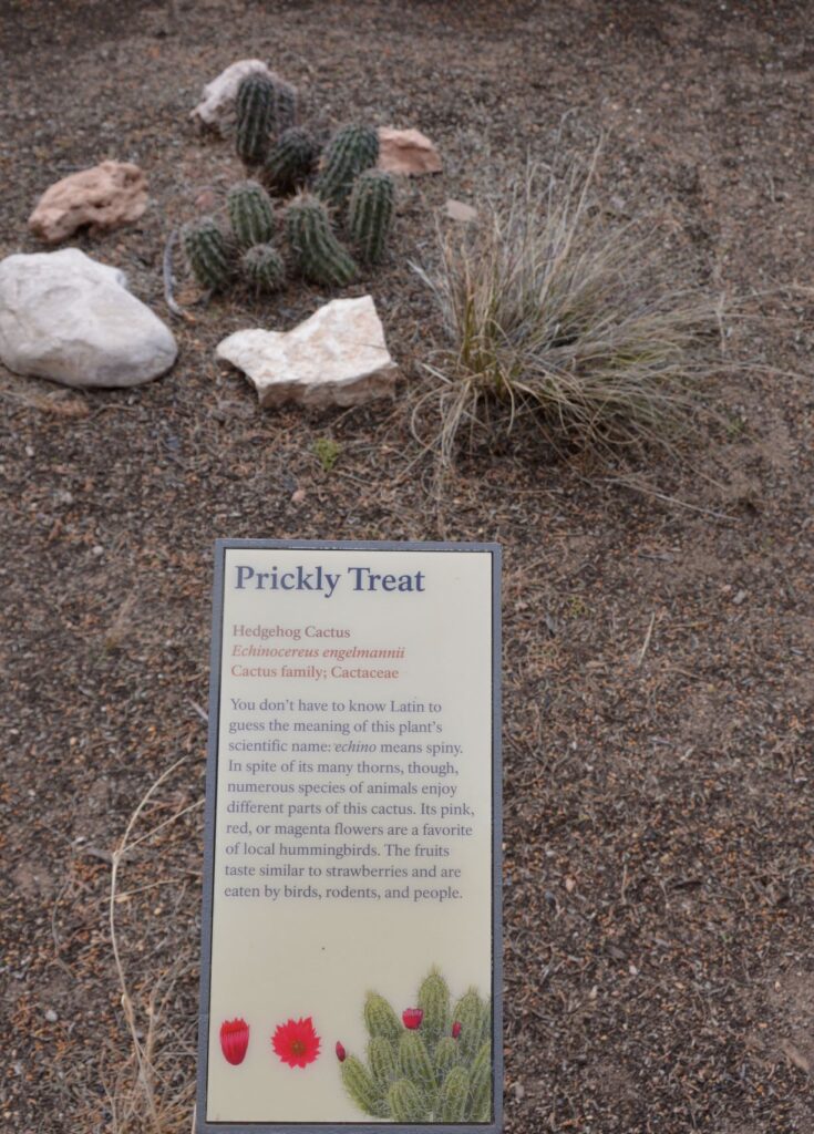
I kept seeing bright pink patches from the rocks on the cliffs. Stopping to check it out, I discovered they were hedgehog cacti in bloom.
Hedgehog cacti on cliffsideHedgehog cactusHedgehog cactusHedgehog cactus
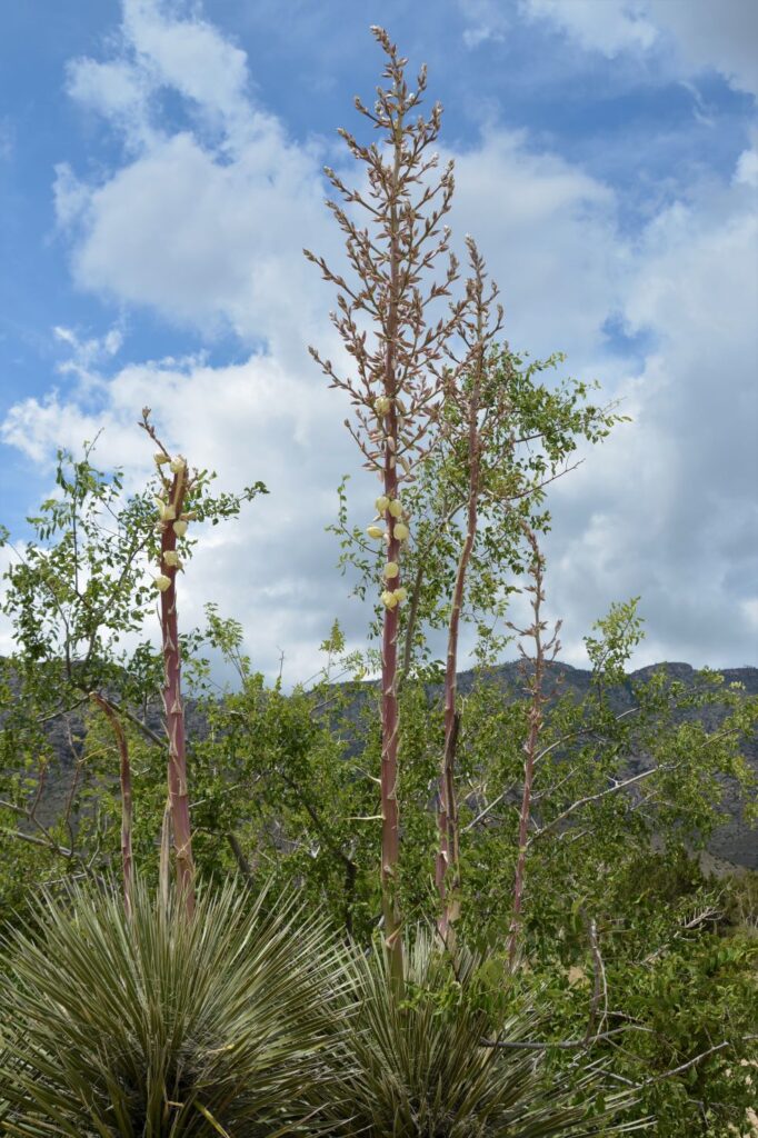
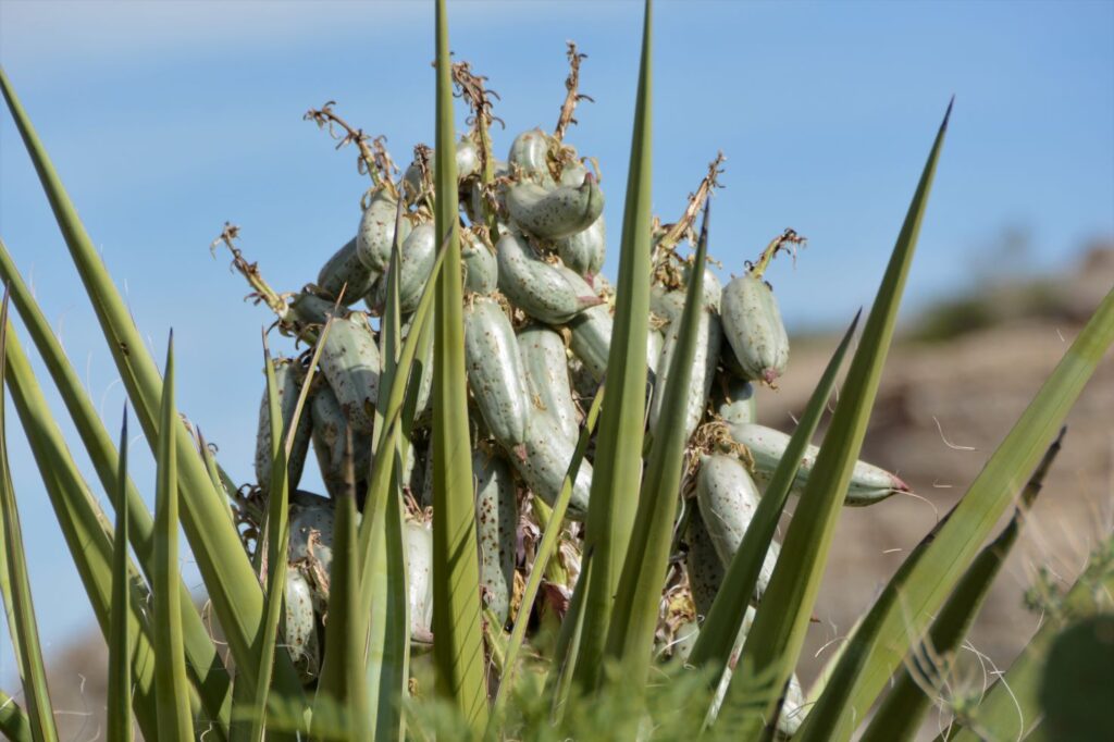
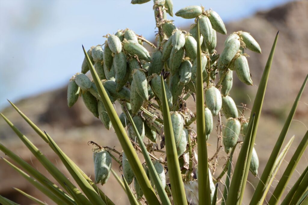
Ray was curious about the “green chili peppers” he saw on some of the yucca. I zoomed in and got these photos. The chili peppers are really seed pods of the yucca plant. These are yet another stage of the yucca plant.
Yucca seed podsYucca seed pods
Yucca plants take many years to grow.
Yucca plant
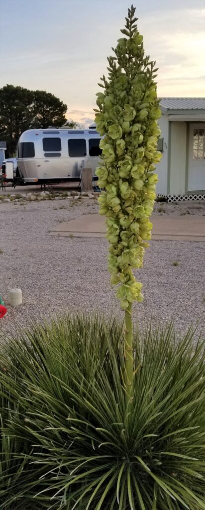
Our Escapees park had some beautiful specimens of yucca and ocotillo.
Yucca plant in bloom at Escapees campgroundYucca flowers close up.Ocotillo in bloom
I was somewhat disappointed in Guadalupe Mountains National Park. However, it has been years since I have seen Carlsbad Caverns National Park. I would love to go back and re-visit it again. And, who knows, I might just give Guadalupe Mountains National Park another try also.
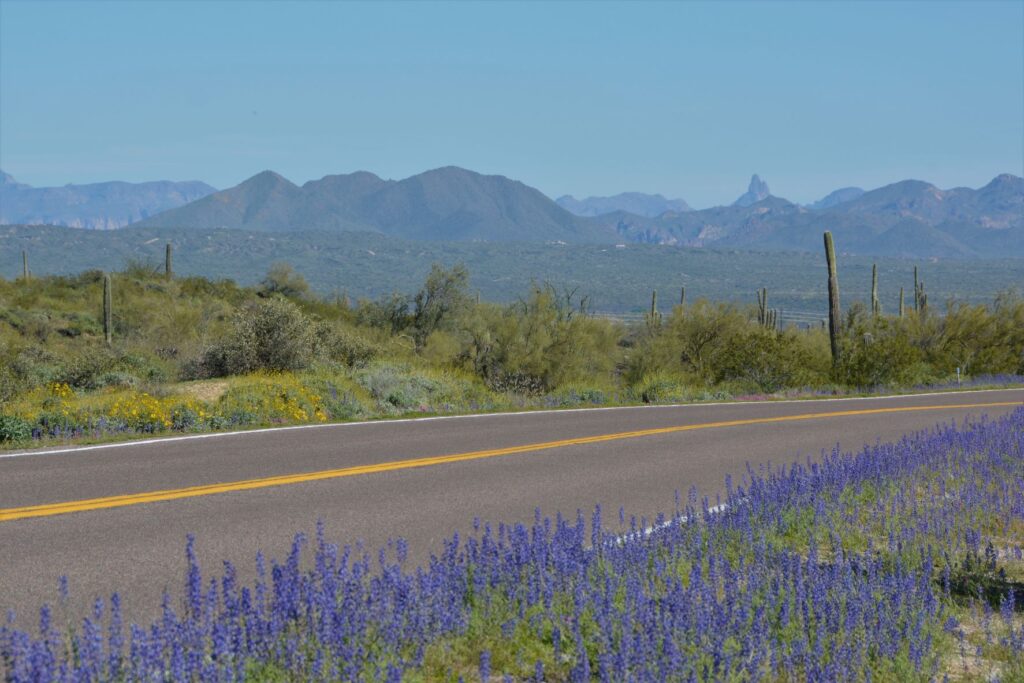
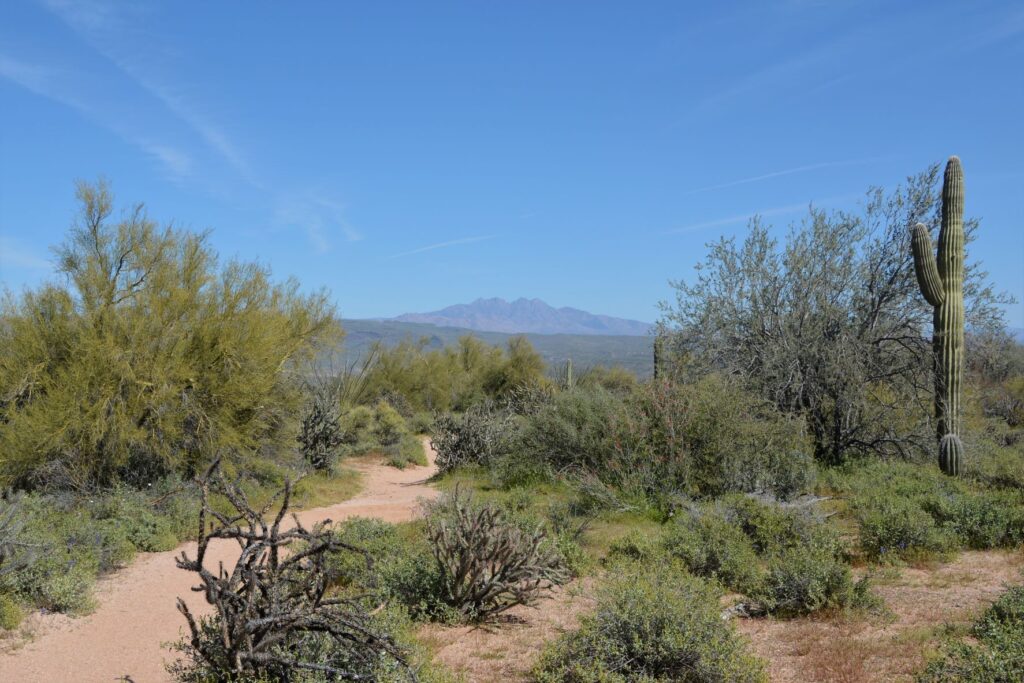
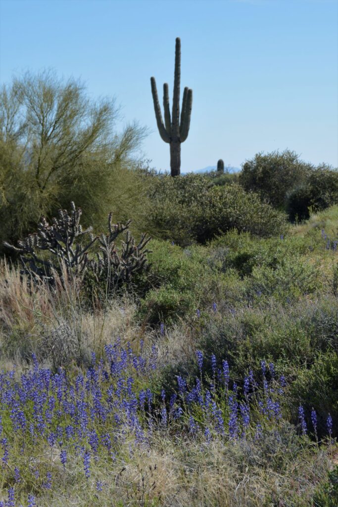
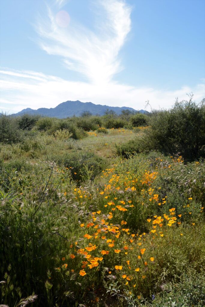
After several days of cool, cloudy weather in Mesa, Arizona, it finally warmed up. We packed a picnic lunch one morning and drove north to McDowell Mountain Regional Park near Fountain Hills, Arizona. The recent and frequent rainfall over the winter made a perfect environment for a great season of wildflowers. On our drive there, the sides of the road were awash in color.
We stopped at the Visitors’ Center where we ate our lunch outside in a picnic area. Inside the Center, we saw some live rattlesnakes, and picked up some literature about wildflower species.
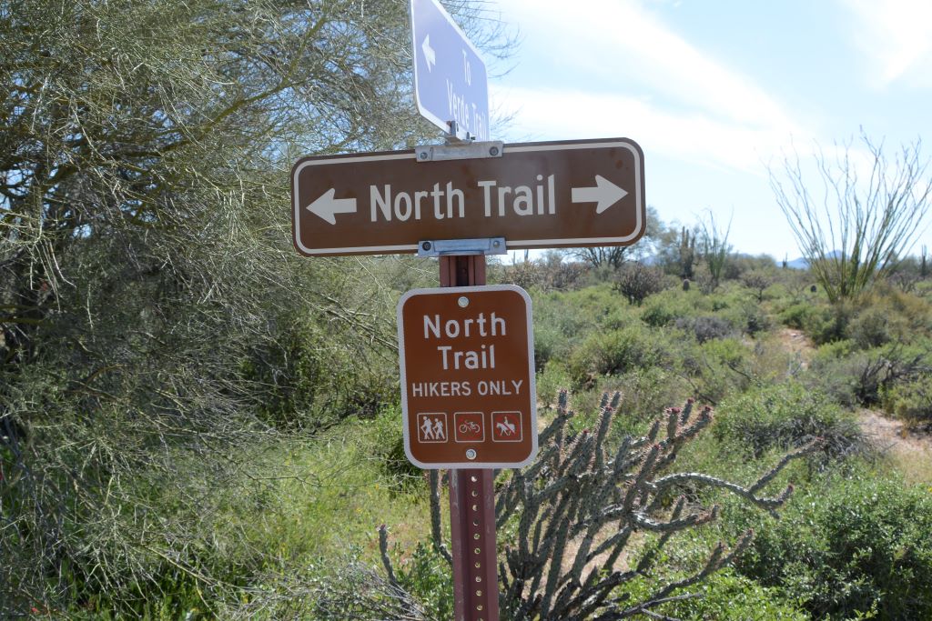
The Ranger at the gate suggested the North Trail hike for spotting the most wildflowers. It was supposed to be an easy hike. We planned to just walk a short way to get some photos.
At one point I turned and looked back and saw a beautiful view of the Four Peaks.
North Trail looking toward Four Peaks
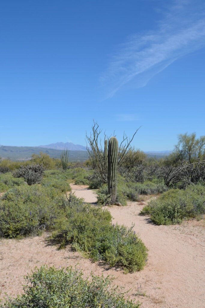
On our way, we met some people who told us there were fields of poppies about a half mile to a mile down the trail. What we didn’t realize is that the trail splits and makes a loop. We took the trail to the right, but the fields of poppies were on the trail to the left.
The trail splits, but we go to the right.
We kept going, thinking the fields of poppies might be around the next bend.
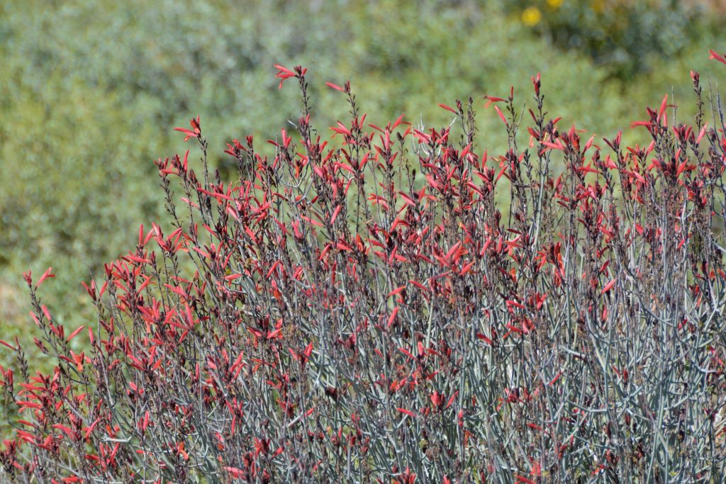
Chuparosa bushChuparosa bush
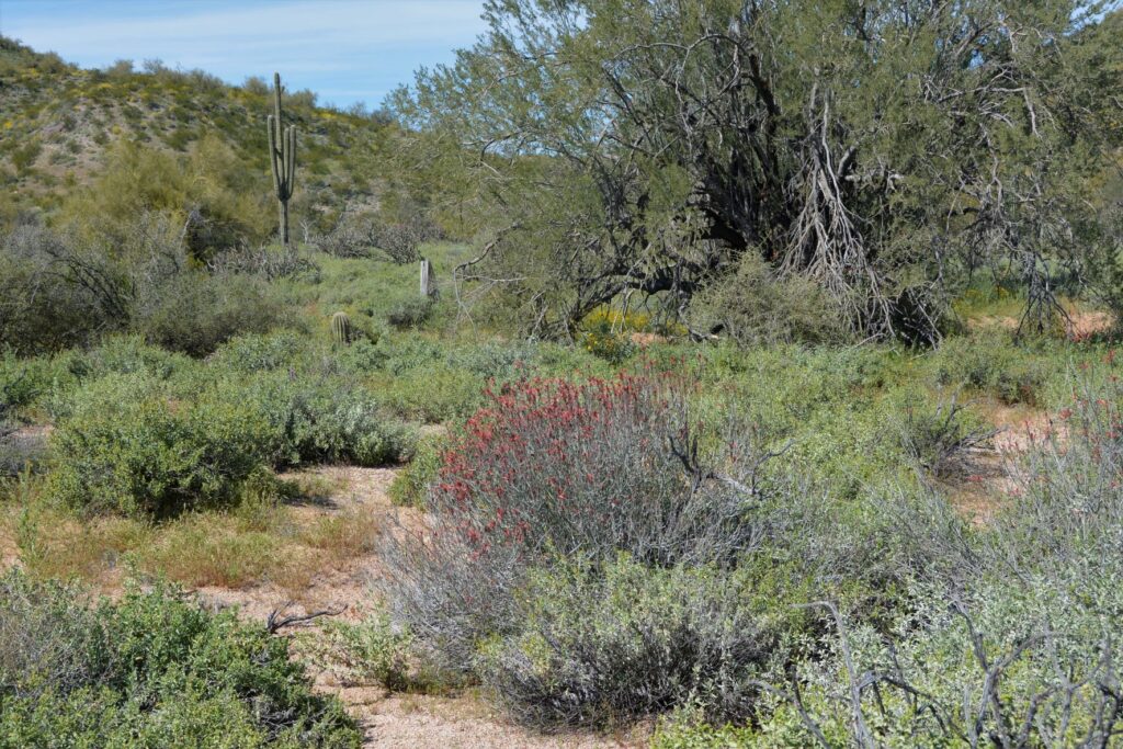
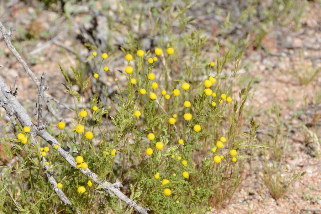
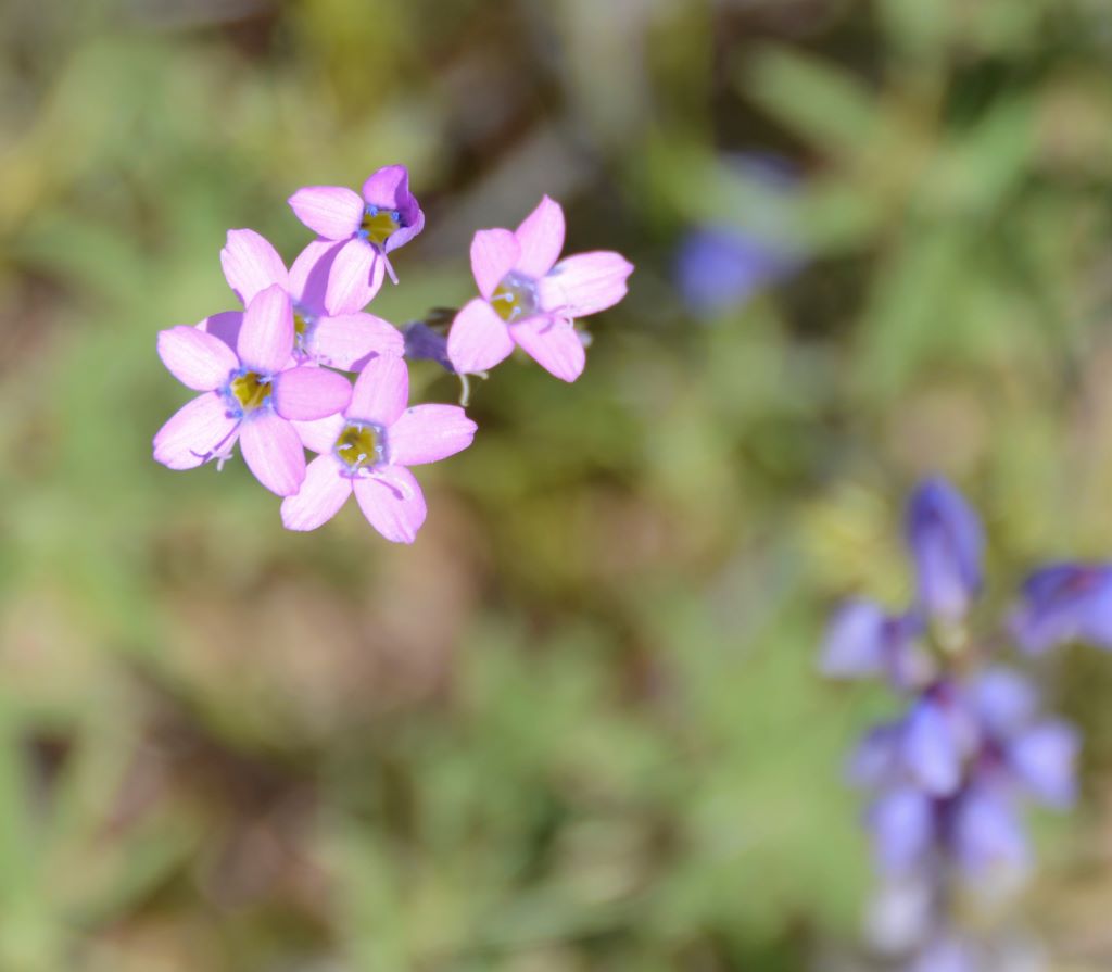
On our walk we saw a variety of wildflowers and desert plants in bloom.
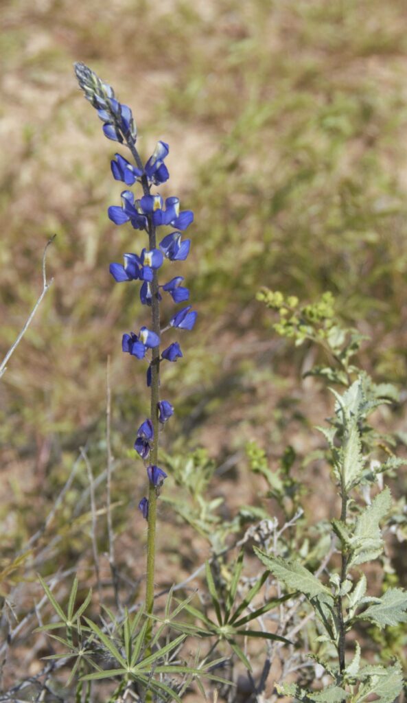
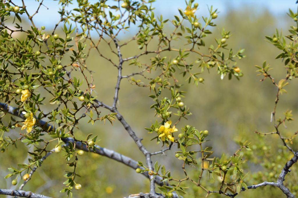
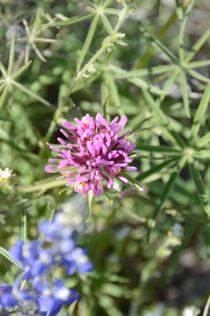
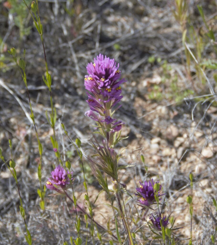
Scorpion WeedStinknet or Globe Chamomile Rock GiliaBrittlebush, the little sunflowers of the Arizona desertDesert Star DaisyCoulter’s LupineCreosote Bush
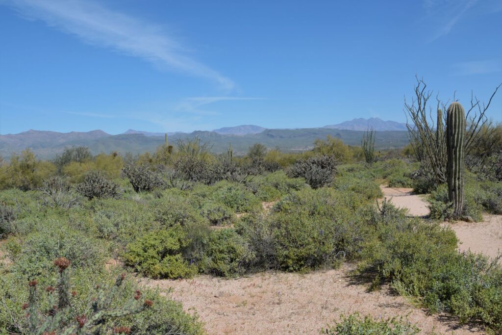
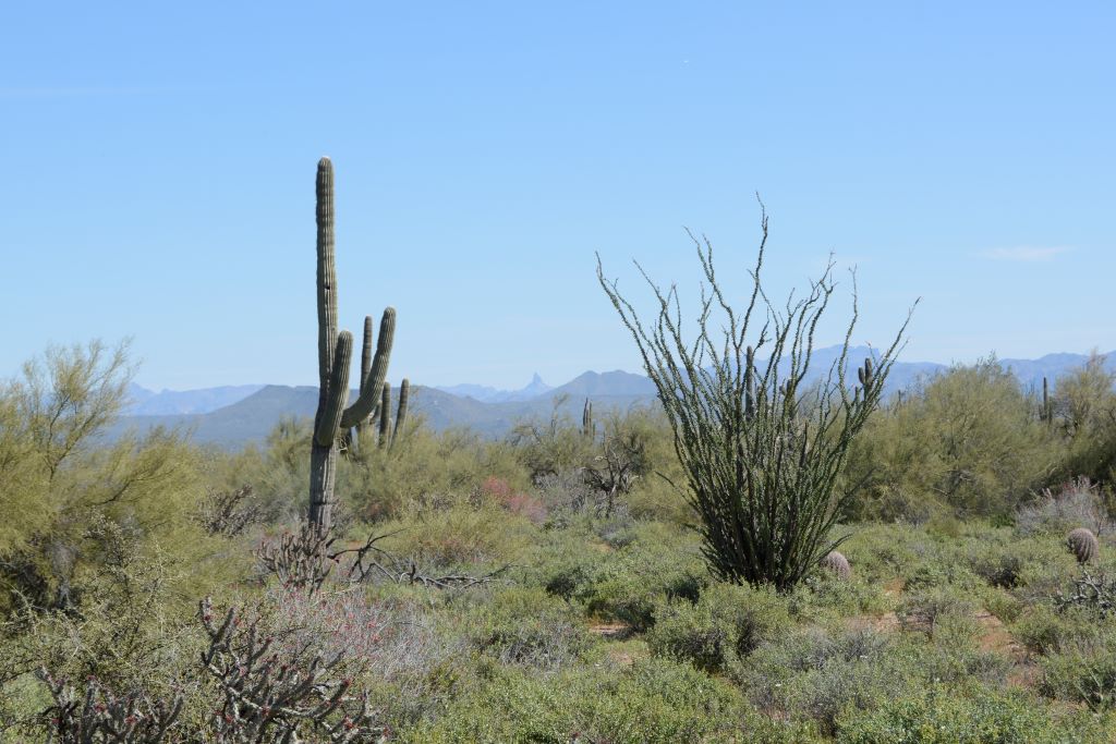
The views of cacti and distant mountains were beautiful, but by now we were starting to get hot and thirsty.
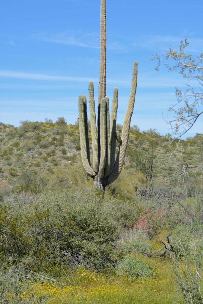
Saguaro cactus and Ocotillo CactusOcotillo Cactus in bloom
We finally saw some yellow flowers, but they were not poppies. Could the people we met on the trail possibly have mistaken these yellow flowers for poppies? It seemed unlikely. But we’d already gone past the one mile marker. The path started to get steeper.
Saguaro Cactus
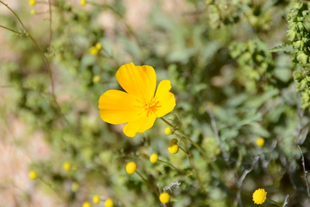
After walking more than a mile, we finally found a few poppies, but no fields of them. By now we were wishing that we’d worn a hat and had brought along some water. We decided it was time to turn back.
Golden Poppy
Not being satisfied with the amount of wildflowers we had seen on our walk, I was hoping to get more photos on our drive out of the park. I was not disappointed.
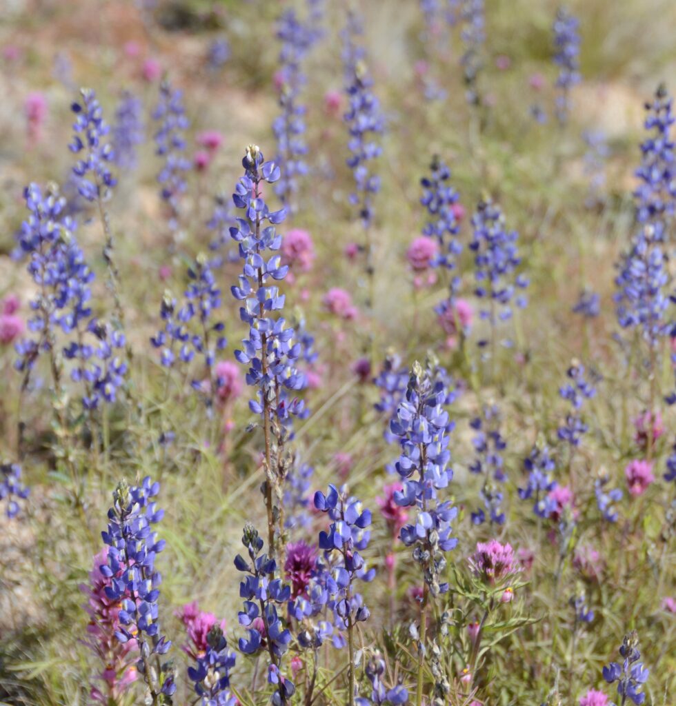
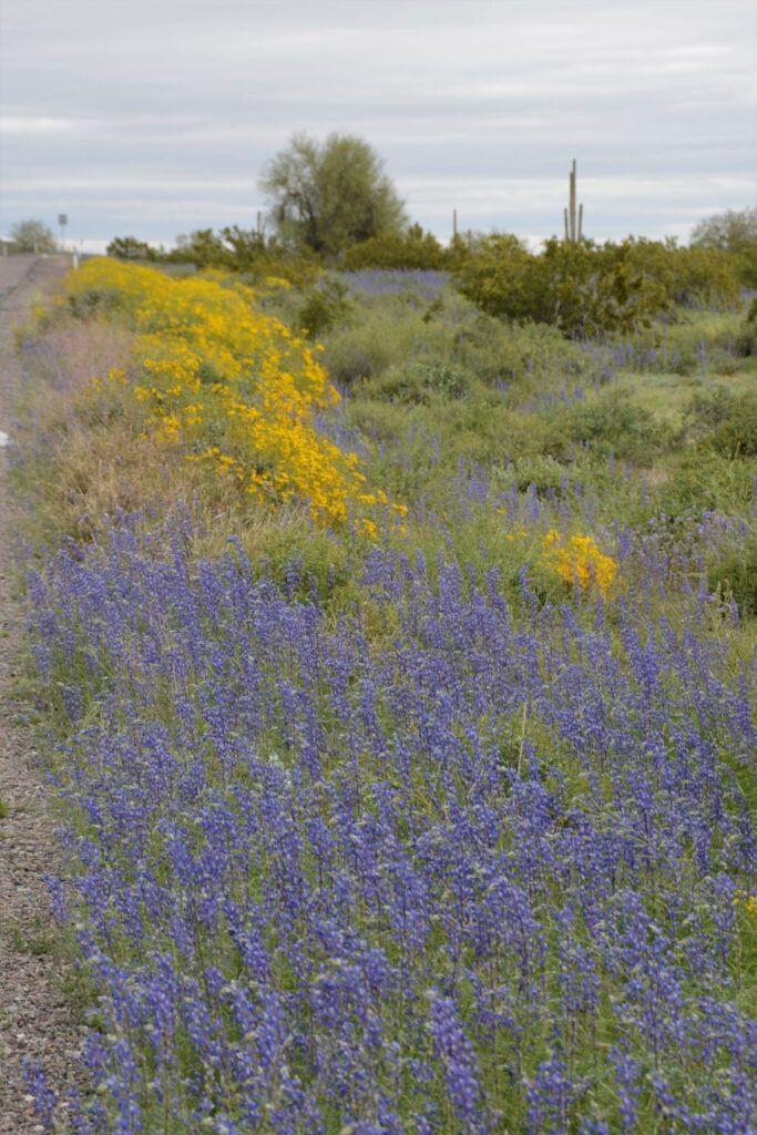
Purple Owl’s Clover and LupinePurple Owl’s Clover and LupineLupine
We stopped along the road in several places.
Purple Owl’s CloverPurple Owl’s Clover and Lupine
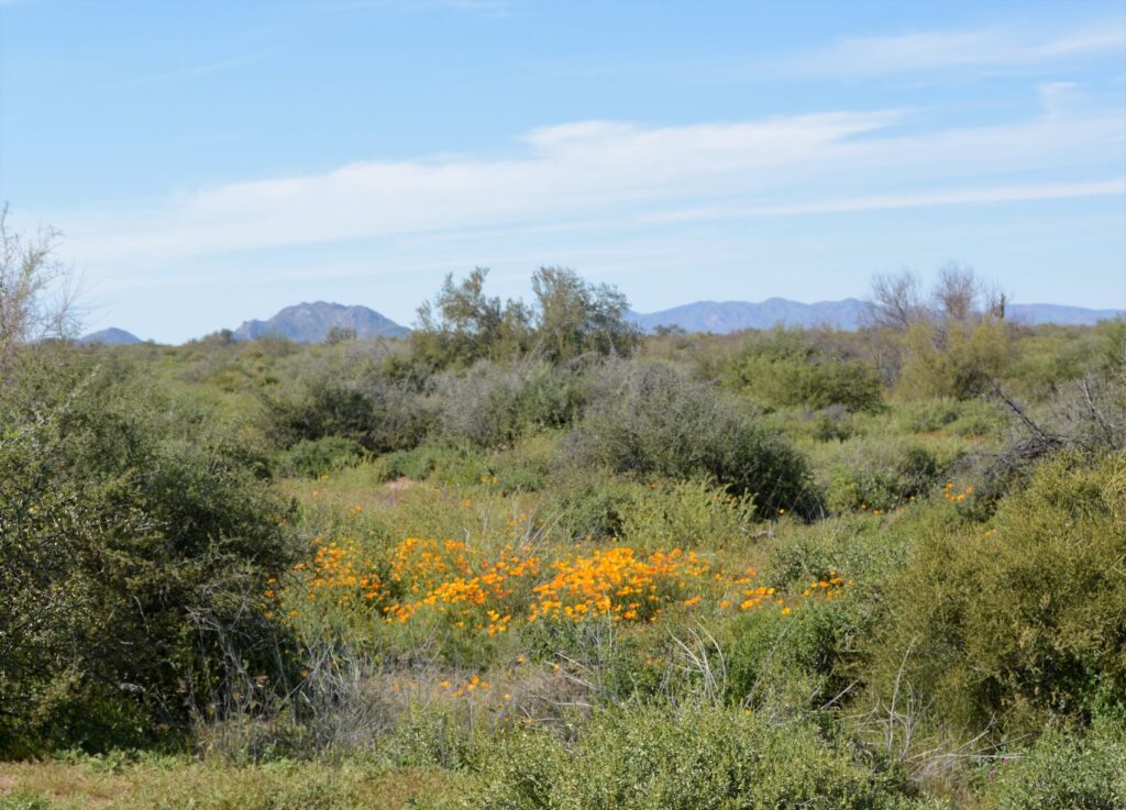
Finally, Ray spotted some poppies. I got out to get a better look and get some photos.
Golden PoppiesGolden Poppies
Knowing how quickly flowers can bloom and fade, I do not blame the Ranger for sending us off on a wild goose chase. If we had taken the correct pathway, we might have seen the fields of poppies described by the people we met on the trail. But it was not a total loss. We saw more flowers on our way out of the park than we saw on our hike.
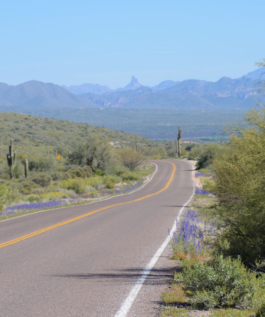
The flowers lined the road as we headed home. In the distance was Weaver’s Needle in the Superstition Mountains. It had been a successful day of wildflower hunting and photography.
“And if God cares so wonderfully for flowers that are here today and gone tomorrow, won’t he more surely care for you, O men of little faith?” Matthew 6:30
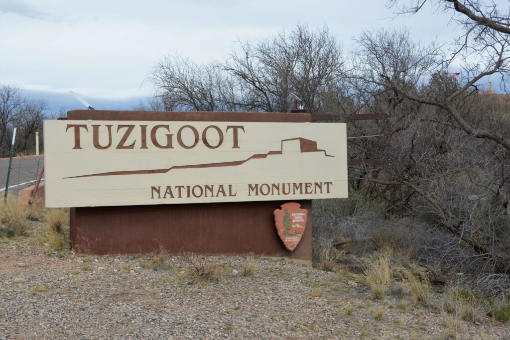
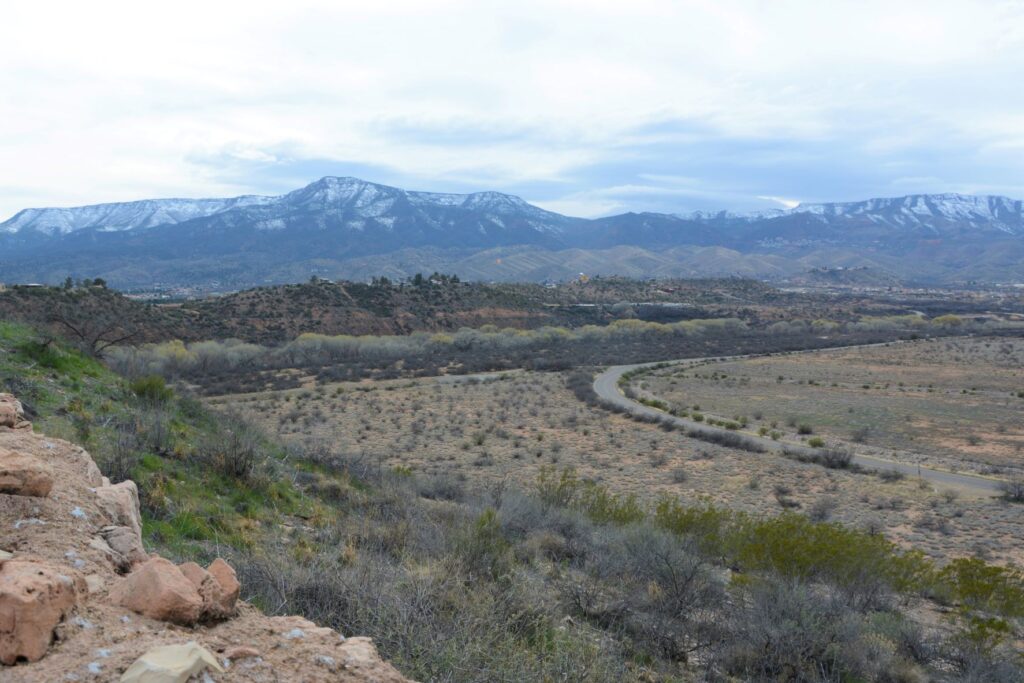
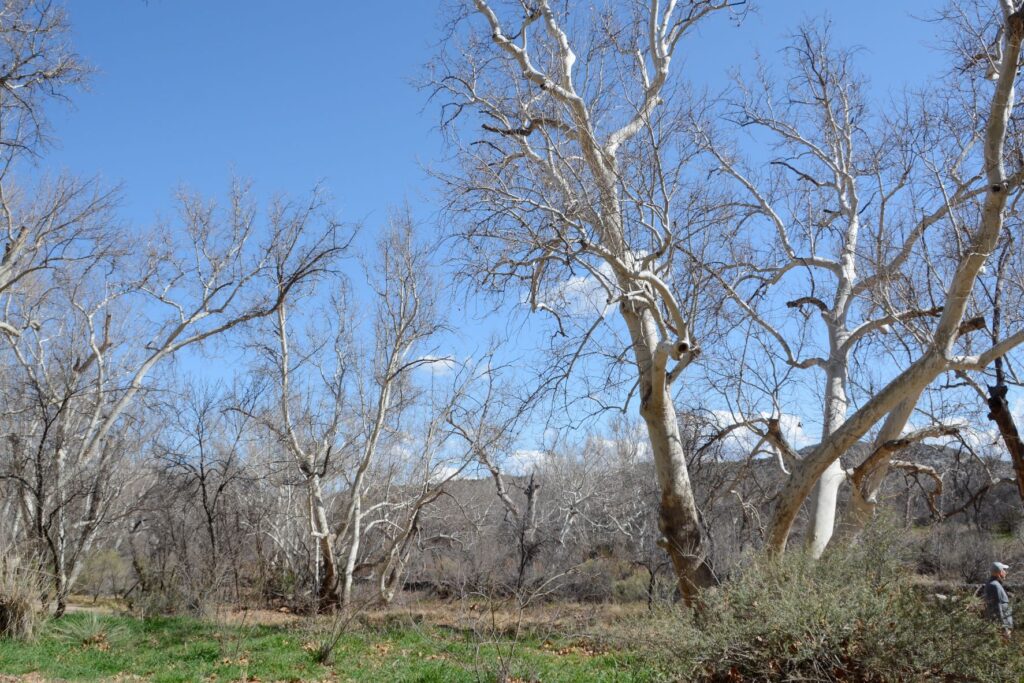
When I lived in Arizona, one of my favorite places to see while traveling north along Highway 17 was Verde Valley. The highway crests a hill and suddenly the view of a lush green valley opens up. As the highway descends into the valley, the green fields and bright green of the cottonwood trees are a stark contrast to the dry surrounding desert. Vermillian cliffs surround the valley while snow-capped mountains peak over the rim. It is a stunning view.
View from the top of Tuzigoot NM. Cottonwood trees line the Verde River. The ghost town of Jerome sits on the side of the distant mountains.
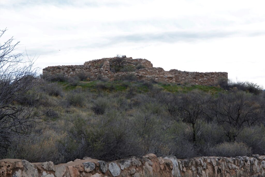
The Indians who came here 1400 years ago traveled along the Verde River valley. Like people of today, they liked to settle near water or on hilltops. One such group, the Sinagua, settled on a hill overlooking the Verde River. They were close enough to the river for water, but high enough to avoid the floodwaters when the river overflowed its banks.
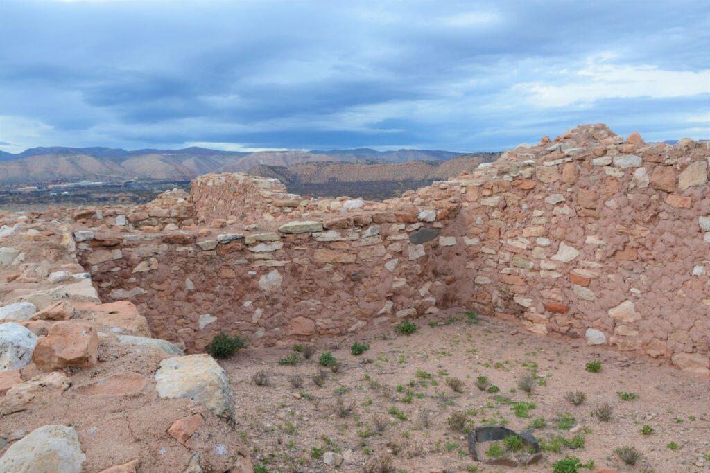
Tuzigoot ruins sit on a hilltop
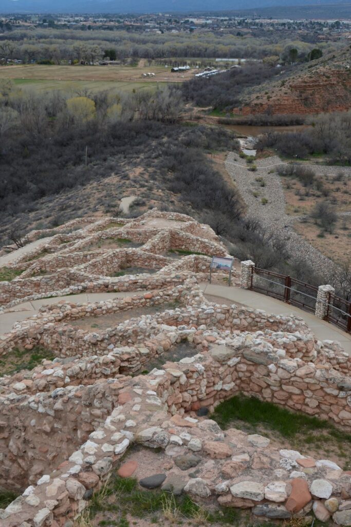
We don’t know much about these people. Their multi-room settlement was similar in construction to many other pueblos found in New Mexico, Colorado and southern Arizona which means they traveled frequently to each others’ settlements. The relics found, as well as the construction of their dwellings, show evidence of this.
View from the ruins looking down toward the Verde River
The Sinagua people eventually moved north and the walls crumbled and became buried and forgotten until the 1880s when two men from Smithsonian Institute began excavating the site. They gave the name “Tuzigoot” to this site. Tuzigoot is a corrupted form of the Tonto Apache name Tú Digiz, the name for this stretch of the Verde River. It is translated “Crooked Water.”
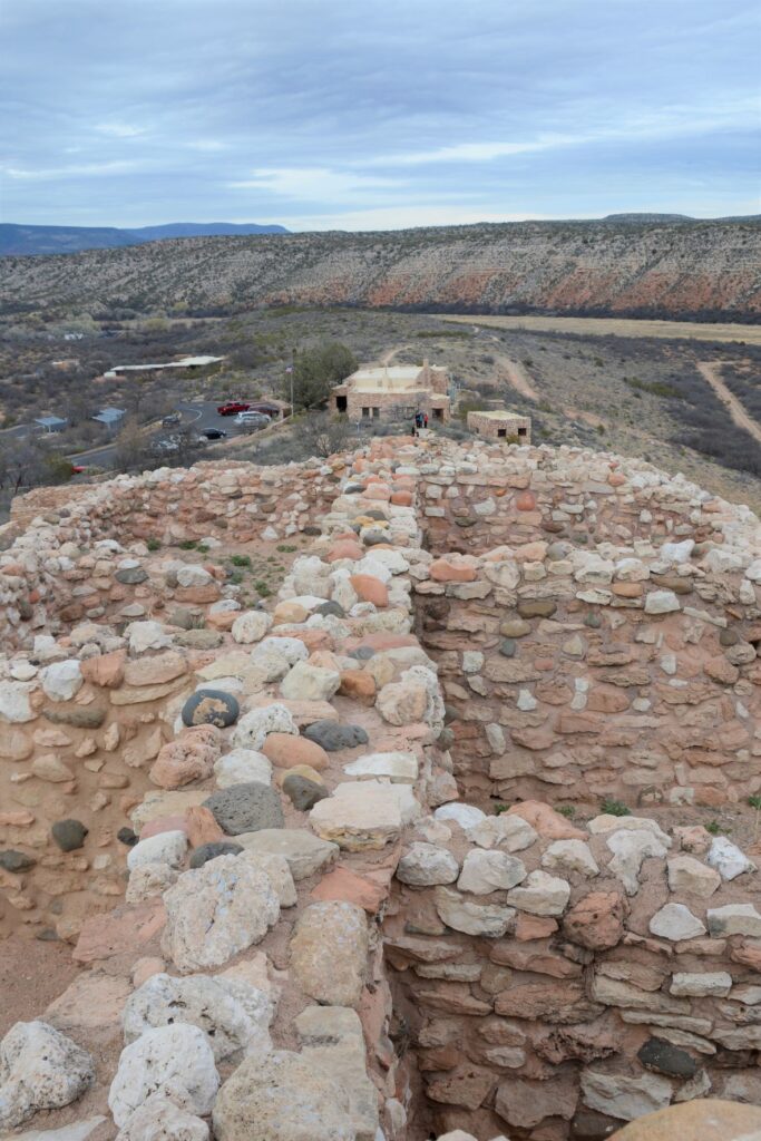
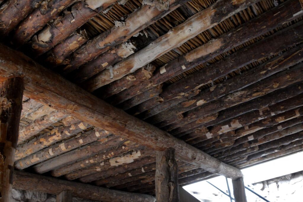
Typical wall construction was of adobe and stone.Roof construction was of logs from trees growing by the nearby Verde River.To preserved the structure, mortar is regularly replaced with a mixture similar to the original.
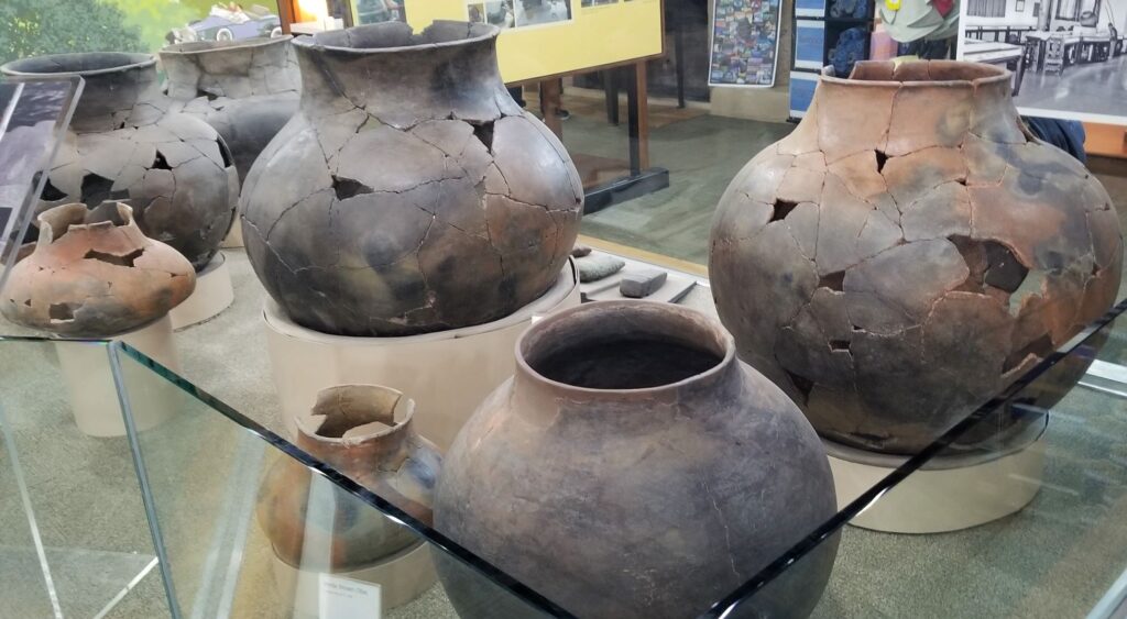
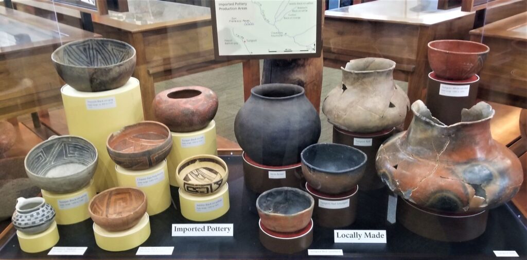
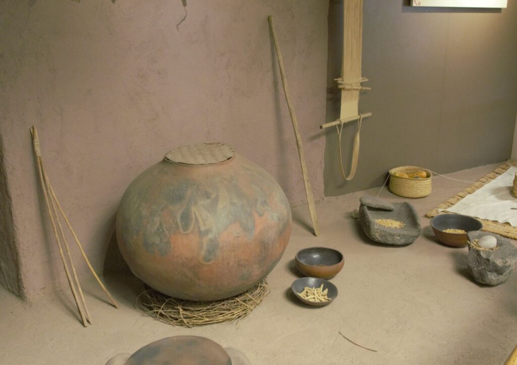
Since taking a pottery class many years ago, I have always been interested in pottery from historical sites. These pots were probably made by coil rope construction, smoothed, glazed and fired in a pit in the ground. What amazed me about these pots was their size!
Large pots probably for water storage.Pottery imported from neighboring areas show that the desert people traveled and traded with one another.Grinding stone for grinding corn into flour.Wildlife is plentiful along the Verde River.
Along the walkway several indigenous plants were labeled. Isn’t this Hedgehog Cactus cute?
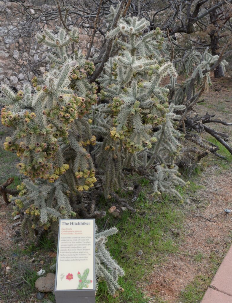
Cane Cholla Cactus is easily caught on clothing and shoes while walking by.
Today visitors can enjoy walking through the rooms of this ancient Indian village, see the displays of artifacts that were discovered here, and enjoy the beautiful views from atop the historical mound.
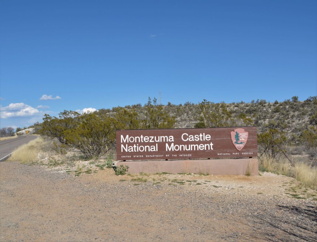
Montezuma’s Castle National Monument
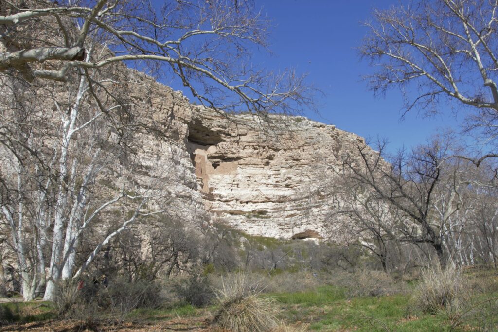
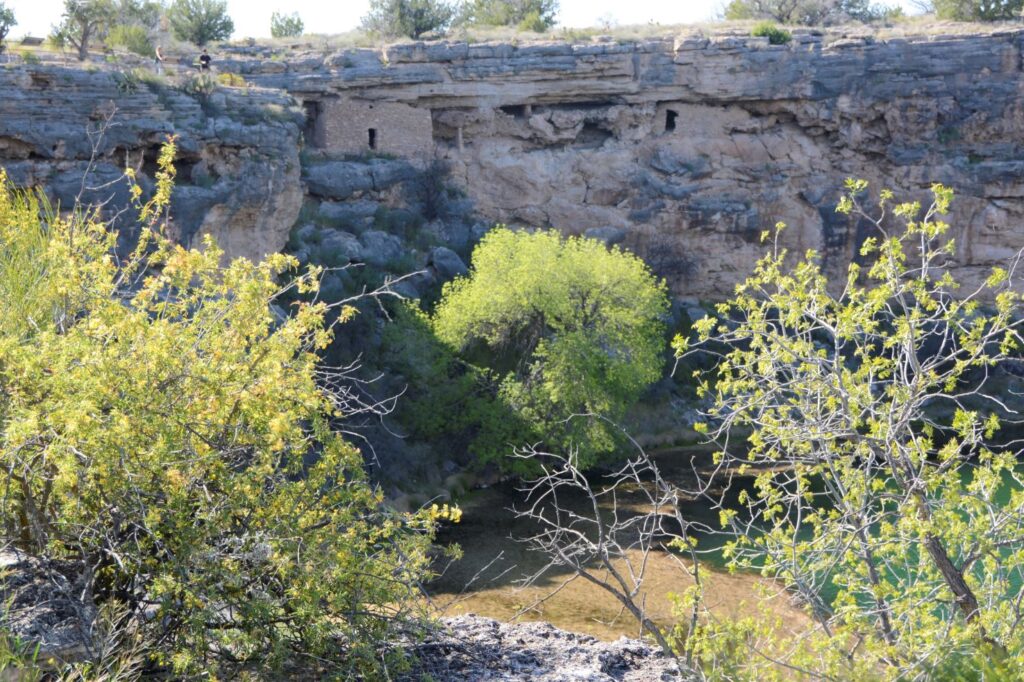
Less than 25 miles away is another ancient ruin known as Montezuma’s Castle National Monument which was also occupied by Sinagua people. It was misnamed by early discoverers of the site who thought that it was built by the Aztec Indians of Mexico.
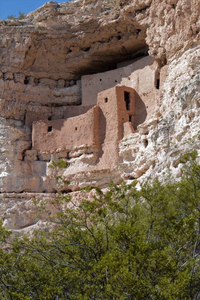
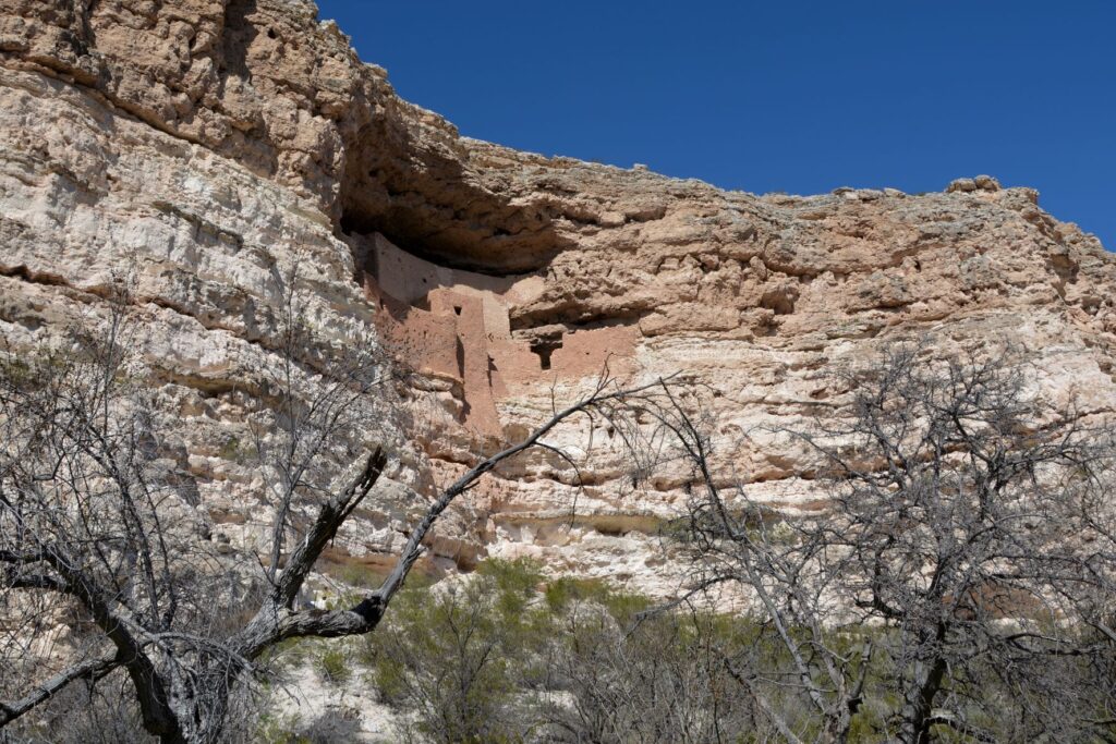
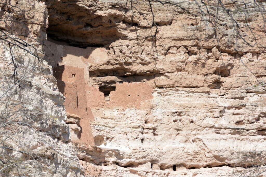
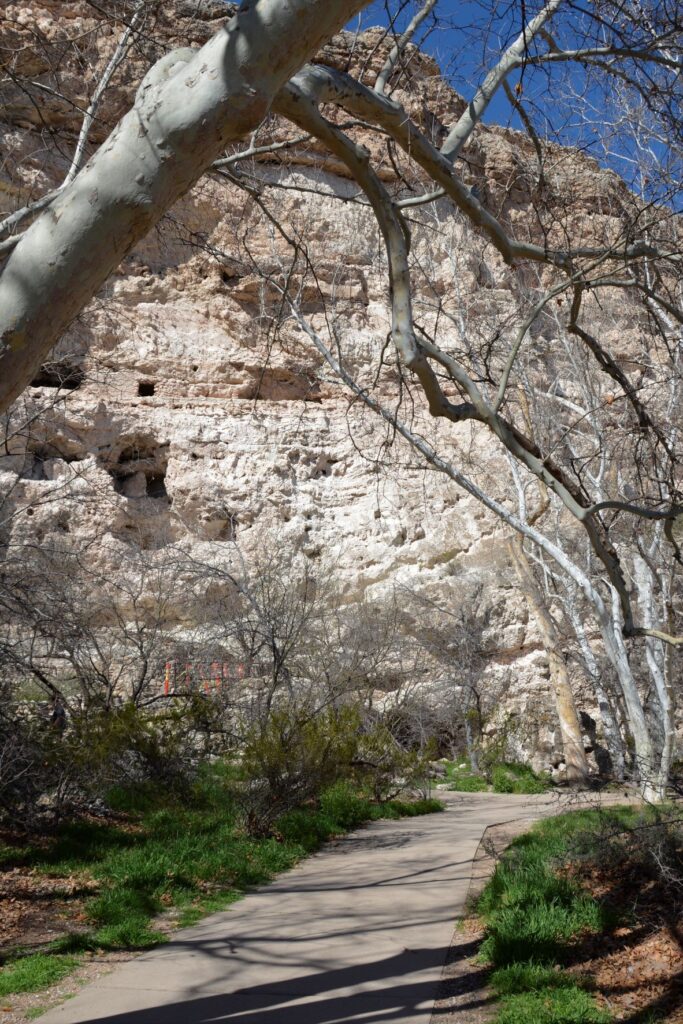
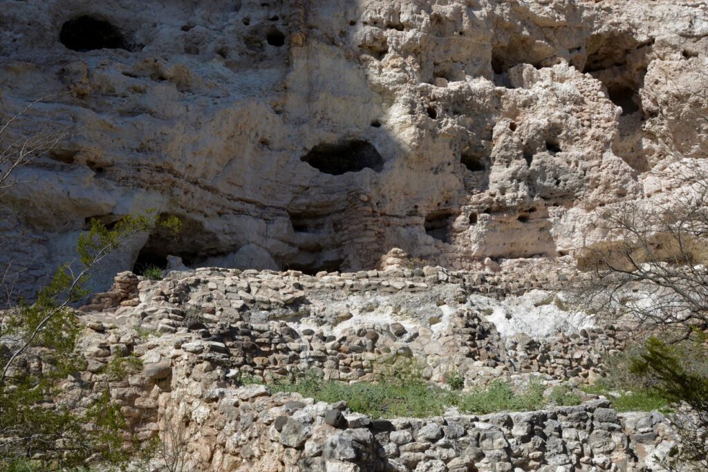
Montezuma’s Castle cliff dwellings
This pueblo cliff dwelling is an impressive five-story 20 room dwelling accessed by ladders during the time it was in use. It was south-facing, so it got the warmth of the winter sun. In summer, it was cool because of the shade from the cliffs.
Nearby, Beaver Creek kept the cliff dwellers supplied with water for living and gardening. The Indians grew crops of corn, beans and squash which were known as the Three Sisters because of how the plants worked together to sustain each other.
The beans climbed the corn stalks to reach sunlight, while supporting the corn from the winds, while the squash was a ground cover that kept the soil moist and discouraged the weeds. The beans, a legume, also enriched the soil. Do you grow these plants in your garden?
The pathway to the ruins is a short pleasant walk from the Visitors’ Center.One can see the similarities between these rock walls and the ones at Tuzigoot.
The day we visited, Beaver Creek was a rushing torrent from recent rains. The pathway to the creek was cordoned off to visitors. The Ranger told us that in a previous year, the creek had overflowed and the water came up to the bottom of the cliff. Maybe this is why the Indians built their pueblos way above the water.
Looking toward Beaver Creek, this area was where they grew their crops.
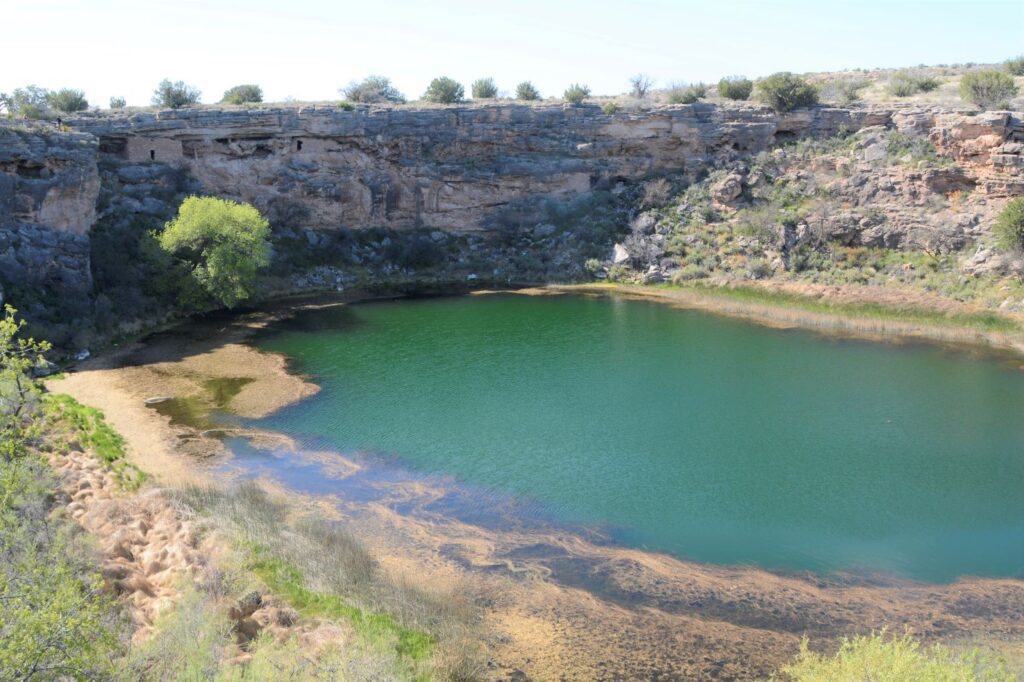
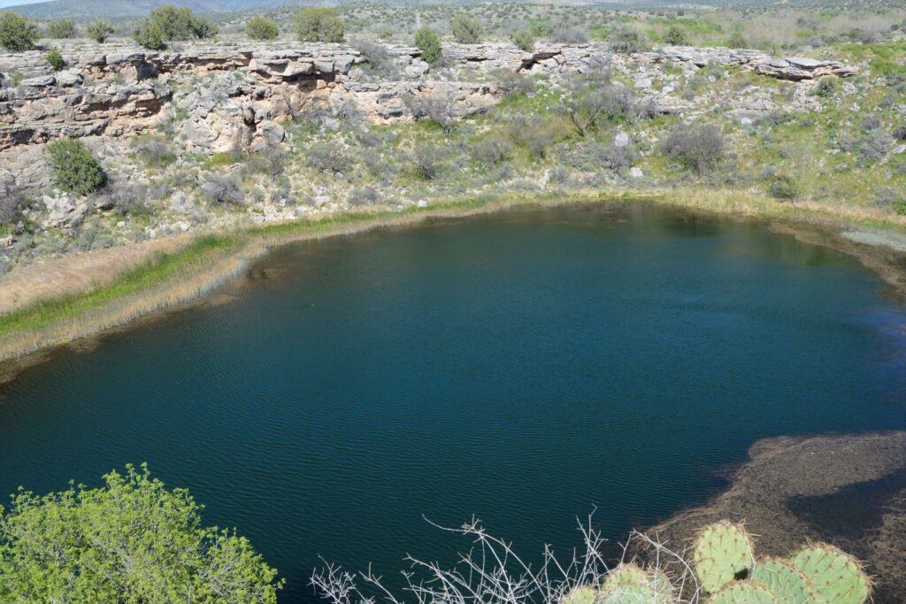
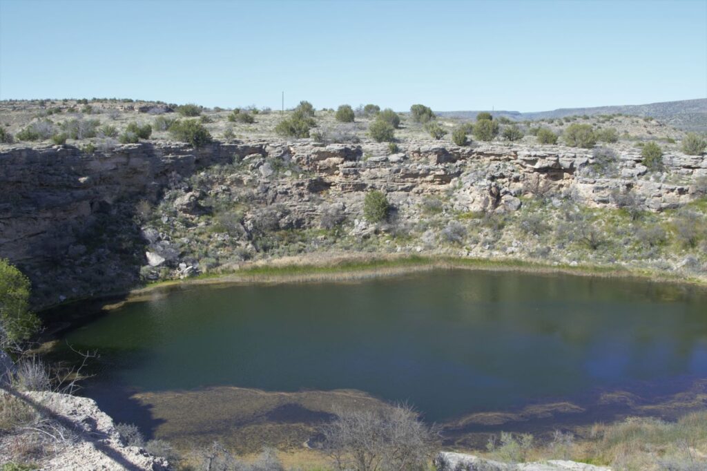
Montezuma’s Well
About 10 miles north of Montezuma’s Castle is Montezuma’s Well. Instead of taking us on paved roads, our GPS took us the long way. I couldn’t believe such a popular national monument would be accessed by a three mile dirt road. It dawned on us that there was a better way when we reached the entrance to the Monument. There was the paved road we were looking for. On our return route we followed the paved road back to Rimrock from which we were able to access Interstate 17.
Montezuma’s Well and cliff dwellings
There is a short climb up to the rim overlooking Montezuma’s Well. The well is an ancient sinkhole that is fed by an underground spring of over 1.5 million gallons of water each day. The spring waters are from rain and snow that fall on the nearby Mogollon Rim which then seeps through the rock until it reaches the spring. Pressure pushes the water up to the surface. It is said that the water takes as long as 10,000 years to travel from the Rim to the Well.
The well is deep. Millions of gallons of water flow into and out of the well.
The water exits the well through underground streams and a cave system which drains into an ancient irrigation canal. The water level remains constant, as well as the temperature of the water which averages 70 degrees F. However, because the water has a high alkalinity and an excessive amount of dissolved carbon dioxide–more than 100 times higher than normal–fish cannot survive.
Fish can’t live in the water, but thousands of leeches live here.
The depth of the well is unknown because of the pressure of the water. Divers have discovered a “false bottom” at around 60 feet of pressurized groundwater that holds a column of fluidized sand in suspension. The fluidized sand rises from two deep vents in the floor of the well. One is 124 feet deep and the other is 74 feet deep. But previous measurements measured 137′ and 95′. So, we can just say, it’s deep.
Pueblo dwellings in the rocks above Montezuma’s Well
The people who built homes near Montezuma’s Well were the Hohokam and later the Sinagua.
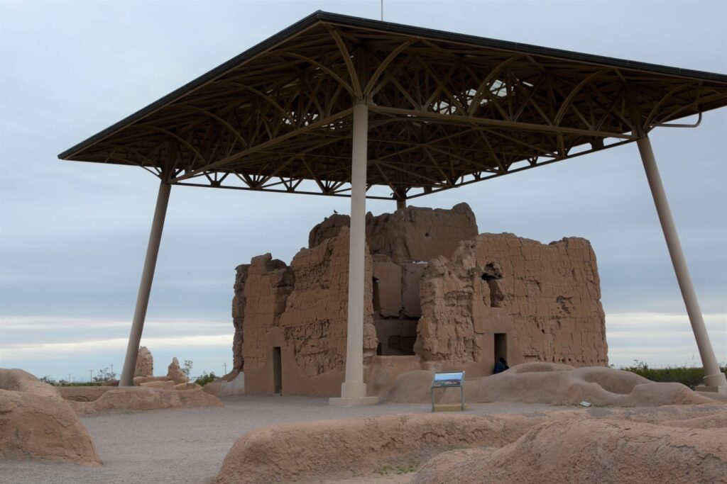
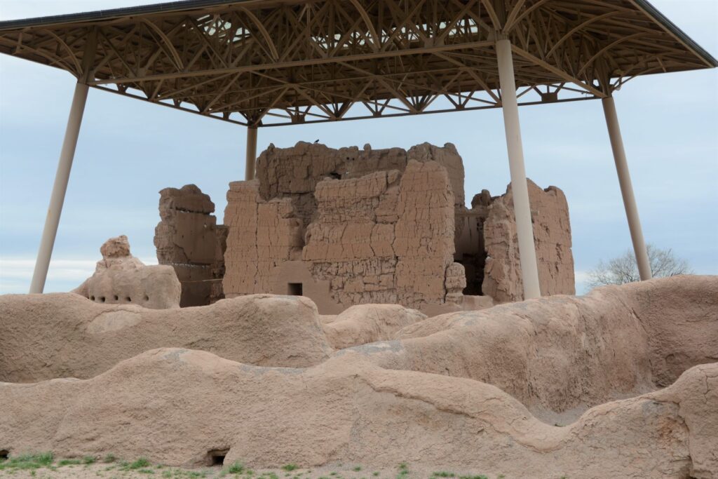
Casa Grande Ruins National Monument
Leaving the Verde Valley area, we traveled south to Mesa, Arizona. One afternoon we drove south, halfway to Tucson to Casa Grande Ruins National Monument. This “Grand House” was probably built in the 1300’s, which is the time period of the founding of the Byzantine Empire, the 100 years war, and the black death or bubonic plague in Europe. These desert people had already been using irrigation methods for hundreds of years to grow their crops.
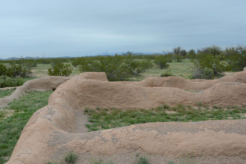
A metal structure over the ruins keeps it from deteriorating.
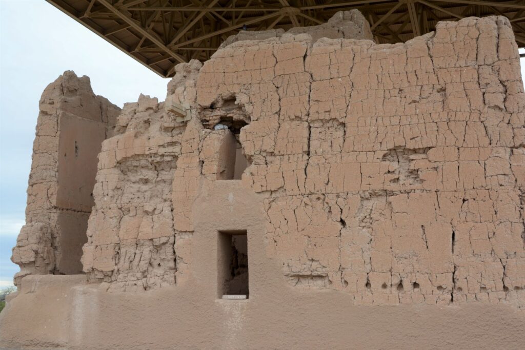
Archeologists are not sure of the purpose of this grand structure. However, because of the construction they believe it was well planned and organized. The builders used caliche, a natural concrete-like material found under the soil around this region. They used it to build houses with solid walls and flat roofs covered with this caliche substance.
Walls were made from caliche, a concrete-like material found in the ground.
These desert people were given the name “Hohokam.” It is not really the name of a tribe or people. The name may have come from “huhugam,” an O’Odham word that means ancestors. Today these people are referred to as Sonoran Desert people. By the way, Hohokam is the name of the grade school I attended. Our elementary schools were named after Indian tribes.
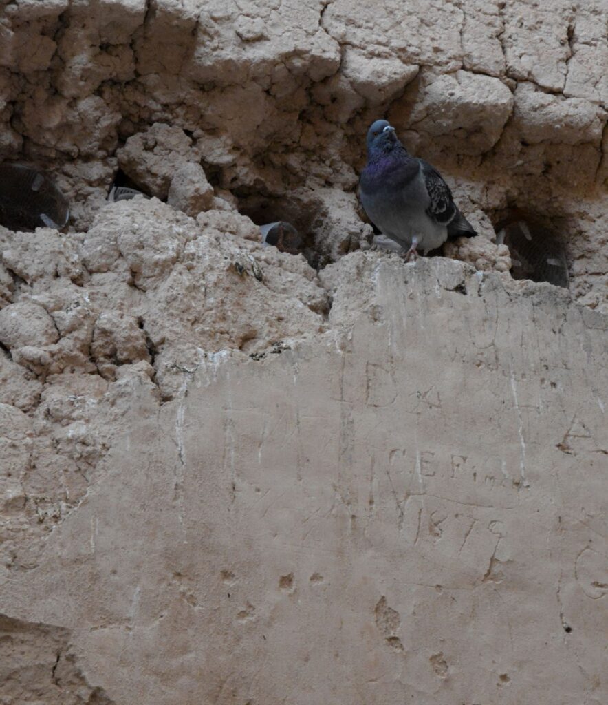
A pigeon makes its home among the walls of the ruins. Note the etched name and date below it.
When I took the photo above, I didn’t notice the name and date etched on the wall. It is a good thing that people like Mary Hemenway and President Benjamin Harrison took steps to preserve the ruins for future generations from vandalism and looting. Mary Hemenway was a wealthy woman who sponsored archaeological expeditions. One expedition to Casa Grande Ruins alerted her to the vandalism. She made efforts to preserve the site and as a result, it became the first federal prehistoric and cultural reservation by President Harrison in 1892.
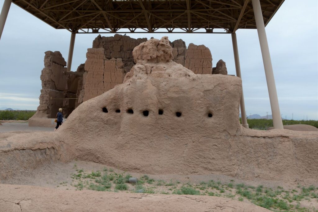
One of the purposes of this structure might have been a calendar. Some of the holes line up directly with the sun on the summer and winter solstices.
In later years, the village homes were grouped into caliche-walled compounds which were arranged around public plazas and public structures. The Grand House or Casa Grande was at the center of this settlement.
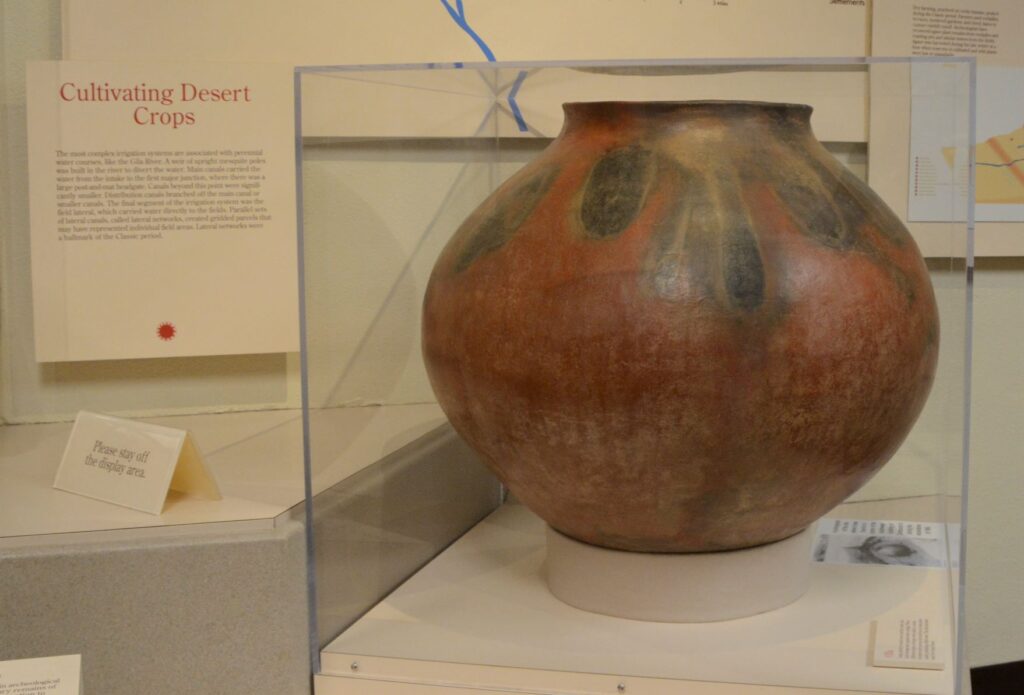
These desert people were identified by their type of pottery called “red-on-buff.” This beautiful piece of pottery below is an example of the techniques used in creating their pottery. In my opinion, the dark portions on this pot look to me like leaves of some plant that they tied around the neck of the pot while being fired which left these unusual designs.
This pot below looks similar in design to the one above with the plant-like designs.
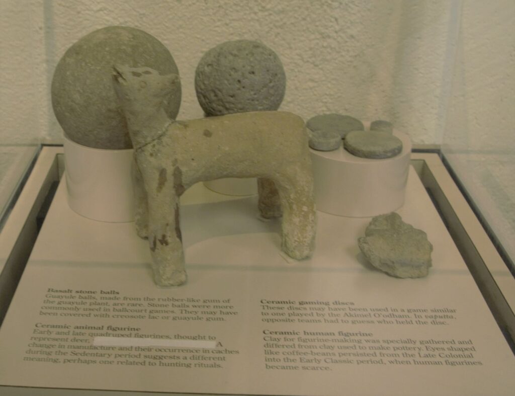
These desert people also enjoyed games. There are over 200 oval-shaped, structures with earthen sides located in large Hohokam villages in southern and central Arizona. Archaeologists have speculated that some kind of game was played within these courts with two teams using a hard rubber or stone ball. Round discs were found that might also have been used in other games.
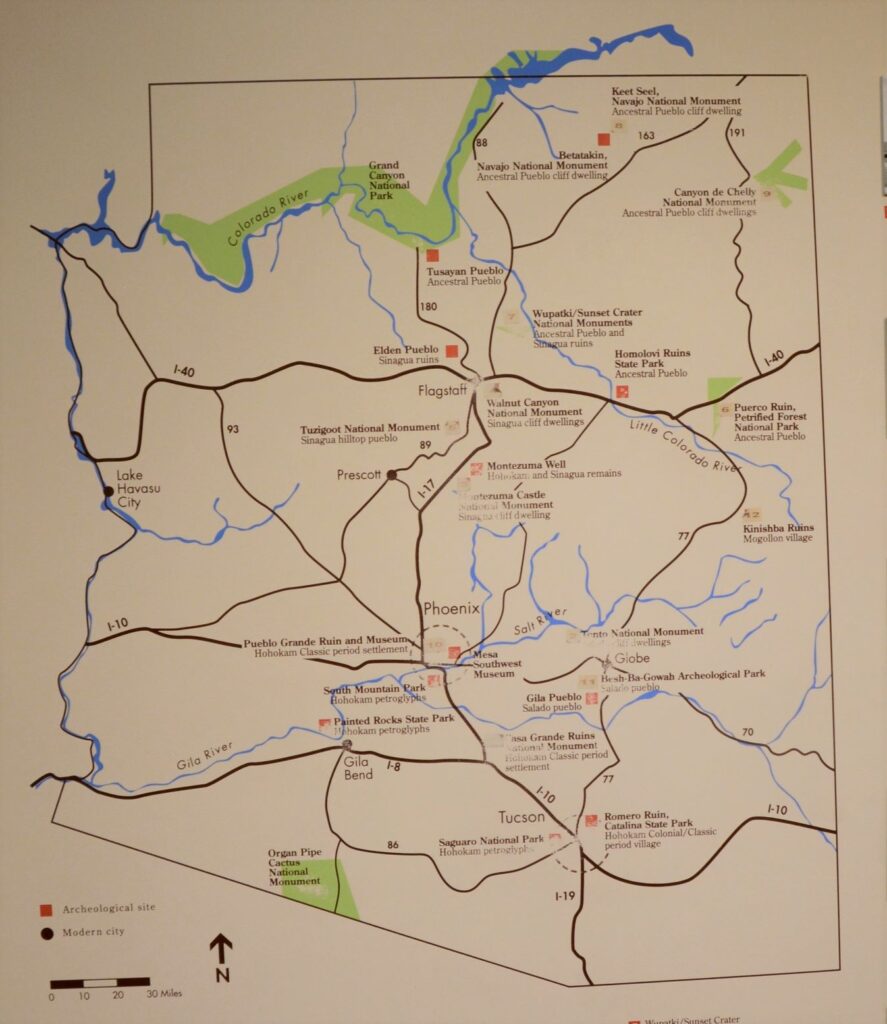
The map below shows many places around Arizona where the Sonoran desert people lived and moved. Eventually, they all left for unknown reasons. It may have been drought, floods, disease, invasion, earthquakes, internal strife or salinization of farmland. We don’t know. Yet we can still appreciate the structures, relics and places they left behind and marvel at their ingenuity.
I am glad we took time to see these places, having never visited any except Montezuma’s Castle when I was growing up. I don’t think I appreciated the contributions these people made to Arizona history. It’s a shame that Hohokam school didn’t teach us anything about the people that our school was named after. I think it would have made a big impression on me to have learned about them and to have visited Casa Grande National Monument.
But the moral of the story is, explore your own backyard. You never know what you might be missing!
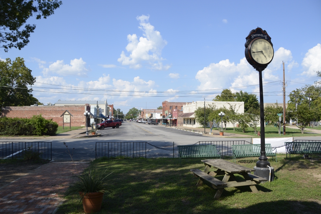
One of my favorite things to do is to step back in time by visiting historic small towns. Texas has many small towns scattered across the state. They were often established along rivers or railway lines. Such was the case with Smithville, Texas. Although a doctor founded the town and built the first house and store, the town was named after William Smith, who arrived several years later. The town population grew quickly when a local businessman made a deal with a railroad by gifting land to build a depot at a new town site. Almost overnight, the town blossomed and flourished.
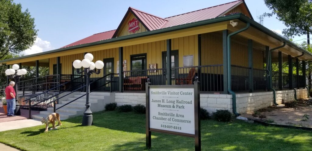
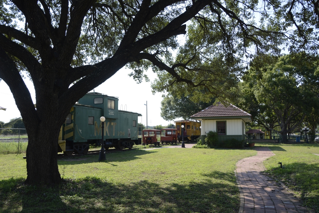
Smithville is located just off Highway 71, about halfway between Austin and Columbus, Texas. When we visited there, our first stop was the Railroad Museum at the end of the main street where we learned about the disaster of 1911.
Smithville Visitor Center and Railroad MuseumSmithville town clock at the Railroad Museum, looking down Main Street.Railroad Park in Smithville, TX
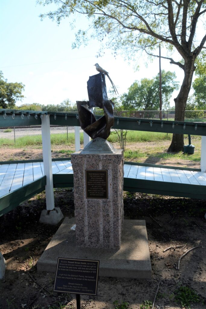
On February 8, 1911, a switch engine’s boiler exploded. The engine was building up steam in preparation to make a run to another town. The explosion sent the roof sheet metal of the firebox hurtling a distance of three blocks where it landed in the street. Smaller pieces flew twice that distance. Four people were killed and twelve more were injured.
Today a Railroad Park surrounds the Museum showcasing railroad cars from the past. In the garden is a sculpture with a piece of the iron from the engine that exploded.
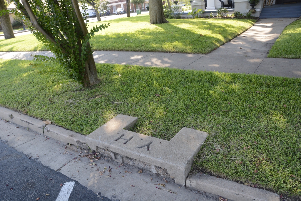
As we drove around the town, we saw many old stately homes. One of the homes had a carriage step by the street. Carriage steps were to help people getting in and out of their carriages or on and off a horse.
Carriage step
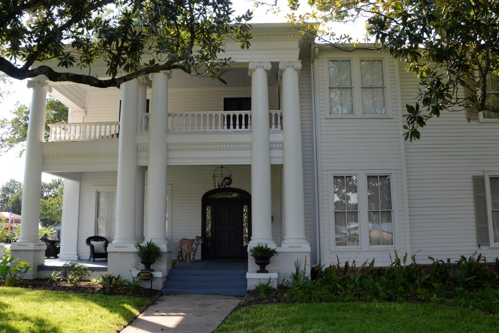
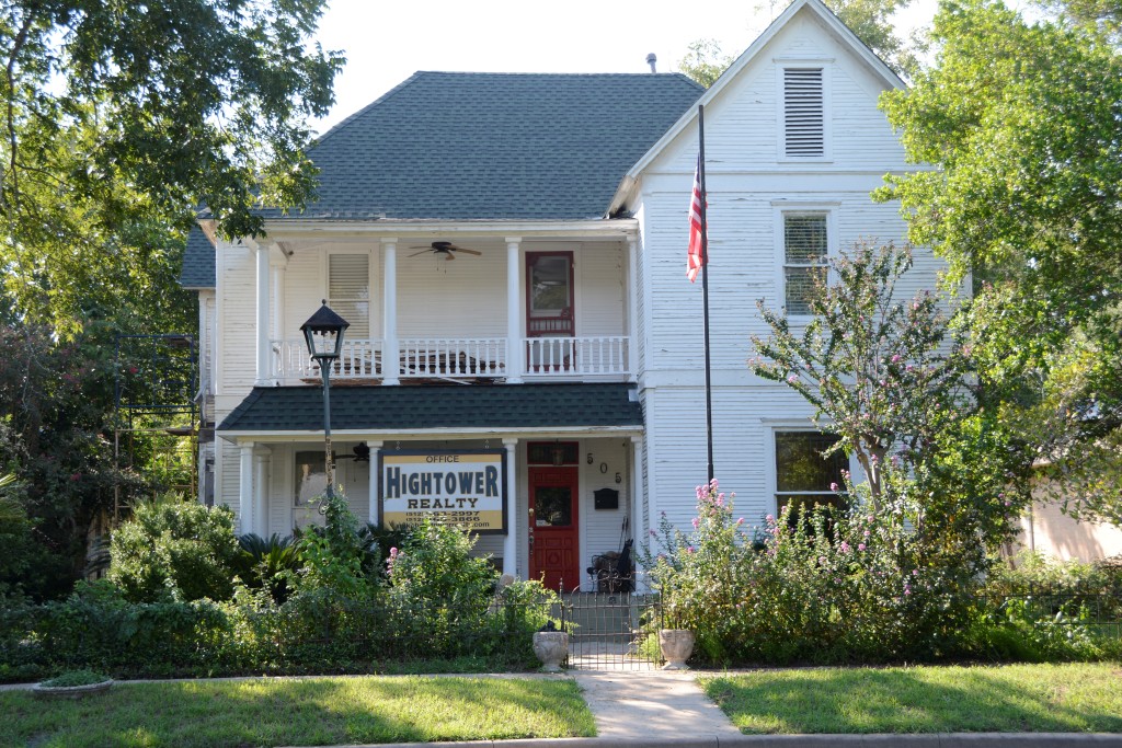
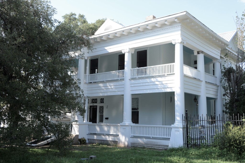
There were plenty of old style houses around the town. The ones with columns and covered porches were especially beautiful. While some had neatly kept yards, others looked neglected.
The house shown below is where the movie “Hope Floats”, a 1998 drama starring Sandra Bullock, was filmed. Smithville prides itself on being a film-friendly destination. They even publish a map for tourists showing the locations where dozens of movies were filmed.
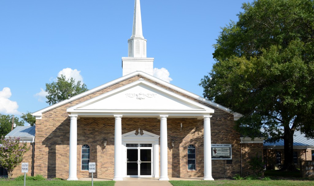
House where “Hope Floats” was filmed.First Baptist Church, Smithville, TX
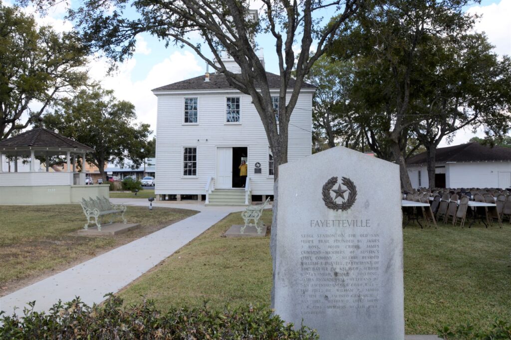
Fayetteville, Texas
About halfway between Houston and Austin is the town of Fayetteville in the county of Fayette. It is not, however, the county seat. It was named after Fayetteville, North Carolina, a town which we’ve also passed through in our travels.
The county of Fayette is named after General Lafayette, the Revolutionary War hero. Its county seat, La Grange, is named after General Lafayette’s castle in France, Chateau de la Grange-Bleneau. The Marquis de Lafayette fought with the Americans and aided the cause of the American Revolution. La Grange is where we do most of our grocery shopping when we’re staying in Columbus, Texas.
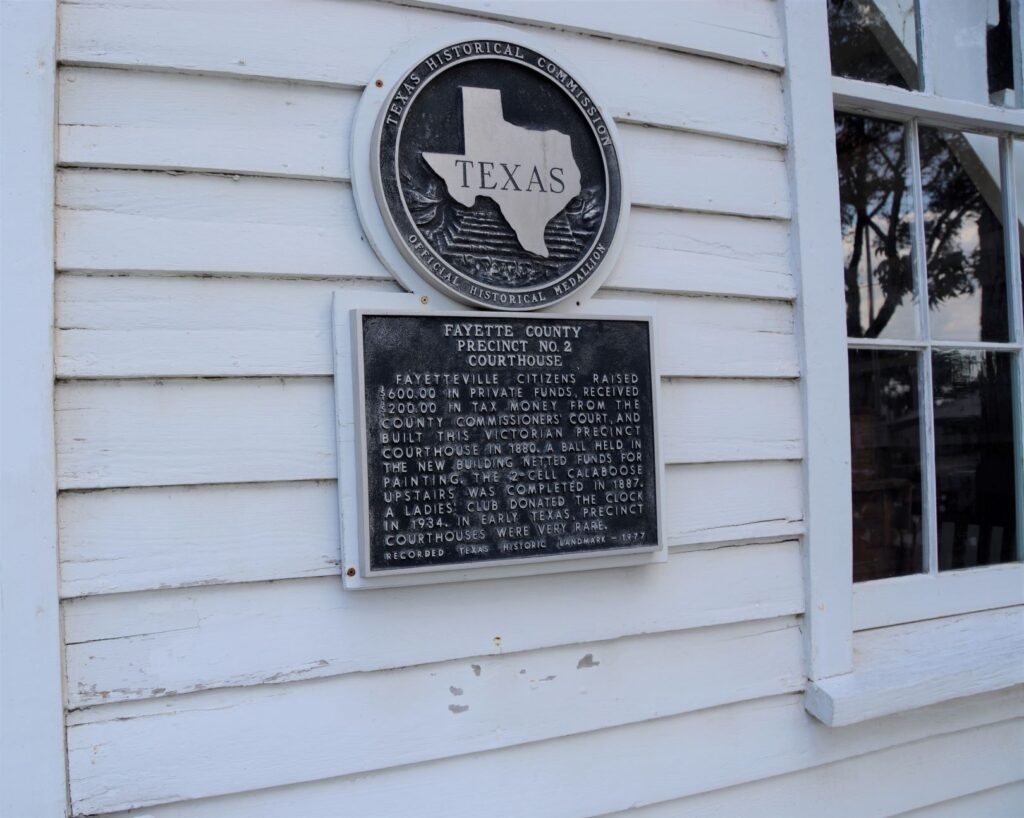
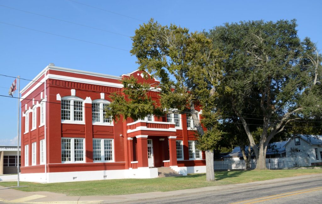
Fayetteville Historical Courthouse
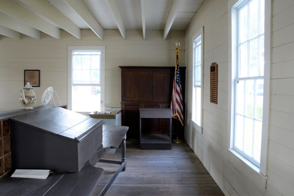
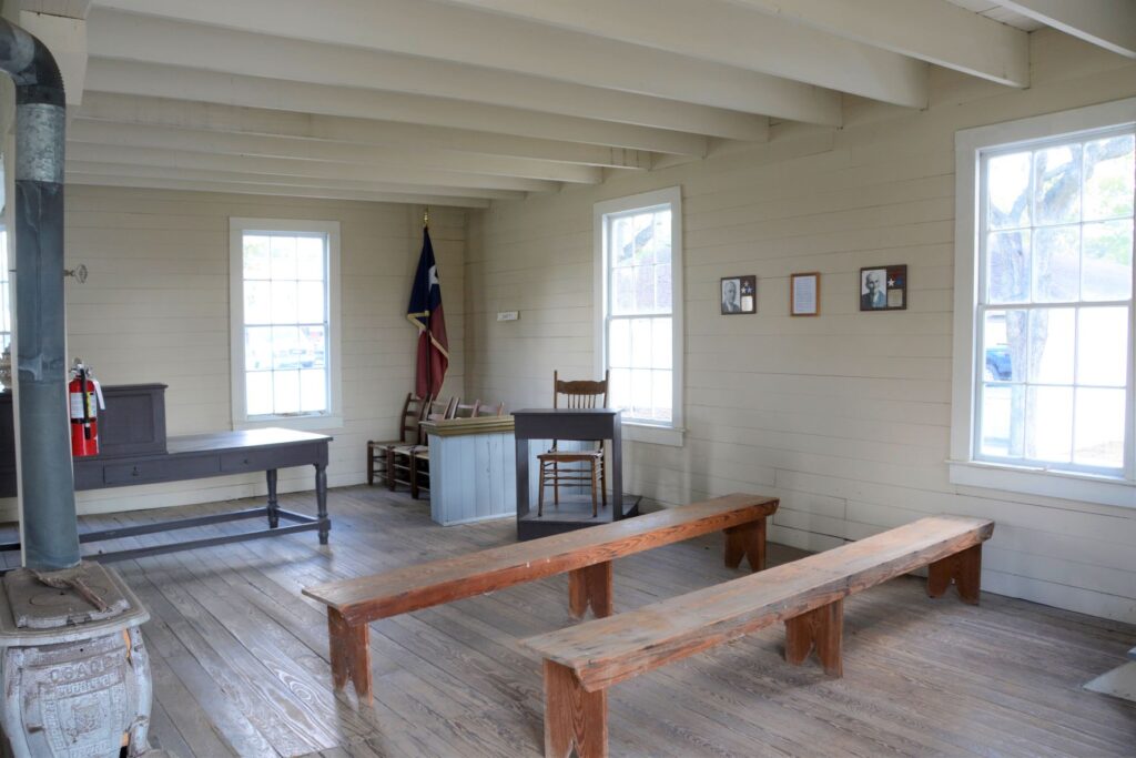
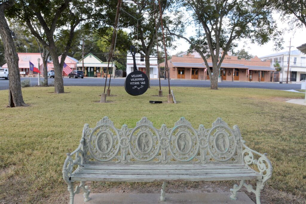
At the center of Fayetteville is the historical courthouse and town square. The day we visited, the town was getting ready for their chili feed the next day. The courthouse is a two-story structure. The first floor is the original courthouse, while the second floor houses the old jail.
Inside Fayetteville CourthouseJury box and witness stand in Fayetteville CourthouseBench with historic figures of the past
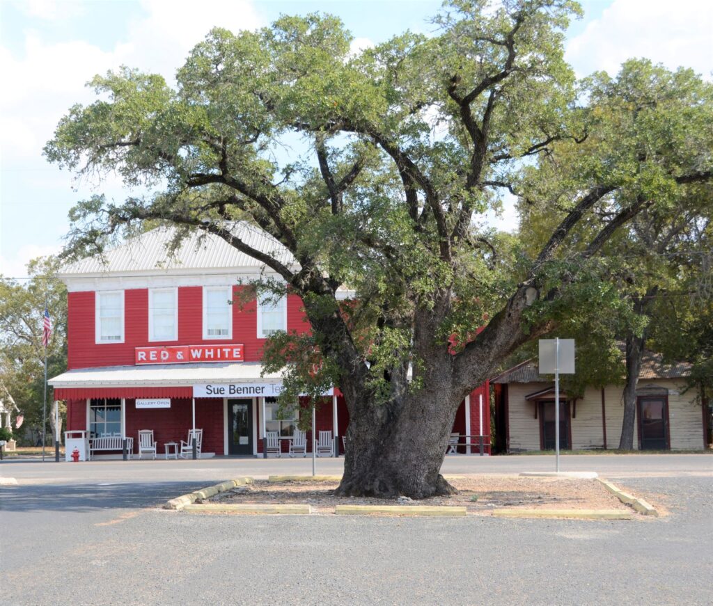
Much of Fayetteville’s population is from German and Czech ancestors. The Texas BBQ menus almost always offer sausages as well as the usual brisket and ribs. This is from the Czech and German influence.
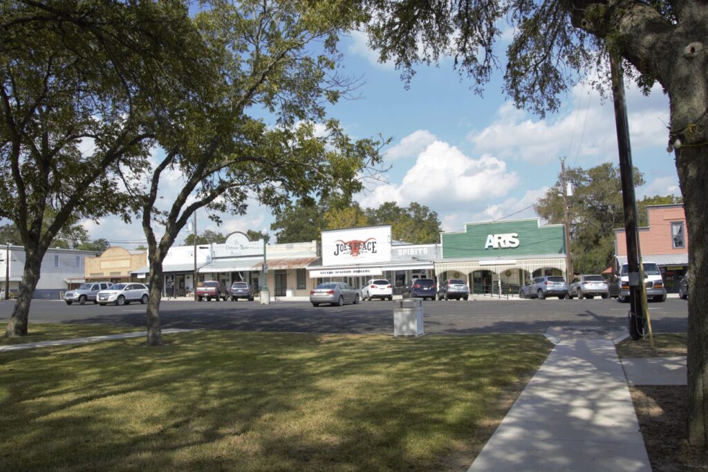
Large oak in town square. Local businesses line the surrounding streets.Looking across town square from courthouse.
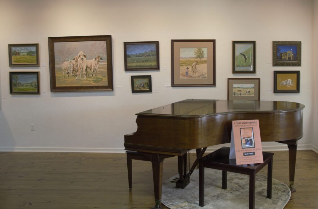
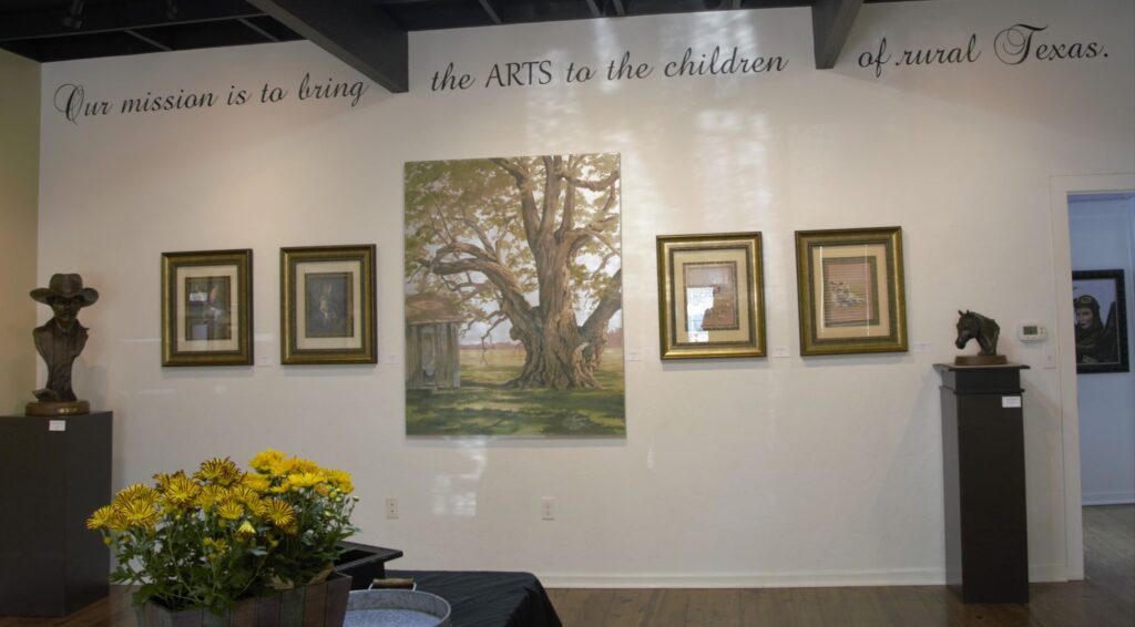
We wandered into an art gallery off the town square. Fayetteville is kind of an artsy place. They have programs encouraging children of the county and other counties to explore the arts. The featured artist in the gallery at the time was a renowned forensic reconstruction artist. Her paintings and sculptures were on display.
Newly refurbished old schoolhouse
The high school sits at the edge of town. In front of the current high school sits the newly refurbished 110 year old schoolhouse. A new library resides in the downstairs and upstairs houses the district administrative offices.
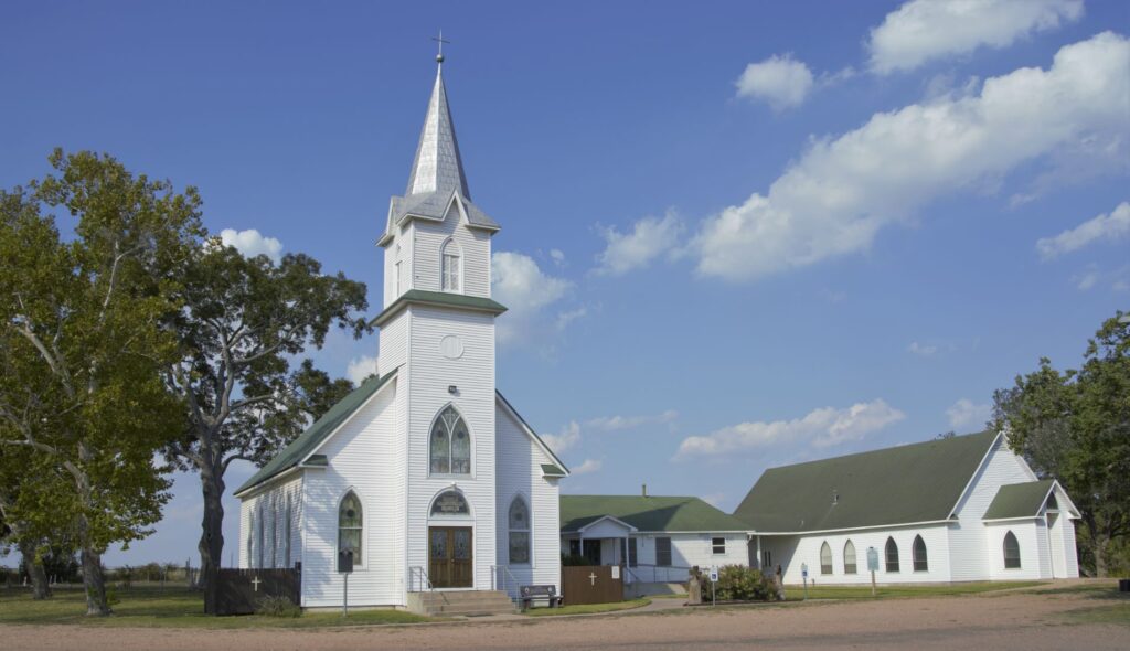
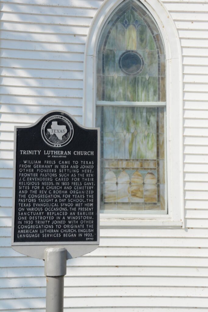
As we drove out of the town, we saw this pretty church with a silver steeple. It was locked, so we couldn’t see the interior.
Trinity Lutheran ChurchHistoric Trinity Lutheran Church
We drove on some back roads through some other small towns including Industry and New Ulm. These towns were very small with perhaps a store and a few houses. Ellinger was another small town which was on our way home. It has a very busy Czech restaurant and bakery where we stopped and bought some of their delicious kolatches. (pastries with fruit fillings) It is on the highway between Columbus and La Grange.
I feel at home in small towns, having lived on the outskirts of one for many years in California. The people are usually friendly even if they know you’re not a local. The pace of life is slower. The roads are narrower. The views are peaceful. Cows graze in the fields. Barns and farmhouses bring thoughts and memories to mind of childhood visits to farms of relatives in Indiana. In short, it’s a relaxing way to spend an afternoon.
These are just a few of the small towns we have visited in Texas. With 254 counties, there are many more interesting small towns scattered across the vast state, enough to keep us busy for a long, long time!
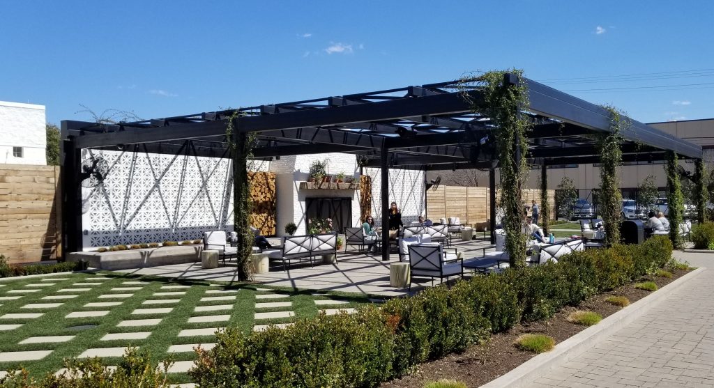
One of the reasons “Fixer Upper” has been so popular, I think, is that Chip and Joanna Gaines like to preserve the old character and history of the homes and structures they renovate. That’s what attracted me to their shows. Plus, they are both very talented at what they do. They’re funny and playful, and they have good old fashioned values.
I heard their restaurant, Magnolia Table, was a popular and busy tourist attraction, but I had no idea that on a Wednesday in March that we would be fighting for a parking spot. I heard that reservations were recommended, but I decided to take a chance. When we arrived, we were told it would be an hour plus wait for a table. Well, we were too hungry. In the same parking lot was Rudy’s BBQ, so we opted to go there to eat instead. It was delicious!
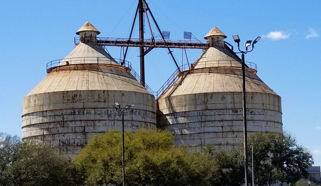
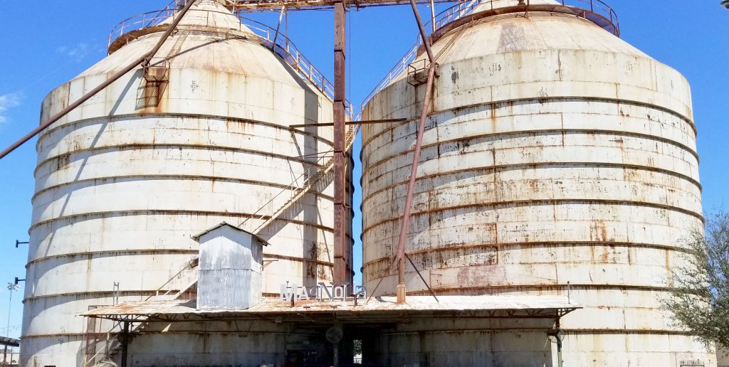
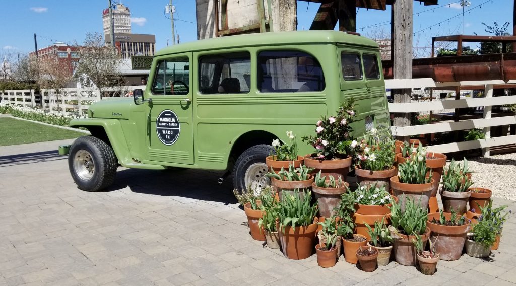
The Silos complex is a few miles away from Magnolia Table restaurant. We drove around for some time before we found a parking spot a few blocks away from the entrance.
The Silos are a prominent landmark feature of the Magnolia complex. The Gaines’ businesses fill an entire city block.
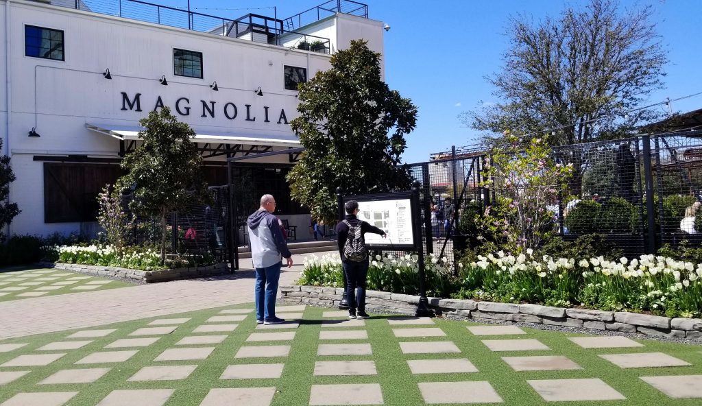
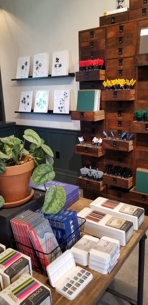
We approached from corner of the block where the bakery sits. I wanted to see the checkerboard patio area. We didn’t buy anything from the bakery as there was already a line out the door. It was an excuse for me not to to eat something sugary.
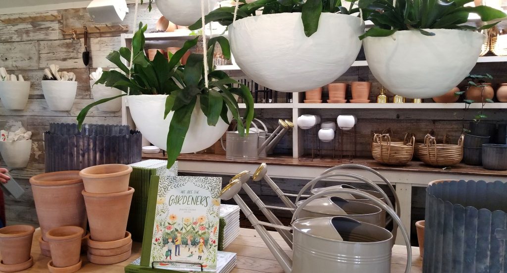
Magnolia Market was our first stop. It houses displays of home decor, wall decor, seasonal decorations, clothing and more. Their stated purpose is “a place where you find inspiration and a renewed vision for your home”.
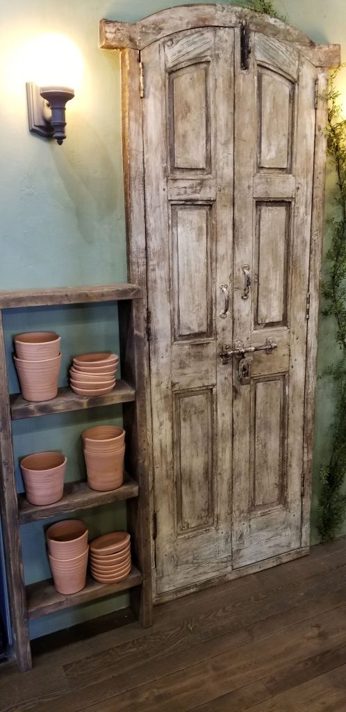
I know how much Joanna Gaines likes old doors, so it wasn’t surprising to find some in her store.
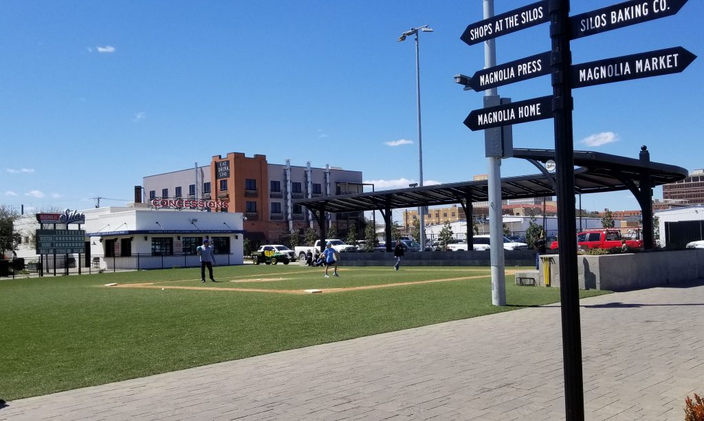
Katy Park is a wiffle ball park that provides some fun for families while they are visiting the Silos. It was nice to see a family out there enjoying it.
Katy Ball Park
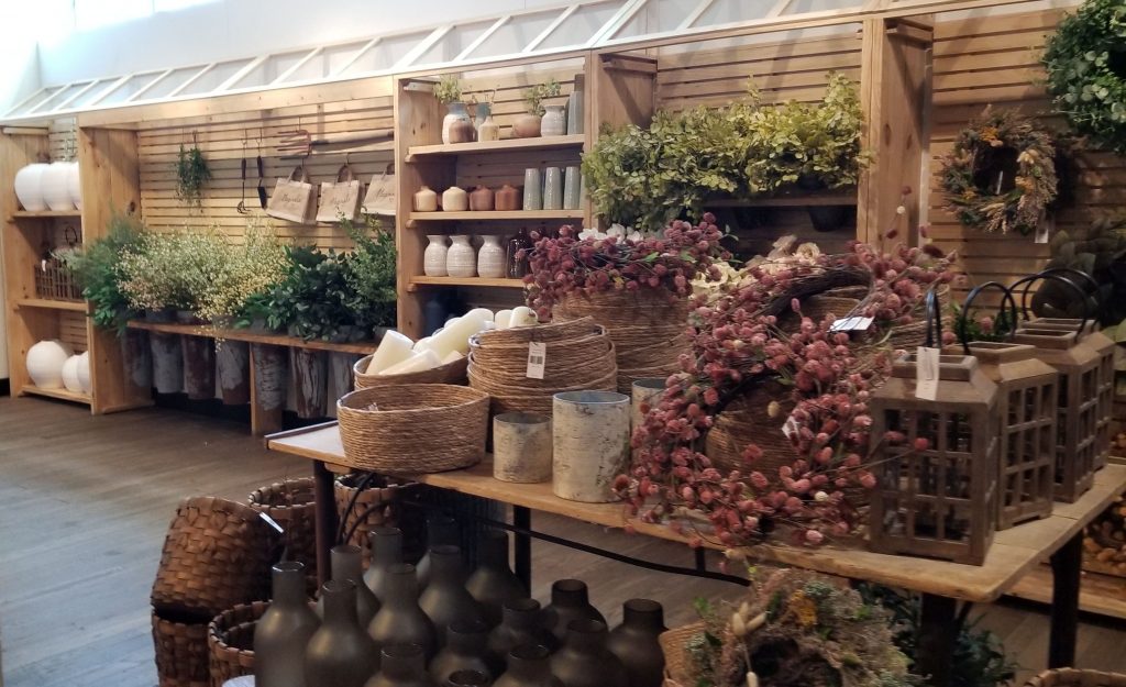
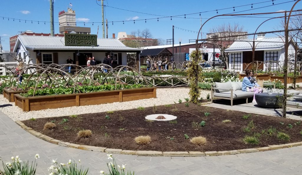
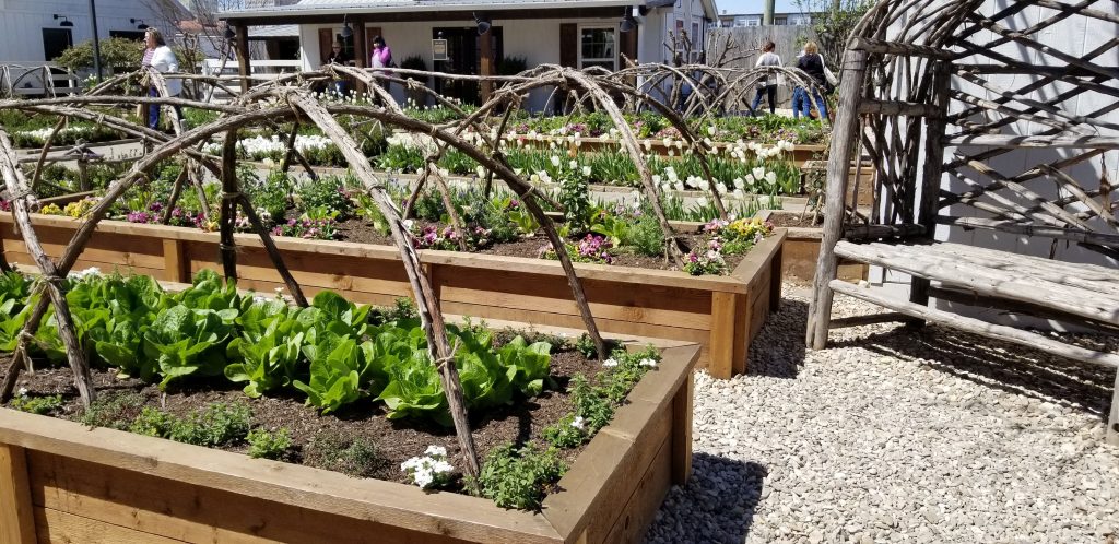
In one corner of the block is Magnolia Seed and Supply, a gardening supply center and garden. This was one of my favorite spots. This garden not only supplies fresh ingredients for Magnolia Table (the restaurant), but also for the Salvation Army.
Magnolia Seed and Supply
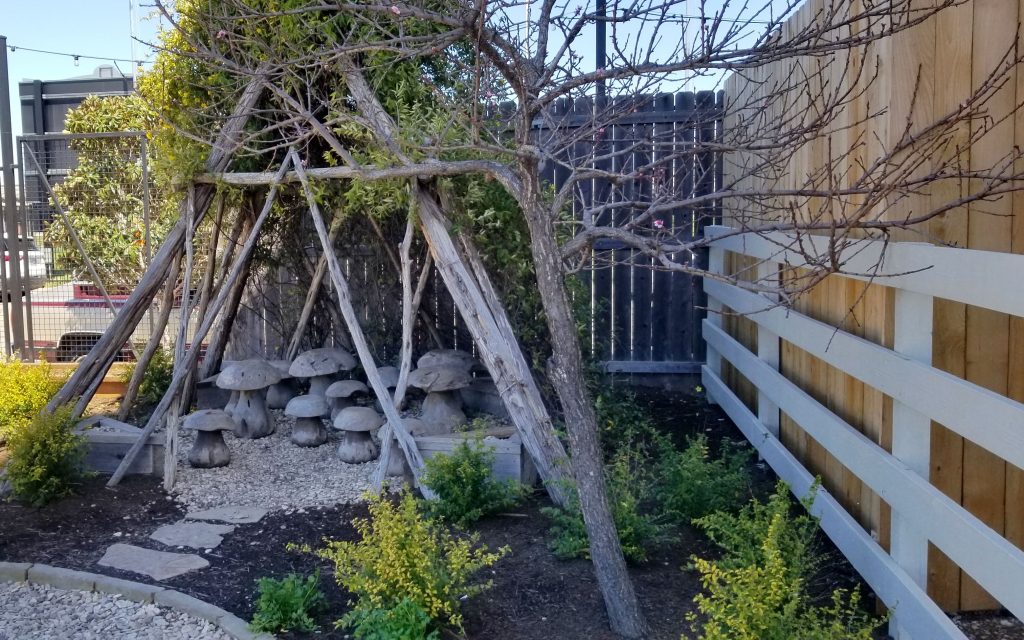
I liked the cozy benches made from branches that were tucked away in corners.
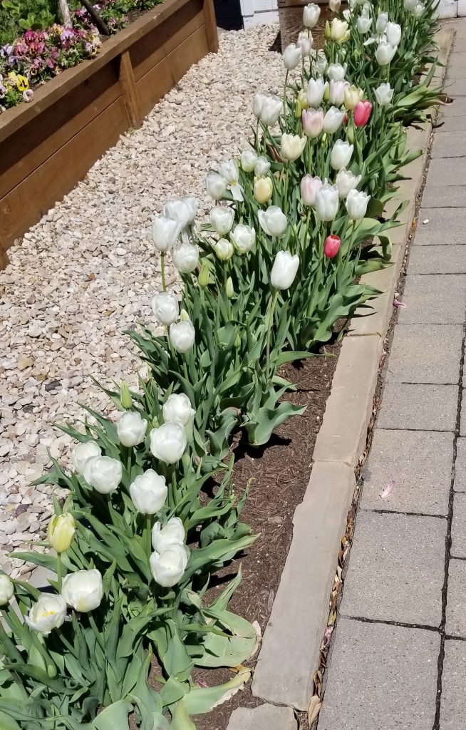
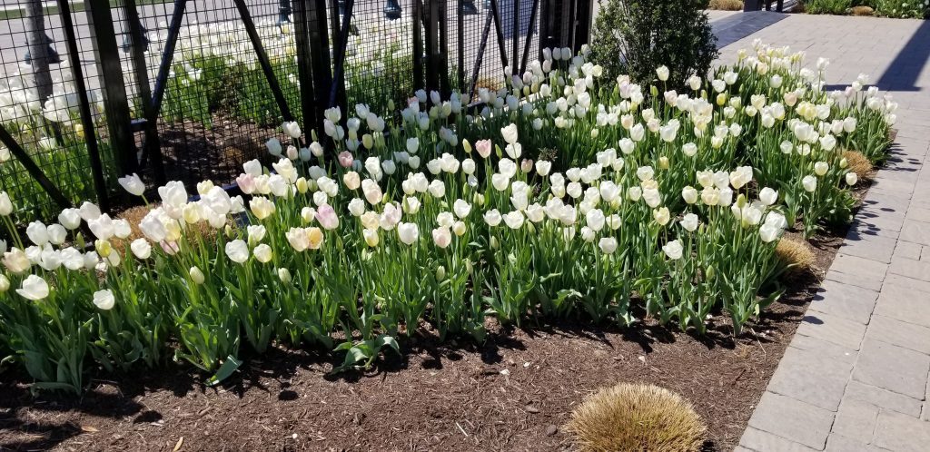
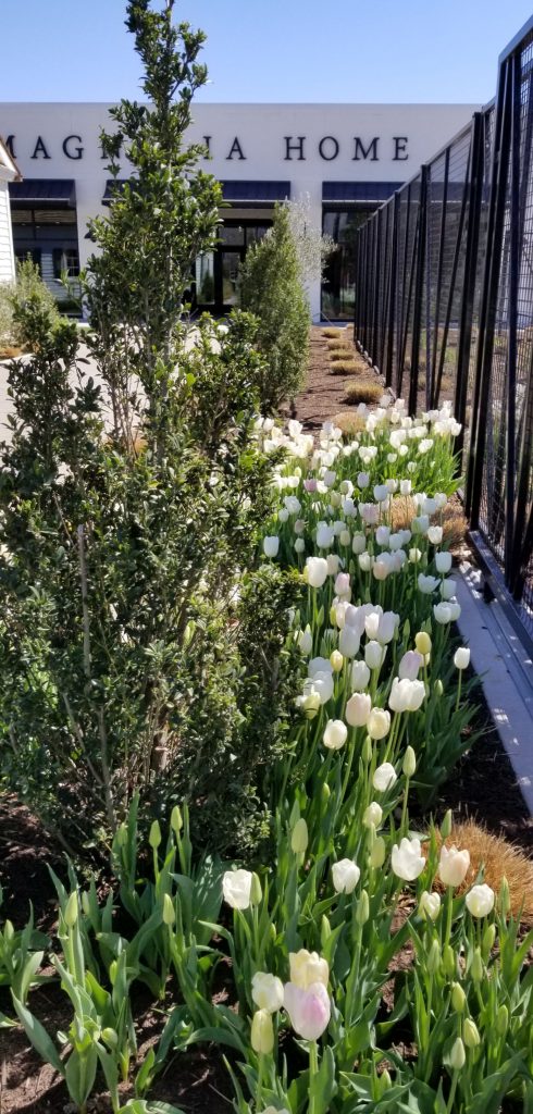
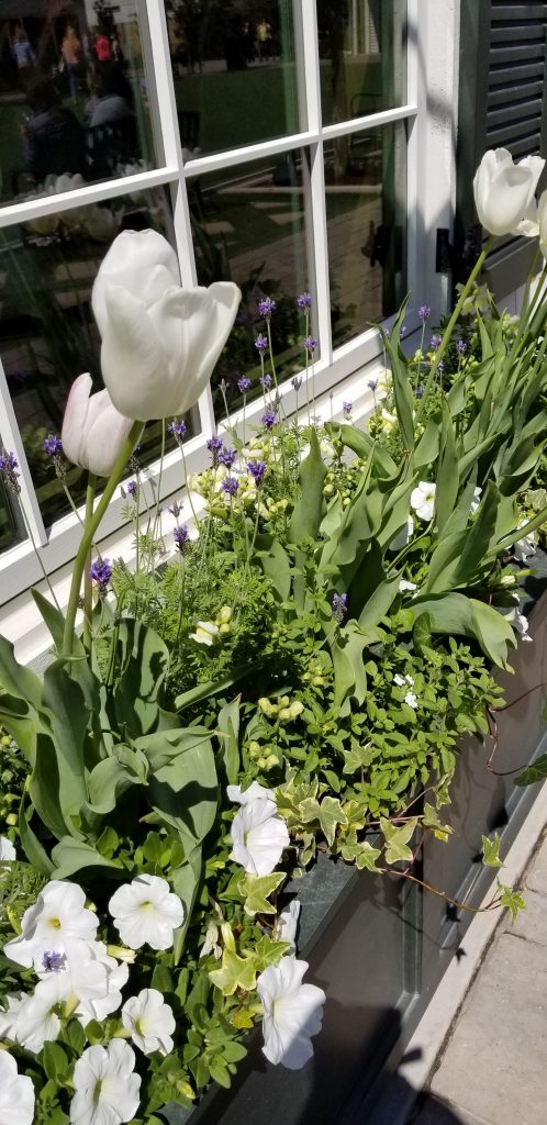
My all time favorite flower is the tulip, so I was delighted to see all the beautiful tulips in bloom.
Inside Magnolia Seed and SupplyMore tulips!
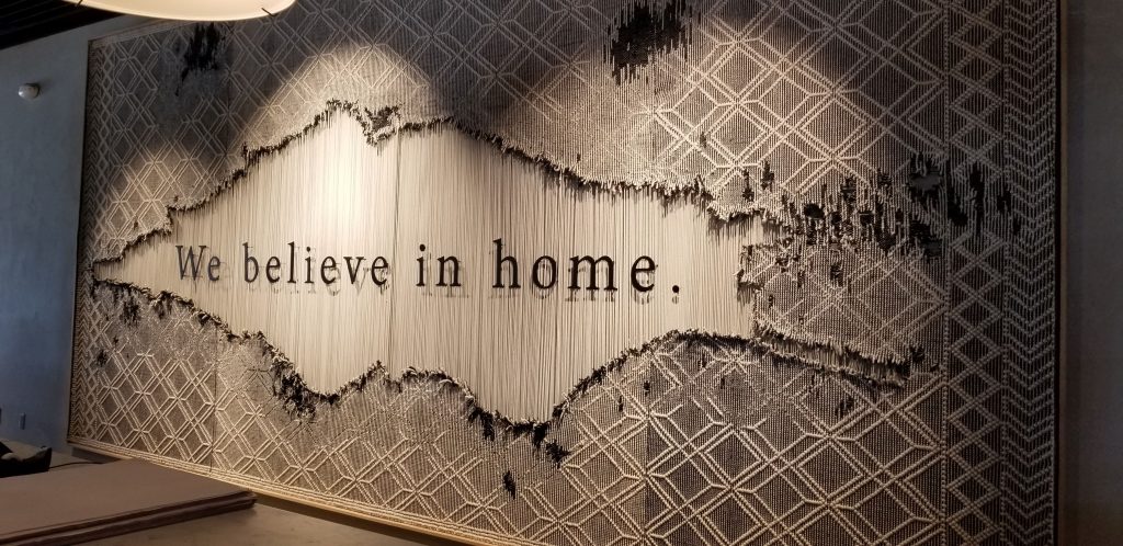
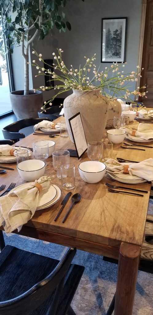
Magnolia Home is a showcase for fully-designed room scenes to help the shopper visualize possibilities for their own home.
This is a large woven wall hanging in Magnolia Home.Bedroom display in Magnolia HomeTable setting in Magnolia Home
Another building nearby housed Magnolia Press, a coffee shop. We just walked inside to take a look.
Magnolia Press seating area outsideMagnolia Press Coffee Shop
In another part of the complex there are six little cottage shops. Each of the shops has a specific style and theme such as bath and body, men’s items, leather bags and jewelry, women’s clothing, and books and paper. A new shop that will house children’s items was not open yet.
Flowers outside a cottage shopBath and body shopThe books and paper shop had art supplies.Plants inside bag and jewelry shop
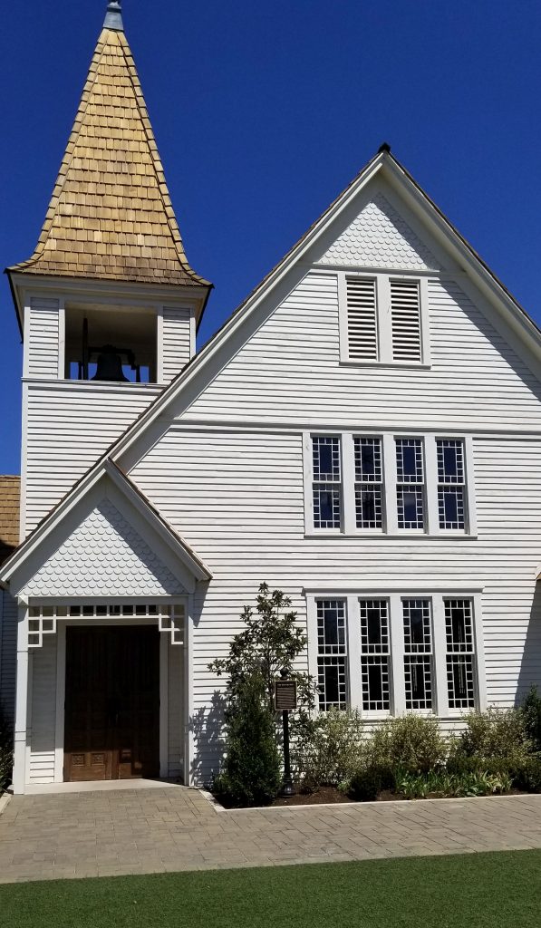
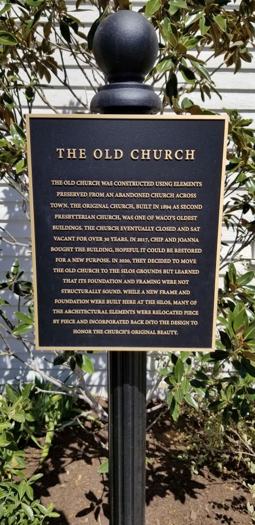
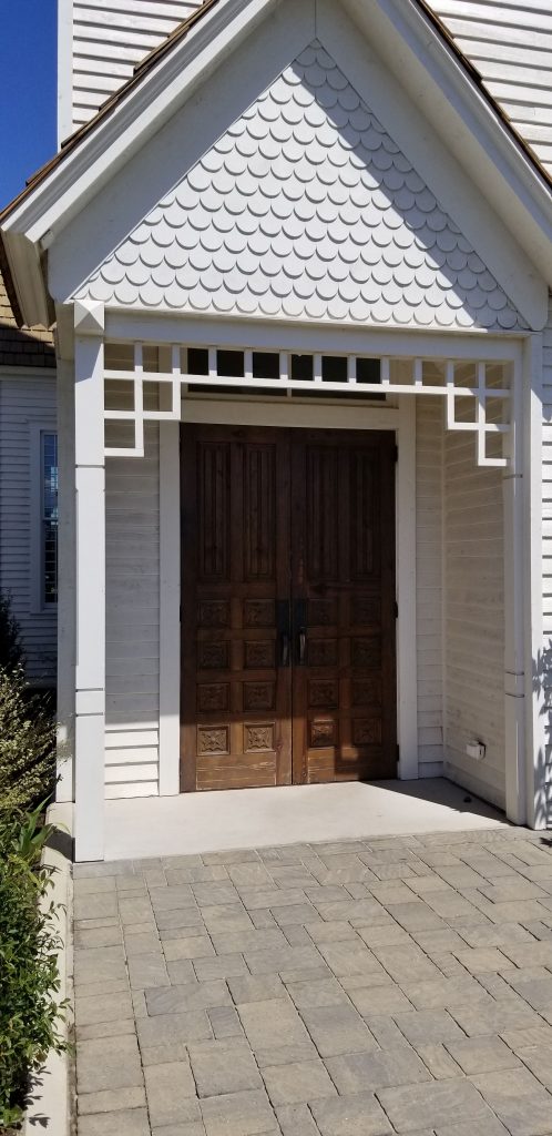
I really wanted to see the old 1894 church that was moved to the Silos site and renovated. It was beautiful on the inside and outside. There was something missing though. See if you notice.
I love the scallops and other detail of the church entrance.
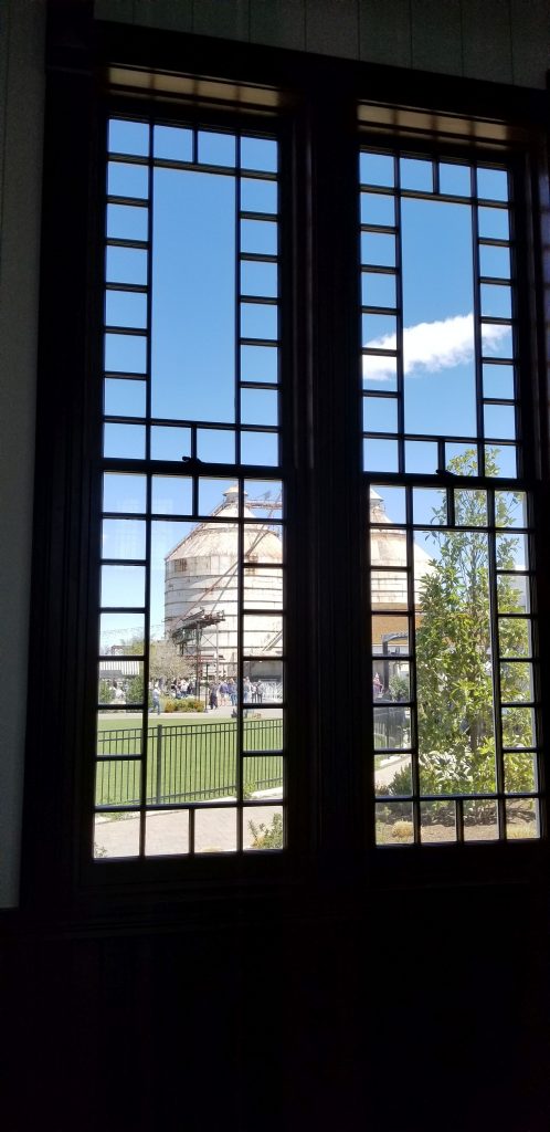
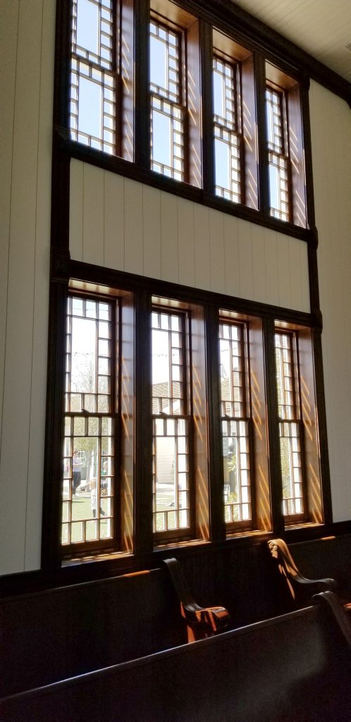
Large wooden doors to old church at the Silos.The Silos as seen from inside the old church.Inside the Old Church
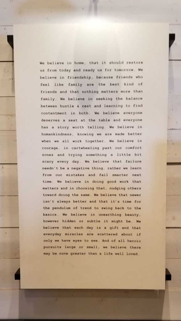
Below is Chip and Joanna Gaines’ statement of belief for their business. It seems really nice. But there seems to be something missing. See if you notice what it might be.
Magnolia Statement of Belief
Ray was the one who pointed out to me that their statement of belief never mentions God. There is no mention of why the old church is important other than as a renovation project saving an historic building. There is no cross on top of nor inside of the church. There is no pulpit. It’s just a pretty building.
I know they have received attacks from leftists. It’s possible that they are just trying not to offend anyone. They clearly believe in family, friendship and home, but what is glaringly missing is any mention of Christian values or God. I know I may be bursting someone’s bubble by mentioning this. I could be wrong, but after researching their religious beliefs, I came away wondering. Just what do they believe?
I’m really glad we took the time to visit the Silos. It is a very unique and popular place. If you don’t mind fighting through the crowds of people or standing in line, it’s a fun place to see. Though the products are very pricey and I didn’t notice many people with shopping bags, I imagine most people were just there to look–like me. Smile. And I still admire Chip and Joanna’s sense of business and entrepreneurship–it’s amazing!
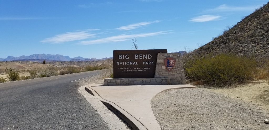
Big Bend National Park Entrance at Maverick Junction
From the tip of southern Texas, we traveled northwest along the Texas/Mexico border to the “bulge” of southern Texas. It is appropriately called “Big Bend” because that is where the Rio Grande River makes a huge bend toward the southeast and then bends back to the northeast. In the crook of this huge bend is Big Bend National Park.
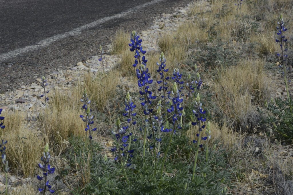
Spring was a perfect time of year to visit before the heat set in. It was still chilly at night, and not many cacti or wildflowers were blooming yet except for a few bluebonnets (the Texas state flower) that were starting to bloom by the roadside.
Bluebonnets
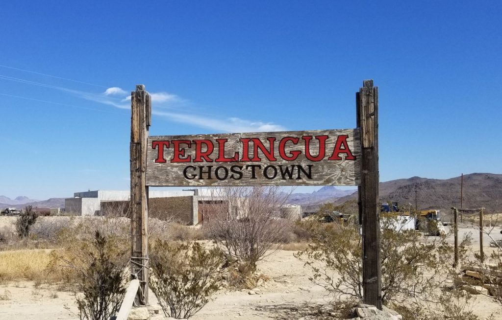
We stayed in an RV park in the town of Terlingua (Ter-ling-gwa), a little town that got its start in the 1880’s when “quicksilver” (mercury) was found in the area.
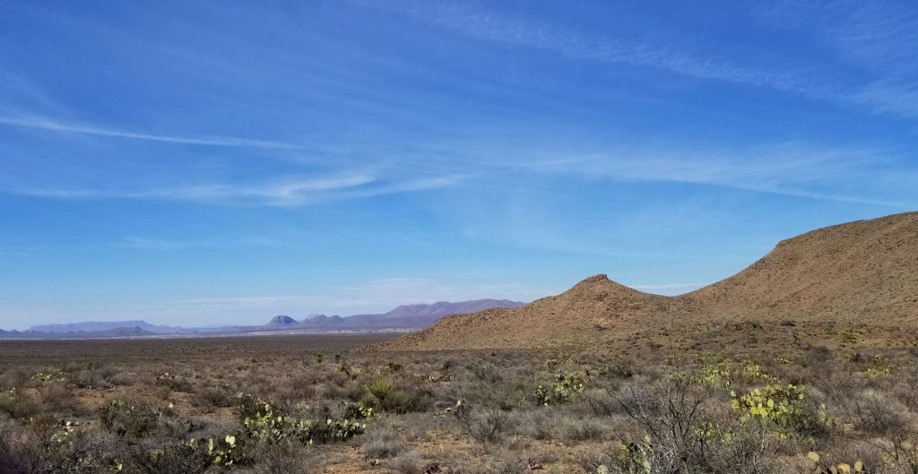
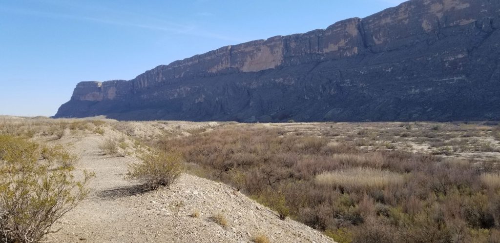
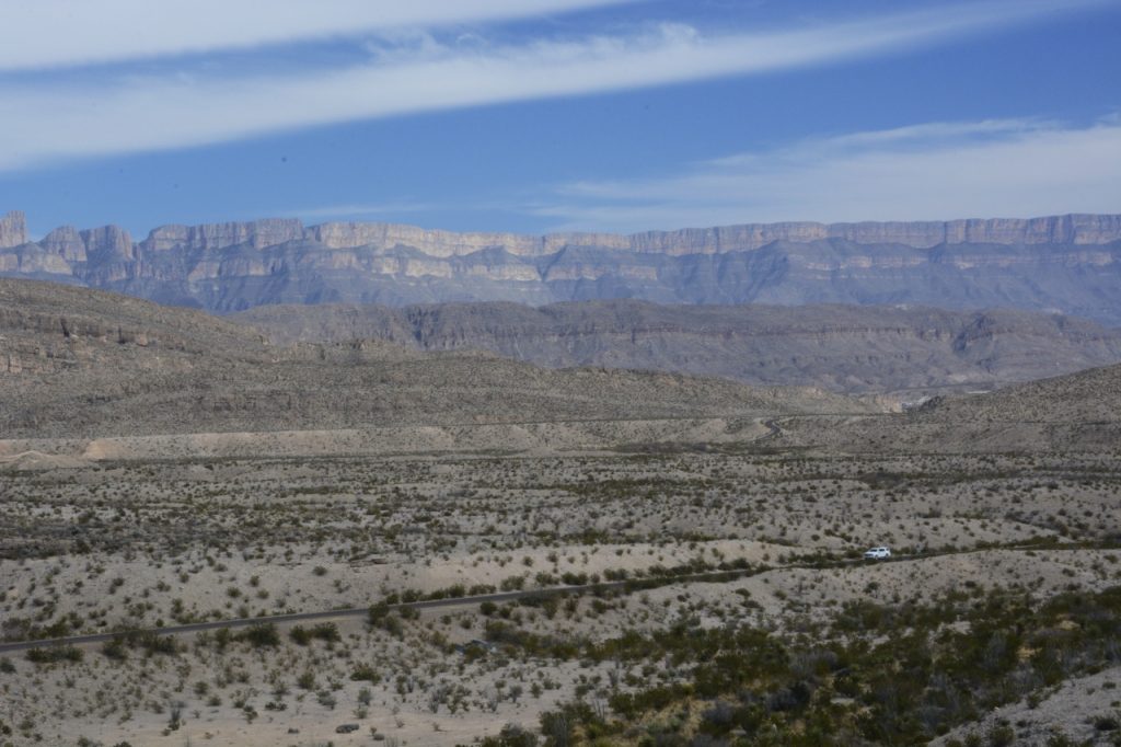
The first thing I noticed was how vast this area is that Big Bend encompasses. You can see the purple mountains in the far distance, and somewhere beyond those mountains is the Rio Grande, and beyond them is Mexico. Though it is only #15 on the list of the largest national parks, Big Bend National Park is over 800,000 acres, and is larger than Yosemite National Park.
There are plenty of things to do in Big Bend NP including scenic drives, day hikes, river trips, bird watching, fishing, horseback riding and stargazing. Speaking of stargazing, Big Bend has the darkest night skies of any national park in the lower 48 states and is designated an International Dark Sky Park.
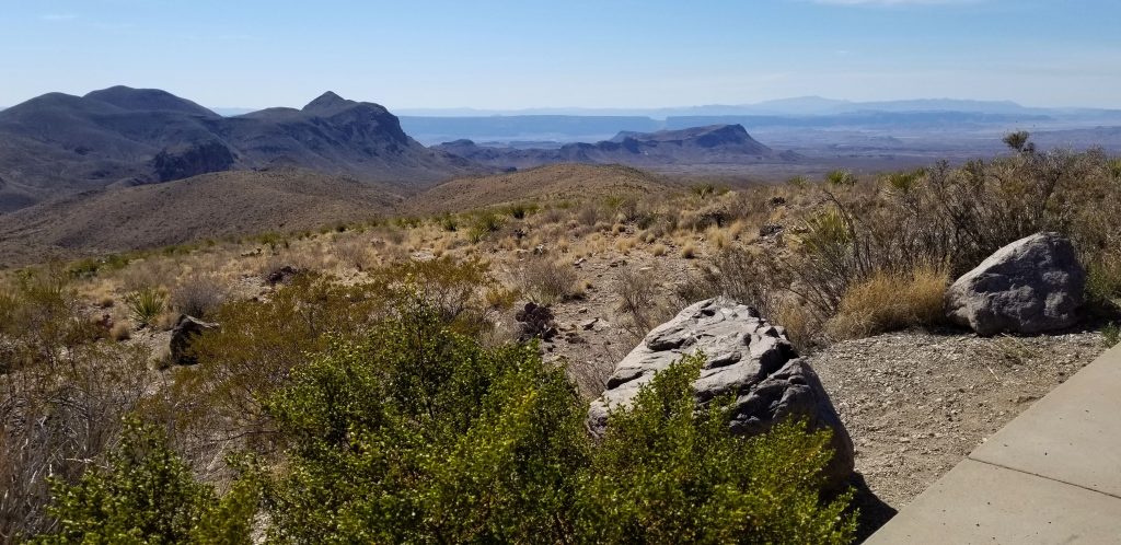
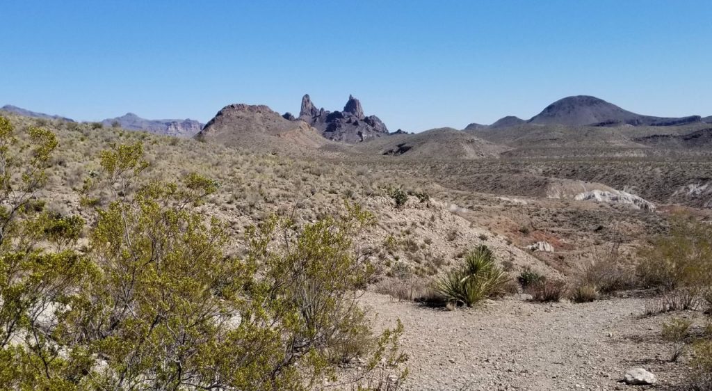
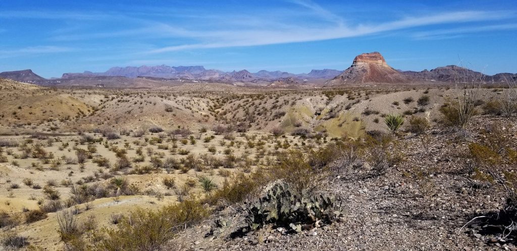
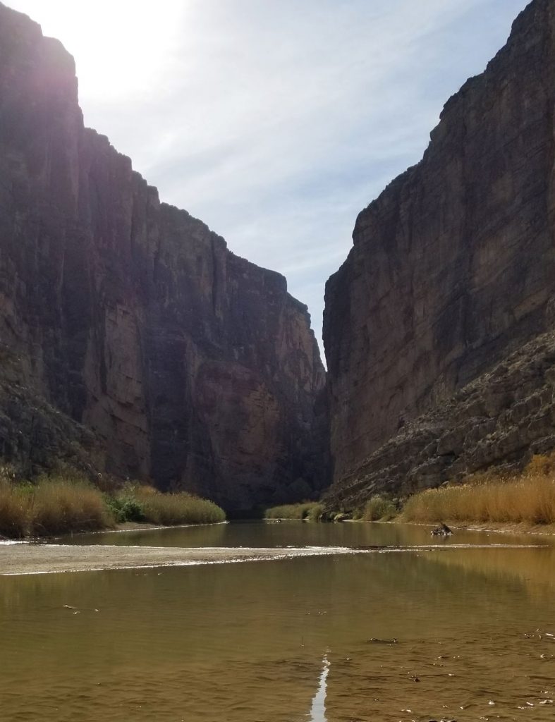
The Big Bend NP website has suggestions for scenic drives. We drove on all the paved roads in the park. The Ross Maxwell Scenic drive took us to Sotol Vista where we had a view over the entire valley. The notch in the distant ridge is where the road would end. That is where the Rio Grande cuts through steep cliffs at Santa Elena Canyon.
Sotol Vista Santa Elena Canyon at the end of the road.
This is the “notch” in the faraway ridge you were looking at in the last photo. But first, some sites along the way.
We stopped at the Mule Ears Overlook. You don’t have to have much of an imagination to see the “mule ears”.
Mule Ears Overlook
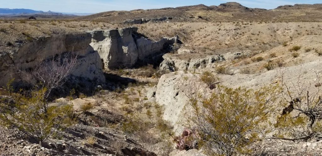
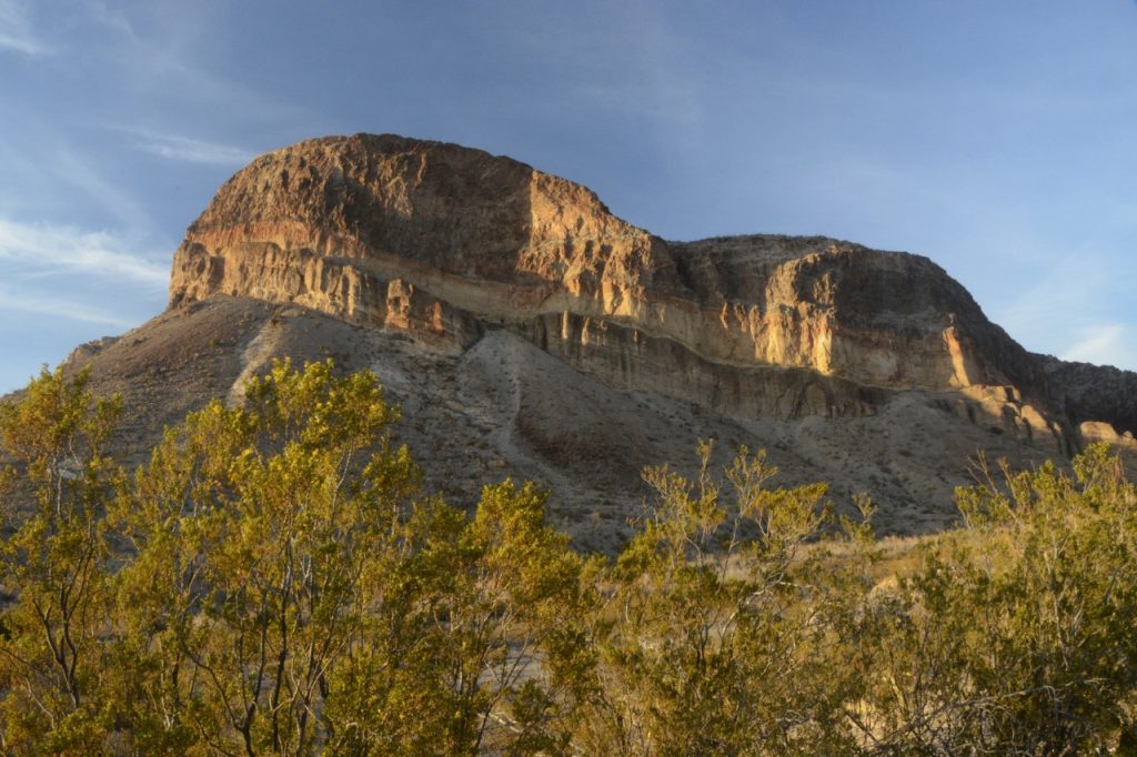
Tuff Canyon and Castalon Peak were other stops.
Tuff CanyonCastalon Peak
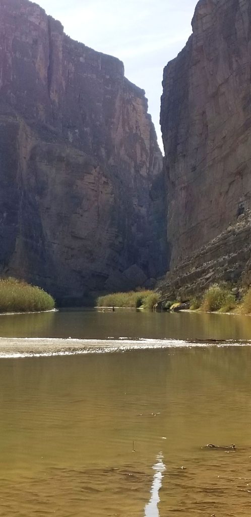
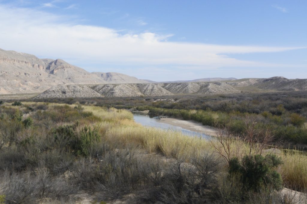
Near the end of the road, there is a massive mountain of rock wall that makes a natural barrier at the border of USA and Mexico.This is where the Rio Grande cuts through the rock and becomes Santa Elena Canyon.
Rock walls on the border make a natural barrier.
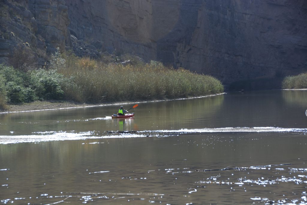
The Rio Grande is a favorite place for those who like to kayak and canoe down the river. It’s also a favorite spot to watch the sunset, as it sets between the two walls.
Rio Grande at Santa Elena River AccessRio Grande at Santa Elena Canyon
We brought a picnic supper with us so we could wait for the sunset. But instead of staying at Santa Elena Canyon, we started making our way back along the same road, stopping to photograph the “golden hour” effect on various mountains and hills.
The sunset did not disappoint.
The next day we packed a lunch and drove to the high country of Big Bend on the Chisos Basin road. In less than 6 miles, this road climbs over 2,000 feet above the desert floor to an elevation of around 4,500 feet. As the road gained elevation, the desert flora soon gave way to drooping junipers, gray oaks and the tall Douglas firs and Arizona pines. The air was notably cooler.
The road ended at the Chisos Mountains Lodge and the Chisos Basin Visitor Center. The parking lot was full, so we turned around and went back home.
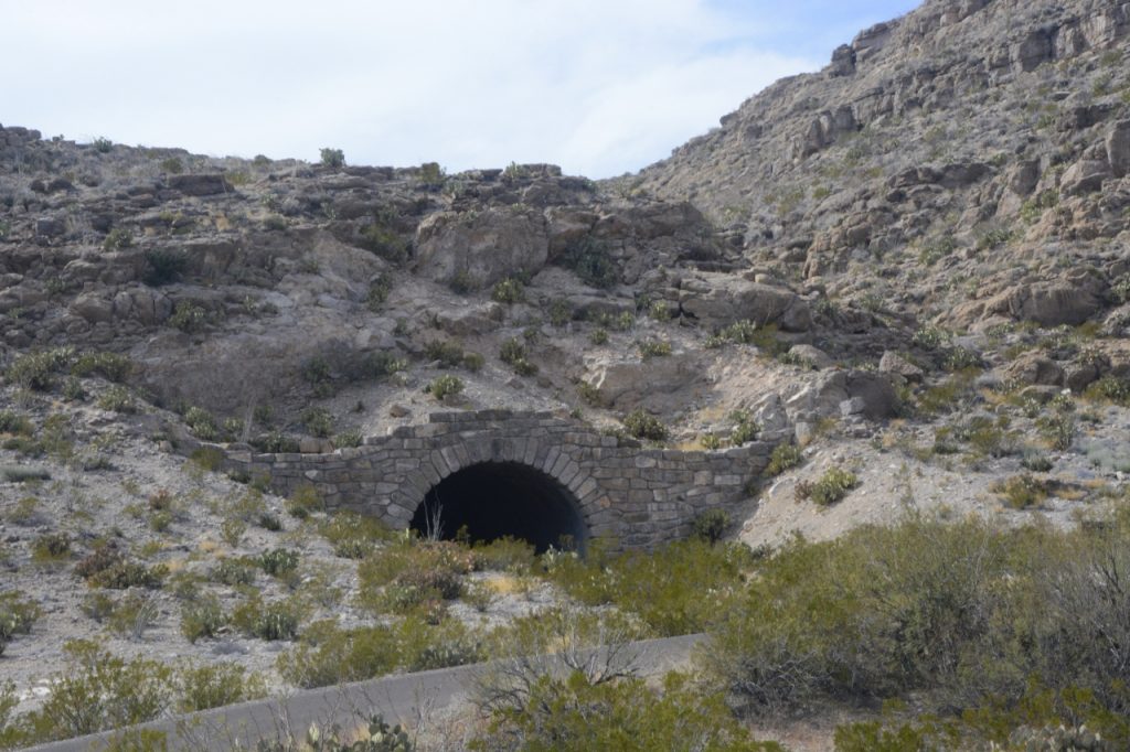
Our third day of exploration took us to Panther Junction where we turned onto the road to Rio Grande Village. This 20 mile drive descends nearly 2,000 feet in elevation on its way to the Rio Grande. Along the way we drove through a tunnel, and stopped for a view of the Rio Grande from above.
Tunnel before Rio Grande Overlook
Looking out across to the Rio Grande, we could see the mountains on the Mexican side of the Rio Grande. Nearby, we saw a spineless prickly pear cactus and other native plants.
Rio Grande OverlookSpineless Prickly Pear Cactus
Down by the river is a campground, but the sites had no hookups. Even in early March the weather was quite warm. A generator would be a must.
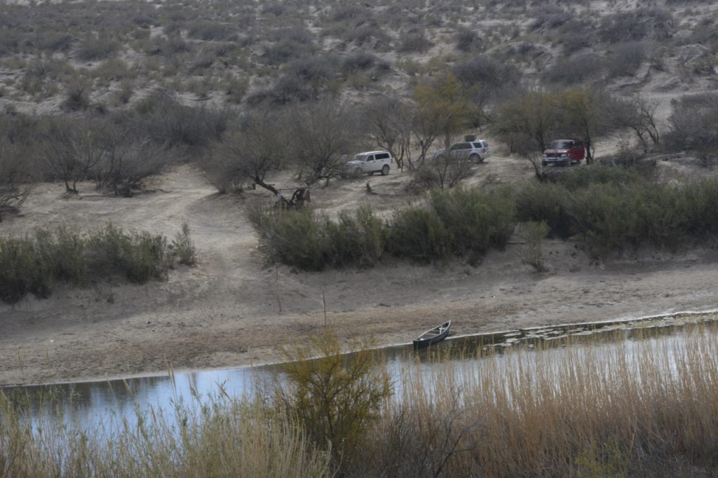
We drove to the Rio Grande river overlook at Boquillas Canyon. Curiously enough, a sketchy-looking man was there selling trinkets and souvenirs to tourists for a high price. I’m not sure if he was from Mexico or the USA. There were three vehicles parked on the other side of the river and a canoe pulled up on the opposite bank. It’s hard to tell why the vehicles were there, and if they had anything to do with the peddler.
Rio Grande River at Boquillas Canyon Overlook
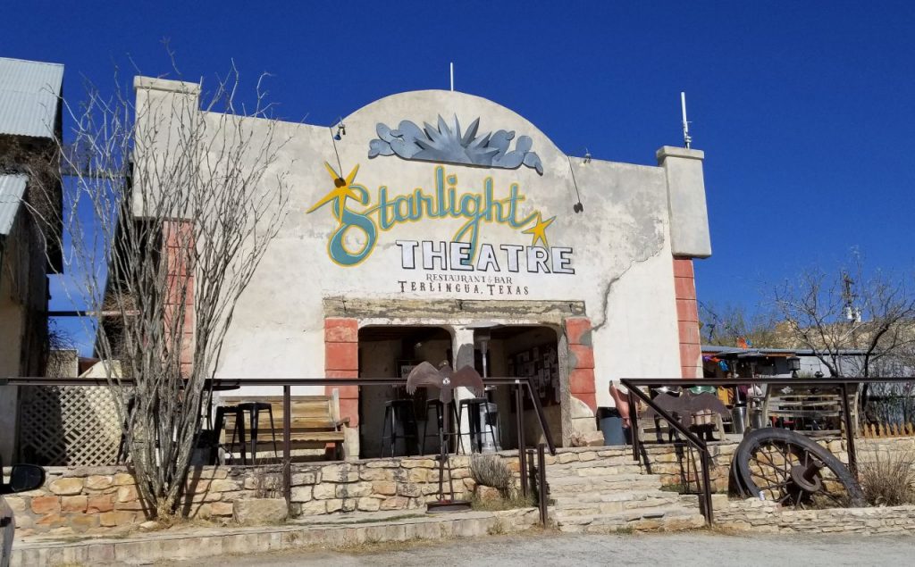
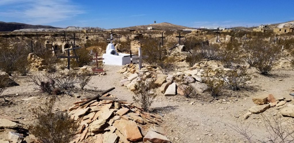
Another day we visited the nearby “ghost town” of Terlingua. The town is now a tourist trap more than a ghost town. A few old buildings and ruins could be seen. We visited a general store next door to the Holiday Hotel and the Starlight Theatre. We strolled through the old cemetery and then bought supper-to-go at the Rustic Iron BBQ.
General Store in Terlingua Ghost TownTerlingua Ghost Town Cemetery
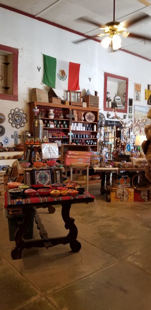
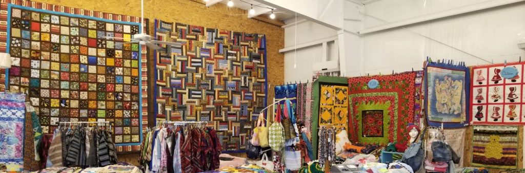
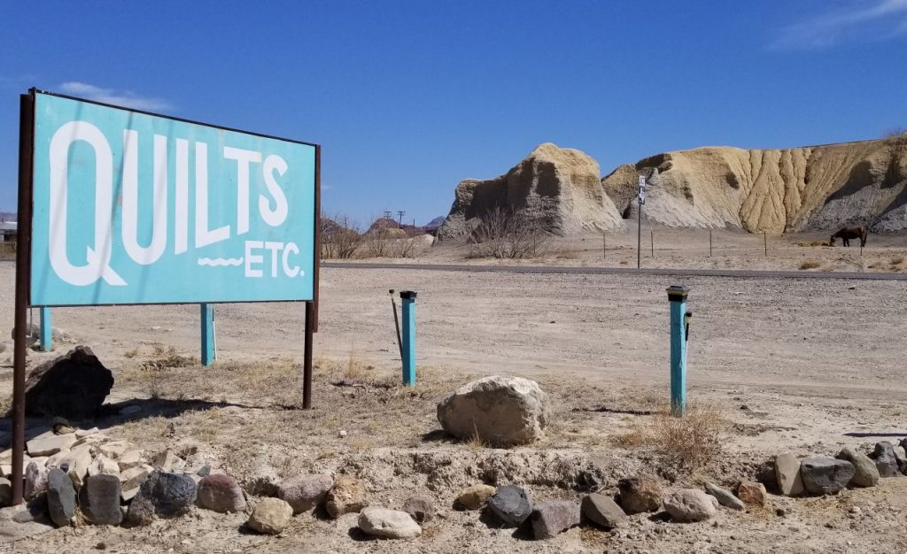
On the way home, I took a peek in the Quilt store in the town of Terlingua. Two little ladies were sewing away. The owner said she has 14 quilters working for her. When I asked how she ended up in the middle of nowhere, she said, “The warm weather!” “Yep,” I said, “That’s why we’re here.”
Quilt Store in Terlingua, Texas
Big Bend National Park was better than I anticipated. I found myself wanting to visit again someday because there’s so much more to see.
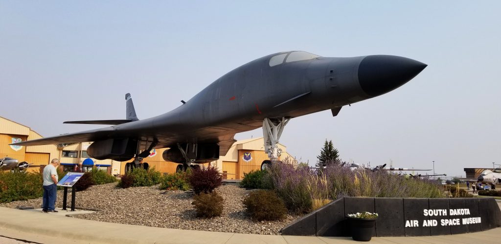
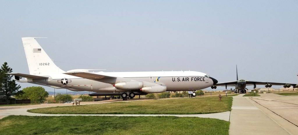
The South Dakota Air and Space Museum sits just outside Ellsworth Air Force Base.
When I was in grade school during the Cuban missile crisis, our school practiced air-raid drills. When we heard the alarm go off, we were to duck under our desks. One day the alarm went off and our teacher told us to duck under our desks, but it was a fire alarm–not an air-raid. It was just a practice drill, but the teacher eventually realized her mistake and led us all outside to “safety”.
As a child, I was aware of the cold war after the Cuban missile crisis. I watched episodes of “The Man from U.N.C.L.E” which was a fictional TV series about two spies who somehow always thwarted the bad guys from taking over the world. I read stories about the Iron Curtain and escapes from East Berlin. What I was not aware of, was what our government was doing to defend us.
During the Cold War, Ellsworth Air Force Base was a crucial part of our country’s readiness and defense force. It was the home of the Intercontinental Ballistic Missiles like the Titan I and the Minuteman missiles, and and arsenal of bombers such as the B-29.
Today visitors can tour a missile silo that was used to train maintenance personnel, but you must reserve well ahead of your visit since only 6 people are allowed at one time on a tour and it is booked far in advance. For that reason, we didn’t get to go on that tour. The missile sites are now preserved as the Minuteman Missile National Historic Site.
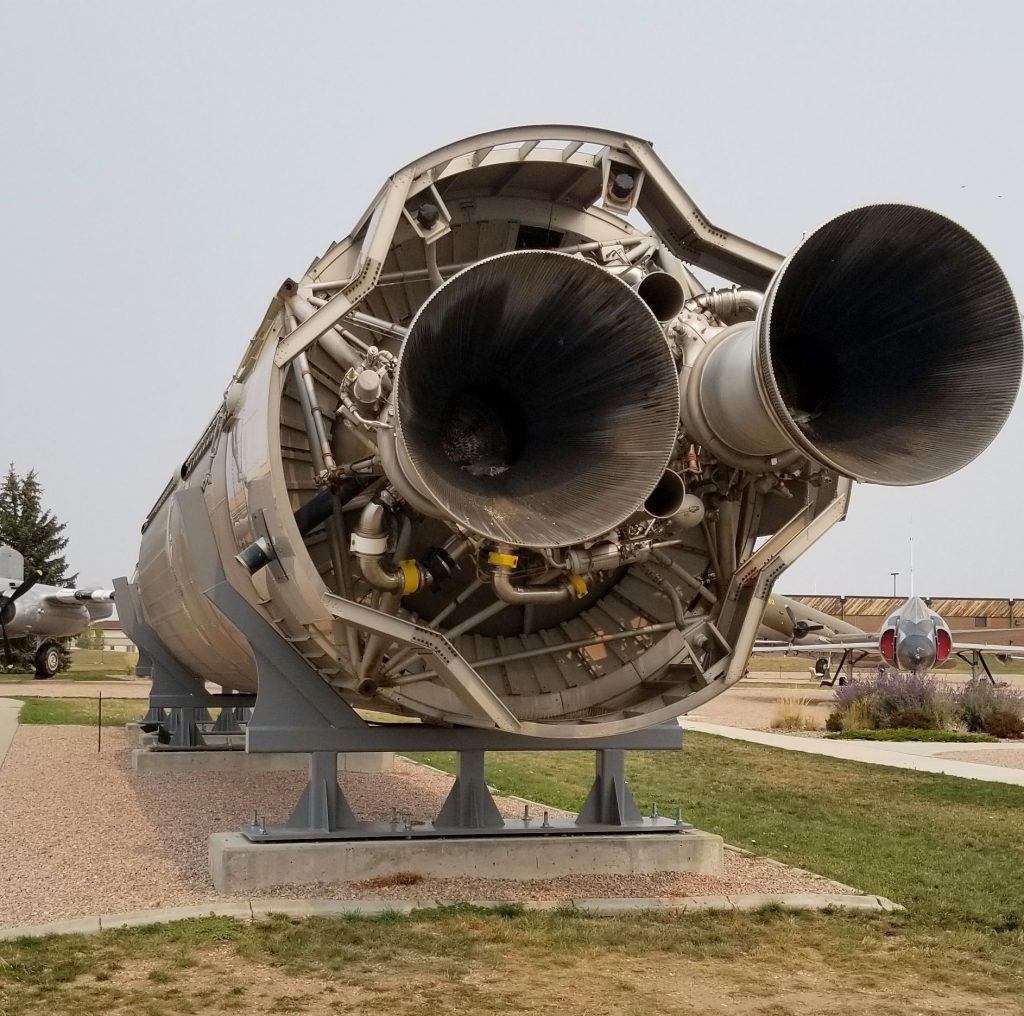
However, we enjoyed an extensive time visiting inside and outside the South Dakota Air and Space Museum which included a Titan I missile.
Titan I Missile
The Titan I missiles took 15 minutes to fully deploy because they couldn’t be fueled up until right before launch. This was not speedy enough for countering a nuclear attack. So therefore, they were replaced three years later with Titan II and the more reliable Minuteman missiles. Each silo contained three missiles.
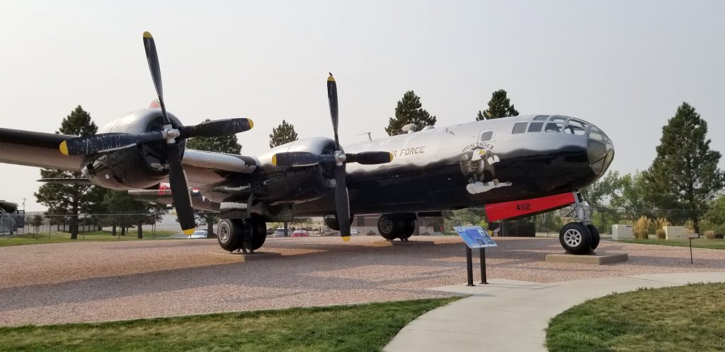
Besides intercontinental ballistic missiles, the United States also had bombers (such as the B-29 Superfortress) ready to deploy in case of attack. Later these huge planes were used for aerial tankers and weather reconnaissance until they were retired.
B-29 SuperfortressB-52 Stratotanker and B-52 Stratofortress (in background)
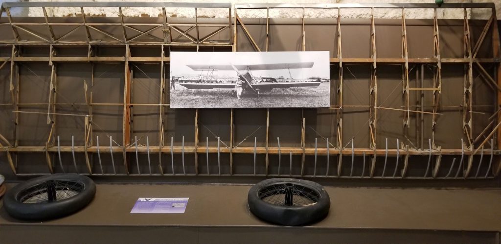
Inside the museum are four large galleries of artifacts of military and civilian aerospace history of the last century. My favorite display was about Nellie Zabel Wilhite, South Dakota’s first female pilot. She was also the first deaf person to earn her pilot’s license. The museum houses the wing and tires from her first airplane along with a photo of her in front of her plane in 1934. Despite some harrowing flights and at one time being a barnstormer, she lived to age 98. I’m always inspired by people who make history despite their handicaps.
Wings and tires from Nellie Zabel Wilhite’s plane
The museum is open year round (although the indoor galleries are closed during January and February) and the tours of Ellsworth AFB and the Missile Silo are offered from mid-May through mid-September. Admission to the museum is free, but there is a small charge for the bus tours to the Missile Silo.
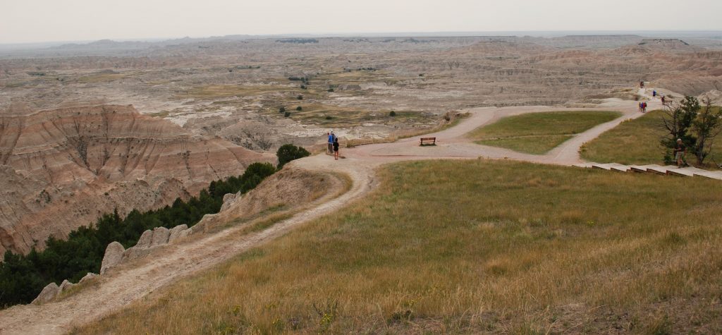
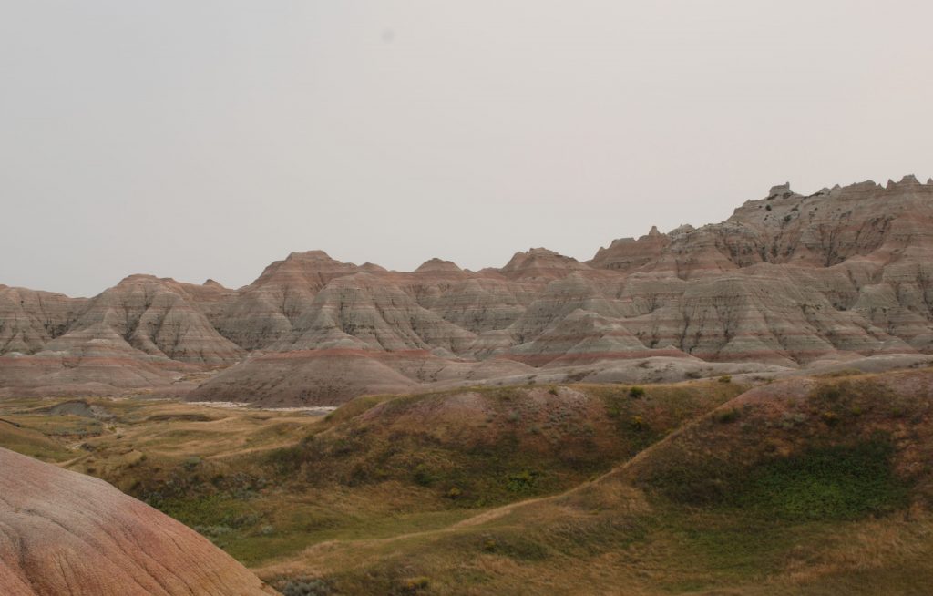
Badlands National Park
Not many miles from the Black Hills, the prairie stretches for miles until unexpectedly you come across Badlands National Park. Recently designated a national park in 1978, the nearly 250,000 acres of geologic formations, fossil beds and wildlife made this a place we had to visit. It reminded me somewhat of the Painted Desert in northern Arizona with its colorful rock layers. My favorite view was this scenic overlook where you can see for miles.
Our first stop was this scenic overlook
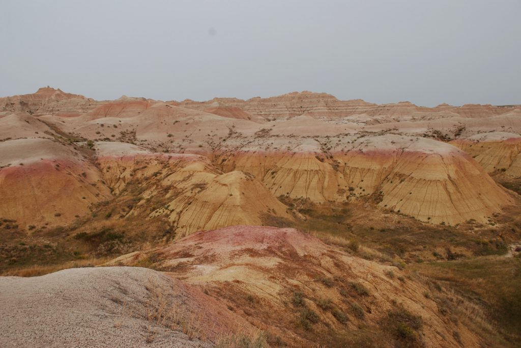
Down in the canyons are trees and grasslands.
In the Badlands many fossils of ancient mammals have been found which are probably related to our present-day bison and bighorn sheep.
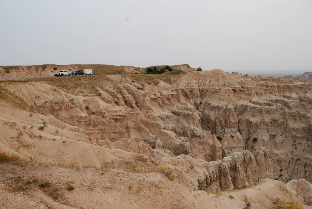
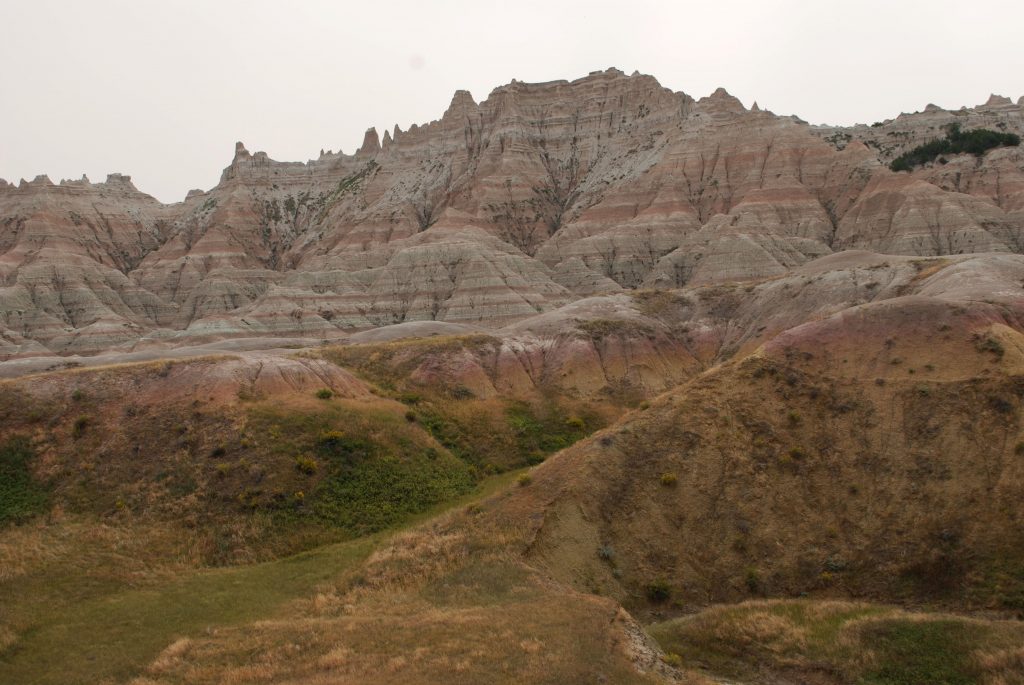
We started out looking out over the canyons, but soon we were driving in among the rock formations.
In this photo below, you can see a dry river bed. Two forces made these formations, deposition and erosion. Layers of sediment formed the rock layers which were deposited by a number of natural forces which range from shallow inland seas to rivers to wind. Then the Cheyenne and White rivers carved their way through the landscape. If the rocks erode at the rate of one inch per year as estimated, what we see today may be quite different the next time we visit!
It reminds me of Psalm 24: 1-2.
“The earth is the Lord’s, and the fullness of it, The world, and those who dwell in it. For He has founded it upon the seas And established it upon the streams and the rivers.” Amplified Bible
Our national parks are a treasure of unique and beautiful places. I am thankful for those who had foresight to set aside these places for generations of people to enjoy.
Whenever I think of South Dakota, I think of a flat wide expanse of endless prairie, a picture I got in my mind from reading the Little House books. But when we arrived in South Dakota we found beautiful forested mountains with pretty green meadows spaced in between the hills. Western South Dakota in the Black Hills region is a region of surprising beauty. Tucked away in these hills is the iconic Mount Rushmore. (See my blog on Mount Rushmore)
The Black Hills of South Dakota
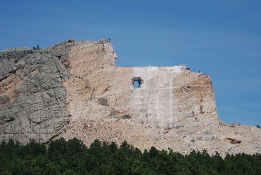
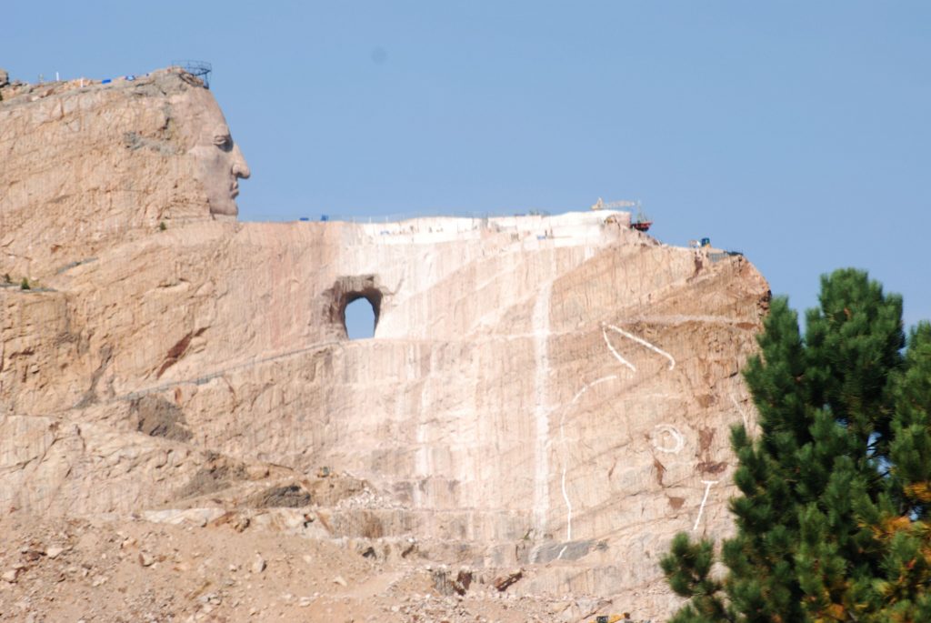
In the Black Hills region are other interesting places to explore. One of the places I wanted to see was the Crazy Horse Memorial. This is a privately-owned memorial to Crazy Horse, a leader of the Lakota Sioux Indians. The sculptor, Korczak Ziolkowski, who dedicated his life to carving this memorial, is now deceased and his descendants have taken on the project.
I had mixed feelings about Crazy Horse Monument. For one thing, after 71 years, it is far from being completed. In contrast, Mount Rushmore was finished in only 14 years. Some reasons for the delay are said to be the weather, tourists, the size of the project and lack of funds. Critics say it has become a money making project for enriching the sculptor’s family. I can’t say for sure that is true, but I was disappointed. It does seem like the 40,000 square foot Visitor’s Center has taken over the central focus instead of the rock carving.
Below is a prototype carving of what the mountain will look like when finished. It’s sad to think I might never see it completed in my lifetime.
The outline of the horse’s head on the mountain yet to be carved.
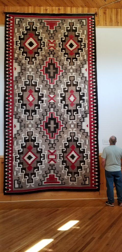
We wandered around the huge visitor center for nearly an hour. It seemed like we were rushing through it just to be able to see it all. The buildings also house The Indian Museum of North America which houses a large collection of art and artifacts showing the histories and cultures of over 300 native nations. One impressive exhibit was this Navajo Indian rug.
Huge handmade Navajo rug
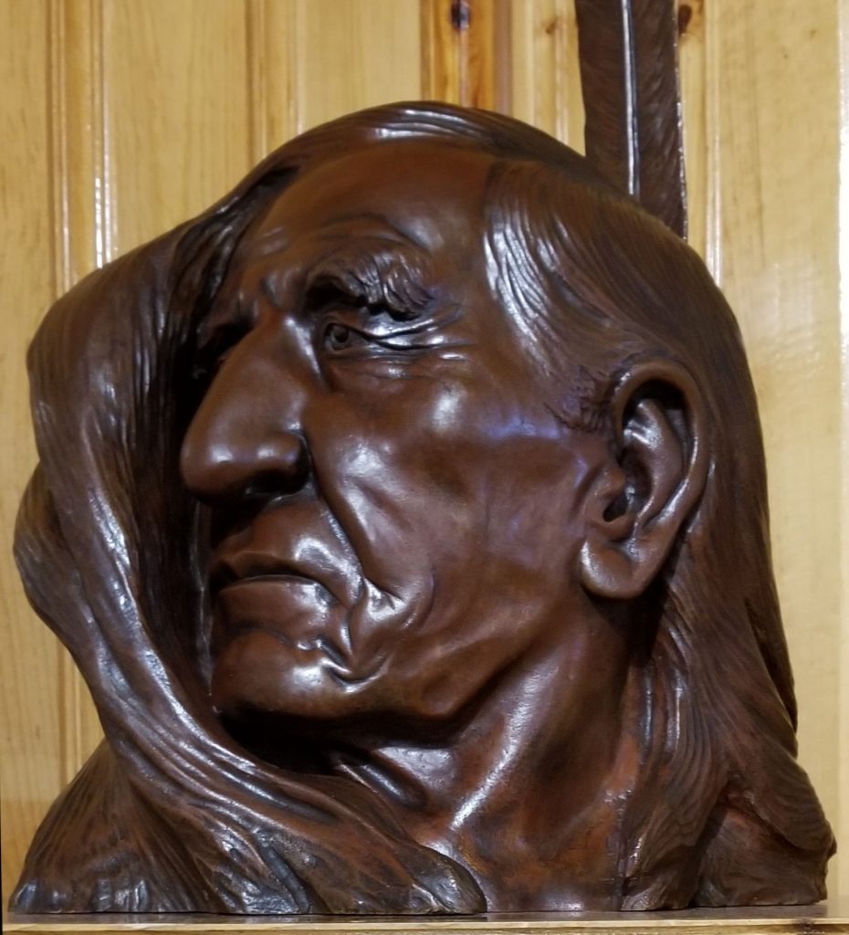
Other items in the museum showcase the artist’s talent such as this carving of Henry Standing Bear, a cousin of Crazy Horse. He was the one who found the artist Korczak Ziolkowski for the Crazy Horse project.
Henry Standing Bear
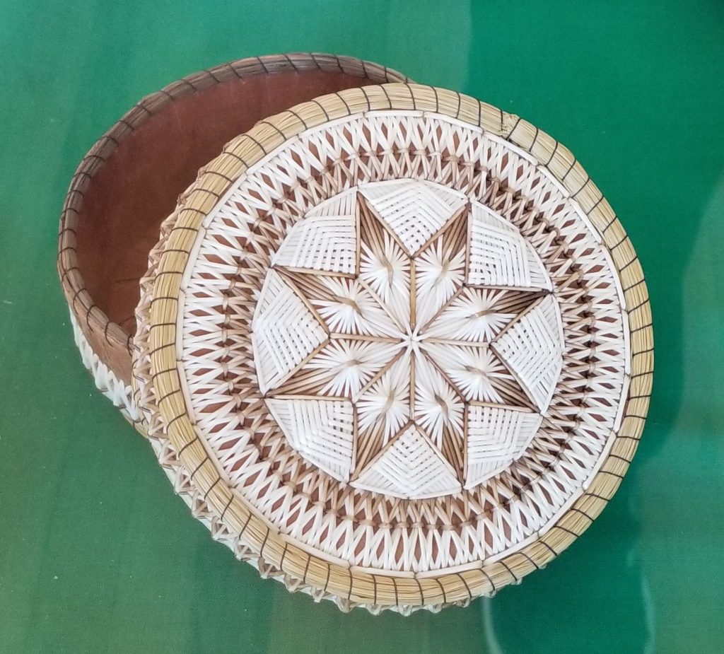
Many Indian handcrafted items were on display. This beautifully crafted pine quill basket caught my attention.
Pine quill basket
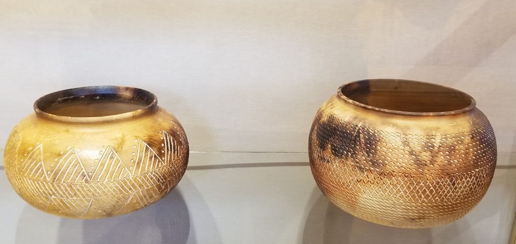
Having taken a pottery class, I’m always fascinated by handmade pottery. These look like they were from a wood-fired kiln or pit.
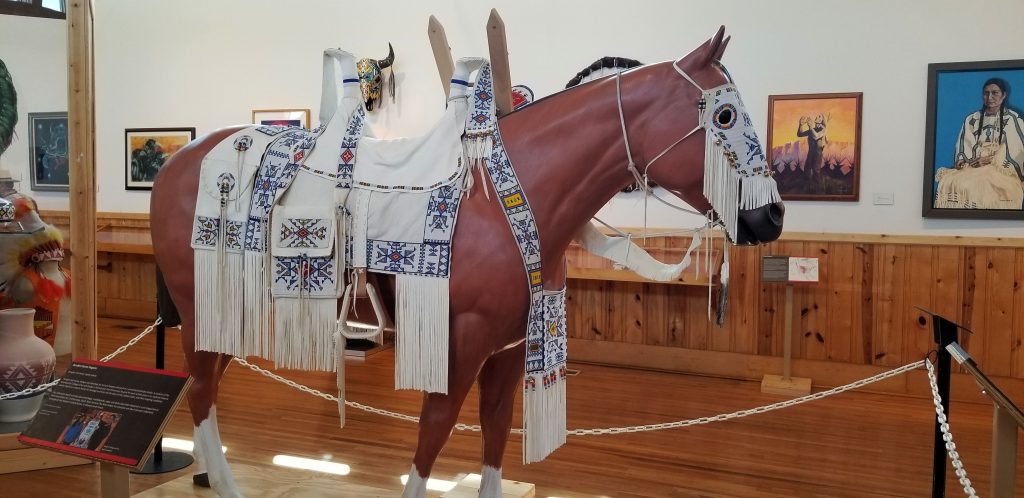
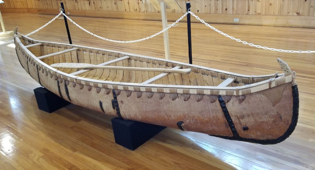
Other exhibits were this highly decorated horse outfit and the hand-crafted canoe pictured below.
Horse and saddle in museumHand crafted canoe
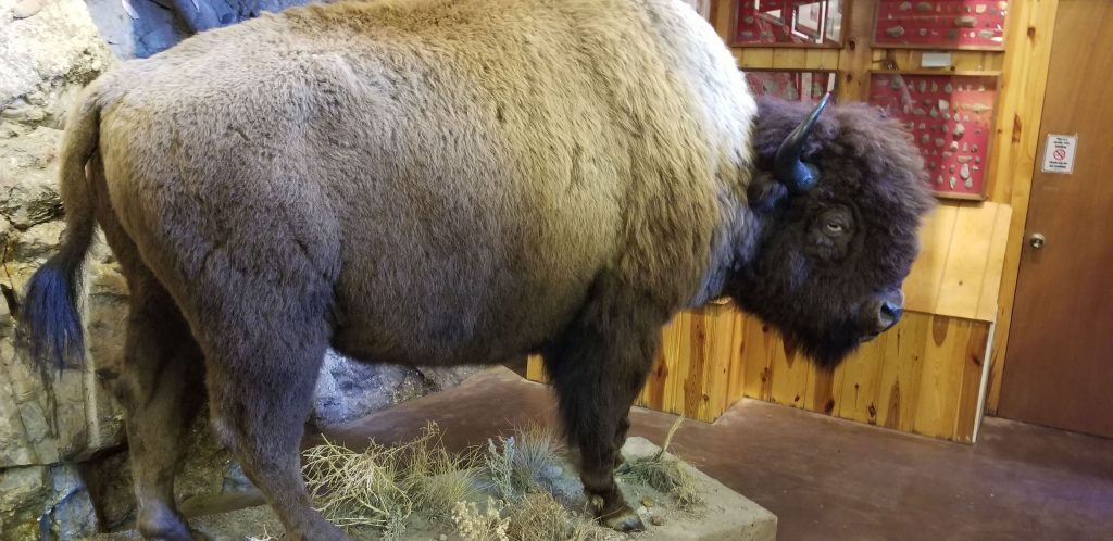
It was irresistible to get a photo of a buffalo up close like this. It was easy to see why the Indians liked the buffalo hides for keeping them warm in the cold winters.
Bison or buffalo
The artist Korczak Ziolkowski, and his wife had 10 children. They must have been a musical family as there were many musical instruments from their home on display in the museum.
We stopped to eat dinner in the nearby town of Custer where a painted buffalo caught my eye. Since it was late in the year, many places were already closed for the winter. We found a Pizza Hut and I ordered chicken wings. They were really good!
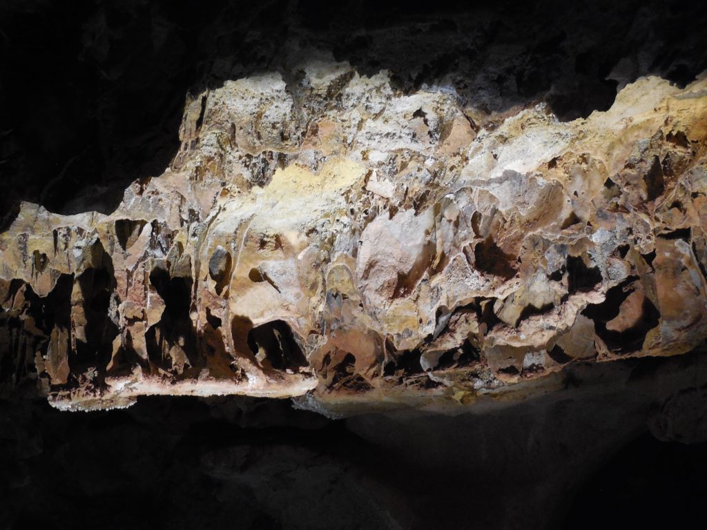
Another day we drove to Wind Cave National Park and took a tour into the cave. The cave is so named because as the air pressure changes on the outside, the air blows in or out of the cave to maintain equal pressure. Two brothers discovered the cave when they heard wind blowing out of a hole in the ground. When one leaned in to get a better look, his hat blew off his head.
Wind Cave is the second longest and most complex cave in the world. Only a small part has been explored. It is home to “boxwork”, a unique formation found only in this cave.
One of the stories our guide told us about was in the early history of the cave tours, there was a guide that led tourists down into the cave with a lantern. If he saw a passage that he wanted to explore, he would leave his guests in the dark and go exploring, sometimes leaving them there in the dark for hours before returning. I can’t imagine being left in pitch dark for hours not knowing for sure if the guide would ever return!
Boxwork in Wind Cave NP
Above ground we saw prairie dogs, bison and park-like prairie grasslands and hillsides with forests. I pondered if this would be a nice place to live someday–but then I thought about the cold winters. Hm. Probably not.
The little town of White Sulphur Springs is located in the western half of Montana about midway from north to south. To get there from Choteau, Montana, we went through Great Falls and then south on Highway 87 through the Little Belt Mountains and Lewis and Clark National Forest. It is some of the prettiest scenery, going over Kings Hill Pass of 7400 feet, and past quaint little towns tucked in among the forests.
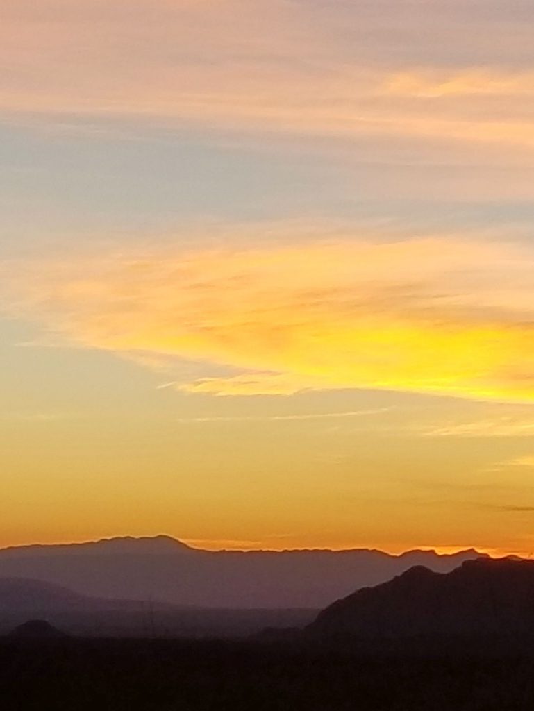
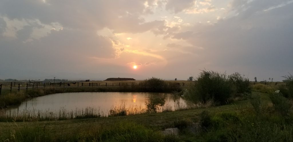
On the edge of White Sulphur Springs is an RV park with a view of the Big Belt Mountains to the west. The smoke from fires in the west made beautiful sunsets in the evenings.
View from campground at White Sulphur Springs, Montana
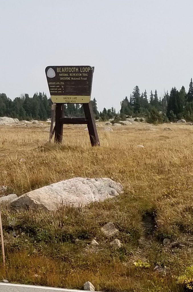
We were familiar with this quiet little town, having spent some time here last year. There are plenty of day trip destinations from there. One place I really wanted to see this year was the “Top of the World Drive” on Highway 212 going from Yellowstone National Park to Red Lodge, Montana.
To get to this highway, you must take Highway 89 to Yellowstone National Park, across the border in Wyoming. We ate a picnic lunch just inside the north entrance of Yellowstone NP. Then we followed the road to Mammoth Hot Springs and on to Tower-Roosevelt.
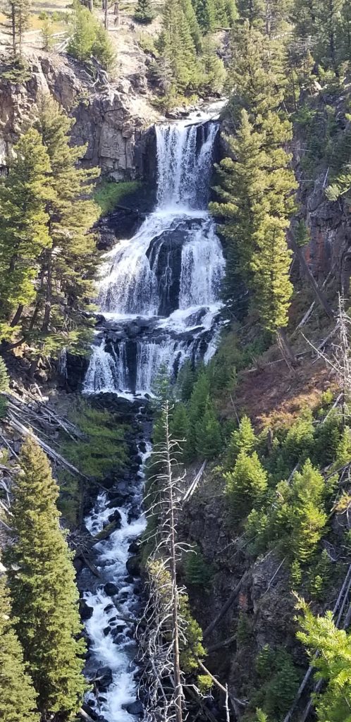
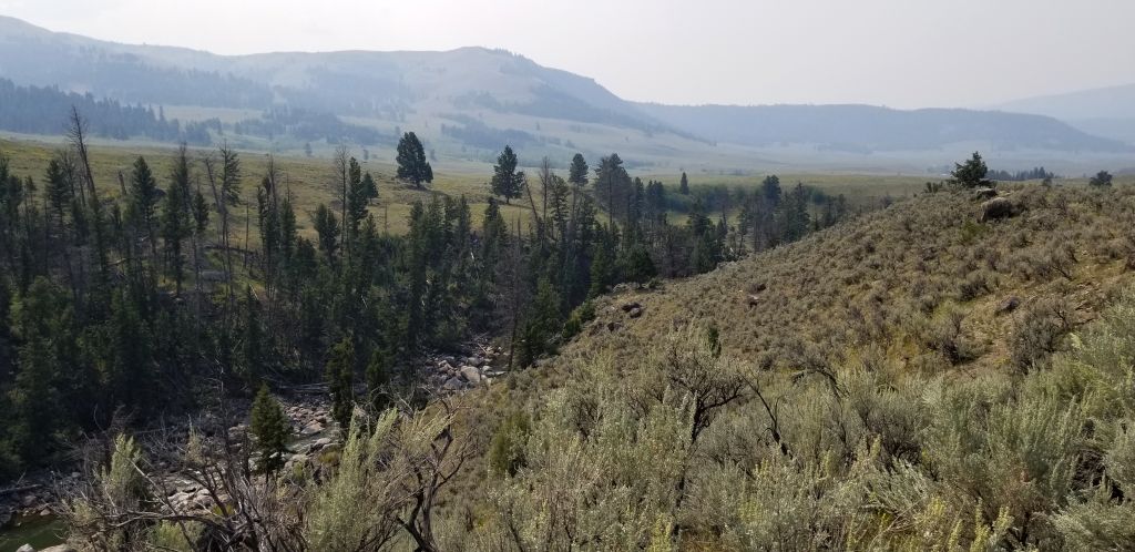
Along the way, I stopped to get a photo of a waterfall and some other scenery. Due to the smoke from the fires in the west, it was very hazy.
Waterfall in Yellowstone National Park
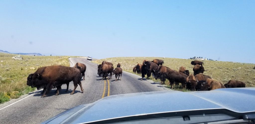
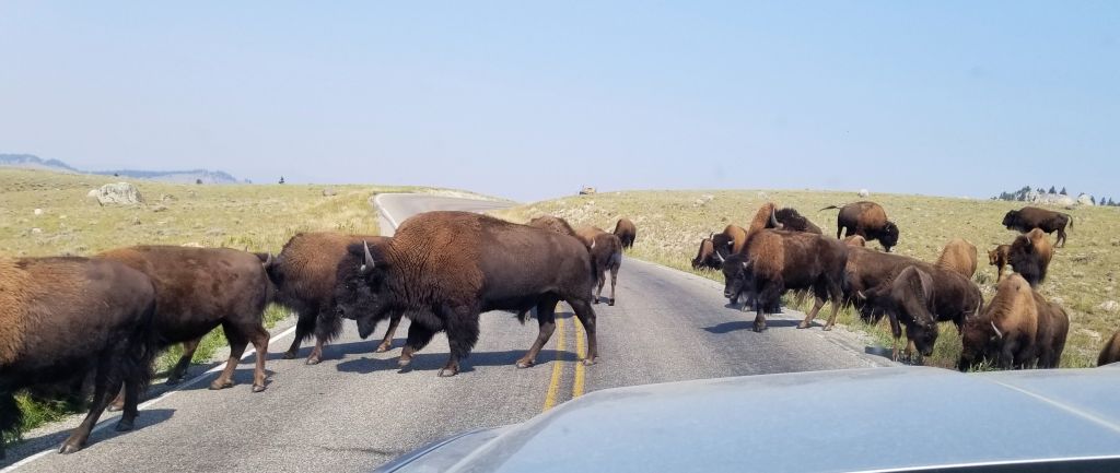
As we traveled through Yellowstone NP, at one point we had to stop to let some buffalo cross the road. Seeing them up close made us realize how huge these beasts are in size.
Buffalo in Yellowstone NPSmoke and haze along creek and mountains in Yellowstone NP
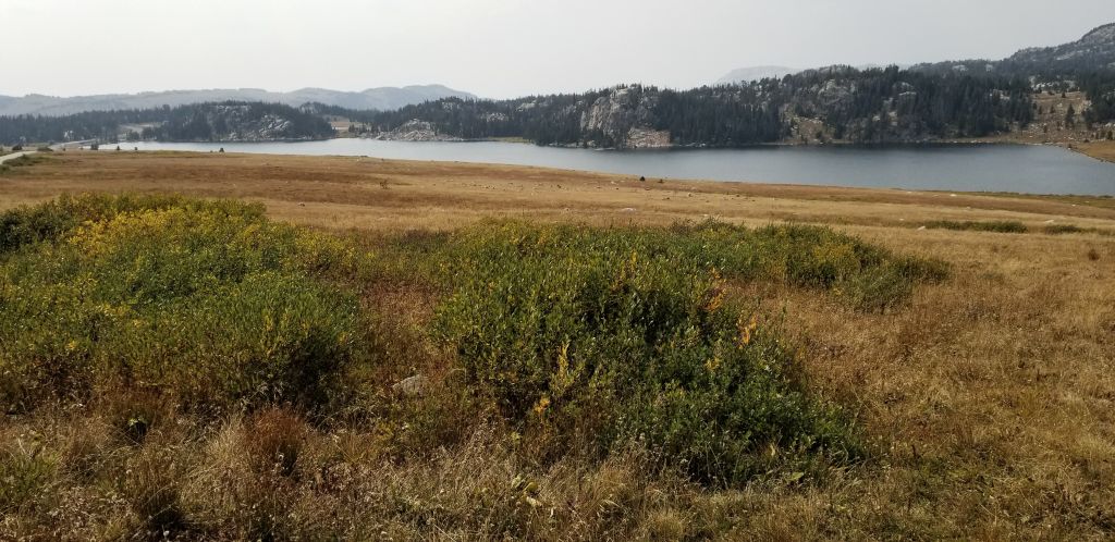
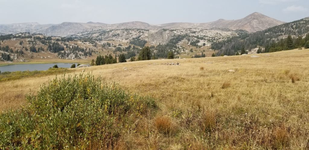
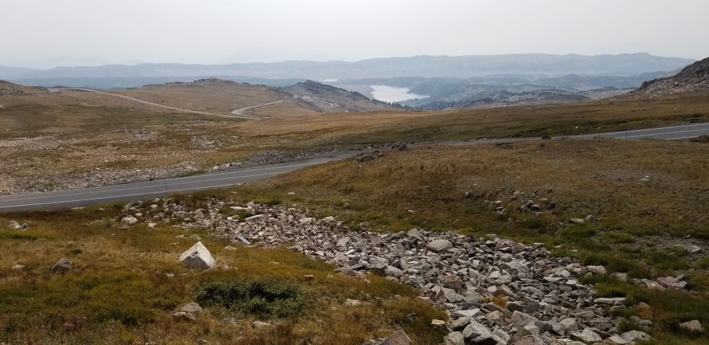
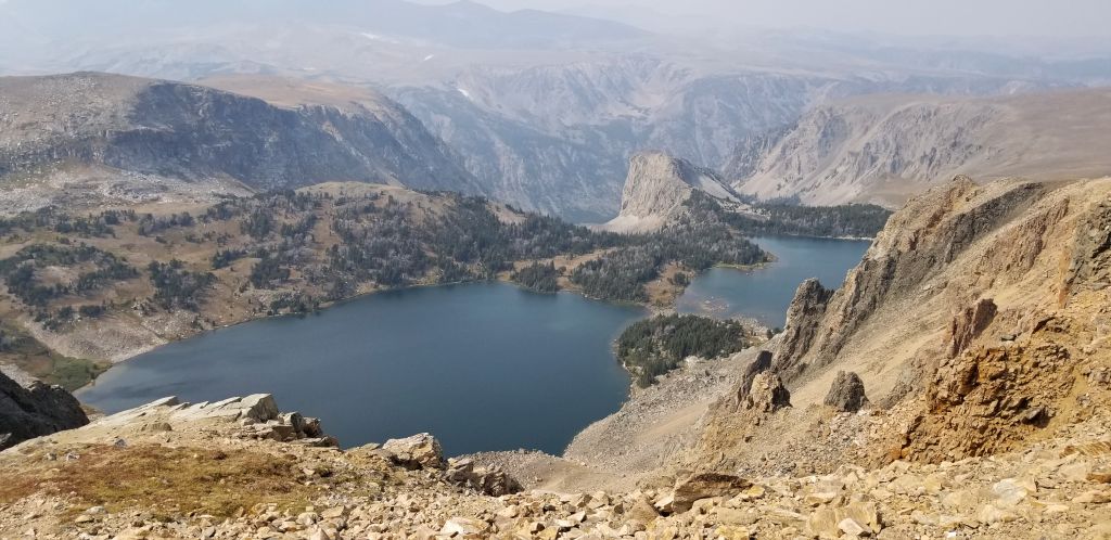
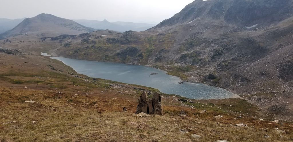
Once you leave Yellowstone NP, the road quickly ascends on its way to Beartooth Pass. This pass climbs to nearly 11,000 feet in elevation giving views of alpine lakes and epic views.
The start of Beartooth HighwayAlpine lake view from Beartooth HighwayA mountain meadow and lake along Beartooth Highway.Looking back at switchbacks on road to Beartooth PassViews of glacial lakes and steep canyons along Beartooth HighwayGlacial lake at top of Beartooth Pass
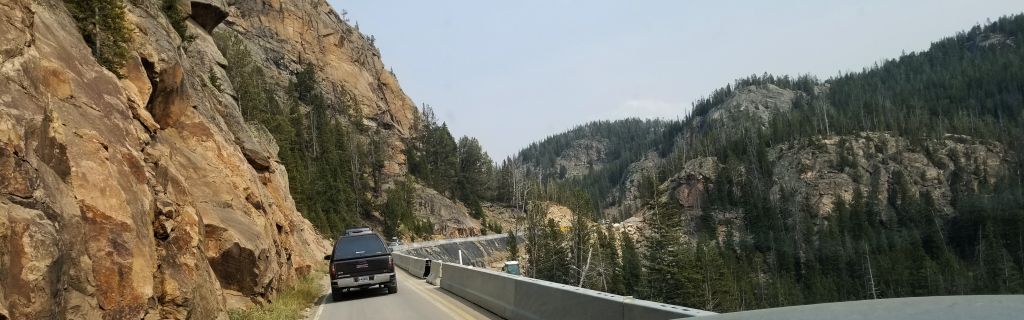
We came across some construction work on the road that had us going along a steep cliff on a temporary roadway. It must take constant work to keep this road in good condition.
Road construction along Beartooth Highway.
I remember traveling this route when I was a kid on one of our family vacations to Indiana. My dad stopped along the road at one point so my sister and I could play in the snow and make snowballs. We never got to play in snow where we lived in the Arizona. That was quite a treat for us in August. (However, this year in 2021, we saw very little snow.)
That night our family stayed in Red Lodge, Montana. We ate dinner at a café that served all kinds of wild game dishes. I wasn’t brave enough to try any back then. After dinner, we went back to our cabin where we fell asleep to the sound of a gurgling creek out back of the cabin.
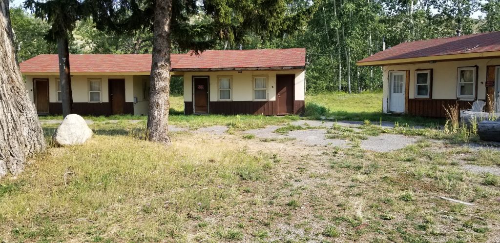
On our day trip there, I found the place where we stayed and got a photo. The place was in bad shape, but it looks like someone may be fixing up some of the units.
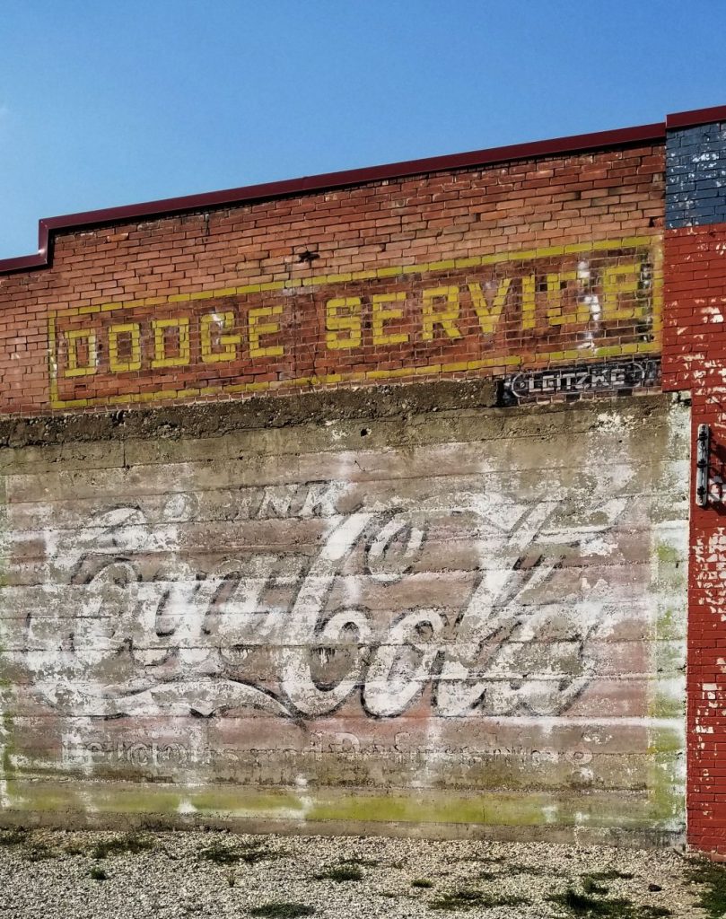
The cabins we stayed in many years ago when I was a kid are now in disrepair.Possibly the location of the cafe where we ate many years ago in Red Lodge, Montana. It is now a pizza place.
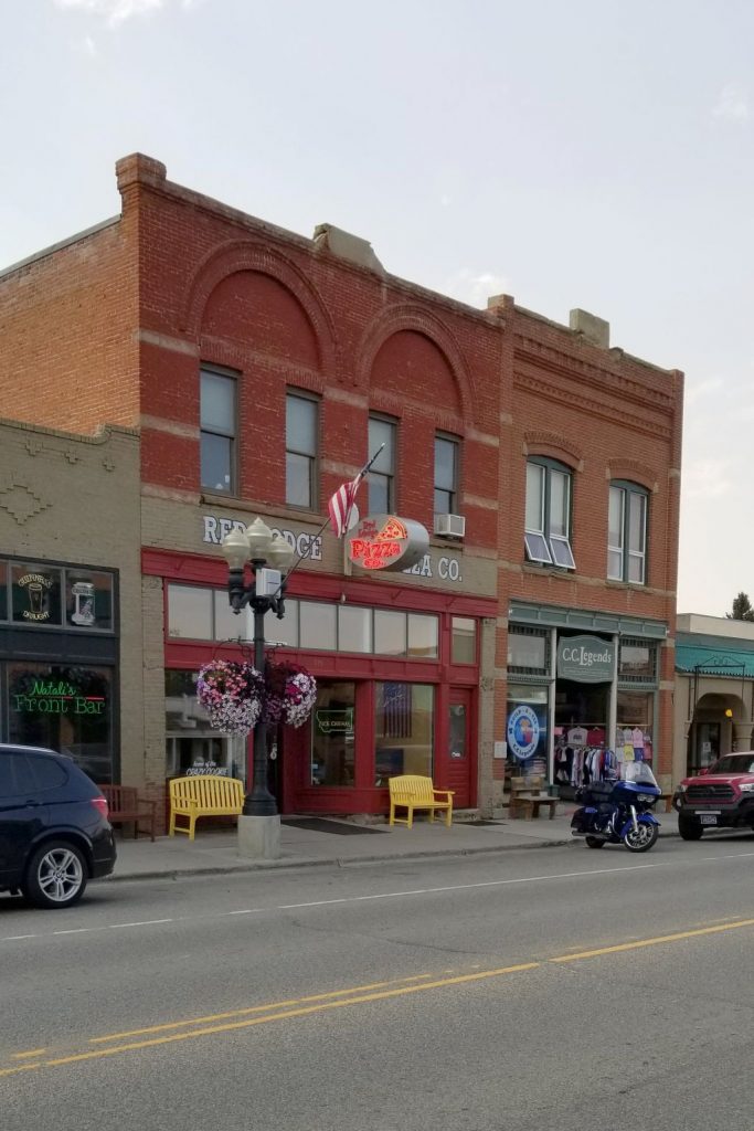
The town of Red Lodge is now a tourist trap with lots of shops and eateries. It also has quite a few luxurious houses surrounding it. It is still a cute and quaint little town, however, and a fun place to visit.
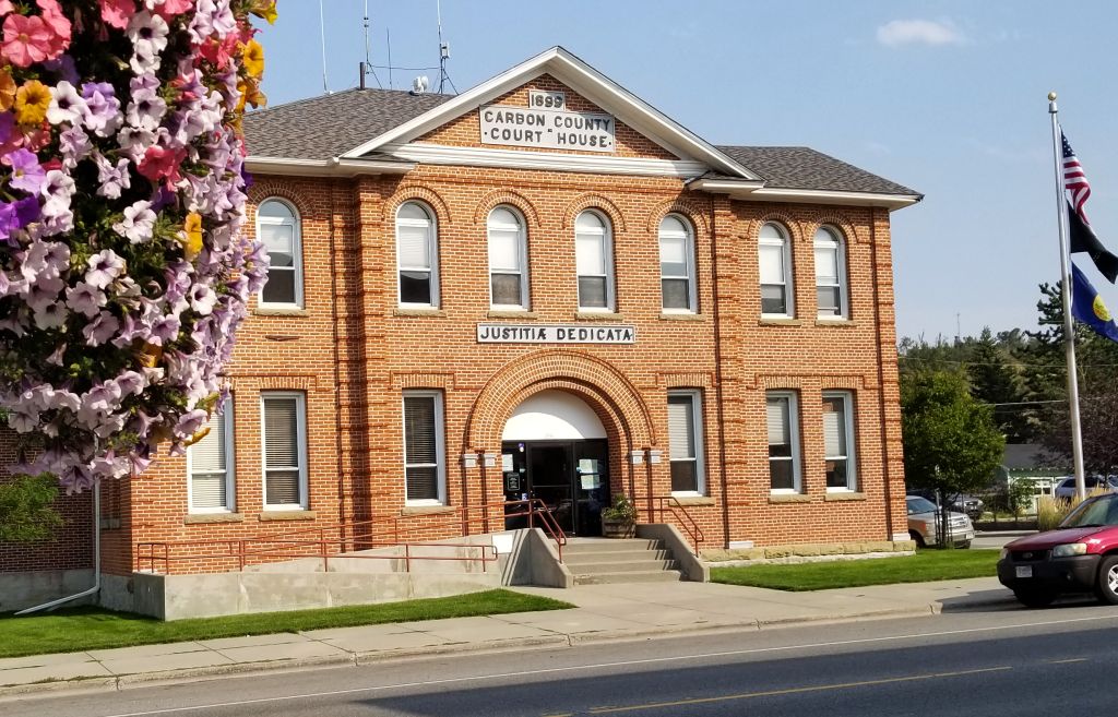
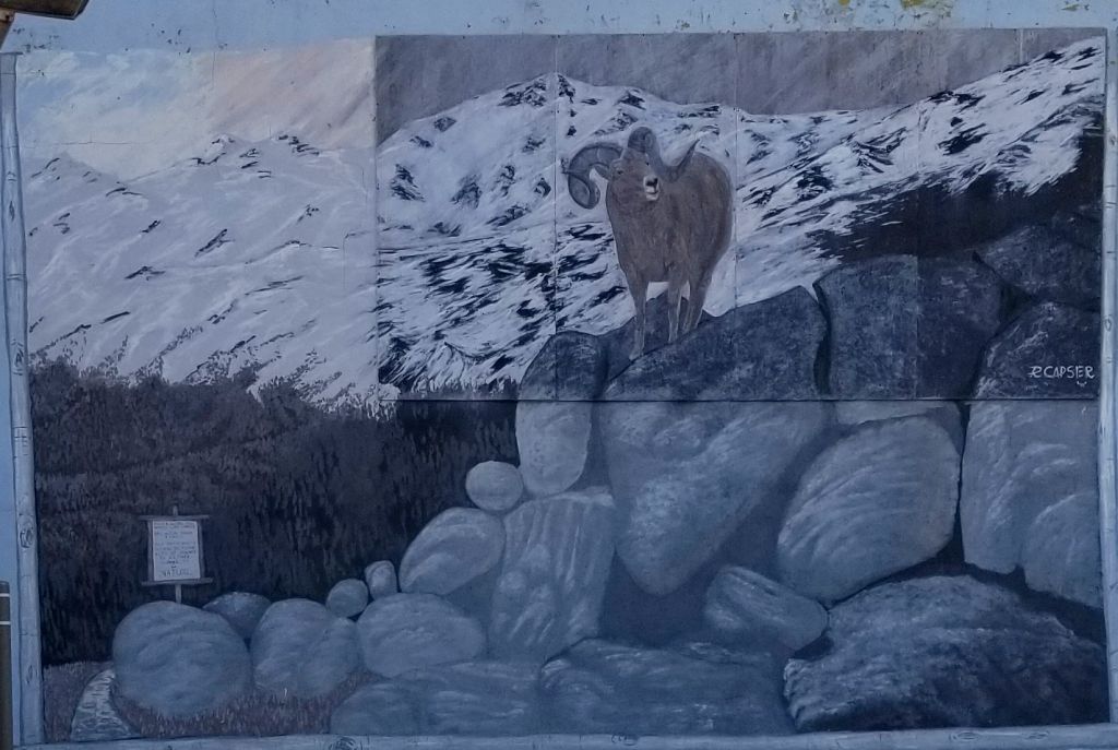
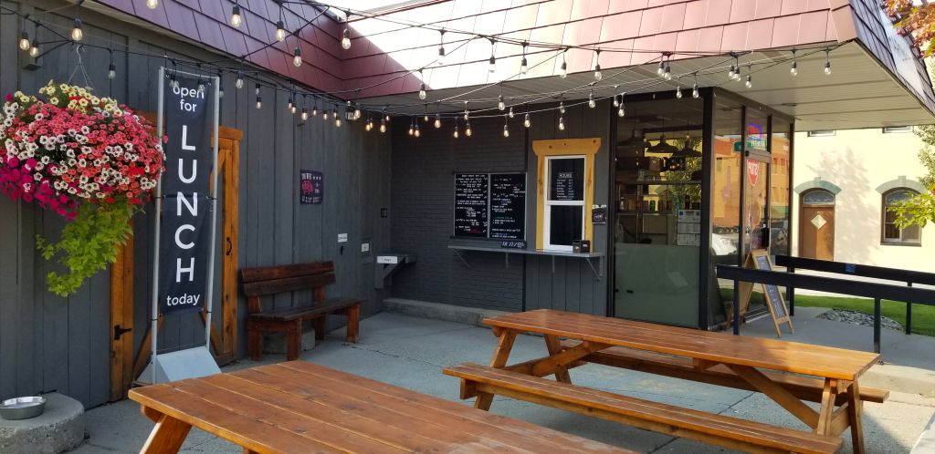
Old Coca Cola sign shows evidence of the past in Red Lodge, MontanaCourthouse in Red Lodge, Montana.Mural in Red Lodge, MontanaWe ate BBQ here for lunch in Red Lodge, Montana.
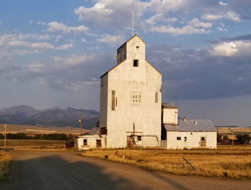
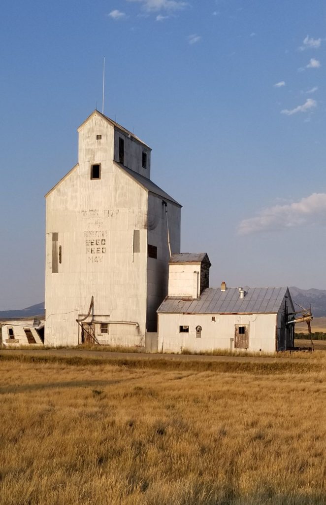
On our way home, I spotted this sight while going through one of the small towns in Montana. I couldn’t resist stopping and getting some photos of the evening sun on this grain elevator. It made a nice ending to our day.