Our 50th Anniversary trip to Hawaii continued by flying from Oahu to the big island of Hawaii, which is called….Hawaii. We stayed in the small town of Kailua-Kona, which is on the western side of the island.
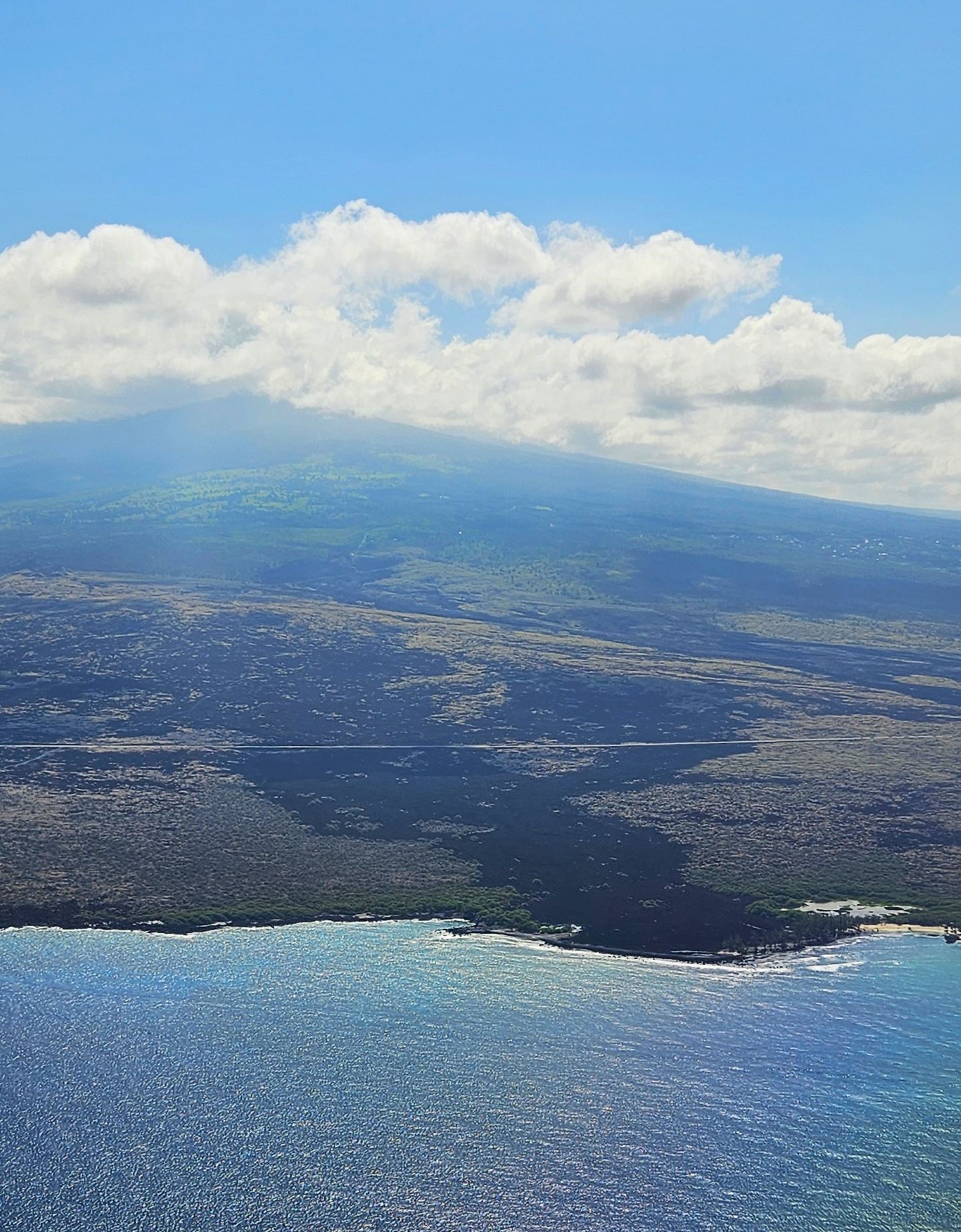
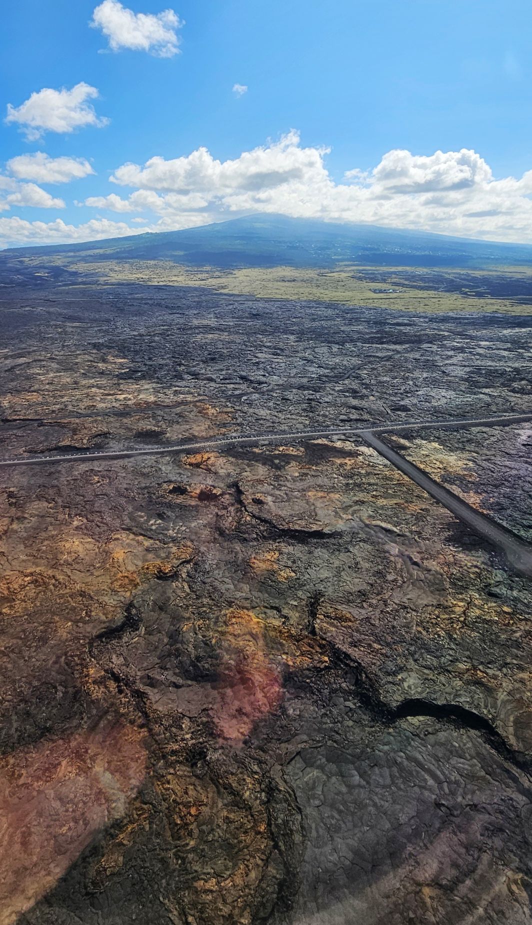
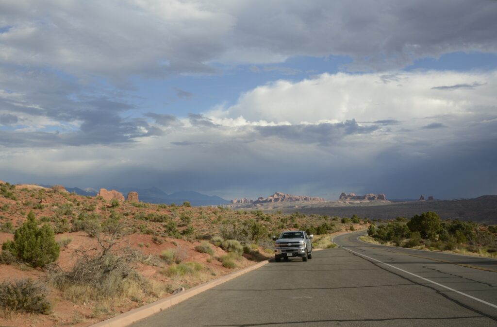
The volcanic origins of the island were visible from the air. The airport and the roads are built right on top of old lava flows.
View from the air. Roads are built on top of old lava flows.
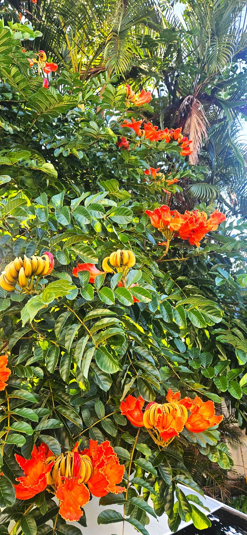
Our Air BnB had this beautiful African tulip tree growing in the front yard.
Flowering African Tulip Tree outside our Air BnB.
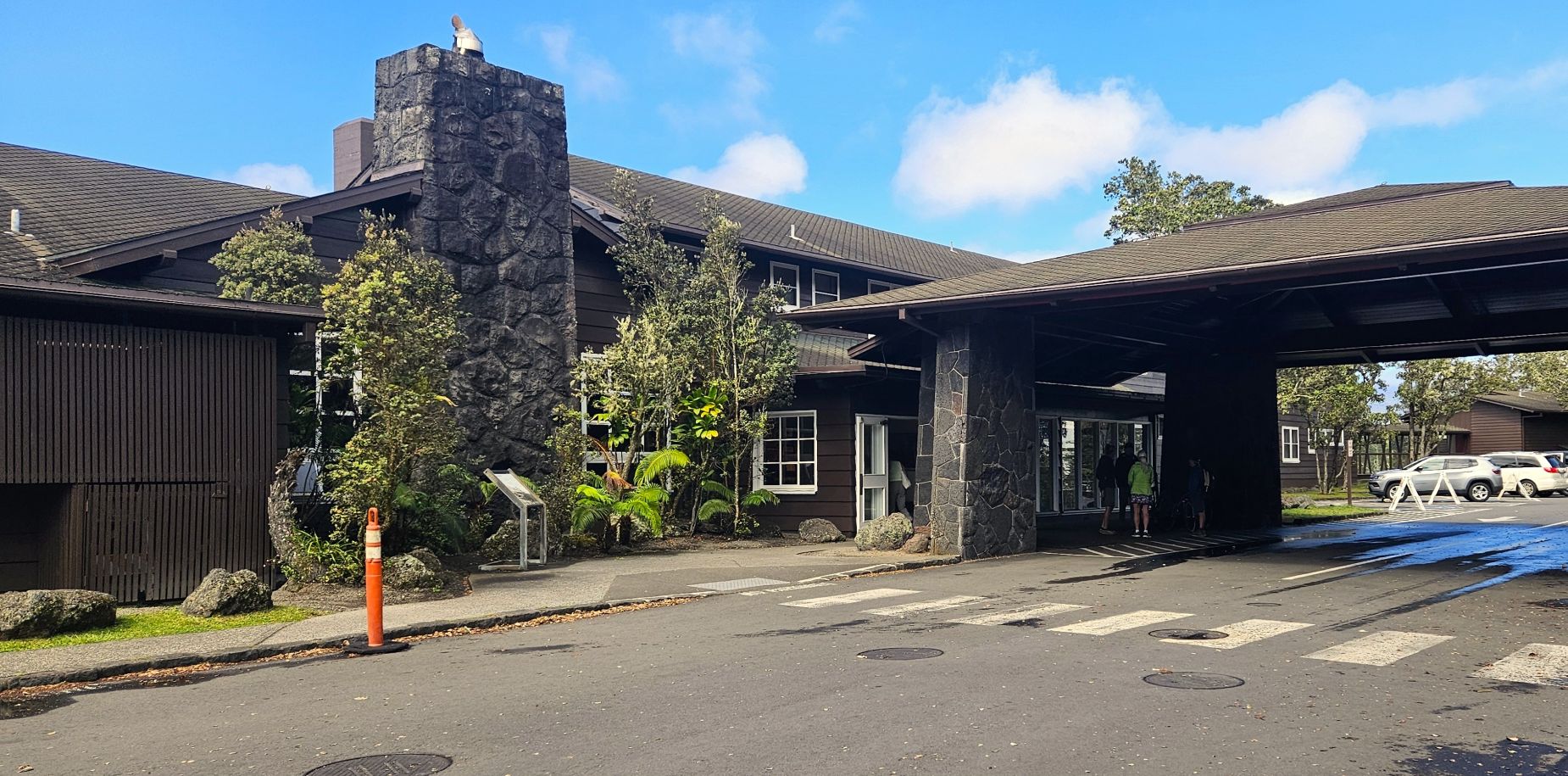
We drove over the middle of the island called the “Saddle Road” to get to Hawaii Volcanoes National Park entrance. It was a 3 hour drive. We stopped at this historic hotel called “The Volcano House” to get some information about where to get my Park Passport book stamped since it was during the government shut down.
Historic Volcano House
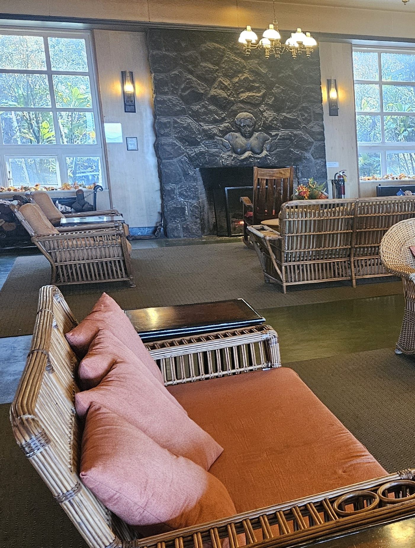
It was a rainy and cool day when we started, but thankfully, it cleared up. The fireplace in the lounge looked very inviting.
Lounge and fireplace in Volcano House
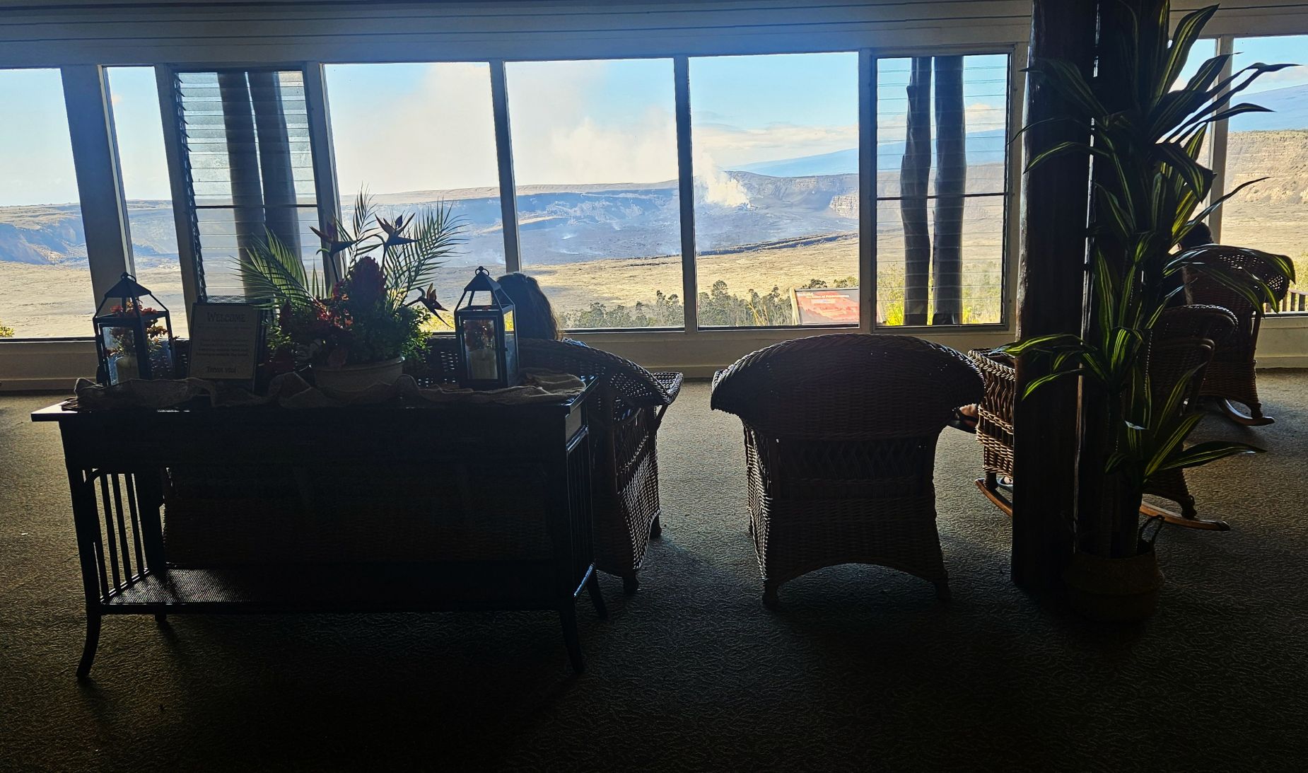
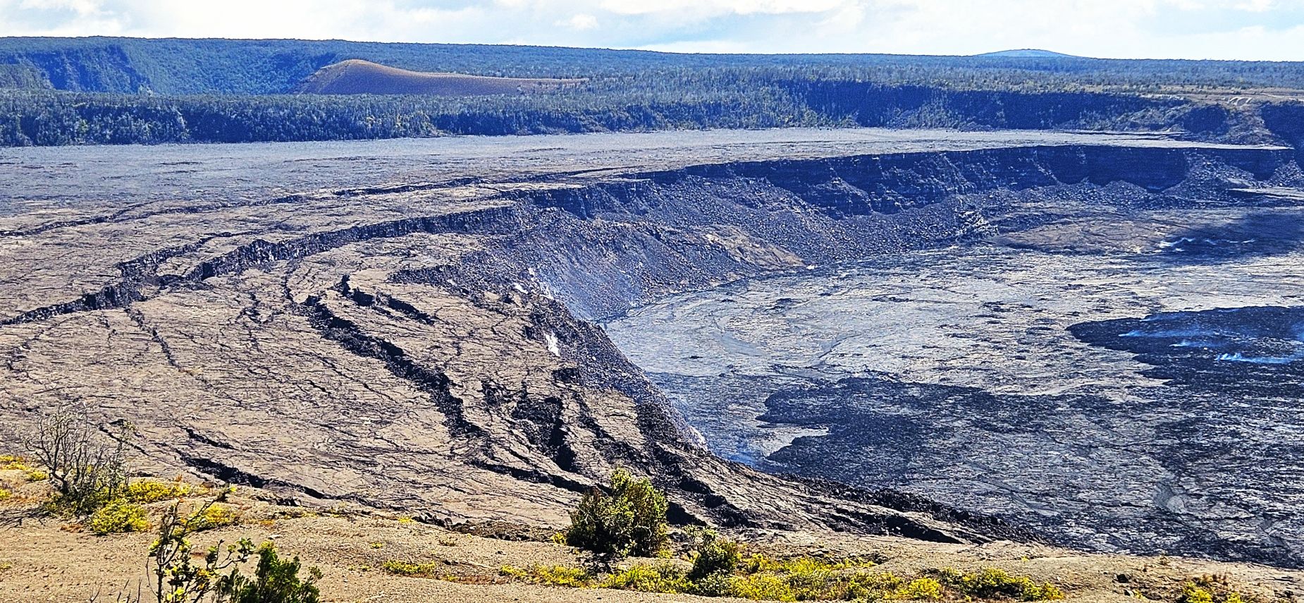
The best part of the Volcano House was the view out over the crater of the volcano. Just five days previously, the volcano had erupted. And, just five days after we left, it erupted again. Again it erupted in December of 2025 and was so powerful that it took out one of the cameras. This is the most active volcano on the island.
Steam venting from volcano can be seen from inside the Volcano House.
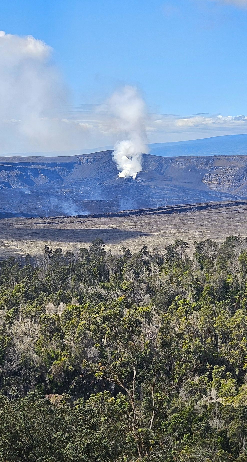
The view from outside the Volcano House was one of the best.
Gasses venting from a recent eruption.
We had a delicious Margarita pizza in the Volcano House restaurant. From our table we could look out at the volcano.
Margarita Pizza at the Volcano House restaurant.
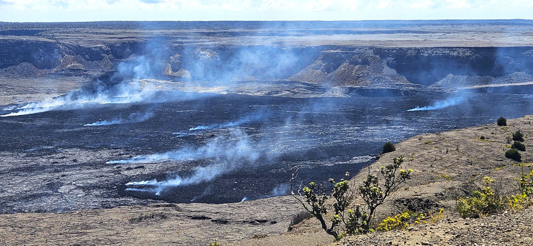
I got my Passport book stamped, and bought a couple of stickers. After that, we drove to the end of Crater Rim Drive to get a closer look at the steam vents.
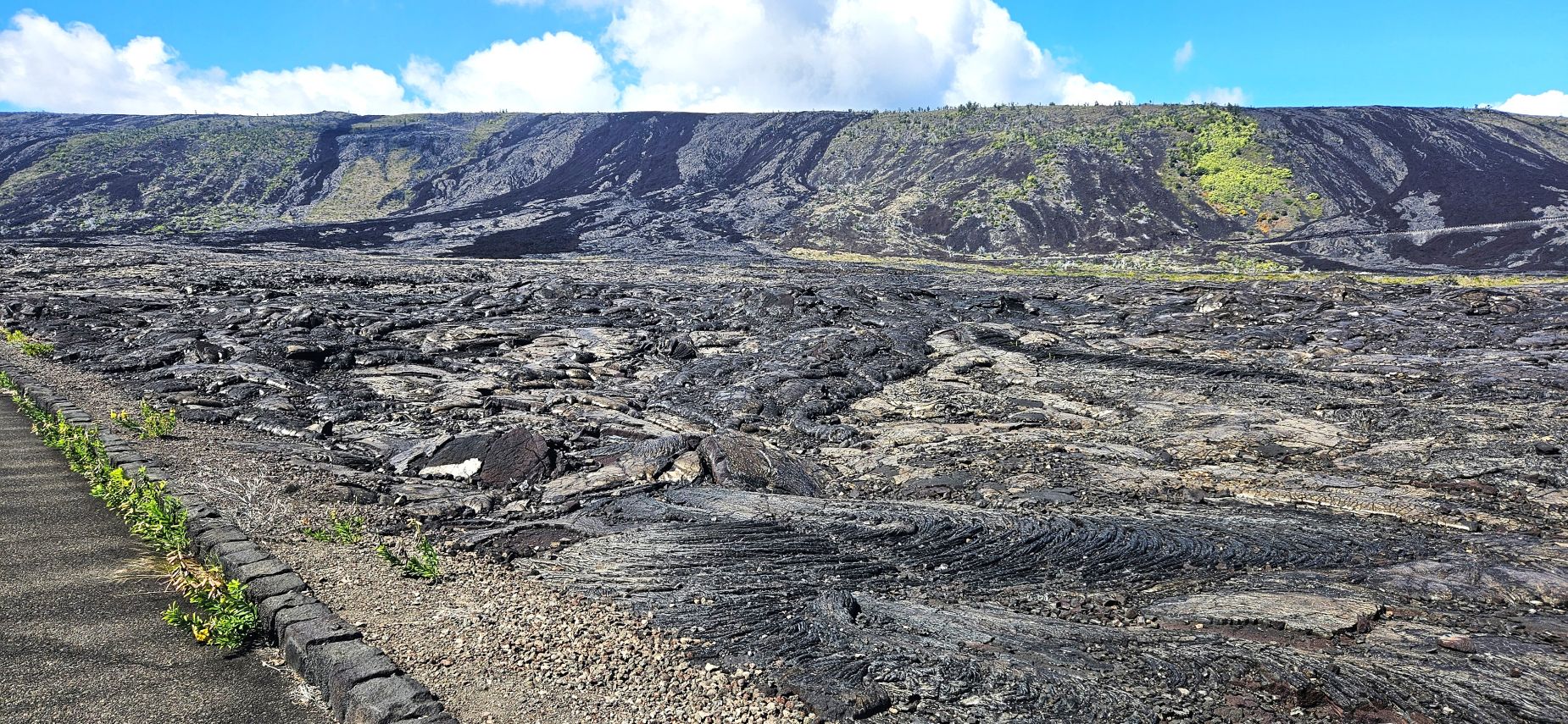
Volcanic smog rising from the recent lava flow of Kilauea volcano.
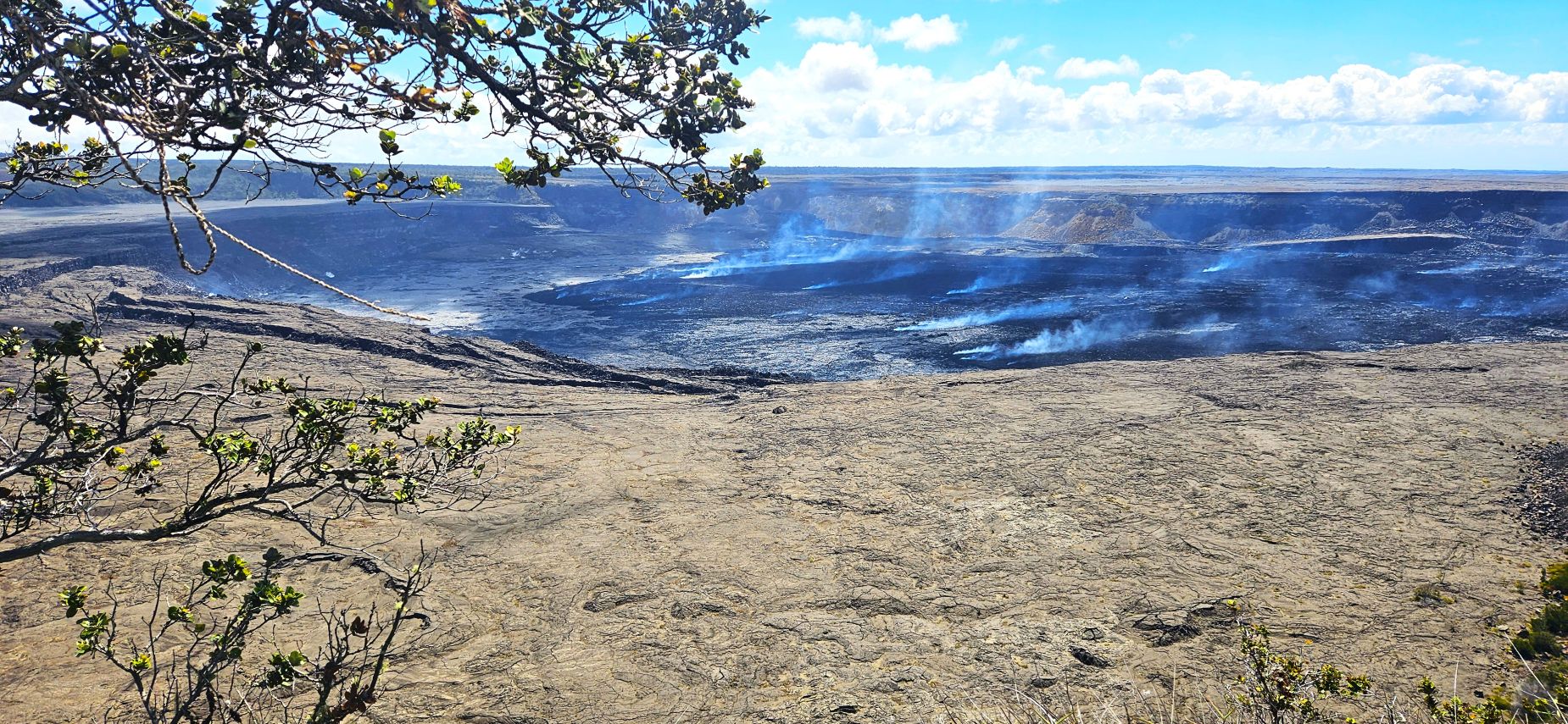
The lava flows onto the crater floor. In 2018, the magma drained from beneath, causing the floor to collapse hundreds of feet. At the crater’s edge, we could see cracks along the crater’s edge where this happened.
From this view point, we could look out over the crater floor and see many steam vents.
Steam vents on the crater floor.
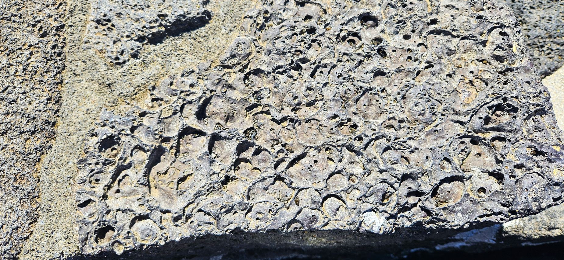
The man-made walls around the viewpoint were made of lava stones. This one shows gas bubbles of all sizes formed in the rock as it was cooling.
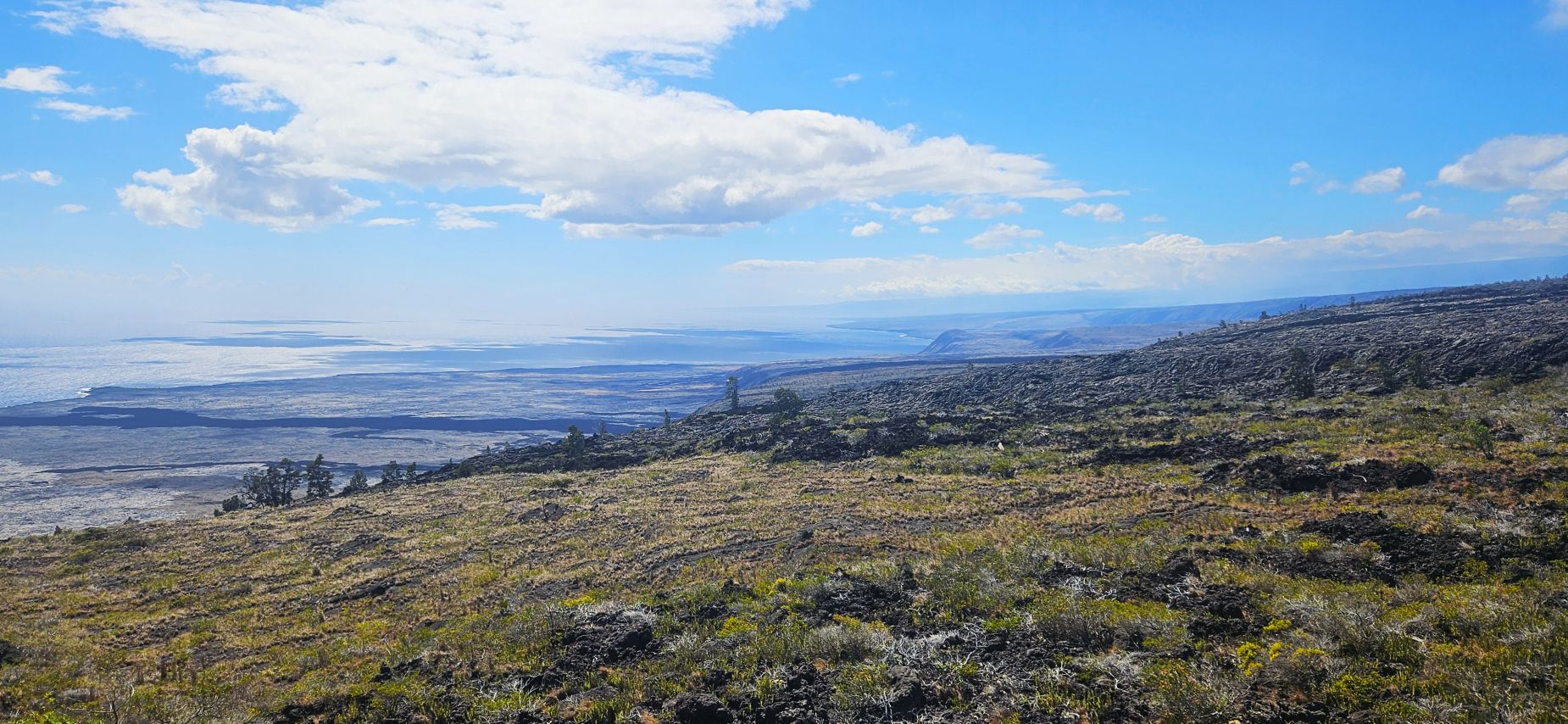
After lunch, we drove the Chain of Craters Road all the way to the ocean where it ended. At this overlook we could see the new land formed by the lava flows. It is unstable because the ocean waves erode and undermine the surface. No one is allowed out there.
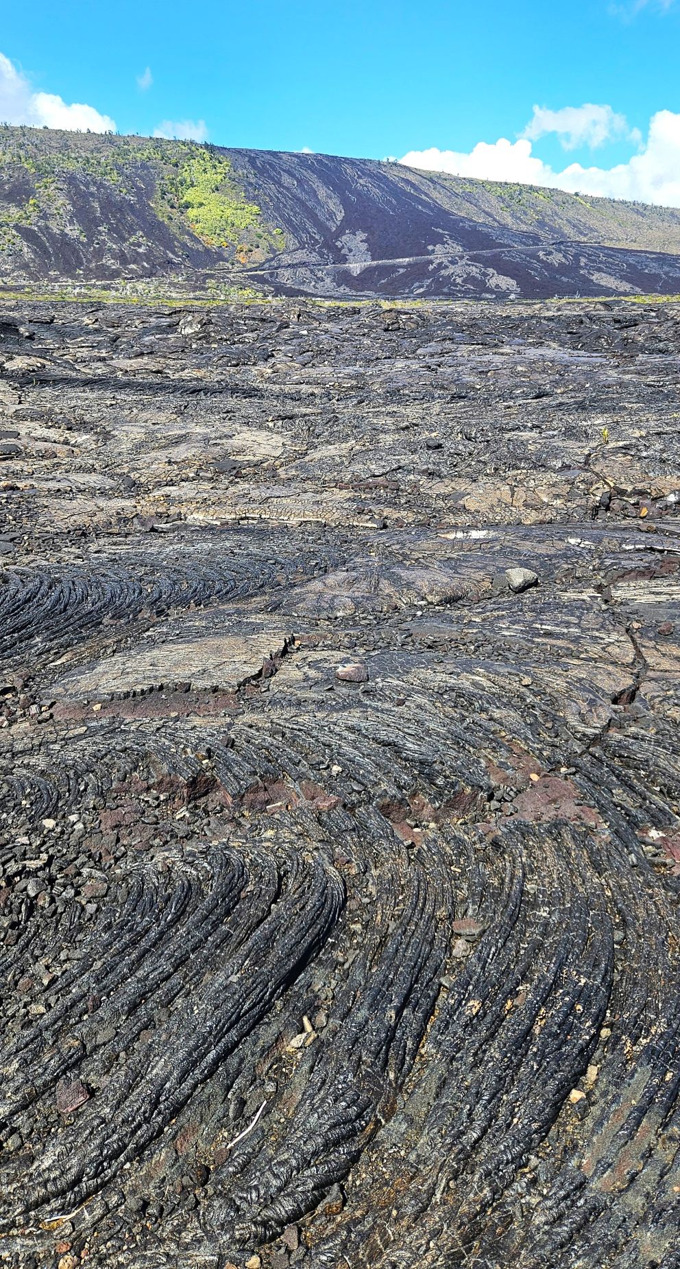
Driving along the road, we could see the black areas where lava flowed down the hills toward the sea.
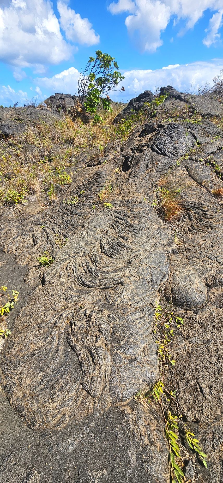
Looking closer, we could see wrinkles in the rock where lava once flowed and then cooled.
Wrinkles from lava flow.Lava flowed here once.
Hawaii Volcanoes National Park was a fascinating place. I’ve always had an interest in geology since a field trip I took with my class in 6th grade. We had a long drive home, so we headed back to our Air BnB for some supper and some rest. The next day, we would fly to our last island–Maui.
“The mountains melted like wax at the presence of the Lord, At the presence of the Lord of the whole earth. The heavens declare His righteousness, And all the peoples have seen His glory.” Psalm 97:5-6
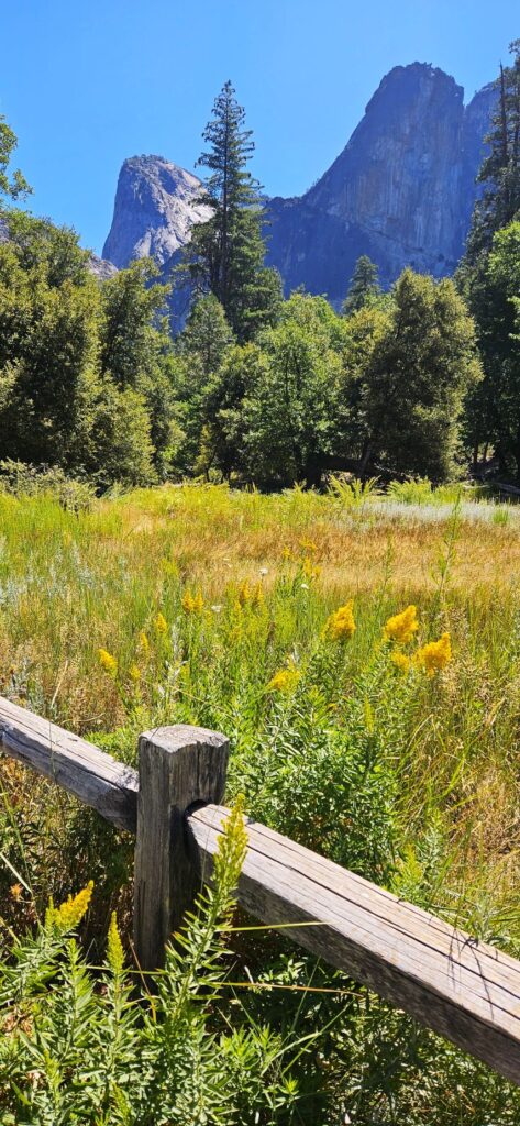
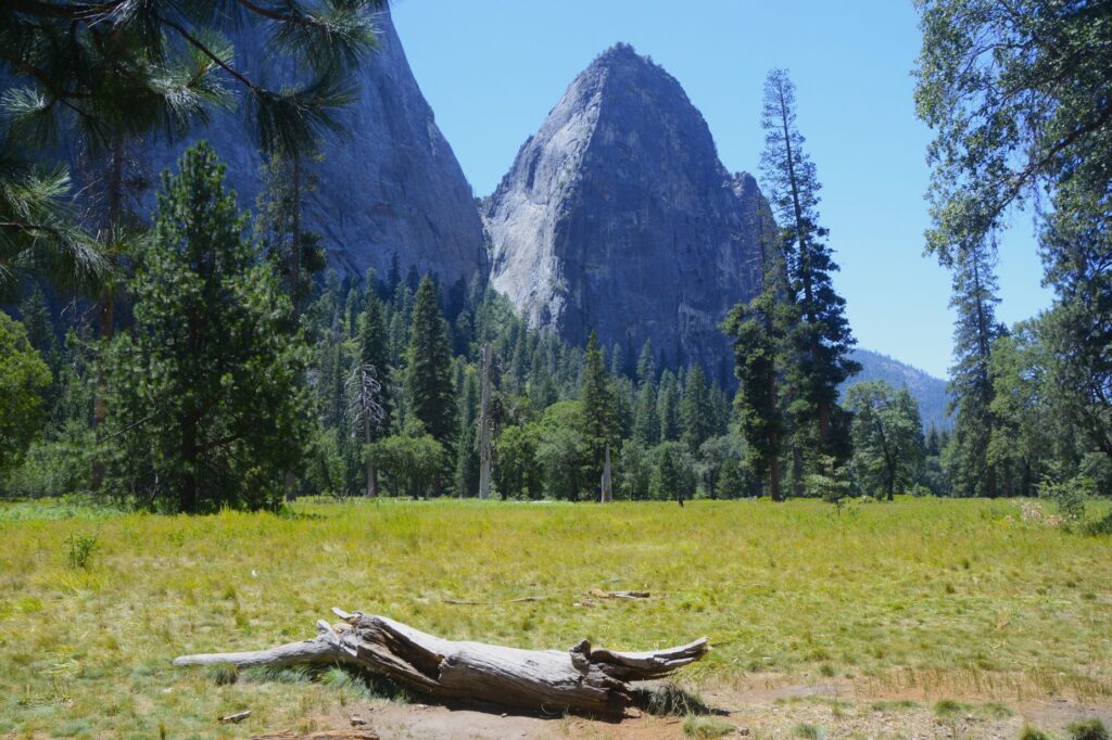
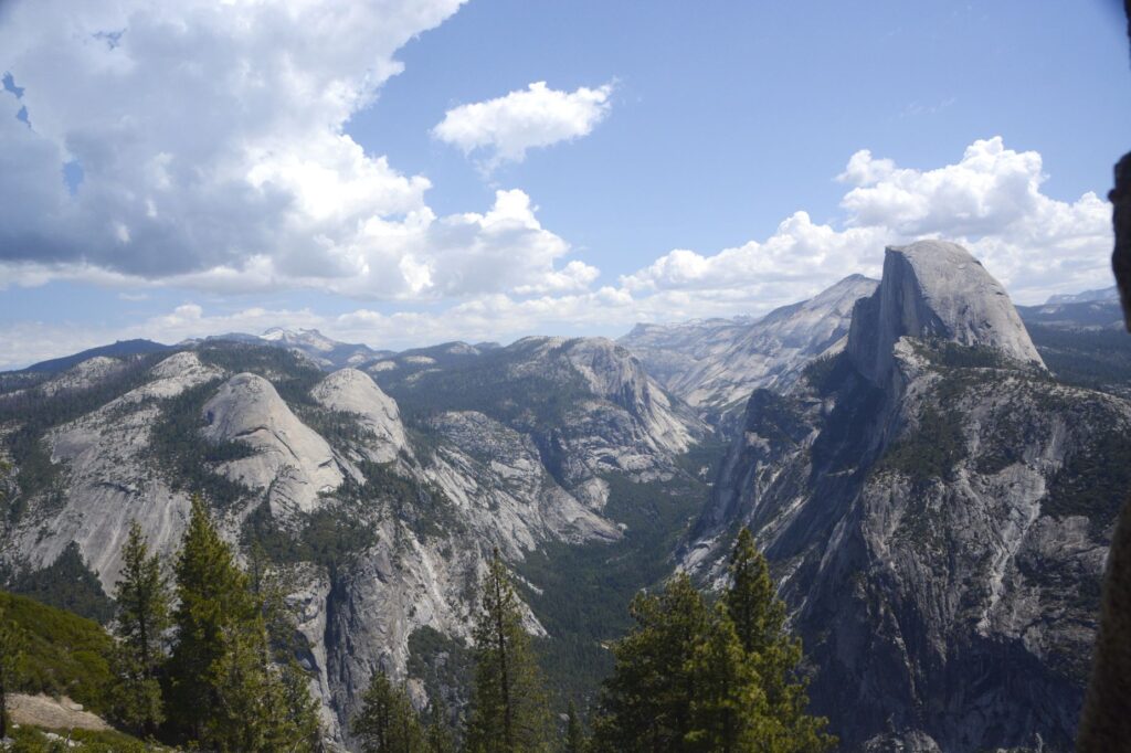
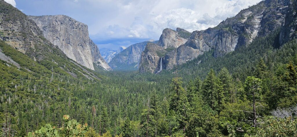
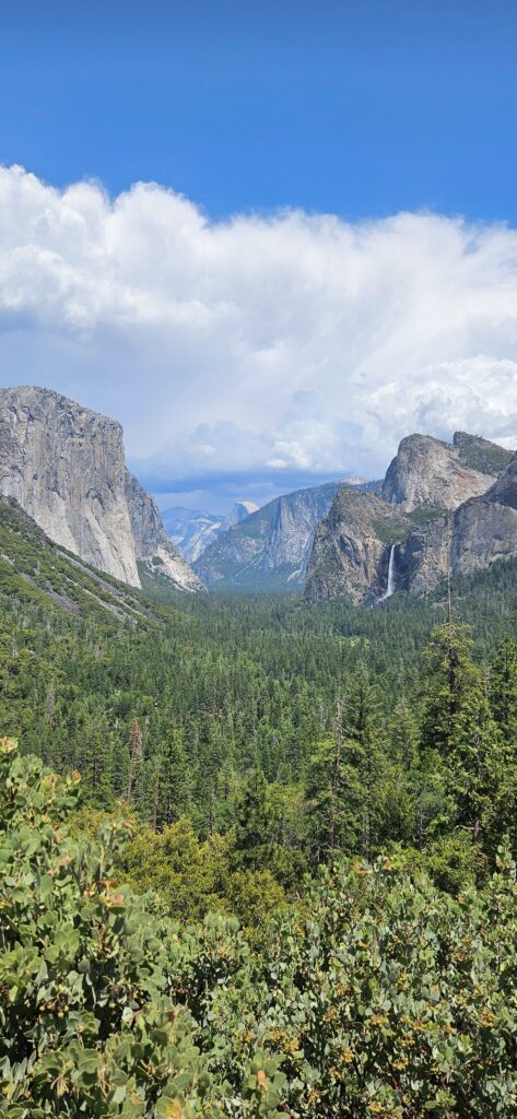
Now that Yosemite National Park has a reservation system during the summer months, we couldn’t just decide to go to Yosemite for the day without some planning. Even with our reservation, we waited 30 minutes to enter the park.
Half Dome from Big Oak Flat Road
The Valley was very crowded that day even though it was a week day. The parking at this pullout along the road was empty when I got there, but by the time I left, it was double parked with vehicles. Everyone had to see what we were looking at!
Tall Goldenrod
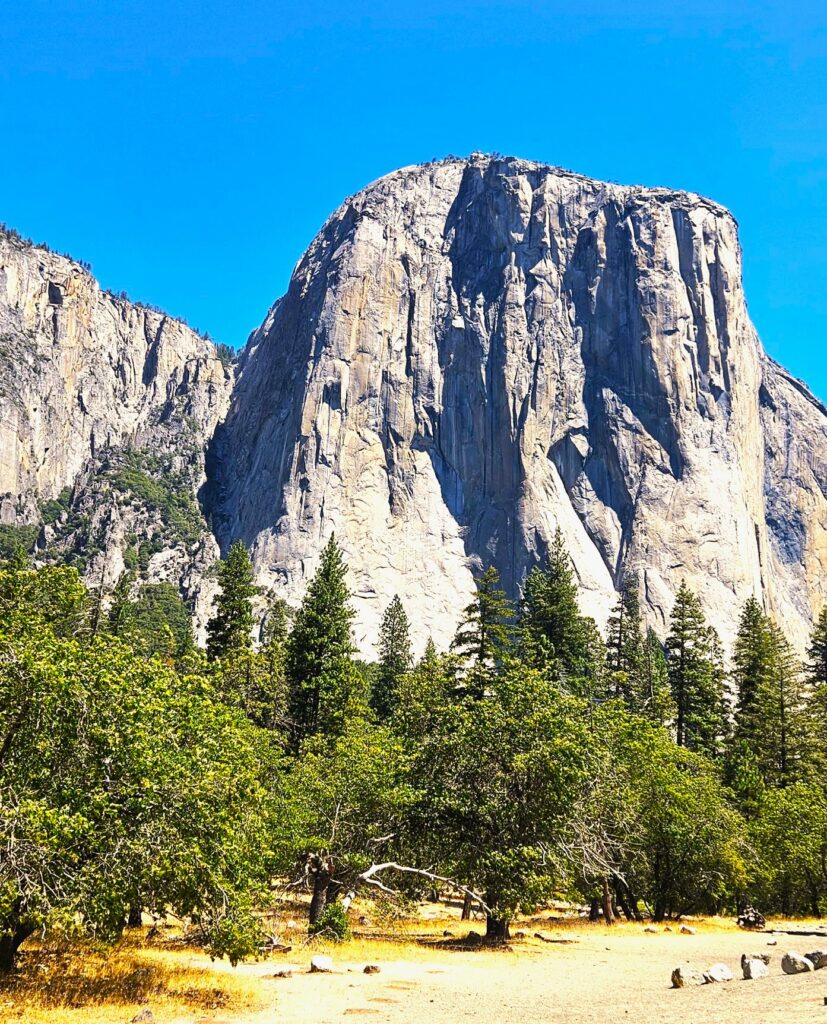
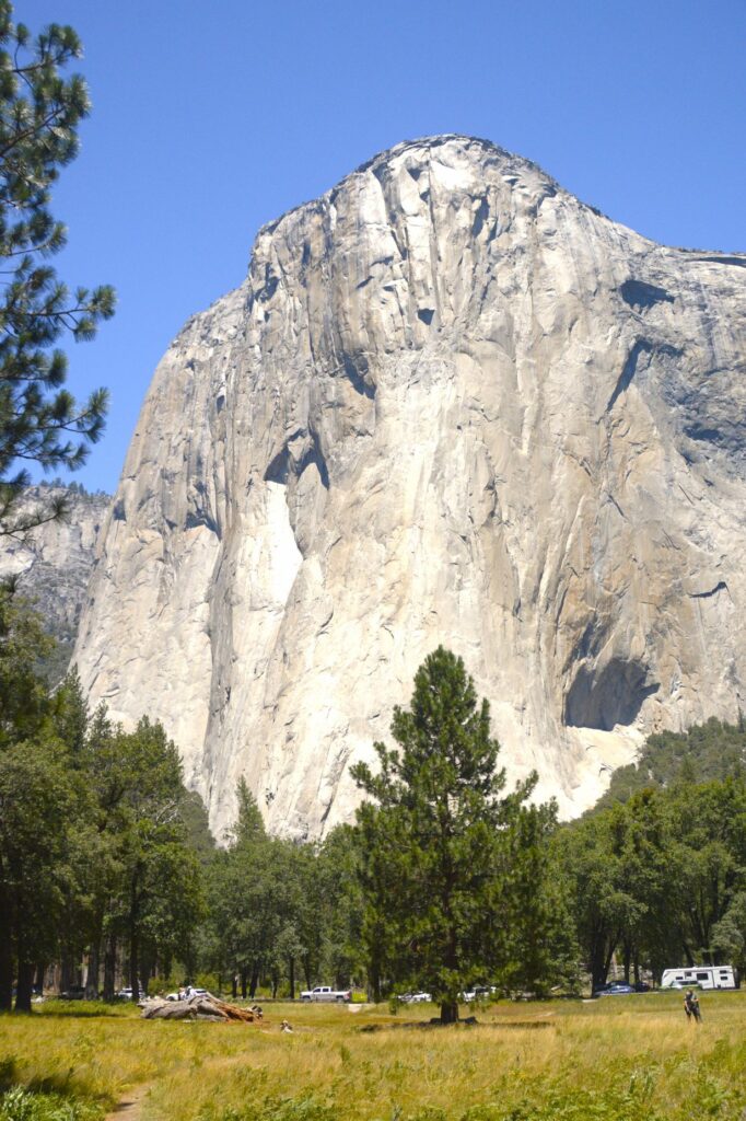
Across the road from us was a magnificent view of El Capitan.
El Capitan
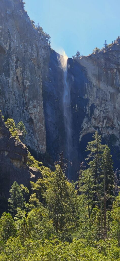
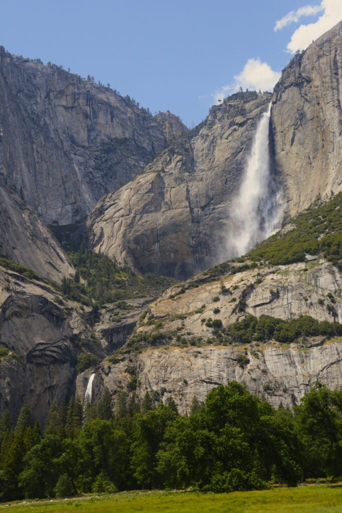
It was a bit windy that day. You can see the water at the top of Bridal Veil Falls being whipped up by the breeze. Though Bridal Veil still had water, Yosemite Falls was just a trickle.
Bridal Veil Falls
The parking lots in the valley were totally full. We drove around to see if anyone might be leaving, but soon gave up. We had to settle for parking along the road like this meadow pullout.
Meadow in Yosemite Valley
I took a little walk along the pathway and found this old fallen log.
Meadow in Yosemite Valley
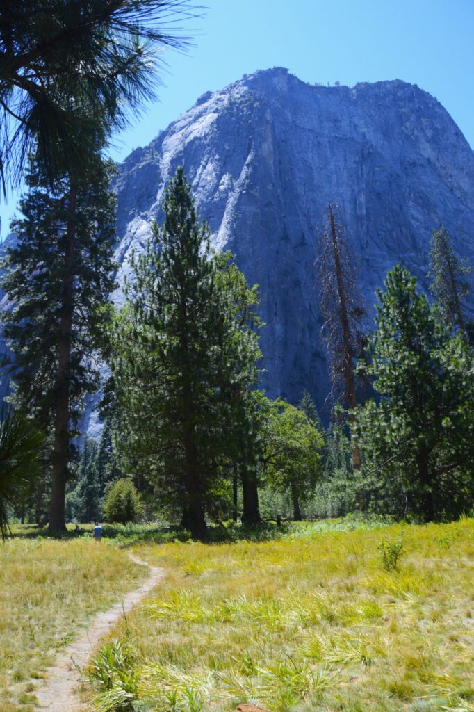
Looking back, I could see El Capitan from a different angle.
El Capitan
We got tired of the crowds and decided to drive up into the high country. We found a nice pull out with a view. We were the only ones there.
View Point from Big Oak Flat Road
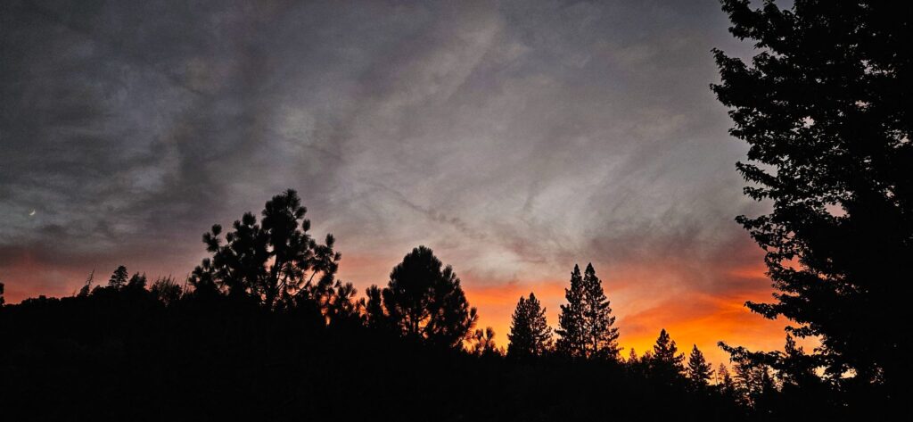
Our campground was only five miles from the Oak Flat entrance. We enjoyed our time there, but we didn’t attempt any more trips into the park. It was just too crowded for our taste. However, we enjoyed our evening walks around the campground and the many beautiful sunsets like this one.
Sunset at Yosemite Lakes Campground
“We can make our plans, but the Lord determines our steps.” Proverbs 16:9
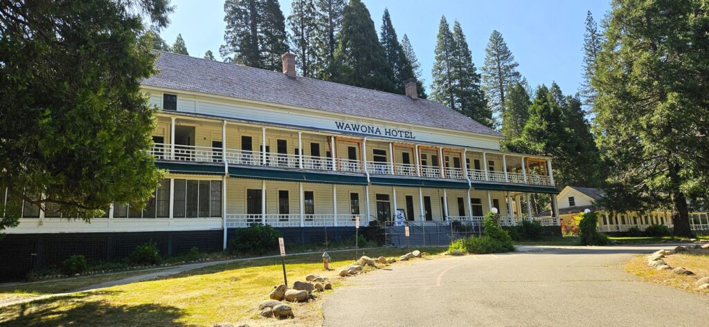
Of all the national parks we’ve visited, (33 so far), Yosemite is our all-time favorite. While we were staying in Coarsegold, California, we couldn’t resist a visit to our former “backyard.”
The Historical Wawona Hotel was being renovated in 2025.
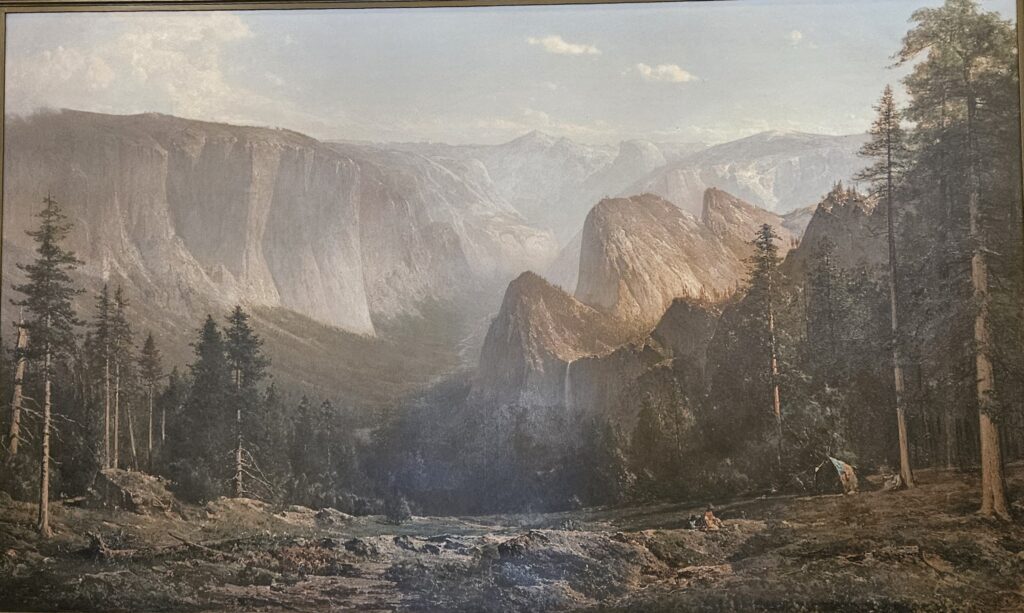
We entered Yosemite park through the Oakhurst entrance and stopped at the Wawona visitors’ center. In all our visits to Yosemite, I’d never been to this visitors’ center. It houses a fabulous collection of paintings of the famous landscape artist, Thomas Hill.
A large floor to ceiling painting of Thomas Hill in the Wawona Visitors’ center.
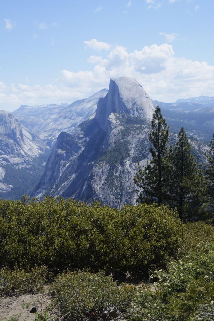
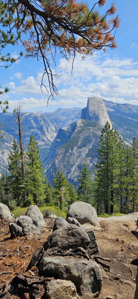
After getting my National Parks Passport book stamped and buying a couple of stickers for my journal, we drove on to Glacier Point. The road was fully opened recently after having been closed for a couple of years for repairs.
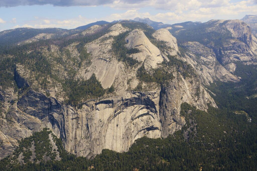
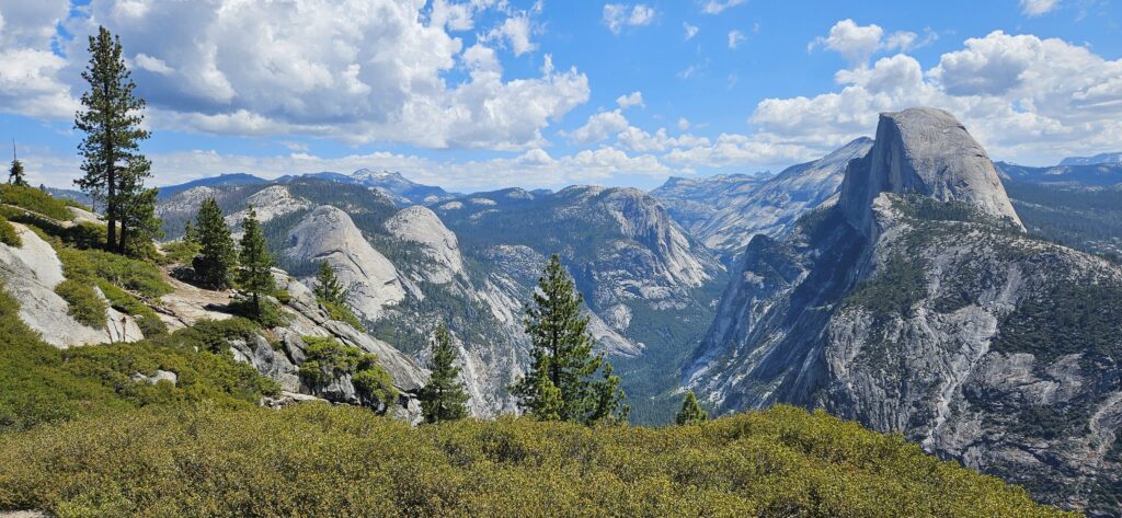
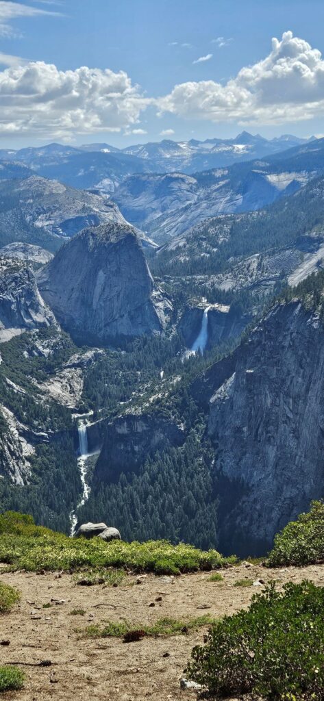
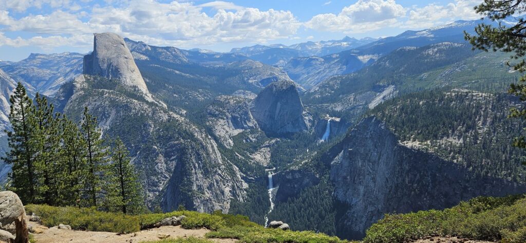
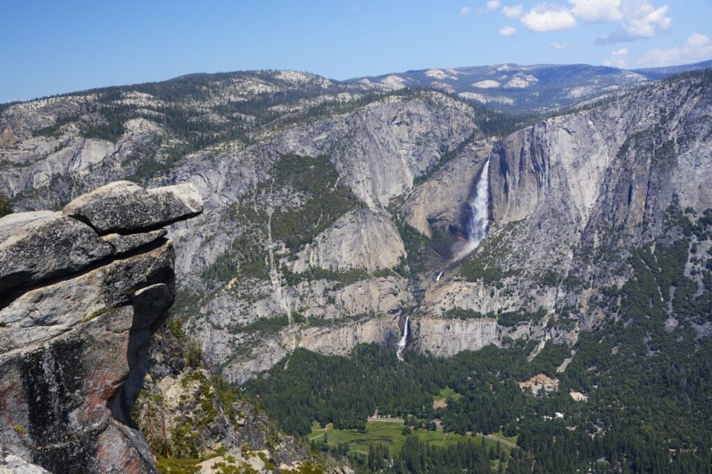
At over 7,200 feet in elevation, Glacier Point has the best views of Half Dome and Vernal and Nevada Falls. It also has wonderful views of Yosemite Valley and Yosemite Falls.
Huge rock walls of Yosemite Valley
The weather was a perfect temperature that day. The clouds added character to the beautiful landscape.
Half Dome and Yosemite ValleyView of Half Dome from Glacier PointVernal and Nevada Falls from Glacier PointHalf Dome, Vernal and Nevada Falls from Glacier PointRock ledge overlooking Yosemite Valley and Yosemite Upper and Lower Falls from Glacier Point
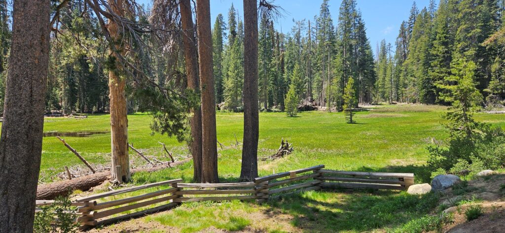
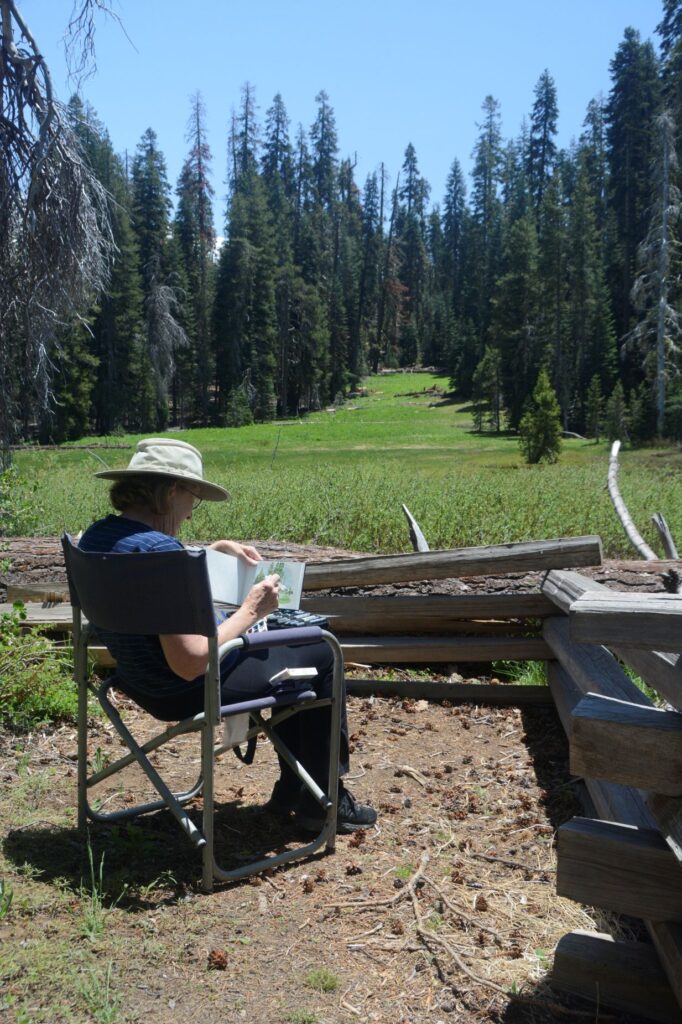
We were driving back from Glacier Point when we found this nice meadow where we stopped to eat our picnic lunch. I took some time to do a quick “plein air” watercolor painting. It wasn’t a Thomas Hill, but it was fun and relaxing.
Meadow on Glacier RoadPlein Air painting
As we were coming through the tunnel, the view suddenly opened up and we saw this magnificent view of the valley and Bridal Veil Falls. I never get tired of looking at this view.
This view is known as the Tunnel view because the road goes through a tunnel and then opens up to this.
The clouds were really something that day. They started forming in the distance over the mountains and kept growing and growing until they filled the whole sky above.
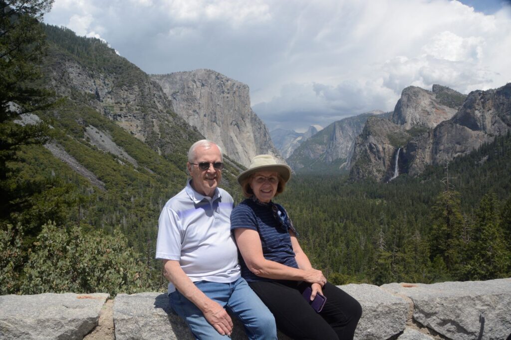
While enjoying the view, a young lady from Utah offered to take our photo. She and her family own a campground in St. George, Utah. Since it was my birthday, I figured I should have a photo to commemorate it.
Birthday photo in Yosemite
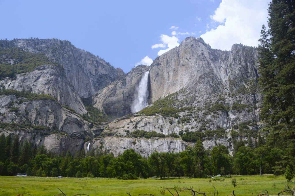
As we drove through Yosemite Valley, we caught glimpses of Yosemite Falls. They were full and beautiful from record snowfall and rainfall in the winter and spring of that year.
Yosemite Falls (Upper and Lower) from Sentinel Bridge area.Yosemite Falls
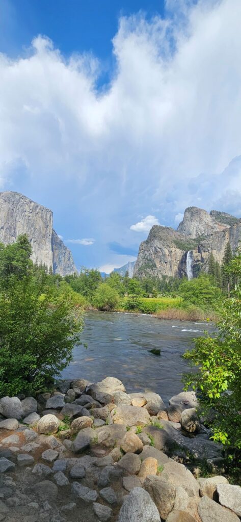
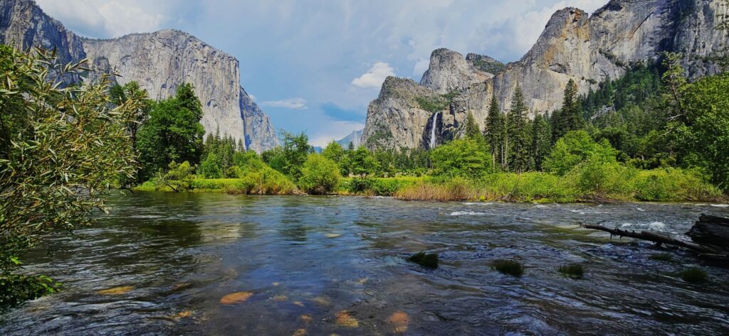
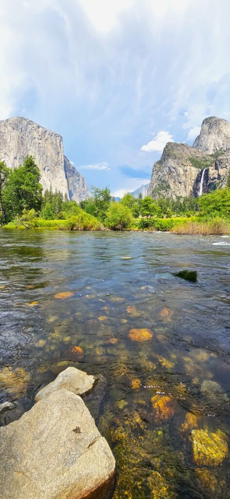
We continued on driving through the valley until we stopped at this viewpoint of Bridal Veil Falls and the Merced River.
Merced River and Bridal Veil Falls from Valley View TurnoutMerced River and Bridal Veil Falls from Valley View Turnout
By now the clouds had almost completely filled the sky above us. We turned toward home as we closed out our day with a last look at this magical place.
“I lift up my eyes to the mountains—where does my help come from? My help comes from the Lord, the Maker of heaven and earth.” Psalm 121:1
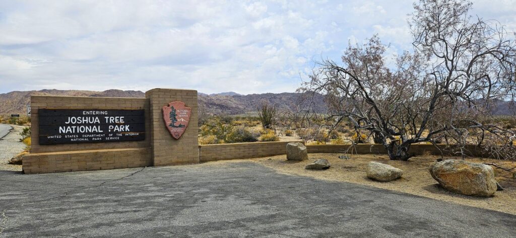
While traveling from Arizona to California, we stayed in Cathedral City, California. It’s not far from Indio. For some reason, we thought we had seen Joshua Tree National Park before. The fact was, we hadn’t.
South entrance from Interstate Highway 10.
Of course, my first goal was to get my National Parks Passport book stamped at the visitors’ center. We entered the park from the south entrance from Hwy 10 and stopped at the Cottonwood Visitor Center.
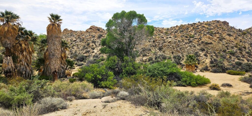
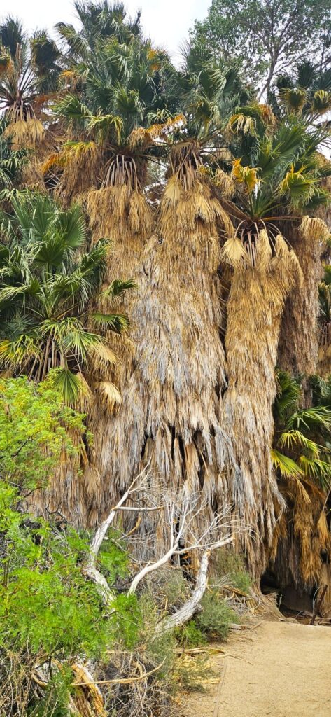
Lost Palms Oasis
Not far from the visitors’ center was a picnic area where we stopped and had our lunch. Near there was Lost Palms Oasis, the largest grove of California fan palms in the park. These huge bearded trees thrive due to a constant water supply from Cottonwood Spring.
California fan palms in Lost Palms Oasis
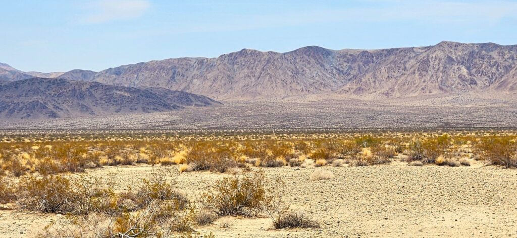
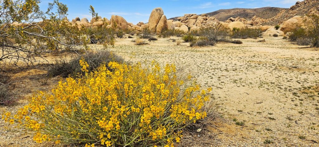
From there, we worked our way northwards through the park. We saw very few Joshua trees at first. The temperatures in the desert in early May were quite pleasant since we were climbing in elevation the whole time.
The road is about a 30 mile drive, but we made several stops along the way to learn about the desert plants and geology. This alluvial fan coming is a common sight where the mountains meet the desert floor. Material from the mountains is washed down by streams during rains and flash floods. As the water slows, sediment gets deposited from the streams.
Alluvial fan
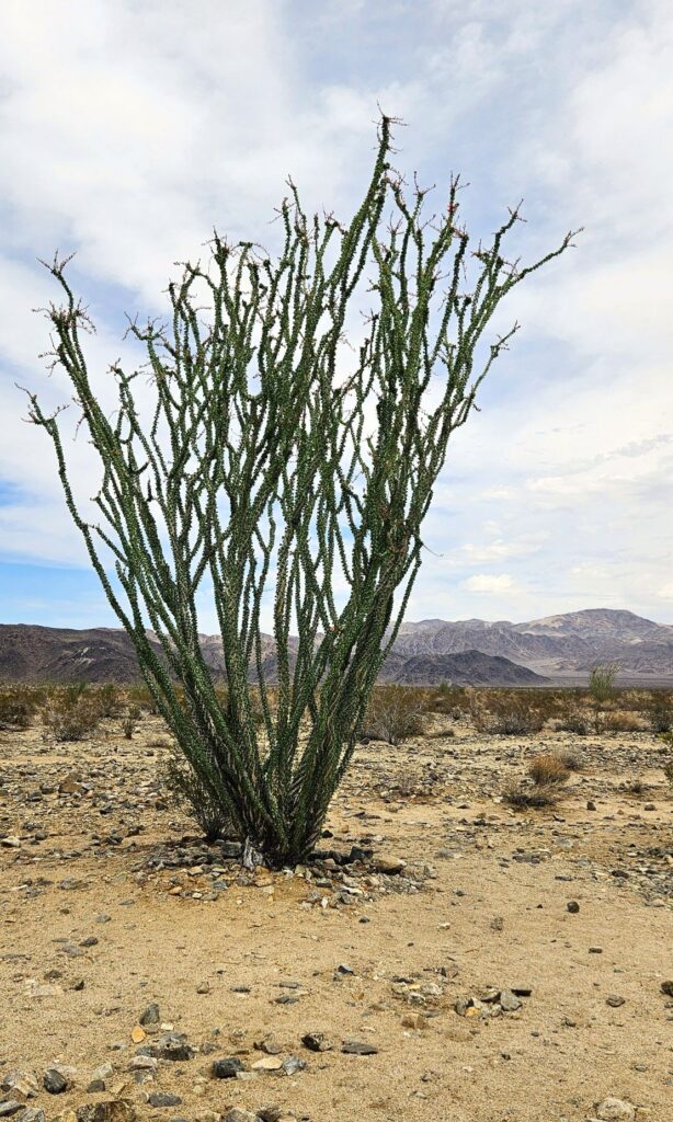
The alluvial fan gets more moisture from runoff to support more plants like the ocotillo and chollas. Believe it or not, ocotillos are more closely related to blueberries and tea plants than cactus plants!
Ocotillo plant
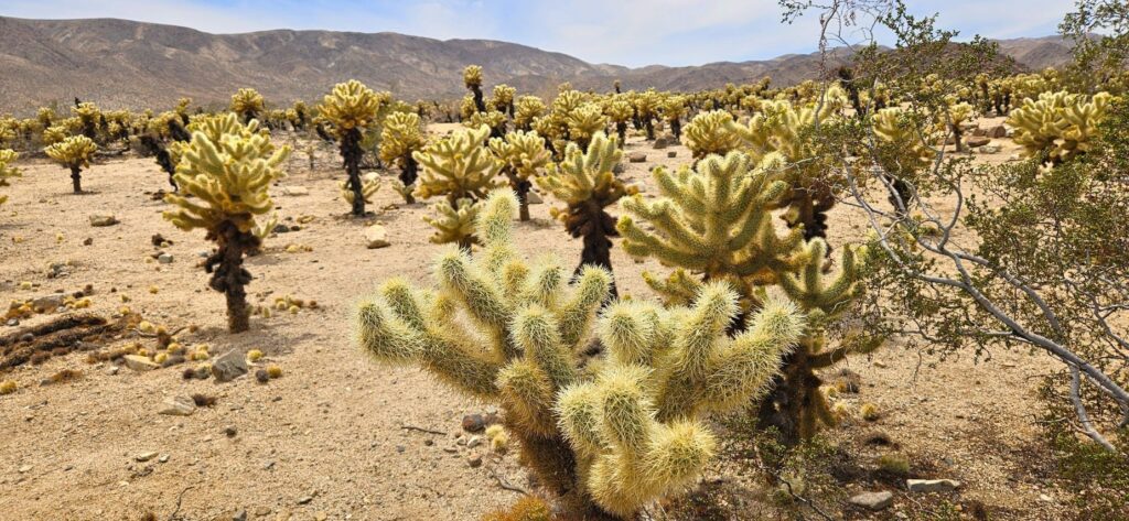
Our next stop was the cholla garden. I’ve never seen so many chollas in one place! There were warning signs telling tourists not to get too close. Chollas are also known as “jumping cactus” because if you happen to brush up against one, it will stick to you.
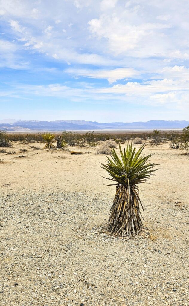
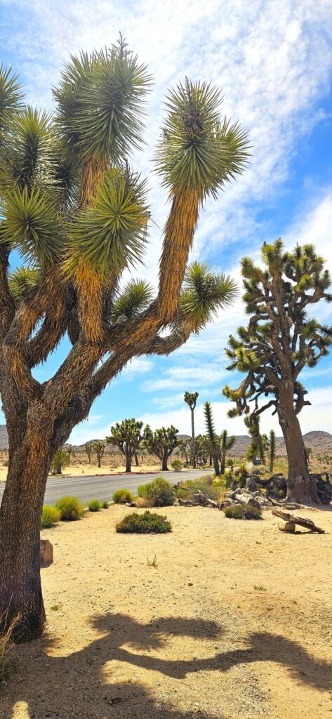
Joshua trees are a type of yucca plant. Sometimes it’s hard to tell the difference. I thought at first these yucca plants were baby Joshua trees. But they are yuccas.
Spanish Dagger yucca plant
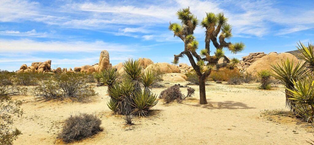
The next photo shows the difference between a yucca and a Joshua tree. It’s pretty easy to tell when they’re this big and side by side.
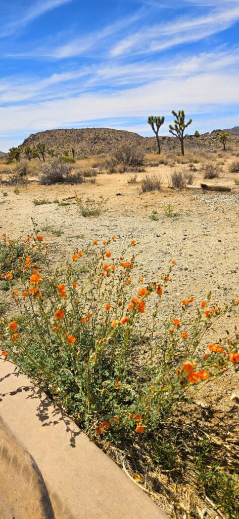
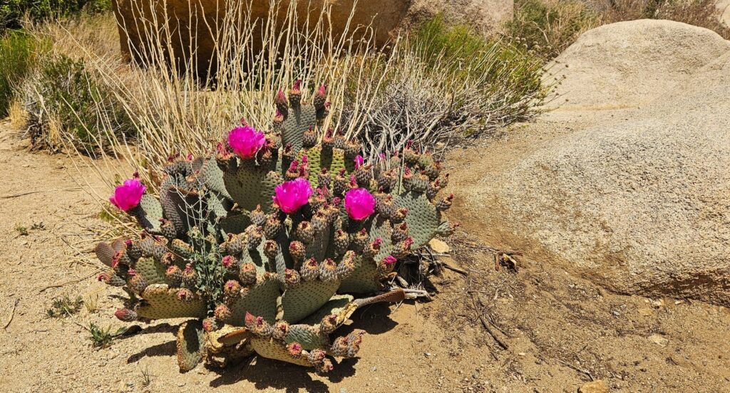
It was late spring when we visited, but there were plenty of desert flowering plants.
Flowering Blue Palo VerdeFlowering Desert Globe MallowFlowering Prickly Pear Cactus
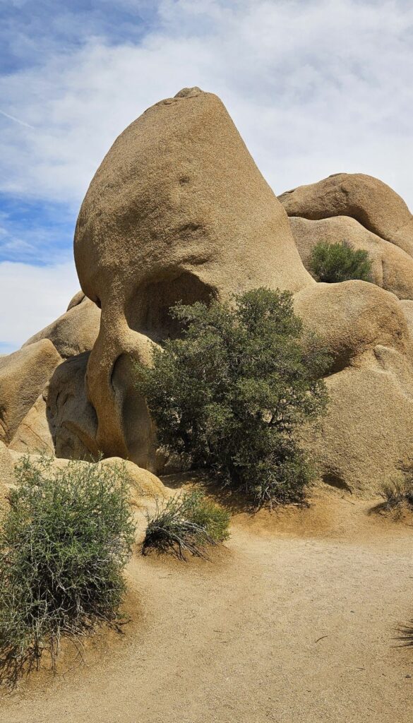
Along our route was this interesting rock formation called “Skull Rock.” Joshua Tree National Park has a variety of rock formations. This is a popular one for tourists.
Skull Rock
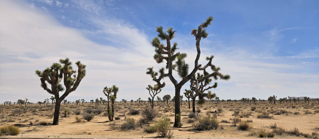
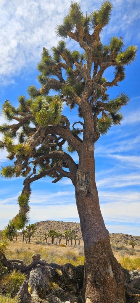
As we got further and further into the park, we began to see huge Joshua trees. I’ve seen many Joshua trees in my lifetime, but these were the biggest I’ve ever seen.
The trunks of these trees were like the size of an oak tree, and had many “arms.”
Large Joshua Trees
Another stop along our route was this “balancing rock” formation. It looked like it could topple down at any time.
Balancing Rock
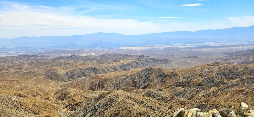
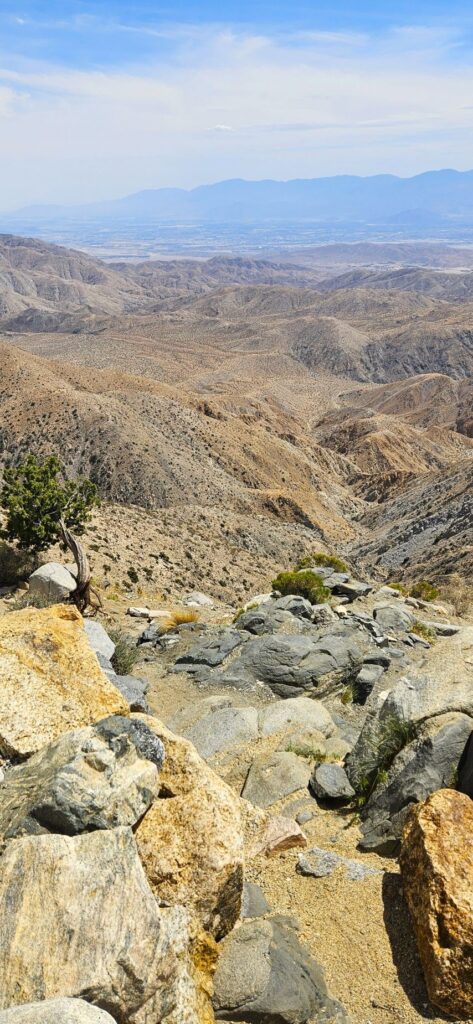
Our last stop in the park was Keys View where we could look out over the whole Coachella Valley. I didn’t know this, but the San Andreas Fault line runs right down the middle of this valley.
Keys View of Coachella Valley
At over 5,000 feet in elevation, we enjoyed the cool breezes as the day continued to warm up.
Overlooking Coachella Valley
Joshua Tree National Park is worth seeing. The variety of desert plants and animals that can withstand the extreme temperatures of desert weather is a testament to God’s marvelous creation.
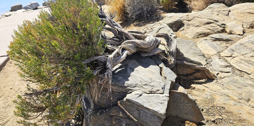
Twisted tree at Keys View
“The wilderness and the desert will rejoice, And the desert will shout for joy and blossom.” Isaiah 35:1a
Death Valley National Park was not a high priority on my bucket list of places to see because I imagined vast salt flats, sand dunes and barren desert that seemed somewhat boring. Instead, what I saw surprised me. I realized my preconceived ideas of it were very wrong. It is actually a beautiful and fascinating place to visit.
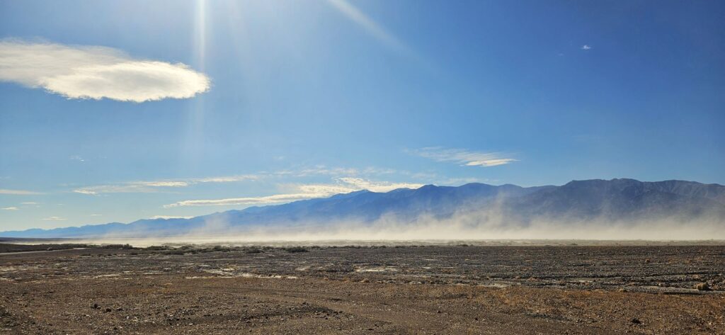
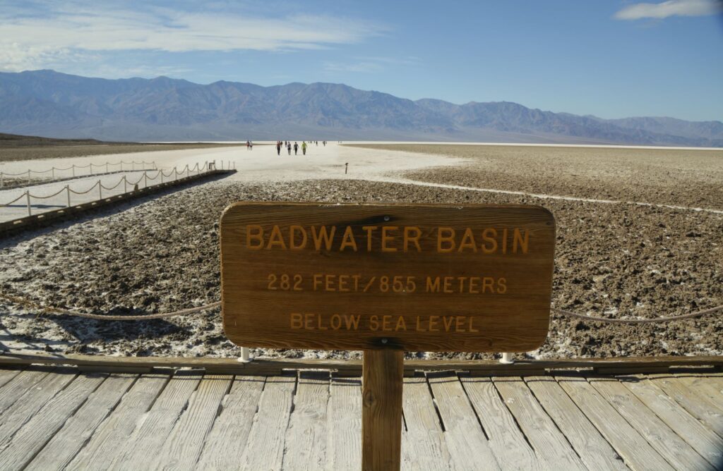
After our drive into the park and viewing the visitors’ center, our first stop was to see the salt flats at Badwater Basin. It was very windy that day and the dust blew across our pathway as we drove 17 miles south from the visitors’ center. It was so windy that sometimes a gust of wind would knock me off balance.
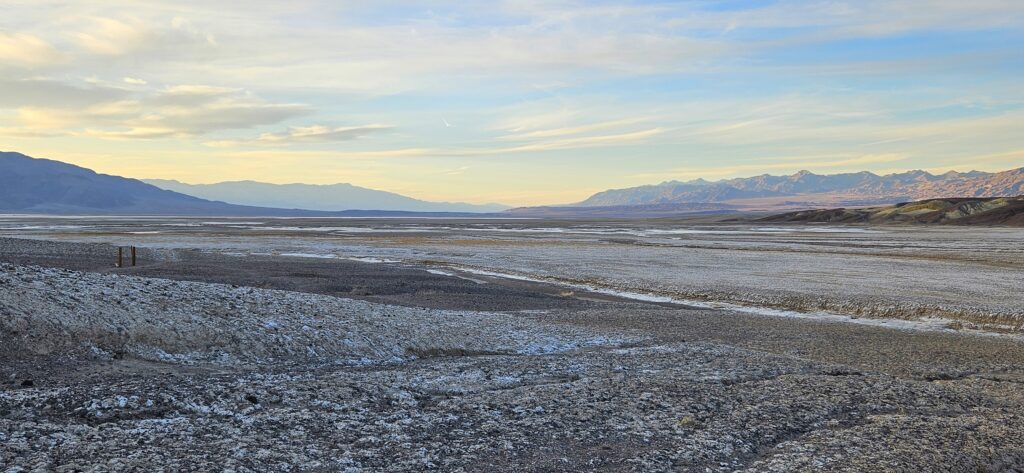
Badwater Basin is the lowest point in North America at 282 feet below sea level. There is no outlet for the rainfall and runoff from the mountains. Part of the basin had water in it when we were there due to recent record rainfalls in California.
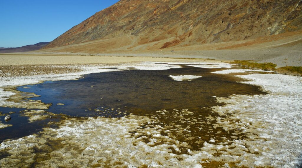
Near the parking lot were some pools which are spring fed. The water is very salty, from which it gets its name, “Badwater Basin.” Surprisingly, the pools support some unique animal and plant life.
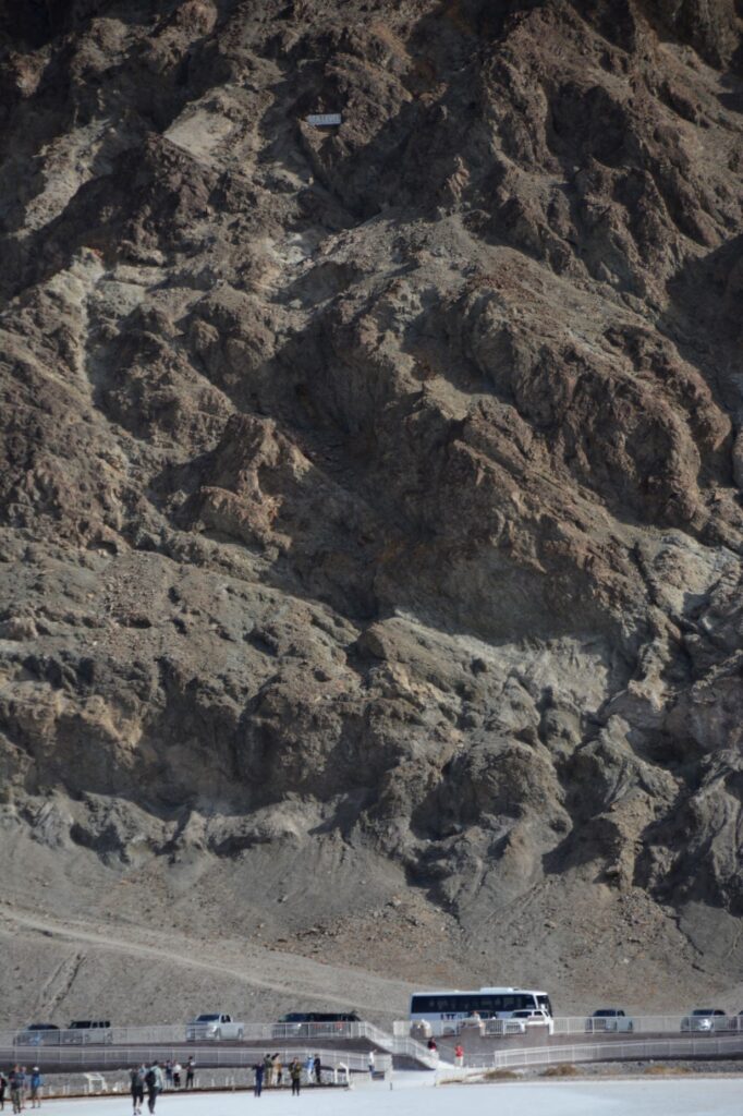
As I walked out toward the salt flats, I looked back at the mountain where I could barely make out the sign that says “Sea Level.”
Sea level sign on mountain above parking lot
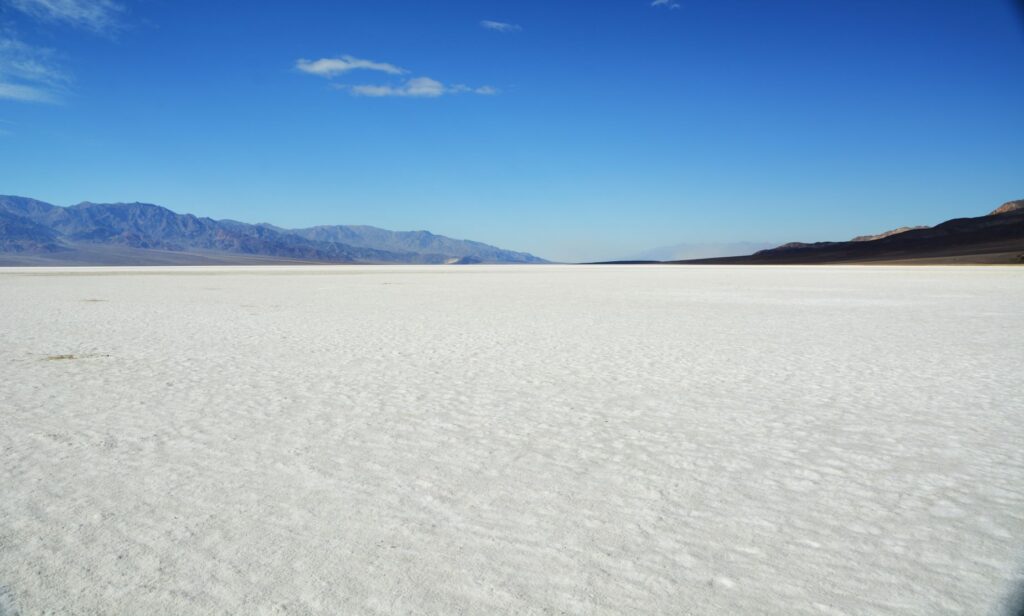
This is what it looks like about a quarter of a mile out on the salt flat. The sun shining on the white salt blinded me. The salt crystals were trampled down from the tourists. This is what I expected Death Valley to look like. But there was much more to see that was surprisingly beautiful.
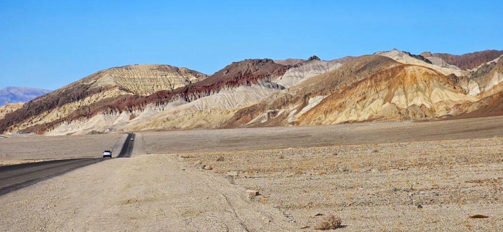
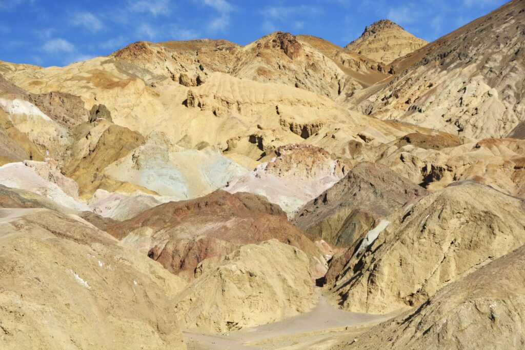
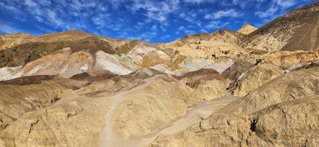
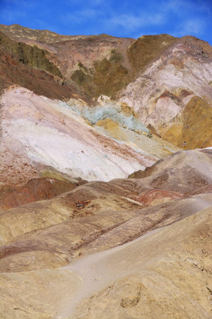
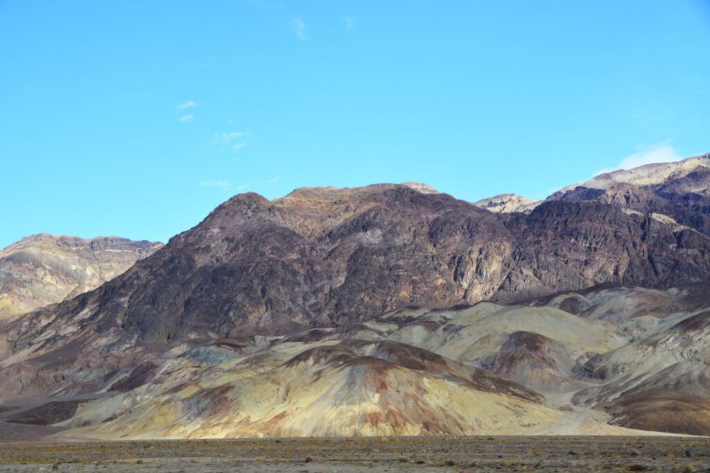
Heading back toward the visitors’ center, we began to see colorful rocks and mountains which were the result of volcanic deposits, chemical weathering, and oxidation of the exposed minerals. The deep reds, pinks and yellows were created by iron compounds.
We drove a nine mile drive called “Artists Drive” to see “Artists Palette.” These colorful hills are made from volcanic ash, gravel and playa deposits which contain iron oxides and chlorite.
Colorful deposits on Artists’ Drive
Rainfall, heat and flash flooding eroded the deposits of iron, manganese and mica which, when exposed, were oxidized by the air. This causes the colors of red, pink, yellow, green and purple.
The green rocks are from decomposed mica, not copper, as I originally thought. The purple is created by manganese.
Artist’s Palette
The colorful rocks and mountains were some of the first surprisingly beautiful discoveries in Death Valley. There was much more to come.
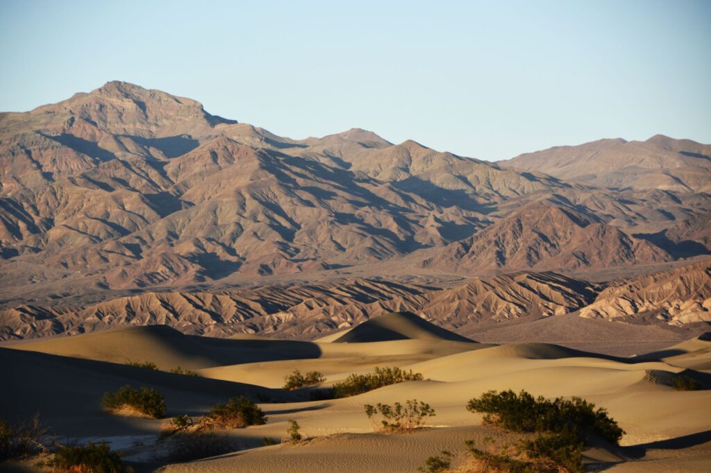
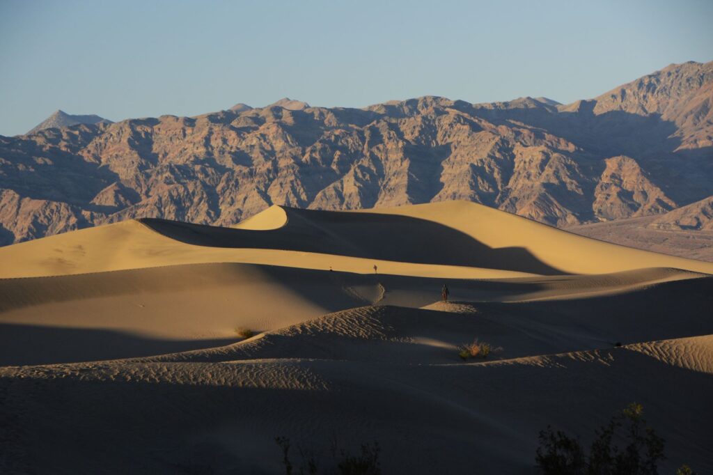
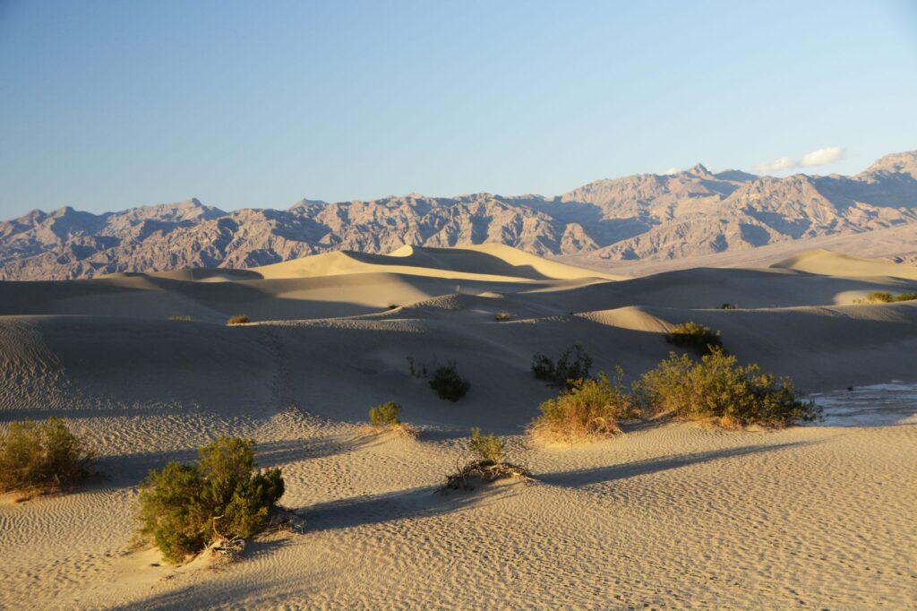
We drove on another 38 miles. We were racing against the clock to be at Mesquite Flat Sand Dunes before sunset. We arrived just in time. The shadows on the dunes were already beginning to deepen.
The dunes were massive. I felt like an ant climbing over them. Each one seemed bigger than the last.
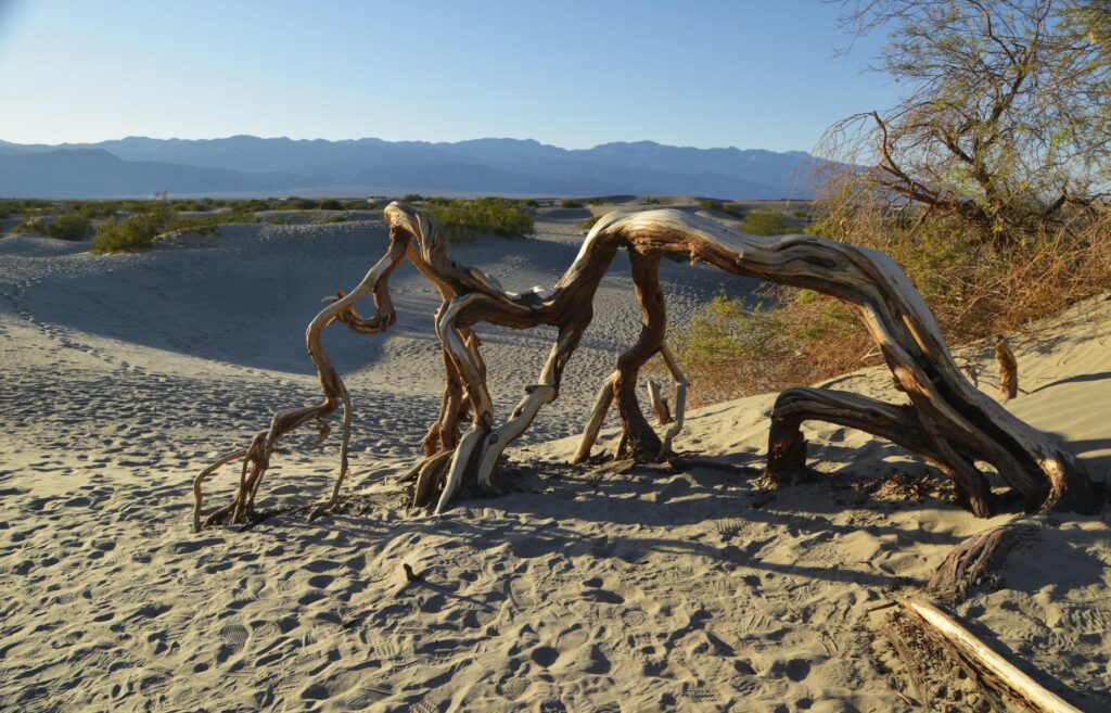
A twisted dead tree trunk was a reminder of the harshness of this environment. The highest recorded temperature in Death Valley was 134 degrees. I thought of the pioneers and native people who lived here before air conditioning and wondered how they survived. They likely fled to the surrounding mountains where temperatures were cooler.
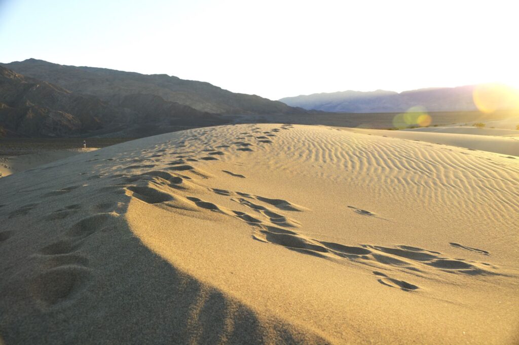
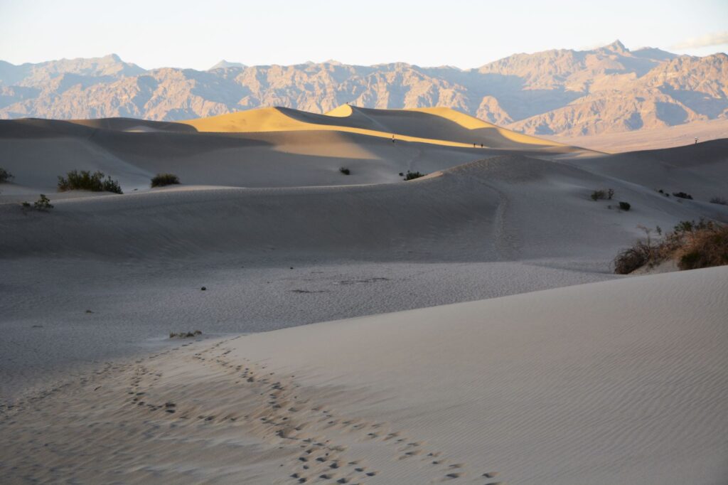
I followed the footprints of other tourists who had gone before me. I was sometimes confused about which way to go when down between the dunes.
I climbed to the top of another dune and sat down as I watched as the last light of day illuminate the top of the mountain range. In the distance, I could see other people that were like tiny dots. I paused to catch my breath while enjoying the beauty of the stark contrast of the dark shadows against the sunlit sides of the dunes.
I thought of how these dunes would shift and change with time. The next time I visited they might be completely different in shape.
The shadows were quickly lengthening and the breeze grew cooler.
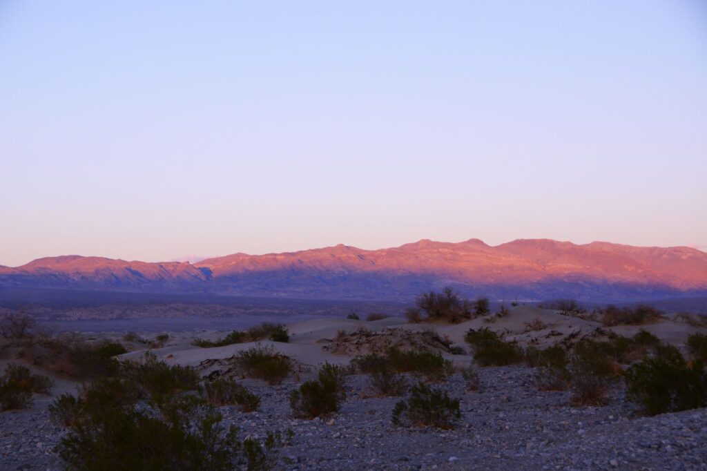
It was perfectly quiet. All I could hear was the sound of the wind as the last light of day faded on the distant mountains turning them a purplish pink. I followed my footprints back to the truck.
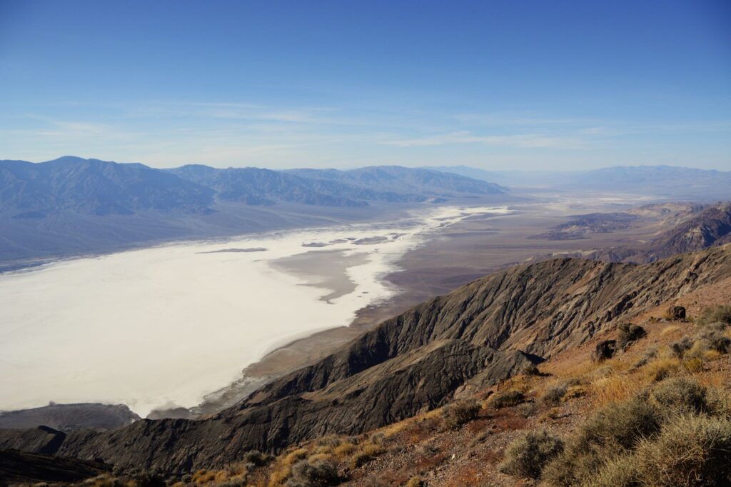
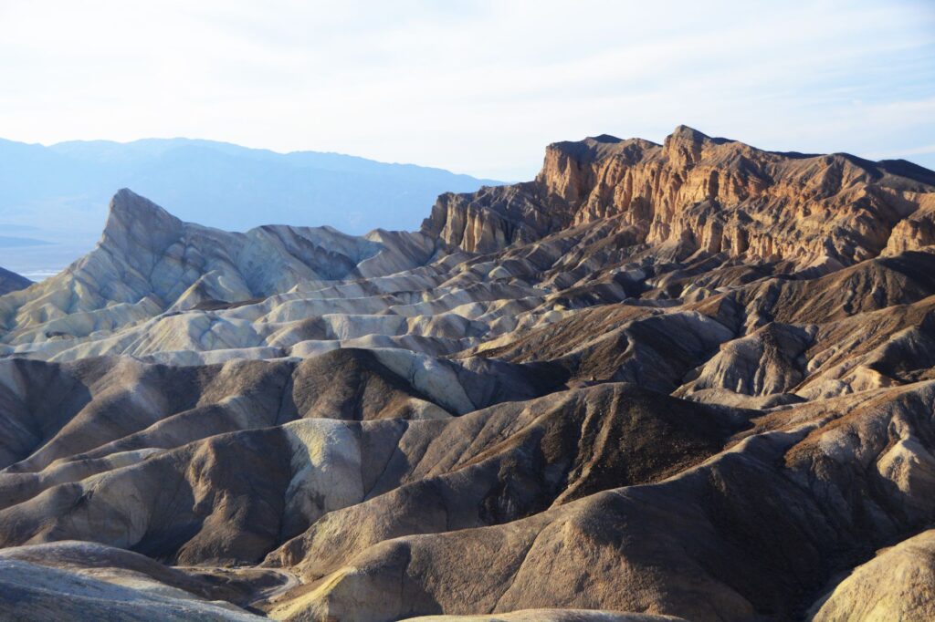
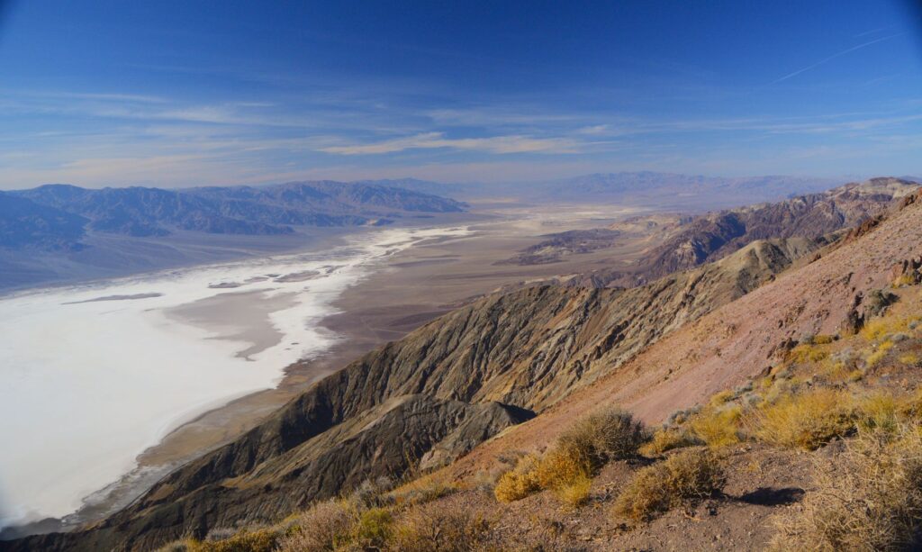
On our second trip into Death Valley National Park, we made our first stop at Dante’s View. This expansive view of the entire valley probably should have been our first stop of the trip. Looking down from over a mile above, one gets a great overview of the valley below, and a feeling for the great distances in this park.
Looking the other direction, it just keeps going on and on. This viewpoint was definitely worth the windy steep six mile drive. This view was unexpected. Previously, I thought Death Valley was flat all over.
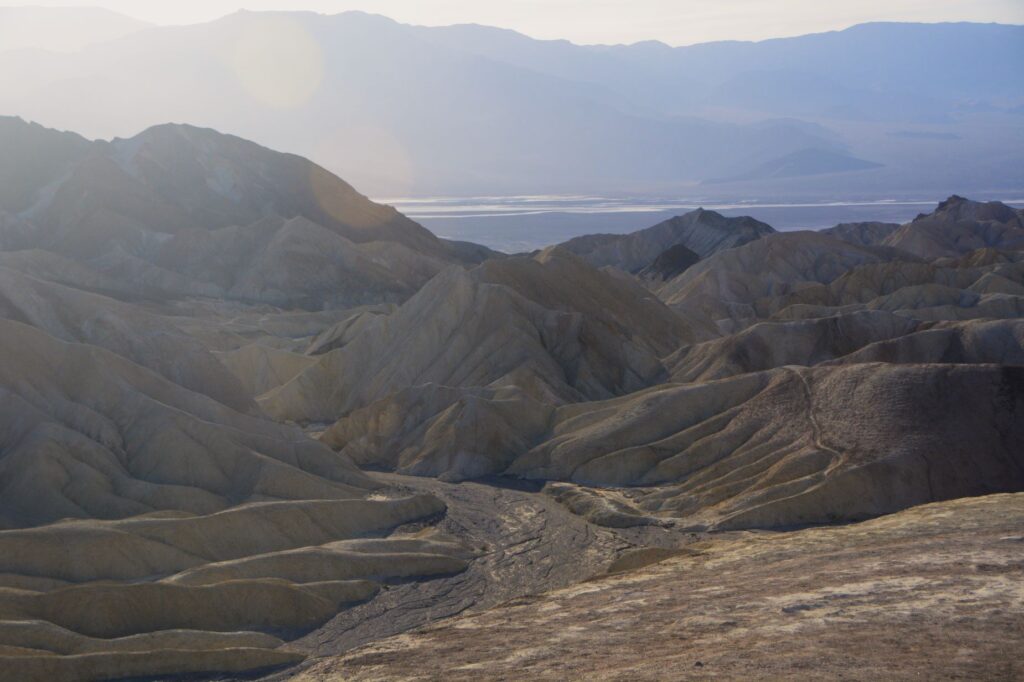
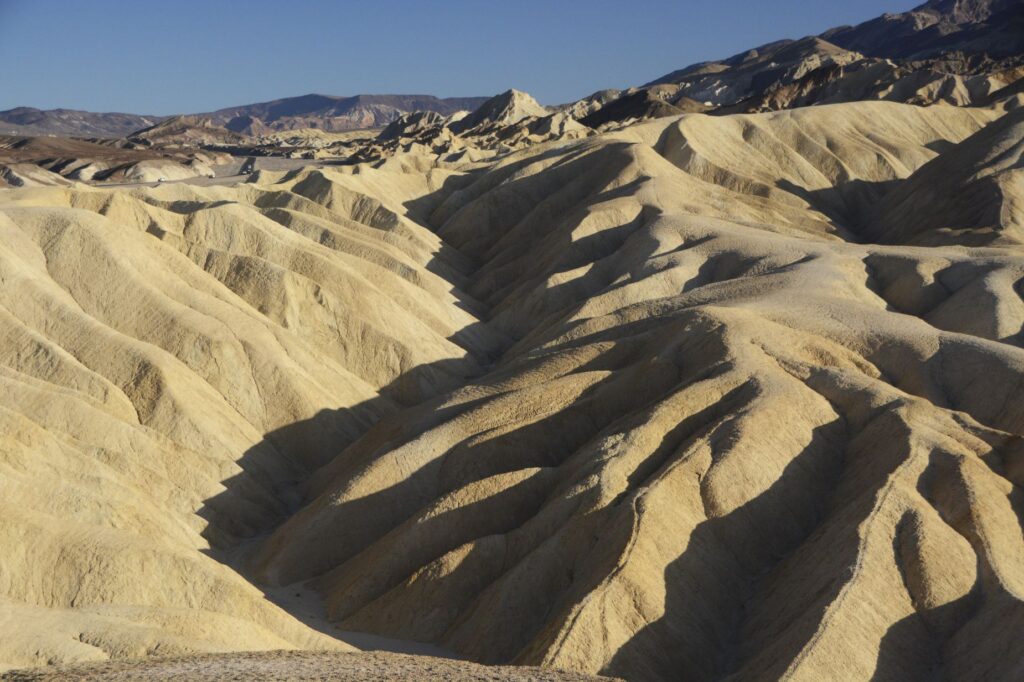
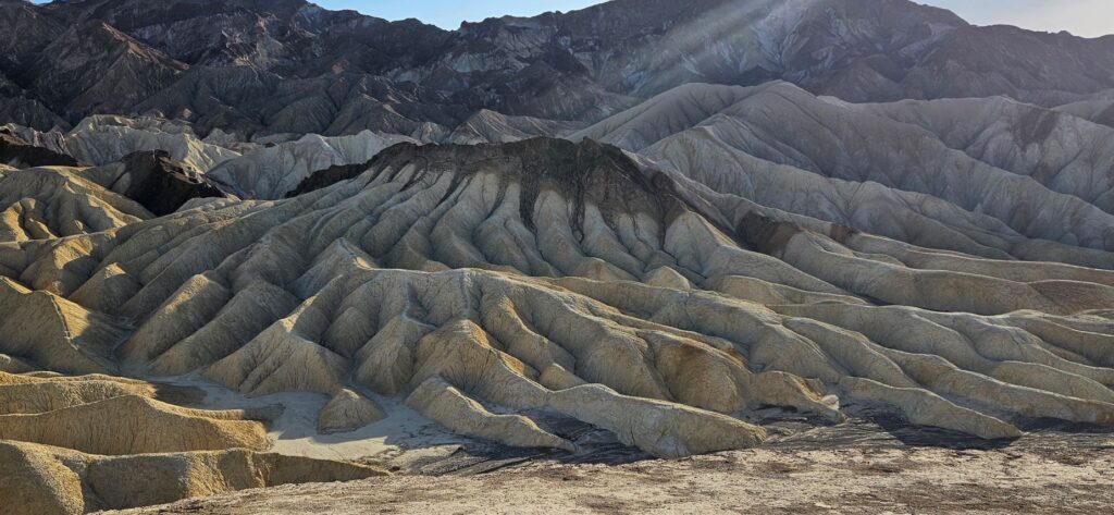
Zabriskie Point is another overlook on the way into the valley. We stopped here to hike up the quarter mile paved pathway to the overlook.
Since it was later in the day, the afternoon sun made interesting shadows on the golden colored badlands.
The beauty of Death Valley continued to surprise me. These different colored bands in the badlands at Zabriskie Point were so interesting.
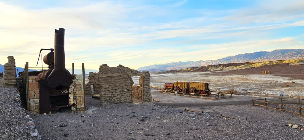
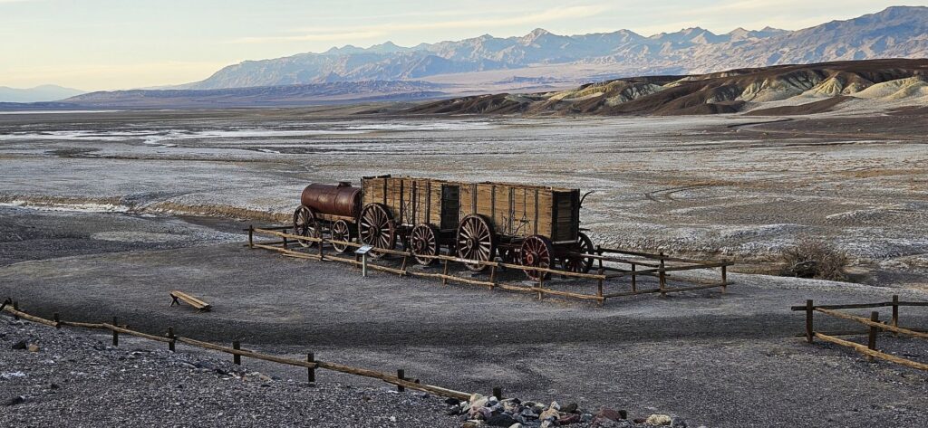
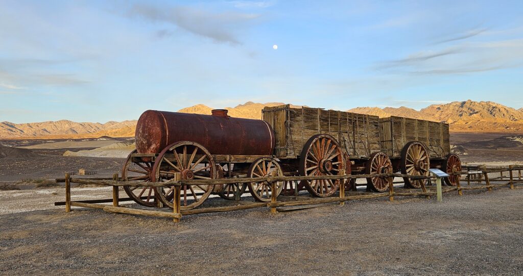
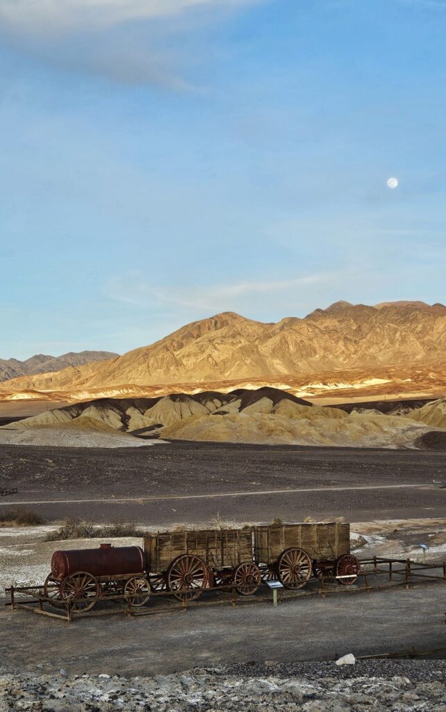
We had one more place to visit that day–The Harmony Borax Works. Here we saw the remains of a building for processing borax, one of the most profitable ores mined in the area. There was also an historic 20-mule team wagon.
Chinese laborers from San Francisco, scraped borax off the salt flats and transported it by wagon to the refinery.
Borax fields
The borax could not be processed during the summer months due to the heat.
The nearest railroad was 165 miles away, so the ore was processed on site to make it easier to transport the borax by wagon.
Twenty Mule Team Wagon
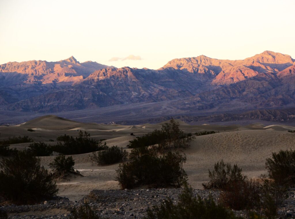
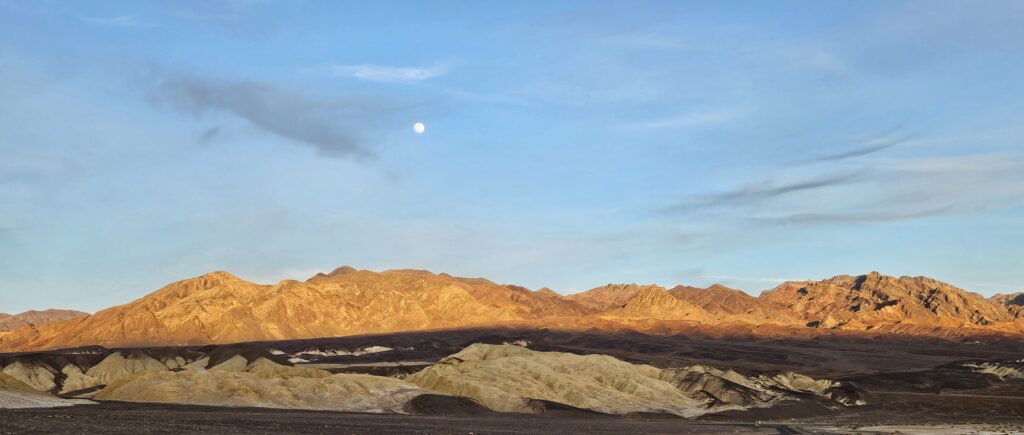
As we ended our day, the moon rose over the mountains as the sun was setting. Once again, I was awestruck by the beauty.
Death Valley is a study of contrasts. It is the lowest place in elevation in North America at 282 feet below sea level, while the highest peak, Mt. Whitney (14,505 feet) is just a few miles away. Death Valley has had the highest temperature recorded (134 degrees), but also recorded a temperature of 15 degrees in the winter of 1913. Death Valley has an average rainfall of 2.2 inches per year. But lately, 2.2 inches of rain fell in a single day in August 2023, resulting in flooding.
We visited in February of 2025 and, other than the first day, we experienced beautiful weather. I would love to revisit Death Valley in the future. There are still many places we did not get to see. It truly was a surprise to me that such a desolate place could hold so much beauty.
“Even when walking through the dark valley of death I will not be afraid, for you are close beside me, guarding, guiding all the way.” Psalm 23:4
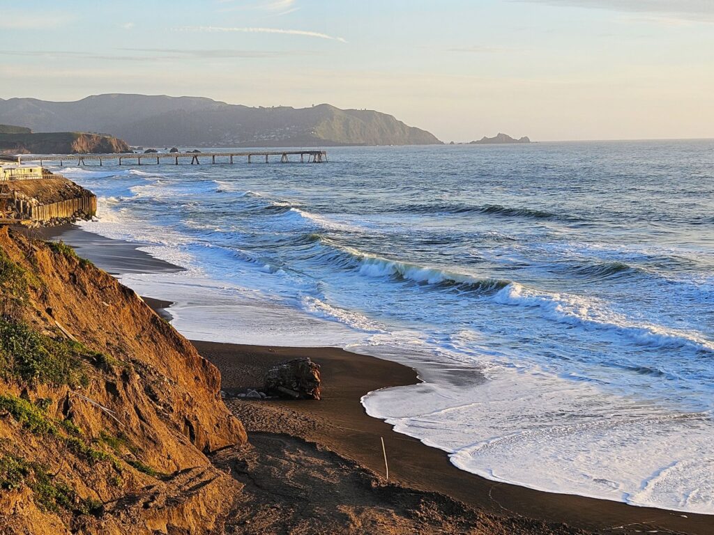
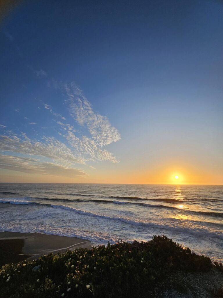
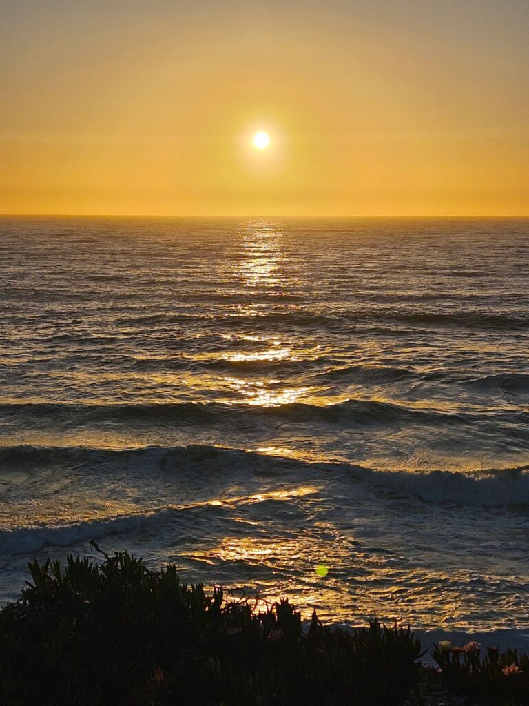
We began our 2024 summer travels by going up Highway 101 in California to Pacifica near San Francisco. Our first campsite was off Highway 1, right on the Pacific Ocean. We were up on a cliff, and it was pretty windy and chilly. My favorite thing about this site was that I could open the back curtains in our RV each morning and look out and see the ocean.
My other favorite thing to do was to capture photos of the sunset every evening. Every sunset was different and unique.
Sunset on Pacific coast
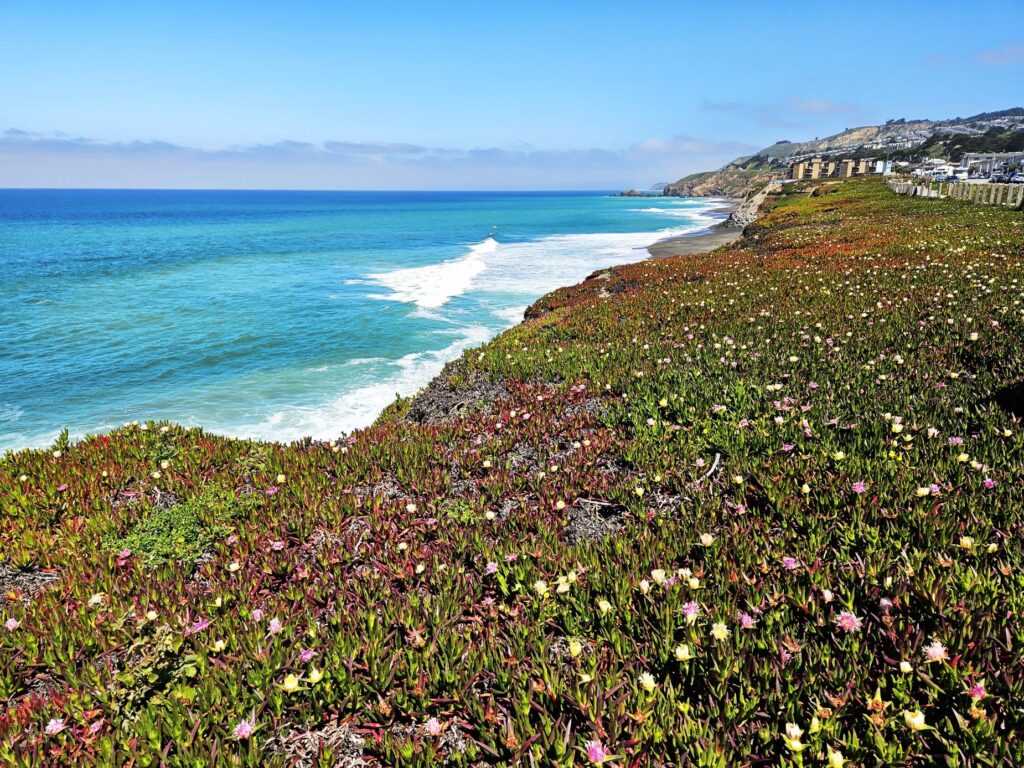
The ice plants were in full bloom. On clear afternoons, we could see people para-sailing over this coastline. The RV park is part of the Esplande Beach Overlook Trail. The trail goes right through the RV park and continues beyond it along this street. There are benches where you can sit and enjoy views like this. Some days the water was a beautiful turquoise blue.
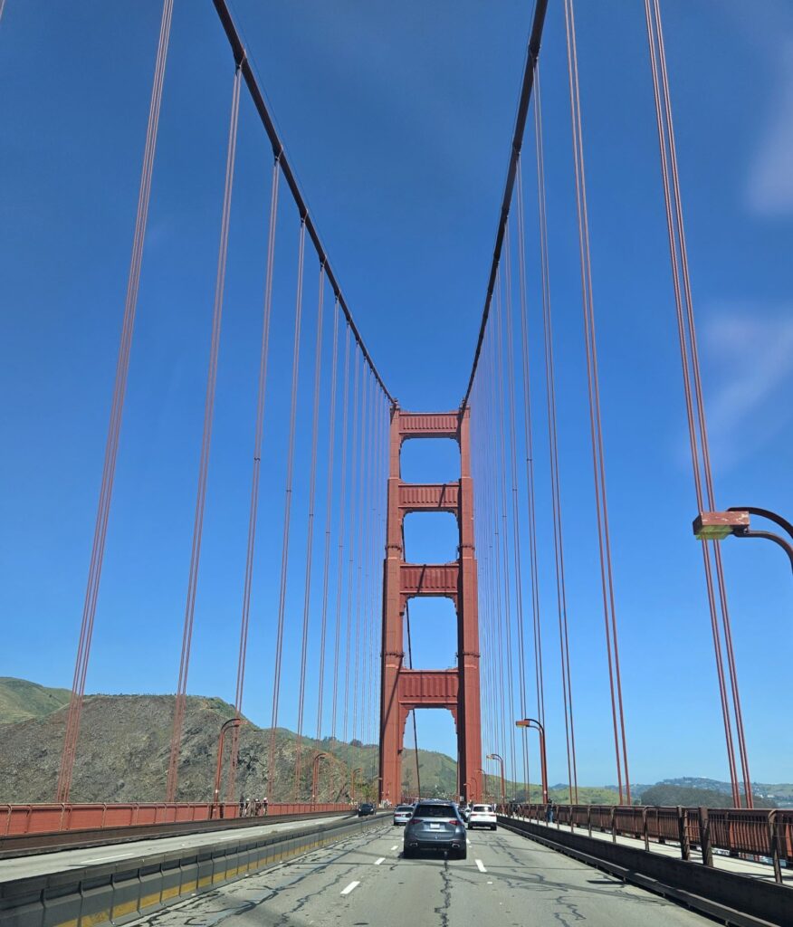
After spending four days there, we got back on Highway 101 and crossed the bay on the Golden Gate Bridge. Although Highway 1 follows the coastline, we followed Highway 101 because it is easier for pulling a travel trailer. Highway 101 eventually makes its way back to the ocean near Eureka, CA.
Golden Gate Bridge
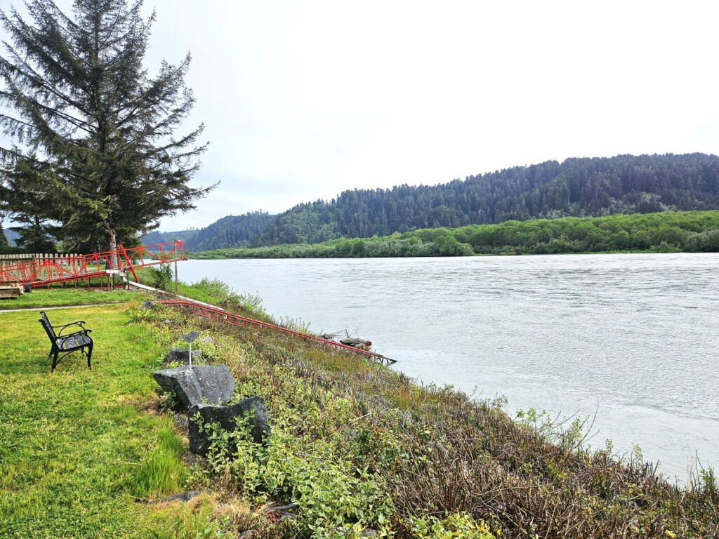
North of Eureka is Klamath, California, where the Klamath River meets the Pacific Ocean. Our campground was right on the Klamath River. From there, it was only a short drive to Redwoods National Park.
Our Campground was right on the Klamath River
Redwoods National Park is actually a combination of three California state parks (Prairie Creek Redwoods State Park, Del Norte Coast Redwoods State Park, Jedediah Smith Redwoods State Park) and a national park (Redwoods National Park) and stretches many miles along the northern coast of California.
Newton B Drury Scenic Parkway in Prairie Creek Redwoods State Park (Redwoods National Park)
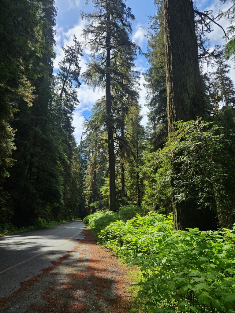
There’s a scenic drive south of Klamath called the Newton B. Drury Scenic Parkway. It is a ten-mile drive through the redwood trees.
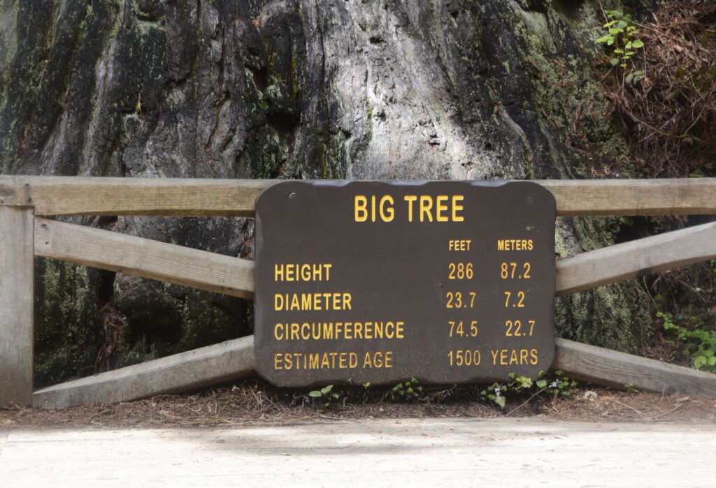
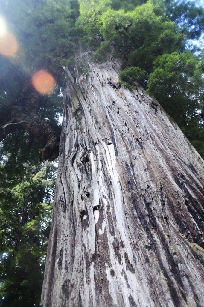
Redwoods along the Newton B. Drury Scenic ParkwayPathway to The Big Tree
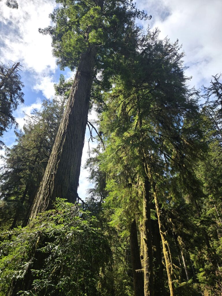
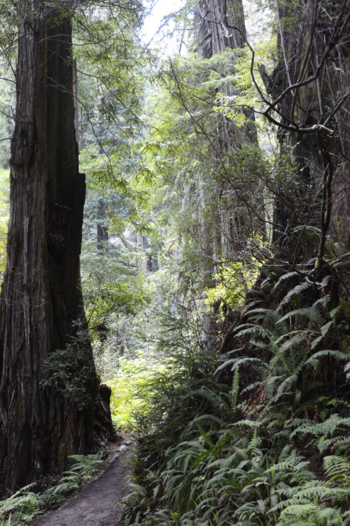
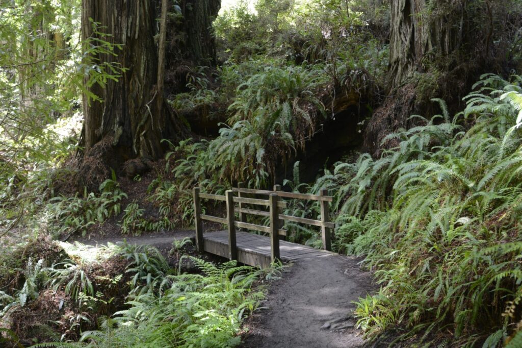
Along the scenic drive was a side road to see The Big Tree. The pathway there was lined with all kinds of ferns.
No camera can quite capture the immensity of these huge redwood trees.
The Big Tree
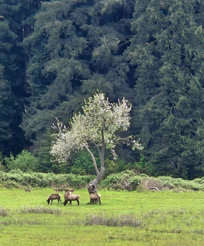
We continued south to the Prairie Creek Redwoods State Park Visitors’ Center. On the way, we saw a bear along the road. In the meadow we saw several elk grazing.
Elk grazing in Prairie Creek Redwoods State Park (Redwoods National Park)
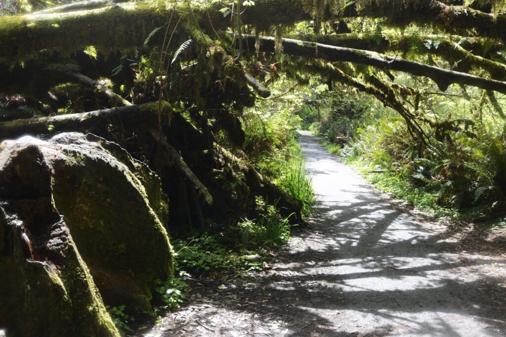
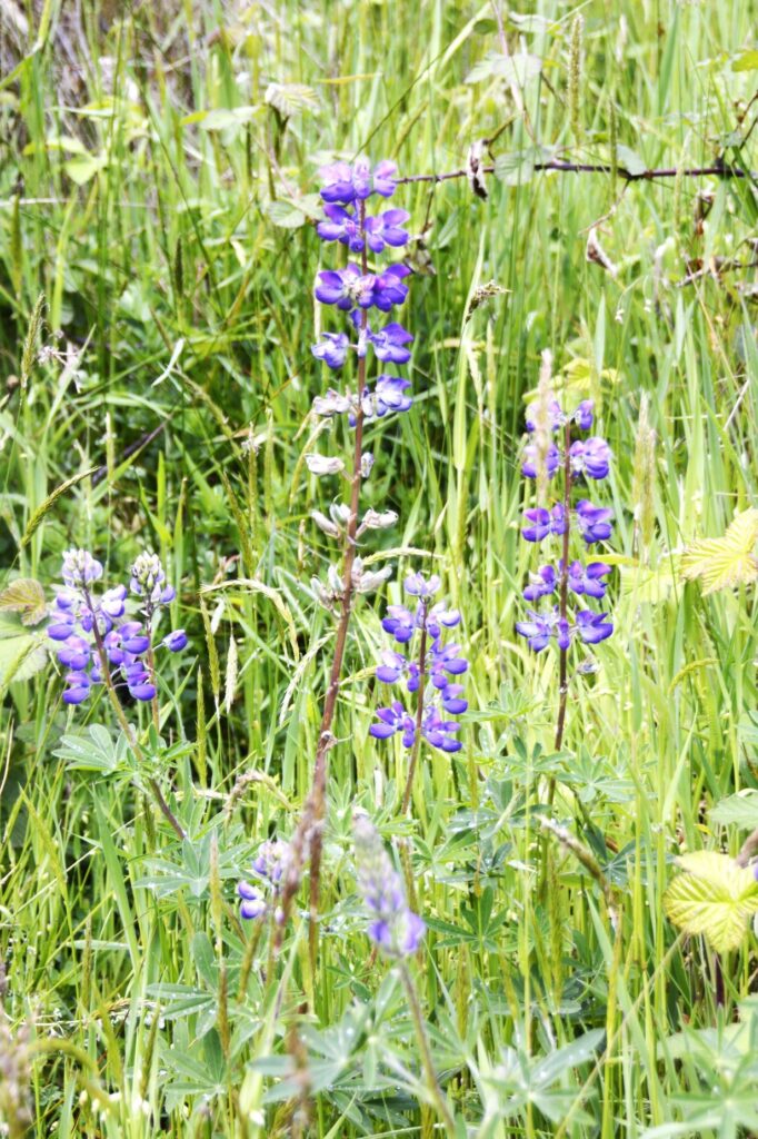
After getting my National Parks Passport book stamped, we drove further south to Elk Meadow area where I hiked to Trillium Falls. Wildflowers greeted me at the start of the trail.
Lupine blooming along trail.
The forest soon closed in around me as the trail wound up switchbacks for a 200′ elevation gain. The sign at the trailhead said there were bears in the area. I was a little nervous being all alone, but I knew there were people ahead of me and behind me also.
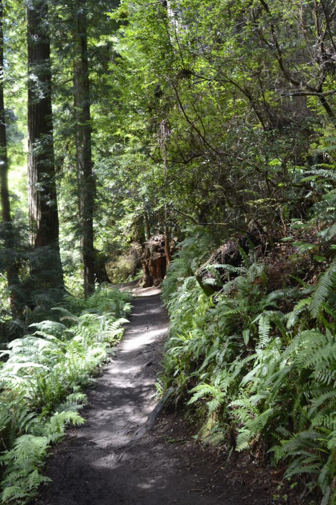
Pathway to Trillium Falls
I quit worrying and just enjoyed the quiet and beauty of the forest. Ferns grew everywhere, even out of old tree stumps.
Pathway to Trillium Falls lined with ferns.
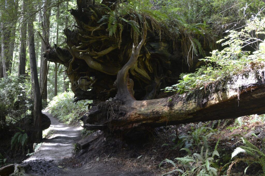
I had to hold onto the roots of a large fallen redwood trying to avoid a muddy spot on the trail. There were several spots that were muddy and slippery. I took my time and didn’t slip.
Roots of fallen Redwood tree
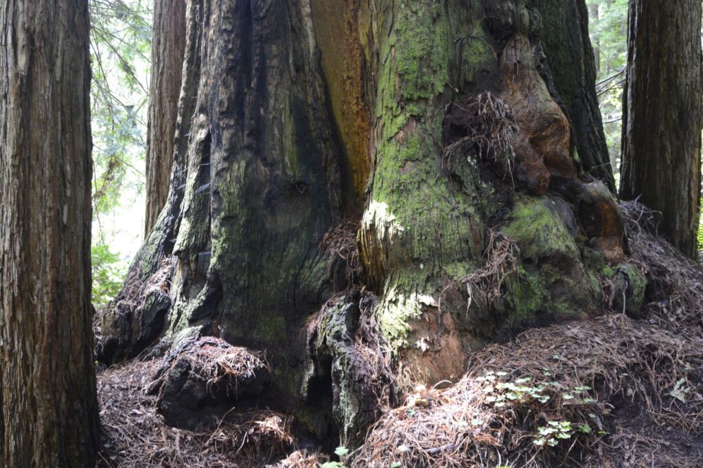
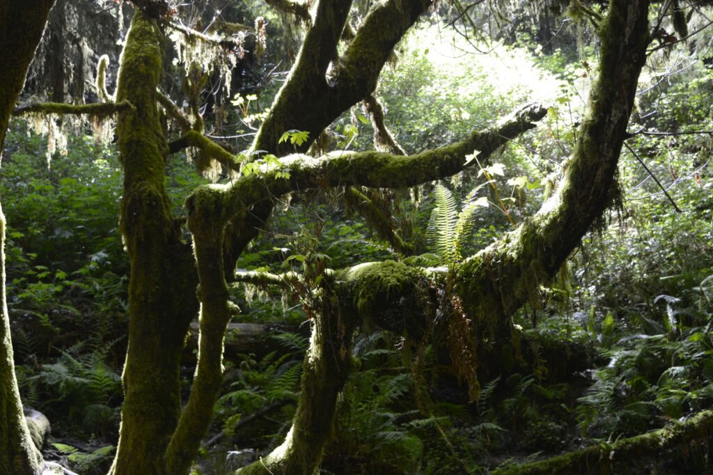
These giant redwoods don’t have deep roots, but the roots spread out for quite a distance around them. These huge moss-covered trunks intrigued me.
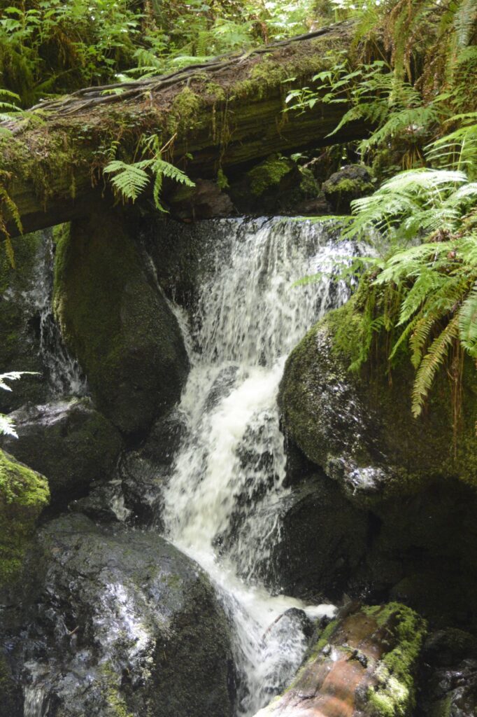
Moss covers Redwood tree trunks.A footbridge over water on the trail to Trillium Falls.
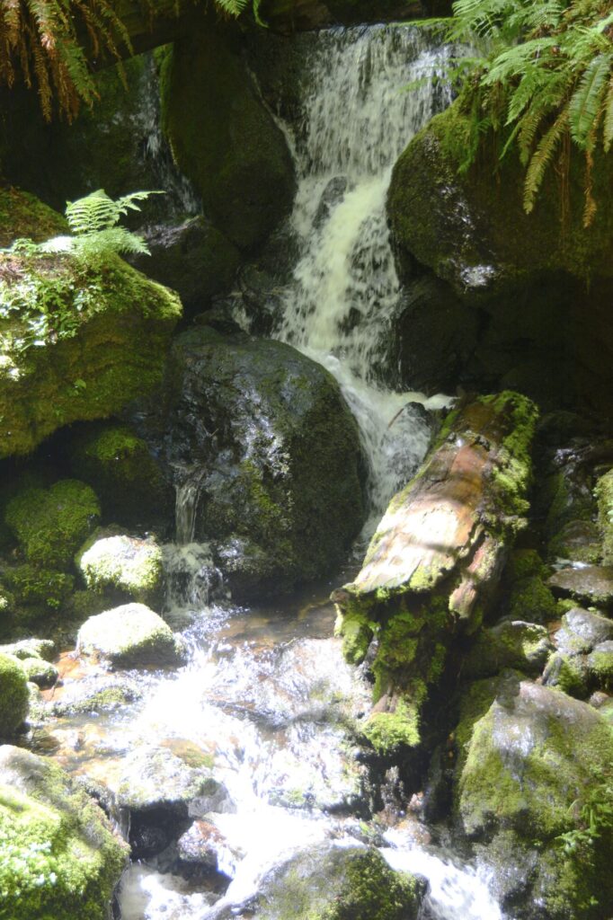
After a half-mile of hiking, I came to Trillium Falls. The falls weren’t that impressive, but the setting was magical. The forest and ferns around it made it such a pretty place.
There were several people gathered around the falls getting photos and climbing on the rocks. I had to wait to get some photos.
Trillium FallsTrillium Falls
It was such a beautiful spot in the late afternoon. The light was filtering down through the trees on this very twisted mossy tree that hung over the falls.
Tree at Trillium Falls with fern.
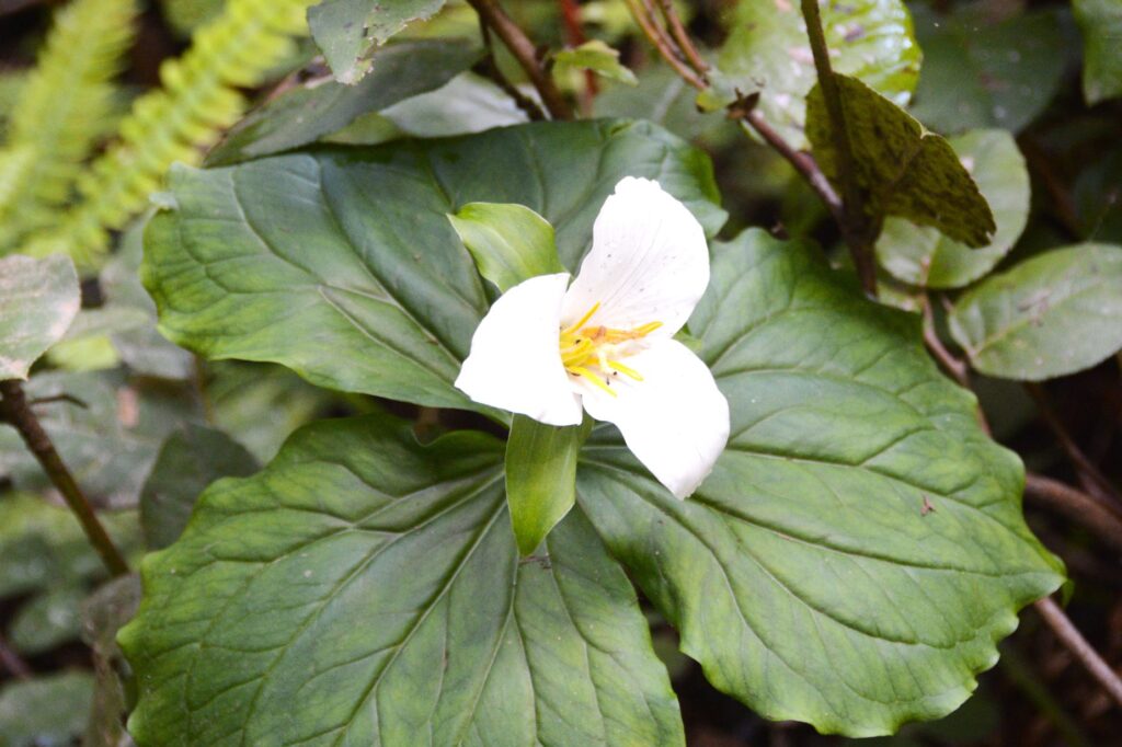
After lingering at the falls for awhile, I headed back to the truck. The trail continued on, but I didn’t carry any water with me, and I was getting pretty thirsty by then. I felt like this hike had been well worth the effort. There was just one thing more that I wished for. This may seem silly, but I prayed to see a trillium flower for which the falls was named.
My prayer was answered. Though I had looked all along the pathway for flowers, I didn’t see this one until I was on the way back.
Trillium Flower is known for it’s three petals and three leaves.
“The Lord directs the steps of the godly. He delights in every detail of their lives.” Psalm 37:23
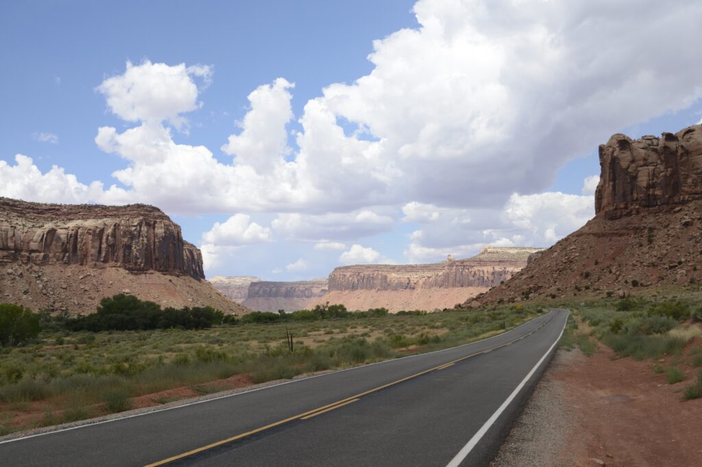
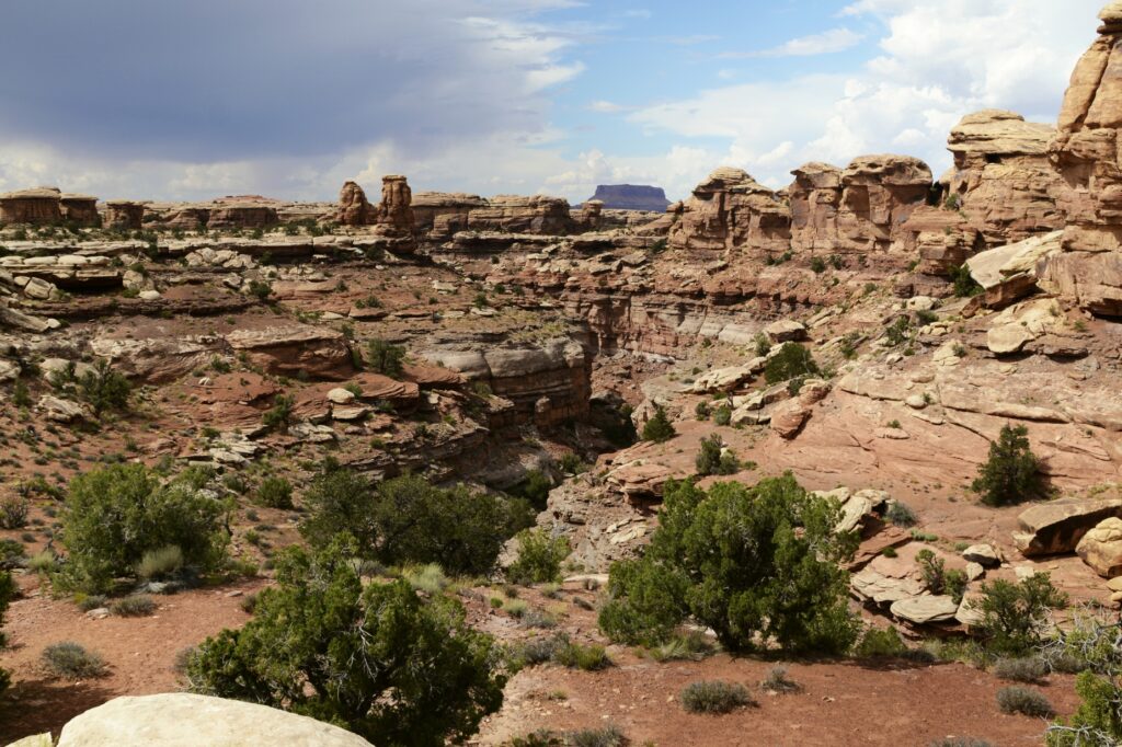
Several years ago, we visited Canyonlands National Park on the west entrance. The road follows the rim of the canyon where there are epic views of the canyons where one can see for miles. This time we visited the east entrance where we drove around the canyon floor.
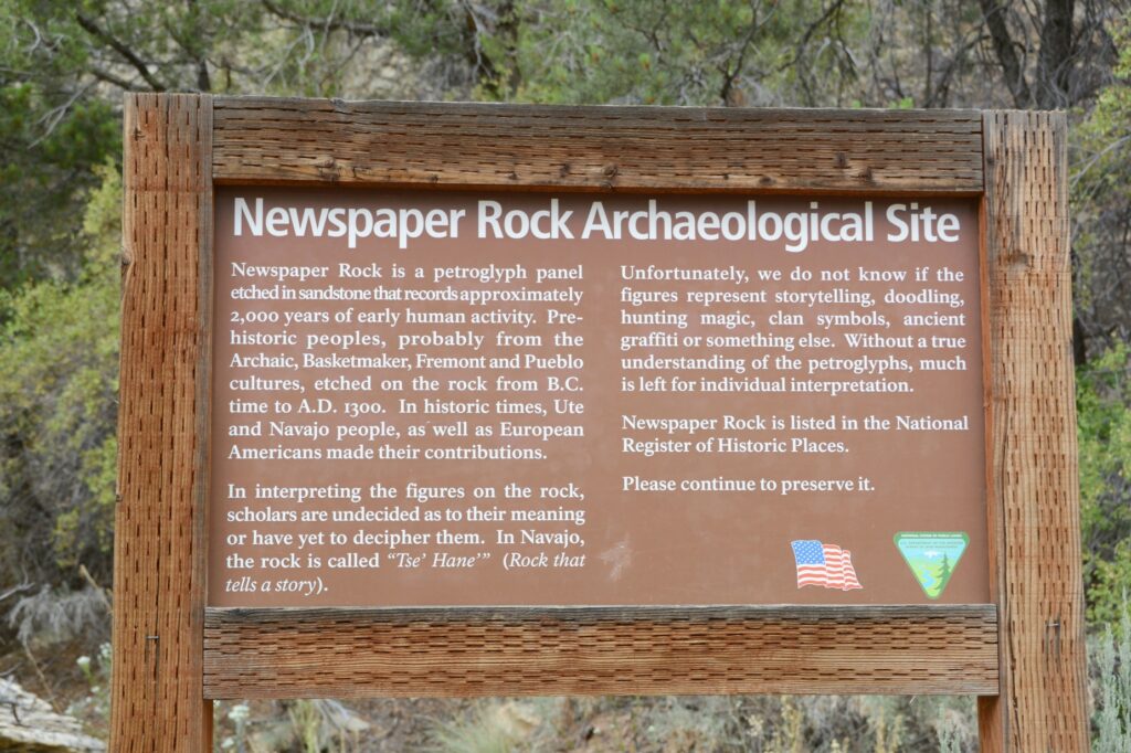
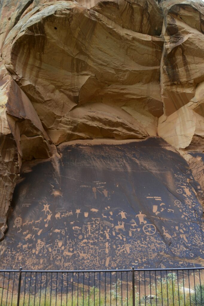
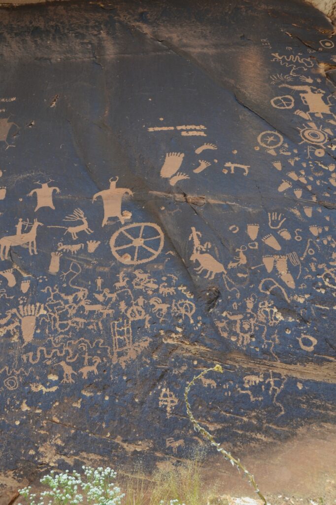
On our way there, we stopped to see Newspaper Rock Archaeological Site. This site is well protected by the overhanging cliff.
It was interesting to me to see that some of the feet drawn on the rock had six toes. It seems having an extra toe or finger was maybe highly valued. Excavations have found six-toed skeletons in Chaco Canyon in New Mexico.
Six-toed footprints, flying saucers, men with horns–what are these petroglyphs about?
As we drove along the canyon floor on the way to the entrance of Canyonlands, the rock walls towered above us.
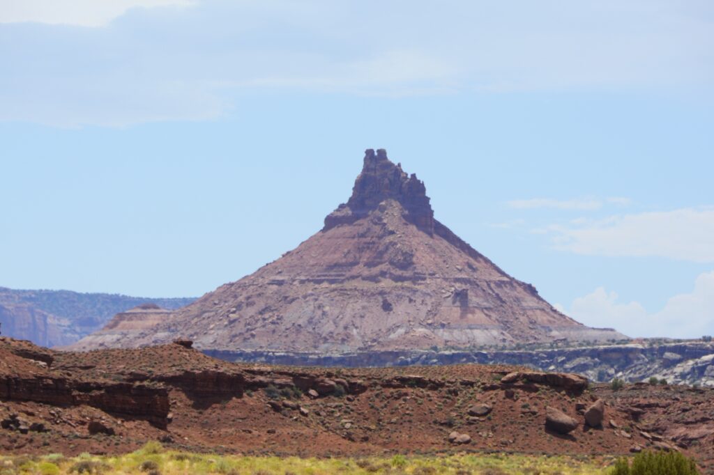
We saw this interesting rock formation along the way.
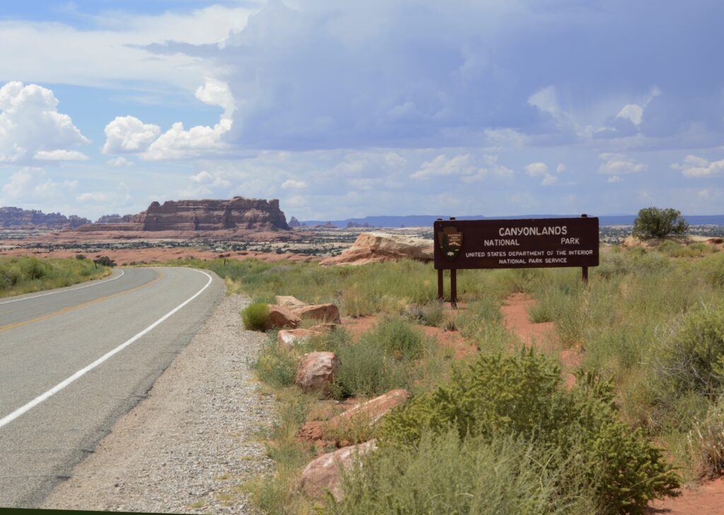
After driving several miles, we finally came to the entrance. We stopped at the visitors’ center where I found some post cards and a t-shirt.
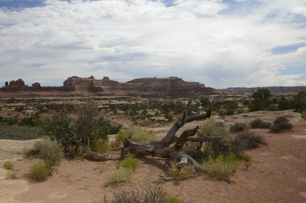
This section of the park is called The Needles because of the colorful spires of Cedar Mesa Sandstone that are prevalent in the area. There is only one road leading in and out of the area. We drove the scenic drive all the way to the end. Our first scenic viewpoint was the Wooden Shoe Arch Overlook. I think it was appropriately named.
Wooden Shoe Arch Overlook with Wooden Shoe Arch in the distance.
Our time in southeastern Utah was during the monsoon season of August. Every day a rain storm would bring clouds and often times rain.
We drove through the campground at the park just to get an idea of what the sites looked like. There were no hook ups and the sites were very small. Water was available only seasonally at the restroom facilities.
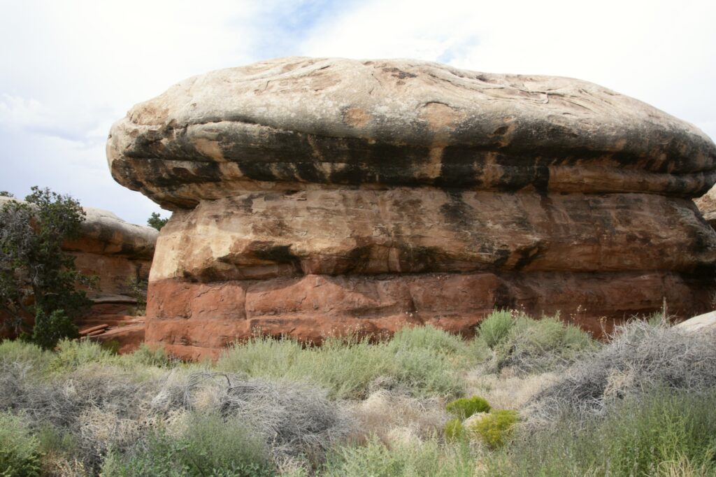
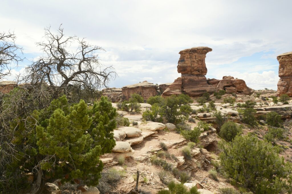
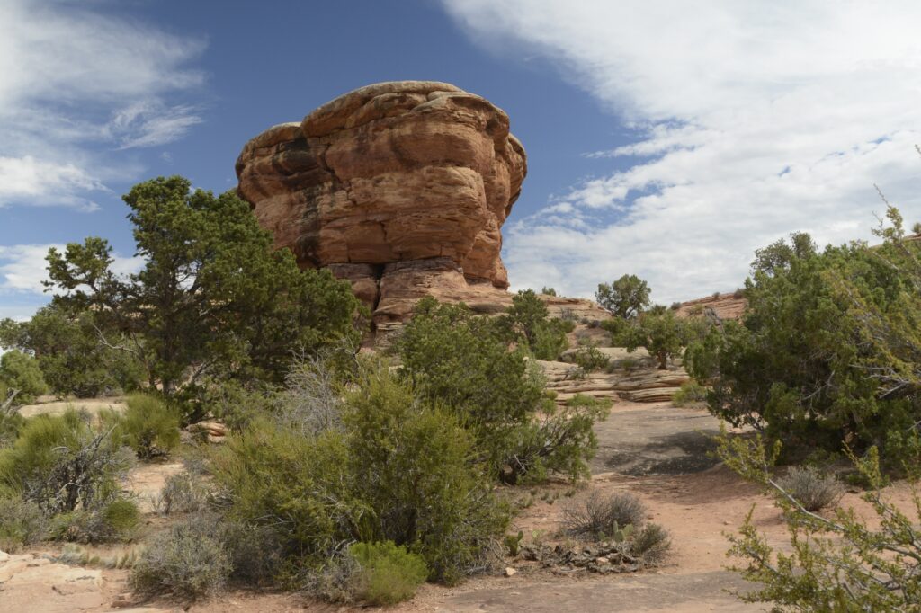
The rock formations around the campground looked like giant toadstools.
Toadstool like rock formations among the campground area.
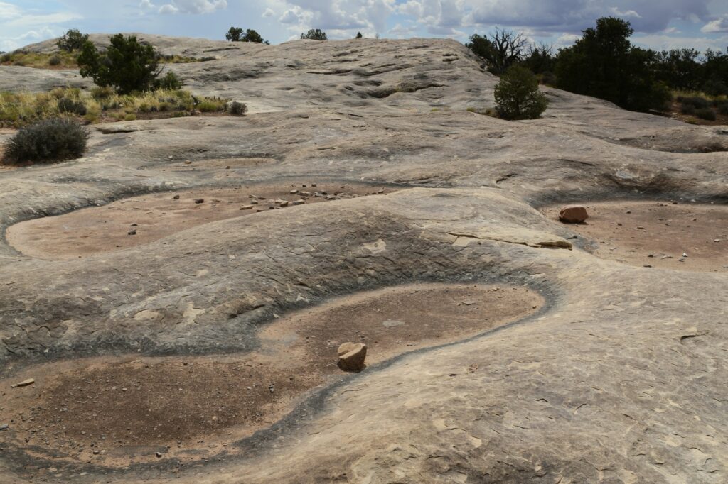
We drove to Pothole Point where we saw the potholes that collect water when it rains. Even though they were dried up, there is a whole ecosystem with aquatic life that comes alive when the rains come. It’s important not to step in the holes because of that. They are a source of water for the wildlife in the rainy season.
Pothole Point had many potholes to collect water during the rains.
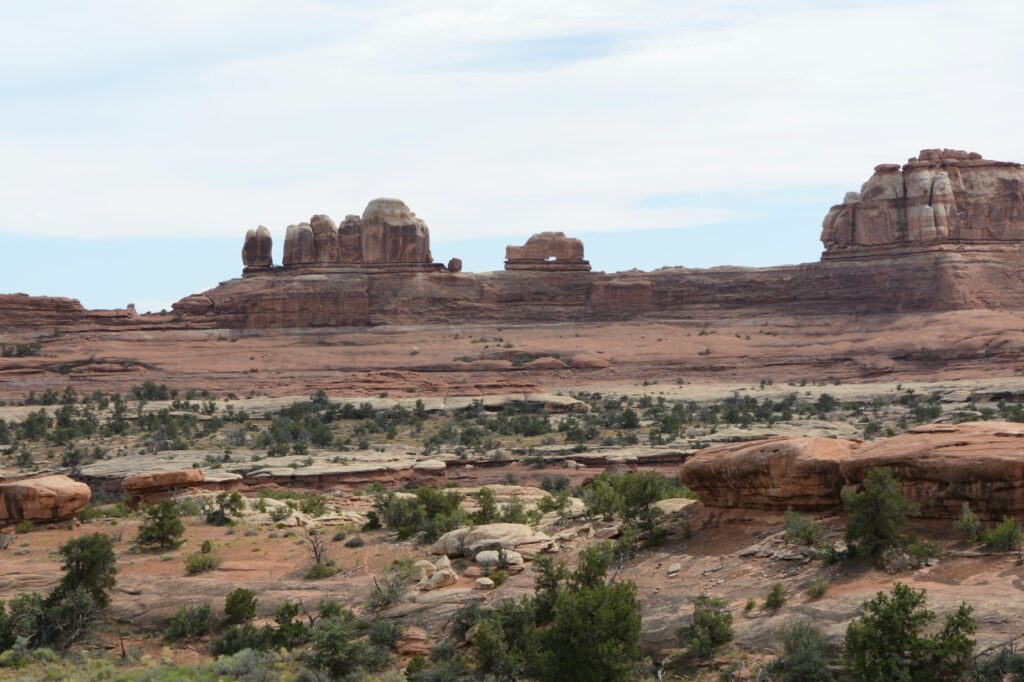
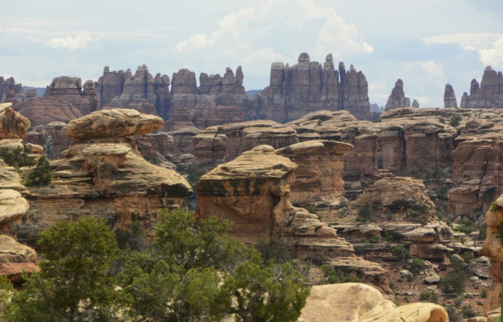
At the end of the road is Big Spring Canyon Overlook. It was here that we got a good look at the pinnacles from which the name “The Needles” comes from.
The Pinnacles in the background give this section of the park its name: The Needles.Big Spring Canyon Overlook
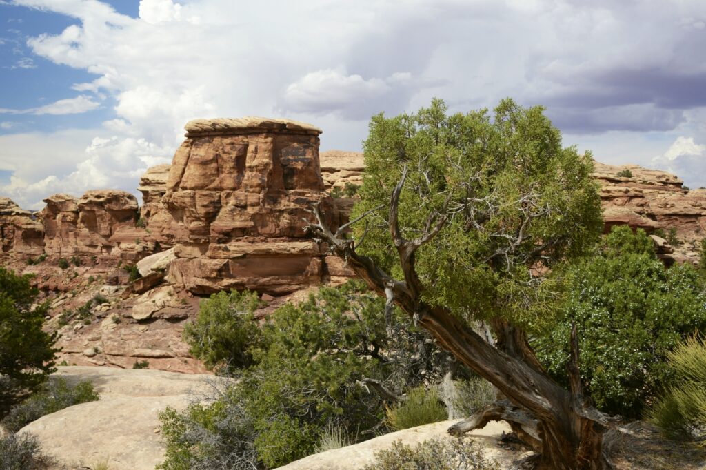
The Utah Juniper tree is a hearty tree that can survive the harshest of conditions due to its extensive and deep root system. The roots can grow 25 feet deep and spread out for 100 feet from the tree.
Utah Juniper clings to the rocks at Big Spring Canyon Overlook.
Although The Needles section of Canyonlands National Park was interesting and beautiful, it didn’t compare with the views from the western entrance. I was mildly disappointed. But I’m glad we got to see this area of the park.
We drove back to our campground in Monticello, Utah. That spot turned out to be a perfect base camp for visiting all the attractions of southeastern Utah. We still had at least one more area to explore, but I will save that for the next blog.
“No one is as holy as the Lord! There is no other God, nor any Rock like our God.” I Samuel 2:2
There are five national parks in the state of Utah. Even though we’ve visited all five in the past, we wanted to revisit Arches and Canyonlands again. There’s never enough time to see everything all at once.
Arches NP is now so popular that it requires a timed entry ticket to visit during peak hours. We found the afternoons had plenty of time slots available. I was also hoping to get some sunset photos.
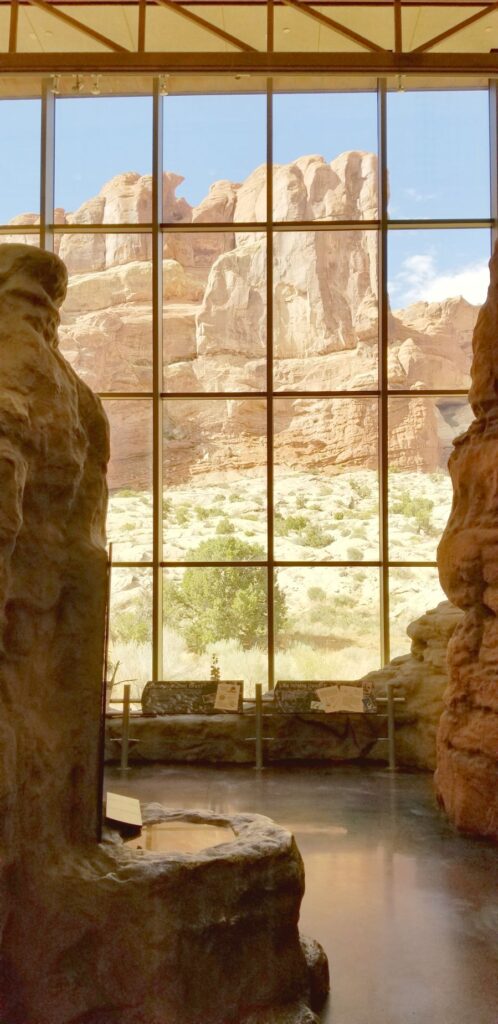
Visitors’ Center
We started our visit this time at the visitors’ center. It was built in 2005, so it was our first time to see it. I especially liked the views from the large windows.
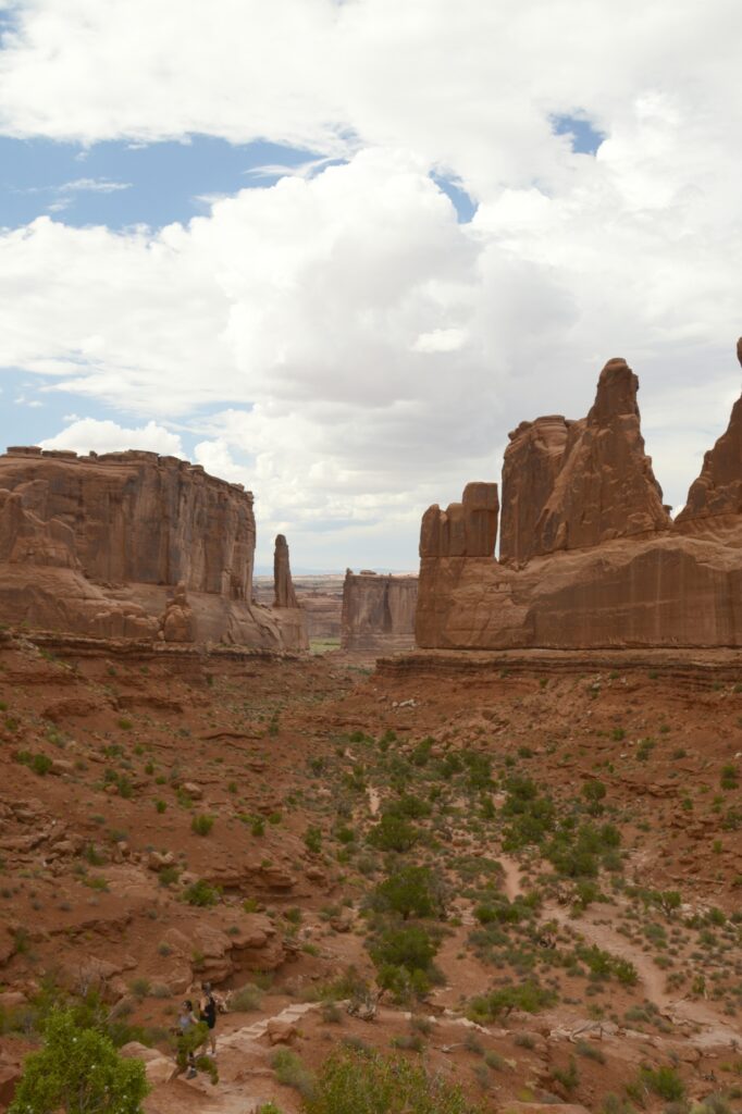
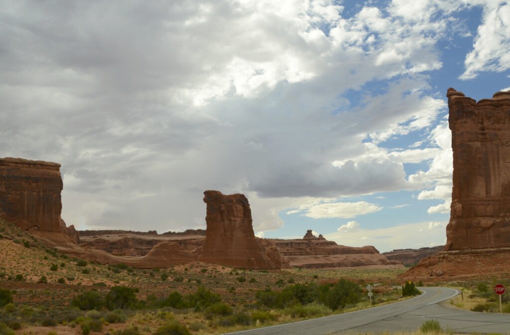
Park Avenue Viewpoint and Trailhead
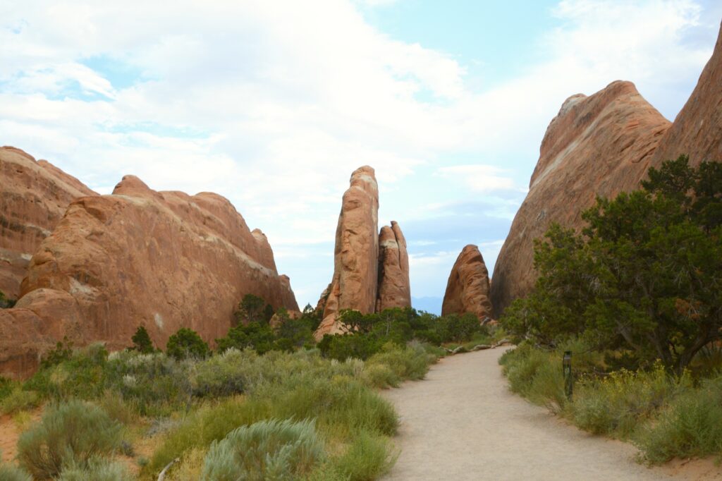
Our first stop along the 40-mile scenic drive was the Park Avenue Viewpoint. From the viewpoint it was like looking through a window at the mountains beyond. The trail climbed down into a valley between massive rock formations.
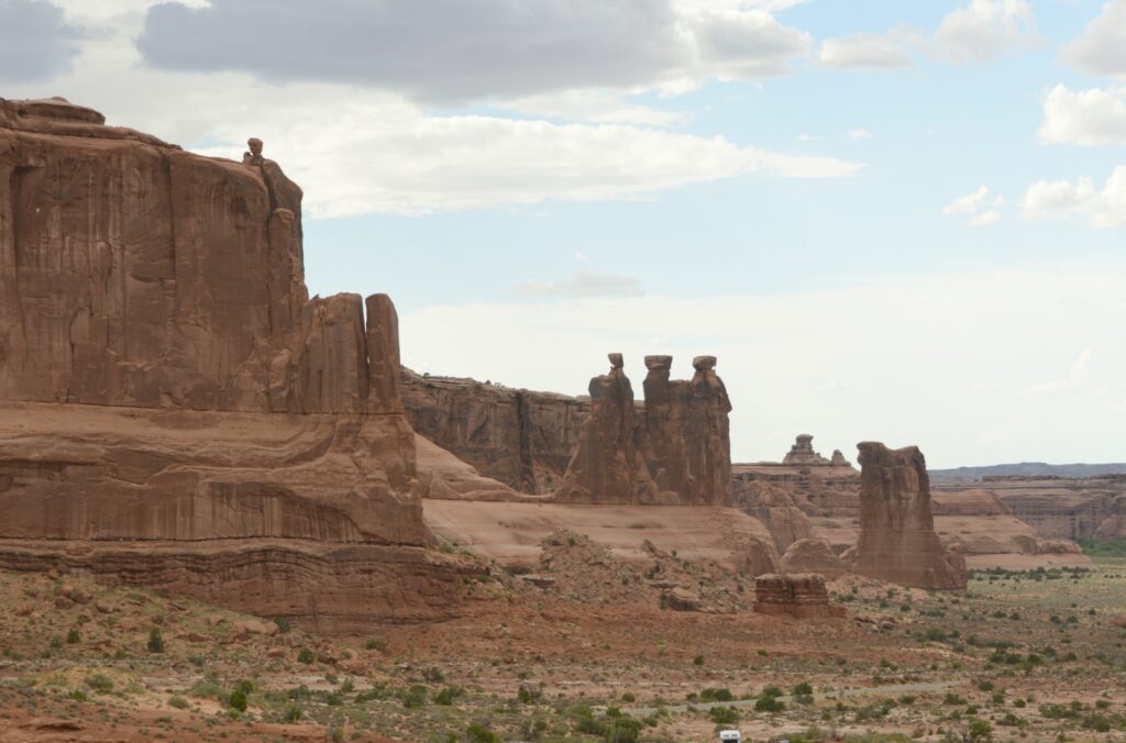
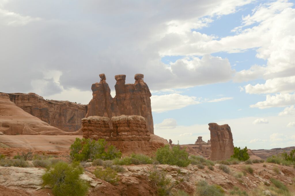
Three Gossips
The three gossips looked familiar to us from previous visits. I call them “Three Wise Men” because they look like they’re wearing turbans.
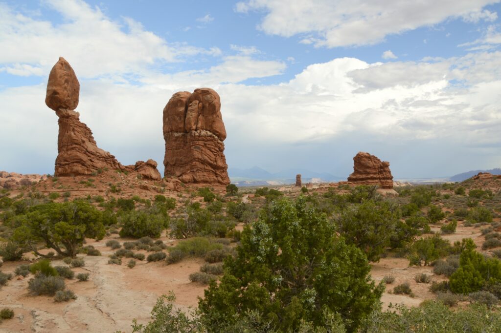
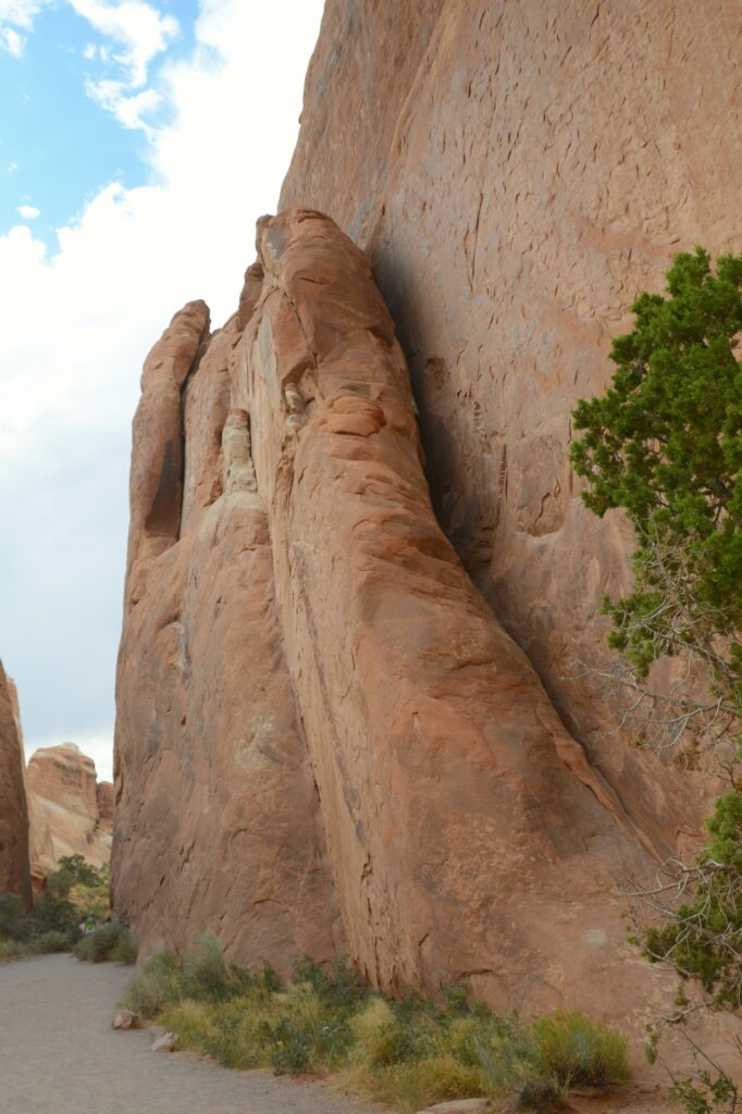
Erosion is constantly wearing down the sandstone rock. Some arches eventually collapse. Such is the one shown below. The three rock columns were once connected on top by a layer of rock.
Other types of formations in the park are balancing rocks, such as this one.
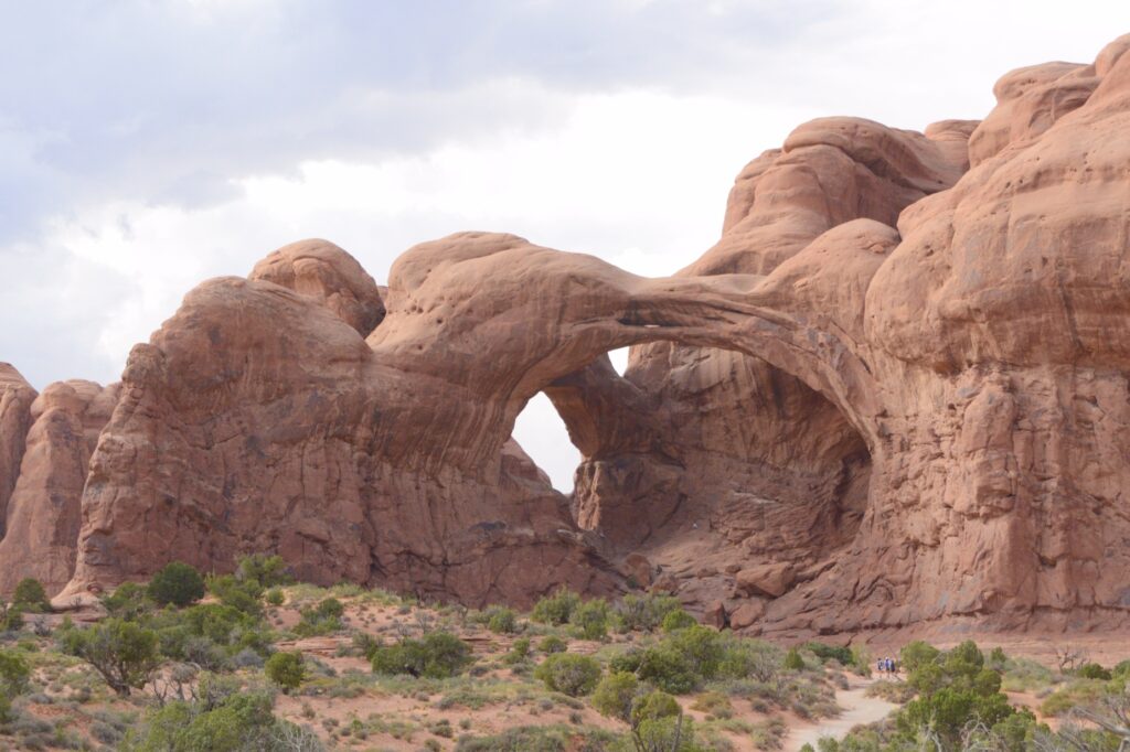
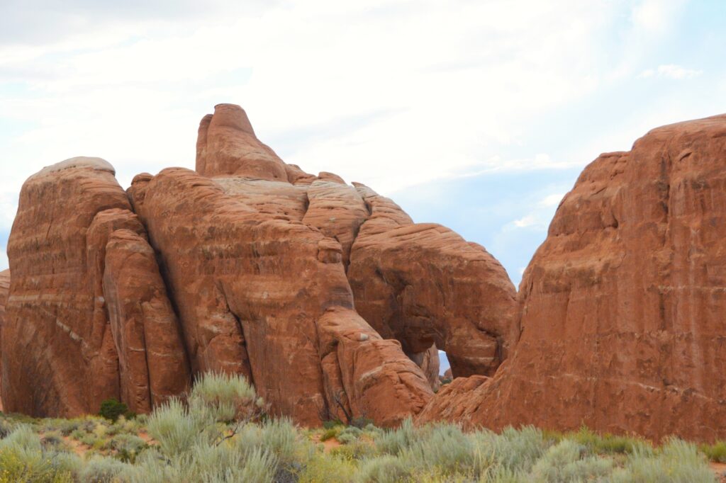
This double arch was formed from water erosion from the top, rather than more typical erosion from the side. Next to them are the beginnings of other arch caves.
Double ArchesDouble Arches and arch caves
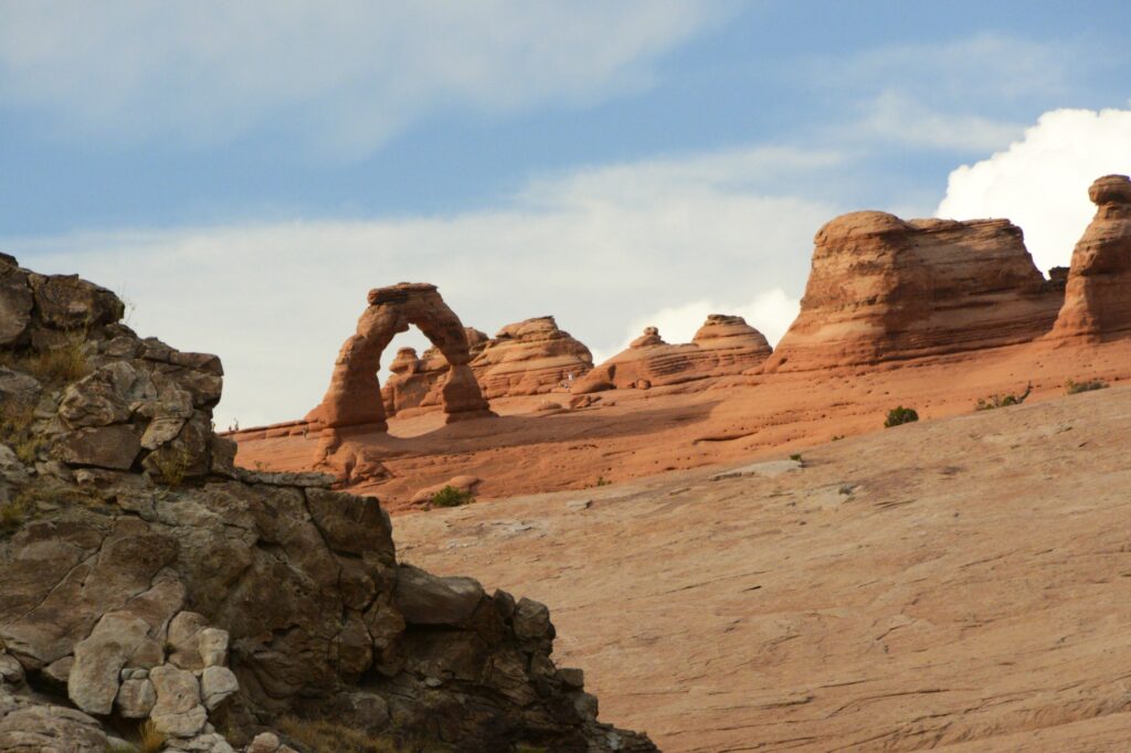
Delicate Arch has had many names in the past, including “Old Maids Bloomers”, “Pants Crotch” and “School Marm’s Pants.” Although the rumor is not true that the names of Delicate Arch and Landscape Arch were inadvertently exchanged due to a signage switch, in my opinion, the switched names fit better than the current ones.
We hiked up to this arch years ago. But this time, I just took a photo from a distance with a zoom lens.
Delicate Arch
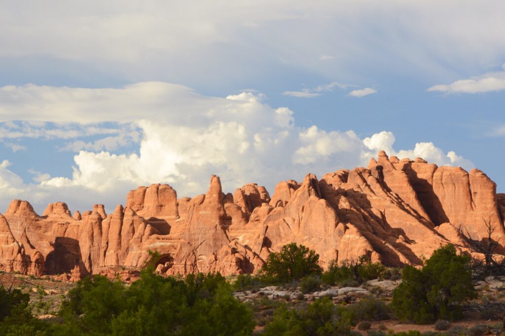
There are over 2,000 natural arches in Arches National Park. There are also hundreds of towering pinnacles, huge rock fins, and giant balanced rocks.
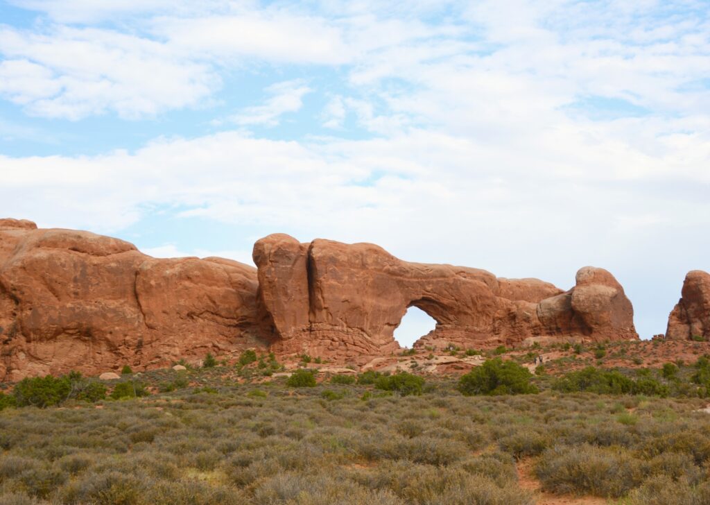
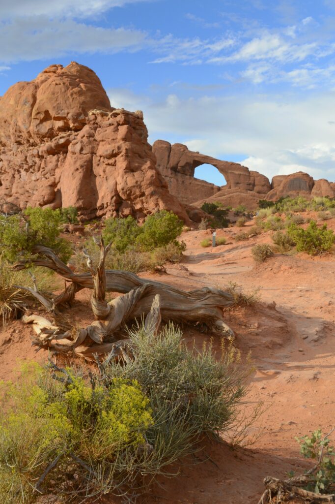
North Window
Windows are formed by blowing sand that erodes the rock instead of water erosion. North and South Windows are sometimes called the “spectacles” because they look like eyeglasses.
North and South Windows
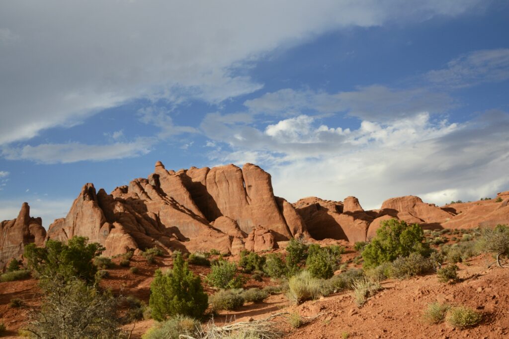
Formations called “fins” are formed when water flows along parallel joints or fractures and erodes the rock away in “slices”.
Fin rock formations
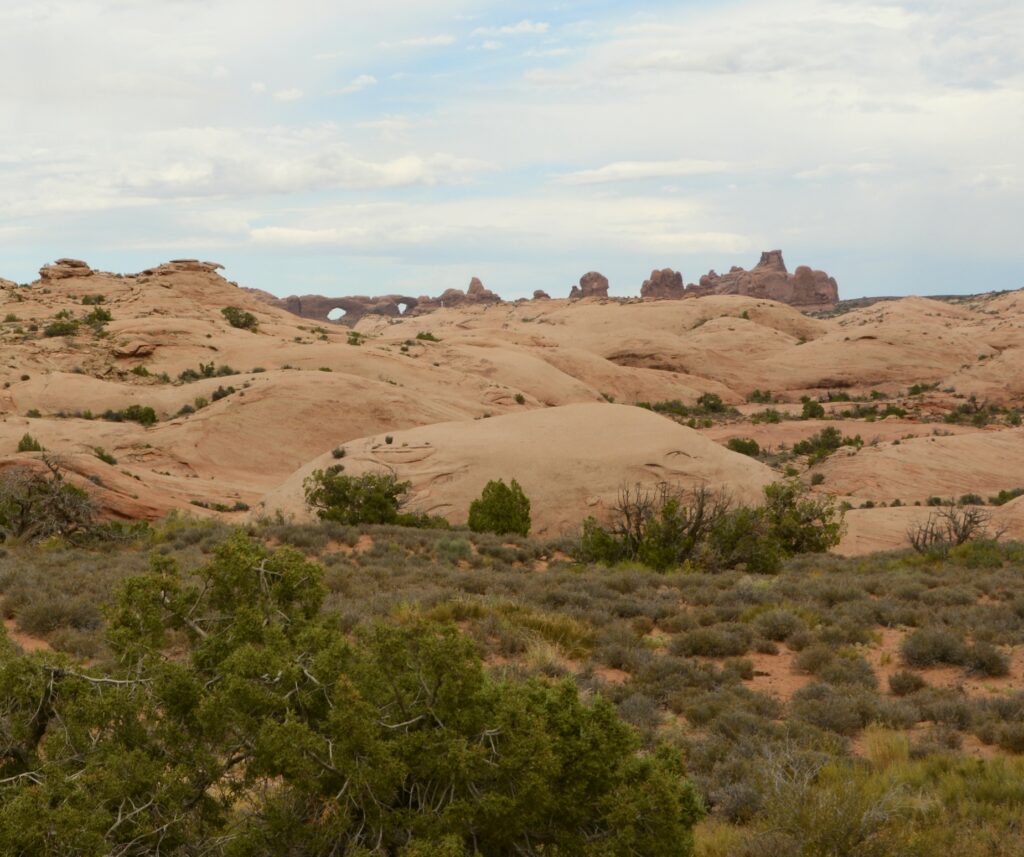
As the afternoon wore on, the clouds parted and the sun lit up the rocks. We weren’t at the end of the scenic drive yet. There were still more sites to see.
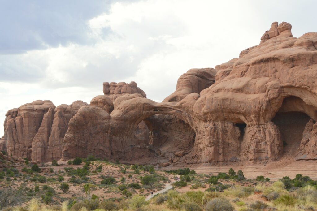
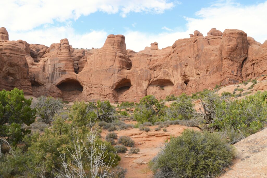
Driving along the road, we could see the beginnings of many arches forming in the rocks.
Cave arches
Skyline Arch was one of my favorites simply because you could see it from the road and it had this interesting twisted old tree in front of it.
Skyline Arch
At the end of the scenic drive is Devils Garden Trailhead. This trail leads to Landscape Arch, which is the longest rock arch in North America. It is very long and thin, which makes me think it should have been named “Delicate Arch.”
The wind had kicked up, and it was late in the day, so I only hiked a short way on the two-mile hike to the arch.
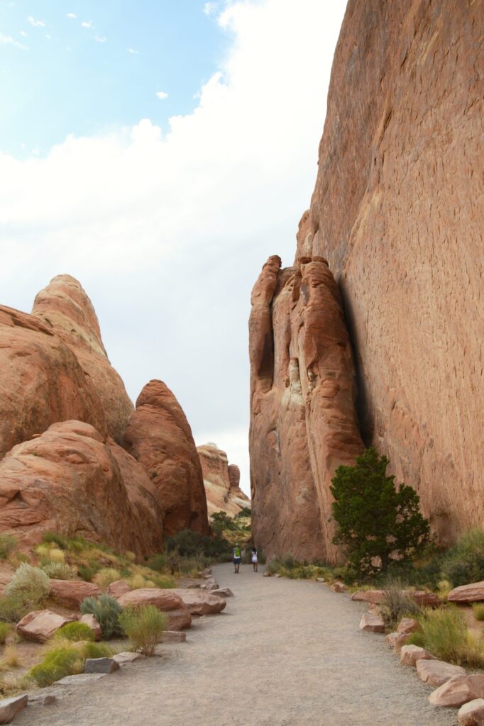
The Gates of Argonath
The entrance to the trail is something like walking through the Gates of Argonath in the Lord of the Rings. The rocks tower on either side of the pathway like guards.
Entrance to Devils Garden TrailheadDevils Garden Trail
I hiked far enough to see one of the other arches along the trail called Pine Tree Arch, then turned around and headed back.
Pine Tree Arch
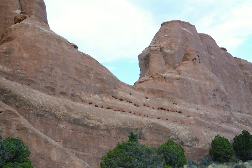
We noticed these holes in the rock above the parking lot. It shows how water enters the rocks and begins the erosion process that eventually forms arches.
The rain was all around us while we were there, but it finally caught up with us as we were leaving.
The rain caught up with us.
Our second visit to Arches made for a beautiful day enjoying the beautiful scenery created by God.
He is the Rock; His deeds are perfect. Everything He does is just and fair. He is a faithful God who does no wrong; how just and upright He is! Deuteronomy 32:4 TLB
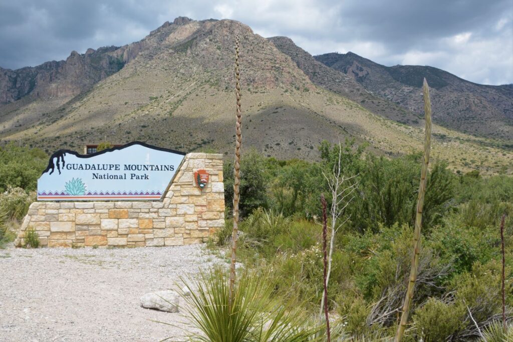
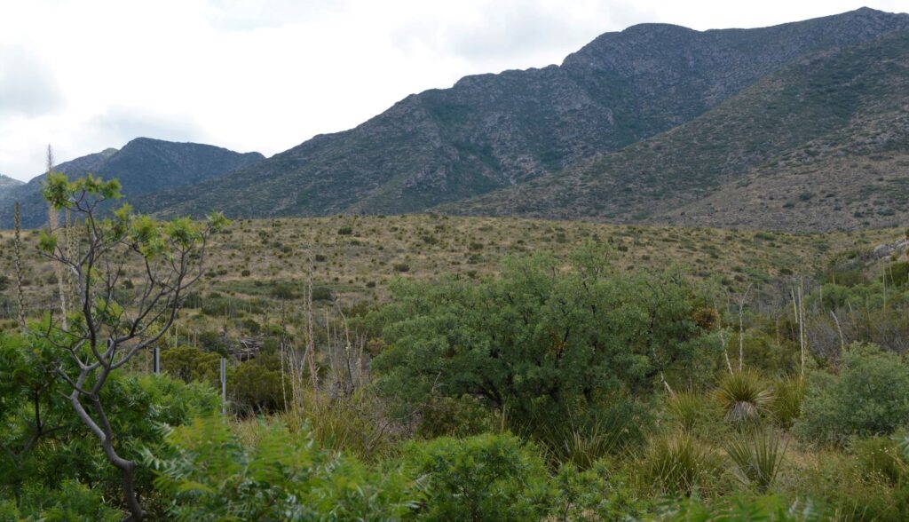
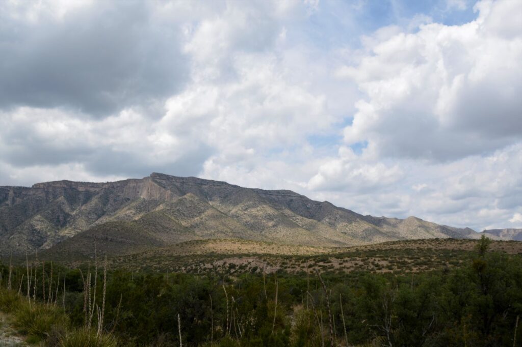
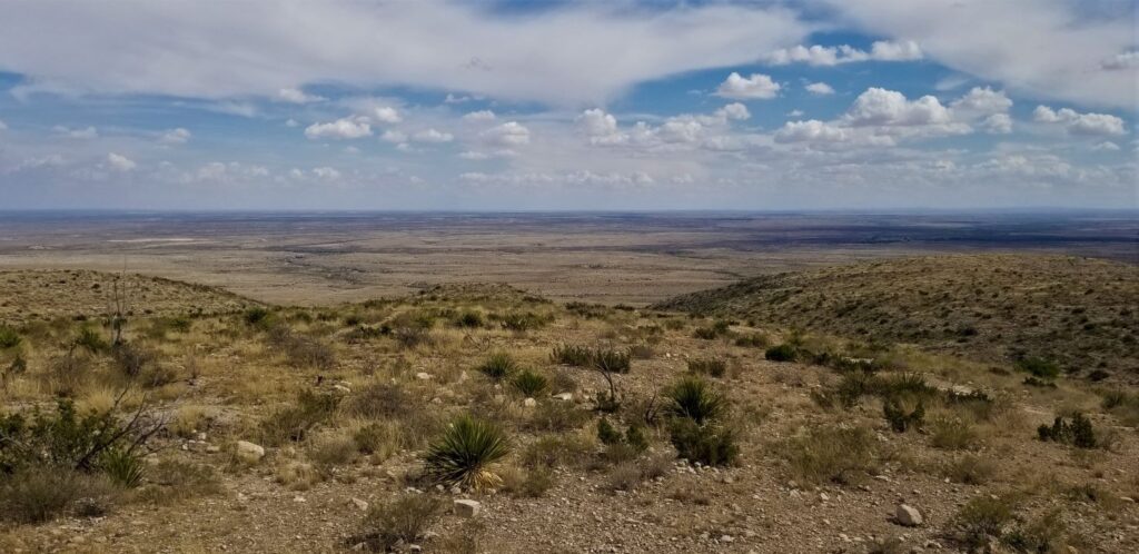
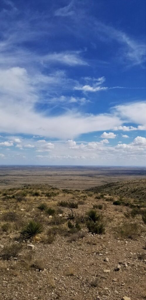
Created in 1966, Guadalupe Mountains National Park contains the highest point in the state of Texas, Guadalupe Peak (8,751′). The park is located near Carlsbad, New Mexico, and just a few miles across the Texas border. In the western “arm” of Texas, this less known national park is well-known for its clean air.
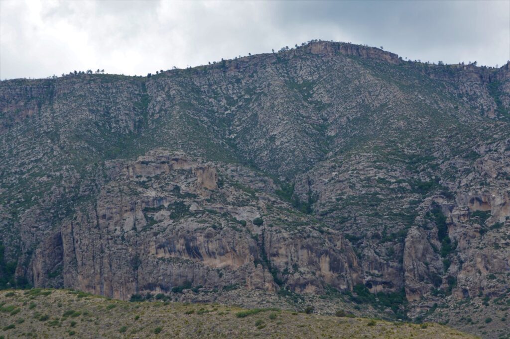
The views of mountains in Guadalupe Mountains National Park with a zoom lens
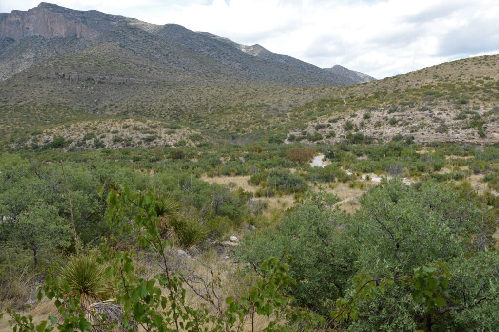
The Park is intentionally inaccessible. It was created during a time when the environmental movement was in full swing. Ninety-five percent of the park is wilderness. From the eastern border of the park where we were, there are only three short roads into the park. If you like to hike, however, there are numerous trails throughout. For us old people, we had to be content with viewing the mountains from a distance.
There are roads around the outside of the park with various viewpoints. If we had driven several hours more, we might have been able to see more, but we just didn’t have the time.
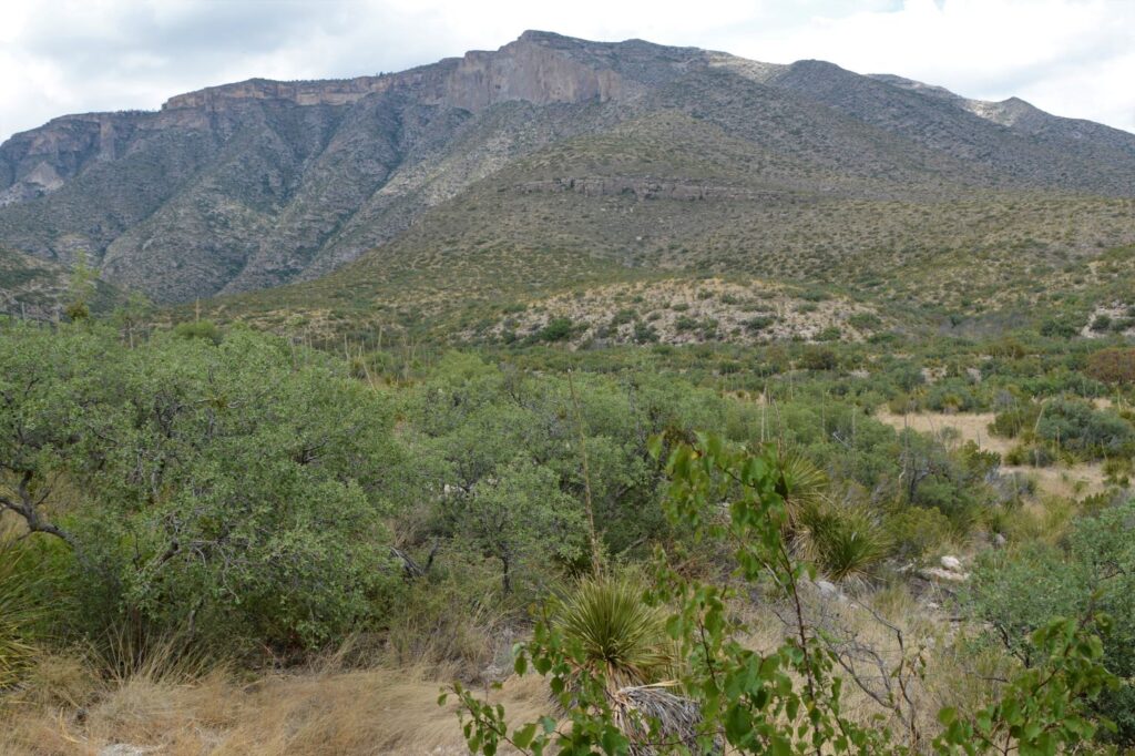
Like Yosemite National Park, this park also has an “El Capitan.” It is a 1,000′ high limestone cliff. It is visible from the highway as you drive further south. However, we did not go that far.
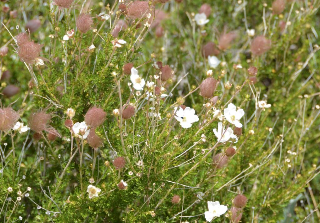
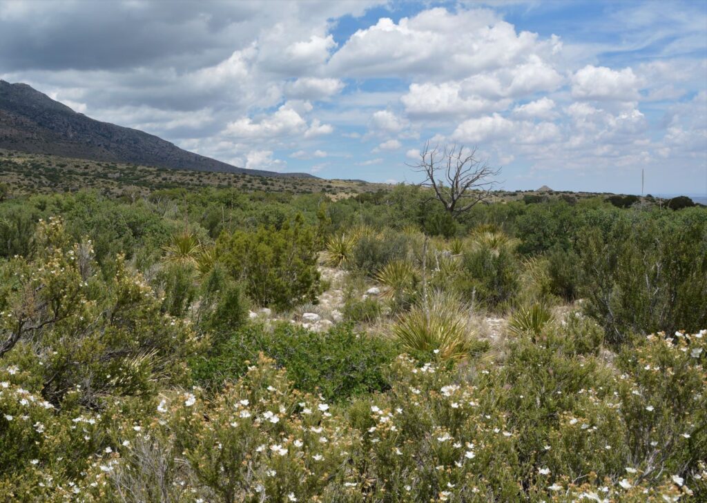
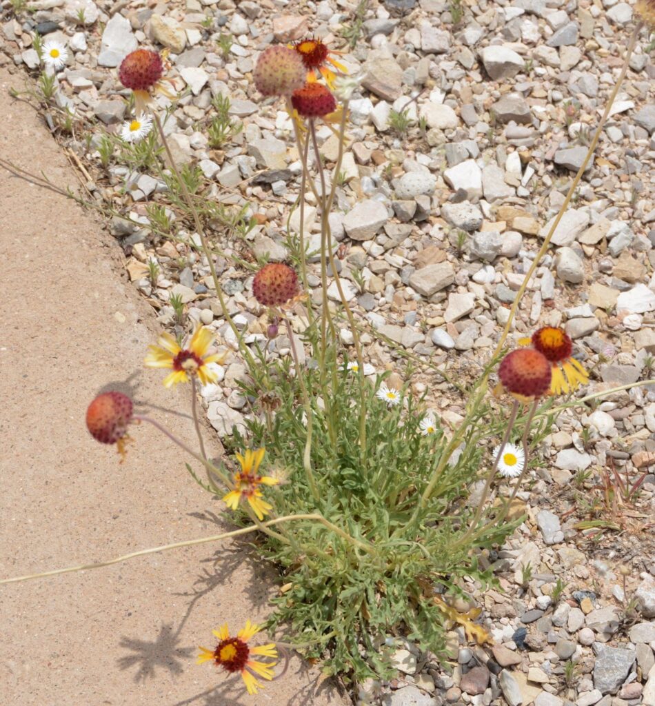
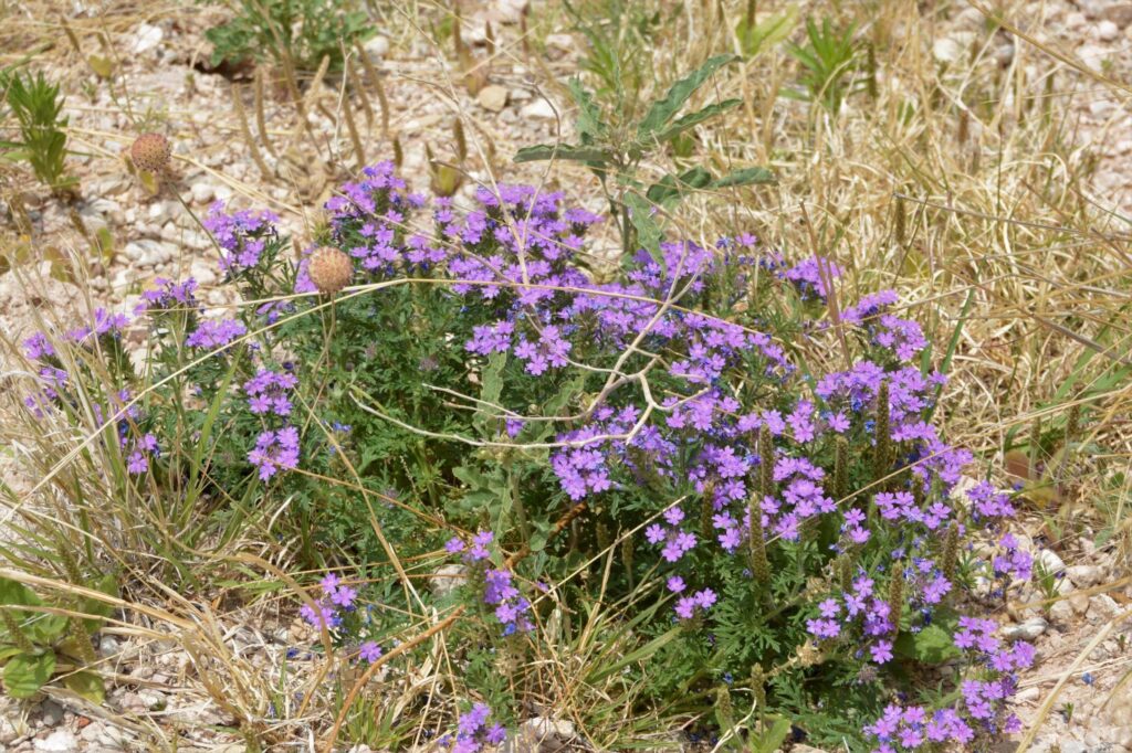
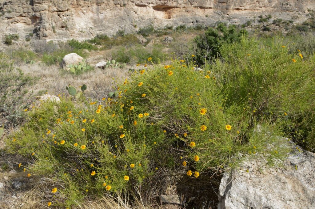
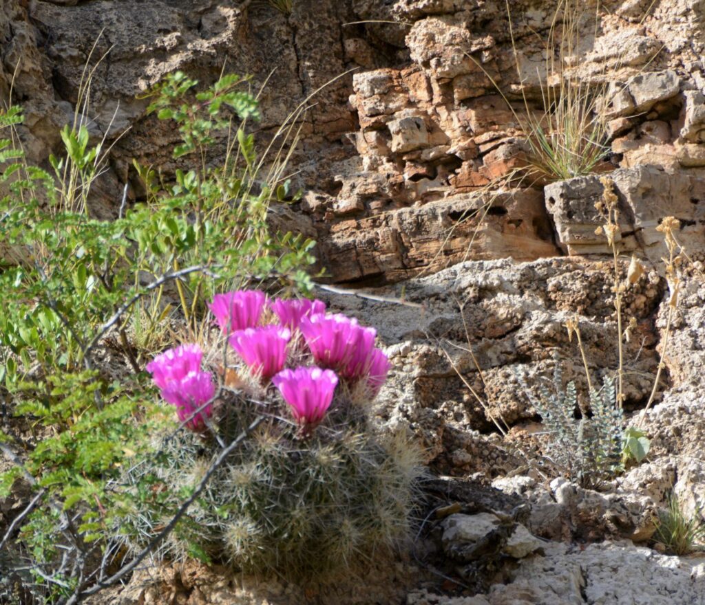
The wildflowers and cactus were in bloom and we enjoyed seeing the beauty of the desert in bloom.
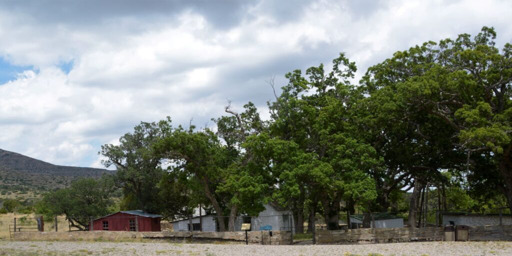
We visited the historic Frijole Ranch, but the museum was closed. It is only open seasonally when staff or volunteers are available. There was a spring outside the ranch house that flows continually at 5 gallons per minute. A spring house covers the opening and the water flows in a channel through the courtyard.
Frijole Ranch
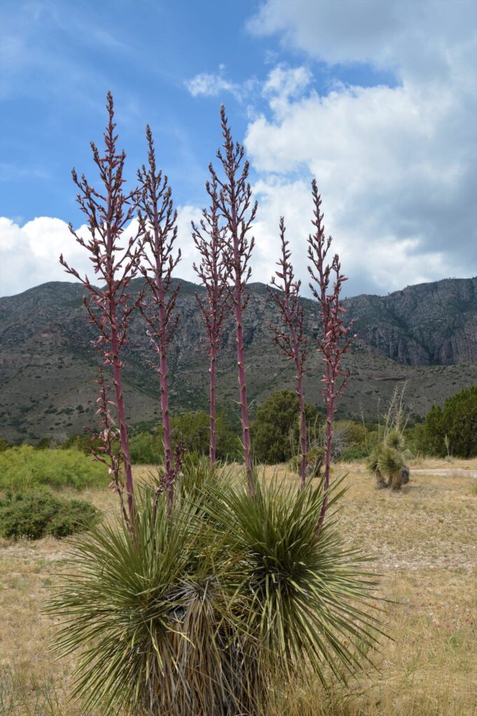
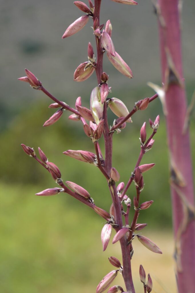
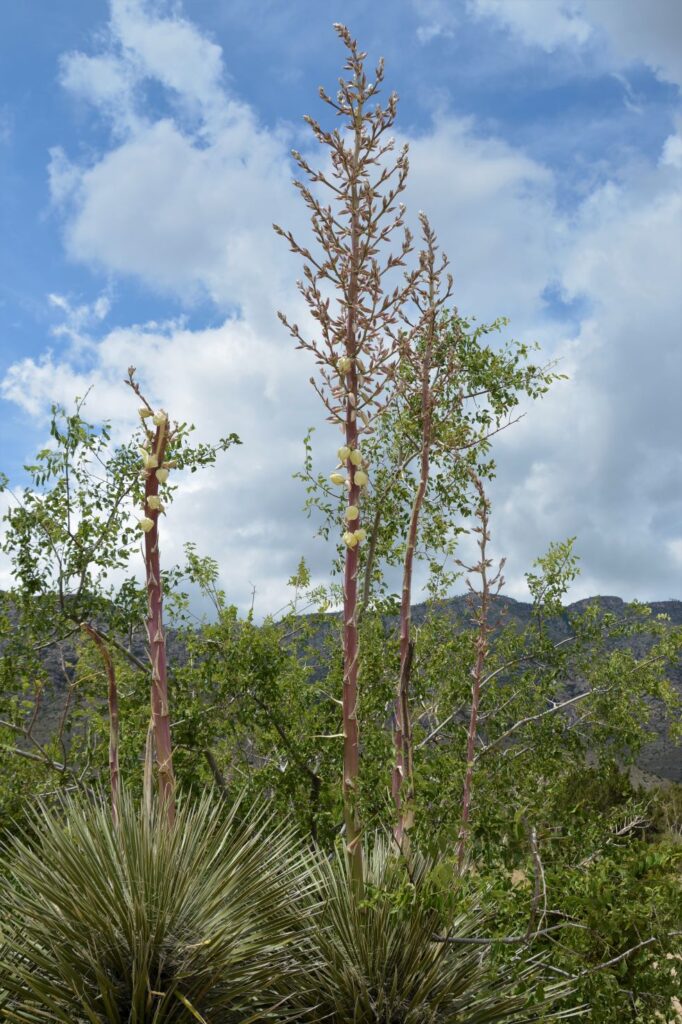
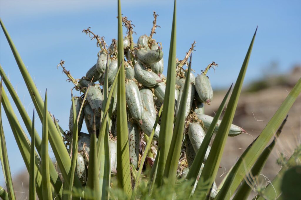
Outside the Visitors’ Center, we were fascinated with the yucca plants in various states of bloom. The yucca is related to the agave plant.
Yucca plants in early bloomClose up of yucca blooms
Indians called yucca “soap weed.” The roots were used for washing. Other parts of the plant were used for medicine and food. The fibers were used for many things and the seeds were used for tea or dried for making beads.
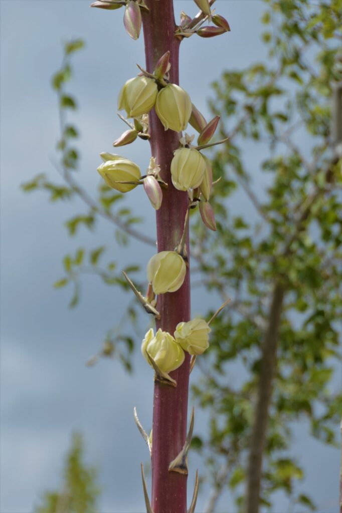
Yucca plants with mature flowersMature flowers of the yucca plant
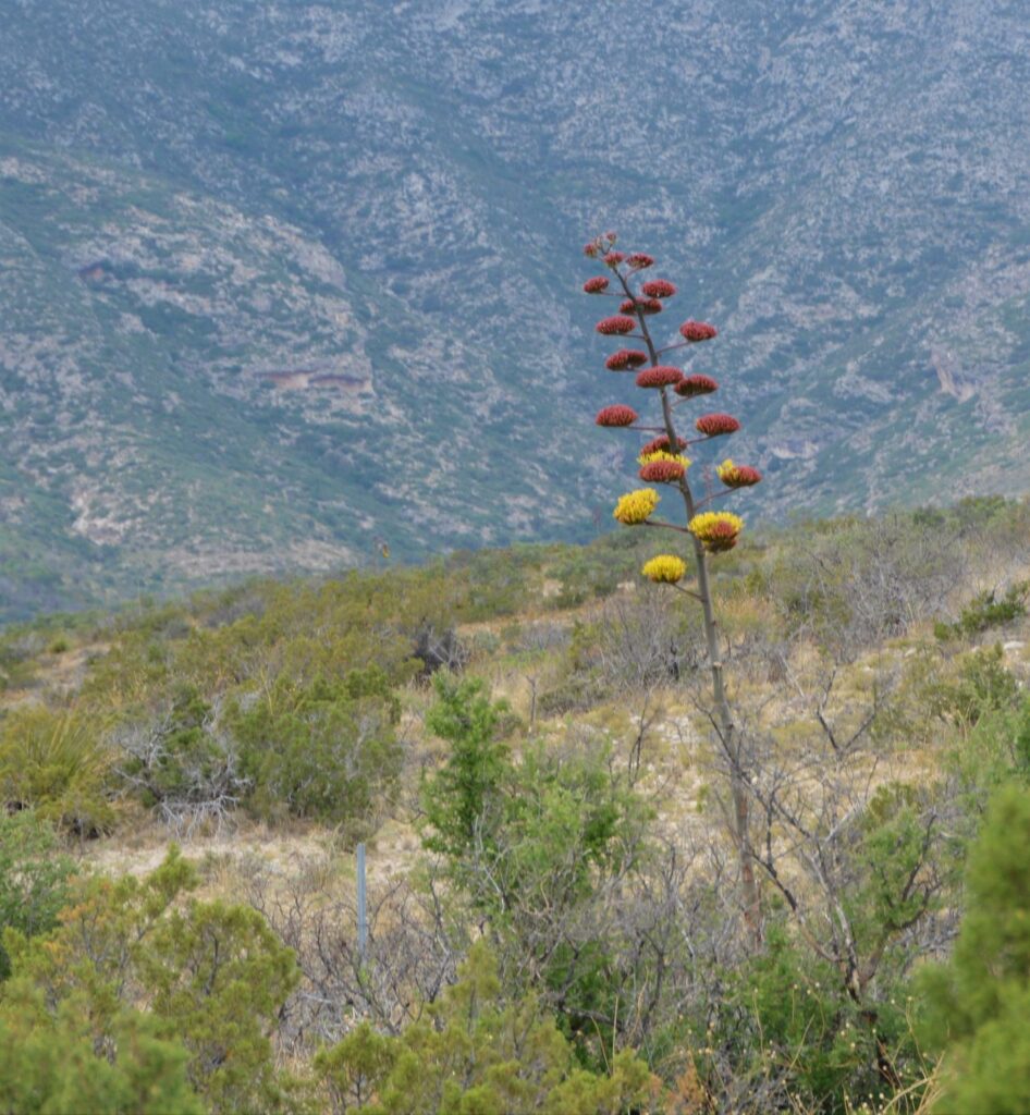
And we also saw century plants in bloom. Century plants and yucca plants look similar, but the century plants have “branches” with blooms on the ends.
Century Plant in bloom
Later in the afternoon, the sun finally came out and lit up the mountains.
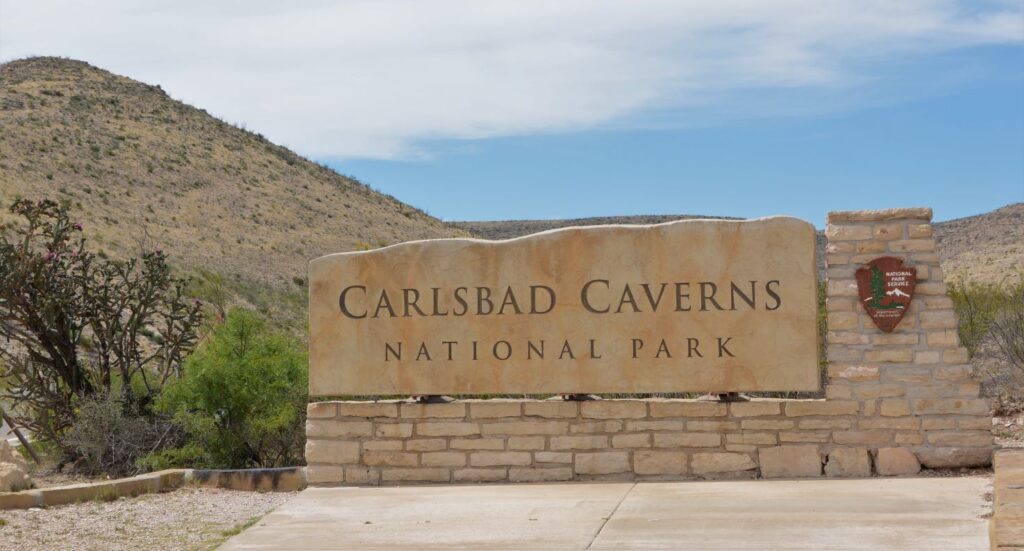
In the early afternoon, we headed back to our campground. On the way, we were going to pass Carlsbad Caverns National Park, so we decided to stop. We were too late to go on a cave tour, but we looked at the exhibits in the Visitors’ Center. I got my National Parks Passport Book stamped since we had already visited years ago.
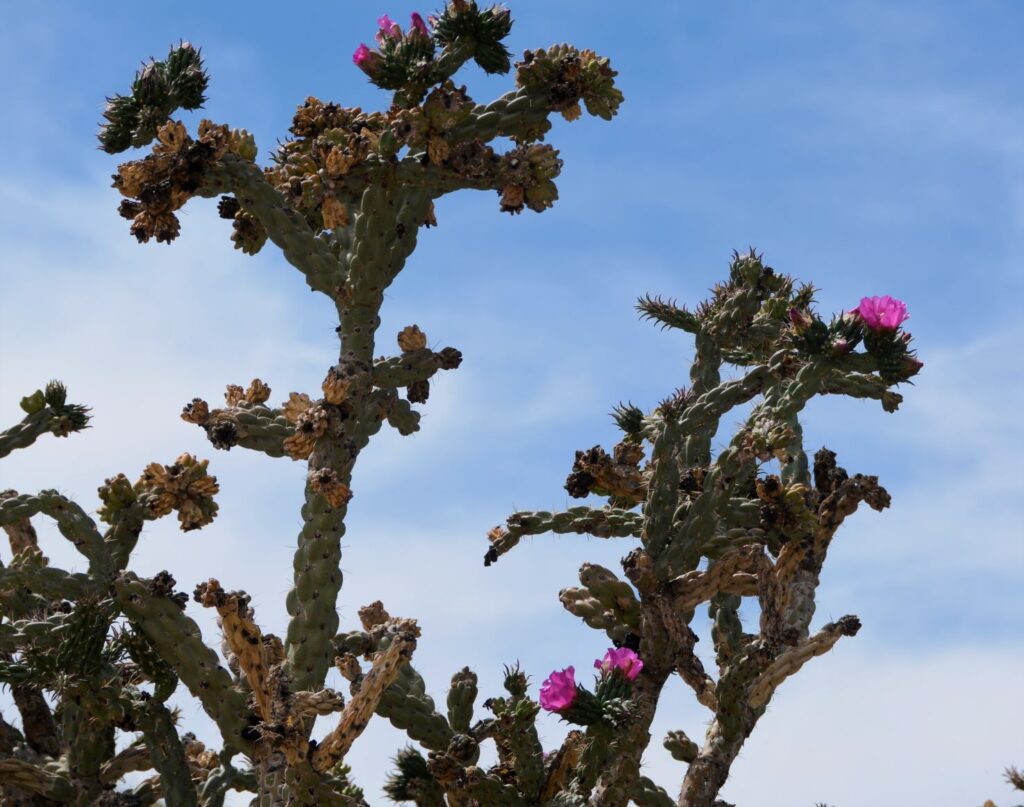
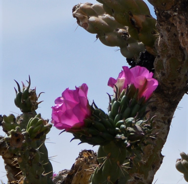
The five mile drive into the park was reason enough to visit. The cacti were in bloom everywhere. On our way out of the park, I got a few photos of the blooms. Right at the entrance a huge cholla cactus was in bloom.
This is the view from the Visitors’ Center at Carlsbad Cavers NP. I didn’t remember this from our visit years ago, but it is a beautiful view.
View from Carlsbad Caverns National Park Visitor Center in New Mexico.
More wildflowers decorated the roadside.
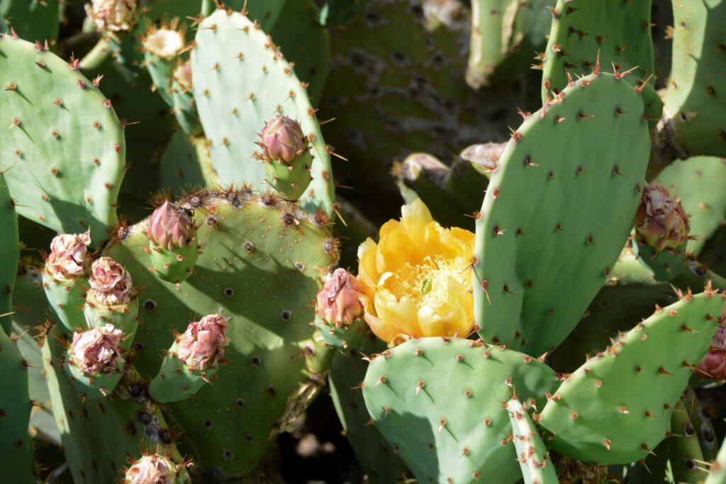
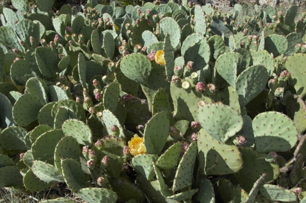
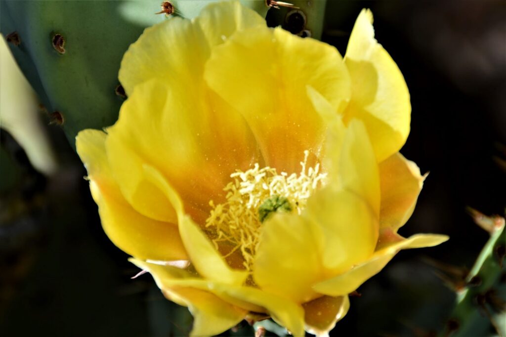
I’ve never seen such an abundance of prickly pear cacti, many with bright yellow blooms.
Prickly pear cactusBloom of prickly pear cactus
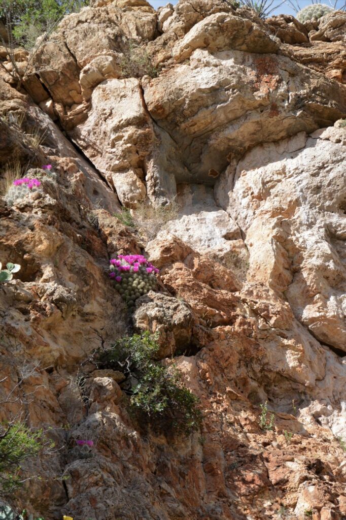
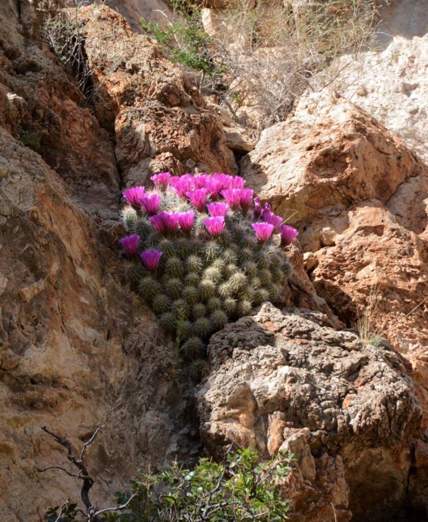
I kept seeing bright pink patches from the rocks on the cliffs. Stopping to check it out, I discovered they were hedgehog cacti in bloom.
Hedgehog cacti on cliffsideHedgehog cactusHedgehog cactusHedgehog cactus
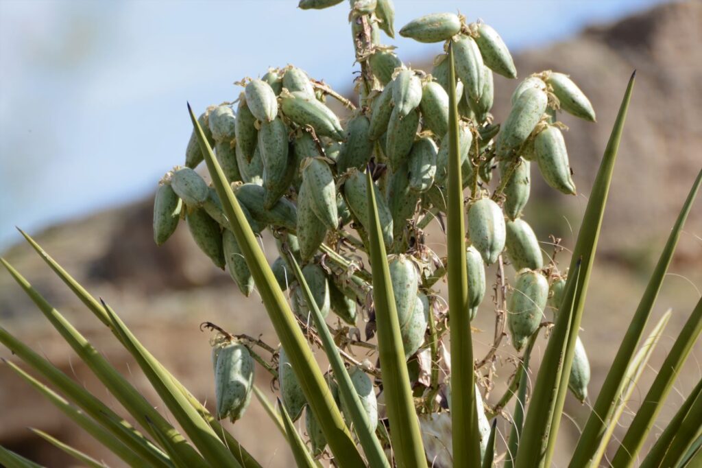
Ray was curious about the “green chili peppers” he saw on some of the yucca. I zoomed in and got these photos. The chili peppers are really seed pods of the yucca plant. These are yet another stage of the yucca plant.
Yucca seed podsYucca seed pods
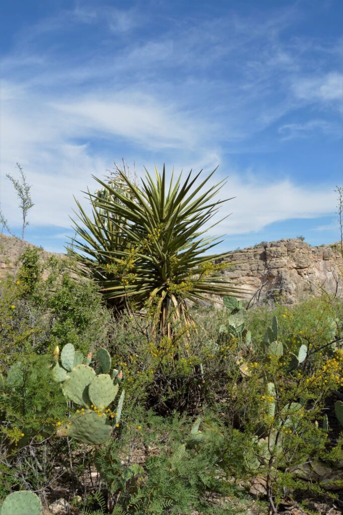
Yucca plants take many years to grow.
Yucca plant
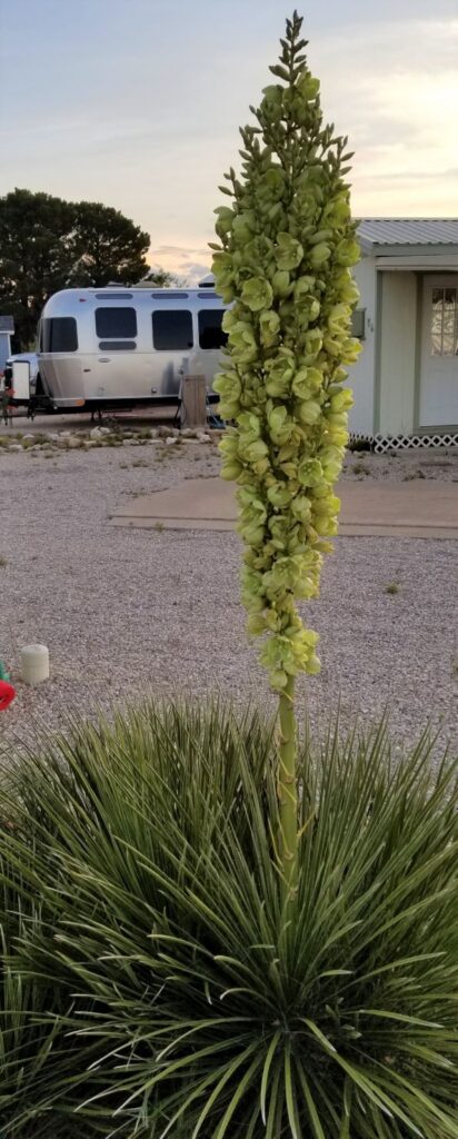
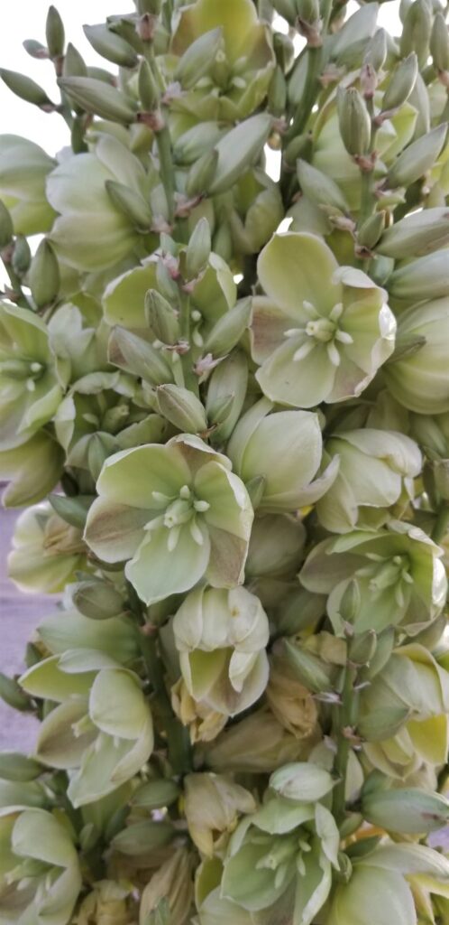
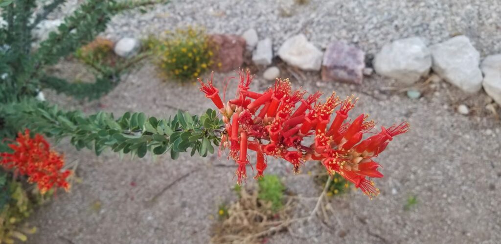
Our Escapees park had some beautiful specimens of yucca and ocotillo.
Yucca plant in bloom at Escapees campgroundYucca flowers close up.Ocotillo in bloom
I was somewhat disappointed in Guadalupe Mountains National Park. However, it has been years since I have seen Carlsbad Caverns National Park. I would love to go back and re-visit it again. And, who knows, I might just give Guadalupe Mountains National Park another try also.
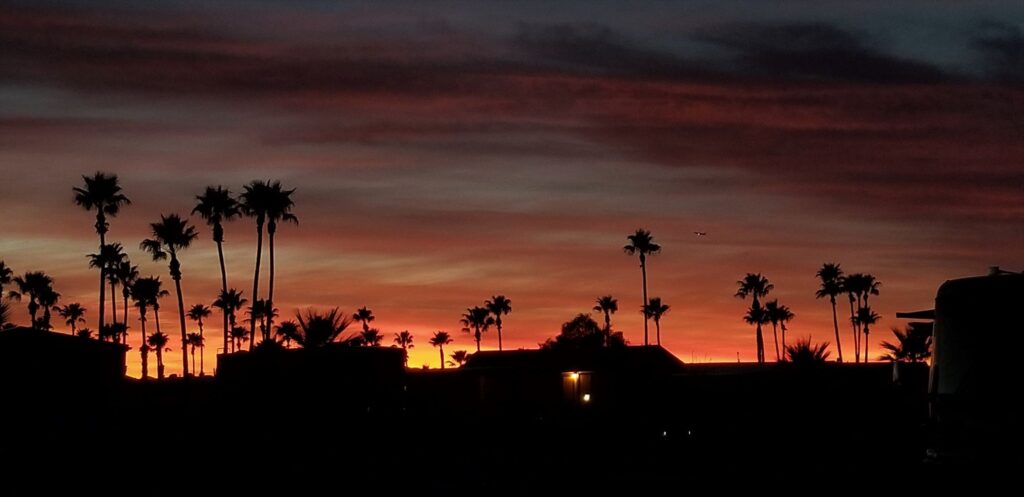
Our weeks in Tucson and Benson, Arizona, gave us a chance to explore southern Arizona. Arizona skies seem to have the perfect conditions for amazing sunsets. We enjoyed this beautiful sunset one evening on our walk around the RV park.
Sunset in Tucson, Arizona
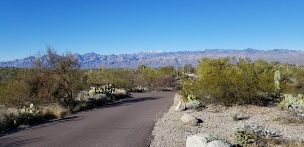
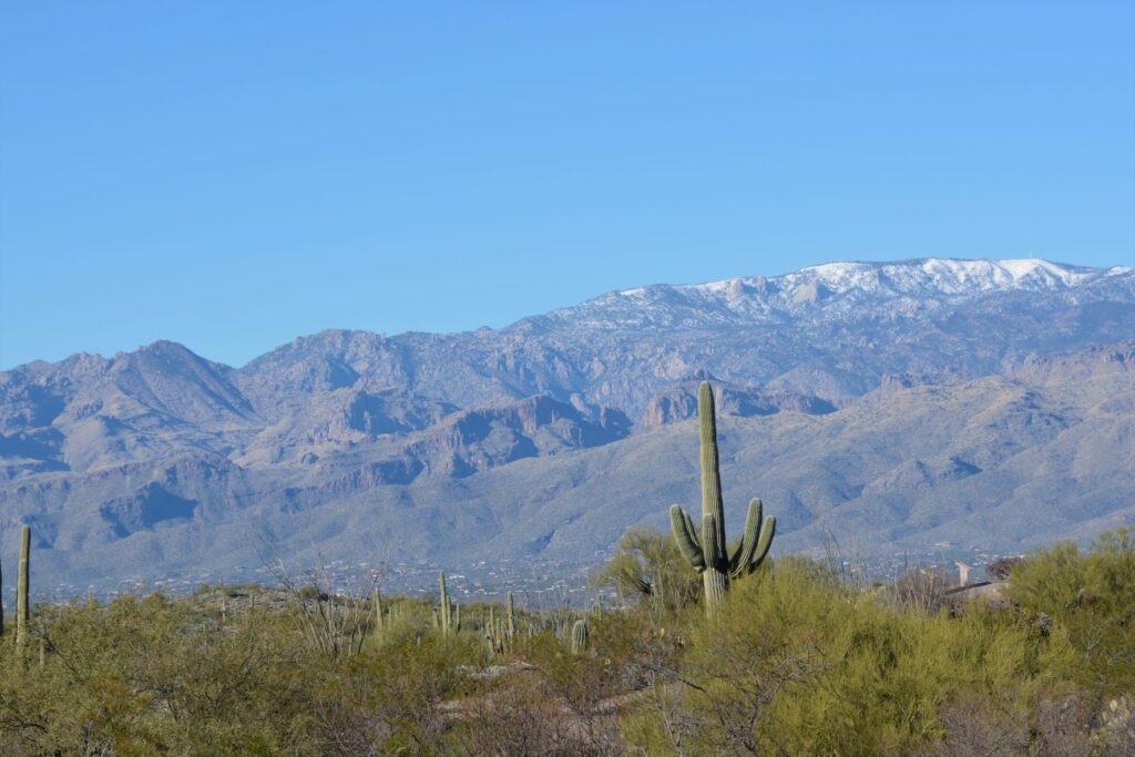
Since we were so near Saguaro National Park, I made a quick trip there one afternoon to get my National Park Passport Book stamped. While there, I couldn’t resist a quick trip on the 8-mile drive through the park. The photos of cactus with the snowy mountains in the background were worth it.
Saguaro National ParkSaguaro National Park
Green Valley
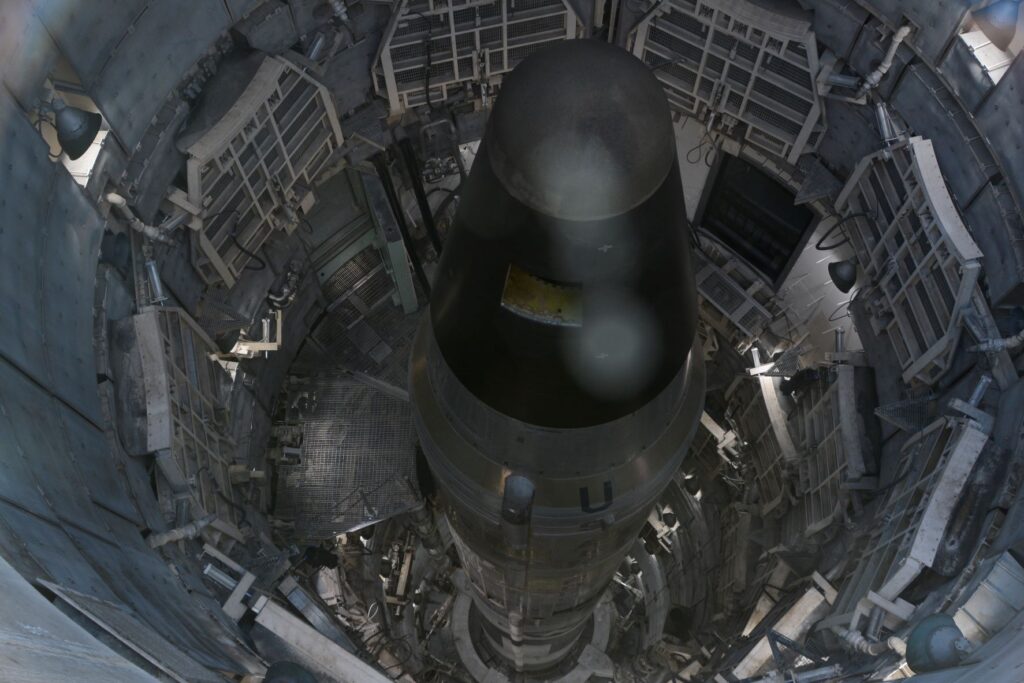
One afternoon we took a tour of the Titan II Missile Museum in Green Valley, Arizona, which is just a few miles from Tucson. The missile is not operational, but it was a sobering reminder of the former cold war and threat we faced of nuclear war.
View looking down into the silo of the Titan II Missile
Tombstone
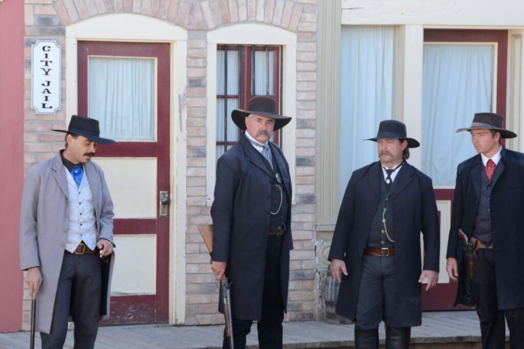
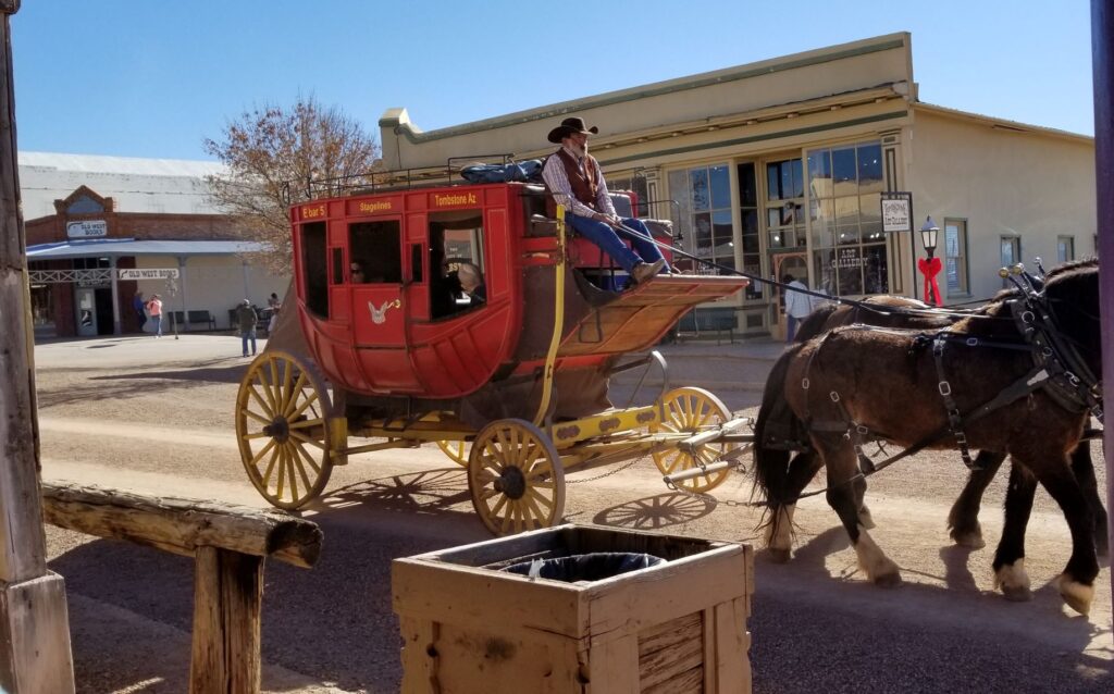
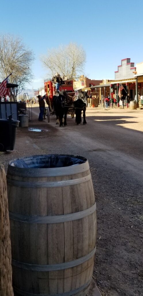
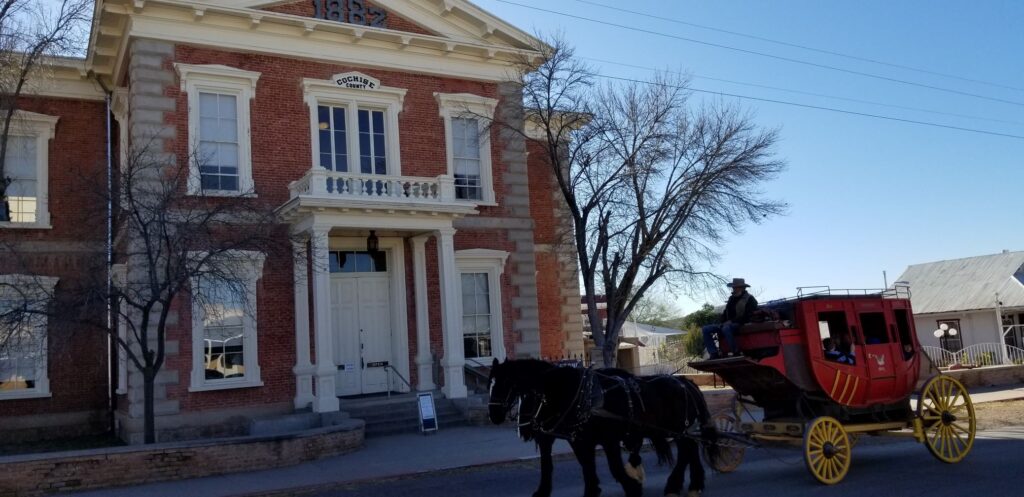
Another popular southern Arizona town is the historic town of Tombstone. One day we packed a lunch and spent the day touring the town. While there, we witnessed a re-enactment of the shootout at the OK Corral. Afterwards we strolled along the streets visiting the Epitaph Press, the Bird Cage Theater, the Arizona Ranger Museum and a presentation of the history of Tombstone.
Actors of Doc Holiday and the Earp Brothers re-enact the shootout at the OK CorralStagecoach ride in TombstoneMain Street in TombstoneHistoric Courthouse at Tombstone, AZ
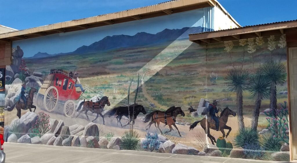
Benson
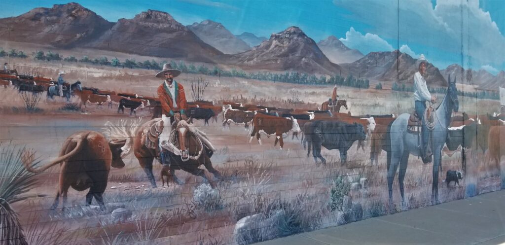
We spent one week in Benson, Arizona, just a few miles south of Tucson. Benson is an interesting town because of the murals painted on the buildings and walls around the town. It has a western small town feel to it and reminded me of our former hometown of Mariposa, California.
Mural in Benson, ArizonaAnother mural in Benson, Arizona
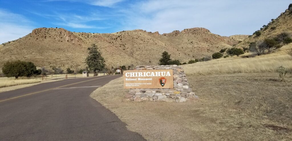
Chiricahua National Monument
About an hour drive from the town of Benson is Chiricahua National Monument in the southeast corner of the state. National Monuments may not be as popular as National Parks, but they can be surprisingly beautiful and interesting. It seems there isn’t a substantial difference between the two except that National Parks require an act of Congress to establish and National Monuments do not. Arizona has 18 National Monuments, more than any other state.
Entrance to Chiricahua National Monument
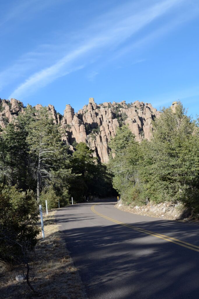
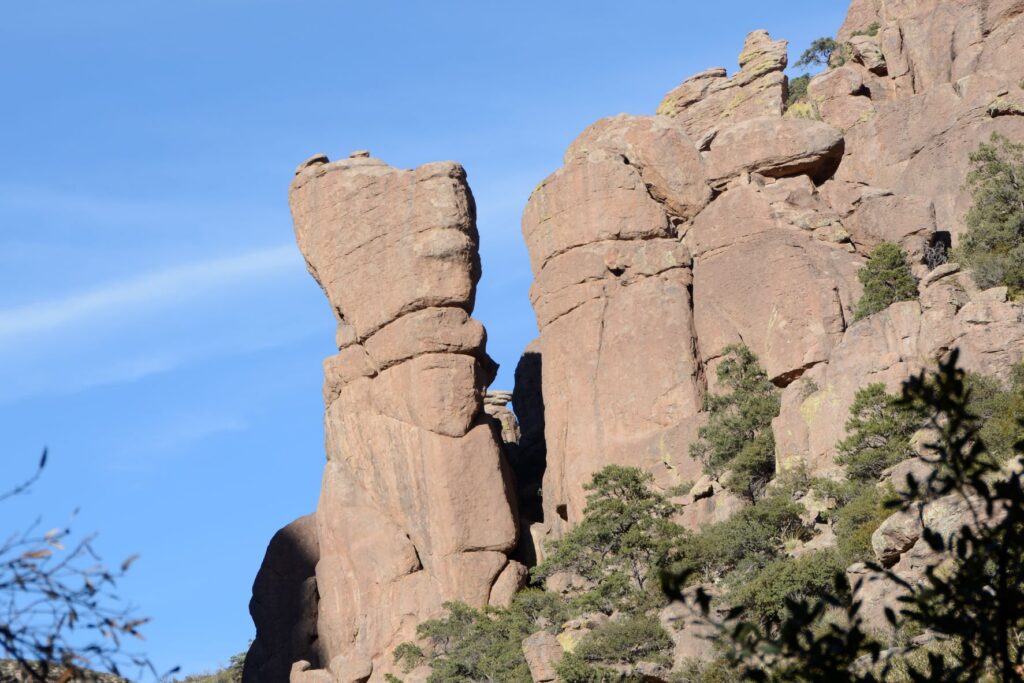
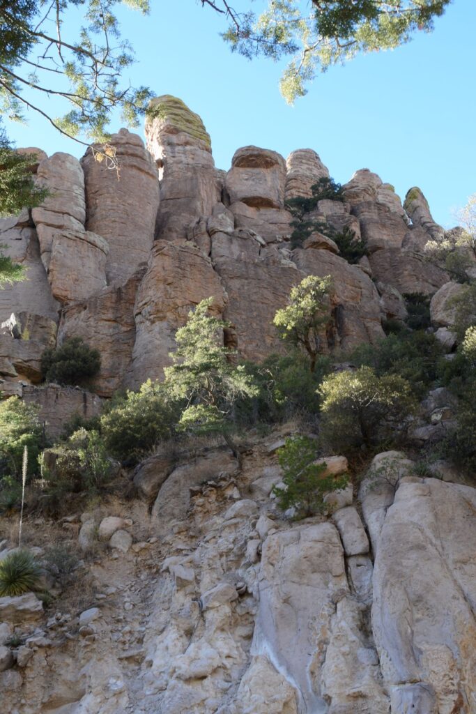
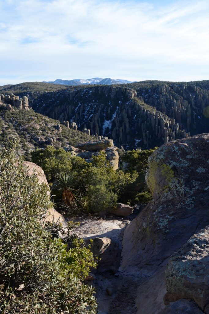
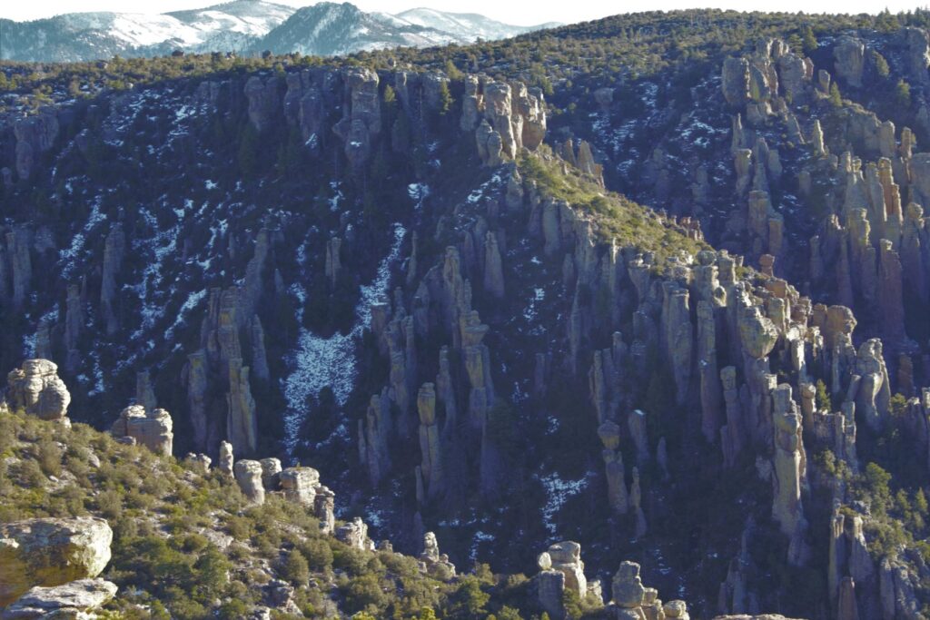
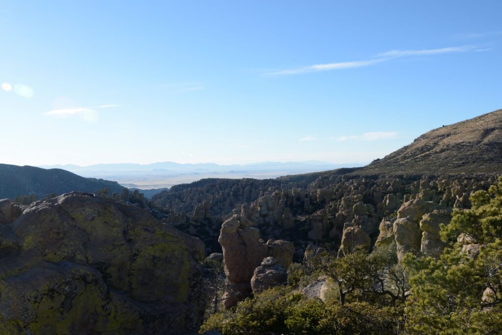
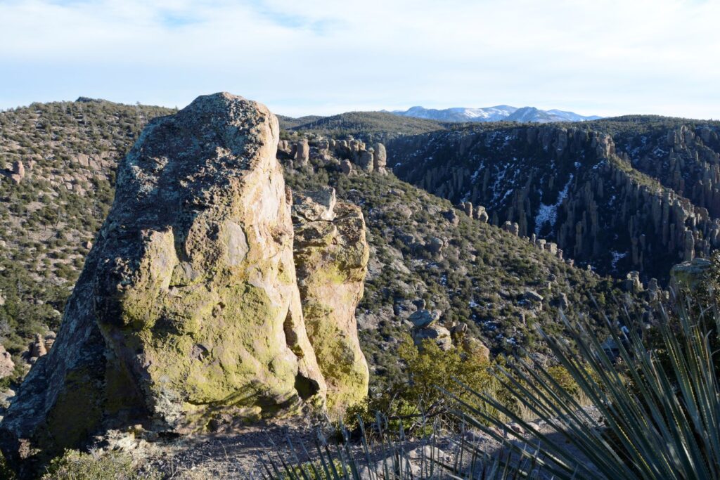
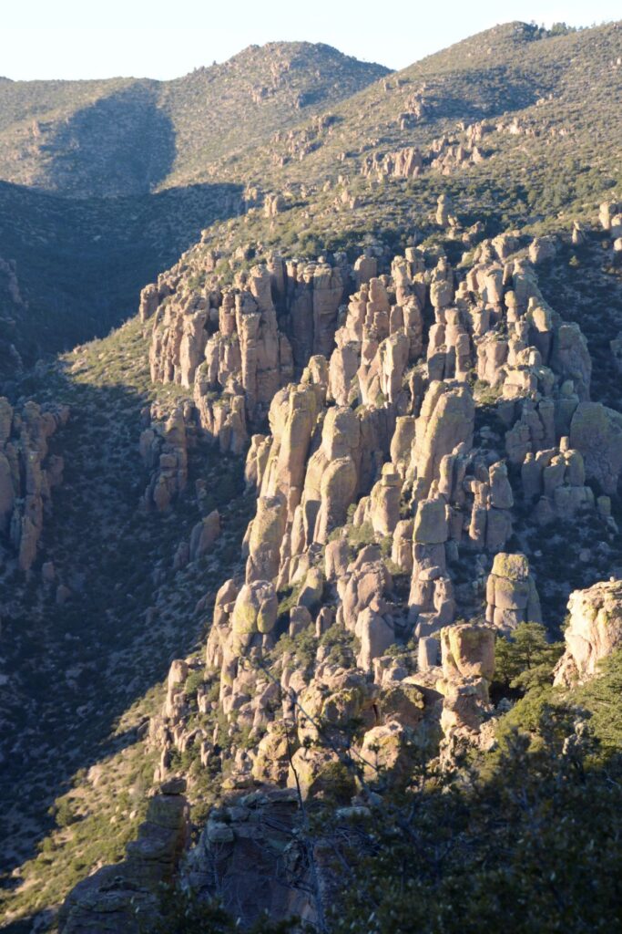
The eight-mile scenic drive starts by winding along the bottom of a canyon surrounded by rhyolite rock pinnacles or hoodoos for which the monument was created to protect. As the road climbs steadily, the views change until you’re overlooking the rock formations from the top of Massai Point at an elevation of 6,870 feet.
Hoodoo rock formations near entranceRhyolite rock pinnacles overlooking scenic drive.
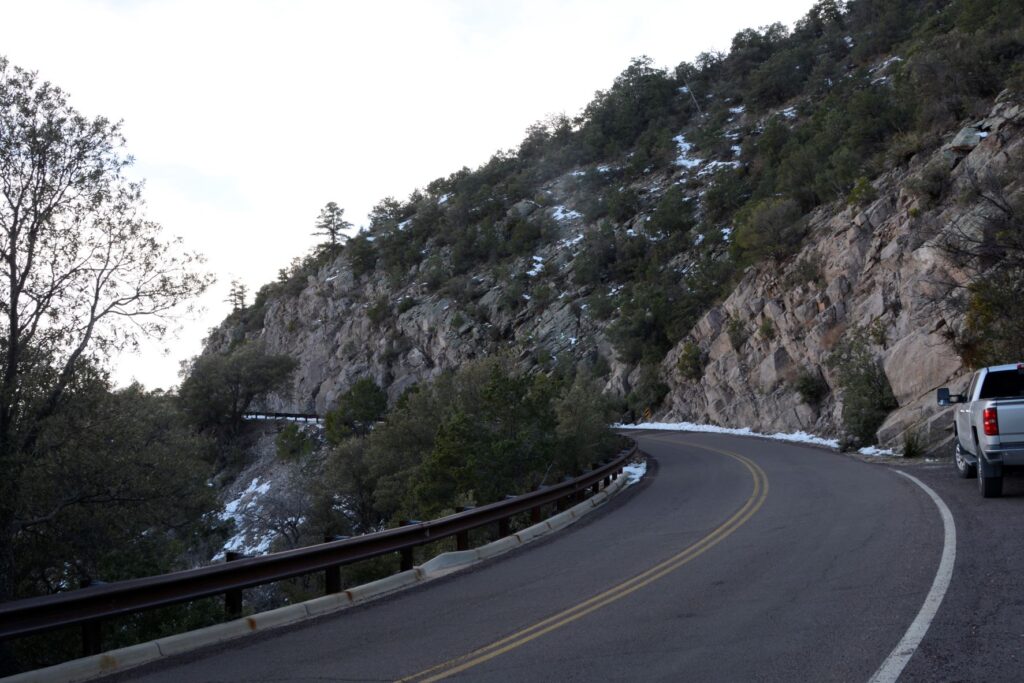
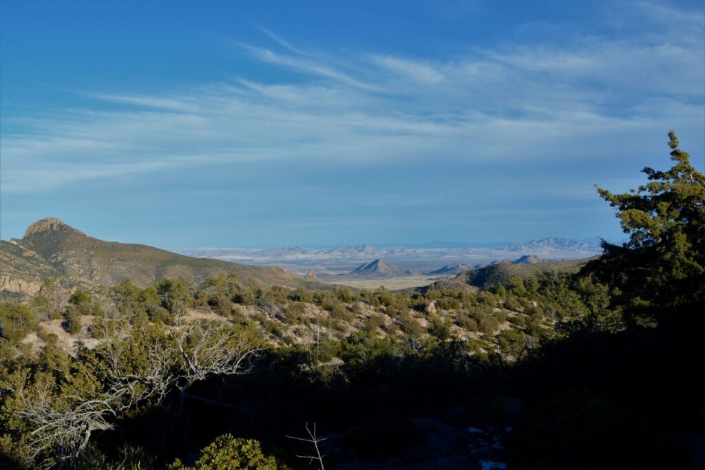
As the road climbed in elevation, we encountered some snow, and could see more mountain ranges in the distance.
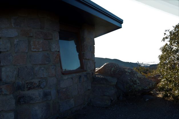
At the end of the road is Massai Point where there is a parking lot and a path leading to a stone building. It was a windy day so we were glad to go inside to get out of the wind. Inside we read about the nature and history of the park.
View from Massai Point
At the summit, we could now look down on the many rock pinnacles.
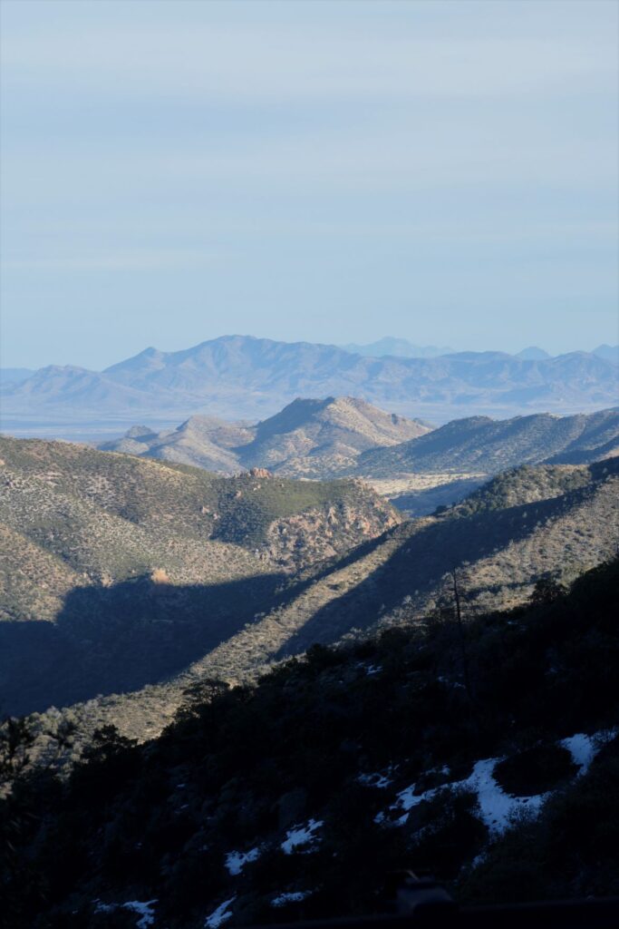
At Massai Point, we could see miles of the surrounding area with distant mountain ranges, including the Dragoon Mountains and Cochise Stronghold.
In the distance are the Dragoon Mountains and Cochise Stronghold
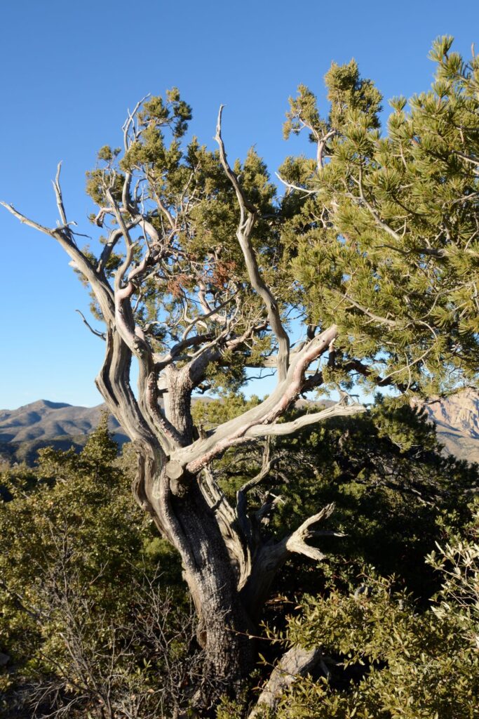
The trees at the higher elevations must be hardy to withstand the harsh climate.
Weathered pine at Massai Point
Chiricahua National Monument is considered a “sky island” because it is comprised of an isolated mountain range that rises up out of the surrounding desert which is like a sea. Because it rises about 6,000 feet above the surrounding valley, it provides a wide range of ecosystems and plant and animal diversity.
Chiricahua NM is one of many “sky islands” in the southeastern desert of ArizonaRhyolitic tuff rock formations were caused by volcanic activity where ash cooled and hardened.
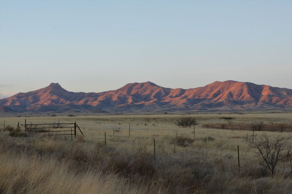
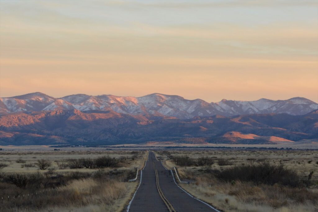
As we drove back down the mountain and out of the park, the evening sun cast a red glow on the nearby mountains. It was late in the day and we were hungry, but I decided to pull over and get one last photo.
As I got out of the truck, I happened to look behind me down the road where we had come. What I saw was this beautiful view of the snowy mountains in the last light of day. By the time I got back in the truck, the light was already gone. I was so glad I stopped for that one last shot.
Road to Chiricahua National Monument
I was surprised at the beauty and interesting topography of Chiricahua National Monument. Though it is off the beaten path, it is worth a visit.
Another surprise was a fascinating article I came across while researching for this blog. The article is about a missing ranger from Chiricahua National Monument. Out of curiosity, I clicked on the link and discovered a tangled mystery. It is quite long, but keep reading. It gets more and more mysterious the further you go. If you care to read it, I will link it below.