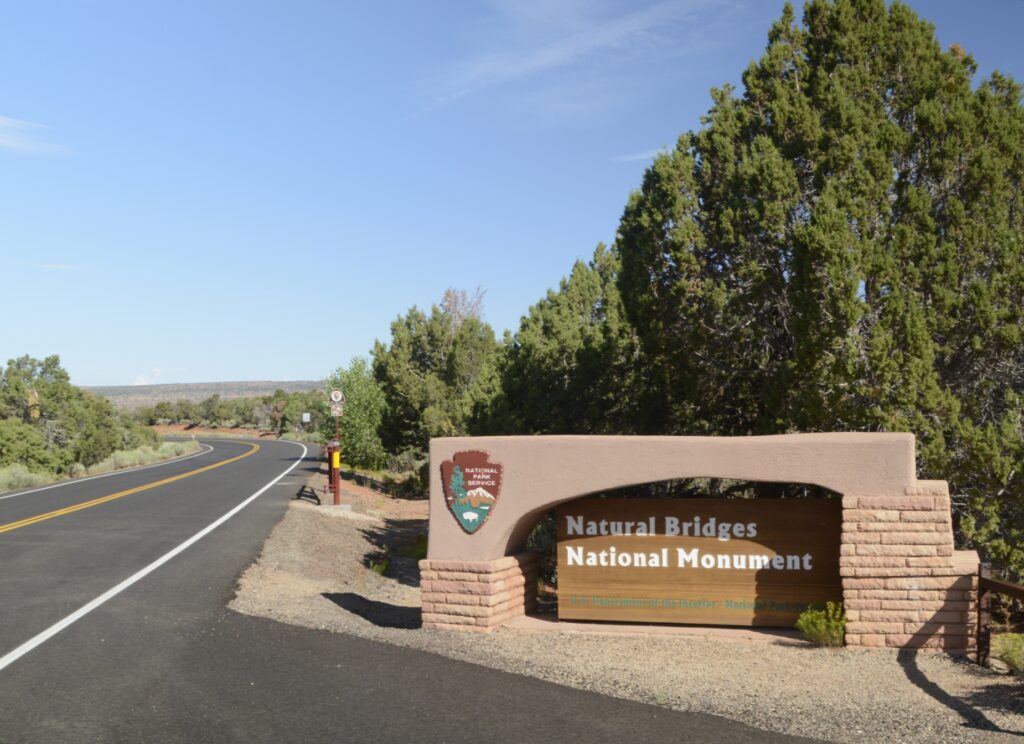
Utah’s first national monument, Natural Bridges, is off the beaten path. It was over an hour drive from Monticello, Utah, where we were staying. After turning on state highway 94 at Blanding, Utah, which is about the halfway point, there are no towns or services from then on. But the scenery is worth the drive.
There are three natural bridges within the park boundaries: Sipapu, Kachina, and Owachomo which are Hopi Indian words meaning “place of emergence,” rock art that resembles kachina dolls, and “rock mound.” They were discovered by a prospector in 1883, and later it was designated a national monument.
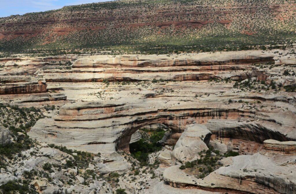
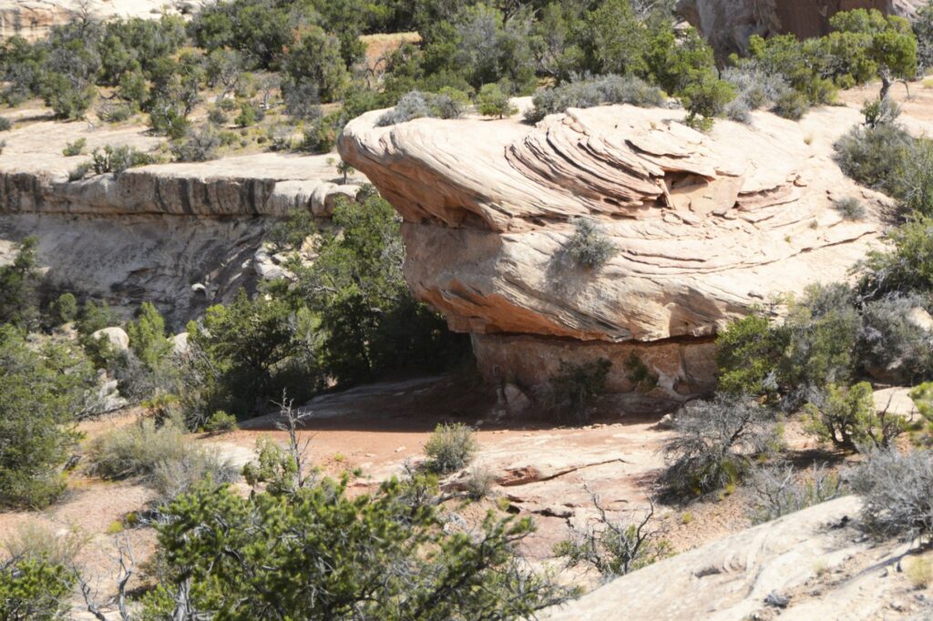
Sipapu Natural Bridge
We started our visit at the visitors’ center where we learned the difference between a natural bridge, an arch and a window. A natural bridge is formed by flowing water. As streams wind back and forth in a canyon, the thin walls are worn through by the water pounding against them.
Sipapu Natural Bridge
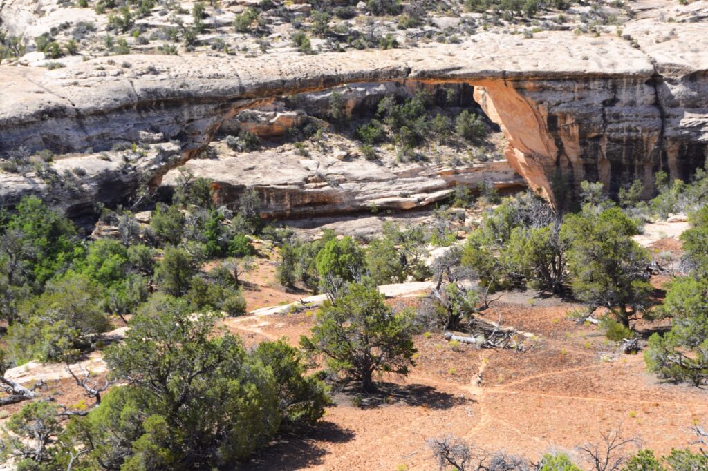
Sipapu (see-pa-pu) bridge was the first stop on the nine-mile Bridge View Drive through the park. It’s the largest of the three bridges. Its meaning has to do with an entryway by which the Hopi believe their ancestors came into this world. To give you an idea of its size, the dome of the United States Capitol would nearly fit underneath it. It is the second largest natural bridge in the U.S.
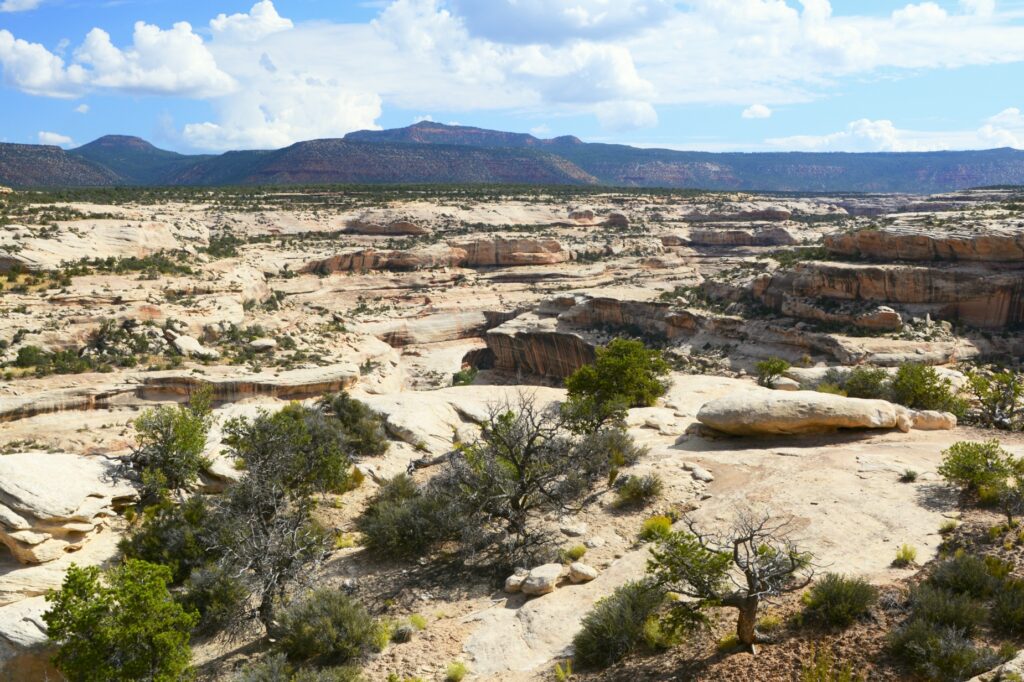
View of canyon
The drive along the canyon was beautiful. There were swirls in the rocks that showed water was a factor in forming the rocks we see today.
Swirls in rocks
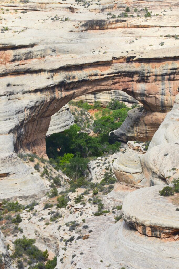
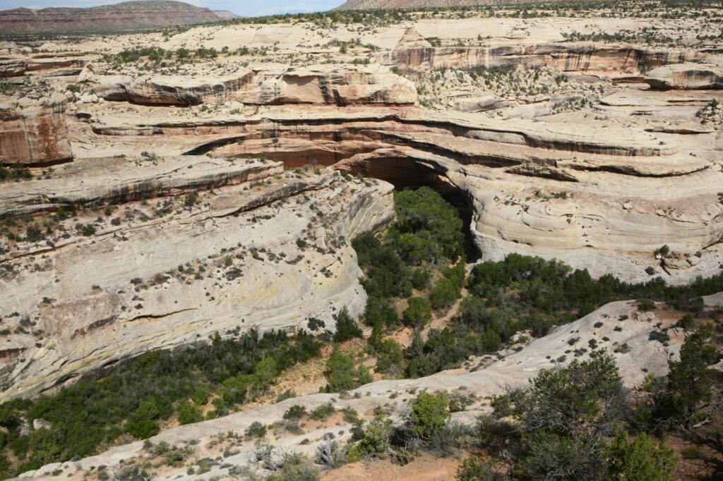
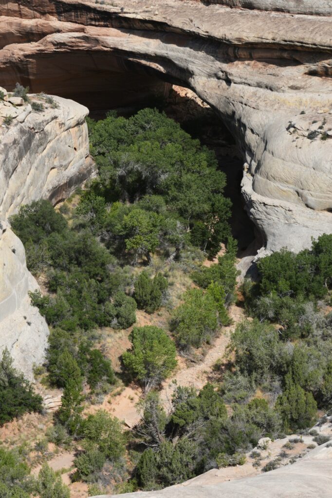
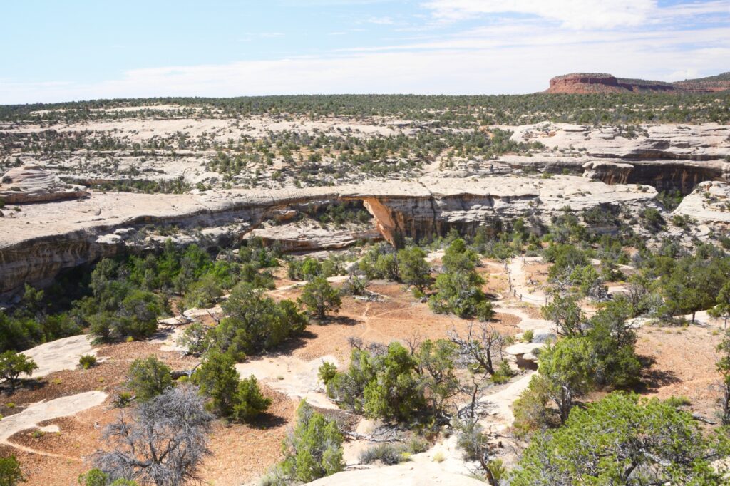
Kachina Bridge was harder to see because trees obscure the opening. It is smaller than Sipapu Bridge, but has a massive amount of rock above it.
Kachina BridgeKachina Bridge
The Owachomo Bridge is the smallest and thinnest of them all. A rock mound on the east end of the bridge is why it is named Owachomo. The word means “rock mound” in the Hopi Indian language.
Owachomo Bridge with rock mound on left
You can see that the rock on the top of this bridge is much thinner. Some believe it may be the oldest of the three because of the amount of erosion, but no one can tell for sure.
Owachomo Bridge
It was very hot that day, so we didn’t take any hikes down to see the bridges from below. The viewpoints from above don’t really showcase the enormity and size of the bridges. Perhaps someday we will return during a cooler time and take some of the hikes.
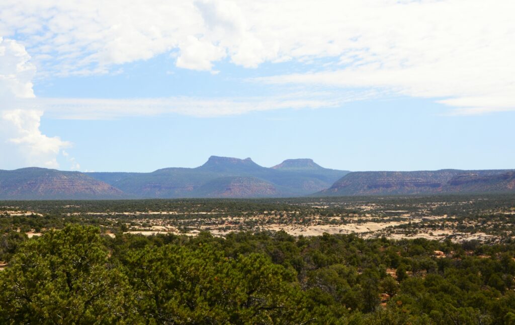
Bears Ears of Bears Ears National Monument
It was time for us to return to our campground. We ate our sack lunch and headed home. On our way out the park, I saw a sign about Bears’ Ears National Monument. I had been seeing signs for it, but didn’t know what to look for. In the distance were the Bears Ears for which the national monument is named. Someday, maybe we will explore it also.
“Great are the works of the Lord; They are studied by all who delight in them.” Psalm 111:2
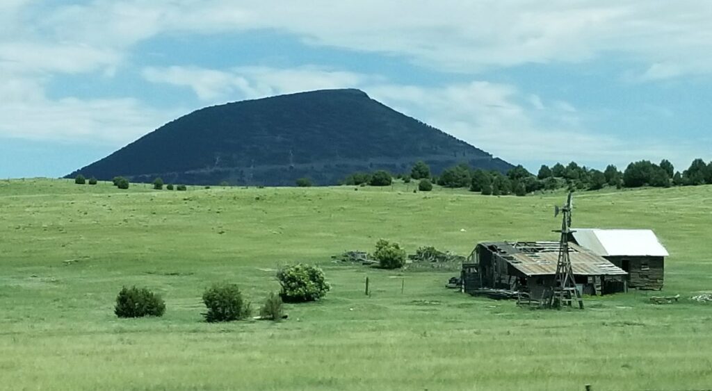
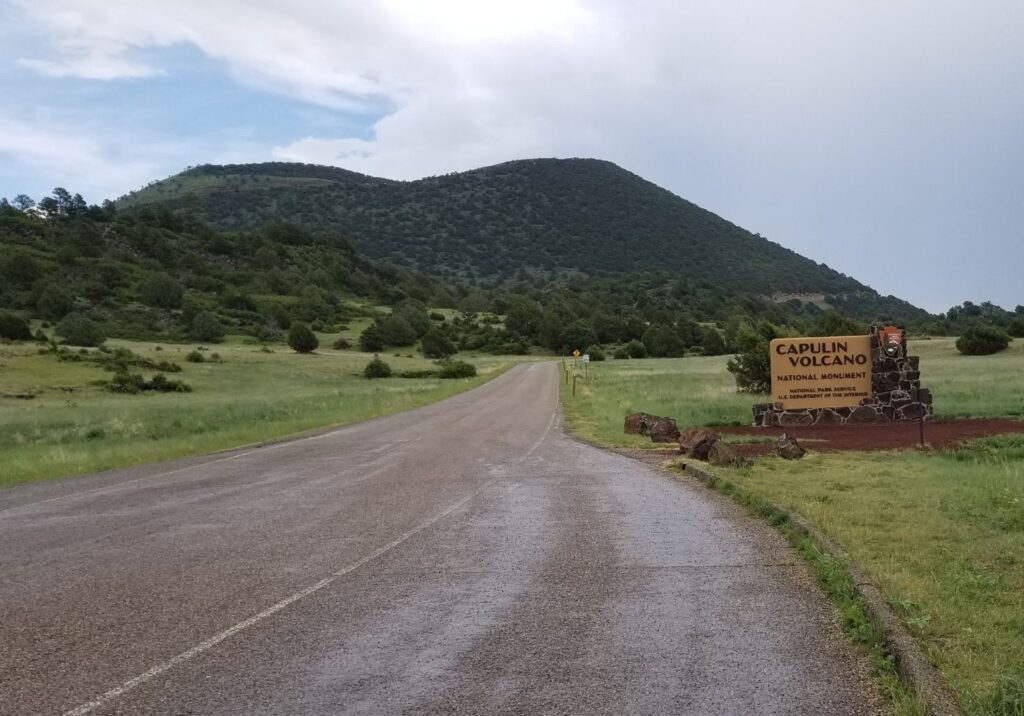
Our path to Colorado took us across the northeastern corner of New Mexico. Everything was green and beautiful. As we passed Capulin Volcano National Monument, I took a photo out the window. I thought maybe someday we would be able to visit there. Little did I know that day would come sooner than expected.
Not many miles past the volcano, our truck sounded a warning. A service engine light came on with a message that the truck fuel exhaust system needed cleaning. “Keep driving,” it said. Then it reduced the power and went into limp mode. It was especially slow going uphill. There was nothing we could do. It gave us seven warning messages. It seemed like our truck had major problems. That’s a scary thing when you’re pulling a trailer and there’s a mountain pass between you and your destination.
We stopped in the nearest town, Raton, New Mexico, where Ray got a bottle of fuel cleaner to add to the fuel tank. To make a long story short, we got a campsite in the KOA park there and made an appointment with a diesel mechanic the soonest we could get, which was five days from then.
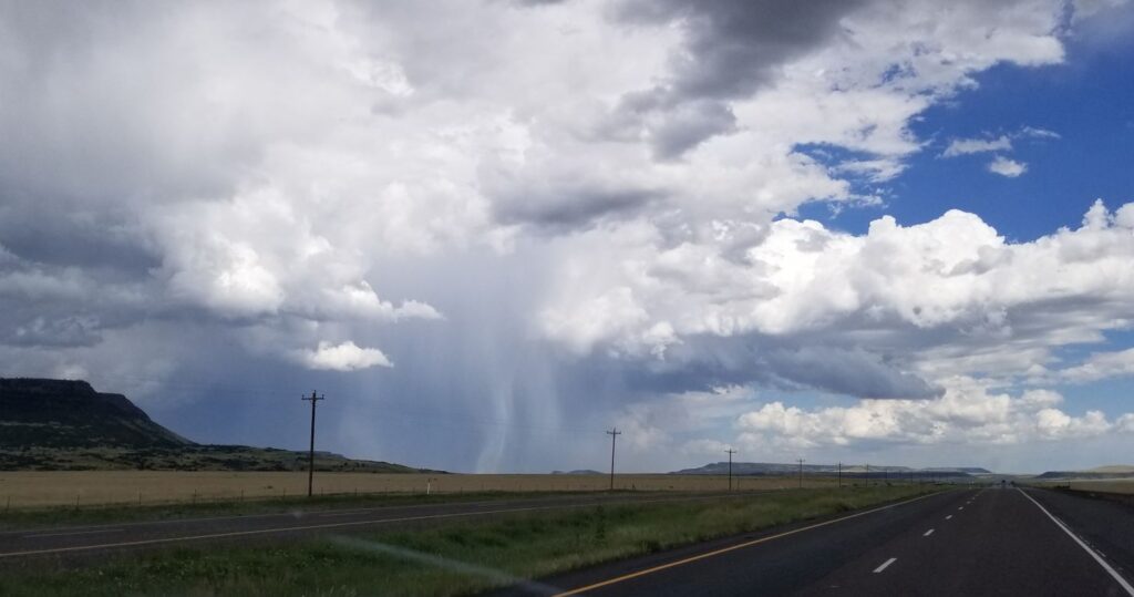
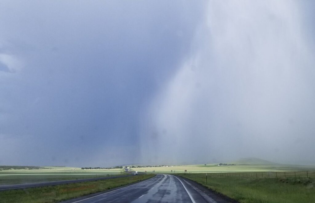
In the meantime, we needed to drive the truck to get the fuel cleaner throughout the system. We decided to drive back to see the Capulin Volcano National Monument that very same day. On the way, we saw a rainstorm about to cross our pathway.
Most of it blew across the road before we got there, but we got a real truck wash for a few minutes.
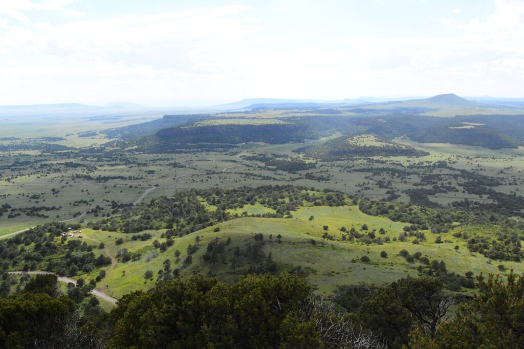
The national monument was only a few miles off the main road. The drive through the countryside was beautiful, especially after the rain.
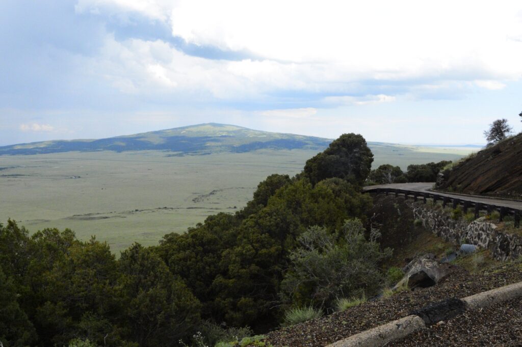
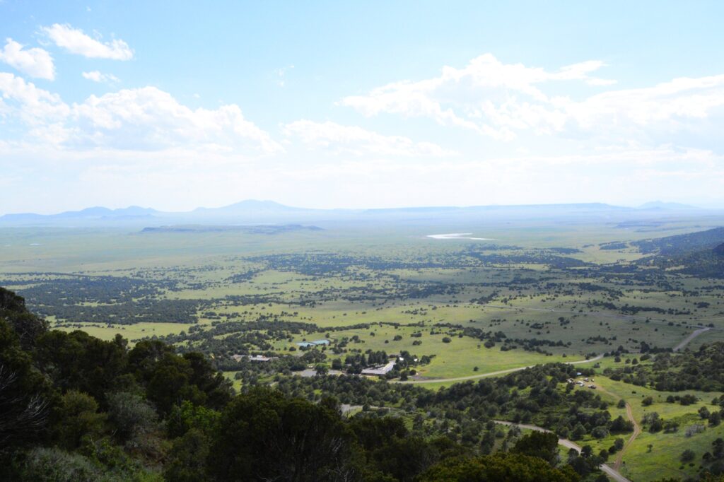
We stopped at the Visitors’ Center before we drove up the road to the top of the volcano. The road curves around the volcano as it climbs to the top. The views were really something.
A shield volcano can be seen from the road up Capulin volcano.
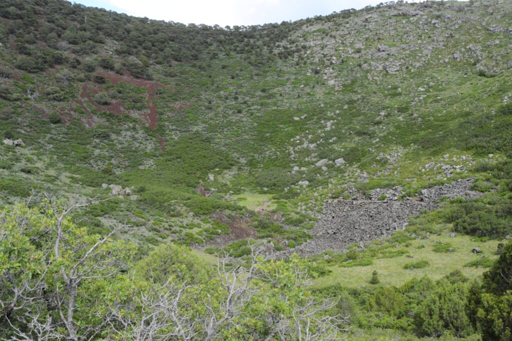
At the top of the volcano was a parking lot. From the parking lot, there was a trail that went around the top of the crater and down to the bottom. We did not attempt that. It was a long ways down. If you look carefully, you might be able to see people at the bottom of the crater.
The crater was covered in vegetation, which surprised me. I was expecting bare rocks. I think that means this volcano has been extinct for a very long time.
Crater of Capulin Volcano
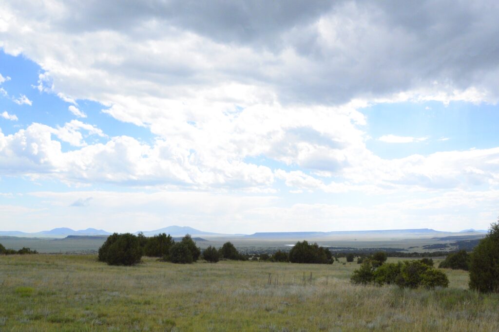
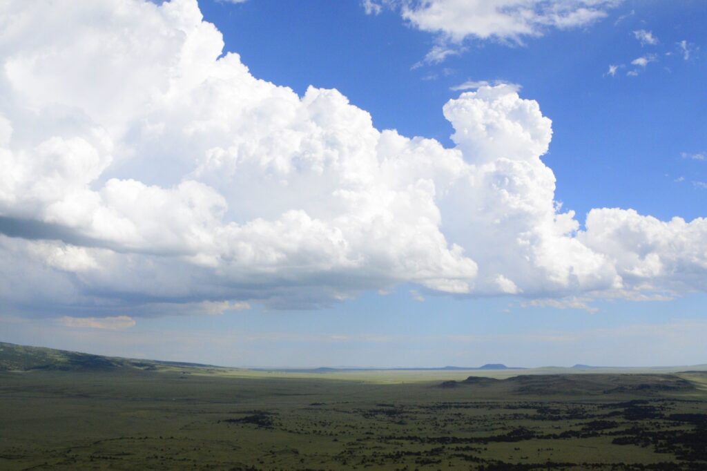
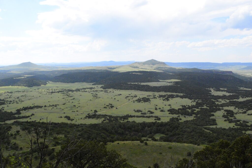
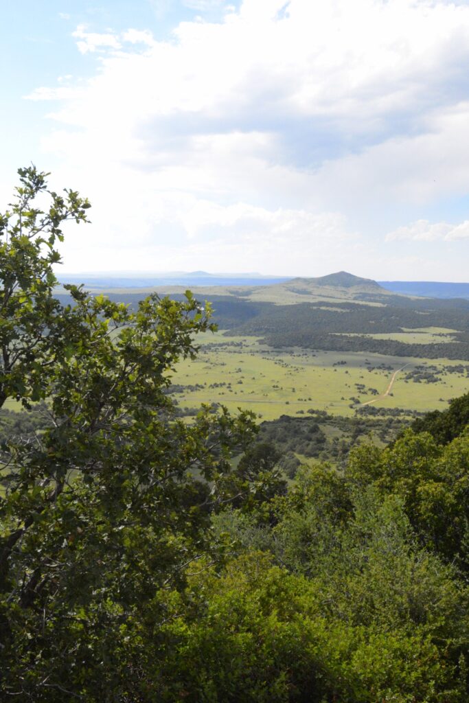
Here are a few more views from the top of the volcano. The elevation at the top was 7,877′.
View from top of volcano
The flat top mountains are ancient lava flows. The peaks are other cinder cones, shield volcanoes and volcanic domes.
View from top of volcano
Capulin Volcano is said to have erupted when mammoths and giant bison roamed these plains.
There’s an interesting story about a former slave from Texas who found some ancient bison bones after a devastating flood in an area seven miles north of Capulin Volcano. What made the discovery important was the finding of “Folsom points”, stone projectile points used by early bison hunters. The fact that they were intermingled with the giant bison ribs, even embedded in one, meant that they could place mankind in North America almost 7,000 years earlier than previously thought. Of course, if they had believed the Bible, they could have saved themselves some trouble with their dating process.
President Woodrow Wilson declared Capulin Mountain a National Monument in 1916. It was considered the most perfect specimen of extinct volcanoes in North America. A road was built in 1925. In 1933 a Civil Works Project was approved and gave local men a dollar a day plus food to build a sound road. It was 1987, however, before the road was actually paved.
*****
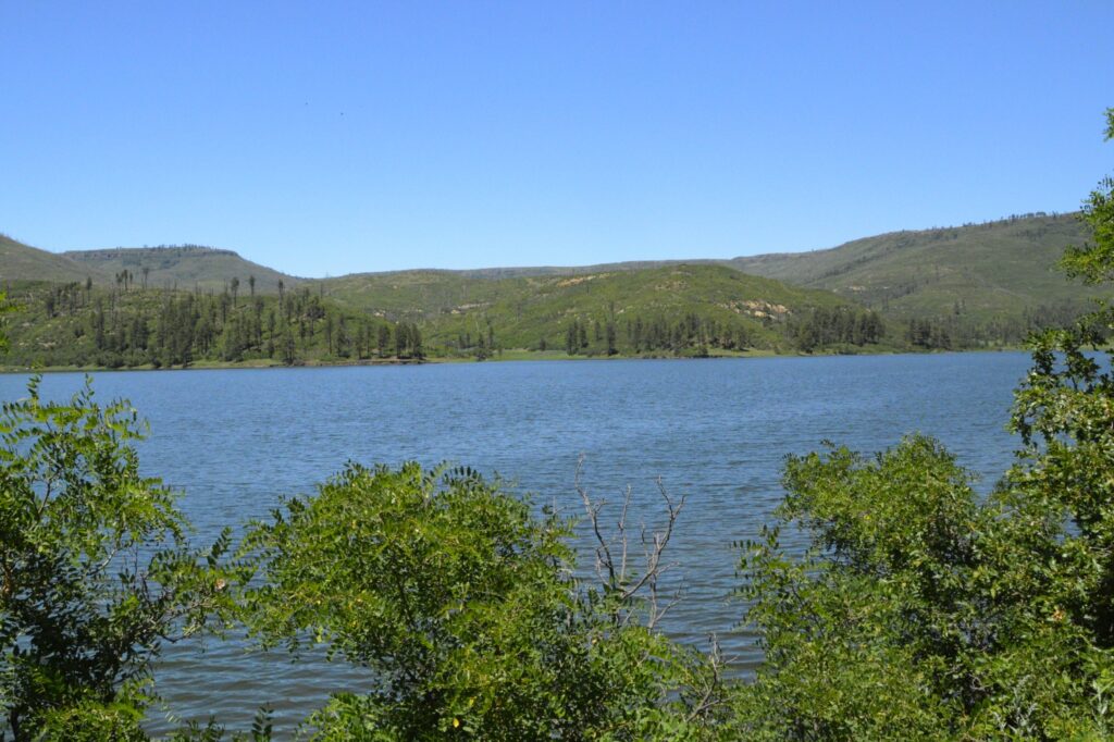
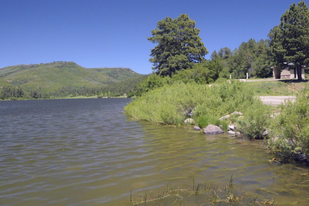
Over a period of four days, we drove the truck several miles. One day we took a drive to nearby Sugarite State Park. The park has a couple of lakes formed by dams.
The upper lake, Lake Maloya, is the larger lake. The park is so close to the state line that Lake Maloya extends a short distance over the Colorado border.
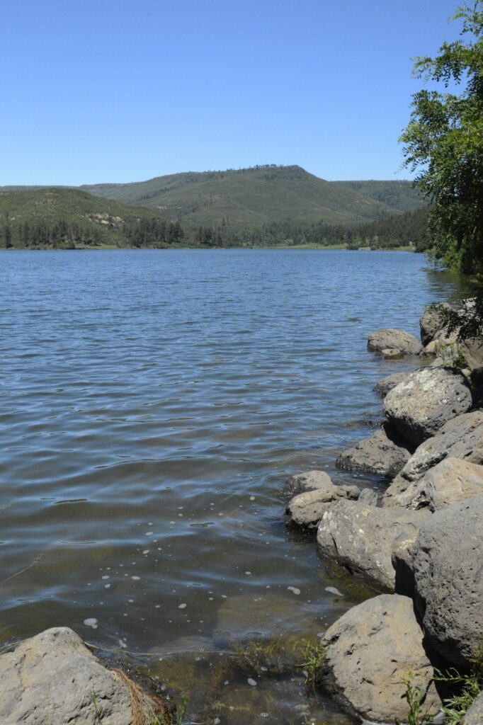
Lake Maloya at Sugarite State ParkThe hills beyond the lake are in Colorado
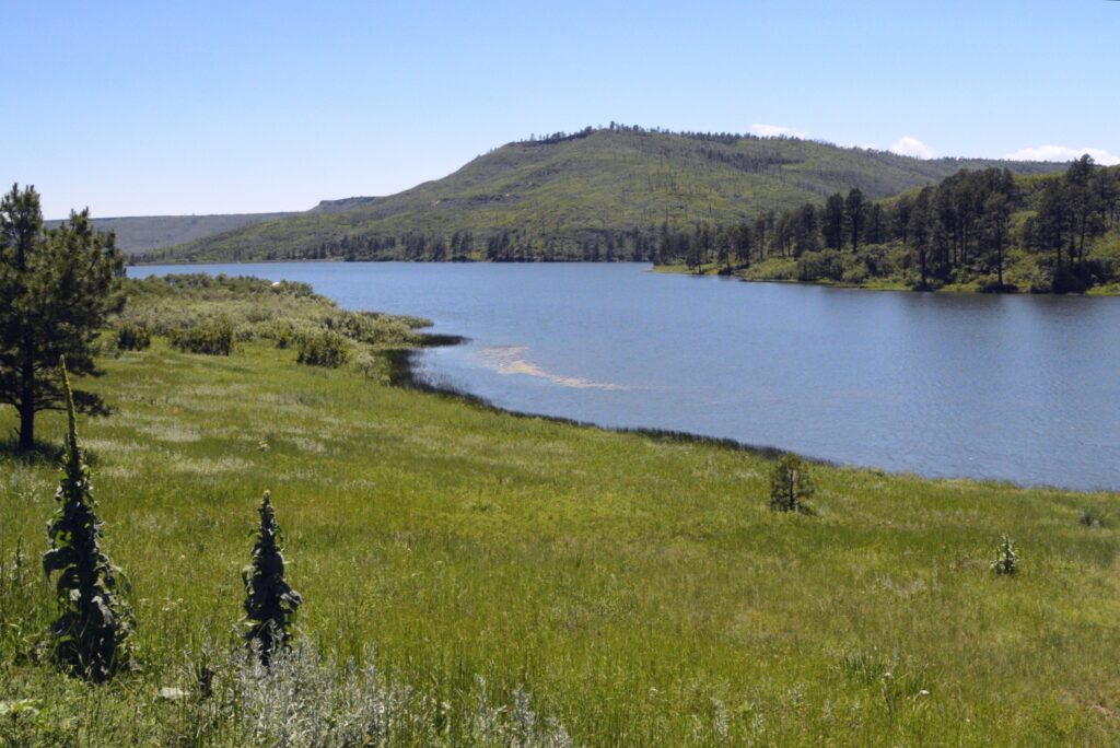
The lake is a popular fishing spot. A fisherman told me that there were pike and trout in the lake.
Lake Maloya is a popular place for fishing.Lake Maloya
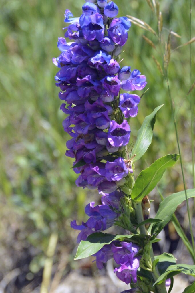
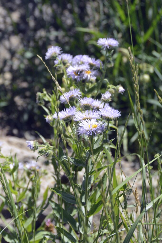
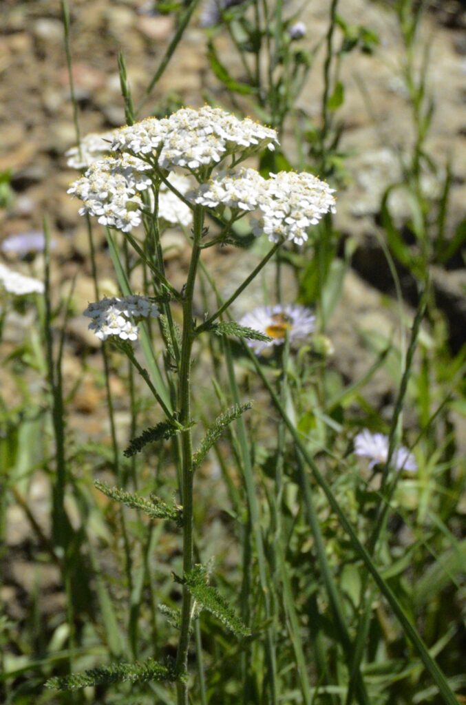
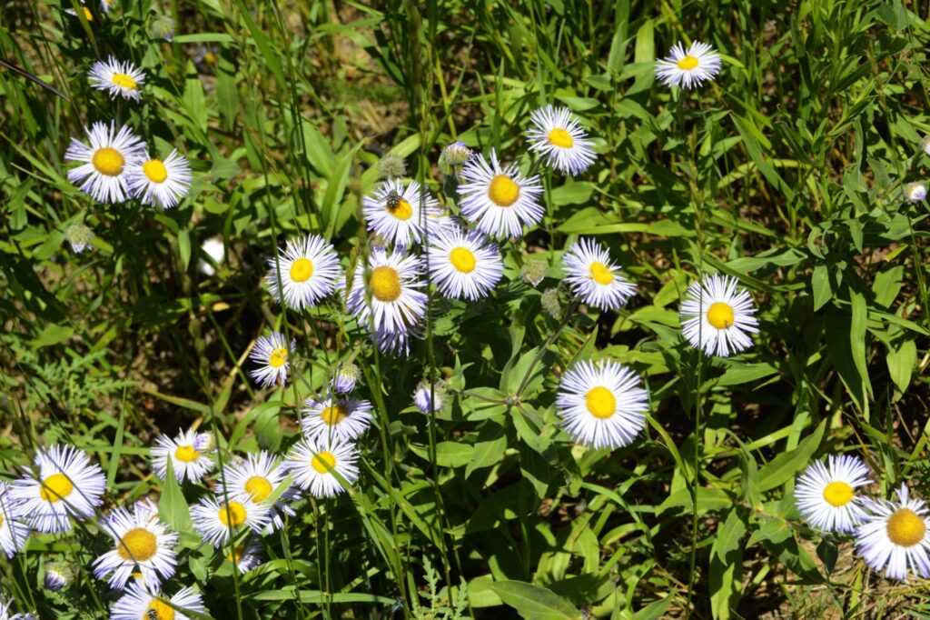
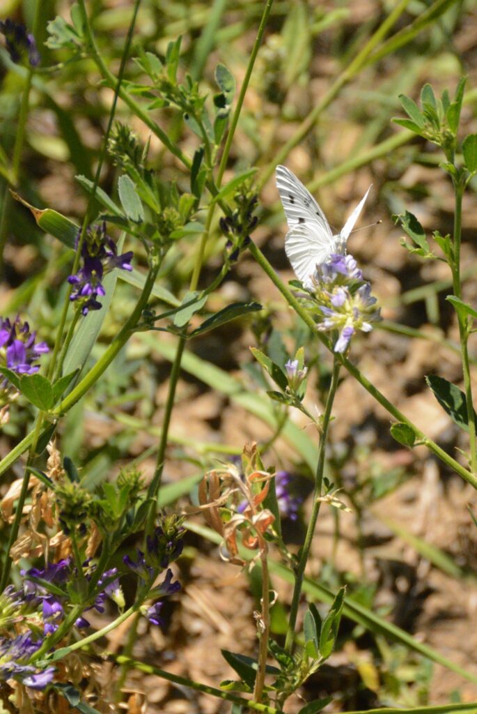
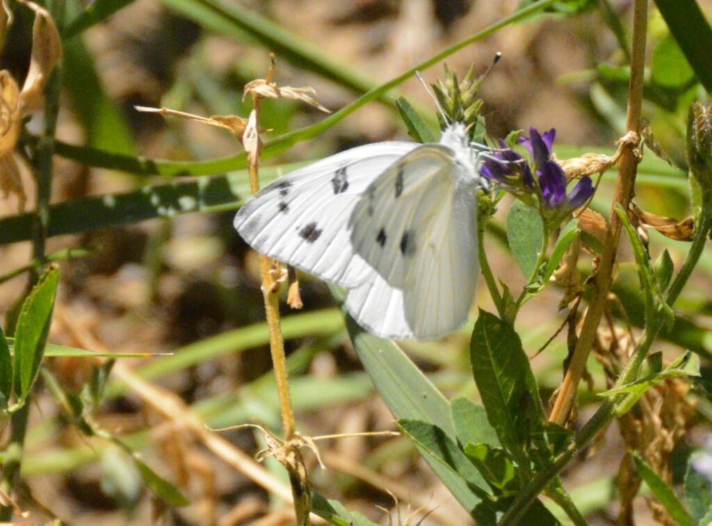
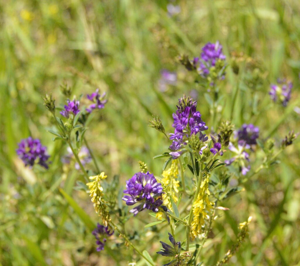
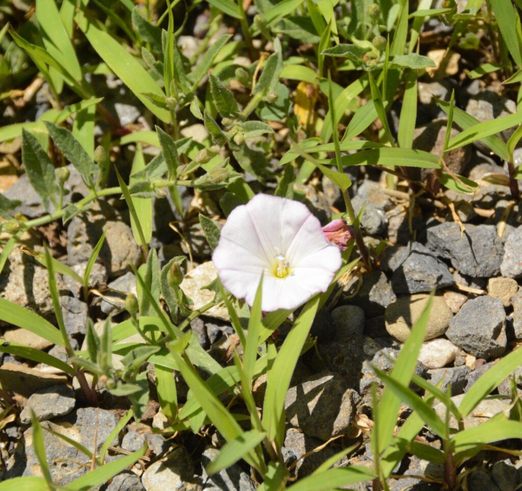
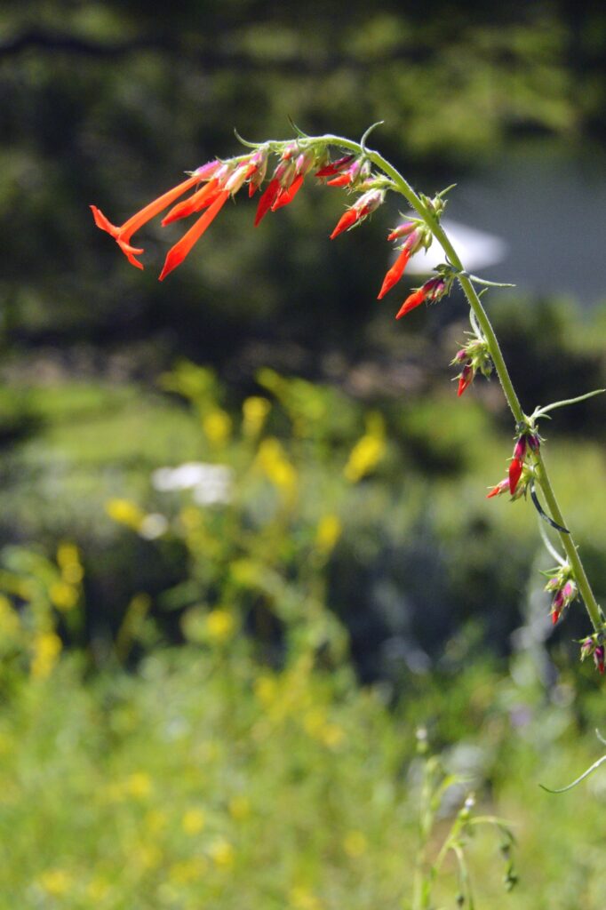
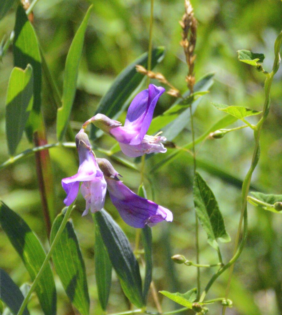
There were many wildflowers in bloom around the lake. Butterflies were also abundant. I discovered a phone app called “Picture This” that helps me identify flowers just by taking a photo of them. Here are some I identified with it.
Rocky Mountain PenstamonAspen FleabaneYarrowAspen FleabaneCheckered White ButterflyAlfalfa flowersField BindweedScarlet GiliaMarsh Pea
We continued driving the truck each day. On day four, Ray was able to clear all the warning messages and canceled the appointment with the mechanic. The truck was running fine. We left the next day and drove across the pass to our next destination, thanking God for His wonderful care for us.
“Lord hears his people when they call to him for help. He rescues them from all their troubles.” Psalm 34:17
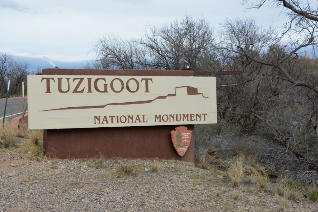
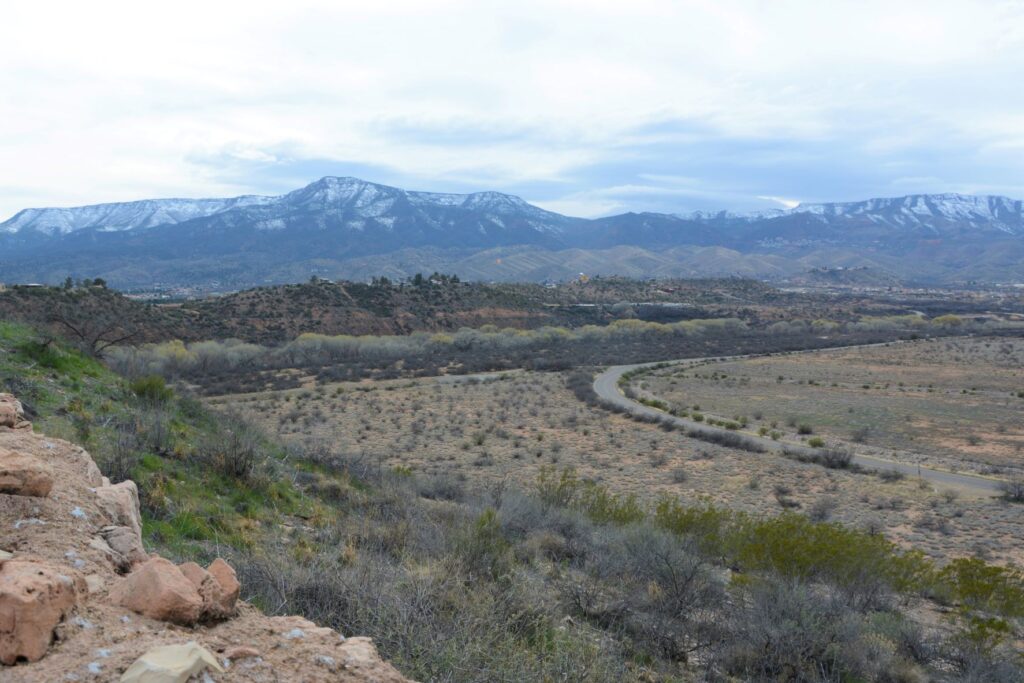
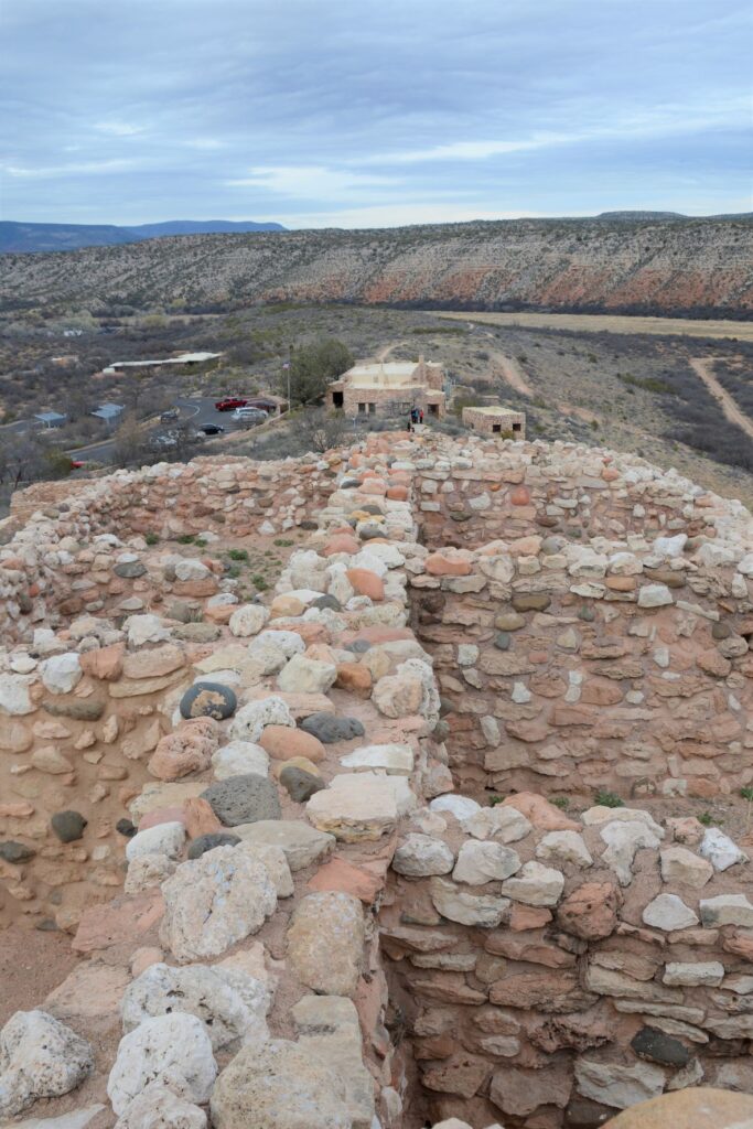
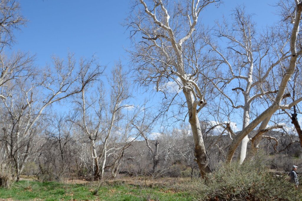
When I lived in Arizona, one of my favorite places to see while traveling north along Highway 17 was Verde Valley. The highway crests a hill and suddenly the view of a lush green valley opens up. As the highway descends into the valley, the green fields and bright green of the cottonwood trees are a stark contrast to the dry surrounding desert. Vermillian cliffs surround the valley while snow-capped mountains peak over the rim. It is a stunning view.
View from the top of Tuzigoot NM. Cottonwood trees line the Verde River. The ghost town of Jerome sits on the side of the distant mountains.
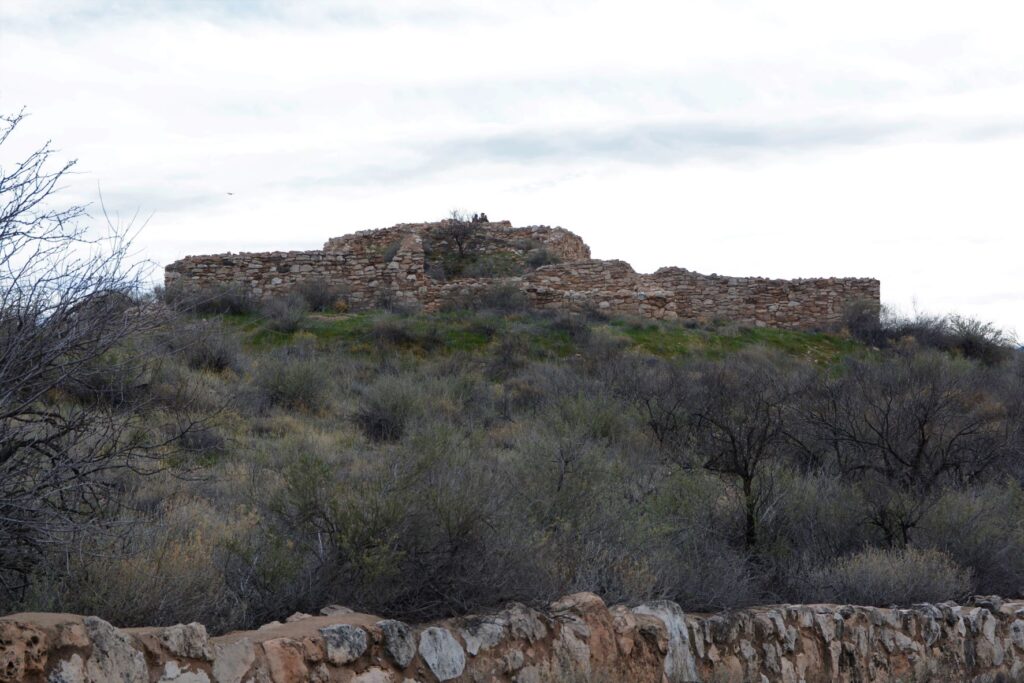
The Indians who came here 1400 years ago traveled along the Verde River valley. Like people of today, they liked to settle near water or on hilltops. One such group, the Sinagua, settled on a hill overlooking the Verde River. They were close enough to the river for water, but high enough to avoid the floodwaters when the river overflowed its banks.
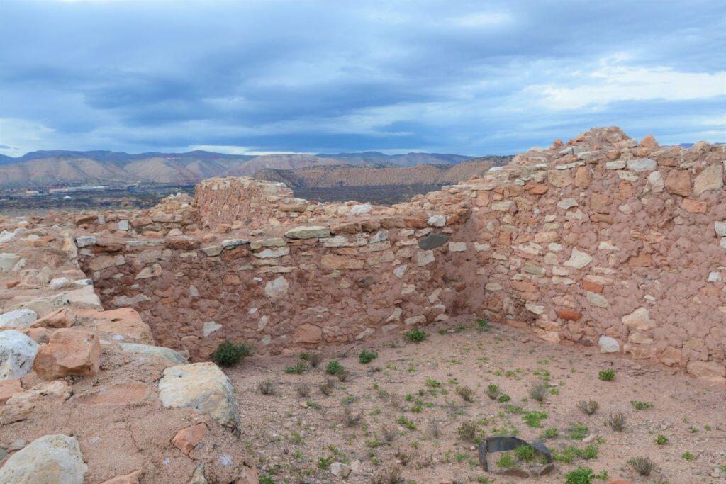
Tuzigoot ruins sit on a hilltop
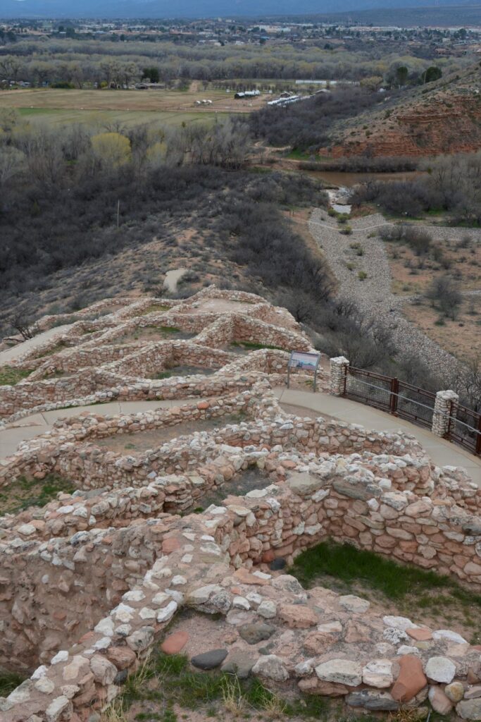
We don’t know much about these people. Their multi-room settlement was similar in construction to many other pueblos found in New Mexico, Colorado and southern Arizona which means they traveled frequently to each others’ settlements. The relics found, as well as the construction of their dwellings, show evidence of this.
View from the ruins looking down toward the Verde River
The Sinagua people eventually moved north and the walls crumbled and became buried and forgotten until the 1880s when two men from Smithsonian Institute began excavating the site. They gave the name “Tuzigoot” to this site. Tuzigoot is a corrupted form of the Tonto Apache name Tú Digiz, the name for this stretch of the Verde River. It is translated “Crooked Water.”
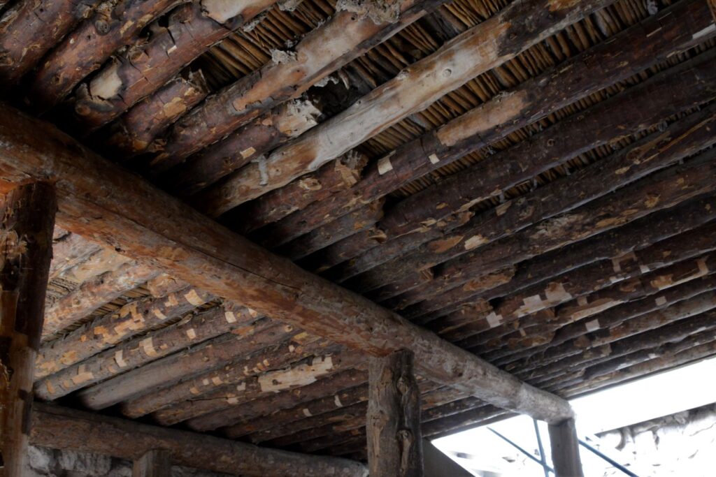
Typical wall construction was of adobe and stone.Roof construction was of logs from trees growing by the nearby Verde River.To preserved the structure, mortar is regularly replaced with a mixture similar to the original.
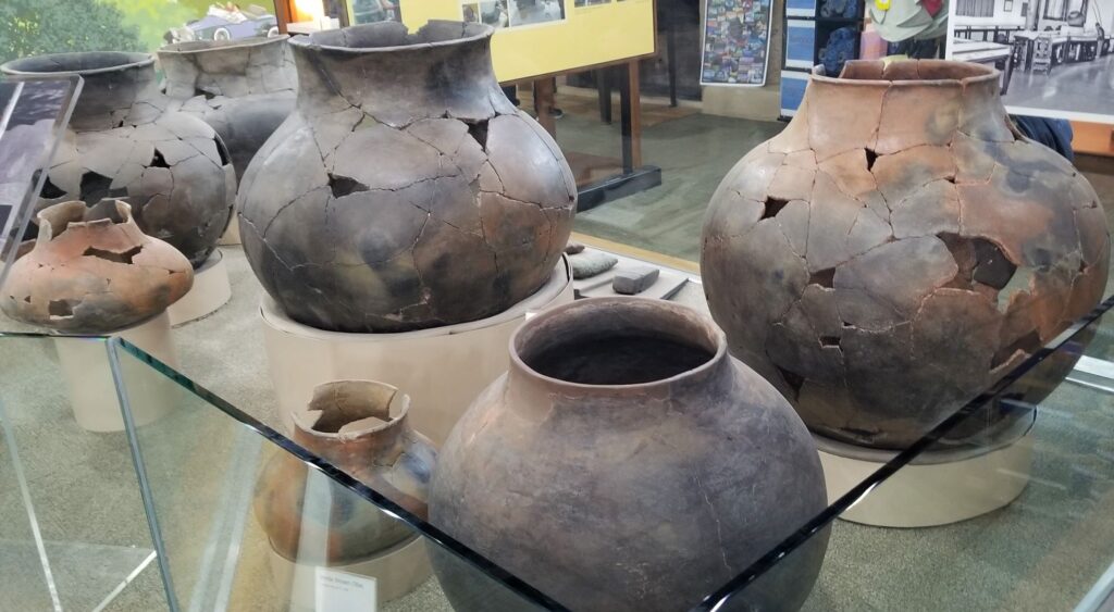
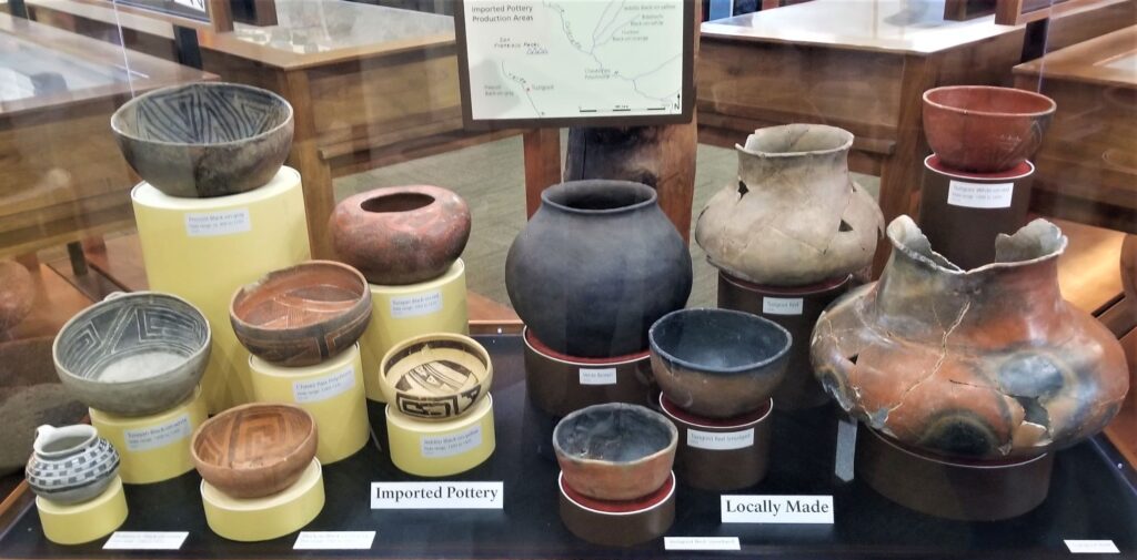
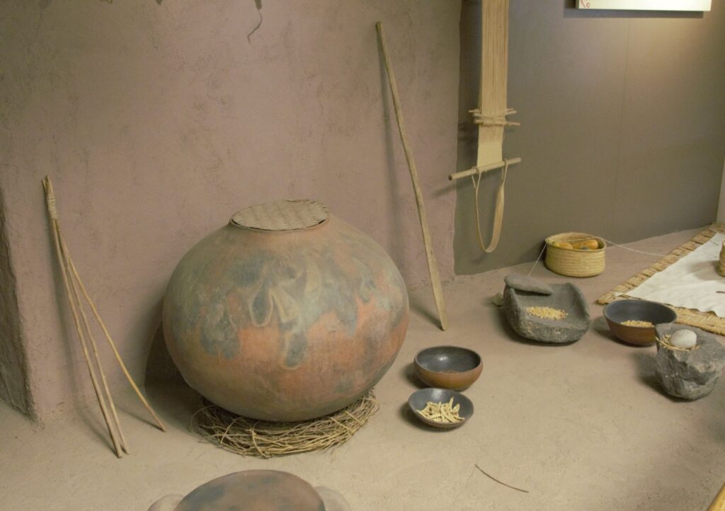
Since taking a pottery class many years ago, I have always been interested in pottery from historical sites. These pots were probably made by coil rope construction, smoothed, glazed and fired in a pit in the ground. What amazed me about these pots was their size!
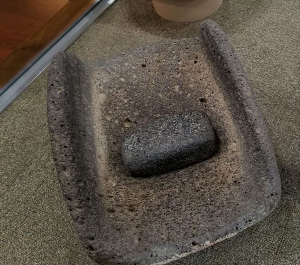
Large pots probably for water storage.Pottery imported from neighboring areas show that the desert people traveled and traded with one another.Grinding stone for grinding corn into flour.Wildlife is plentiful along the Verde River.
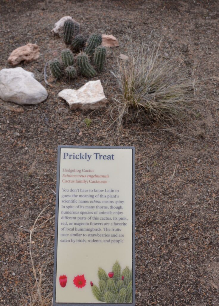
Along the walkway several indigenous plants were labeled. Isn’t this Hedgehog Cactus cute?
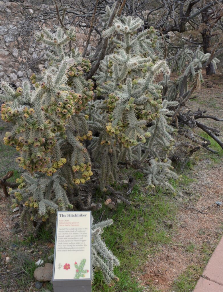
Cane Cholla Cactus is easily caught on clothing and shoes while walking by.
Today visitors can enjoy walking through the rooms of this ancient Indian village, see the displays of artifacts that were discovered here, and enjoy the beautiful views from atop the historical mound.
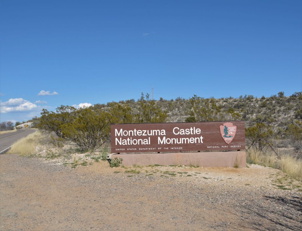
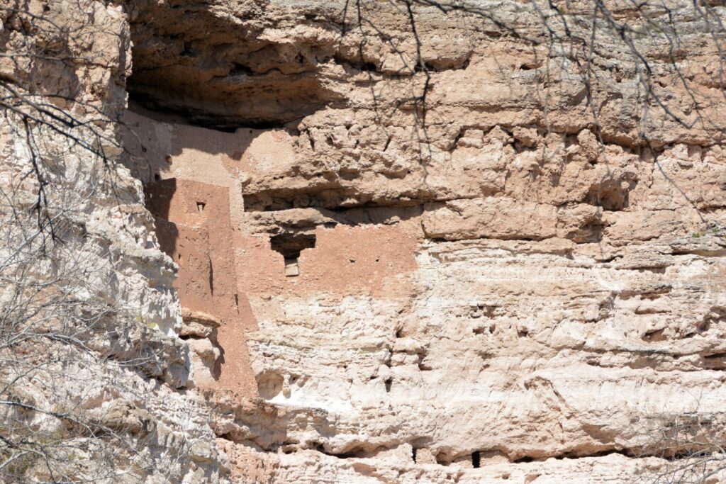
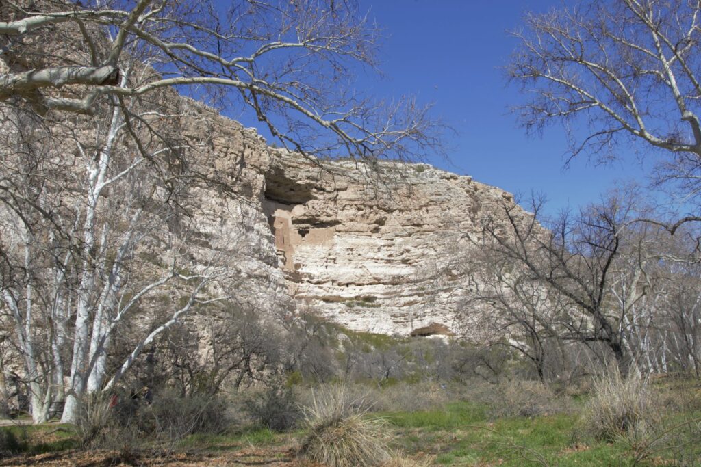
Montezuma’s Castle National Monument
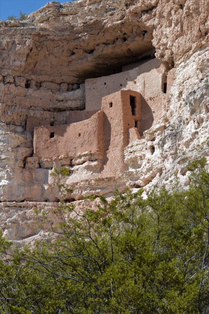
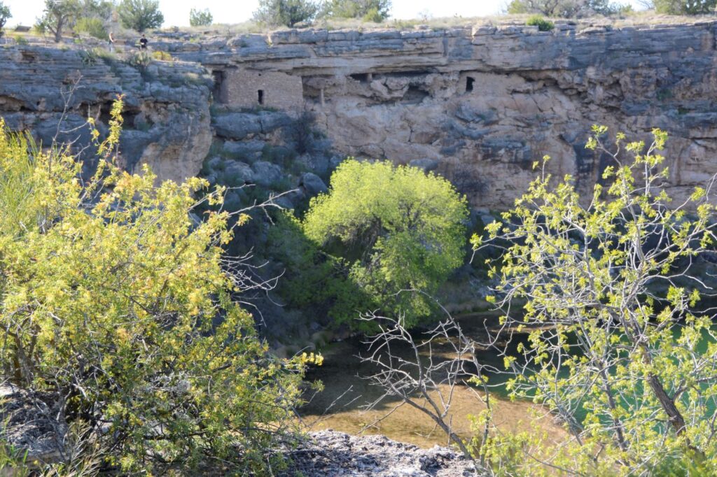
Less than 25 miles away is another ancient ruin known as Montezuma’s Castle National Monument which was also occupied by Sinagua people. It was misnamed by early discoverers of the site who thought that it was built by the Aztec Indians of Mexico.
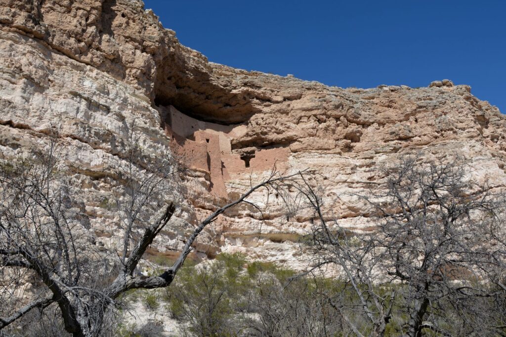
Montezuma’s Castle cliff dwellings
This pueblo cliff dwelling is an impressive five-story 20 room dwelling accessed by ladders during the time it was in use. It was south-facing, so it got the warmth of the winter sun. In summer, it was cool because of the shade from the cliffs.
Nearby, Beaver Creek kept the cliff dwellers supplied with water for living and gardening. The Indians grew crops of corn, beans and squash which were known as the Three Sisters because of how the plants worked together to sustain each other.
The beans climbed the corn stalks to reach sunlight, while supporting the corn from the winds, while the squash was a ground cover that kept the soil moist and discouraged the weeds. The beans, a legume, also enriched the soil. Do you grow these plants in your garden?
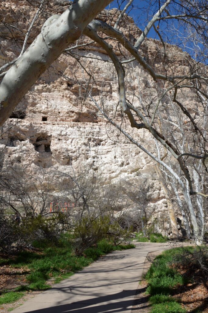
The pathway to the ruins is a short pleasant walk from the Visitors’ Center.One can see the similarities between these rock walls and the ones at Tuzigoot.
The day we visited, Beaver Creek was a rushing torrent from recent rains. The pathway to the creek was cordoned off to visitors. The Ranger told us that in a previous year, the creek had overflowed and the water came up to the bottom of the cliff. Maybe this is why the Indians built their pueblos way above the water.
Looking toward Beaver Creek, this area was where they grew their crops.
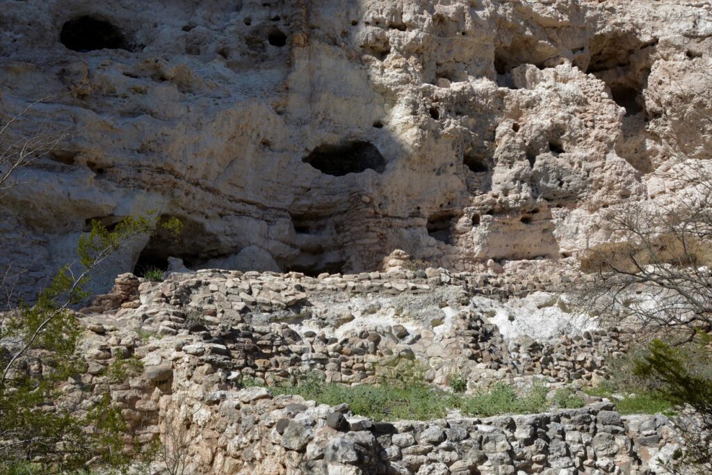
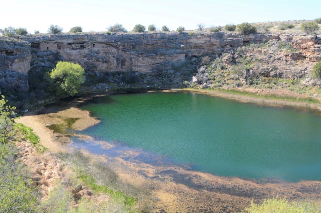
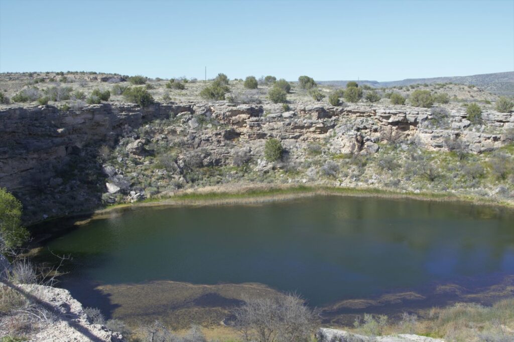
Montezuma’s Well
About 10 miles north of Montezuma’s Castle is Montezuma’s Well. Instead of taking us on paved roads, our GPS took us the long way. I couldn’t believe such a popular national monument would be accessed by a three mile dirt road. It dawned on us that there was a better way when we reached the entrance to the Monument. There was the paved road we were looking for. On our return route we followed the paved road back to Rimrock from which we were able to access Interstate 17.
Montezuma’s Well and cliff dwellings
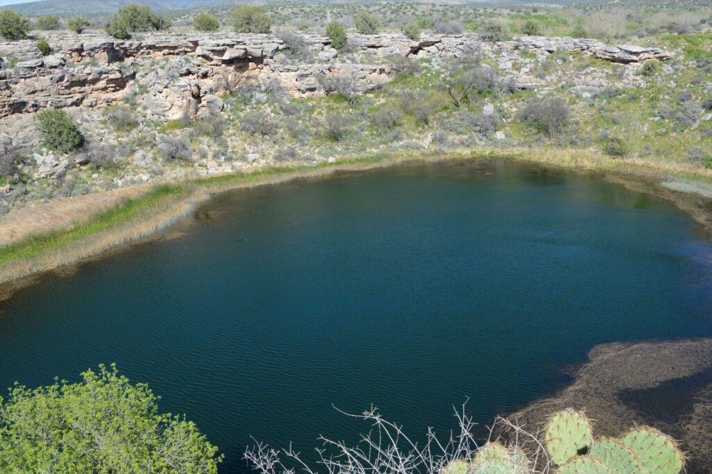
There is a short climb up to the rim overlooking Montezuma’s Well. The well is an ancient sinkhole that is fed by an underground spring of over 1.5 million gallons of water each day. The spring waters are from rain and snow that fall on the nearby Mogollon Rim which then seeps through the rock until it reaches the spring. Pressure pushes the water up to the surface. It is said that the water takes as long as 10,000 years to travel from the Rim to the Well.
The well is deep. Millions of gallons of water flow into and out of the well.
The water exits the well through underground streams and a cave system which drains into an ancient irrigation canal. The water level remains constant, as well as the temperature of the water which averages 70 degrees F. However, because the water has a high alkalinity and an excessive amount of dissolved carbon dioxide–more than 100 times higher than normal–fish cannot survive.
Fish can’t live in the water, but thousands of leeches live here.
The depth of the well is unknown because of the pressure of the water. Divers have discovered a “false bottom” at around 60 feet of pressurized groundwater that holds a column of fluidized sand in suspension. The fluidized sand rises from two deep vents in the floor of the well. One is 124 feet deep and the other is 74 feet deep. But previous measurements measured 137′ and 95′. So, we can just say, it’s deep.
Pueblo dwellings in the rocks above Montezuma’s Well
The people who built homes near Montezuma’s Well were the Hohokam and later the Sinagua.
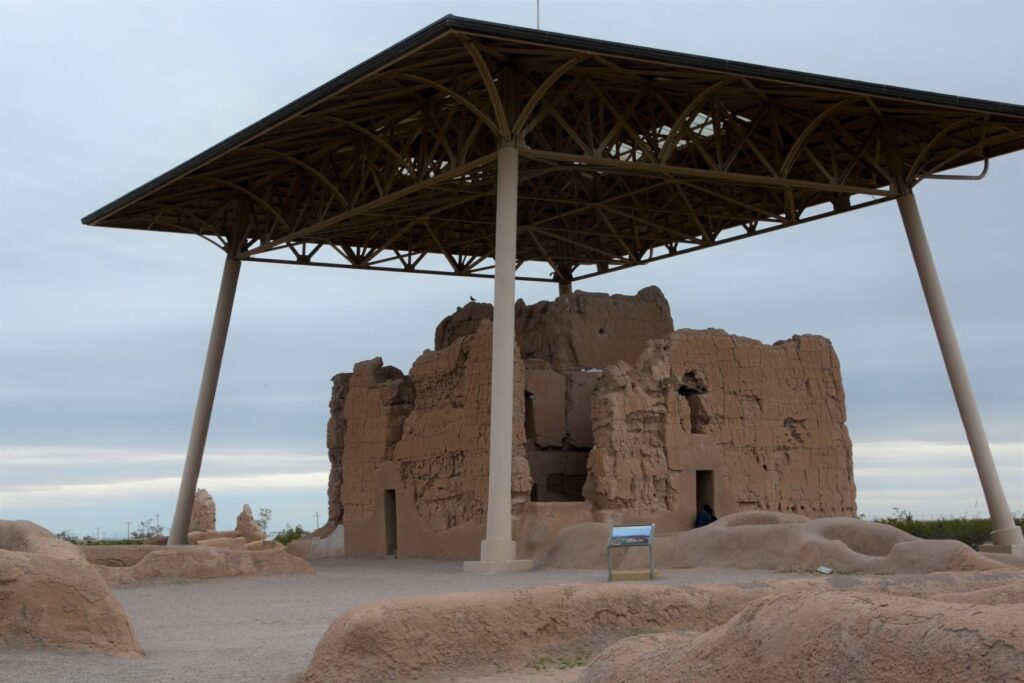
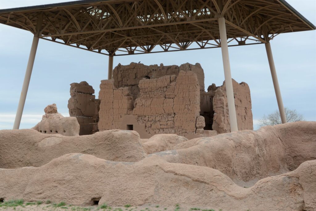
Casa Grande Ruins National Monument
Leaving the Verde Valley area, we traveled south to Mesa, Arizona. One afternoon we drove south, halfway to Tucson to Casa Grande Ruins National Monument. This “Grand House” was probably built in the 1300’s, which is the time period of the founding of the Byzantine Empire, the 100 years war, and the black death or bubonic plague in Europe. These desert people had already been using irrigation methods for hundreds of years to grow their crops.
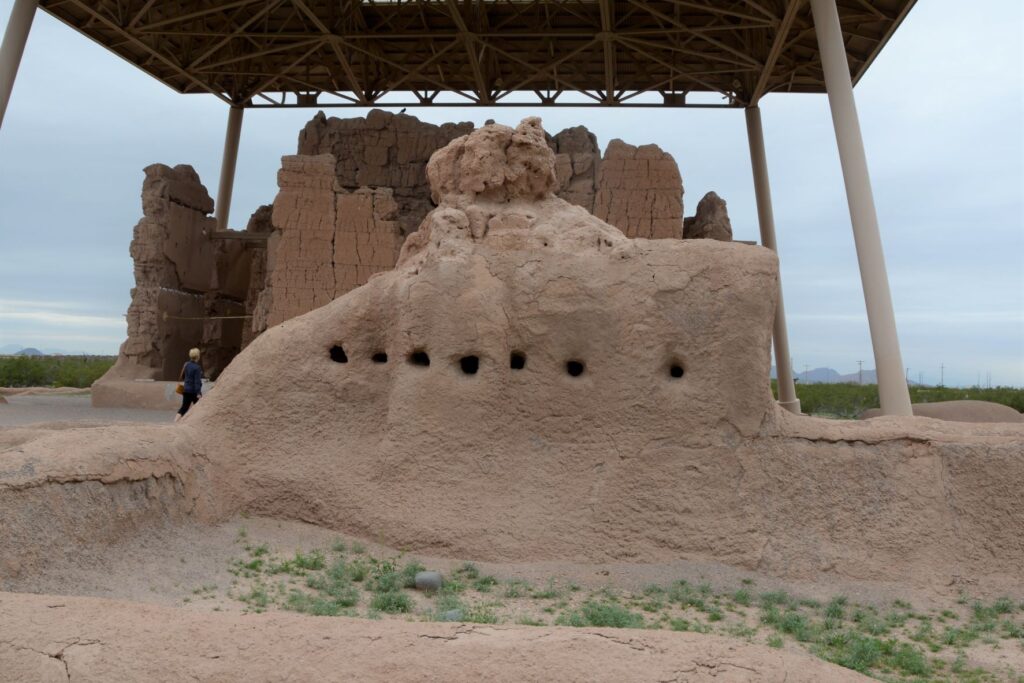
A metal structure over the ruins keeps it from deteriorating.
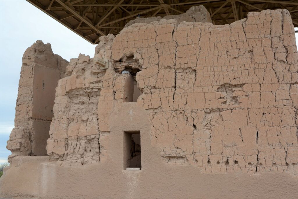
Archeologists are not sure of the purpose of this grand structure. However, because of the construction they believe it was well planned and organized. The builders used caliche, a natural concrete-like material found under the soil around this region. They used it to build houses with solid walls and flat roofs covered with this caliche substance.
Walls were made from caliche, a concrete-like material found in the ground.
These desert people were given the name “Hohokam.” It is not really the name of a tribe or people. The name may have come from “huhugam,” an O’Odham word that means ancestors. Today these people are referred to as Sonoran Desert people. By the way, Hohokam is the name of the grade school I attended. Our elementary schools were named after Indian tribes.
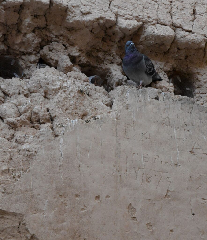
A pigeon makes its home among the walls of the ruins. Note the etched name and date below it.
When I took the photo above, I didn’t notice the name and date etched on the wall. It is a good thing that people like Mary Hemenway and President Benjamin Harrison took steps to preserve the ruins for future generations from vandalism and looting. Mary Hemenway was a wealthy woman who sponsored archaeological expeditions. One expedition to Casa Grande Ruins alerted her to the vandalism. She made efforts to preserve the site and as a result, it became the first federal prehistoric and cultural reservation by President Harrison in 1892.
One of the purposes of this structure might have been a calendar. Some of the holes line up directly with the sun on the summer and winter solstices.
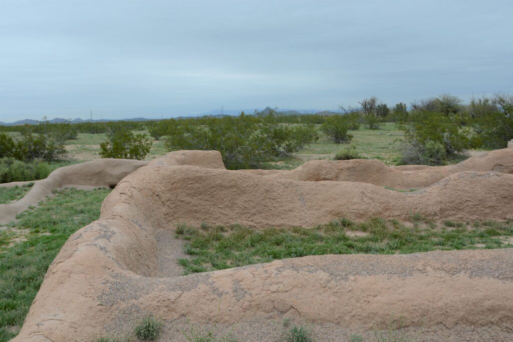
In later years, the village homes were grouped into caliche-walled compounds which were arranged around public plazas and public structures. The Grand House or Casa Grande was at the center of this settlement.
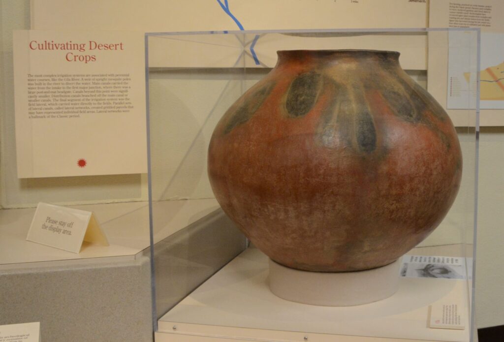
These desert people were identified by their type of pottery called “red-on-buff.” This beautiful piece of pottery below is an example of the techniques used in creating their pottery. In my opinion, the dark portions on this pot look to me like leaves of some plant that they tied around the neck of the pot while being fired which left these unusual designs.
This pot below looks similar in design to the one above with the plant-like designs.
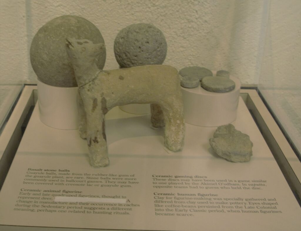
These desert people also enjoyed games. There are over 200 oval-shaped, structures with earthen sides located in large Hohokam villages in southern and central Arizona. Archaeologists have speculated that some kind of game was played within these courts with two teams using a hard rubber or stone ball. Round discs were found that might also have been used in other games.
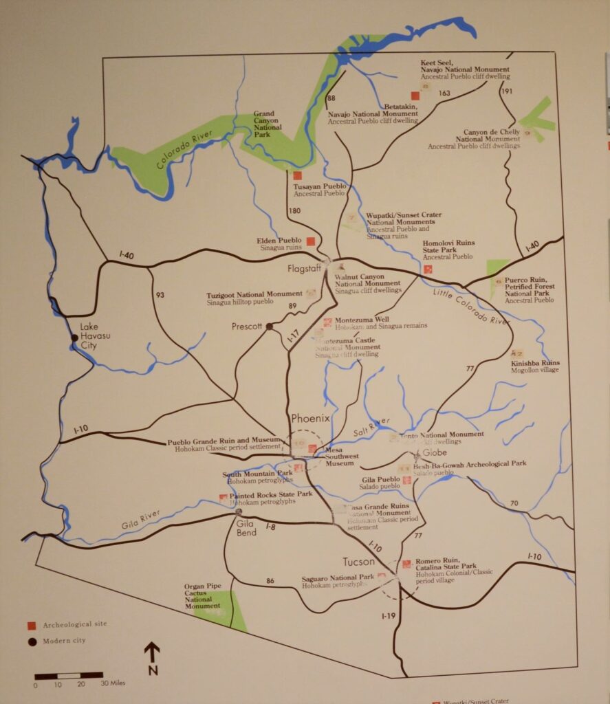
The map below shows many places around Arizona where the Sonoran desert people lived and moved. Eventually, they all left for unknown reasons. It may have been drought, floods, disease, invasion, earthquakes, internal strife or salinization of farmland. We don’t know. Yet we can still appreciate the structures, relics and places they left behind and marvel at their ingenuity.
I am glad we took time to see these places, having never visited any except Montezuma’s Castle when I was growing up. I don’t think I appreciated the contributions these people made to Arizona history. It’s a shame that Hohokam school didn’t teach us anything about the people that our school was named after. I think it would have made a big impression on me to have learned about them and to have visited Casa Grande National Monument.
But the moral of the story is, explore your own backyard. You never know what you might be missing!