Murals of San Angelo, Texas

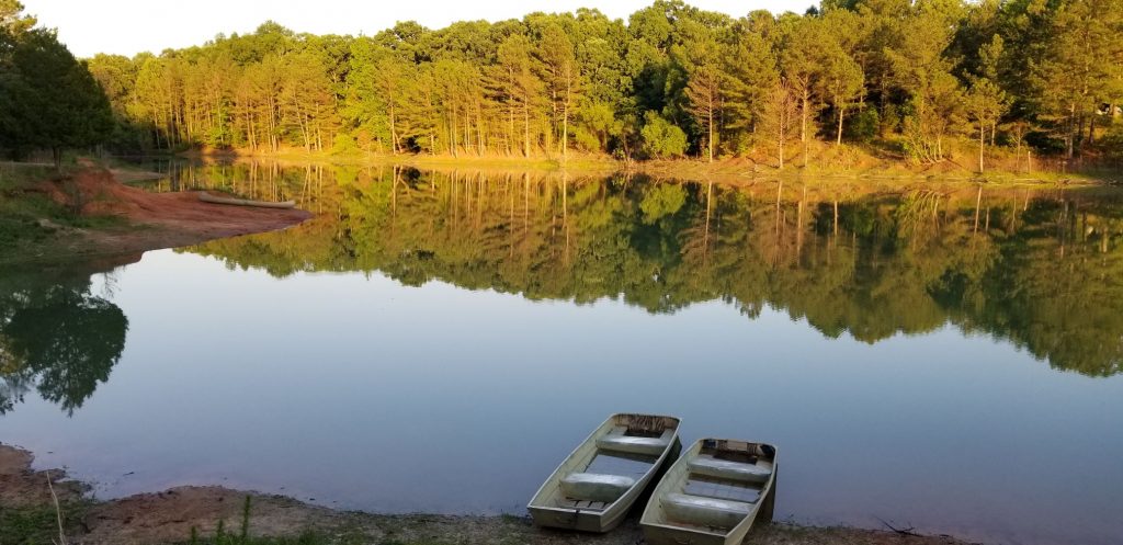
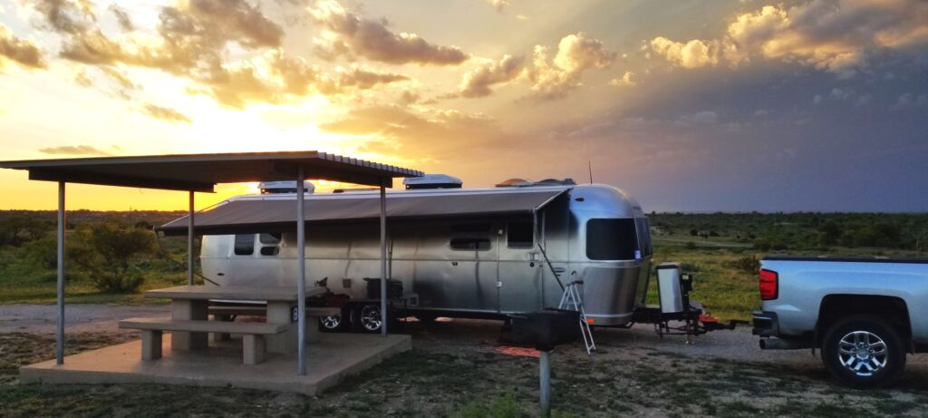
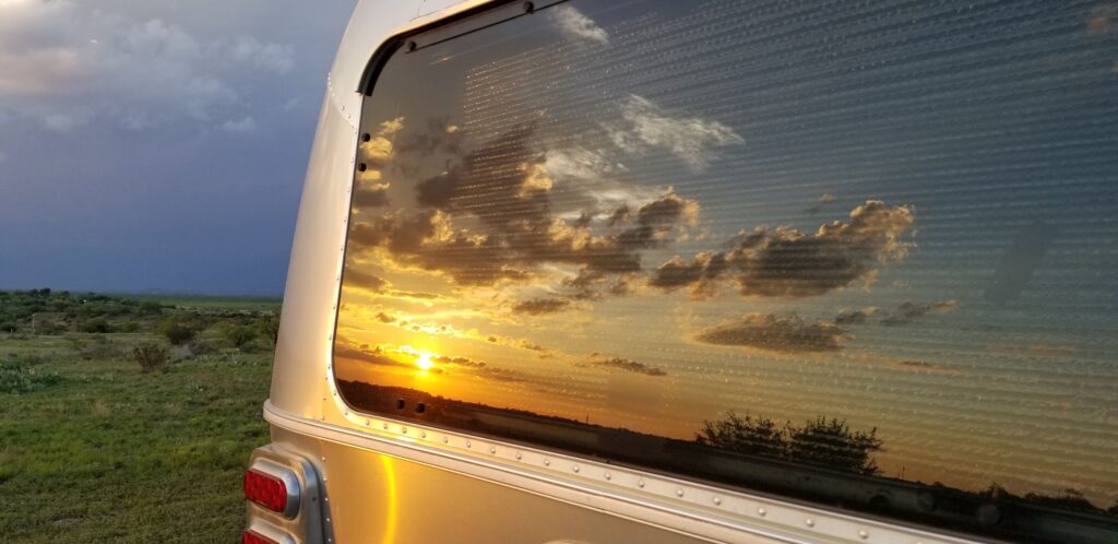
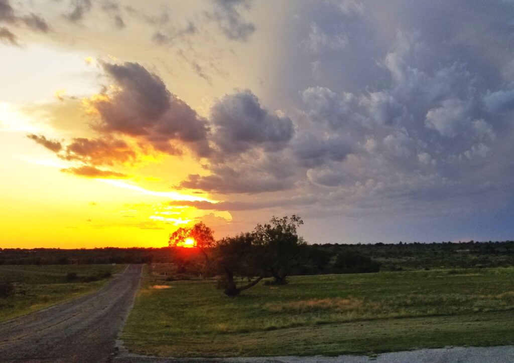
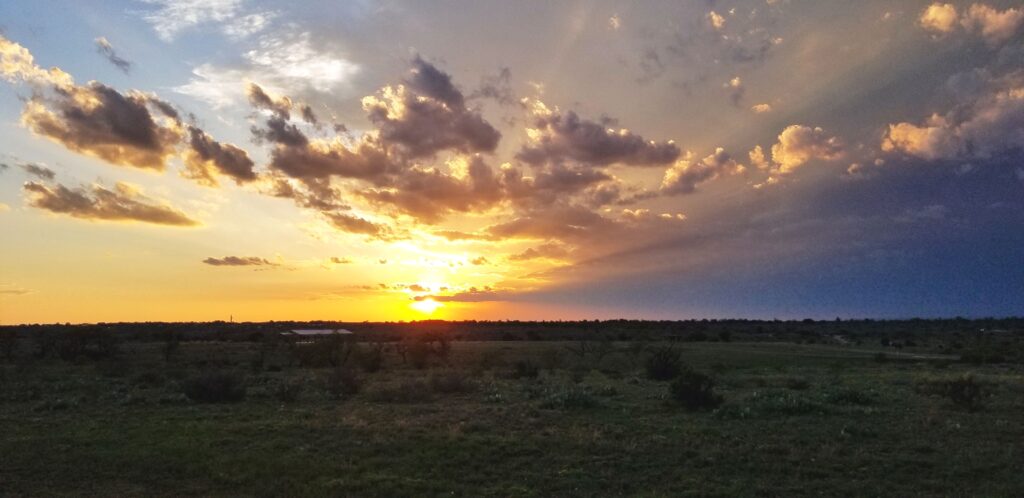
One of our favorite Texas towns to visit was San Angelo. We stayed in San Angelo State Park Campground where we had some great views of the evening sunsets.

Our campsite at San Angelo State Park

The weather was fickle with cloudy skies in the morning and rain and thunderstorms in the afternoons with clearing in between.

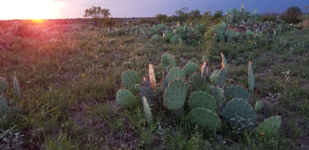
We sometimes went for walks in the evenings.

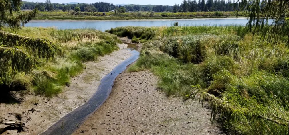
This part of Texas is dry and cactus, especially prickly pear, thrive.

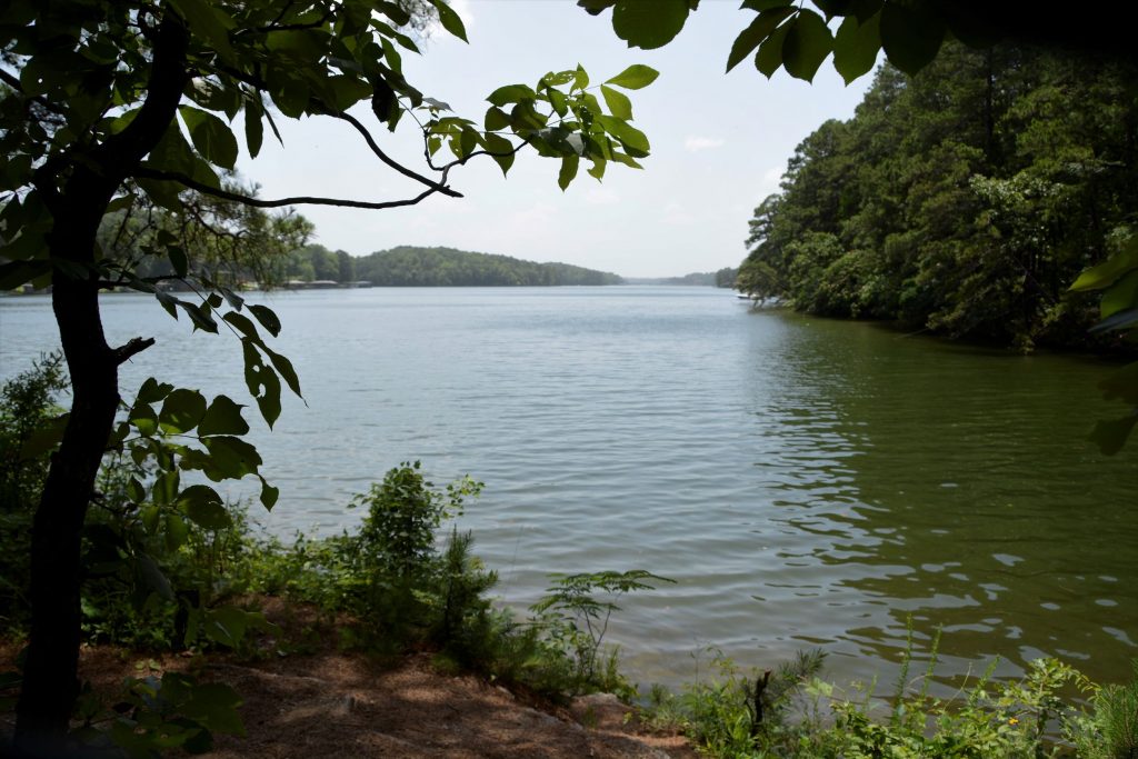
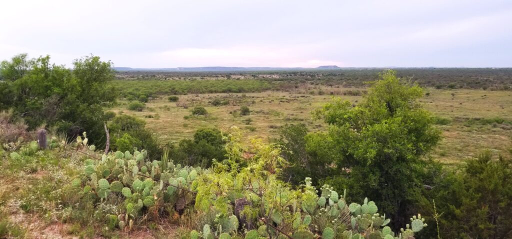
One evening we drove to a lookout in the park where we could see for miles.

Lookout at San Angelo State Park

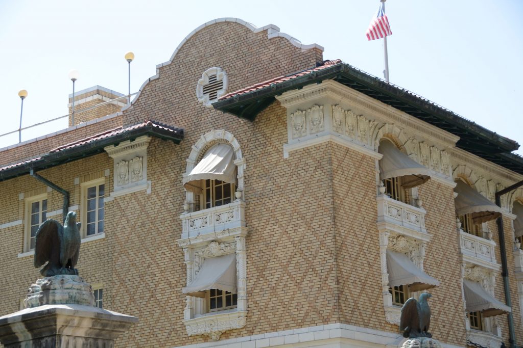
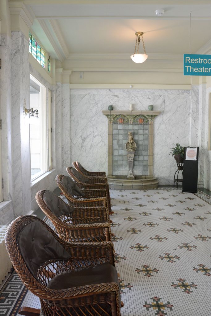
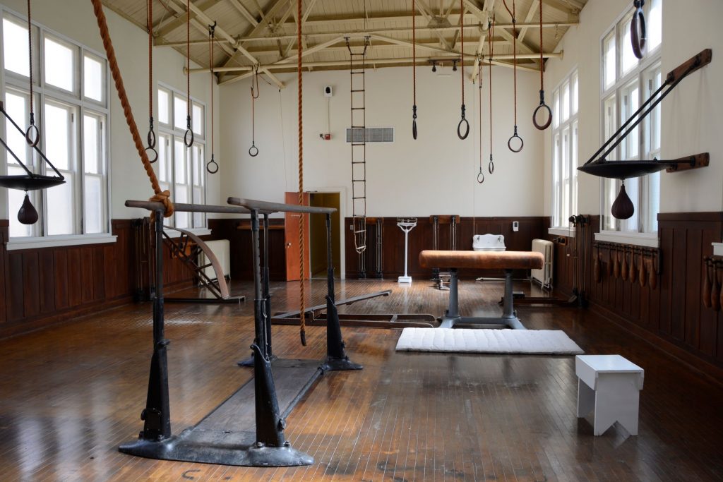
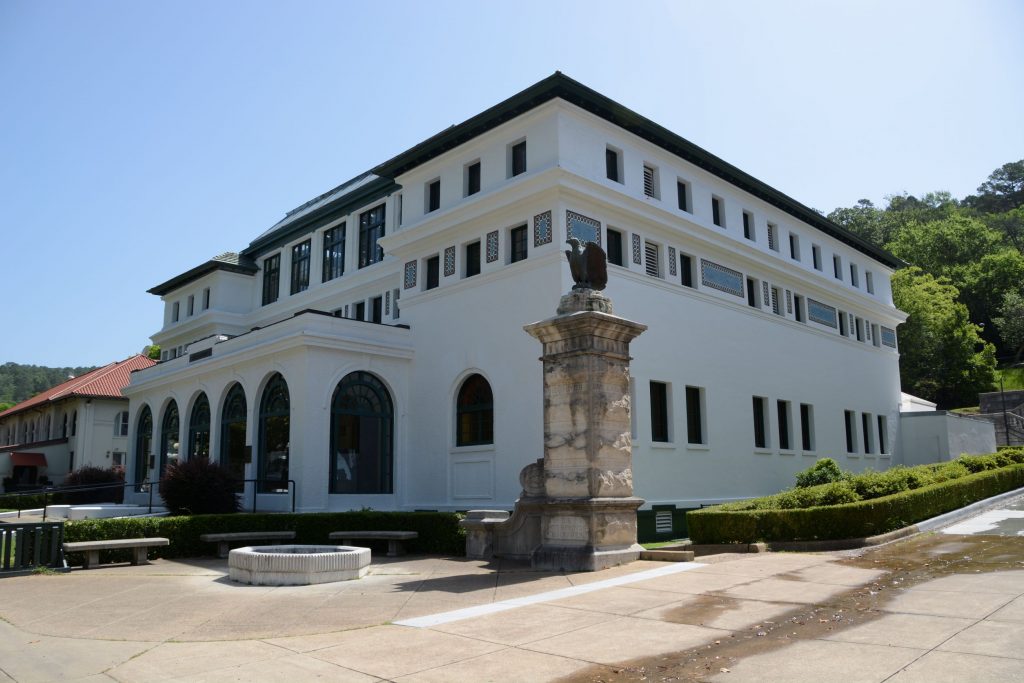
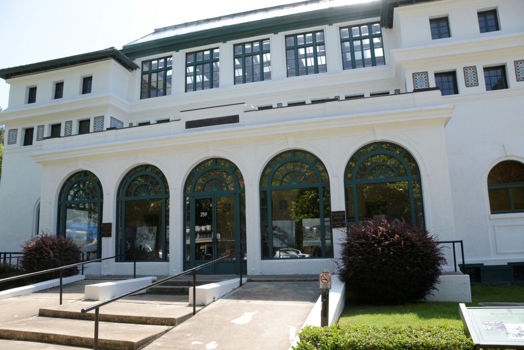
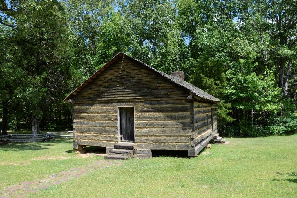
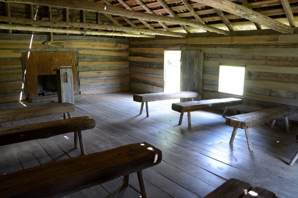
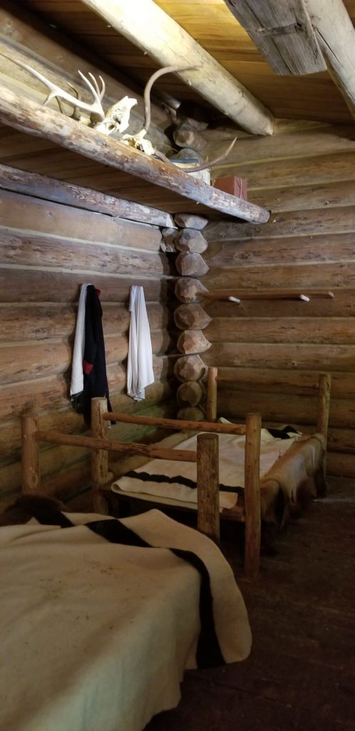
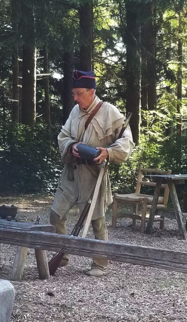
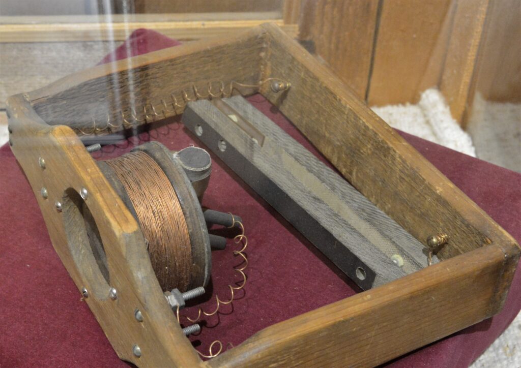
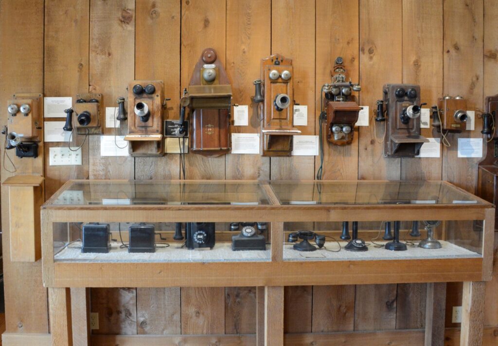
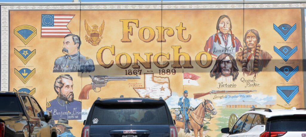
We drove into San Angelo to see some sites. Ray wanted to see the telephone museum located at Fort Concho, an historical fort established in 1867 to protect the frontier settlements. Fort Concho is now a National Historic Landmark, so I was able to get a stamp for my National Parks Passport book.

Fort Concho Museum of Telephony

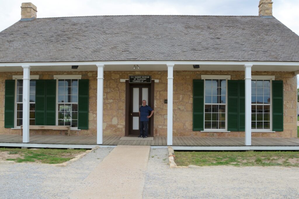
The museum has on display a unit designed and made by Alexander Graham Bell. There were only five made and only two in existence today.

Unit designed and made by Alexander Graham Bell in 1876.
Old phones from Museum of Telephony in San Angelo, Texas

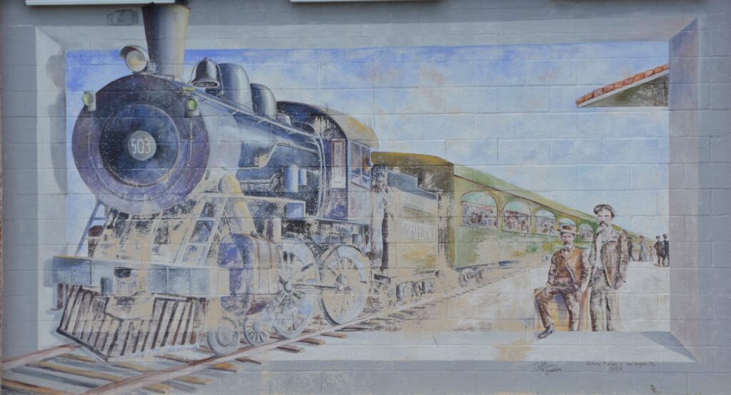
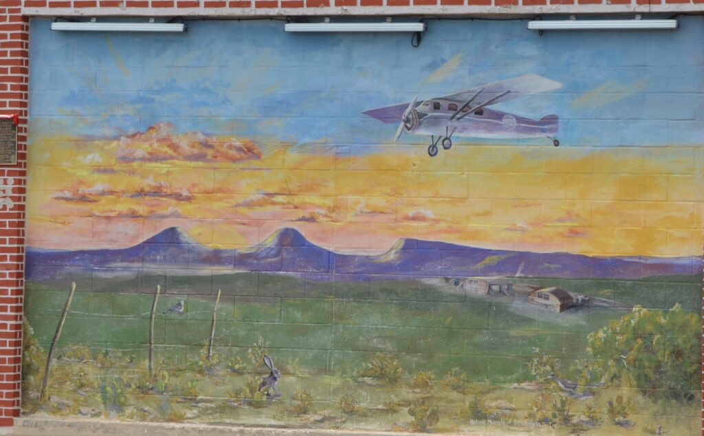
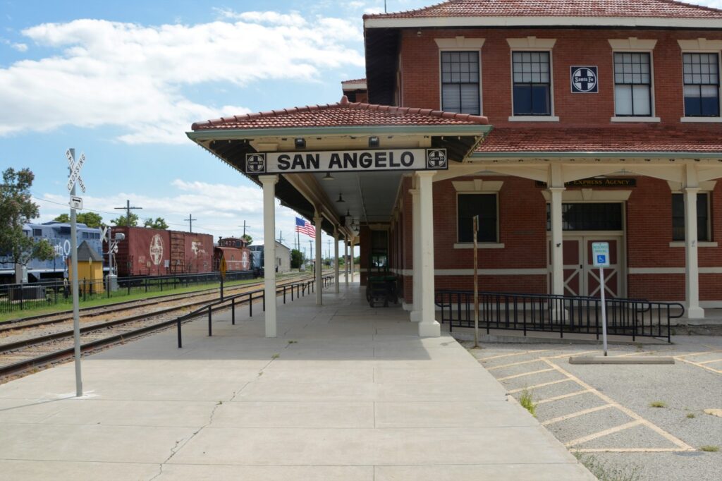
San Angelo is known for their historic murals depicting the history of the area. We went on a search to find as many as we could. The first one we saw was near the Train Museum and depot. It was about all the forms of transportation used throughout their history.

Four murals capture the history of transportation.

Up closer, they look like this.

Horse and buggy days.
Stagecoach was a form of transportation in the early days.
The Iron Horse was a vast improvement for transporting goods and people to the west.
The airplane made the vast Texas distances seem much smaller.

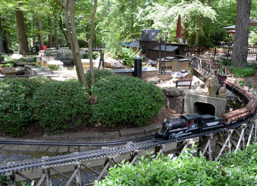
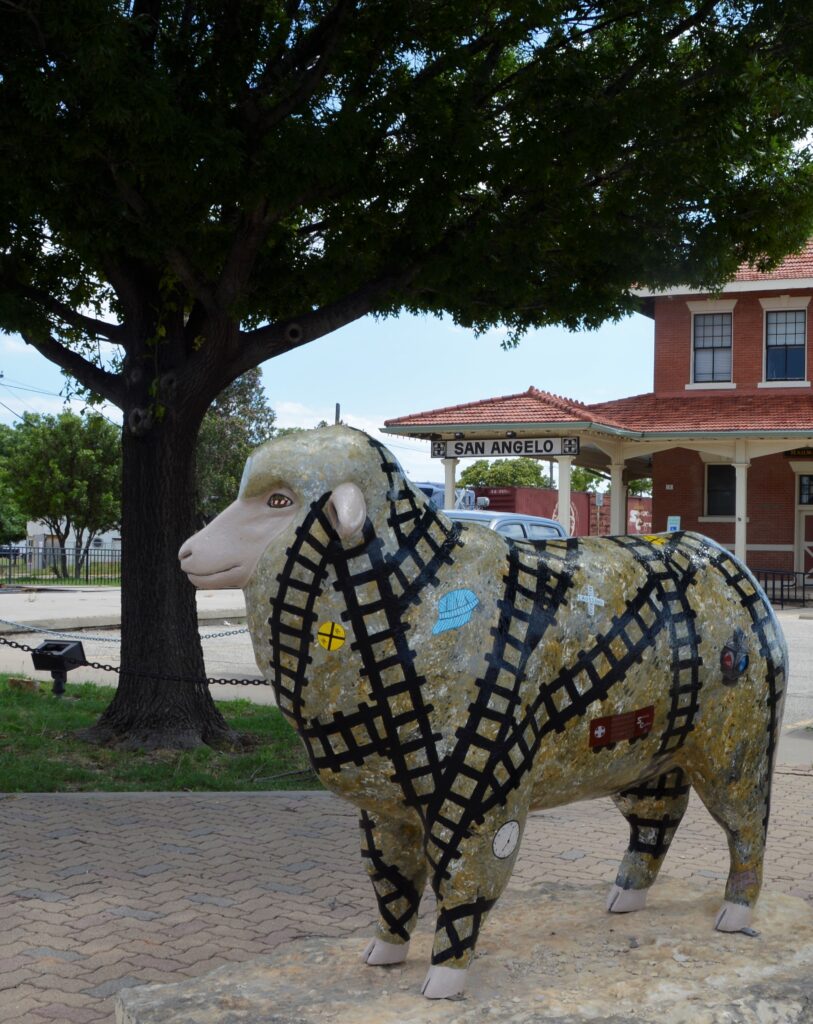
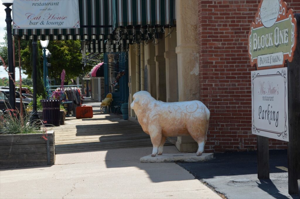
One of the things we were told to look for were sheep. They are decorated and found all around town. This one was at the Train Museum and Depot. We wanted to see the train museum, but we were on a mission to find the murals. We decided to save it for another time.

Train Museum and Depot

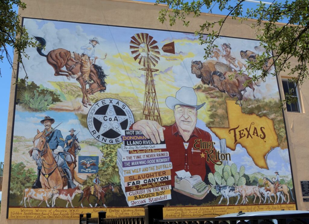
Most of the murals are found near the old downtown area of San Angelo. Since they are painted on the sides of buildings in parking lots, sometimes it was hard to get a clear photo of them. This one is of a local author who writes westerns about the Texas Rangers. His name is Elmer Kelton. I have not read any of his novels, but they sound interesting.

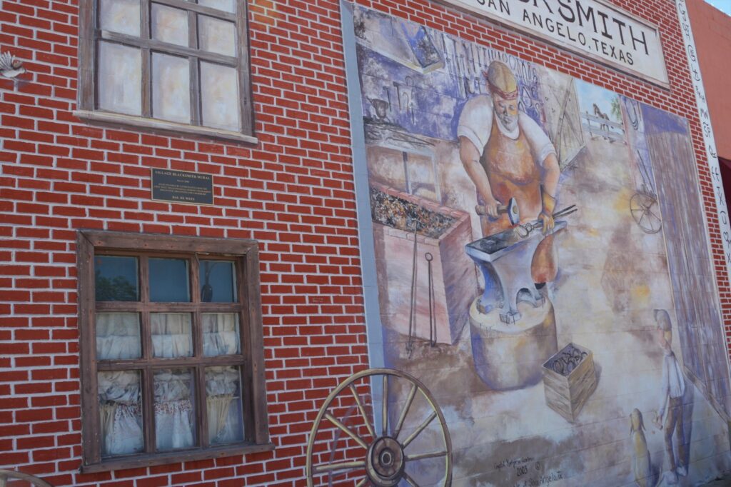
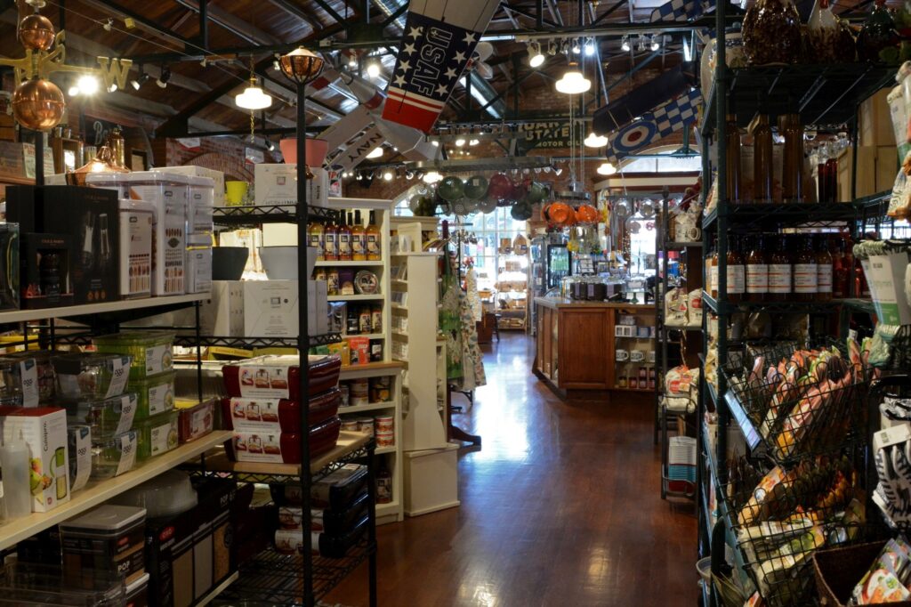
I stumbled across the Blacksmith mural while looking for another mural. This is right across the street from the famous Eggemeyer’s General Store. While taking a photo of Eggemeyer’s from across the street, I came upon another sheep!

Sheep #2
Eggemeyer’s General Store

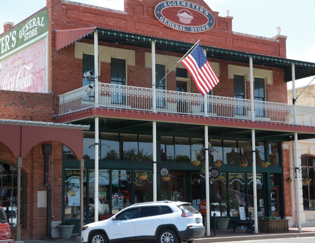
This store has so much in it, it could take hours to see it all. I liked the Indian with the lollipops in his headdress.

Indian Lollipop holder

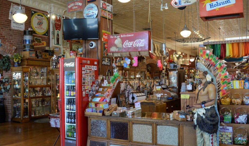
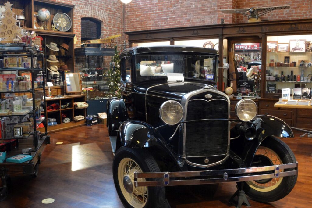
There were all kinds of candies, chocolates, sweets, jewelry, household goods, teapots, teacups, knickknacks, vintage signs, vintage toys, aprons, hand towels, kitchen items, bandanas, cards, stationery, and even an old car in the men’s section.

The men’s section had an old car.

The best thing about living in a travel trailer is that you’re not tempted to buy anything because you don’t have room. The worst thing about living in a travel trailer is that you can’t buy anything because you don’t have room.

I enjoyed just looking at all the kitchen items.

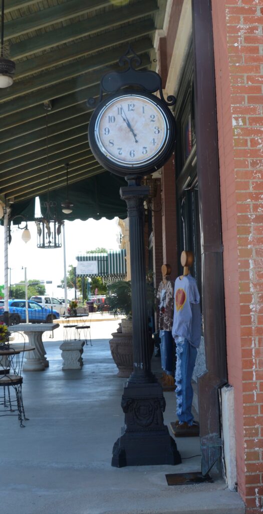
I collect photos of street clocks. Here on this same corner was a street clock.

Street clock in San Angelo, Texas

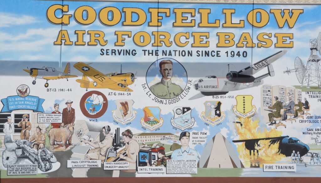
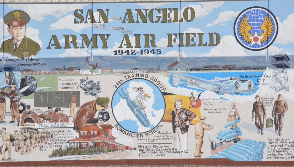
We wanted to find some more murals, and to my surprise, I found three more on the opposite street corner. These three were together and depicted the military history of the area. Ray was stationed in San Angelo for training at Goodfellow Air Force Base. He had a five and a half month long advanced electronic repair training.

Goodfellow Air Force Base mural

San Angelo Army Air Field was only used from 1942-1945 for training bombardiers for combat missions. It was closed after WWII and today is a civil airfield called Mathis Field.

San Angelo Army Air Field Mural

Fort Concho, as mentioned earlier, was a fort established to protect frontier settlers. William “Pecos Bill” Shafter commanded here along with other notables. Also, the 9th and 10th Cavalry Regiments and 24th and 25th Infantry Regiments were all black soldier units known as the Buffalo Soldiers.

Fort Concho Mural

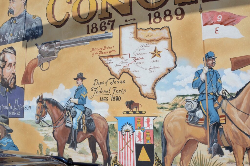
Here’s a closer look at some of the details.

Fort Concho Mural

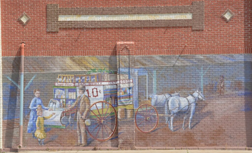
By now, we were hot and tired. We managed to find one more mural. This one was not mentioned on the website list of murals. I call it the Dry Goods Mural. There were two or three more that we missed or couldn’t find.

Dry Goods Mural

There were many more things we would have liked to see, but there just wasn’t time and energy for them.

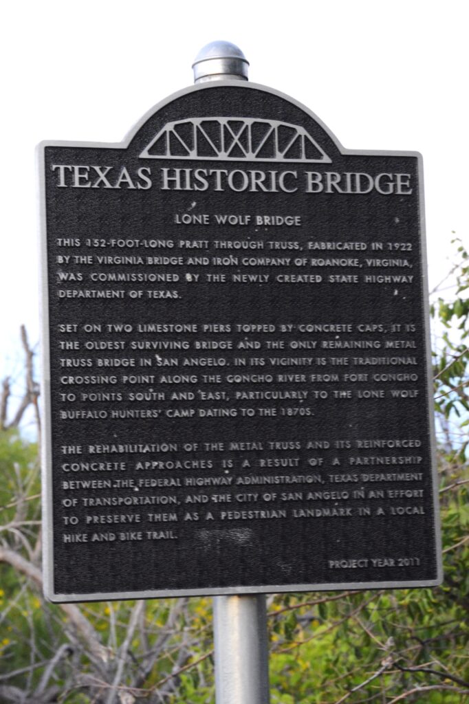
We did, however, drive into town to see Lone Wolf Bridge in the evening. It was supposedly lit up at night, but though we stayed for awhile after sunset, we never saw any lights. It looks like a hangout for taggers. The bridge is covered with graffiti, It’s a sketchy area at night. So we left.

Lone Wolf Bridge

You can read about this historic bridge below.

If you ever get to San Angelo, there are lots of things to see. The top of my list is the water lily gardens and the murals. And don’t forget to take a picture of a sheep! They are all over town.

For a photo tour of sheep and their “ewe”-nique names, click on this link:

https://www.downtownsanangelo.com/sheep-gallery

Hot Springs National Park

June 2022

This year we tried something new and stayed in some Army Corps of Engineer campgrounds along our way. We found that these parks are generally very nice, and well-kept. The price at this particular one was $14 per night with our National Parks Senior Pass. We made our reservations online and we could pick our campsite and even see a photo of it. The one drawback is that some of them do not have sewer hookups, but there are always free dump stations available.

Army Corps of Engineers Campground, Little Rock, Arkansas

One such park, Maumelle in Little Rock, Arkansas, was right along the Arkansas River which happened to be nearly in flood stage. (The park was well above the water line.) The sites were nicely shaded.

Arkansas River at Maumelle Campground

Hot Springs National Park

Hot Springs National Park is located not far from Little Rock, Arkansas, in the town of Hot Springs. It was the 18th national park established in 1916. However, it had long been a popular place with its ancient thermal springs, mountain views and historic bathhouses with their grand architecture.

We camped at Gulpha Gorge Campground which is within the park boundaries and just minutes away from the Hot Springs National Park attractions. Again, with our National Parks Senior Pass, the fees were very low.

Gulpha Gorge Campground

On the day we explored the main part of the park, we got an early start and found a free parking space near enough to walk to Bathhouse Row. Temperatures were going to be pretty hot that day, so we wanted to get out early to beat the heat.

This national park seemed very different from others, in that, it is located in the downtown area of a small city. The park boundaries extend beyond the downtown area into the hills above the city where the hot springs originate.

On the way to main street, we saw this hot water cascade at Arlington Lawn. We dipped our fingers in the water, and it was hot enough that we couldn’t hold our hands in it for long. The corner area of this block is a park with shade trees, green grass and walkways. Trails wind up and around the backsides of the row of bathhouses.

Park near hot water cascade
Pool at the bottom of hot water cascade
Pool at hot water cascade in Hot Springs NP

Looking down Main Street, you can see several of the bathhouses. Some are open to the public, and others are fully operating businesses offering hot mineral baths and spa treatments to their customers. And two are operated by the National Park Service.

Bathhouse Row

The Quapaw Bathhouse is known for its mosaic tile dome.

Quapaw Bathhouse

The Ozark is home to the Hot Springs National Park Cultural Center. The Center features gallery spaces for displaying artwork from the park’s Artist-in-Residence Program. Admission was free but because of time, we had to choose which bathhouses we could explore, and we opted to skip this one.

Ozark Bathhouse

I love the blue awnings of the Buckstaff bathhouse seen below. It is the only one that offers a traditional bathing experience. It has been in continuous operation since 1912.

Buckstaff Bathhouse

The Lamar contains offices for the park’s employees and the park store. I love browsing in the national park store. I don’t buy souvenirs, but it’s fun to look.

Lamar Bathhouse

The Fordyce Bathhouse is in the middle of the block. It functions as the park’s visitor center. It is the largest bathhouse on the Row with three main floors, two courtyards, and a basement under most of the building. It houses the museum.

It is also where I could get my National Parks Passport stamped.

Fordyce Bathhouse

The Fordyce Bathhouse Museum is located here and visitors can go on a self-guided tour. The architecture on this building is really interesting.

Closer view of Fordyce Bathhouse architecture

Inside tour of Fordyce

Our tour began in the lobby where we were greeted by an elaborate fountain situated in a room of wicker rocking chairs sitting on a mosaic tile floor.

Inside Fordyce Bathhouse

Men’s and women’s areas were separate. Here is the the De Soto Fountain in the men’s area.

Fordyce Bathhouse

Below is a photo of the gymnasium with period equipment.

Gymnasium at Fordyce Bathhouse

There were many beautiful stained glass windows and ceilings. This room was an area to relax and enjoy conversation or listen to music played on the grand piano. Notice the beautiful stained glass ceiling and mosaic tiled floor.

Lounge at Fordyce Bathhouse
Grand piano of Fordyce Bathhouse

At the end of our tour, we walked back to the truck to take a break and get some refreshments. Afterwards I took photos of the other bathhouses before we left.

The Maurice Bathhouse is a commercial enterprise of art and high-end tourist items. The architecture is really beautiful.

Maurice Bathhouse
Maurice Bathhouse front view

The Hale Bathhouse is now Hotel Hale, a luxury hotel. Overnight guests can stay in historic rooms and experience the thermal springs.

Hale Bathhouse

We drove to another part of town and ate lunch at Chick-fil-A. While we were there, a lady at the table next to us introduced herself and gave us some “must see” sites to see which included the observation tower and the botanical gardens.

We only had one day to see everything, so even though it was hot, we decided to see as much as we could.

Hot Springs Mountain Tower

This tower (shown below) is located on the mountain behind Bathhouse row up a steep winding road. At 1,256 feet above sea level, it overlooks 140 miles of surrounding Arkansas countryside.

We took the elevator up to the top observation deck and enjoyed the views.

Looking out from the observation deck, we could see the town of Hot Springs and Bathhouse Row.

View from Hot Springs Mountain Tower
View from Tower

Garvin Woodland Gardens

Another suggestion from our friendly lady at lunch was to see Garvin Woodland Gardens located a few miles outside the city. At one time, it was logged for trees. After the trees grew back a second time, the owner was going to log it again when his daughter, Verna Cook Garvan, stepped in and asked him to spare them. She eventually inherited the land and turned it into a botanical garden, planting themed garden areas, and developing it for over 30 years. At her death it was donated to the University of Arkansas with the stipulation that it be preserved and cared for.

Entrance to Garvan Woodland Gardens
Flowers at entrance of gardens
Hydrangeas at entrance of gardens

The garden encompasses 210 acres and has miles of pathways meandering throughout the forest canopy.

Near the entrance is an elaborate garden railroad with several trains running simultaneously through the tunnels and over bridges and tracks.

Garden Railroad
Garden Railroad

Though the day was hot and humid, we stayed under the shady trees on most of the pathways. We only explored a small part of the gardens. The pathways wound downhill toward the lake and koi pond.

Miles of shaded pathways lead throughout the garden.
Bridge to pathway to Japanese garden area.
Bonsai plants in Japanese Garden area.
Lilies line the pathway
Lilies

All of the water is pumped uphill from the lake to make the creeks, waterfalls and pond.

Round stone bridge
Pink Hydrangeas
Waterfall
Waterfall into the Koi Pond

When we were at the Koi pond (shown below), I saw something swimming across the water. At first I thought it was a fish, but then I realized as it got closer that it was a snake! It was swimming with its head out of the water using its body to propel it.

Koi Pond
Waterfall
Lush green trees and bushes
Shoreline of lake

What goes down, must go back up. Eventually we had to hike back uphill to the entrance and parking lot. We were glad to get back to the truck and cool off in the air conditioning. We were only able to explore a small part of this huge botanical garden. I would love to go back someday when the weather is cooler and explore more of this place of beauty. It is truly unique and beautiful.

Shiloh National Military Park

June, 2022

Cherokee Landing Campground

In the Western half of Tennessee we stayed at a Thousand Trails campground near the small town of Saulsbury. Nearly 40 miles away is the national historical battlefield of Shiloh, a civil war battleground. Having never visited a national battleground before, I wasn’t sure what to expect.

Shiloh National Military Park

Replica of Shiloh Church

We started out at the Visitor’s Center where we watched an award winning documentary about the battle of Shiloh that took place on April 6-7,1862. The battle was named after a small church in the vicinity. Ironically, the name Shiloh means “place of peace” or “heavenly peace”. It is much more fitting today as the beautiful grounds are quiet and solemn.

Inside Shiloh Church

The Union Troops came south on steamboats to Pittsburg Landing on the Tennessee River. The goal was to take the Confederate’s stronghold at Corinth, Mississippi, (a few miles to the south) in order to cut the South’s supply lines. Corinth, Mississippi, was a crossroads where railway lines from the east and west met ones from the north and south. We visited Corinth and saw where these railroads crossed.

Corinth Railroad Junction

General Grant of the Union Army was waiting for Buell’s Army of the Ohio to join him. Little did Grant realize that the Confederates who he thought were in Corinth, had moved near Shiloh to launch a surprise attack.

The Confederate Army under General Johnston originally had planned to attack two days earlier. Due to a heavy rain storm that turned the roads to mud, it took Johnston three days to move his army just 23 miles. They were also short of rations due to the delay.

In the meantime, General Grant was trying to avoid a battle until his reinforcements arrived, but early on April 6th, a Union reconnaissance patrol came face to face with the Confederates and the battle began.

The battle raged for two days with thousands of casualties. At first, the battle went in favor of the Confederates, but after the second day, the Confederates were outnumbered and out of supplies. They retreated to Corinth, where the war continued.

The pathway where the battle began when Union soldiers stumbled into Confederate pickets.

Many beautiful monuments have been erected to honor the armies of both sides. We took a twelve mile self-guided tour on the roads throughout the park. There were many monuments and memorial sites as well as signs with explanations of the battle sites.

Monument to the Iowa soldiers
Monument to Indiana Infantry, 17th Regiment
Confederate Memorial
Explanation of Memorial

The roads through the battlefield were lined with beautiful trees and park-like vistas.

The Confederates amassed more than 50 cannons, the largest concentration of field guns yet witnessed along a half mile frontage, to pound a dense oak thicket in the middle of the battlefield that the Union Army still held.This kept them pinned down while the Confederates surrounded them forcing the Union soldiers to surrender.

This map shows the troop placements and time of day when the Confederates surrounded part of the Union Army. Some were able to escape, but many were captured.

Hornets Nest

Much of the battle of Shiloh took place on farmland of Joseph Duncan.

The Sixth Mississippi lost over 300 men in less than an hour.

Mississippi Memorial
Minnesota Monument
Tennessee Monument

No part of this battlefield was left untouched by the horror of this battle. Mass burial graves were necessary to inter the 3,482 dead. More than 16,000 were wounded and 3,844 were captured or missing. This was the bloodiest battle of the Civil War thus far, and the war was only a year along.

Bloody Pond

The Civil War was a costly war in terms of humankind. National Military Parks like this help us to appreciate the history of our country and the freedoms we have because of those who went before and paid the price.

It is sobering to think of the cost of freedom. Young men in the prime of their lives were cut off from living so that we can enjoy freedom to live as we do today. We can honor them by supporting parks like this.

A Museum and a National Historical Park

July, 2021

Columbia River Maritime Museum

While we were staying in Seaside, Oregon, we went to The Columbia River Maritime Museum in Astoria, Oregon. As we entered the museum, we saw a large map of the shipwrecks at the mouth of the Columbia River.

Map of shipwrecks in the “Graveyard of the Pacific”, Columbia River Maritime Museum.

We watched a 3D surround sound documentary of “Aircraft Carrier–City at Sea” in the Theater. Then we wandered around the exhibits and learned about the extreme conditions of the Columbia River Bar, the U.S. Coast Guard and the Columbia River Bar Pilots.

U.S. Coast Guard Rescue display at Columbia River Maritime Museum.
Display in Columbia River Maritime Museum.

The museum tells the history of the Columbia River from the times of the Indians and their dugout canoes to the present day. The museum is very expansive and takes 2 or 3 hours to see everything. We took a break for lunch and walked across the street to a food truck to get lunch and then came back to see more.

Outside the museum is docked the Lightship Columbia, a National Historic Landmark. It is an actual lightship that used to guide ships to safety at the mouth of the Columbia River. I was able to go aboard and see the sailors living quarters. The lightship is a floating lighthouse manned by a crew of 17 men working two to four week rotations, with 10 men on duty at a time. It was in use from 1951 to 1979.

The Columbia Lightship–part of The Columbia River Maritime Museum.

We learned at the museum that ships today must have a specially trained pilot to guide them through the mouth of the Columbia River where it meets the Pacific Ocean. This pilot will come aboard their ship and guide the ships through the treacherous waters and sand bars at the mouth of the river. We saw several large cargo ships waiting their turn.

Cargo ships on Columbia River await their turn to go through the dangerous waters at the mouth of the Columbia River.

Lewis and Clark Natl. Historical Pk.

Lewis and Clark have always been two of my favorite explorers ever since I read “Streams to the River, River to the Sea” by Scott O’Dell. The story of their amazing adventure is told in part at the Lewis and Clark National Historical Park near Astoria, Oregon, off Highway 101. Besides having another national park to check off of our list, it gave us a day of learning about the history of our country and some exercise as we hiked the trails near the visitor center.

We stopped at the Visitor Center where we saw a short film about the story of the winter fort of the Lewis and Clark Expedition in1805 – 1806. They named it Fort Clatsop after the nation of Indians who resided nearby.

Replica of Fort Clatsop, the winter fort of the Lewis and Clark Expedition.
Inside Fort Clatsop
Sleeping quarters inside Fort Clatsop.
Room inside Fort Clatsop

At the fort we watched a demonstration of the loading and shooting of a black powder rifle.

We walked down a pathway to the place on the river where Lewis and Clark could possibly have docked their dugout canoes.

Pathway to river access.
Boardwalk to river.
River access.

Lewis and Clark National Historical Park actually has several different site locations. Many of the other sites are only minutes away. We decided save some of those different locations for another visit at another time. In all, we had an enjoyable day visiting this park.