Crescent City and Battery Point Lighthouse

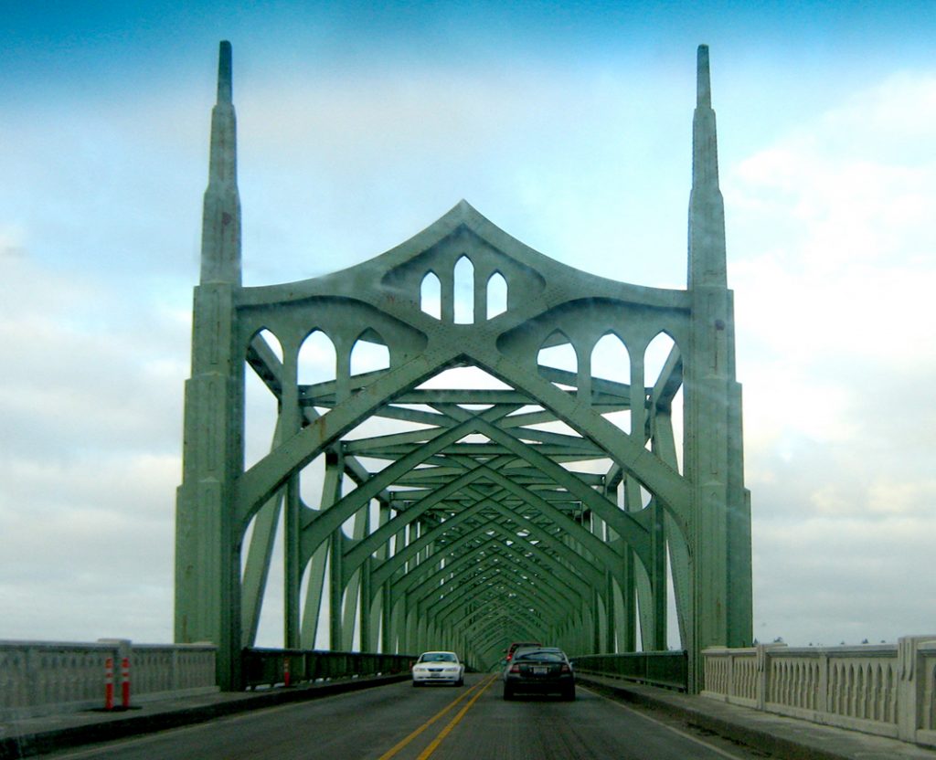
Crescent City lies on the northern coastline of California just 20 miles south of the Oregon border. We drove north on Highway 101 from our campground in Klamath to Crescent City one afternoon to see the quaint little town and lighthouse.

Northern California coast

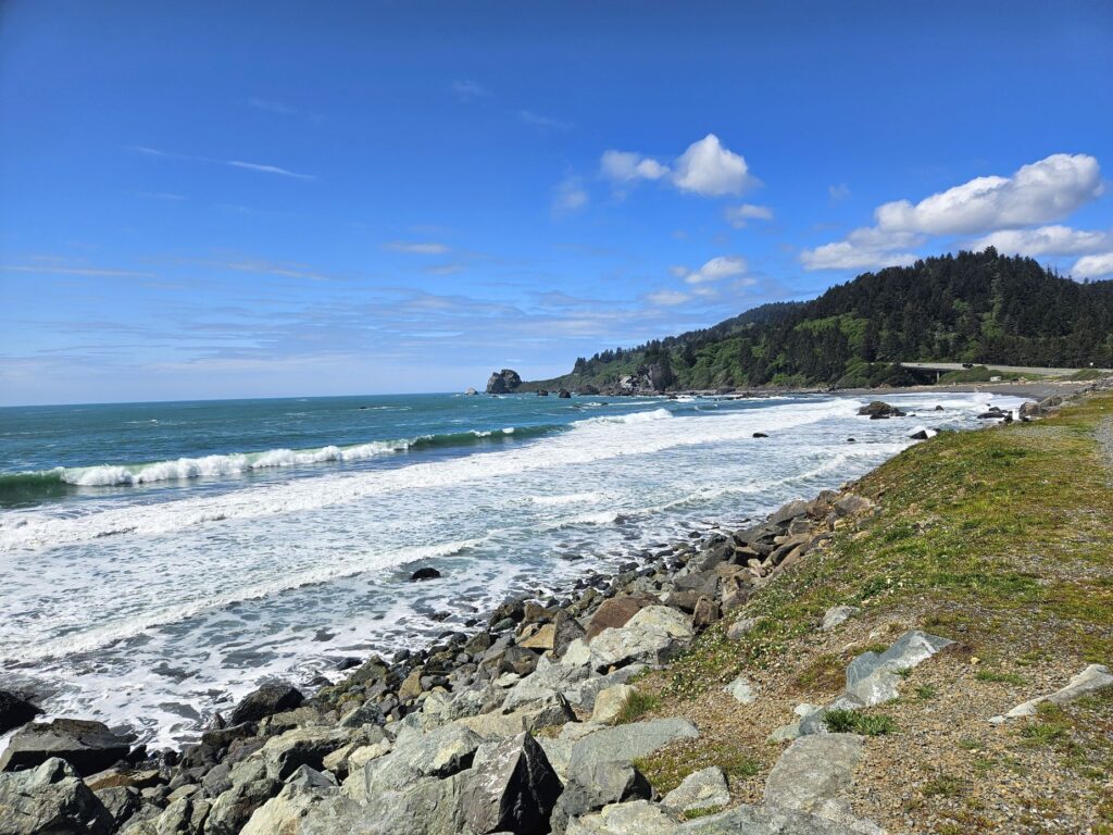
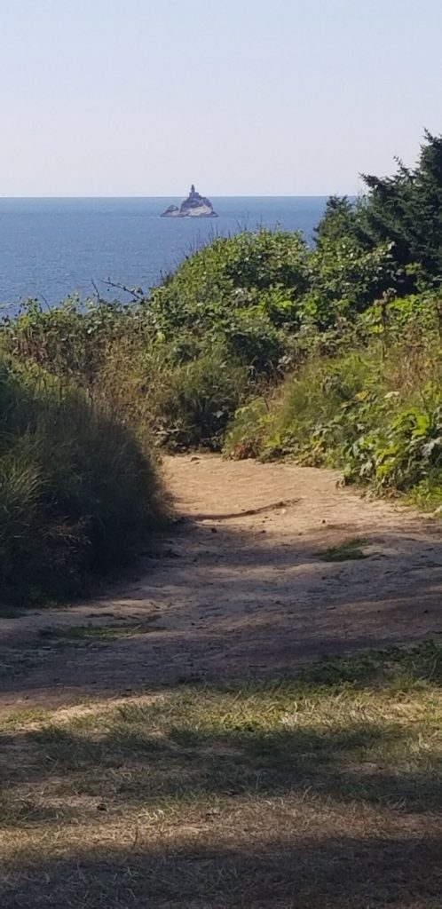
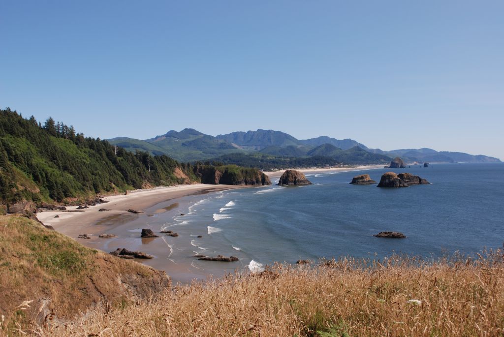
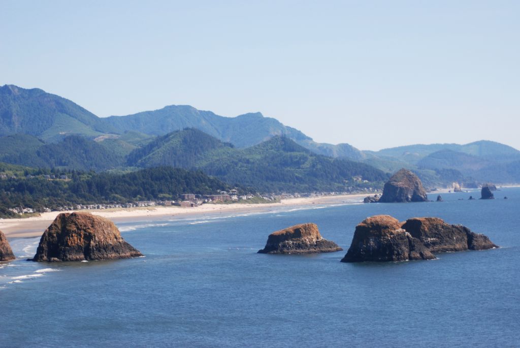
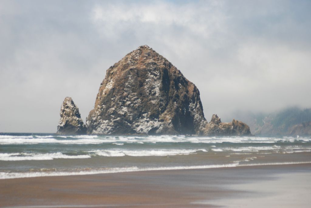
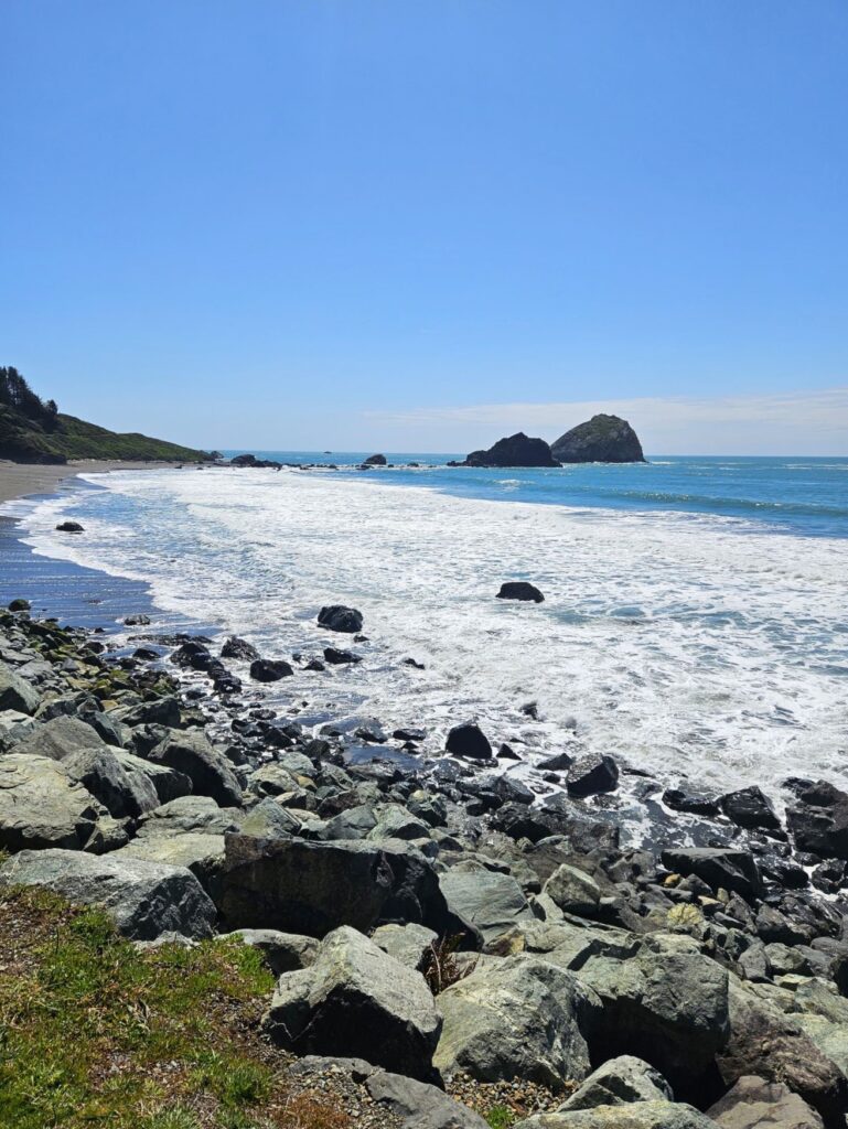
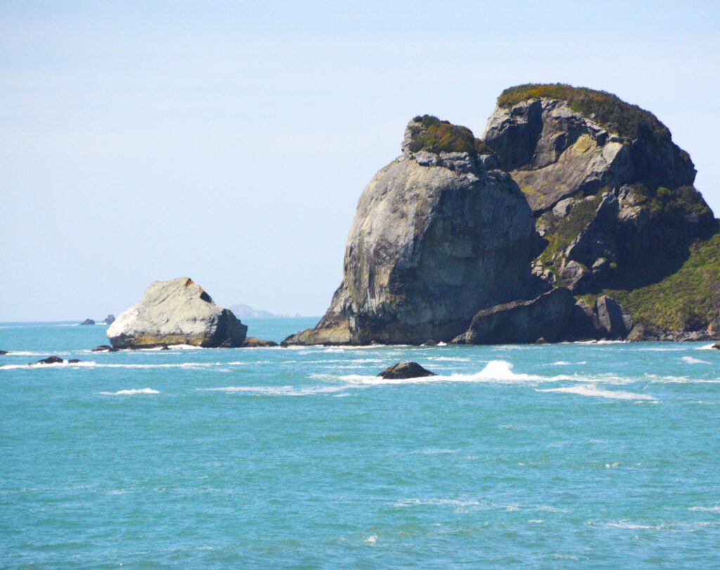
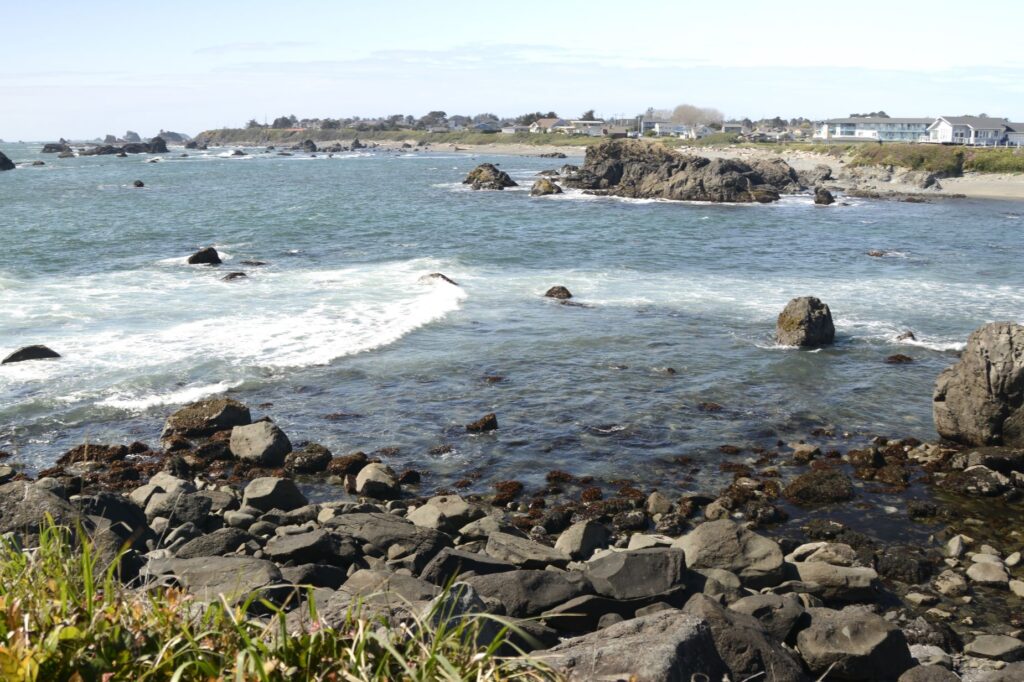
Along the way we saw large rock formations jutting up from the ocean near rocky beaches. The water was such a beautiful blue that day.

Rocky Northern California coastline

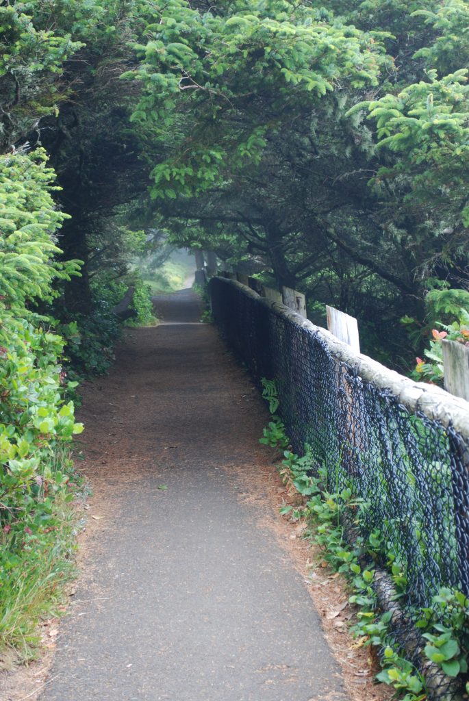
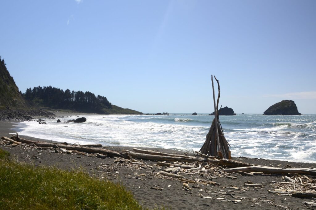
There is always plenty of driftwood on these beaches because the tree line comes to the edge of the ocean.

Driftwood art
Friendly Seagull

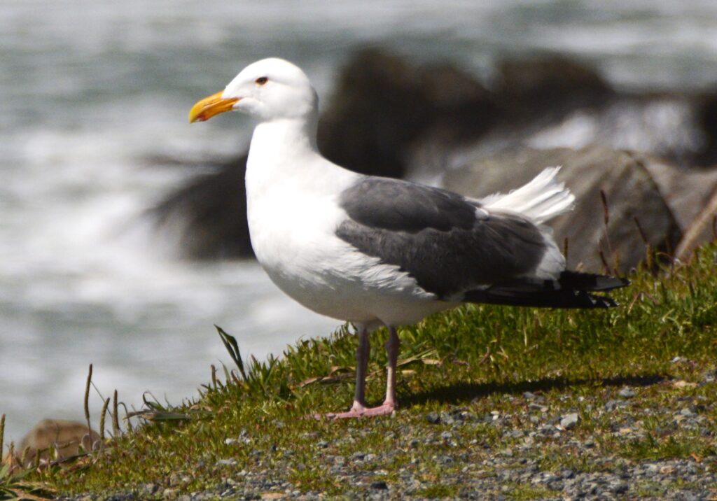
Birds of all kinds love the safety of the rocky ledges and rock formations out in the ocean where they make their homes. There’s always plenty to eat along the water’s edge. Sea lions also like the rocks for sunning themselves.

Crescent City, so named because of its crescent shaped shoreline, was partially destroyed in 1964 from tsunami waves from the Alaskan Earthquake. The city installed a breakwater in 1957 to protect against future tsunamis. However, in 2011, several boats and docks were damaged from tsunami waves from an earthquake in Sendai, Japan.

Battery Point Lighthouse

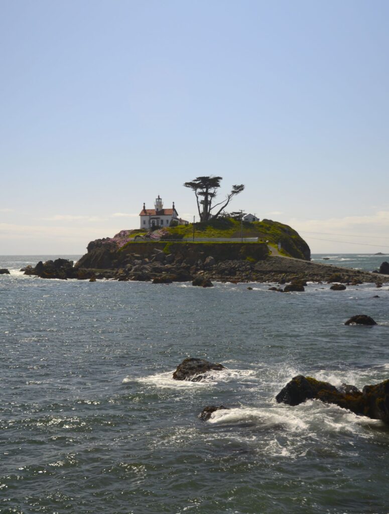
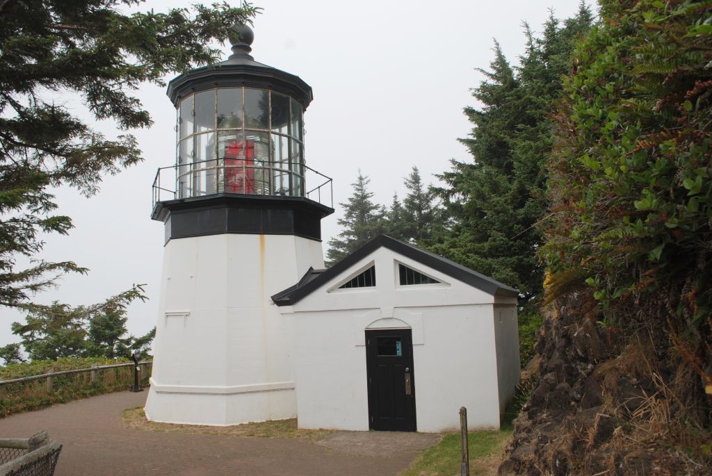
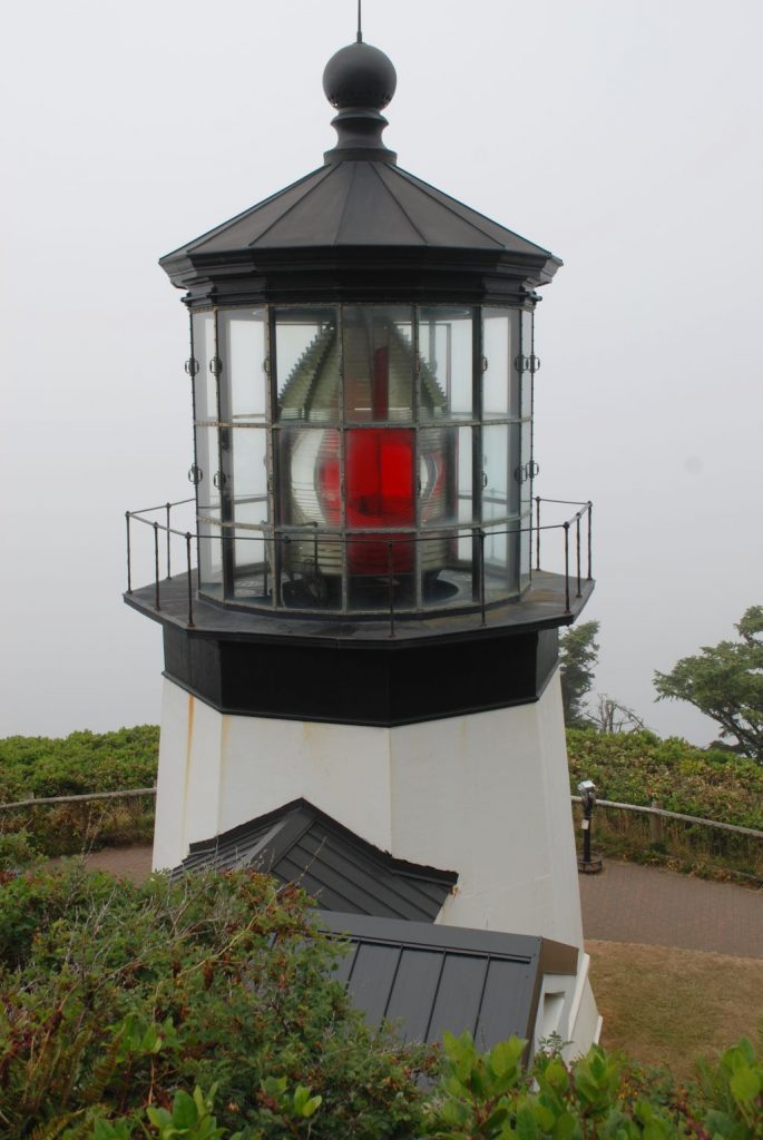
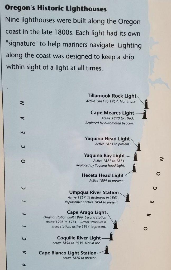
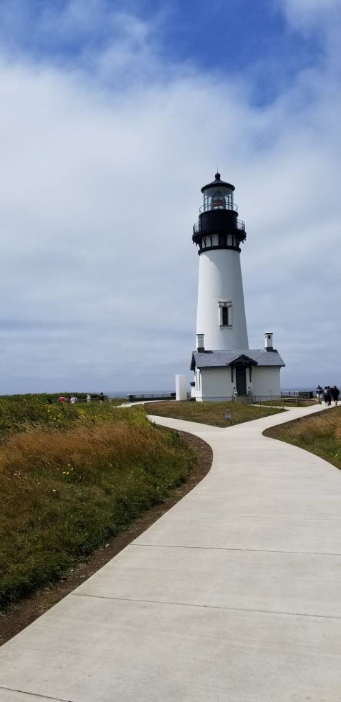
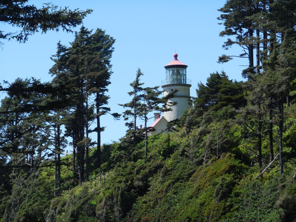
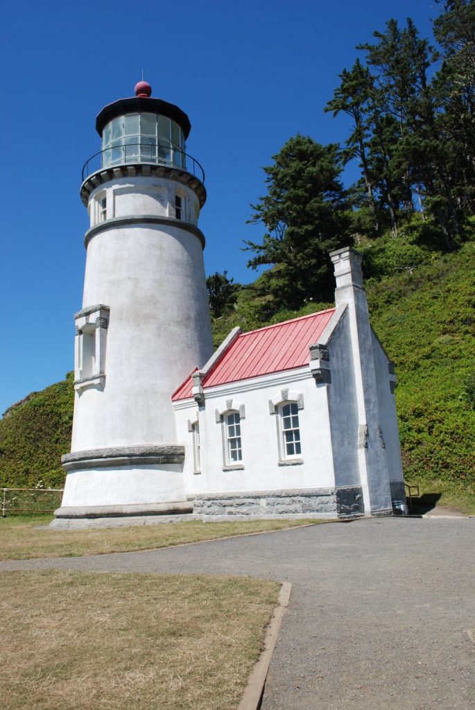
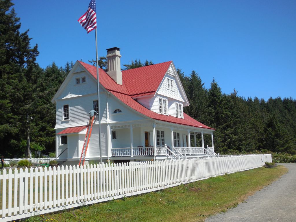
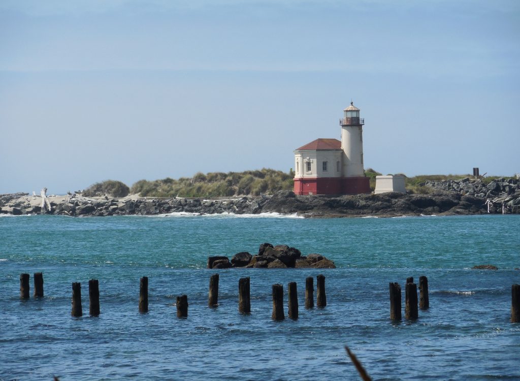
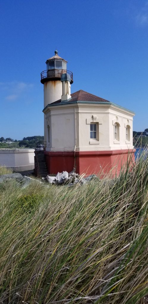
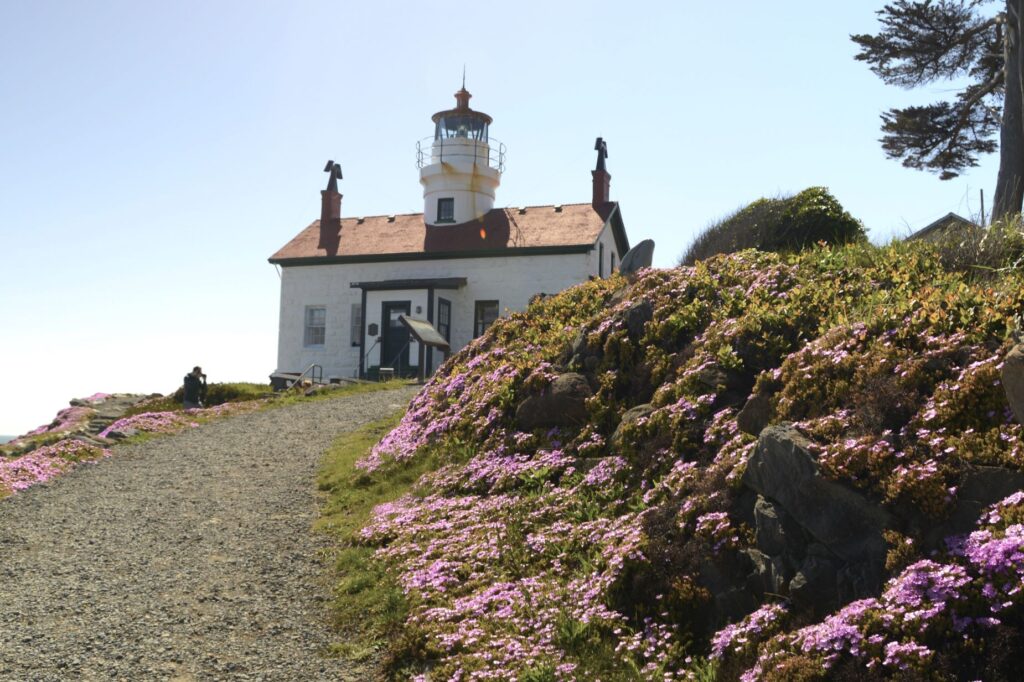
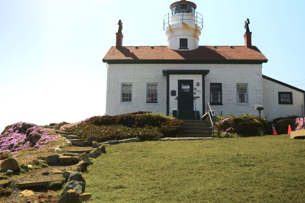
During the 1964 tsunami, the resident lighthouse keepers were stranded inside the Battery Point Lighthouse. Built in 1856, this lighthouse still stands strong. It is still active and serves as a private navigational aid.

Jetty near Battery Point Lighthouse

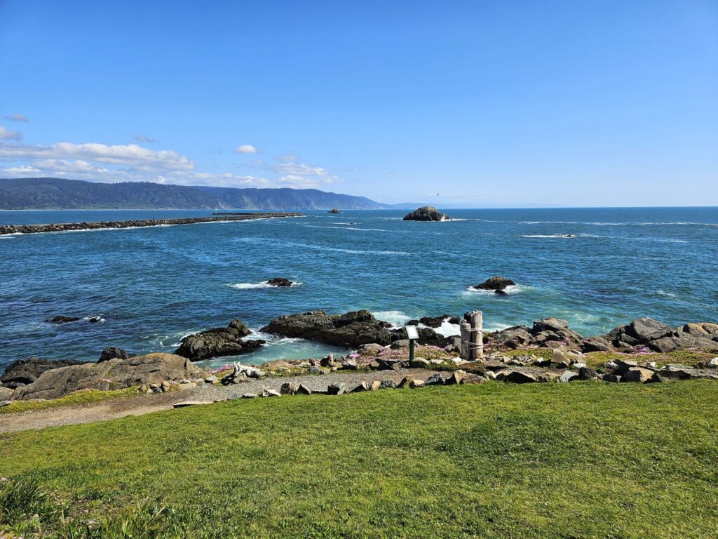
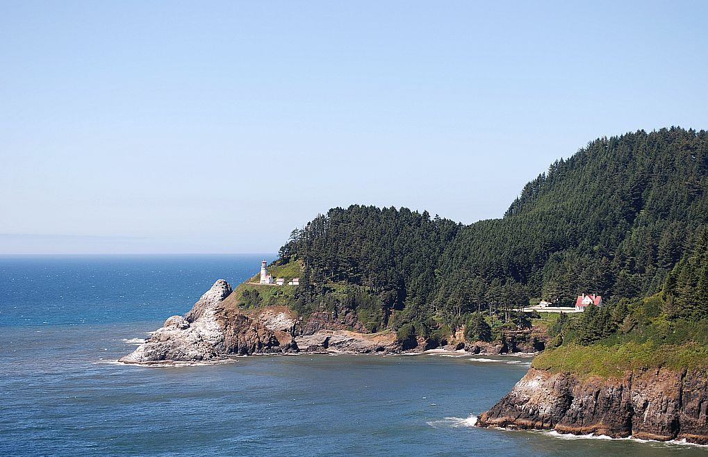
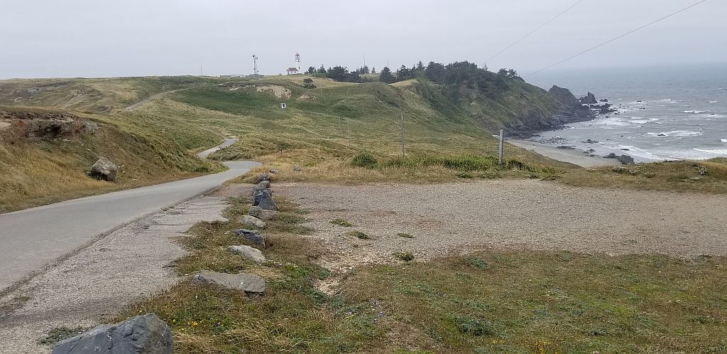
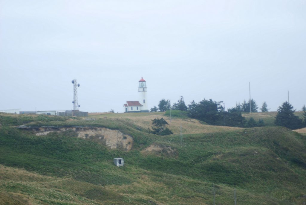
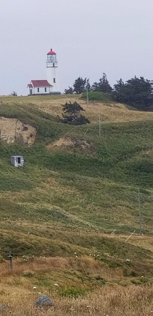
We walked out on the jetty to get a long-range view of the lighthouse. Signs warned us of sleeper waves that may crash over the jetty unexpectedly. We didn’t get wet, but a few waves splashed up on the jetty.

Low tide at Battery Point Lighthouse

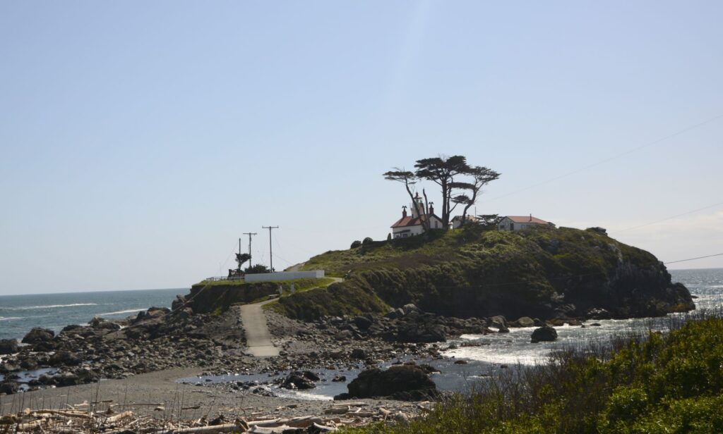
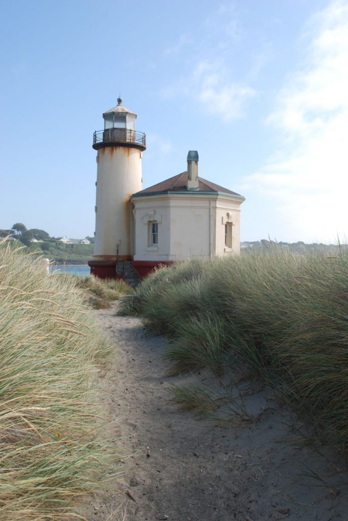
We arrived at low tide, which is the only time the lighthouse is accessible by land. However, we were unable to go inside the lighthouse because it was was closed.

Spring flowers at Battery Point Lighthouse

The Battery Point Lighthouse was automated in 1953, but decommissioned from the Coast Guard in 1965. It was re-activated as a private aid to navigation in 1982.

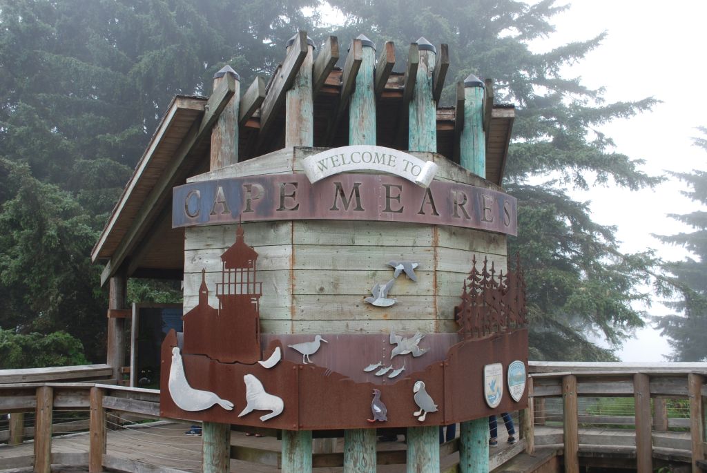
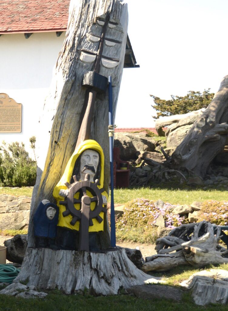
Fishing, crabbing, tourism and timber are the major industries in Crescent City. A carving outside the lighthouse pays tribute to their seafaring people.

Tree carving near Battery Lighthouse

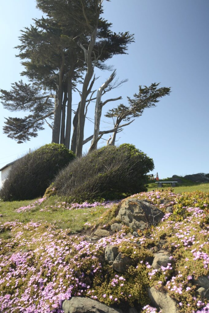
It was springtime at the lighthouse and the spreading phlox was brilliant with bloom. The Monterey Cypress trees are native to the California coast. They do well in the cool climate.

Gnarly Monterey Cypress Trees at Lighthouse

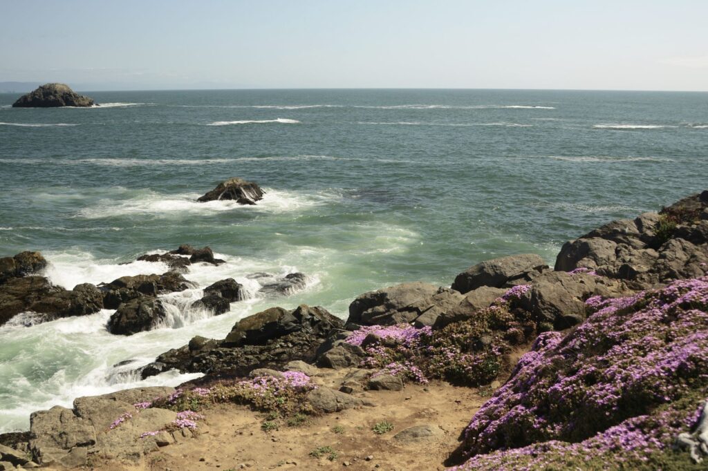
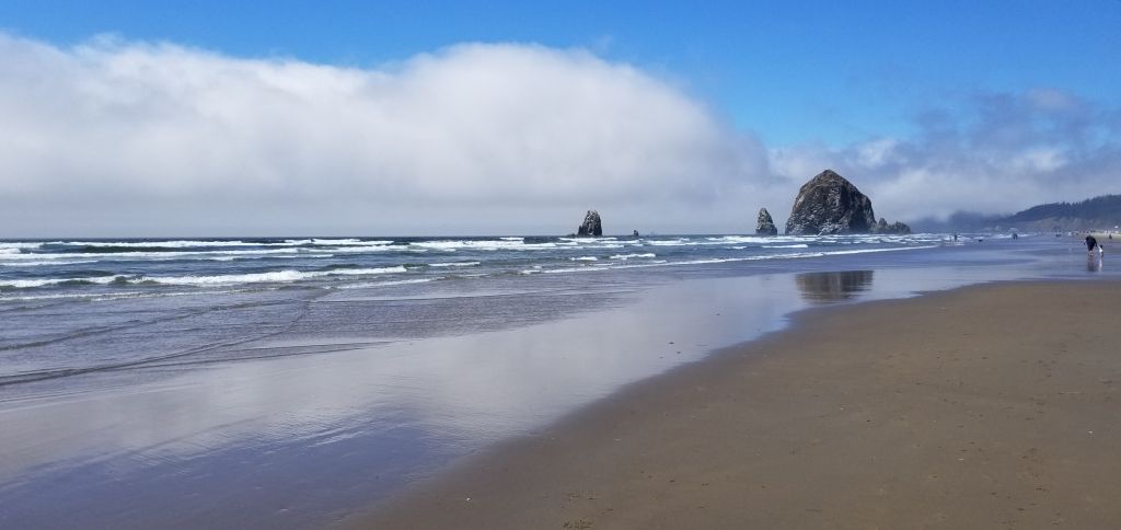
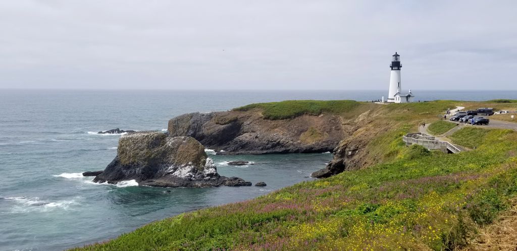
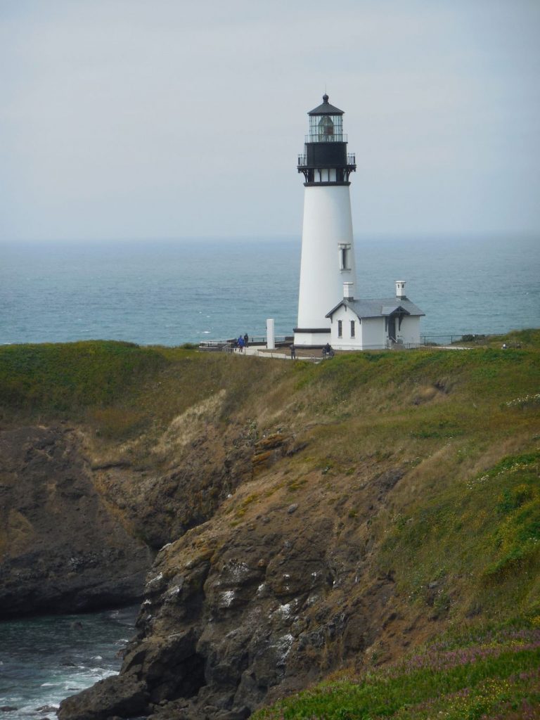
The color of the sea changes with the weather. On clear days, the water is a turquoise blue, and changes as the mist forms in the afternoon.

Crescent City from Battery Point Lighthouse

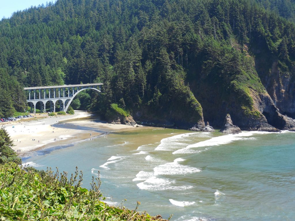
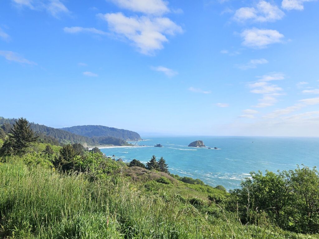
As we drove back to our campground in Klamath that afternoon, the sun came out. We stopped at this overlook to get one last shot at the beautiful California coastline.

“The sea is His, for it was He who made it,
And His hands formed the dry land.” Psalm 95:5

Washington Lighthouses

July 29, 2021

We drove across the famous Astoria- Megler Bridge in Astoria, Oregon. The bridge is a feat of engineering and quite impressive. The bridge is over 4 miles long and crosses the mouth of the Columbia River connecting Oregon and Washington on Highway 101. The ramp to the bridge steadily gains in elevation in a 360 curve. At the Oregon side, it is 200′ from the river below, allowing large ships access to travel up the Columbia River.

Astoria-Megar Bridge, Astoria, Oregon on Highway 101.

We drove to Cape Disappointment State Park in Washington state where we ate a picnic lunch. The beach was lined with a barrier of fallen trees. It is my guess that they were put there to protect the park from the tremendous breakers during bad weather. In the distance is Cape Disappointment Lighthouse.

Cape Disappointment Lighthouse, Washington.
Cape Disappointment Lighthouse, Washington

Cape Disappointment was named so because Captain John Meares was unable to find the mouth of the Columbia River while sailing south in search of trade. He mistook it to be a large bay and was prevented from entering because of a large shallow shoal.

Looking back at Cape Disappointment State Park and beach in Washington.

We drove a short ways to The Lewis and Clark Interpretive Center. Although we did not pay to see the museum, there were exhibits in the lobby that were free to view.

Lewis and Clark Interpretive Center, Washington.

One exhibit was a first-order Fresnel Lens that was meant for the lighthouse. However, the lens was too big, so another one had to be ordered.

Fresnel Lens at Lewis and Clark Interpretive Center

Another display showed several lighthouses on the Oregon and Washington coast and their identifying light flashes.

Display at Lewis and Clark Interpretive Center, Cape Disappointment, Washington.

From the Lewis and Clark Interpretive Center, we had a better view of the lighthouse.

Cape Disappointment Lighthouse, Washington.

From there, we drove a short ways to see the North Head Lighthouse. North Head Lighthouse was built because ships approaching from the north could not see the lighthouse at Cape Disappointment.

Pathway to North Head Lighthouse.

I nearly missed getting a photo because of the fog that was blowing in. Cape Disappointment is one of the foggiest places in the U.S.

North Head Lighthouse, Washington
North Head Lighthouse keeper’s quarters.

I felt satisfied that we had seen as many lighthouses on the Oregon and Washington coast as we could during the time we were in Seaside, Oregon. We saw some beautiful scenery, we enjoyed the cool weather, and we feel sure we will be back.

Seaside, Oregon

It was just a short drive north on Highway 101 from South Beach to Seaside, Oregon, where we stayed in another Thousand Trails RV Resort called Seaside RV Resort. We had to backtrack south to see the Tillamook Lighthouse which is not really near Tillamook. It was really only a few miles south of Seaside, Oregon.

The Tillamook Lighthouse is on an island. It was quite windy and hazy making it hard to get a good photo.

Tillamook Lighthouse, Tillamook, Oregon

The view from the Tillamook lookout was beautiful. If you look carefully, you can see Haystack Rock.

Scene from Tillamook Lighthouse viewpoint.

In this closer view Haystack Rock is in the distance. Later, we drove to Canon Beach where I got a closer look. Haystack Rock is home to many birds who make their nest in the nooks and crannies of the rock, even burrowing into the dirt to make their nests.

Haystack Rock in the distance at Canon Beach, Oregon.
Haystack Rock

When the tide is out, many people like to explore the tide pools around the rock.

Haystack Rock

A long drive south to Tillamook took us closer to Cape Meares Lighthouse. The road there is very narrow and windy, but we finally found the end.

There are two pathways to the lighthouse. It was windy and very misty. We opted for the pathway through the trees. The air was so moist, the trees “rained” on us as the moisture collected on the leaves and foliage.

Pathway to Cape Meares Lighthouse.
Cape Meares Lighthouse

Although Cape Meares Lighthouse is the shortest lighthouse on the Oregon Coast, it put out a powerful beam that could be seen twelve miles out at sea. Each lighthouse had its own signature beam of light. Cape Meares was 30 seconds of fixed white light from the primary lens followed by a red flash of five seconds from the bull’s-eye lens once every minute.

Cape Meares Lighthouse
Cape Meares Lighthouse information booth.

The photo below shows the nine historic lighthouses on the Oregon Coast and whether they are still active.

With the cold windy weather, we were glad to get back to our truck to get warm.

Oregon Lighthouses

July 2021

We stayed in South Beach, Oregon (near Newport, OR) for twelve days in Thousand Trails Whaler’s Rest RV Resort. My goal was to see and photograph as many lighthouses along the Oregon coast as I could.

Our campground was just a short distance away from the beach, but because of the thick trees and bushes and Highway 101 in between, it wasn’t an easy access. The weather was cloudy and overcast in the mornings. By noon, however, the sun was shining. So that’s when we decided to go looking for lighthouses.

Our first lighthouse and my favorite, (Yaquina Head) was close to Newport just a few miles from the campground. It was easily accessible and very easy to photograph. We saw some sea lions sunning themselves on the rocks below.

Yaquina Head Lighthouse near Newport, Oregon.
Yaquina Head Lighthouse, Newport, Oregon.

Near Yaquina Head Lighthouse is Yakina Bay Lighthouse. We visited it after all the other lighthouses on another day, but I include it here because it is in order going south on Highway 101. This one was a bit of a disappointment because the shutters were all closed over the windows making it look boarded up. There was a fence around it and an ugly tower next to it.

Yakina Bay Lighthouse

While we were there at Yakina Bay Lighthouse, we got a good view of Yakina Bay Bridge.

Yakina Bay Bridge

Our next next search for lighthouses took us south on Highway 101 as far as Cape Blanco, near Port Orford, Oregon.

The first lighthouse we saw was Heceta Head Lighthouse near Florence, Oregon. (All of these lighthouses are just off Highway 101 in Oregon.) We had a bit of a hike uphill to see this lighthouse. Here it is from below.

Heceta Lighthouse near Florence, Oregon off Highway 101.
Hectea Lighthouse

We were also able to see the lighthouse keeper’s house.

Lighthouse keeper’s house Heceta Head

The lighthouse is visible from Highway 101 further on.

We also saw many historic bridges designed by Conde McCullough from the 1930’s. Cape Creek Bridge near Heceta Head Lighthouse was built in 1932. It is a double-tiered structure with Roman arches and spans Cape Creek next to the Cape Creek Tunnel.

Our next lighthouse, Umpqua River Lighthouse, is located near the city of Reedsport. It isn’t quite as scenic because it was surrounded by a chain-link fence with a roadway running in front of it and mailboxes blocking the view.

Umpqua River Lighthouse, near Reedsport, Oregon.
Umpqua River Lighthouse

The next lighthouse going south is Cape Arago near Coos Bay. We were unable to find it, but we saw it from a distance from Sunset Bay State Park. However, I felt it was too hazy and distant to get a good photo. It is not accessible by land because it is on an island in the bay, and the closest place to get a good photo is Lighthouse Way which is a private drive. The photo is not mine, but one from the web.

Photo from visittheoregoncoast.com

We drove across several bridges on Highway 101 on our quest for lighthouses. One of my favorites is the bridge across Coos Bay. The Coos Bay Bridge is an historic bridge that has a series of arches that come to a point at the top, giving you the feeling of driving though a cathedral. I didn’t get a photo of it, but I borrowed one from the web.

Photo by Richard Nilsen

The next lighthouse south on Highway 101 in Oregon is the Coquille River Lighthouse near Bandon, Oregon.

Coquille River Lighthouse near Bandon, Oregon.

We had a round about way of finding this lighthouse. We first saw it across the river. Then we found a way to drive up closer and walk up.

Coquille River Lighthouse

The furthest lighthouse was over 250 miles from our campground. Cape Blanco Lighthouse is near Port Orford, Oregon. It was getting dark and the fog and clouds were rolling in from the ocean. The road to the lighthouse was closed by a gate. It turns out, the only day of the week that it is closed was the day we happened to visit it.

Cape Blanco Lighthouse near Port Orford, Oregon.
Cape Blanco Lighthouse

We drove back and got to our trailer around midnight, but we felt we were pretty successful in our mission.

We saw more lighthouses but that will be in the next blog.

Port Isabel Museums

February 24, 2020

Previously, we visited the lighthouse at Port Isabel and the museum. Nearby were two more museums. We visited one, but at the time, the other museum was about to close. We decided to come back and visit it later. If you visit all three museums, you can save money by buying a Combination Site Ticket. Combination tickets are available at all three museum sites.

The first museum we visited was the Port Isabel Lighthouse Museum.

 The Port Isabel Historical Museum is located a block or so away from the lighthouse. It’s tricky to find the entrance. The museums are beside and behind the parking lot to the Event and Cultural Center Building. This photo is taken at the back of the building. The back is actually where the entrance is. Walk around to the left and the door is under the awning.

The Port Isabel Historical Museum houses exhibits on two levels of the building. It is mostly collections of Mexican artifacts from the US/Mexican War.

 To find the third museum, Treasure of the Gulf Museum, follow the arrows on the sidewalk at the back of the Historical Museum.

Below is what the entrance of Treasures of the Gulf Museum looks like. Do you see any signs?

 Treasures of the Gulf Museum spotlights history and artifacts from three 1554 Spanish shipwrecks.

While we were there, we also saw this clock tower and inscription near the parking lot. I thought it made a nice photo, and the inscription is a good admonishment to us about good government.

You can find out more about these museums here: Museums of Port Isabel

Categories: Airstream Travel, RV Travel, Texas Travel Tags: Brownsville, Museums of Port Isabel, Places to see near Brownsville, Places to see near Port Isable, Port Isabel, Port Isabel Historical Museum, Port Isabel Lighthouse, Port Isabel Lighthouse Museum, Port Isabel Tower Clock, Port Isabel Treasures of the Gulf Museum, South Texas places to see, South Texas travel, Texas, Texas History, Texas Museums, Texas places to see, Texas sites to see, Texas travel