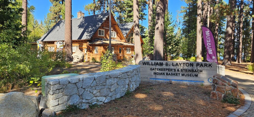
In Tahoe City, a little town in north Lake Tahoe, we visited the Gatekeeper’s Museum and Indian Basket Museum. We stopped here on our audio tour on a previous day, but it was closed. It was worth coming back to visit.
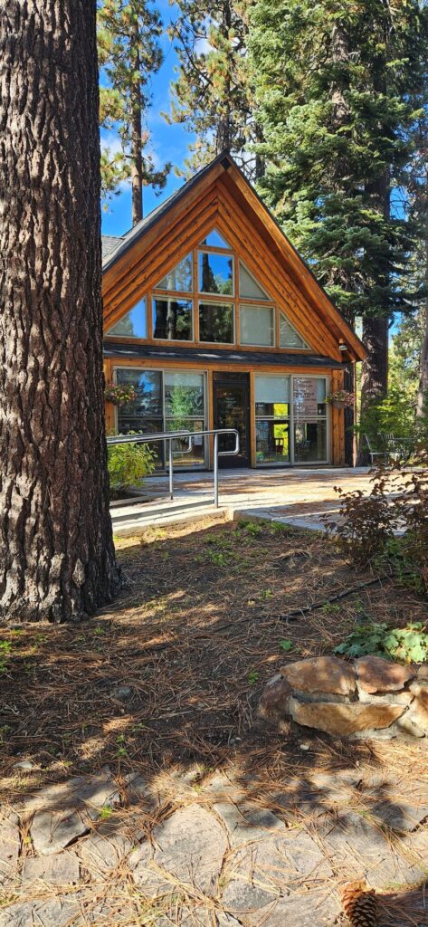
Entrance to Gatekeepers Museum, Tahoe City, NV
The Gatekeeper’s Museum was once the cabin where the Gatekeeper for the Lake Tahoe Dam resided, whose job it was to regulate the water flow out of the dam. It burned down in 1978 just before it was deeded over to the North Lake Tahoe Historical Society. They reconstructed it completely by hand on the original foundation.
Gatekeeper’s Museum
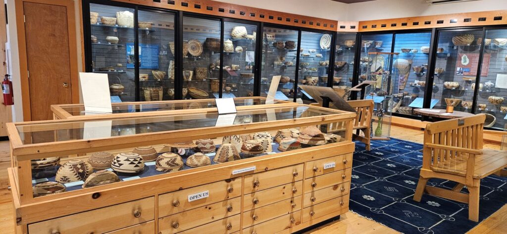
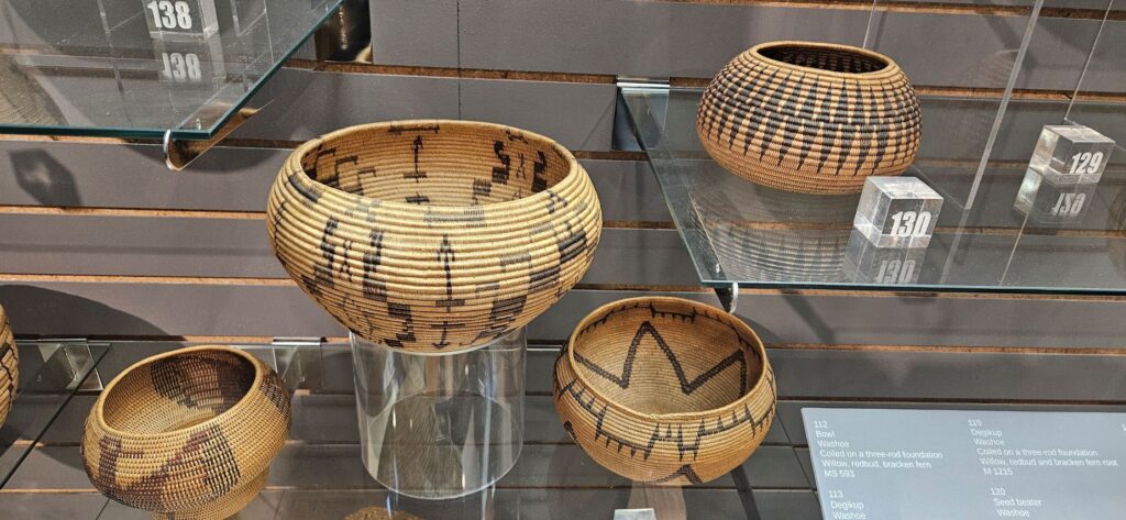
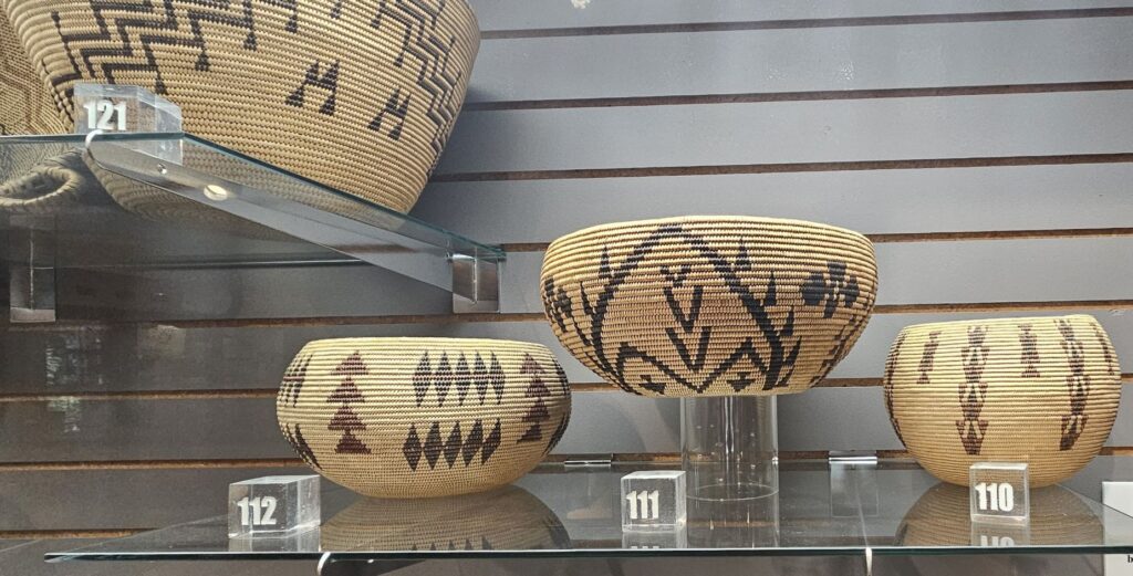
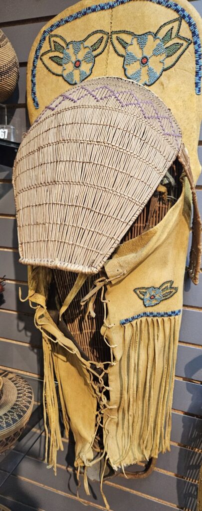
The museum also houses the Marion Steinbach Native American Basket Collection. The basket gallery showcases more than 700 baskets from native peoples of Western North America. The baskets are in very good condition and are works of art.
Indian Basket Collection is part of the Gatekeeper’s Museum.Cradle board for papoose
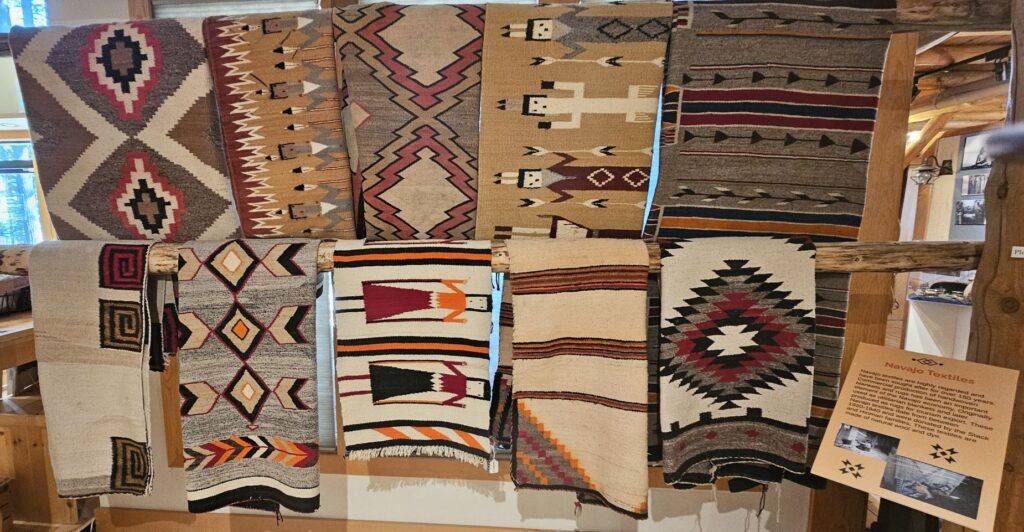
Another display showcases Navajo Indian rugs.
The rest of the museum preserves and tells the history of the Lake Tahoe area. There are stories of various boats that were used on the lake, artifacts from dog sled operators, and dresses from ladies of the past and more. Upstairs there’s more history and wild tales of the legend of the plug at the bottom of the lake.
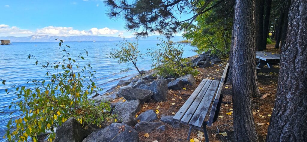
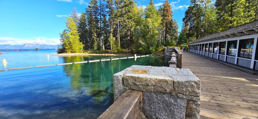
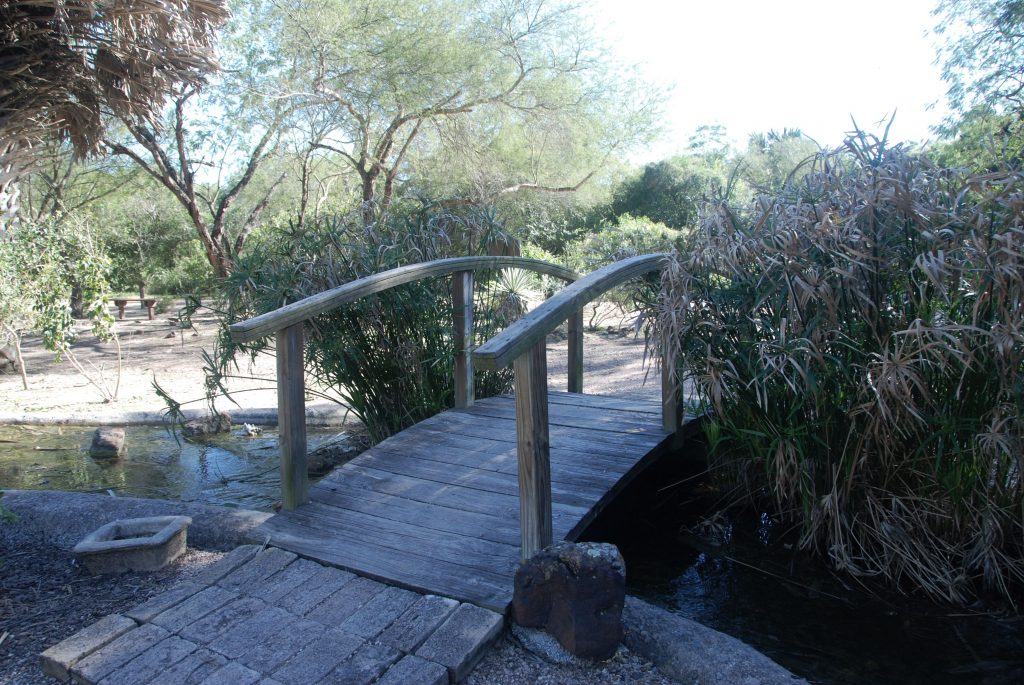
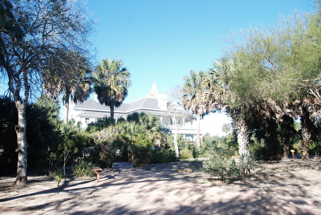
The outside of the museum has beautiful grounds that are right on the edge of the lake. Let’s take a walk down to the lake.
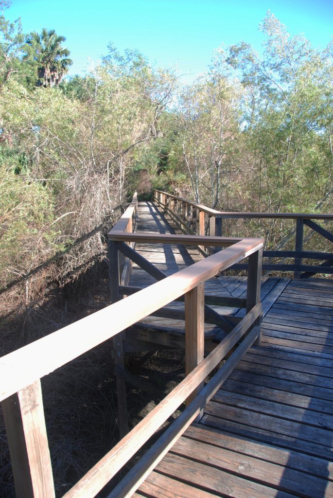
Pathway from Gatekeeper’s Museum to Lake Tahoe
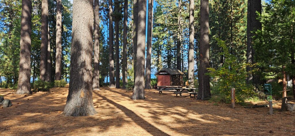
Someone (not us) collected all these pine cones and arranged them on the picnic table.
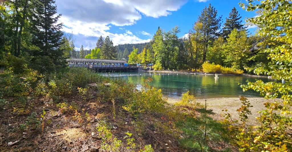
Within sight of the Gatekeeper’s grounds, is the famous Fanny Bridge which is located over the only outlet of Lake Tahoe into the Truckee River.
The bridge has an interesting story on how it got its name. It was so named from all the fannies that can be seen from the road as gawkers stare over the edge of the bridge at the water below. Do you see any fannies?
Here’s a view of what you can see from Fanny Bridge.
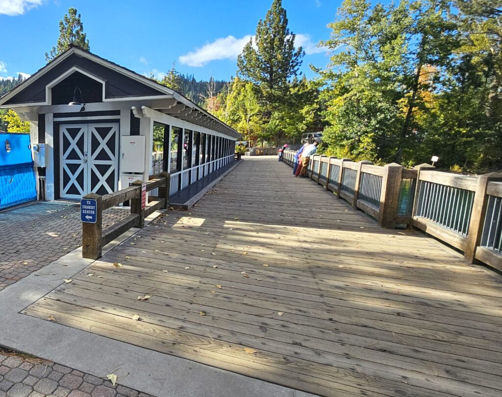
If you walk across the bridge, the North Lake Tahoe Visitor Center has a very interesting interactive display. The “Shaping Watersheds” interactive sandbox is a large-scale educational model where visitors can move the sand to build mountains, valleys and other land-forms. An overhead projector casts topographical contour lines and a color-coded elevation map onto the surface. The motion-sensing camera detects changes and the projected lines and colors change to reflect the new topography. It’s even fun for adults. Ask me how I know.
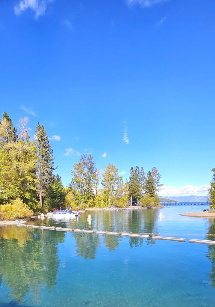
Grounds of Gatekeeper’s MuseumLake Tahoe from Gatekeeper’s Grounds
There was another historical cabin in Tahoe City that we did not get to see. It’s nice to have reasons to come back. This is one area I could visit over and over again.
“Whoever drinks of the water that I will give him shall never be thirsty; but the water that I will give him will become in him a fountain of water springing up to eternal life.” –Jesus
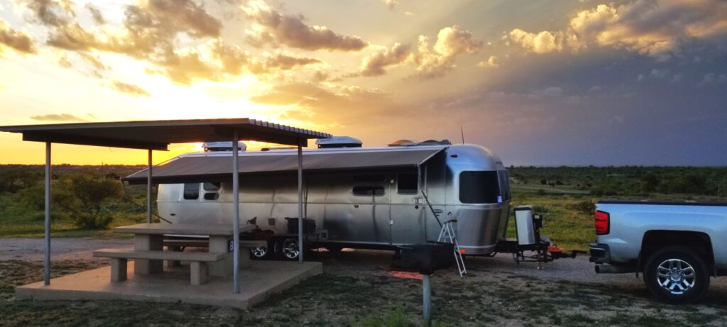
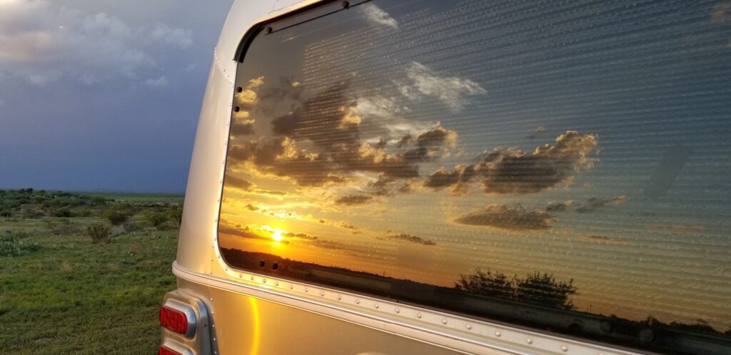
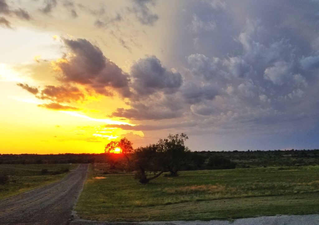
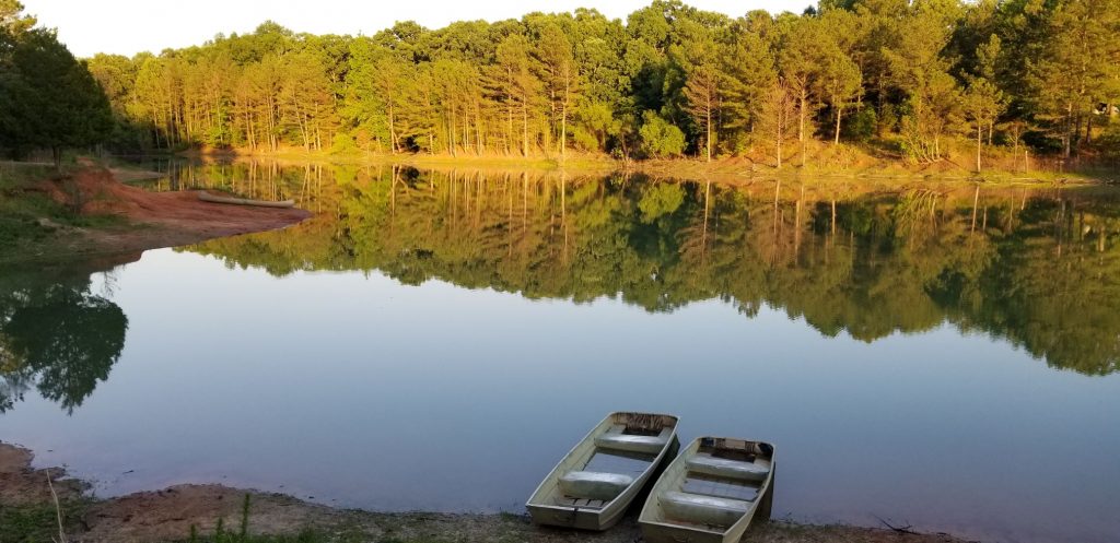
One of our favorite Texas towns to visit was San Angelo. We stayed in San Angelo State Park Campground where we had some great views of the evening sunsets.
Our campsite at San Angelo State Park
The weather was fickle with cloudy skies in the morning and rain and thunderstorms in the afternoons with clearing in between.
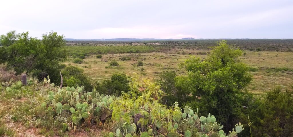
We sometimes went for walks in the evenings.
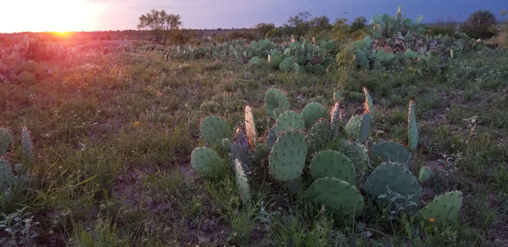
This part of Texas is dry and cactus, especially prickly pear, thrive.
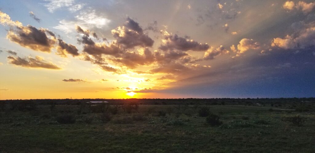
One evening we drove to a lookout in the park where we could see for miles.
Lookout at San Angelo State Park
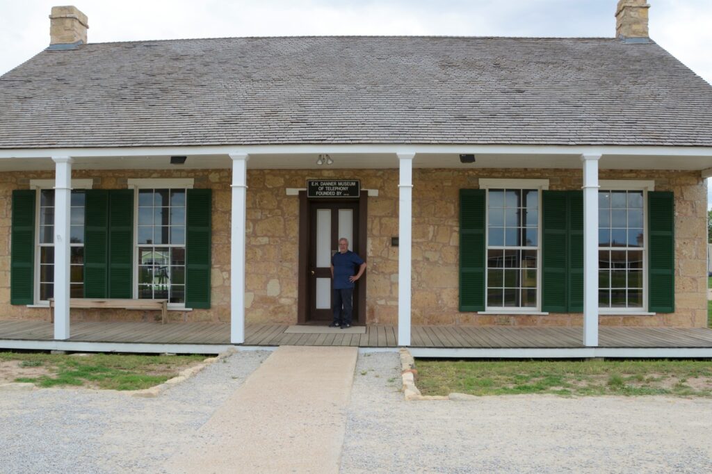
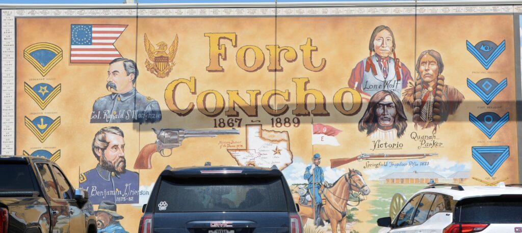
We drove into San Angelo to see some sites. Ray wanted to see the telephone museum located at Fort Concho, an historical fort established in 1867 to protect the frontier settlements. Fort Concho is now a National Historic Landmark, so I was able to get a stamp for my National Parks Passport book.
Fort Concho Museum of Telephony
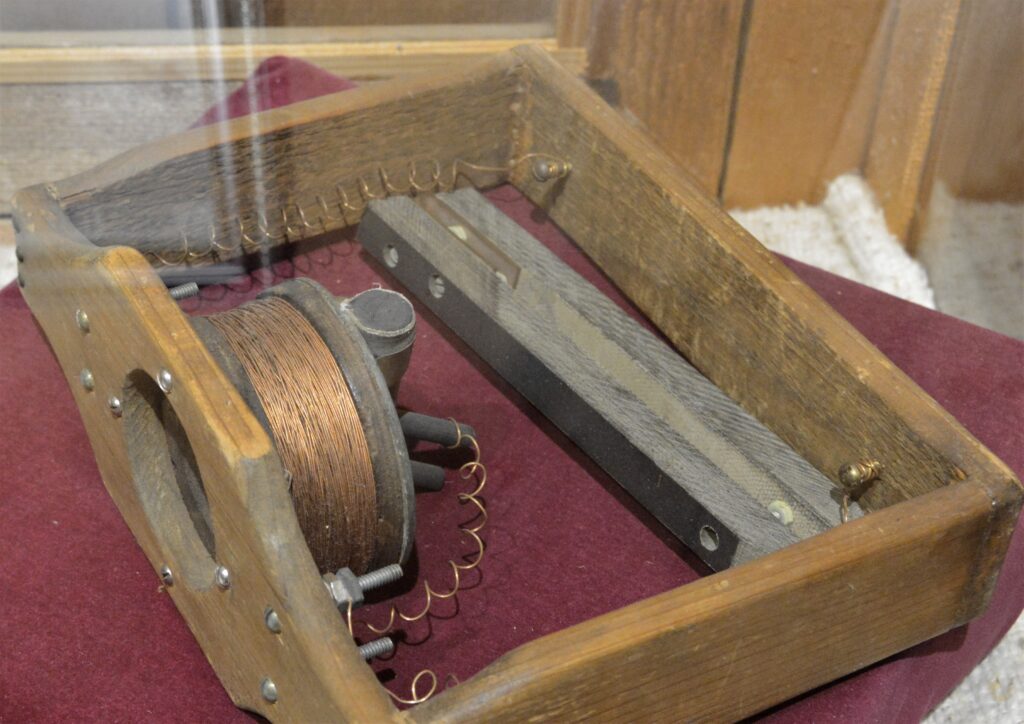
The museum has on display a unit designed and made by Alexander Graham Bell. There were only five made and only two in existence today.
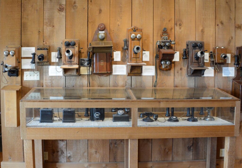
Unit designed and made by Alexander Graham Bell in 1876. Old phones from Museum of Telephony in San Angelo, Texas
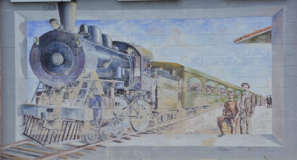
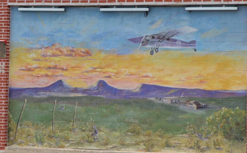
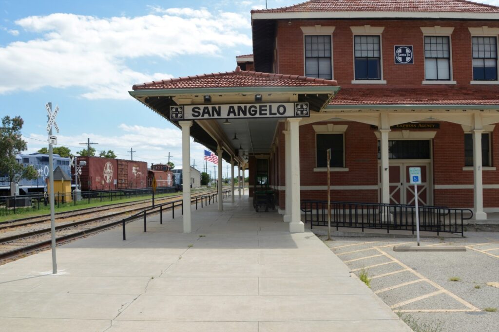
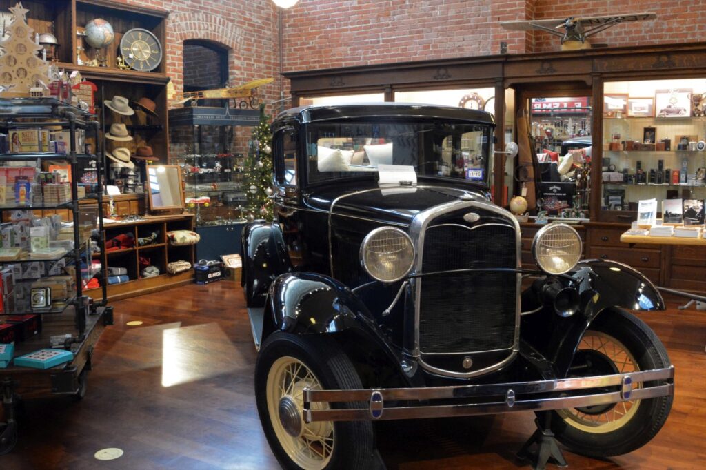
San Angelo is known for their historic murals depicting the history of the area. We went on a search to find as many as we could. The first one we saw was near the Train Museum and depot. It was about all the forms of transportation used throughout their history.
Four murals capture the history of transportation.
Up closer, they look like this.
Horse and buggy days.Stagecoach was a form of transportation in the early days.The Iron Horse was a vast improvement for transporting goods and people to the west.The airplane made the vast Texas distances seem much smaller.
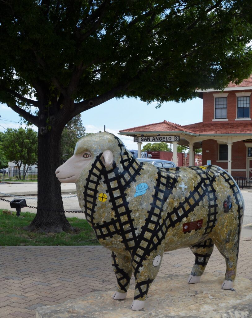
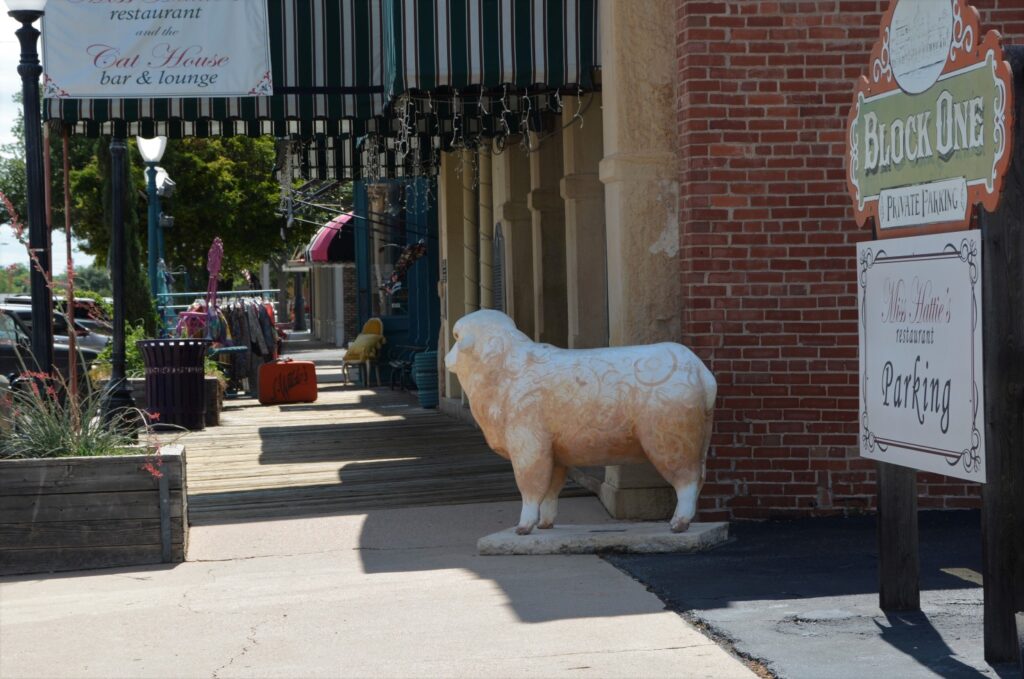
One of the things we were told to look for were sheep. They are decorated and found all around town. This one was at the Train Museum and Depot. We wanted to see the train museum, but we were on a mission to find the murals. We decided to save it for another time.
Train Museum and Depot
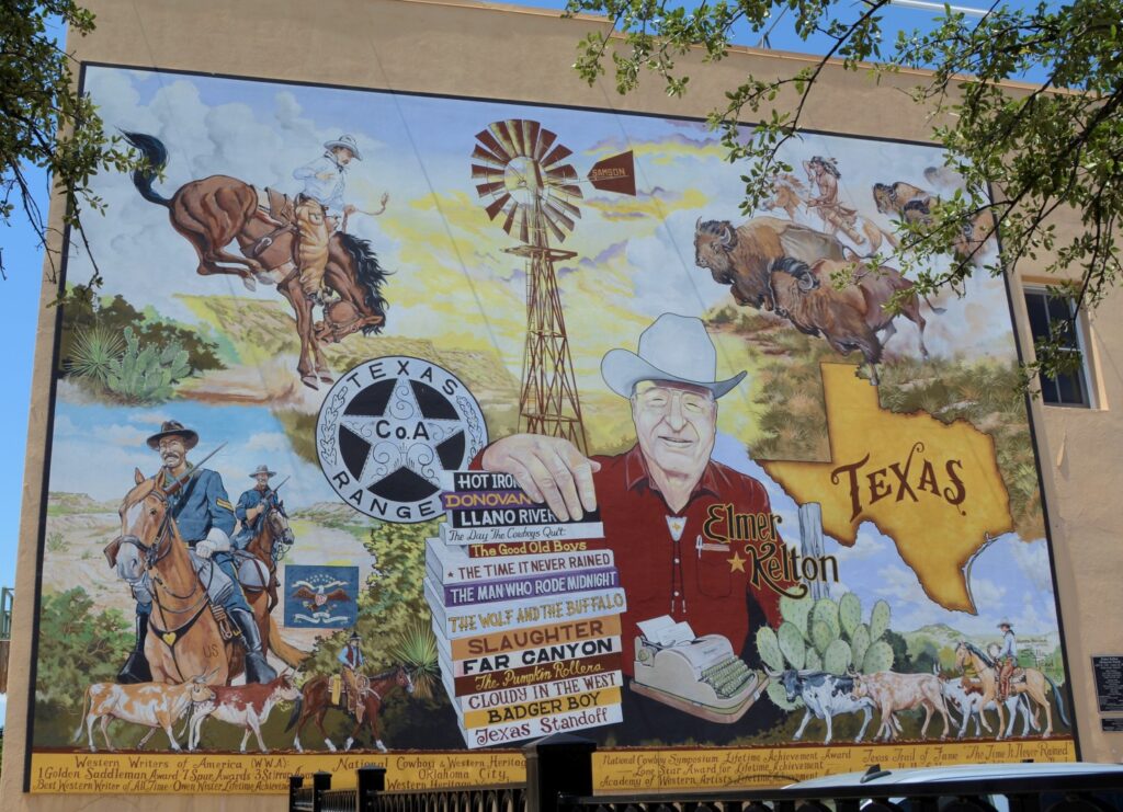
Most of the murals are found near the old downtown area of San Angelo. Since they are painted on the sides of buildings in parking lots, sometimes it was hard to get a clear photo of them. This one is of a local author who writes westerns about the Texas Rangers. His name is Elmer Kelton. I have not read any of his novels, but they sound interesting.
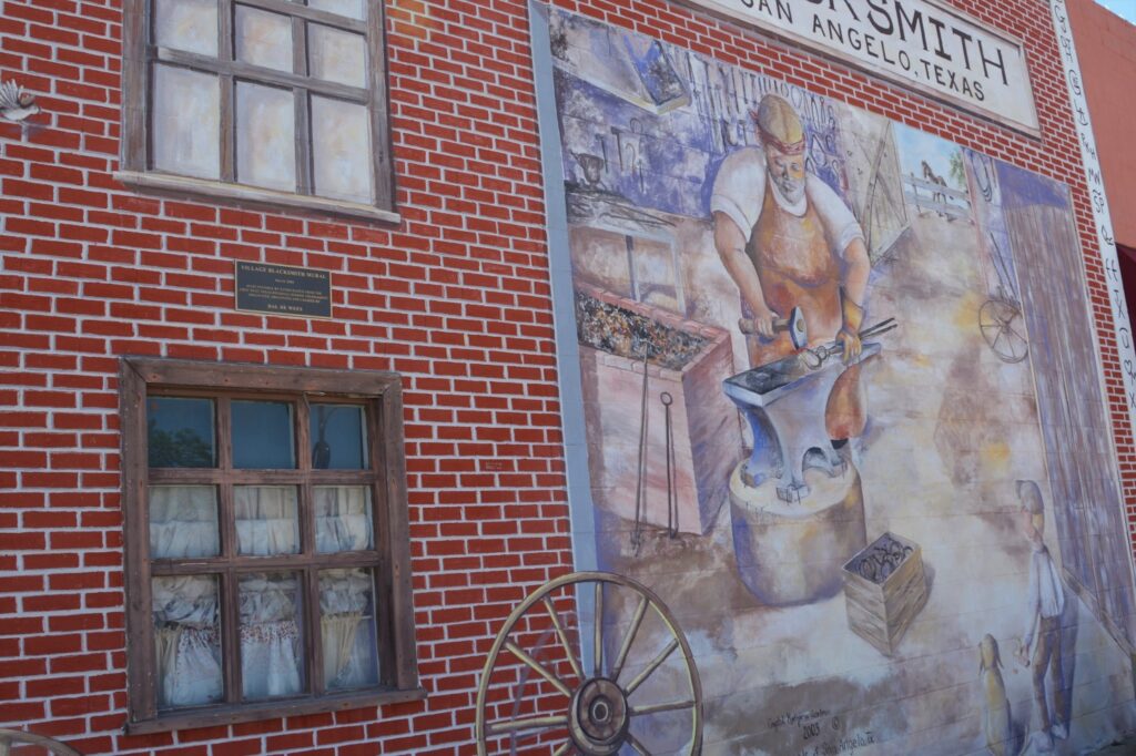
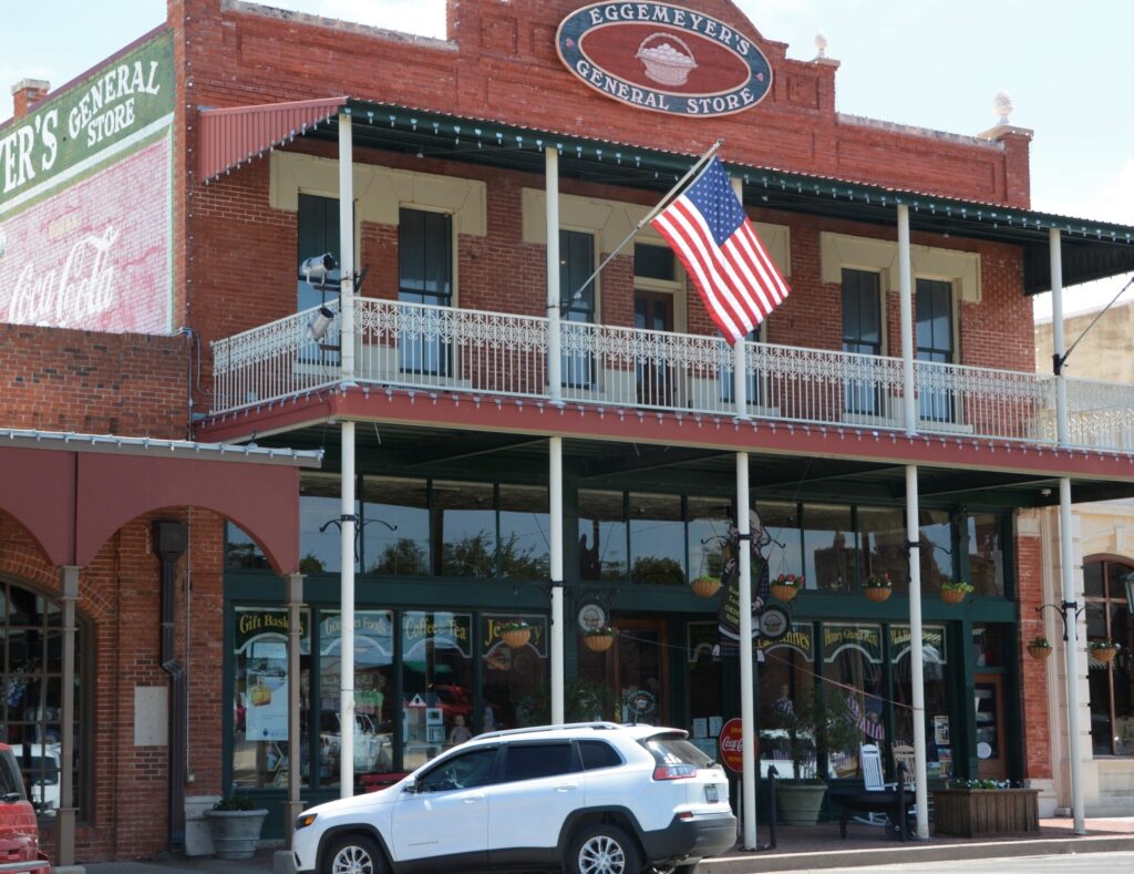
I stumbled across the Blacksmith mural while looking for another mural. This is right across the street from the famous Eggemeyer’s General Store. While taking a photo of Eggemeyer’s from across the street, I came upon another sheep!
Sheep #2Eggemeyer’s General Store
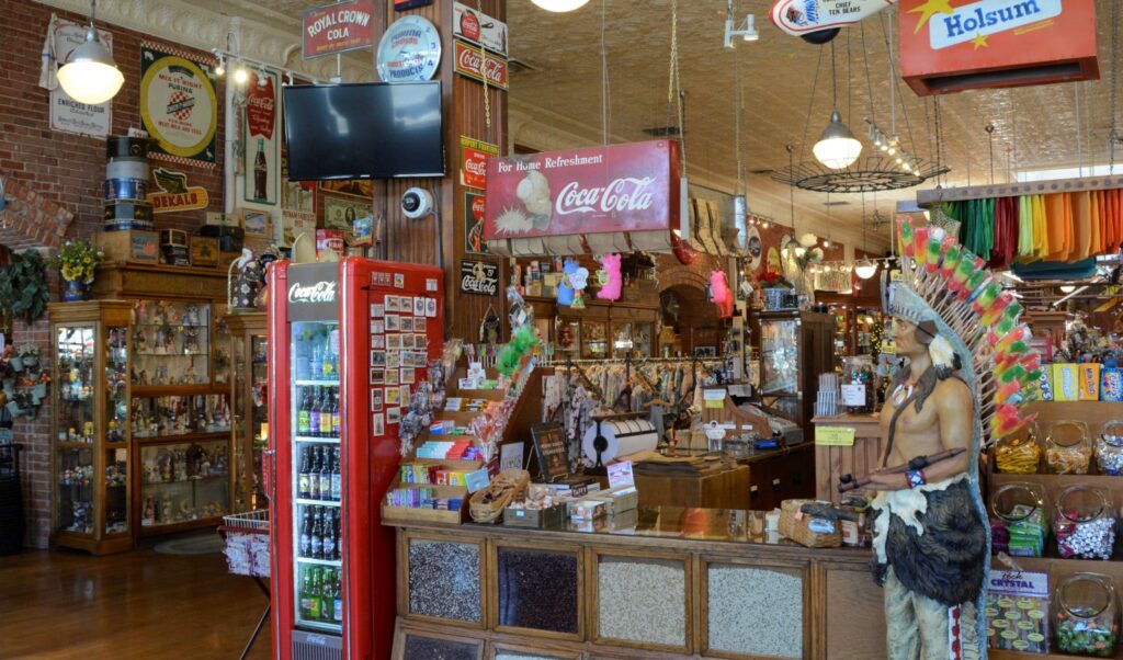
This store has so much in it, it could take hours to see it all. I liked the Indian with the lollipops in his headdress.
Indian Lollipop holder
There were all kinds of candies, chocolates, sweets, jewelry, household goods, teapots, teacups, knickknacks, vintage signs, vintage toys, aprons, hand towels, kitchen items, bandanas, cards, stationery, and even an old car in the men’s section.
The men’s section had an old car.
The best thing about living in a travel trailer is that you’re not tempted to buy anything because you don’t have room. The worst thing about living in a travel trailer is that you can’t buy anything because you don’t have room.
I enjoyed just looking at all the kitchen items.
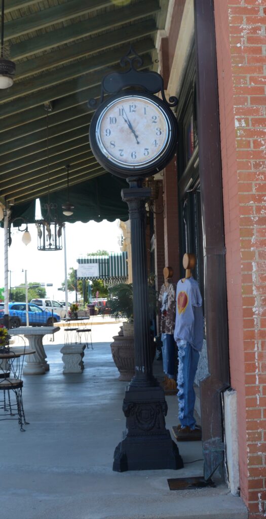
I collect photos of street clocks. Here on this same corner was a street clock.
Street clock in San Angelo, Texas
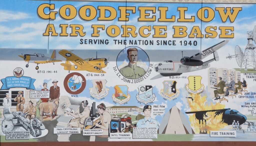
We wanted to find some more murals, and to my surprise, I found three more on the opposite street corner. These three were together and depicted the military history of the area. Ray was stationed in San Angelo for training at Goodfellow Air Force Base. He had a five and a half month long advanced electronic repair training.
Goodfellow Air Force Base mural
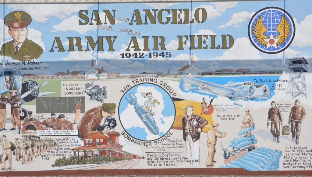
San Angelo Army Air Field was only used from 1942-1945 for training bombardiers for combat missions. It was closed after WWII and today is a civil airfield called Mathis Field.
San Angelo Army Air Field Mural
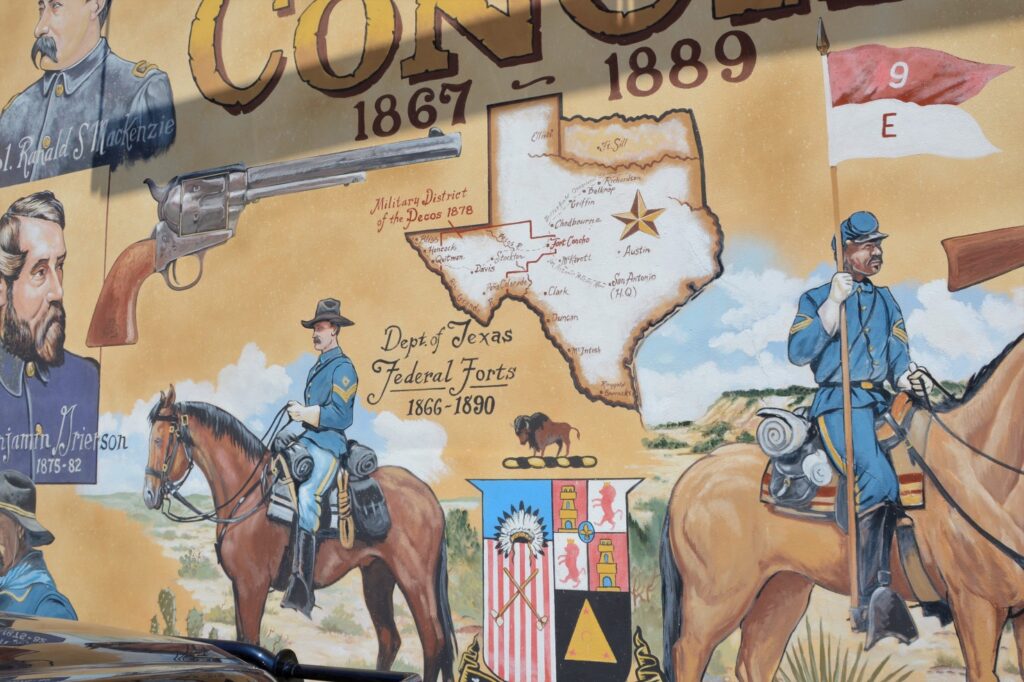
Fort Concho, as mentioned earlier, was a fort established to protect frontier settlers. William “Pecos Bill” Shafter commanded here along with other notables. Also, the 9th and 10th Cavalry Regiments and 24th and 25th Infantry Regiments were all black soldier units known as the Buffalo Soldiers.
Fort Concho Mural
Here’s a closer look at some of the details.
Fort Concho Mural
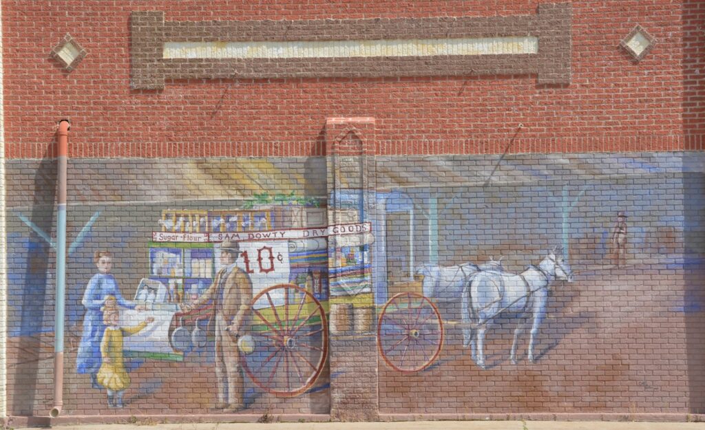
By now, we were hot and tired. We managed to find one more mural. This one was not mentioned on the website list of murals. I call it the Dry Goods Mural. There were two or three more that we missed or couldn’t find.
Dry Goods Mural
There were many more things we would have liked to see, but there just wasn’t time and energy for them.
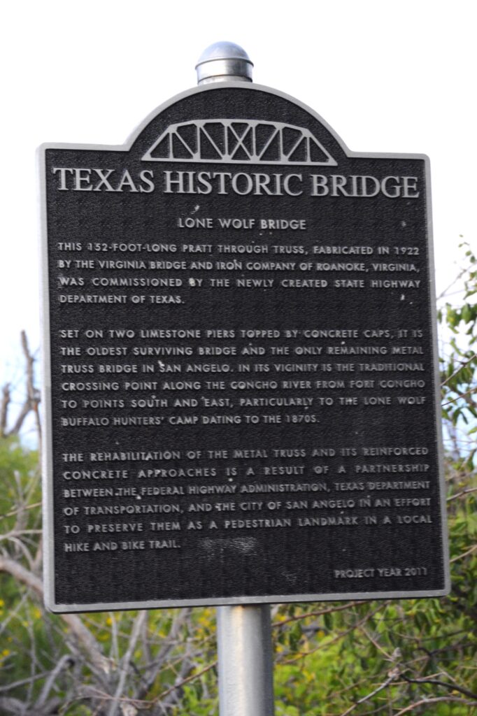
We did, however, drive into town to see Lone Wolf Bridge in the evening. It was supposedly lit up at night, but though we stayed for awhile after sunset, we never saw any lights. It looks like a hangout for taggers. The bridge is covered with graffiti, It’s a sketchy area at night. So we left.
Lone Wolf Bridge
You can read about this historic bridge below.
If you ever get to San Angelo, there are lots of things to see. The top of my list is the water lily gardens and the murals. And don’t forget to take a picture of a sheep! They are all over town.
For a photo tour of sheep and their “ewe”-nique names, click on this link:
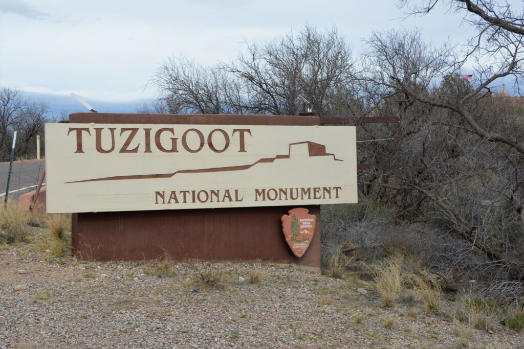
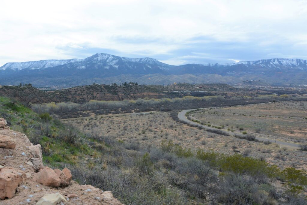
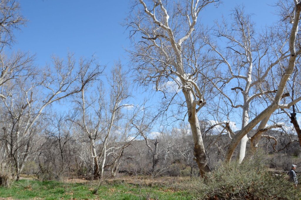
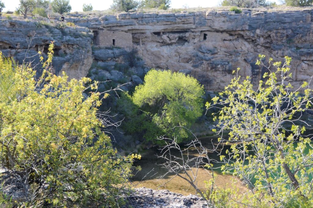
When I lived in Arizona, one of my favorite places to see while traveling north along Highway 17 was Verde Valley. The highway crests a hill and suddenly the view of a lush green valley opens up. As the highway descends into the valley, the green fields and bright green of the cottonwood trees are a stark contrast to the dry surrounding desert. Vermillian cliffs surround the valley while snow-capped mountains peak over the rim. It is a stunning view.
View from the top of Tuzigoot NM. Cottonwood trees line the Verde River. The ghost town of Jerome sits on the side of the distant mountains.
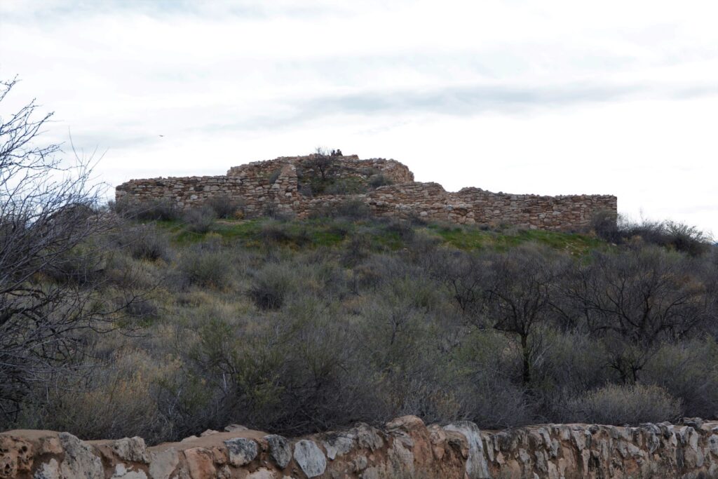
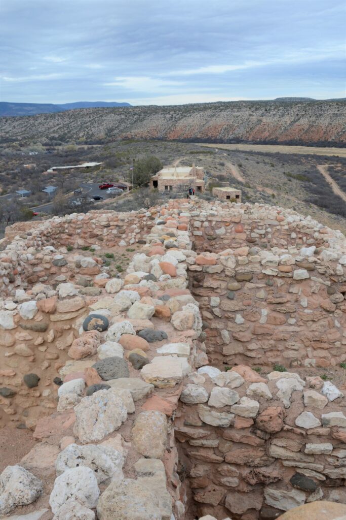
The Indians who came here 1400 years ago traveled along the Verde River valley. Like people of today, they liked to settle near water or on hilltops. One such group, the Sinagua, settled on a hill overlooking the Verde River. They were close enough to the river for water, but high enough to avoid the floodwaters when the river overflowed its banks.
Tuzigoot ruins sit on a hilltop
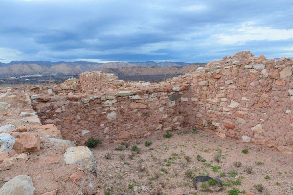
We don’t know much about these people. Their multi-room settlement was similar in construction to many other pueblos found in New Mexico, Colorado and southern Arizona which means they traveled frequently to each others’ settlements. The relics found, as well as the construction of their dwellings, show evidence of this.
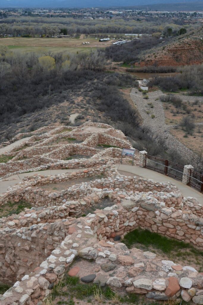
View from the ruins looking down toward the Verde River
The Sinagua people eventually moved north and the walls crumbled and became buried and forgotten until the 1880s when two men from Smithsonian Institute began excavating the site. They gave the name “Tuzigoot” to this site. Tuzigoot is a corrupted form of the Tonto Apache name Tú Digiz, the name for this stretch of the Verde River. It is translated “Crooked Water.”
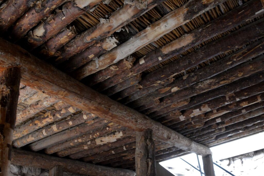
Typical wall construction was of adobe and stone.Roof construction was of logs from trees growing by the nearby Verde River.To preserved the structure, mortar is regularly replaced with a mixture similar to the original.
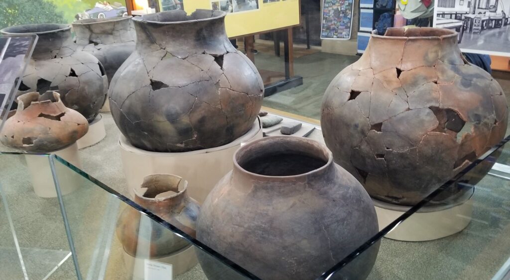
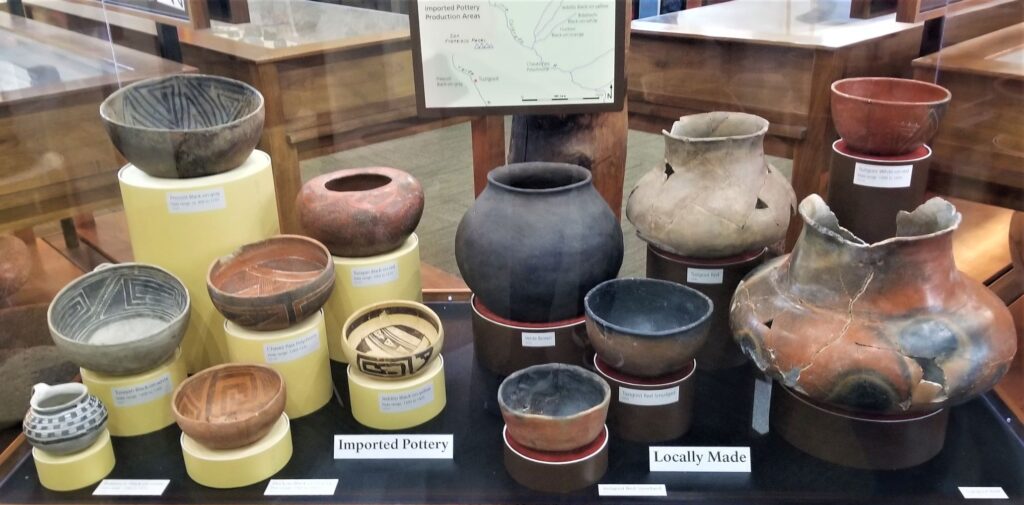
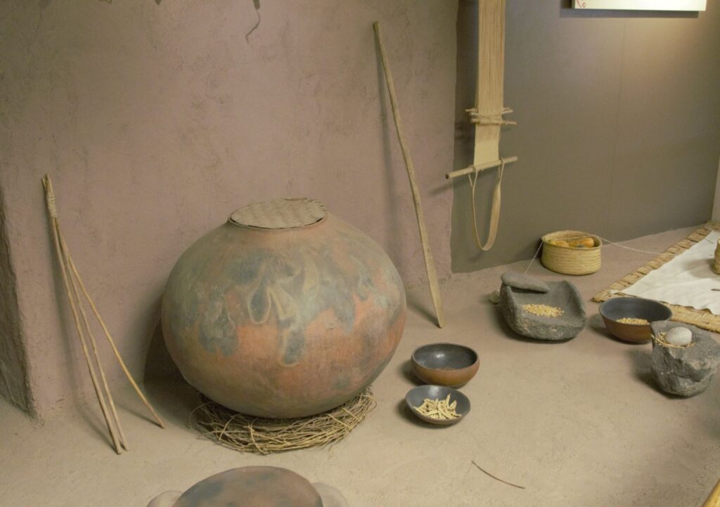
Since taking a pottery class many years ago, I have always been interested in pottery from historical sites. These pots were probably made by coil rope construction, smoothed, glazed and fired in a pit in the ground. What amazed me about these pots was their size!
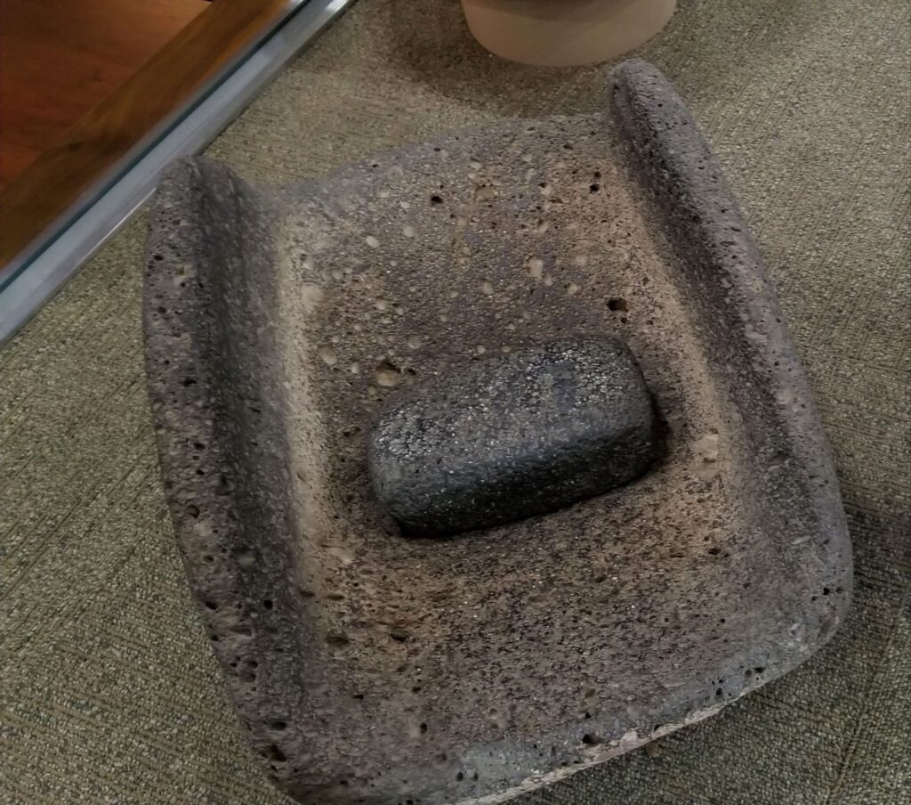
Large pots probably for water storage.Pottery imported from neighboring areas show that the desert people traveled and traded with one another.Grinding stone for grinding corn into flour.Wildlife is plentiful along the Verde River.
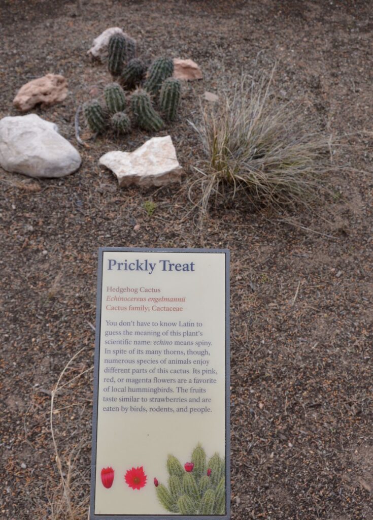
Along the walkway several indigenous plants were labeled. Isn’t this Hedgehog Cactus cute?
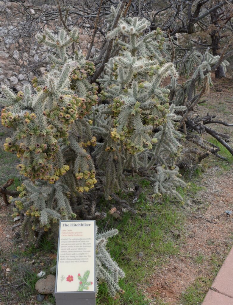
Cane Cholla Cactus is easily caught on clothing and shoes while walking by.
Today visitors can enjoy walking through the rooms of this ancient Indian village, see the displays of artifacts that were discovered here, and enjoy the beautiful views from atop the historical mound.
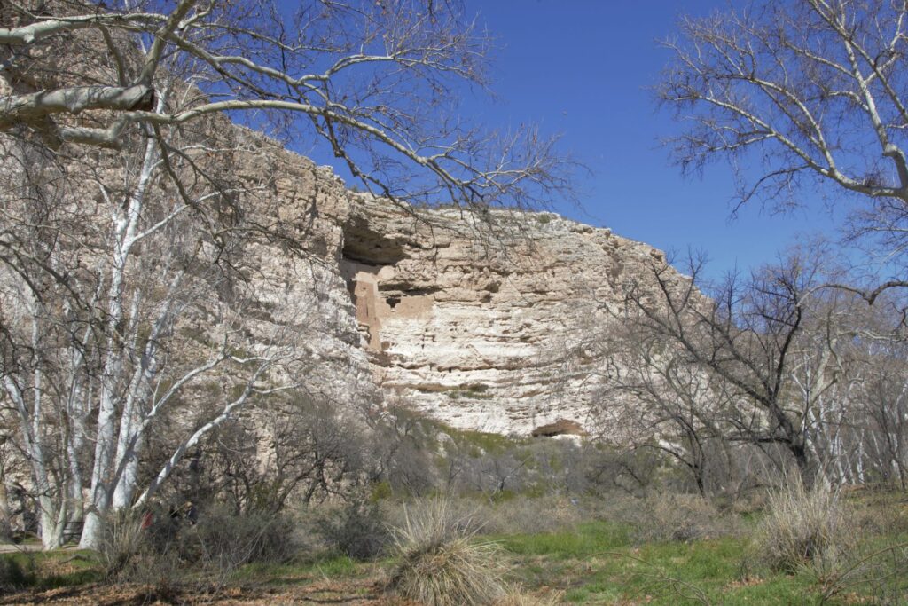
Montezuma’s Castle National Monument
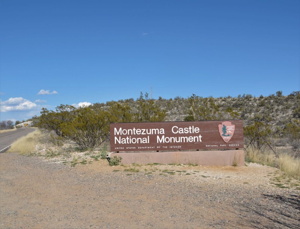
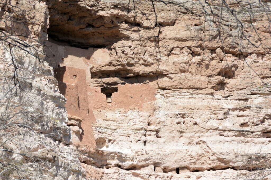
Less than 25 miles away is another ancient ruin known as Montezuma’s Castle National Monument which was also occupied by Sinagua people. It was misnamed by early discoverers of the site who thought that it was built by the Aztec Indians of Mexico.
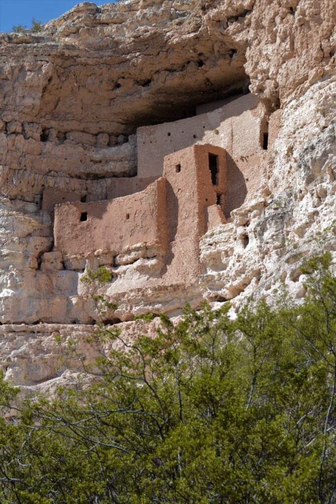
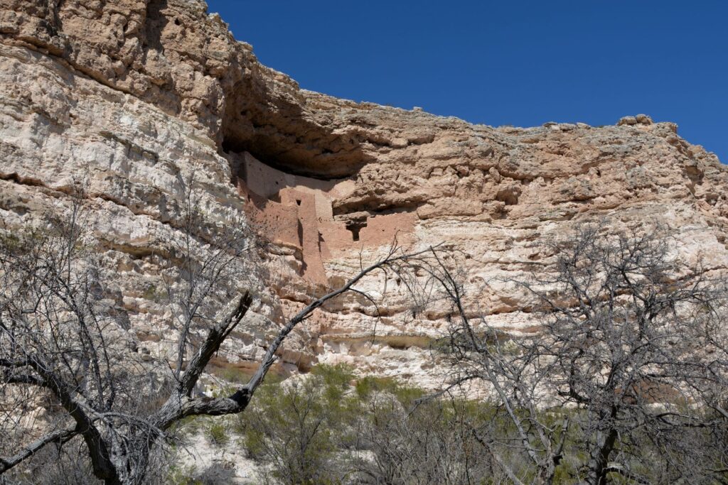
Montezuma’s Castle cliff dwellings
This pueblo cliff dwelling is an impressive five-story 20 room dwelling accessed by ladders during the time it was in use. It was south-facing, so it got the warmth of the winter sun. In summer, it was cool because of the shade from the cliffs.
Nearby, Beaver Creek kept the cliff dwellers supplied with water for living and gardening. The Indians grew crops of corn, beans and squash which were known as the Three Sisters because of how the plants worked together to sustain each other.
The beans climbed the corn stalks to reach sunlight, while supporting the corn from the winds, while the squash was a ground cover that kept the soil moist and discouraged the weeds. The beans, a legume, also enriched the soil. Do you grow these plants in your garden?
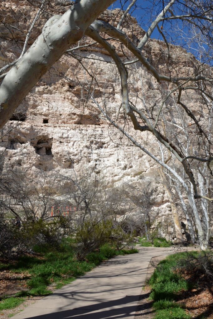
The pathway to the ruins is a short pleasant walk from the Visitors’ Center.One can see the similarities between these rock walls and the ones at Tuzigoot.
The day we visited, Beaver Creek was a rushing torrent from recent rains. The pathway to the creek was cordoned off to visitors. The Ranger told us that in a previous year, the creek had overflowed and the water came up to the bottom of the cliff. Maybe this is why the Indians built their pueblos way above the water.
Looking toward Beaver Creek, this area was where they grew their crops.
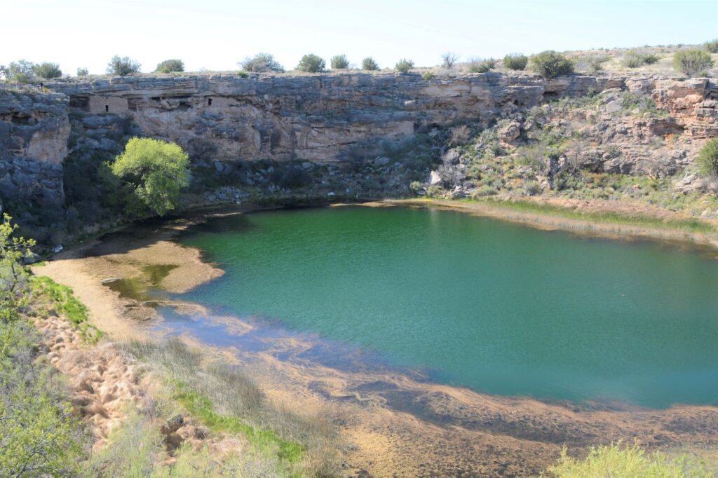
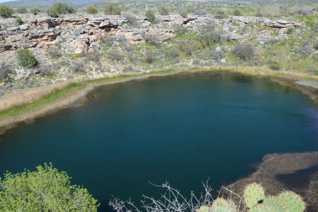
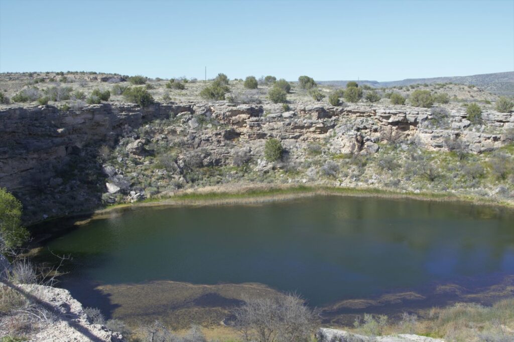
Montezuma’s Well
About 10 miles north of Montezuma’s Castle is Montezuma’s Well. Instead of taking us on paved roads, our GPS took us the long way. I couldn’t believe such a popular national monument would be accessed by a three mile dirt road. It dawned on us that there was a better way when we reached the entrance to the Monument. There was the paved road we were looking for. On our return route we followed the paved road back to Rimrock from which we were able to access Interstate 17.
Montezuma’s Well and cliff dwellings
There is a short climb up to the rim overlooking Montezuma’s Well. The well is an ancient sinkhole that is fed by an underground spring of over 1.5 million gallons of water each day. The spring waters are from rain and snow that fall on the nearby Mogollon Rim which then seeps through the rock until it reaches the spring. Pressure pushes the water up to the surface. It is said that the water takes as long as 10,000 years to travel from the Rim to the Well.
The well is deep. Millions of gallons of water flow into and out of the well.
The water exits the well through underground streams and a cave system which drains into an ancient irrigation canal. The water level remains constant, as well as the temperature of the water which averages 70 degrees F. However, because the water has a high alkalinity and an excessive amount of dissolved carbon dioxide–more than 100 times higher than normal–fish cannot survive.
Fish can’t live in the water, but thousands of leeches live here.
The depth of the well is unknown because of the pressure of the water. Divers have discovered a “false bottom” at around 60 feet of pressurized groundwater that holds a column of fluidized sand in suspension. The fluidized sand rises from two deep vents in the floor of the well. One is 124 feet deep and the other is 74 feet deep. But previous measurements measured 137′ and 95′. So, we can just say, it’s deep.
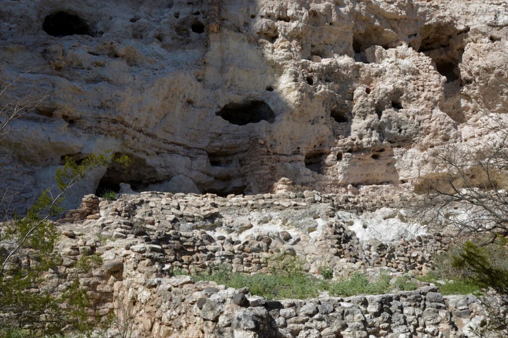
Pueblo dwellings in the rocks above Montezuma’s Well
The people who built homes near Montezuma’s Well were the Hohokam and later the Sinagua.
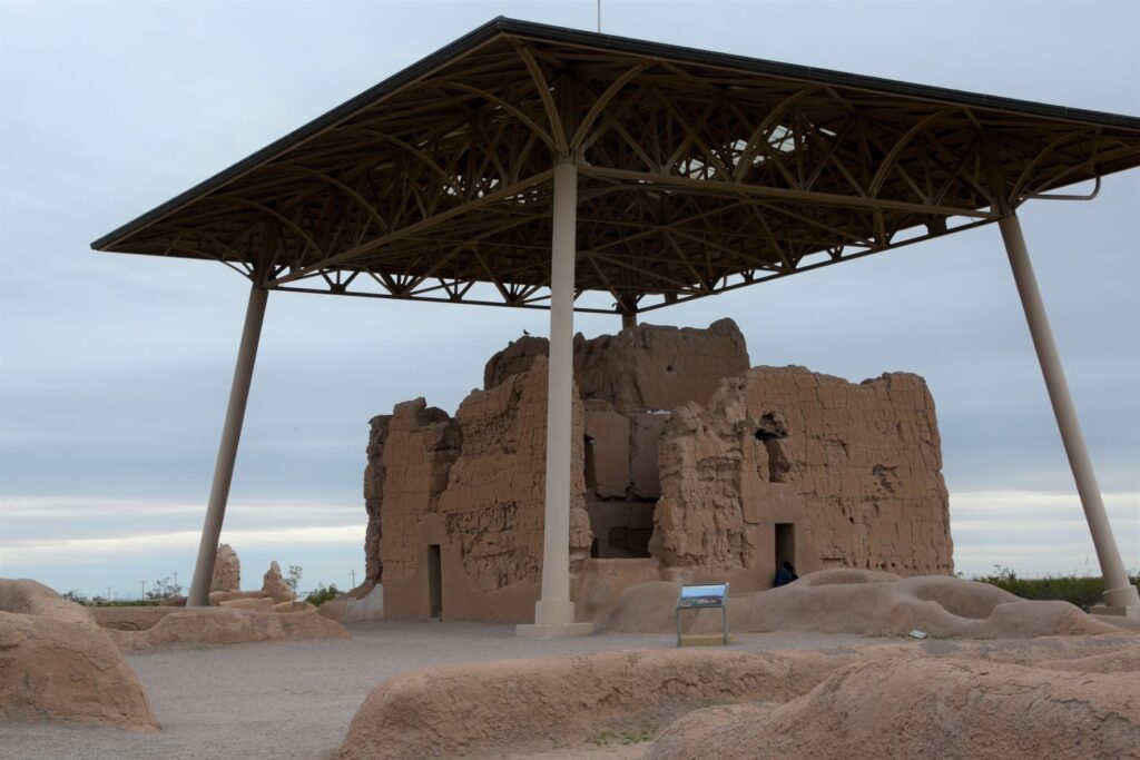
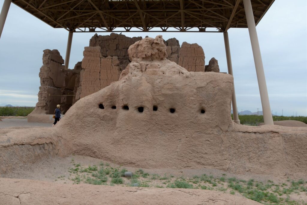
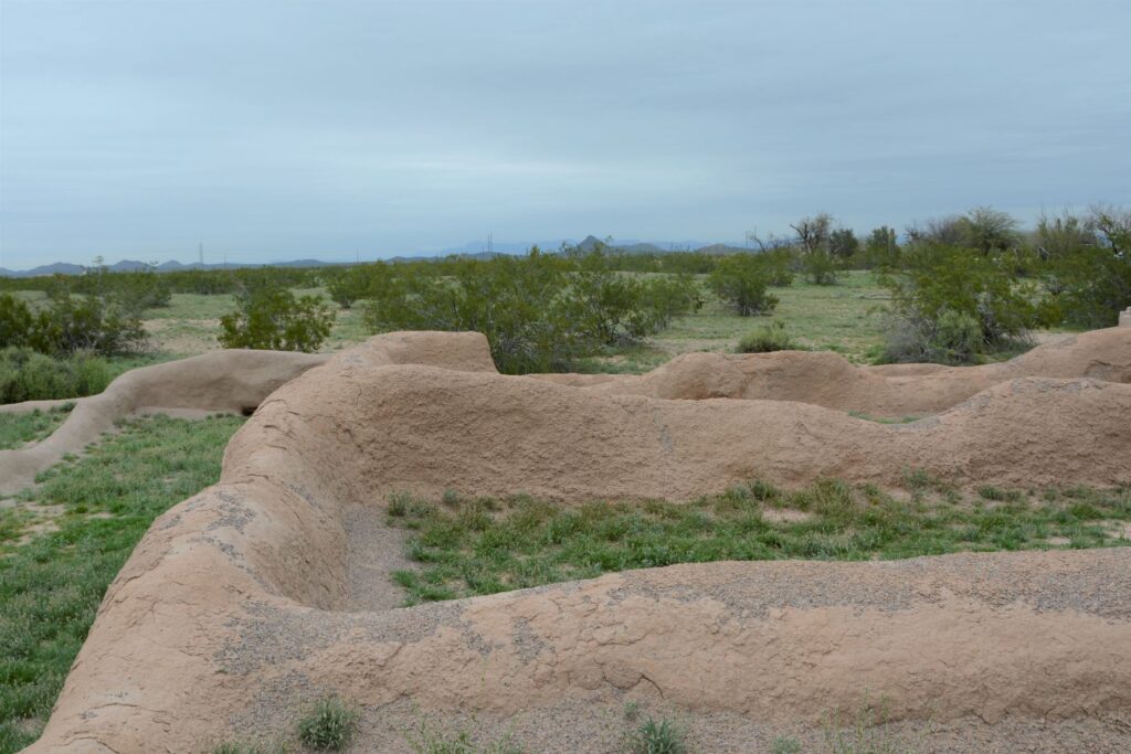
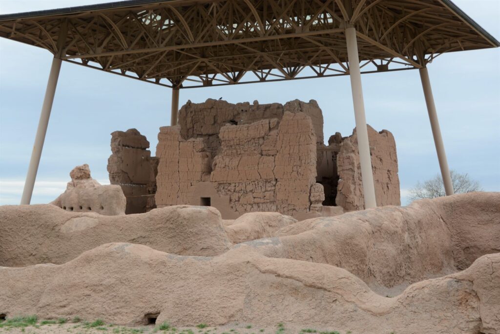
Casa Grande Ruins National Monument
Leaving the Verde Valley area, we traveled south to Mesa, Arizona. One afternoon we drove south, halfway to Tucson to Casa Grande Ruins National Monument. This “Grand House” was probably built in the 1300’s, which is the time period of the founding of the Byzantine Empire, the 100 years war, and the black death or bubonic plague in Europe. These desert people had already been using irrigation methods for hundreds of years to grow their crops.
A metal structure over the ruins keeps it from deteriorating.
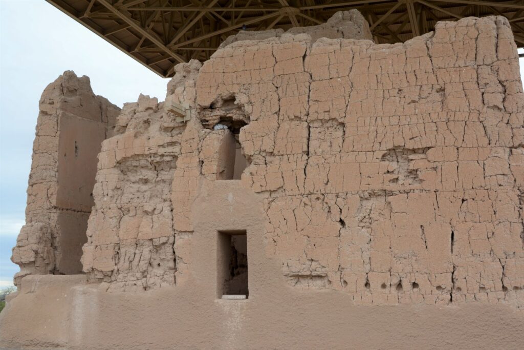
Archeologists are not sure of the purpose of this grand structure. However, because of the construction they believe it was well planned and organized. The builders used caliche, a natural concrete-like material found under the soil around this region. They used it to build houses with solid walls and flat roofs covered with this caliche substance.
Walls were made from caliche, a concrete-like material found in the ground.
These desert people were given the name “Hohokam.” It is not really the name of a tribe or people. The name may have come from “huhugam,” an O’Odham word that means ancestors. Today these people are referred to as Sonoran Desert people. By the way, Hohokam is the name of the grade school I attended. Our elementary schools were named after Indian tribes.
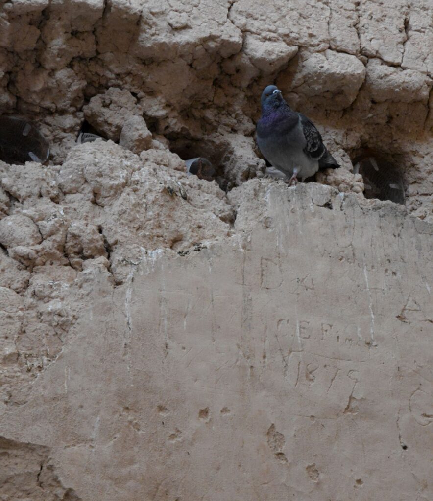
A pigeon makes its home among the walls of the ruins. Note the etched name and date below it.
When I took the photo above, I didn’t notice the name and date etched on the wall. It is a good thing that people like Mary Hemenway and President Benjamin Harrison took steps to preserve the ruins for future generations from vandalism and looting. Mary Hemenway was a wealthy woman who sponsored archaeological expeditions. One expedition to Casa Grande Ruins alerted her to the vandalism. She made efforts to preserve the site and as a result, it became the first federal prehistoric and cultural reservation by President Harrison in 1892.
One of the purposes of this structure might have been a calendar. Some of the holes line up directly with the sun on the summer and winter solstices.
In later years, the village homes were grouped into caliche-walled compounds which were arranged around public plazas and public structures. The Grand House or Casa Grande was at the center of this settlement.
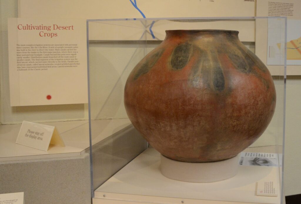
These desert people were identified by their type of pottery called “red-on-buff.” This beautiful piece of pottery below is an example of the techniques used in creating their pottery. In my opinion, the dark portions on this pot look to me like leaves of some plant that they tied around the neck of the pot while being fired which left these unusual designs.
This pot below looks similar in design to the one above with the plant-like designs.
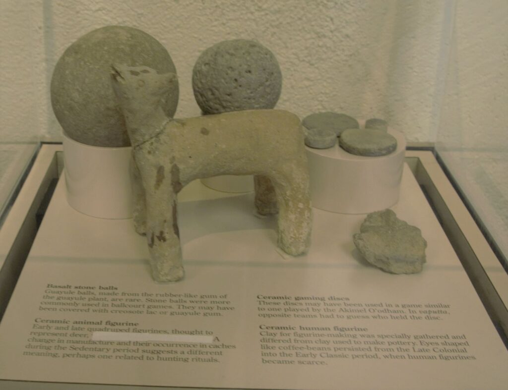
These desert people also enjoyed games. There are over 200 oval-shaped, structures with earthen sides located in large Hohokam villages in southern and central Arizona. Archaeologists have speculated that some kind of game was played within these courts with two teams using a hard rubber or stone ball. Round discs were found that might also have been used in other games.
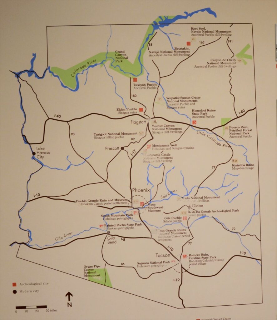
The map below shows many places around Arizona where the Sonoran desert people lived and moved. Eventually, they all left for unknown reasons. It may have been drought, floods, disease, invasion, earthquakes, internal strife or salinization of farmland. We don’t know. Yet we can still appreciate the structures, relics and places they left behind and marvel at their ingenuity.
I am glad we took time to see these places, having never visited any except Montezuma’s Castle when I was growing up. I don’t think I appreciated the contributions these people made to Arizona history. It’s a shame that Hohokam school didn’t teach us anything about the people that our school was named after. I think it would have made a big impression on me to have learned about them and to have visited Casa Grande National Monument.
But the moral of the story is, explore your own backyard. You never know what you might be missing!
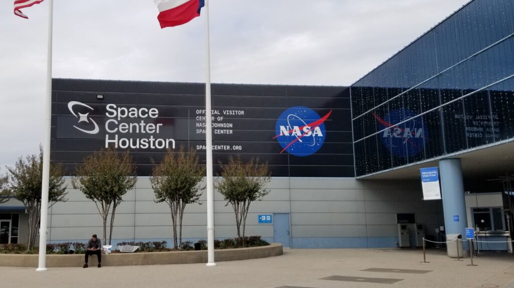
We like to explore areas around the places we stay. Space Center in Houston was just a 90 minute drive from Lake Conroe RV Resort in Willis, Texas, where we stayed in November, so we planned a visit.
Lake Conroe
When I was a child, the space program was a nationwide interest. Alan Shepard and Gus Grissom, the first two Americans in space, were household names. They were considered American heroes, as were Buzz Aldrin and Neil Armstrong, the first two men to step onto the moon. Seeing the Space Center reminded me of the beginnings of the space race long ago.
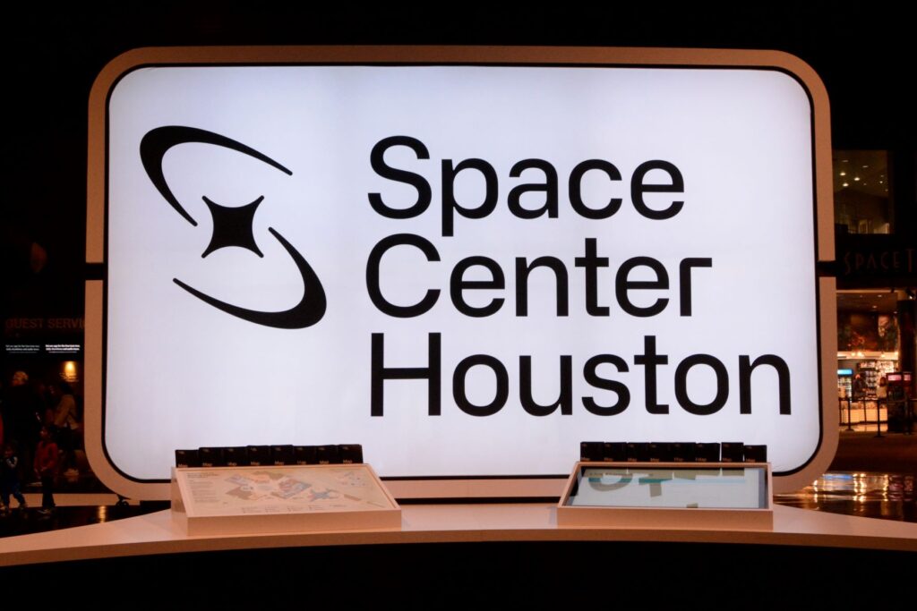
We started our tour in the main building of the museum.The day was cold and windy. It was home school day for the local home schoolers, so we felt right at home with everyone, remembering our own days of homeschooling.
The Main building was huge and would have taken more time and energy to see all of it than we had. There were four main areas plus a Kids Space Place which had hands on exhibits for kids.
We watched a demonstration using a mock-up of the International Space Station and learned what it would be like to live there for an extended time. We also watched a short film of the history of space exploration in the Space Center Theater. As we wandered through the exhibits, we learned about the many aspects of space exploration and travel.
Outside the main building were the Falcon 9 Rocket and Space Shuttle exhibits. In addition, there were three NASA tram tours off-site: The Rocket Park, Mission Control and the Astronaut Training Facility. The Rocket Park was the only tour available on the day we visited because of a mission in progress.
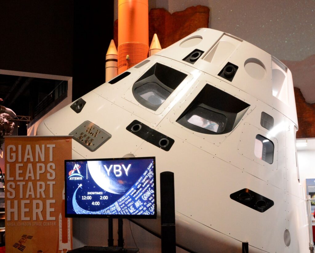
The photos below show a few of the items in the main lobby.
Space CapsuleRocket Motor
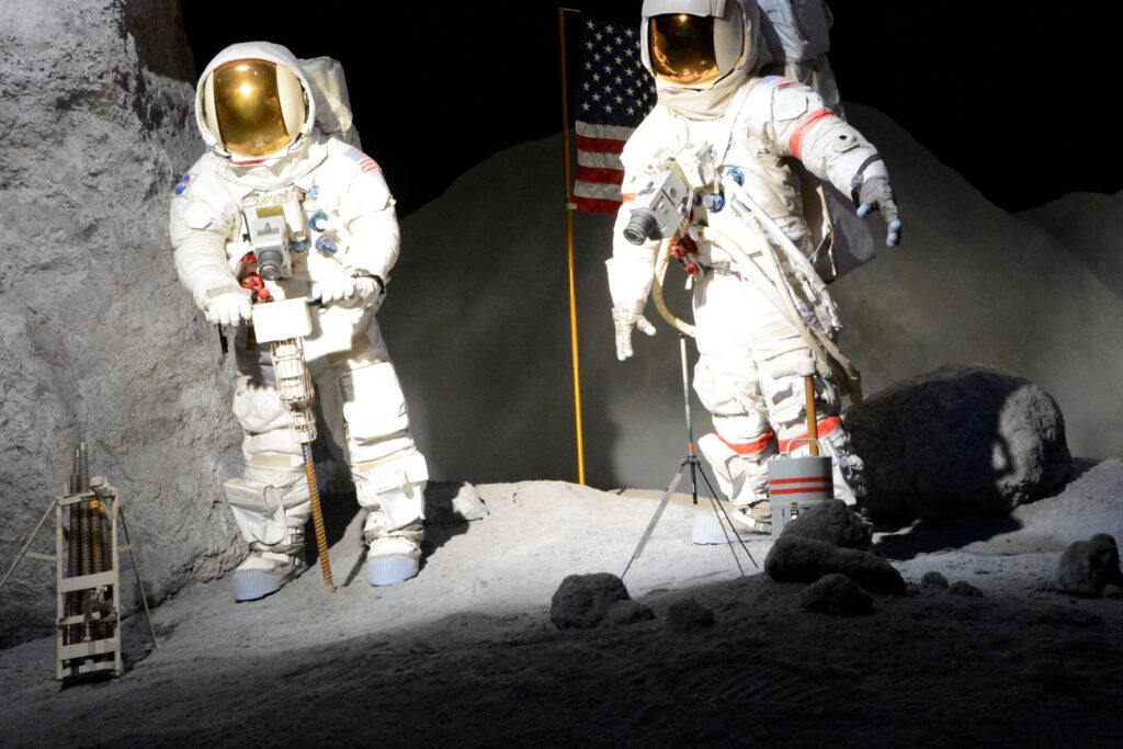
Some of you may be old enough to remember the first men to land on the moon. On our visit to the Space Center we got to see up close what it might have looked like on the moon. We could even touch a moon rock.
Astronauts on Moon exhibitNeil Armstrong, Michael Collins, and Buzz Aldrin, the crew of the first manned moon landing.
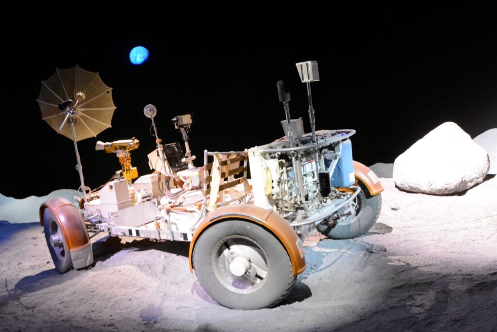
The Lunar Rover vehicle used in the moon landing had to have special tires made of a woven mesh of zinc-coated piano wire. The chevron pattern kept the wheels from sinking into the soft soil on the moon surface.
Lunar Rover
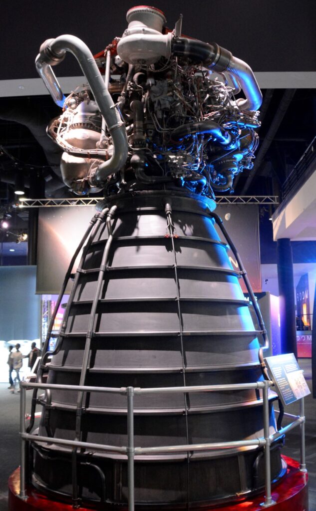
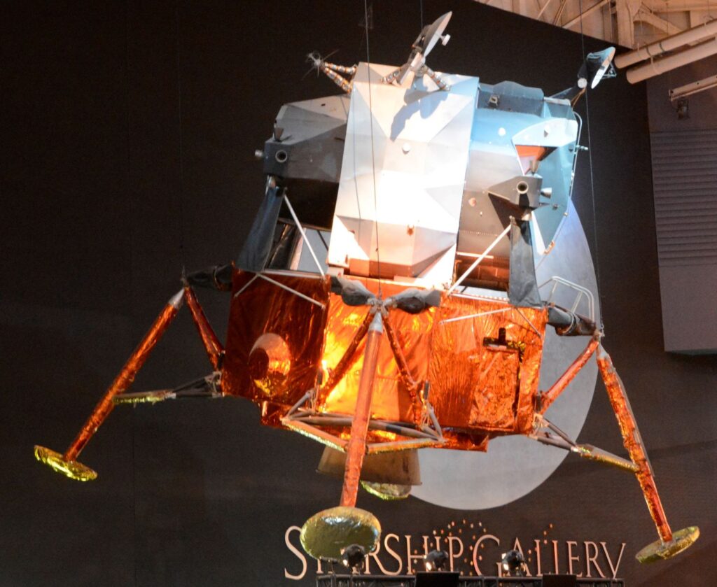
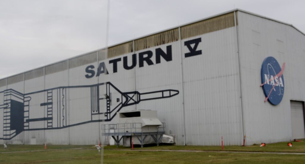
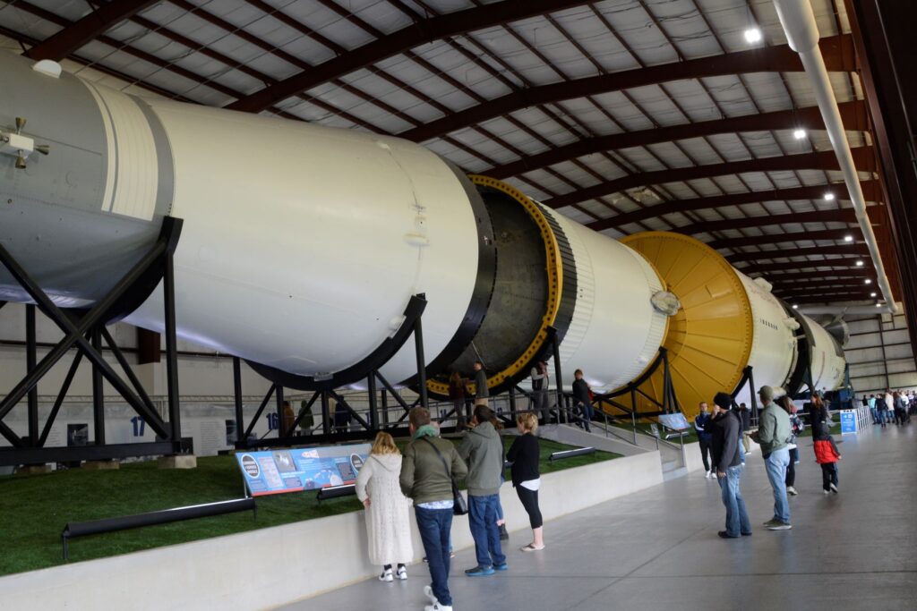
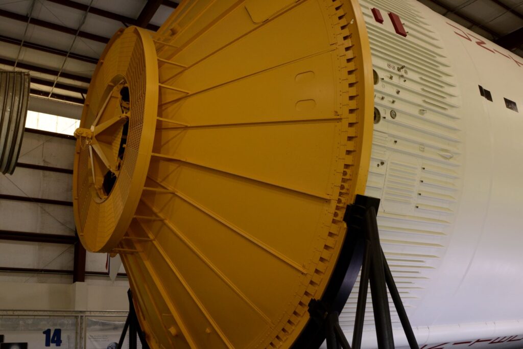
After seeing many of the exhibits, it was time for us to board the tram to the Rocket Park where the Saturn V rocket was housed. You can get an idea of the size of the rocket by the size of the building. The rocket was lying on its side the length of this building.
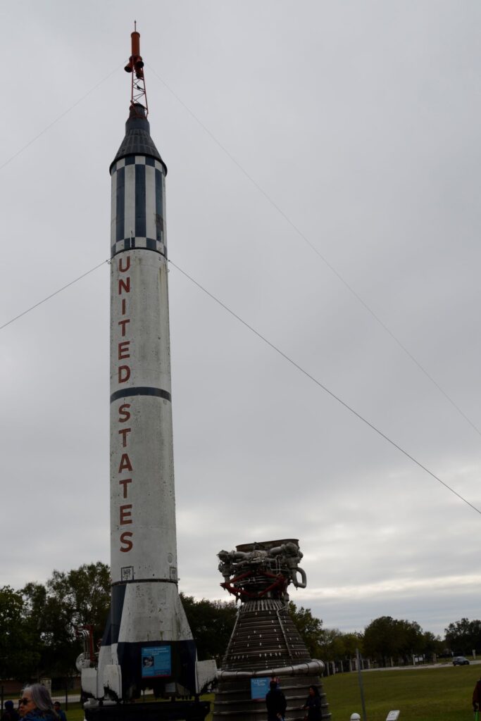
Saturn V Building in Rocket ParkRocket Park: Outside Saturn V building was the Mercury Redstone which took the first men into space.
The Saturn V was the rocket that was used to launch the missions to the moon. It had to be massive enough to launch the crew, the lunar lander and the lunar rover all at once. As you can see, it fills the entire building.
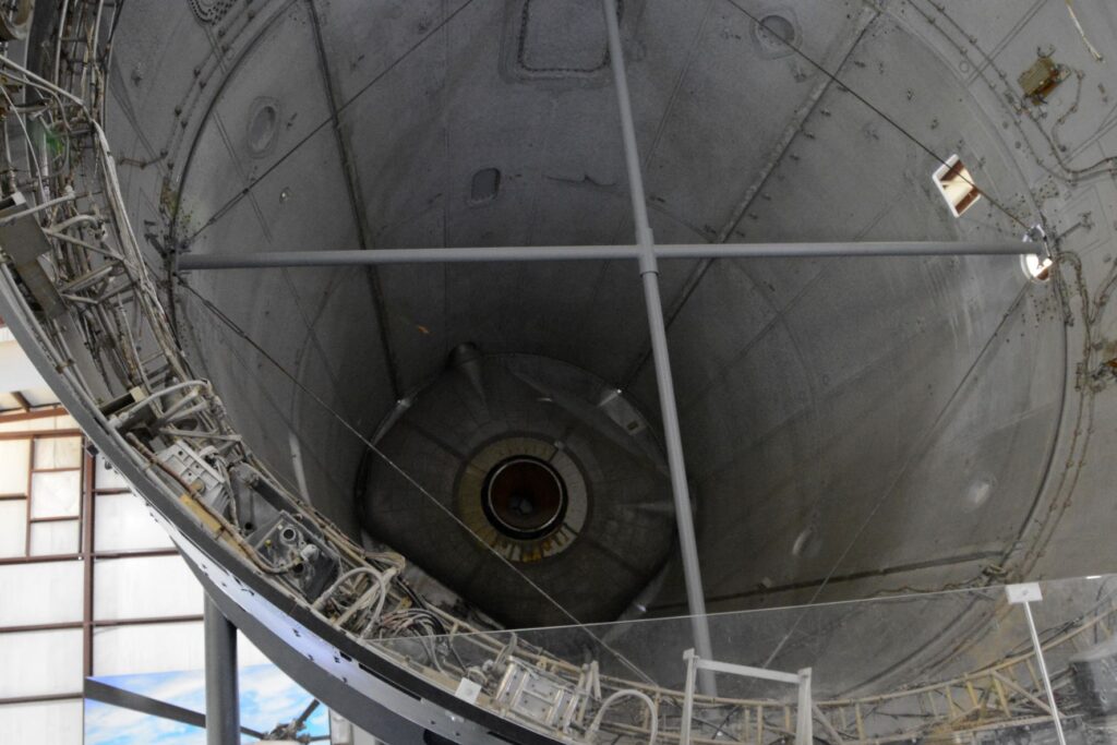
Inside Saturn V building showing stages of the rocket
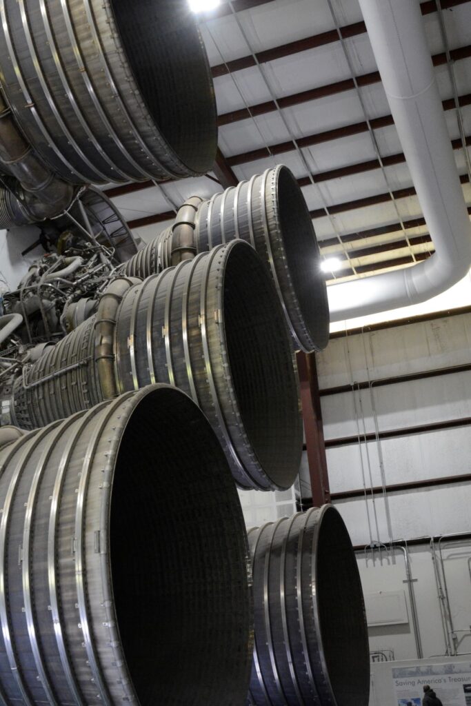
To get an idea of the immense size of the rocket motors on the Saturn V, I took this photo. Notice the man at the bottom of the photo for size reference. The Saturn V had 5 rocket motors on the first stage to launch it into orbit.
Three hours after the Apollo 11 mission was launched, the spacecraft left Earth’s orbit and began its three-day journey to the Moon.
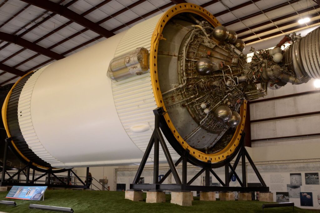
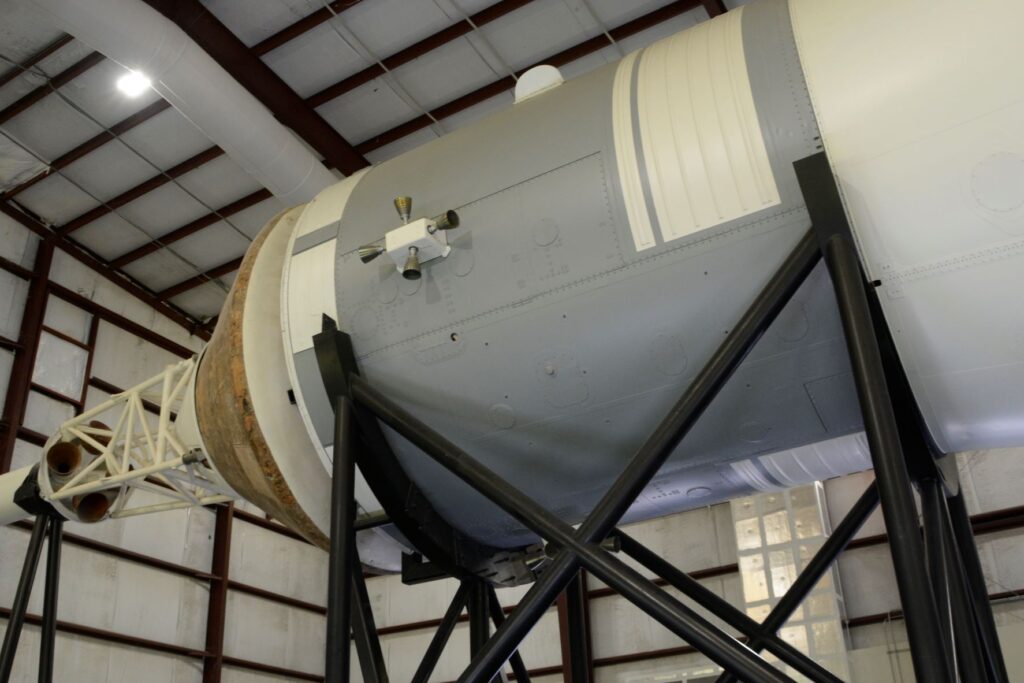
Stage 3 of the Saturn RocketA look inside the cargo area of the Saturn VThe final stage of Saturn V
The lower stages were jettisoned from the rocket as the fuel burned up. On Apollo 11, the command module, Columbia and its command module pilot Michael Collins, would orbit the moon, while the other two crew members, once in position, would climb into the Eagle (lunar lander) and undock from the main spacecraft. From there, they would descend to the moon’s surface.
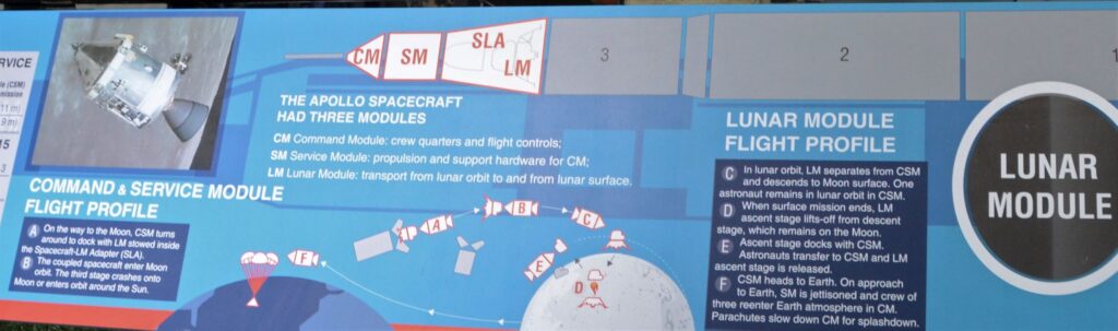
The diagram below explains the sections of the Command and Service Module. This shows how the Lunar module separated and got to the moon and back.
NASA’s next mission is to go to Mars. Although this seems ambitious to me, plans are already in progress.
Our visit to the Space Center was very informative. It made me think about the vastness of space. I was reminded of Psalm 8:3-4
“When I consider Your heavens, the work of Your fingers, The moon and the stars, which You have set in place; What is man that You think of him, And a son of man that You are concerned about him?”
And again, Psalm 19:1
“The heavens tell of the glory of God; And their expanse declares the work of His hands.”
The more we explore the universe, the more it shows the handiwork of God and the finiteness of man. Man has accomplished a lot in learning about our universe, but the knowledge that really matters is knowing the Creator of it all.
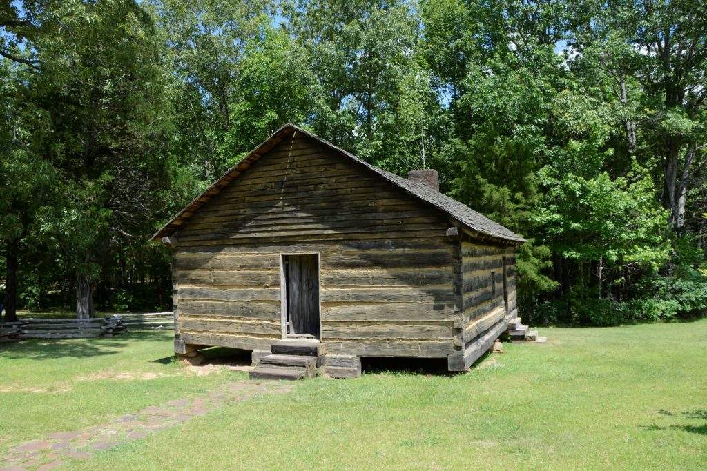
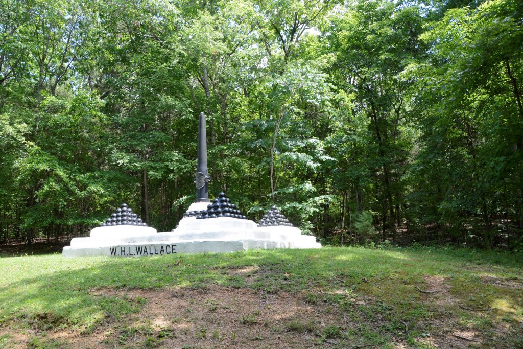
In the Western half of Tennessee we stayed at a Thousand Trails campground near the small town of Saulsbury. Nearly 40 miles away is the national historical battlefield of Shiloh, a civil war battleground. Having never visited a national battleground before, I wasn’t sure what to expect.
Shiloh National Military Park
Replica of Shiloh Church
We started out at the Visitor’s Center where we watched an award winning documentary about the battle of Shiloh that took place on April 6-7,1862. The battle was named after a small church in the vicinity. Ironically, the name Shiloh means “place of peace” or “heavenly peace”. It is much more fitting today as the beautiful grounds are quiet and solemn.
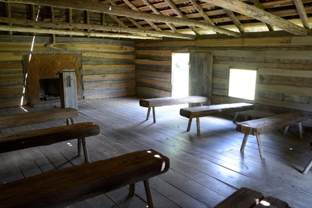
Inside Shiloh Church
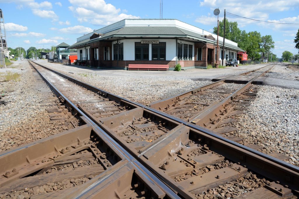
The Union Troops came south on steamboats to Pittsburg Landing on the Tennessee River. The goal was to take the Confederate’s stronghold at Corinth, Mississippi, (a few miles to the south) in order to cut the South’s supply lines. Corinth, Mississippi, was a crossroads where railway lines from the east and west met ones from the north and south. We visited Corinth and saw where these railroads crossed.
Corinth Railroad Junction
General Grant of the Union Army was waiting for Buell’s Army of the Ohio to join him. Little did Grant realize that the Confederates who he thought were in Corinth, had moved near Shiloh to launch a surprise attack.
The Confederate Army under General Johnston originally had planned to attack two days earlier. Due to a heavy rain storm that turned the roads to mud, it took Johnston three days to move his army just 23 miles. They were also short of rations due to the delay.
In the meantime, General Grant was trying to avoid a battle until his reinforcements arrived, but early on April 6th, a Union reconnaissance patrol came face to face with the Confederates and the battle began.
The battle raged for two days with thousands of casualties. At first, the battle went in favor of the Confederates, but after the second day, the Confederates were outnumbered and out of supplies. They retreated to Corinth, where the war continued.
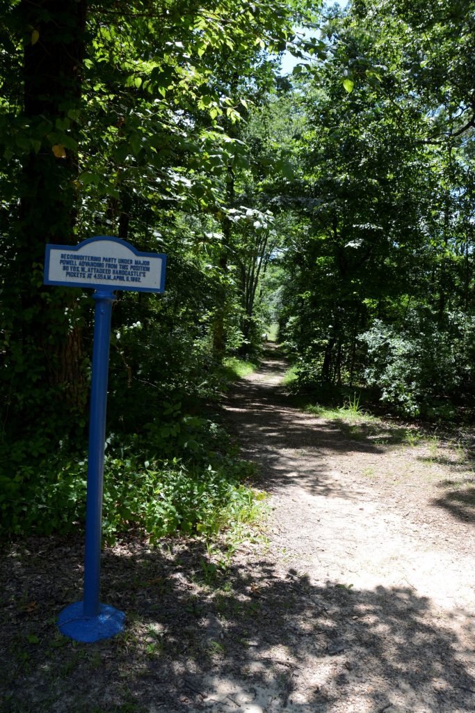
The pathway where the battle began when Union soldiers stumbled into Confederate pickets.
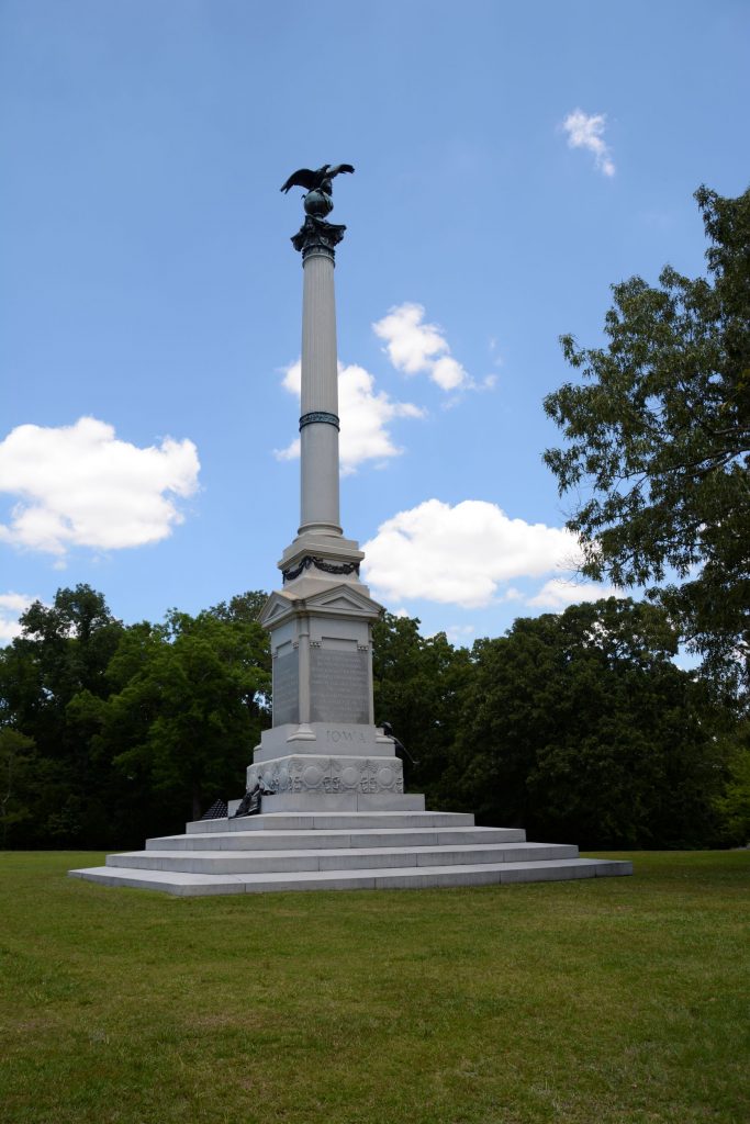
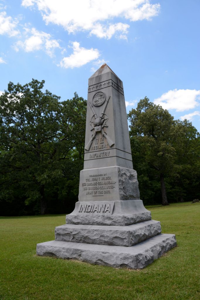
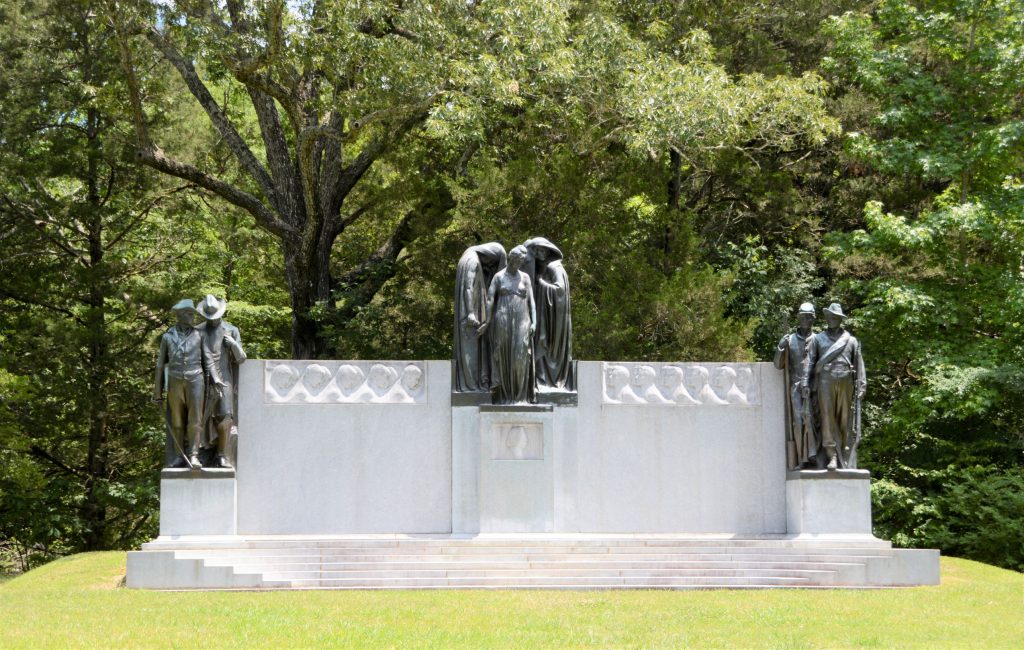
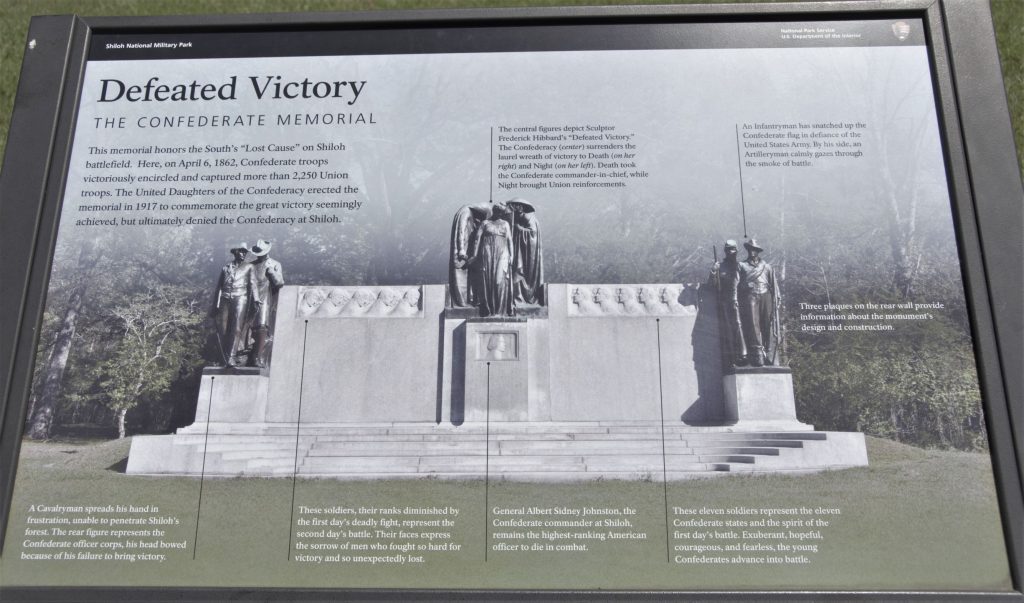
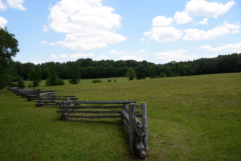
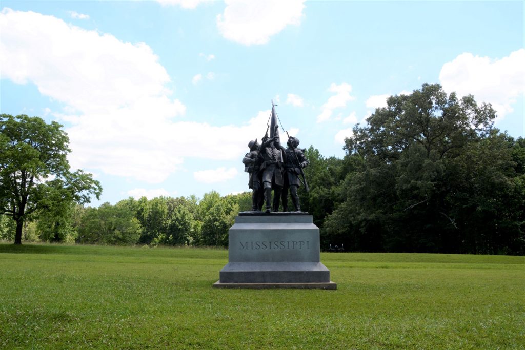
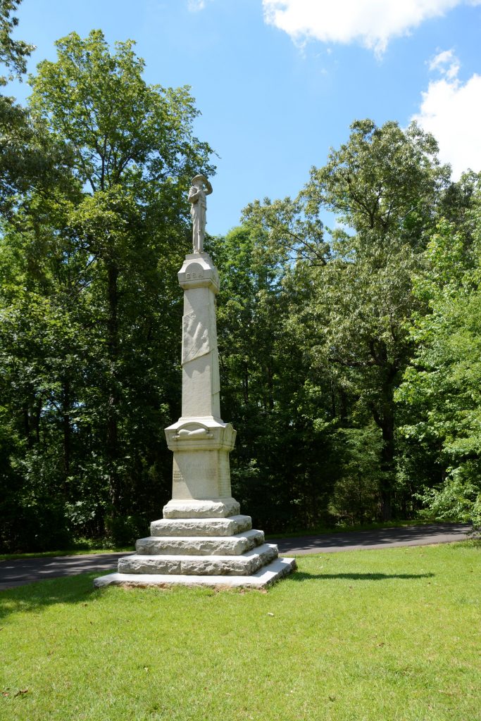
Many beautiful monuments have been erected to honor the armies of both sides. We took a twelve mile self-guided tour on the roads throughout the park. There were many monuments and memorial sites as well as signs with explanations of the battle sites.
Monument to the Iowa soldiersMonument to Indiana Infantry, 17th RegimentConfederate MemorialExplanation of Memorial
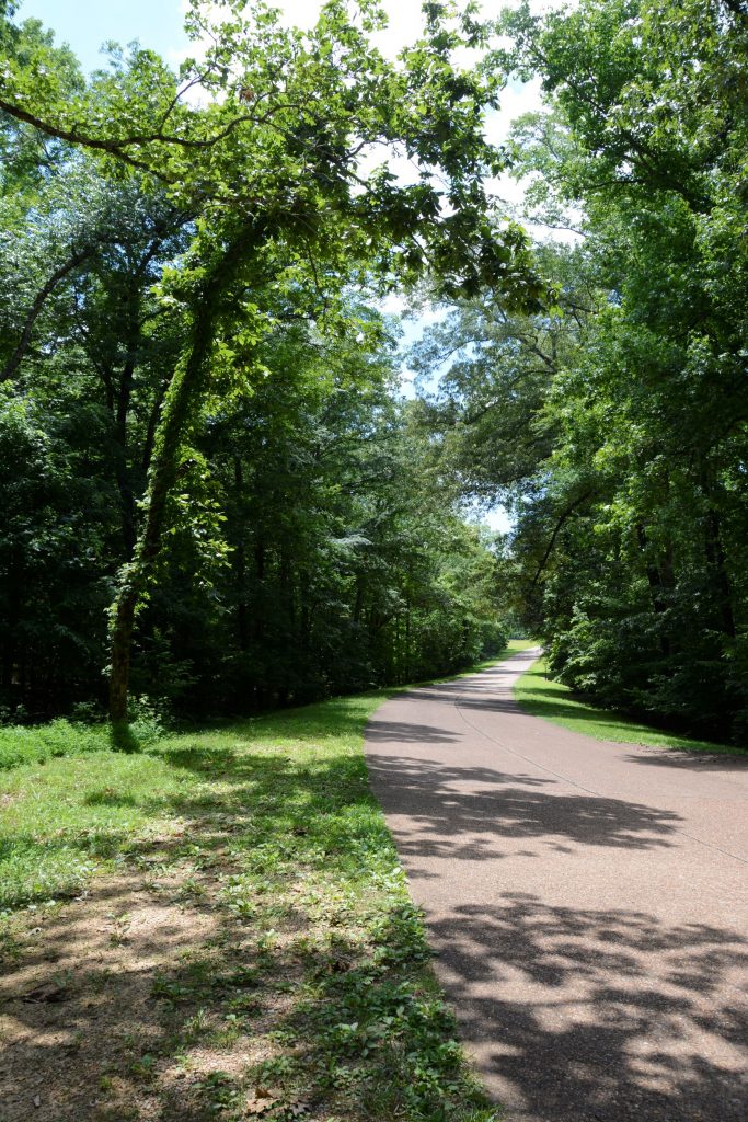
The roads through the battlefield were lined with beautiful trees and park-like vistas.
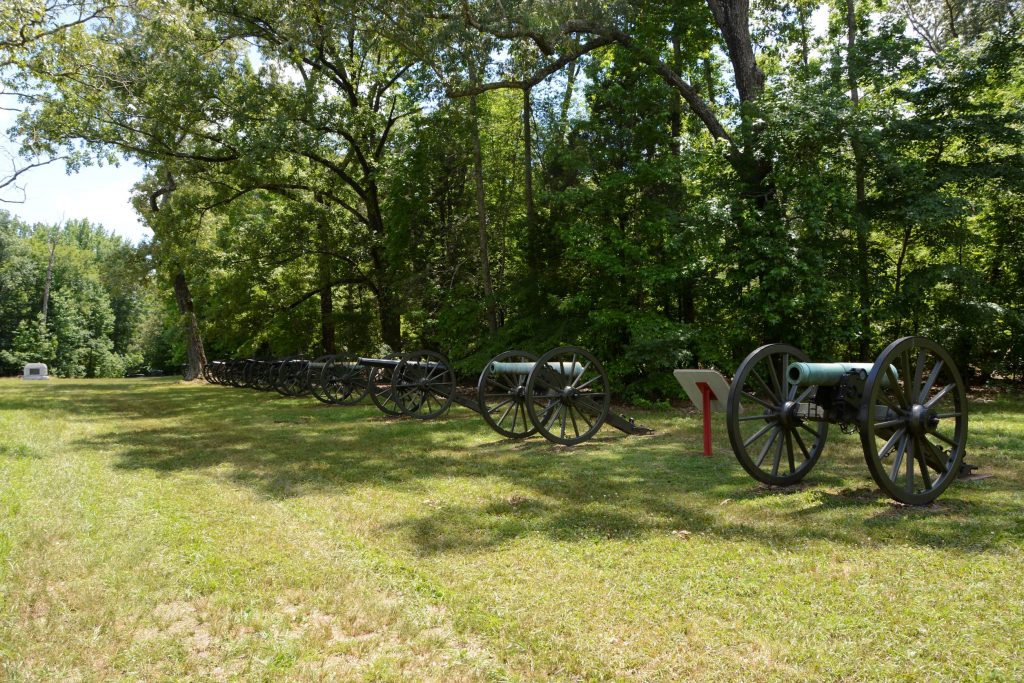
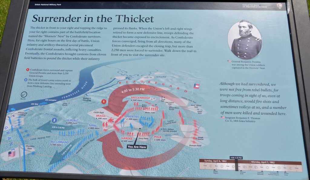
The Confederates amassed more than 50 cannons, the largest concentration of field guns yet witnessed along a half mile frontage, to pound a dense oak thicket in the middle of the battlefield that the Union Army still held.This kept them pinned down while the Confederates surrounded them forcing the Union soldiers to surrender.
This map shows the troop placements and time of day when the Confederates surrounded part of the Union Army. Some were able to escape, but many were captured.
Hornets Nest
Much of the battle of Shiloh took place on farmland of Joseph Duncan.
The Sixth Mississippi lost over 300 men in less than an hour.
No part of this battlefield was left untouched by the horror of this battle. Mass burial graves were necessary to inter the 3,482 dead. More than 16,000 were wounded and 3,844 were captured or missing. This was the bloodiest battle of the Civil War thus far, and the war was only a year along.
Bloody Pond
The Civil War was a costly war in terms of humankind. National Military Parks like this help us to appreciate the history of our country and the freedoms we have because of those who went before and paid the price.
It is sobering to think of the cost of freedom. Young men in the prime of their lives were cut off from living so that we can enjoy freedom to live as we do today. We can honor them by supporting parks like this.
One way to get to know the history of an area is to visit local museums. Some museums are carefully curated and others seem to be a hodge-podge collection. Each museum, however, reveals something of our past or has something for us to learn.
This is a small taste of what we experienced at five museums we visited from Texas to Ohio.
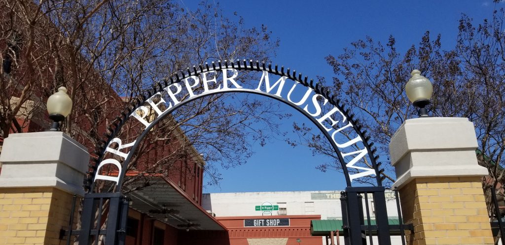
1. Dr. Pepper Museum, Waco, Texas
Dr. Pepper has always been my favorite soft drink. I hardly ever drink soft drinks anymore because of the caffeine and sugar, but a chance to see where Dr. Pepper was founded sounded fun.
We learned that Waco was the perfect place for a bottling company. That’s because of the Trinity Aquifer and artesian water from which Waco earned the nickname, “Geyser City”. We learned the first bottled soft drink was made by Jacob Schweppe and bottled in ceramic bottles.
Dr. Pepper MuseumEntrance to Dr Pepper Museum
There are several stories as to how Dr. Pepper got it’s name, so I won’t try to explain all of them. A Waco pharmacist named Charles Alderton, experimented with soft drink recipes until he came up with the popular drink then known as the “Waco”. Not being interested in starting a business, Alderton never became rich from his recipe. Instead he allowed the drug store owner where he worked and the owner of a ginger ale company to take over the business of producing it.
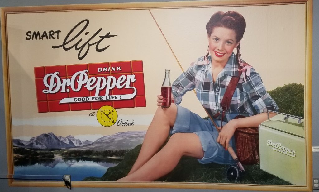
It seems the real genius was in marketing the new drink. We saw many examples of ad campaigns and Dr. Pepper paraphernalia. Remember the 10, 2 and 4 ads? If I drank Dr. Pepper at 10 a.m., 2 p.m. and 4 p.m., I would be awake for a week!
Example of Dr. Pepper 10-2-4 ad
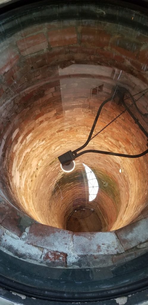
My favorite part of the Dr. Pepper Museum was looking down the well. The well had been covered over for many decades. When it was discovered, it was found to be filled with all kinds of debris, including many vintage bottles. Archeology students from Baylor University spent many hours excavating and preserving the items found in the well. Many of them are now displayed inside the museum. As you can see, the bricks lining the walls are very well preserved.
Well in Dr. Pepper Museum
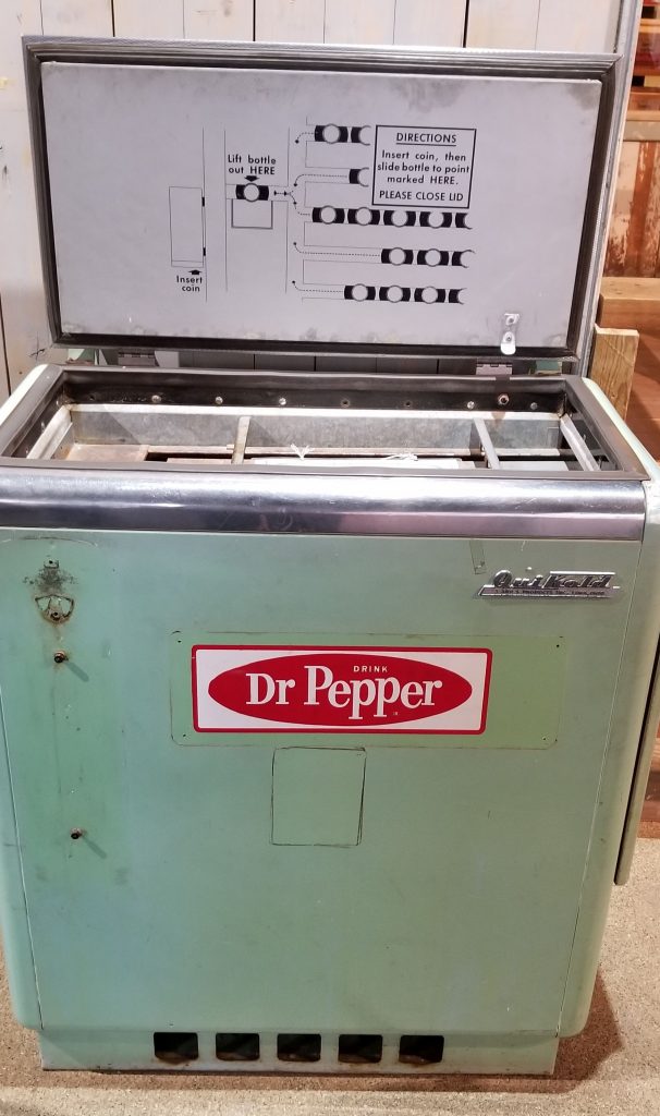
I remember riding my bike to a Circle K store and getting a soda out of a cooler like the one below . I inserted my money and slid the bottle to the opening where I could lift it out. (See instructions on lid) Sometimes these coolers kept drinks so cold, the soda would turn to ice when you popped off the bottle cap.
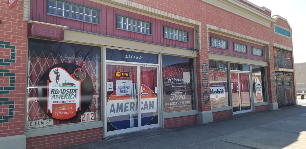
2. Roadside America Museum
Every small town in Texas is proud of their history. Hillsboro, Texas, is no exception. We visited the Roadside America Museum. This museum is a collection of Americana memorabilia. Tours are by appointment, but we arrived just when another couple was being ushered into the museum by the tour guide.
Roadside America Museum
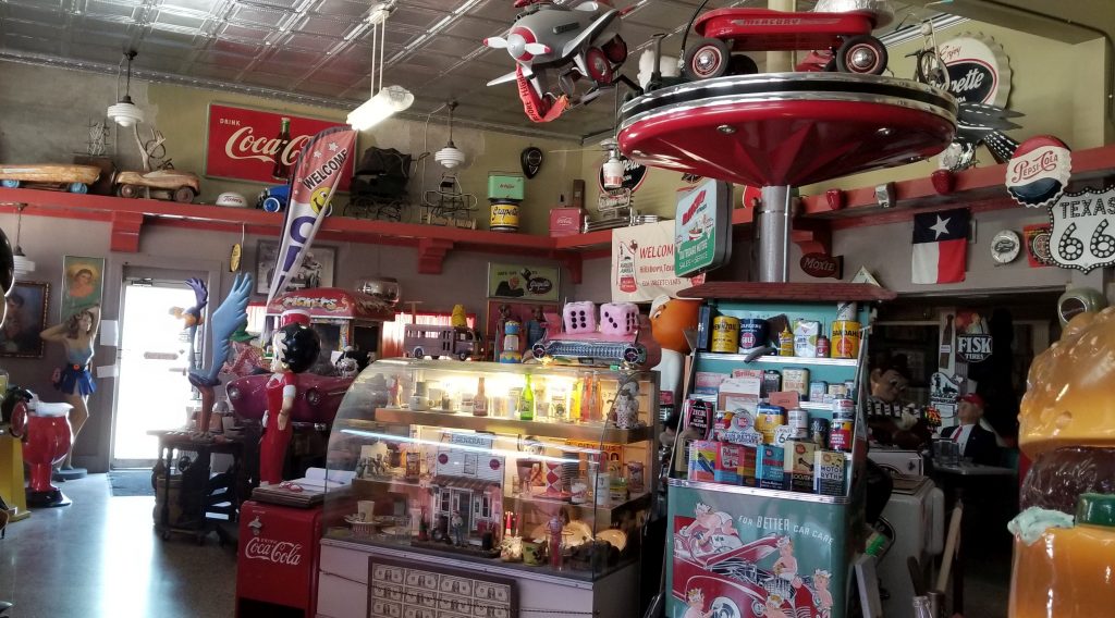
I have to say, this museum was overwhelming. There were so many items crammed into such a small space, that my eyes hurt. This museum owner is a collector bordering on hoarding. But I think he is very clever to turn his collector’s habit into a museum.
Lots of vintage stuff at Roadside America Museum
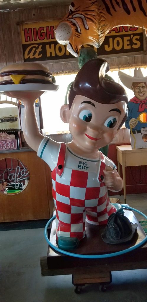
I remember going out to eat at Bob’s Big Boy in Scottsdale, Arizona. My sister’s first job was working there as a waitress. A Big Boy icon like the one below was outside every Bob’s Big Boy restaurant.
Bob’s Big Boy
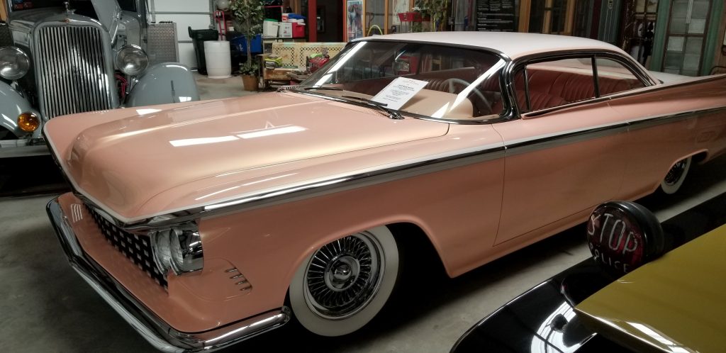
There were also a lot of old vehicles in this museum that had been restored. My favorite was this peach car with the peach interior.
Roadside America Museum
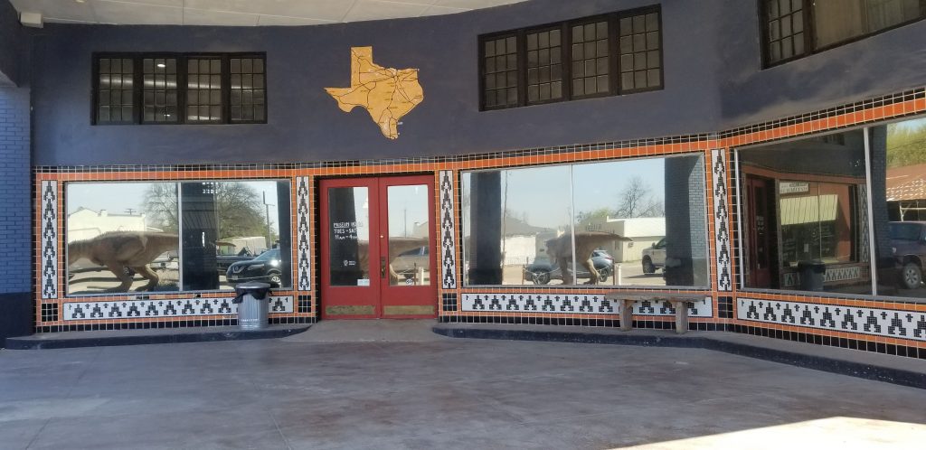
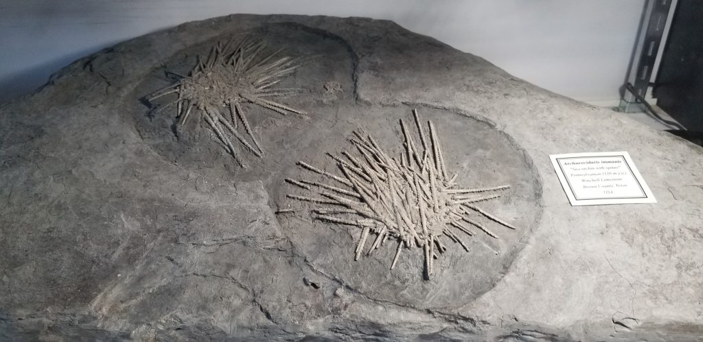
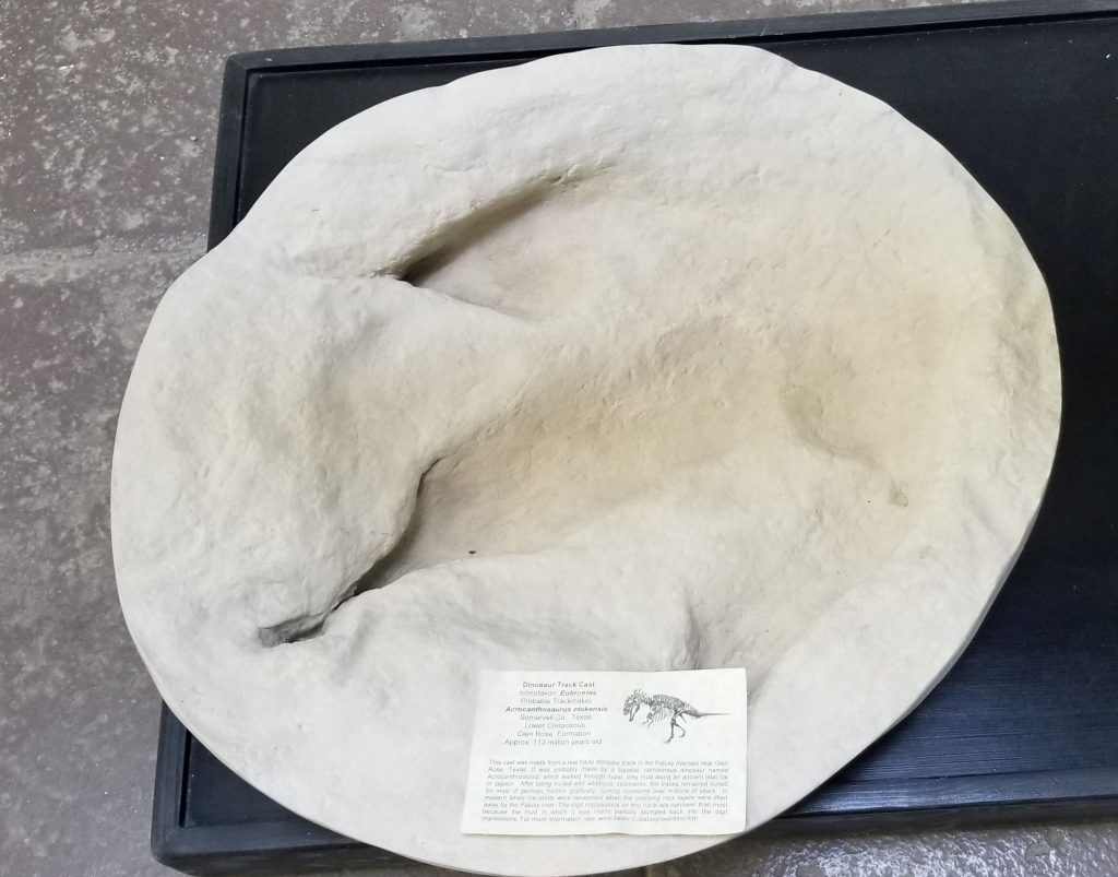
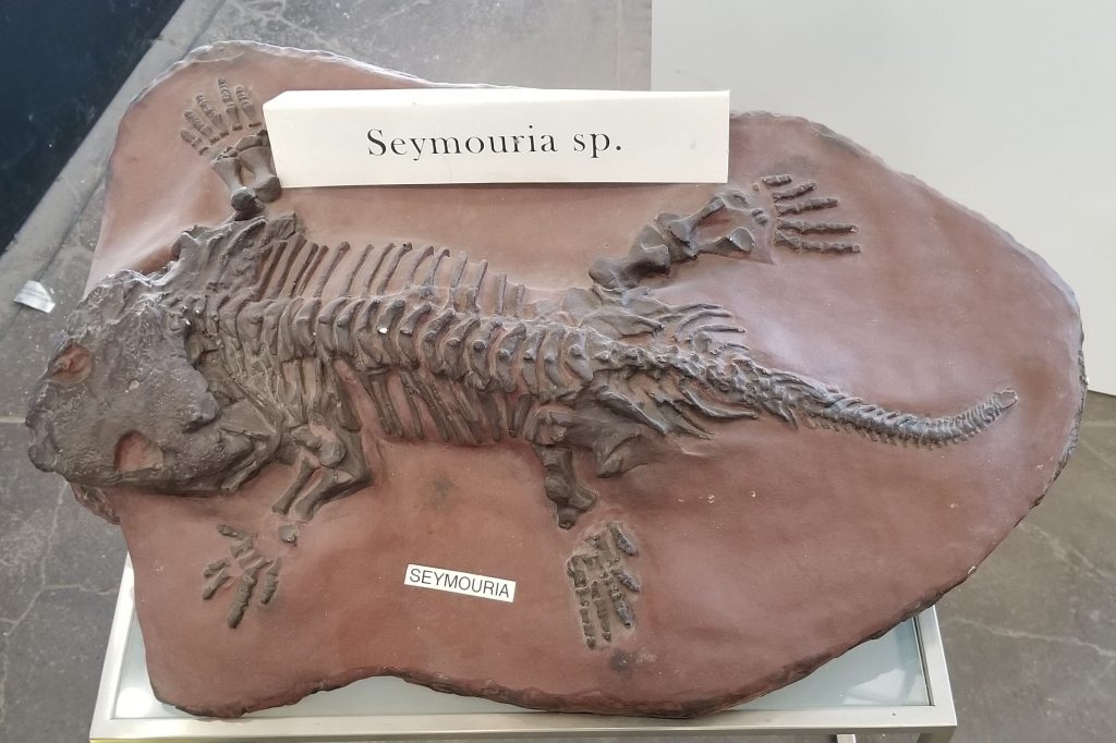
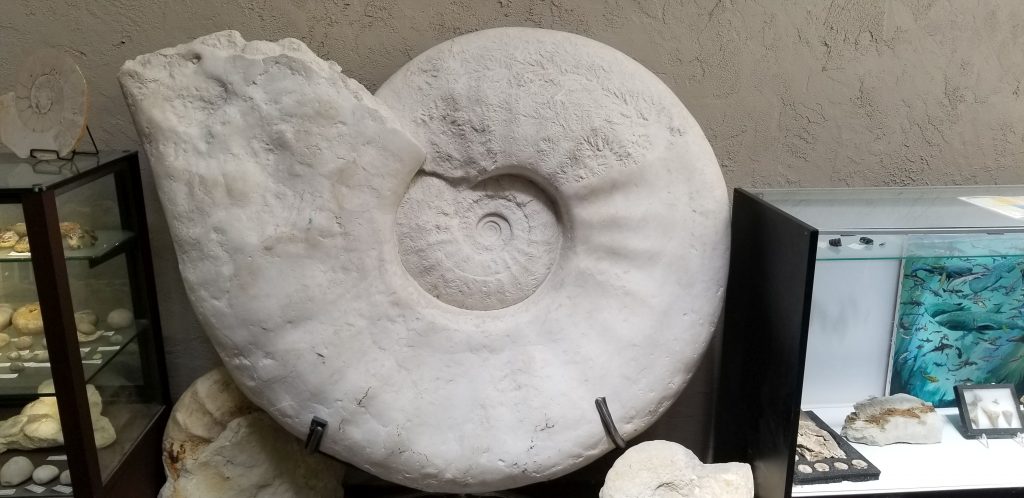
3. Texas Through Time Fossil Museum
In the same little town of Hillsboro, Texas, was the Texas Through Time Museum. I was interested in the fossil collection that is housed there. Though the museum has fossils from around the world, their main goal is to educate and stimulate appreciation for Texas’ unique fossil record. We got there near closing time, so I only had time to snap a few pictures.
Texas Through Time Fossil MuseumSea Urchin fossilsDinosaur Track Fossilized skelton of Seymouria, an extinct reptileGiant Fossil
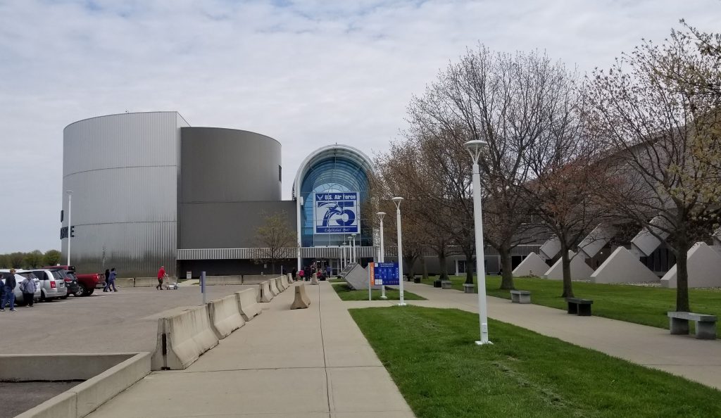
4. National Museum of the United States Air Force
While we were in Ohio close to Dayton, Ray, being an Air Force vet, wanted to visit this impressive museum.
The National Museum of the United States Air Force is the official museum of the United States Air Force. It is located at Wright-Patterson Air Force Base, 6 miles northeast of Dayton, Ohio. This is the world’s largest military aviation museum and also the oldest. It houses and displays more than 360 aircraft and missiles. It is housed in five massive airplane hangers. We only had enough time to see one during our visit.
National Museum of the USAF entrance
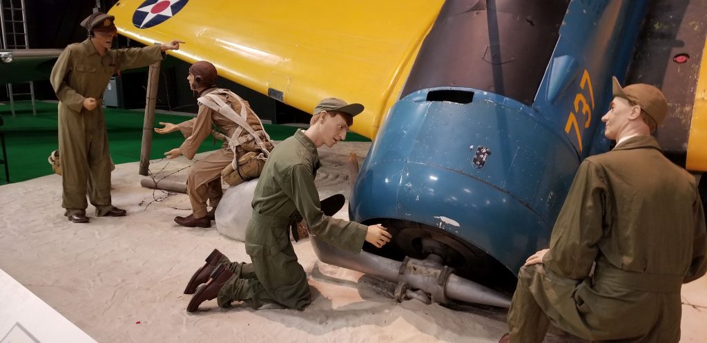
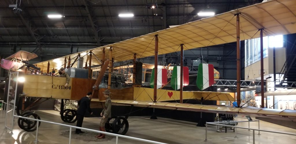
The museum is more than airplanes. We saw tastefully done dioramas with realistic looking figures in authentic uniforms. There are so many displays that it would take days to read all of them.
Plane crash dioramaEarly Bi-plane
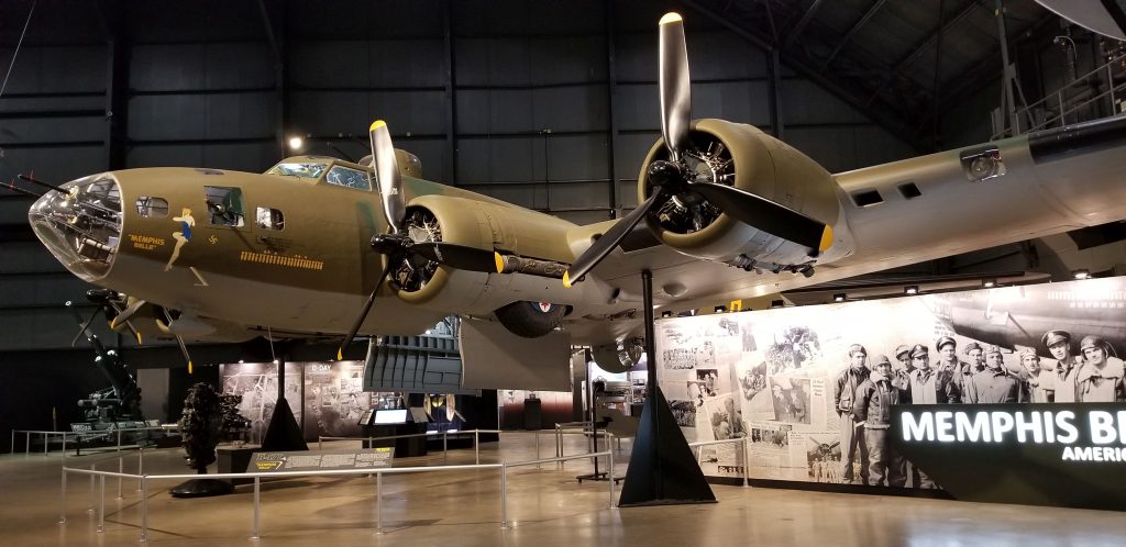
I enjoyed the movie about the WW II Memphis Belle. It was one of the first B-17 bombers to complete 25 combat missions, after which the aircrew returned with the bomber to the United States to sell war bonds. Restoration of it began in 2005. As of 2018, it now resides in this museum.
Memphis Belle
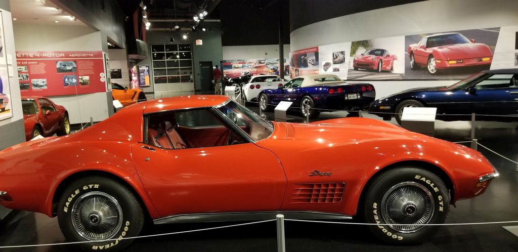
5. Corvette Museum, Bowling Green, Kentucky
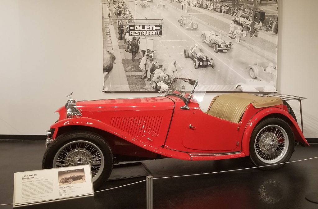
One of my all-time favorite cars is the Corvette. I think they are some of the most aesthetically beautiful cars that have been made. We were only a short drive to Bowling Green, Kentucky, where the Corvette Museum is located, so we packed a lunch and went to see it.
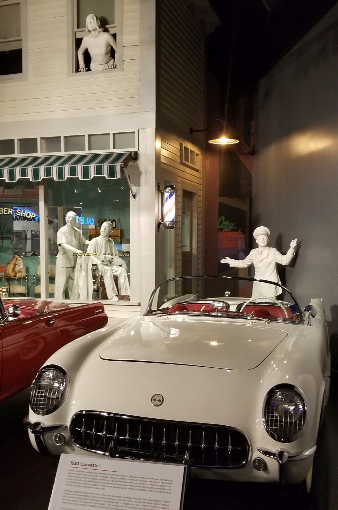
When World War 2 soldiers came back from the war, they wanted sports cars like this European roadster. They felt the American made cars were boxy and dull. The first Corvette was produced in 1953 to fill that demand. Since then there have been eight generations of Corvettes produced.
European Roadster1953 Corvette, first year of Corvette production
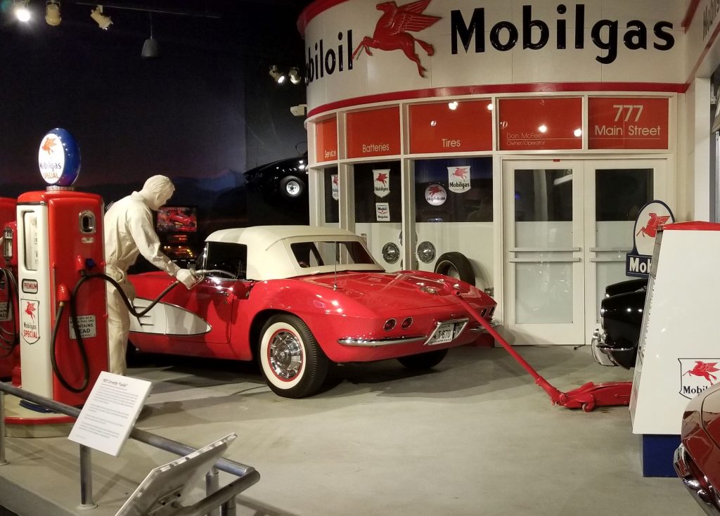
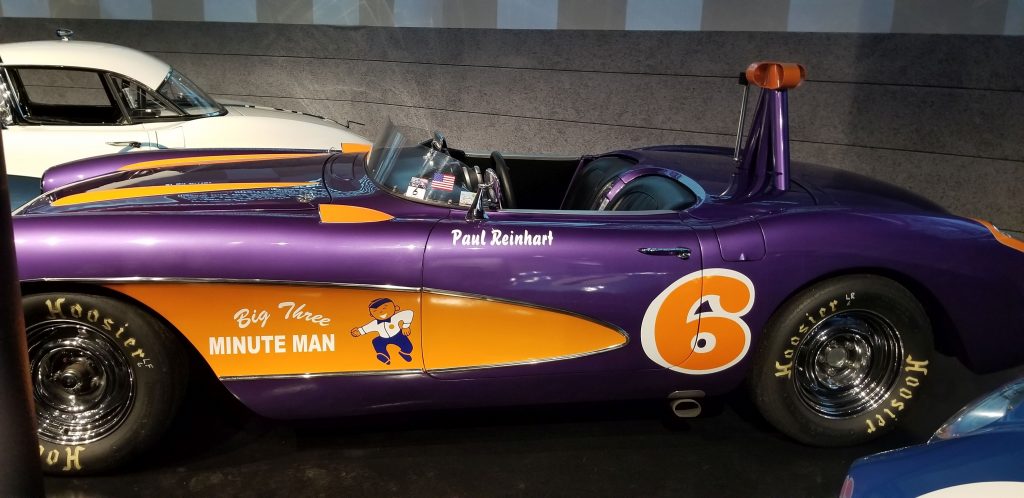
Because Corvettes had such high performance engines, they were desirable for racing. Here is one used by Paul Reinhart painted in his special colors.
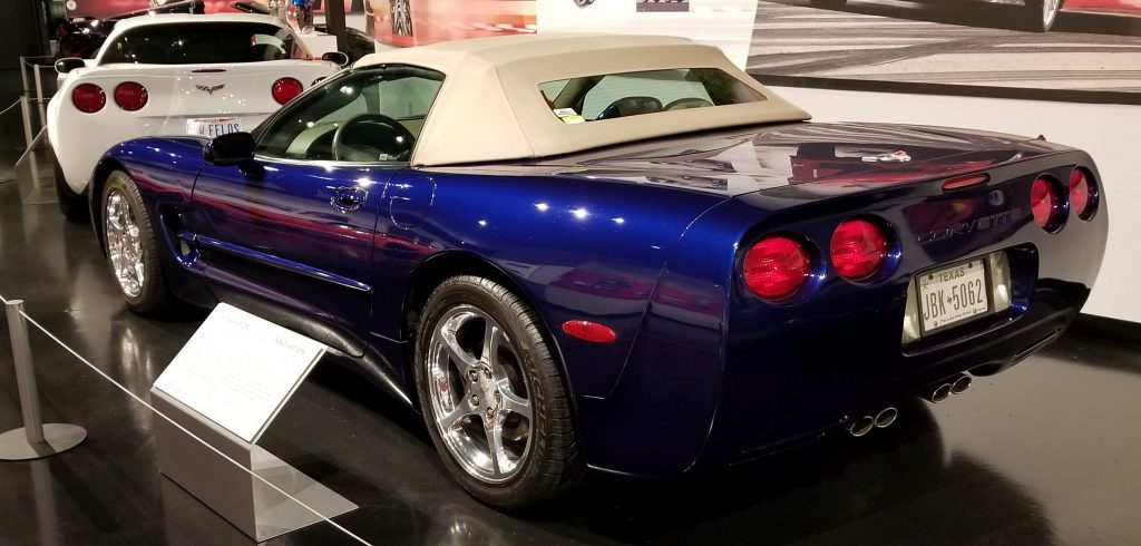
There was just something about seeing so many Corvettes in one place at one time!
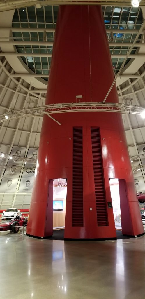
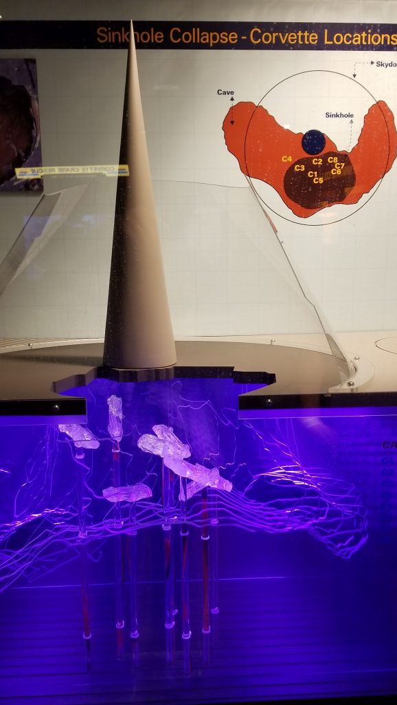
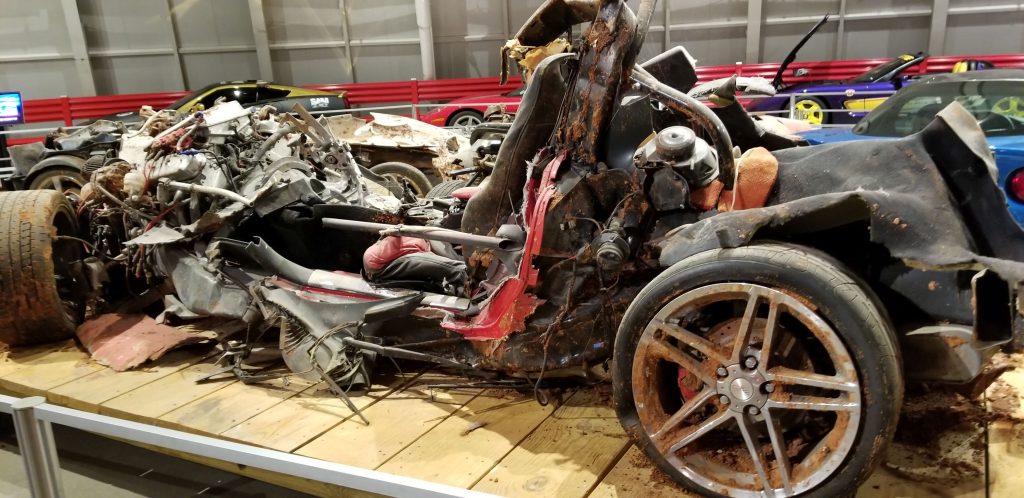
In 2014, a 40 foot sinkhole opened up in the skydome of the Corvette Museum in the early morning hours. Eight Corvettes were swallowed. You can watch the security camera footage at this link: https://www.corvettemuseum.org/explore/exhibits/corvette-cave-in-exhibit/. (Click on link and scroll down.) Two cars were able to be restored back to original condition while the others remain displayed as found.
Skydome in Corvette MuseumDisplay showing sinkhole and where the cars were locatedCorvette damaged in the sink hole collapse
We enjoyed our time in each of these museums. We learned much more than I am able to share here. We’re never to old to learn something new! I hope you enjoyed our short mini-tours.
During January and February of 2022, we stayed for several weeks in Harlingen, Texas, which is located in the Rio Grande Valley or RGV at the very southern tip of Texas. The Rio Grande Valley is not really a valley, but a river delta. It is a popular place for “winter Texans”, people who want to escape the harsh winters of the northern United States.
Having stayed in this area previously, we already explored many of the museums and sites to see. This time we added another place to our list of places we have been: The Sabal Palm Sanctuary.
The drive to Sabal Palm Sanctuary took us right down along the border. We saw miles and miles of the border wall. To get to the Sanctuary, we had to drive through an opening in the wall. There was a Humvee with National Guardsmen at the gate. They allowed us through both ways without a problem.
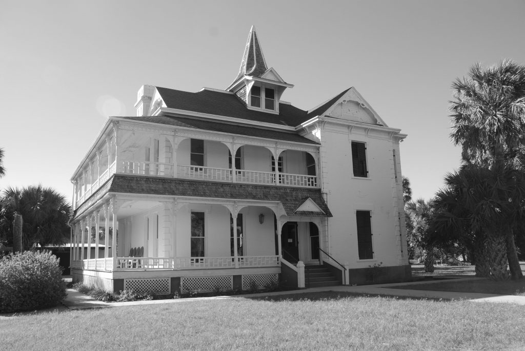
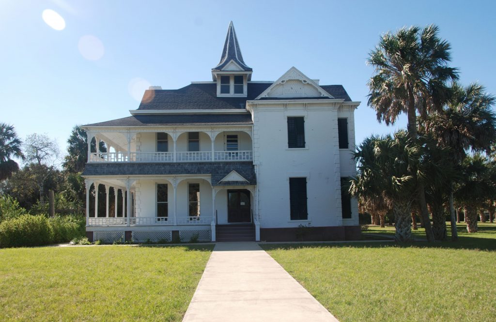
The plantation house is like stepping back in time. Ray took this photo, but I changed it to black and white to get a feel of the place in 1892.
The Rabb Plantation House of Sabol Palm SanctuaryRabb Plantation House
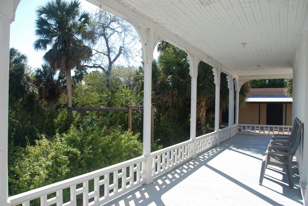
When Frank and Lillian Rabb built the house, it had a commanding view of the Rio Grande River and the steamboats that docked there. Today, the river has since changed course and the view is quite different. We walked some of the trails of the more than 20,000 acres and saw the old river bed.
The veranda of the Rabb Plantation House
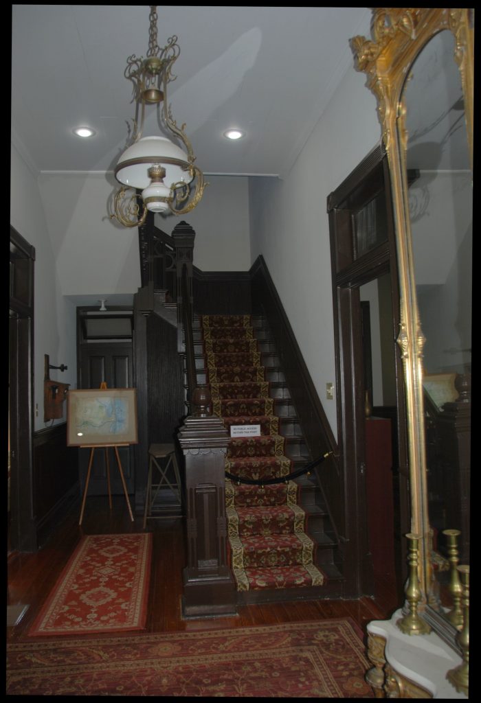
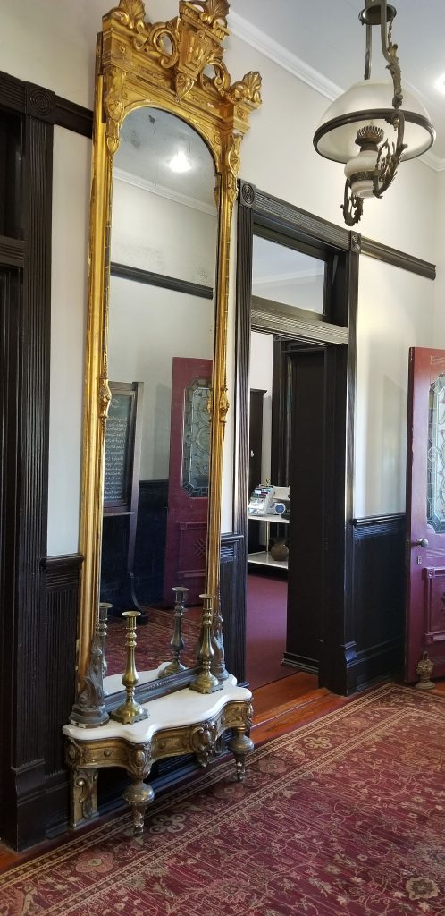
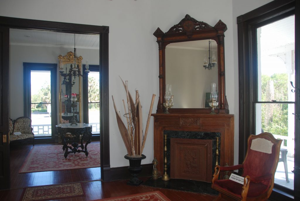
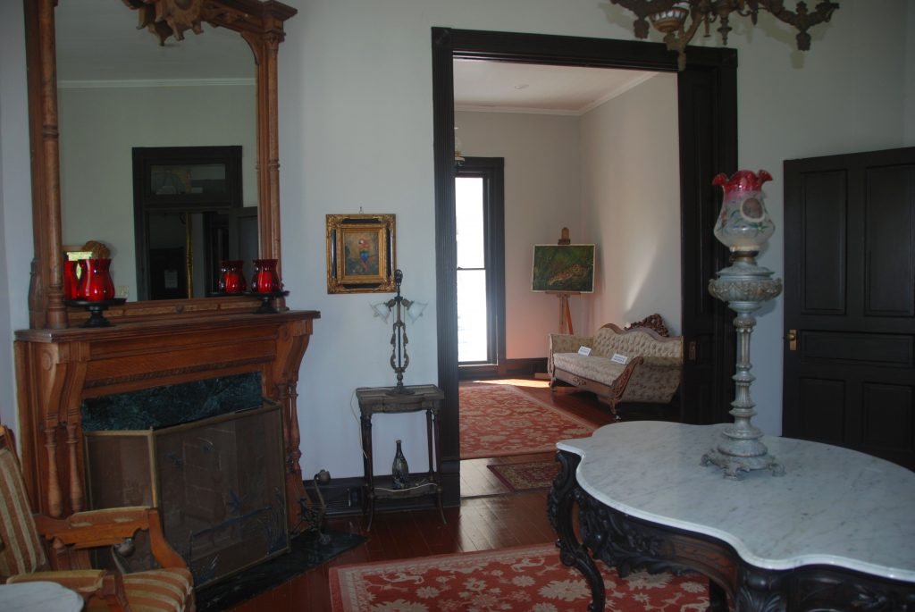
Inside, the rooms had been restored to their former beauty. The polished mahogany wood staircase in the entrance and the antique mirror showed the grandeur of previous days.
Staircase in entryway
Mirror in entryway
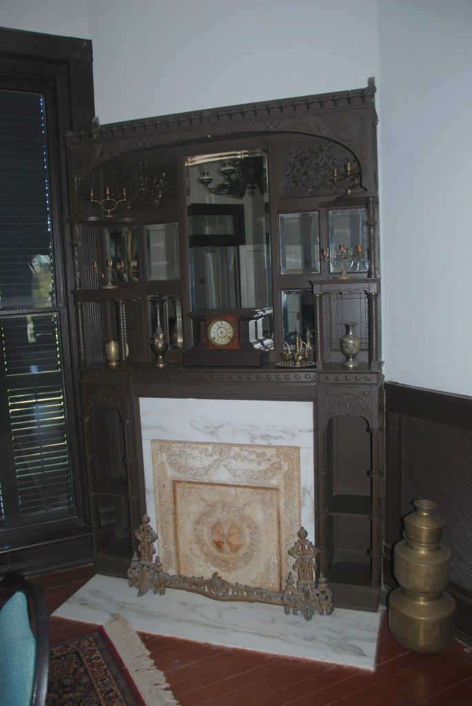
Two fireplaces with mirrors and detailed engravings were decorated with more antiques. I doubt that they were used much since the winter weather is so mild in south Texas. However, while we were there, the sunny, warm days were few and far between. We had more rain than sunshine.
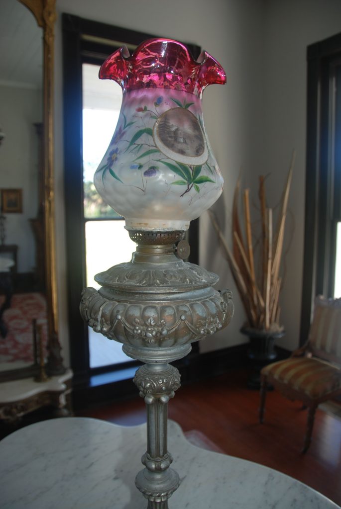
The antique lamp on the living room table caught my eye. Electricity didn’t come to the RGV until 1929 and oil lamps were beautiful as well as useful.
Although the lamp shown below has a cord, it was much later before electricity arrived and lamps like this were used in the plantation house.
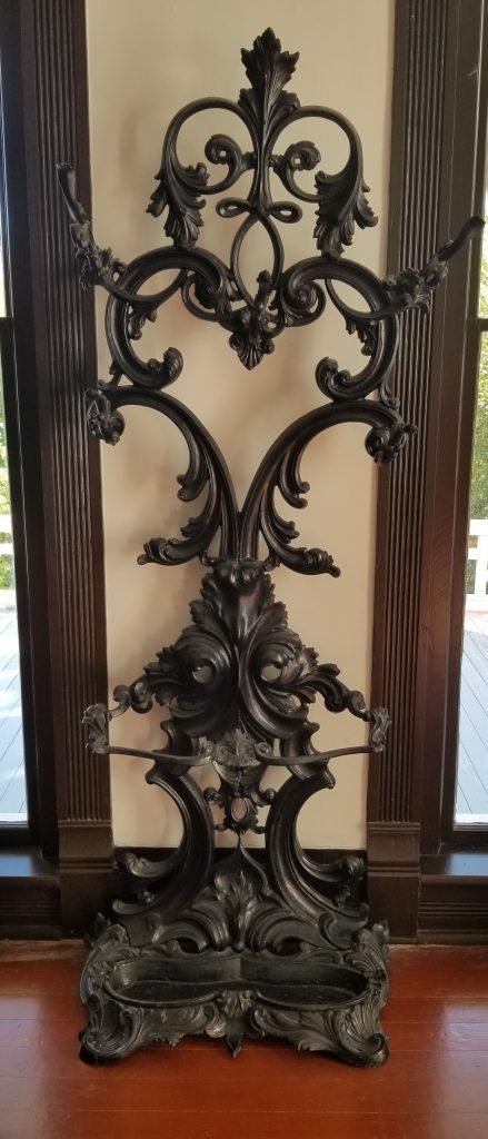
Antique umbrella holder
Antique lamp and table
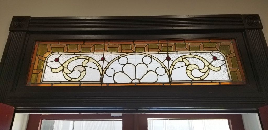
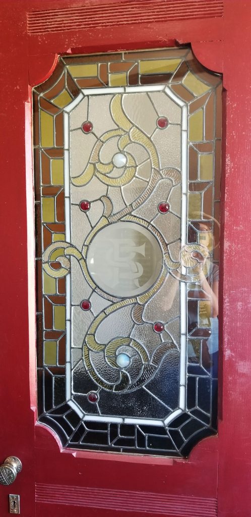
In addition to the antique furnishings were these beautiful stained glass windows and doors.
Antique stained glass transomAntique stained glass door
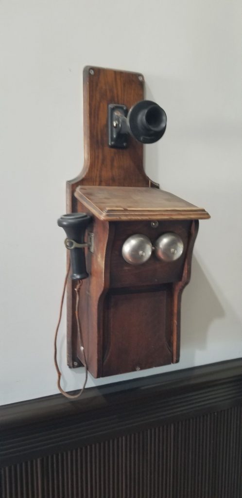
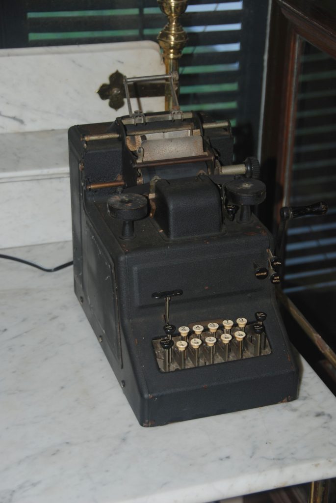
Other items that interested me were an old telephone and calculator. The first telephone exchange didn’t develop until the early 1900’s and in 1913 the city complained that “the telephone service rendered for several weeks has been totally inadequate and demoralized for several weeks, and no improvement in sight.”
Antique wall telephone
Antique adding machine
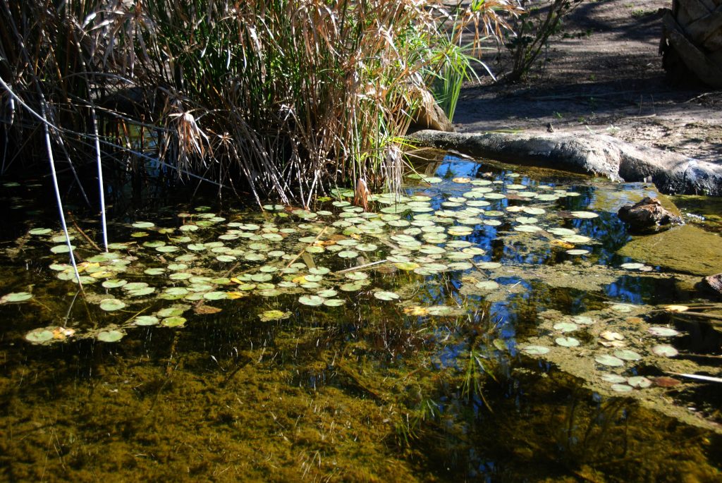
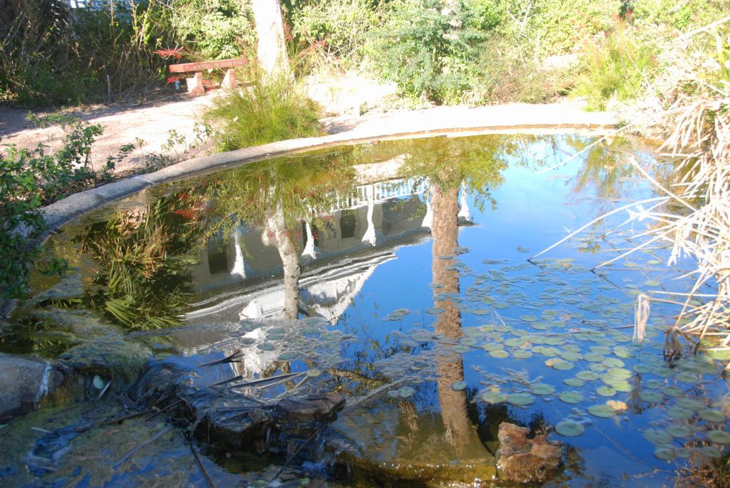
After touring the plantation house, we made our way through the garden. It was winter, so the flowers and many other plants were dormant. I could imagine what it looked like in spring and summer with butterflies fluttering around the fragrant flowers.
Lily Pond in Butterfly GardenPlantation House reflected in lily pondFootbridge over lily pond
Past the garden were the walking paths lined with palms. The Sabal Palm Sanctuary protects one of the rarest ecosystems in the United States. The Sabal Palm Forest once covered 60,000 acres along the banks of the Rio Grande River. When the Spaniards first explored the river, they found miles upon miles of dense palm forest. Today, less than 30 acres of the Sabal forest are left, some of which are protected by the Sanctuary. Today, much of the Rio Grande Valley is mostly agricultural.
Pathway through Sabal palms
Previously, the land in the Rio Grande Valley was used for raising cattle. The soil was too dry for crops until 1910 when irrigation and centrifugal pumps came along. By 1910, there were 50 steam-engine pump houses along the Rio Grande River that watered one million acres of farmland.
Spanish MossWe walked on this walkway where Rio Grande River used to flow.The pathway eventually led us back to the Plantation House.
When I visit historical places like this, I imagine what life would be in those times. One thing that I’m thankful for today is that we have air conditioning. Those summers in the RGV would have been stifling in the humidity and the heat!
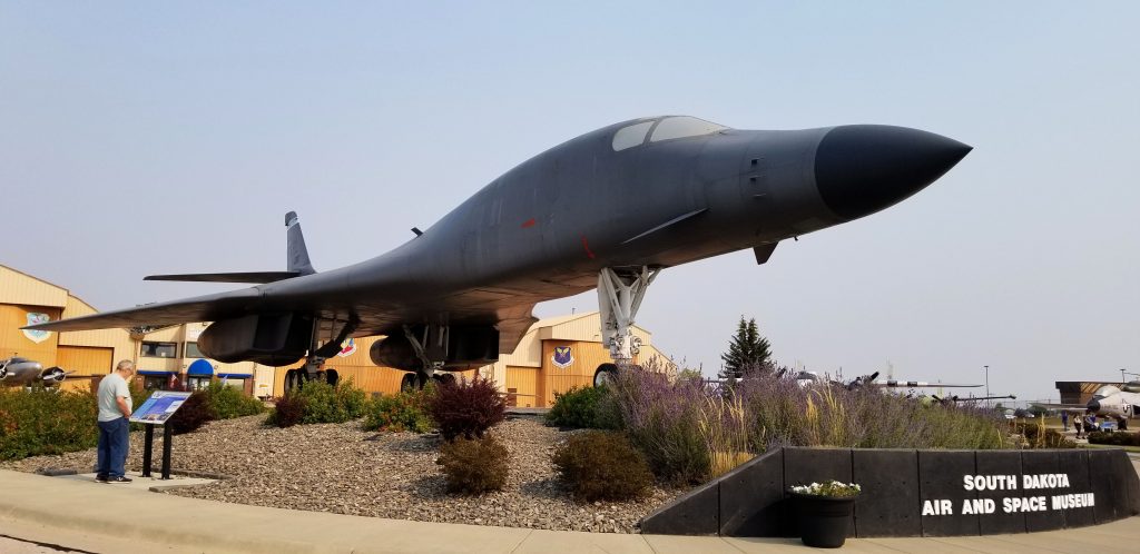
The South Dakota Air and Space Museum sits just outside Ellsworth Air Force Base.
When I was in grade school during the Cuban missile crisis, our school practiced air-raid drills. When we heard the alarm go off, we were to duck under our desks. One day the alarm went off and our teacher told us to duck under our desks, but it was a fire alarm–not an air-raid. It was just a practice drill, but the teacher eventually realized her mistake and led us all outside to “safety”.
As a child, I was aware of the cold war after the Cuban missile crisis. I watched episodes of “The Man from U.N.C.L.E” which was a fictional TV series about two spies who somehow always thwarted the bad guys from taking over the world. I read stories about the Iron Curtain and escapes from East Berlin. What I was not aware of, was what our government was doing to defend us.
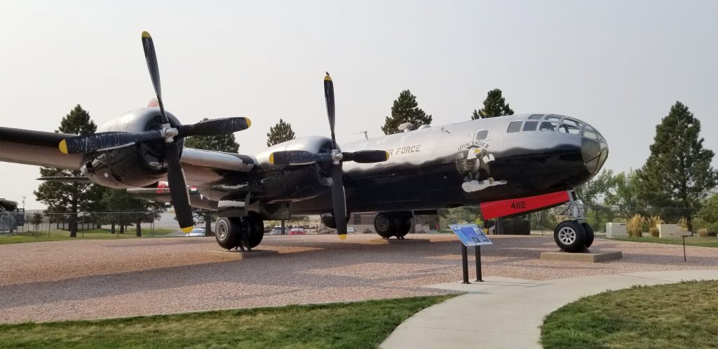
During the Cold War, Ellsworth Air Force Base was a crucial part of our country’s readiness and defense force. It was the home of the Intercontinental Ballistic Missiles like the Titan I and the Minuteman missiles, and and arsenal of bombers such as the B-29.
Today visitors can tour a missile silo that was used to train maintenance personnel, but you must reserve well ahead of your visit since only 6 people are allowed at one time on a tour and it is booked far in advance. For that reason, we didn’t get to go on that tour. The missile sites are now preserved as the Minuteman Missile National Historic Site.
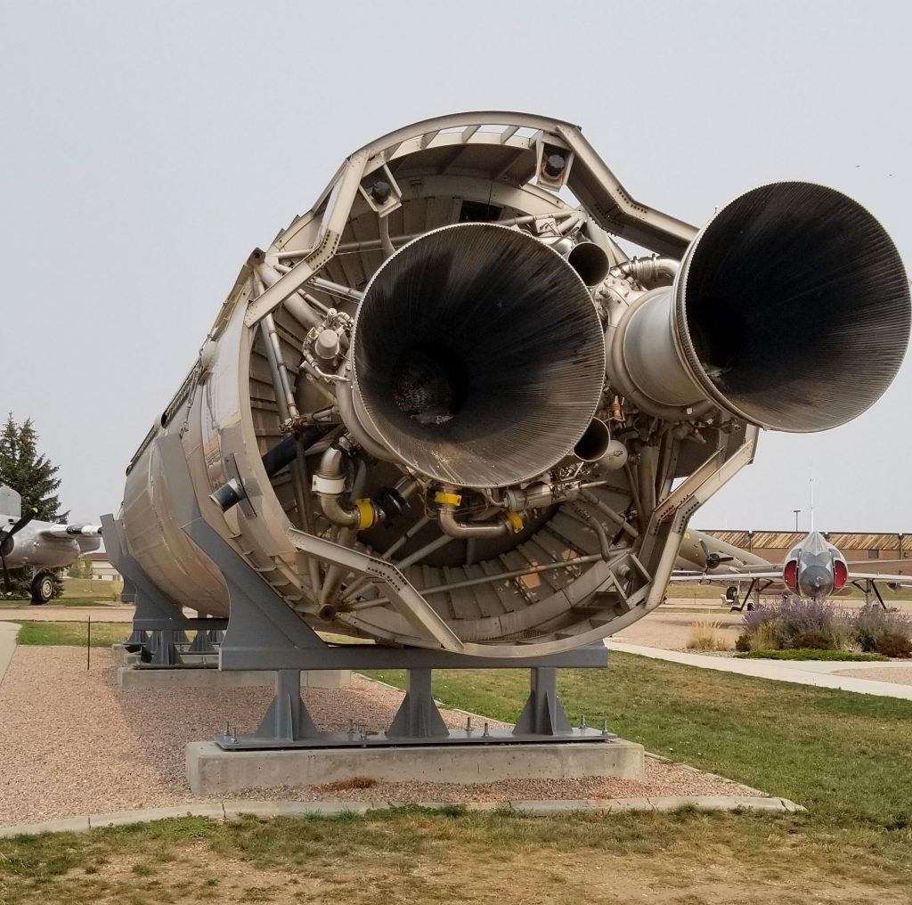
However, we enjoyed an extensive time visiting inside and outside the South Dakota Air and Space Museum which included a Titan I missile.
Titan I Missile
The Titan I missiles took 15 minutes to fully deploy because they couldn’t be fueled up until right before launch. This was not speedy enough for countering a nuclear attack. So therefore, they were replaced three years later with Titan II and the more reliable Minuteman missiles. Each silo contained three missiles.
Besides intercontinental ballistic missiles, the United States also had bombers (such as the B-29 Superfortress) ready to deploy in case of attack. Later these huge planes were used for aerial tankers and weather reconnaissance until they were retired.
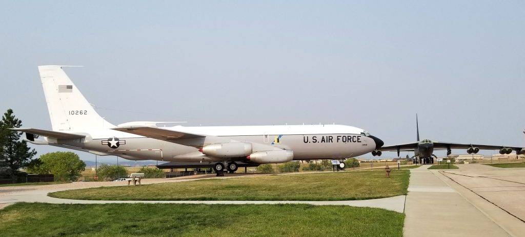
B-29 SuperfortressB-52 Stratotanker and B-52 Stratofortress (in background)
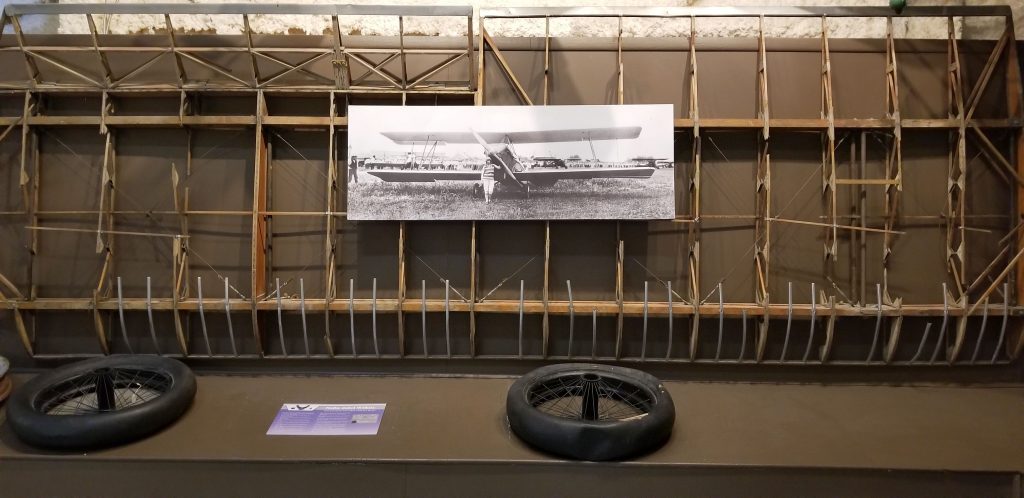
Inside the museum are four large galleries of artifacts of military and civilian aerospace history of the last century. My favorite display was about Nellie Zabel Wilhite, South Dakota’s first female pilot. She was also the first deaf person to earn her pilot’s license. The museum houses the wing and tires from her first airplane along with a photo of her in front of her plane in 1934. Despite some harrowing flights and at one time being a barnstormer, she lived to age 98. I’m always inspired by people who make history despite their handicaps.
Wings and tires from Nellie Zabel Wilhite’s plane
The museum is open year round (although the indoor galleries are closed during January and February) and the tours of Ellsworth AFB and the Missile Silo are offered from mid-May through mid-September. Admission to the museum is free, but there is a small charge for the bus tours to the Missile Silo.
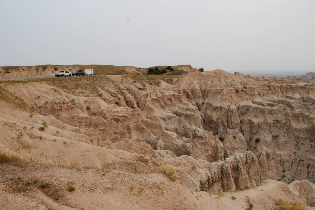
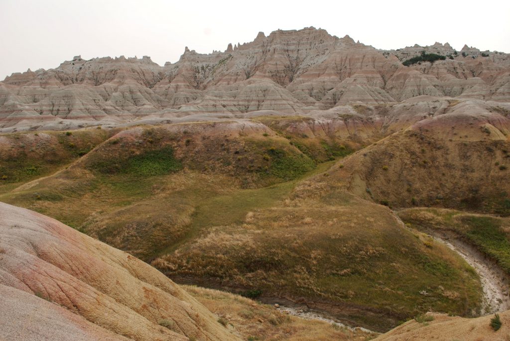
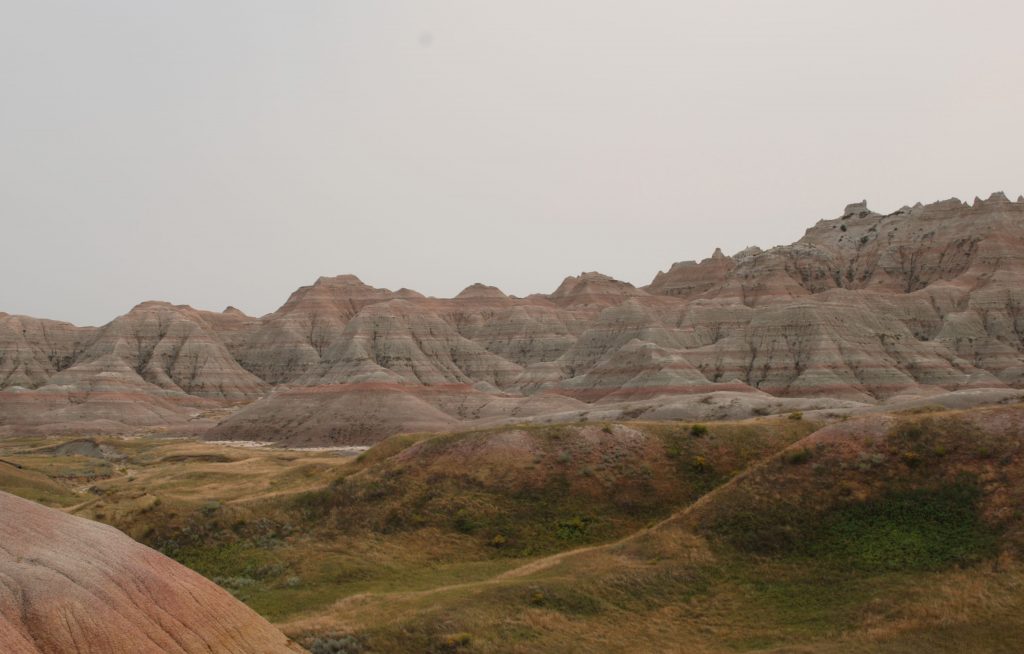
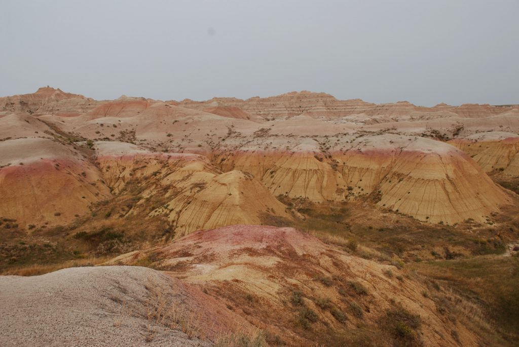
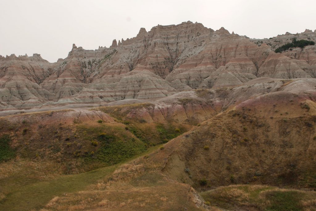
Badlands National Park
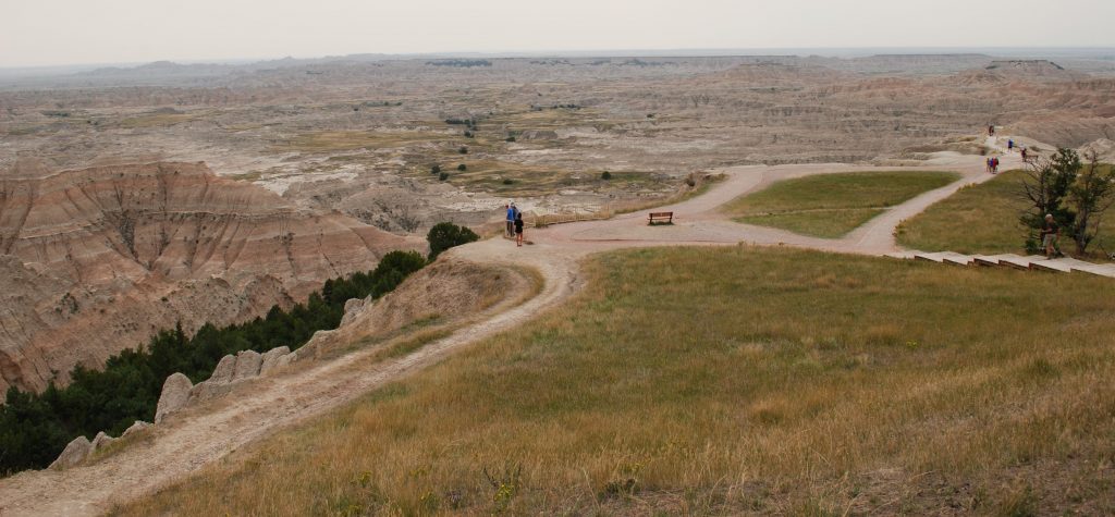
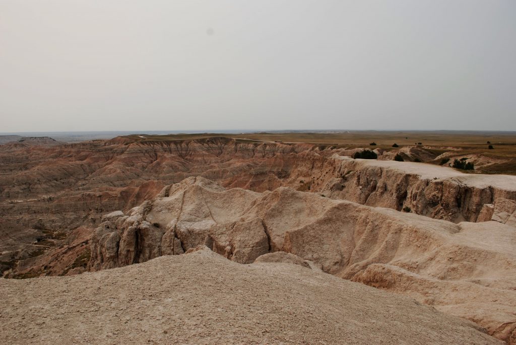
Not many miles from the Black Hills, the prairie stretches for miles until unexpectedly you come across Badlands National Park. Recently designated a national park in 1978, the nearly 250,000 acres of geologic formations, fossil beds and wildlife made this a place we had to visit. It reminded me somewhat of the Painted Desert in northern Arizona with its colorful rock layers. My favorite view was this scenic overlook where you can see for miles.
Our first stop was this scenic overlook
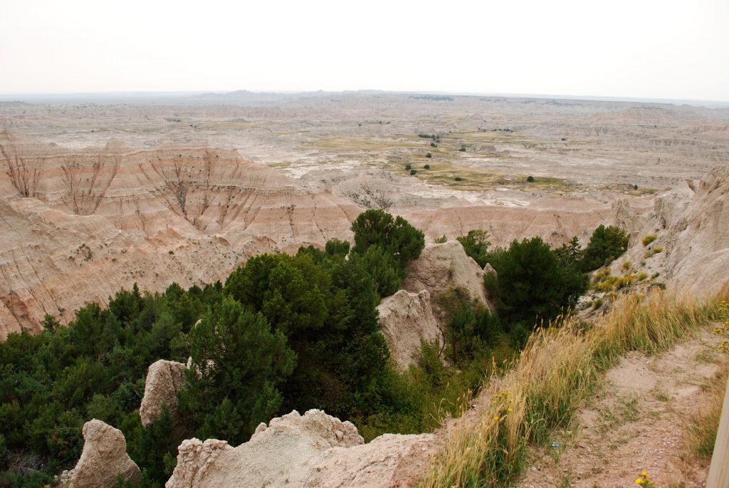
Down in the canyons are trees and grasslands.
In the Badlands many fossils of ancient mammals have been found which are probably related to our present-day bison and bighorn sheep.
We started out looking out over the canyons, but soon we were driving in among the rock formations.
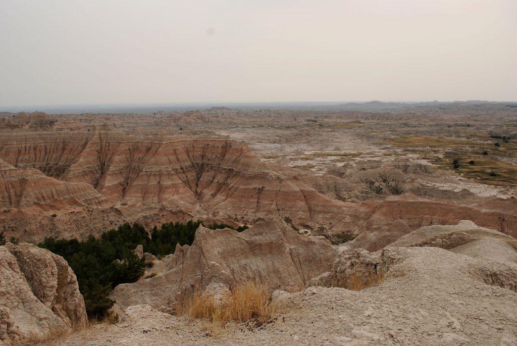
In this photo below, you can see a dry river bed. Two forces made these formations, deposition and erosion. Layers of sediment formed the rock layers which were deposited by a number of natural forces which range from shallow inland seas to rivers to wind. Then the Cheyenne and White rivers carved their way through the landscape. If the rocks erode at the rate of one inch per year as estimated, what we see today may be quite different the next time we visit!
It reminds me of Psalm 24: 1-2.
“The earth is the Lord’s, and the fullness of it, The world, and those who dwell in it. For He has founded it upon the seas And established it upon the streams and the rivers.” Amplified Bible
Our national parks are a treasure of unique and beautiful places. I am thankful for those who had foresight to set aside these places for generations of people to enjoy.
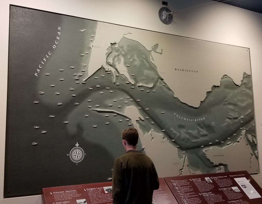
While we were staying in Seaside, Oregon, we went to The Columbia River Maritime Museum in Astoria, Oregon. As we entered the museum, we saw a large map of the shipwrecks at the mouth of the Columbia River.
Map of shipwrecks in the “Graveyard of the Pacific”, Columbia River Maritime Museum.
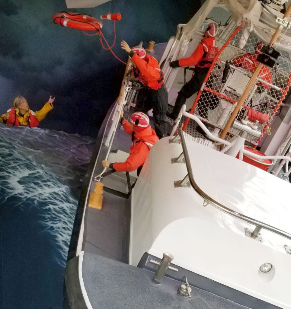
We watched a 3D surround sound documentary of “Aircraft Carrier–City at Sea” in the Theater. Then we wandered around the exhibits and learned about the extreme conditions of the Columbia River Bar, the U.S. Coast Guard and the Columbia River Bar Pilots.
U.S. Coast Guard Rescue display at Columbia River Maritime Museum.Display in Columbia River Maritime Museum.
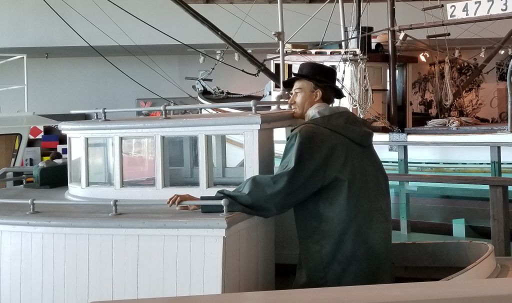
The museum tells the history of the Columbia River from the times of the Indians and their dugout canoes to the present day. The museum is very expansive and takes 2 or 3 hours to see everything. We took a break for lunch and walked across the street to a food truck to get lunch and then came back to see more.
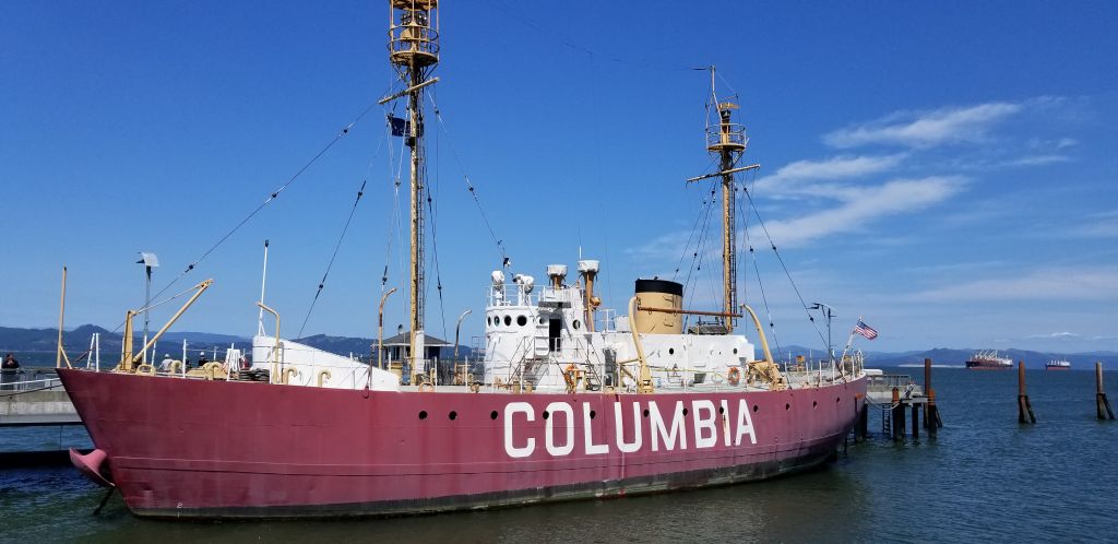
Outside the museum is docked the Lightship Columbia, a National Historic Landmark. It is an actual lightship that used to guide ships to safety at the mouth of the Columbia River. I was able to go aboard and see the sailors living quarters. The lightship is a floating lighthouse manned by a crew of 17 men working two to four week rotations, with 10 men on duty at a time. It was in use from 1951 to 1979.
The Columbia Lightship–part of The Columbia River Maritime Museum.
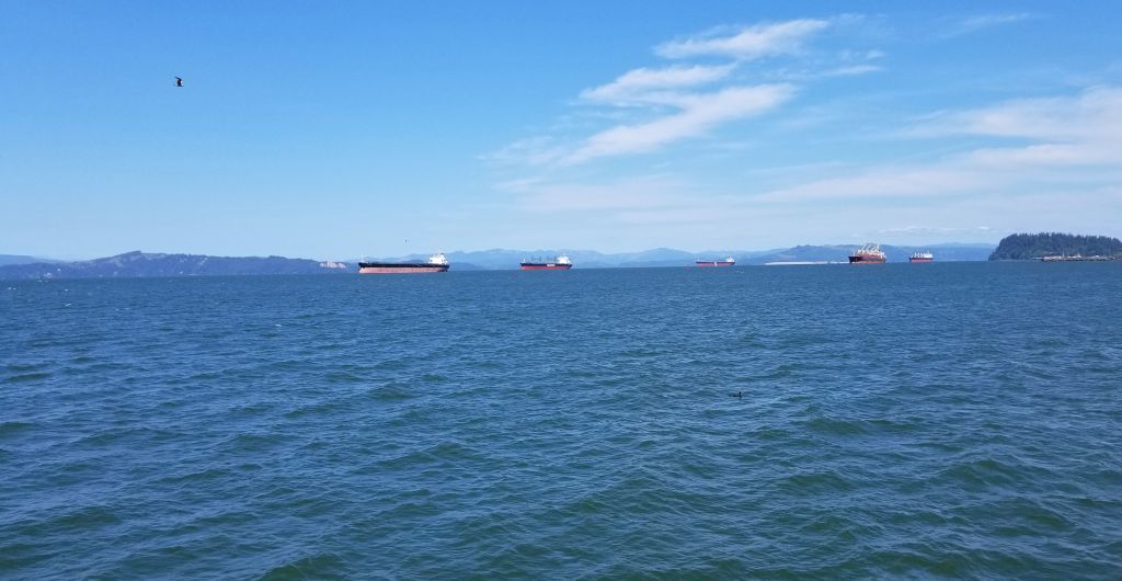
We learned at the museum that ships today must have a specially trained pilot to guide them through the mouth of the Columbia River where it meets the Pacific Ocean. This pilot will come aboard their ship and guide the ships through the treacherous waters and sand bars at the mouth of the river. We saw several large cargo ships waiting their turn.
Cargo ships on Columbia River await their turn to go through the dangerous waters at the mouth of the Columbia River.
Lewis and Clark Natl. Historical Pk.
Lewis and Clark have always been two of my favorite explorers ever since I read “Streams to the River, River to the Sea” by Scott O’Dell. The story of their amazing adventure is told in part at the Lewis and Clark National Historical Parknear Astoria, Oregon, off Highway 101. Besides having another national park to check off of our list, it gave us a day of learning about the history of our country and some exercise as we hiked the trails near the visitor center.
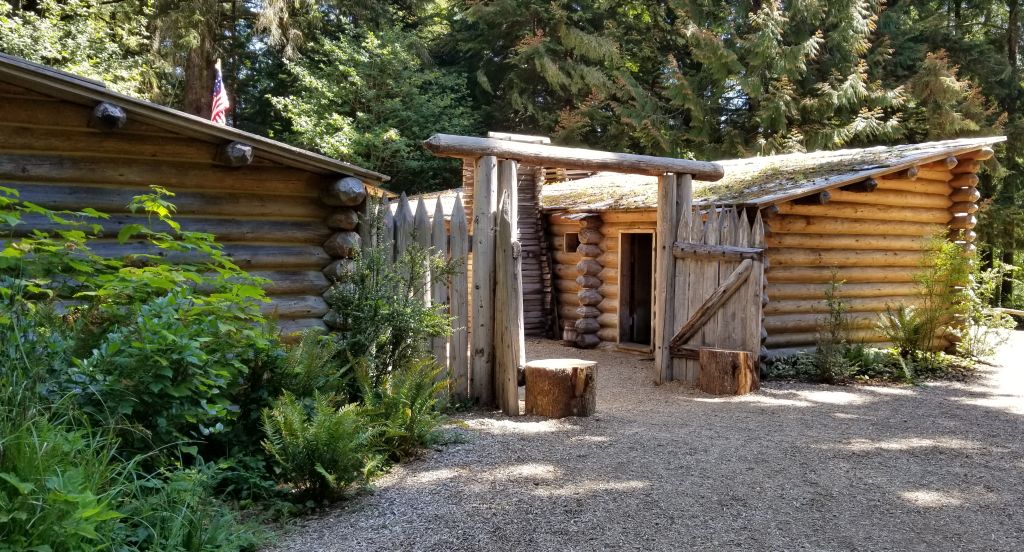
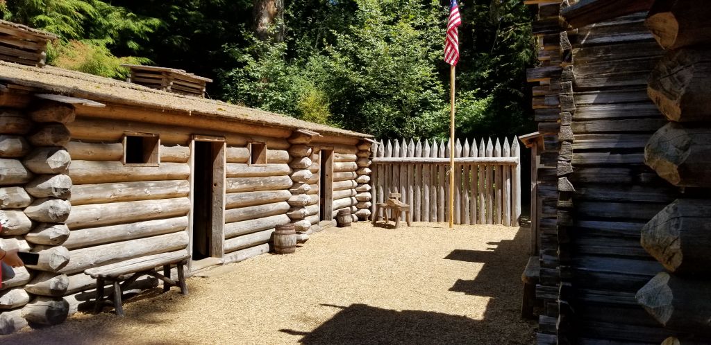
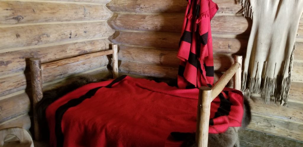
We stopped at the Visitor Center where we saw a short film about the story of the winter fort of the Lewis and Clark Expedition in1805 – 1806. They named it Fort Clatsop after the nation of Indians who resided nearby.
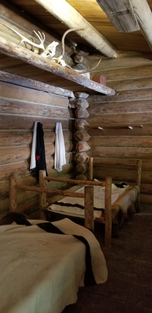
Replica of Fort Clatsop, the winter fort of the Lewis and Clark Expedition.Inside Fort ClatsopSleeping quarters inside Fort Clatsop.Room inside Fort Clatsop
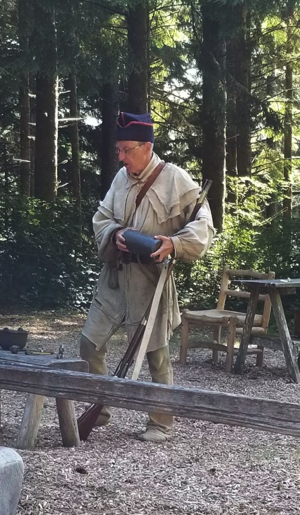
At the fort we watched a demonstration of the loading and shooting of a black powder rifle.
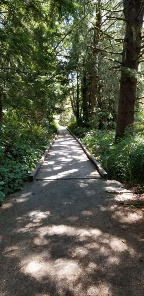
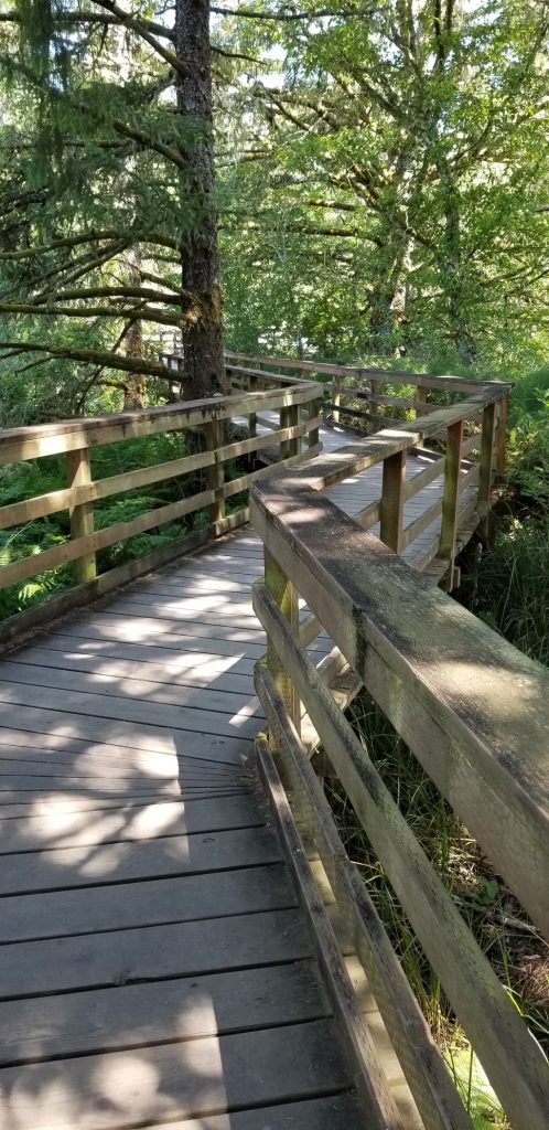
We walked down a pathway to the place on the river where Lewis and Clark could possibly have docked their dugout canoes.
Pathway to river access.Boardwalk to river.River access.
Lewis and Clark National Historical Park actually has several different site locations. Many of the other sites are only minutes away. We decided save some of those different locations for another visit at another time. In all, we had an enjoyable day visiting this park.
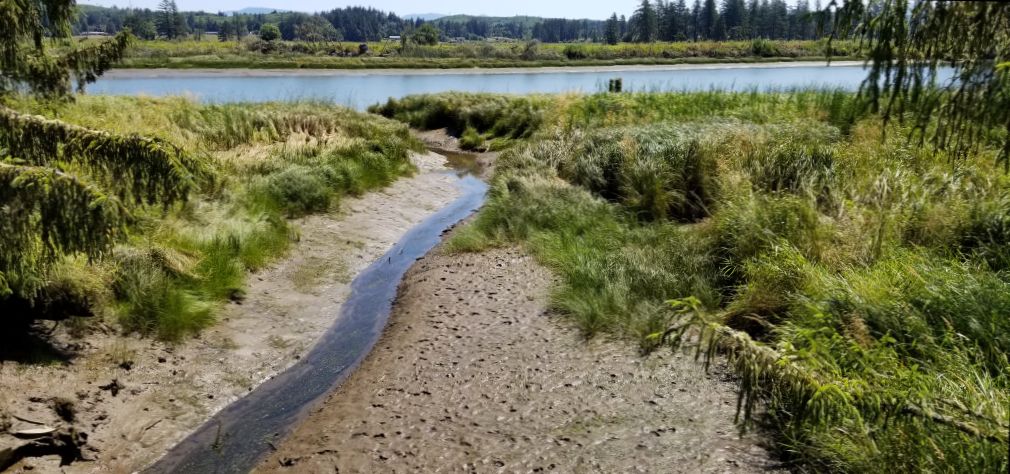
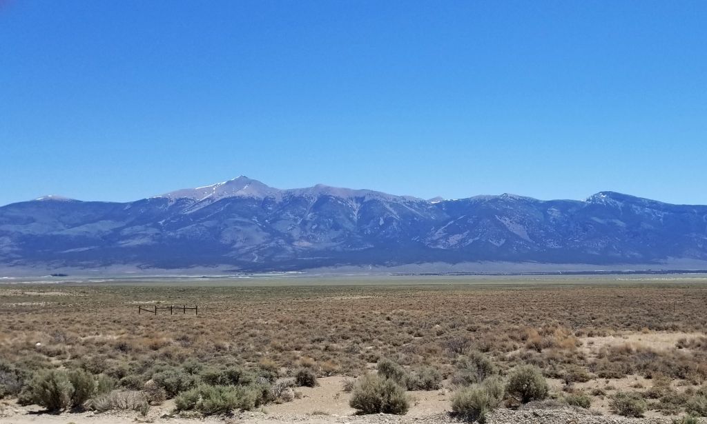
After leaving Arizona, we made our way north by way of eastern Nevada, going through Caliente, Ely and Wells, NV.
Wheeler Peak Great Basin National Park
On the way there, we drove along the backside of Great Basin National Park. I could see Wheeler Peak in the distance. We drove to the top of it when we visited the park last year. The 13,000’ peak still had snow on it.
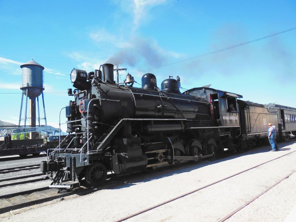
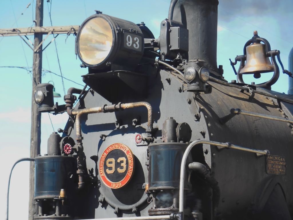
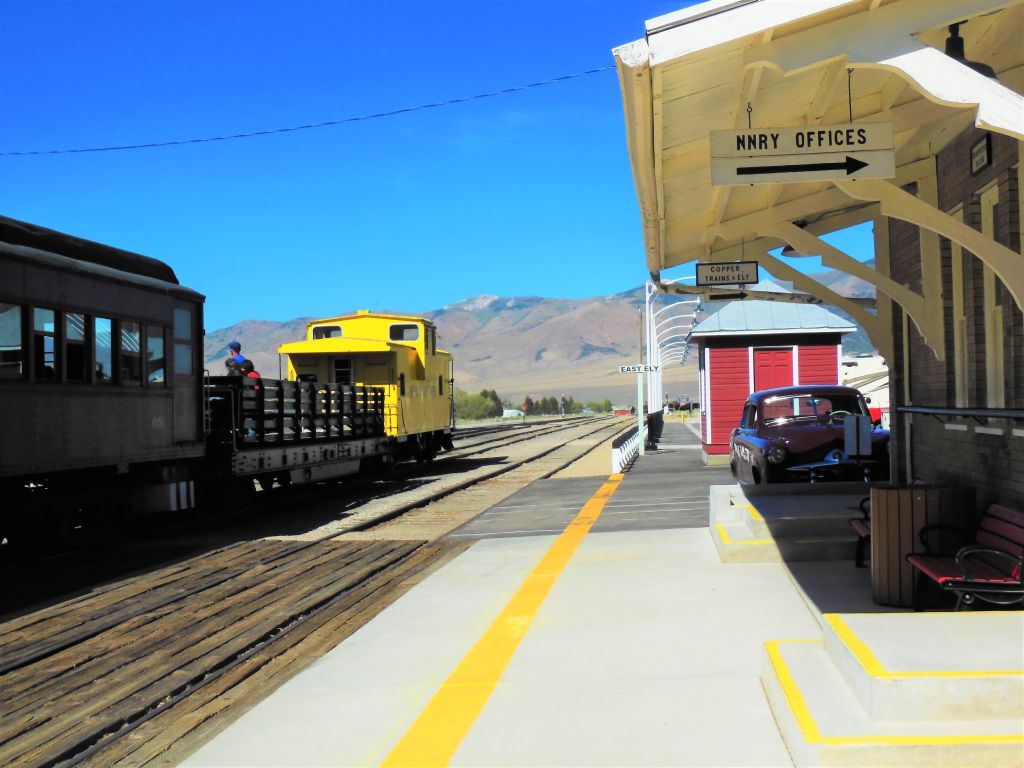
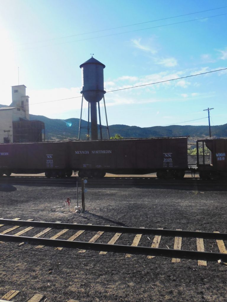
In Ely, we stopped for four nights so we could ride the Nevada Northern Railway and visit the Museum. The Railway is a National Historic Landmark and the museum complex includes a rail yard on 56 acres with 63 structures to explore.
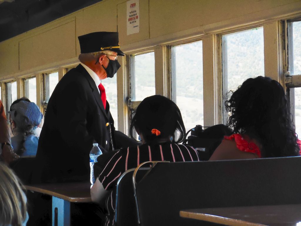
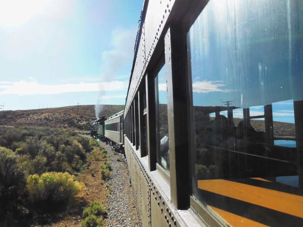
We enjoyed a 90 minute ride in an old passenger car pulled by a steam locomotive.
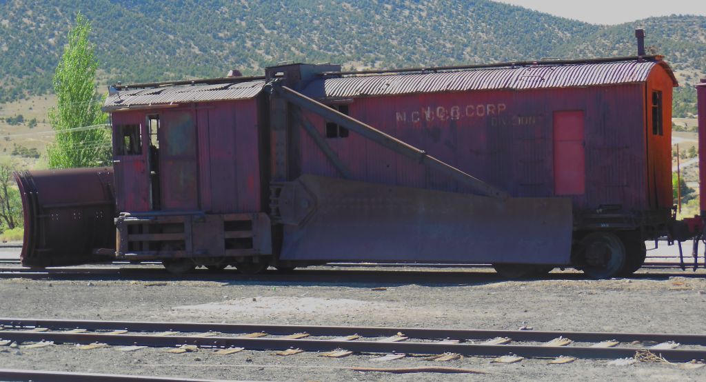
The train depot for the Northern Nevada Railway.The elevation of Ely is 6,437 feet. In winter, this snowplow was used to clear the snow off the tracks.Water tower for Northern Nevada Railway.The conductor punches our tickets.
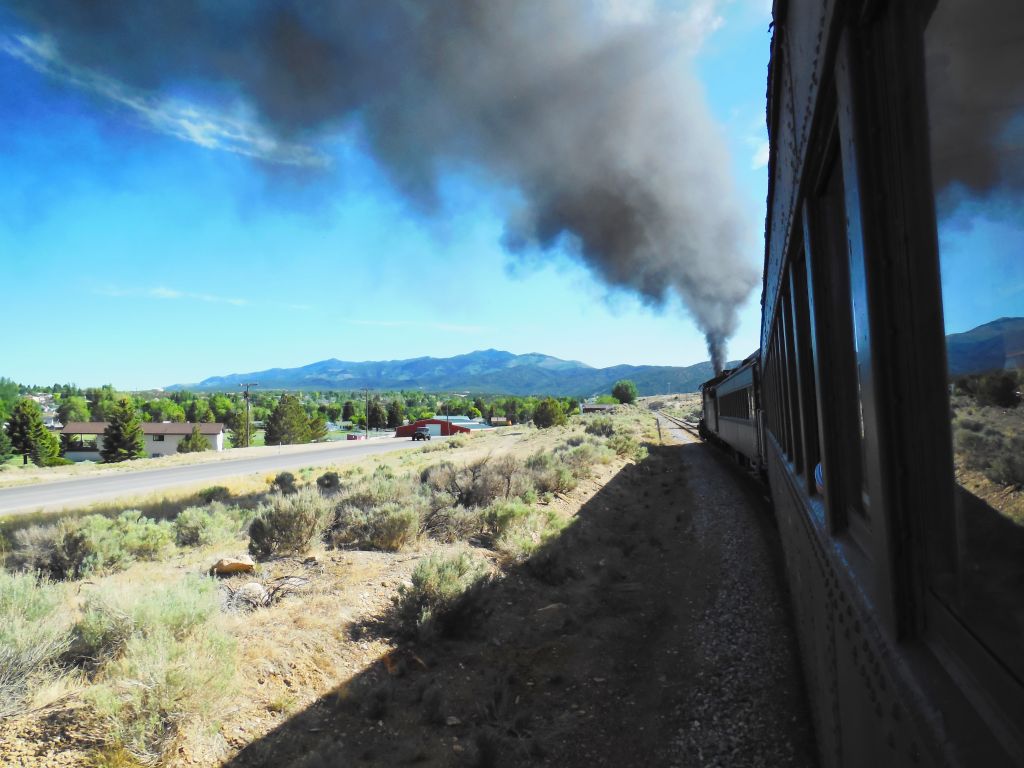
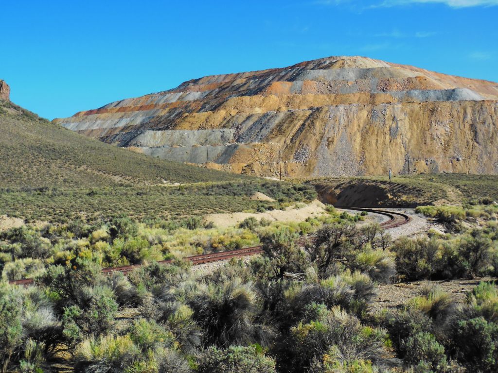
The ride took us through the hills around Ely to a large copper mine and back. Along the way we learned about local history.
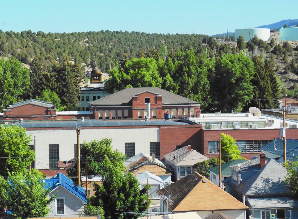
We view the historic town of Ely, Nevada, on our train ride out to the mine.
As we head out of town and uphill, the smoke gets blacker.
Northern Nevada RailwayTailings from the Robinson copper mine.
Copper was used for wiring homes for electricity in the late 1890s. This was once a thriving mine and is still being mined today.
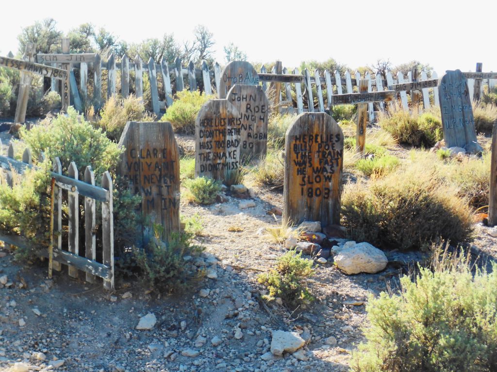
Humorous grave yard on the way to the Robinson copper mine.
On the way back, we were told that sometimes the train gets held up by bandits, but we didn’t see any that day. We did, however, see the graveyard and fake western town nearby.
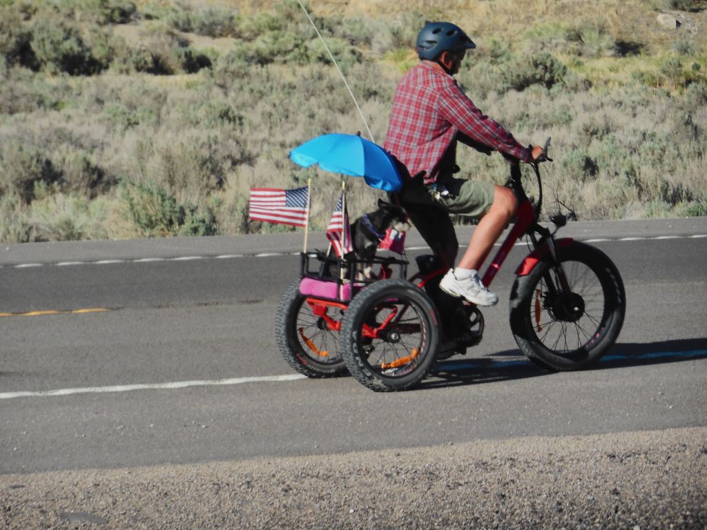
On our way there and back, this fellow with his little dog on the back rode along the highway parallel to the railroad track.
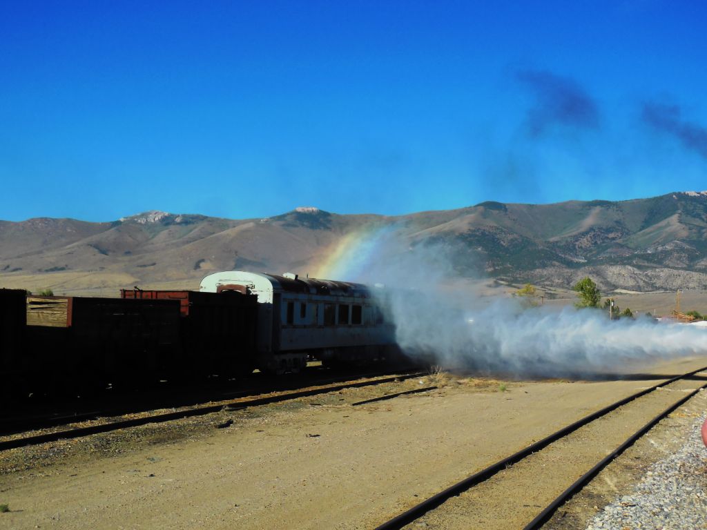
As we arrived back at the depot, we see the rainbow at our journey’s end as the locomotive lets off steam.