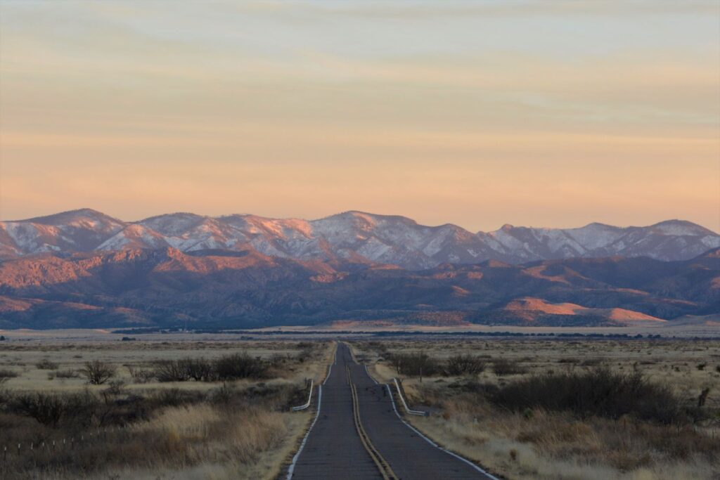
It was a cloudy morning when we left Monticello, Utah, to drive to Monument Valley across the Arizona border. It would take us nearly two hours to get there. I was wishing that the sun would pop out sometime during the day.
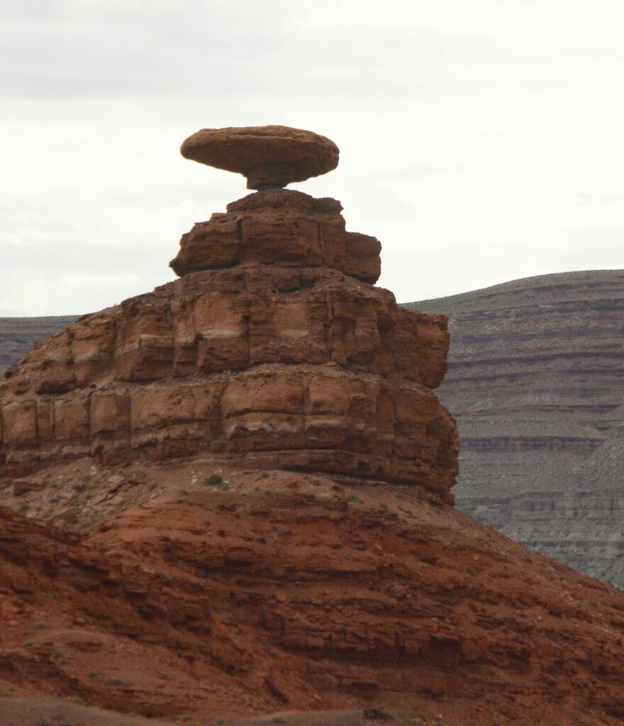
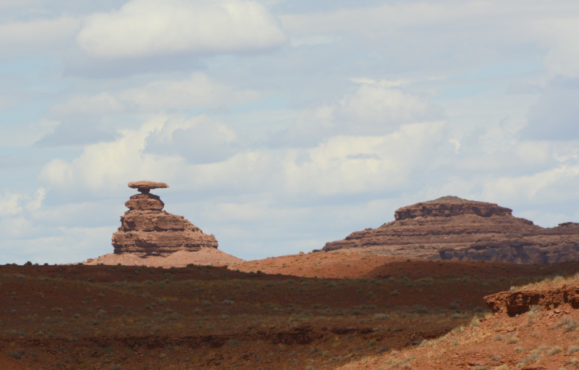
Along the way, we passed the little town of Mexican Hat, Utah, and the rock formation which gave it its name. Doesn’t it looks like a man sitting on a rock wearing a large Mexican hat?
Mexican Hat on Highway 163Mexican Hat Rock
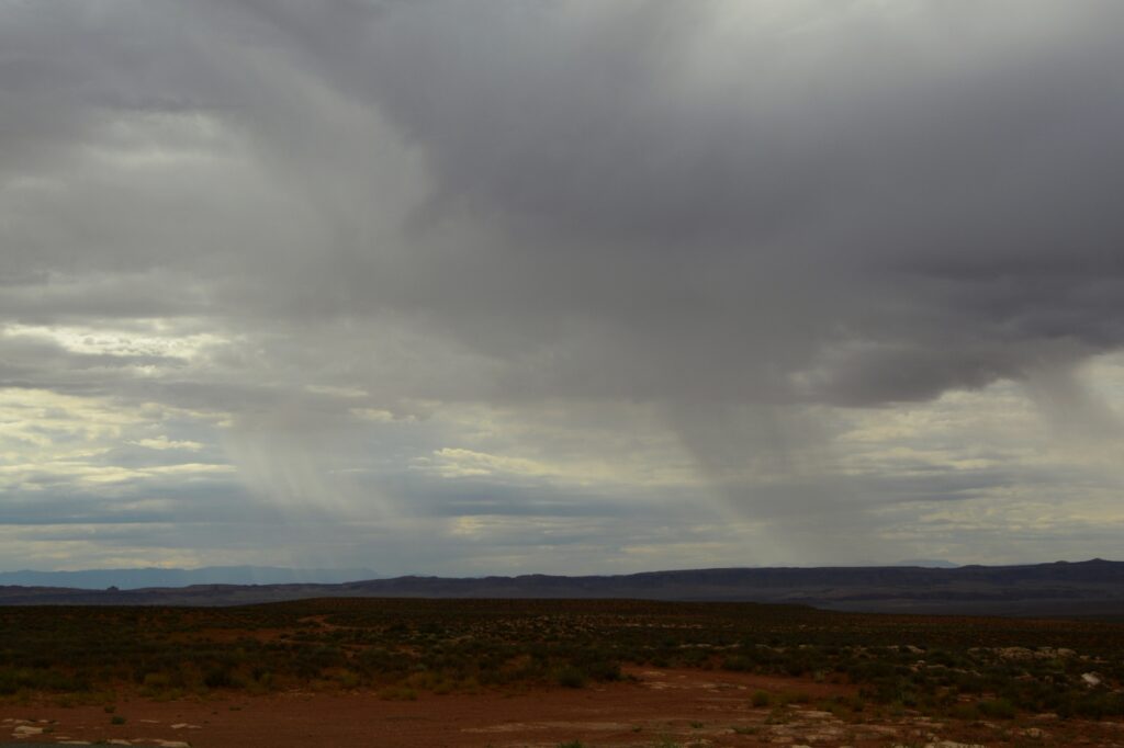
As we traveled further, we could see rain in the distance. I was hoping for some sunshine, and it wasn’t long before I got my wish.
Rain over the desert
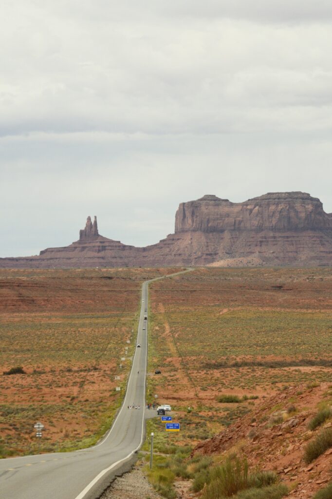
A famous tourist spot outside Monument Valley is the location of a scene from the movie “Forrest Gump.” We didn’t get there early enough to beat the crowds. People were standing in the road, sitting in the road, lying in the road, blocking the road—all just to get a photo. It was a mess.
I just wanted a photo of the road leading up toward the mountains–without all the people. It turns out that was impossible. So I settled for a less than perfect photo.
Location of Forrest Gump movie scene
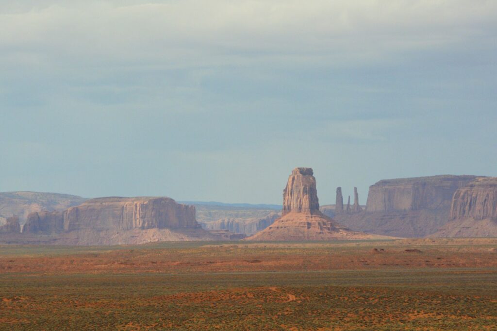
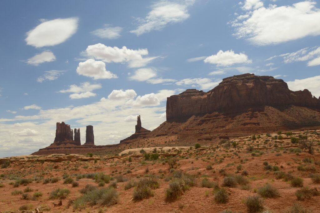
As we got closer to our destination, we could see some of the classic Monument Valley rock formations sticking up from the desert floor. At the same time, the sun began to peek out from the clouds.
Monument Valley is located on Navajo Indian Reservation. It is owned and operated by the Navajo Indian Tribe.
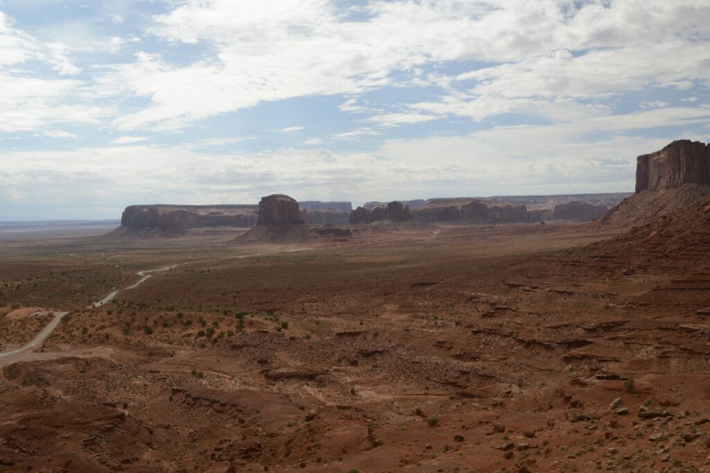
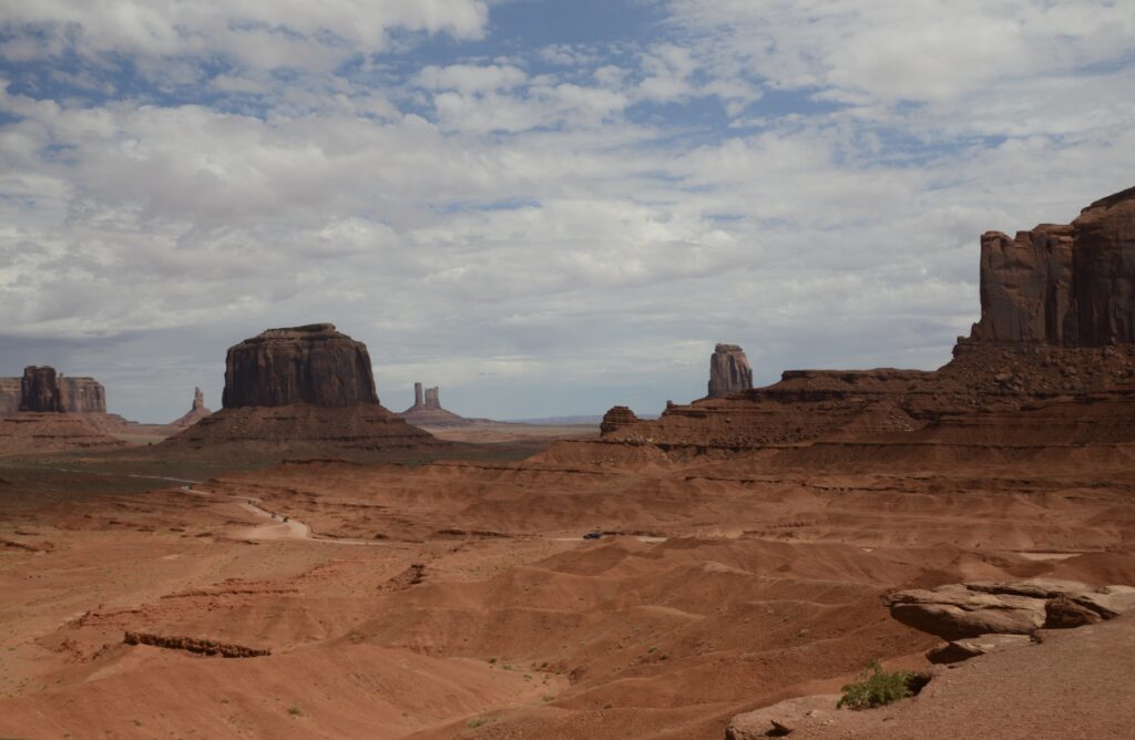
We first went to the Visitors’ Center. The Visitors’ Center is situated overlooking Monument Valley. We could see the road we would travel, winding its way across the desert floor.
Viewpoint from Monument Valley Visitors’ CenterLayers of rock as seen from balcony of visitors’ center
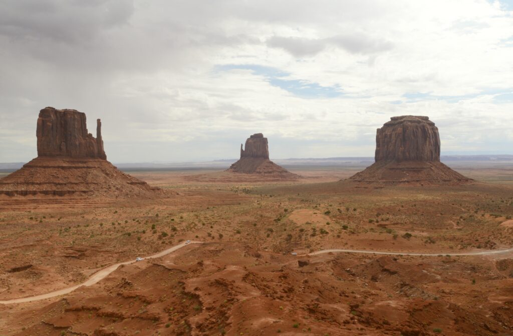
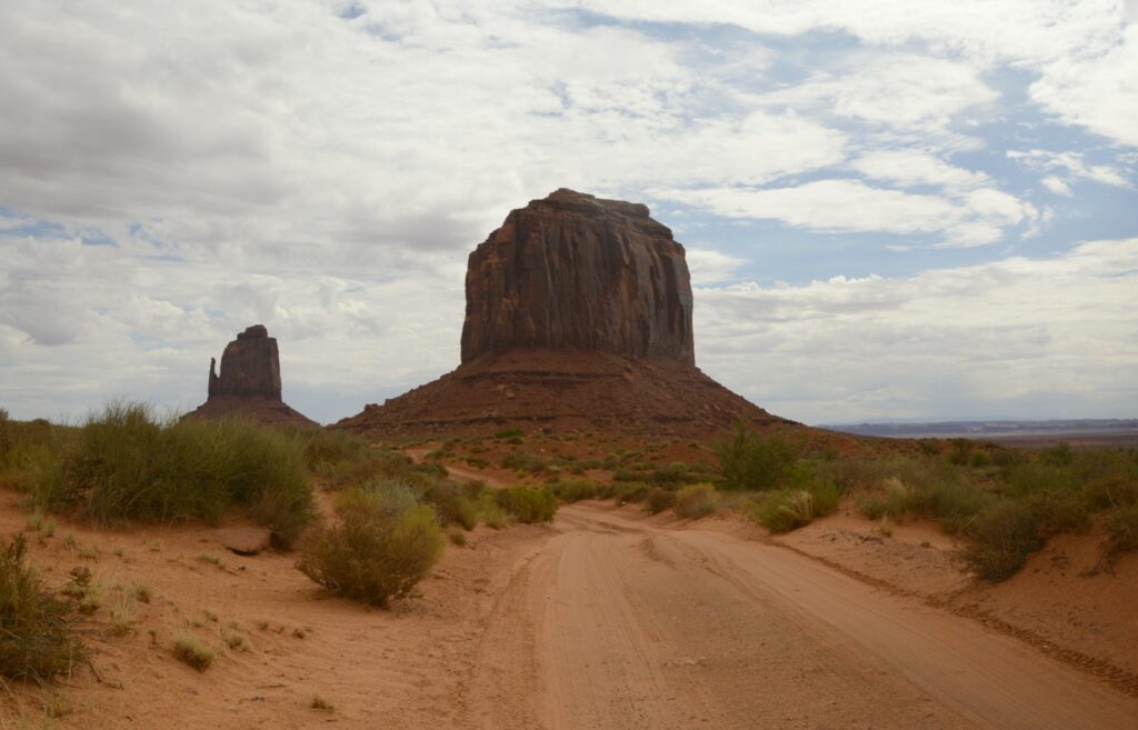
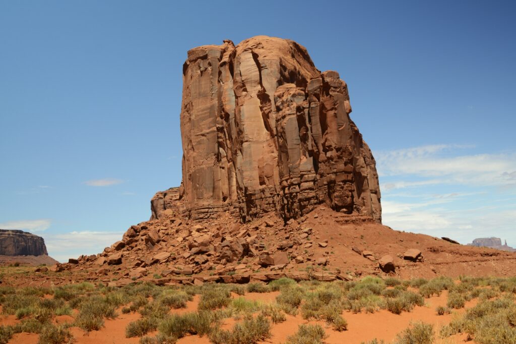
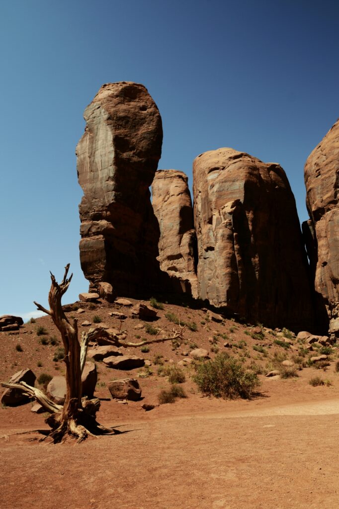
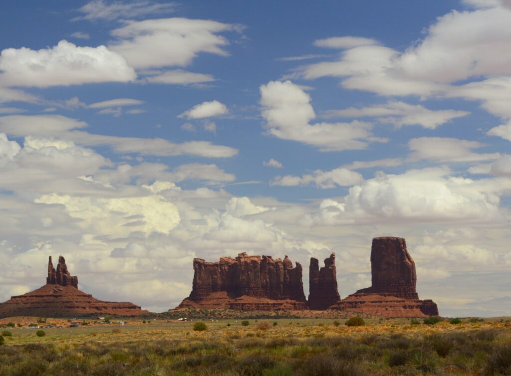
The balcony at the visitors’ center is one of the best places to get photos of the valley. Seen below are the classic “Mittens” with their “thumbs” sticking out of the sides, and Merrick Butte (on the right).
The two mittens and Merrick Butte
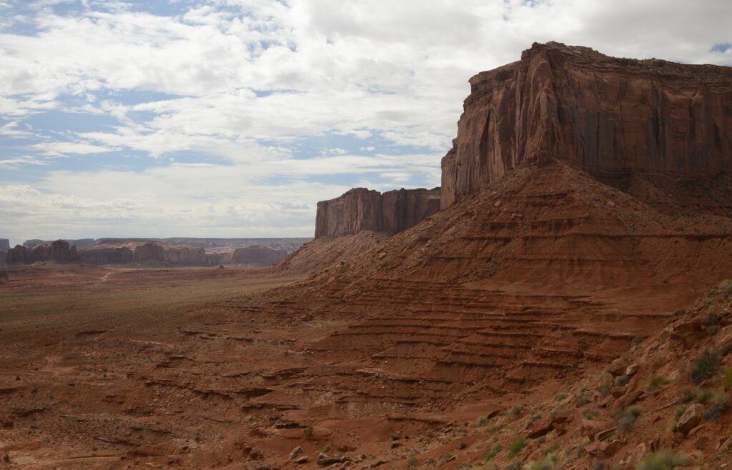
A four-wheel drive vehicle is recommended to drive the 17 mile loop. The first part of the road is a series of very steep and rutted switchbacks. Even in a 4WD truck, it was a rough ride. The speed limit was 15 mph, but I never got above 7 or 8 mph on that terrible road. It was dusty and bumpy. Our truck was coated with a fine layer of red dirt by the time we were done.
Merrick Butte. The dirt road is very primitive and rough.
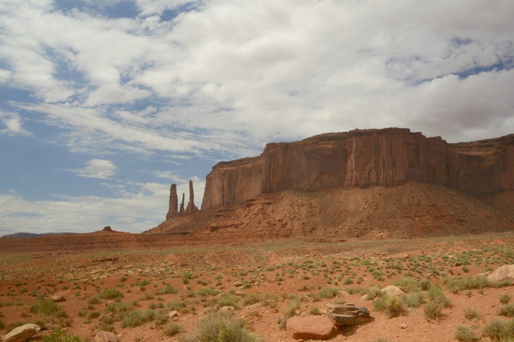
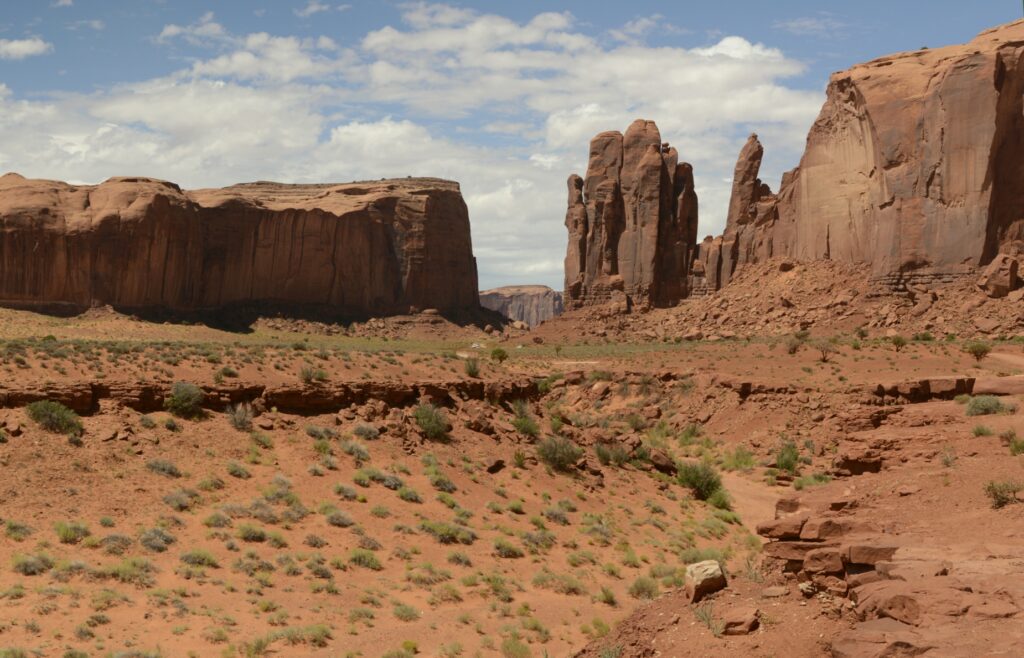
There are eleven marked viewpoints along the drive. The names describe the rocks, if you have an imagination.
Sentinel Mesa and Three Sisters
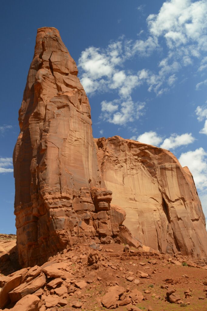
Three kinds of formations dominate the valley: mesas, buttes and pillars.
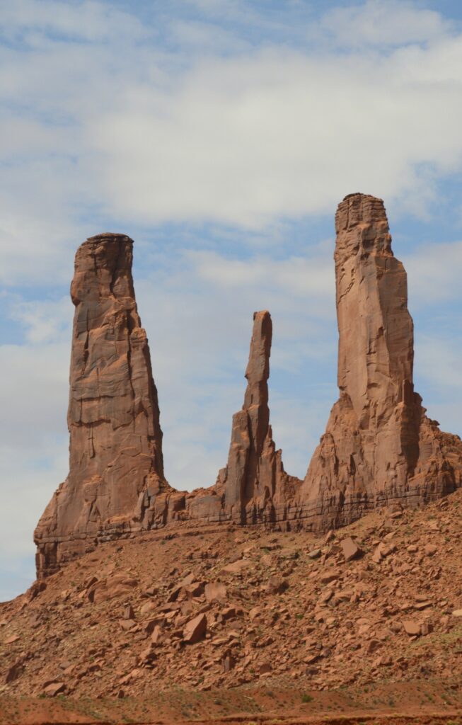
Three Sisters are three rock pillars.
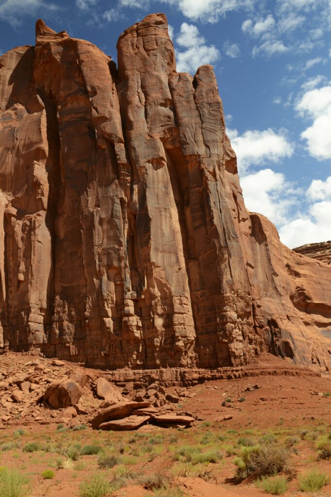
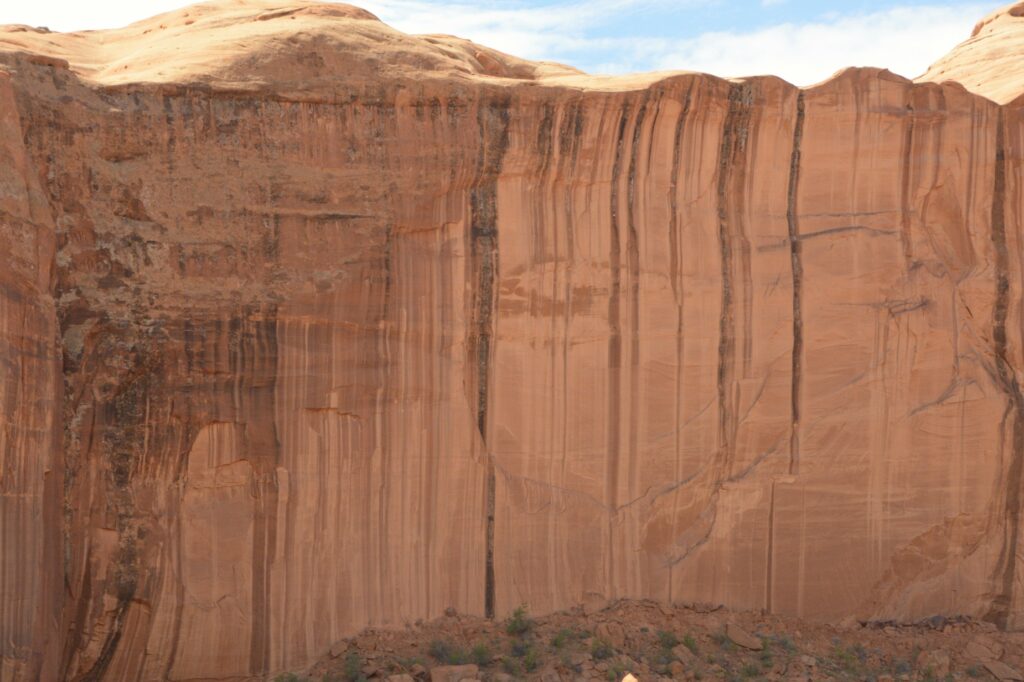
The hard top layers of the buttes and mesas called caprock resist weathering and erosion, but the softer sandstone layers below are eroded away by rain, snow, wind and ice. The debris that falls down the sides is known as scree or talus.
Scree at the bottom of sandstone cliffs
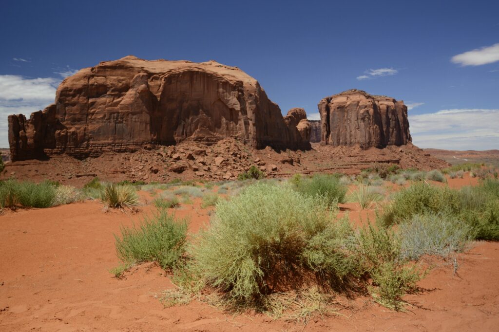
The rock walls have many interesting colors probably from minerals in the rocks and water.
Some of buttes and spires are over 1,000 feet high.
As the day progressed, the sun broke through the clouds. We had blue skies with puffy white clouds.
Big Indian Butte
Many western movies were filmed in Monument Valley. One of the iconic scenes is John Ford’s point as seen below. You may have seen this viewpoint in movies like “The Searchers” with John Wayne.
At this viewpoint, there was a Navajo Indian available to take photos of tourists sitting on a horse, for a price, of course.
John Ford’s PointCly Butte
On our way to the Artists Point, was Thumb butte. I thought it was a pretty good description of this rock formation. I give it a thumbs up!
The Thumb
The “window” between these rocks looks out on a large plain called Artists’ Point. The road leads to where you can get a view of the valley on the other side.
North Window viewpoint
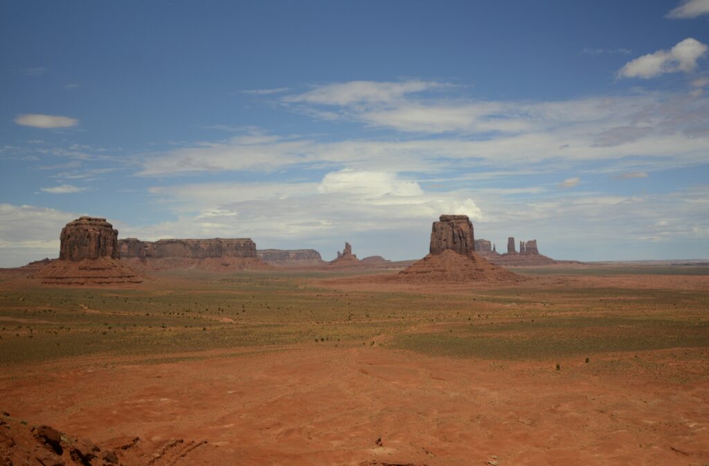
Views like this have made Monument Valley one of the most photographed places on earth.
View from artists’ point
The complimentary colors of the red rocks and green shrubs along with the blue sky inspire all kinds of artists, including me.
Desert Beauty
If you don’t have time to drive the seventeen mile road, there are still many great views from outside the park. These photos were taken from the highway. The blue sky and clouds made a beautiful backdrop against the red rocks.
View from outside Monument Valley
In the photo below, these formations from left to right are called King on His Throne, Stagecoach, Bear and Rabbit, and Castle Butte. Which one is your favorite?
King on his throne, Stagecoach, Bear & Rabbit and Castle Buttes
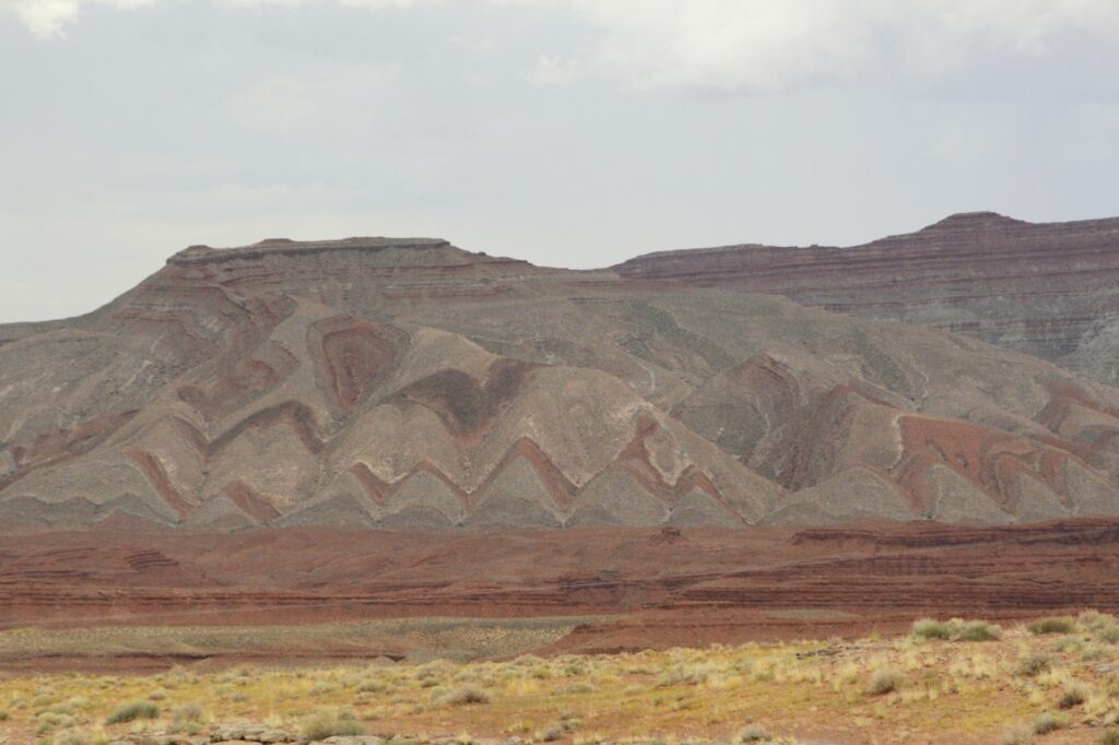
On our way back home, I noticed this mountain near Mexican Hat, Utah. Notice the folds in the rock. The rock had to be soft when it was folded because the rock would break if it was solid like it is today. Is it likely that these layers were laid down during Noah’s flood, and folded as the mountains were raised? Wouldn’t the layers have been worn away by erosion if it had taken millions of years for the layers to form as scientists tell us? Food for thought.
Folded mountain layers near Mexican Hat, Utah
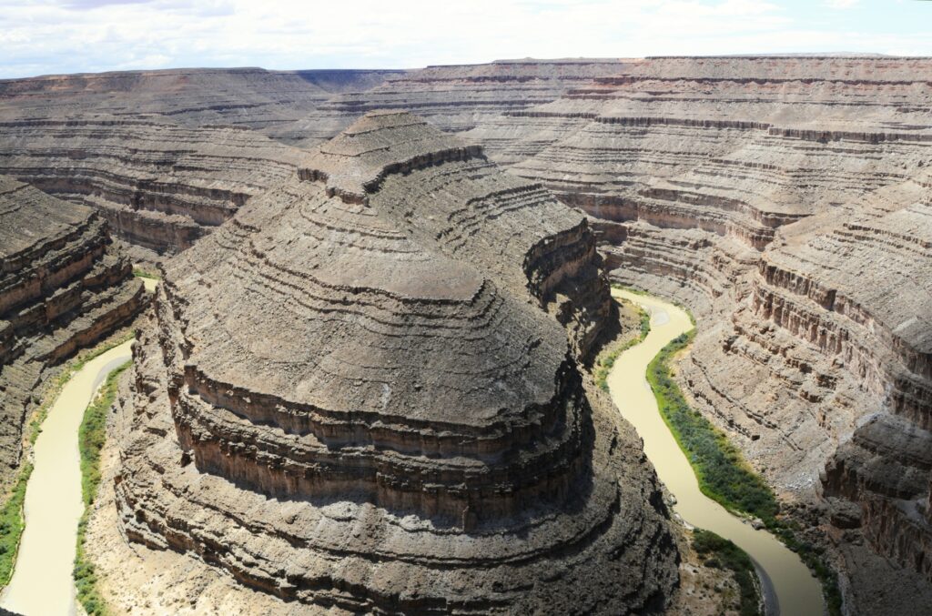
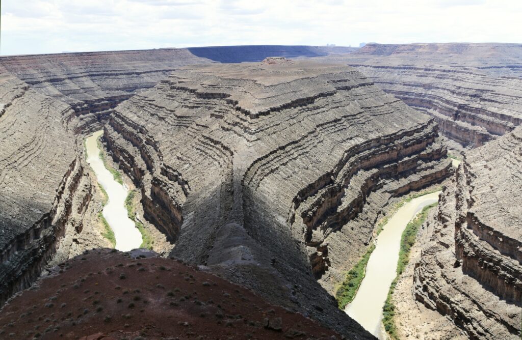
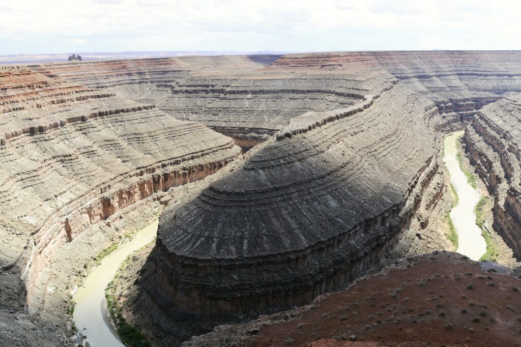
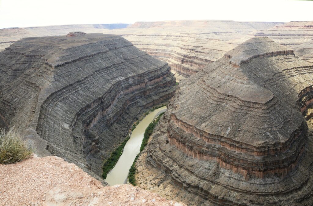
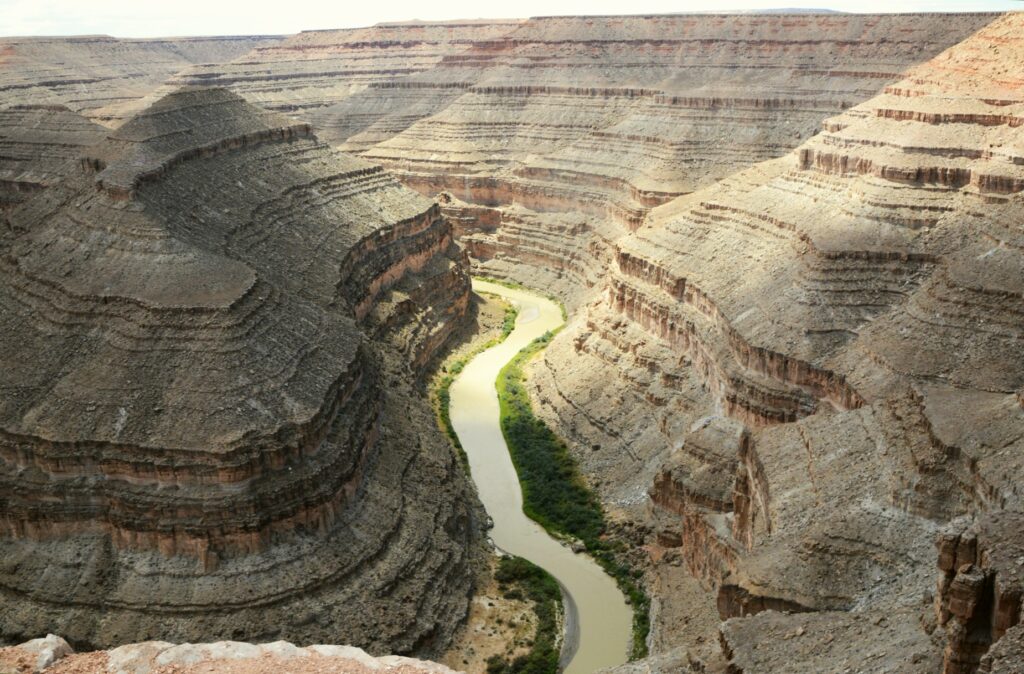
Goosenecks State Park
On our way back to Monticello, Utah, we made a detour to visit Goosenecks (Utah) State Park.
Goosenecks State Park, Utah
This small 10 acre Utah state park overlooks the San Juan River meandering and cutting a gorge of 1,000 feet deep.
It wasn’t quite as beautiful as Horseshoe Bend in northern Arizona, but it was still very impressive since you can stand on the edge and look straight down. Also, it is not just one bend in the river, but several all together.
The San Juan River at Goosenecks State Parke
I guess I should have been a geologist because places like this fascinate me. It was a great ending to our day.
“But let justice roll down like waters And righteousness like an ever-flowing stream. Amos 5:4
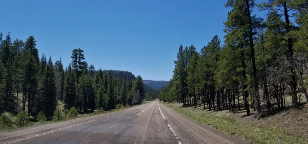
The drive from Show Low to Alpine, Arizona, was very scenic. We drove almost due east on Highway 60 to Springerville and Eager. From there, we headed south to the beautiful little town of Alpine, Arizona, where we stayed almost a week.
Highway 180 and 191 going into Alpine, Arizona
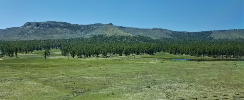
Alpine. at an elevation of 8,000 feet, is in the White Mountains and is situated in a large alpine meadow lined with tall pines and sprinkled with small lakes. There’s a small grocery store, post office, and a few other businesses. Elk herds feed in the vast meadow unharmed.
The entrance to Alpine is a large meadow with a lake
Alpine lies a few miles west of the Arizona/New Mexico border. Highways 180 and 191 split in the center of town. Highway 180 goes east and then south into New Mexico, and Highway 191 goes south in Arizona. These highways parallel each other and never meet again. Both eventually end up at the Mexican border.
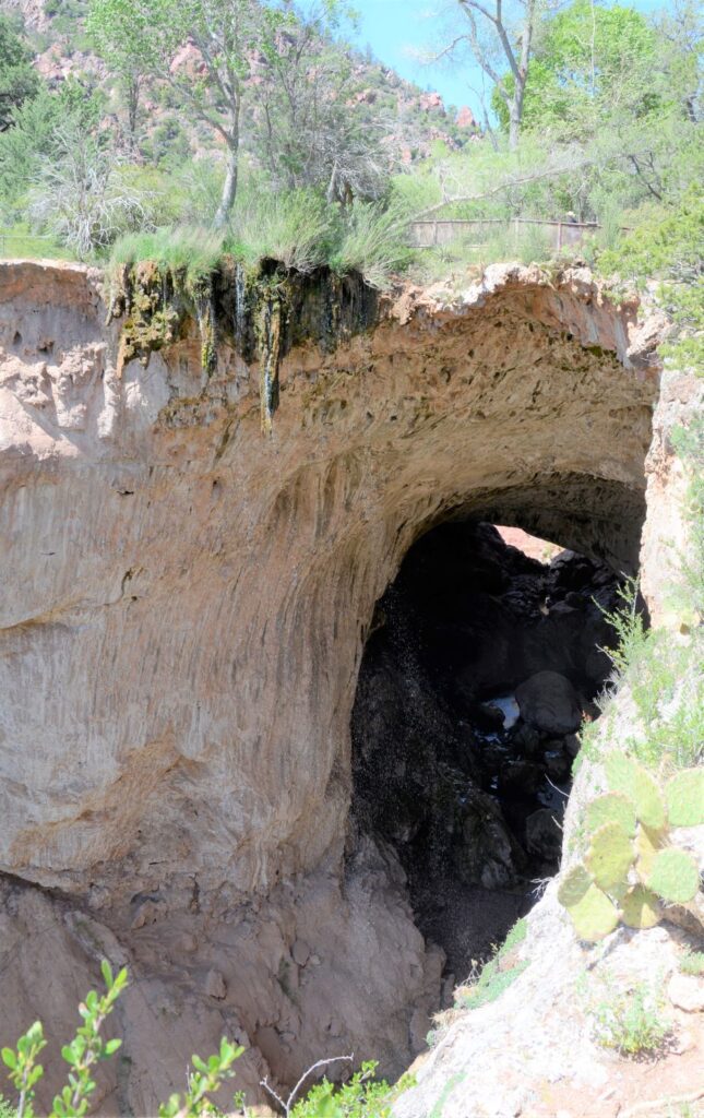
Catwalk National Recreation Trail
We took Highway 180 into New Mexico as far as the little town of Glenwood, New Mexico. It is a very scenic drive, going from pine studded mountains to high desert to green valleys of cottonwood trees.
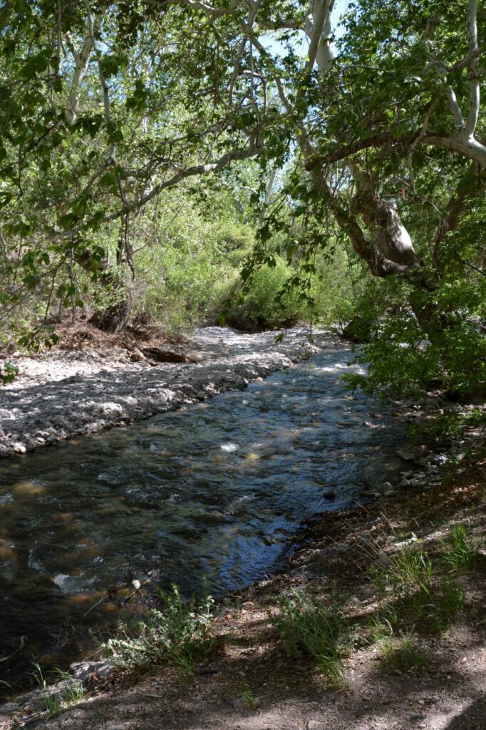
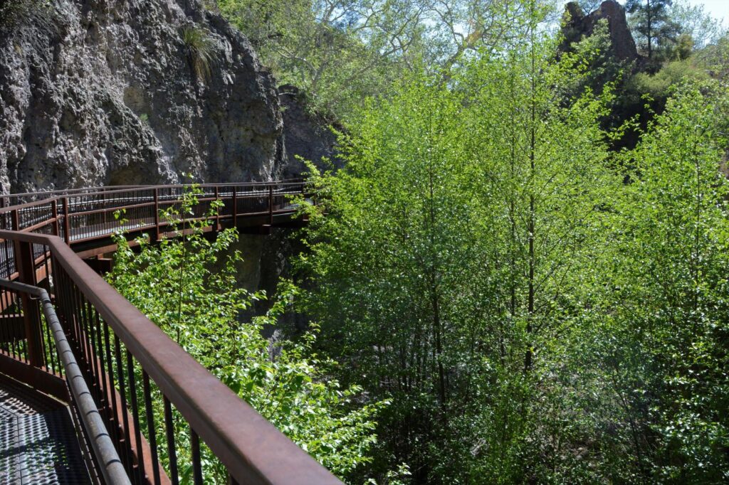
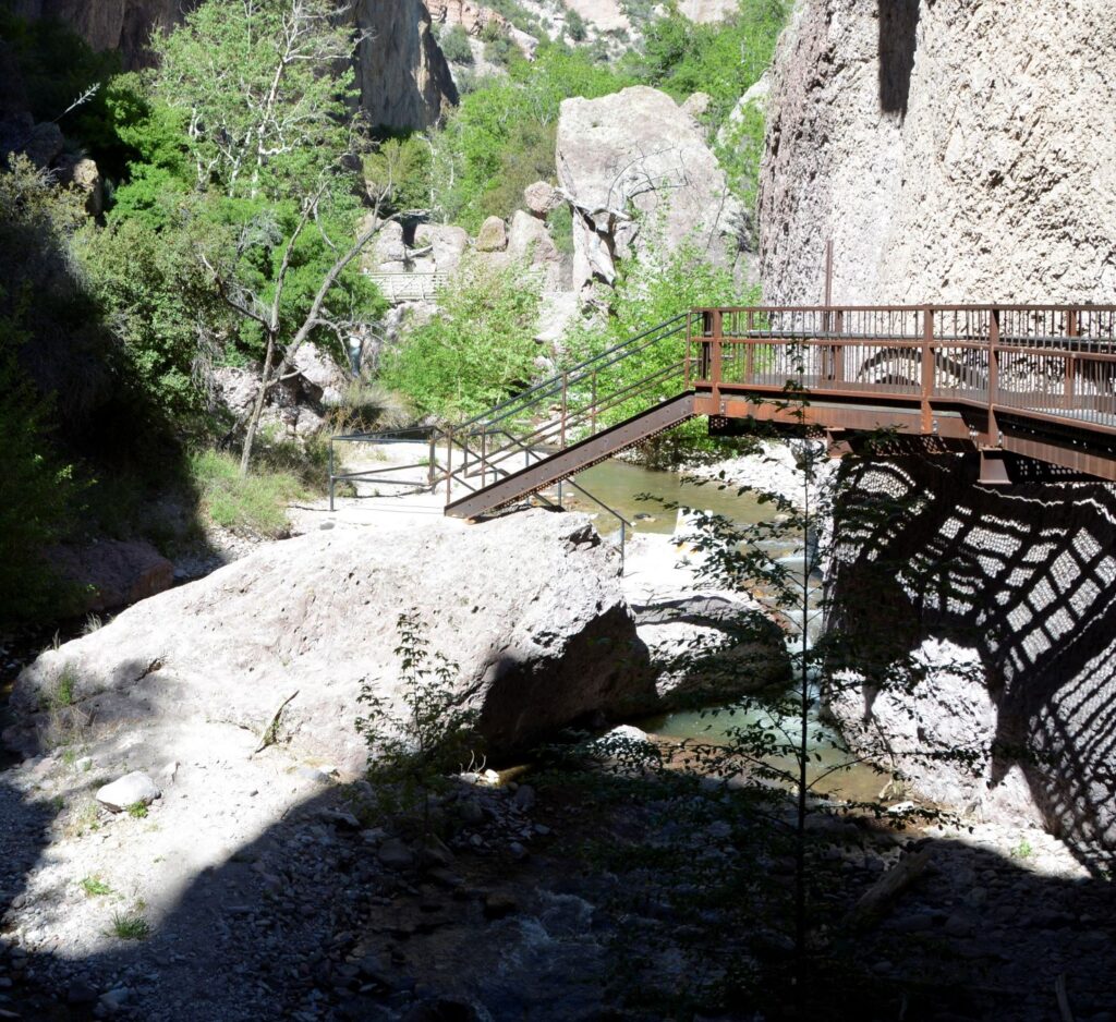
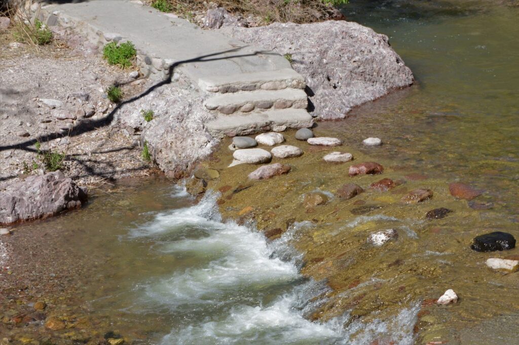
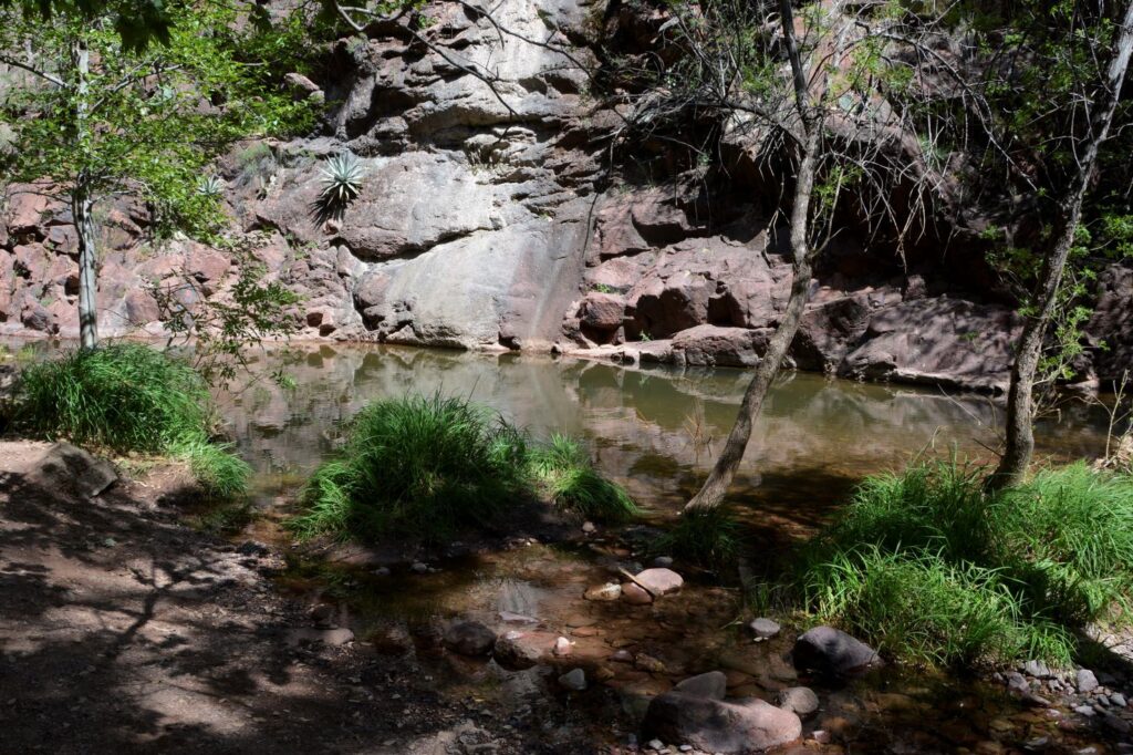
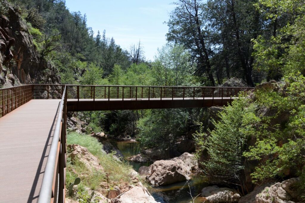
At Glenwood, we turned onto a side road (NM Hwy 184 or Catwalk Road) and drove 5 miles to Catwalk Recreation Area in the Gila National Forest. We forded a couple of streams that flowed over the road on our way there. At the end of the road is a large parking lot. A picnic area is situated under the shade of large sycamore trees near sparkling Whitewater Creek.
Whitewater Creek near picnic area
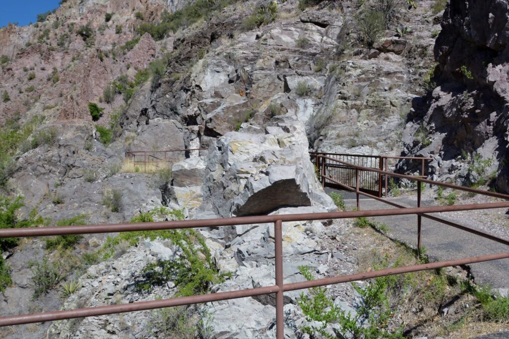
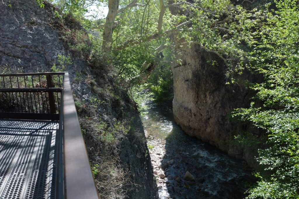
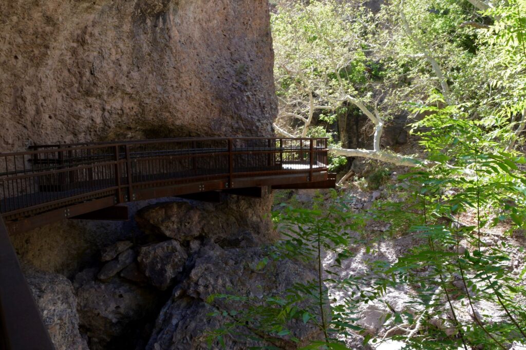
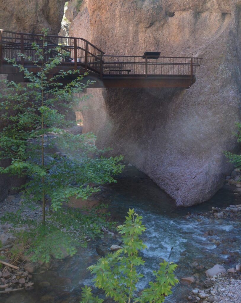
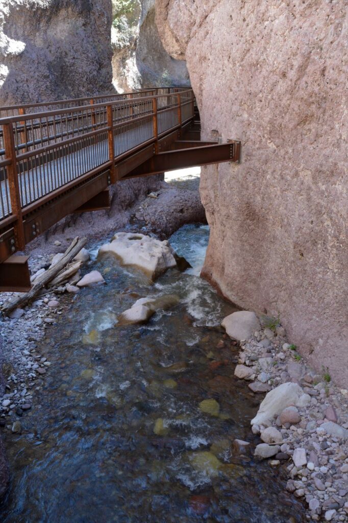
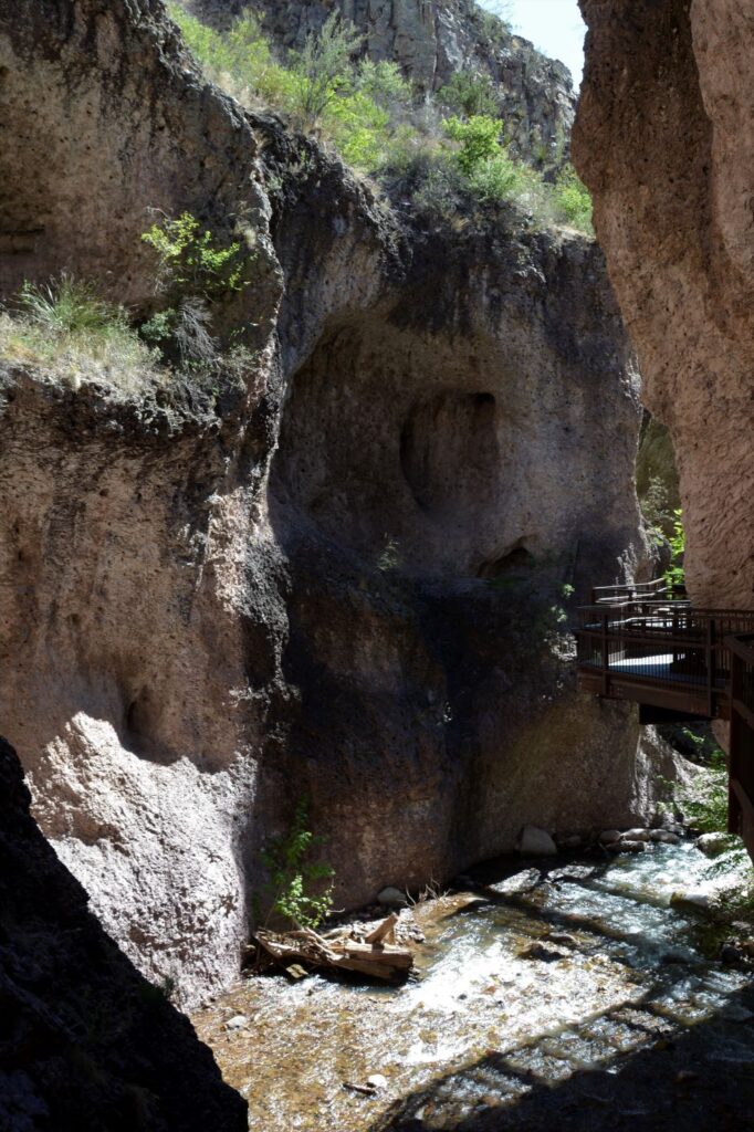
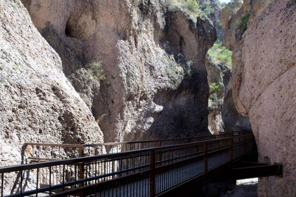
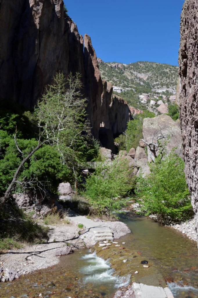
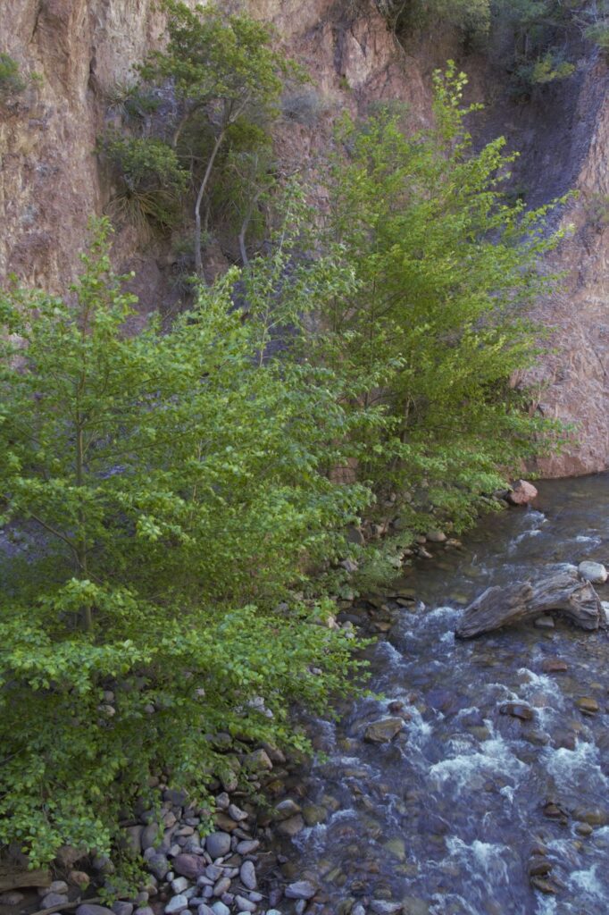
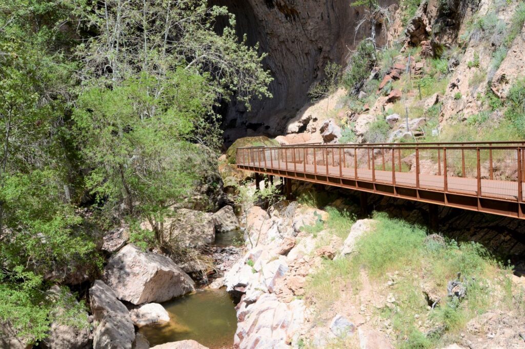
There is a trail that follows the creek up into Whitewater Canyon. When the canyon narrows, a metal catwalk attached to the canyon walls allows hikers to walk above the creek at tree level.
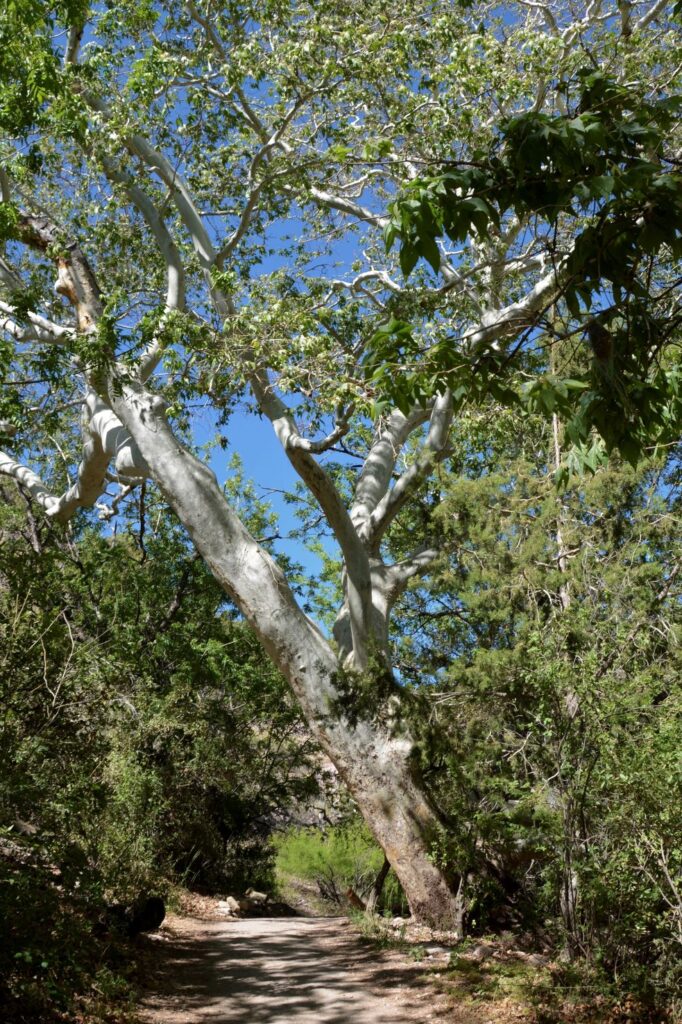
Western Sycamore Trees line Whitewater Creek
The Catwalk was originally a board walkway placed on top of a steel pipe that brought water to an ore processing plant. Apparently, a person needed to have the balance of a cat to walk on it. That’s how it got its name.
Later, in the 1930’s, the Civilian Conservation Corps built a wooden catwalk over the existing pipeline. It washed away during a flood in 2012. The present day catwalk was then built to replace the old one. It is now accessible for all ages and abilities. It is only .6 miles long. The trail continues beyond, but is closed due to danger of falling rocks.
Looking up at a Western Sycamore tree
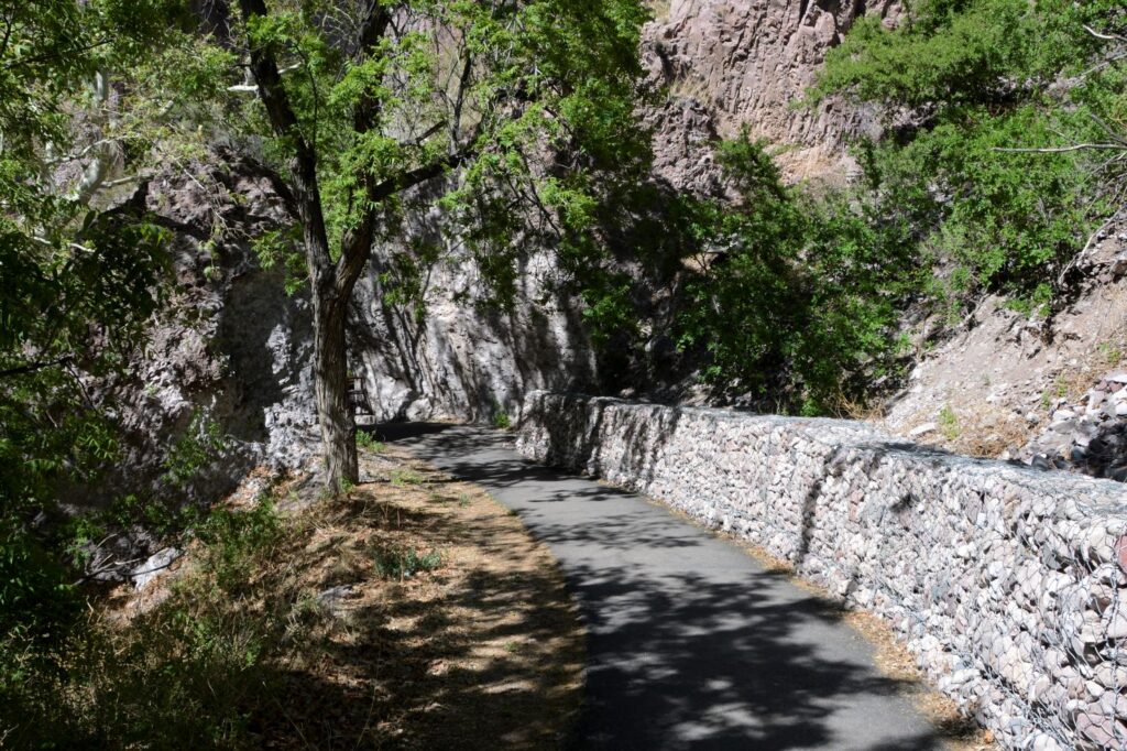
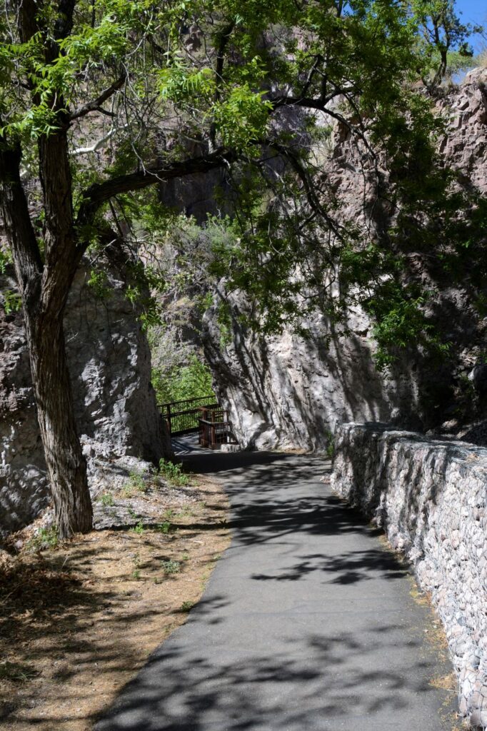
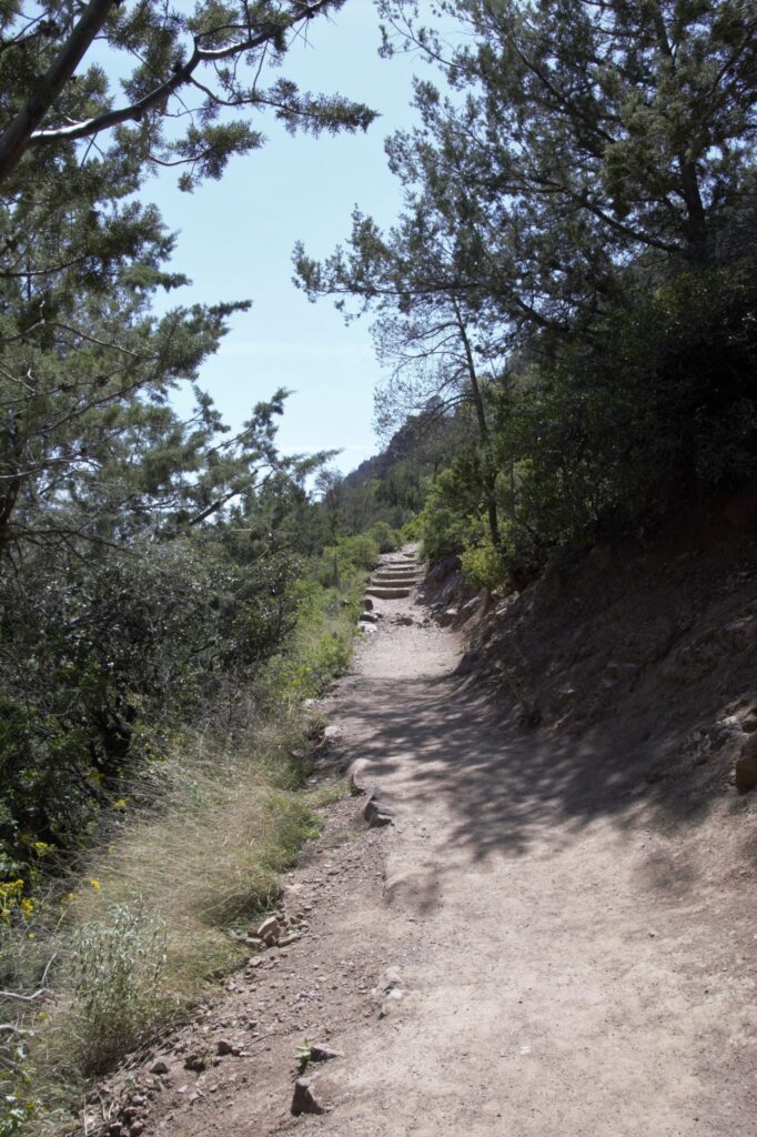
The trail starts out easy. We walked in the shade of the trees and there was a cool breeze.
Shady path leads to first bridge over creek
Before the path crosses the first bridge, it splits. A more difficult path stays to the left of the creek, while the easier path crosses the bridge on the right side.+
It got warmer as soon as we left the shade of the trees. We were going uphill at that point.
We thought we were getting closer to the catwalk when we reach some metal handrails, but we still had a ways to go.
The rocks are held in place by wire.
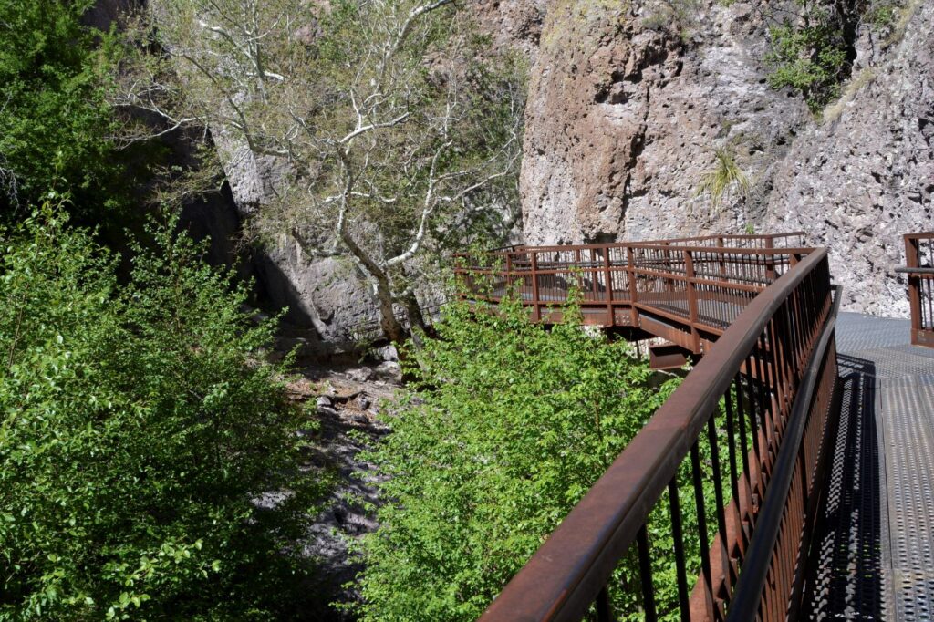
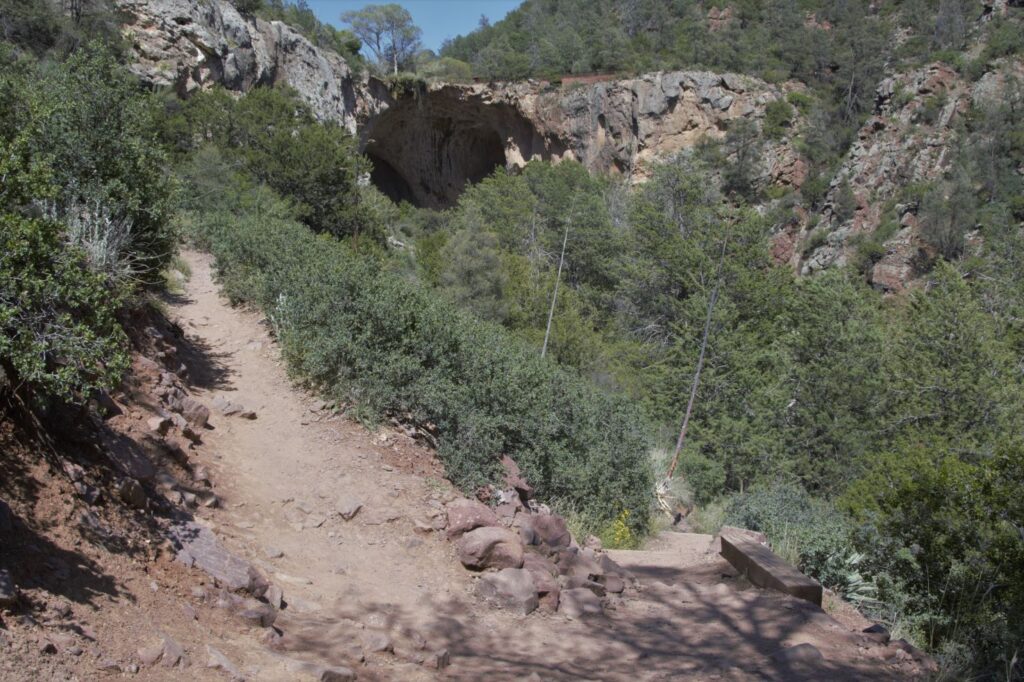
Shortly after we were rewarded with our first glimpse of the catwalk.
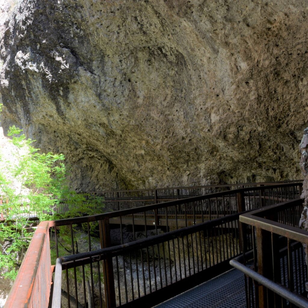
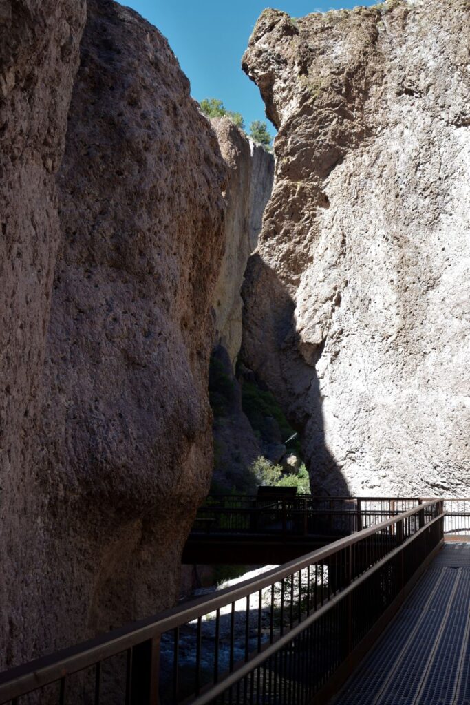
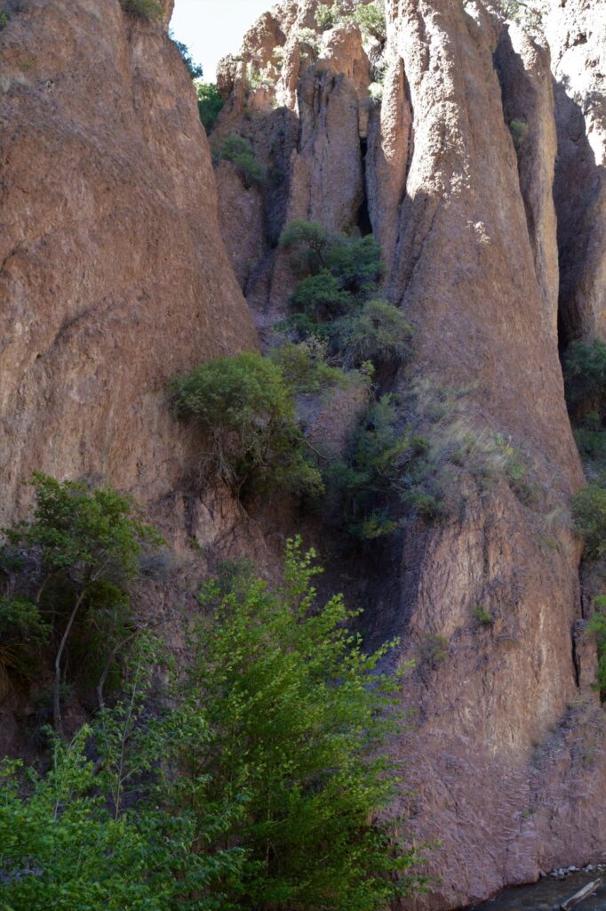
We were above the treetops! At this point, the canyon was closing in on us. The walls were closer and towered above us.
We were above the treetops.Looking back where we came from.
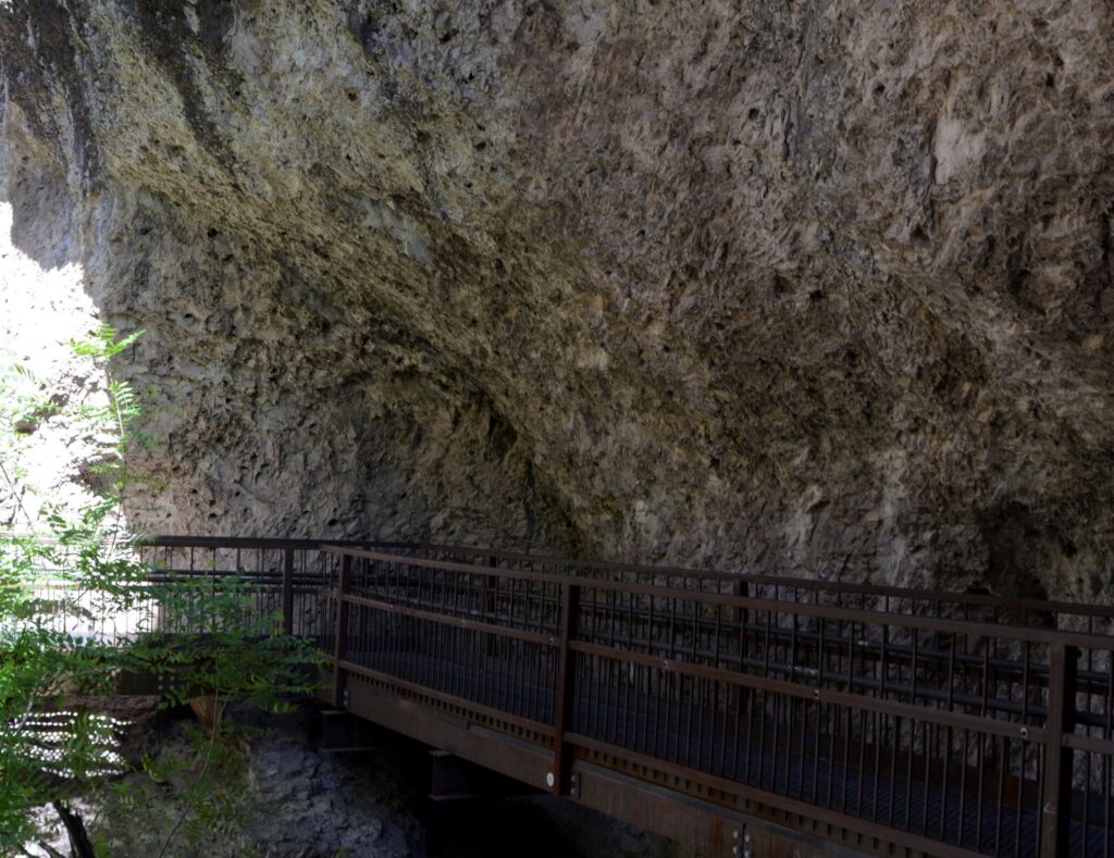
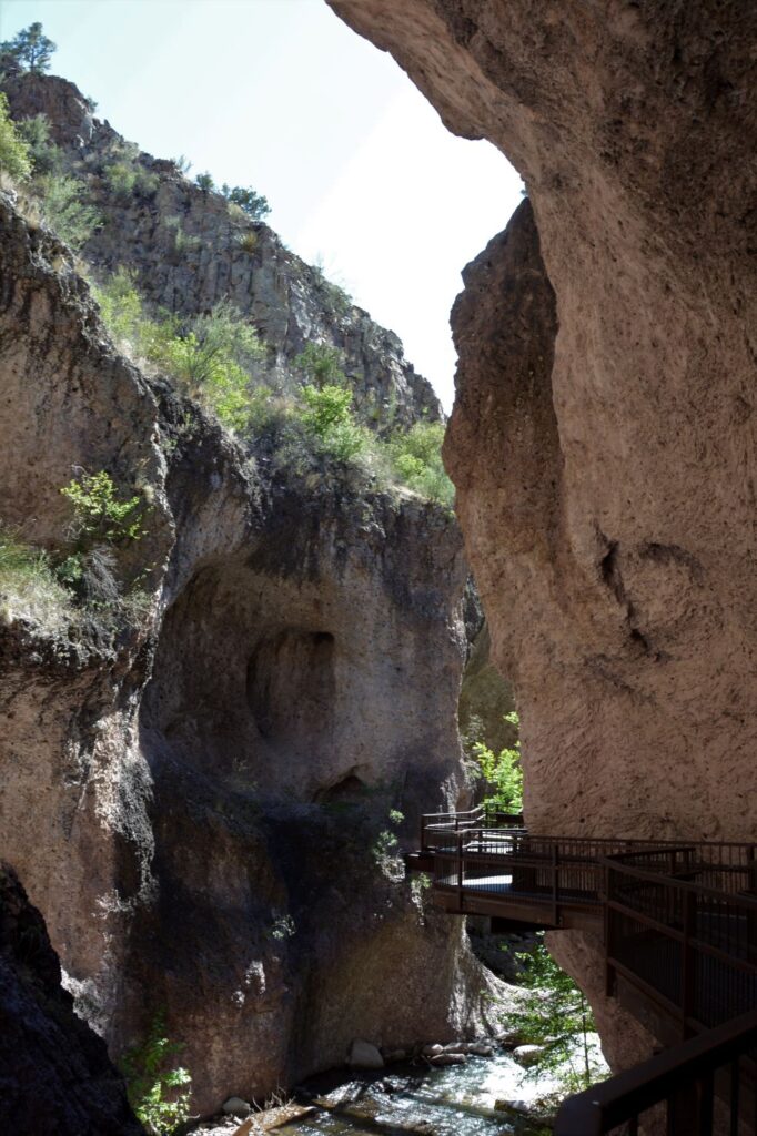
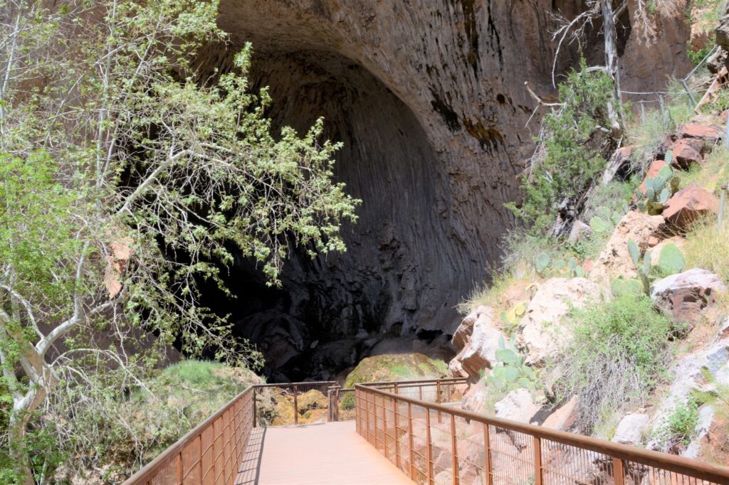
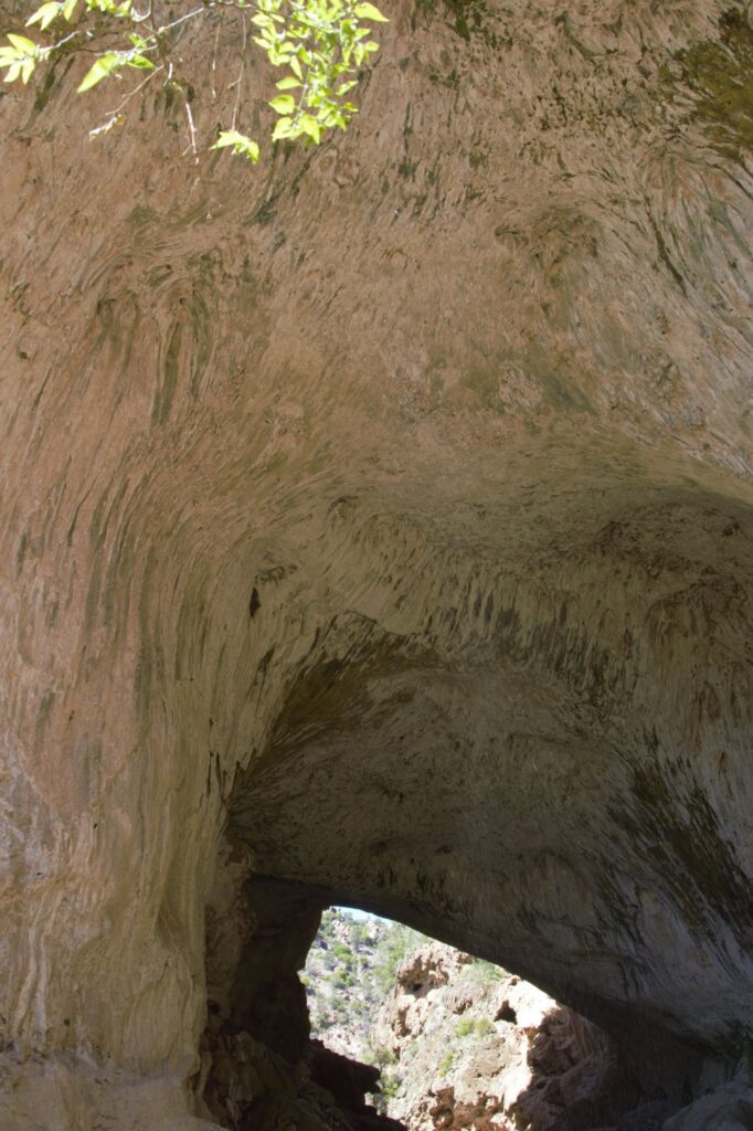
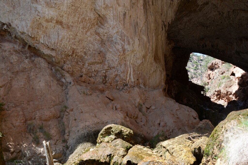
We rounded a corner, and it was like we were in a cave. The rock wall curved over our heads.
Looking back, we could see the canyon walls and the creek below.
Each bend around the canyon walls showcased another beautiful sight.
The Catwalk hangs over the canyon.
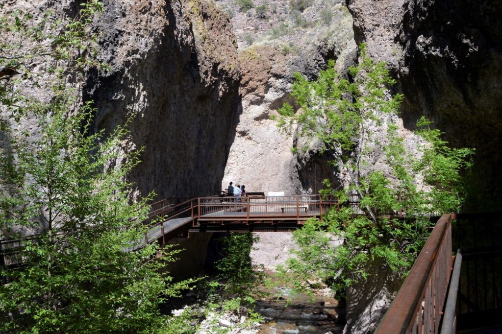
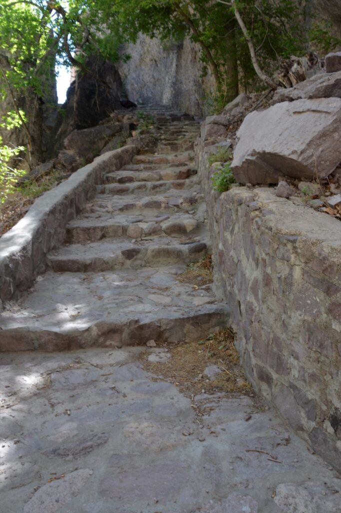
Eventually we got to the bridge where we met up with the trail from the other side. There was a bench there and we rested awhile enjoying the beauty of the place.
At this point, the Catwalk crossed to the left side of the canyon and continued on. I walked across to where the other trail met up. Steep steps led down to the bridge. I was glad we chose the easier route.
We continued on the catwalk which was now on the opposite side of the canyon walls. Most of these photos are taken looking backward down the catwalk where we’ve already walked, so they look like we are still walking on the same side.
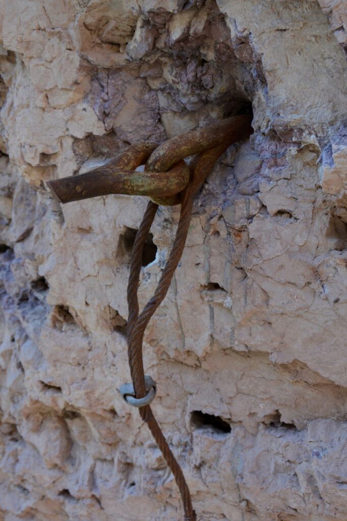
Sometimes we saw evidence of the past. Here is an metal anchor from a previous catwalk.
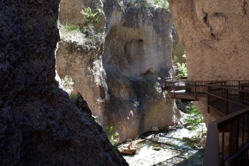
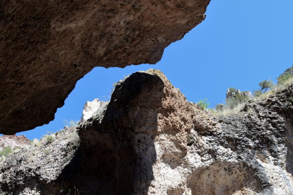
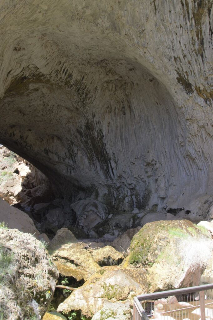
The canyon walls above us were so close, they almost touched. The rock in this part of the canyon is harder. Therefore, the canyon walls are narrower because they haven’t eroded as much as the walls near the picnic area where the rock is of a softer material.
The Narrows of the canyon.
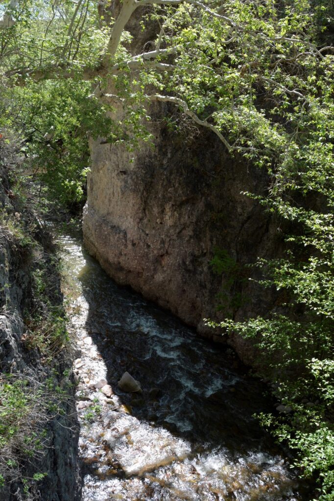
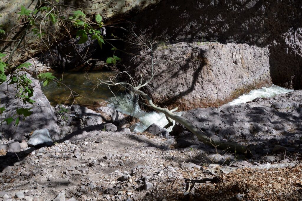
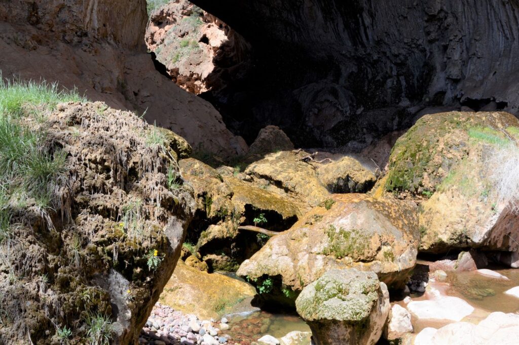
The creek was always below us, rushing through the canyon.
Sometimes we could hear or see a small waterfall.
Small waterfall
When we finally came to the end of the catwalk, we walked down to the creek below. We didn’t intend to go further, but the trail continued on. However, due to recent rock falls, the trail was closed.
The Catwalk ends but the trail goes on.
The trail that continued on crossed the creek on stepping stones.
The path continues on after the catwalk.Stepping stones lead across the creek as the trail goes on.
Trees and vegetation grew out of the canyon walls, making a beautiful contrast of colors.
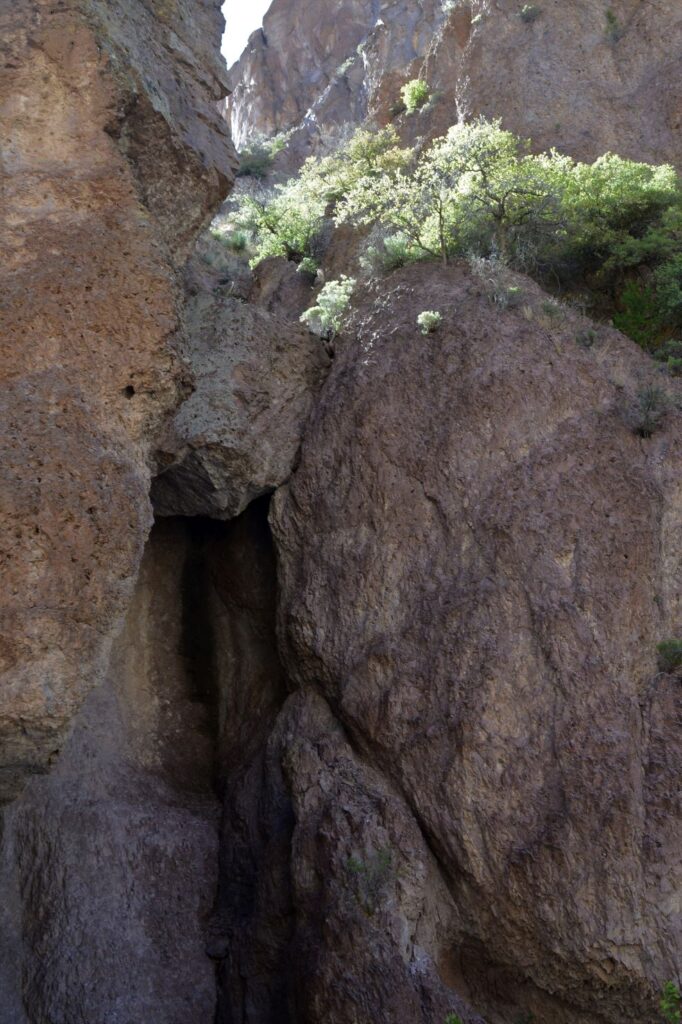
Around one corner, there was a deep crevice.
By the time we got back to our truck, we were hot, tired and thirsty. This time we carried water with us and wore our hats. It was recommended to carry bug deterrent, but even though I was prepared, there were no bugs to bother us.
This is another example of a really beautiful spot in an out-of-the-way place. A hidden jewel waiting to be discovered.
“Lord, how many are Your works! In wisdom You have made them all; The earth is full of Your possessions.” Psalm 104:24 NASB
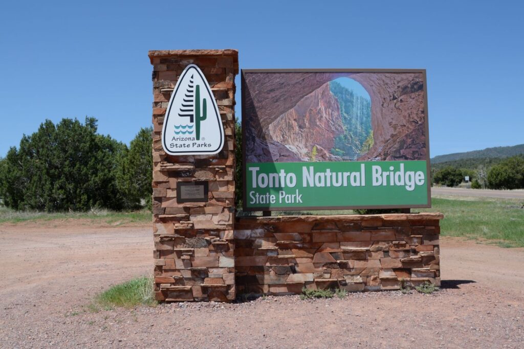
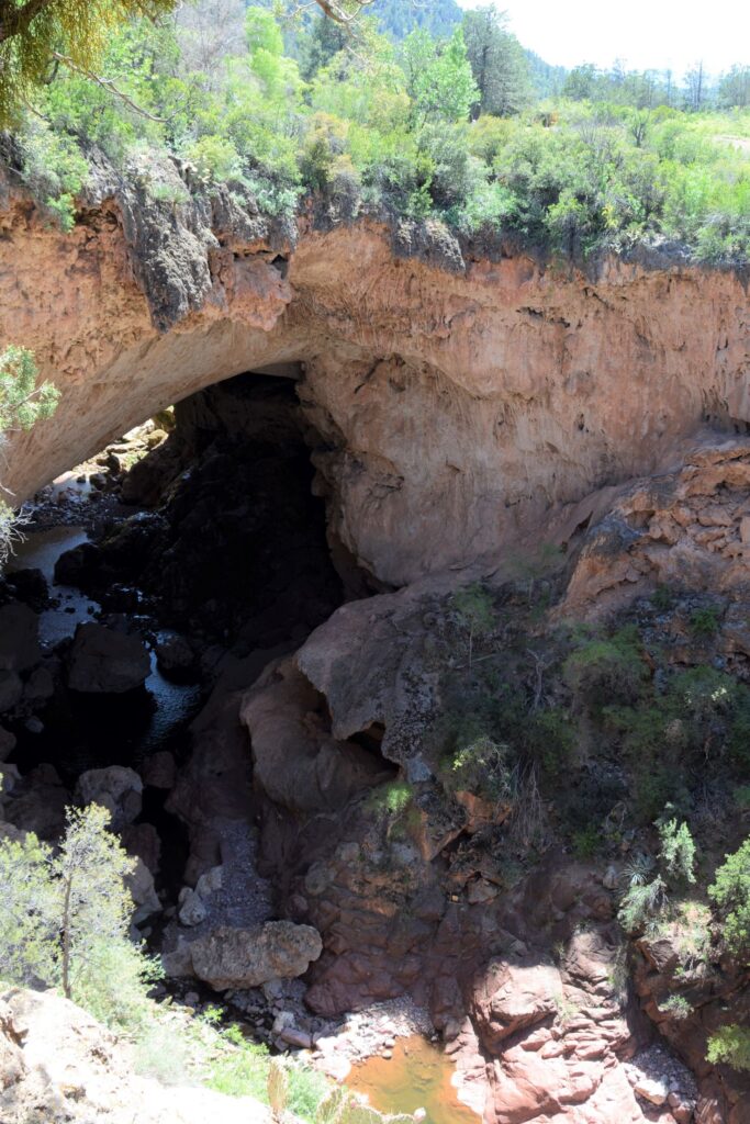
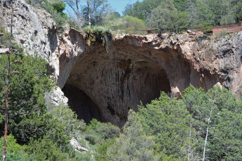
While we were staying in Show Low, Arizona, we took a day trip to see Tonto Natural Bridge State Park. It is believed to be the largest travertine natural bridge in the world.
Entrance to Tonto Naturla Bridge on Arizona Highway 260 near Pine, Arizona.
The natural bridge is located less than 15 miles from Payson, Arizona. It was about an hour and a half drive from Show Low. We ate lunch in Payson and then continued on to the park.
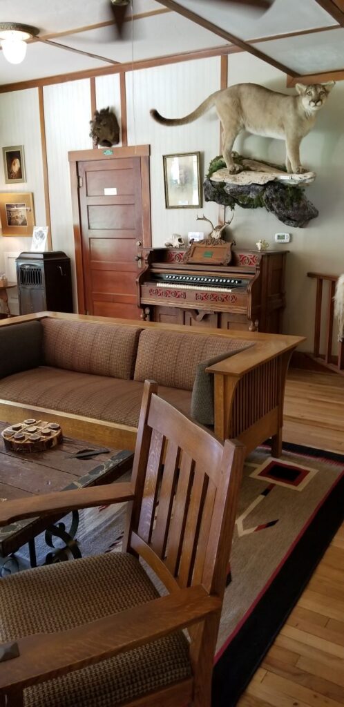
At the entrance we had to park and pay our entrance fee in the gift shop, which is located on the bottom floor of the historic Goodfellow Lodge. The Lodge was built in the 1920s and is still in use today.
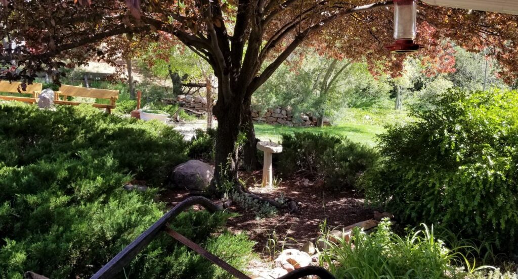
Lobby of the Goodfellow LodgeGarden outside Goodfellow Lodge
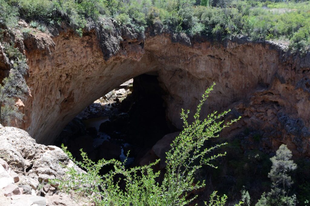
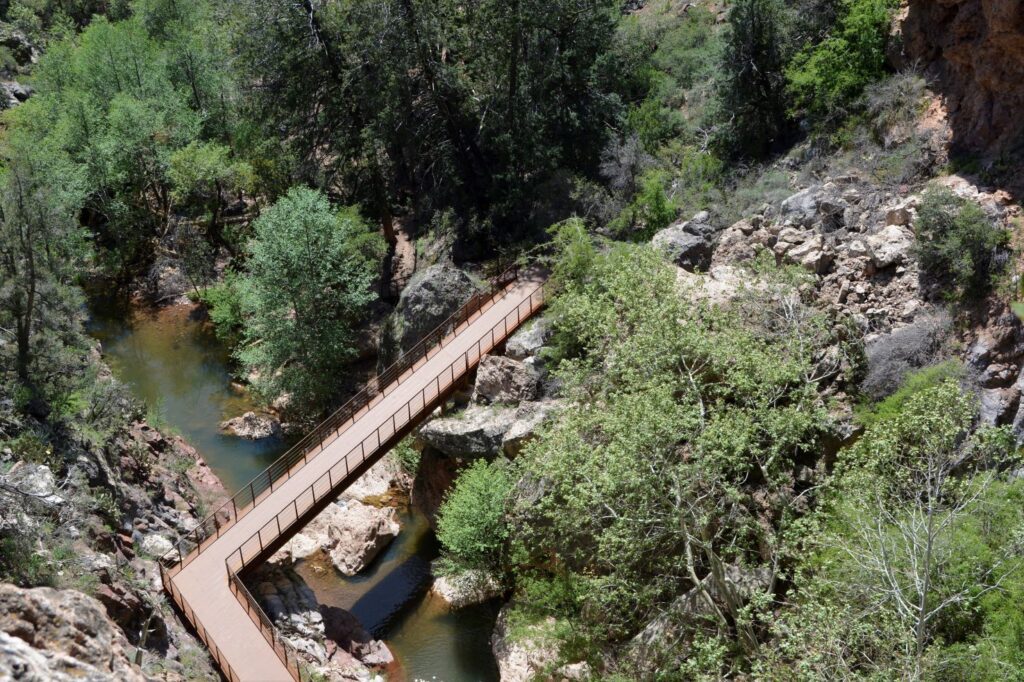
After getting our park pass, we drove to the parking lot closest to the Natural Bridge. There are four viewpoints along the walking path overlooking the tunnel of the bridge from above. We stopped at Viewpoint #1 first.
Bridge from Viewpoint #1Tonto Natural Bridge from Viewpoint #1
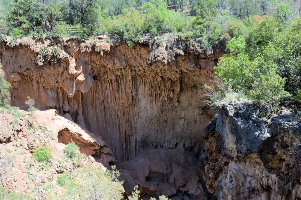
To reach viewpoint #2, we had to walk across the bridge and walk a short distance on the Anna Mae pathway. The tunnel is not visible from this viewpoint. However, the travertine layers are visible. Travertine is formed from calcium carbonate-rich water exposed to air. As it precipitates out, calcite is forced out of solution when the water evaporates. These are similar to cave formations.
Travertine formations from Viewpoint #3 along the Anna Mae trail.
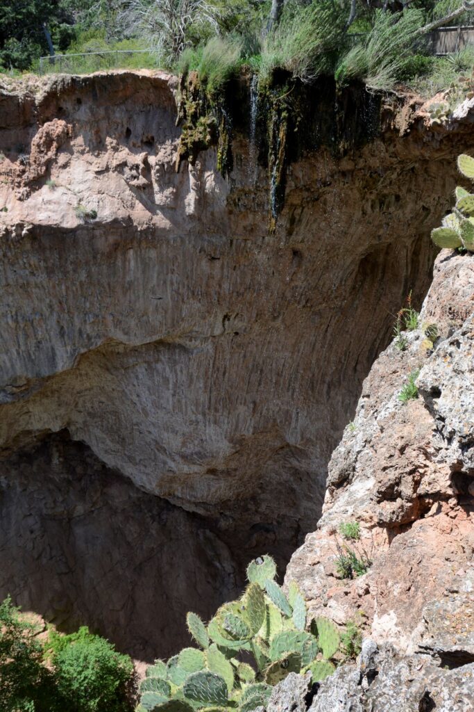
Crossing back over the bridge, we walked to Viewpoint #3 and #4. As we walked to the viewpoints, we crossed over a small stream that flows over the top of the bridge and makes a sparkling waterfall. Looking down, we could see the observation deck and bridge below.
Looking down from Viewpoint #4 at bridge that crosses Pine Creek.Viewpoint #4 waterfall drips over top of natural bridgeWater flows over the top of the bridge from Viewpoint #4
We debated if we should try to hike the trail to the bottom. It was very steep and rocky. But we were there to see what we could, so we decided to give it a go. We proceeded carefully and made it to the bottom fairly easily.
Looking back up the Gowan trail. The Gowan trail is only about .3 miles to the bottom of the Bridge
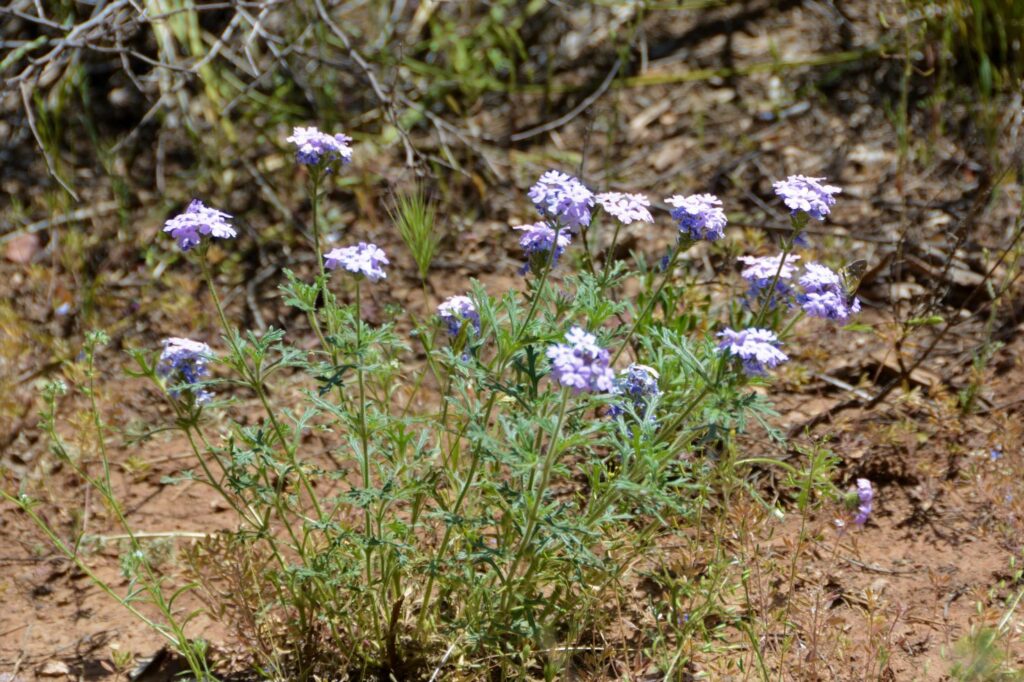
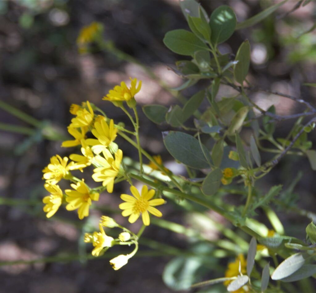
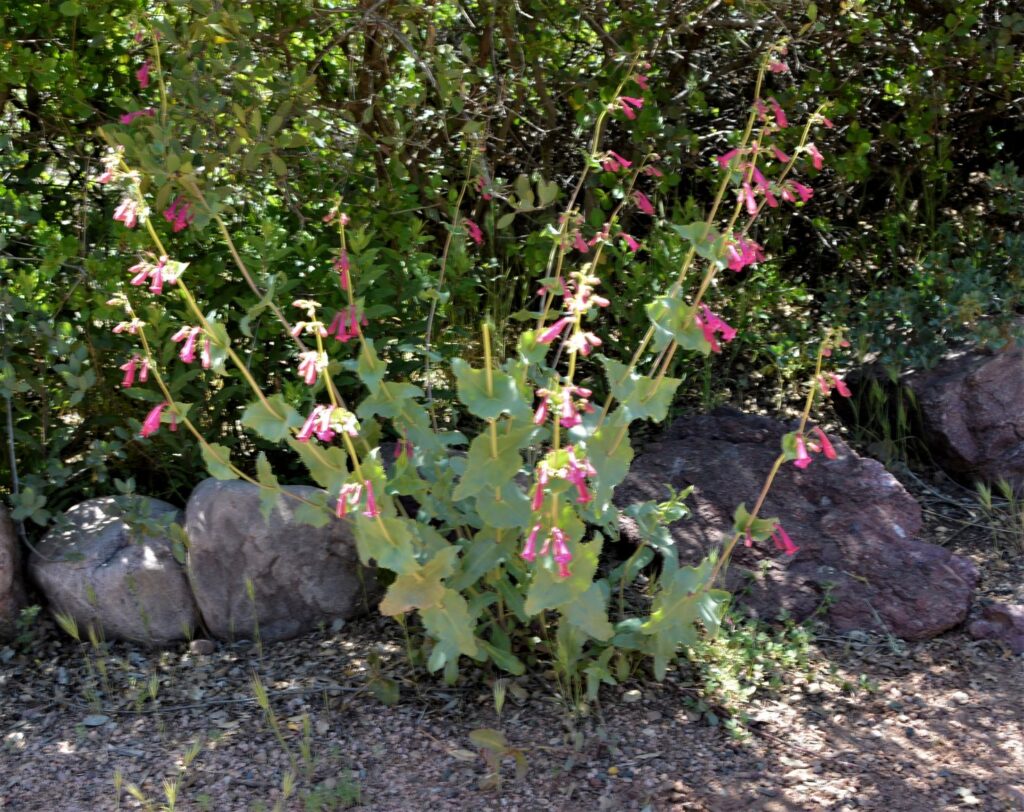
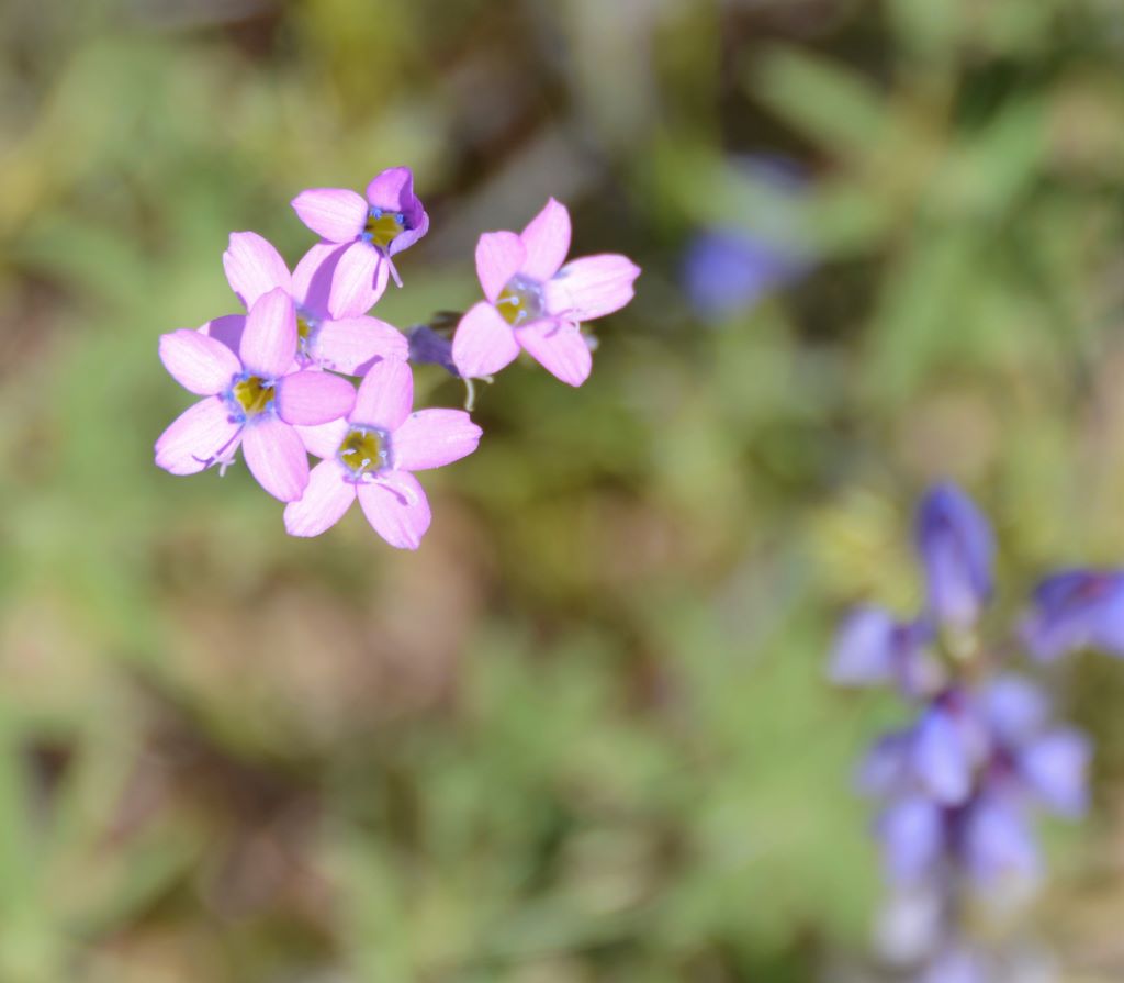
Along the trail to the bottom we saw several wildflowers and interesting plant life.
Purple wildflowers along Gowan TrailWildflowers on Gowan TrailWildflowers on Gowan TrailThe Bridge from the pathway as we get closer.
When we got to the bottom, we relaxed for a time in the cool shade, listening to the sounds of Pine Creek. Fortunately, there was a nice breeze that day that kept us cool.
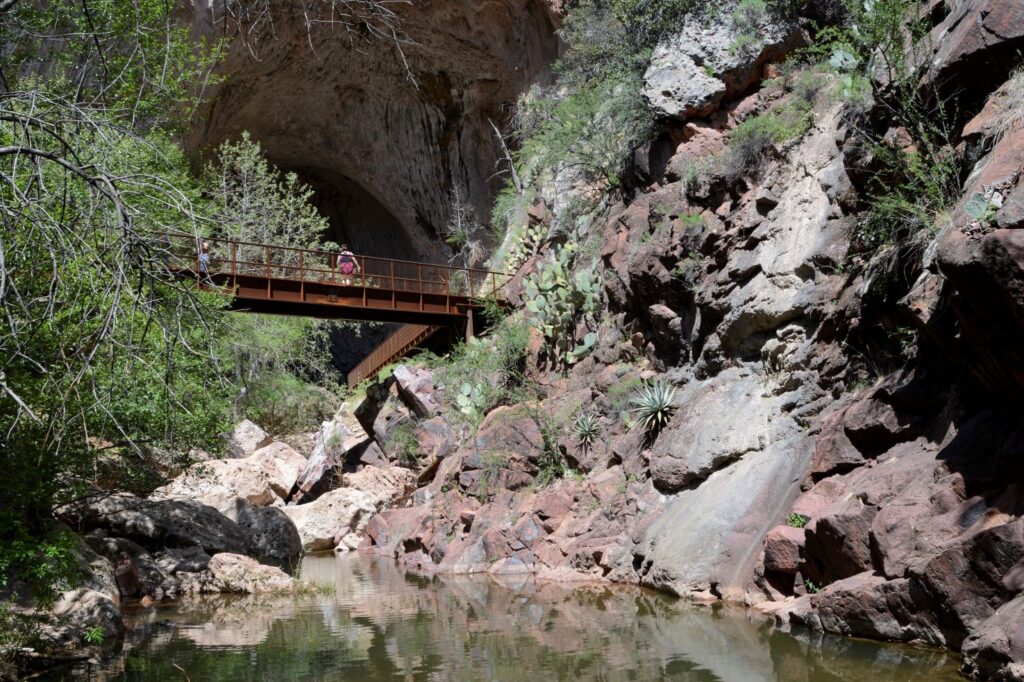
Pine Creek flows under the Natural BridgeBridge and observation deck at bottom of Gowan trailBoulders at the bottom of the BridgeLooking back from observation deck at bridge over Pine Creek
Once at the bottom, the enormity of the Bridge, which was 183 feet high, was evident. It was like looking into a huge cave. Boulders were scattered throughout, and the waterfall glistened as it fell to the rocks below.
Looking through the tunnel formed by the Natural Bridge
Arrows painted on the rocks showed us that the path continued through the tunnel to the other side. However, it involved scrambling over slippery rocks and boulders. We opted to go back out the way we came.
Looking through tunnel at Tonto Natural Bridge
We took our time and stopped frequently to catch our breath. The elevation is over 4,500 feet. There were a couple of benches of which we took advantage on our way back. It definitely seemed a lot longer going up than it did going down. Eventually we made it up to the top.
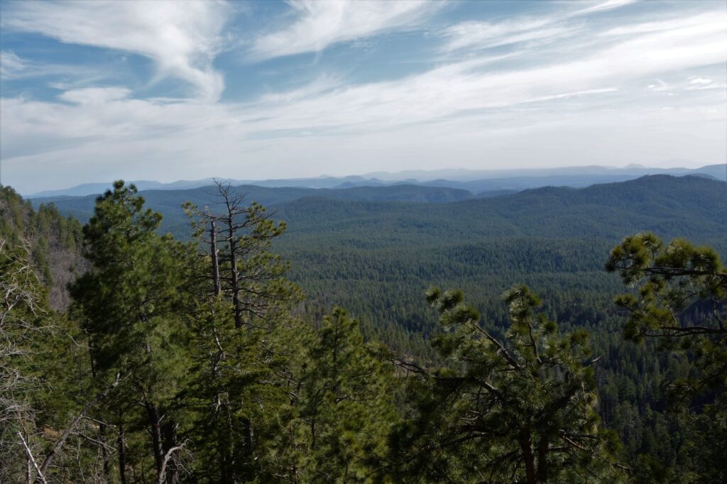
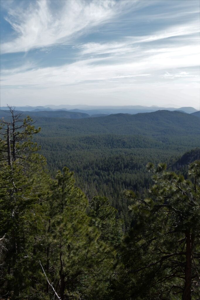
On our way back home to Show Low, we drove for miles along the Mogollon Rim, a steep edge of the Colorado Plateau. We stopped at the Mogollon Rim Visitor Center. It was closed, but the observation deck was open. I stood looking over the mountains and valleys below. Highway 280 along this section is one of the most beautiful drives in Arizona.
Looking out from the Mogollon Rim Looking out from the Mogollon Rim
Sometimes it is worth the effort to go out of your way to see something really special. That is what we did on this day, and we were glad we did.
“Lord, You have been our dwelling place in all generations. Before the mountains were born Or You gave birth to the earth and the world, Even from everlasting to everlasting, You are God.”
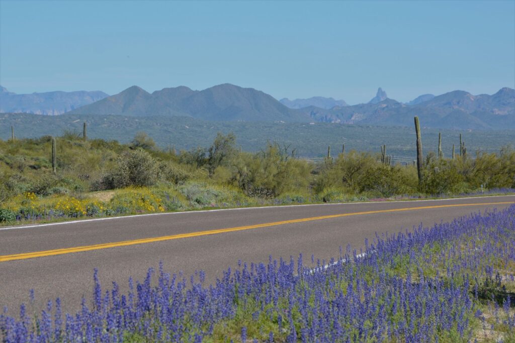
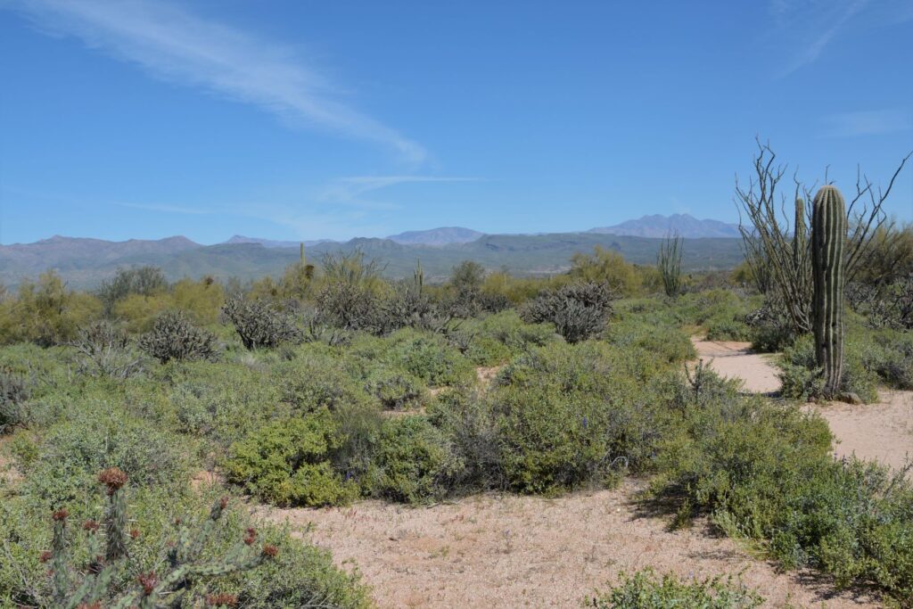
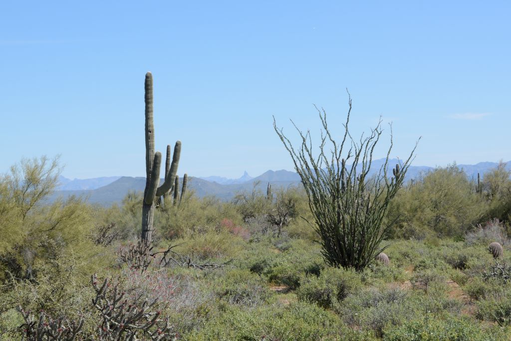
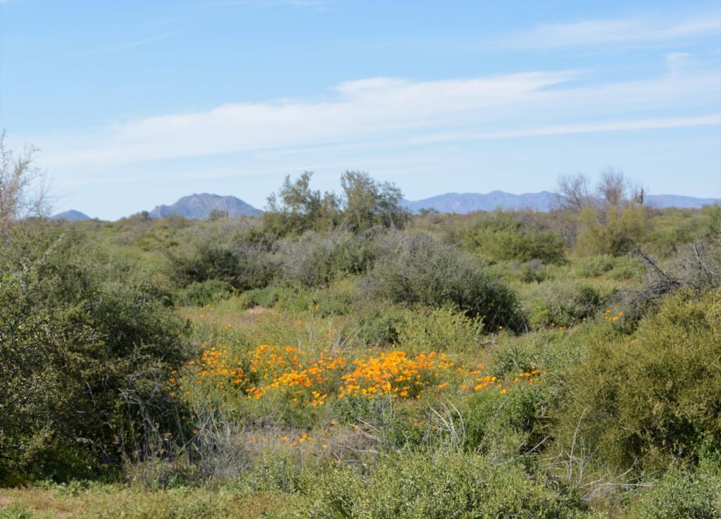
After several days of cool, cloudy weather in Mesa, Arizona, it finally warmed up. We packed a picnic lunch one morning and drove north to McDowell Mountain Regional Park near Fountain Hills, Arizona. The recent and frequent rainfall over the winter made a perfect environment for a great season of wildflowers. On our drive there, the sides of the road were awash in color.
We stopped at the Visitors’ Center where we ate our lunch outside in a picnic area. Inside the Center, we saw some live rattlesnakes, and picked up some literature about wildflower species.
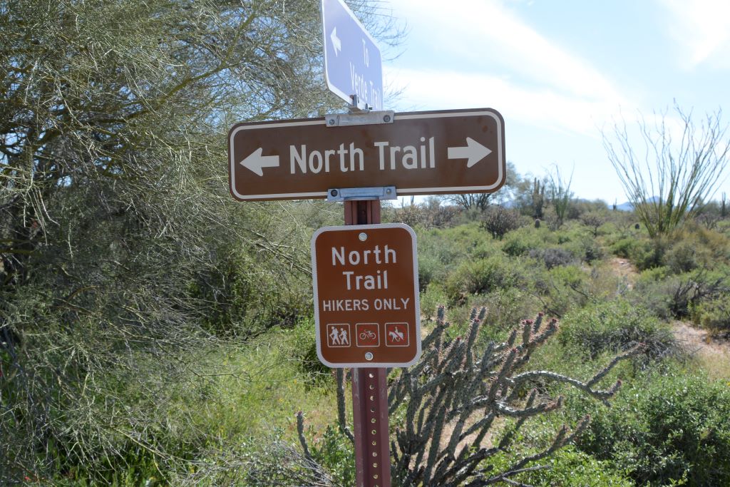
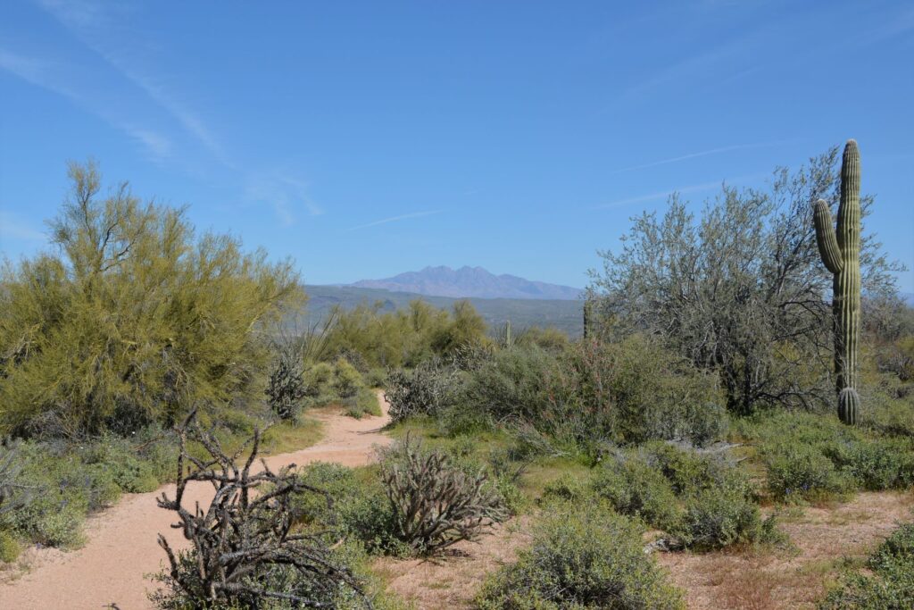
The Ranger at the gate suggested the North Trail hike for spotting the most wildflowers. It was supposed to be an easy hike. We planned to just walk a short way to get some photos.
At one point I turned and looked back and saw a beautiful view of the Four Peaks.
North Trail looking toward Four Peaks
On our way, we met some people who told us there were fields of poppies about a half mile to a mile down the trail. What we didn’t realize is that the trail splits and makes a loop. We took the trail to the right, but the fields of poppies were on the trail to the left.
The trail splits, but we go to the right.
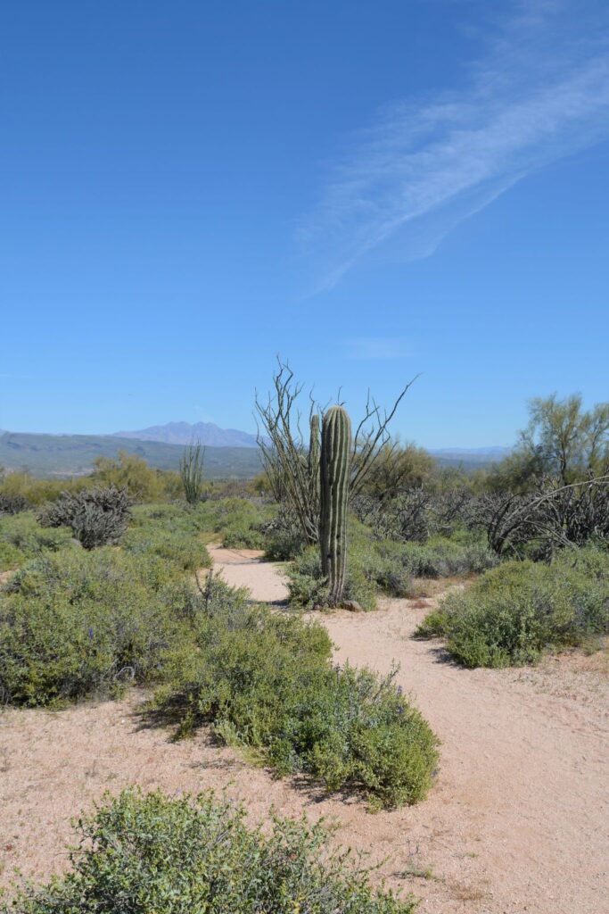
We kept going, thinking the fields of poppies might be around the next bend.
Chuparosa bushChuparosa bush
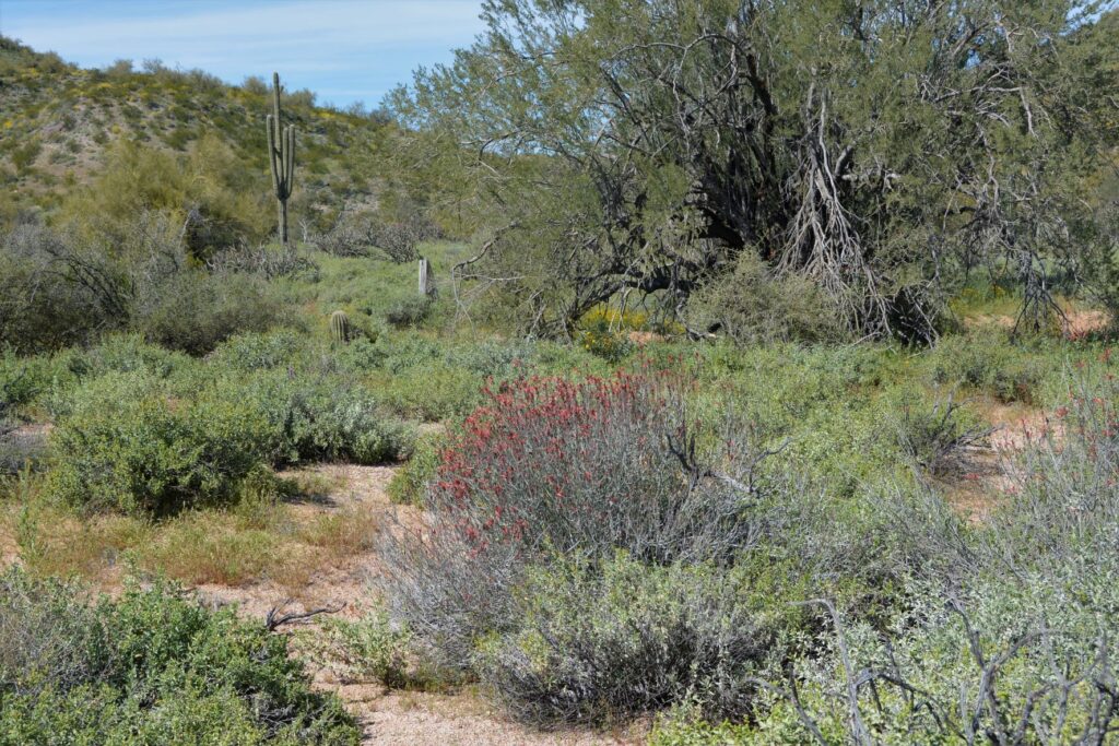
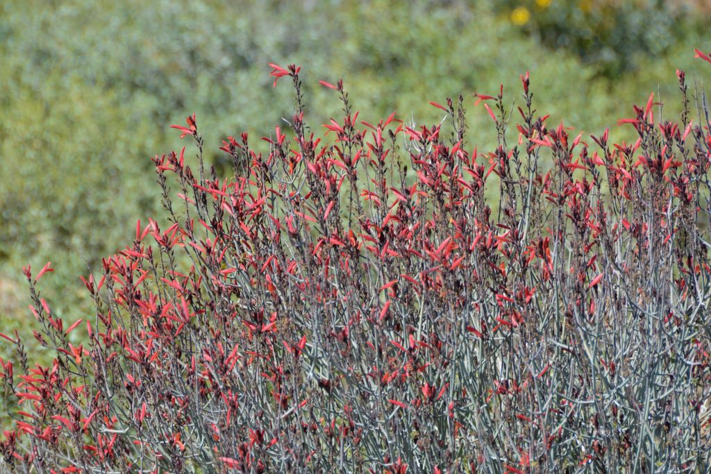
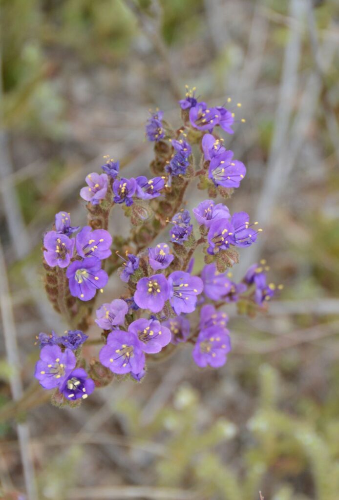
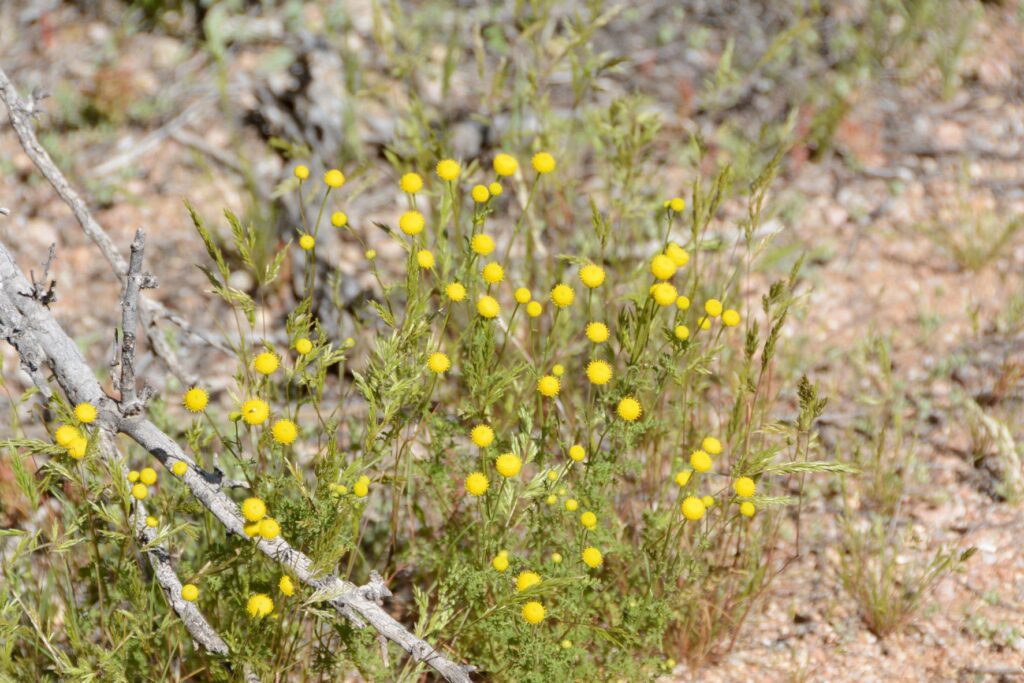
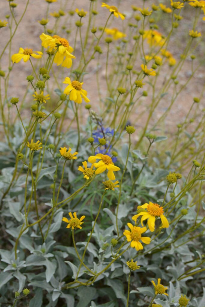
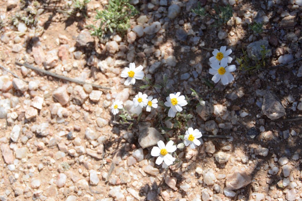
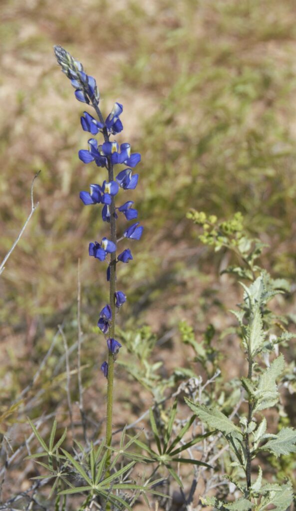
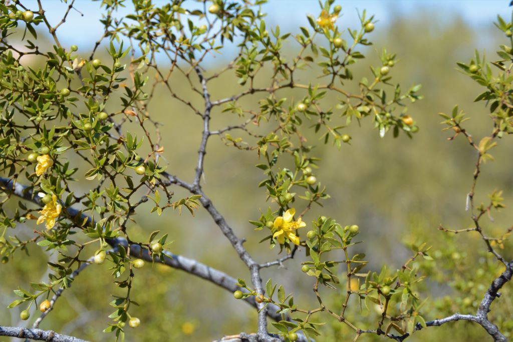
On our walk we saw a variety of wildflowers and desert plants in bloom.
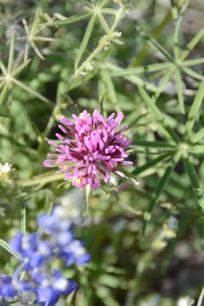
Scorpion WeedStinknet or Globe Chamomile Rock GiliaBrittlebush, the little sunflowers of the Arizona desertDesert Star DaisyCoulter’s LupineCreosote Bush
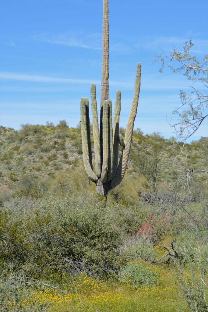
The views of cacti and distant mountains were beautiful, but by now we were starting to get hot and thirsty.
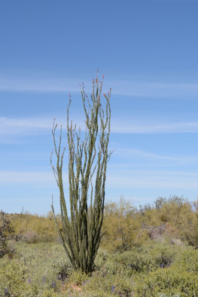
Saguaro cactus and Ocotillo CactusOcotillo Cactus in bloom
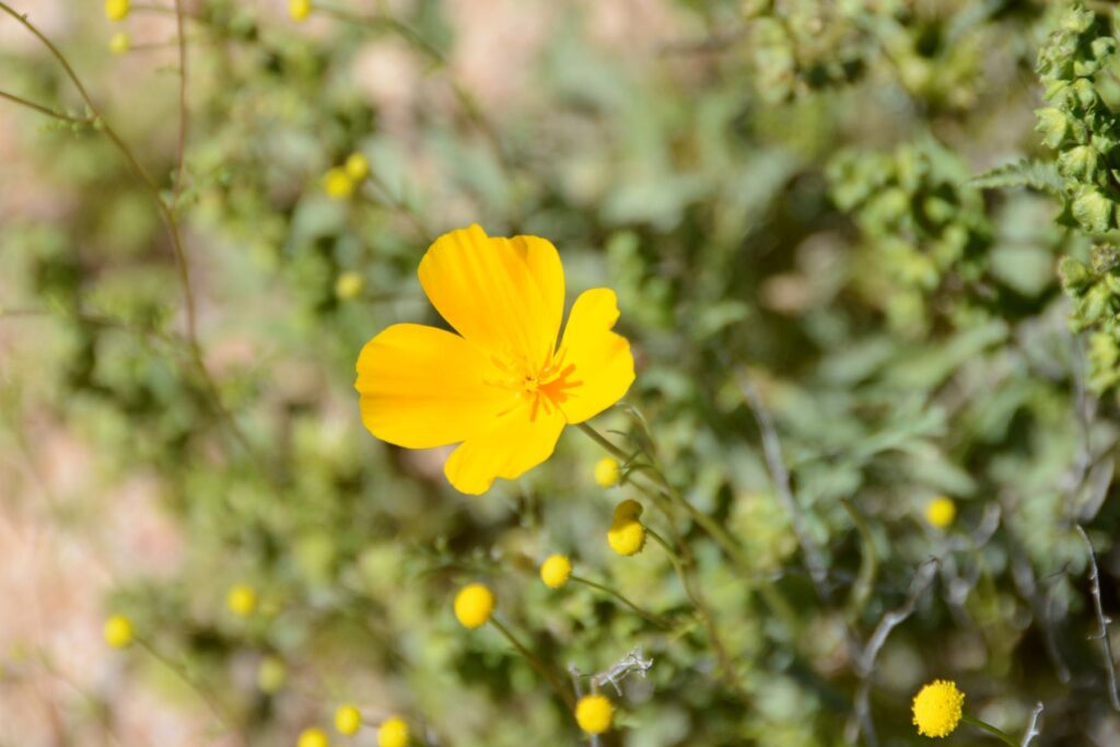
We finally saw some yellow flowers, but they were not poppies. Could the people we met on the trail possibly have mistaken these yellow flowers for poppies? It seemed unlikely. But we’d already gone past the one mile marker. The path started to get steeper.
Saguaro Cactus
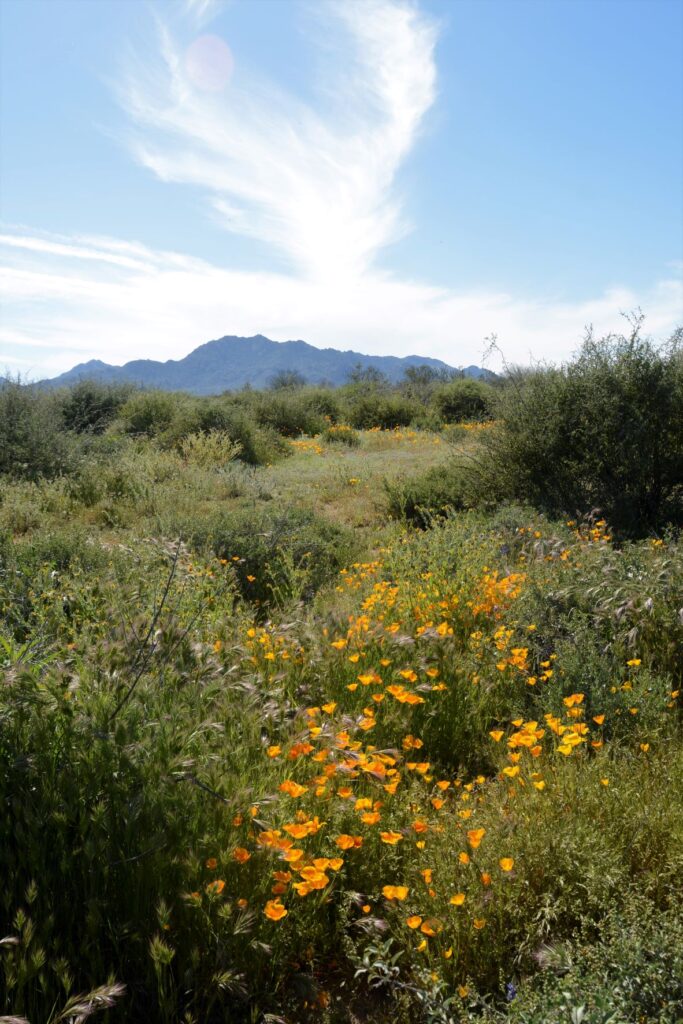
After walking more than a mile, we finally found a few poppies, but no fields of them. By now we were wishing that we’d worn a hat and had brought along some water. We decided it was time to turn back.
Golden Poppy
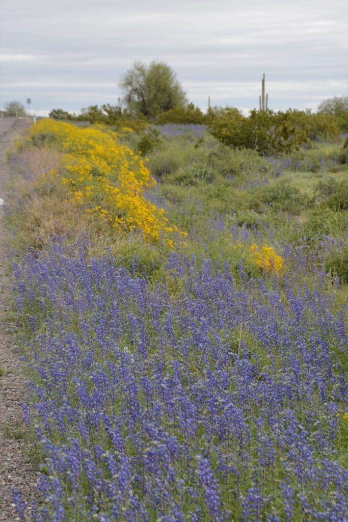
Not being satisfied with the amount of wildflowers we had seen on our walk, I was hoping to get more photos on our drive out of the park. I was not disappointed.
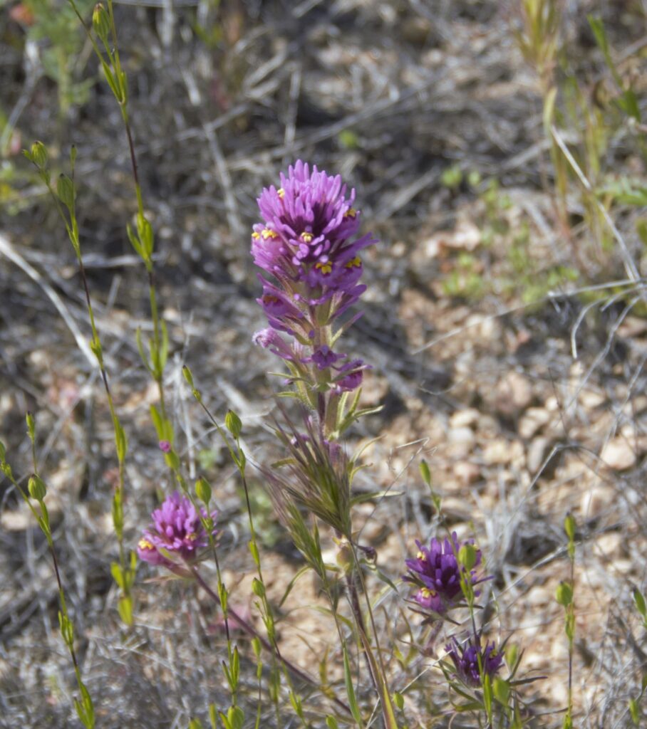
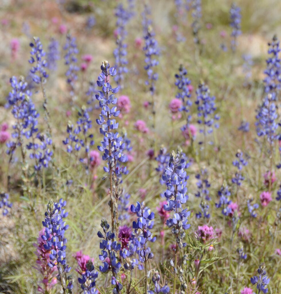
Purple Owl’s Clover and LupinePurple Owl’s Clover and LupineLupine
We stopped along the road in several places.
Purple Owl’s CloverPurple Owl’s Clover and Lupine
Finally, Ray spotted some poppies. I got out to get a better look and get some photos.
Golden PoppiesGolden Poppies
Knowing how quickly flowers can bloom and fade, I do not blame the Ranger for sending us off on a wild goose chase. If we had taken the correct pathway, we might have seen the fields of poppies described by the people we met on the trail. But it was not a total loss. We saw more flowers on our way out of the park than we saw on our hike.
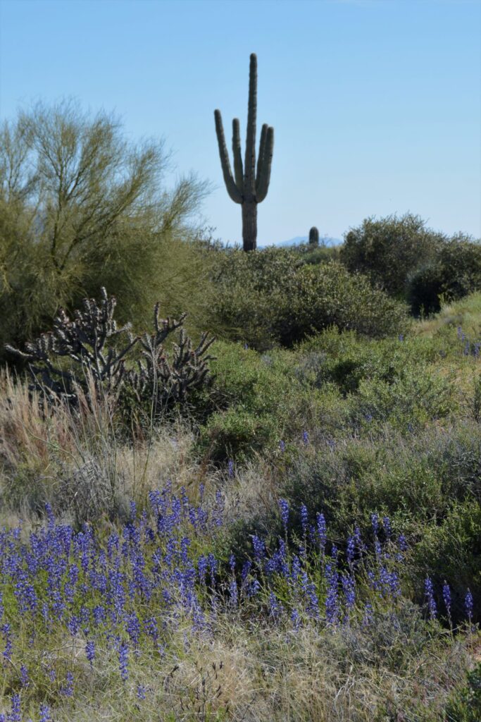
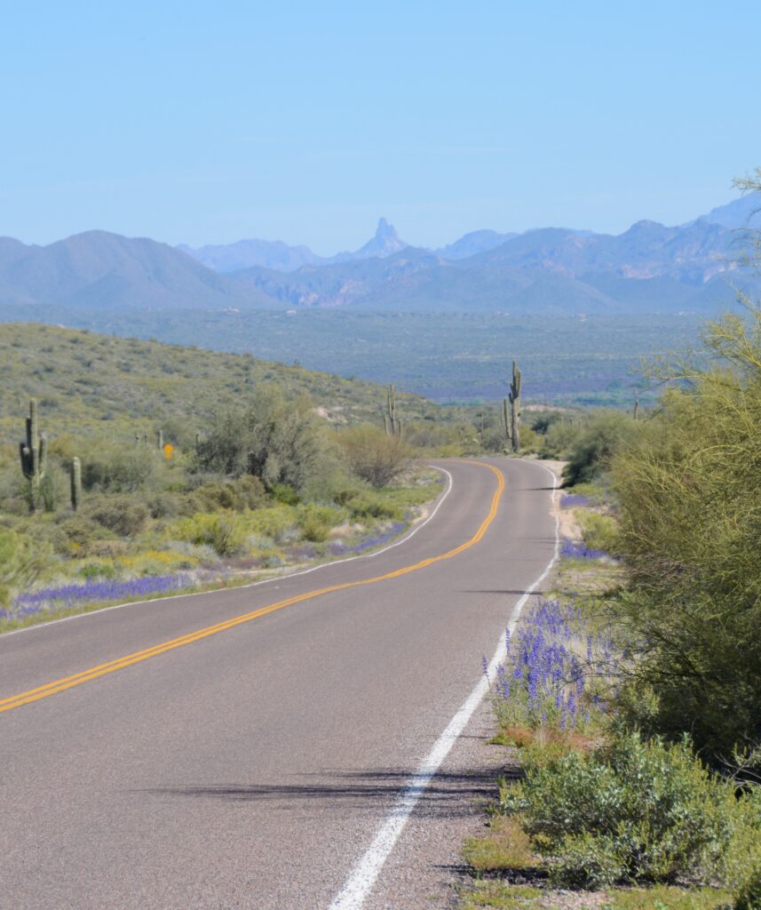
The flowers lined the road as we headed home. In the distance was Weaver’s Needle in the Superstition Mountains. It had been a successful day of wildflower hunting and photography.
“And if God cares so wonderfully for flowers that are here today and gone tomorrow, won’t he more surely care for you, O men of little faith?” Matthew 6:30
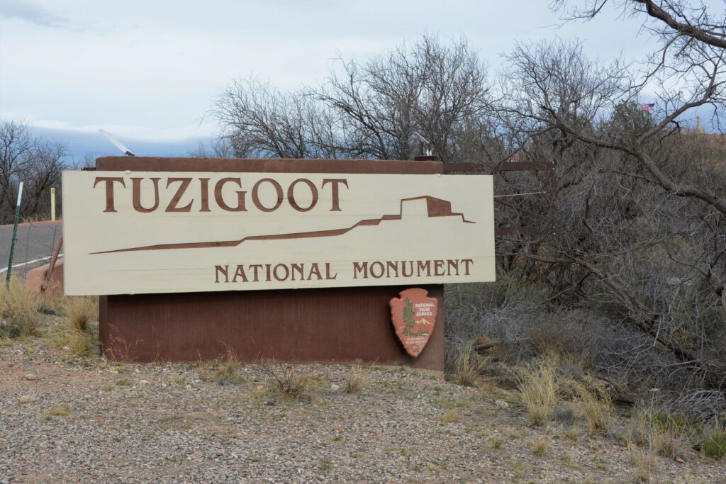
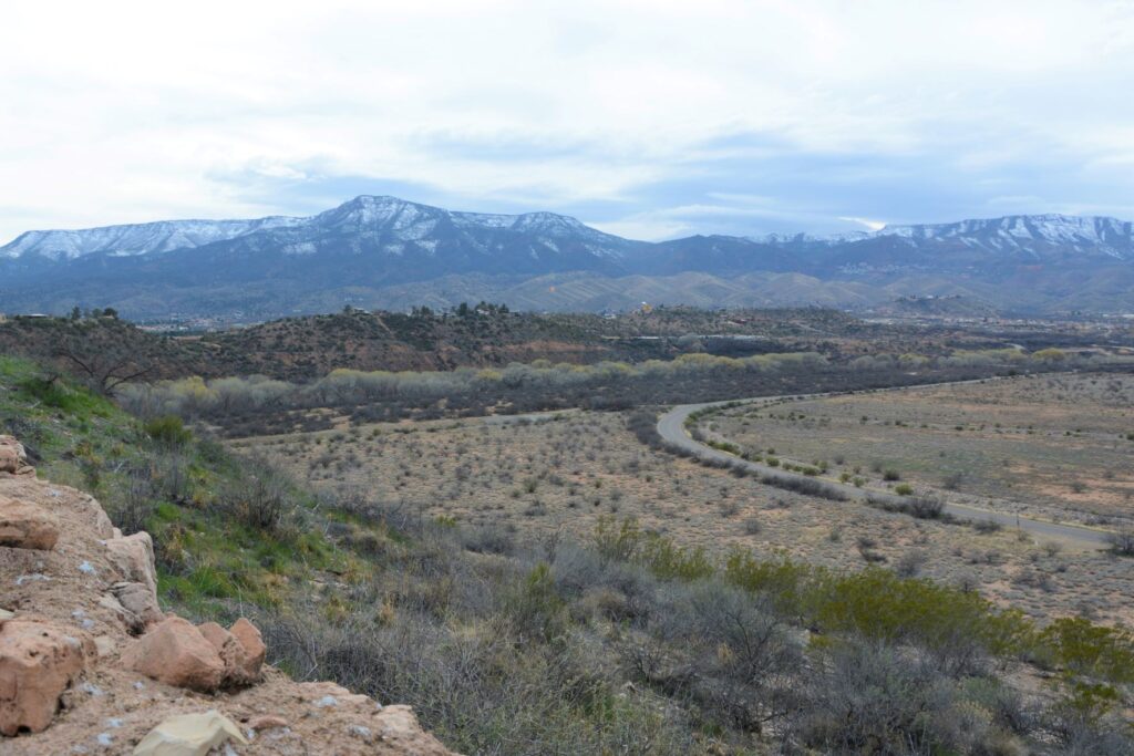
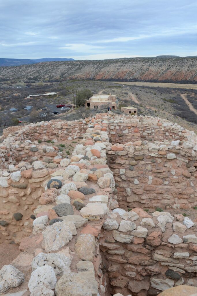
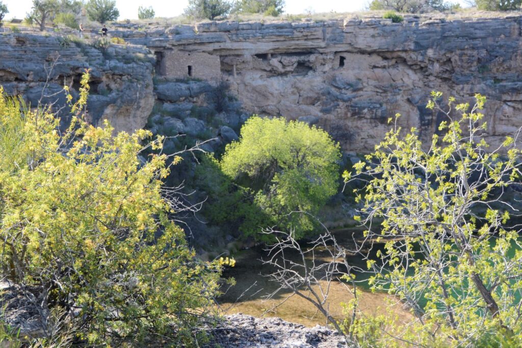
When I lived in Arizona, one of my favorite places to see while traveling north along Highway 17 was Verde Valley. The highway crests a hill and suddenly the view of a lush green valley opens up. As the highway descends into the valley, the green fields and bright green of the cottonwood trees are a stark contrast to the dry surrounding desert. Vermillian cliffs surround the valley while snow-capped mountains peak over the rim. It is a stunning view.
View from the top of Tuzigoot NM. Cottonwood trees line the Verde River. The ghost town of Jerome sits on the side of the distant mountains.
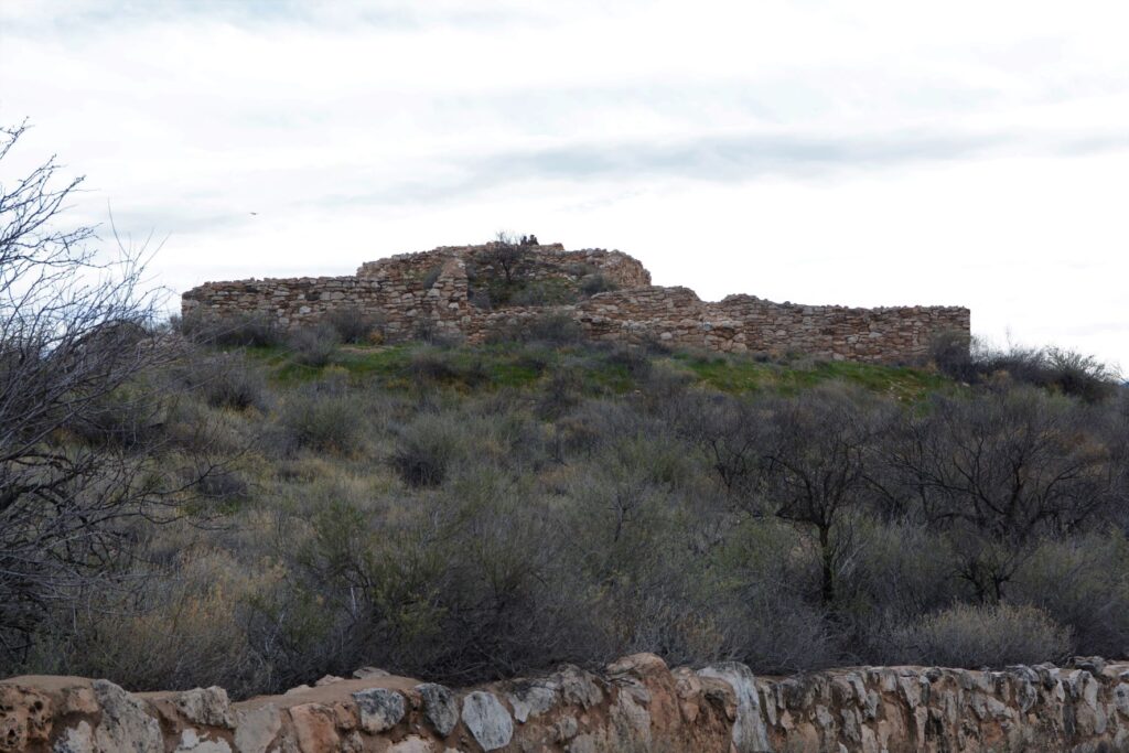
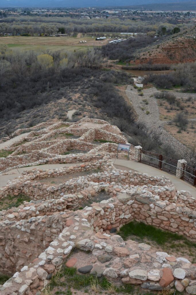
The Indians who came here 1400 years ago traveled along the Verde River valley. Like people of today, they liked to settle near water or on hilltops. One such group, the Sinagua, settled on a hill overlooking the Verde River. They were close enough to the river for water, but high enough to avoid the floodwaters when the river overflowed its banks.
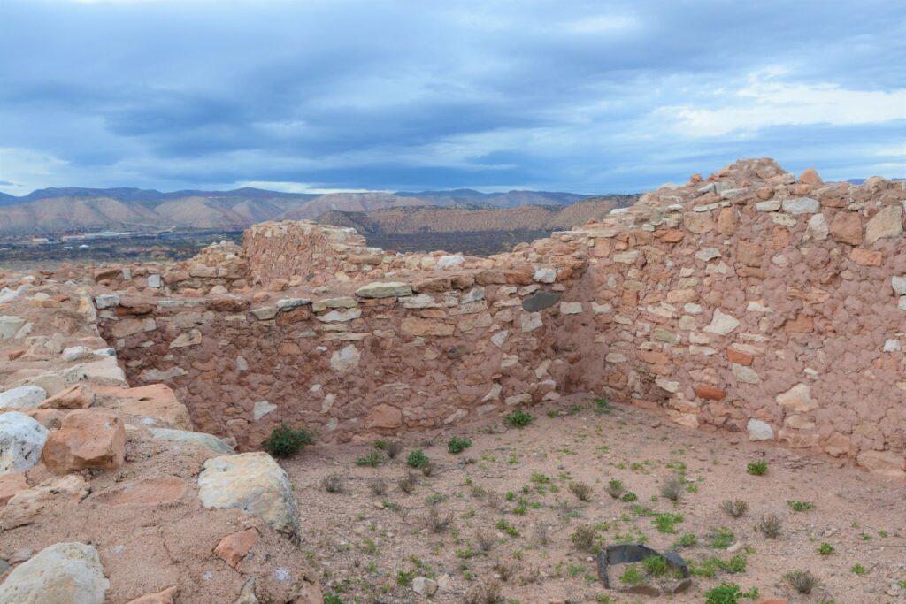
Tuzigoot ruins sit on a hilltop
We don’t know much about these people. Their multi-room settlement was similar in construction to many other pueblos found in New Mexico, Colorado and southern Arizona which means they traveled frequently to each others’ settlements. The relics found, as well as the construction of their dwellings, show evidence of this.
View from the ruins looking down toward the Verde River
The Sinagua people eventually moved north and the walls crumbled and became buried and forgotten until the 1880s when two men from Smithsonian Institute began excavating the site. They gave the name “Tuzigoot” to this site. Tuzigoot is a corrupted form of the Tonto Apache name Tú Digiz, the name for this stretch of the Verde River. It is translated “Crooked Water.”
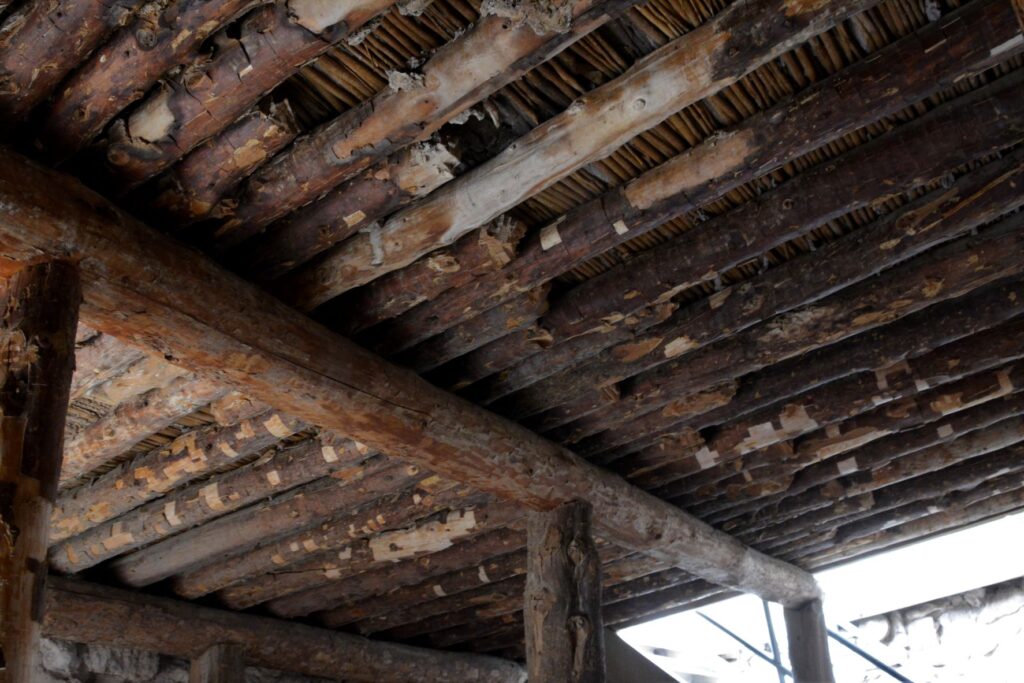
Typical wall construction was of adobe and stone.Roof construction was of logs from trees growing by the nearby Verde River.To preserved the structure, mortar is regularly replaced with a mixture similar to the original.
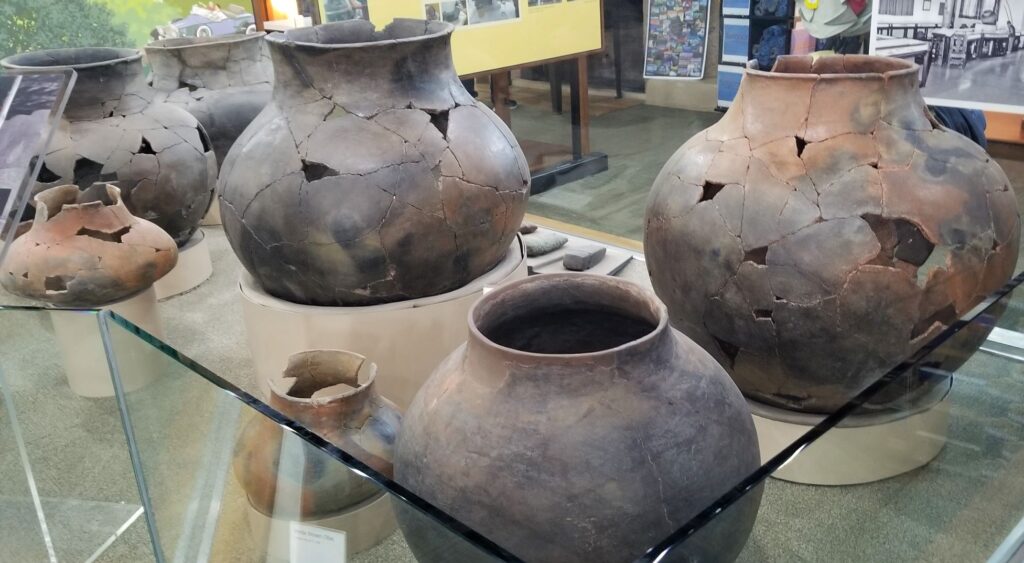
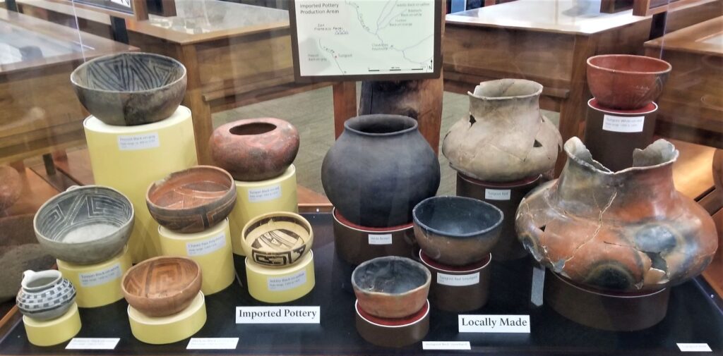
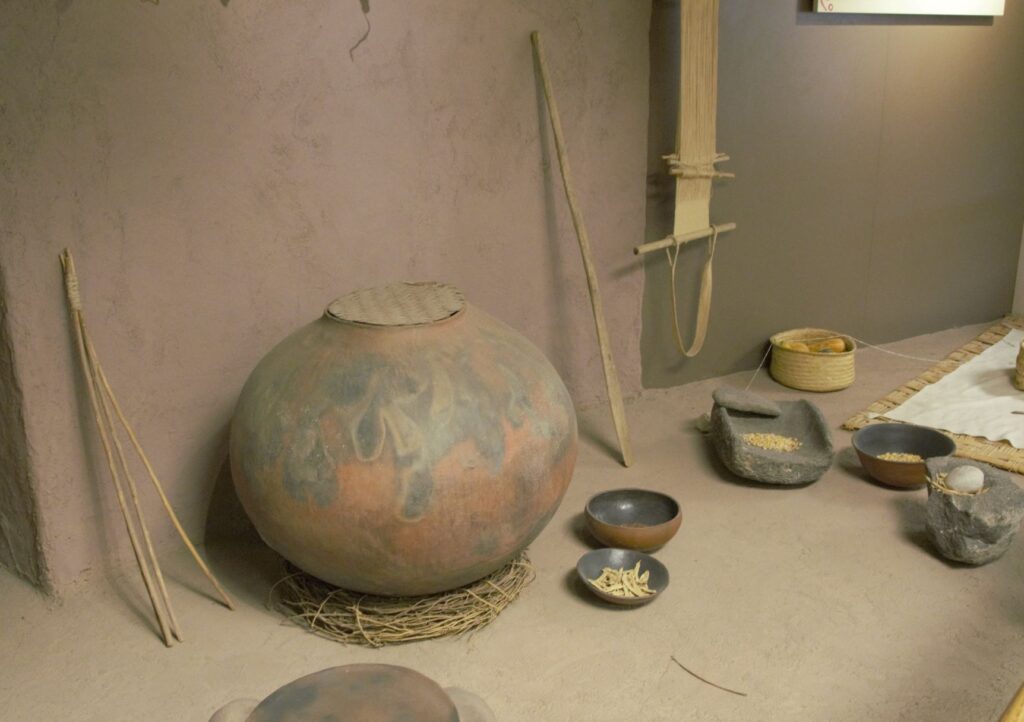
Since taking a pottery class many years ago, I have always been interested in pottery from historical sites. These pots were probably made by coil rope construction, smoothed, glazed and fired in a pit in the ground. What amazed me about these pots was their size!
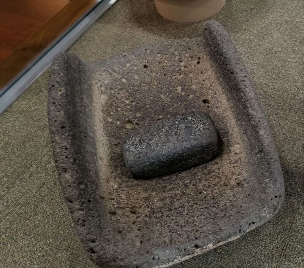
Large pots probably for water storage.Pottery imported from neighboring areas show that the desert people traveled and traded with one another.Grinding stone for grinding corn into flour.Wildlife is plentiful along the Verde River.
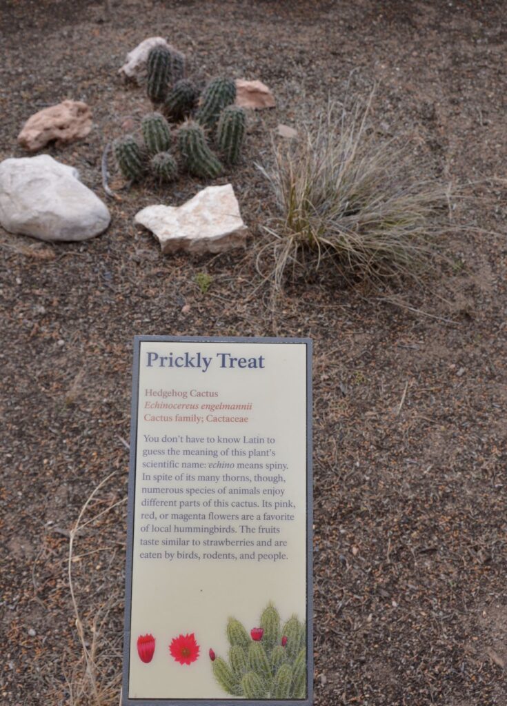
Along the walkway several indigenous plants were labeled. Isn’t this Hedgehog Cactus cute?
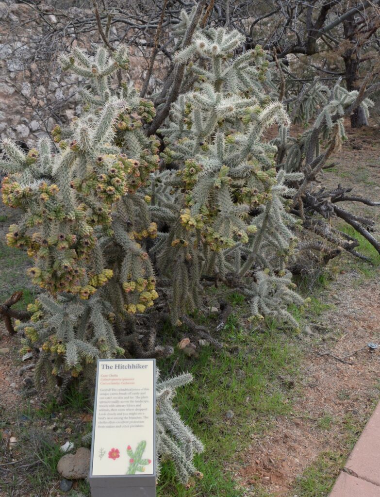
Cane Cholla Cactus is easily caught on clothing and shoes while walking by.
Today visitors can enjoy walking through the rooms of this ancient Indian village, see the displays of artifacts that were discovered here, and enjoy the beautiful views from atop the historical mound.
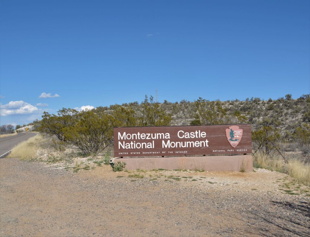
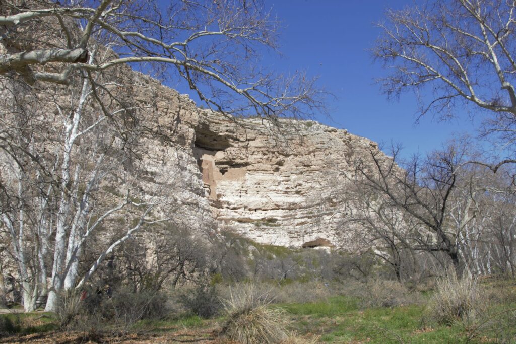
Montezuma’s Castle National Monument
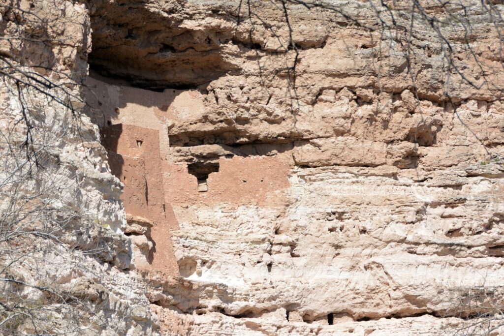
Less than 25 miles away is another ancient ruin known as Montezuma’s Castle National Monument which was also occupied by Sinagua people. It was misnamed by early discoverers of the site who thought that it was built by the Aztec Indians of Mexico.
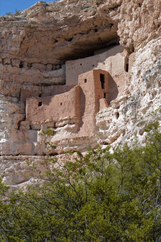
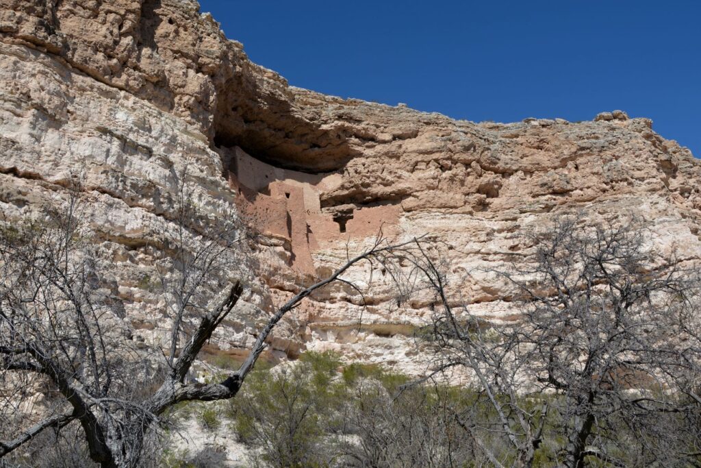
Montezuma’s Castle cliff dwellings
This pueblo cliff dwelling is an impressive five-story 20 room dwelling accessed by ladders during the time it was in use. It was south-facing, so it got the warmth of the winter sun. In summer, it was cool because of the shade from the cliffs.
Nearby, Beaver Creek kept the cliff dwellers supplied with water for living and gardening. The Indians grew crops of corn, beans and squash which were known as the Three Sisters because of how the plants worked together to sustain each other.
The beans climbed the corn stalks to reach sunlight, while supporting the corn from the winds, while the squash was a ground cover that kept the soil moist and discouraged the weeds. The beans, a legume, also enriched the soil. Do you grow these plants in your garden?
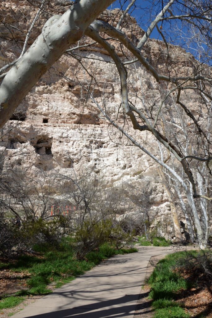
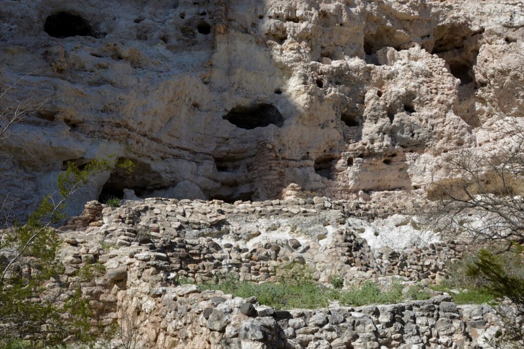
The pathway to the ruins is a short pleasant walk from the Visitors’ Center.One can see the similarities between these rock walls and the ones at Tuzigoot.
The day we visited, Beaver Creek was a rushing torrent from recent rains. The pathway to the creek was cordoned off to visitors. The Ranger told us that in a previous year, the creek had overflowed and the water came up to the bottom of the cliff. Maybe this is why the Indians built their pueblos way above the water.
Looking toward Beaver Creek, this area was where they grew their crops.
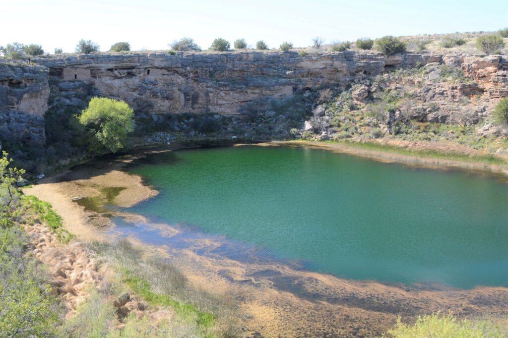
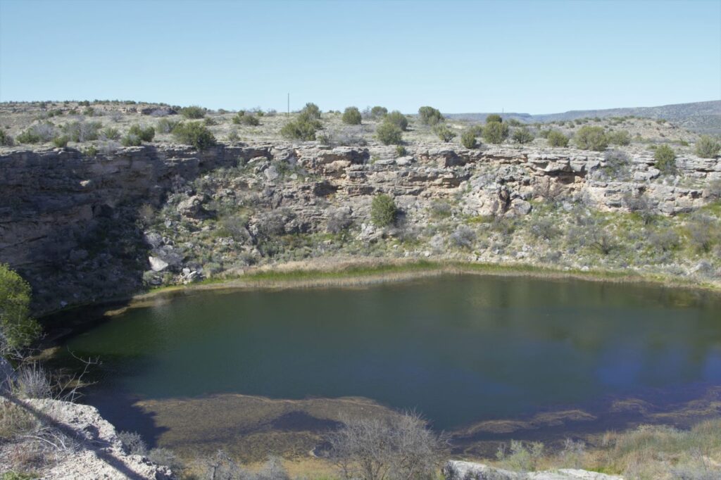
Montezuma’s Well
About 10 miles north of Montezuma’s Castle is Montezuma’s Well. Instead of taking us on paved roads, our GPS took us the long way. I couldn’t believe such a popular national monument would be accessed by a three mile dirt road. It dawned on us that there was a better way when we reached the entrance to the Monument. There was the paved road we were looking for. On our return route we followed the paved road back to Rimrock from which we were able to access Interstate 17.
Montezuma’s Well and cliff dwellings
There is a short climb up to the rim overlooking Montezuma’s Well. The well is an ancient sinkhole that is fed by an underground spring of over 1.5 million gallons of water each day. The spring waters are from rain and snow that fall on the nearby Mogollon Rim which then seeps through the rock until it reaches the spring. Pressure pushes the water up to the surface. It is said that the water takes as long as 10,000 years to travel from the Rim to the Well.
The well is deep. Millions of gallons of water flow into and out of the well.
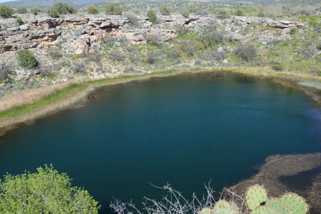
The water exits the well through underground streams and a cave system which drains into an ancient irrigation canal. The water level remains constant, as well as the temperature of the water which averages 70 degrees F. However, because the water has a high alkalinity and an excessive amount of dissolved carbon dioxide–more than 100 times higher than normal–fish cannot survive.
Fish can’t live in the water, but thousands of leeches live here.
The depth of the well is unknown because of the pressure of the water. Divers have discovered a “false bottom” at around 60 feet of pressurized groundwater that holds a column of fluidized sand in suspension. The fluidized sand rises from two deep vents in the floor of the well. One is 124 feet deep and the other is 74 feet deep. But previous measurements measured 137′ and 95′. So, we can just say, it’s deep.
Pueblo dwellings in the rocks above Montezuma’s Well
The people who built homes near Montezuma’s Well were the Hohokam and later the Sinagua.
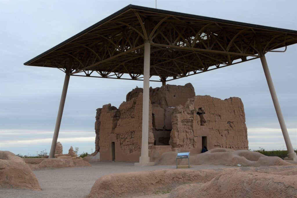
Casa Grande Ruins National Monument
Leaving the Verde Valley area, we traveled south to Mesa, Arizona. One afternoon we drove south, halfway to Tucson to Casa Grande Ruins National Monument. This “Grand House” was probably built in the 1300’s, which is the time period of the founding of the Byzantine Empire, the 100 years war, and the black death or bubonic plague in Europe. These desert people had already been using irrigation methods for hundreds of years to grow their crops.
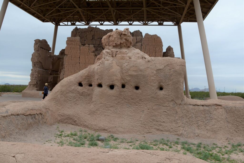
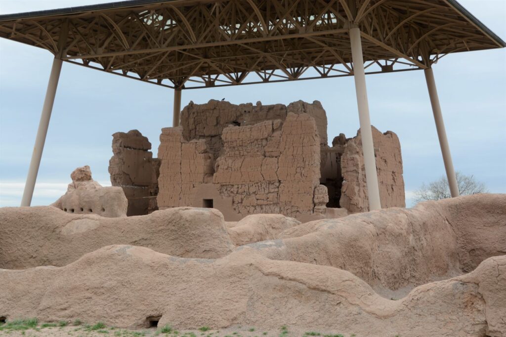
A metal structure over the ruins keeps it from deteriorating.
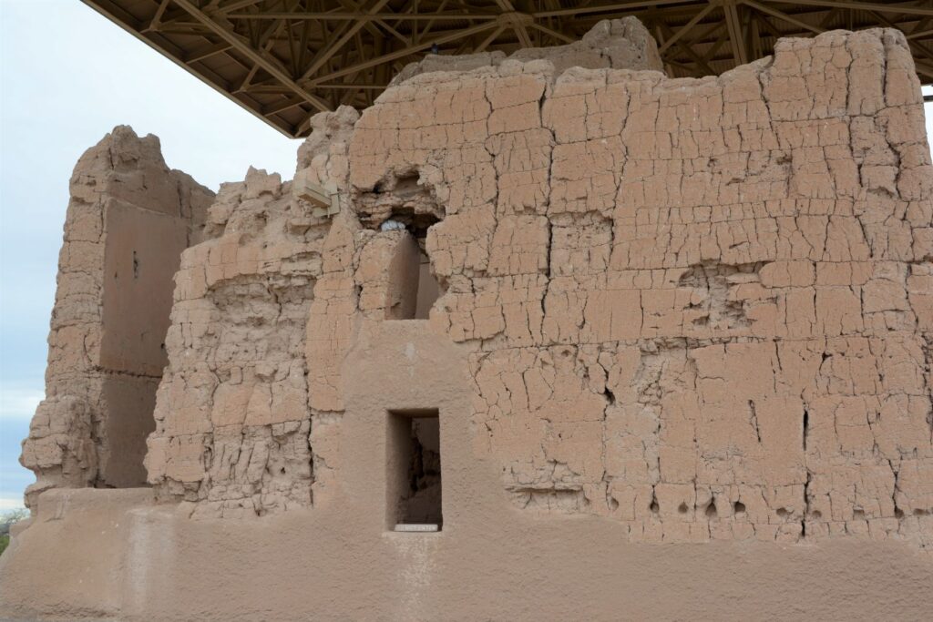
Archeologists are not sure of the purpose of this grand structure. However, because of the construction they believe it was well planned and organized. The builders used caliche, a natural concrete-like material found under the soil around this region. They used it to build houses with solid walls and flat roofs covered with this caliche substance.
Walls were made from caliche, a concrete-like material found in the ground.
These desert people were given the name “Hohokam.” It is not really the name of a tribe or people. The name may have come from “huhugam,” an O’Odham word that means ancestors. Today these people are referred to as Sonoran Desert people. By the way, Hohokam is the name of the grade school I attended. Our elementary schools were named after Indian tribes.
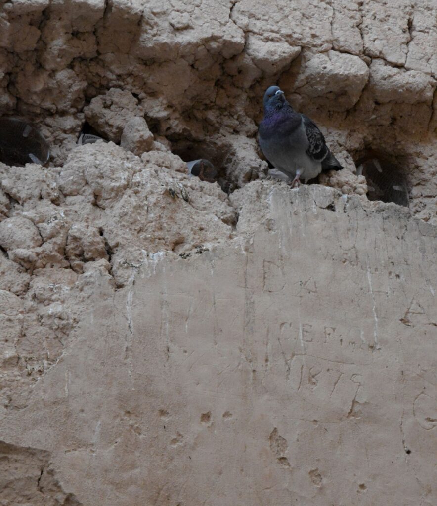
A pigeon makes its home among the walls of the ruins. Note the etched name and date below it.
When I took the photo above, I didn’t notice the name and date etched on the wall. It is a good thing that people like Mary Hemenway and President Benjamin Harrison took steps to preserve the ruins for future generations from vandalism and looting. Mary Hemenway was a wealthy woman who sponsored archaeological expeditions. One expedition to Casa Grande Ruins alerted her to the vandalism. She made efforts to preserve the site and as a result, it became the first federal prehistoric and cultural reservation by President Harrison in 1892.
One of the purposes of this structure might have been a calendar. Some of the holes line up directly with the sun on the summer and winter solstices.
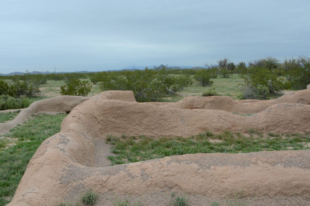
In later years, the village homes were grouped into caliche-walled compounds which were arranged around public plazas and public structures. The Grand House or Casa Grande was at the center of this settlement.
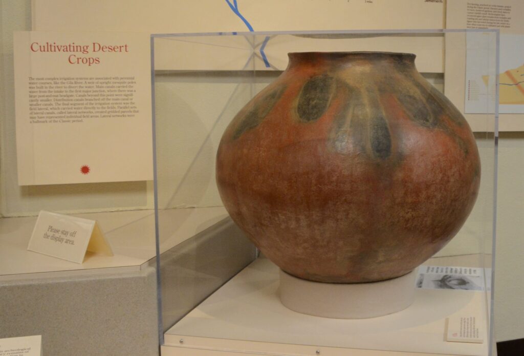
These desert people were identified by their type of pottery called “red-on-buff.” This beautiful piece of pottery below is an example of the techniques used in creating their pottery. In my opinion, the dark portions on this pot look to me like leaves of some plant that they tied around the neck of the pot while being fired which left these unusual designs.
This pot below looks similar in design to the one above with the plant-like designs.
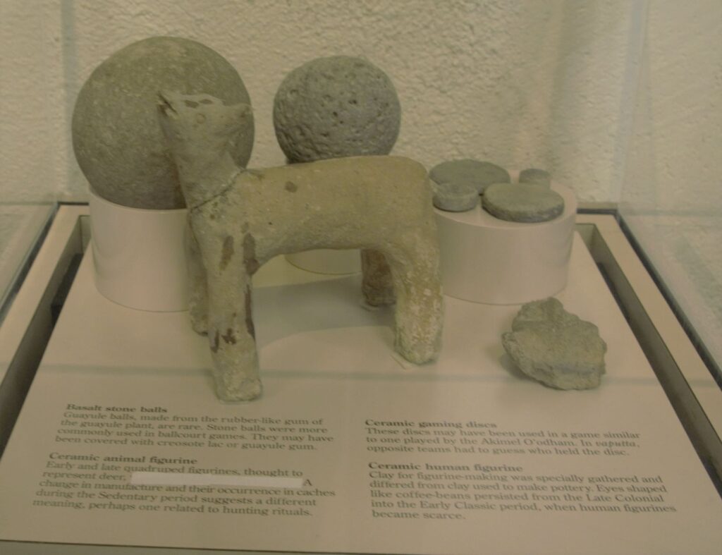
These desert people also enjoyed games. There are over 200 oval-shaped, structures with earthen sides located in large Hohokam villages in southern and central Arizona. Archaeologists have speculated that some kind of game was played within these courts with two teams using a hard rubber or stone ball. Round discs were found that might also have been used in other games.
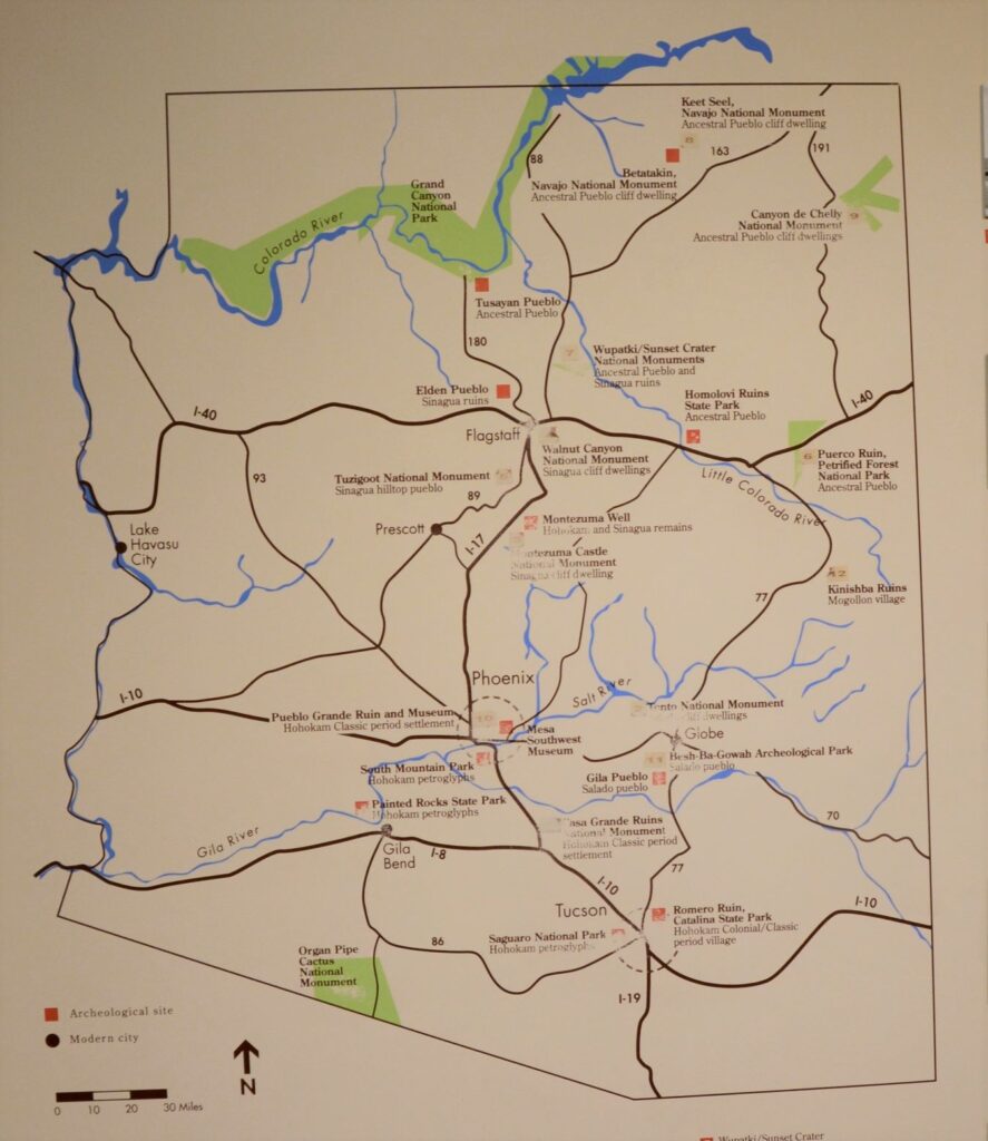
The map below shows many places around Arizona where the Sonoran desert people lived and moved. Eventually, they all left for unknown reasons. It may have been drought, floods, disease, invasion, earthquakes, internal strife or salinization of farmland. We don’t know. Yet we can still appreciate the structures, relics and places they left behind and marvel at their ingenuity.
I am glad we took time to see these places, having never visited any except Montezuma’s Castle when I was growing up. I don’t think I appreciated the contributions these people made to Arizona history. It’s a shame that Hohokam school didn’t teach us anything about the people that our school was named after. I think it would have made a big impression on me to have learned about them and to have visited Casa Grande National Monument.
But the moral of the story is, explore your own backyard. You never know what you might be missing!
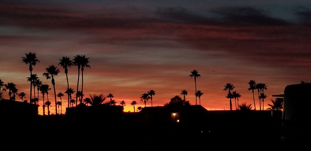
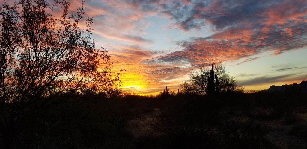
Our weeks in Tucson and Benson, Arizona, gave us a chance to explore southern Arizona. Arizona skies seem to have the perfect conditions for amazing sunsets. We enjoyed this beautiful sunset one evening on our walk around the RV park.
Sunset in Tucson, Arizona
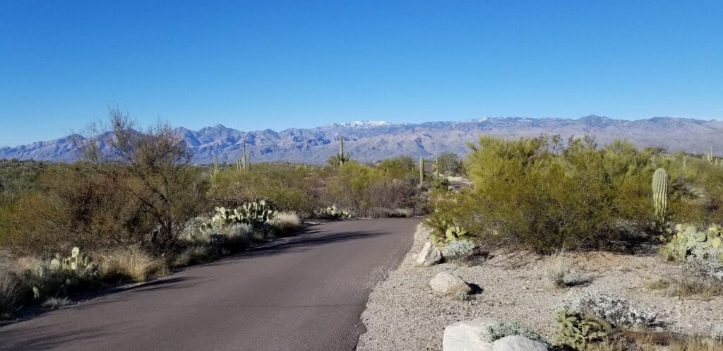
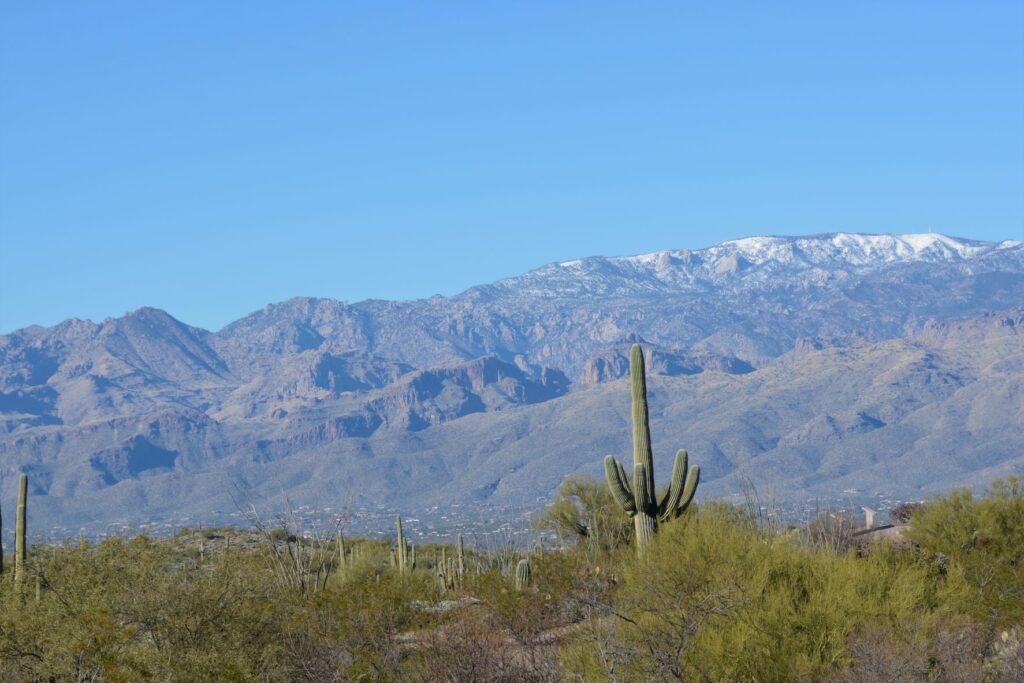
Since we were so near Saguaro National Park, I made a quick trip there one afternoon to get my National Park Passport Book stamped. While there, I couldn’t resist a quick trip on the 8-mile drive through the park. The photos of cactus with the snowy mountains in the background were worth it.
Saguaro National ParkSaguaro National Park
Green Valley
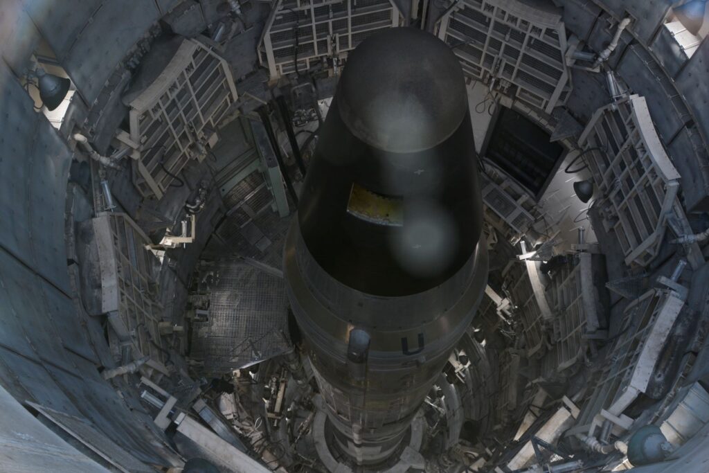
One afternoon we took a tour of the Titan II Missile Museum in Green Valley, Arizona, which is just a few miles from Tucson. The missile is not operational, but it was a sobering reminder of the former cold war and threat we faced of nuclear war.
View looking down into the silo of the Titan II Missile
Tombstone
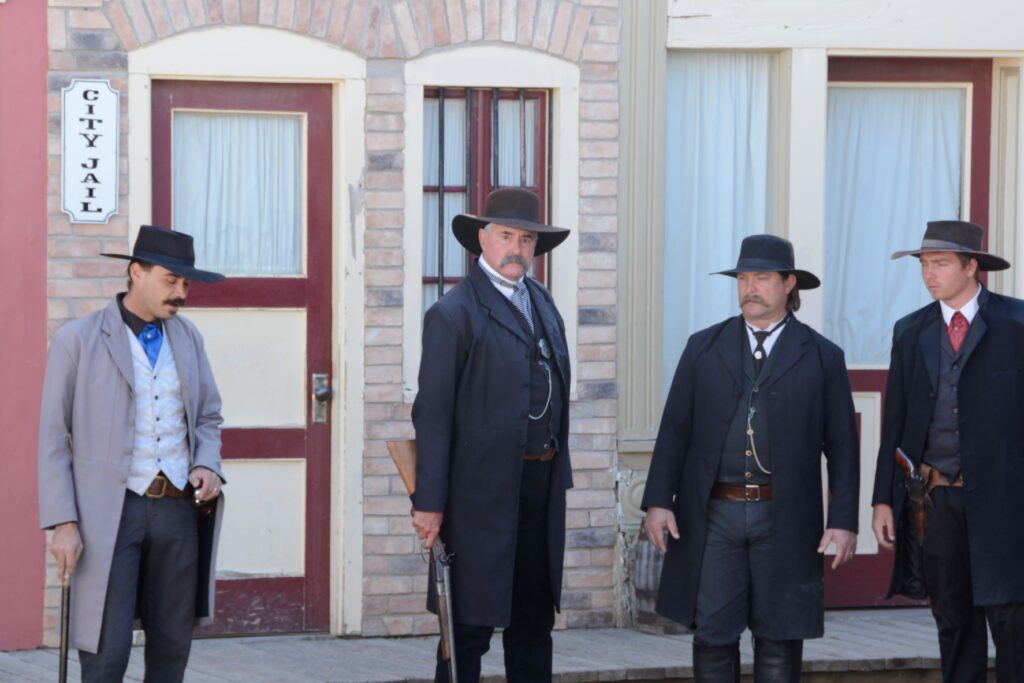
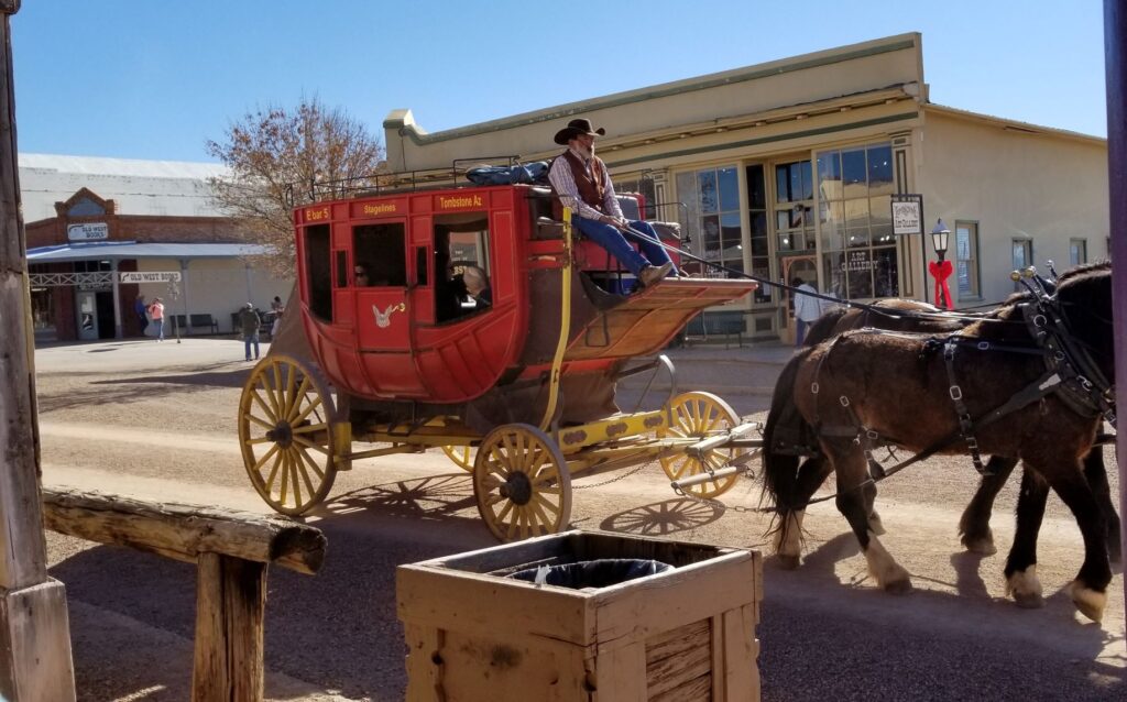
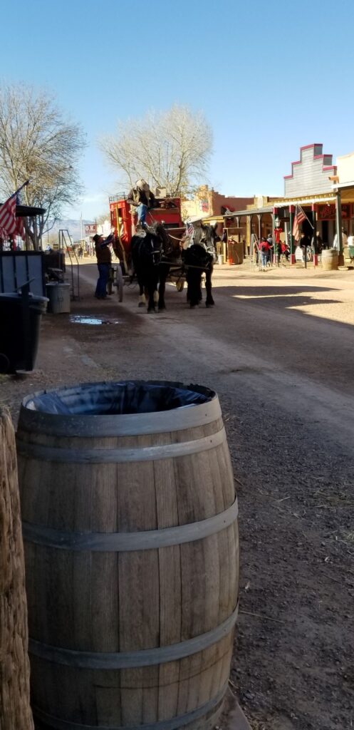
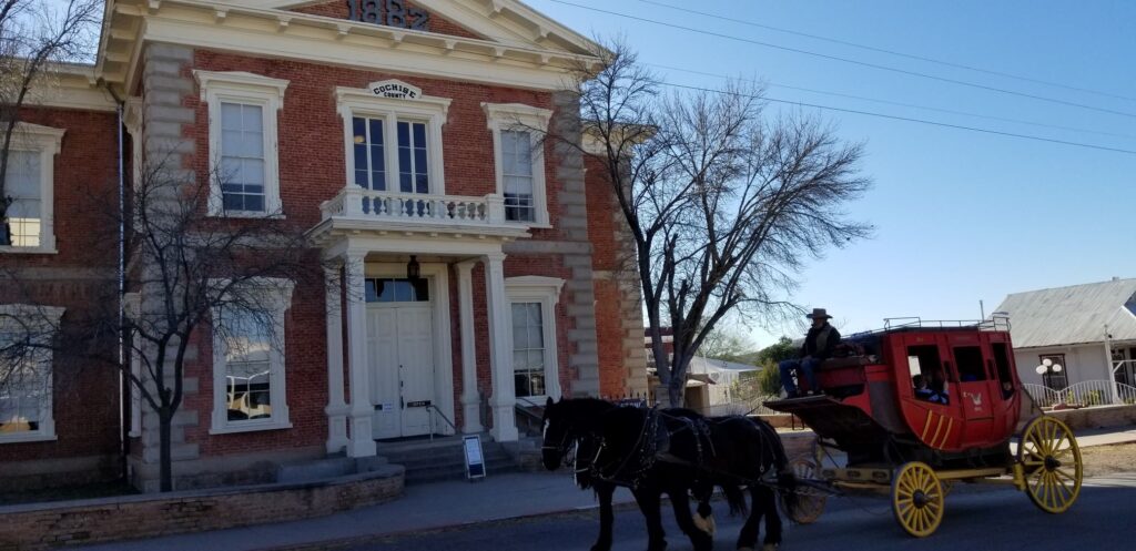
Another popular southern Arizona town is the historic town of Tombstone. One day we packed a lunch and spent the day touring the town. While there, we witnessed a re-enactment of the shootout at the OK Corral. Afterwards we strolled along the streets visiting the Epitaph Press, the Bird Cage Theater, the Arizona Ranger Museum and a presentation of the history of Tombstone.
Actors of Doc Holiday and the Earp Brothers re-enact the shootout at the OK CorralStagecoach ride in TombstoneMain Street in TombstoneHistoric Courthouse at Tombstone, AZ
Benson
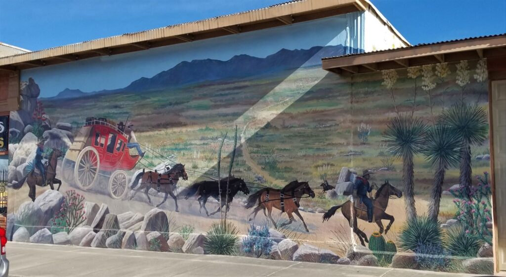
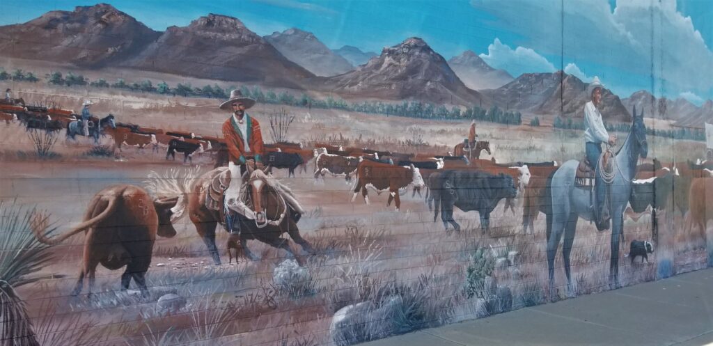
We spent one week in Benson, Arizona, just a few miles south of Tucson. Benson is an interesting town because of the murals painted on the buildings and walls around the town. It has a western small town feel to it and reminded me of our former hometown of Mariposa, California.
Mural in Benson, ArizonaAnother mural in Benson, Arizona
Chiricahua National Monument
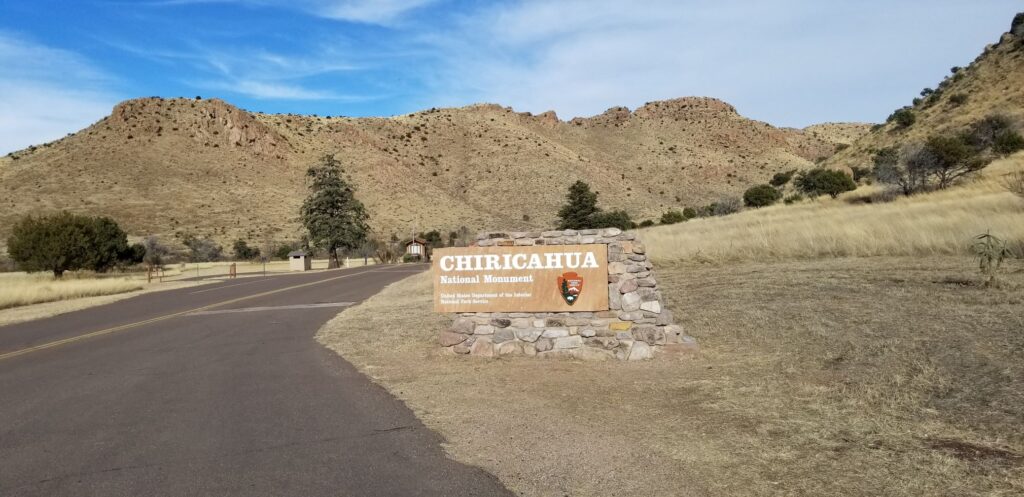
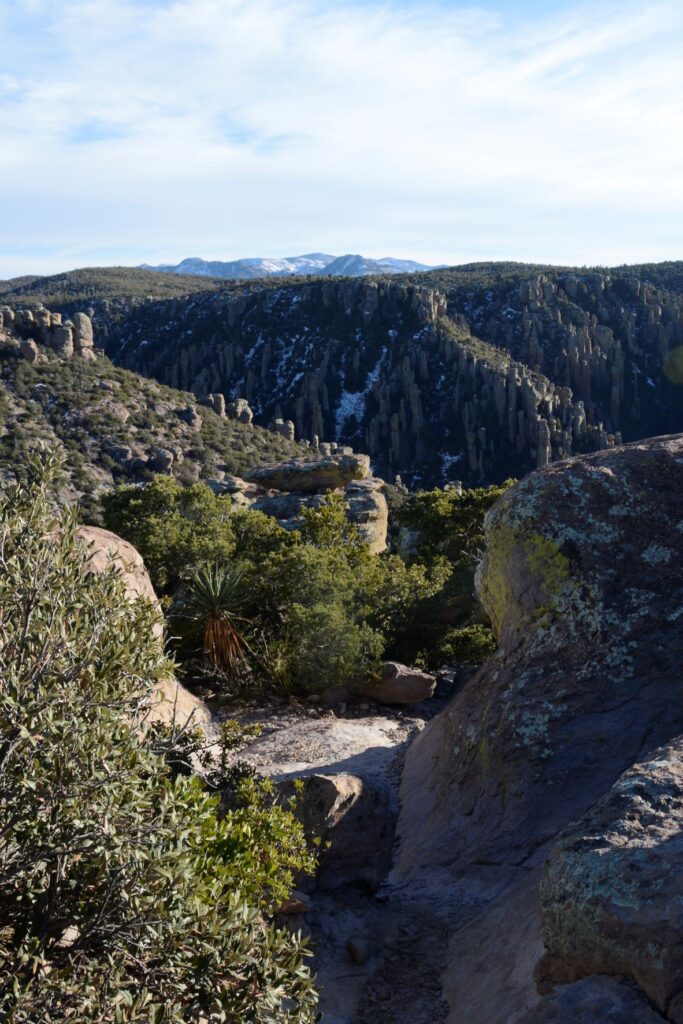
About an hour drive from the town of Benson is Chiricahua National Monument in the southeast corner of the state. National Monuments may not be as popular as National Parks, but they can be surprisingly beautiful and interesting. It seems there isn’t a substantial difference between the two except that National Parks require an act of Congress to establish and National Monuments do not. Arizona has 18 National Monuments, more than any other state.
Entrance to Chiricahua National Monument
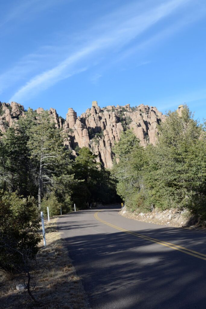
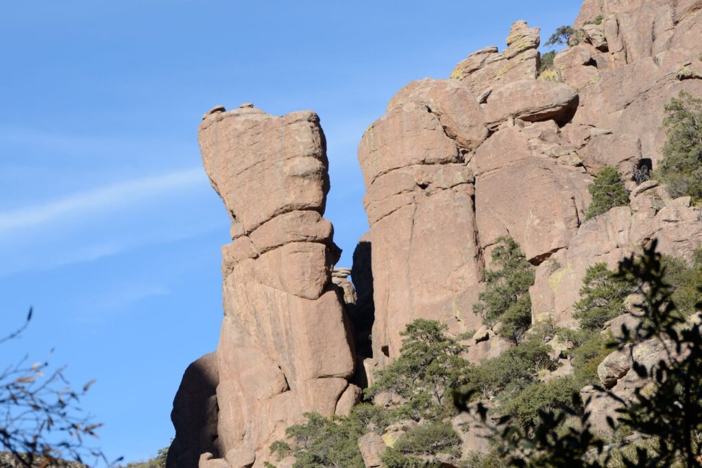
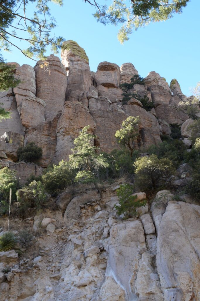
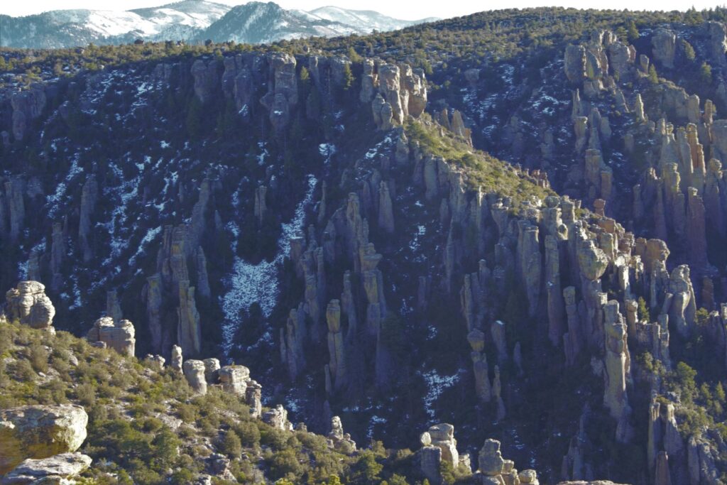
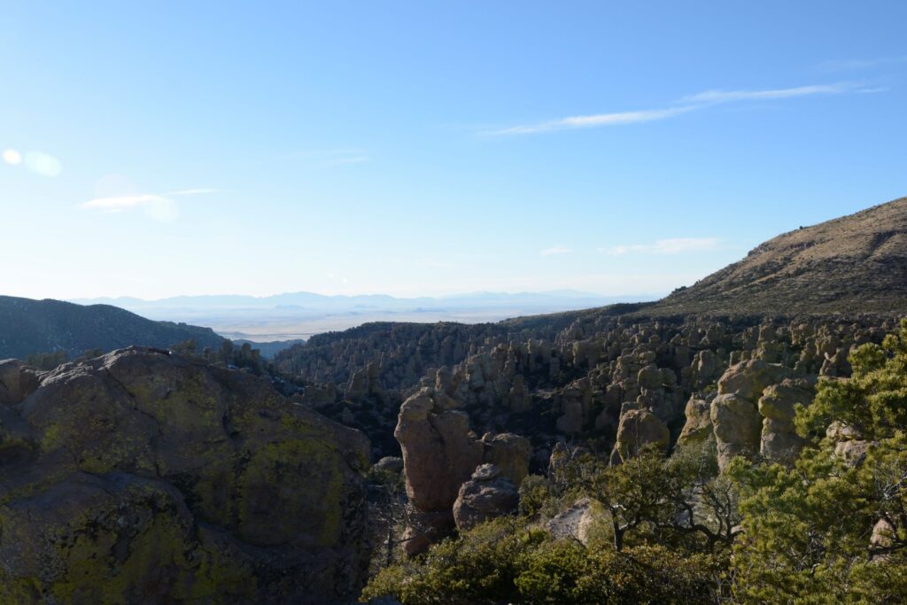
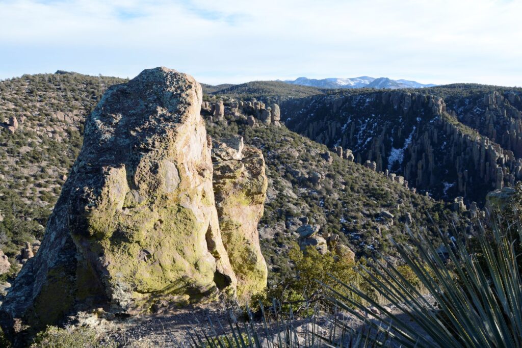
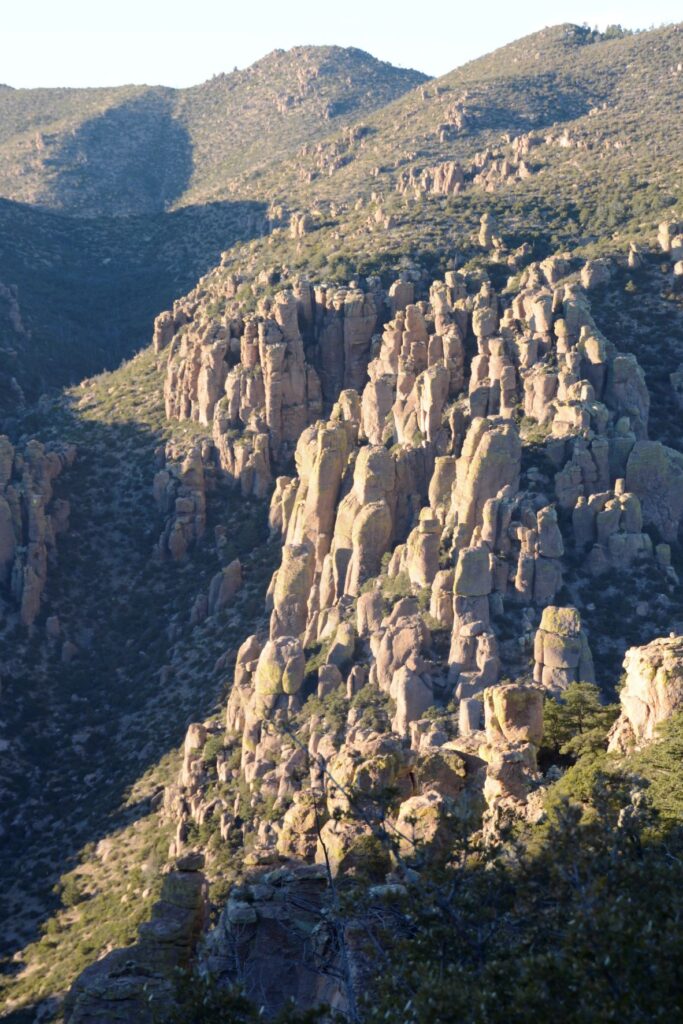
The eight-mile scenic drive starts by winding along the bottom of a canyon surrounded by rhyolite rock pinnacles or hoodoos for which the monument was created to protect. As the road climbs steadily, the views change until you’re overlooking the rock formations from the top of Massai Point at an elevation of 6,870 feet.
Hoodoo rock formations near entranceRhyolite rock pinnacles overlooking scenic drive.
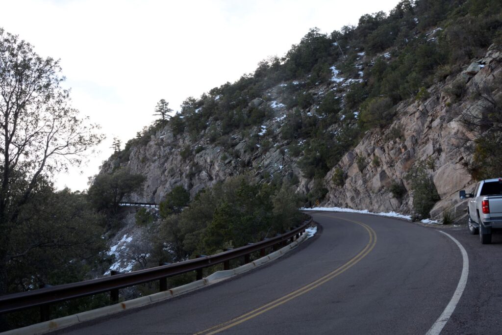
As the road climbed in elevation, we encountered some snow, and could see more mountain ranges in the distance.
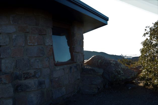
At the end of the road is Massai Point where there is a parking lot and a path leading to a stone building. It was a windy day so we were glad to go inside to get out of the wind. Inside we read about the nature and history of the park.
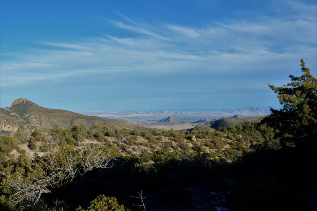
View from Massai Point
At the summit, we could now look down on the many rock pinnacles.
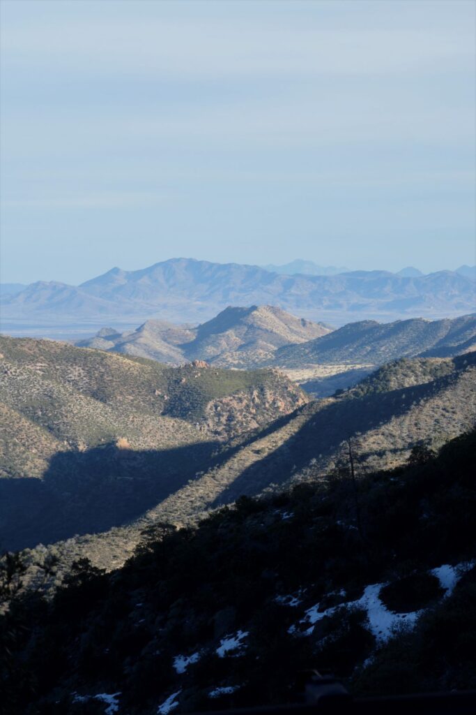
At Massai Point, we could see miles of the surrounding area with distant mountain ranges, including the Dragoon Mountains and Cochise Stronghold.
In the distance are the Dragoon Mountains and Cochise Stronghold
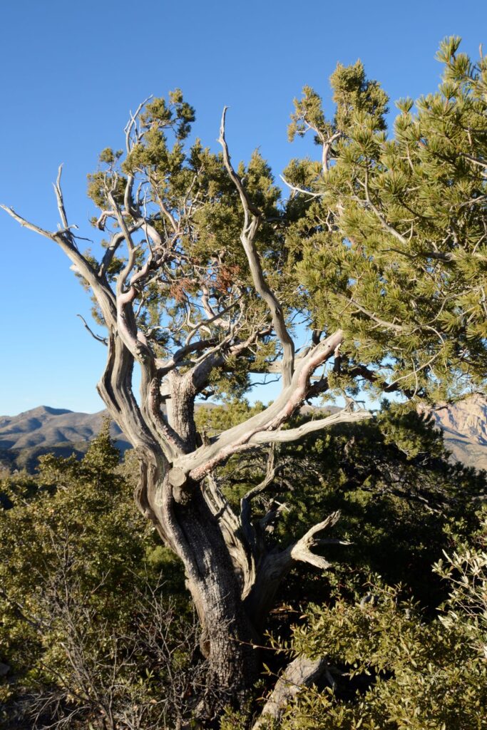
The trees at the higher elevations must be hardy to withstand the harsh climate.
Weathered pine at Massai Point
Chiricahua National Monument is considered a “sky island” because it is comprised of an isolated mountain range that rises up out of the surrounding desert which is like a sea. Because it rises about 6,000 feet above the surrounding valley, it provides a wide range of ecosystems and plant and animal diversity.
Chiricahua NM is one of many “sky islands” in the southeastern desert of ArizonaRhyolitic tuff rock formations were caused by volcanic activity where ash cooled and hardened.
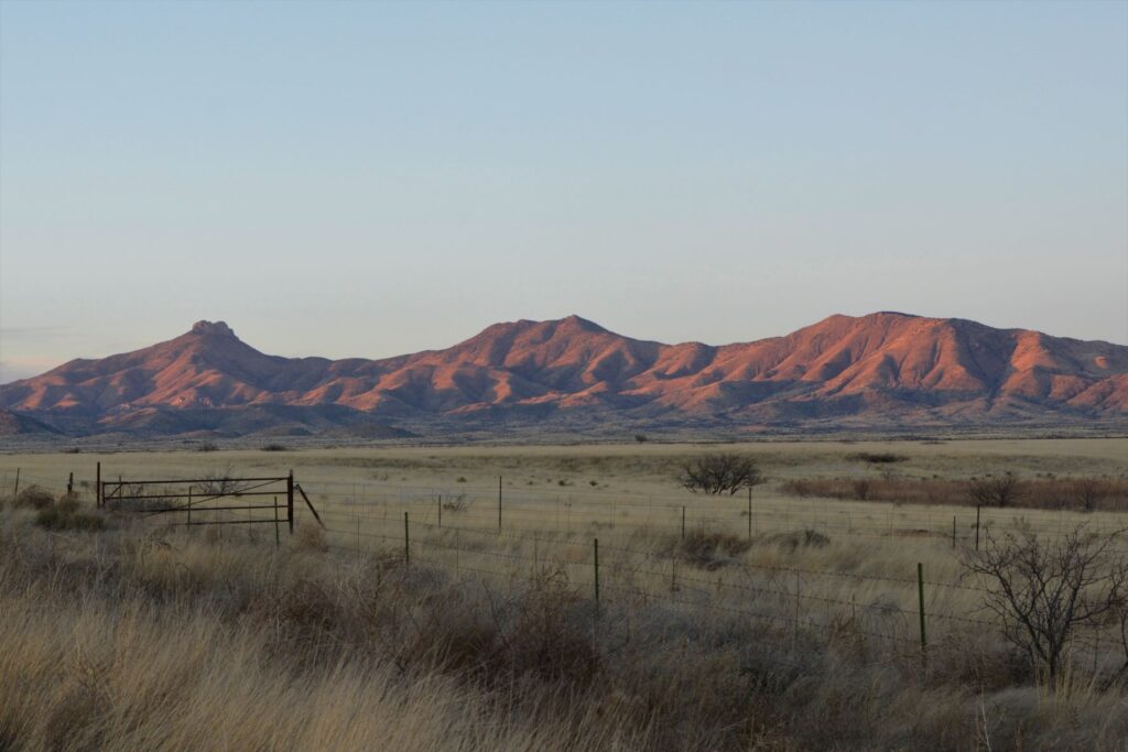
As we drove back down the mountain and out of the park, the evening sun cast a red glow on the nearby mountains. It was late in the day and we were hungry, but I decided to pull over and get one last photo.
As I got out of the truck, I happened to look behind me down the road where we had come. What I saw was this beautiful view of the snowy mountains in the last light of day. By the time I got back in the truck, the light was already gone. I was so glad I stopped for that one last shot.
Road to Chiricahua National Monument
I was surprised at the beauty and interesting topography of Chiricahua National Monument. Though it is off the beaten path, it is worth a visit.
Another surprise was a fascinating article I came across while researching for this blog. The article is about a missing ranger from Chiricahua National Monument. Out of curiosity, I clicked on the link and discovered a tangled mystery. It is quite long, but keep reading. It gets more and more mysterious the further you go. If you care to read it, I will link it below.
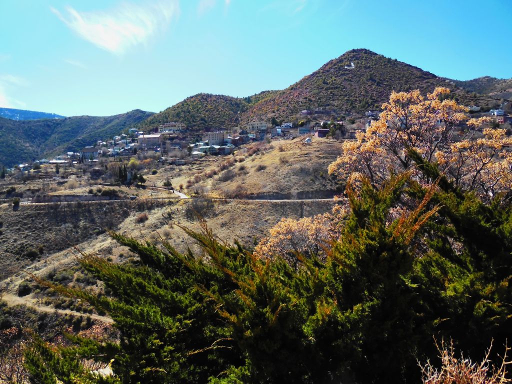
While we were in the Cottonwood area, we visited a few other places nearby. Jerome, 9 miles away, is a ghost town that has come back to life. It is now a tourist trap. Jerome State Historic Park is worth visiting.
The “ghost town” of Jerome is coming alive once more.
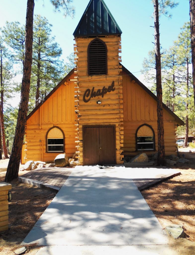
We drove the windy road through Jerome to Prescott, Arizona, where I spent one summer of my life as a kitchen helper at Prescott Pines Campground. The campground is a few miles outside of town. In many ways it looked the same, just updated.
The chapel at Prescott Pines Campground where I worked as kitchen staff in 1972.
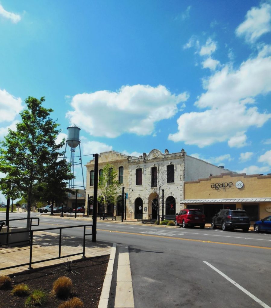
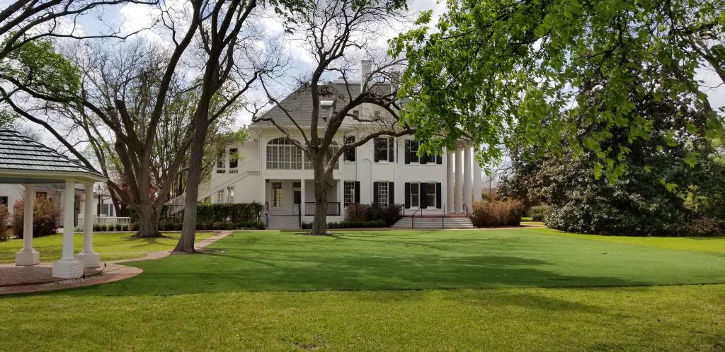
While we were in Cottonwood, we flew to Texas for a week-long stay with my dad while my sister was on vacation. We visited Round Rock, Texas, a pretty little town and the home of the beautiful historic Woodbine Mansion which is now a wedding venue.
Round Rock, Texas, main street.Woodbine Mansion in Round Rock, Texas
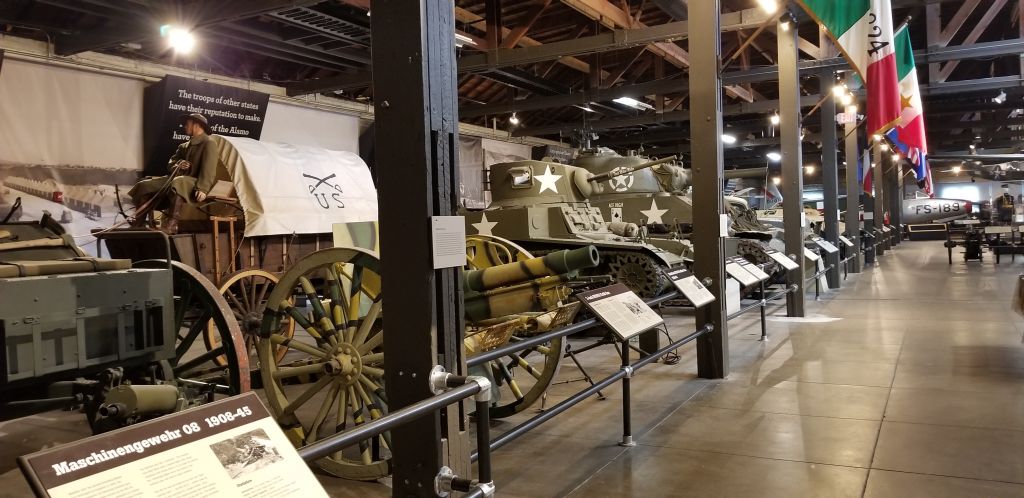
Another day, we visited the Texas Military Museum in Austin. It was large, so we saw just a small portion of it. We plan to visit it again someday.
Texas Military Museum
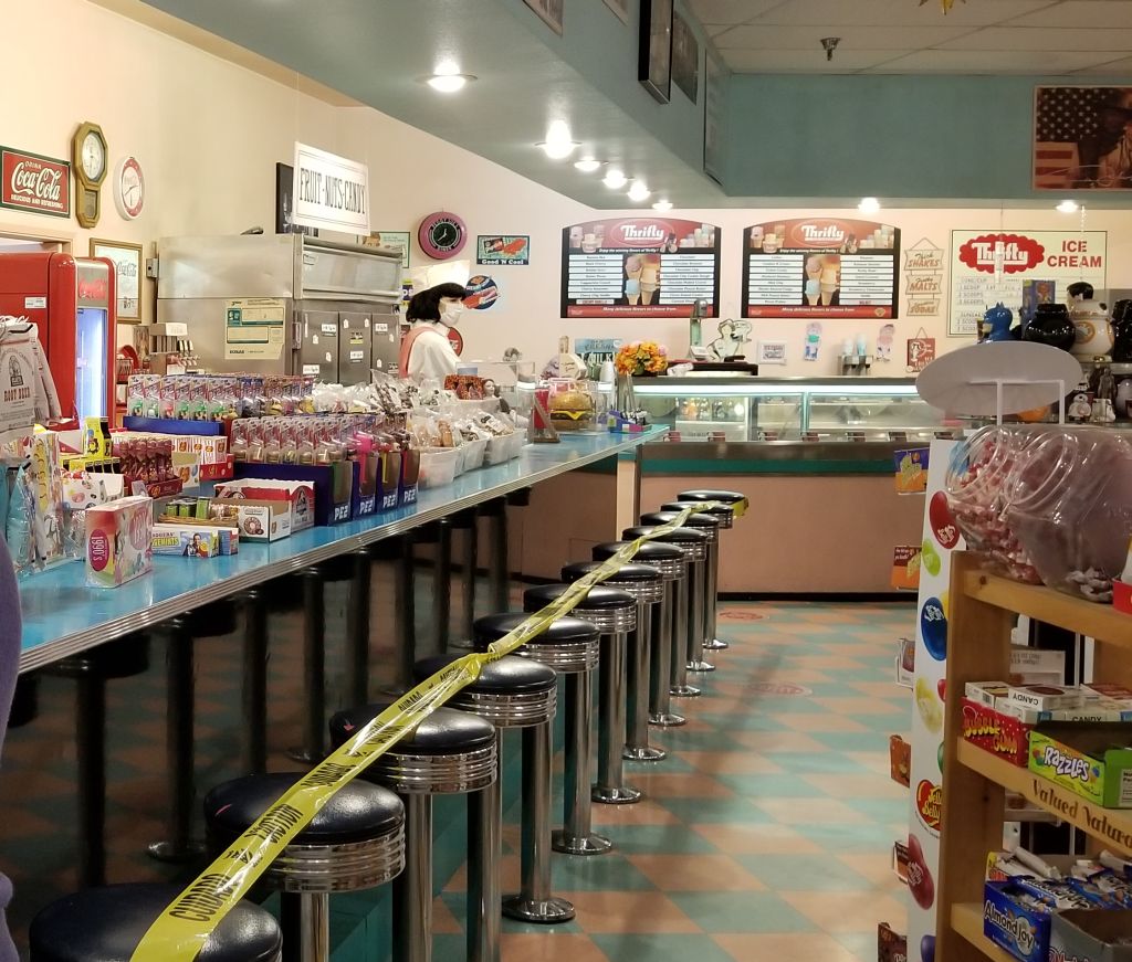
When we got back to Cottonwood, it was time to head back to California for the birth of our 10th grandchild. We used our Harvest Host membership for the first time and stayed overnight in the parking lot of Peggy Sue’s 50’s Diner about 10 miles from Barstow, California.
Inside gift shop at Peggy Sue’s 50s Diner
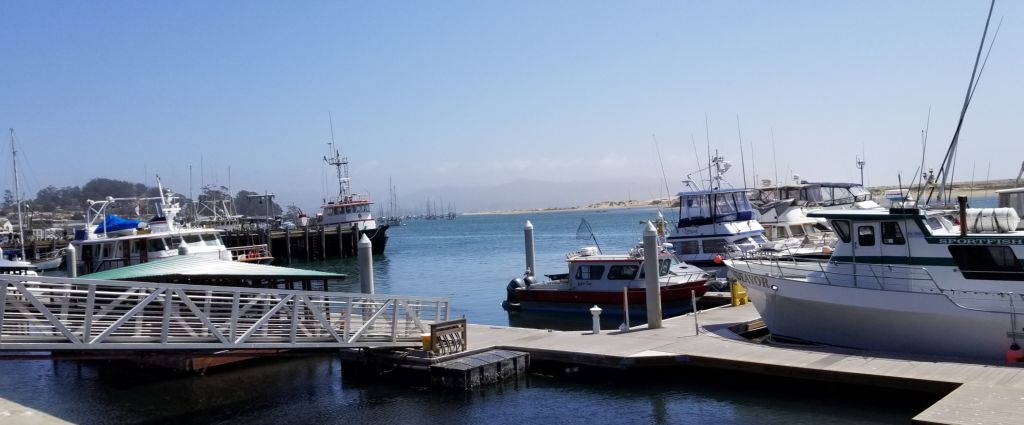
We stayed at our Thousand Trails Encore park in Oceano until our grandchild was born, helping the family with meals and laundry and other such things. Getting to be around the grandkids is always fun, but we made sure we took time for a side trip to Morro Bay for a lunch near the water.
Morro Bay, CA, marina
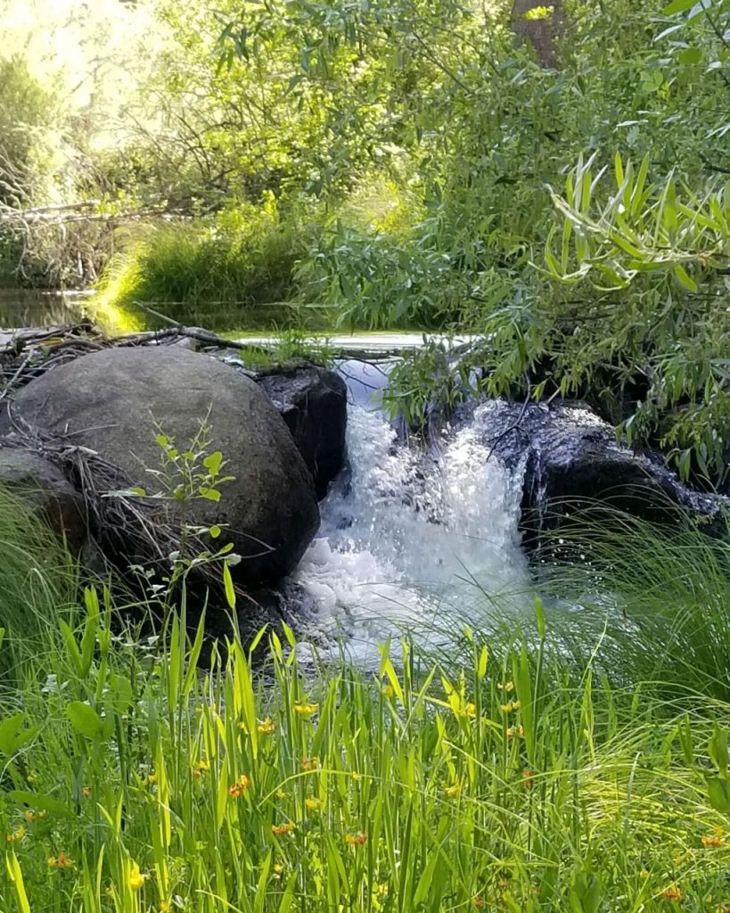
With the new baby welcomed, we made one last visit to our storage unit before heading north for our summer travels. The campground where we like to stay is in Oakhurst, CA. There is a beautiful little waterfall and wildflowers just behind the campsites and plenty of shade.
Our waterfall at Oakhurst, CA.Wildflowers at Oakhurst, CA.Our campsite at Oakhurst, CA.
We probably moved too soon to Cottonwood, Arizona, in mid-February. The elevation of Cottonwood is 2,000 feet higher than the Phoenix area. The first couple of nights the pipes froze that supplied our water. After that, we left the water dripping during the night. The days were warm and pleasant, however.
DEAD HORSE RANCH STATE PARK
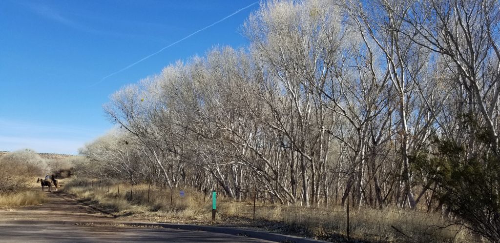
We took a day trip to Dead Horse Ranch State Park. There is a story about how it got its name. Calvin Ireys bought the ranch in 1950. The first time the family looked at the ranch to purchase, they saw a dead horse lying in a field. After buying the property, they named it Dead Horse Ranch. In 1971, Ireys sold the ranch to the state for a state park. Today the park is 423 acres with 10 miles of hiking trails, 150 campground sites and several picnic areas.
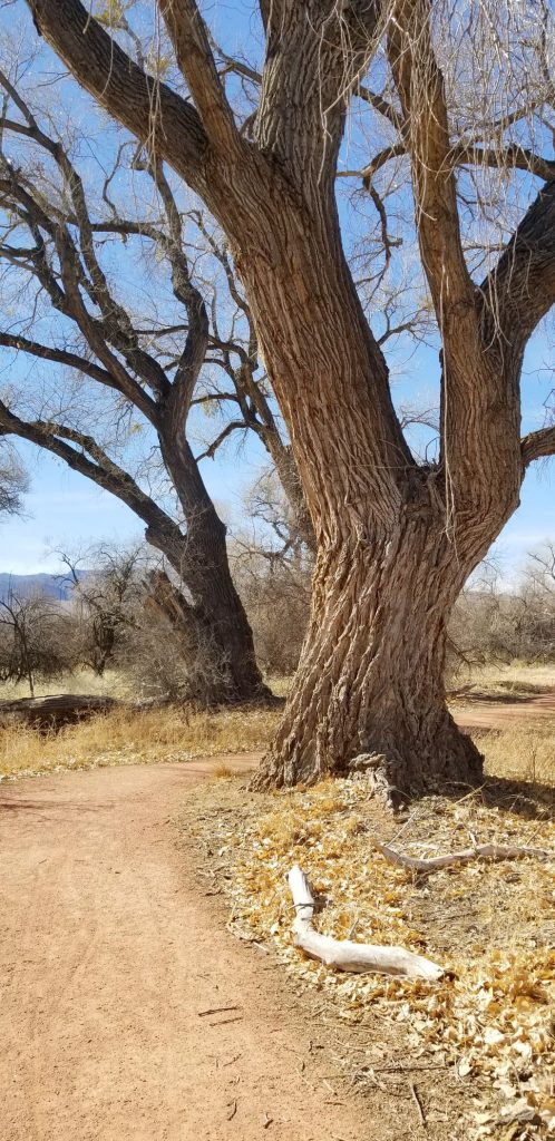
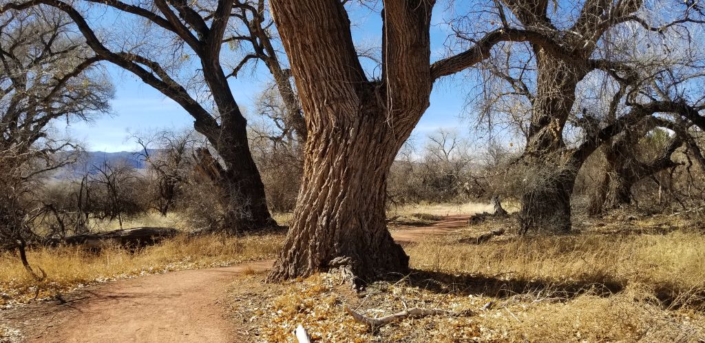
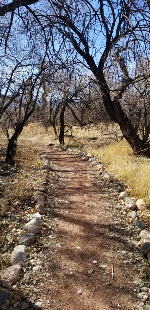
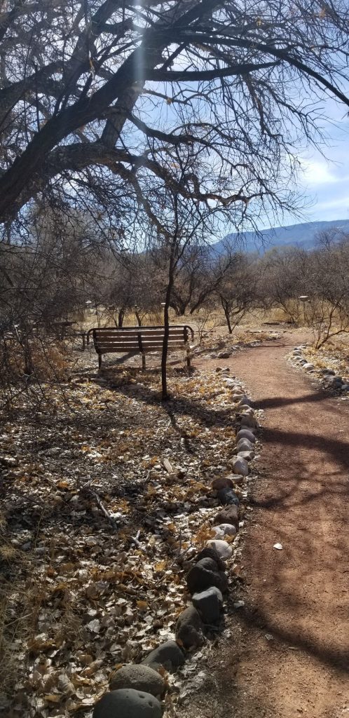
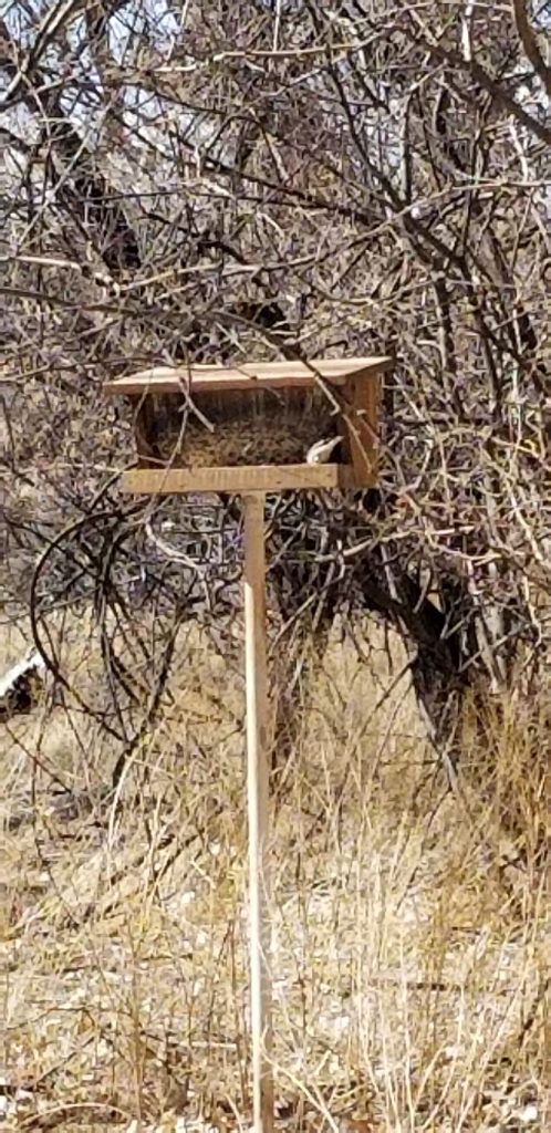
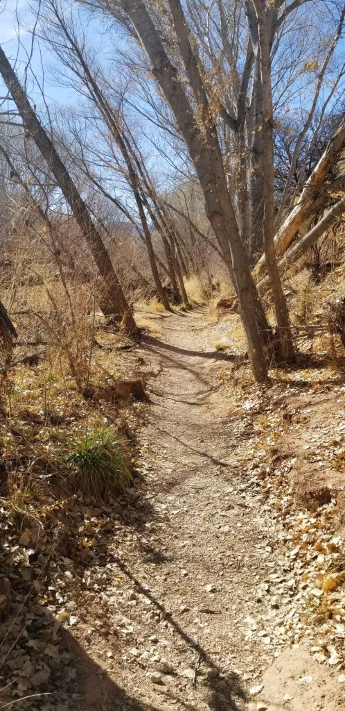
We took a walk on the “Canopy” trail which is just a quarter of a mile long.
Canopy Trail Dead Horse Ranch State ParkCanopy TrailCanopy TrailCanopy trail to bird feeders
We sat on a bench and watched the birds at the bird feeders.
Canopy trail Bird feeder at Canopy Trail
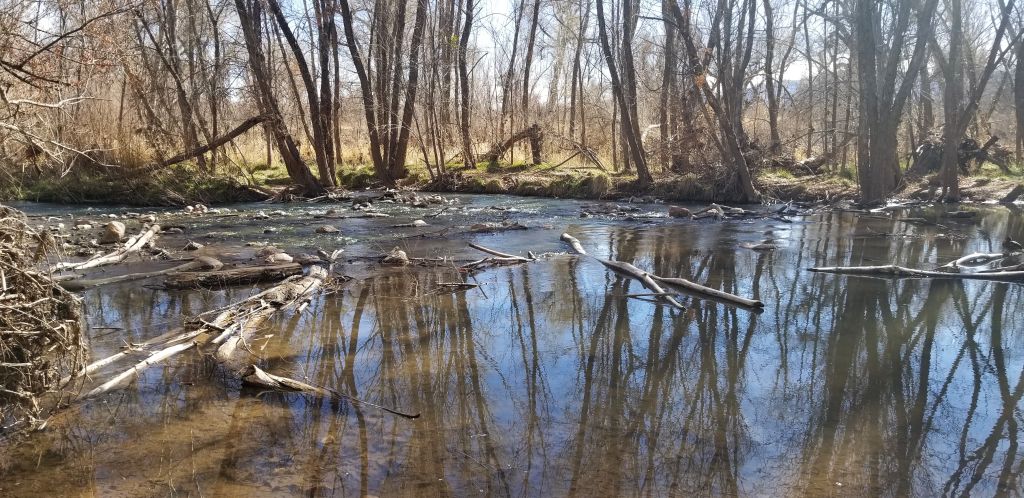
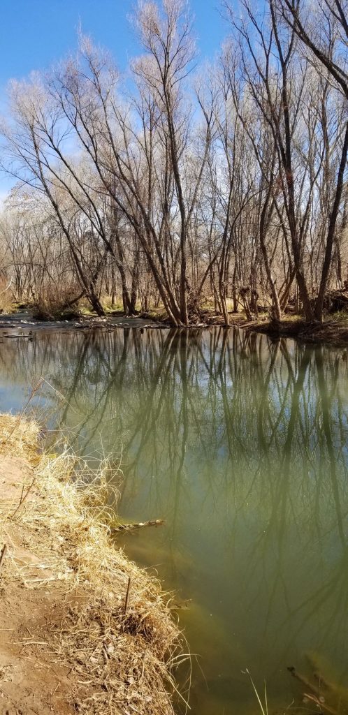
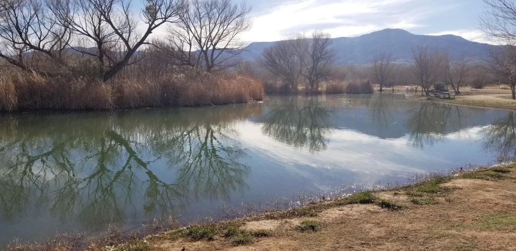
Later we took a short hike down this trail by the Verde River.
Trail to Verde River, Dead Horse Ranch State ParkVerde River
“Verde” means “green” in Spanish, and it is green! The cottonwood trees that surround the river on both sides were dormant. In spring or summer, they would be a brilliant lush green.
Verde River
We saw some horseback riders.
Dead Horse Ranch State Park
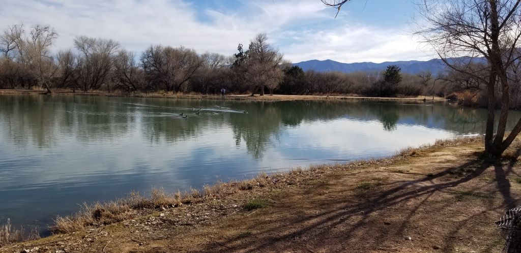
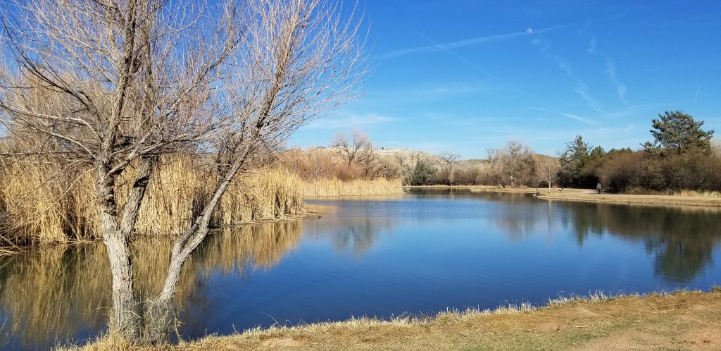
Later we drove around the park and found the “West Lagoon”. I got out to take some photos and walked on the pathway that goes completely around the lagoon. (about .7 miles)
Lagoon at Dead Horse Ranch State Park
The lagoon was home to much wildlife.
We got some exercise and enjoyed the scenery and wildlife. It would be nice to see the Cottonwood trees (which the town is named after) in spring and summer when they have their full foliage. It’s a bright green, which gives another reason for the name Verde Valley. The entire valley is a green oasis in the desert, surrounded by red rock rimmed mountains. It’s a place to see!
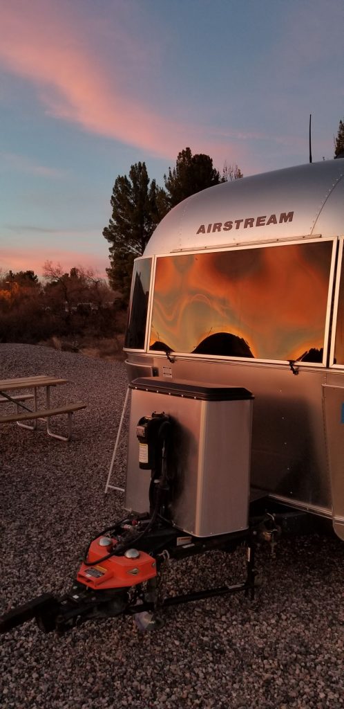
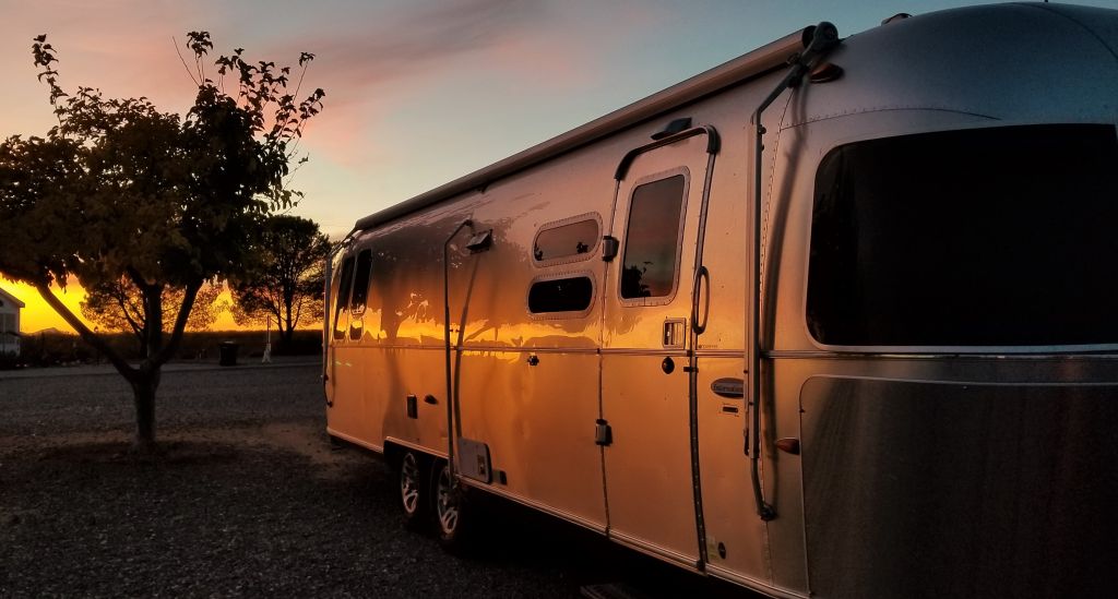
The Airstream reflects the evening sunset in Cottonwood, AZ.
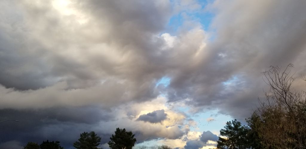
Mesa, Arizona, is a place where snowbirds stay during winter. Occasionally, it gets really cold there too. We were wintering in Mesa hoping to get some really nice weather, but when we arrived, it was chilly. A couple of storms blew in blanketing the surrounding mountains in snow.
Stormy clouds over Mesa, Arizona.Four Peaks as seen from Mesa, Arizona
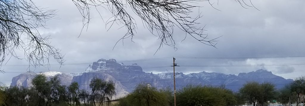
It’s not usual for the Four Peaks (above) to get snow in winter, but it is for Superstition Mountain (below). This storm really blanketed the Four Peaks, and dumped a fair amount on Superstition too.
Superstition Mountain after snow storm
It only lasted a couple of days before it melted.
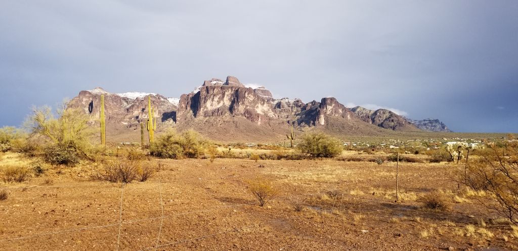
Superstition Mountain
We spent most of January in the area mostly getting medical visits taken care of. It was also nice being close to so many stores. It made shopping really easy. We enjoyed eating out several times too.
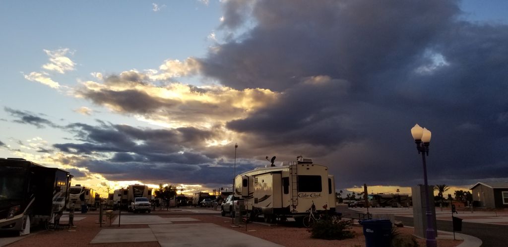
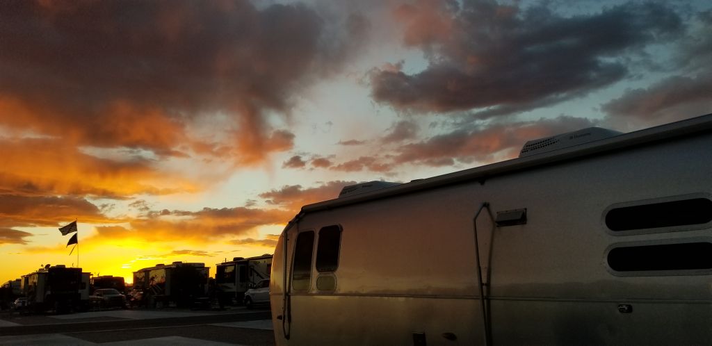
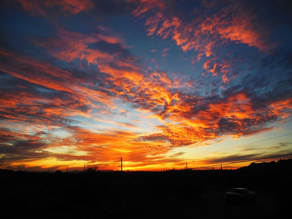
Sunset at Monte Vista RV Resort, Mesa, Arizona.d
One thing about Arizona, the sunsets are fabulous!
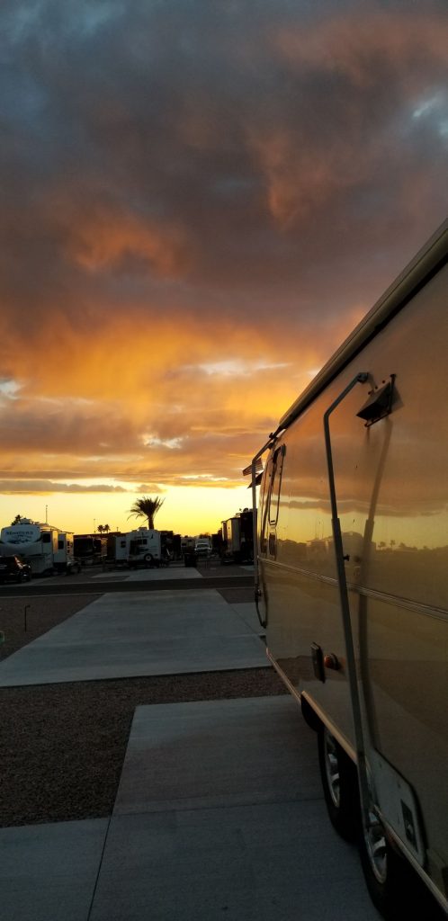
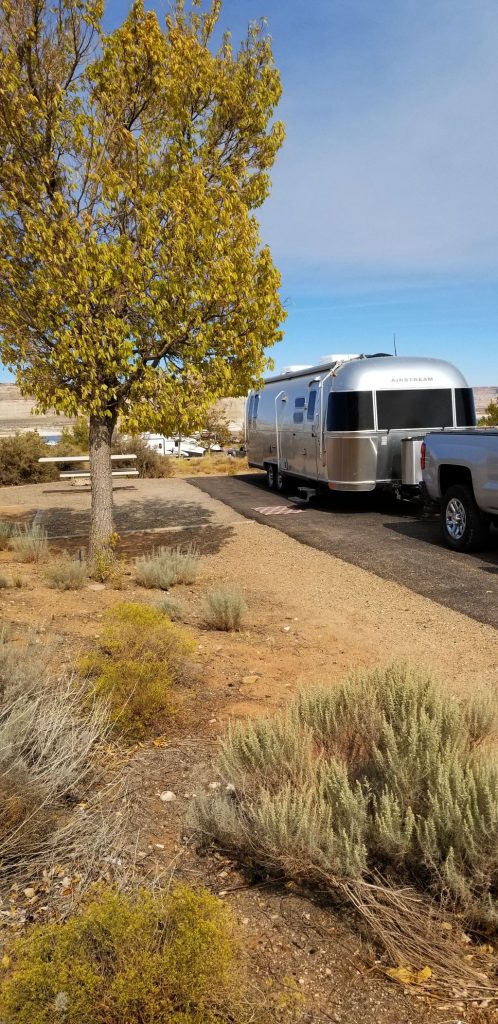
By October, we were in northern Arizona headed south to warmer weather where we would spend the winter. We stayed a couple of days in Waweep RV Park which is just south of the Utah/Arizona border near Page, AZ. Our cell phones were constantly confused about the time since Arizona does not observe Daylight Savings time and Utah does. The campground was very nice with the campsites spaced out nicely. We could look out our windows and see the mountains and Lake Powell.
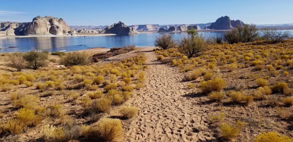
Our campsite at Waweep RV Park near Page, Arizona.My morning walk down the path to Lake Powell.
A nice pathway winds through the campground and down to the lake. I took a walk one morning and just enjoyed the beauty of the rocks, mountains and water. Each evening we enjoyed a beautiful sunset.
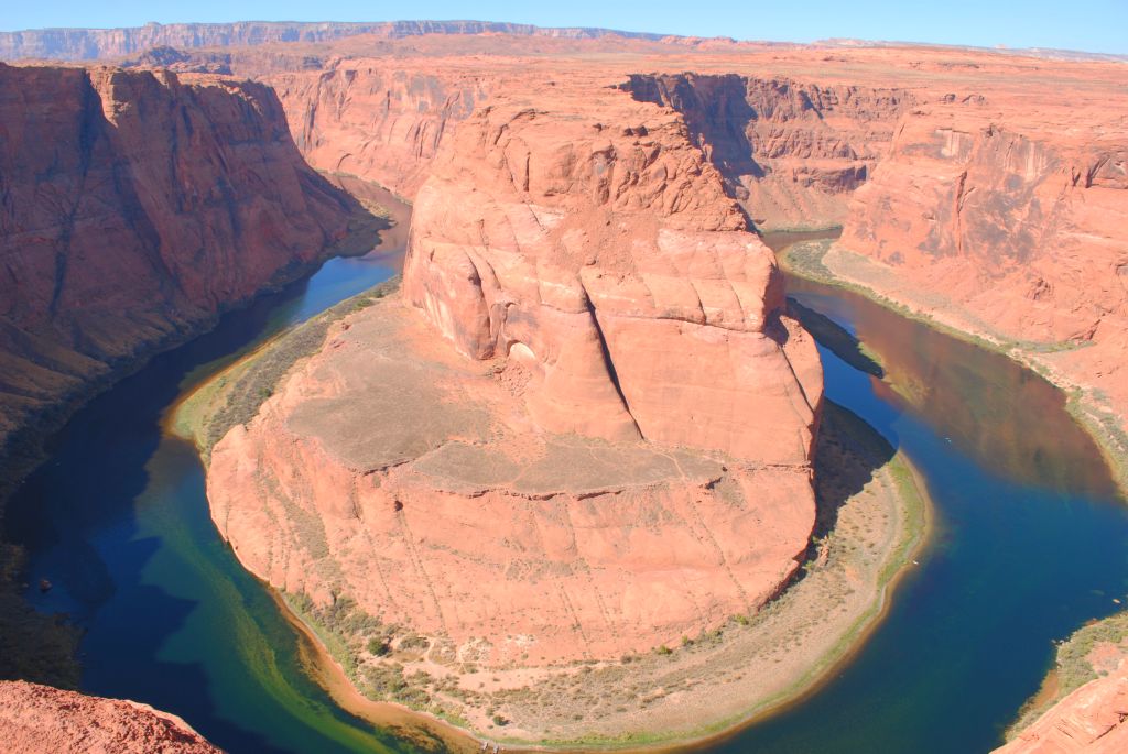
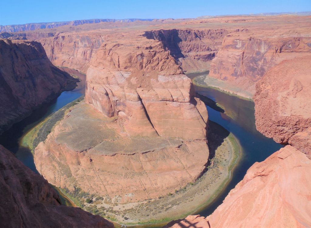
One of the items on my bucket list was to visit Horseshoe Bend on the Colorado River. It just so happened it was only a few miles away from our campground. Although it is on Indian land, it is accessible to the public. There is, however, a $10 charge to park. The trail is paved and there are a couple of shaded benches along the way. We were warned to take water with us since it can get quite hot and the hike is a 1.5 mile round trip. The hike is a gradual downhill walk. At the lookout, there are guardrails along the edge. It was quite an experience looking down a 1,000 foot drop. Down below I could see tiny figures that I realized were people kayaking on the river. My cell phone wasn’t able to get the whole view, but fortunately I brought along two other cameras that had wide-angle lenses that were able to capture the entire view. Even then, it was impossible to get the entire view in one shot. I did some research and found that timing is important. If you get there too early or too late in the day, the canyon is in shadow, so I made sure I timed it just right.
Horseshoe Bend of the Colorado River near Page, Arizona.It’s a 1,000 foot drop to the canyon floor below.
APACHE JUNCTION, AZ
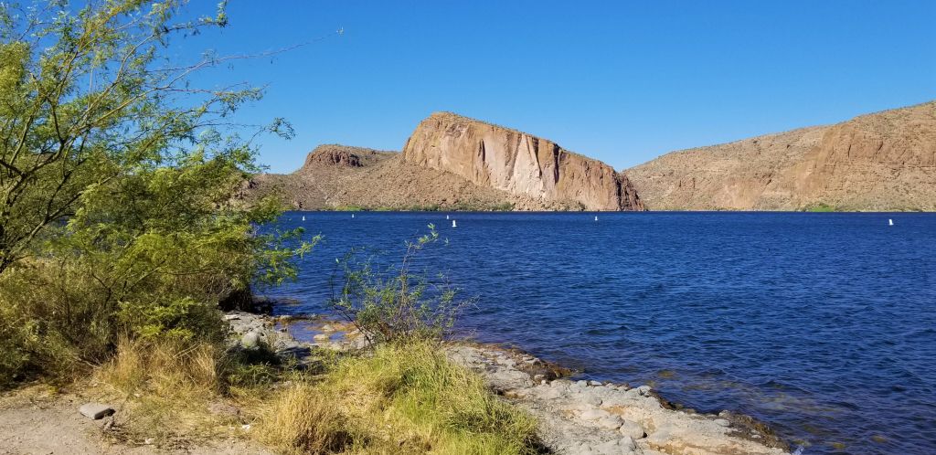
Although it was October, the temperatures were still in the 90’s. We headed to Apache Junction (near Mesa, AZ) to stay in one of our Thousand Trail Encore parks. While we were there, we took a day trip to Canyon Lake.
Canyon Lake
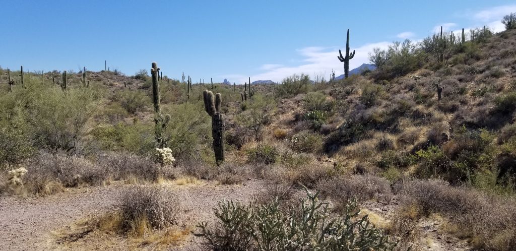
Along Highway 88 from Apache Junction to Canyon Lake was a pull out with a trail to Weaver’s Needle, a rock spire in the Superstition Mountains. I hiked to the end of the trail hoping to get a photo of the needle. I was disappointed that I could only see the tip of the needle in the far distance. A zoom lens helped me get a little closer look.
Path to Weaver’s Needle falls short of a good view.
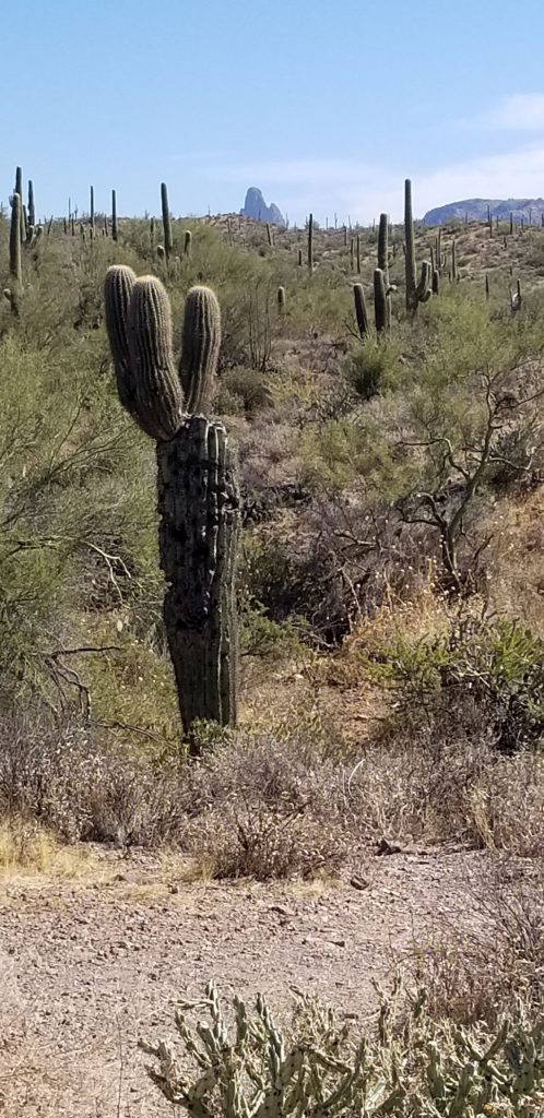
There is a legend that the shadow of Weaver’s Needle points to the Lost Dutchman’s Mine at a particular time of year.
Even with a zoom lens, Weaver’s Needle is barely visible.
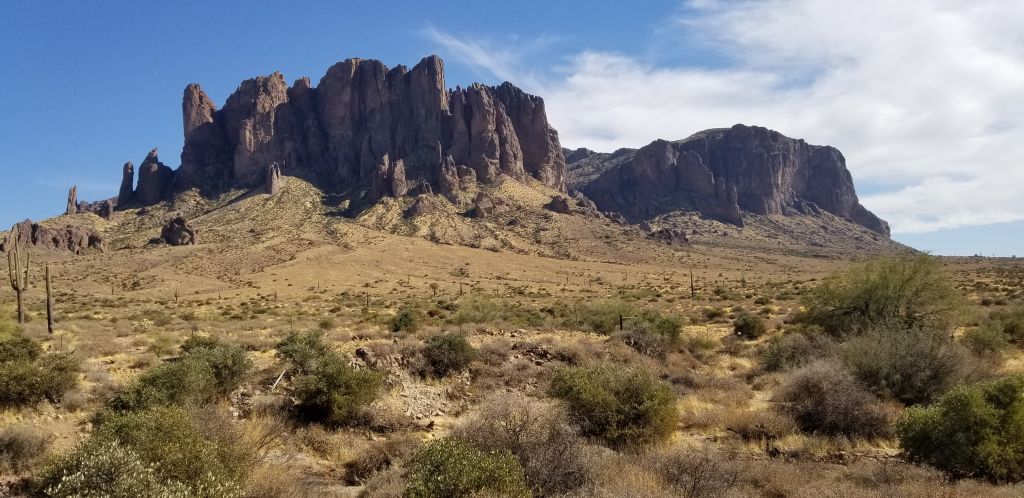
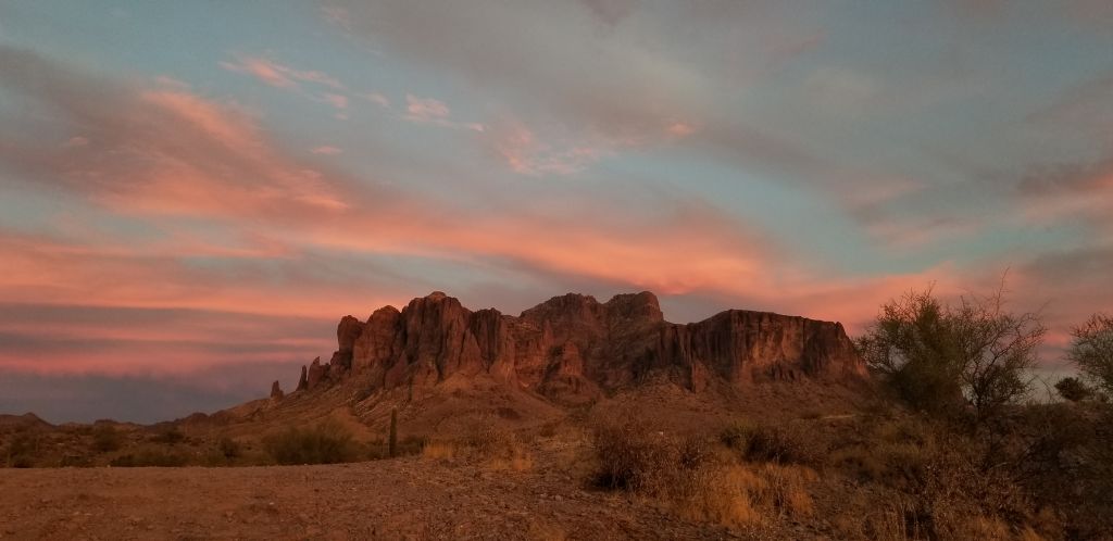
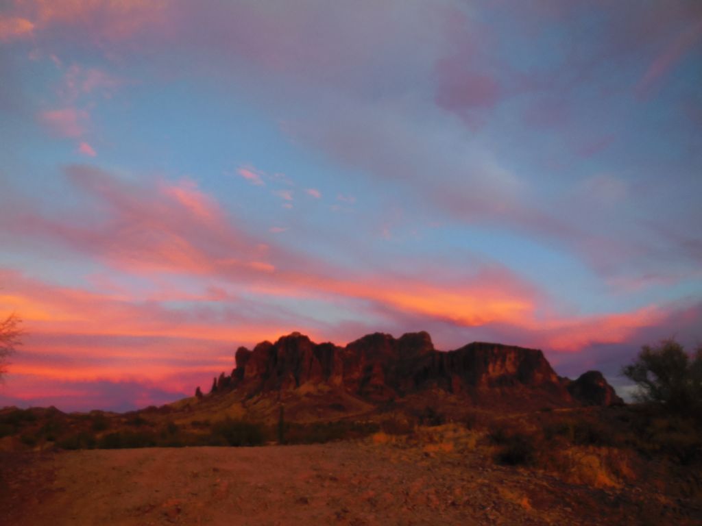
Apache Junction sits at the foot of the beautiful Superstition Mountains. The mountain faces west, so as the sun sets, the mountain reflects the colors of the sunset. There’s a state park there now—Lost Dutchman State Park—with hiking trails. One day I hiked on one of the trails to get some photos of the mountain and the desert.
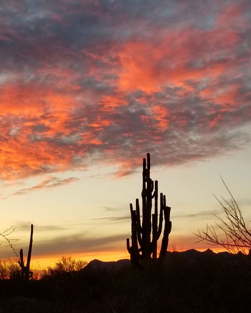
But my favorite time of day was in the evening when the cacti were silhouetted against a flaming sky of color.
Arizona sunsets are the best!
It was time to head to California to spend the holidays with family.