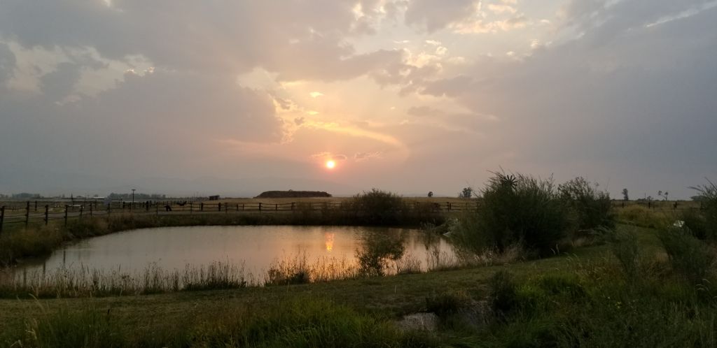
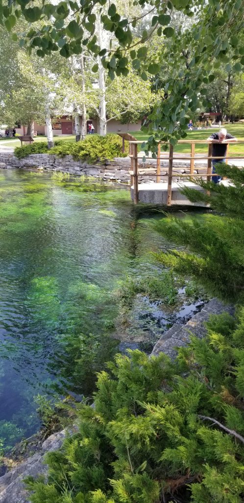
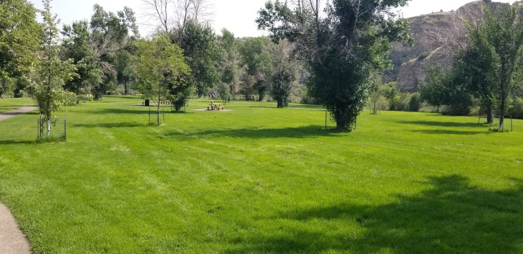
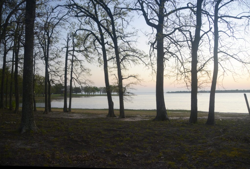
On our way out of Texas we stayed at Lake Tawakoni (Tuh-WA-kuh-nee) which is 50 miles east of Dallas. The lake is pretty with the trees surrounding it and the campsites are situated near the edge of the lake. We took a walk one evening and watched the sunset.
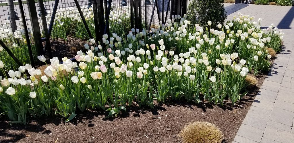
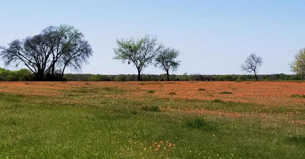
As we traveled in the month of April, we saw more and more wildflowers. Here is a field of wildflowers outside our park in Lake Tawakoni. I believe they were Indian paintbrush which is a common flower in Texas.
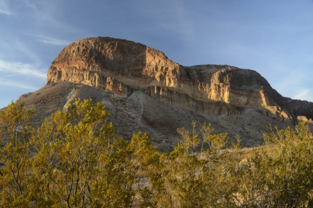
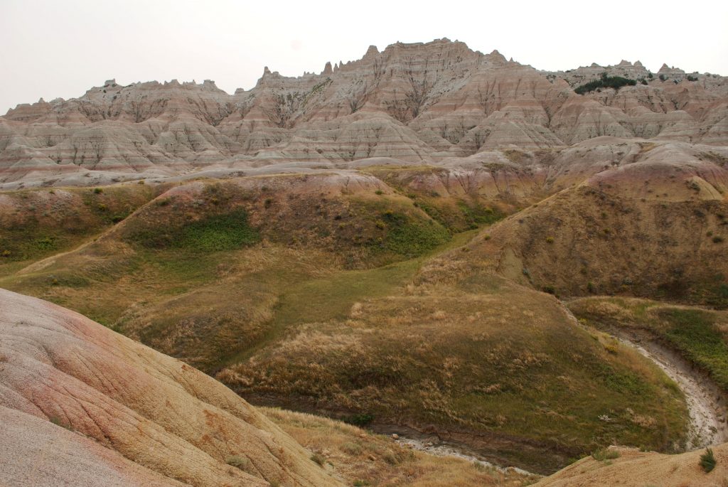
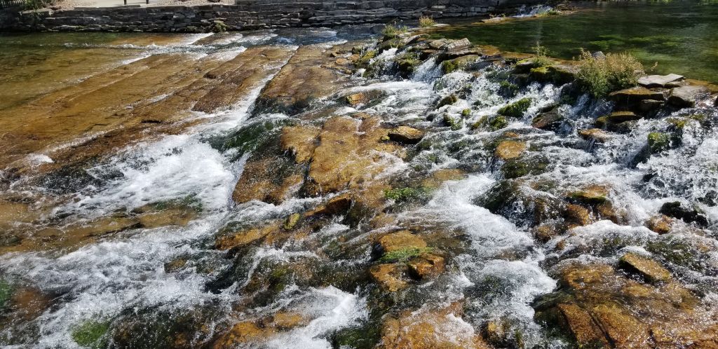
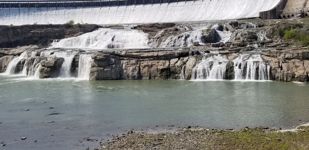
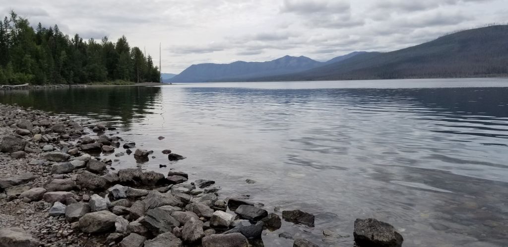
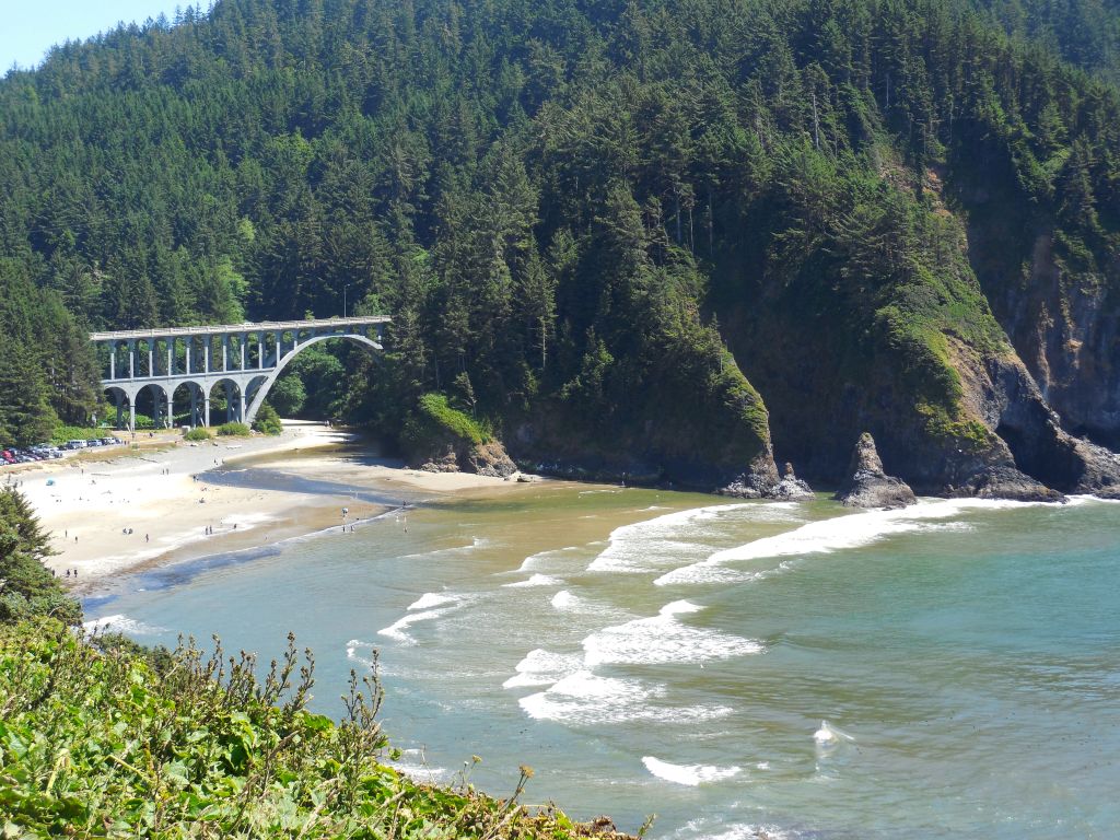
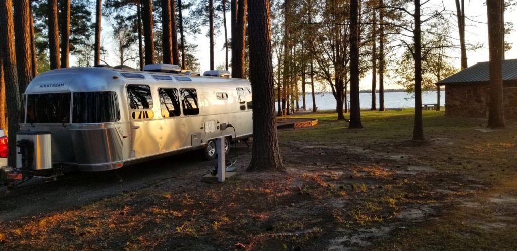
Our next stop was an Army Corps of Engineers Campground located a few miles south of Texarkana, Texas. The eastern side of Texas is called the “piney woods”, and in this campground we camped right in among the pines and had a wonderful view of the lake. It was a really windy day, so there weren’t any boats out on the choppy water.
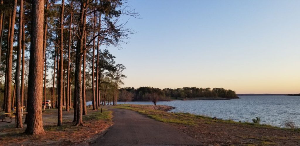
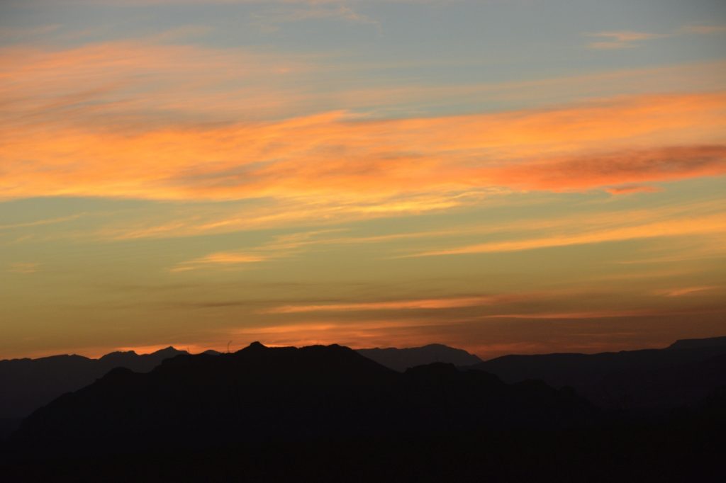
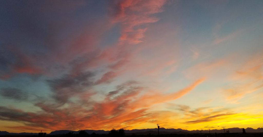
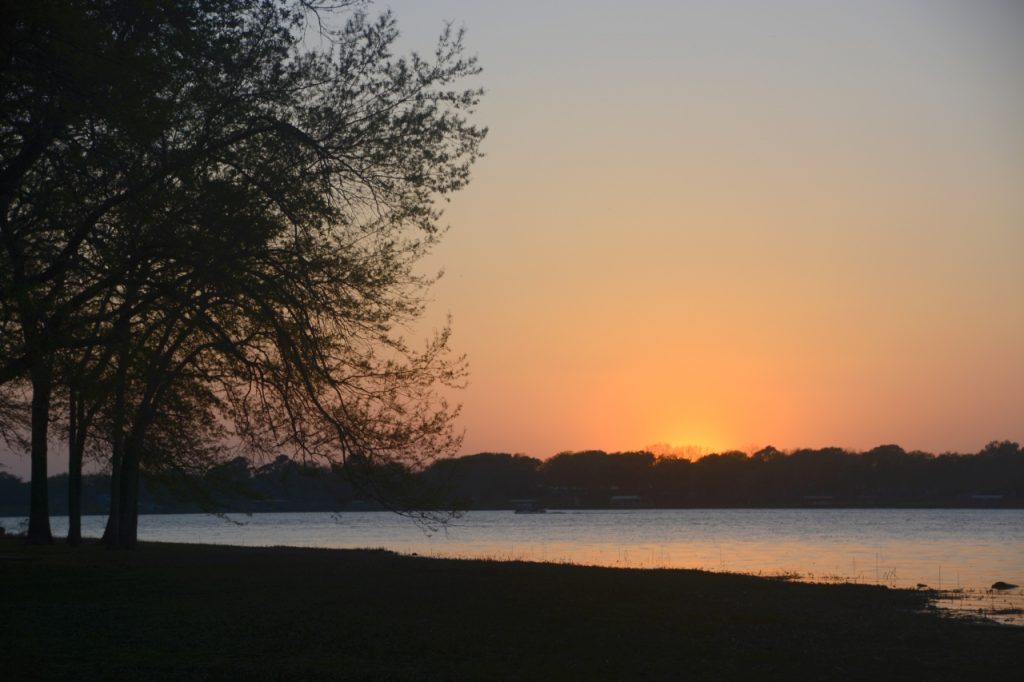
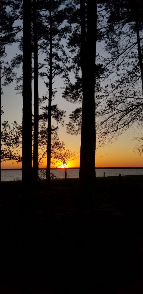
I thought the sunset was unusually beautiful when viewed from among the trees. We were only there one night, but we plan to stay several days on our way back during mid-June. It should be a nice cool place to camp when temperatures start to warm up.
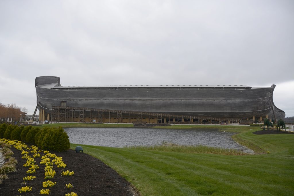
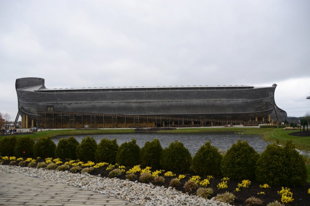
We stayed in a campground near Corinth, Kentucky, so we could visit the Ark Encounter. The Ark Encounter is a full-size replica of Noah’s Ark. I’d read a little about it online and it was something I had always wanted to see. Since our path to Ohio was taking us right by it, we planned a visit.
The day we chose to visit it was raining for 40 days and 40 nights. (Just kidding!) I really didn’t know what to expect when we booked tickets to the Ark Encounter–they are rather pricey. I was hoping it would be worth it.
When we first arrived, we had to pay an additional $15 for parking. The huge parking lot is situated with a building in the middle. There we showed our tickets that we bought online and were given wrist bands to wear. After that, we were ushered into a waiting line for the next available bus to take us to the Ark. We didn’t have to wait long. The buses come and go all day long.
The bus dropped us off in front of the Answers Center where we walked through the gift shop to the large auditorium and listened in on the last few minutes of a talk about desert animals. A little armadillo was running back and forth across the stage. So cute!
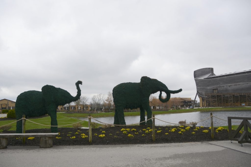
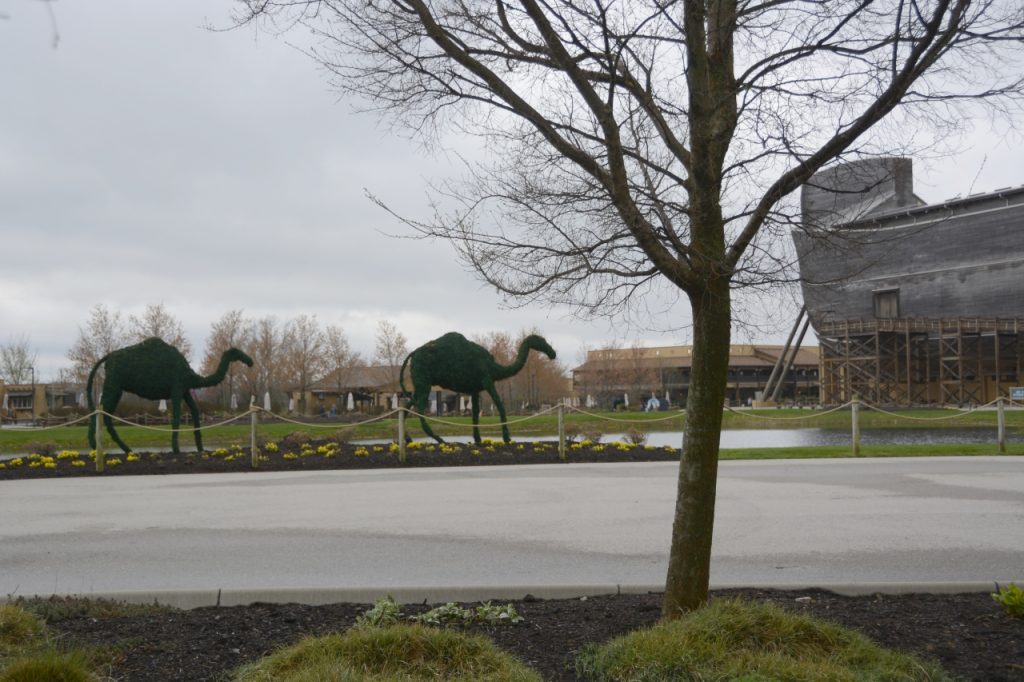
From there, we went outside and walked through a rainbow archway along a sidewalk that led to the ark. It was probably a quarter mile to the Ark. There was a pond in front of the Ark, and what looked like topiary animals walking on their way to the ark entrance.
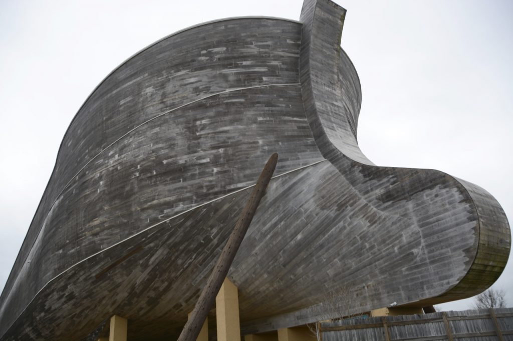
We didn’t walk up the huge outside ramp to enter the ark. We entered under the huge keel in the stern of the ark. According to the designers, this huge keel was needed for stabilizing the ark through the turbulent seas.
As we entered the Ark, it was dimly lit. Sounds of boards creaking, animals screeching and trumpeting, along with background music immediately made me feel like we were in the Ark and the storms had begun.
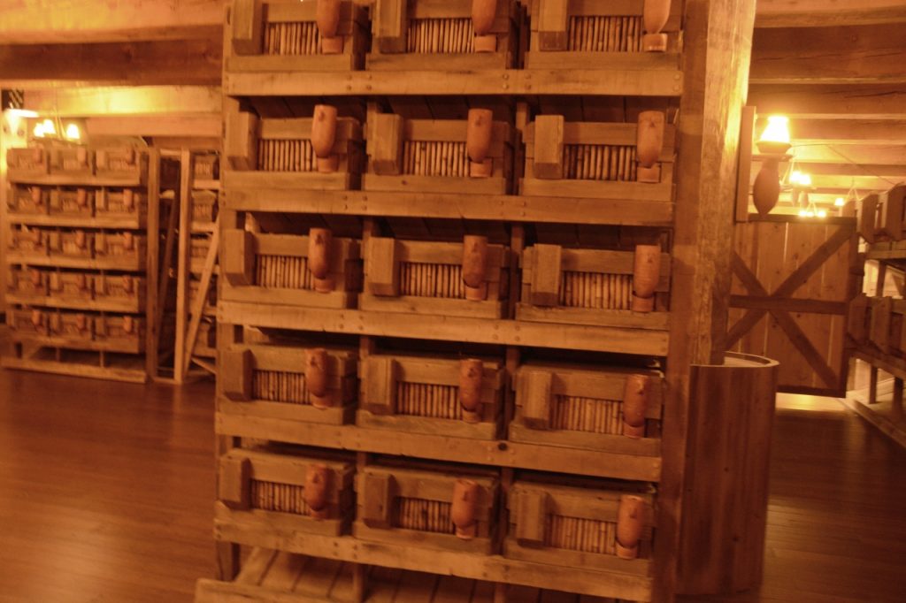
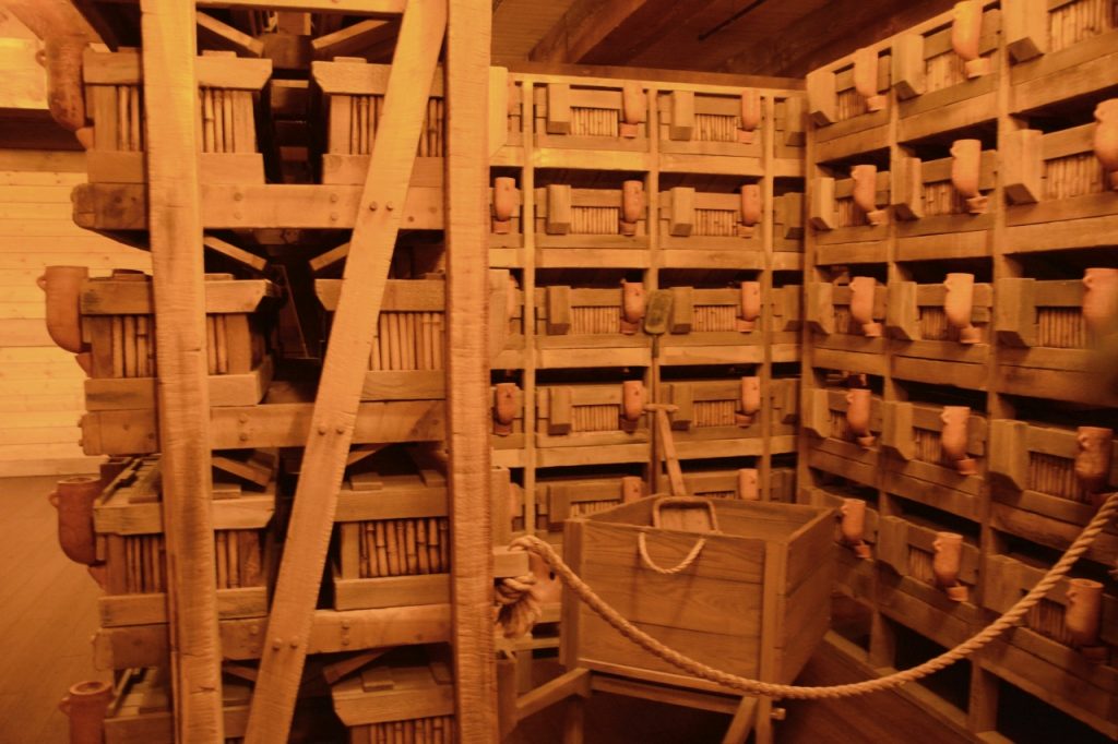
We saw rows and rows of cages stacked to the ceiling on the first level. The lighting was made to look like oil lamps which were hung from the ceilings and along the end of the rows. Notice the containers for food and water hanging outside the cages. There were slanting boards underneath the cages to carry animal waste to the bottom where it could be cleaned out.
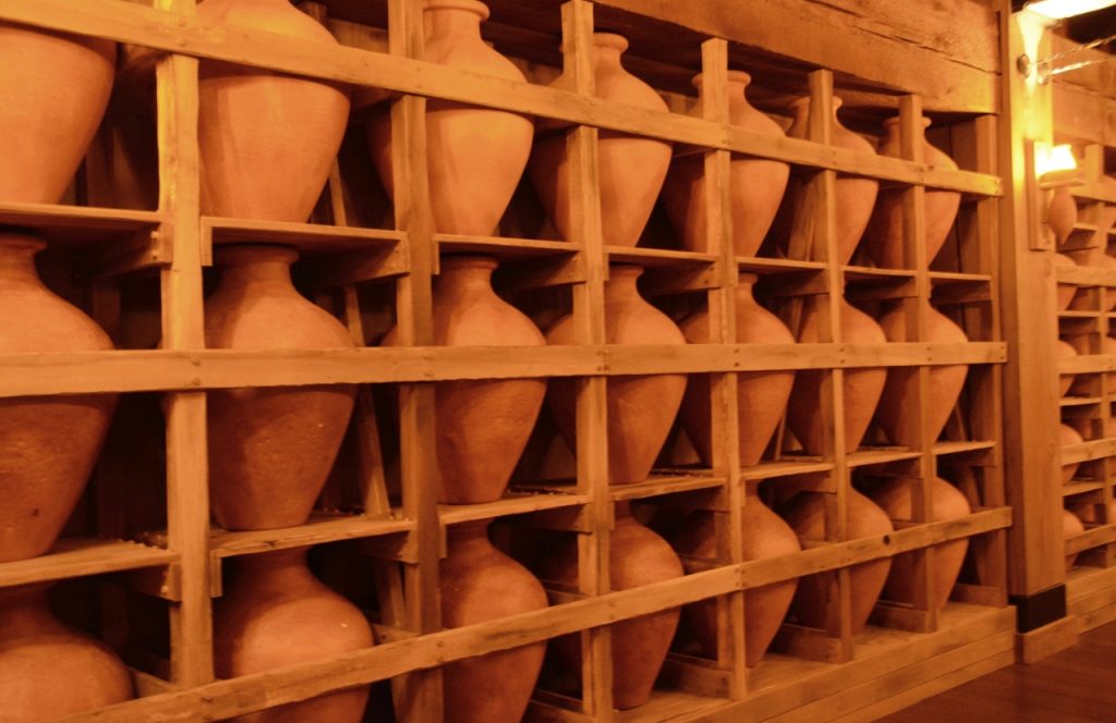
Along the side walls were numerous shelves with large clay jars for fresh water storage.
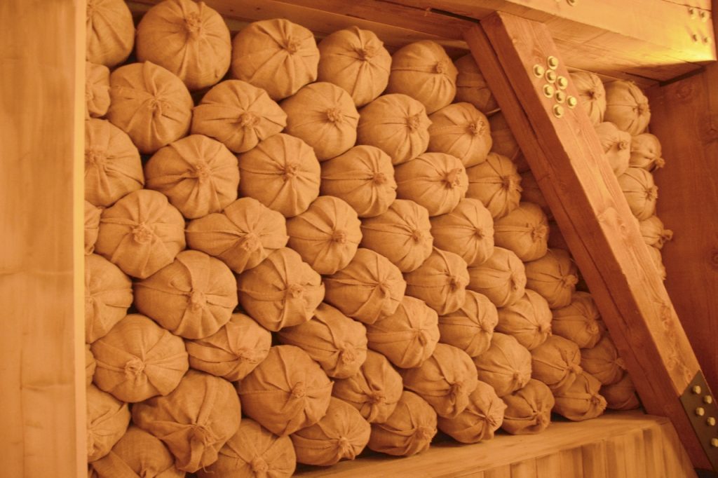
Also along the outer walls were bags of grain stored for feed.
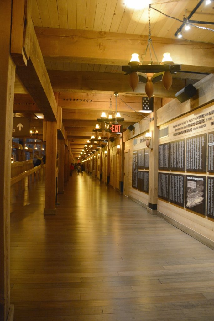
The enormity of the Ark can be envisioned somewhat when you look down the hallways. There was a hallway like this on either side. In the middle was a large ramp that led to the next level. There were three levels. Also along the outer walls were exhibits. These displays focused on explaining how the animals were cared for throughout the Ark journey with enough food and water to last for most of a year. In the actual Ark, all this space could be used to house the animals and food.
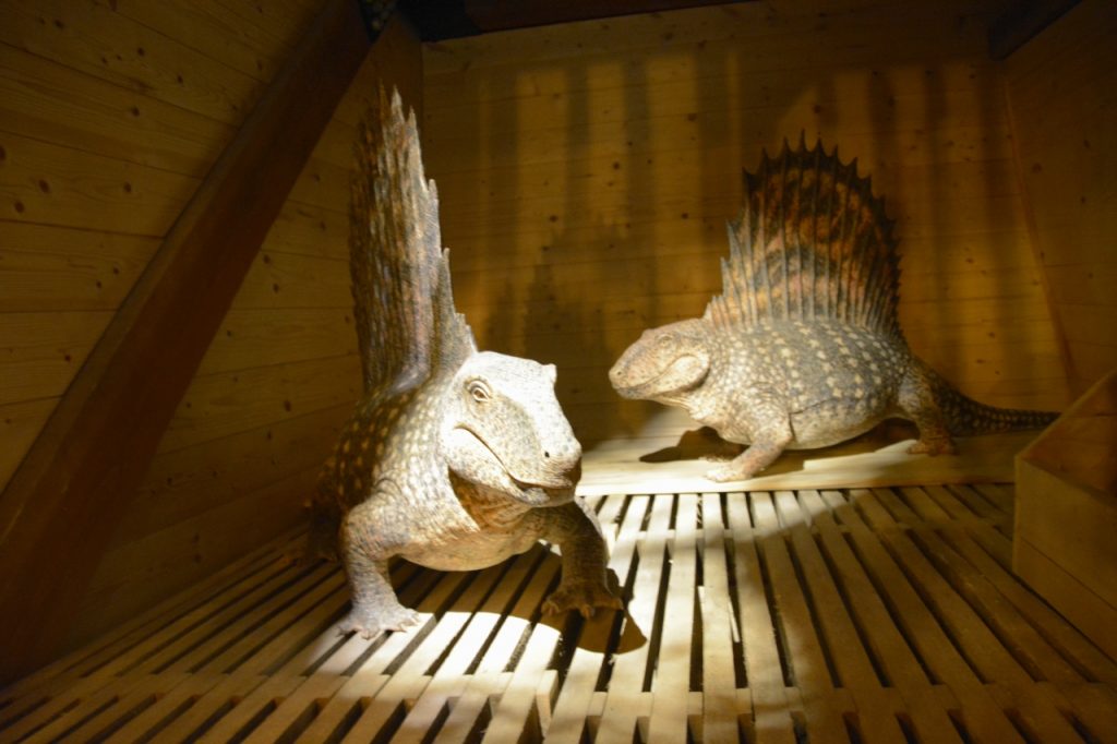
Peeking inside the cages, we saw artistically crafted representations of animals that may have been on the ark. Some of them were strange-looking to me.
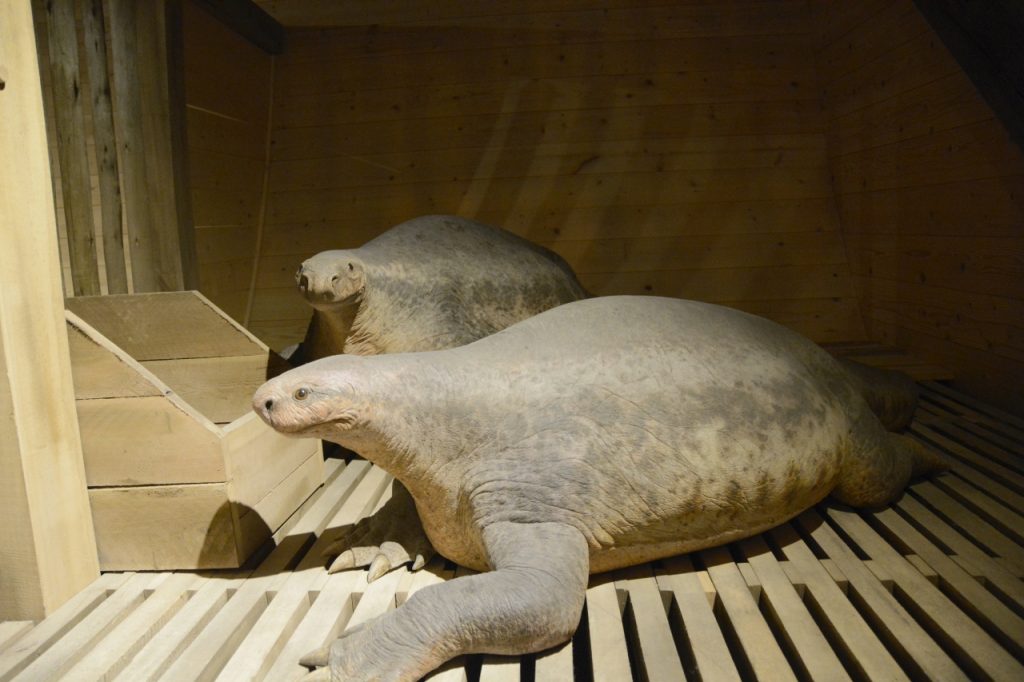
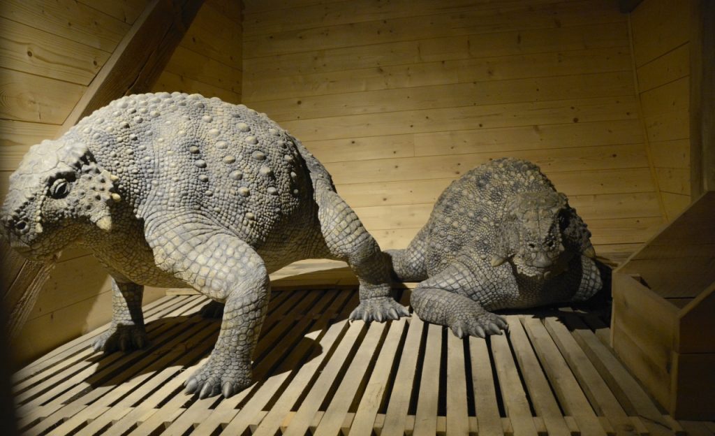
Some people have questioned if Noah could fit dinosaurs on the ark. The exhibits postulated that Noah would likely have taken young dinosaurs or smaller species of animals. But we were reminded that God brought the animals to Noah.
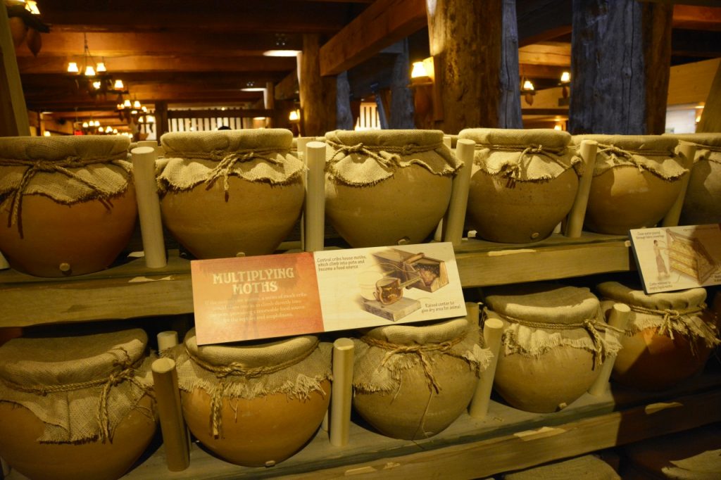
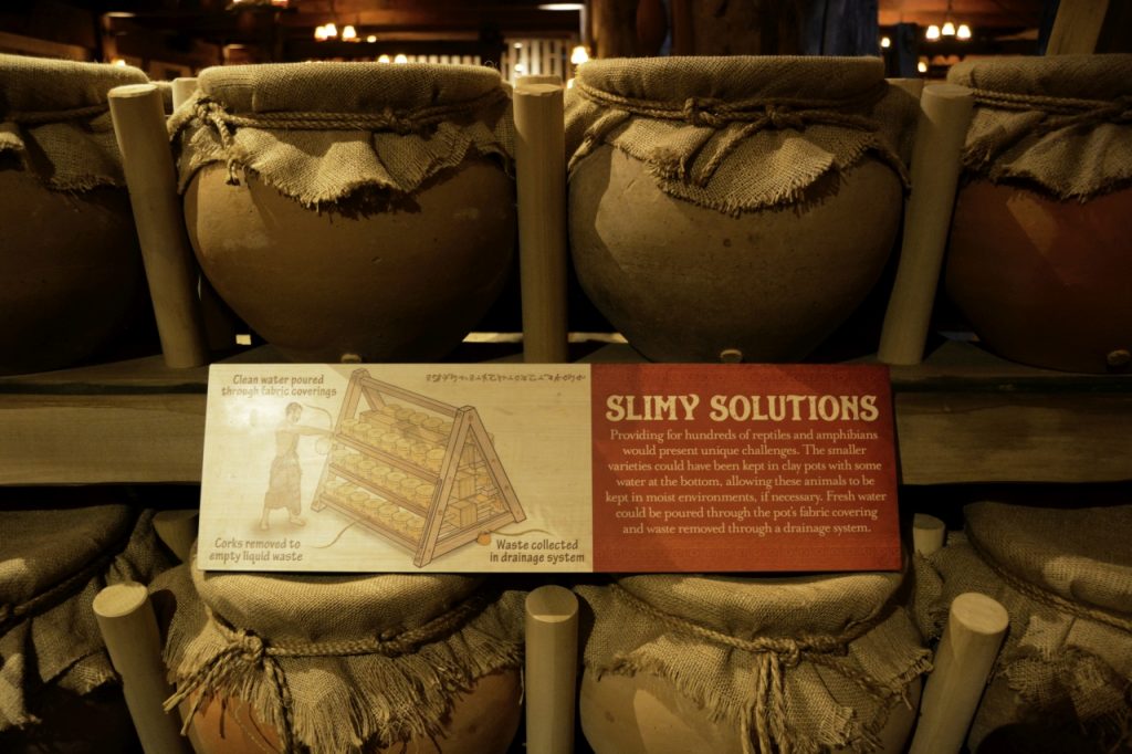
It seems like a lot of thinking went into the displays on the Ark Encounter. One of the displays showed these clay jars with burlap coverings that housed moths for lizard and other small reptiles. The moth eggs would hatch and the moths would make their way into the place where the reptiles were waiting to eat them for food. Water could be poured on the burlap for moisture.
The Ark had to have a way to get fresh air and light. In this reproduction, the three decks were not entirely sealed off from each other. The artists who designed this Ark replica showed how shutters on the windows above could allow light and air into the lower decks of the Ark.
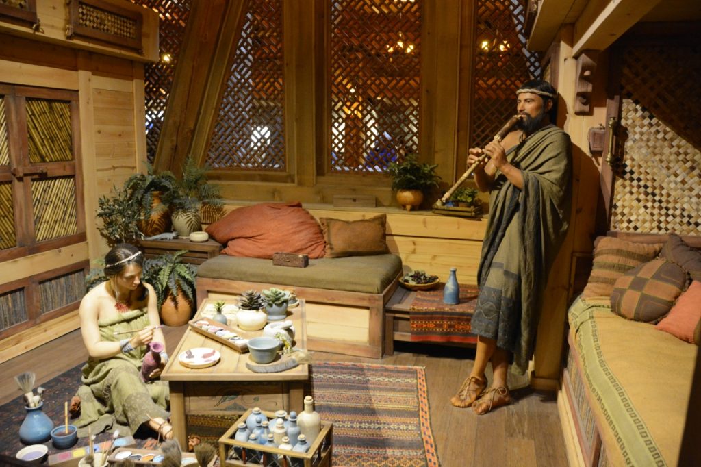
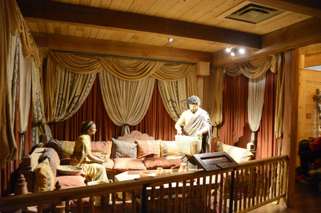
The second deck primarily showed how Noah’s family might have lived. Here, one of Noah’s sons is playing a musical instrument while his wife paints pottery.
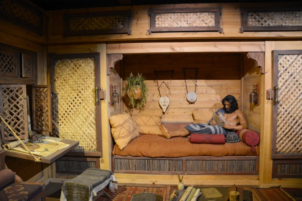
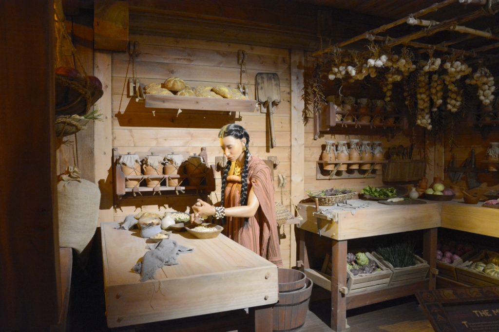
The Ark had to provide enough food not only for the animals, but also for Noah and his wife, his sons and their wives for nearly a year. Since the Bible tells us that the animals and people were all vegetarians until after the flood, you see many vegetables and herbs being stored.
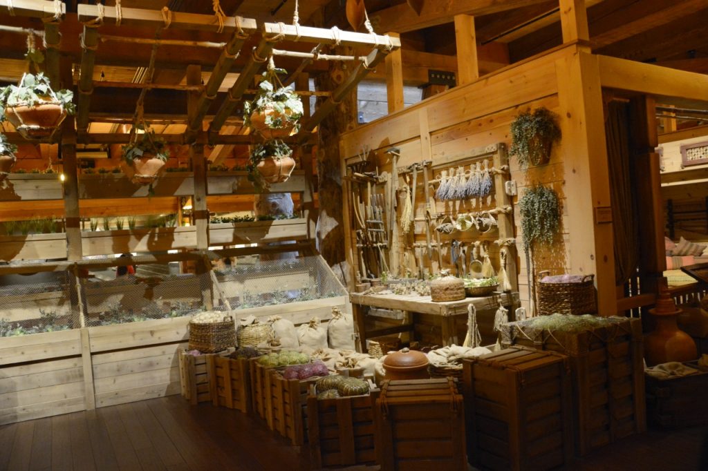
Below you can see how vegetables might have been grown for food using light from the windows above. The vegetables are grown in the wooden bins or from hanging pots.
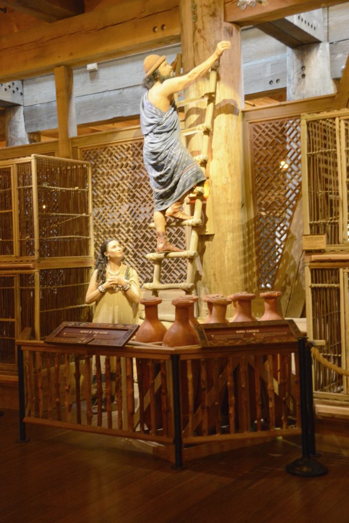
This scene shows one of the men trying to catch a bird that got loose from a cage.
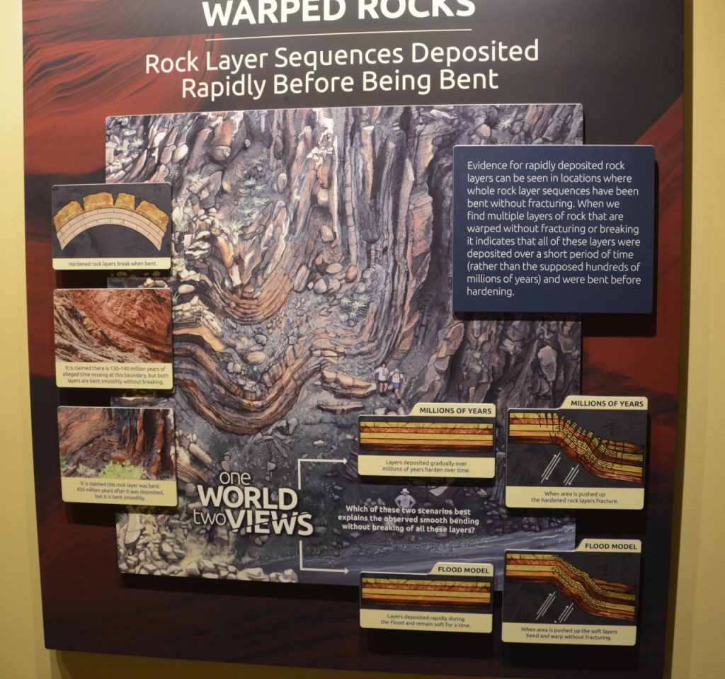
The second and third decks housed exhibits that explained alternate views to the standard evolutionary viewpoint. The “Warped Rocks” display explained something I’ve often thought about when I see rocks like this. The rocks had to be soft and flexible in order for the layers to bend like this without cracking.
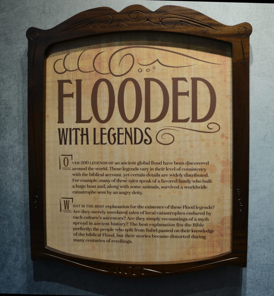
Something I’ve known about for some time is that nearly every civilization has a flood story. The details may vary, but they often have similar details of a flood in their oral histories. The Ark Encounter had several stories from different people groups on display.
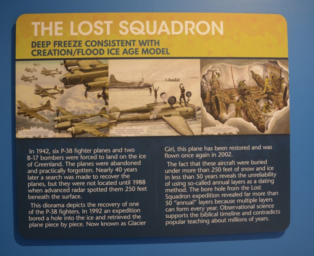
Ray was particularly interested in this story. A group of planes were forced to land in Greenland in 1942 due to bad weather and had to be abandoned. Fifty years later, an expedition found the planes and bored through 250 feet of ice and snow to recover them. The hole was bored through 250 feet of ice that was deposited over 50 years. Science has been saying that each line in ice bores is a layer representing one year and 250 feet of ice would have represented millions of years. In reality, each layer is a layer of snow of ice deposited in a single storm, not an entire year.
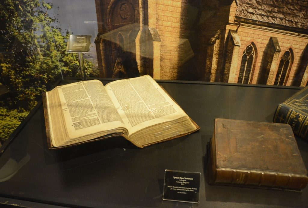
Other exhibits showed the history of the English Bible and why it is a reliable translation of the originals. Below is the Tyndale Bible. It was the first Bible translation in the English language.
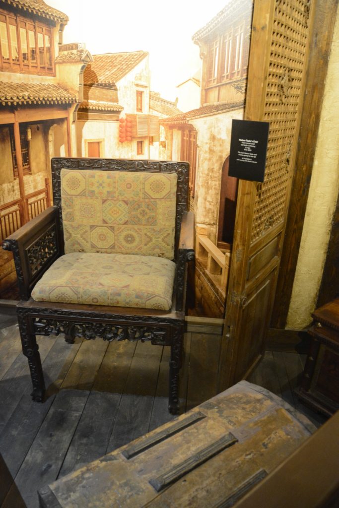
Other exhibits were about missionaries and their work around the world. This chair belonged to Hudson Taylor. He was a missionary to China who founded China Inland Mission. He was responsible for bringing over 800 missionaries to China who founded 125 schools and resulted in thousands of conversions to Christ.
Outside the Ark were other attractions like a zoo, camel rides, petting zoo, a zip line and aerial challenge plus many places to eat. Most of these were closed since the season had just opened. The Answers Center where lectures took place throughout the day also housed a very large gift shop and book store.They also host conferences and seminars in the large auditorium. Everything was well organized and very well maintained.
We spent hours walking through the three decks and exhibits. We also attended a very interesting lecture by Dr. Andrew Snelling, a geologist who studies the evidence of the flood around the world.
He revealed the six main geological evidences for the Flood. Genesis chapters 7 and 8 describe the flood in which the water covered all the high mountains. These floodwaters carried along marine creatures, and all air-breathing and land-dwelling life was killed. He posed the question: “Wouldn’t we expect to find billions of dead plants and animals buried and fossilized in sand, mud, and limestone that were deposited rapidly by water in rock layers all over the earth?” In his lecture, Dr. Snelling demonstrated that is exactly what we find in the fossil record.
The Gospel message was also clearly explained in the lecture and in some of the exhibits. The slogan of the Ark Adventure is, “Get Ready to Believe!” I can’t think of a better phrase to summarize what we saw on our day spent at the Ark Adventure. I think both of us came away with greater understanding and belief in the Biblical record of the Genesis flood.
I highly recommend it!
“If [God] did not spare the ancient world when he brought the flood on its ungodly people, but protected Noah, a preacher of righteousness, and seven others, …then the Lord knows how to rescue the godly from trials and to hold the unrighteous for punishment on the day of judgment.” 2 Peter 2:5,9