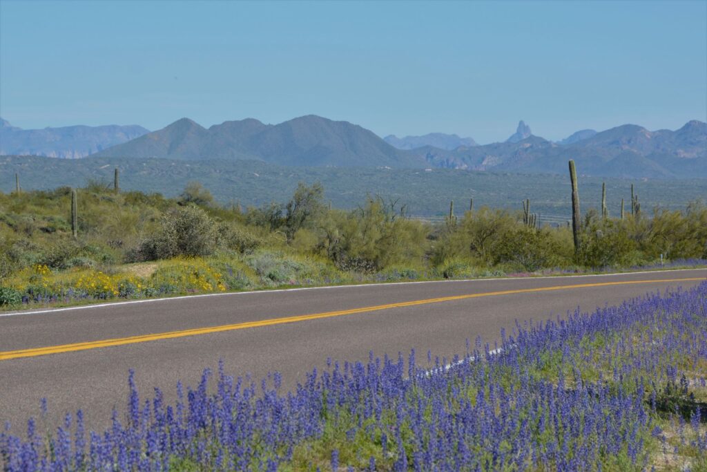
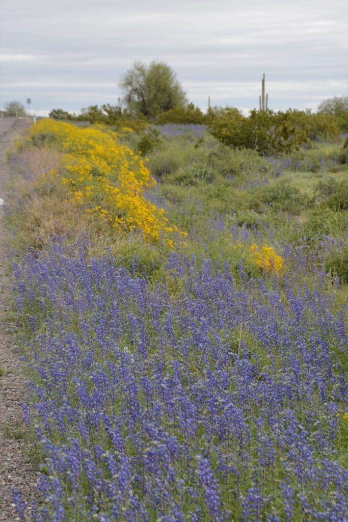
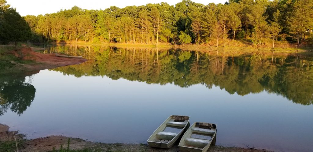
After several days of cool, cloudy weather in Mesa, Arizona, it finally warmed up. We packed a picnic lunch one morning and drove north to McDowell Mountain Regional Park near Fountain Hills, Arizona. The recent and frequent rainfall over the winter made a perfect environment for a great season of wildflowers. On our drive there, the sides of the road were awash in color.
We stopped at the Visitors’ Center where we ate our lunch outside in a picnic area. Inside the Center, we saw some live rattlesnakes, and picked up some literature about wildflower species.
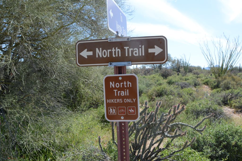
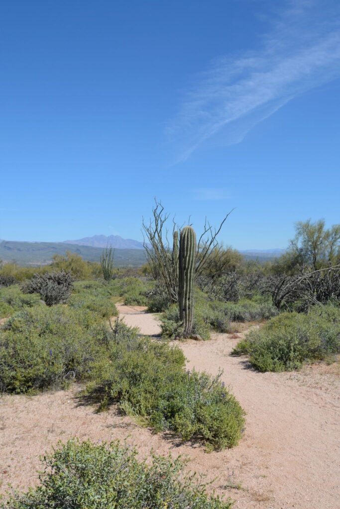
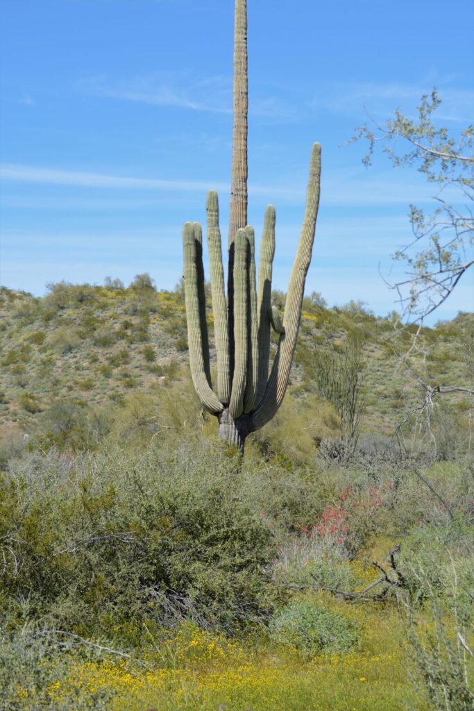
The Ranger at the gate suggested the North Trail hike for spotting the most wildflowers. It was supposed to be an easy hike. We planned to just walk a short way to get some photos.
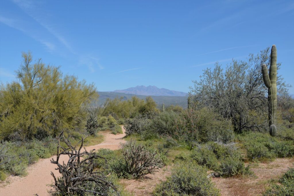
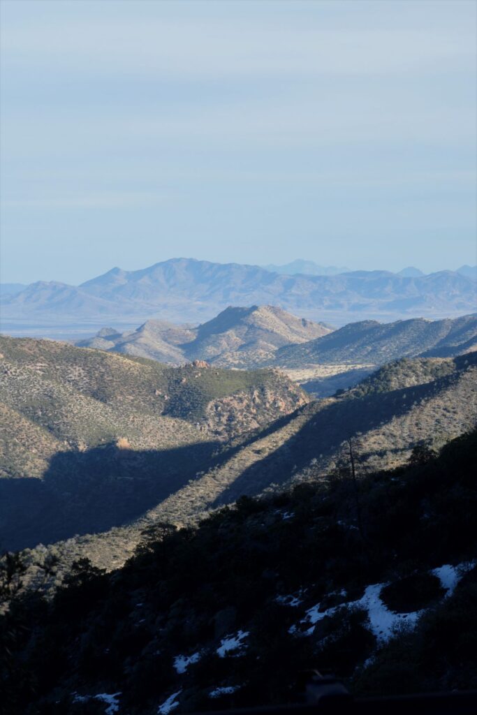
At one point I turned and looked back and saw a beautiful view of the Four Peaks.
North Trail looking toward Four Peaks
On our way, we met some people who told us there were fields of poppies about a half mile to a mile down the trail. What we didn’t realize is that the trail splits and makes a loop. We took the trail to the right, but the fields of poppies were on the trail to the left.
The trail splits, but we go to the right.
We kept going, thinking the fields of poppies might be around the next bend.
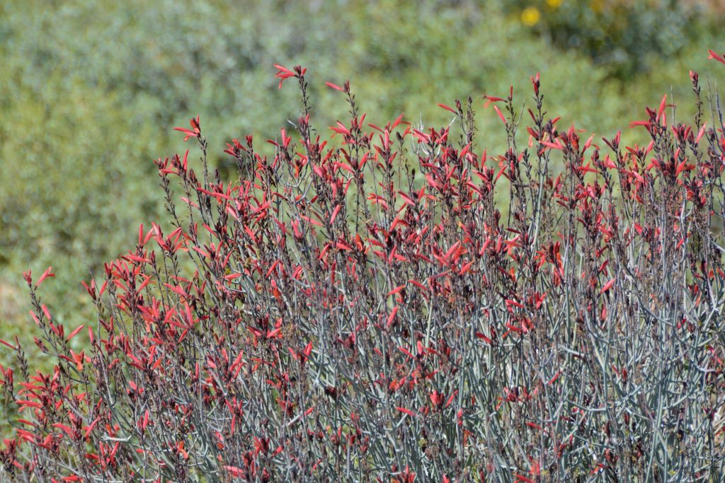
Chuparosa bushChuparosa bush
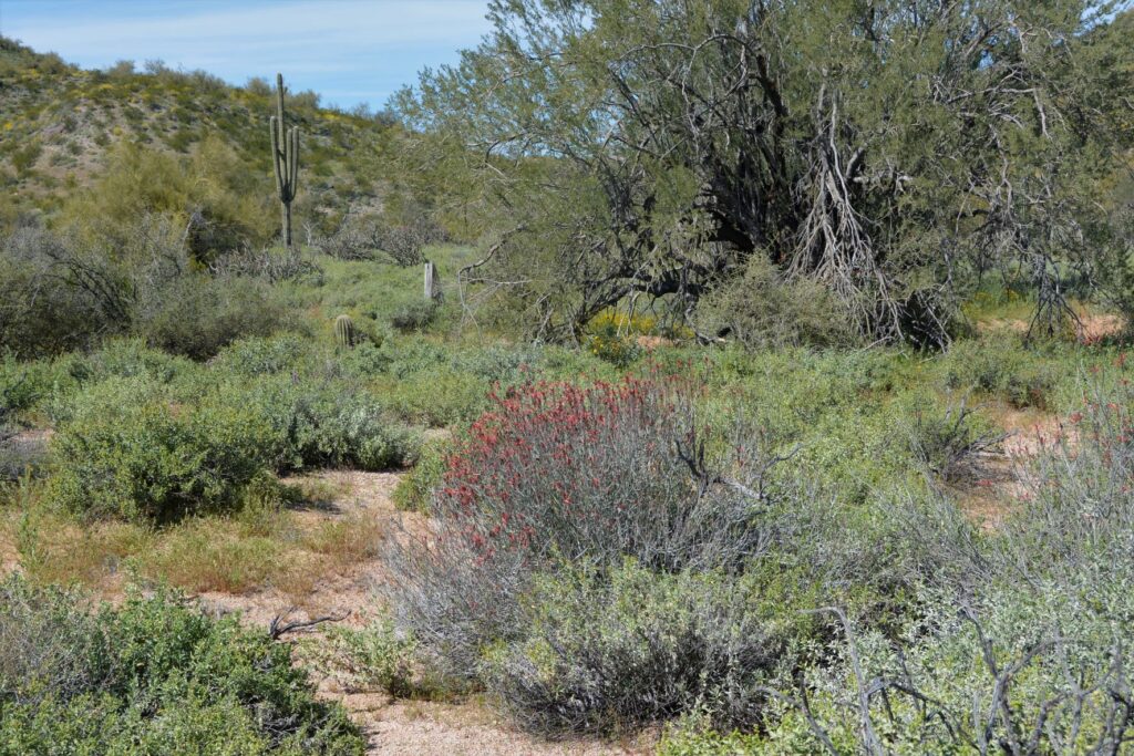
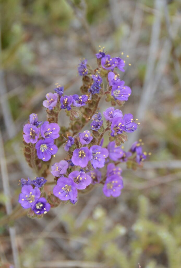
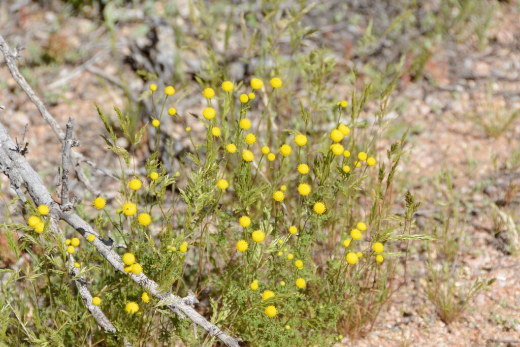
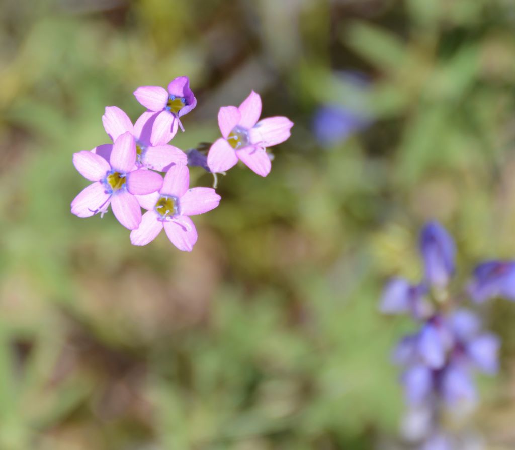
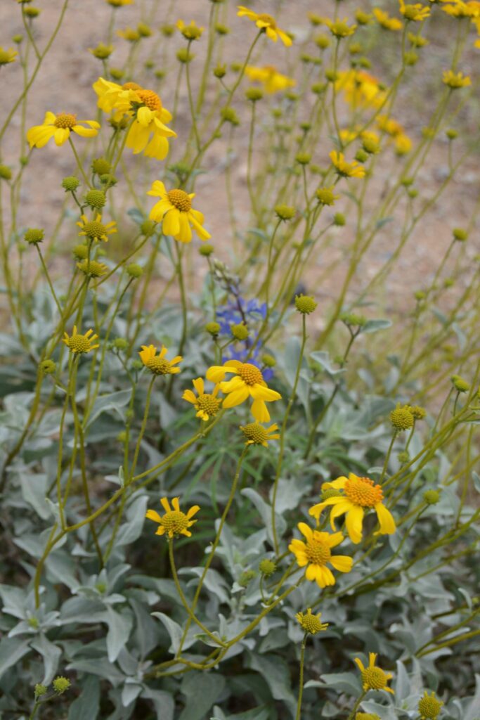
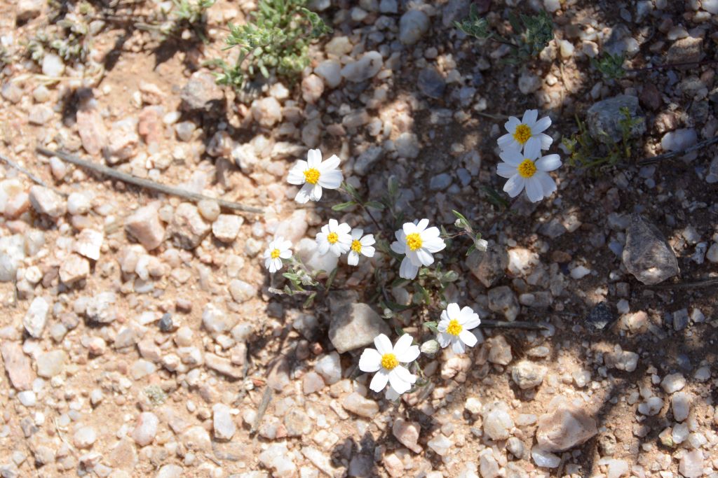
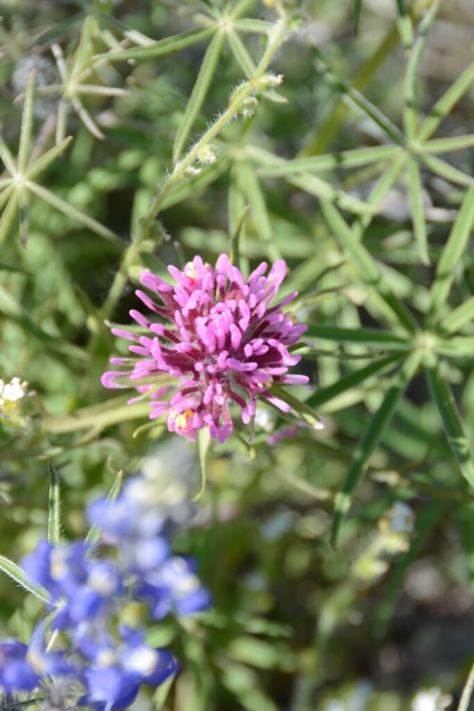
On our walk we saw a variety of wildflowers and desert plants in bloom.
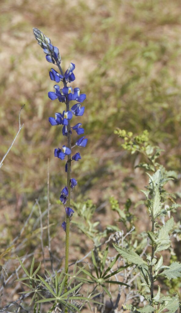
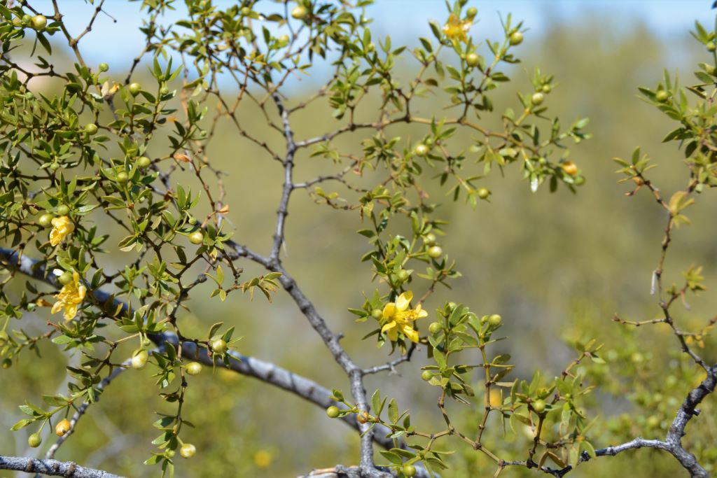
Scorpion WeedStinknet or Globe Chamomile Rock GiliaBrittlebush, the little sunflowers of the Arizona desertDesert Star DaisyCoulter’s LupineCreosote Bush
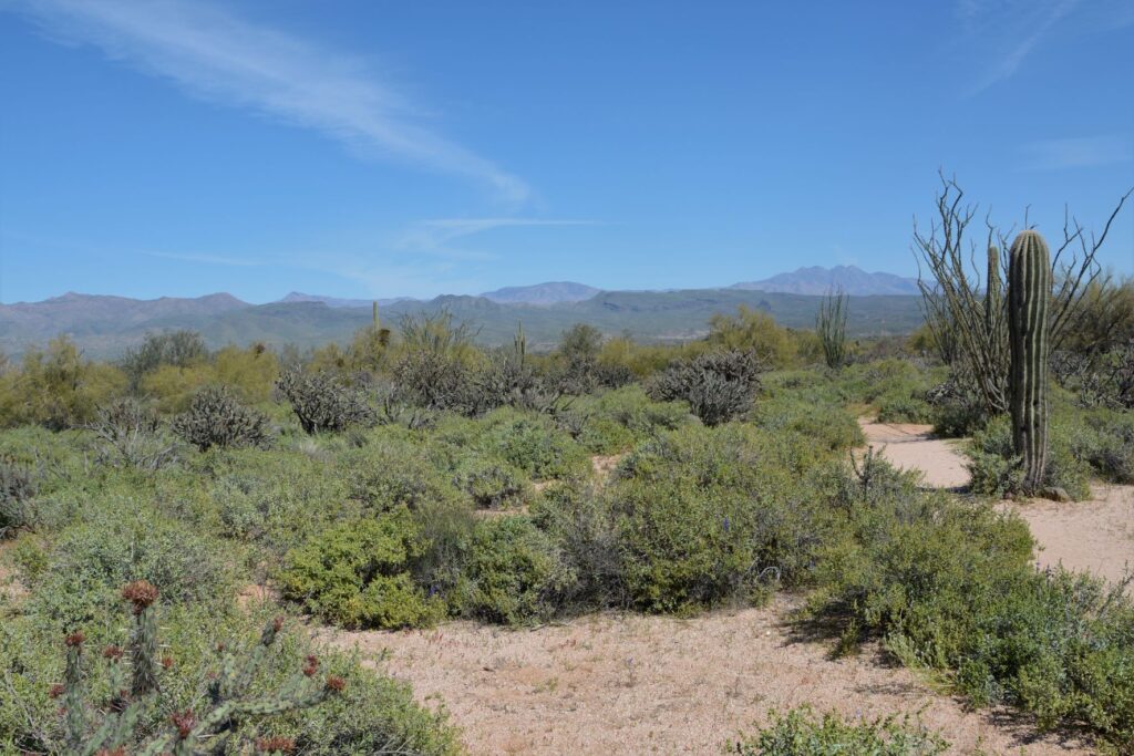
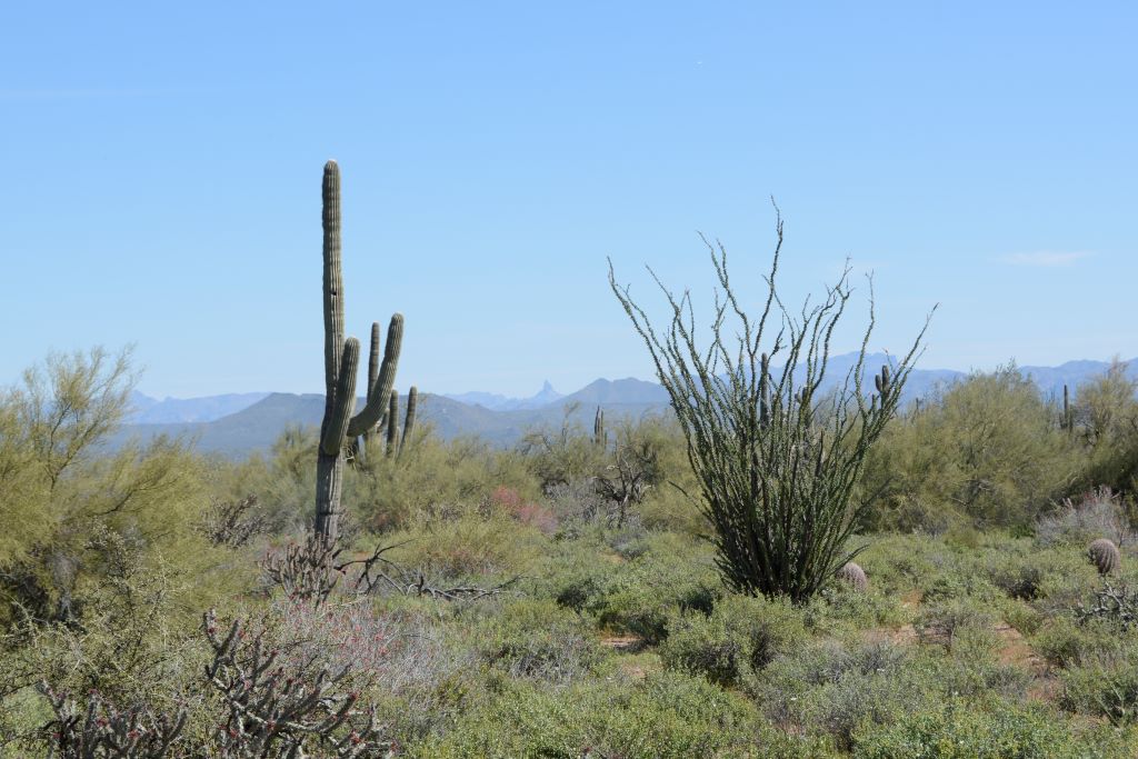
The views of cacti and distant mountains were beautiful, but by now we were starting to get hot and thirsty.
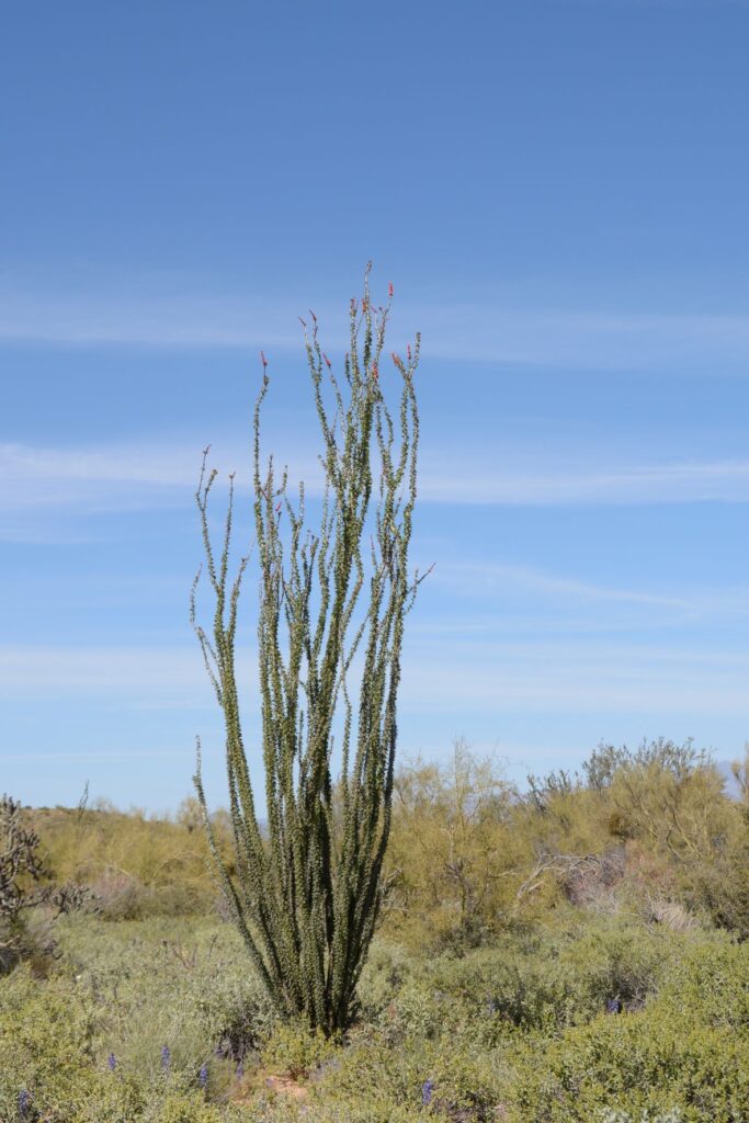
Saguaro cactus and Ocotillo CactusOcotillo Cactus in bloom
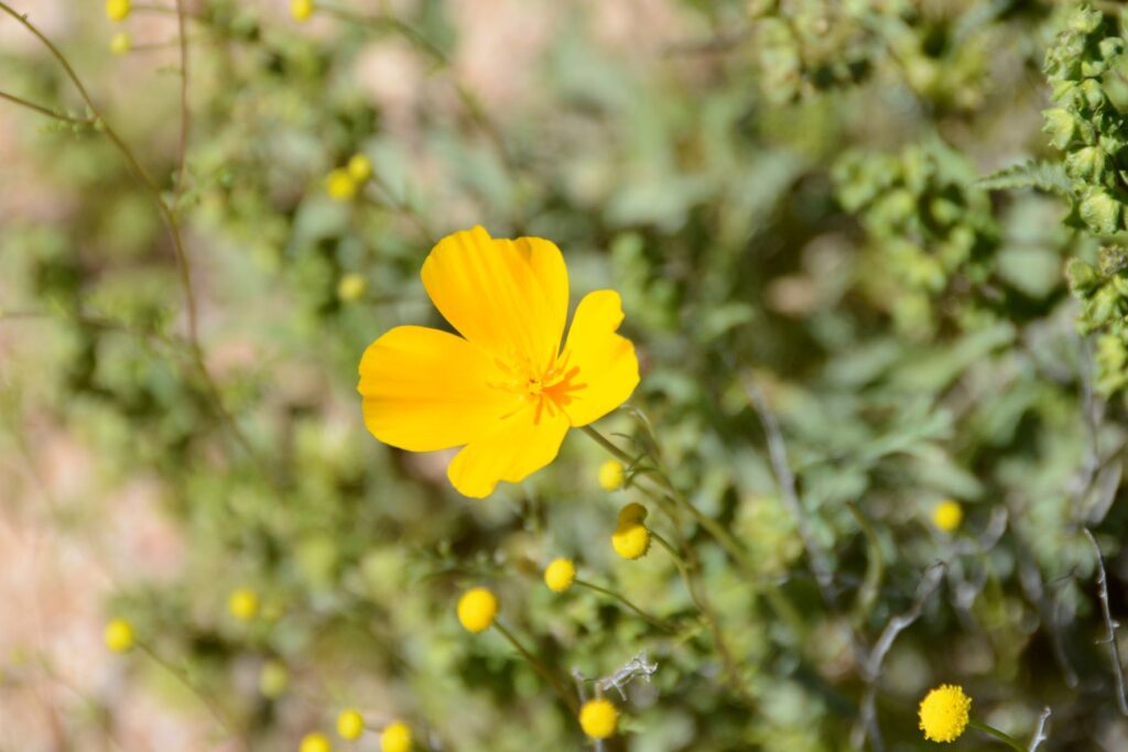
We finally saw some yellow flowers, but they were not poppies. Could the people we met on the trail possibly have mistaken these yellow flowers for poppies? It seemed unlikely. But we’d already gone past the one mile marker. The path started to get steeper.
Saguaro Cactus
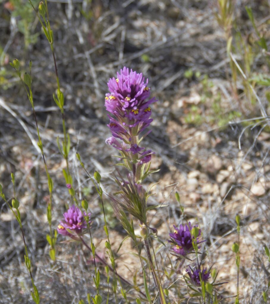
After walking more than a mile, we finally found a few poppies, but no fields of them. By now we were wishing that we’d worn a hat and had brought along some water. We decided it was time to turn back.
Golden Poppy
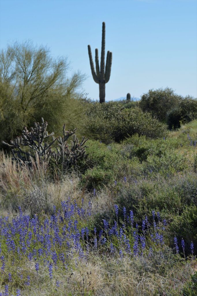
Not being satisfied with the amount of wildflowers we had seen on our walk, I was hoping to get more photos on our drive out of the park. I was not disappointed.
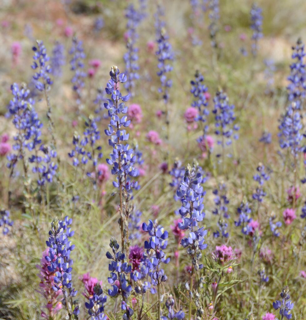
Purple Owl’s Clover and LupinePurple Owl’s Clover and LupineLupine
We stopped along the road in several places.
Purple Owl’s CloverPurple Owl’s Clover and Lupine
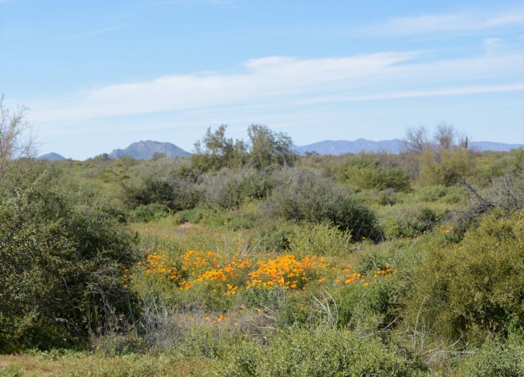
Finally, Ray spotted some poppies. I got out to get a better look and get some photos.
Golden PoppiesGolden Poppies
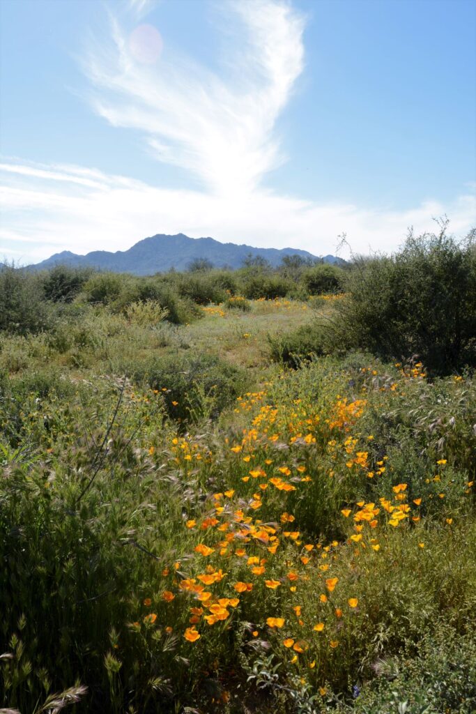
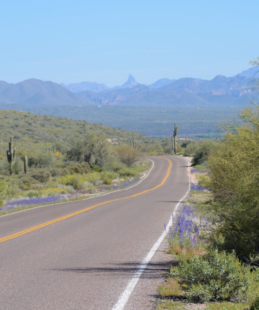
Knowing how quickly flowers can bloom and fade, I do not blame the Ranger for sending us off on a wild goose chase. If we had taken the correct pathway, we might have seen the fields of poppies described by the people we met on the trail. But it was not a total loss. We saw more flowers on our way out of the park than we saw on our hike.
The flowers lined the road as we headed home. In the distance was Weaver’s Needle in the Superstition Mountains. It had been a successful day of wildflower hunting and photography.
“And if God cares so wonderfully for flowers that are here today and gone tomorrow, won’t he more surely care for you, O men of little faith?” Matthew 6:30
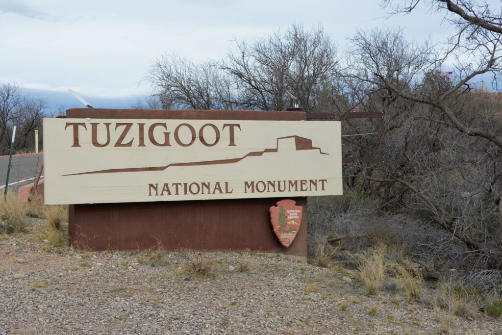
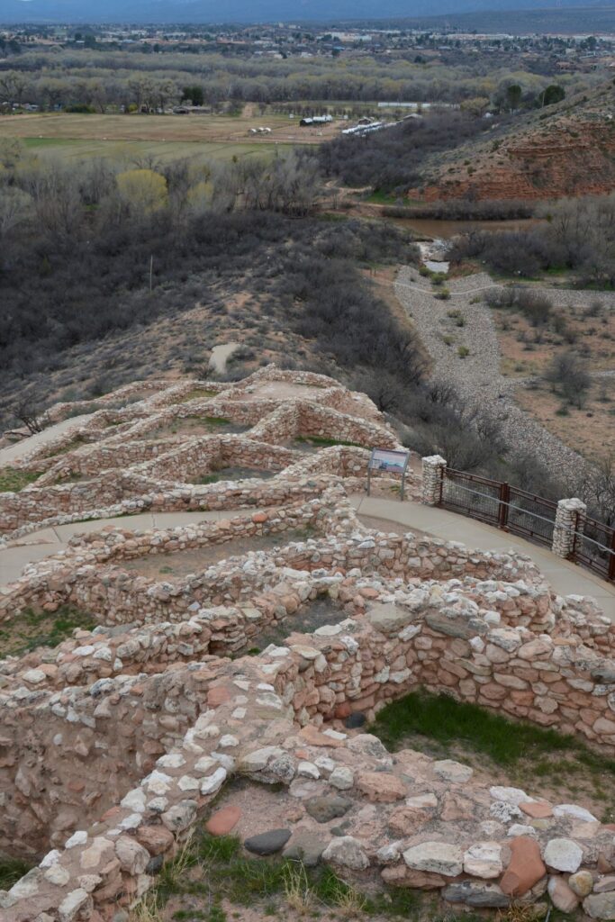
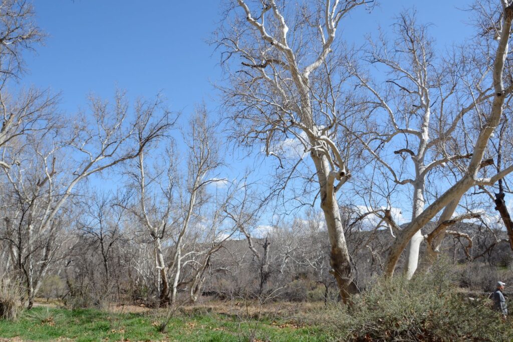
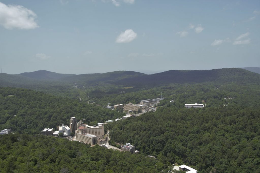
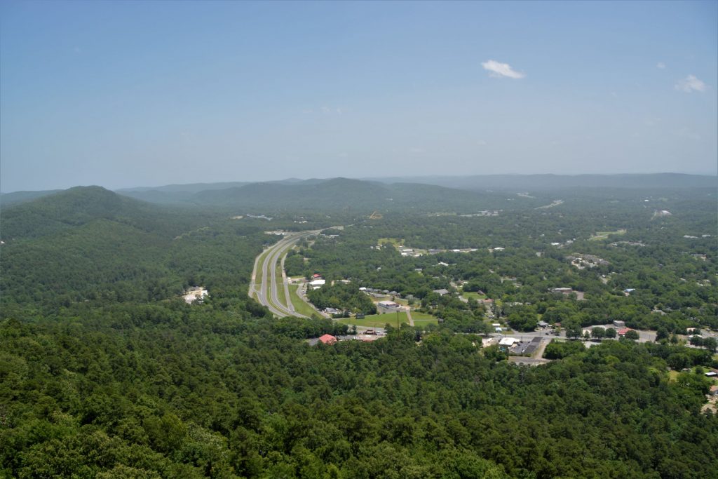
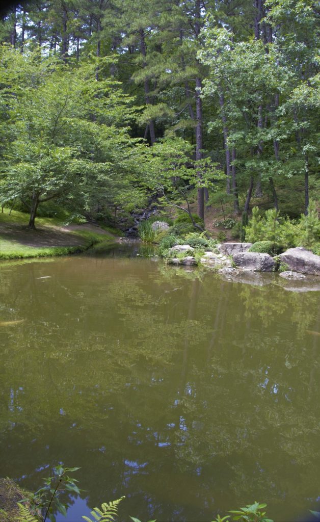
When I lived in Arizona, one of my favorite places to see while traveling north along Highway 17 was Verde Valley. The highway crests a hill and suddenly the view of a lush green valley opens up. As the highway descends into the valley, the green fields and bright green of the cottonwood trees are a stark contrast to the dry surrounding desert. Vermillian cliffs surround the valley while snow-capped mountains peak over the rim. It is a stunning view.
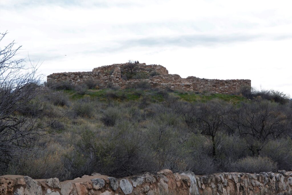
View from the top of Tuzigoot NM. Cottonwood trees line the Verde River. The ghost town of Jerome sits on the side of the distant mountains.
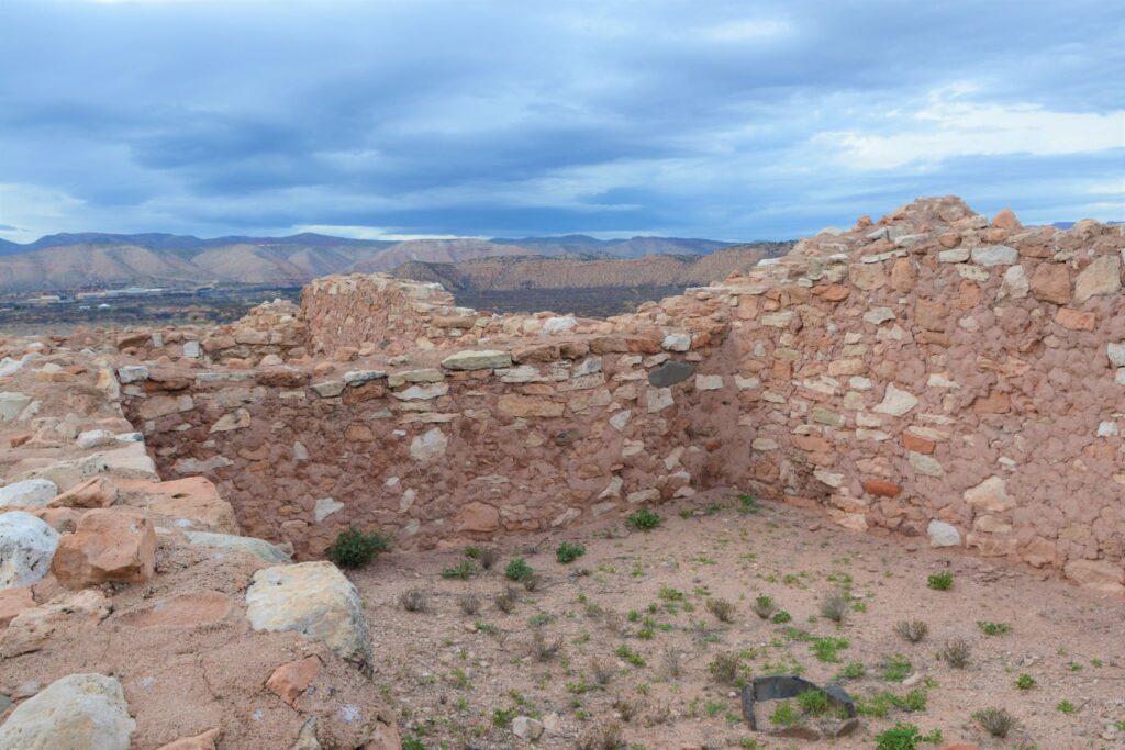
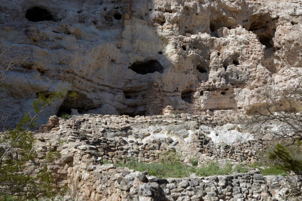
The Indians who came here 1400 years ago traveled along the Verde River valley. Like people of today, they liked to settle near water or on hilltops. One such group, the Sinagua, settled on a hill overlooking the Verde River. They were close enough to the river for water, but high enough to avoid the floodwaters when the river overflowed its banks.
Tuzigoot ruins sit on a hilltop
We don’t know much about these people. Their multi-room settlement was similar in construction to many other pueblos found in New Mexico, Colorado and southern Arizona which means they traveled frequently to each others’ settlements. The relics found, as well as the construction of their dwellings, show evidence of this.
View from the ruins looking down toward the Verde River
The Sinagua people eventually moved north and the walls crumbled and became buried and forgotten until the 1880s when two men from Smithsonian Institute began excavating the site. They gave the name “Tuzigoot” to this site. Tuzigoot is a corrupted form of the Tonto Apache name Tú Digiz, the name for this stretch of the Verde River. It is translated “Crooked Water.”
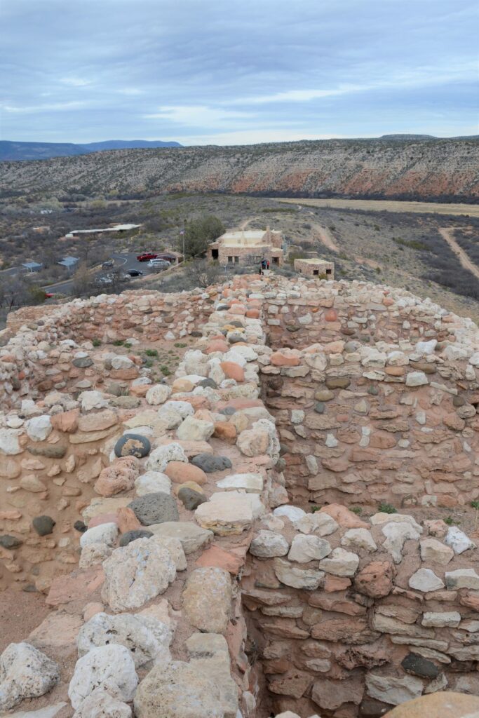
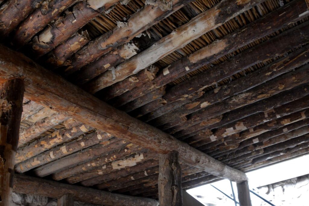
Typical wall construction was of adobe and stone.Roof construction was of logs from trees growing by the nearby Verde River.To preserved the structure, mortar is regularly replaced with a mixture similar to the original.
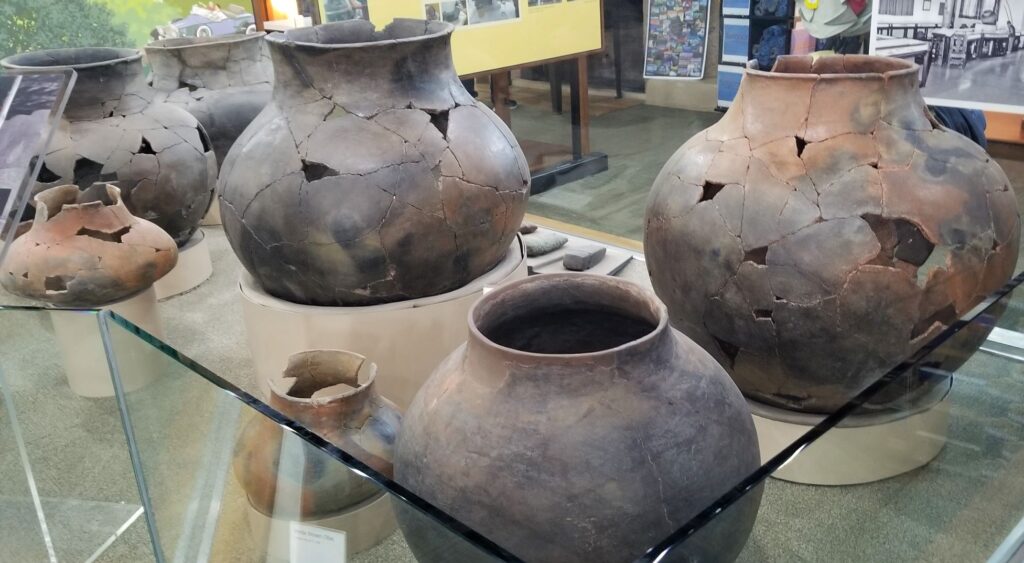
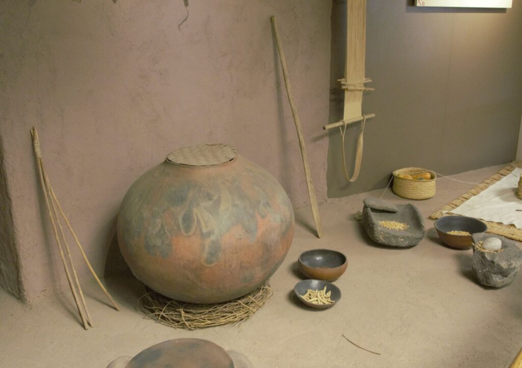
Since taking a pottery class many years ago, I have always been interested in pottery from historical sites. These pots were probably made by coil rope construction, smoothed, glazed and fired in a pit in the ground. What amazed me about these pots was their size!
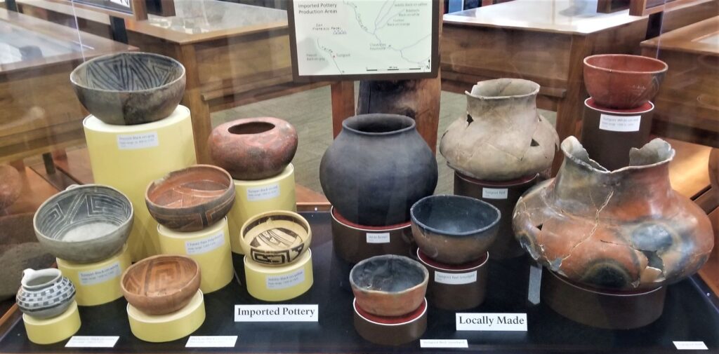
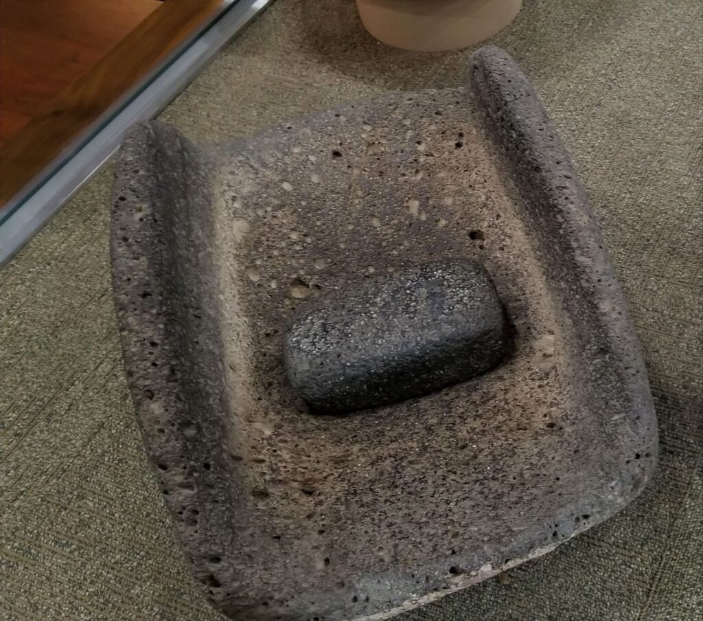
Large pots probably for water storage.Pottery imported from neighboring areas show that the desert people traveled and traded with one another.Grinding stone for grinding corn into flour.Wildlife is plentiful along the Verde River.
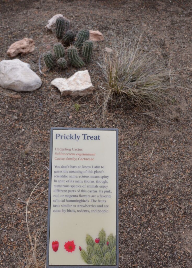
Along the walkway several indigenous plants were labeled. Isn’t this Hedgehog Cactus cute?
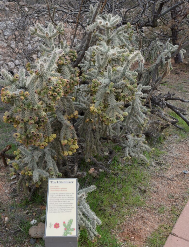
Cane Cholla Cactus is easily caught on clothing and shoes while walking by.
Today visitors can enjoy walking through the rooms of this ancient Indian village, see the displays of artifacts that were discovered here, and enjoy the beautiful views from atop the historical mound.
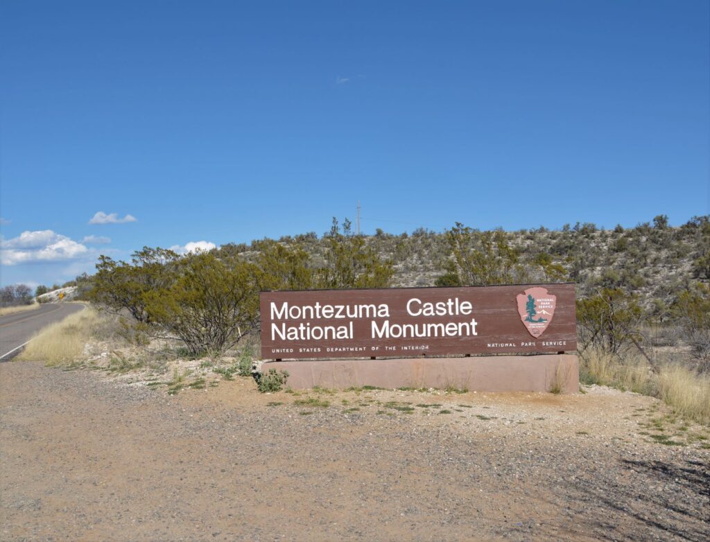
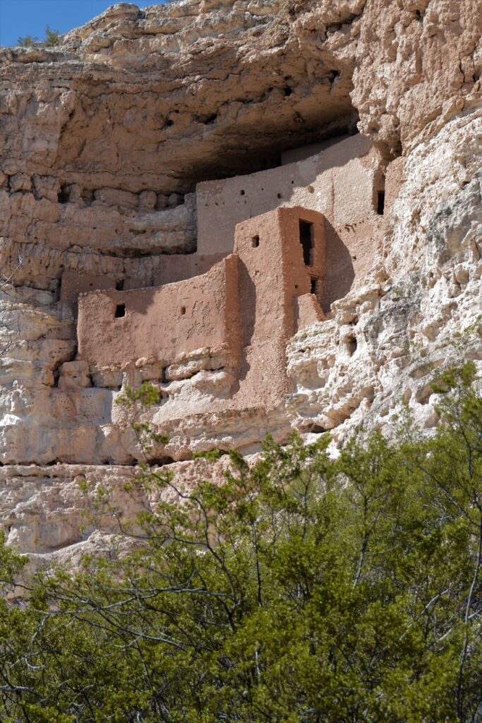
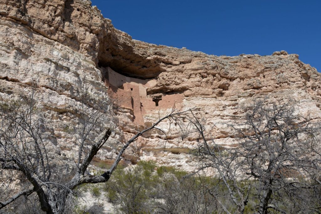
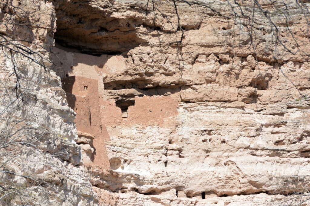
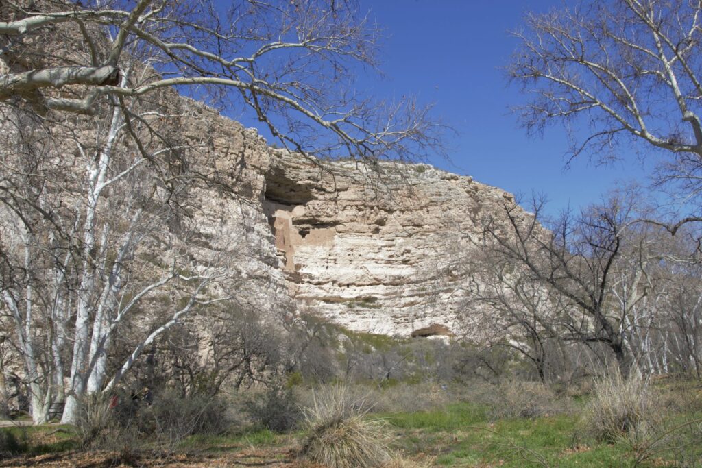
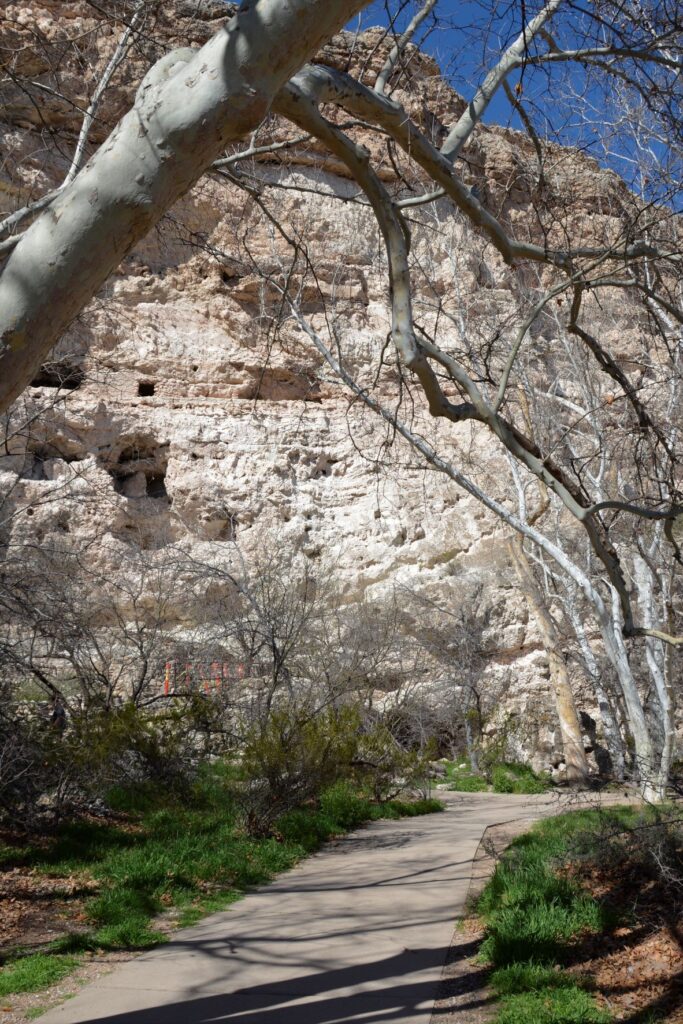
Montezuma’s Castle National Monument
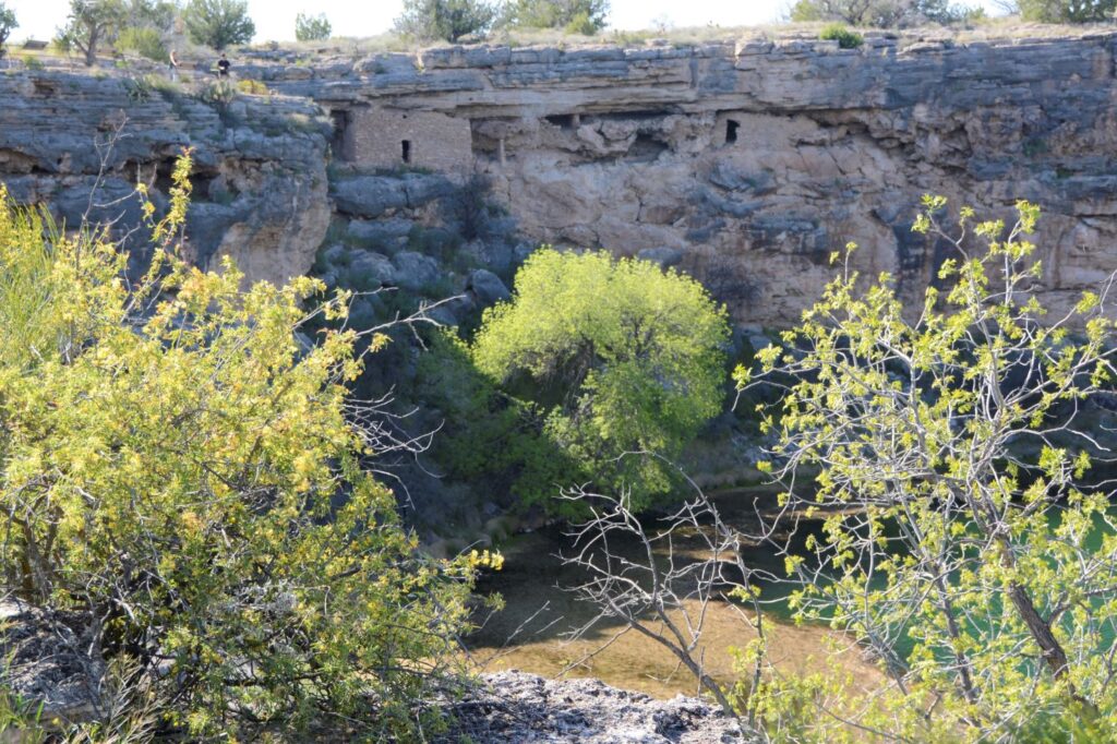
Less than 25 miles away is another ancient ruin known as Montezuma’s Castle National Monument which was also occupied by Sinagua people. It was misnamed by early discoverers of the site who thought that it was built by the Aztec Indians of Mexico.
Montezuma’s Castle cliff dwellings
This pueblo cliff dwelling is an impressive five-story 20 room dwelling accessed by ladders during the time it was in use. It was south-facing, so it got the warmth of the winter sun. In summer, it was cool because of the shade from the cliffs.
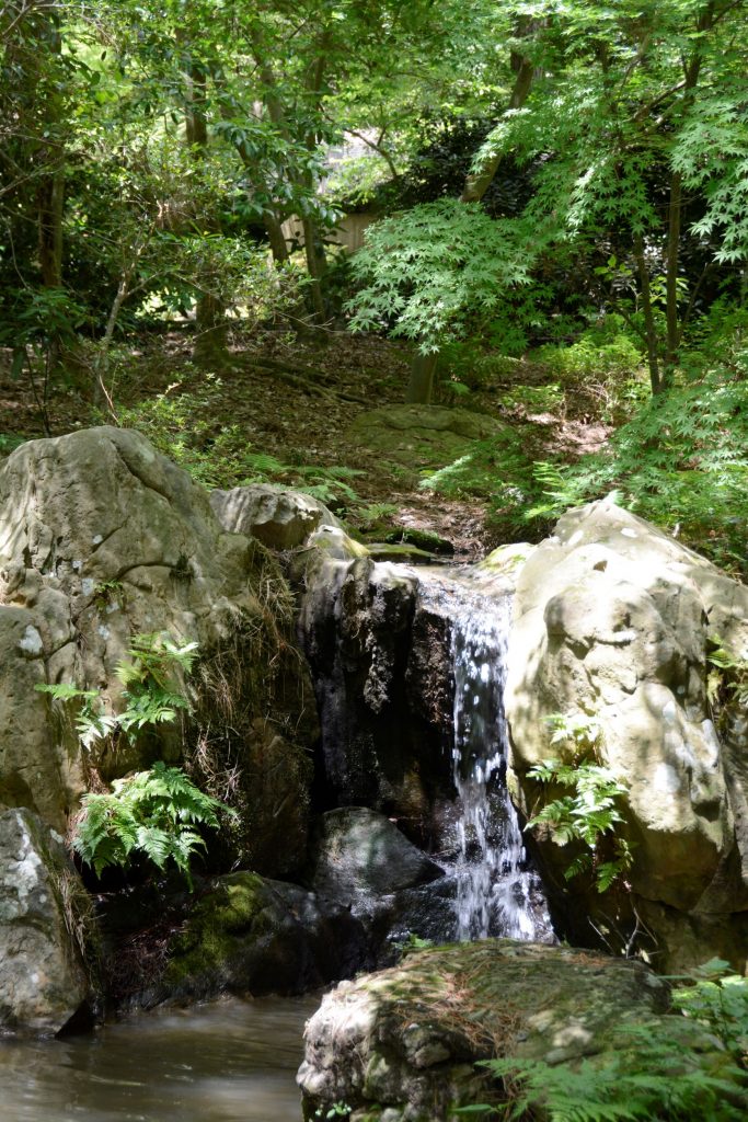
Nearby, Beaver Creek kept the cliff dwellers supplied with water for living and gardening. The Indians grew crops of corn, beans and squash which were known as the Three Sisters because of how the plants worked together to sustain each other.
The beans climbed the corn stalks to reach sunlight, while supporting the corn from the winds, while the squash was a ground cover that kept the soil moist and discouraged the weeds. The beans, a legume, also enriched the soil. Do you grow these plants in your garden?
The pathway to the ruins is a short pleasant walk from the Visitors’ Center.One can see the similarities between these rock walls and the ones at Tuzigoot.
The day we visited, Beaver Creek was a rushing torrent from recent rains. The pathway to the creek was cordoned off to visitors. The Ranger told us that in a previous year, the creek had overflowed and the water came up to the bottom of the cliff. Maybe this is why the Indians built their pueblos way above the water.
Looking toward Beaver Creek, this area was where they grew their crops.
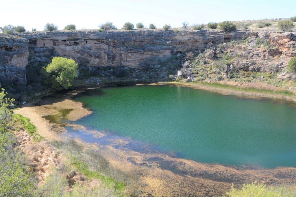
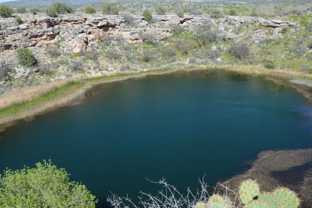
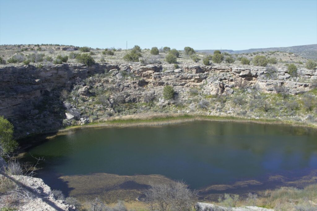
Montezuma’s Well
About 10 miles north of Montezuma’s Castle is Montezuma’s Well. Instead of taking us on paved roads, our GPS took us the long way. I couldn’t believe such a popular national monument would be accessed by a three mile dirt road. It dawned on us that there was a better way when we reached the entrance to the Monument. There was the paved road we were looking for. On our return route we followed the paved road back to Rimrock from which we were able to access Interstate 17.
Montezuma’s Well and cliff dwellings
There is a short climb up to the rim overlooking Montezuma’s Well. The well is an ancient sinkhole that is fed by an underground spring of over 1.5 million gallons of water each day. The spring waters are from rain and snow that fall on the nearby Mogollon Rim which then seeps through the rock until it reaches the spring. Pressure pushes the water up to the surface. It is said that the water takes as long as 10,000 years to travel from the Rim to the Well.
The well is deep. Millions of gallons of water flow into and out of the well.
The water exits the well through underground streams and a cave system which drains into an ancient irrigation canal. The water level remains constant, as well as the temperature of the water which averages 70 degrees F. However, because the water has a high alkalinity and an excessive amount of dissolved carbon dioxide–more than 100 times higher than normal–fish cannot survive.
Fish can’t live in the water, but thousands of leeches live here.
The depth of the well is unknown because of the pressure of the water. Divers have discovered a “false bottom” at around 60 feet of pressurized groundwater that holds a column of fluidized sand in suspension. The fluidized sand rises from two deep vents in the floor of the well. One is 124 feet deep and the other is 74 feet deep. But previous measurements measured 137′ and 95′. So, we can just say, it’s deep.
Pueblo dwellings in the rocks above Montezuma’s Well
The people who built homes near Montezuma’s Well were the Hohokam and later the Sinagua.
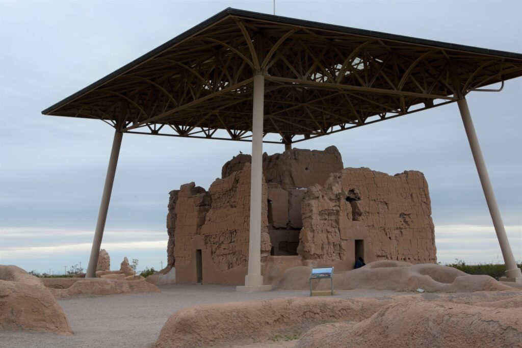
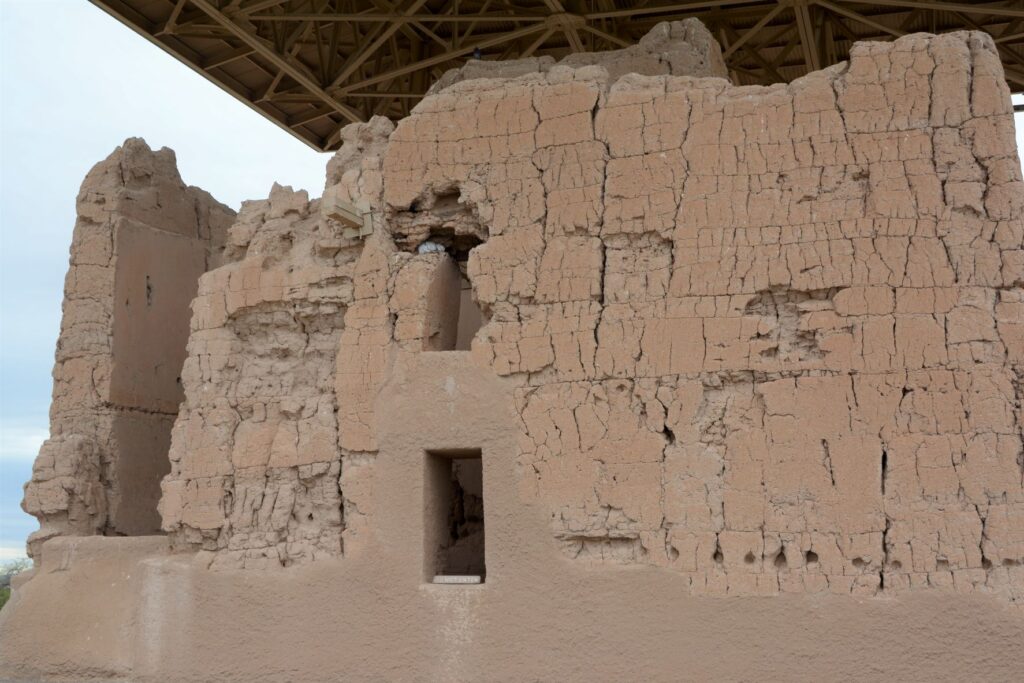
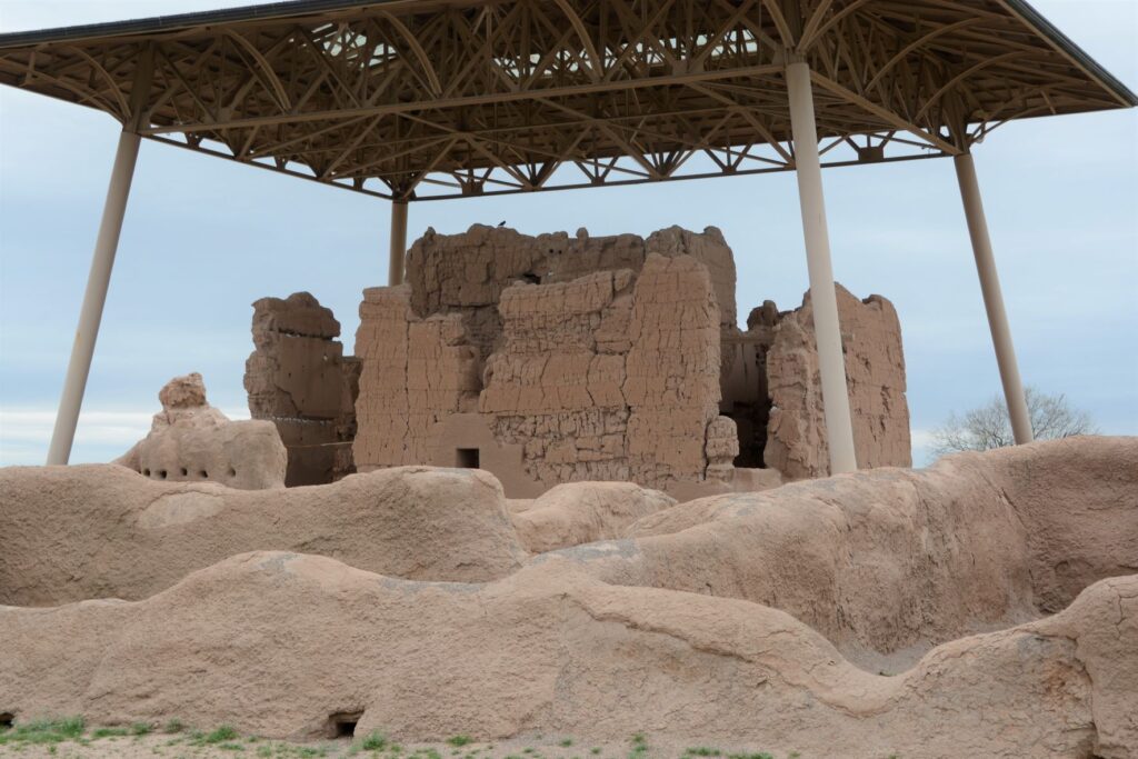
Casa Grande Ruins National Monument
Leaving the Verde Valley area, we traveled south to Mesa, Arizona. One afternoon we drove south, halfway to Tucson to Casa Grande Ruins National Monument. This “Grand House” was probably built in the 1300’s, which is the time period of the founding of the Byzantine Empire, the 100 years war, and the black death or bubonic plague in Europe. These desert people had already been using irrigation methods for hundreds of years to grow their crops.
A metal structure over the ruins keeps it from deteriorating.
Archeologists are not sure of the purpose of this grand structure. However, because of the construction they believe it was well planned and organized. The builders used caliche, a natural concrete-like material found under the soil around this region. They used it to build houses with solid walls and flat roofs covered with this caliche substance.
Walls were made from caliche, a concrete-like material found in the ground.
These desert people were given the name “Hohokam.” It is not really the name of a tribe or people. The name may have come from “huhugam,” an O’Odham word that means ancestors. Today these people are referred to as Sonoran Desert people. By the way, Hohokam is the name of the grade school I attended. Our elementary schools were named after Indian tribes.
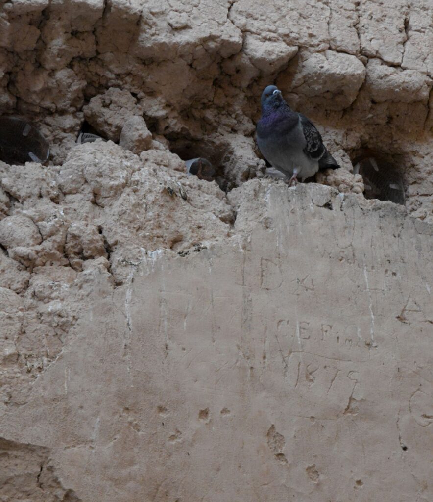
A pigeon makes its home among the walls of the ruins. Note the etched name and date below it.
When I took the photo above, I didn’t notice the name and date etched on the wall. It is a good thing that people like Mary Hemenway and President Benjamin Harrison took steps to preserve the ruins for future generations from vandalism and looting. Mary Hemenway was a wealthy woman who sponsored archaeological expeditions. One expedition to Casa Grande Ruins alerted her to the vandalism. She made efforts to preserve the site and as a result, it became the first federal prehistoric and cultural reservation by President Harrison in 1892.
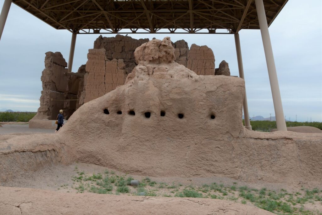
One of the purposes of this structure might have been a calendar. Some of the holes line up directly with the sun on the summer and winter solstices.
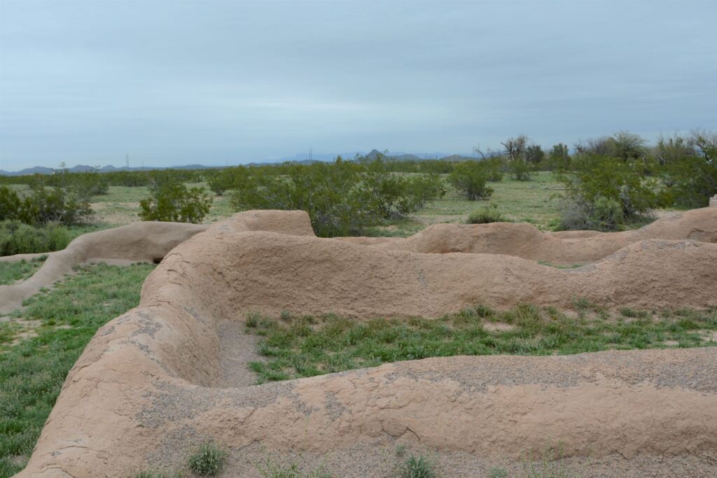
In later years, the village homes were grouped into caliche-walled compounds which were arranged around public plazas and public structures. The Grand House or Casa Grande was at the center of this settlement.
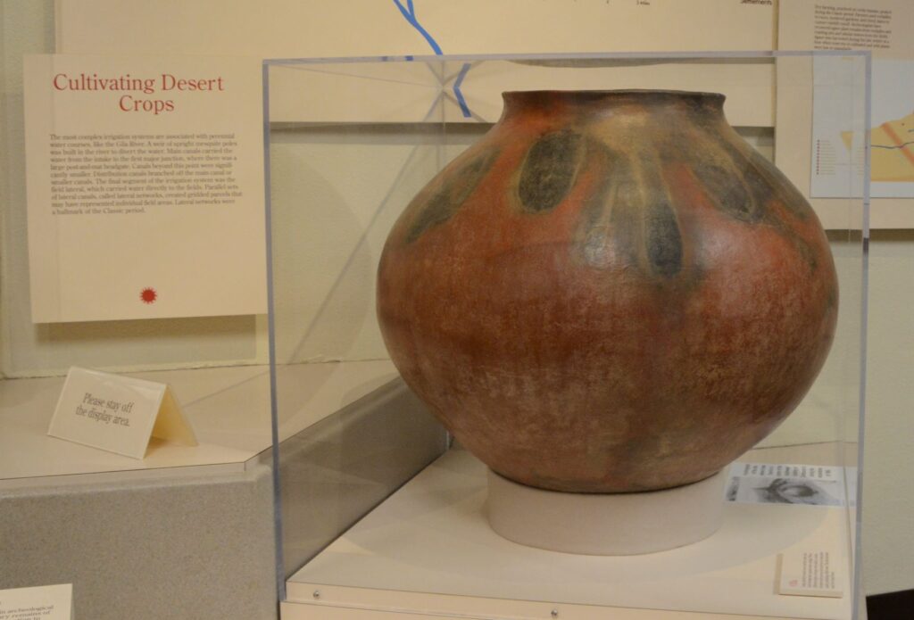
These desert people were identified by their type of pottery called “red-on-buff.” This beautiful piece of pottery below is an example of the techniques used in creating their pottery. In my opinion, the dark portions on this pot look to me like leaves of some plant that they tied around the neck of the pot while being fired which left these unusual designs.
This pot below looks similar in design to the one above with the plant-like designs.
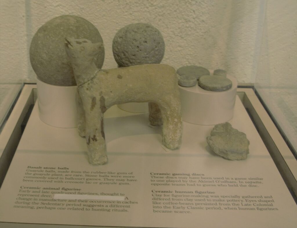
These desert people also enjoyed games. There are over 200 oval-shaped, structures with earthen sides located in large Hohokam villages in southern and central Arizona. Archaeologists have speculated that some kind of game was played within these courts with two teams using a hard rubber or stone ball. Round discs were found that might also have been used in other games.
The map below shows many places around Arizona where the Sonoran desert people lived and moved. Eventually, they all left for unknown reasons. It may have been drought, floods, disease, invasion, earthquakes, internal strife or salinization of farmland. We don’t know. Yet we can still appreciate the structures, relics and places they left behind and marvel at their ingenuity.
I am glad we took time to see these places, having never visited any except Montezuma’s Castle when I was growing up. I don’t think I appreciated the contributions these people made to Arizona history. It’s a shame that Hohokam school didn’t teach us anything about the people that our school was named after. I think it would have made a big impression on me to have learned about them and to have visited Casa Grande National Monument.
But the moral of the story is, explore your own backyard. You never know what you might be missing!
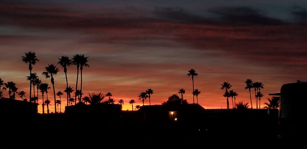
Our weeks in Tucson and Benson, Arizona, gave us a chance to explore southern Arizona. Arizona skies seem to have the perfect conditions for amazing sunsets. We enjoyed this beautiful sunset one evening on our walk around the RV park.
Sunset in Tucson, Arizona
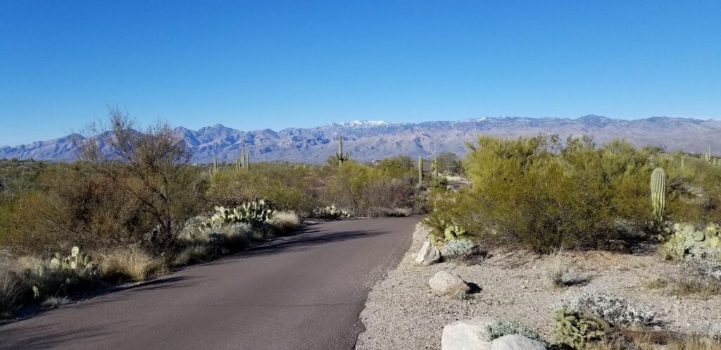
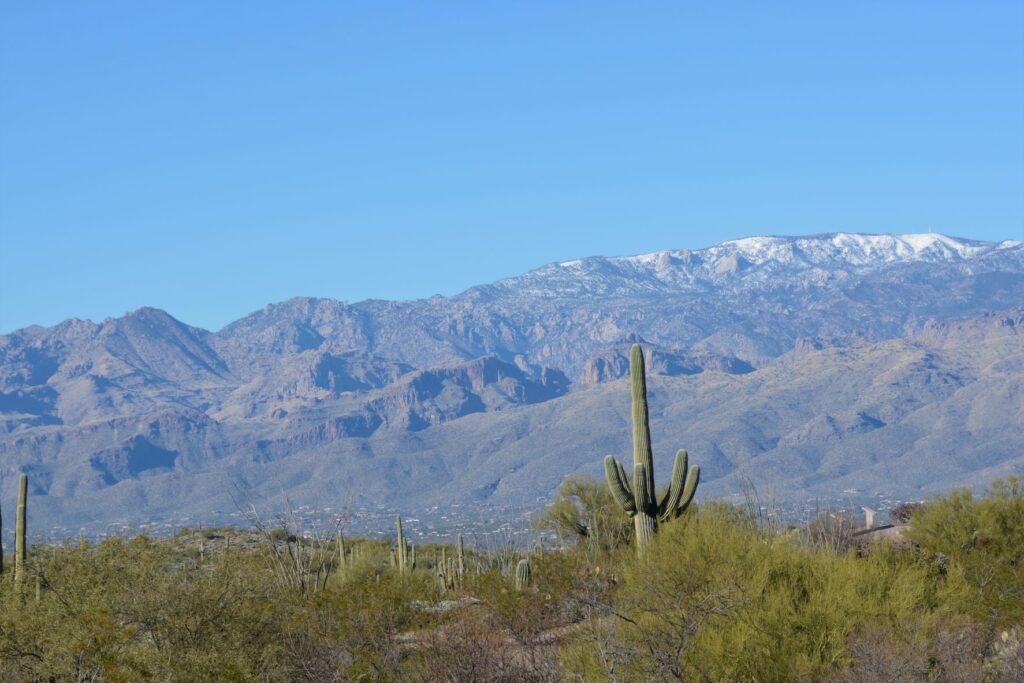
Since we were so near Saguaro National Park, I made a quick trip there one afternoon to get my National Park Passport Book stamped. While there, I couldn’t resist a quick trip on the 8-mile drive through the park. The photos of cactus with the snowy mountains in the background were worth it.
Saguaro National ParkSaguaro National Park
Green Valley
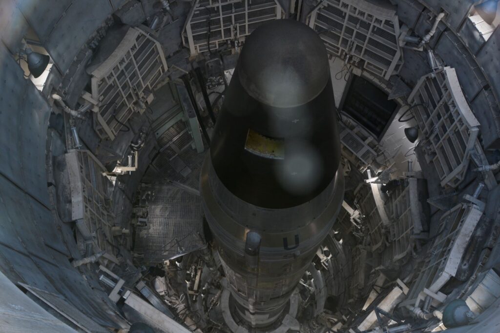
One afternoon we took a tour of the Titan II Missile Museum in Green Valley, Arizona, which is just a few miles from Tucson. The missile is not operational, but it was a sobering reminder of the former cold war and threat we faced of nuclear war.
View looking down into the silo of the Titan II Missile
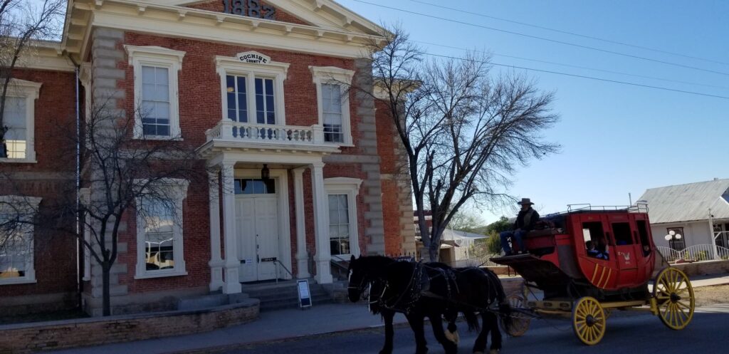
Tombstone
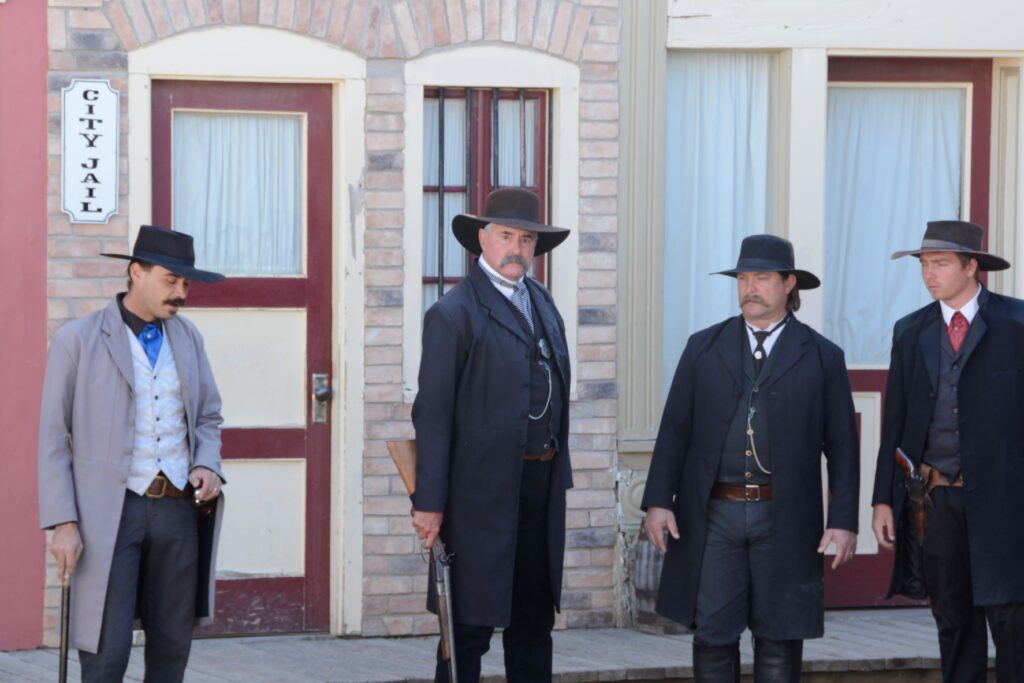
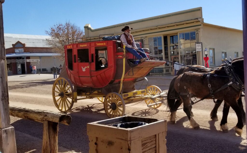
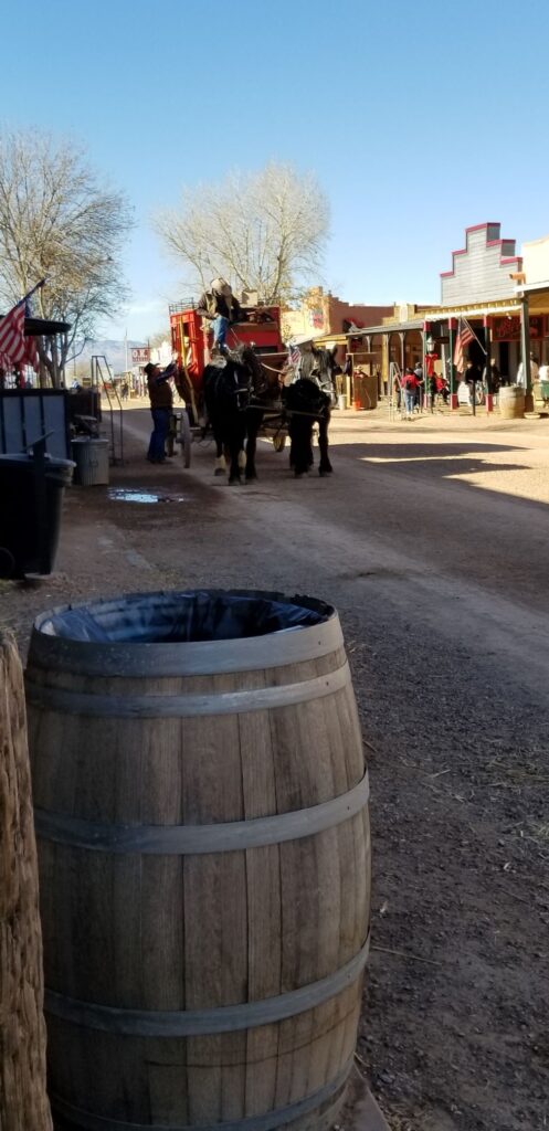
Another popular southern Arizona town is the historic town of Tombstone. One day we packed a lunch and spent the day touring the town. While there, we witnessed a re-enactment of the shootout at the OK Corral. Afterwards we strolled along the streets visiting the Epitaph Press, the Bird Cage Theater, the Arizona Ranger Museum and a presentation of the history of Tombstone.
Actors of Doc Holiday and the Earp Brothers re-enact the shootout at the OK CorralStagecoach ride in TombstoneMain Street in TombstoneHistoric Courthouse at Tombstone, AZ
Benson
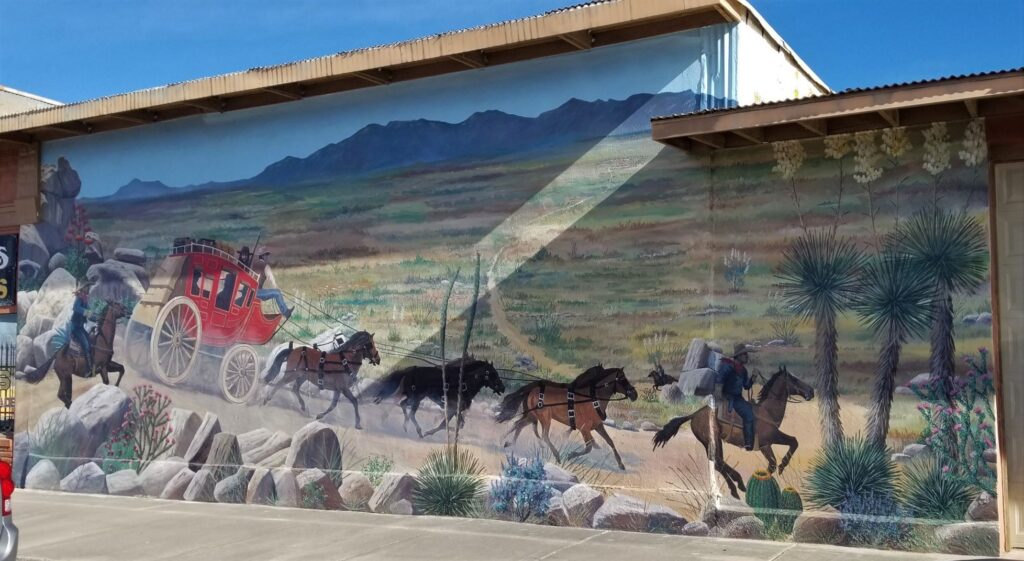
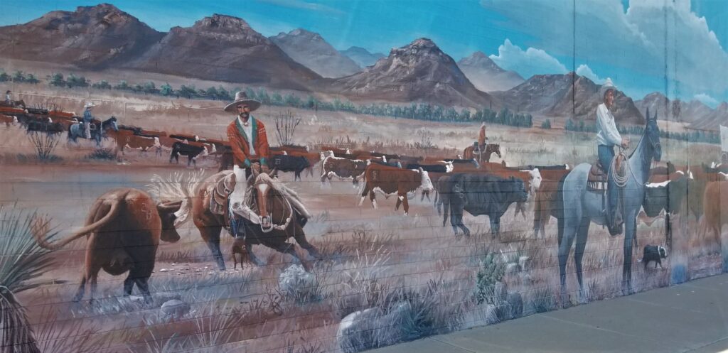
We spent one week in Benson, Arizona, just a few miles south of Tucson. Benson is an interesting town because of the murals painted on the buildings and walls around the town. It has a western small town feel to it and reminded me of our former hometown of Mariposa, California.
Mural in Benson, ArizonaAnother mural in Benson, Arizona
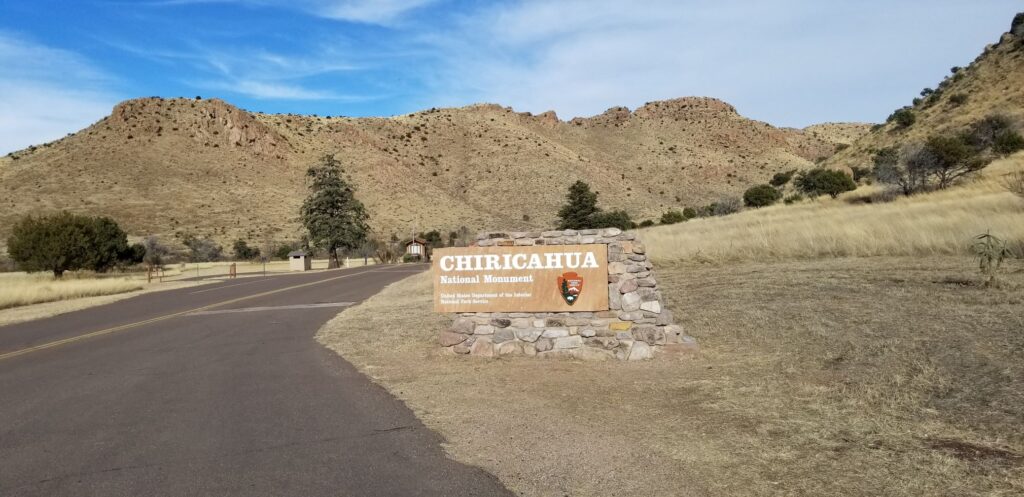
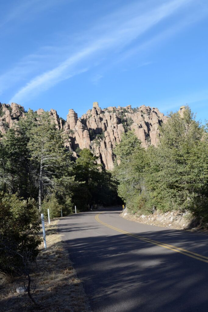
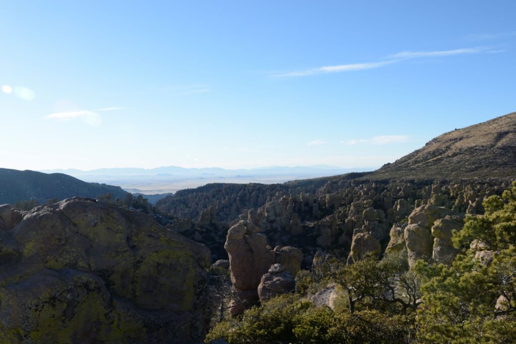
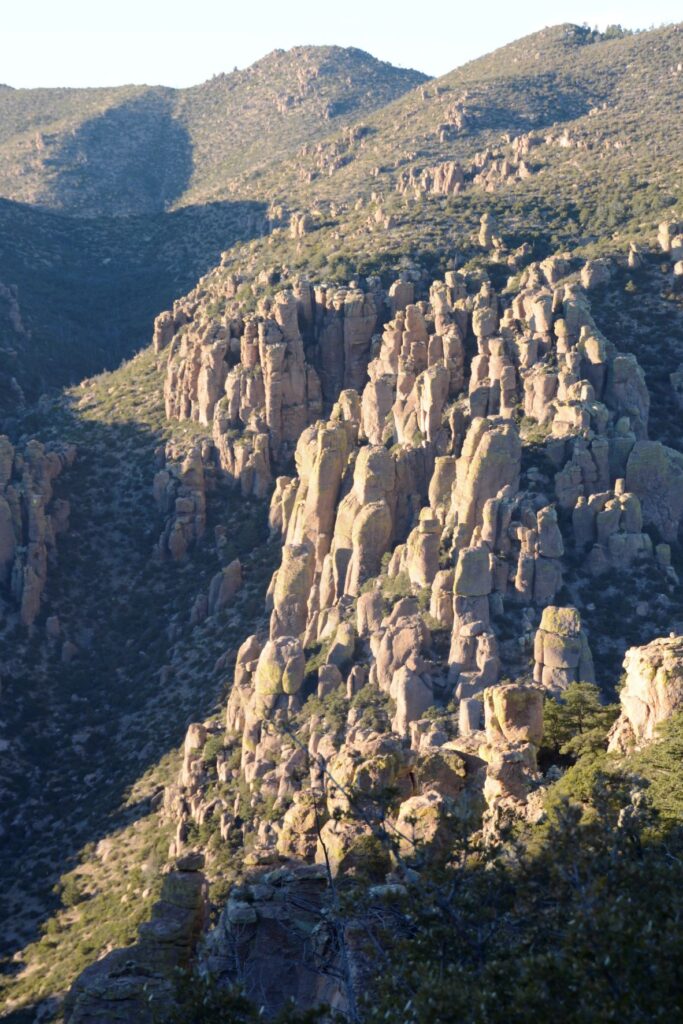
Chiricahua National Monument
About an hour drive from the town of Benson is Chiricahua National Monument in the southeast corner of the state. National Monuments may not be as popular as National Parks, but they can be surprisingly beautiful and interesting. It seems there isn’t a substantial difference between the two except that National Parks require an act of Congress to establish and National Monuments do not. Arizona has 18 National Monuments, more than any other state.
Entrance to Chiricahua National Monument
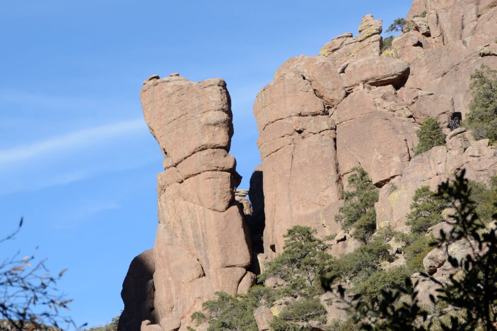
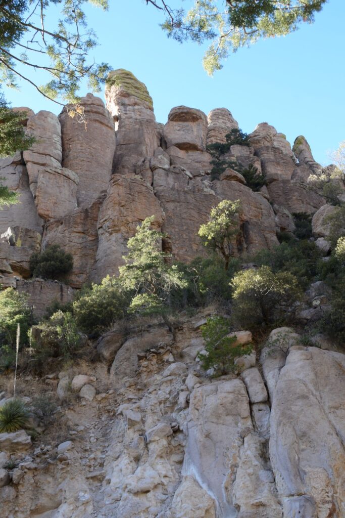
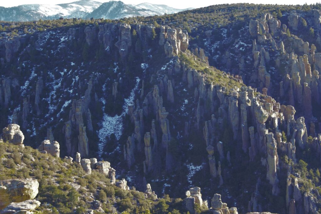
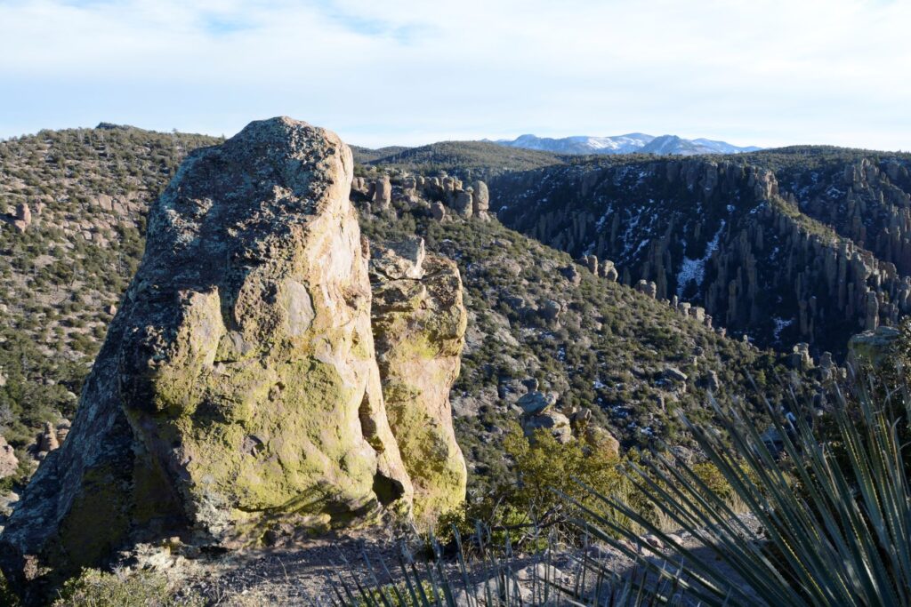
The eight-mile scenic drive starts by winding along the bottom of a canyon surrounded by rhyolite rock pinnacles or hoodoos for which the monument was created to protect. As the road climbs steadily, the views change until you’re overlooking the rock formations from the top of Massai Point at an elevation of 6,870 feet.
Hoodoo rock formations near entranceRhyolite rock pinnacles overlooking scenic drive.
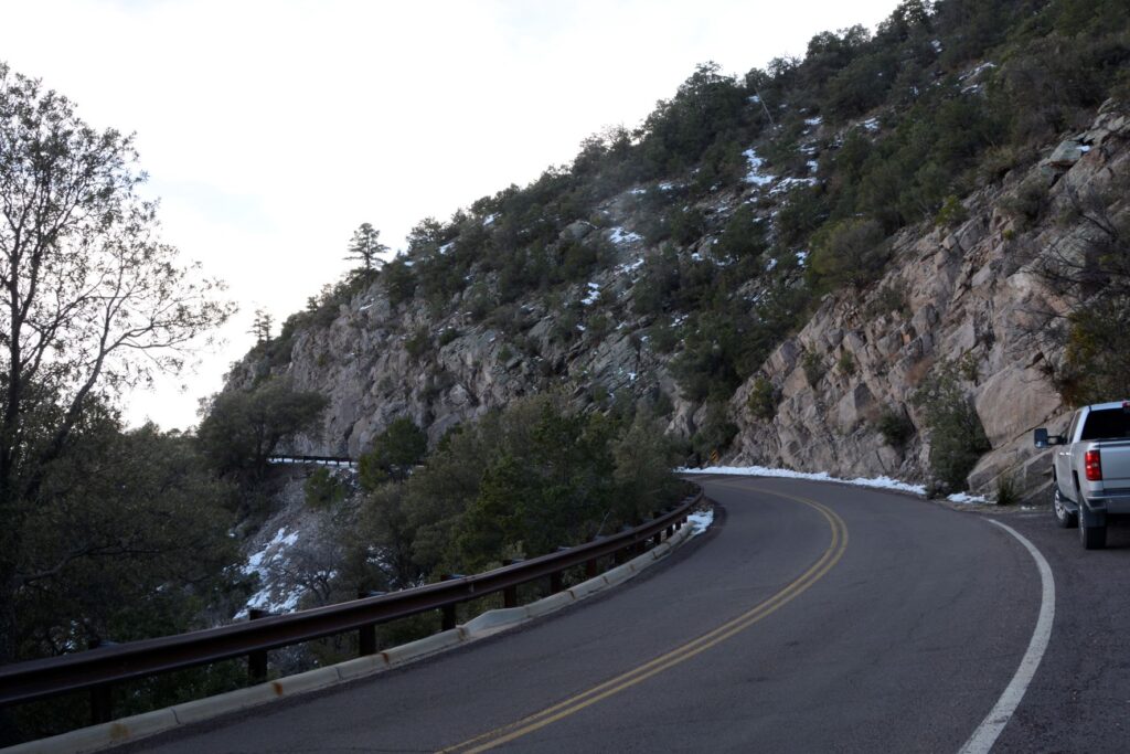
As the road climbed in elevation, we encountered some snow, and could see more mountain ranges in the distance.
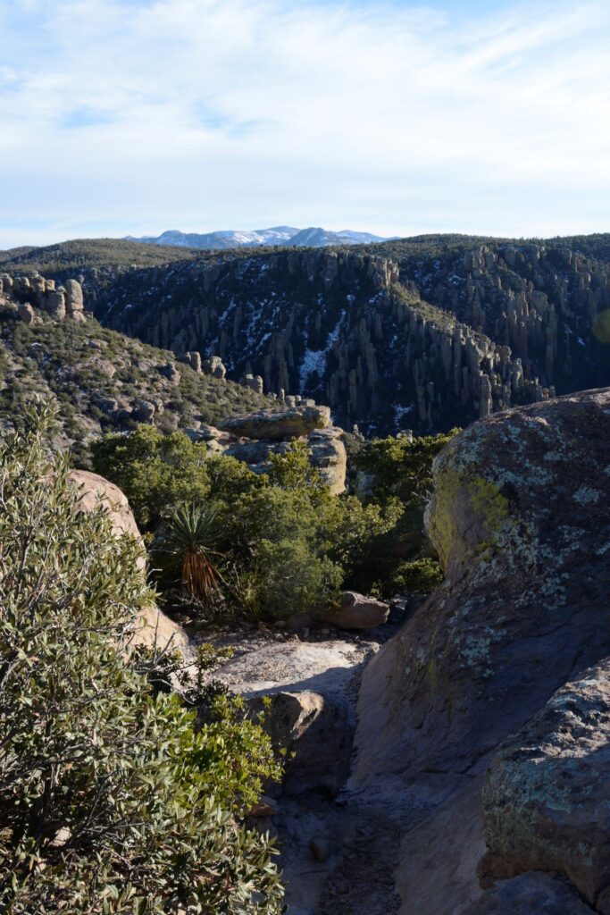
At the end of the road is Massai Point where there is a parking lot and a path leading to a stone building. It was a windy day so we were glad to go inside to get out of the wind. Inside we read about the nature and history of the park.
View from Massai Point
At the summit, we could now look down on the many rock pinnacles.
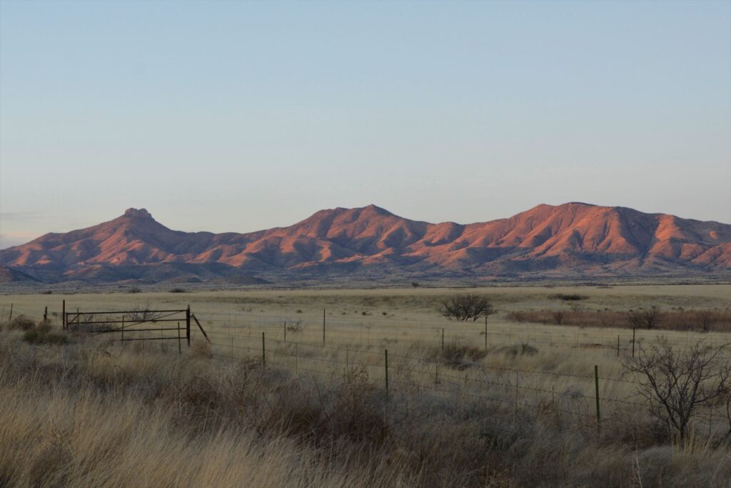
At Massai Point, we could see miles of the surrounding area with distant mountain ranges, including the Dragoon Mountains and Cochise Stronghold.
In the distance are the Dragoon Mountains and Cochise Stronghold
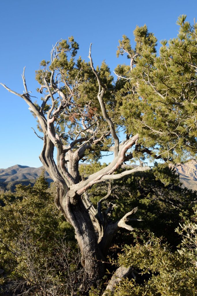
The trees at the higher elevations must be hardy to withstand the harsh climate.
Weathered pine at Massai Point
Chiricahua National Monument is considered a “sky island” because it is comprised of an isolated mountain range that rises up out of the surrounding desert which is like a sea. Because it rises about 6,000 feet above the surrounding valley, it provides a wide range of ecosystems and plant and animal diversity.
Chiricahua NM is one of many “sky islands” in the southeastern desert of ArizonaRhyolitic tuff rock formations were caused by volcanic activity where ash cooled and hardened.
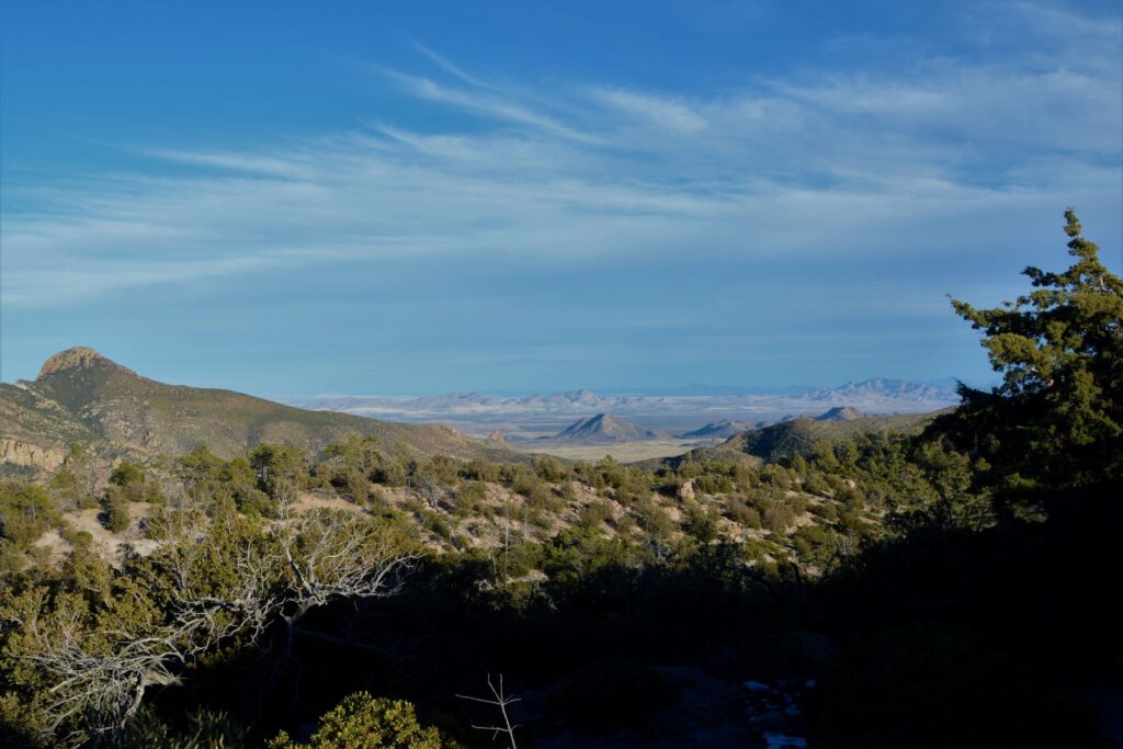
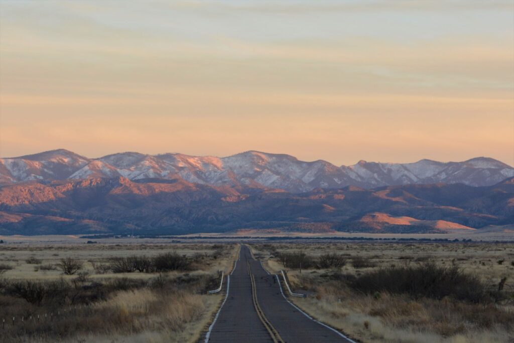
As we drove back down the mountain and out of the park, the evening sun cast a red glow on the nearby mountains. It was late in the day and we were hungry, but I decided to pull over and get one last photo.
As I got out of the truck, I happened to look behind me down the road where we had come. What I saw was this beautiful view of the snowy mountains in the last light of day. By the time I got back in the truck, the light was already gone. I was so glad I stopped for that one last shot.
Road to Chiricahua National Monument
I was surprised at the beauty and interesting topography of Chiricahua National Monument. Though it is off the beaten path, it is worth a visit.
Another surprise was a fascinating article I came across while researching for this blog. The article is about a missing ranger from Chiricahua National Monument. Out of curiosity, I clicked on the link and discovered a tangled mystery. It is quite long, but keep reading. It gets more and more mysterious the further you go. If you care to read it, I will link it below.
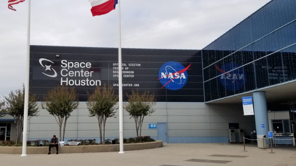
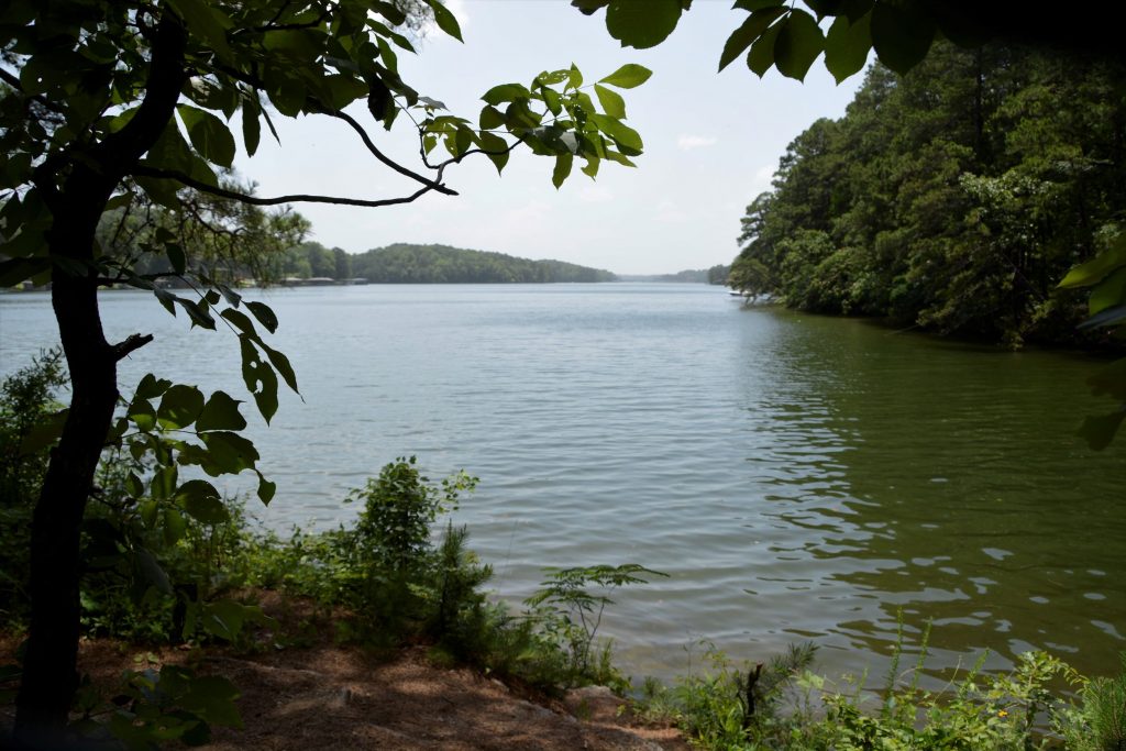
We like to explore areas around the places we stay. Space Center in Houston was just a 90 minute drive from Lake Conroe RV Resort in Willis, Texas, where we stayed in November, so we planned a visit.
Lake Conroe
When I was a child, the space program was a nationwide interest. Alan Shepard and Gus Grissom, the first two Americans in space, were household names. They were considered American heroes, as were Buzz Aldrin and Neil Armstrong, the first two men to step onto the moon. Seeing the Space Center reminded me of the beginnings of the space race long ago.
We started our tour in the main building of the museum.The day was cold and windy. It was home school day for the local home schoolers, so we felt right at home with everyone, remembering our own days of homeschooling.
The Main building was huge and would have taken more time and energy to see all of it than we had. There were four main areas plus a Kids Space Place which had hands on exhibits for kids.
We watched a demonstration using a mock-up of the International Space Station and learned what it would be like to live there for an extended time. We also watched a short film of the history of space exploration in the Space Center Theater. As we wandered through the exhibits, we learned about the many aspects of space exploration and travel.
Outside the main building were the Falcon 9 Rocket and Space Shuttle exhibits. In addition, there were three NASA tram tours off-site: The Rocket Park, Mission Control and the Astronaut Training Facility. The Rocket Park was the only tour available on the day we visited because of a mission in progress.
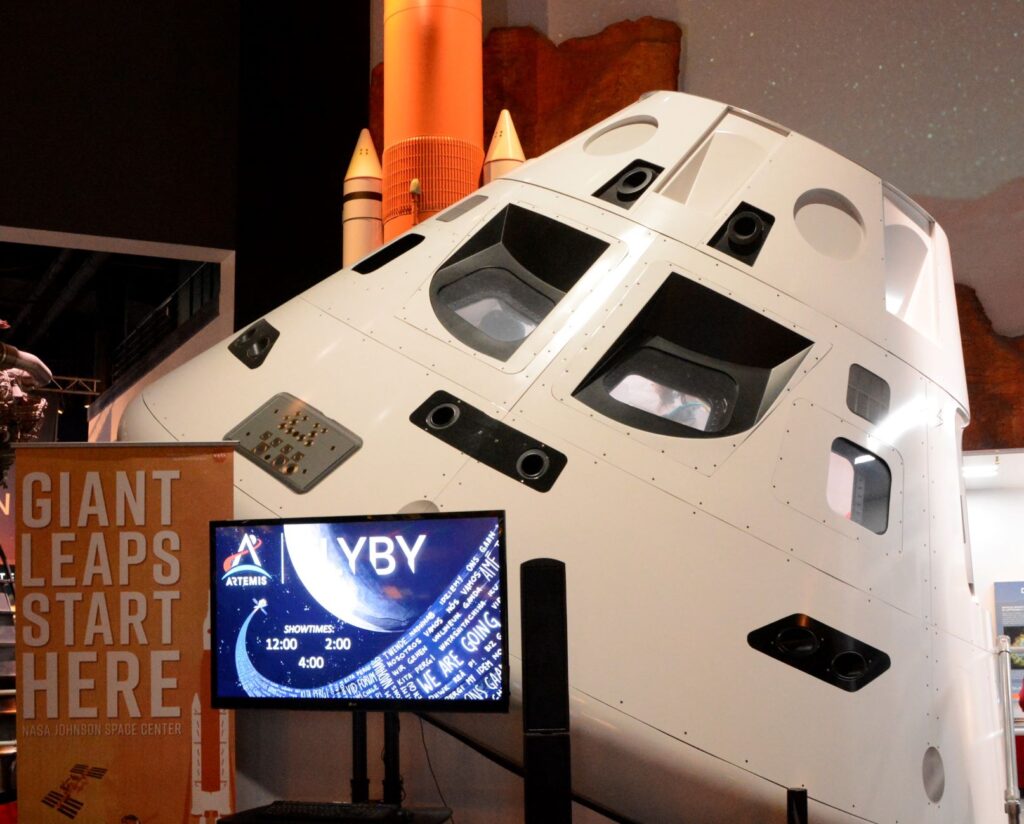
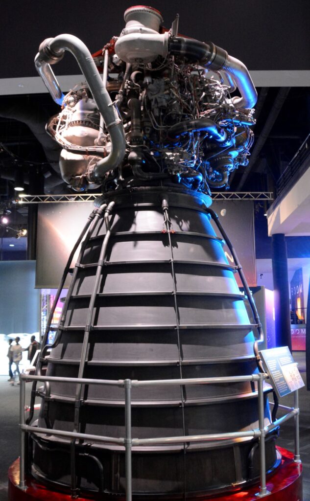
The photos below show a few of the items in the main lobby.
Space CapsuleRocket Motor
Some of you may be old enough to remember the first men to land on the moon. On our visit to the Space Center we got to see up close what it might have looked like on the moon. We could even touch a moon rock.
Astronauts on Moon exhibitNeil Armstrong, Michael Collins, and Buzz Aldrin, the crew of the first manned moon landing.
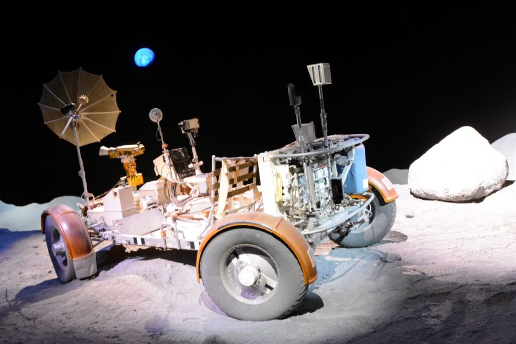
The Lunar Rover vehicle used in the moon landing had to have special tires made of a woven mesh of zinc-coated piano wire. The chevron pattern kept the wheels from sinking into the soft soil on the moon surface.
Lunar Rover
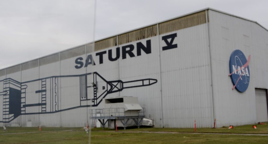
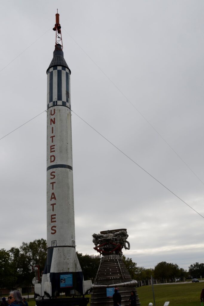
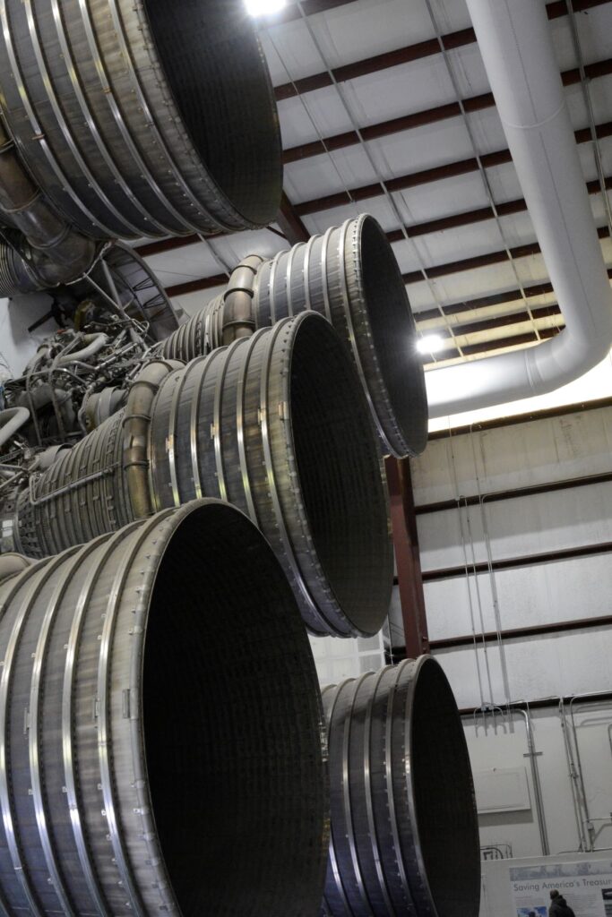
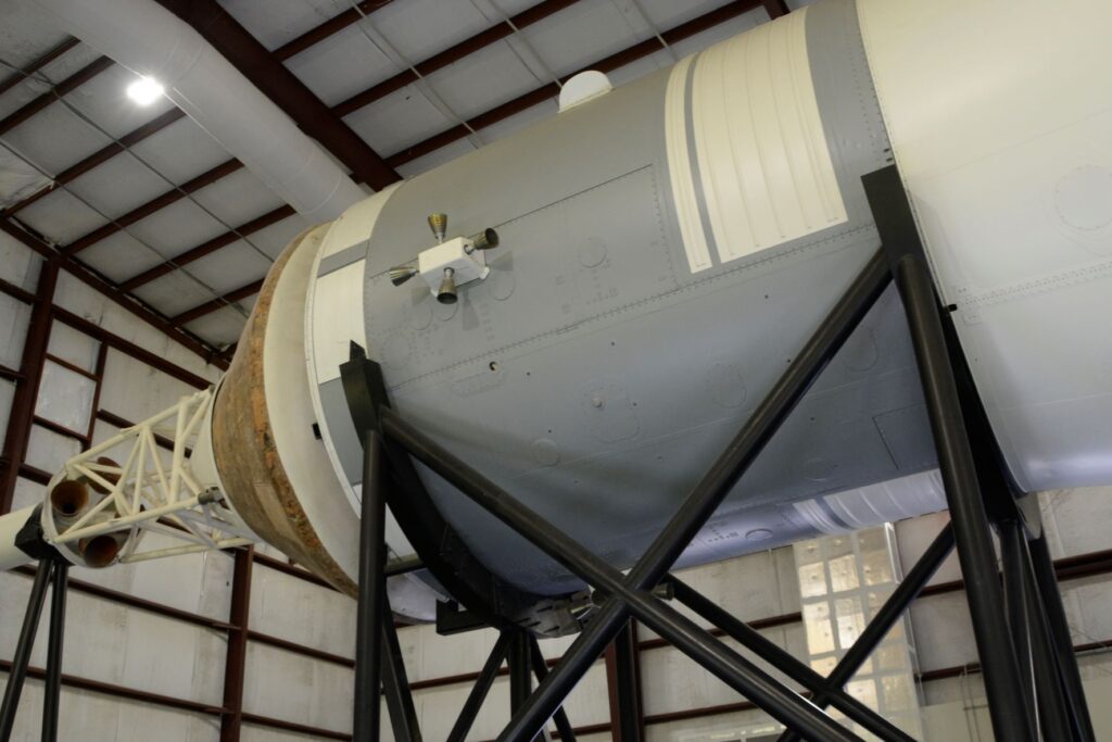
After seeing many of the exhibits, it was time for us to board the tram to the Rocket Park where the Saturn V rocket was housed. You can get an idea of the size of the rocket by the size of the building. The rocket was lying on its side the length of this building.
Saturn V Building in Rocket ParkRocket Park: Outside Saturn V building was the Mercury Redstone which took the first men into space.
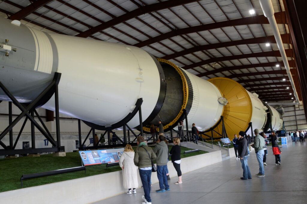
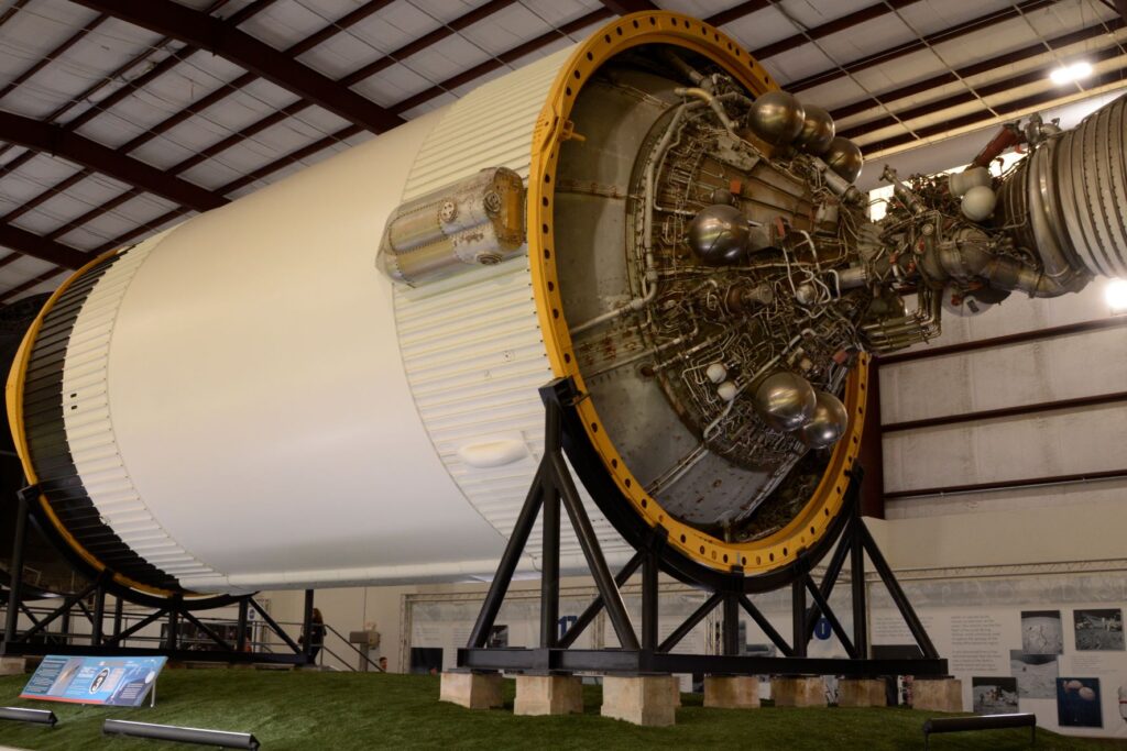
The Saturn V was the rocket that was used to launch the missions to the moon. It had to be massive enough to launch the crew, the lunar lander and the lunar rover all at once. As you can see, it fills the entire building.
Inside Saturn V building showing stages of the rocket
To get an idea of the immense size of the rocket motors on the Saturn V, I took this photo. Notice the man at the bottom of the photo for size reference. The Saturn V had 5 rocket motors on the first stage to launch it into orbit.
Three hours after the Apollo 11 mission was launched, the spacecraft left Earth’s orbit and began its three-day journey to the Moon.
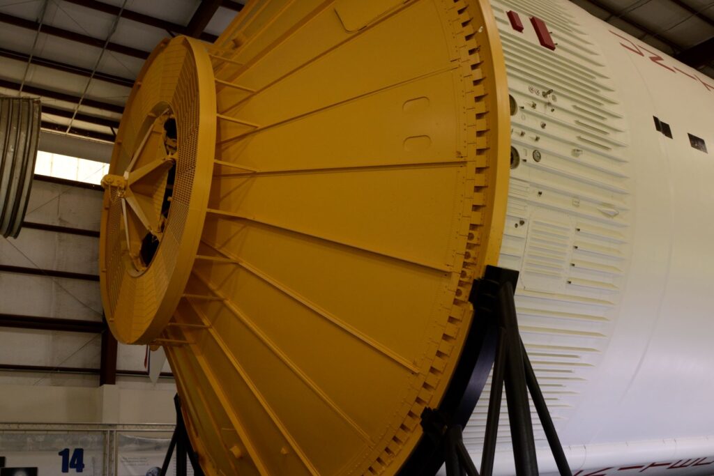
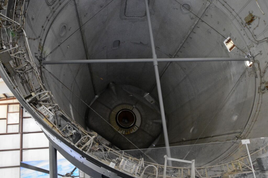
Stage 3 of the Saturn RocketA look inside the cargo area of the Saturn VThe final stage of Saturn V
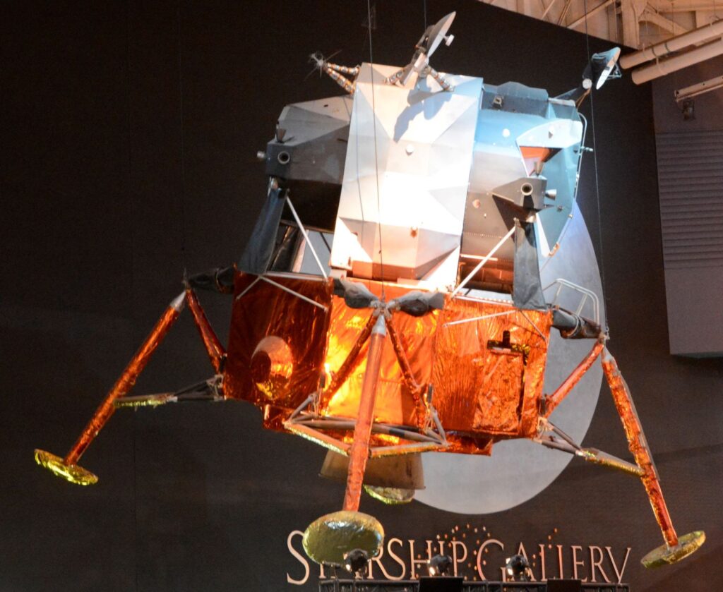
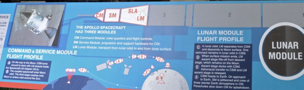
The lower stages were jettisoned from the rocket as the fuel burned up. On Apollo 11, the command module, Columbia and its command module pilot Michael Collins, would orbit the moon, while the other two crew members, once in position, would climb into the Eagle (lunar lander) and undock from the main spacecraft. From there, they would descend to the moon’s surface.
The diagram below explains the sections of the Command and Service Module. This shows how the Lunar module separated and got to the moon and back.
NASA’s next mission is to go to Mars. Although this seems ambitious to me, plans are already in progress.
Our visit to the Space Center was very informative. It made me think about the vastness of space. I was reminded of Psalm 8:3-4
“When I consider Your heavens, the work of Your fingers, The moon and the stars, which You have set in place; What is man that You think of him, And a son of man that You are concerned about him?”
And again, Psalm 19:1
“The heavens tell of the glory of God; And their expanse declares the work of His hands.”
The more we explore the universe, the more it shows the handiwork of God and the finiteness of man. Man has accomplished a lot in learning about our universe, but the knowledge that really matters is knowing the Creator of it all.
One of my favorite things to do is to step back in time by visiting historic small towns. Texas has many small towns scattered across the state. They were often established along rivers or railway lines. Such was the case with Smithville, Texas. Although a doctor founded the town and built the first house and store, the town was named after William Smith, who arrived several years later. The town population grew quickly when a local businessman made a deal with a railroad by gifting land to build a depot at a new town site. Almost overnight, the town blossomed and flourished.
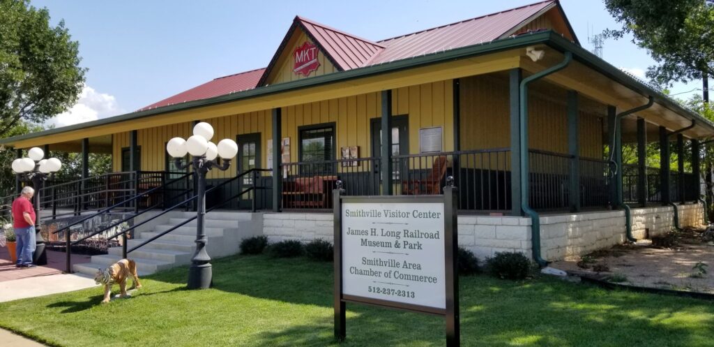
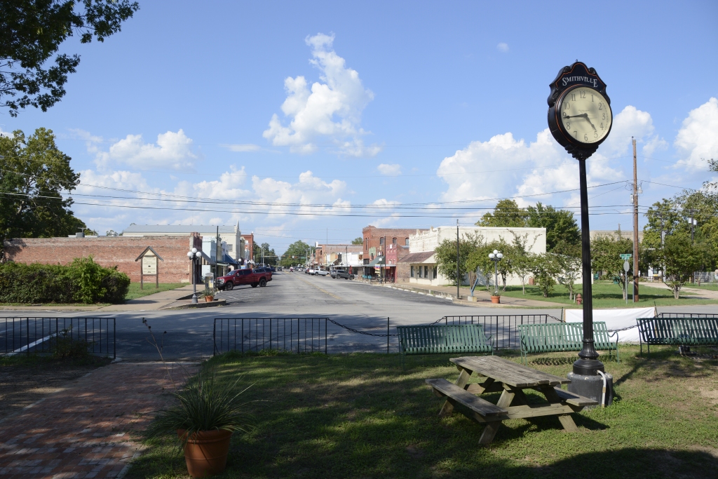
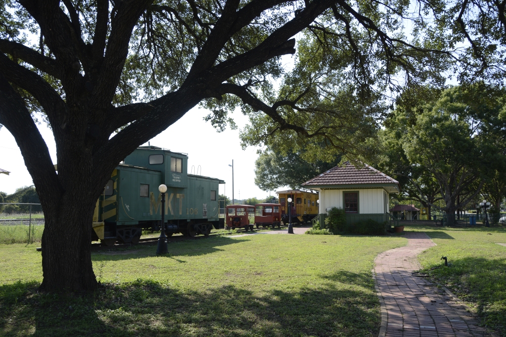
Smithville is located just off Highway 71, about halfway between Austin and Columbus, Texas. When we visited there, our first stop was the Railroad Museum at the end of the main street where we learned about the disaster of 1911.
Smithville Visitor Center and Railroad MuseumSmithville town clock at the Railroad Museum, looking down Main Street.Railroad Park in Smithville, TX
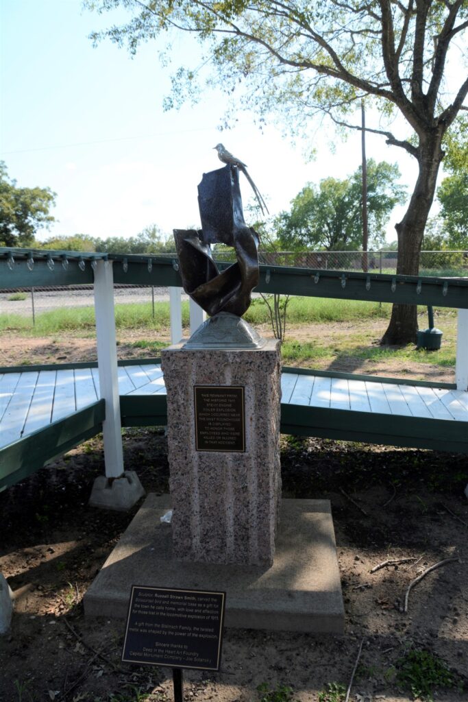
On February 8, 1911, a switch engine’s boiler exploded. The engine was building up steam in preparation to make a run to another town. The explosion sent the roof sheet metal of the firebox hurtling a distance of three blocks where it landed in the street. Smaller pieces flew twice that distance. Four people were killed and twelve more were injured.
Today a Railroad Park surrounds the Museum showcasing railroad cars from the past. In the garden is a sculpture with a piece of the iron from the engine that exploded.
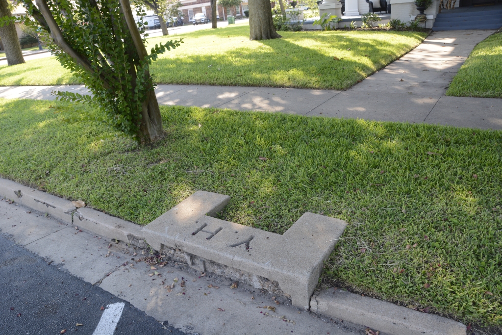
As we drove around the town, we saw many old stately homes. One of the homes had a carriage step by the street. Carriage steps were to help people getting in and out of their carriages or on and off a horse.
Carriage step
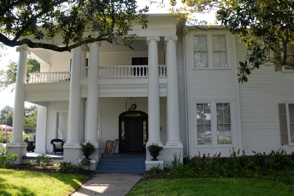
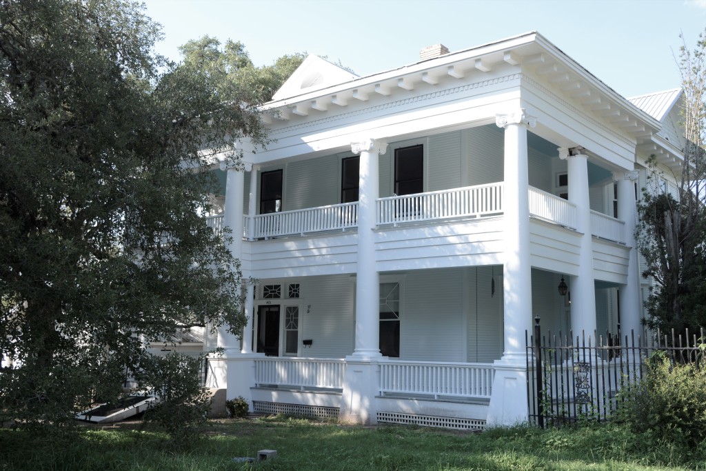
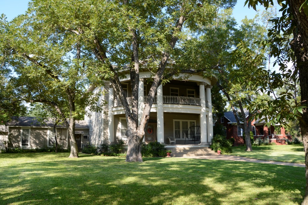
There were plenty of old style houses around the town. The ones with columns and covered porches were especially beautiful. While some had neatly kept yards, others looked neglected.
The house shown below is where the movie “Hope Floats”, a 1998 drama starring Sandra Bullock, was filmed. Smithville prides itself on being a film-friendly destination. They even publish a map for tourists showing the locations where dozens of movies were filmed.
House where “Hope Floats” was filmed.First Baptist Church, Smithville, TX
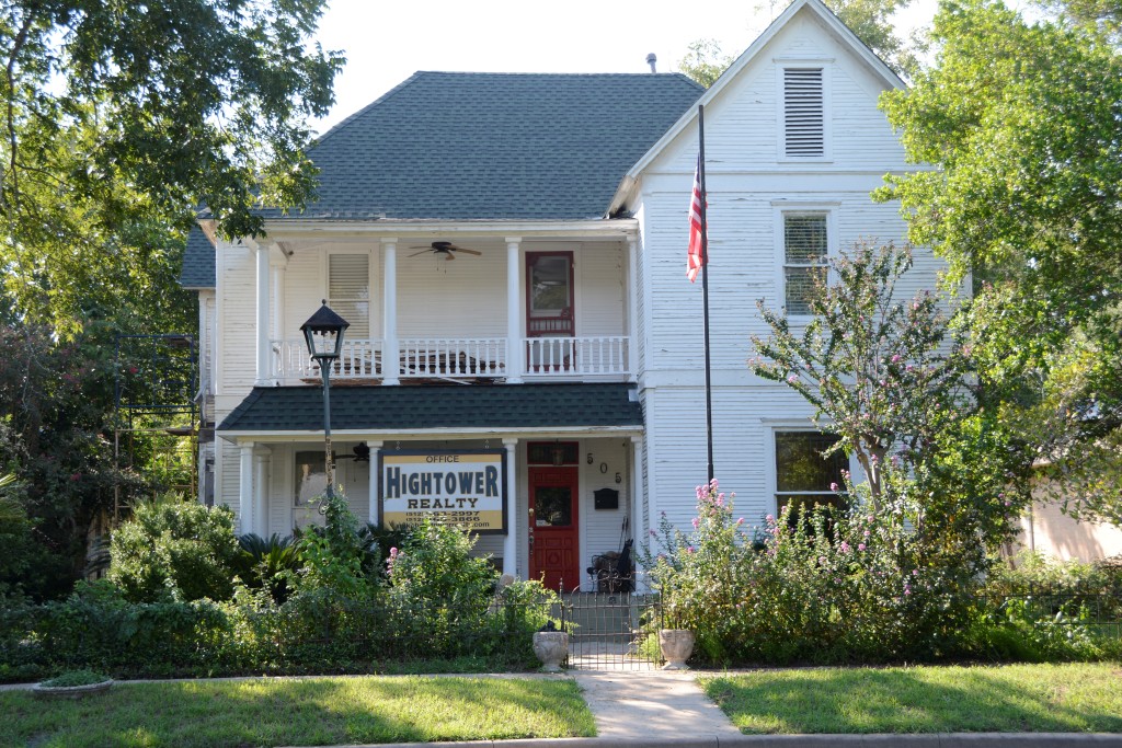
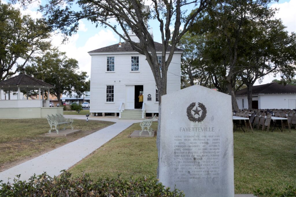
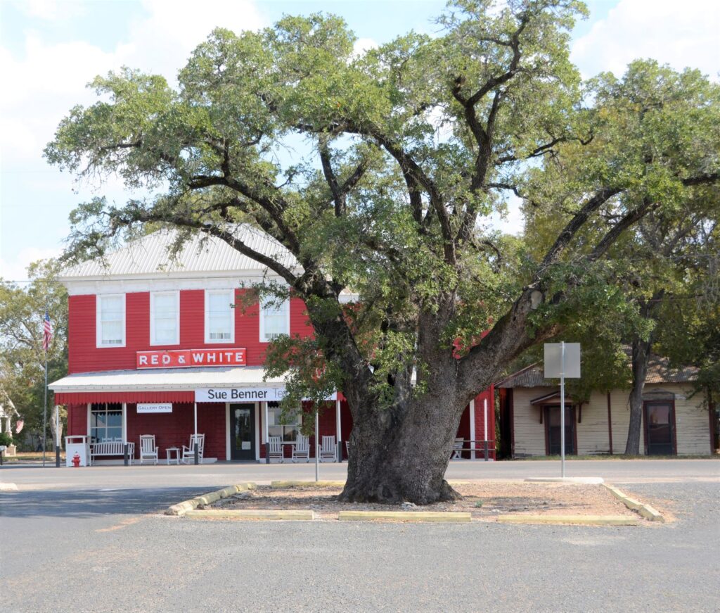
Fayetteville, Texas
About halfway between Houston and Austin is the town of Fayetteville in the county of Fayette. It is not, however, the county seat. It was named after Fayetteville, North Carolina, a town which we’ve also passed through in our travels.
The county of Fayette is named after General Lafayette, the Revolutionary War hero. Its county seat, La Grange, is named after General Lafayette’s castle in France, Chateau de la Grange-Bleneau. The Marquis de Lafayette fought with the Americans and aided the cause of the American Revolution. La Grange is where we do most of our grocery shopping when we’re staying in Columbus, Texas.
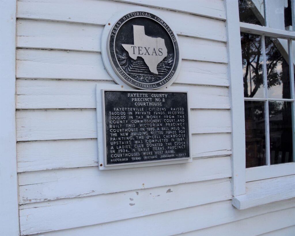
Fayetteville Historical Courthouse
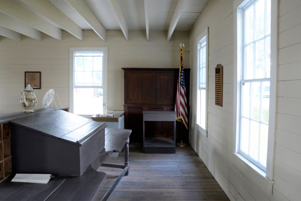
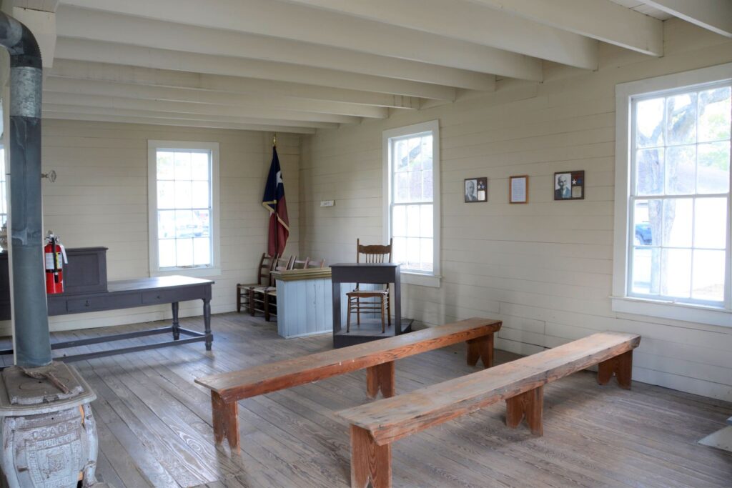
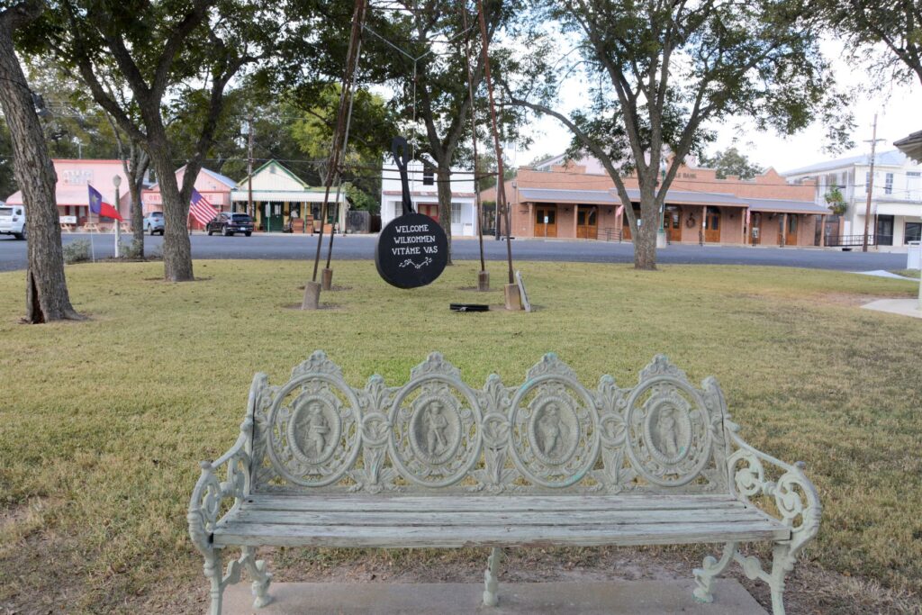
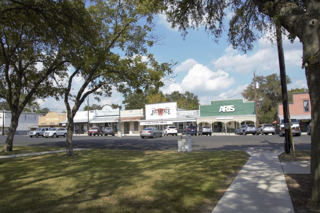
At the center of Fayetteville is the historical courthouse and town square. The day we visited, the town was getting ready for their chili feed the next day. The courthouse is a two-story structure. The first floor is the original courthouse, while the second floor houses the old jail.
Inside Fayetteville CourthouseJury box and witness stand in Fayetteville CourthouseBench with historic figures of the past
Much of Fayetteville’s population is from German and Czech ancestors. The Texas BBQ menus almost always offer sausages as well as the usual brisket and ribs. This is from the Czech and German influence.
Large oak in town square. Local businesses line the surrounding streets.Looking across town square from courthouse.
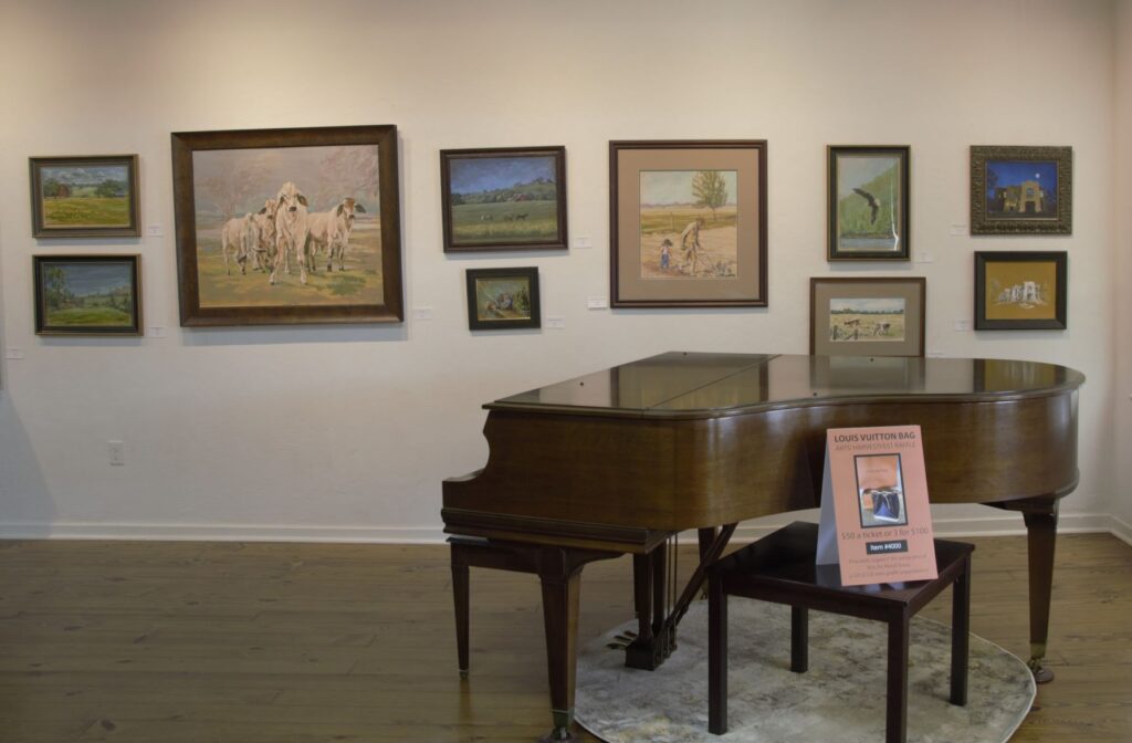
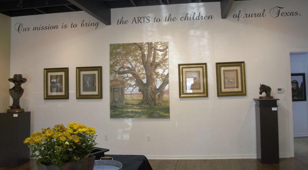
We wandered into an art gallery off the town square. Fayetteville is kind of an artsy place. They have programs encouraging children of the county and other counties to explore the arts. The featured artist in the gallery at the time was a renowned forensic reconstruction artist. Her paintings and sculptures were on display.
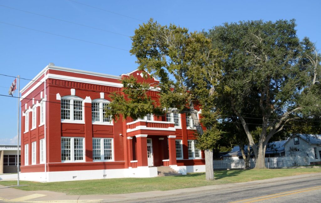
Newly refurbished old schoolhouse
The high school sits at the edge of town. In front of the current high school sits the newly refurbished 110 year old schoolhouse. A new library resides in the downstairs and upstairs houses the district administrative offices.
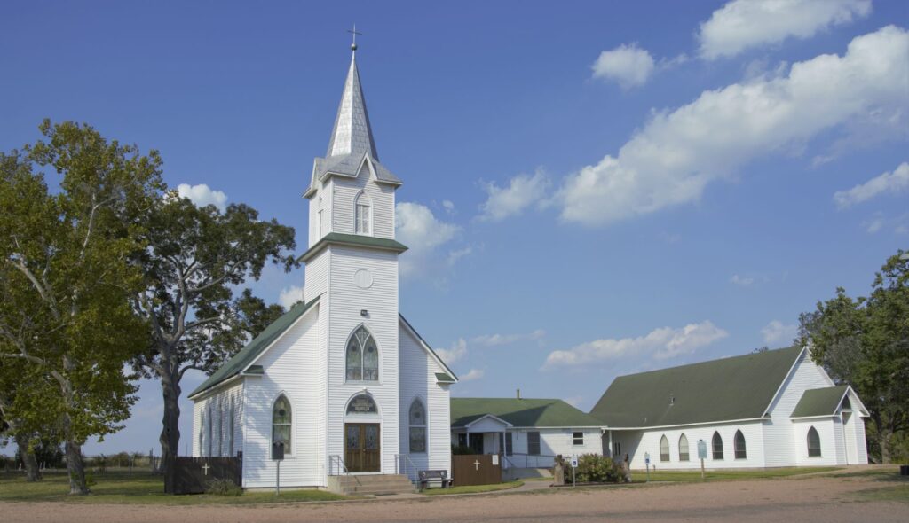
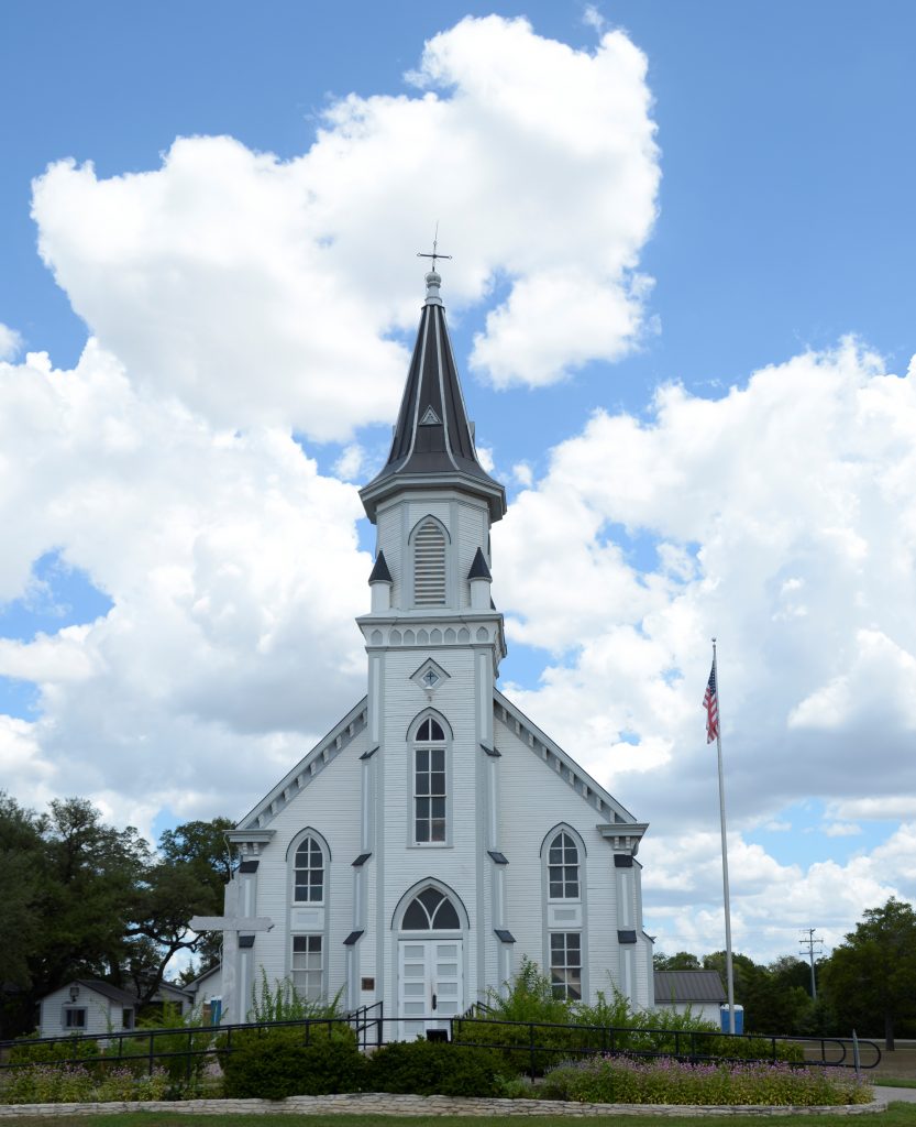
As we drove out of the town, we saw this pretty church with a silver steeple. It was locked, so we couldn’t see the interior.
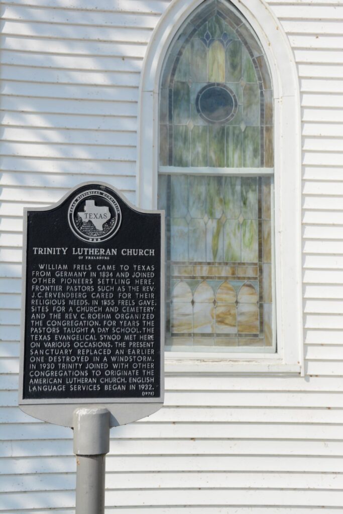
Trinity Lutheran ChurchHistoric Trinity Lutheran Church
We drove on some back roads through some other small towns including Industry and New Ulm. These towns were very small with perhaps a store and a few houses. Ellinger was another small town which was on our way home. It has a very busy Czech restaurant and bakery where we stopped and bought some of their delicious kolatches. (pastries with fruit fillings) It is on the highway between Columbus and La Grange.
I feel at home in small towns, having lived on the outskirts of one for many years in California. The people are usually friendly even if they know you’re not a local. The pace of life is slower. The roads are narrower. The views are peaceful. Cows graze in the fields. Barns and farmhouses bring thoughts and memories to mind of childhood visits to farms of relatives in Indiana. In short, it’s a relaxing way to spend an afternoon.
These are just a few of the small towns we have visited in Texas. With 254 counties, there are many more interesting small towns scattered across the vast state, enough to keep us busy for a long, long time!
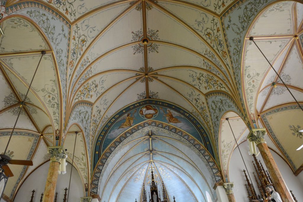
Many Europeans immigrants settled in Texas in the 1800’s, entering through the port of Galvaston. The majority of them were of German or Czech descent. Being full or part-time farmers, most immigrants came to Texas because of the availability of land. They were very proud of their heritage and tended to settle in groups in the hill country and areas in the southern portion of Texas.
These same people built churches and decorated and painted them to emulate the elaborate churches they left behind in Europe. This included stained glass windows, hand-painted sculptures, paintings, stencils and more.
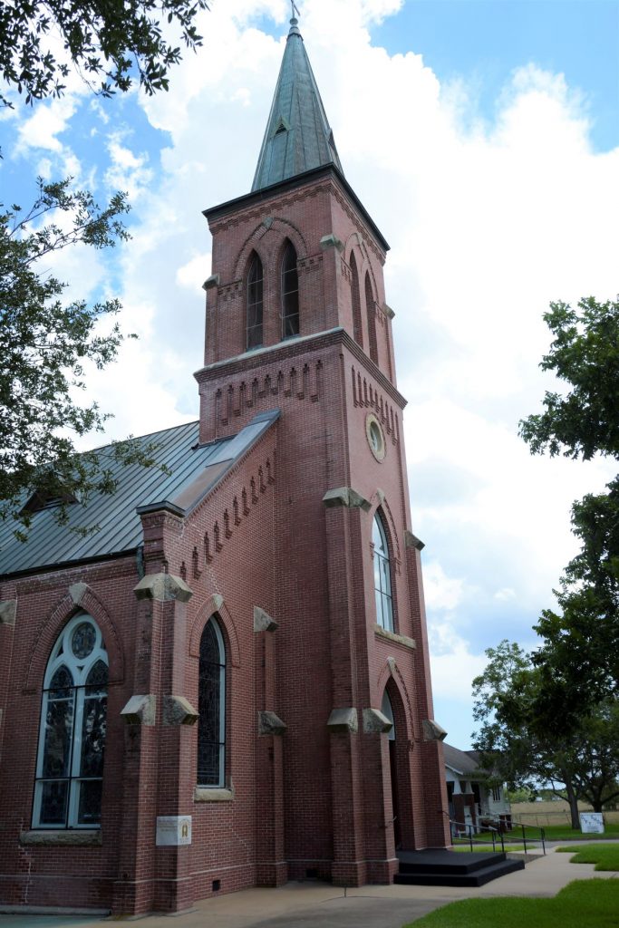
Although there are as many as 20 painted churches, four are located in the vicinity of Schulenburg, Texas. We took a pleasant drive through the countryside to visit these churches in one afternoon. If we had trouble locating any of these churches, we just had to look for the church spire which was visible from a distance above the tree tops.
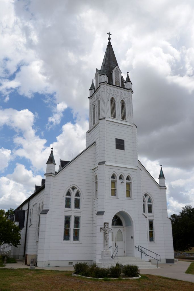
Saints Cyril and Methodius Catholic Church in Dubina, Texas with iron cross on top
1. Saints Cyril and Methodius Catholic Church
The first church we visited was Saints Cyril and Methodius Catholic Church in Dubina. Dubina means “oak grove” in Czech. Their first church was constructed in 1877 among the oak studded hills, but was destroyed in a hurricane in 1909. The church was re-built and topped by an iron cross found among the rubble of the first church. The cross was made by a freed slave blacksmith. It is still atop the church today.
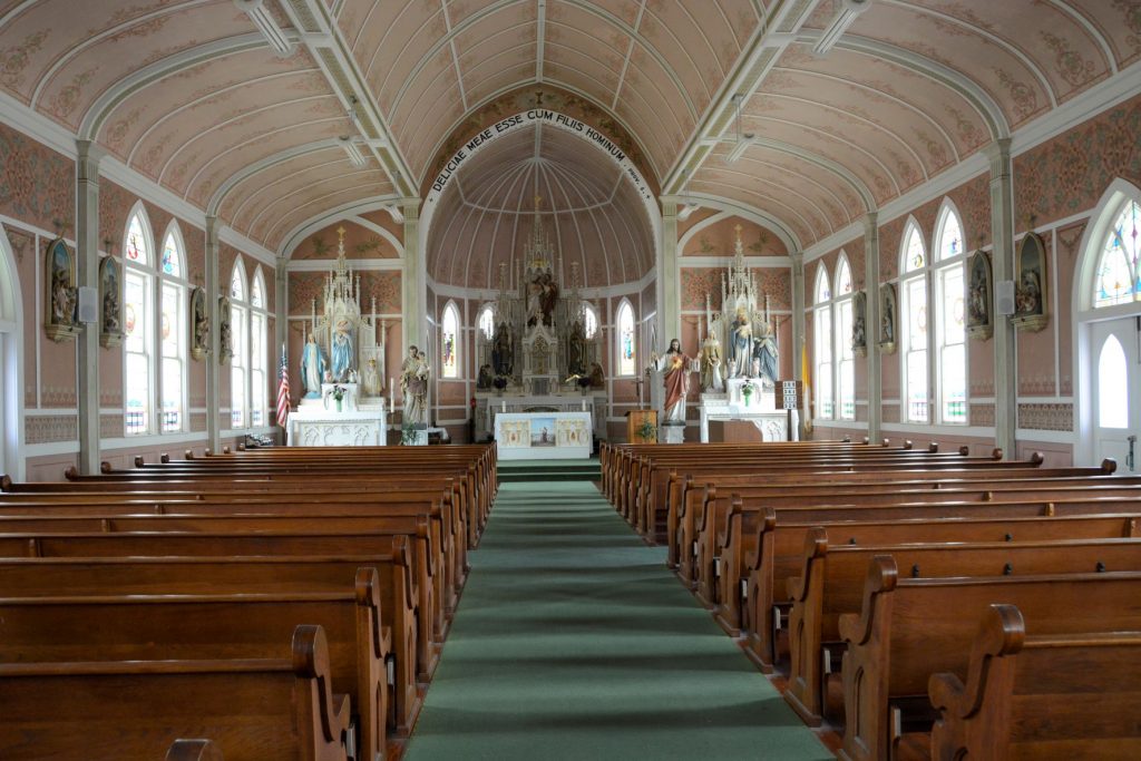
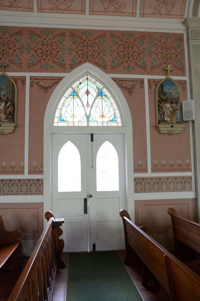
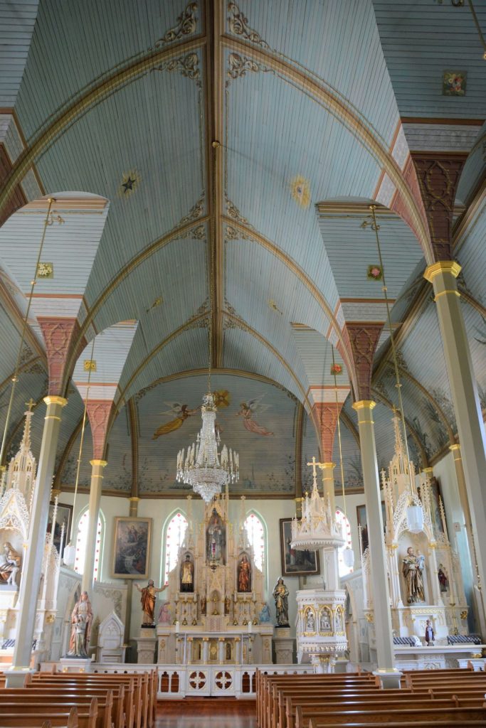
The original artwork was painted over in white paint in the 1950’s because the artwork was thought to be too distracting. In the 1980’s, however, when other painted churches were being recognized for their beauty and historicity, the church members decided to restore the church to its original beauty. They uncovered old designs and found old stencils stored in the church to repaint the designs. The columns look like marble, but they are actually just painted to look that way.
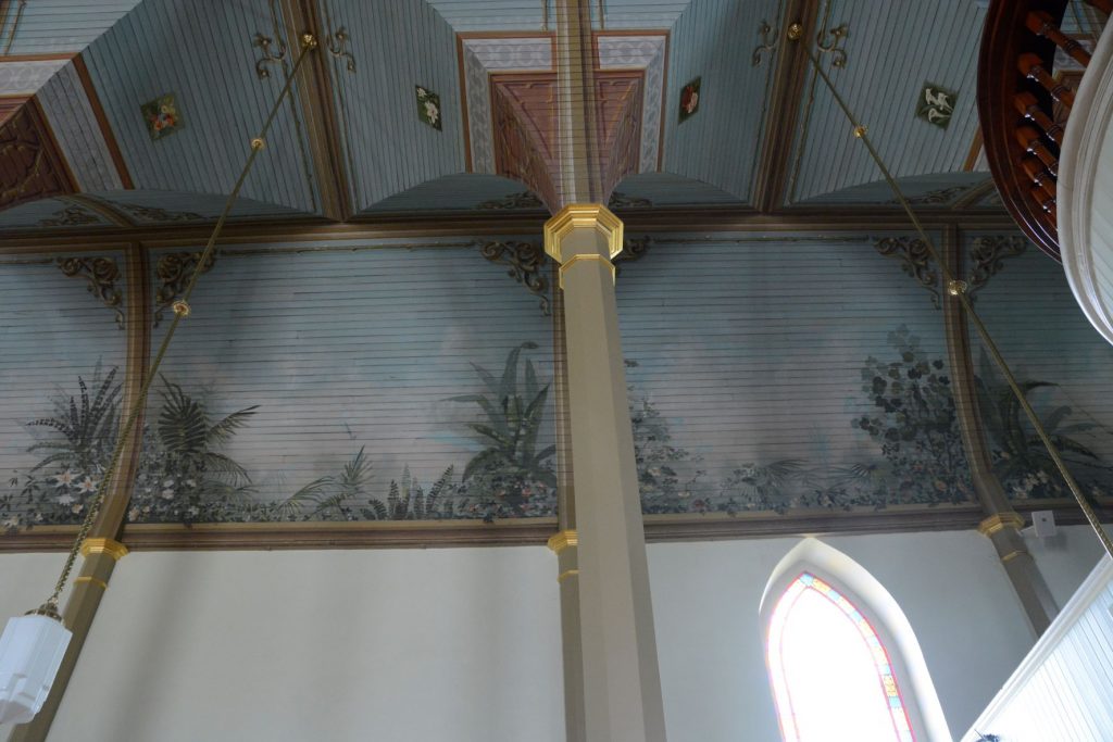
Star studded ceiling of Saints Cyril and Methodius Catholic churchInside Saints Cyril and Methodius Catholic Church
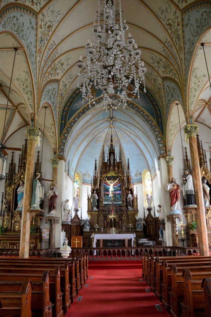
2. St. John The Baptist Catholic Church, Ammannsville
It was a short drive to the next church: St. John the Baptist Catholic Church in Ammannsville, Texas. It looks similar on the outside to Saints Cyril and Methodius Church. The first church built here was also destroyed by the 1909 hurricane. They rebuilt, but the second church was destroyed by fire. The third and current church is the one standing today.
St. John the Baptist Catholic Church
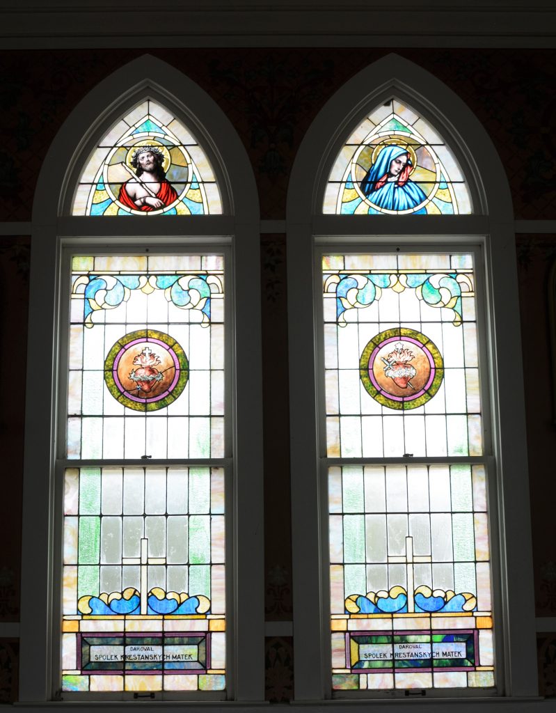
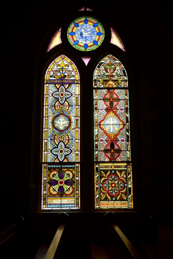
The peach-colored interior of this church is sometimes referred to as dusty rose. There is a blend of both German and Czech styles. This church has beautiful stained glass windows.
St. John the Baptist Catholic Church
The detail in the painting of this church can be seen in the next photo above the side door and stained glass window.
The windows in this church were really beautiful. The church’s stained glass windows tell the story of the area’s Czech roots and history.
Altar of St. John the Baptist Catholic ChurchSt. John the Baptist Church
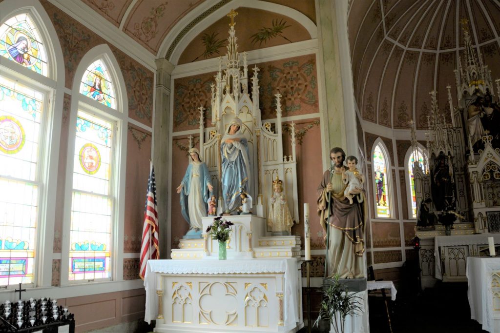
3. St. Mary’s Catholic Church, High Hill, Texas
St. Mary’s Catholic Church, High Hill, TexasInterior St. Mary’s Catholic Church
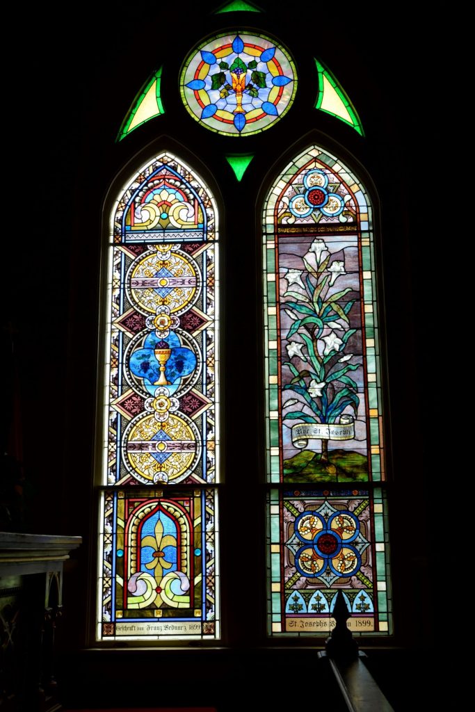
Built in 1906, St. Mary’s Catholic Church is the most elaborate of the four churches and is called “The Queen” of the painted churches. The church hierarchy encouraged the community to build in the Spanish mission style. This was rejected by the local church leaders who wanted churches built of brick or stone to be able to weather storms or fires. The exterior of St. Mary’s is built of bricks.
The interior of the church has painted arches creating an illusion of structural beams. The columns are wood, but painted to resemble marble.
The church is dimly lit because of the intricate and beautiful stained glass windows. The windows, imported from Germany portray biblical scenes, designs and symbols.
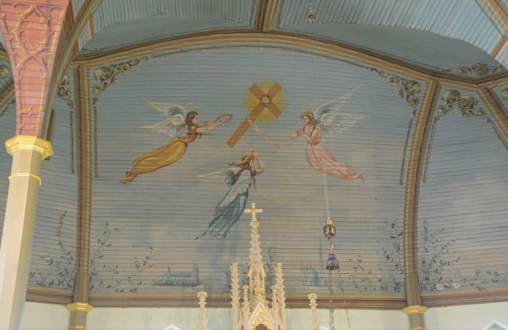
The elaborate interiors of these churches were painted meticulously by hand.
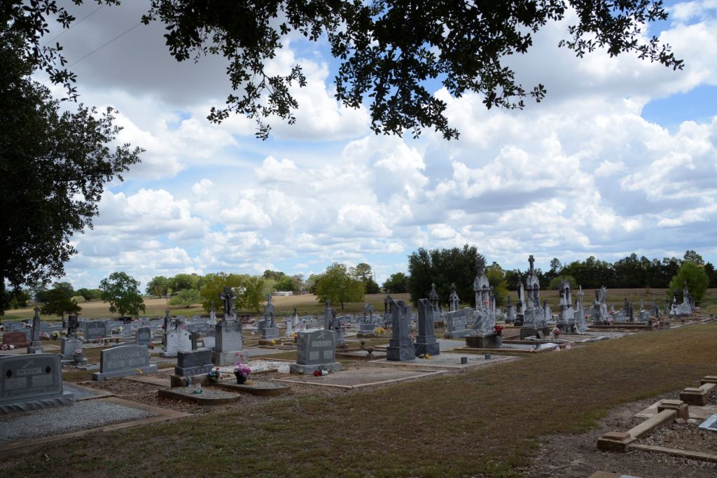
Graveyard for St. Mary’s Catholic Church
Although each of these churches had a graveyard nearby, this is the only one of which I took a photo.
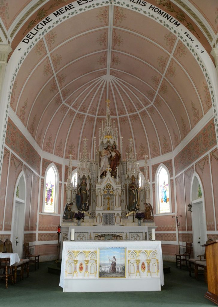
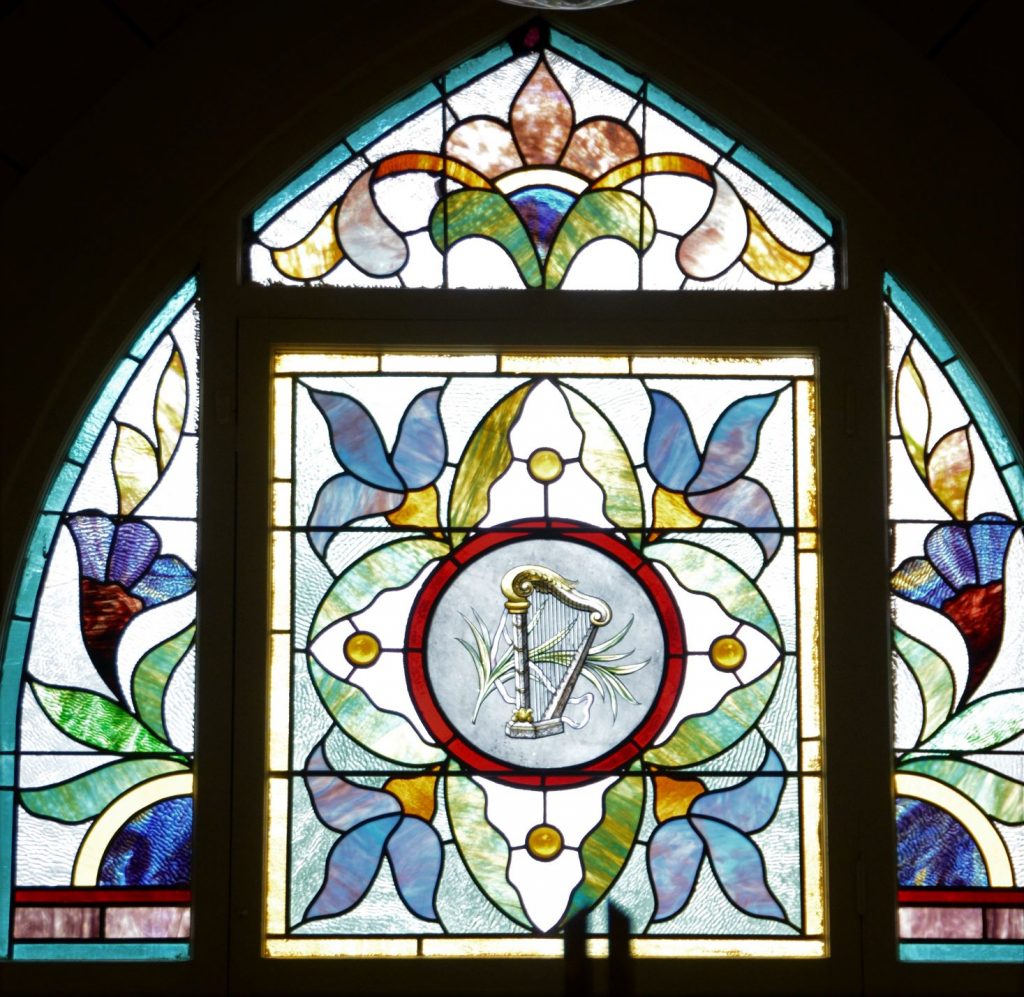
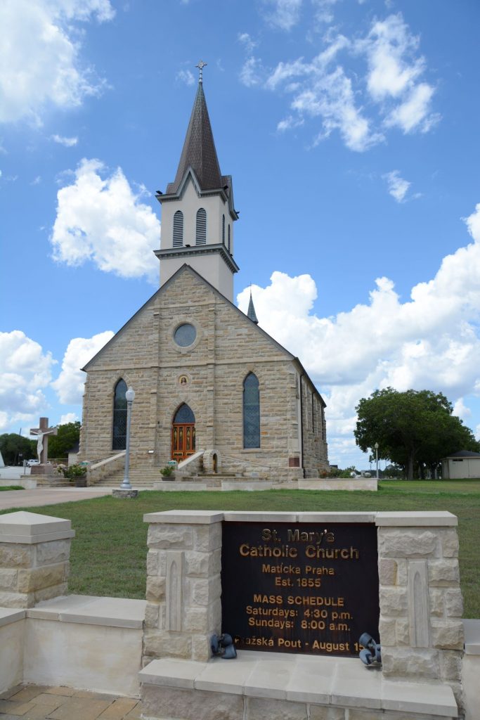
4. St. Mary’s Church of the Assumption, Praha, Texas
St. Mary’s Catholic Church, Praha, Texas
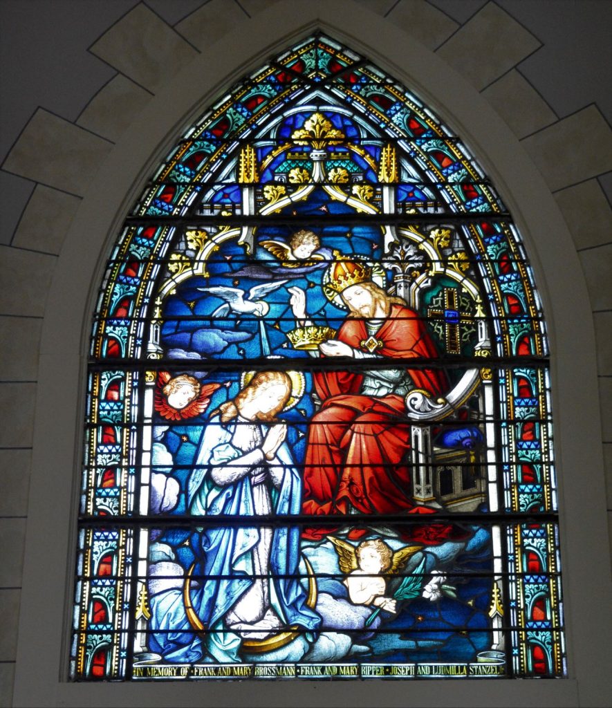
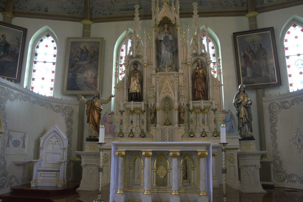
Built in 1895, St. Mary’s Church of the Assumption is a stone church located in Praha, Texas. It is one of the oldest of the painted churches. The altars are hand-carved, and hand-painted in white and gold leaf.
The ceiling is painted to represent the Garden of Eden and filled with Texas flowers.
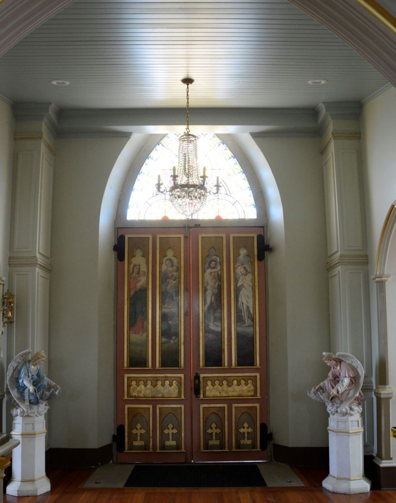
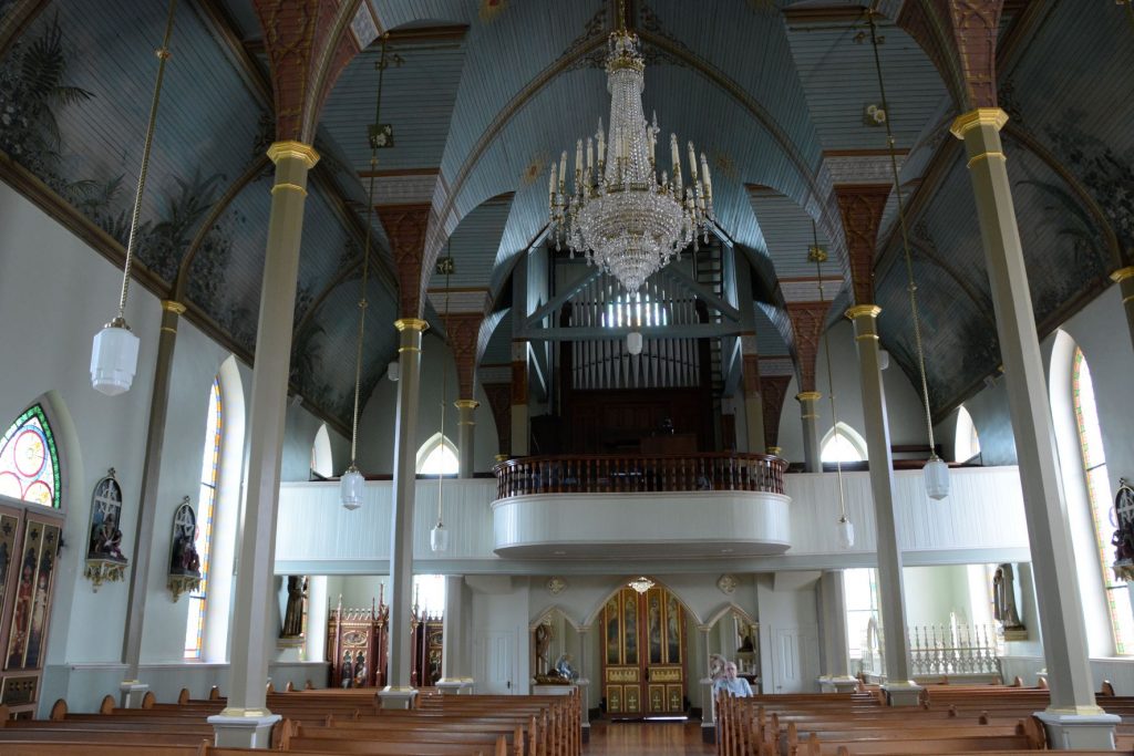
Garden of Eden with Texas flowersPainting of angels over altarAltar and paintingsPaintings on inside front door of churchPipe Organ in balcony with chandelier
After our tour, we stopped and had an ice cream cone at the “Country Store” in Schulenburg. It was a fun day and perfect for shooting photos with the blue sky and white puffy clouds.
I couldn’t help but notice that almost all of the statues of Jesus depicted Him either dying or dead. It’s wonderful to know the Bible promises us that Jesus is alive!
7 For when we died with Christ we were set free from the power of sin. 8 And since we died with Christ, we know we will also live with Him. 9 We are sure of this because Christ was raised from the dead, and He will never die again. Death no longer has any power over Him. 10 When He died, He died once to break the power of sin. But now that He lives, He lives for the glory of God. Romans 6:7-10 NLT
33 Who will bring charges against God’s elect? God is the one who justifies; 34 who is the one who condemns? Christ Jesus is He who died, but rather, was [a]raised, who is at the right hand of God, who also intercedes for us. Romans 8:33-34 NASB
As for the other painted churches in Texas, hopefully we will be able to visit them eventually and add them to this blog.
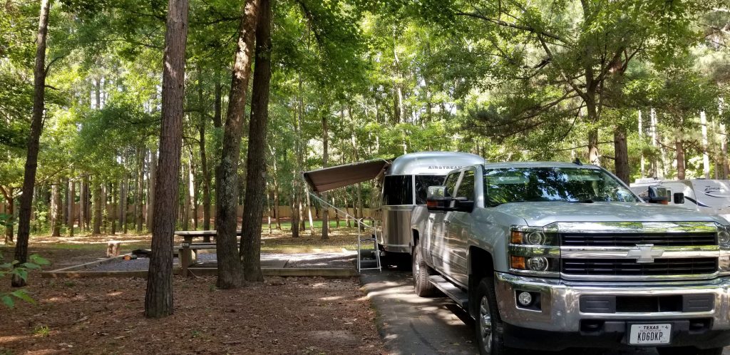
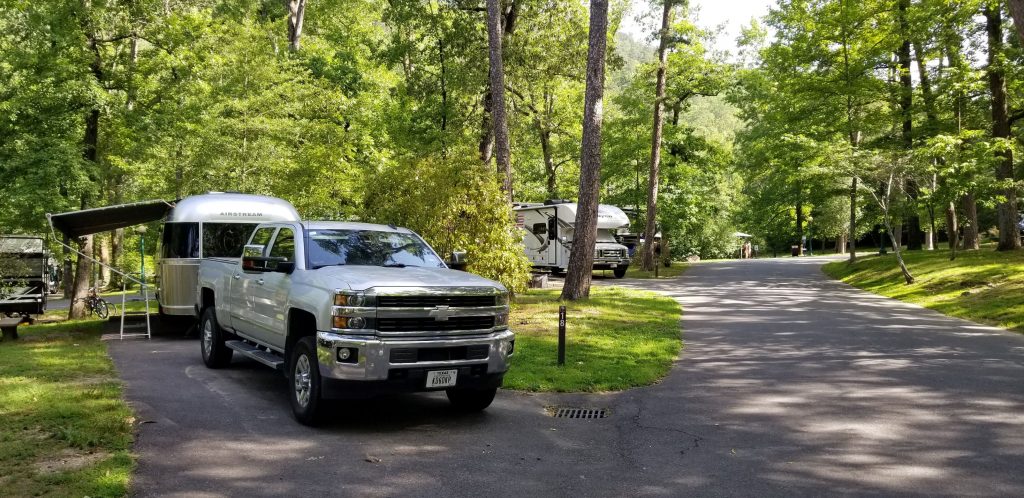
This year we tried something new and stayed in some Army Corps of Engineer campgrounds along our way. We found that these parks are generally very nice, and well-kept. The price at this particular one was $14 per night with our National Parks Senior Pass. We made our reservations online and we could pick our campsite and even see a photo of it. The one drawback is that some of them do not have sewer hookups, but there are always free dump stations available.
Army Corps of Engineers Campground, Little Rock, Arkansas
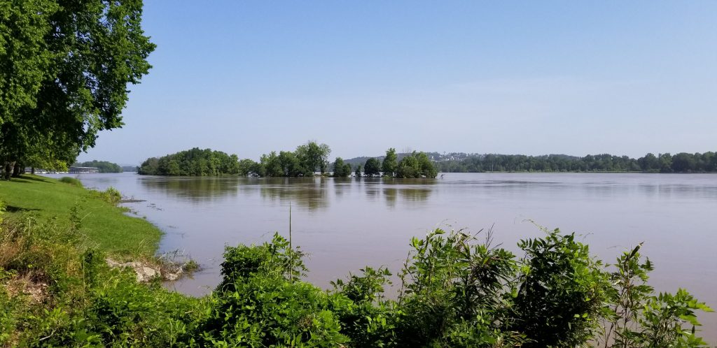
One such park, Maumelle in Little Rock, Arkansas, was right along the Arkansas River which happened to be nearly in flood stage. (The park was well above the water line.) The sites were nicely shaded.
Arkansas River at Maumelle Campground
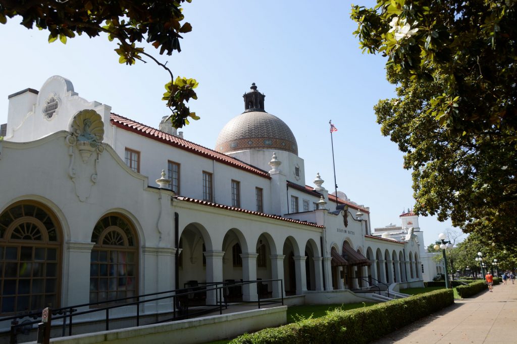
Hot Springs National Park
Hot Springs National Park is located not far from Little Rock, Arkansas, in the town of Hot Springs. It was the 18th national park established in 1916. However, it had long been a popular place with its ancient thermal springs, mountain views and historic bathhouses with their grand architecture.
We camped at Gulpha Gorge Campground which is within the park boundaries and just minutes away from the Hot Springs National Park attractions. Again, with our National Parks Senior Pass, the fees were very low.
Gulpha Gorge Campground
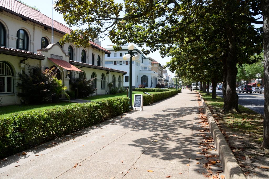
On the day we explored the main part of the park, we got an early start and found a free parking space near enough to walk to Bathhouse Row. Temperatures were going to be pretty hot that day, so we wanted to get out early to beat the heat.
This national park seemed very different from others, in that, it is located in the downtown area of a small city. The park boundaries extend beyond the downtown area into the hills above the city where the hot springs originate.
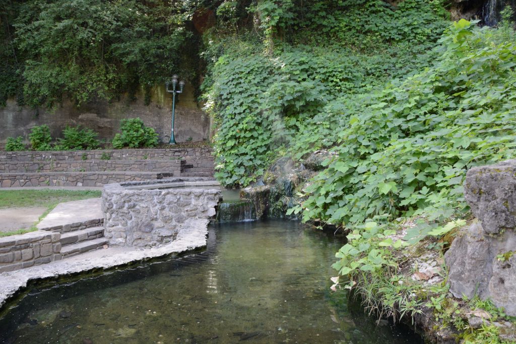
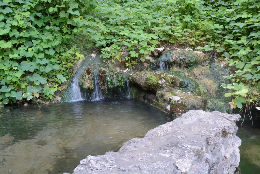
On the way to main street, we saw this hot water cascade at Arlington Lawn. We dipped our fingers in the water, and it was hot enough that we couldn’t hold our hands in it for long. The corner area of this block is a park with shade trees, green grass and walkways. Trails wind up and around the backsides of the row of bathhouses.
Park near hot water cascadePool at the bottom of hot water cascadePool at hot water cascade in Hot Springs NP
Looking down Main Street, you can see several of the bathhouses. Some are open to the public, and others are fully operating businesses offering hot mineral baths and spa treatments to their customers. And two are operated by the National Park Service.
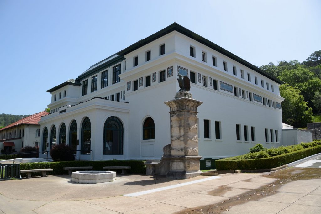
Bathhouse Row
The Quapaw Bathhouse is known for its mosaic tile dome.
Quapaw Bathhouse
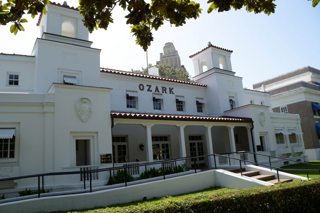
The Ozark is home to the Hot Springs National Park Cultural Center. The Center features gallery spaces for displaying artwork from the park’s Artist-in-Residence Program. Admission was free but because of time, we had to choose which bathhouses we could explore, and we opted to skip this one.
Ozark Bathhouse
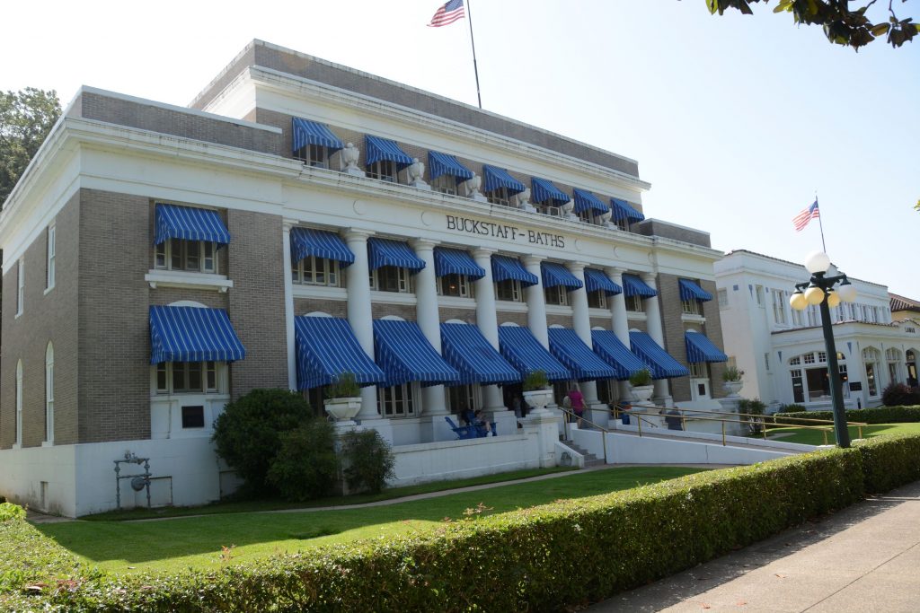
I love the blue awnings of the Buckstaff bathhouse seen below. It is the only one that offers a traditional bathing experience. It has been in continuous operation since 1912.
Buckstaff Bathhouse
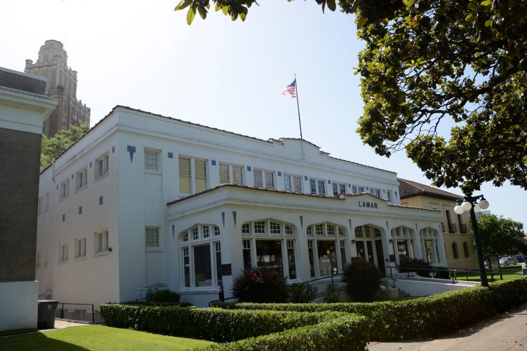
The Lamar contains offices for the park’s employees and the park store. I love browsing in the national park store. I don’t buy souvenirs, but it’s fun to look.
Lamar Bathhouse
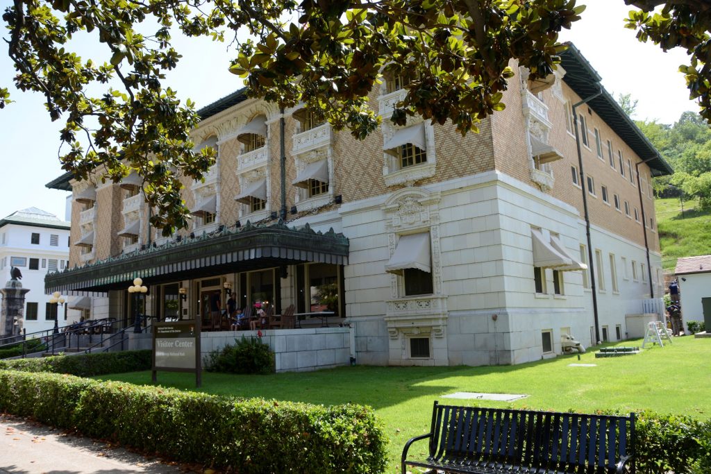
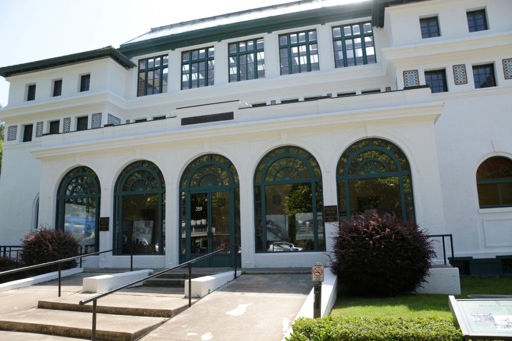
The Fordyce Bathhouse is in the middle of the block. It functions as the park’s visitor center. It is the largest bathhouse on the Row with three main floors, two courtyards, and a basement under most of the building. It houses the museum.
It is also where I could get my National Parks Passport stamped.
Fordyce Bathhouse
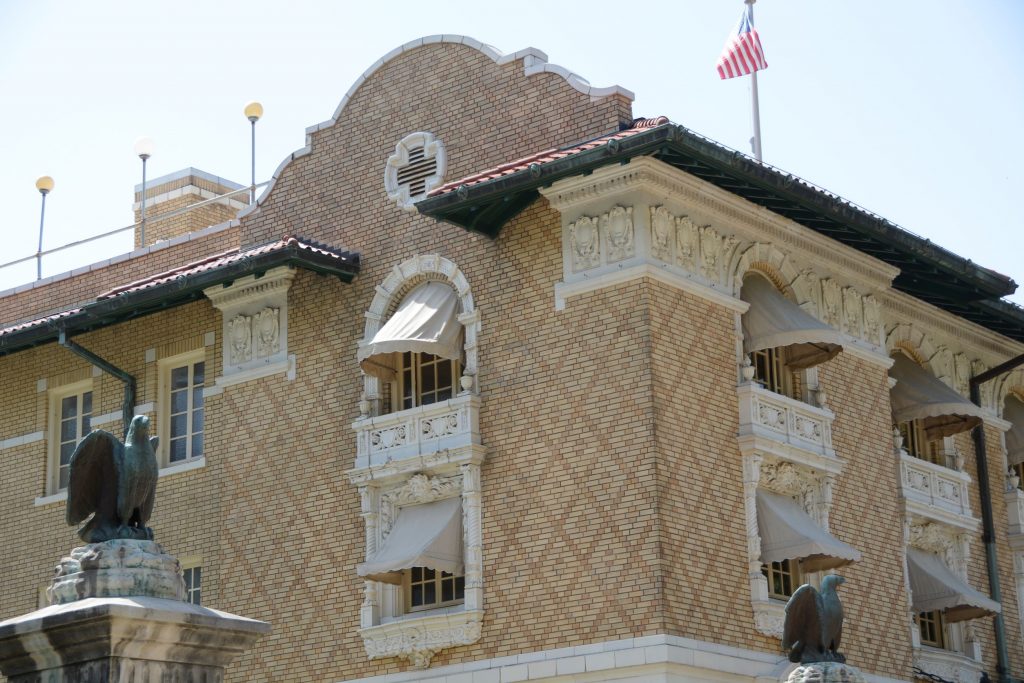
The Fordyce Bathhouse Museum is located here and visitors can go on a self-guided tour. The architecture on this building is really interesting.
Closer view of Fordyce Bathhouse architecture
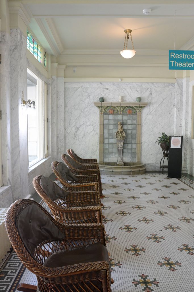
Inside tour of Fordyce
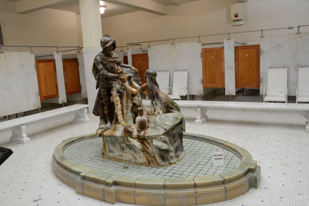
Our tour began in the lobby where we were greeted by an elaborate fountain situated in a room of wicker rocking chairs sitting on a mosaic tile floor.
Inside Fordyce Bathhouse
Men’s and women’s areas were separate. Here is the the De Soto Fountain in the men’s area.
Fordyce Bathhouse
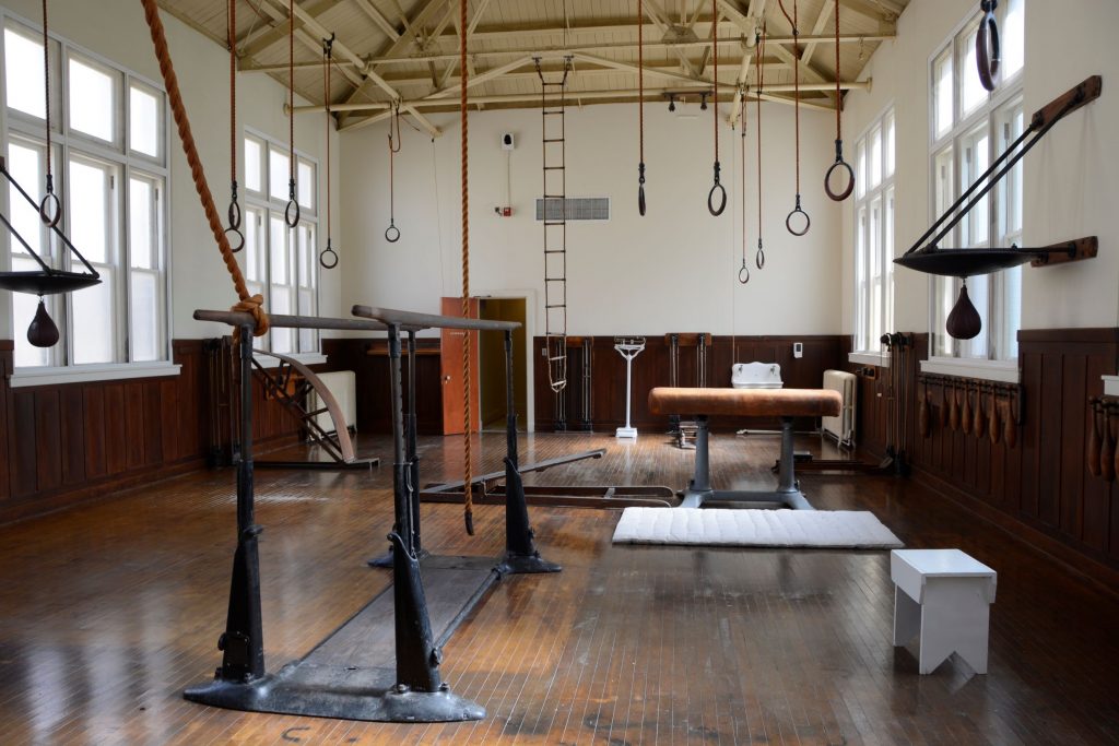
Below is a photo of the gymnasium with period equipment.
Gymnasium at Fordyce Bathhouse
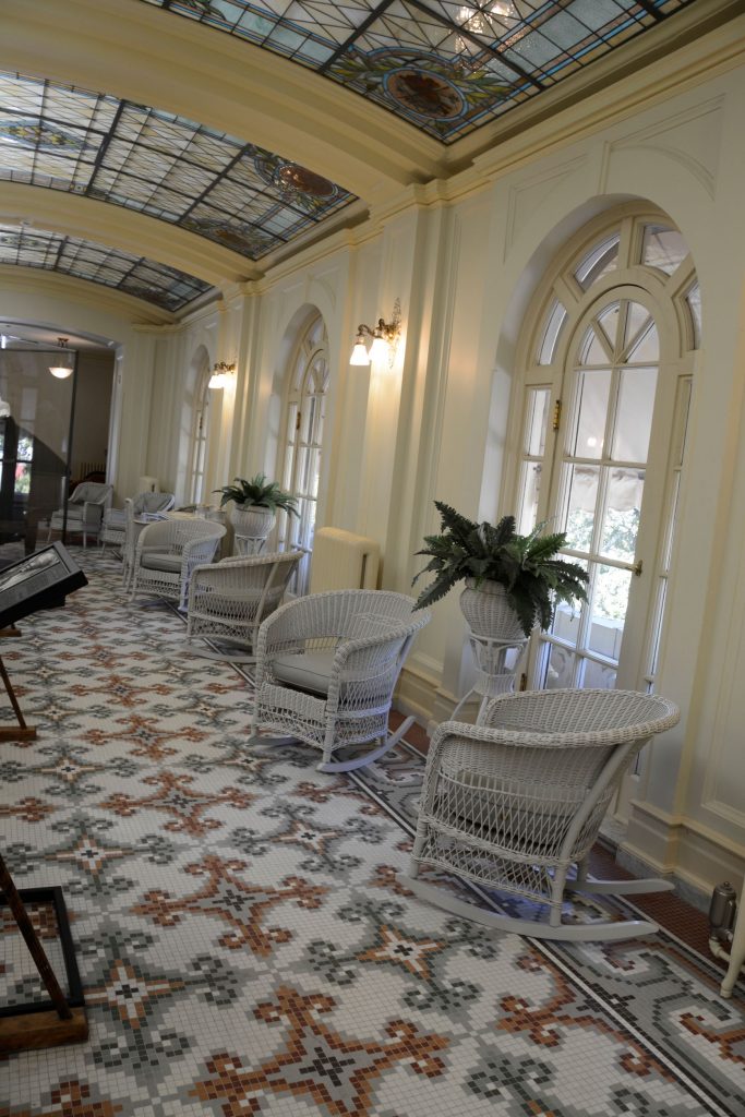
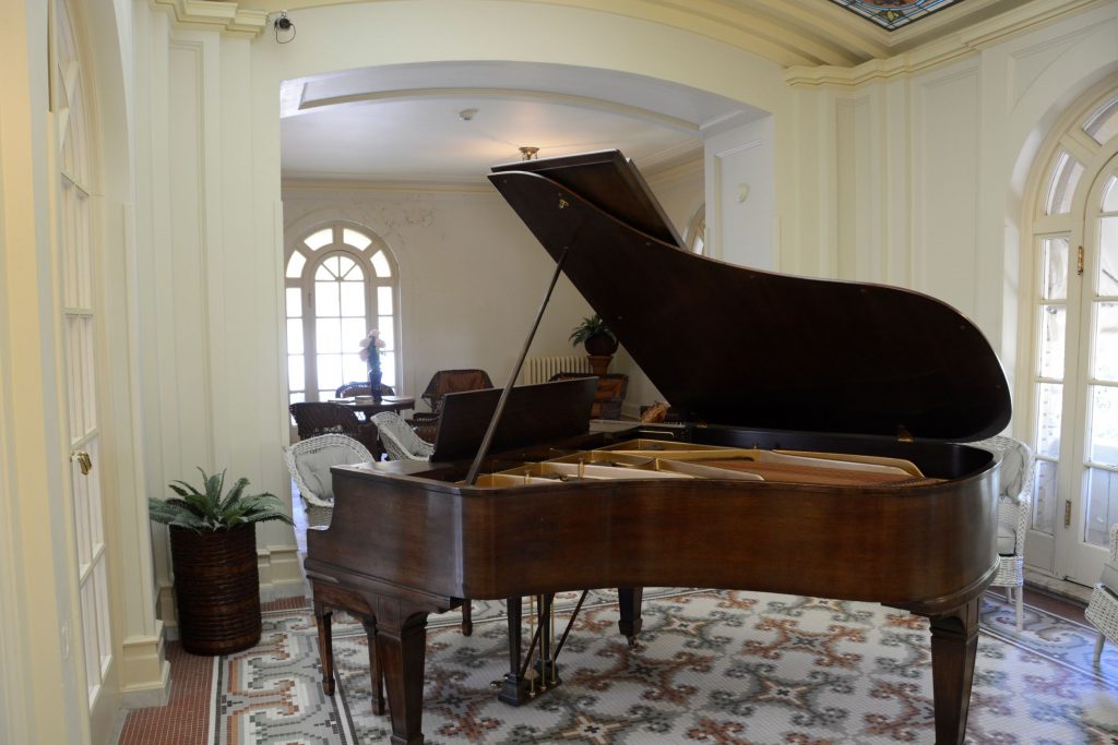
There were many beautiful stained glass windows and ceilings. This room was an area to relax and enjoy conversation or listen to music played on the grand piano. Notice the beautiful stained glass ceiling and mosaic tiled floor.
Lounge at Fordyce BathhouseGrand piano of Fordyce Bathhouse
At the end of our tour, we walked back to the truck to take a break and get some refreshments. Afterwards I took photos of the other bathhouses before we left.
The Maurice Bathhouse is a commercial enterprise of art and high-end tourist items. The architecture is really beautiful.
Maurice BathhouseMaurice Bathhouse front view
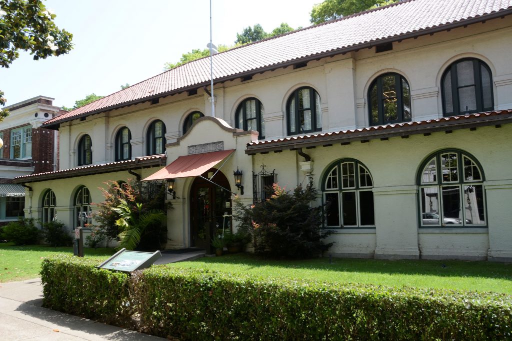
The Hale Bathhouse is now Hotel Hale, a luxury hotel. Overnight guests can stay in historic rooms and experience the thermal springs.
Hale Bathhouse
We drove to another part of town and ate lunch at Chick-fil-A. While we were there, a lady at the table next to us introduced herself and gave us some “must see” sites to see which included the observation tower and the botanical gardens.
We only had one day to see everything, so even though it was hot, we decided to see as much as we could.
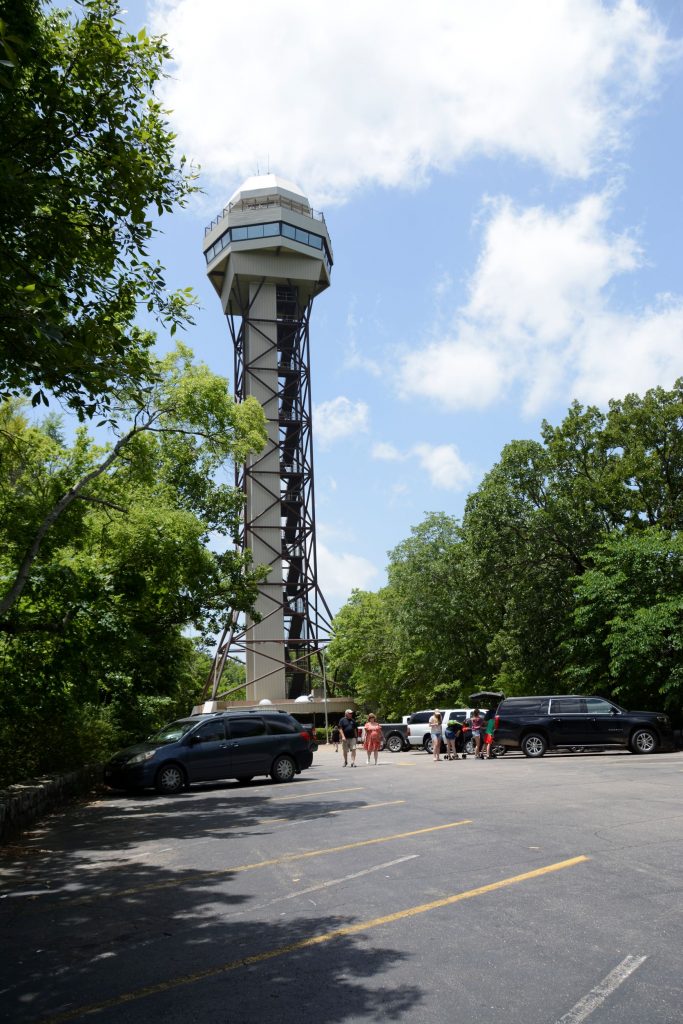
Hot Springs Mountain Tower
This tower (shown below) is located on the mountain behind Bathhouse row up a steep winding road. At 1,256 feet above sea level, it overlooks 140 miles of surrounding Arkansas countryside.
We took the elevator up to the top observation deck and enjoyed the views.
Looking out from the observation deck, we could see the town of Hot Springs and Bathhouse Row.
View from Hot Springs Mountain TowerView from Tower
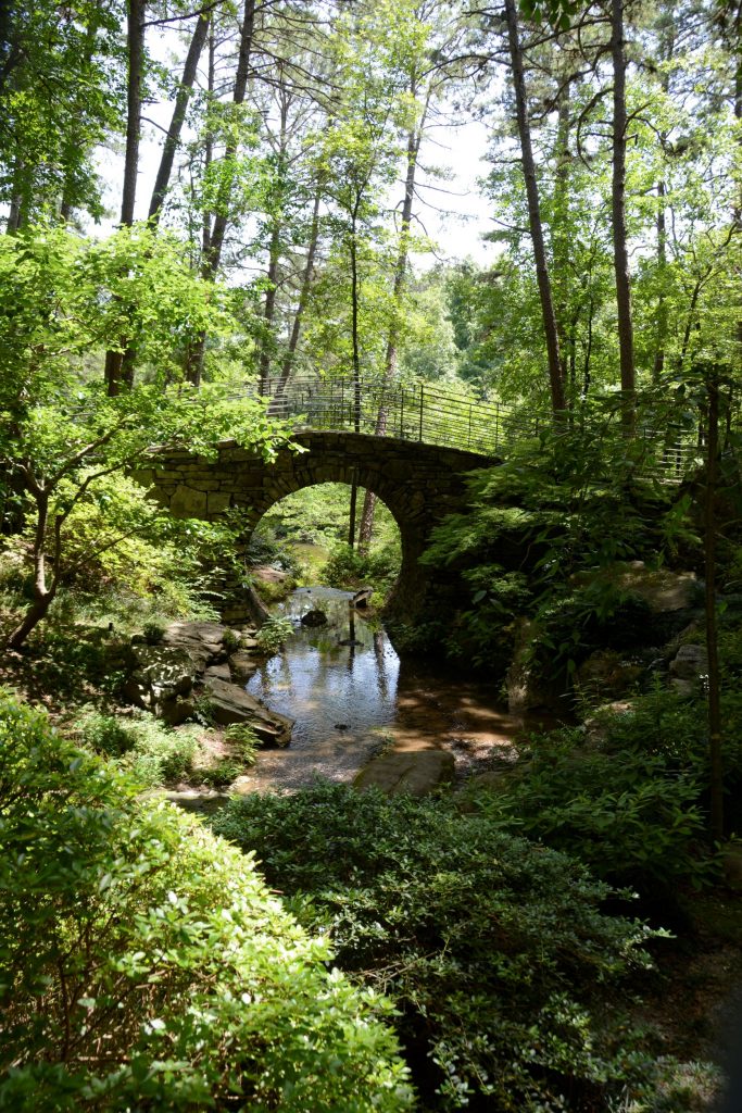
Garvin Woodland Gardens
Another suggestion from our friendly lady at lunch was to see Garvin Woodland Gardens located a few miles outside the city. At one time, it was logged for trees. After the trees grew back a second time, the owner was going to log it again when his daughter, Verna Cook Garvan, stepped in and asked him to spare them. She eventually inherited the land and turned it into a botanical garden, planting themed garden areas, and developing it for over 30 years. At her death it was donated to the University of Arkansas with the stipulation that it be preserved and cared for.
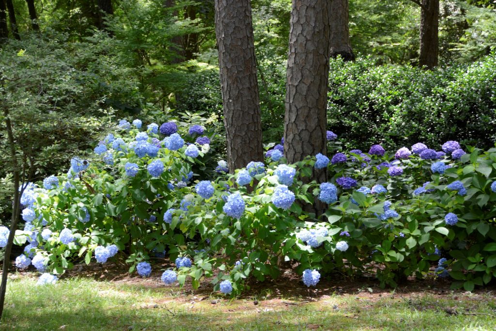
Entrance to Garvan Woodland GardensFlowers at entrance of gardensHydrangeas at entrance of gardens
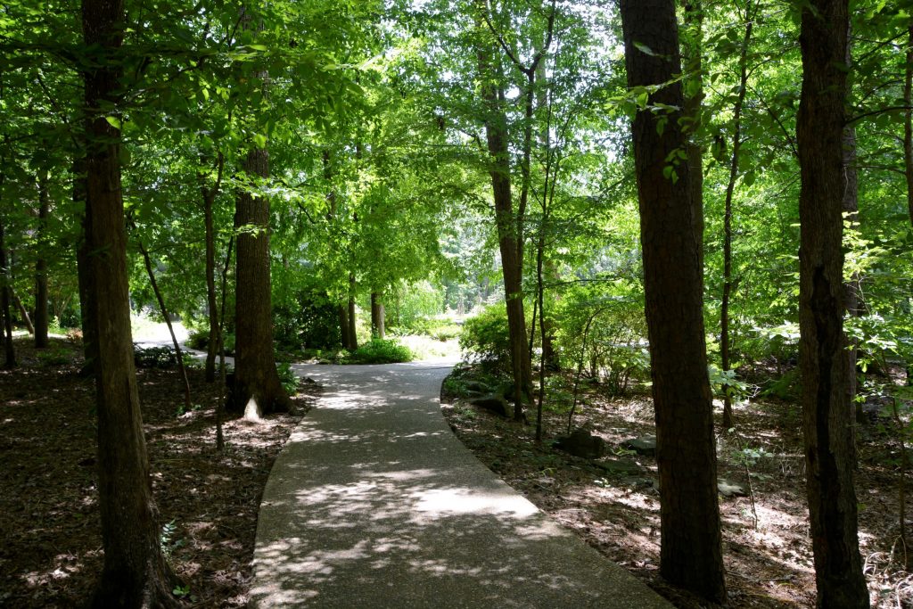
The garden encompasses 210 acres and has miles of pathways meandering throughout the forest canopy.
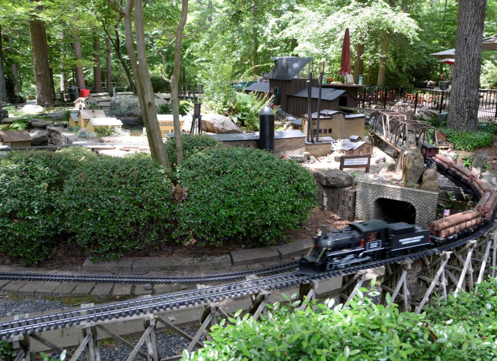
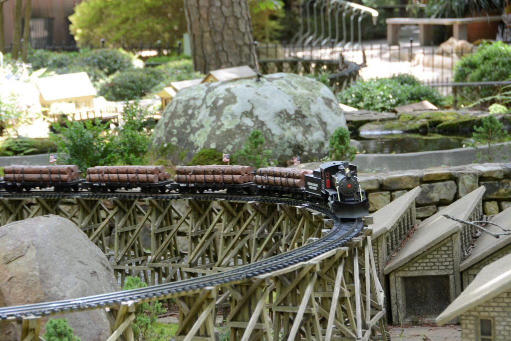
Near the entrance is an elaborate garden railroad with several trains running simultaneously through the tunnels and over bridges and tracks.
Garden RailroadGarden Railroad
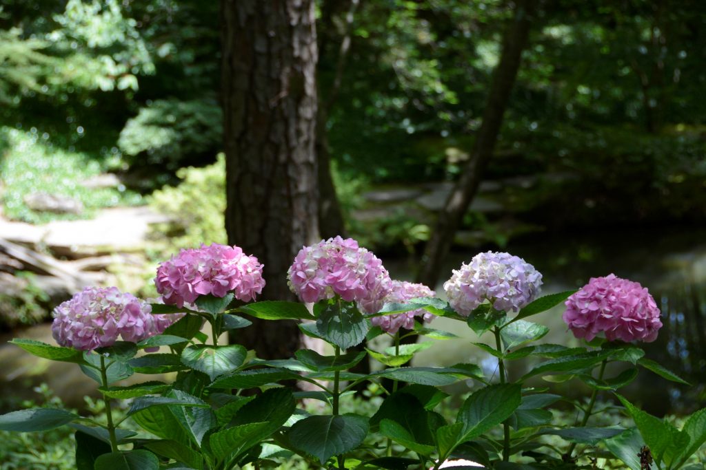
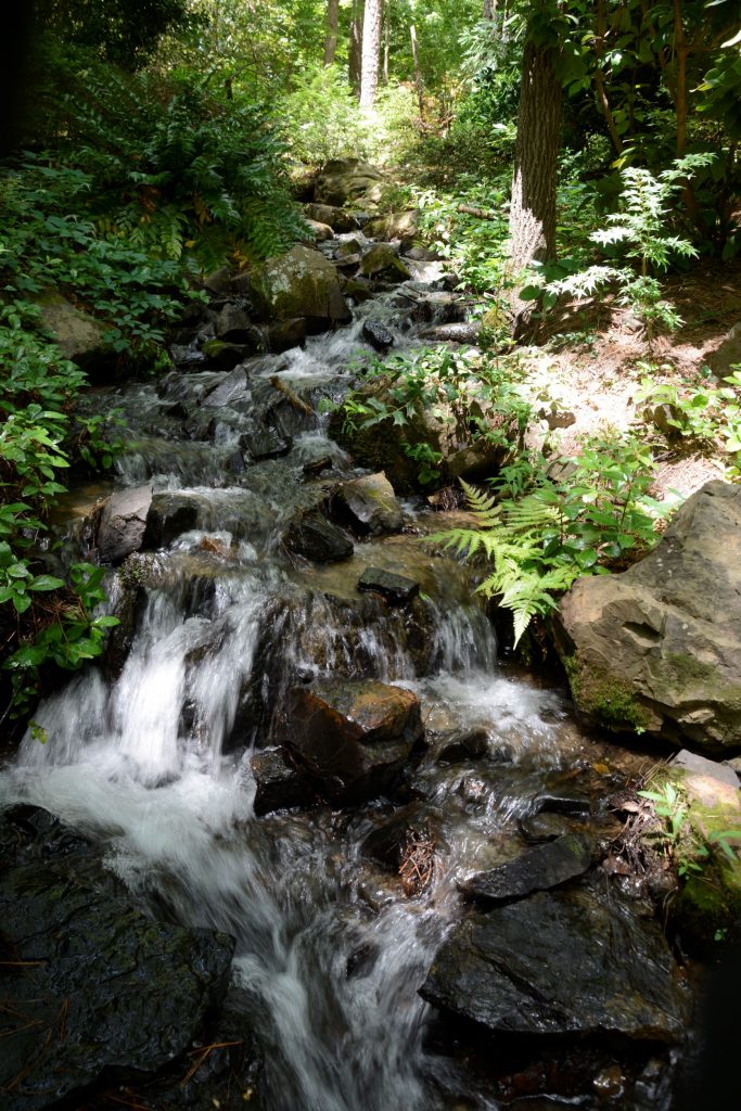
Though the day was hot and humid, we stayed under the shady trees on most of the pathways. We only explored a small part of the gardens. The pathways wound downhill toward the lake and koi pond.
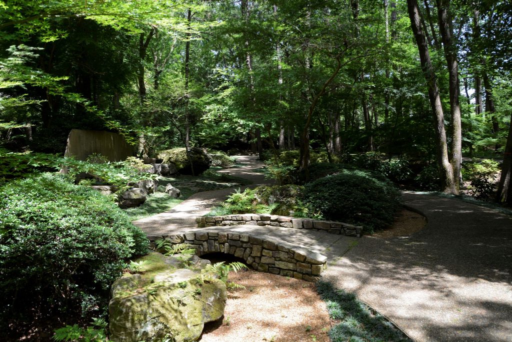
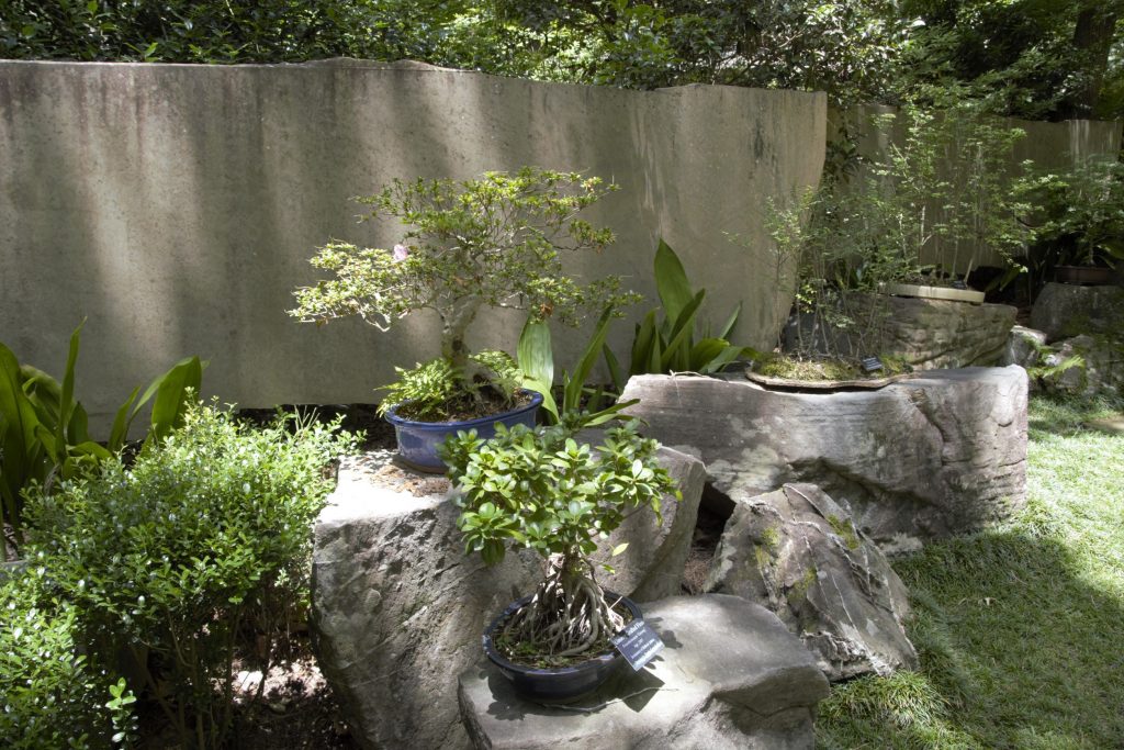
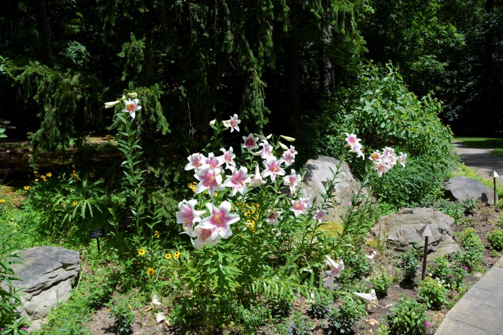
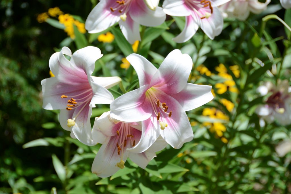
Miles of shaded pathways lead throughout the garden.Bridge to pathway to Japanese garden area.Bonsai plants in Japanese Garden area.Lilies line the pathwayLilies
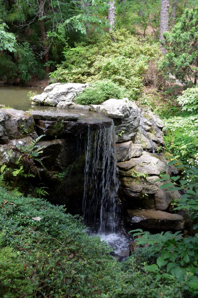
All of the water is pumped uphill from the lake to make the creeks, waterfalls and pond.
Round stone bridgePink HydrangeasWaterfallWaterfall into the Koi Pond
When we were at the Koi pond (shown below), I saw something swimming across the water. At first I thought it was a fish, but then I realized as it got closer that it was a snake! It was swimming with its head out of the water using its body to propel it.
Koi PondWaterfallLush green trees and bushesShoreline of lake
What goes down, must go back up. Eventually we had to hike back uphill to the entrance and parking lot. We were glad to get back to the truck and cool off in the air conditioning. We were only able to explore a small part of this huge botanical garden. I would love to go back someday when the weather is cooler and explore more of this place of beauty. It is truly unique and beautiful.
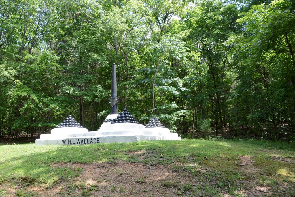
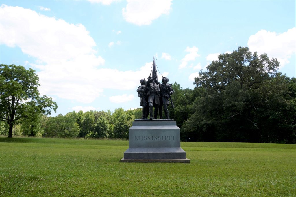
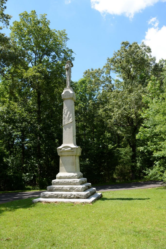
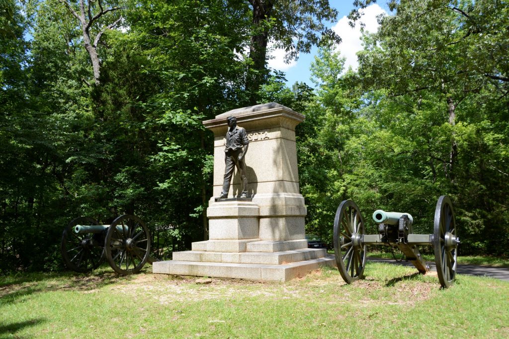
In the Western half of Tennessee we stayed at a Thousand Trails campground near the small town of Saulsbury. Nearly 40 miles away is the national historical battlefield of Shiloh, a civil war battleground. Having never visited a national battleground before, I wasn’t sure what to expect.
Shiloh National Military Park
Replica of Shiloh Church
We started out at the Visitor’s Center where we watched an award winning documentary about the battle of Shiloh that took place on April 6-7,1862. The battle was named after a small church in the vicinity. Ironically, the name Shiloh means “place of peace” or “heavenly peace”. It is much more fitting today as the beautiful grounds are quiet and solemn.
Inside Shiloh Church
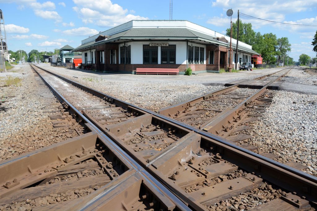
The Union Troops came south on steamboats to Pittsburg Landing on the Tennessee River. The goal was to take the Confederate’s stronghold at Corinth, Mississippi, (a few miles to the south) in order to cut the South’s supply lines. Corinth, Mississippi, was a crossroads where railway lines from the east and west met ones from the north and south. We visited Corinth and saw where these railroads crossed.
Corinth Railroad Junction
General Grant of the Union Army was waiting for Buell’s Army of the Ohio to join him. Little did Grant realize that the Confederates who he thought were in Corinth, had moved near Shiloh to launch a surprise attack.
The Confederate Army under General Johnston originally had planned to attack two days earlier. Due to a heavy rain storm that turned the roads to mud, it took Johnston three days to move his army just 23 miles. They were also short of rations due to the delay.
In the meantime, General Grant was trying to avoid a battle until his reinforcements arrived, but early on April 6th, a Union reconnaissance patrol came face to face with the Confederates and the battle began.
The battle raged for two days with thousands of casualties. At first, the battle went in favor of the Confederates, but after the second day, the Confederates were outnumbered and out of supplies. They retreated to Corinth, where the war continued.
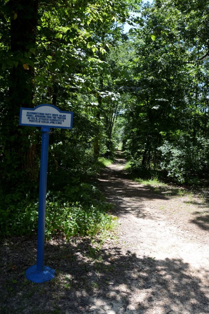
The pathway where the battle began when Union soldiers stumbled into Confederate pickets.
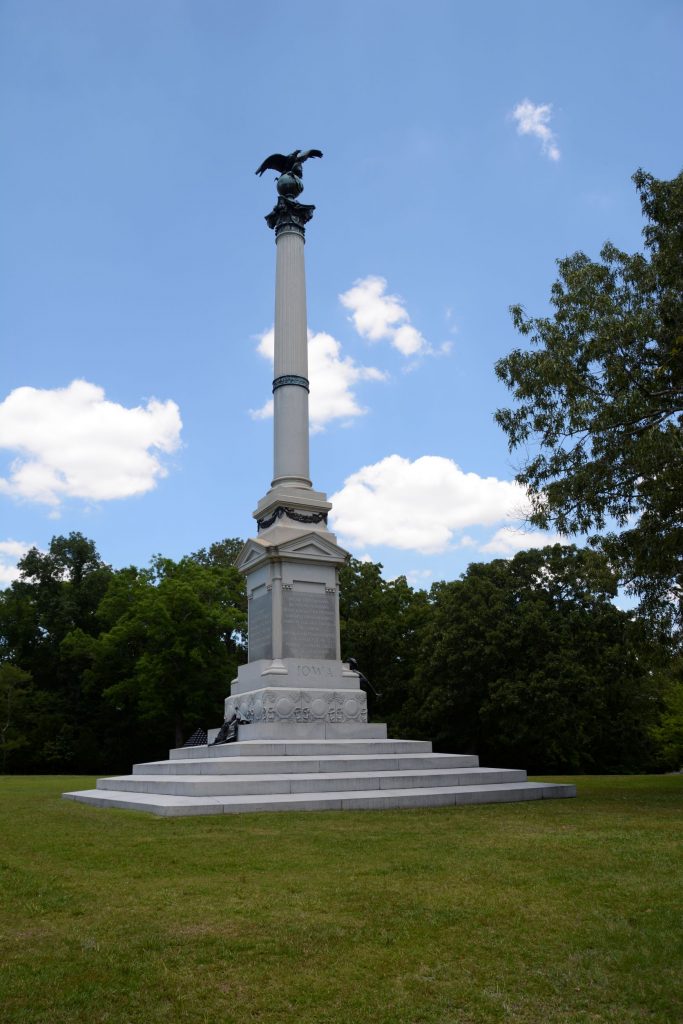
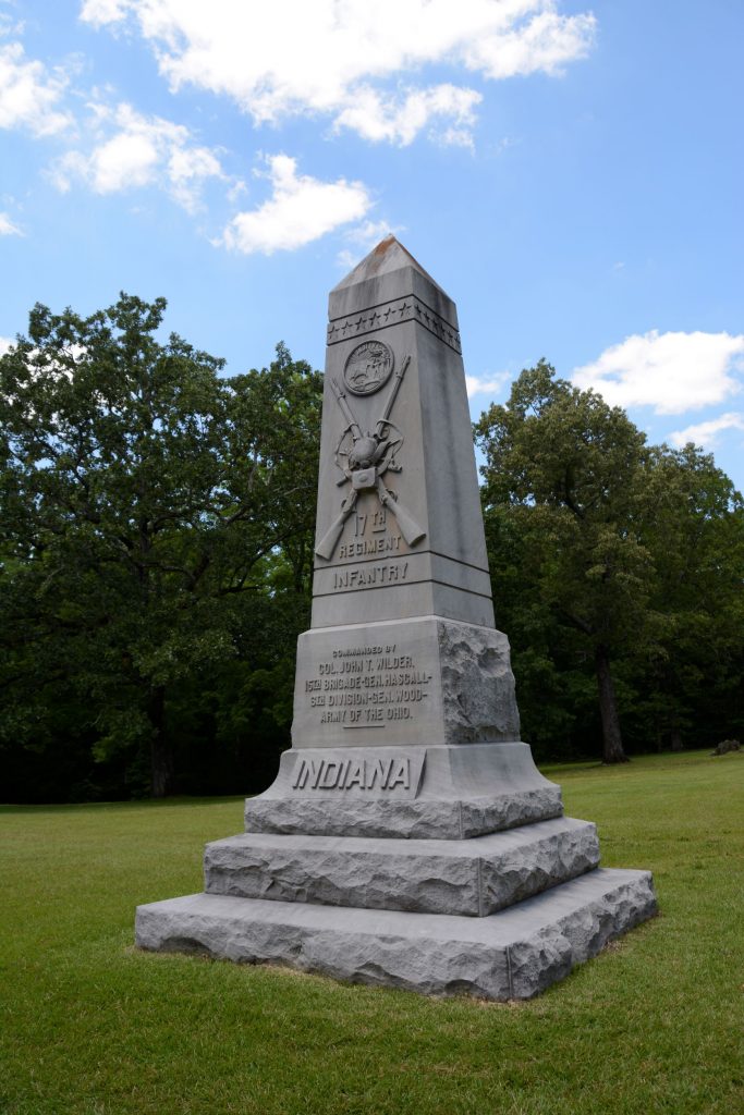
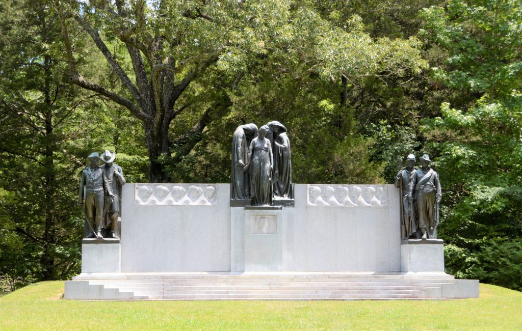
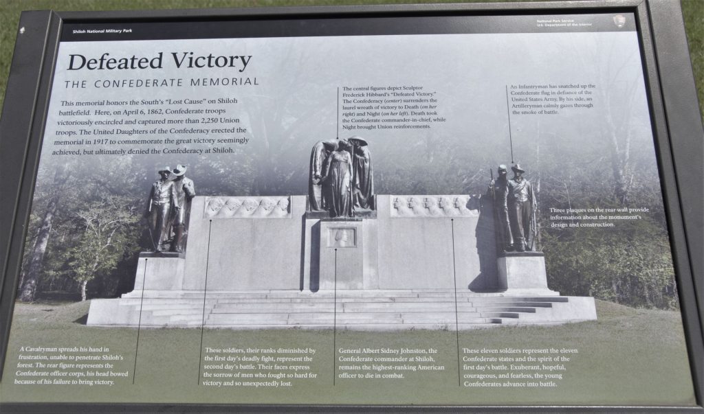
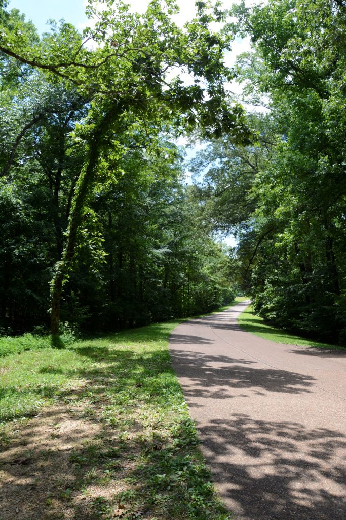
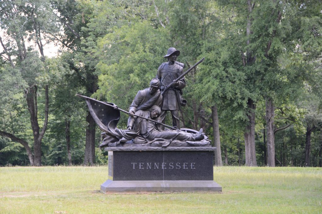
Many beautiful monuments have been erected to honor the armies of both sides. We took a twelve mile self-guided tour on the roads throughout the park. There were many monuments and memorial sites as well as signs with explanations of the battle sites.
Monument to the Iowa soldiersMonument to Indiana Infantry, 17th RegimentConfederate MemorialExplanation of Memorial
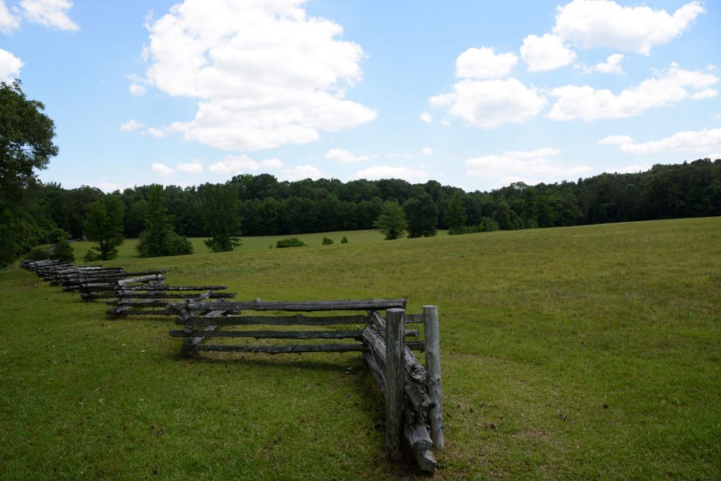
The roads through the battlefield were lined with beautiful trees and park-like vistas.
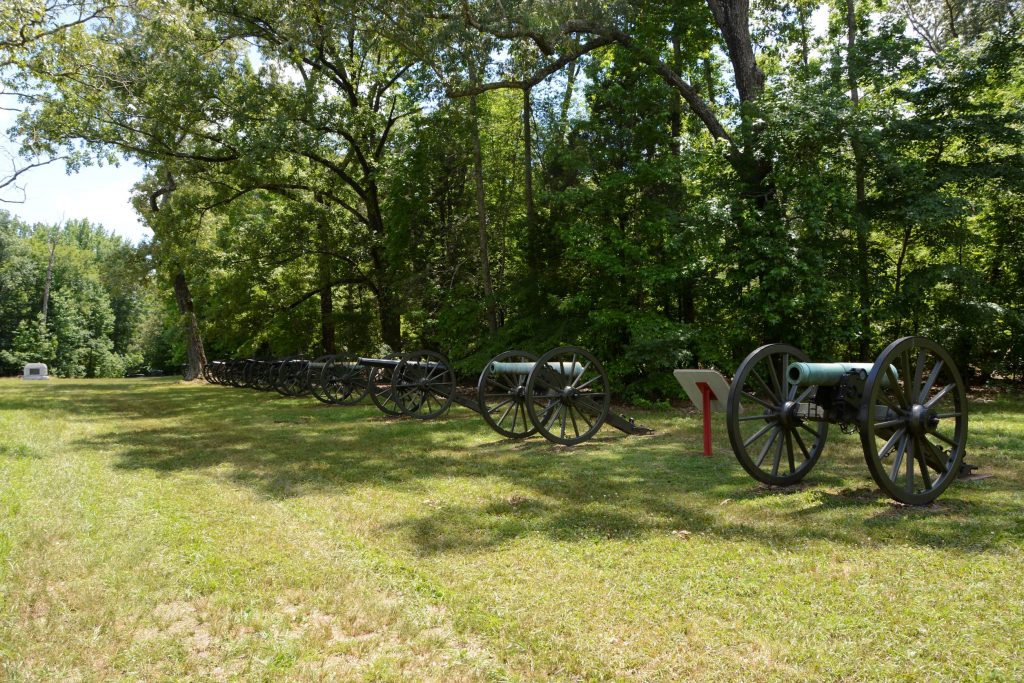
The Confederates amassed more than 50 cannons, the largest concentration of field guns yet witnessed along a half mile frontage, to pound a dense oak thicket in the middle of the battlefield that the Union Army still held.This kept them pinned down while the Confederates surrounded them forcing the Union soldiers to surrender.
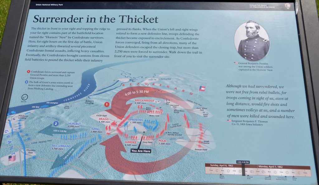
This map shows the troop placements and time of day when the Confederates surrounded part of the Union Army. Some were able to escape, but many were captured.
Hornets Nest
Much of the battle of Shiloh took place on farmland of Joseph Duncan.
The Sixth Mississippi lost over 300 men in less than an hour.
No part of this battlefield was left untouched by the horror of this battle. Mass burial graves were necessary to inter the 3,482 dead. More than 16,000 were wounded and 3,844 were captured or missing. This was the bloodiest battle of the Civil War thus far, and the war was only a year along.
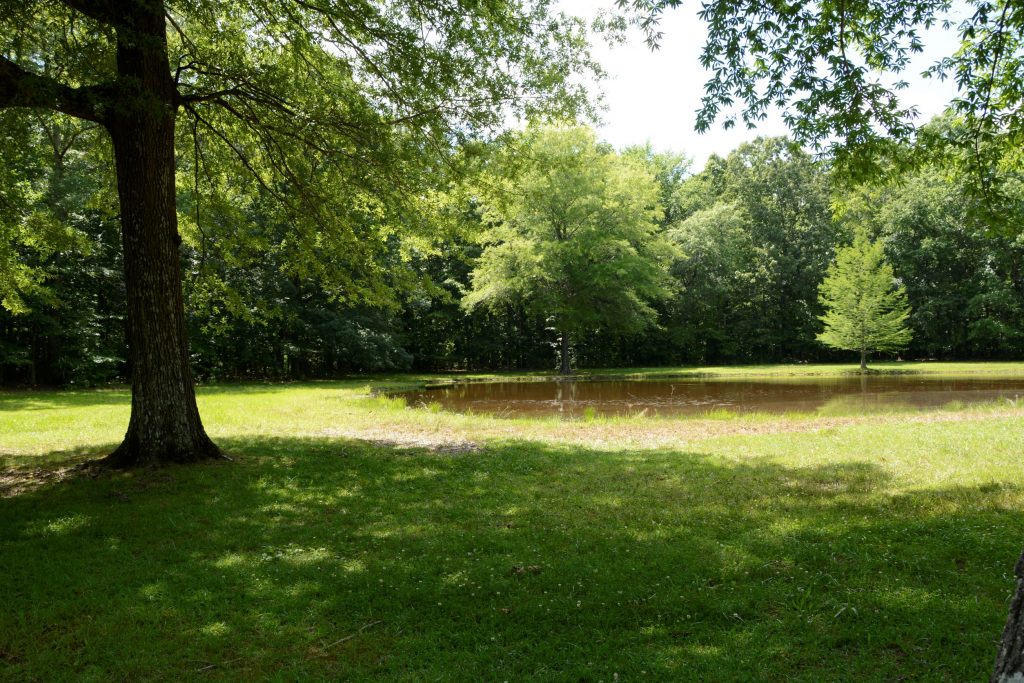
Bloody Pond
The Civil War was a costly war in terms of humankind. National Military Parks like this help us to appreciate the history of our country and the freedoms we have because of those who went before and paid the price.
It is sobering to think of the cost of freedom. Young men in the prime of their lives were cut off from living so that we can enjoy freedom to live as we do today. We can honor them by supporting parks like this.
One way to get to know the history of an area is to visit local museums. Some museums are carefully curated and others seem to be a hodge-podge collection. Each museum, however, reveals something of our past or has something for us to learn.
This is a small taste of what we experienced at five museums we visited from Texas to Ohio.
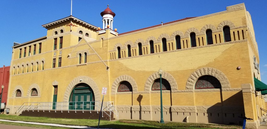
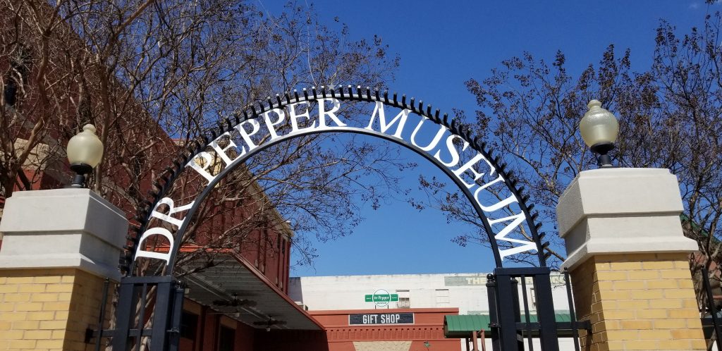
1. Dr. Pepper Museum, Waco, Texas
Dr. Pepper has always been my favorite soft drink. I hardly ever drink soft drinks anymore because of the caffeine and sugar, but a chance to see where Dr. Pepper was founded sounded fun.
We learned that Waco was the perfect place for a bottling company. That’s because of the Trinity Aquifer and artesian water from which Waco earned the nickname, “Geyser City”. We learned the first bottled soft drink was made by Jacob Schweppe and bottled in ceramic bottles.
Dr. Pepper MuseumEntrance to Dr Pepper Museum
There are several stories as to how Dr. Pepper got it’s name, so I won’t try to explain all of them. A Waco pharmacist named Charles Alderton, experimented with soft drink recipes until he came up with the popular drink then known as the “Waco”. Not being interested in starting a business, Alderton never became rich from his recipe. Instead he allowed the drug store owner where he worked and the owner of a ginger ale company to take over the business of producing it.
It seems the real genius was in marketing the new drink. We saw many examples of ad campaigns and Dr. Pepper paraphernalia. Remember the 10, 2 and 4 ads? If I drank Dr. Pepper at 10 a.m., 2 p.m. and 4 p.m., I would be awake for a week!
Example of Dr. Pepper 10-2-4 ad
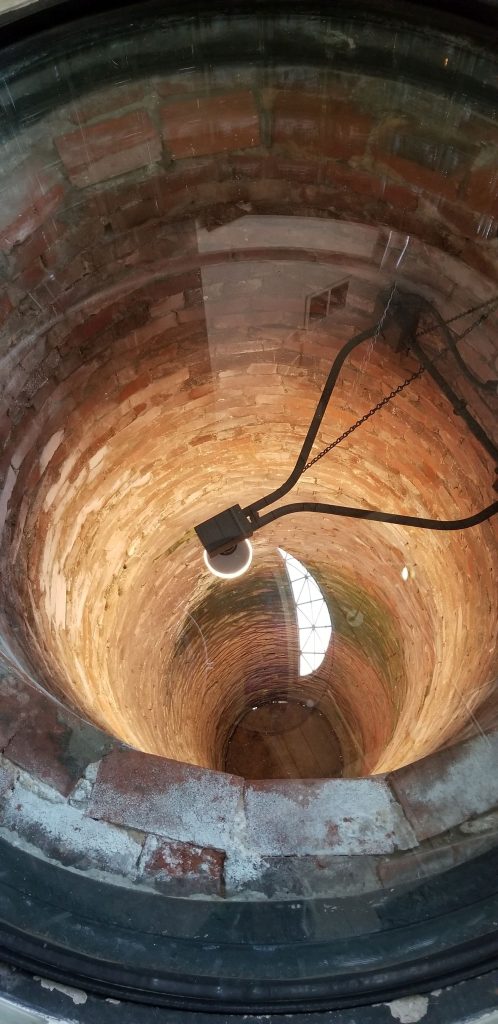
My favorite part of the Dr. Pepper Museum was looking down the well. The well had been covered over for many decades. When it was discovered, it was found to be filled with all kinds of debris, including many vintage bottles. Archeology students from Baylor University spent many hours excavating and preserving the items found in the well. Many of them are now displayed inside the museum. As you can see, the bricks lining the walls are very well preserved.
Well in Dr. Pepper Museum
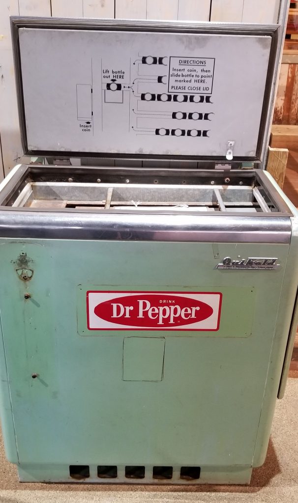
I remember riding my bike to a Circle K store and getting a soda out of a cooler like the one below . I inserted my money and slid the bottle to the opening where I could lift it out. (See instructions on lid) Sometimes these coolers kept drinks so cold, the soda would turn to ice when you popped off the bottle cap.
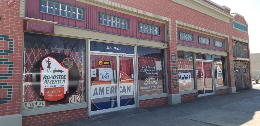
2. Roadside America Museum
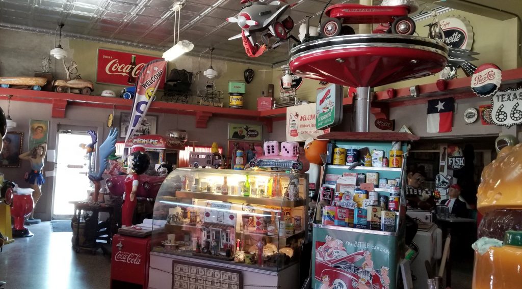
Every small town in Texas is proud of their history. Hillsboro, Texas, is no exception. We visited the Roadside America Museum. This museum is a collection of Americana memorabilia. Tours are by appointment, but we arrived just when another couple was being ushered into the museum by the tour guide.
Roadside America Museum
I have to say, this museum was overwhelming. There were so many items crammed into such a small space, that my eyes hurt. This museum owner is a collector bordering on hoarding. But I think he is very clever to turn his collector’s habit into a museum.
Lots of vintage stuff at Roadside America Museum
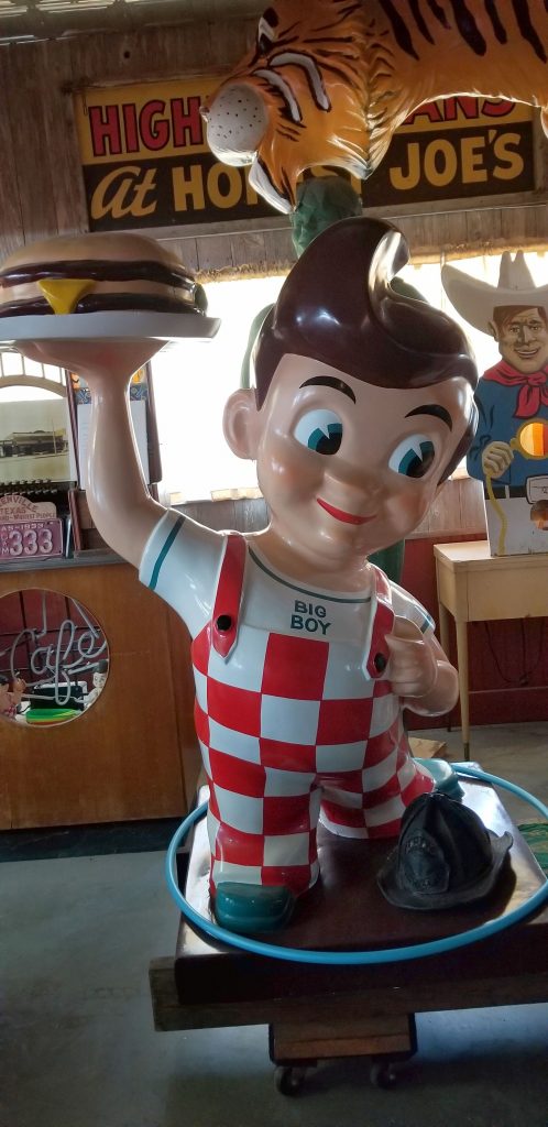
I remember going out to eat at Bob’s Big Boy in Scottsdale, Arizona. My sister’s first job was working there as a waitress. A Big Boy icon like the one below was outside every Bob’s Big Boy restaurant.
Bob’s Big Boy
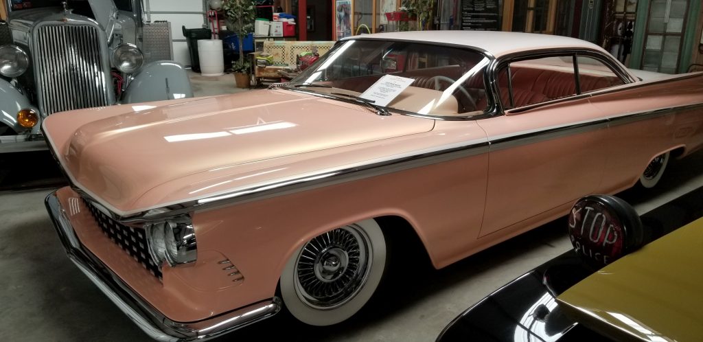
There were also a lot of old vehicles in this museum that had been restored. My favorite was this peach car with the peach interior.
Roadside America Museum
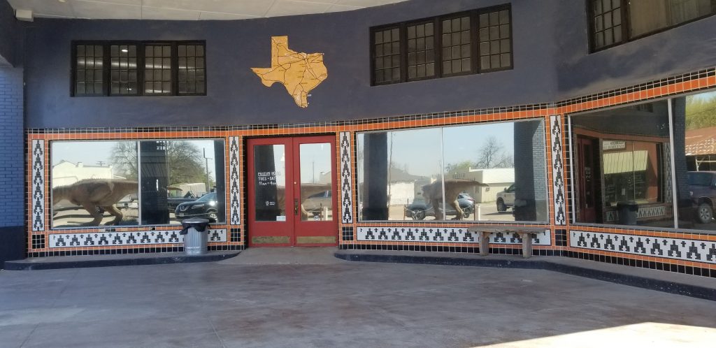
3. Texas Through Time Fossil Museum
In the same little town of Hillsboro, Texas, was the Texas Through Time Museum. I was interested in the fossil collection that is housed there. Though the museum has fossils from around the world, their main goal is to educate and stimulate appreciation for Texas’ unique fossil record. We got there near closing time, so I only had time to snap a few pictures.
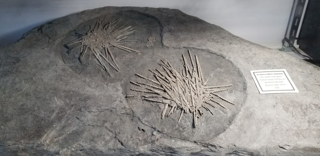
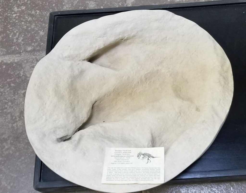
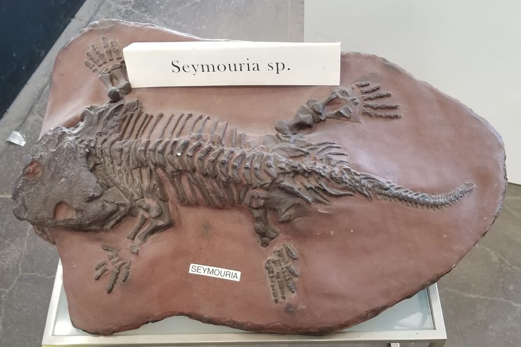
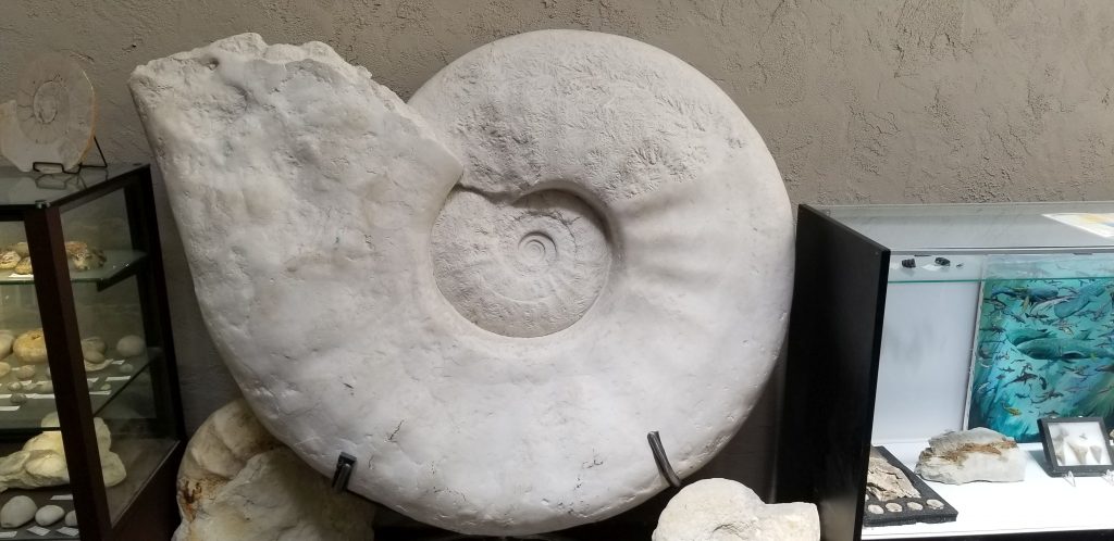
Texas Through Time Fossil MuseumSea Urchin fossilsDinosaur Track Fossilized skelton of Seymouria, an extinct reptileGiant Fossil
4. National Museum of the United States Air Force
While we were in Ohio close to Dayton, Ray, being an Air Force vet, wanted to visit this impressive museum.
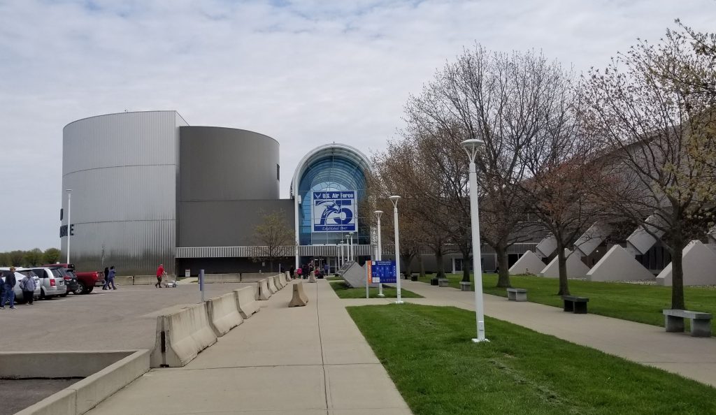
The National Museum of the United States Air Force is the official museum of the United States Air Force. It is located at Wright-Patterson Air Force Base, 6 miles northeast of Dayton, Ohio. This is the world’s largest military aviation museum and also the oldest. It houses and displays more than 360 aircraft and missiles. It is housed in five massive airplane hangers. We only had enough time to see one during our visit.
National Museum of the USAF entrance
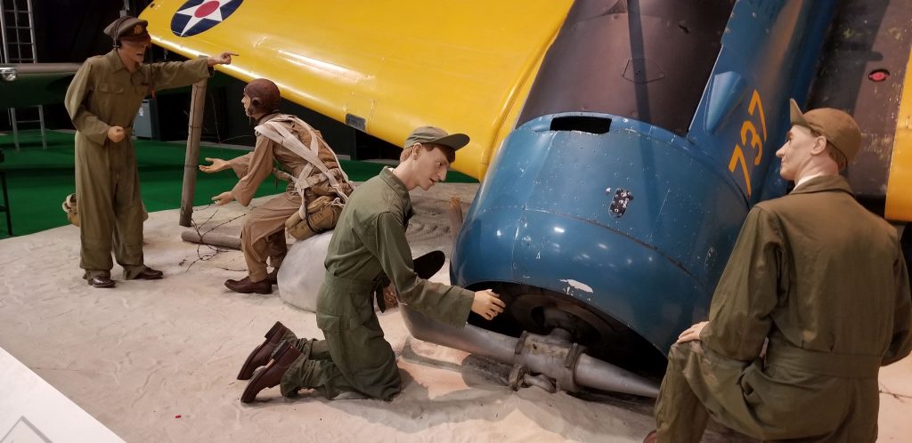
The museum is more than airplanes. We saw tastefully done dioramas with realistic looking figures in authentic uniforms. There are so many displays that it would take days to read all of them.
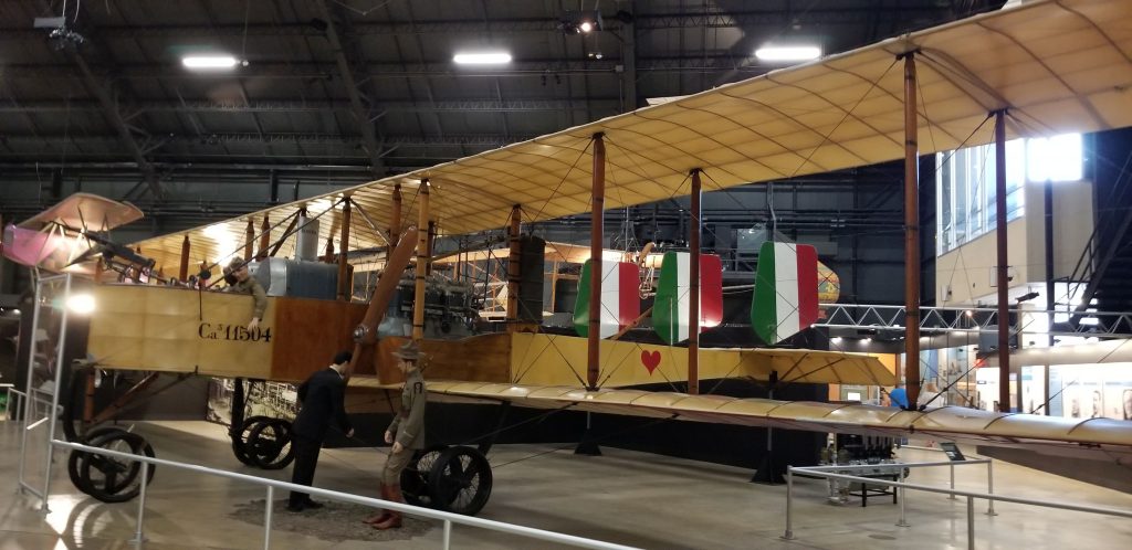
Plane crash dioramaEarly Bi-plane
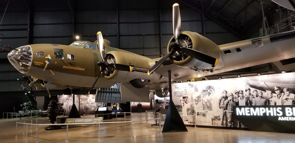
I enjoyed the movie about the WW II Memphis Belle. It was one of the first B-17 bombers to complete 25 combat missions, after which the aircrew returned with the bomber to the United States to sell war bonds. Restoration of it began in 2005. As of 2018, it now resides in this museum.
Memphis Belle
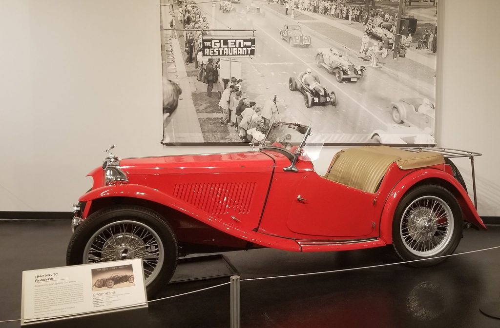
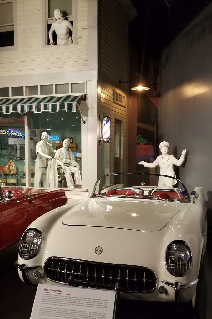
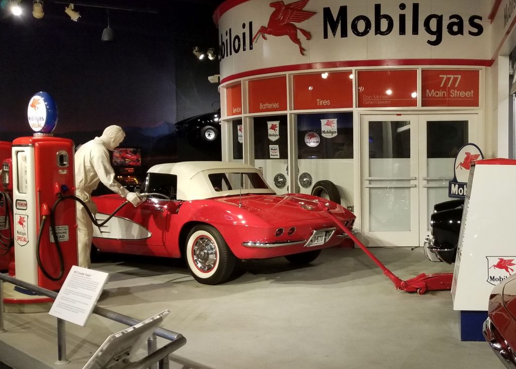
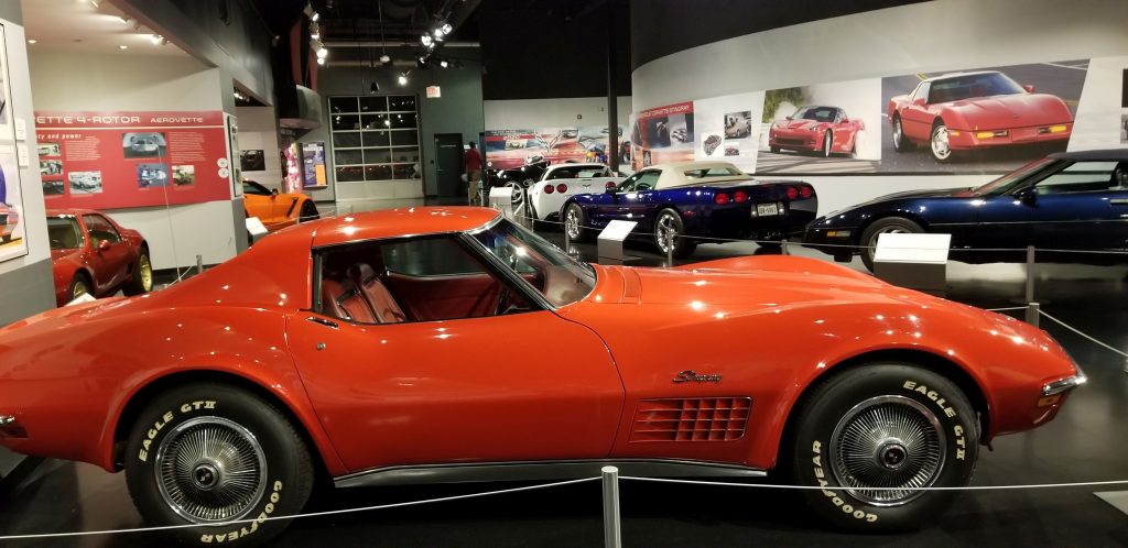
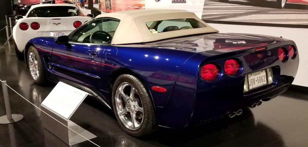
5. Corvette Museum, Bowling Green, Kentucky
One of my all-time favorite cars is the Corvette. I think they are some of the most aesthetically beautiful cars that have been made. We were only a short drive to Bowling Green, Kentucky, where the Corvette Museum is located, so we packed a lunch and went to see it.
When World War 2 soldiers came back from the war, they wanted sports cars like this European roadster. They felt the American made cars were boxy and dull. The first Corvette was produced in 1953 to fill that demand. Since then there have been eight generations of Corvettes produced.
European Roadster1953 Corvette, first year of Corvette production
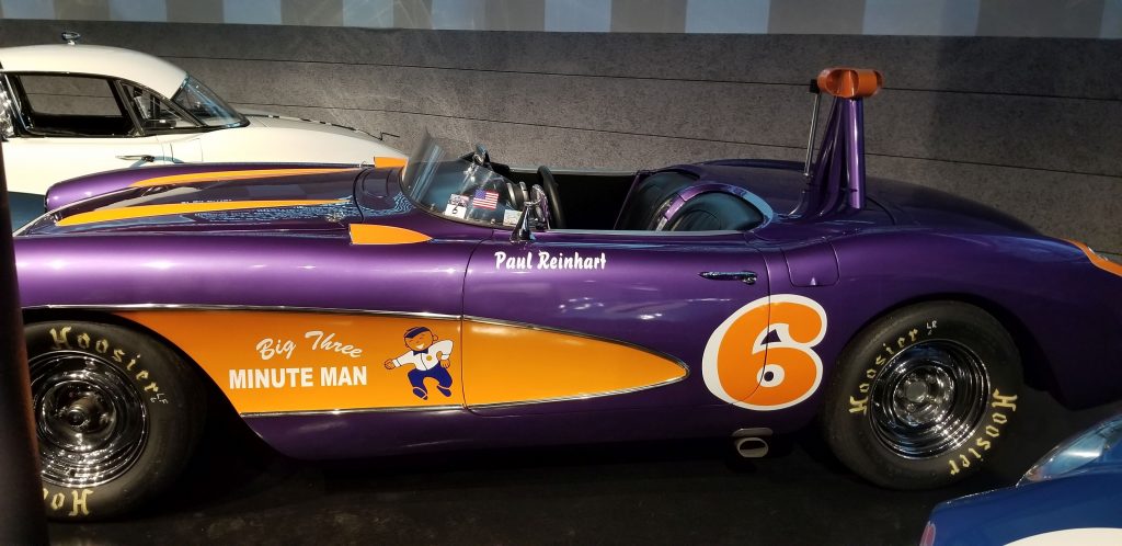
Because Corvettes had such high performance engines, they were desirable for racing. Here is one used by Paul Reinhart painted in his special colors.
There was just something about seeing so many Corvettes in one place at one time!
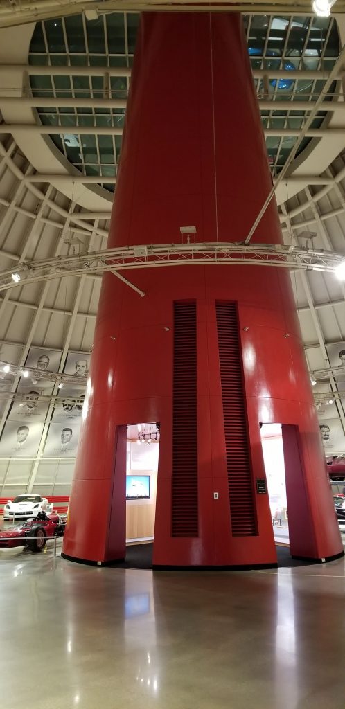
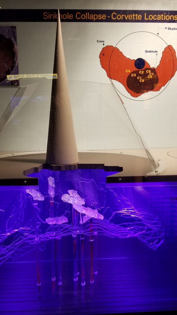
In 2014, a 40 foot sinkhole opened up in the skydome of the Corvette Museum in the early morning hours. Eight Corvettes were swallowed. You can watch the security camera footage at this link: https://www.corvettemuseum.org/explore/exhibits/corvette-cave-in-exhibit/. (Click on link and scroll down.) Two cars were able to be restored back to original condition while the others remain displayed as found.
Skydome in Corvette MuseumDisplay showing sinkhole and where the cars were locatedCorvette damaged in the sink hole collapse
We enjoyed our time in each of these museums. We learned much more than I am able to share here. We’re never to old to learn something new! I hope you enjoyed our short mini-tours.
Kentucky has a lot of caves–5,000 as of 2018. It ranks fourth in the USA in number of documented caves. The reason for this is that about a quarter of the state is has limestone under the surface which has the right conditions for cave formation.
Our Thousand Trails Campground named Diamond Caverns lies within the Mammoth Cave National Park boundaries so we made a reservation to go on a tour of the cave. There are many tours available, but we opted for the easiest one with only 12 required stair steps, and lasting only an hour and 15 minutes. Some of the tours lasted for 2 or more hours, were 2 or more miles in length and had 400+ stair steps.
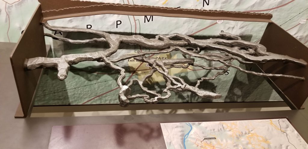
While we waited for our bus ride to the cave tour, we wandered around the Visitor Center. I saw this 3-D map of a portion of the cave. It illustrates the complexity of Mammoth Cave. Mammoth Cave is the world’s longest known cave system.
3-D Map of a portion of Mammoth Cave
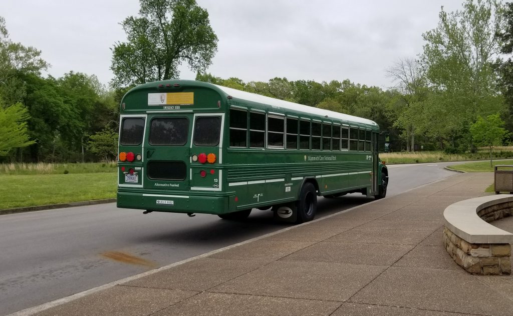
Thirty minutes before our tour, we made our way to the bus stop. Our group members sat on concrete benches under a covered waiting area. They were mostly older people and families with young children.
Our bus was a converted school bus painted green. It took me back to elementary school days when we rode buses on our field trips. Now I am a grandma going on my own field trip! The day was cool and cloudy, so none of the windows were open. I was glad for that.
Mammoth Cave Tour Bus
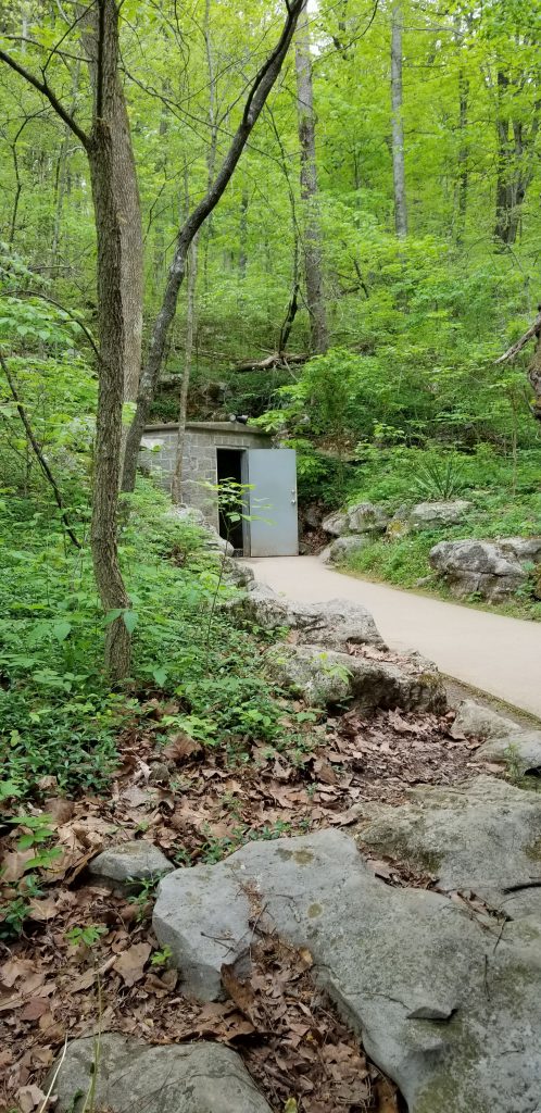
We boarded the bus after showing our tickets. The bus ride took us through bright green woods and forests of deciduous trees until we arrived 10 to 15 minutes later at the door to the cave which looked like a utility building in the side of a hill.
Entrance to Cave Tour
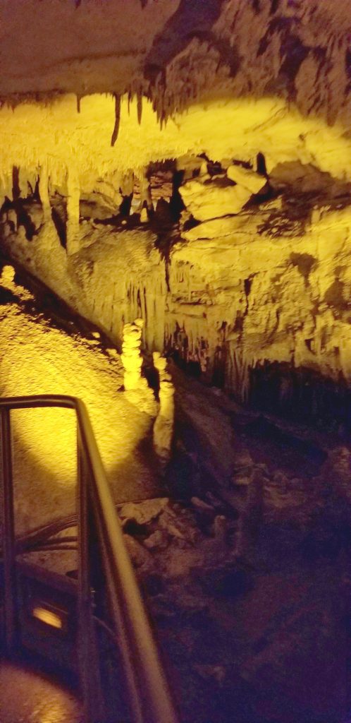
I was disappointed that our cave tour started as a small narrow passageway. When I think of “mammoth”, I think of a huge cavernous opening with high ceilings. Apparently, there are such places in Mammoth Cave, but that would have been a more strenuous tour.
The photo is a little blurry, but you can see two prominent stalagmites growing up from the floor. They are stalagmites because they “might” reach the ceiling. Stalagmites are formed when water drips on the floor and the minerals in the water build up into a formation like this.
Near the entry of Frozen Niagra Tour
These stalactites look like a bunch of carrots hanging down. They are stalactites because they have to hold on “tight” to the ceiling. Stalactites are formed when water-dissolved minerals drip from the roof of a cave. When exposed to air, the minerals solidify and form stalactites.
“Carrot bunch” stalactites
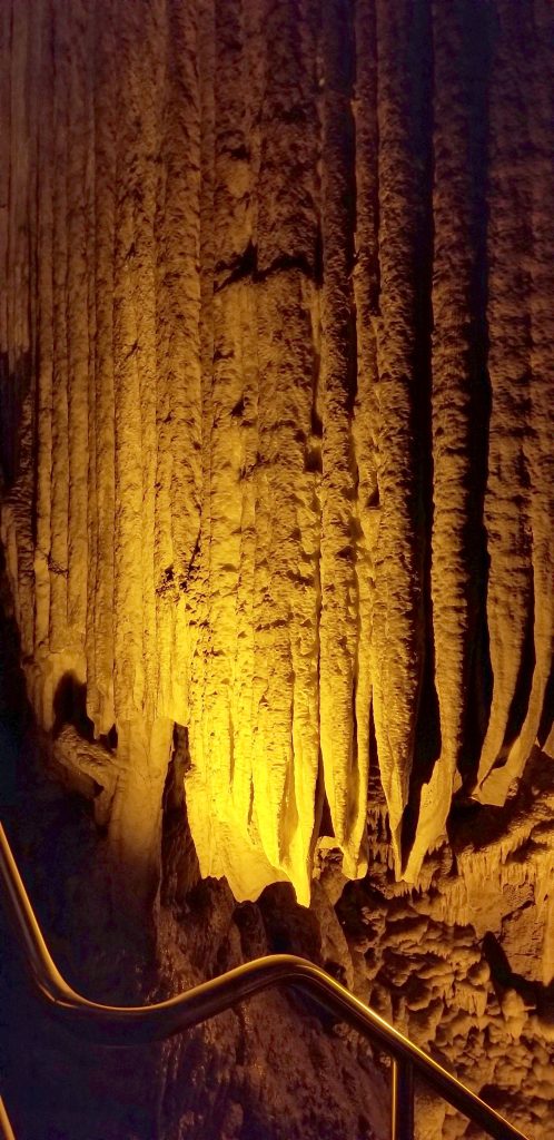
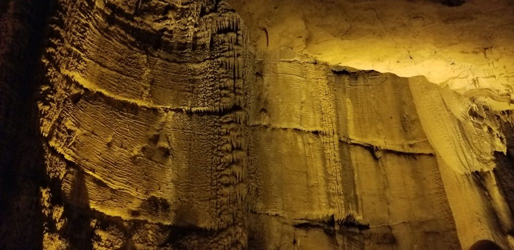
These sheet-like formations are called flowstones.
Flowstone formations
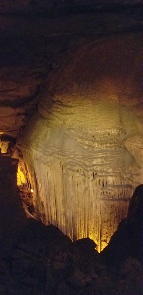
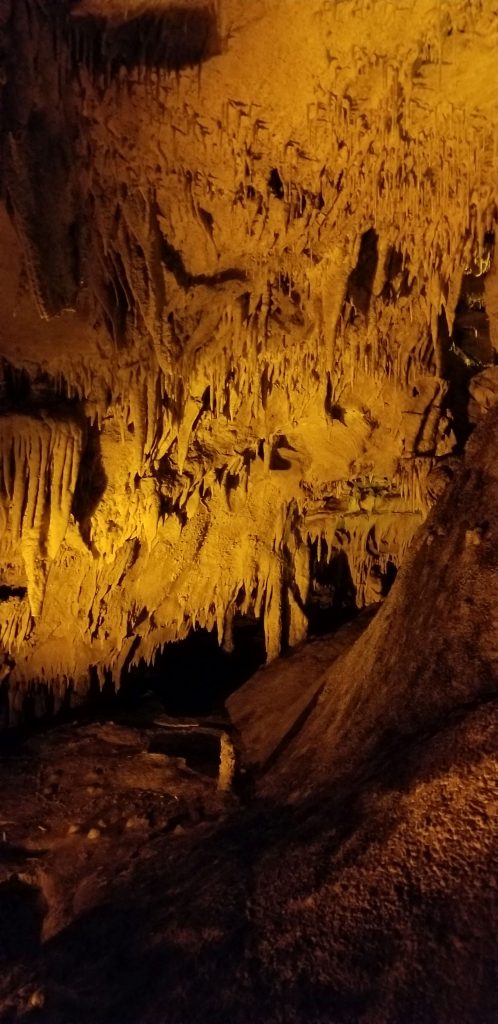
We finally came to the Frozen Niagra formation for which the tour was named. I think it looked more like a melting ice cream cone.
Frozen Niagra
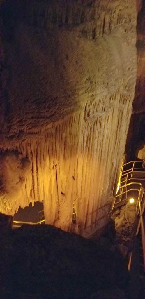
There were 98 optional stair steps that went down to where we could get a better view of the Frozen Niagra formation. The 98 optional stairs then became 98 mandatory stairs in order to get back out, as our tour guide informed us. We were game to venture down them, as were most of the others in our tour.
Optional stairs below Frozen Niagra
On our way back to the door, our tour guide told us about the creatures that live in the cave. There was a pack rat that had made a stash of litter he found and brought into the cave. There was a spider in a web that was far enough away that I didn’t freak out. (I dislike spiders.)
And there were cave crickets. The cave crickets weren’t visible until she shined her flashlight on the cave ceiling. Then we could see them creeping around. They are very light colored, almost translucent with long antennae. I would have been creeped out if the tour guide had shown us these before we went on the cave tour. How many of them were lurking above our heads as we brushed the cave ceiling, is something I don’t want to know about!
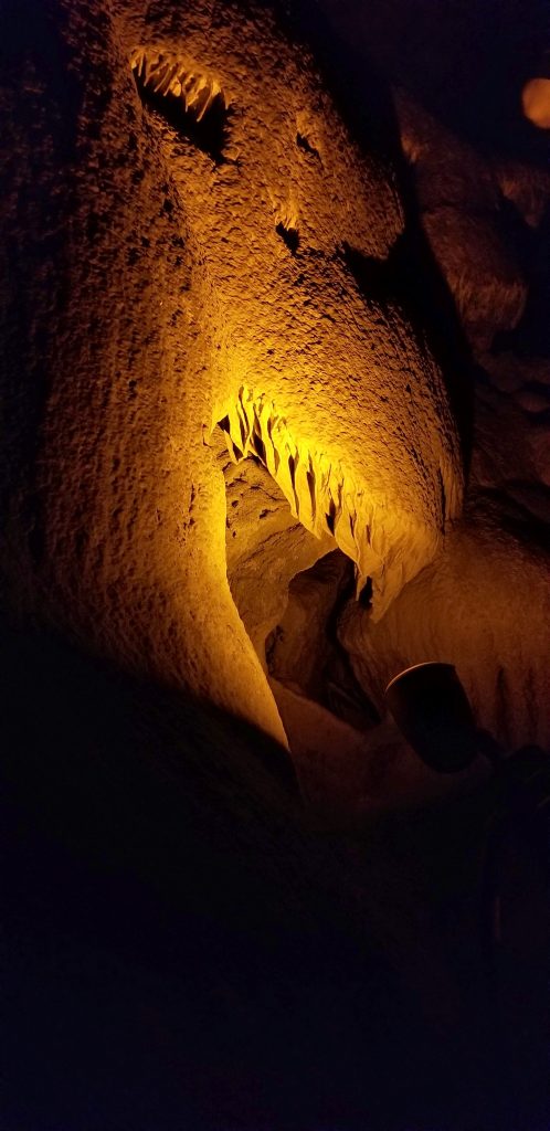
This formation looks like a dinosaur with teeth, don’t you think?
Dinosaur
I have seen three large caves: Carlsbad, Wind Cave and Mammoth Cave. Of the three, I liked Carlsbad the best. I have to say, I would not make a good cave woman nor a cave explorer. I’m not claustrophobic, but I like sunshine. I can’t imagine spending time exploring caves with a headlight crawling through tight spaces and enjoying it. But it’s nice there are people willing to do that and people who want to preserve these caves for others to see.
Mammoth Cave formations
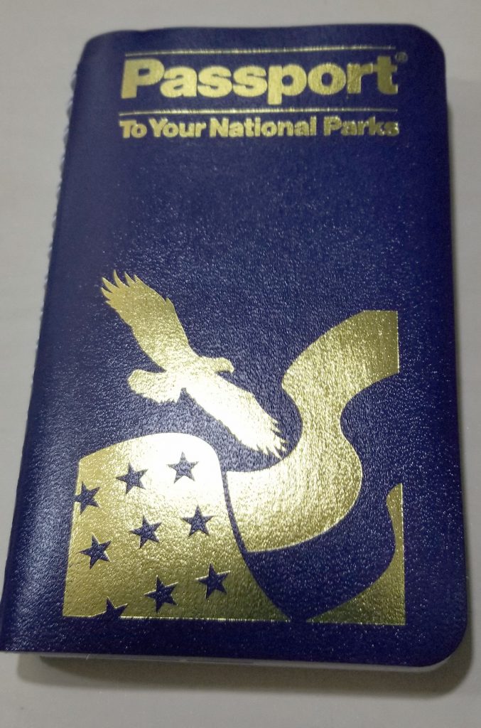
While in the visitor center gift shop, I bought a National Parks Passport book and got my first National Park stamped with the date of our visit. The passport lists all the national parks and their locations by region. When you visit a national park, you can get your passport stamped at the visitor center showing when you visited the park. There’s a way to get stamps for parks already visited, but since we’ve seen 25 or more, I’m not going to try to do that.